appendix b project web site - metromedia.metro.net/projects_studies/westside/images... · culver...
TRANSCRIPT

Project Scoping Report
Appendix B – Project Web Site
W E S T S I D E E X T E N S I O N T R A N S I T C O R R I D O R S T U D Y February 4, 2008
APPENDIX B
Project Web Site

N egaPfOpoT#mth.ofni_swen/edistsew/smargorp_stcejorp/ten.ortem//:ptthofnI dna swe
1 of 1 11/30/2007 2:00 PM
Search
Metro.netMetro.net
Powered by Google
Home | Projects & Programs | Westside Transit Corridor Study
Overview
News and Info
Meetings
Contact Us
News and Info
Some documents are PDF format, requiring Adobe® Acrobat Reader plug-in for viewing.
Early Public Scoping Meeting (Video)
Early Scoping Presentation (PDF)
Potential Alignment Map (PDF)
Study Area Map (PDF)
Fact Sheets
Frequently Asked Questions (FAQs)
Copyright © 2007, LACMTA | Privacy Policy

News and Info Fact Sheets http://metro.net/projects_programs/westside/Fact%20Sheets.htm#TopO...
1 of 3 11/30/2007 2:00 PM
SearchMetro.netMetro.net
Powered by Google
Home | Projects & Programs | Westside Transit Corridor Study
Overview
News and Info
Meetings
Contact Us
Fact Sheets
Fact Sheet 1: Study Background, Overview and Schedule
Study Description
Today, communities in and adjacent to the Westside Corridor experience day-long traffic back-ups as additional retail, entertainment and employment centers have been built and become fully occupied, and as more development occurs. Public frustration with delays caused by traffic jams on both freewaysand city streets has dramatically increased.
The convergence of this increasing congestion, rising fuel and parking costs,land use densification, and Metro’s challenge to meet transit demands withbuses, are among the many reasons why the Metro Board of Directors hasauthorized an Alternatives Analysis for the Westside Transit Corridor Extension.This Alternatives Analysis will review previous planning studies for a WestsideExtension and update materials in relation to the new and changed conditionswithin the Corridor.
This includes evaluating changes or shifts in population, development, employment, and travel patterns. Upon completion of the Alternatives Analysis Study, the results and recommendations will be presented to the Metro Board of Directors, and the initiation of an environmental process may be authorized. It is anticipated that the environmental process would evaluate the following alternatives: a No Build, a Baseline or Transportation Systems Management Alternative, and one or more Build Alternatives which will include potential alignments, stations and modes.
Study History
The Metro Red Line subway was opened in segments starting from DowntownLos Angeles at Union Station. It began operations to Wilshire and WesternAvenue in Koreatown in 1996. The last segment connecting to North Hollywoodin the San Fernando Valley began operations in 2000. The Wilshire/Westernsegment was recently renamed the “Purple Line”.
In the 1980s and 1990s, extensive planning studies were conducted for awestward extension of the subway. This led to a Full Funding Grant Agreementwith the federal government for a 2.3-mile extension of the subway fromWilshire/Western to Pico/San Vicente in 1994. In 1998, due to fundingconstraints, Metro suspended the project and focused its attention ondeveloping bus and light rail transit options for the Westside. This ultimatelyresulted in a decision that the area was too big to be served by a single project.

News and Info Fact Sheets http://metro.net/projects_programs/westside/Fact%20Sheets.htm#TopO...
2 of 3 11/30/2007 2:00 PM
The Exposition Light Rail Transit (LRT) project, currently under construction, wasplanned for the “southern” portion of the Westside, with Wilshire Bus RapidTransit (BRT) slated to serve the area’s “northern” portion. Increasingcongestion and growth since then has prompted reconsideration of a possiblerail extension to the Westside for the northern area.
Although the Westside Extension project has historically been defined as a heavy rail subway mode, various new alternatives could emerge from the public scoping process that will take place as part of the Alternatives Analysis. These could include looking at alignments other than Wilshire Boulevard. Other modes that may be considered include Bus Rapid Transit (BRT) with dedicated bus lanes, as well as at-grade, below-grade, and above-grade rail options. Additionally, funding constraints could dictate a series of phased extension segments that would need to be identified and evaluated with the goal of developing between two and four near-term operable segments.
Study Area
The study corridor will extend from the existing Metro Rail Hollywood/Highland and Wilshire/Western Stations to the Pacific Ocean. The northern boundary to the study area follows the base of the Santa Monica Mountains along Hollywood, Sunset and San Vincente Boulevards, and the southern boundary follows Pico Boulevard. The overall study area covers a swath that is of approximately 38 square miles.
Study Scope
The Alternatives Analysis will study and make recommendations based on the following topics:
The need for a mass transit alternative to address traffic growth and changing travel patternsReview the potential level of service of various transit modes including heavy-rail subway, light-rail at-grade, elevated rail and BRTIdentify the potential construction and operating costs of various transit modes and alignmentsEvaluate issues of noise, visual and traffic impacts from at-grade and elevated rail optionsEconomic impacts of new mass transit on existing land usesAbility to serve the many activity centers on the WestsideEvaluate localized construction impacts and overall construction safety, particularly for options involving tunnelingEvaluate localized impacts resulting from the introduction and ongoing operations of a new transit project
Anticipated Study Results
At the conclusion of the study, the Metro Board of Directors may select one ormore alignments and modes as a “Locally Preferred Alternative” and directfurther environmental review of that selection. A fully defined project wouldneed to go through complete environmental analysis and review before it couldbe funded or built.
Anticipated Study Schedule
Distribution of Early Scoping Notice September 2007
Definition of Purpose and Need October 2007

News and Info Fact Sheets http://metro.net/projects_programs/westside/Fact%20Sheets.htm#TopO...
3 of 3 11/30/2007 2:00 PM
Public Scoping Meetings September/October 2007
Completion of Alternatives Analysis Study Report
June 2008
Recommendation to Board of Locally Preferred Alternative
Summer 2008
Where can I get information about the Alternatives Analysis and Environmental processes?
For additional information about the Westside Transit Corridor, please visit http://www.metro.net/westside or call the project information line at (213) 922-6934.
Listed below are several websites describing the Federal and State requirements that apply to the Alternatives Analysis and the Environmental processes.
The guidelines associated with an Alternatives Analysis (AA) for a transportation project seeking Federal New Starts funding may be found at:
http://www.fta.dot.gov/printer_friendly/planning_environment_3010.html
Updates to the AA guidelines are available at:
http://www.fta.dot.gov/printer_friendly/planning_environment_2590.html
The guidelines associated with an Environmental Impact Statement (EIS) for a transportation project seeking Federal New Starts funding may be found at:
http://www.fta.dot.gov/planning/environment/planning_environment_3009.html
The guidelines associated with an Environmental Impact Report (EIR) for a transportation project in California may be found at:
http://www.ceres.ca.gov/topic/env_law/ceqa/guidelines/art7.html
Copyright © 2007, LACMTA | Privacy Policy

egaPfOpoT#mth.tluafed/edistsew/smargorp_stcejorp/ten.ortem//:ptthweivrevO - ydutS rodirroC tisnarT edistseW | ten.ortem
1 of 1 11/30/2007 2:01 PM
Search
Metro.netMetro.net
Powered by Google
Home | Projects & Programs | Westside Transit Corridor Study
Overview
News and Info
Meetings
Contact Us
Overview
Background
Over the past 30 years, tremendous population and employment growth,worsening congestion, changing land uses and traffic patterns, as well asMetro’s challenge to meet transit demand, have led to the need to improvemobility in what is now known as the Westside Corridor.
Against this background, the Metro Board of Directors has authorized an Alternatives Analysis for the Westside Transit Corridor Extension, which will review previous planning studies, and update materials in relation to the new and changed conditions along the Corridor. This includes evaluating changes or shifts in population, development, employment, and travel patterns. Upon completion of the Alternatives Analysis Study, the results and recommendations will be presented to the Metro Board of Directors. The initiation of an environmental process may then be authorized.
The Westside Extension Transit Corridor Study will also look at various modes, including Bus Rapid Transit (BRT) with dedicated bus lanes, as well as at-grade, below-grade, and above-grade rail options, and at least two alignments respectively along Wilshire and Santa Monica Boulevards. Additionally, funding constraints could dictate a series of phased extension segments that would need to be identified and evaluated with the goal of developing between two and four near-term operable segments.
Study Area
The study corridor will extend from the existing Metro Rail Hollywood/Highland and Wilshire/Western Stations to the Pacific Ocean. The northern boundary to the study area follows the base of the Santa Monica Mountains along Hollywood, Sunset and San Vicente Boulevards. The southern boundary follows Pico Boulevard. Overall study area is approximately 38 square miles. Studyarea map.
Copyright © 2007, LACMTA | Privacy Policy

OLYMPIC
PICO
PICO
OLYMPIC
PICO
EXPOSITION
JEFFERSON
WASHINGTON BL
VENICE BL
VENICE BLPICO
PICO
PICO
EXPOSITION
JEFFERSON
WASHINGTON BL
VENICE BL
VENICE BL
Sunset/Fairfax
La Cienega
CrenshawLa Brea
Western Vermont
Washington/National
WESTWOODVETERAN’S
ADMINISTRATION
UCLA
WESTLOS ANGELES
CULVER CITY
SANTA MONICA
WEST HOLLYWOODHOLLYWOOD
KOREATOWN
BEVERLYHILLS
MID-WILSHIRE
CENTURYCITY
SAN
DIEG
O FW
Y
HIG
HLA
ND
LA B
REA
LA B
REA
SUNSET
SAN VICEN
TE
WILSHIRE
WES
TER
N
VER
MO
NT
SUNSET
SUNSET
LINCOLN
BUNDY
SANTA MONICA FWY
SUNSET
WIL
SHIRE
WESTW
OOD
SAN DIEGO FWY
SANTA MONICA FWY
WILSHIRE
LA C
IEN
EGA
BEVERLY DR
HOLLYWOOD BL
CREN
SHAW
BL
SANTA MONICA BL
SANTA MONIC
A BL
SANTA MONICA BL
FAIR
FAX
OLYMPIC
FAIR
FAX
HOLLYWOOD/HIGHLAND
WILSHIRE/WESTERN
Wilshire/Western
Wilshire/Vermont
Hollywood/Highland
405
10
405
10
2
2
BO
STO
N
A CARLOTTA
CANYON
BIG TUJUNGA
JAN 2007 Subject to Change 07-1851 ©2007 LACMTA
210
134
101
Metro Bus Line
Metro Rapid Bus Line & Stop
Municipal Bus Line
Transitway & Station
Metro Rail Line & Station
Metrolink Line & Station
Interstate Freeway
US Highway or Freeway
State Highway or Freeway
Transit Center
Metro Customer Center
Tourist Attraction/Sports Venue
Shopping Area
School/College/University
Point of Interest
Airport/Civic/Government
Parks
48 110 260 362 490 550 620
M10
720
Scale/Miles (Approximate) 0 1 2 3 4 5
System Map
Metro Rail
Metro Rail (Future)
Metro Orange Line/Transitways
Metro Rapid (Future)
Metro Rail (Future)
Metrolink and Stations
08-0309 ©2007 LACMTA
AUG 2007 Subject to Change
Scale/Miles 0 1 2 4 6
Transitway
Metro Rail & Station
Parking
Expo Line & Station(Under Construction)
Aerial Section & Station
Undercrossing
Westside Extension Study Potential Alignments & Stations
Existing MetroRail & Station
Potential Alignment & Station
Expo Line Phase 1(under construction)
Expo Line Phase 2Options (under study)
08-0720 ©2007 LACMTA
Metro Rail
Metro Rail (Future)
Metro Orange Line/Transitways
Metro Rapid (Future)
Metro Rail (Future)
Metrolink and Stations
08-0309 ©2007 LACMTA
AUG 2007 Subject to Change
Scale/Miles 0 1 2 4 6 Subject to Change

OLYMPIC
PICO
PICO
OLYMPIC
PICO
EXPOSITION
JEFFERSON
WASHINGTON BL
VENICE BL
VENICE BLPICO
PICO
PICO
EXPOSITION
JEFFERSON
WASHINGTON BL
VENICE BL
VENICE BL
La Cienega
CrenshawLa Brea
Western Vermont
Washington/National
WESTWOOD
VETERAN’S ADMINISTRATION
UCLA
WESTLOS ANGELES
CULVER CITY
SANTA MONICA
WEST HOLLYWOODHOLLYWOOD
KOREATOWN
BEVERLYHILLS
MID-WILSHIRE
CENTURYCITY
SAN
DIEG
O FW
Y
HIG
HLA
ND
SUNSET
SAN VICEN
TE
WILSHIRE
WES
TER
N
VER
MO
NT
SUNSET
SUNSET
LINCOLN
BUNDY
SANTA MONICA FWY
SUNSET
WIL
SHIRE
WESTW
OOD
SAN DIEGO FWY
SANTA MONICA FWY
WILSHIRE
LA C
IEN
EGA
BEVERLY DR
HOLLYWOOD BL
CREN
SHAW
BL
SANTA MONICA BL
SANTA MONIC
A BL
SANTA MONICA BL
FAIR
FAX
OLYMPIC
FAIR
FAX
HOLLYWOOD/HIGHLAND
WILSHIRE/WESTERN
Wilshire/Western
Wilshire/Vermont
Hollywood/Highland
405
10
405
10
2
2
BO
STO
N
A CARLOTTA
CANYON
BIG TUJUNGA
JAN 2007 Subject to Change 07-1851 ©2007 LACMTA
210
134
101
Metro Bus Line
Metro Rapid Bus Line & Stop
Municipal Bus Line
Transitway & Station
Metro Rail Line & Station
Metrolink Line & Station
Interstate Freeway
US Highway or Freeway
State Highway or Freeway
Transit Center
Metro Customer Center
Tourist Attraction/Sports Venue
Shopping Area
School/College/University
Point of Interest
Airport/Civic/Government
Parks
48 110 260 362 490 550 620
M10
720
Scale/Miles (Approximate) 0 1 2 3 4 5
System Map
Metro Rail & Station
Expo Line Phase 1(under construction)
Expo Line Phase 2Options (under study)
08-0309 ©2007 LACMTA
Metro Rail
Metro Rail (Future)
Metro Orange Line/Transitways
Metro Rapid (Future)
Metro Rail (Future)
Metrolink and Stations
08-0309 ©2007 LACMTA
AUG 2007 Subject to Change
Scale/Miles 0 1 2 4 6
Transitway
Metro Rail & Station
Parking
Expo Line & Station(Under Construction)
Aerial Section & Station
Undercrossing
Subject to Change
Westside Extension Transit Corridor Study Area

Tonight’s Agenda
• 6:00 – 6:30 PM Open House
• 6:30 – 7:00 PM Metro Presentation
• 7:00 – 8:00 PM Public Comment

Early Public Scoping Meetings
October 2007

Study Area
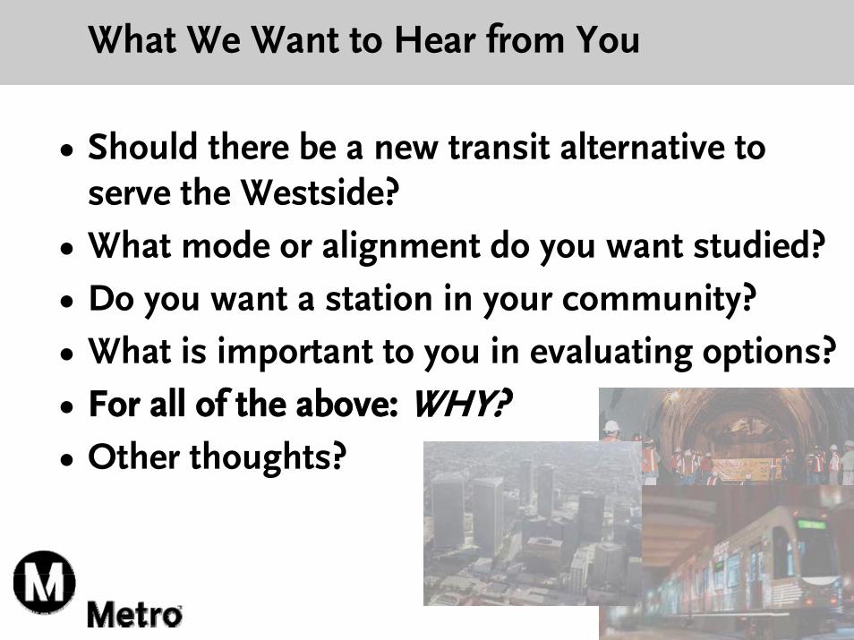
• Should there be a new transit alternative to serve the Westside?
• What mode or alignment do you want studied?• Do you want a station in your community?• What is important to you in evaluating options?• For all of the above: WHY?• Other thoughts?
What We Want to Hear from You

Alternatives Analysis
Process and Schedule

What is an Alternatives Analysis?
• First step in defining a project • Evaluation of a wide range of alternatives &
issues, including:– Modes– Alignments– Station locations– Segment lengths
• Includes public comments from scoping• Screening of alternatives to move into
environmental analysis

Project Development Process

Alternatives Analysis Schedule
Public Scoping Meetings October 2007
Public Comment Period Closes November 1, 2007
Initial Alternatives Screening Report January/February 2008
Completion of AA Study Report
Recommendation to Board of Locally Preferred Alternative (LPA)
Summer 2008

Possible AA Study Outcomes
1. Board adopts Locally Preferred Alternative (LPA)• Authorizes moving forward into Preliminary
Engineering (PE) and DEIS/DEIR
2. Board does not adopt LPA• Authorizes DEIS/DEIR for 2 or more alternatives• Defers PE until end of DEIS/DEIR
3. Board does not adopt LPA and does not authorize further actions/study

Why This Study?

What’s New?
• Long history of studying transit alternatives
• Renewed interest in considering options
• Improved tunneling technology
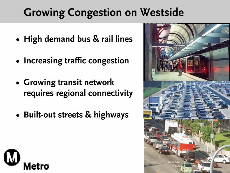
Growing Congestion on Westside
• High demand bus & rail lines
• Increasing traffic congestion
• Growing transit network requires regional connectivity
• Built-out streets & highways