antarctic mapping and aerial photography
TRANSCRIPT

Antarctic Mapping and Aerial PhotographyAuthor(s): Finn RonneSource: The Scientific Monthly, Vol. 71, No. 5 (Nov., 1950), pp. 287-293Published by: American Association for the Advancement of ScienceStable URL: http://www.jstor.org/stable/19991 .
Accessed: 01/05/2014 07:14
Your use of the JSTOR archive indicates your acceptance of the Terms & Conditions of Use, available at .http://www.jstor.org/page/info/about/policies/terms.jsp
.JSTOR is a not-for-profit service that helps scholars, researchers, and students discover, use, and build upon a wide range ofcontent in a trusted digital archive. We use information technology and tools to increase productivity and facilitate new formsof scholarship. For more information about JSTOR, please contact [email protected].
.
American Association for the Advancement of Science is collaborating with JSTOR to digitize, preserve andextend access to The Scientific Monthly.
http://www.jstor.org
This content downloaded from 130.132.123.28 on Thu, 1 May 2014 07:14:00 AMAll use subject to JSTOR Terms and Conditions
SCIENTIFIC MONTHLY NOVEMBER 1950
Antarctic Mapping and Aerial Photography
FINN RONNE Following the example of his adventurous father, who, at the age of sixty-eight, after more than twenty years of arctic exploration, accompanied the first Byrd Expedition, Finn Ronne has become a veteran polar explorer. He went on the second Byrd Expedition, and was with the U. S. Antarctic Service Expedition in 1939-41. After several years of active service in the Navy, Commander Ronne organized and led his own expedition to Antarctica in 1946-48. As the navigator, he flew in the trimetrogon-camera-equipped Beechcraft on all the long explora- tory flights. Two women, one of whom was Mrs. Ronne, spent the winter with the expedition, an exploit unique in the annals of antarctic e A LTHOUGH Antarctica has been the goal for
about one hundred and seventy expedi- tions from many nations for well over a
century, two thirds of its 6 million square miles have yet to be seen by man. Even the coastal margins have not been fully delineated. Members of the Ronne Antarctic Research Expedition in 1947 flew over and photographed most of the least-known coast, a 500-mile strip of the Weddell Sea coastline.
Comprehensive mapping in the Antarctic was only one part of the work done on this expedition. Thorough studies were also made in geology, seis- mology, meteorology, solar radiation, and tidal ob- servations, to mention just a few. The coordination of these and other data provides information of wide significance to geographers.
Early Mapping Methods The methods used to map and chart the new
land by the early explorers contrast sharply with those possible today. For sorrme seventy-five years,
November 1950
until man first set foot on its shores, all mapping and charting of the continent of Antarctica were done from the decks of ships. Accurate sights of the sun and stars were difficult to obtain from the small sailing vessels, rolling and pitching in the violent antarctic seas, with sextants and chronometers, their main tools for determining positions, which lacked modern precision. Previously charted points for reference either did not exist or were of doubtful accuracy. Taking these things into consideration, it is with amazement and considerable admiration that we find how close they came at times to an accurate location of their newly discovered land- marks. Generally, however, an error of 50 miles was considered good navigation in those early days.
At the beginning of the twentieth century, both the north and south polar regions aroused in men an infectious desire to be the first to reach the poles, and serious exploration was often subordinated to this overpowering primary objective. Forced to travel over the surface with the bare minimln
287
This content downloaded from 130.132.123.28 on Thu, 1 May 2014 07:14:00 AMAll use subject to JSTOR Terms and Conditions

'., ..:,R' ,'..-' ,, ,-.,.. ,.,, 0 . 0 ig; 0 ~ ~ ~ ~ ~ ~ ~ ~ ~ ~ ~ ~ ~ ~ ~ .. .....
Preparing planes for flight. Weasel in foreground and expedition ship, The Port of Beaumont, Texas, frozen in in the background.
weight-load, the early explorers usually left cumber- some transits behind. The magnetic compass, how- ever, even with the problems it presented in proxi- mal polar areas, was a boon to both ship navigation and surface travel. Mounted on a sled, the compass was used to take magnetic bearings to prominent features, and the easily manageable ship's sextant was relied on for navigation.
As man's tedious task of hauling sledges gave way to dog-power and mechanized surface transporta- tion, and weight was no longer almost a life-and- death matter, the more accurate transit largely re- placed the sextant, and the chronometer was sup- plemented by portable radio sets for receiving daily "time-ticks" sent out from the main base.
The innovation that dwarfed all others, however, as an aid to exploration was the airplane. With the development of aerial photography, the airplane opened up undreamed-of possibilities for the map- ping of vast unknown areas. In the early stages of aerial photography and mapping, the limitations and inadequacies of oblique photography, and the
near impossibility of reconstructing the plane's exact flight track on vacant grid-line charts, re- sulted in nearly as much inaccuracy in the plotting of topographic features as in the days before man first set foot on antarctic shores. These shortcomings were particularly evident when long flights were made without the benefit of ground control points.
Techniques Used on the Ronne 1947 Expedition Aerial photographic equipment. Aerial photog-
raphy and mapping were greatly accelerated dur- ing World War II, chiefly through the refinements in trimetrogon photography. By this method it be- came possible to photograph the entire area along the flight track from horizon to horizon, one camera taking a vertical picture of the terrain directly be- low, and the other two taking simultaneous oblique pictures on either side.
Such cameras were installed in one of the Ronne Expedition's airplanes, a twin-engine Beechcraft. An intervalometer was connected to the electrically operated cameras to expose pictures automatically, at a rate commensurate with the plane's speed and so controlled as to produce overlapping photo- graphs, each of which could be placed in true re- lation to another. The latest navigational aids avail- able-such as a radio altimeter, a view finder, and a drift meter -were also installed.
Network of weather stations. We recognized in the earliest planning stages of our expedition that accomplishment of the aerial photographic objec- tives would depend in large part on the weather; a network of stations was therefore planned at strategic locations in the general area of intended operations, to report weather observations to the meteorologist at the main base for correlation and forecasts before flights. The weather forecasts served three primary purposes: safety, gasoline con- servation, and continuity of photographs. Knowl-
The three portions of a trimetrogon photograph. Center picture is vertical with left and right obliques along the
flioht track. Overlapping features can be noted along adjacent edges.
288 THE SCIENTIFIC MONTHLY
This content downloaded from 130.132.123.28 on Thu, 1 May 2014 07:14:00 AMAll use subject to JSTOR Terms and Conditions
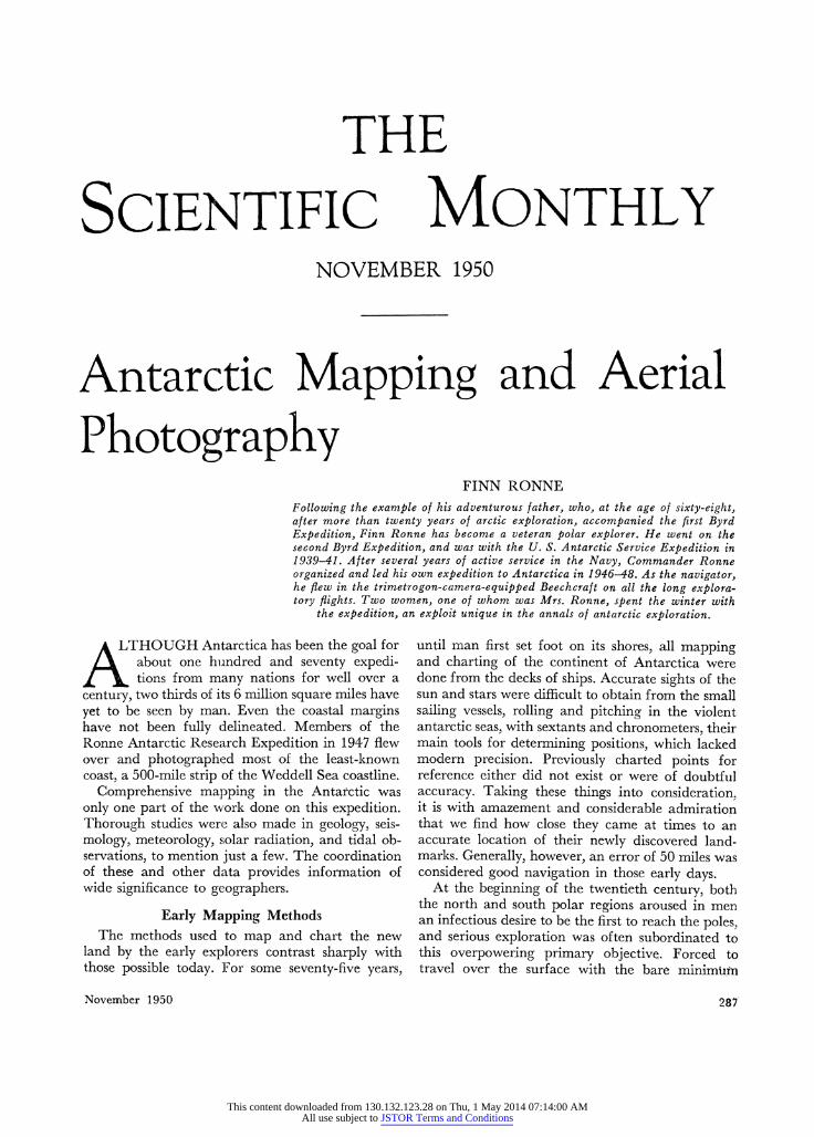
Cape Kee]er weather station.
edge of the weather conditions along the flight track was an essential safety precaution, for if the weather should close in suddenly during a flight, the pilot would not have much chance to make a safe landing among the mountains and glaciers of the Palmer Peninsula; aviation gasoline was so important a limiting factor that to ensure its not being wasted it behooved us to know whether a flight could be completed, even before the heaters were applied to the airplane motors. And the cloud cover within the area of a photographic mission had to be known to provide identifiable continuity in the resulting photographs.
Early in the antarctic spring of 1947, the plan was put into operation by establishing a meteorological station on the Palmer Peninsula plateau 17 miles east of the wintering base; it was manned for 104 days. A second meteorological station was operated continuously for 74 days at Cape Keeler, 125 miles southeast of the base on the opposite side of the peninsula. Supplementary weather information was relayed to the main base from dog-team parties working in other areas. 'It can now be stated that if
such a network of weather stations had not been established our aerial photography and mapping mission would have failed.
Most of the photographic missions were flown at an altitude of 10,000 feet, although altitudes of 14,000 feet were necessary in some of the moun- tainous areas. To assist in the correlation of the photographs, the camera operator maintained a constant check on changes in altitude, and the navigator obtained lines of position from sun sights with a bubble sextant. Careful records of driftmeter readings aided in determination of the flight track and the ground speed. The intervalometer was set at appropriate intervals, depending on the altitude and ground speed, so that each photograph would overlap the preceding one by 60 per cent.
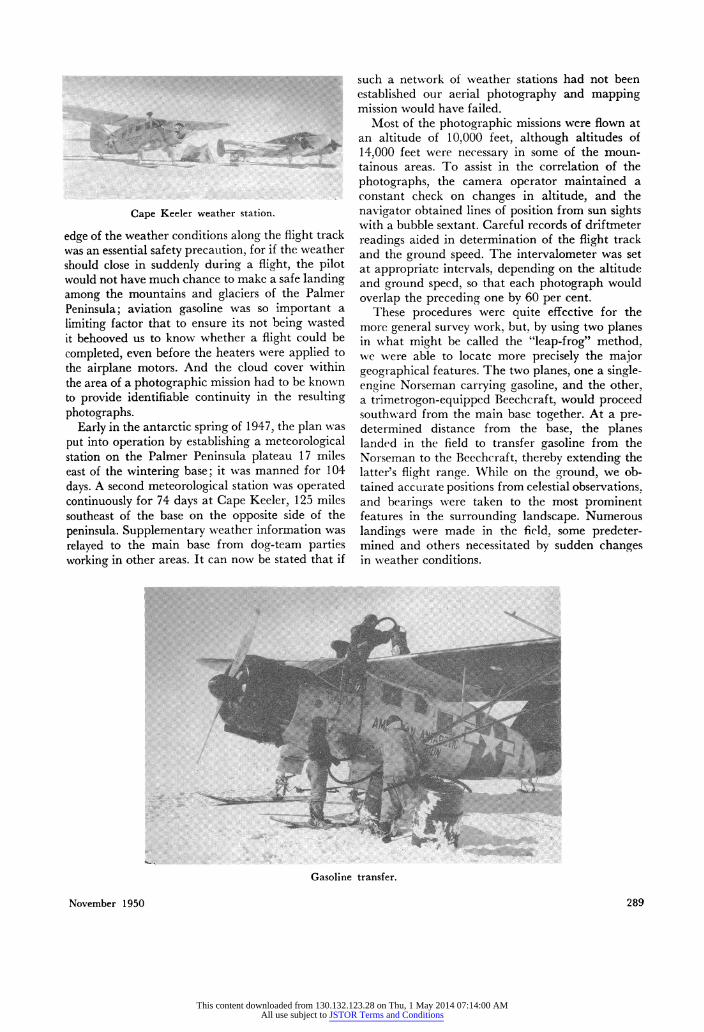
These procedures were quite effective for the more general survey work, but, by using two planes in what might be called the "leap-frog" method, we were able to locate more precisely the major geographical features. The two planes, one a single- engine Norseman carrying gasoline, and the other, a trimetrogon-equipped Beechcraft, would proceed southward from the main base together. At a pre- determined distance from the base, the planes landed in the field to transfer gasoline from the Norseman to the Beechcraft, thereby extending the latter's flight range. While on the ground, we ob- tained accurate positions from celestial observations, and bearings were taken to the most prominent features in the surrounding landscape. Numerous landings were made in the field, some predeter- mined and others necessitated by sudden changes in weather conditions.
Gasoline transfer.
November 1950 289
This content downloaded from 130.132.123.28 on Thu, 1 May 2014 07:14:00 AMAll use subject to JSTOR Terms and Conditions
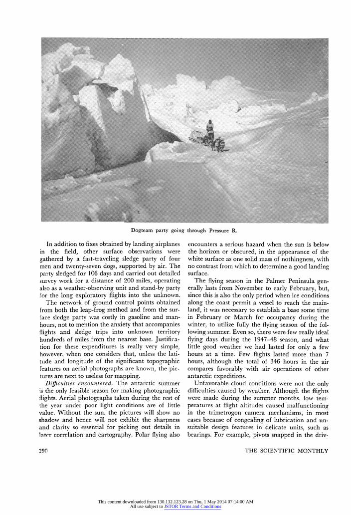
Dogteam party.going.through.Pressure.R.
Dogteam party going through Pressure R.
In addition to fixes obtained by landing airplanes in the field, other surface observations were gathered by a fast-traveling sledge party of four men and twenty-seven dogs, supported by air. The party sledged for 106 days and carried out detailed survey work for a distance of 200 miles, operating also as a weather-observing unit and stand-by party for the long exploratory flights into the unknown.
The network of ground control points obtained from both the leap-frog method and from the sur- face sledge party was costly in gasoline and man- hours, not to mention the anxiety that accompanies flights and sledge trips into unknown territory hundreds of miles from the nearest base. Justifica- tion for these expenditures is really very simple, however, when one considers that, unless the lati- tude and longitude of the significant topographic features on aerial photographs are known, the pic- tures are next to useless for mapping.
Difficulties encountered. The antarctic summer is the only feasible season for making photographic flights. Aerial photographs taken during the rest of the year under poor light conditions are of little valtue. Without the sun, the pictures will show no shadow and hence will not exhibit the sharpness and clarity so essential for picking out details in later correlation and cartography. Polar flying also
encounters a serious hazard when the sun is below the horizon or obscured, in the appearance of the white surface as one solid mass of nothingness, with no contrast from which to determine a good landing surface.
The flying season in the Palmer Peninsula gen- erally lasts from November to early February, but, since this is also the only period when ice conditions along the coast permit a vessel to reach the main- land, it wa.s necessary to establish a base some time in February or March for occupancy during the winter, to utilize fully the flying season of the fol- lowing summer. Even so, there were few really ideal flying days dirng the 1947-48 season, and what little good Weather we had lasted for only a few hours at a timWe Few flights lasted more than 7 hours, alth the total of 346 hours in the air compares favorably with air operations of other antarctic expeditions.
Unfavorable cloud conditions were not the only difficulties caused by weather. Although the flights were made-..during the summer months, low tem- peratures at flight altitudes caused malfunctioning in the trimetrogon camera mechanisms, in most cases because of congealing of lubrication and un- suitable design features in delicate units, such as bearings. For example, pivots snapped in the driv-
290 THE SCIENTIFIC MONTHLY
This content downloaded from 130.132.123.28 on Thu, 1 May 2014 07:14:00 AMAll use subject to JSTOR Terms and Conditions
ing gears of the cameras. On some flights this mal- functioning was not discovered until after the plane had returned to base, :for the camnera indicated the film had wound normally on the spool. The cold also led to an overload of the electric circuits on one
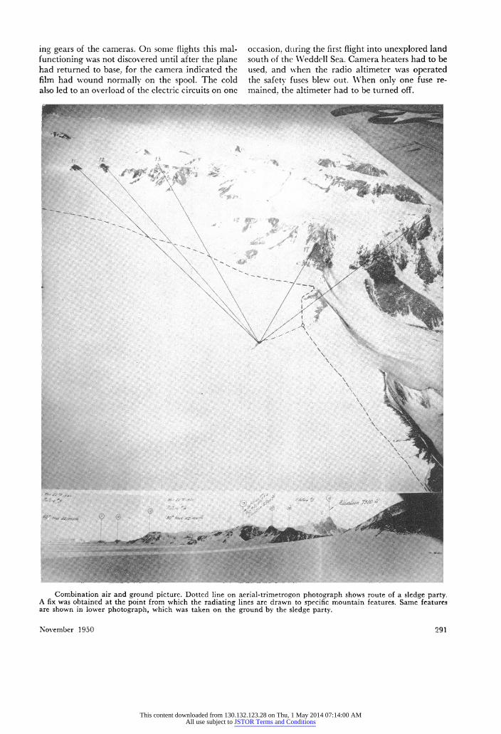
occasion, during the first flight into unexplored land south of the Weddell Sea. Camera heaters had to be used, and when the radio altimeter was operated the safety fuses blew out. When only one fuse re- mained, the altimeter had to be turned off.
13~~~~~~~~~~~~~~~~~~~~~~~~~~~~~6
tT~~~
.WI~~~~~~~~~~~~~~~~~~~~~~~~
Combination air and ground pictuire. Dotted line on aerial-trimetrogon photograph shows route of a sledge party. Afix was obtained at the point from which the radiating lines are drawn to specific mountain features. Same features are shown in lower photograph, which was taken on the ground by the sledge party.
November 1950 291
This content downloaded from 130.132.123.28 on Thu, 1 May 2014 07:14:00 AMAll use subject to JSTOR Terms and Conditions
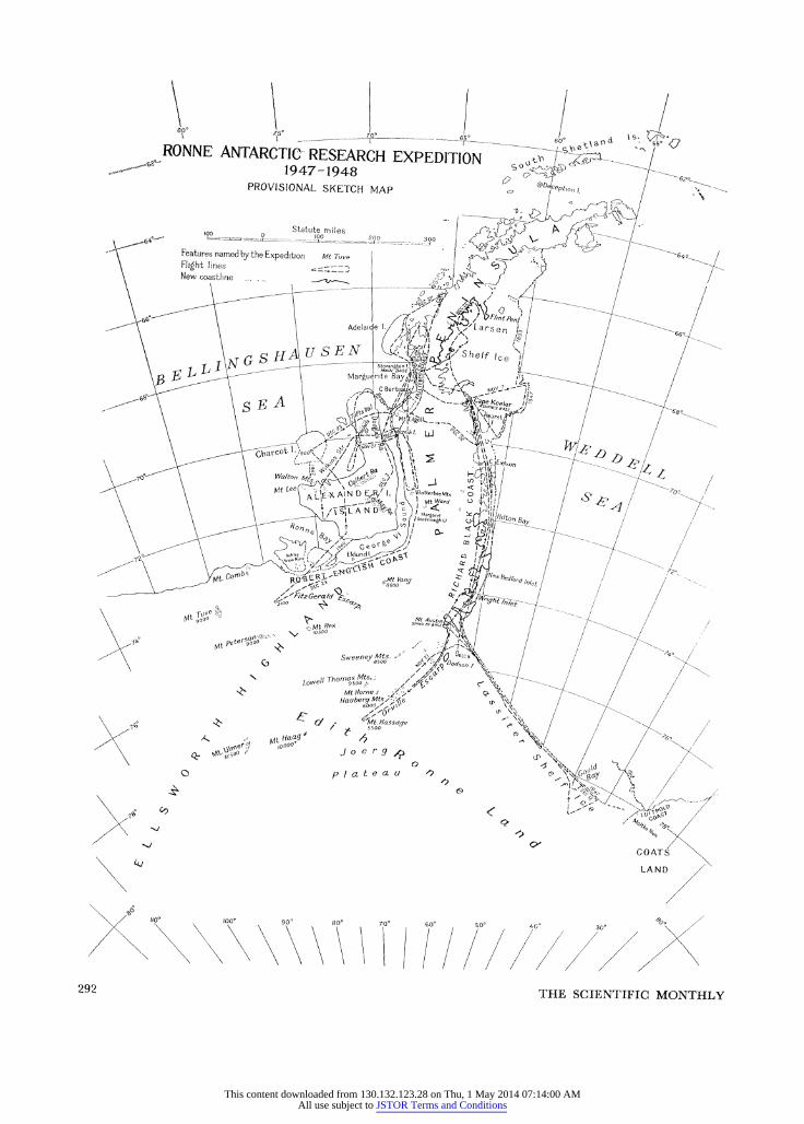
ROANNE ANTARCTIG( E ( XEITO > --
PR'OVISIONAL SKETCH MAP 'DCPtion, / .-
64>- t?F o ~~~~Statute Omiles \ ;
4;~~ ~ ~~~ Features name.dby the Expedition ......
|Wt .TuveX l i -6< New coar ine - ....... ........-..6
\B f - l
~~~~~~~~Margu6rite Bay/tllXv,
\S f
~~~~~~~~~~~~~~~~~~~. -Be \_rw/ Jtea
/ Z= a 50 ^ Z Z S A aPD',Keelert
/>? Mt ;>etersgO ' >> . * < ! / -~I t-Edi
\ ^z6? ;t 6 CX / AMt. //esseye -,<\4 / >~~~~~M. wo'
44,~~~~~~~~~~~~~~~~~~ A N N
/ \\ \ X X \\ X X / / j , / * / / // \~~~~~~~~~~~~~~~~~~~~~~~~~~~~~~~~~~~~~~~~~~~~ 292~~~~~~~~~~~~~~~~~~~~~~~~~~~~~~~~~~~~~~~~~~~~~~~~~~~~~~~~ TH CINIFCMOTL
This content downloaded from 130.132.123.28 on Thu, 1 May 2014 07:14:00 AMAll use subject to JSTOR Terms and Conditions
Contributions to the Antarctic Map The Ronne Antarctic Research Expedition made
what has been callecl the world's last remaining major geographical discovery, in establishing that Antarctica is one continent and not two. In 346 hours of flying the planes covered more than 700,- 000 square miles, 250,000 of which were newly dis- covered land. More than 14,000 trimetrogon aerial photographs were taken, which will be correlated with the astronomical fixes and ground control points to make new maps of the entire area covered.
New Techniques and Instruments for Future Antarctic Use
Future expeditions to the Antarctic will have available a wealth of new devices that will per- mit an even better job of mapping the remaining unexplored 4 million square miles to be done. Care- fully drawn plans for use of such devices will have to be made well in advance of an expedition's de- parture, and coordinated with cartographic prac- tices used in this work. Electronic equipment will play a large part. Slhoran undoubtedly will con- tribute greatly to furtlher mapping of the Antarctic. After several Shoran stations have been established, ground control points will be fixed and recorded automatically at the instant a set of photographs is taken. Radar photography will also be used in
conjunction with trimetrogon photography to ex- tend horizontal ground control between fixed posi- tions, thereby providing continuous coverage even though clouds interrupt visibility. For vertical con- trol, airborne radar altimeters will be synchronized with the trimetrogon cameras to obtain a contin- uous profile of the ground surface. These and other new developments, had they been available to us at the timne of our expedition's departure from the United States in January 1947, would have made the laborious task of obtaining ground control points much easier and would have enabled us to cover an area several times larger.
But who can afford the outfitting of such an elab- orately equipped expedition? In my opinion, the era of the private expedition to the Antarctic has passed, and only the government can cover the necessary expenditures. In times such as these, when technological developments are making such great forward strides, it would seem only reasonable for the three divisions of the Department of Defense- Navy, Armny, and Air Force-to pool their excellent resources and undertake a comprehensive mapping program in the Antarctic. Comparatively modest expenditures today may give a good return in the future, for each of the 4 million square miles of un- explored territory must be assumed to have poten- tial value at some time, if not now.
.. .: .. .....
| a . .. .. .... .. .
..' .... ! ... .
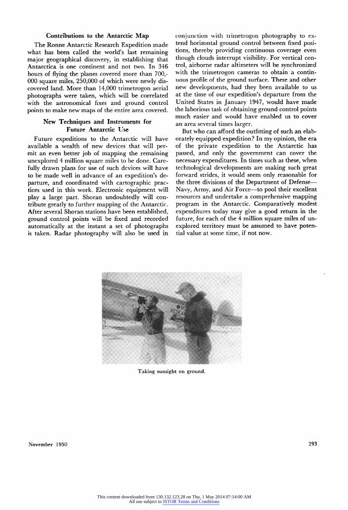
Taking sunsight on ground
November 1950 293
This content downloaded from 130.132.123.28 on Thu, 1 May 2014 07:14:00 AMAll use subject to JSTOR Terms and Conditions