annotated format for presentation report for
TRANSCRIPT

UNITEDNATIONS EP
United NationsEnvironmentProgram
Original: ENGLISH
Proposed areas for inclusion in the SPAW list ANNOTATED FORMAT FOR PRESENTATION REPORT FOR:
Seaflower Marine Protected AreaColombia
Date when making the proposal : October 5th, 2010
CRITERIA SATISFIED :Ecological criteria Cultural and socio-economic criteriaRepresentativenessConservation value
Cultural and traditional use

Area name: Seaflower Marine Protected Area
Country: Colombia
Contacts
Focal Point
Last name: FRANKE ANTE First name: Rebeca Position: Dirección Territorial Caribe. Parques Nacionales Naturales de Colombia Email: [email protected] Phone: 5754230752
Manager
Last name: FRANKE ANTE First name: Rebeca Position: Manager Email: [email protected] Phone: 00121122222
SUMMARYChapter 1 - IDENTIFICATIONChapter 2 - EXECUTIVE SUMMARYChapter 3 - SITE DESCRIPTIONChapter 4 - ECOLOGICAL CRITERIAChapter 5 - CULTURAL AND SOCIO-ECONOMIC CRITERIAChapter 6 - MANAGEMENTChapter 7 - MONITORING AND EVALUATIONChapter 8 - STAKEHOLDERSChapter 9 - IMPLEMENTATION MECHANISMChapter 10 - OTHER RELEVANT INFORMATION
ANNEXED DOCUMENTS
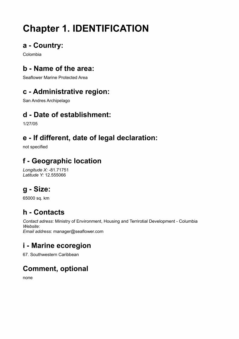
Chapter 1. IDENTIFICATIONa - Country:Colombia
b - Name of the area:Seaflower Marine Protected Area
c - Administrative region:San Andres Archipelago
d - Date of establishment:1/27/05
e - If different, date of legal declaration:not specified
f - Geographic locationLongitude X: -81.71751Latitude Y: 12.555066
g - Size:65000 sq. km
h - ContactsContact adress: Ministry of Environment, Housing and Terrirotial Development - ColumbiaWebsite: Email address: [email protected]
i - Marine ecoregion67. Southwestern Caribbean
Comment, optionalnone
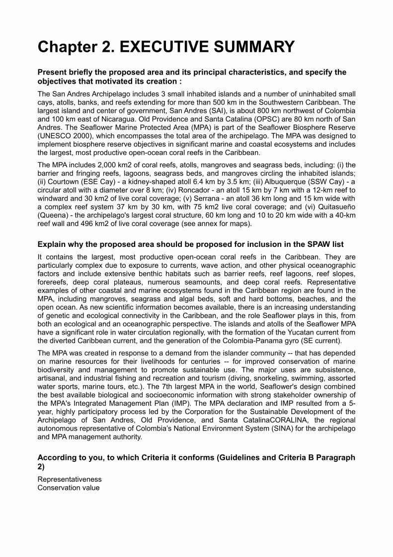
Chapter 2. EXECUTIVE SUMMARYPresent briefly the proposed area and its principal characteristics, and specify the objectives that motivated its creation :The San Andres Archipelago includes 3 small inhabited islands and a number of uninhabited small cays, atolls, banks, and reefs extending for more than 500 km in the Southwestern Caribbean. The largest island and center of government, San Andres (SAI), is about 800 km northwest of Colombia and 100 km east of Nicaragua. Old Providence and Santa Catalina (OPSC) are 80 km north of San Andres. The Seaflower Marine Protected Area (MPA) is part of the Seaflower Biosphere Reserve (UNESCO 2000), which encompasses the total area of the archipelago. The MPA was designed to implement biosphere reserve objectives in significant marine and coastal ecosystems and includes the largest, most productive open-ocean coral reefs in the Caribbean.
The MPA includes 2,000 km2 of coral reefs, atolls, mangroves and seagrass beds, including: (i) the barrier and fringing reefs, lagoons, seagrass beds, and mangroves circling the inhabited islands; (ii) Courtown (ESE Cay) - a kidney-shaped atoll 6.4 km by 3.5 km; (iii) Albuquerque (SSW Cay) - a circular atoll with a diameter over 8 km; (iv) Roncador - an atoll 15 km by 7 km with a 12-km reef to windward and 30 km2 of live coral coverage; (v) Serrana - an atoll 36 km long and 15 km wide with a complex reef system 37 km by 30 km, with 75 km2 live coral coverage; and (vi) Quitasueño (Queena) - the archipelago's largest coral structure, 60 km long and 10 to 20 km wide with a 40-km reef wall and 496 km2 of live coral coverage (see annex for maps).
Explain why the proposed area should be proposed for inclusion in the SPAW listIt contains the largest, most productive open-ocean coral reefs in the Caribbean. They are particularly complex due to exposure to currents, wave action, and other physical oceanographic factors and include extensive benthic habitats such as barrier reefs, reef lagoons, reef slopes, forereefs, deep coral plateaus, numerous seamounts, and deep coral reefs. Representative examples of other coastal and marine ecosystems found in the Caribbean region are found in the MPA, including mangroves, seagrass and algal beds, soft and hard bottoms, beaches, and the open ocean. As new scientific information becomes available, there is an increasing understanding of genetic and ecological connectivity in the Caribbean, and the role Seaflower plays in this, from both an ecological and an oceanographic perspective. The islands and atolls of the Seaflower MPA have a significant role in water circulation regionally, with the formation of the Yucatan current from the diverted Caribbean current, and the generation of the Colombia-Panama gyro (SE current).
The MPA was created in response to a demand from the islander community -- that has depended on marine resources for their livelihoods for centuries -- for improved conservation of marine biodiversity and management to promote sustainable use. The major uses are subsistence, artisanal, and industrial fishing and recreation and tourism (diving, snorkeling, swimming, assorted water sports, marine tours, etc.). The 7th largest MPA in the world, Seaflower's design combined the best available biological and socioeconomic information with strong stakeholder ownership of the MPA's Integrated Management Plan (IMP). The MPA declaration and IMP resulted from a 5-year, highly participatory process led by the Corporation for the Sustainable Development of the Archipelago of San Andres, Old Providence, and Santa CatalinaCORALINA, the regional autonomous representative of Colombia’s National Environment System (SINA) for the archipelago and MPA management authority.
According to you, to which Criteria it conforms (Guidelines and Criteria B Paragraph 2)RepresentativenessConservation value

Cultural and socio-economic criteriaCultural and traditional use
Chapter 3. SITE DESCRIPTIONa - General features of the site
Terrestrial surface under sovereignty, excluding wetlands: 650 sq. km
Wetland surface: 250 ha
Marine surface: 65000 sq. km
Global comment for the 3 previous fields (optional): The Seaflower MPA includes 65,000 km2. The territory is under the jurisdiction of the Colombian State, with the native community (known as raizales) having tenure rights under the Constitution (Art. 310) and subsequent regulations.
b - Physical features
Brief description of the main physical characteristics in the area: See details below.
Geology: The Seaflower MPA includes a series of oceanic islands, barrier reef complexes, atolls and coral shoals, of volcanic origin, linked to the formation of the Nicaraguan Rise and the Caribbean Sea. It is characterized by 2 barrier reef complexes on the windward sides of the main populated islands of San Andres and Old Providence (linked to the smaller island of Santa Catalina by bridge), and a series of atolls and coral banks lined up in a NNE direction that extend for over 500 km. The Seaflower MPA includes Courtown (ESE Cay) - a kidneyshaped atoll 6.4 km by 3.5 km; Albuquerque (SSW Cay) - a circular atoll with a diameter over 8 km; Roncador - an atoll 15 km by 7 km with a 12-km reef to windward; Serrana - an atoll 36 km long and 15 km wide with a complex reef system 37 km by 30 km; and Quitasueño (Queena) - the archipelago's largest coral structure, a half-atoll, 60 km long and 10 to 20 km wide with a 40-km reef wall.
Geister and Diaz (1997) estimate that as the islands and atolls appear to be closely linked to the formation of the Nicaraguan Rise and the Caribbean Sea, the early pre-island history may date back to the late Cretaceous period. The islands, atolls, and banks are volcanic in origin, formed from the subsidence of volcanic basements and the capping of sea mounts by carbonates in Tertiary to Quaternary times. The San Andres Trough, a tectonic graben on the lower-Nicaraguan Rise (15° NNE), separates the archipelago from the Middle American continental shelf. The Trough itself is part of a regional tectonic pattern deemed remarkable for its fracture zones.
Because of its remote location within the Caribbean region, according to the 2004 World Resources Institute’s (WRI) Reefs at Risk analysis, the Seaflower MPA represents not only one of

the most extensive reef areas in the Western Atlantic but also a particularly complex one due to its exposure to currents, wave action, and other physical oceanographic factors. Furthermore, the islands and atolls of the Seaflower MPA play a significant role in water circulation regionally, with the formation of the Yucatan current from the diverted Caribbean current, and the generation of the Colombia-Panama gyro (SE current).
Topography: The Seaflower MPA includes slightly over 250 ha of mangroves in 12 coastal, estuarine swamps. Four species – red, black, white, and buttonwood – are found. San Andres is the archipelago's largest island. In 1996, mangroves covered 161 ha. Following education, reforestation, and establishment of protected areas, total mangrove area has increased to close to 200 ha. The Hooker Bight/Honda Bay mangroves are the island’s largest wetland at 51 ha. This ecosystem is protected in the Old Point Regional Mangrove Park. Other mangrove forests are Cocoplum, Salt Creek, Sound Bay, Smith Channel, and Cove Seaside, all of which are protected.
In Old Providence and Santa Catalina mangroves covered a total area of 54 ha in 1996. With an area of 30 hectares, the Oyster Creek mangroves are the largest and most productive and form part of the only national park in the archipelago, Old Providence McBean Lagoon. Other small but productive stands of mangroves are Southwest Bay, Old Town, Manchineel Bay, Jones Point, and Santa Catalina.
Others: Length of beaches (in km), including islands :
a) Length of sandy beaches: 2.4 km in length
b) Length of pebble or stony beaches: .8 km in length
c) Length, height and depth of active sand-dunes: 3.8 km2 in area with 2.5-3.5 m in height
Mean annual precipitation (in mm) 1700 mm
c - Biological features
Habitats
Brief description of dominant and particular habitats (marine and terrestrial)*: List here the habitats and ecosystems that are representative and/or of importance for the WCR (i.e. mangroves, coral reefs, etc):
The Seaflower MPA contains the largest, most productive open-ocean coral reefs in the Caribbean and includes complete extended coral reefs with all associated ecosystems and a high level of habitat representation. Other habitat types include mangrove forests, sea grass and algal beds, soft bottoms, beaches, and open ocean. These offer sea bird and sea turtle nesting sites; fish spawning, nursery, and aggregation sites; habitat for a number of threatened species; and demonstrated local and regional genetic and ecological connectivity.
Coral reef formations are particularly complex here as a result of their oceanic location and the heavy wave action and turbulence to which they are subjected as the result of high swells generated by the trade winds over a 2,000 km wave fetch (Geister and Diaz 1997). This is a major influence on coral reef morphology, sedimentology, and reef community structure. There are over 200,000 ha of coral; extensive and diverse benthic habitats include barrier reefs, reef lagoons, reef

slopes, fore-reefs, deep coral plateaus, numerous seamounts, and deep coral reefs (Diaz et al. 2000). The MPA features rare and beautiful coral reef formations such as tall pinnacles, steep walls, extensive meander-like Montastrea lagoons, and ribbon reefs with high Acropora coverage.
Each site exhibits its own special characteristics. For example, the Old Providence and Santa Catalina reef complex, covering an area of approximately 25,500 ha, is one of the largest in the western hemisphere (Geister and Diaz 1997). The windward reefs of Courtown are considered to be a unique and unusual reef environment (Geister and Diaz 1997) due to the influence of strong waves and currents, turbulences and the presence of an intricate system of caves. Remote areas such as Roncador demonstrate high reef integrity with little anthropogenic influence. Unlike most Caribbean reefs, the dominant reef-building coral at Roncador is Montastraea franksi.
In regard to other habitats, there are 12 mangrove lagoons (covering over 250 ha) on San Andres, Old Providence and Santa Catalina, showing classic zoning patterns. They provide habitat, food and refuge to a wide variety of marine and coastal fauna and flora. Productive and healthy seagrass beds (estimated at over 2,000 ha) are also found primarily along the shores of these islands. They stabilize the sea bottom, help control erosion, and provide food, oxygen, and habitat for marine life. Algal beds, soft bottoms, beaches, and the deep ocean are other habitats found in the MPA. Sea turtle nesting occurs on the more isolated beaches. Deep sea areas are largely unexplored but are considered to be important for flows, connectivity, spawning aggregations, larval dispersal and maintaining marine food webs.
Detail for each habitat/ecosystem the area it covers:
Marine / coastal ecosystem categoriesDetail for each habitat / ecosystem the area covers
Size (estimate)
Description and commentsunit Area
covered
Mangroves
Estuarine areas ha 250The Seaflower MPA includes slightly over 250 ha of mangroves in 12 coastal, estuarine swamps. Four species – red, black, white, and buttonwood – are found.
Coral reefs
Corals ha 218850
There are over 200,000 ha of coral; extensive and diverse benthic habitats include barrier reefs, reef lagoons, reef slopes, fore-reefs, deep coral plateaus, numerous seamounts, and deep coral reefs (Diaz et al. 2000).
Sea grass beds
Seagrass beds ha 2000Productive and healthy seagrass beds (estimated at over 2,000 ha) are also found primarily along the shores of these islands.v
Other marine ecosystemsAlgal beds ha 4310
Terrestrial ecosystemsSize (estimate)
unit Area covered
Other terrestrial ecosystemsBeaches sq.km 29 Beaches – 2,940 ha

Flora
Brief description of the main plant assemblages significant or particular in the area:
The Seaflower MPA features 3 seagrass species and 4 mangrove and associated species; including red, white, black and buttonwood mangroves. Native beach vegetation includes The greatest diversity of marine flora occurs within the algae, with Seaflower supporting at least 163 species. Native beach vegetation includes trees such as sea grape, mahoe, and beach almond; shrubs including sea purslane, bay cedar and sea lavendar; grasses and trailing vines.
List of plant species within the site that are in SPAW Annex I
List of species in SPAW annex I Estimate of population size Comments if any
List of plant species within the site that are in SPAW Annex III
List of species in SPAW annex III Estimate of population size Comments if anyCombretaceae: Conocarpus erectus not givenCompositae : Laguncularia racemosa not givenCymodoceaceae: Halodule wrightii not givenCymodoceaceae: Syringodium filiforme not givenHydrocharitaceae: Thalassia testudinum not givenRhizophoraceae: Rhizophora mangle not givenVerbenaceae: Avicennia germinans not given
List of plant species within the site that are in the IUCN Red List. UICN red list : http://www.iucnredlist.org/apps/redlist/search You will specify the IUCN Status (CR:critically endangered; EN:endangered; VU:vulnerable).
List of species in IUCN red list that are present in your site IUCN Status Estimate of
population size Comments if any
Syringodium : filiforme Unknown not givenThalassia: testudinum Unknown not givenHalodule : wrightii Unknown not givenRhizophora: mangle Unknown not given Red mangroveAvicennia : germinans Unknown not given Black mangroveLaguncularia : racemosa Unknown not given White mangrove
Conocarpus: erectus Unknown not given Silver-leaved Buttonwood
Cedrela : odorata VU - Vulnerable not given Spanish Cedar
List of plant species within the site that are in the national list of protected species
List of species in the national list of protected species that are present in your site
Estimate of population size
Comments if any
Fauna
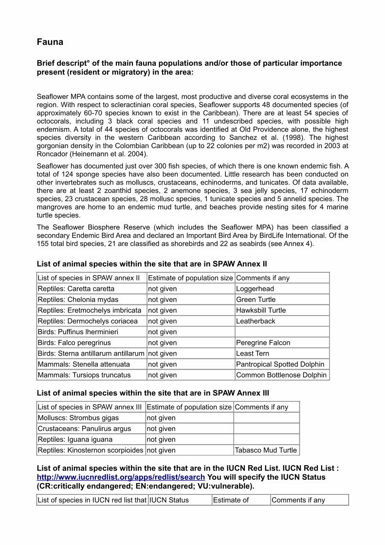
Brief descript° of the main fauna populations and/or those of particular importance present (resident or migratory) in the area:
Seaflower MPA contains some of the largest, most productive and diverse coral ecosystems in the region. With respect to scleractinian coral species, Seaflower supports 48 documented species (of approximately 60-70 species known to exist in the Caribbean). There are at least 54 species of octocorals, including 3 black coral species and 11 undescribed species, with possible high endemism. A total of 44 species of octocorals was identified at Old Providence alone, the highest species diversity in the western Caribbean according to Sanchez et al. (1998). The highest gorgonian density in the Colombian Caribbean (up to 22 colonies per m2) was recorded in 2003 at Roncador (Heinemann et al. 2004).
Seaflower has documented just over 300 fish species, of which there is one known endemic fish. A total of 124 sponge species have also been documented. Little research has been conducted on other invertebrates such as molluscs, crustaceans, echinoderms, and tunicates. Of data available, there are at least 2 zoanthid species, 2 anemone species, 3 sea jelly species, 17 echinoderm species, 23 crustacean species, 28 mollusc species, 1 tunicate species and 5 annelid species. The mangroves are home to an endemic mud turtle, and beaches provide nesting sites for 4 marine turtle species.
The Seaflower Biosphere Reserve (which includes the Seaflower MPA) has been classified a secondary Endemic Bird Area and declared an Important Bird Area by BirdLife International. Of the 155 total bird species, 21 are classified as shorebirds and 22 as seabirds (see Annex 4).
List of animal species within the site that are in SPAW Annex II
List of species in SPAW annex II Estimate of population size Comments if anyReptiles: Caretta caretta not given LoggerheadReptiles: Chelonia mydas not given Green TurtleReptiles: Eretmochelys imbricata not given Hawksbill TurtleReptiles: Dermochelys coriacea not given LeatherbackBirds: Puffinus lherminieri not givenBirds: Falco peregrinus not given Peregrine FalconBirds: Sterna antillarum antillarum not given Least TernMammals: Stenella attenuata not given Pantropical Spotted DolphinMammals: Tursiops truncatus not given Common Bottlenose Dolphin
List of animal species within the site that are in SPAW Annex III
List of species in SPAW annex III Estimate of population size Comments if anyMolluscs: Strombus gigas not givenCrustaceans: Panulirus argus not givenReptiles: Iguana iguana not givenReptiles: Kinosternon scorpioides not given Tabasco Mud Turtle
List of animal species within the site that are in the IUCN Red List. IUCN Red List : http://www.iucnredlist.org/apps/redlist/search You will specify the IUCN Status (CR:critically endangered; EN:endangered; VU:vulnerable).
List of species in IUCN red list that IUCN Status Estimate of Comments if any

are present in your site population size
Panulirus : argus Unknown not given Caribbean Spiny Lobster
Acropora : palmata CR - Critically endangered not given Elkhorn Coral
Agaricia : agaricites Unknown not given Lettuce CoralAgaricia : fragilis Unknown not given Fragile Saucer CoralAgaricia : humilis Unknown not given Lowrelief Lettuce Coral Agaricia : lamarcki VU - Vulnerable not given Lamarck's Sheet CoralAgaricia : tenuifolia Unknown not given Thin Leaf Lettuce Coral Colpophyllia : natans Unknown not given Boulder Brain CoralDendrogyra : cylindrus VU - Vulnerable not given Pillar CoralDichocoenia : stokesii VU - Vulnerable not given Elliptical Star CoralDiploria : clivosa Unknown not given Knobby Brain CoralDiploria : labyrinthiformis Unknown not given Grooved Brain Coral
Diploria strigosa: strigosa Unknown not given Symmetrical Brain Coral
Eusmilia : fastigiata Unknown not given Smooth Flower CoralFavia : fragum Unknown not given Golfball CoralIsophyllastrea: rigida Unknown not given Rough Star CoralIsophyllia : sinuosa Unknown not given Sinuous Cactus CoralLeptoseris: cucullata Unknown not given Sinuous Cactus CoralMadracis : decactis Unknown not given Ten-ray Star CoralManicina : areolata Unknown not given Rose CoralMeandrina : meandrites Unknown not given Maze CoralMillepora : alcicornis Unknown not givenMillepora : complanata Unknown not givenMontastraea : annularis Unknown not given Boulder Star CoralMontastraea : cavernosa Unknown not given Great Star CoralMontastraea : faveolata EN - Endangered not givenMontastraea : franksi VU - Vulnerable not givenMussa : angulosa VU - Vulnerable not givenMycetophyllia : danaana Unknown not given Lowridge Cactus CoralMycetophyllia: lamarckiana Unknown not given Ridged Cactus CoarlPorites : astreoides Unknown not given Mustard Hill CoralPorites : porites Unknown not given Finger CoralSiderastrea : radians Unknown not given Lesser Starlet CoralSiderastrea: siderea Unknown not given Massive Starlet CoralSolenastrea : bournoni Unknown not given Smooth Star Coral)
Epinephelus : itajara CR - Critically endangered not given Atlantic Goliath Grouper
Epinephelus : striatus EN - Endangered not given Nassau GrouperEpinephelus : guttatus Unknown not given Red HindMycteroperca: bonaci Unknown not given Black Grouper
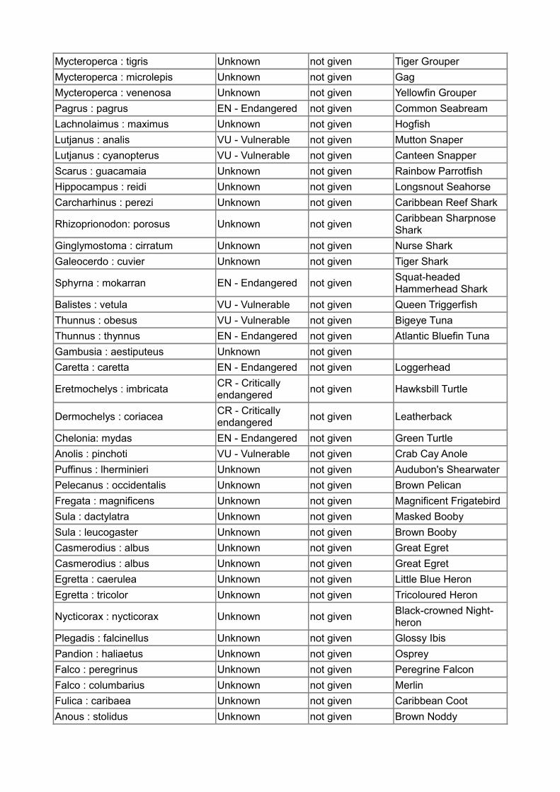
Mycteroperca : tigris Unknown not given Tiger GrouperMycteroperca : microlepis Unknown not given GagMycteroperca : venenosa Unknown not given Yellowfin GrouperPagrus : pagrus EN - Endangered not given Common SeabreamLachnolaimus : maximus Unknown not given HogfishLutjanus : analis VU - Vulnerable not given Mutton SnaperLutjanus : cyanopterus VU - Vulnerable not given Canteen SnapperScarus : guacamaia Unknown not given Rainbow ParrotfishHippocampus : reidi Unknown not given Longsnout SeahorseCarcharhinus : perezi Unknown not given Caribbean Reef Shark
Rhizoprionodon: porosus Unknown not given Caribbean Sharpnose Shark
Ginglymostoma : cirratum Unknown not given Nurse SharkGaleocerdo : cuvier Unknown not given Tiger Shark
Sphyrna : mokarran EN - Endangered not given Squat-headed Hammerhead Shark
Balistes : vetula VU - Vulnerable not given Queen TriggerfishThunnus : obesus VU - Vulnerable not given Bigeye TunaThunnus : thynnus EN - Endangered not given Atlantic Bluefin TunaGambusia : aestiputeus Unknown not givenCaretta : caretta EN - Endangered not given Loggerhead
Eretmochelys : imbricata CR - Critically endangered not given Hawksbill Turtle
Dermochelys : coriacea CR - Critically endangered not given Leatherback
Chelonia: mydas EN - Endangered not given Green TurtleAnolis : pinchoti VU - Vulnerable not given Crab Cay AnolePuffinus : lherminieri Unknown not given Audubon's ShearwaterPelecanus : occidentalis Unknown not given Brown PelicanFregata : magnificens Unknown not given Magnificent FrigatebirdSula : dactylatra Unknown not given Masked BoobySula : leucogaster Unknown not given Brown BoobyCasmerodius : albus Unknown not given Great EgretCasmerodius : albus Unknown not given Great EgretEgretta : caerulea Unknown not given Little Blue HeronEgretta : tricolor Unknown not given Tricoloured Heron
Nycticorax : nycticorax Unknown not given Black-crowned Night-heron
Plegadis : falcinellus Unknown not given Glossy IbisPandion : haliaetus Unknown not given OspreyFalco : peregrinus Unknown not given Peregrine FalconFalco : columbarius Unknown not given MerlinFulica : caribaea Unknown not given Caribbean CootAnous : stolidus Unknown not given Brown Noddy

Sterna : fuscata Unknown not given Sooty TernSterna : hirundo Unknown not given Common TernSterna : maxima Unknown not given Royal TernSterna : sandvicensis Unknown not given Sandwich TernSterna : antillarum Unknown not given Least TernCalidris : alba Unknown not given SanderlingHimantopus : mexicanus Unknown not given Black-necked StiltVireo : caribaeus VU - Vulnerable not given San Andres VireoMolossus : molossus Unknown not given Pallas's Mastiff Bat
Stenella: attenuata Unknown not given Pantropical Spotted Dolphin
Tursiops : truncatus Unknown not given Common Bottlenose Dolphin
List of animal species within the site that are in the national list of protected species
List of species in the national list of protected species that are present in your site
Estimate of population size
Comments if any
d - Human population and current activities
Inhabitants inside the area or in the zone of potential direct impact on the protected area:
Inside the area In the zone of potential direct impactPermanent Seasonal Permanent Seasonal
Inhabitants not given not given not given not given
Description of population, current human uses and development:
The main uses of the MPA are artisanal, subsistence, and industrial fishing and recreationand tourism (diving, snorkeling, swimming, assorted water sports, marine tours, etc.).
Activities Current human uses
Possible development Description / comments, if any
Tourism significant unknown
Dive shops – 12 (30 employees) Boat and jet ski rentals – 8 Tour boats – 6 (45 employees) Launch cooperative – 1 Hotel watersports – 13 “Sun, sand, and sea tourism” Tourists – 350,000 annual average (+90% use MPA)
Fishing significant unknownArtisanal fishing cooperatives – 4 Fishing associations - 4 Registered artisanal – 700 (390 classified as active) Registered industrial - 80
Agriculture unknown unknownIndustry unknown unknownForestry unknown unknown
Others not specified not specified

e - Other relevant features
f - Impacts and threats affecting the area
Impacts and threats within the area
Impact and threats level
Evolution In the short term
Evolution In the long term
Species affected
Habitats affected Description / comments
Exploitation of natural ressources: Fishing
very important increase decrease
Queen conch Reef fish Shore birds
Artisanal fishers traditionally used fishing methods and practices that were in general sustainable. They have lobbied to limit industrial fishing to selected sites in the Northern Section only and to ban the use of destructive industrial methods such as long lines and drag nets in the entire MPA. However, the sheer number of users and growing poverty now mean that even traditional methods contribute to overfishing. Consequently, MPA management measures include closed seasons for key species such as lobster and conch, protection of spawning sites and aggregations, size limits and quotas, and bans on fisheries of threatened and endangered species such as sea turtles, sharks, etc. in addition to the use of no-entry and no-take zones to balance use with conservation. Fisheries are known to be over-exploited. Research has been carried out on queen conch and some species of reef fish as well as on sea and shore birds, which are sometimes exploited for their eggs. Limited studies are currently being done but more research is needed to improve the quality and availability of scientific information and data to better inform MPA management. In 2009, especially significant was the study that was done on queen conch and information gathered from monitoring of fisheries by the Secretary of Fisheries, but carrying out more research is an urgent need.

Exploitation of natural ressources: Agriculture
limited not specified
not specified Not commented
Exploitation of natural ressources: Tourism
significant increase increase
Unsustainable tourism practices such as poor diving techniques, groundings from watercraft, and overuse of popular sites, also impact biodiversity and ecosystem condition.
Exploitation of natural ressources: Industry
limited not specified
not specified Not commented
Exploitation of natural ressources: Forest products
limited not specified
not specified Not commented
Increased population limited not
specifiednot specified Not commented
Invasive alien species
very important increase increase
In addition to the local drivers, marine ecosystems have been increasingly affected in recent years by global drivers of biodiversity loss including introduced species (e.g., lion fish)
Pollution limited not specified
not specified Not commented
Other limited not specified
not specified Not commented
Impacts and threats around the area
Impact and threats Level
Evolution In the short term
Evolution In the long term
Species affected
Habitats affected Description / comments
Exploitation of natural ressources: Fishing
limited not specified
not specified Not commented
Exploitation of natural ressources: Agriculture
limited not specified
not specified Not commented
Exploitation of natural ressources: Tourism
limited not specified
not specified Not commented
Exploitation of natural ressources:
limited not specified
not specified
Not commented

IndustryExploitation of natural ressources: Forest products
limited not specified
not specified Not commented
Increased population limited not
specifiednot specified Not commented
Invasive alien species limited not
specifiednot specified Not commented
Pollution significant not specified
not specified
Although water quality is improving from better managed waste disposal on land, there is still non-point source pollution in coastal waters from uncontrolled dumping of solid waste, discharge of liquid waste, and runoff of contaminated storm water directly into the sea and mangroves or as carried by gullies.
Other limited not specified
not specified Not commented
h - Information and knowledge
Information and knowledge available
Despite being located within the Western Caribbean Coral Reef Hotspot, one of the world’s top ten regions exceptionally rich in marine species and facing extreme threat, the significant tropical ecosystems of Seaflower have received little scientific attention, except for narrow targeted research. Available information does, however, indicate a wide diversity of fish and marine invertebrates. Seaflower exhibits the highest octocoral species diversity found in the Western Caribbean, and fish and coral diversity comparable to sites outside the Caribbean. Seaflower is also an important site for turtle nesting, seabird breeding and, being at the edge of the western flyway, it is a significant stopover site for 130 migrant bird species.
List of the main publications
Title Author Year Editor / review
Briefly indicate in the chart if any regular monitoring is performed and for what groups/species
Species / group monitored(give the scientific name)
Frequency of monitoring(annual / biannual / etc...)
Comments(In particular, you can describe here the monitoring methods that are used)

Chapter 4. ECOLOGICAL CRITERIA(Guidelines and Criteria Section B/ Ecological Criteria) Nominated areas must conform to at least one of the eight ecological criteria. Describe how the nominated site satisfies one or more of the following criteria. (Attach in Annex any relevant supporting documents.)
Representativeness:
Name the type of habitats considered of Caribbean representativeness and their estimatedcover (ha).· Coral reefs – 218,850 ha· Mangroves – 250 ha· Seagrass beds – approximately 2,000 ha· Algal beds – 4,310 ha· Beaches – 2,940 ha
Conservation value:
1) No-entry, with use restricted to research and monitoring (11,600 ha);2) No-take, allowing a variety of non-extractive uses (221,400 ha);3) Artisanal fishing, for use by traditional fishers only (201,500 ha);4) Special use, for specific uses like shipping lanes, large-vessel anchorage, ports, andmarinas or uses with the potential to generate conflict like heavily used water sports areas(6,800 ha); and5) General use, where minimal restrictions apply to preserve MPA integrity and promotemarine conservation.These zones were designed by the community and authorities using an ecosystem-basedapproach to assure the protection of ecologically important areas, and hence of biodiversityhabitat and ecosystem services. Zoning criteria included representativeness, connectivity, keyhabitats, ease of demarcation, likelihood to foster compliance, and the potential to effectivelymeet MPA objectives.
Chapter 5. CULTURAL AND SOCIO-ECONOMIC CRITERIA(Guidelines and Criteria Section B / Cultural and Socio-Economic Criteria) Nominated Areas must conform, where applicable, to at least one of the three Cultural and Socio-Economic Criteria. If applicable, describe how the nominated site satisfies one or more of the following three Criteria (Attach in Annex any specific and relevant documents in support of these criteria).
Cultural and traditional use:
The local raizal community identified the establishment of a multiple-use MPA as the preferred approach to address the problems caused by open access to resources, including diminishing resources, user conflicts and political and social marginalization. The archipelago has a long social and economic history distinct from that of mainland Colombia. Indigenous islanders (now known as raizales) descend from European (mainly English) settlers and Africans (slaves and runaway slaves from other islands) who came to the islands in the 17th, 18th, and 19th centuries. The islands’ remoteness meant that for centuries the community had a high degree of autonomy and self-determination, depending on and managing the marine resources until the latter half of the

20th century.
The raizal identity is inextricably linked with the marine environment. In a study carried out during MPA planning, nearly 99% of raizal respondents considered traditional fishing essential to their identity as islanders, and as many said that the archipelago’s marine territory was their patrimony and belonged to them by historical right. This sense of ownership and belief that their well-being as a people is linked with the health of the marine environment contributed significantly to the almost universal support for MPA conservation (97% in favor of marine reserves and 96% agreement that marine conservation would benefit them) (Howard et al. 2003).
Chapter 6. MANAGEMENTa - Legal and policy framework (attach in Annex a copy of original texts, and indicate, if possible, the IUCN status)
National status of your protected area:
The MPA was declared in 2005 by the Minister of Environment, Housing, and TerritorialDevelopment (Resolution 107/05) (see Annex 1). The same year, three management sectionsand multiple-use zones (five zone types) were designated by CORALINA in Accords 021/05and 025/05, respectively. Artisanal fishing zones were established by the San AndresDepartment fishing authority (Junta Departamental de Pesca) in Accord 004/05.
IUCN status (please tick the appropriate column if you know the IUCN category of your PA):
unknown
b - Management structure, authorityMinister of Environment, Housing, and Territorial Development
c - Functional management body (with the authority and means to implement the framework)
Description of the management authority
Zoning agreements were signed with stakeholders prior to legal designation.MPA declaration:- Minister of Environment, Housing, and Territorial Development Resolution 107/2005 –declared the Seaflower MPA- CORALINA Accord 021/2005 – defined the MPA Northern, Central, and Southernadministrative sectionsOther relevant national laws include :- Congressional Law 99/1993 – defined the national environmental framework,establishing CORALINA and declaring the San Andres Archipelago a Biosphere Reserve

- Congressional Law 165/1994 – defined the National Biodiversity Policy- Congressional Law 136/1994 - declared mangroves protected areas throughout the nation- Minister of Environment Resolution 1426/1996 – declared the archipelago’s coral reefsspecial management areas
Means to implement the framework
MPA declaration: - Minister of Environment, Housing, and Territorial Development Resolution 107/2005
– declared the Seaflower MPA
– CORALINA Accord 021/2005 – defined the MPA Northern, Central, and Southern administrative sections
Other relevant national laws include :
- Congressional Law 99/1993
– defined the national environmental framework, establishing CORALINA and declaring the San Andres Archipelago a Biosphere Reserve
- Congressional Law 165/1994 – defined the National Biodiversity Policy
- Congressional Law 136/1994 - declared mangroves protected areas throughout the nation
- Minister of Environment Resolution 1426/1996
– declared the archipelago’s coral reefs special management areas
d - Objectives (clarify whether prioritized or of equal importance)Objective Top
priority Comment
Stakeholders Yes Implement effective adaptive management in collaboration with stakeholders and in accordance with the IMP.
Financial mechanisms Yes Design and implement sustainable financial mechanisms for the long-
term funding of MPA management.
Economic activities Yes
Render key economic activities in the archipelago compatible with the objectives, guidelines, and regulations set out in the IMP and associated plans.
Monitoring an analysis Yes Implement a management-oriented monitoring and analysis system
that supports adaptive management and informed decision-making.
e - Brief description of management plan (attach in Annex a copy of the plan)The Seaflower MPA and Integrated Management Plan (IMP) were developed in collaboration with local stakeholders, especially those who live off the marine resources such as artisanal fishers and watersports operators, along with other institutions with jurisdiction in the marine area. Not only were stakeholders consulted and involved every step of the way, but they had final decision-making power; meaning that they reached consensus and signed formal agreements on MPA objectives, zoning, and management structure.
The general goal of the new project is to fully implement the MPA’s Integrated Management Plan
(IMP). The project’s specific objectives are: 1) to implement effective adaptive management in collaboration with stakeholders and in accordance with the IMP; 2) to design and implement sustainable financial mechanisms for the long-term funding of MPA management; 3) to render key economic activities in the archipelago compatible with the objectives, guidelines, and regulations set out in the IMP and associated plans; and 4) to implement a management-oriented monitoring and analysis system that supports adaptive management and informed decision-making.
- Draft Seaflower MPA Integrated Management Plan (IMP), Parts I (background), II (management), and III (operations) completed and under participatory review by stakeholders and technical experts
- Key Species Conservation Action Plans (shore and sea birds, lobster, sharks, and conch)
- Seaflower MPA management structure in place, including Stakeholder and Institutional Advisory Committees with formal agreements 2005
Management plan - date of publication : not specified
Management plan duration : not specified
Date of Review planned : not specified
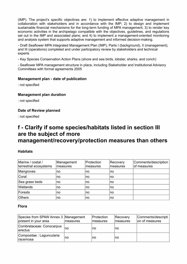
f - Clarify if some species/habitats listed in section III are the subject of more management/recovery/protection measures than others
Habitats
Marine / costal / terrestrial ecosystems
Management measures
Protection measures
Recovery measures
Comments/description of measures
Mangroves no no noCoral no no noSea grass beds no no noWetlands no no noForests no no noOthers no no no
Flora
Species from SPAW Annex 3 present in your area
Management measures
Protection measures
Recovery measures
Comments/description of measures
Combretaceae: Conocarpus erectus no no no
Compositae : Laguncularia racemosa no no no

Cymodoceaceae: Halodule wrightii no no no
Cymodoceaceae: Syringodium filiforme no no no
Hydrocharitaceae: Thalassia testudinum no no no
Rhizophoraceae: Rhizophora mangle no no no
Verbenaceae: Avicennia germinans no no no
Fauna
Species from SPAW Annex 2 present in your area
Management measures
Protection measures
Recovery measures
Comments/description of measures
Reptiles: Caretta caretta no no noReptiles: Chelonia mydas no no noReptiles: Eretmochelys imbricata no no no
Reptiles: Dermochelys coriacea no no no
Birds: Puffinus lherminieri no no noBirds: Falco peregrinus no no noBirds: Sterna antillarum antillarum no no no
Mammals: Stenella attenuata no no no
Mammals: Tursiops truncatus no no no
Species from SPAW Annex 3 present in your area
Management measures
Protection measures
Recovery measures
Comments/description of measures
Molluscs: Strombus gigas no no noCrustaceans: Panulirus argus no no no
Reptiles: Iguana iguana no no noReptiles: Kinosternon scorpioides no no no
g - Describe how the protected area is integrated within the country’s larger planning framework (if applicable)not specified

h - Zoning, if applicable, and the basic regulations applied to the zones (attach in Annex a copy of the zoning map)Name Basic regulation applied to the zone
i - Enforcement measures and policiesTo address these threats, information gathered in 2009 found that the most pressing management needs were identified to be stronger enforcement and economic development for vulnerable groups; i.e., to establish effective enforcement and compliance structures that are collaborative (community-based), transparent, legitimate, fair, and based on accurate information; and to promote sustainable and alternative livelihoods to alleviate poverty and achieve financial sustainability to support long-term MPA management and generation of local jobs in conservation. These results are in accord with on-going consultations with MPA users in which they consistently identified their main concerns as the need for stronger enforcement to achieve conservation and MPA management objectives, and for the MPA to generate new economic opportunities to alleviate local poverty and improve quality of life.
j - International status and dates of designation (e.g. Biosphere Reserve, Ramsar Site, Significant Bird Area, etc.)International status Date of designationBiosphere reserve yes 1/1/00Ramsar site noSignificant bird area yes 1/1/04World heritage site (UNESCO) noOthers: no
Comments
World Heritage Site, tentative list 2008, nomination in process
k - Site’s contribution to local sustainable development measures or related plansnot specified
l - Available management resources for the area
Ressources
How many/how much
Comments/description
Human ressources
Permanent staff 0 There is no permanent MPA staff at this time, with personnel
dependent on short-term, grantdriven contracts. The Seaflower MPA was the major outcome of a 5-year GEF-World Bank project funded from 2000-05. Funding for MPA implementation has lacked consistency since the end of the
VolunteersPartners

project, so MPA staff has concentrated on management aspects of education, monitoring, and some ad hoc research. CORALINA personnel in projects related to the MPA have also supported priority management functions such as education, biophysical monitoring, mapping, and targeted research. A team to carry out the new MPA GEF-funded project to strengthen implementation of the Integrated Management Plan (IMP) will lead to the creation of permanent staff by 2014, including substantial staff training. Many CORALINA staff and MPA team members have already received extensive training in MPA
Physical ressources
EquipmentsInfrastructures
Financial ressources
Present sources of funding
158000$
The MPA has no regular, secure sources of income at this time. Since the conclusion of the project to establish the MPA in 2005, there has been no annual budget specifically for MPA management and implementation and no money has been received from national or departmental government. MPA priorities such as monitoring and education have been carried out through projects primarily funded by the Environment Ministry’s Environmental Compensation Fund (Fondo de Compensación Ambiental). The amount spent on activities related to MPA management averaged US $158,000 yearly for 2006-08. The estimated annual operating budget needed to fully implement the IMP is US $750,000, which is expected to be self-financed by 2014. Additionally, several short-term grants for MPA programs were received in the last few years. Mainly these were from the NOAA Coral Conservation Fund and the White Water to Blue Water Initiative. These allowed ad hoc research and management actions to be carried out.
Sources expected in the future
Annual budget (USD)
Conclusion Describe how the management framework outlined above is adequate to achieve the ecological and socio-economic objectives that were established for the site (Guidelines and Criteria Section C/V).Biophysical, socioeconomic and governance effectiveness indicators have been identified in a participatory process, however only few are being measured. See prior comments about the need to evaluate and streamline the many existing monitoring programs and protocols, as well as shifting to a question-based approach to best provide information needed to adequately support adaptive management.
This also applies to evaluation. Information management and analysis also need to be improved,

with results disseminated to stakeholders. Although consulted presently in an informal way, stakeholders will be formally incorporated into the new evaluation process to improve the transparency, responsiveness, and accountability of MPA management.
Chapter 7. MONITORING AND EVALUATIONIn general, describe how the nominated site addresses monitoring and evaluation
Results of research and monitoring since 2006 revealed that the condition of most resources has remained the same, while a few have improved or others have even declined, since the establishment of the MPA. For example, in regard to species, a spiny lobster stock analysis showed a fishery that is presently stable but at high risk of overexploitation, and surveys of seabird colonies revealed reductions in numbers. As for ecosystems, monitoring showed that coral condition has remained generally the same, but the condition of some popular reef sites for divers and tourists has declined as have some seagrass beds. Exceptions are mangrove coverage that has grown and queen conch populations that show signs of recovery, both as the result of effective regulation, management, compliance and enforcement, and education.
Zones have been mapped and policies to reduce over-fishing, land-based sedimentation, coastal population, and adapt to climate change impacts have been developed. But the lack of financial resources has impacted CORALINA’s ability to achieve MPA objectives and reduce threats. To date the MPA has been unable to slow the decreasing quality of life and growth of poverty in the islands linked to increasing costs of living, unemployment, crime, and ineffective immigration controls. Therefore, a main thrust of the new GEF project is to achieve financial sustainability and eliminate dependence on grants and outside funding
What indicators are used to evaluate management effectiveness and conservation success, and the impact of the management plan on the local communities
Indicators by category Comments
Evaluation of management effectiveness
Governance effectiveness
Biophysical, socioeconomic and governance effectiveness indicators have been identified in a participatory process, however only few are being measured. See prior comments about the need to evaluate and streamline the many existing monitoring programs and protocols, as well as shifting to a question-based approach to best provide information needed to adequately support adaptive management. This also applies to evaluation. Information management and analysis also need to be improved, with results disseminated to stakeholders. Although consulted presently in an informal way, stakeholders will be formally incorporated into the new evaluation process to improve the transparency, responsiveness, and accountability of MPA management.
Evaluation of conservation measures on the status of species populations within and around protected areaSocioeconomic Evaluation of conservation measures on the status of habitats within and around the protected areaBiophysical Evaluation of conservation measures on the status of ecological processes within and around the

protected area
Management measures
However, the sheer number of users and growing poverty now mean that even traditional methods contribute to overfishing. Consequently, MPA management measures include closed seasons for key species such as lobster and conch, protection of spawning sites and aggregations, size limits and quotas, and bans on fisheries of threatened and endangered species such as sea turtles, sharks, etc. in addition to the use of no-entry and no-take zones to balance use with conservation.
Evaluation of the impact of the management plan on the local communitiesLocal communities
Chapter 8. STAKEHOLDERSDescribe how the nominated site involves stakeholders and local communities in designation and management, and specify specific coordination measures or mechanisms currently in place
Stackeholders involvement Involvement Description of involvement
Specific coordination measures
Comments (if any)
Institutions yes
Decisions are guided by and consulted with the Stakeholder Advisory Committee (SAC) and Inter-Institutional Committee (IIC). There is a special advisory committee that is not involved in general management but meets annually and can be consulted at any time for scientific and technical advice – the International Advisory Board (IAB). Advice can be solicited from the IAB by CORALINA, MPA staff, or at the request of the SAC or IIC.
Public noDecision-makers noEconomic-sectors noLocal communities noOthers no
Chapter 9. IMPLEMENTATION MECHANISMDescribe the mechanisms and programmes that are in place in regard to each of the following management tools in the nominated site (fill only the fields that are relevant for your site)

Management tools Existing Mechanisms and programmes in place Comments
(if any)
Public awareness, education, and information dissemination programmes
yes
The MPA provides ample opportunities for environmental education and to build awareness of the significance of marine ecosystems and conservation. One of the major successes of MPA management to date is the variety and extent of its on-going education, outreach, and public involvement programs. First, all management decisions integrate scientific knowledge with indigenous knowledge, which requires bringing scientists and community together on a regular basis. The MPA also employs community promoters, who are well-known to the community and bring together management, scientists, and stakeholders, facilitating grassroots interaction in any number of ways. Informal public meetings are a regular feature of MPA management, with open dialogue encouraged. There are many activities to share information, educate the wider community, and build stewardship and an environmental consciousness. These include the creation and management of public document centers to make information widely available to the community; information management systems; island-wide, diverse meetings and events targeting all stakeholders, ages, and levels of the wider community; media campaigns; local, national, and international presentations; introduction of formal school curricula on coastal and marine ecosystems; and the production of a variety of publications for children and adults, general outreach materials, and peer-reviewed articles. Collective learning initiatives are also developed with local people and scientists through partnership research, advisory groups, community-based monitoring, expert training, etc. For example, community-based monitoring programs in place include ReefCheck, RECON, COSALC, and REEF. Other examples of joint activities include hiring community and volunteers to support research expeditions, community clean-ups, volunteer inspectors, and an adopt-an-ecosystem program (beaches, mangroves, etc.).
Capacity building of staff and management
yes CORALINA has consistently invested significant budget and efforts in education about marine ecosystems and conservation, with the MPA being a priority. However, the lack of secure budget and staff (the MPA is not yet financially self-sustainable) can reduce effectiveness of the education process when education and outreach become project-driven. Programs need to be integrated into a comprehensive plan that progresses from theory to action to properly address the needs, levels, and responsibilities of diverse stakeholder groups. See prior answers for more detail on the many education, outreach, and training programs. Because outreach and community-wide education are among CORALINA’s most developed programs, environmental awareness has steadily improved. However, awareness is not enough. Compliance is not as high as it should be, there are many violations in spite of the growing awareness, and the community needs to become more pro-active in regard to conservation, instead of solely relying on CORALINA. Shared responsibility is challenging considering

the pressure of daily needs exacerbated by the declining quality of life and growing poverty, but is still a major goal of MPA education.
Research, data storage, and analysis
no
Surveillance and enforcement
yes
Human and material resources need to be substantially strengthened to improve surveillance. As mentioned in earlier sections, this is a main focus of the new GEF MPA project. Legal procedures are well-defined with graduated penalty structures and an education-based approach. Lawyers and managers are very accessible to the public. However, legal procedures are too complicated and bureaucratic, needing to be simplified and streamlined to become more efficient and effective.
Participation of exterior users no
Alternative and sustainable livelihoods
no
Adaptative management no
Chapter 10. OTHER RELEVANT INFORMATIONContact addresses
Name Position Contact adress Email adress
who is submitting the proposal (national focal point)
FRANKE ANTE Rebeca
Dirección Territorial Caribe. Parques Nacionales Naturales de Colombia
who prepared the report (manager)
FRANKE ANTE Rebeca
Manager
Ministry of Environment, Housing and Terrirotial Development - Columbia
Date when making the proposal : 10/05/2010
List of annexed documents
Name Description