an advisory services panel report williams gateway area mesa, arizona
TRANSCRIPT

A N A D V I S O R Y S E R V I C E S P A N E L R E P O R T
Williams Gateway AreaMesa, Arizona
Urban LandInstitute$
$ULI–the Urban Land Institute1025 Thomas Jefferson Street, N.W.Suite 500 WestWashington, D.C. 20007-5201

Williams Gateway AreaMesa, ArizonaStrategies for an Urban Gateway
September 17–22, 2006An Advisory Services Panel Report
ULI–the Urban Land Institute1025 Thomas Jefferson Street, N.W.Suite 500 WestWashington, D.C. 20007-5201

An Advisory Services Panel Report2
The mission of the Urban Land Institute is toprovide leadership in the responsible use ofland and in creating and sustaining thrivingcommunities worldwide. ULI is committed to:
• Bringing together leaders from across the fieldsof real estate and land use policy to exchangebest practices and serve community needs;
• Fostering collaboration within and beyondULI’s membership through mentoring, dia-logue, and problem solving;
• Exploring issues of urbanization, conservation,regeneration, land use, capital formation, andsustainable development;
• Advancing land use policies and design prac-tices that respect the uniqueness of both builtand natural environments;
• Sharing knowledge through education, appliedresearch, publishing, and electronic media; and
• Sustaining a diverse global network of localpractice and advisory efforts that address cur-rent and future challenges.
Established in 1936, the Institute today has morethan 35,000 members from 90 countries, represent-ing the entire spectrum of the land use and devel-opment disciplines. Professionals represented include developers, builders, property owners, in-vestors, architects, public officials, planners, realestate brokers, appraisers, attorneys, engineers,financiers, academics, students, and librarians.ULI relies heavily on the experience of its mem-bers. It is through member involvement and infor-mation resources that ULI has been able to setstandards of excellence in development practice.The Institute has long been recognized as one ofthe world’s most respected and widely quotedsources of objective information on urban plan-ning, growth, and development.
About ULI–the Urban Land Institute
©2007 by ULI–the Urban Land Institute1025 Thomas Jefferson Street, N.W. Suite 500 WestWashington, D.C. 20007-5201
All rights reserved. Reproduction or use of the whole or anypart of the contents without written permission of the copy-right holder is prohibited.
Cover photo by ©Todd Photographic Services, Phoenix, Arizona.

Mesa, Arizona, September 17–22, 2006 3
The goal of ULI’s Advisory Services Programis to bring the finest expertise in the realestate field to bear on complex land use plan-ning and development projects, programs,
and policies. Since 1947, this program has assem-bled well over 400 ULI-member teams to helpsponsors find creative, practical solutions forissues such as downtown redevelopment, landmanagement strategies, evaluation of develop-ment potential, growth management, communityrevitalization, brownfields redevelopment, mili-tary base reuse, provision of low-cost and afford-able housing, and asset management strategies,among other matters. A wide variety of public,private, and nonprofit organizations have con-tracted for ULI’s Advisory Services.
Each panel team is composed of highly qualifiedprofessionals who volunteer their time to ULI.They are chosen for their knowledge of the paneltopic and screened to ensure their objectivity.ULI’s interdisciplinary panel teams provide aholistic look at development problems. A re-spected ULI member who has previous panelexperience chairs each panel.
The agenda for a five-day panel assignment is in-tensive. It includes an in-depth briefing day com-posed of a tour of the site and meetings with spon-sor representatives; a day of hour-long interviewsof typically 50 to 75 key community representa-tives; and two days of formulating recommenda-tions. Many long nights of discussion precede thepanel’s conclusions. On the final day on site, thepanel makes an oral presentation of its findingsand conclusions to the sponsor. A written report isprepared and published.
Because the sponsoring entities are responsiblefor significant preparation before the panel’s visit,including sending extensive briefing materials toeach member and arranging for the panel to meetwith key local community members and stake-holders in the project under consideration, partici-
pants in ULI’s five-day panel assignments areable to make accurate assessments of a sponsor’sissues and to provide recommendations in a com-pressed amount of time.
A major strength of the program is ULI’s uniqueability to draw on the knowledge and expertise ofits members, including land developers and own-ers, public officials, academicians, representativesof financial institutions, and others. In fulfillmentof the mission of the Urban Land Institute, thisAdvisory Services panel report is intended toprovide objective advice that will promote the re-sponsible use of land to enhance the environment.
ULI Program StaffWilliam P. KistlerExecutive Vice President, Exchange Group
Thomas W. EitlerDirector, Advisory Services
Nicholas GabelAssociate, Advisory Services
Carmen McCormickPanel Coordinator, Advisory Services
Romana KernsAdministrative Assistant
Nancy H. StewartDirector, Book Program
Lise Lingo, Publications Professionals LLCManuscript Editor
Betsy VanBuskirkArt Director
Martha LoomisDesktop Publishing Specialist/Graphics
Susan S. Teachey, ON-Q Design, Inc.Layout Artist
Craig ChapmanDirector, Publishing Operations
About ULI Advisory Services

An Advisory Services Panel Report4
On behalf of the Urban Land Institute, thepanel would like to thank the sponsors: thecity of Mesa, the town of Gilbert, the townof Queen Creek, Arizona State University’s
Polytechnic campus, Chandler-Gilbert CommunityCollege, the Williams Gateway Airport Authority,Phoenix Sky Harbor International Airport, andthe County of Maricopa. The panel also wishes tothank the individuals involved in the weeklongAdvisory Panel process: Mayor Keno Hawker ofMesa, Mayor Steve Berman of Gilbert, Mayor ArtSanders of Queen Creek, and Lieutenant Gover-nor Jennifer Allison-Ray of the Gila River IndianCommunity. Their dedication and vision will helpguide a positive and sensible plan for the future ofthe Williams Gateway Area.
The educational component of the Williams Gate-way Area is incredibly vibrant and exciting for
the panel to see. In this regard, the panel extendsits thanks to President Michael Crow and ViceProvost Terry Isaacson of Arizona State Univer-sity (ASU) and President Maria Hesse and Pro-vost John Schroeder of Chandler-Gilbert Commu-nity College (CGCC).
The panel would especially like to thank the EastValley Partnership: Roc Arnett, Jennifer Whalley,Aaron Huber, and Denny Barney. Special thanksalso go to Wayne Balmer of the city of Mesa forhis contribution. His dedication to the success ofWilliams Gateway Airport and his insights duringthe briefing and tour were invaluable. Finally, thepanel wishes to thank the more than 90 individu-als whom it heard from during the stakeholder interviews, and whose perceptions of and hopesfor the study area were so important to the panel’s work.
Acknowledgments

Mesa, Arizona, September 17–22, 2006 5
ULI Panel and Project Staff 6
Background 7
Market Potential 10
Development Strategies 15
Planning and Design 23
Implementation 32
Conclusion 36
About the Panel 37
Contents

An Advisory Services Panel Report6
Panel ChairAlex J. Rose, ChairVice President, DevelopmentContinental Development CorporationEl Segundo, California
Panel MembersDaniel M. ConwayPresidentTHK Associates, Inc.Aurora, Colorado
Allen K. FolksPrincipal, Vice PresidentEDAW, Inc.Sacramento, California
Robert E. KuhnsDirector, Transportation PlanningClark NexsenAlexandria, Virginia
Richard L. PerlmutterPrincipalArgo Investment CompanyRockville, Maryland
John D. SolomonAirport Executive, RetiredPrescott, Arizona
Zane SegalProject DirectorZane Segal Projects, Inc.Houston, Texas
ULI Project DirectorThomas W. EitlerDirector, Advisory Services
ULI On-Site CoordinatorCarmen McCormickPanel Coordinator
ULI Panel and Project Staff

Mesa, Arizona, September 17–22, 2006 7
The Williams Gateway Airport, located inMesa, Arizona, was created as the result of the closure of Williams Air Force Base in 1993. It consists of approximately 3,000
acres. The base closure process included trans-fers of property to the Williams Gateway AirportAuthority, Arizona State University (ASU),Chandler-Gilbert Community College (CGCC),and the Gila River Indian Community, as well asother entities. Williams Gateway Airport has op-erated as a general aviation and instructional facil-ity and is intended by the community to developas a reliever airport to Phoenix Sky Harbor Inter-national Airport.
The Setting The Williams Gateway Area consists of approxi-mately 52 square miles surrounding the WilliamsGateway Airport southeast of Phoenix in the cityof Mesa and the towns of Gilbert and Queen Creekin Maricopa County. The study area is character-ized by flat topography; it includes such featuresas the new Santan Freeway, the General Motors(GM) Proving Grounds, some heavier industrialuses to the east, and some rather extensive dairyfarms in Mesa to the north, and it is bordered byheavily developed commercial and retail areas inGilbert to the west and, to a lesser extent, QueenCreek to the south. The study area is part of whatis generally referred to as the East Valley. TheEast Valley has seen some of the most intense res-idential and retail growth in the Phoenix metro-politan area in the past decade.
Although the airport currently operates at lessthan its operational capacity, the city of Mesa, thesurrounding communities, and the Williams Gate-way Airport Authority are concerned about theimpact of urban development on the long-termsustainability of airport operations. The key issueis the future potential conflict with proposed resi-dential development in the area as both the air-
port and the residential areas continue to grow.The municipalities represented by the Authorityare also concerned about the return on the invest-ment they have made over the past decade andhow the development potential for the entire 52square miles can be improved without sacrificingthe long-term success of the airport.
The Panel’s AssignmentAt the request of the East Valley Partnership anda host of other sponsors, the Urban Land Insti-tute’s Advisory Services Department organized afive-day Advisory Services panel. The panel washeld September 17–22, 2006. Working from brief-ing materials prepared by the sponsors, an exten-sive on-site briefing, a tour of the study area, andmore than 90 stakeholder interviews, the panelevaluated the economic development potential forthe Williams Gateway Area. In preparing the
Background
Location map.
10
10
10
17
19
40
40
8
15
NEW MEXICO
ARIZONA
COLORADONEVADA
UTAH
CALIFORNIA
MEXICOGulfof
California
Phoenix
Tucson
MesaChandlerTempe
ScottsdaleGlendale
Flagstaff
An Advisory Services Panel Report8
recommendations, the panel was asked to considerthe following questions from the sponsors:
• What type of long-term development vision isneeded to guide future growth, development,and private investment?
• How can we promote and accelerate develop-ment of the study area as a major employmentcenter within the Phoenix metropolitan area?
• What strategies would best help us reach ourgoals of 100,000 jobs and 35,000 students by 2030?
• How can we best promote the development ofWilliams Gateway Airport as a commercial reliever airport?
• What additional uses, tenants, or services areneeded to grow the area to its full potential?
• How should we evaluate the relative merits ofimmediate rezoning requests for residential development in the area as they relate to ourlong-term interest in reserving adequate areasfor future employment uses?
• Should we consider a capital improvement dis-trict or a community facilities district for capitalfunding in the area?
• How can we best coordinate capital improve-ment programs and transportation planning, as well as general planning and zoning activi-ties, to promote coordinated development in the area?
• Is the development of a regional multimodaltransportation plan, including commuter railfrom Florence to downtown Phoenix and ahigh-speed commuter rail shuttle from Wil-liams Gateway Airport to Phoenix Sky Harbor
Airport, a viable solution—and if so, how do we proceed?
• How do we best use the Southern Pacific Railroad freight line running through thestudy area?
• How can we best take advantage of the in-creased access and visibility of the area follow-ing the opening of the Santan Freeway?
• How can we maximize opportunities to further pro-mote new development in the area with the open-ing of the Williams Gateway Freeway in 2020?
The Panel Approach This report is divided into four sections. The Mar-ket Potential section attempts to identify andquantify land use demands and the universe ofland use alternatives. The Development Strate-gies section describes the variety of uses and con-siderations for locating such uses within the studyarea. The Planning and Design section translatesthe development vision and strategies into recog-nizable images and forms, with specific considera-tion of future transportation needs and the rela-tionship between the airport flight paths andcompatible land uses. The Implementation sectionidentifies the steps, tools, and action items neces-sary to make it all happen.
Much information about the future, particularlywhen measured over the next 20 to 30 years, isspeculative at best. Looking back at the past tenyears, however, the one thing that appears to be a near certainty is that the dramatic populationand employment growth is likely to continue inthe Phoenix metropolitan area in general and inthe East Valley in particular. Combining the de-
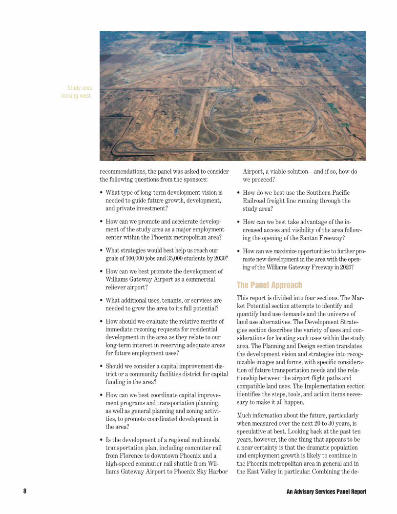
Study area looking west.

Mesa, Arizona, September 17–22, 2006 9
mographics, the physical pattern of growth, andthe land available to accommodate such growthpaints a very clear picture of opportunity, high-lighting the need to plan comprehensively and diligently to capitalize on that opportunity.
The panel’s focus, the Williams Gateway Area, sitssquarely within that picture of opportunity. Forthe purposes of our analysis, this area has beendefined as the 52 square miles bounded by the230-kilovolt power lines north of Elliott Road onthe north, by Meridian Road on the east, by QueenCreek Road on the south, and by Higley Road onthe west. Throughout this report we refer to thisas the study area.
The panel finds that community attention to thestudy area in recent years has been very encour-aging. Mesa, Gilbert, Queen Creek, and the GilaRiver Indian Community formed the Airport Au-thority to take over operation of the airport andsurrounding property from the U.S. Air Force,making significant investments that have nowmade the airport a tremendous regional asset. The educational community has also embraced thestudy area and established deep and meaningfulroots. As a result of these efforts, a good start oncomprehensive planning has been made by all thestakeholding jurisdictions.
The panel believes that such attention and effortat the front end of an expected growth curve iscritical to ensuring that population growth and jobgrowth take place in a manner that is responsiveto unpredictable and uncontrollable market con-ditions. Such attention is also critical to ensuringthat growth is consistent with resources, particu-larly capital, natural resources, and infrastruc-ture, whether or not those resources are currentlyavailable. Such upfront attention also helps ensurethat growth will take place with appropriate inte-gration of neighboring communities and uses, andwith a view that goes beyond and outside thestudy area. Only with such comprehensive andadvance attention will the surrounding communi-ties be able to look back in 20 to 30 years and say“we did this right.”
The study area is huge—the size of communitiessuch as Reston, Virginia, and Irvine, California,
which have developed over 20- and 40-year peri-ods, respectively.
Planning and development is a long-term process,with many incremental steps and milestones. Ab-sent a major unexpected change in the global, na-tional, and regional economies, population and jobgrowth will continue to occur and will come to thisarea. Careful planning with a simultaneous eye tothe near term and the long term is essential.
Successful communities consist of a broad spec-trum of uses and activities—commercial, retail,industrial, institutional, infrastructure, recre-ational, and open-space—but communities are all driven by the presence of people—people whoneed places to live. Successful and desirable com-munities are the ones that balance these usesmost appropriately. Infrastructural componentssuch as transportation networks, water andwastewater services, power resources, airports,colleges and universities, and health care facili-ties are all essential in creating those successfuland desirable communities.
Planning for and managing this diverse set ofvariables—demographics, capital, jobs, economicdevelopment, and physical assets (both availableand needed)—is an increasingly complex task fac-ing communities. Having the right planning andgovernance models and expertise in place is cru-cial, particularly when applied to an area the sizeof the study area that is guaranteed to evolve overthe next 20 to 30 years. It is essential to exerciseconcurrent attitudes of (a) discipline in beingmindful of the plan, process, and objectives and (b) flexibility in being responsive to unexpectedchanging conditions. Adopting a model and an ap-proach that recognize that the study area is not anisland unto itself is critical to creating a successfuland desirable community.
The good news is that the Williams Gateway Areais not in uncharted waters. The city of Mesa canrefer to lessons learned from the Phoenix region’sgrowth over the past 20 years and also fromcountless other areas throughout the country thatshare similar physical and economic characteris-tics. Many communities have gone before Mesaand the East Valley, and many are meeting verysimilar challenges today.

10
Understanding the socioeconomic trendsthat are affecting the study area can helpplanners identify the potential and pres-sure for future land uses. ULI believes
that successful urban planning and land use pol-icy can best be described as public action thatgenerates a desirable, widespread, and sustainedprivate market reaction. Therefore, AdvisoryPanel reports typically have their foundation inmarket possibilities.
BackgroundThe region surrounding the Williams GatewayArea is experiencing some of the most substantialgrowth in the United States, and this expansion is likely to continue through future decades. TheWilliams Gateway primary trade area (PTA), thearea within a ten-mile radius of the airport, is a significant part of the dynamic Phoenix metro-
plex, which includes Maricopa and Pinal counties.As recently as 1980, the Williams Gateway PTAheld just 76,255 people—just 6.7 percent of thepopulation of metropolitan Phoenix. As of 2006,the PTA has 497,944 people—12.7 percent of thePhoenix regional population of 3.9 million. TheWilliams Gateway PTA now captures 18 percentof the Phoenix region’s household growth and 13percent of the growth in seasonal and secondhomes. The PTA is projected to accelerate itsgrowth as the greater Phoenix area continues toevolve as one of America’s most dynamic metro-politan regions.
General DemographicsThe Phoenix metropolitan area is projected toenjoy an average increase of 58,180 new jobs peryear over the next decade, which will cause thepopulation to grow by more than 109,800 people
Market Potential
Figure 1General Demographics
Phoenix Metro Area: Maricopa and Pinal Counties
Average Annual Change Average Annual Change1980 1980–2006 2006 2006–2017 2017
Population 1,146,097 107,074 3,930,025 100,895 5,039,870
Employment 822,451 54,175 2,230,968 51,290 2,795,167
Households 573,170 32,730 1,424,151 35,728 1,817,160
Second Homes 35,473 4,738 158,664 10,899 278,554
Phoenix Metro Area: Williams Gateway Airport Primary Trade Area
Population 76,255 497,944 765,638
Households 20,705 181,161 278,554
Second Homes 2,908 18,974 30,172
Source: THK Associates.
An Advisory Services Panel Report

Mesa, Arizona, September 17–22, 2006 11
per year, in 38,740 households, with second homesgrowing by 4,570 units per year. The WilliamsGateway PTA will grow annually by 26,800 peoplein 9,740 households, with second homes growingby 1,110 units per year. By 2017, a total of 765,638people will live in the PTA. In its analysis, thepanel averaged and then projected the marketsavailable in the metro area and PTA and allocatedan appropriate share of these markets to thestudy area.
Economic Trends by Land Use The following sections identify and analyze themajor market trends by various land use de-mands. As noted in the introduction, Phoenix ingeneral and the East Valley in particular have avery positive growth pattern compared with therest of the state and the country.
Retail, Office, and Industrial TrendsToday metropolitan Phoenix has almost 246 mil-lion square feet of industrial space, of which 47percent is warehouse and distribution space, 8percent is research and development and flexspace, and 45 percent is manufacturing and gen-eral industrial space. Of this total, 18 percent is in the Sky Harbor environs, 17 percent is in Mesaand Gilbert, and 16 percent is in Chandler. Since2002, construction of industrial space in metroPhoenix has averaged 4 million square feet a year;through the next decade, it is projected to average4.2 million square feet a year, with more than 60percent being warehouse and distribution space.If the study area is successful in becoming selfsustaining, it could anticipate annual industrialconstruction levels similar to the current ratio inPhoenix of 60 square feet per capita.
The study area should capture 8 percent of theprojected market demand for industrial space inmetro Phoenix, because of its central location inthe region and its potential as an intermodal trans-portation hub. As a result it should enjoy a marketfor the construction of up to 640,000 square feet ofindustrial space per year, on average. The centrallocation of the study area is especially apparentwhen the potential development of the ArizonaState Land Department properties referred to asSuperstition Vistas is considered. These proper-
ties cover approximately 275 square miles andcould accommodate in excess of 350,000 housingunits and 1 million people. This area will have avariety of its own supporting commercial uses andother related land uses.
In the Sky Harbor environs, construction of indus-trial space has averaged between 1.0 and 1.2 mil-lion square feet a year. The study area is projectedto perform at approximately 65 percent of thislevel, if it is successful in establishing itself as theregional hub serving the East Valley. The studyarea could expect to add up to 1,175 employeesper year in industrial square footage, with asmany as 63 acres per year needed to accommodatethis demand (after adjusting for speculative pur-chases). During the panel’s projection horizon of25 years, as many as 1,575 acres will be urbanizedfor warehouse and distribution, flex, research, de-velopment, and manufacturing space.
The metropolitan Phoenix office market currentlyhas 62.9 million square feet of space, with 23 per-cent located in the central business district, 21percent in Scottsdale, and 12 percent in the EastValley. Net office absorption exceeded 3 millionsquare feet per year in 2005 and 2006 and is pro-jected to average 3.2 million square feet annuallythrough the next decade. As a regional hub, thestudy area should capture approximately 4 per-cent of the projected metro Phoenix demand, withthe construction of 120,000 square feet of officespace per year on average. Office employment an-nually should grow by 520 employees on average;16 acres per year would be needed to accommo-date the office demand, with 400 acres neededover 25 years.
The retail market in metro Phoenix currently has some 124 million square feet, or 32 squarefeet per capita, with 31.4 million square feet, or25.4 percent, located in the area of Mesa, Chan-dler, and Gilbert. Construction of retail spaceamounted to 3.4 million square feet in 2005 and8.6 million square feet in 2006. Construction in theretail market in metro Phoenix is projected to av-erage 3.1 million square feet on average duringthe next decade. The study area should capture 6percent of this projected market demand per yearand benefit from a market for 188,500 square feetof retail commercial space that will employ 540

An Advisory Services Panel Report12
people and require 20 acres of land. Over 25years, 500 acres of retail land will be needed inthe study area.
Annually the study area should expect a marketfor up to 948,500 square feet of industrial, office,and retail space on 129 acres. Up to 2,235 jobs peryear will be created in this space; over 25 years, as many as 56,000 jobs will be created and 2,475acres of land will be absorbed. These jobs will account for approximately 60 percent of all jobscreated in the study area. Additional jobs frompublic, institutional, recreational, educational,and other commercial facilities over 25 years will equal nearly 94,000 jobs.
Residential Development TrendsMetro Phoenix, as a result of substantial jobgrowth, is projected during the next decade tohave an annual market for 45,700 housing units,including seasonal and second homes. The studyarea should capture 5 percent of this projected demand and annually enjoy a market for 1,450 detached single-family units, 450 townhomes andcondominiums, and 450 rental apartments. Totalannual land absorption for residential uses will be435 acres. Over 25 years as many as 60,000 units on11,000 acres could be urbanized within the studyarea, bringing as many as 165,000 people to Mesa,Gilbert, and Queen Creek.
Hotel and Recreational PotentialA very important economic catalyst for the metroPhoenix economy is the hotel, convention, andtourist market. Metro Phoenix today has 61,300rooms in 450 hotel and motel facilities. During the past 10 years, metro Phoenix hotel units haveincreased at a rate of 2,210 rooms per year. ThePhoenix hotel market is projected to grow at anannual pace of 2,140 rooms, of which 50 percentwill be limited service, 30 percent full service, and20 percent resort hotel rooms. By 2017, a total of86,050 hotel rooms will serve the metro Phoenixmarket. It is estimated that 210 of these roomswill be added each year to the study area. Project-ing over a 25-year period shows that the studyarea will need 5,250 hotel rooms in 34 hotels (26 limited service hotels, 6 full service hotels,and 2 resort hotels).
Related to the hotel market is the need for recre-ational land uses, especially golf courses. A syner-gistic relationship can be created between an air-port, a convention or conference center, and a golfcourse. Today metro Phoenix has a need for ap-proximately 195 golf courses, of which 72 percentshould be public. During the next decade a needwill be created for an additional 57 golf courses. Of this total, one course needs to be added withinthe study area every 3.5 years. Projecting over a
Figure 2Industrial Development
Industrial Space by Size and Employment
Square Feet Percent EstimatedMid-2006 of Total Employment
Phoenix Metro Area 245,924,379 100 452,654
Mesa/Gilbert 41,807,150 17 76,700
Chandler 39,347,900 16 72,200
Tempe 14,755,500 6 27,100
Sky Harbor 44,266,400 18 88,200
Industrial Space by Category
Total 246,000,000 100.0
Warehouse and Distribution 115,000,000 46.7
Flex 21,000,000 8.5
General Industrial 110,000,000 44.8
Source: THK Associates.

Mesa, Arizona, September 17–22, 2006 13
25-year period shows that the study area will needseven additional golf courses.
The clear zone for the airport could be a strategiclocation for future golf courses. The panel is awarethat a renovation and master plan for the TokaSticks course is under review. This plan reportedlyincludes a new resort conference hotel, a new club-house, upgrades to the golf course, and a small re-tail business district. A golf course was also builtnear Falcon Field airport as a focal amenity forbusiness parks, offering an exceptional environ-ment for businesses sensitive to quality of life. Golfcourses in the study area, especially near the air-port, represent a special opportunity to put vacantreal estate into production. Seven golf coursescould require as much as 1,400 acres of real estate.
Higher Education and Health Care PotentialHigher-education facilities play a significant rolein the study area, and growth in this sector willcontinue to increase in importance. ASU openedthe Polytechnic campus in 1996 with approxi-mately 1,000 students. It has been growing by 500 students per year. Today it has approximately
6,500 students in 39 undergraduate and graduatedegree programs. Currently, it projects that it willserve 15,000 students by 2015.
Complementing ASU’s Polytechnic campus isCGCC at the Williams campus, which currentlyserves approximately 3,000 credit students annu-ally. This campus anticipates rapid but manage-able growth, to serve approximately 6,000 stu-dents by 2014 and 10,000 by 2024.
Between the two campuses 1,450 new studentsare projected to be added annually over the nextdecade, for an anticipated enrollment of 23,000 in 10 years. Today the state of Arizona has 76 degree-granting colleges with a total enrollmentof just under 546,000 students, of which 88 per-cent are undergraduates. Total enrollment in thestate is projected to grow to 882,500 students by2030—an annual growth rate of 14,500 students.Since 1996, the two campuses have captured ap-proximately 15 percent of the growth in studentsin the metro Phoenix area, and the university andcollege project that this capture rate will grow to10 percent over the next 25 years. This capture
Figure 4Residential Development
Phoenix Williams Gateway Williams GatewayHousing Type Metro Area Airport PTA Area Acres
Detached Single-Family Homes 28,210 7,250 1,450 365
Townhouses and Condominiums 8,810 2,270 450 45
Rental Apartments 8,680 2,230 450 25
Total 45,700 11,750 2,350 435
Note: Residential markets include seasonal units.Source: THK Associates.
Figure 3Retail and Commercial Development
Retail/Commercial Space Percent(Square Feet) Vacant
Phoenix Metro Area 124,058,527 6.0
Scottsdale 18,030,056 14.5
Tempe 16,206,928 13.1
Mesa/Chandler/Gilbert 31,433,248 25.4
Source: THK Associates.

An Advisory Services Panel Report14
rate may be low, since almost 16.5 percent of thegrowth in the state is projected to occur withinthe Williams Gateway Airport PTA. To keep pacewith the projected growth of the region, ASU andCGCC should anticipate an average increase of asmany as 2,400 students per year; over 25 yearsthis could generate demand of approximately68,500 students. This is substantially greater thanthe 35,000 students currently planned for at totalbuildout of these campuses. This projection hassubstantial implications for facility planning andthe ultimate size of the two campuses.
In addition to higher education, health care is agrowing market in the study area. Given thegrowing population and the demographic makeupof those migrating to metro Phoenix, providingadequate health care facilities will be important in the future. The study area can play a major rolein filling that need. Over the next decade, the pop-ulation of residents over age 65 in metro Phoenixis expected to grow by more than 16,300 peopleper year. The need for hospital beds is expected to grow by 290 beds per year over the currentcount of 10,500 beds in the metroplex. In addition,metro Phoenix is projected to see demand for anadditional 650 nursing beds, 465 assisted livingunits, and 25 hospice beds annually. The studyarea is projected to capture 5 percent of this acti-vity; over a 25-year projection period, 350 hospitalbeds at two hospital sites will be needed alongwith 800 nursing beds, 575 assisted living units,
and 50 hospice beds. Special attention should begiven to planning for health care facilities in thestudy area.
Summary of Market PotentialThe study area has very significant potential toaccommodate a variety of higher-intensity andhigher-value real estate development. Over a 25-year planning horizon there will be a need for1,575 acres of industrial land, 400 acres of officespace, and 500 acres of retail space. In addition,the plans should include 5,250 hotel rooms at 34sites on 105 acres and seven golf courses on 1,400acres. Demand for higher-education facilities istwice what is planned now for the existing 320acres. Two hospital sites with 175 beds each willbe needed, along with other medical facilities.Also, if adequate and appropriate lands are avail-able, 60,000 residential units could be built on11,000 acres in the study area—including a varietyof single-family, townhome, condominium, rentalapartment, and mixed-use projects. If all theseprospects are accommodated, the study areawould have 165,000 residents, nearly 68,000 stu-dents at institutions of higher education, and jobsfor 94,000 people.
Cooley Station is a new planned
community located in the town of Gilbert.

Mesa, Arizona, September 17–22, 2006 15
The success of the development of the Wil-liams Gateway Area will require vision, boldmoves, and dedicated leadership. Develop-ment strategies need to balance the desire
for short-term economic growth with the long-term role that Williams plays in the East Valleyand the larger Phoenix metro area.
Development VisionThe study area is one of the most promising ex-panses of underdeveloped land in the Phoenixmetropolitan area and in the western UnitedStates. This is truly a project of extraordinaryproportion and potential regional and super re-gional impact. The panel recommends masterplanning the area for high-density, mixed-use de-velopment with business, research, education,hospitality, retail, and residential uses. This devel-opment should be of high quality with excellenturban design and sustainability components. Thearea also should have a multimodal transportationhub, with passenger air, train, and bus service andair cargo and train and truck freight service. Thepotential buildout includes as much as 100 millionsquare feet of space, 96,000 jobs, and up to 68,500college students. The study area will likely garnera higher than normal percentage of growth in thePhoenix metropolitan area for the foreseeable fu-ture and could have regional and super regionalimpacts on other midwestern and western metro-politan areas.
There are models of edge cities that contain mixed-use elements (Reston Town Center in Reston, Vir-ginia; Los Colinas in Irving, Texas; and CrystalCity in Arlington, Virginia) and of airports thatcontain corporate and cargo air services (AllianceAirport in Fort Worth, Texas). There are modelsof university centers that are integrated into re-search and employment centers (the University of California at Irvine). However, the study areahas the potential of being home to the first center
of its kind that combines so many different ele-ments in a cohesive, urban, mixed-use develop-ment. To accomplish such an ambitious plan, the financial and governance structures must be inno-vative and comprehensive, as the plan itself mustbe innovative and comprehensive in its scope. Thepanel believes that the success of the study areadepends on more private sector participation inthe execution and capitalization of the study areathan has taken place to date. (This will be coveredin more detail in the Implementation section.)
Passenger Terminal and Related ServicesOn the north side of the current runways at theairport, the panel recommends reserving groundfor a passenger terminal that could eventually ac-commodate up to 10 million passengers annually;this is included in the airport’s current masterplan. The panel believes that this capacity will berequired at some point to fulfill the demand in thegreater Phoenix metropolitan area for passengerair service. When capacity is reached at Sky Har-bor, the future passenger terminal at WilliamsGateway will be needed. This terminal should beconnected by walkways and pocket parks to ho-tels, retail, office, and residential spaces, whichshould be vertically and horizontally integrated.These buildings could form linear connections ad-jacent to the runway area, ranging in height fromfour to eight stories. The combination of residen-tial, hotel, office, and retail uses could ensure alively environment during work hours and intoevening hours. The panel envisions larger officeusers locating in distinctive buildings on this sideof the airport. In accordance with ULI sustain-ability principles, these buildings should be of suf-ficient density to support pedestrian foot trafficand multiple uses of facilities.
Cargo Facility On the south side of the current runways, thepanel recommends reserving ground for scheduledcargo facilities adjacent to the runways. These
Development Strategies

An Advisory Services Panel Report16
facilities will be accessible directly from the run-ways, which would be similar to facilities at Al-liance Airport in Fort Worth, Texas; Falcon Fieldin Mesa; and Scottsdale Airport’s Airpark. Thepanel envisions these facilities as serving a newbusiness sector that would provide an alternativefor Sky Harbor and Los Angeles International airports. The current Foreign Trade Zone in thestudy area offers the potential for assembly of imported goods in the cargo center. The success of these facilities would be enhanced by a rail spurand access road from the Williams and Santanfreeways. The panel has not studied the capacityof the existing Union Pacific rail line, and pro-posed plans and schedules for the construction ofthe Williams Gateway Freeway will have to bemodified to meet the surface transportation de-mands of this area. Development of this area will require strong private sector participationthrough appropriate ground leasing and infra-structure improvements.
Education FacilitiesASU enjoys 615 acres of land at the Polytechniccampus. ASU and CGCC expect to have a studentbody of 68,000 at full buildout. This is consistentwith the panel’s projections. The panel believesspecial attention should be given to developing amaster plan for this campus that adheres to ULIprinciples of sustainability. These principles in-clude higher-density development, axial visualconnections with other parts of the study area,and special attention to urban pocket parks andareas for collegial collaboration and contemplation.
Health care services in the East Valley are in highdemand. The current and planned programs atASU Polytechnic support this professional sectorgrowth. The ASU master plan should considerleveraging and collaborating with the medicalschools and hospitals in the PTA. Doing so wouldserve a number of purposes, including support ofASU programs and provision of medical servicesfor the study area and surrounding community.
There is unmet demand for K–12 and technical ed-ucational facilities similar to East Valley Instituteof Technology in the surrounding community, andadditional demand will be generated throughoutthe study area in the future. The panel recom-mends that appropriate land be reserved for thesefacilities on the west side of the ASU property, ad-jacent to Power Road. The co-location of these fa-cilities will permit more efficient use of land andfacilities and collaboration with ASU programs.The facilities will act as a bridge between thestudy area and the greater community and helppromote an attractive mixed-use environment.
Mixed Use and Research and DevelopmentThe panel understands that ASU is consideringentering into public/private partnerships with realestate developers to transform the southern 200acres of its campus into a mixed-use developmentof as much as 10 million square feet. This develop-ment should be integrated into the academic cam-pus in terms of its programs and land use. Officeand research and development tenants could haveprofessional connections with ASU programs.
The Williams GatewayAirport can act as a full-service facility.

Mesa, Arizona, September 17–22, 2006 17
Given the professional and technical orientation of the ASU Polytechnic programs, there could be a strong relationship between ASU and thismixed-use development. Special attention shouldbe given to appropriate axial vistas and pedestri-an connections. The area could also be home tomedium-density residences and retail that wouldserve both ASU and the study area. Based on lim-ited information, the panel supports the generalconcept of converting this area into a high-density,mixed-use development.
Golf Course and ResortThe panel was informed that the Gila River IndianCommunity is contemplating major improvementsto its golf course, including the possibility of de-veloping a resort and conference hotel. These im-provements should be done in a way to integratethese amenities into the surrounding study area.There should be axial and pedestrian connections.The chain-link fence currently separating ASUand the golf course is an unattractive barrier thatdoes not promote efficient use of open space. Thepanel encourages the Gila River Indian Commu-nity to collaborate and cooperate with ASU andother potential users and residents of the studyarea in developing its resort and conference hotelfacilities. The panel’s analysis shows that therewill be demand for additional golf and resort facili-ties elsewhere in the Williams Gateway Area.
Industrial FacilitiesThe panel recommends that land on the north sideof the airport be reserved for industrial facilities.
The land will be accessible from the Santan Free-way and will help meet the growing demand forsuch development in the Phoenix metropolitanarea. This type of development also will serve asa buffer, supporting successful development ofairport and other services contemplated in thestudy area.
Connectivity The panel endorses planning that better coordi-nates land use and transportation; accommodatespedestrian and bike safety and mobility; providesand enhances public transportation service; im-proves the connectivity of road networks; andtakes a multimodal approach to transportation,with supportive land use development patterns to create a variety of transportation options.
Industrial Rail Connection The panel recommends that consideration be givento making a rail connection from the Union Pacificrail line to serve the cargo facility. This rail con-nection would provide a strong link to air andtruck transportation. Rail is an important meansfor moving imported goods throughout the UnitedStates. This level of service, available in such facil-ities as Fort Worth’s Alliance Airport, would helpthe Williams cargo facility compete with similarfacilities in the western and midwestern UnitedStates. In addition, in its High-Capacity TransitStudy, the Maricopa Association of Governmentsidentifies demand for increased rail cargo capacity.
The Gilbert CommunityCollege and Arizona StateUniversity Polytechniccampuses have createdan excellent incubator for businesses, as well as a social life for thestudy area.

An Advisory Services Panel Report18
Passenger Rail ConnectionFixed-rail passenger transit is an important ele-ment of mixed-use, high-density development.Based on potential buildout and extraordinaryresidential growth around the study area, thepanel believes that fixed-rail passenger transitwill be an essential link between this area and thegreater Phoenix metropolitan area. The panel un-derstands that the Maricopa Association of Gov-ernments and the Central Arizona Association ofGovernments are considering a commuter railthat would provide high-speed connection to theASU campus and also provide service needed forPinal County residents commuting for work andstudy. Students are a strong customer base formass transit. In addition, this type of servicewould help promote the study area as an urbanmixed-use center and transportation hub. On aninterim basis, reliable, regularly scheduled busservice should be provided.
Williams Freeway SpurTo serve the cargo facility on the south side of theairport, the panel recommends construction of alimited-access road. This will enable trucks tomove directly to the Santan Freeway and the in-terstate highway system. This spur could alsoserve the Queen Creek area, which will become a growing source of employees and customerswithin the study area. On an interim basis, thepanel recommends improving surface roads to thewest of the airport, to provide access to I-10. As a comparison, this level of service is available atAlliance Airport.
Shuttle ServiceGiven the number of integrated, high-density uses envisioned in the study area, the panel rec-ommends investigation of linking the proposedfixed-rail station with a fixed-rail shuttle through-out the study area. Efficient, seamless transporta-tion service is essential for promoting mixed-usedevelopment. Airports such as Newark Interna-tional and Baltimore-Washington Internationalhave similar shuttles. On an interim basis, busshuttle service could be provided.
Fiberoptic ServiceAll users within the study area will demand high-speed communication service. To be competitivewith other centers, the study area must havesuch cutting-edge service. The panel recom-mends providing fiberoptic service and wirelesscoverage connections throughout the center si-multaneously with construction of other infra-structure improvements.
Land Use Land use considerations start with long-termplanning and include zoning, employment, andquality-of-life issues.
Planning Strategic, long-term master planning is essentialfor creating a high-quality environment in thestudy area. This planning will require greater cooperation between Queen Creek, Mesa, Gilbert,the Gila River Indian Community, and Maricopa
The Union Pacific Railroad traverses
the southern portion ofthe study area, offering
both passenger andfreight opporunities.

Mesa, Arizona, September 17–22, 2006 19
County than has taken place to date. An unknownfactor is how the state land in northern PinalCounty will be developed. Special considerationshould be given to working with the state govern-ment in planning this entire area. Master plansthat span more than one jurisdiction will be re-quired to adequately address the needs of thestudy area. The panel recommends working withthe Arizona State Land Department to form anappropriate entity for addressing substantial re-gional planning issues in and around the studyarea and preparing a comprehensive master plan.
The panel was provided with an overview of thereport by the Morrison Institute entitled “TheTreasure of the Superstitions.” This document be-gins to address the long-term impacts of growth inthe region. The Williams Gateway study area is apart of that larger vision. The Superstitions reporthas sustainability as its primary focus, and thispanel believes that success for the Williams Gate-way Area and the metro Phoenix region is inextri-cably connected to sustainable development. TheSuperstitions report begins to open the discussionof appropriate patterns of growth and locationsfor future employment and residential uses, aswell as ways to provide infrastructure in a mannerthat will guide growth in a constructive way.
ZoningAppropriate zoning, based on a comprehensive,strategic master plan for the study area, is re-quired to support the many uses envisioned in the area. Currently, Queen Creek, Mesa, Gilbert,and Maricopa County are struggling to find theright combination of land uses to support thestudy area. This imperfect process may yield unin-tended, undesirable results. In other areas acrossthe nation where comprehensive development isplanned, overlay zones are often used. Overlayzones set general planning parameters, specificland use criteria, and even thematic urban designstandards. The panel recommends that all juris-dictions in the study area strongly consider work-ing together to place overlay zones on all propertywithin the study area. This coordination will be animportant element in promoting the developmentof the study area as a world-class center.
Employment In every political jurisdiction, it is not merely thequantity of jobs created that is of interest—thequality of the jobs created is critical. The new resi-dential development outside the noise contoursaround Williams Gateway Airport—both currentand projected—is “move up” development, withlesser amounts of workforce and starter housing.A sustainable community, however, needs to pro-vide suitable housing for a cross-section of incomelevels. The types of jobs that will be attractive tothese relatively new residents of the East Valleyare generally high-value occupations—medicaland professional, executive and managerial, acade-mic and research, and aviation and high-tech man-ufacturing—with lesser but still important concen-trations of service and unskilled jobs.
The desire to create high-paying jobs must be bal-anced by the need to protect the overflight zonesthrough compatible industrial uses, such as aircargo operations, intermodal rail container andshipping facilities, and ground logistics, all ofwhich are ideal candidates for using the large va-cant acreage that lies south and southeast, and, toa lesser degree, northwest of the runway system.
The large undeveloped areas northeast of theflight operations area and southwest of the cam-pus area are strong candidates for mid-rise devel-opment with a denser, more mixed-use character,including multifamily for-sale and rental uses.These areas should become nodes of high-payingoffice and research and development employment,as well as incorporate within their cores additionalservice, flex, retail, hospitality, medical, and den-ser residential components to complement thebusiness uses.
As to business sectors, care must be taken toavoid overreliance on high-tech manufacturing,which may be subject to offshore competition. Research in biotech, in concert with programs atASU Polytechnic, could replace such manufactur-ing and even enhance the technology reputation ofthe East Valley, but it must be noted that down-town Phoenix has an advantage in this respect be-cause of its Translational Genomics Center. A sec-ondary caution is that virtually every city in thecountry is attempting to climb onto the samebandwagon. The Valley of the Sun’s reputation as

20
a location for retirees, however, is an obvious ad-vantage when it comes to the creation of medicaljobs to serve both the part-time and the full-timepopulations of seniors.
The Phoenix metropolitan region has a higher-than-normal percentage of jobs in constructionand services; it is also apparently a rich environ-ment for startup companies and entrepreneurial-ism. Economic development efforts affecting thestudy area need to continue to focus on aerospaceindustries, flight services, and corporations thatcan take advantage of the Foreign Trade Zone ex-emption in manufacturing and assembly processes,especially if their supply or distribution chains canuse the access to air freight that Williams Gate-way Airport provides.
Residential-Jobs BalanceThe briefing materials that the panel receivednoted that there is already an imbalance betweenemployment opportunities and residential growthin the East Valley, and this disparity is continuing
to grow. The panel’s observation of virtually un-bridled residential construction surrounding thestudy area (though slowed recently because of thenational and regional recession in housing startsand pricing) suggests that the study sponsors’concern with preserving large swaths of the studyarea, especially within the flight overlay zones andthose areas with potential for airport-related de-velopment, is well founded.
The panel certainly concurs with plans for thelong-term preservation of appropriate acreage forfuture industrial, flex, research and development,and office uses, as part of well-planned, mixed-useenvironments but suggests taking the concern astep further: Each municipality should plan for itsown centers of commerce, not merely retail or of-fice projects, but corridors and nodes appropriatefor development of employment of all types.
To fill these business areas with an appropriaterange of jobs, economic development efforts needto be focused, well funded, and, most important,
coordinated between themunicipalities. Regional eco-nomic development entitiescan take lead roles, but theindividual municipalitiesmust avoid competingagainst each other for facili-ties. Creating a new brandfor the study area, with par-ticular emphasis on theWilliams Gateway Airport,will be part of a new market-ing program, discussed inthe Implementation section.
It is a primary tenet of sus-tainable development toprovide all types of facili-ties needed for daily livingwithin close proximity—within walking distance,when possible. Because thestudy area is so large andthe surrounding undevel-oped regions to the southand east even more vast,there is a great opportunityfor smart planning
Like much of the region, the study area
is characterized by unremarkable architec-
ture, landscapes, andstreetscapes. As part of
an overall marketingstrategy, the panel rec-ommends encouraginggood design for all new
development that willallow the area to be bet-
ter defined, identified,and ultimately branded.
An Advisory Services Panel Report
Mesa, Arizona, September 17–22, 2006 21
to achieve a balance of jobs and housing that im-proves the economic status and quality of life of all citizens. Insufficient or fearful planning andzoning will make the communities of the East Valley unsustainable.
Quality of LifeCorporate location and expansion decisions todayoften hinge on the availability of skilled or quali-fied labor, and it appears that the Phoenix areaand the study area in particular are blessed withan ever-enlarging, well-trained labor pool. Thegrowth of ASU, the East Valley Institute of Tech-nology high school district, and CGCC should con-tinue to fuel the training of qualified workers fortarget industries. However, quality-of-life issuescould work against attracting the right workers to the area.
Although the Valley of the Sun is touted for itsSunbelt climate, access to mountains, and greatphysical beauty, life in the East Valley has signifi-cant potential for improvement. The panel notedthe flat character of the area, the sameness of thearchitecture, the paucity of attractive and usableparks and open space, and the lack, in general, ofwhat is called “place making” in the region.
Mass transportation issues, burgeoning commutetimes, uncoordinated arterial construction, lag-ging freeway construction, escalating fuel costs,and ever more congestion are likely to deter thecontinued attraction of “creative class” workers.These are the young professionals who can chooseto live anywhere, the workers most sought after
by progressive employers considering puttingdown roots in the East Valley. Even if a prizedemployee chooses to live in or near the study areaand suffer a long commute, the potential deterio-ration of his or her quality of life has serious con-sequences in terms of worker productivity andfamily health.
GM Proving GroundEven in a land-rich environment such as the studyarea, a large, contiguous parcel under single own-ership is a rare commodity. Therefore, GM’s salesof about 5,000 acres on the Proving Grounds haveattracted a number of legitimate bids from majorproperty developers. Presuming that GM contin-ues down the road of divesture, the eventual buy-ers of such large and significant tracts are likely to spend considerable time, effort, and money inmaster planning the properties for their potentialhighest and best uses. Such large, contiguous de-velopment sites provide the opportunity for morecoherent, mixed-use, and mixed-density proj-ects—projects that can provide a good example of progressive development and livability. Theseinvestments in significant development sites arebeing made today, so there is no time to waste intaking the implementation steps recommended by the panel, particularly those related to masterplanning and infrastructure planning.
Although it would be presumptuous for the panelto attempt at this point to approve the WilliamsGateway Center plan for the southern 1,800 acresof the Proving Grounds, the panel is indepen-
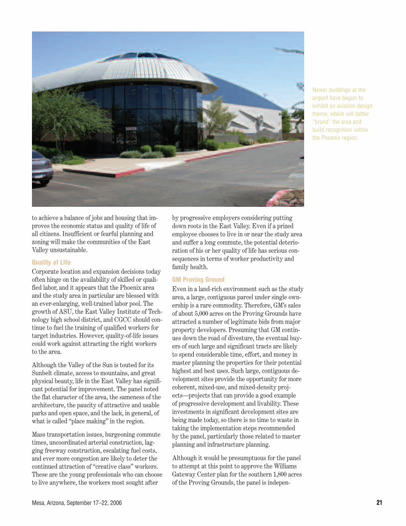
Newer buildings at theairport have begun toexhibit an aviation designtheme, which will better“brand” the area andbuild recognition withinthe Phoenix region.

An Advisory Services Panel Report22
dently recommending uses and approaches thatare quite compatible with the admittedly prelimi-nary development ideas for this site included inthe briefing materials. Those materials suggestthat the Williams Gateway Center and the GMProving Grounds will provide a mixture of busi-ness park, office, and commercial uses south andwest of the Williams Gateway Freeway, near theairport property. North and east of the freeway,in areas that are substantially outside the noiseoverlay zones, would be primarily regional com-mercial and medium-density and multifamily resi-dential uses. Any approval of projects or GeneralPlan amendments encompassing residential com-ponents should proceed cautiously until the com-pletion and adoption of the new noise study.
Market ForcesAs the recent national and regional deteriorationof housing values has clearly shown, there is noguarantee that land or real estate prices of anytype will continue to rise. In fact, the real estatebusiness is cyclical. The prices being paid for landin this region appear to the panel to be artificiallyhigh. While the appetite for residentially zonedland has slowed somewhat, owing to the pricedrops and the slowdown in housing starts, therestill appears to be a large—if not immense—sup-ply of land that is already zoned and appropriatefor housing. Excess supply should keep pricesdown, theoretically speaking, especially when theState Land Trust begins flexing its selling muscleswith the release of its immense local holdings.
Much of the growth in the Phoenix Valley is dueto migration from California of both jobs and people, owing to the high costs of housing and ofdoing business in the neighboring state. Thus, the more affordable price of land in Arizona is aprime factor fueling the state’s growth. If landprices continue to escalate, this competitive ad-vantage will lessen, fewer jobs and people willmigrate to the region, and the large land supplywill be met with lesser demand for growth. Thisprocess should tend to be self-regulating, how-ever, forcing land prices lower to maintain a bal-ance in the future. Because Arizona is a strongproperty-rights state, there is no legislative av-
enue for controlling speculation; it is to be hopedthat a free market will prevail.
In a free-market environment where speculationhas been active what tends to happen is a checker-board development pattern: developers buy thecheapest parcel, not the one that should logicallybe developed next. This can exacerbate commutetimes, municipal expense to provide and maintaininfrastructure, and quality of life, all hallmarks ofunbridled sprawl. Unfortunately, this seems to bethe direction the East Valley is headed, unless sig-nificant new planning and zoning controls are putin place. Adherence to the panels recommenda-tions could help control this to a certain extent.
Airport GovernanceFurther suggestions about the operation and gov-ernance of the Williams Gateway Airport will bemade in the Implementation section, but it is im-portant to note here that the airport has not yetlived up to its potential as a money maker, as SkyHarbor has done for Phoenix. In fact, the panelmembers believe that the airport may not reach a break-even level, much less profitability, withinthe time horizon predicted in its business plan, ifbusiness as usual is allowed to continue. The panelfirmly believes that its recommendation will movethe airport’s break-even and profitability points toa closer and more predictable time. However, thepanel must re-emphasize the importance of evalu-ating the long-term viability of the airport and itsbenefit to its constituent owners and the studyarea, not just applying a short-term quick fix.
The airport is likely to require considerable addi-tional capital expenditures that will not be coveredby the Federal Aviation Administration or supple-mental funding from Sky Harbor, suggesting theneed for the Airport Authority to seek outsidehelp in raising its operations and development ca-pability to achieve profitability. The panel recog-nizes that the value of Williams Gateway Airportto the region and its owners goes far beyond itsdollars-and-cents profitability, particularly if thepanel’s recommendations are seriously considered.

Mesa, Arizona, September 17–22, 2006 23
The opportunity to develop a region-servingcentral focus and to develop the surroundinglands to their highest potential is now ofcritical importance. The East Valley is fac-
ing unrelenting growth pressures with no coordi-nated land use planning controls or—more impor-tant—a clear and common vision. The panel heardmany times in interviews that since the studyarea is physically located at the corner of everysurrounding jurisdiction’s map, the area has novoice and no champion. Now is the time to placethe airport area and its adjoining lands in the center of the map.
The panel heard comments on numerous issues related to land use, open space, and circulation.Three land use concerns were most significant:
• The amount of industrial land (9,000 acres) des-ignated on the cities’ cumulative General Plansis a concern.
• Several pending amend-ments to the generalplans in Mesa and QueenCreek may not protectthe airport’s future via-bility, because they in-troduce residential usesin areas where signifi-cant aircraft noise is pro-jected to be an issue.
• There is no official visionfor the development ofthe State Land Trustproperty when it is re-leased for expansion. Asnoted earlier, the Super-stitions report begins toaddress the long-termimpacts for growth inthe region. The panelbelieves the Williams
Gateway study area should be a part of thatlarger vision for the entire PTA. In this reportthe panel has focused primarily on sustainabil-ity, which is also a general tenet of the UrbanLand Institute.
The panel made four observations:
• There is no clear pattern for districts andneighborhoods or how they are linked in thecomprehensive plans of Mesa and the adja-cent jurisdictions.
• The amount of land designated for residentialuses, not only on the GM property but in otherlocations, may set a precedent for additionalresidential use requests.
• There is confusion about the implications of theairport noise contours and their potential im-pact on attracting a high-volume aviation user.
Planning and Design
Williams Gateway
Airport PinalCounty
City of Mesa
City of Apache
Junction
Town ofQueen CreekMaricopa
County
Town ofGilbert
Surrounding jurisdictions.

An Advisory Services Panel Report24
• Too many county enclaves are within the incor-porated cities, making land use and infrastruc-ture planning difficult.
The General Plans and Land Use The large amount of industrial land depicted inpurple on the General Plan maps shows that an effort has been made to reserve industrial landsfrom residential encroachment, pending final re-solution of the airport noise contours and the typeof aircraft that will use the airport as it evolves.The Airport Authority is now beginning a plan-ning project to update the airport’s master plan,which will help identify the future noise contours.This project will be completed within the next 12to 18 months. The panel believes, however, thatlimiting development within the study area hascontributed to (but is not necessarily the cause of)
low-density sprawl occurring both in Queen Creekand farther to the southeast. A large amount ofland is designated for employment only, outsidethe current known 60-decibel line, the AirportOverflight Area II (which requires aviation ease-ments and requires interior noise levels withinresidential units to be below 45 decibels), and thearea of projected flight track concentration. Thismeans that a greater degree of development canoccur within the study area in many locations,while the airport’s master plan proceeds apace.The panel recommends that over the next 18months the towns of Queen Creek and Gilbert andthe city of Mesa proceed carefully and conserva-tively with the approval of new development pro-posals that respect the current 60-decibel contourand leave sufficient room for greater restrictions.The area of greatest change will be northeast ofthe airfield; that is discussed later.
202
Williams Gateway
Airport
Union Pacific Railroad
Proposed North-South Freeway
Proposed Williams Gateway Freeway
Santan Freeway
Guadalupe Road
Warner Road
Williams Field Road
Pecos Road
Germann Road
Queen Creek Road
Meridian Road
Crimson Road
Hawes Road
Power Road
Higby Road
Ray Road
th
Proposed Flight Track Concentration AreaProposed Flight Track Concentration Area
60-Decibel Sound Contour
60-Decibel Sound Contour
Sound contours and proposed flight-track
concentration areas for the Williams
Gateway Airport.

Mesa, Arizona, September 17–22, 2006 25
Another area of concern to the panel is the lack of districts and neighborhood identification, aswould typically be found in an area of this size. Ina more conventional setting, a study area of thissize could have 10 to 15 districts in areas sepa-rated by freeways, open space, significant uses,noise constraints, etc. The graphic suggests howthese districts could be defined.
Neighborhoods and DistrictsThe districts could also incorporate distinct neigh-borhoods centered on schools and parks in residen-tial areas within a quarter-mile walking radius, aswell as public streets, plazas, and open space inbusiness or commercial areas. The panel recom-mends that the various jurisdictions begin to look atthe study area in a comprehensive manner ratherthan from the viewpoint of individual projects.
A primary focus of activity within the study areawill be the lands around the new passenger termi-nal. Although the new terminal and its associatedparking and other services may not be developedfor some time, allowing related development inthe vicinity to move ahead may be appropriate.
The proposed terminal area would be located just west of an area that can support mid-riseconcentrations of office and other supportingcommercial uses, adjacent to the proposedWilliams Gateway Freeway on the southern portion of the GM property.
East Terminal/GM AreaThis area has the potential to resemble RestonTown Center, near Dulles Airport in Virginia, withvertical mixed-use buildings of ground-floor retailuses and upper-floor office uses. As one movesaway from the terminal area to the northeast,greater concentrations of residential uses are appropriate on the northern portions of the GMsite. The panel recommends examining minimumfloor/area ratio (which essentially means estab-lishing higher levels of building intensity) in thislocation, as well as developing urban design guide-lines to establish a notable urban-centered neigh-borhood. Viewed holistically, the GM property of-fers the greatest chance to provide a new masterplanned community that respects best practices of development. Minimum residential densitiesshould be established to take advantage of the
202202202
Williams Gateway
Airport
Union Pacific Railroad
Propose d North-South FreewayProposed Williams Gateway Freeway
Santan Freeway
Guadalupe Road
Warner Road
Williams Field Road
Germann Road
Queen Creek Road
Meridian Road
Crimson Road
Hawes Road
Power Road
Higby Road
Ray Road
KeyQuarter-Mile Radius =Typical Neighborhood
District Boundary
60-Decibel Sound Contour
202202202
Williams Gateway
Airport
Union Pacific Railroad
Proposed North-South Freeway
Proposed Williams Gateway Freeway
Santan Freeway
Guadalupe Road
Warner Road
Williams Field Road
Germann Road
Queen Creek Road
Meridian Road
Crimson Road
Hawes Road
Power Road
Higby Road
Ray Road
KeyQuarter-Mile Radius =Typical Neighborhood
District Boundary
60-Decibel Sound Contour
Neighborhoods and districts.

An Advisory Services Panel Report26
direct proximity to employment opportunities. Itwill be essential that the owners of the southernportion and northern portion, when selected, knitthe two projects together seamlessly.
Lands to the west of the airfield are occupied pri-marily by ASU, the Toka Sticks golf course, andCGCC. Although most of the area from the formermilitary base is being reused, vacant lands are still available for infill development as are largerparcels directly south of the airport. The panelrecommends that ASU and CGCC be permitted tomaximize their useable real estate and take maxi-mum advantage of uses that may need airport orflight line access. New uses not affiliated with ei-ther school should be aviation related. In addition,land should be set aside in Queen Creek for a newfacility to be associated with the community col-lege, allowing for an educational area to serve res-idents in the southern end of its jurisdiction.
Lands south of the study area to Germann Roadprovide the best location for long-term industrialand airport-related use. As discussed earlier, a railspur could be extended into this area to provide
opportunities for businesses to capitalize on freight-to-rail connections. Although cargo shipping is anticipated to occur within the study area, thisarea could also accommodate users, similar tothose at the Scottsdale Airpark, that need prox-imity to the airfield but may not need direct ac-cess to the flight line.
Flexibility will be important in deciding the mix oftenants and the establishment of floor/area ratiotargets in this zone. Land south of Germann Roadto Queen Creek Road in the town of Queen Creekshould also begin to transition to mixed uses, withconcentrations of industrial, office, retail, andhigher-density residential uses in the future. Thiswill allow the town to benefit from the redevelop-ment occurring at and around the airport.
A few additional recommendations are important.Because of the airport’s traffic patterns and asso-ciated constraints, the land north of the runwaysin the vicinity of Warner Road could contain alarge regional park of more than 100 acres. Thisactive park could be associated with the largewash that trends north-south or with open space
202
Williams Gateway
Airport
Union Pacific Railroad
Proposed North-South Freeway
Proposed Williams Gateway Freeway
Santan Freeway
Guadalupe Road
Warner Road
Williams Field Road
Pecos Road
Germann Road
Queen Creek Road
Meridian Road
Crimson Road
Hawes Road
Power Road
Higby Road
Ray Road
KeyMid-Rise Office and Mixed UseOpen SpaceStreetscape60-Decibel Sound Contour
East Terminal and GeneralMotors’ proving grounds.

Mesa, Arizona, September 17–22, 2006 27
just east of Power Road. Rittenhouse Basin, atthe southeast corner of Power Road and WilliamsField Road, is a proposed 147-acre open-spacepark planned by the town of Gilbert. Another sig-nificant park should be located within the formerGM lands on the east side of the study area, per-haps in areas that would also provide a clear zonesouth of the runways.
Land between Power and Ellsworth roads andgenerally north of Warner Road will be subject tothe most revisions to the airport noise contours.Land uses in this area may need to be generallynonresidential. Until the noise contours issues areresolved, the city of Mesa should weigh new de-velopments there carefully.
The graphic illustration of the study area ex-presses the panel’s general thinking on locationswhere residential uses may occur and where theyshould be restricted. The panel did not attempt torecommend land use changes for all 52 squaremiles of the study area; instead, it offers the fol-lowing general approach. The brown color repre-sents areas appropriate for industrial and com-mercial uses in relation to the flight line, theairport proper, and noise overflight constraints.The orange color indicates areas where a mix ofhigher-intensity employment and residential usescould be developed, subject to further analysisand local approval. The yellow color illustratesareas where single-family residential uses woulddominate, farther away from the cores. The whiteareas either are mostly built out (for example, the
town of Gilbert) or need additional clarification re-garding the airport’s noise constraints. Areas nearthe higher-education campuses and the area clos-est to the new proposed terminal are expected tobe developed as activity centers.
It is also important to plan for urban mixed-use cen-ters and concentrations of higher densities alongkey arteries in the study area. The advantages ofdoing so are (1) avoiding the use of sound walls, (2)placing more affordable units closer to transit andretail services, and (3) adding more options forgreater housing choice throughout the area.
State LandsThe panel would also like to address the issue ofland use and connectivity as it may relate to thefuture sale of the Arizona State Land Departmentacreage. This 275-square-mile area is designatedfor development over many years, assumingwater supplies can be provided and notwithstand-ing other constraints. The first large parcel is ex-pected to become available within the next year.The panel recommends that the State Land De-partment examine the highest and best use ofthose lands through preliminary conceptual plan-ning to address both development opportunitiesand environmental and social needs before sale. Asecond alternative is for Mesa, Queen Creek, andApache Junction, along with Maricopa and Pinalcounties, to join forces to fund a third-party vi-sioning process for those lands. The Superstitionsreport began to address this area and now is the
Urban plazas that encourage street lifeshould be considered in any mixed-use development.

An Advisory Services Panel Report28
time to explore methods to promote qualitygrowth, before land sales are initiated.
Open SpaceThe difference between memorable places andplaces with no discernible character is often mostvisible in the quality and quantity of public openspaces. Included in this category are streets, parks,trails, and all types of open-space lands. The EastValley in particular suffers from three deficits:
• No regional open-space corridors;
• No trails or links between cities and destina-tions, although the planned Queen Creek Wash,Sonoqui Wash, and the Roosevelt Water Con-servation District (RWCD) East MaricopaMarathon Trails in Gilbert will become connec-tors when fully completed; and
• Lack of habitat protection for native plants and animals.
The panel recommends the following actions toimprove the urban design and character of thepublic open spaces:
• Develop a regional open-space plan that in-cludes the entire study area and Mesa, Gilbert,and Queen Creek, as well as the state land.Preservation of lands for environmental habitatprotection should be part of this effort. An ex-ample is the planned Rittenhouse Basin commu-nity park area at the southeast corner of PowerRoad and Williams Field Road.
• Provide direct connections from mass transitstops and surrounding neighborhoods to theASU and CGCC campuses.
• Require all new developments to incorporateneighborhood links to promote walking and non-vehicular transportation (cycling).
• Provide neighborhood parks with a minimumscale of 5 acres per 1,000 persons, and ensure
202
Williams Gateway
Airport
Union Pacific Railroad
Union Pacific Railroad
Union Pacific Railroad
Union Pacific Railroad
Union Pacific Railroad
Union Pacific Railroad
Union Pacific Railroad
Union Pacific Railroad
PPPrrroppossseeeeddddNortttrtr hhhtht -SoS
uth FFrreeeeeeewwwwaaayyy
PropooossssedWilliammmmsss GGGatewewe ay Freeeeeeway
Santan Frreeewayy
Guadaluppe RRoad
WaWaW rner Roadd
WWWilliams Fielldd Road
Germann Rooad
Queen Creekk Road
MMeridian
RRooaaddd
Crimson
Roaddd
Hawes
Road
PPooPoPPoPwweerrRRoad
Higby
Road
Rayy Road
KeyIndustrialCommercial/Mixed UseResidentialRecreation/Open SpaceEducational/InstitutionalWater60-DecibelSound Contour
202
MMeridian
RRooaaddd
KeyIndustrialCommercial/Mixed UseResidentialRecreation/Open SpaceEducational/InstitutionalWater60-DecibelSound Contour
Proposed land uses.

Mesa, Arizona, September 17–22, 2006 29
that all new homes lie within a quarter mile ofusable park space.
• Develop new collector and minor residentialstreet standards that promote comfort, lowspeed, and shade and enhance the viability ofwalking and bicycling from homes to local des-tinations, particularly transit connections.
TransportationThe study area has the ability to operate as a truemultimodal transportation hub with road, rail, andaviation opportunities.
Freeways and ArterialsFreeways and arterial roadways are the backboneof the transportation system in the Williams Gate-way Area. The grid pattern of arterial roadwayswas augmented this year by the opening of theSantan Freeway. There is now direct freeway ac-cess to the rest of the regional freeway system.The new freeway connections have shifted travelpatterns toward grade-separated interchangeswith Higley, Power, and Elliot roads and the Su-perstition Freeway to the north. Another freewayis planned to link the Santan Freeway to the eastthrough Pinal County, connecting with US-60.This new freeway, the Williams Gateway Free-way, is programmed for construction in ten years.
The arterial system in the study area is a grid sys-tem, with major arterials spaced every mile. Amajor improvement to the system is underwaywith the widening of Ellsworth Road through thecenter of the study area. However, the grid sys-tem is missing several important arterial linksthrough the GM and airport properties and alongthe eastern border of the study area. Because ofthe grid pattern, traffic flows have dictated thatarterial intersections be signalized and have multi-ple turning lanes. The road system has a hierarchyof roadway connectivity and function, with thelesser collector streets spaced internally withinthe arterial grid pattern.
The typical advantages of the grid system are sig-nificantly reduced within the study area becauseof the location of the Williams Gateway Airportand the GM properties. The size of these twoproperties eliminates the ability of a motorist to
find an alternative arterial roadway within onemile. In a 6-mile north-south corridor, EllsworthRoad is the only high-capacity arterial street.Similarly, east-west travel patterns are restrictedbetween Elliot and Germann roads. Transport inthe heart of the study area relies exclusively onEllsworth Road. The absence of other roadwaysrestricts connectivity and mobility and results inless-direct and longer trips—and it will delay theexpansion of planned land uses, unless concomi-tant or preceding additions are made to the arter-ial infrastructure.
The missing arterial links within and around thestudy area restrict travel in terms of connectivityand roadway capacity. Traffic to and from residen-tial and retail uses in the study area, Queen Creek,and parts of Pinal County faces heavy congestionduring peak travel periods. Most of the existingroads are two-lane farm roads or have been im-proved only along the frontage of new develop-ments. Partial streets have been built new withinrights-of-way that are ultimately designed to bewidened to four or six lanes.
In October 2004, the citizens of Maricopa Countyapproved Proposition 400, which allows the con-tinuation of the $0.05 sales tax for transportationimprovements over the next 20 years. A numberof Proposition 400 projects are in the study areaand are programmed for implementation withinthe next 20 years. Initial projects include improve-ments to Hawes Road between Santan Freewayand Ray Road and to Ray Road between Sossa-man Road and Ellsworth Road by 2010. Many ofthe north-south arterial roadways are also pro-grammed for improvement, except for a portion of Sossaman Road north of the airport. A numberof east-west roadways are not funded within this20-year program, the most notable being Warnerand Williams Field roads to the east of the airportand Germann Road between Signal Butte andMeridian roads.
In addition to the arterial street improvements,extension of the Williams Gateway Freewaythrough the study area is planned for constructionby 2016. This alignment has been delineated andwill extend east to Pinal County. As it moves fromMaricopa to Pinal County, however, it will needmore refinement where it passes through the

An Advisory Services Panel Report30
State Trust Land in Pinal County. A moresoutherly alignment was examined but not se-lected for Williams Gateway Freeway where itwill traverse the study area, Queen Creek, andmore southerly developing areas in Pinal County.
The panel offers a number of recommendations tohelp improve travel and mobility within the studyarea. The grid system is particularly helpful inproviding a systematic approach to roadway con-nectivity and alternatives for trip making. Al-though many of the arterials are programmed forwidening, it is recommended that missing connec-tions that provide additional capacity as well asconnectivity and travel options should be recon-sidered, in addition to widening-only projects.
The highest-priority links are those that empha-size connections to and from grade-separated in-terchanges of the freeway system on Crimson,Signal Butte, and Meridian roads. As the GMproperty redevelops, these links will assist in re-solving traffic concerns and provide more north-south travel options for the southern portion ofthe study area, as well as for Pinal County. Untilthose roadways are connected in the north-southdirection, Ellsworth Road will continue to absorbthe majority of the north-south traffic through thecenter of the study area. In contrast, the westernedge of the study area is served by three north-south arterials: Higley, Recker, and Power roads.East-west continuity will be most helped by im-provements realigning and connecting Pecos Roadto Ellsworth Road south of the airport and contin-uing Ray Road to the new terminal area and even-tually to Ellsworth Road north of the airport.
New arterial links should be planned to accommo-date traffic to and from the south and southeastand through the center of the study area to con-nect with the freeway system. This will assistQueen Creek in establishing improved regionalconnections and access to the airport; provide anadditional connection to the partial construction ofthe Williams Gateway Freeway; and direct trafficfrom developments south of Queen Creek more di-rectly to the freeway system.
Initial construction of the Williams Gateway Free-way should consider logical termination withinMaricopa County at either Signal Butte or Merid-
ian roads. At a later date and upon refinement ofthe alignment to the east through Pinal County,the freeway can be extended on a phased basis,east of Meridian Road to Ironwood Road and US-60. The acquisition of the needed right-of-wayshould begin today.
The timing of the roadway system through thestudy area needs to be coordinated for roadwayprojects among the respective jurisdictions: Mari-copa County, the city of Mesa, and the towns ofGilbert and Queen Creek. This coordination effortshould be overseen by the county so that improve-ments are implemented to provide the most logi-cal sequencing in opening connections that link thearterial grid and the freeway system. The ArizonaDepartment of Transportation has to be a key par-ticipant in this coordination effort.
Public TransportationLong-distance travel is primarily oriented to theautomobile. Transit service is limited to the north-west corner of the study area via the Valley Metrobus service and to shuttle bus services providedbetween the ASU campuses. Although significanttransit improvements are programmed, fundedprimarily through Proposition 400, the projectsare not expected to be implemented in the studyarea in the next eight years. The light-rail systemis under construction in the region, but currentplanning and funding does not have the systemreaching the study area in the foreseeable future.Consideration is underway—as part of an ongoingstudy of commuter rail—to develop service in theregion using the Union Pacific rail line that crossesthe southwestern corner of the study area. Thenew Cooley Station project in Gilbert has desig-nated a location on its plans for a commuter railstation, if such service is provided.
The panel recommends consideration of the fol-lowing new public transportation services. Publictransportation service to the study area is neededtoday. The ASU and CGCC campuses (especiallyCGCC) are oriented to commuter students andwould be well served by immediate extensions ofthe current bus service provided by Valley Metro.Connections to, or extension of, the light-rail sys-tem in downtown Mesa should be emphasized. Areconsideration of ending the line in downtownMesa and the costs of such an extension should be

Mesa, Arizona, September 17–22, 2006 31
explored in the next 12 to 18 months. An exten-sion of the light-rail system through the campusesto the relocated airport passenger terminal areashould be considered.
Water and SewerWater is available in the study area from a var-iety of sources, including Mesa, the Queen CreekWater Company, the Salt River Project, the Cen-tral Arizona Project, the RWCD, and groundwater.On the basis of information provided to the panel,
it does not appear that water availability is anissue. The panel recommends that in addition tothe transportation opportunities mentioned in theprevious section, provisions for water and sewerservices to the study area be coordinated as partof a consolidated infrastructure plan.

An Advisory Services Panel Report32
The preceding sections of this report outlinean ambitious approach to help define, lever-age, and develop the assets of the WilliamsGateway Area. They offer general strategy
recommendations and development concepts thatwill help the area fulfill its intended role as a vi-brant economic engine in the East Valley. This section describes specific steps to implement thepanel’s recommendations, including establishing a new management structure for the airport thatensures continued leadership, developing an infra-structure plan, and identifying new financial andland use tools that could assist the cities, towns,and counties, as well as a revised approach to mar-keting. There is also a section dealing with theleadership role of ASU. The panel expects thatmany of the steps will be undertaken concurrently.
Governance For 13 years, Williams Gateway Airport has beenoperated by the Williams Gateway Airport Au-thority, whose membership includes the city ofMesa, the town of Gilbert, the town of QueenCreek, and the Gila River Indian Community. Re-cently the city of Phoenix joined the Authority.
The Authority owns the airport in accordancewith the terms of the transfer agreement with the federal government. Since the airport is lo-cated within the city of Mesa, that city has led theconversion of the airport to civilian use, the plan-ning and execution of the necessary infrastructurefor redevelopment, and the construction of new fa-cilities to serve the area. The airport staff has at-tended to the affairs of the airport with care, con-cern, and professionalism. As the governing en-tity, the Authority has been a successful vehicle to unite the communities surrounding the airport.This exemplary intercommunity cooperation hascarried over to include land use planning, coordi-nation, and economic development discussionsamong the Authority members—all of which is
very commendable. The panel recognizes the highvalue of intergovernmental cooperation and there-fore recommends that the governance of the air-port remain with the Authority. Further, thepanel recommends that the Authority considerinviting Maricopa County and the city of ApacheJunction to become members, to enhance the re-gional planning efforts.
To meet the goals of creating a major job centerwith 96,000 jobs and 68,000 students over thenext 25 years, it may be necessary to take a moreaggressive approach to the management of theairport including operations, marketing, financ-ing, strategic planning, and development. Thepanel recommends that the Authority issue a Request for Proposal to seek a private companywith the requisite skills, talent, and financial re-sources to enter into a long-term agreement toundertake the management of the airport and thedevelopment of the airport properties within thestudy area.
Privatization of the airport is not a new concept.Cities from Amsterdam to Australia and acrossthe United States have selected private compa-nies to manage their airports. Alliance Airport inFort Worth, Texas, although different in its con-cept and infrastructure, has an organizationalstructure that can be a model for Williams Gate-way Airport. Fort Worth built the runway, taxi-way, and roadway infrastructure and entered intoan operating agreement with a private companythat funded and developed aircraft hangars, distri-bution and warehouse facilities, and other com-mercial properties. The personnel of that companyhave exceptional real property development skillsand facility management experience, which hasenabled the airport to develop more rapidly andbecome financially productive while meeting pub-lic and private aviation needs.
Privatization shifts much of the financial facilitydevelopment burden from the Authority to the
Implementation

Mesa, Arizona, September 17–22, 2006 33
contractor, who can assign personnel with appro-priate and extensive experience to plan, market,finance, and construct to meet the specific needsof a tenant. This approach does not usually relievethe authority of the responsibility to fund airfieldinfrastructure and other related repairs and im-provements, but it permits the Authority, throughthe contractor-operator, to seek prospective ten-ants, determine their needs, and build to suit at anaccelerated pace. The operations and economicfunctions reside with one entity and that entitycan be more nimble and pragmatic in its approachto adjusting to the market climate. The Authorityand the contractor, through the terms of theagreement, share revenues which can, over a rea-sonable time, change the financial picture for theowner of the airport from negative to positive.
Consolidated Infrastructure PlanA missing resource in the economic developmentequation for the Williams Gateway Area is a con-solidated infrastructure plan, perhaps a miniatureversion of the Maricopa Association of Govern-ments concept. This plan should include water,sewer, drainage, open space, electric service, com-munications, and especially transportation. Whilethe various long-term plans of the cities, towns,and counties, the Salt River Project, and the air-port include the components of such a plan, theyshould be consolidated into a single document.This plan should be prepared by Mesa and Mari-copa County with input from the adjacent jurisdic-tions and relevant organizations. Mesa should takethe lead in preparing the plan, with MaricopaCounty taking the lead specifically on the trans-portation components.
The consolidated infrastructure plan should be along-term blueprint for the provision of infrastruc-ture with details on locations and alignments ofthe various trunk components for water, sewer,and electricity. Specific information on the servicelines should be determined only as individualproperties move through the subdivision and siteplan process.
FinancingMost jurisdictions and governmental bodies in-volved with this panel are experiencing acute short-ages of funds to implement basic infrastructure. In most jurisdictions where ULI has completed an Advisory Panel, there are a variety of methodsfor financing public utilities and infrastructure. InArizona, fewer tools are available to jurisdictions;most notably absent is a local property tax. How-ever, a successful model in the Phoenix area is acommunity facilities district (CFD).
CFDs are a mechanism whereby developers areallowed to establish separate political subdivi-sions, distinct from the jurisdiction in which theyare located, for the purpose of issuing tax-exemptbonds to finance public improvements. Amongother public improvements, CFDs are allowed tofinance public roadways, sewer improvements,water improvements, drainage projects, parks andrecreational facilities, traffic and street lights,civic buildings, and fire and police stations. Theobligation for repaying the CFD bonds is passedon to the end users of the property, who retire thebond obligations over a 25-year period. No resi-dents outside the CFD are responsible for repay-ing the bonds.
In essence, CFDs are truly a mechanism wherebyusers pay for growth. The use of CFD financingalso allows multiple developers and landowners tocome together to fund the construction of regionalimprovements that benefit an area much largerthan a single developer’s or landowner’s property.The panel recommends that, in conjunction withthe preparation of the consolidated infrastructureplan, the cities, county, and airport hire a firmwith specialized expertise to bring about the cre-ation of a CFD or a series of CFDs.
Regulatory ToolsThe primary goal of regulatory tools used by thecommunities within the study area should be thelong-term protection of the airport by ensuringland use compatibility. Protection can be achievedin a number of ways. Land banking of industrialland is simple but can lead to land use battles andprotracted animosities between the developmentcommunity and municipalities. The panel suggests

An Advisory Services Panel Report34
adoption of a realistic land use plan that reflectsfuture nonresidential needs. The land use planrecommended earlier in this document is consis-tent with this approach. The panel suggests en-hancing the airfield overlay district by prohibitingsingle-family residential uses in Airport Over-flight Area II and substantially increasing thenoise attenuation requirements for other residen-tial uses. Further, the panel recommends that thesame zoning overlay be adopted by Queen Creek,which is located in one of the areas most vulnera-ble to noise.
In a more wide-ranging sense, the general plansfor all the jurisdictions associated with theWilliams Gateway Area need to be reviewed forlong-term sustainability. The Urban Land Insti-tute has provided leadership in the real estate in-dustry regarding sustainability. Sustainability is a means to keep the economic engine of develop-ment fueled. Principles that have been adopted byhigh-growth communities around the country in-clude the following:
• Create a shared vision for the future and stickto it.
• Identify and sustain green infrastructure.
• Remember that the right design in the wrongplace is not sustainable.
• Protect environmental systems and conserveresources.
• Provide diverse housing types and opportunities.
• Build centers of concentrated mixed uses.
• Use multiple connections to enhance mobilityand circulation.
• Deliver sustainable transportation choices.
• Preserve the community’s character.
• Make it easy to do the right thing.
The panel observed that the East Valley is pre-cisely in the path of Phoenix’s demographic arrow.Panel members were surprised at the number ofpending and approved residential units in thesoutheast quadrant of the Phoenix metropolitanarea. The current (fall 2006) slowdown in the resi-
dential market may be helpful to the jurisdictionsand the development community by providing arespite and time to consider methods to providebetter guidance for development. The principle of building centers of concentrated developmentshould be a priority for the areas around the studyarea. Smaller concentrated centers of develop-ment should also be considered in Pinal County,Apache Junction, Queen Creek, and the remainingunincorporated areas of Maricopa County. Fur-ther information regarding these principles can beobtained in the ULI publication Ten Principles forSmart Growth on the Suburban Fringe (ULI Cat-alog Number T24).
Open-Space and Trails Plan Provisions for walkable communities, pedestrianlinks to employment areas, and continuous andconnected open space are lacking in the studyarea. Because the study area is on the verge ofsignificant development, now is the time to de-velop an integrated open-space plan to addressconnectivity. In addition to providing needed openspace for residents, water recharge, and wildlife,the open-space approach can be used as a market-ing tool to lure employers to the valley. This ap-proach is consistent with the principles estab-lished in the Superstitions report.
Marketing The image and identity of the Williams GatewayArea is presently defined only by its lack of finan-cial success. Excellent visions and aspirations forthe future of the area abound. What is needed nowis a concerted effort by the current joint owner-ship at the airport, ASU, and CGCC to promotethe area as a preferred site for high-tech, airfreight, industrial, and educational opportunities.A marketing message for Williams Gateway Areamust address the following overall aspects:
• Where in the world is the Williams GatewayArea? All marketing maps should show thestudy area in the center of the market. A mapshowing a 15-mile radius around Williams Gate-way Area would demonstrate how many attrac-tions and facilities are close to the study area.

Mesa, Arizona, September 17–22, 2006 35
• What is the “big idea”? Although inelegantlyput, the question emphasizes the importance ofbeing able to succinctly state the overarchingidea associated with the locality (as can be donein Silicon Valley, along Rt. 128 outside Boston,and in the Research Triangle in North Carolina).
• Who is behind it? Namely, how credible is thepromoter (in this case, the local district) and isthat promoter likely to be able to accomplishwhat it is advertising? In the case of a commu-nity aspiring to bigger and better projects, itbecomes important to include the substantial,credible private partners who are going to as-sist in making the dream a reality.
• What is the product? It is, of course, importantto be able to enumerate what is available to procure (development parcels, buildings, re-creational services, affordable homes, greatneighborhoods, great schools, etc.). Of specialimportance is the ability to demonstrate thatthe products, though similar to products inother communities, are made better by virtue of their location.
Educational Stakeholders RoleASU and CGCC currently function as an eco-nomic engine for the study area. This educationalengine is a dominant force in the creation of jobs,the availability of research dollars, and the devel-opment of new technology. ASU’s mission is to“increase the region’s competitiveness by prepar-ing graduates to move directly into professionaland technological careers and to become ethicalleaders in their professional, public, and personallives.” The community college is a substantialpartner with ASU and provides high-qualitytraining for metro area jobs as well as soundpreparation for transferring into baccalaureateprograms. The educational programs at ASU and CGCC should be nurtured and expanded.
ASU’s Polytechnic campus currently offers pro-grams in education, business, allied health profes-sions, technical writing, and human factors psy-chology, along with science and technology pro-grams in aeronautical management technology,applied biological sciences, computing studies,electronic systems, engineering, technology man-
agement, and mechanical and manufacturing engi-neering technology. Links between these programsand the air freight and industrial components of the airport offer enormous potential for productivesynergies. As an international port of entry and asite for commercial and high-tech development, theairport can leverage and enhance the knowledgebase of these programs. ASU should consider whatother aviation and industry-based programs wouldcontribute to the area’s development.
The data on market potential indicate significantgrowth in the health care field in the greaterPhoenix area. ASU and other higher-education institutions should be encouraged to make invest-ments in programs that will help stimulate the development of new hospitals and clinics and lev-erage medical schools in the PTA to meet the pro-jected demand. Also, ASU and CGCC should beencouraged to expand their programs in alliedhealth areas, wellness, medical technology, nursing,and business programs associated with health care.
Finally, ASU’s desire to leverage the acreage atthe Polytechnic campus and adjacent property foruses such as a hotel and convention center is anexcellent idea. As the academic programs expand,the construction of hospitality infrastructure willhelp the image of the Williams Gateway Area andenhance the interest of organizations in visitingthe campus.

An Advisory Services Panel Report36
To reemphasize: the panel has ample reasonto declare that the Williams Gateway Areais one of the most promising expanses of underdeveloped land in the Phoenix metro-
politan area and western United States. Actedupon appropriately, the study area has the capa-bility of becoming both an unprecedented eco-nomic engine in the East Valley and a vast well-planned community that integrates residentialneighborhoods for many different income levelswith outstanding educational and employment op-portunities—all built around an airport that couldbecome one of Arizona’s most important gateways.
The panel also believes that a key to planning andbuilding a successful area is bringing people in andproviding activity. The ASU and CGCC campusesprovide destinations for large numbers of peoplepursuing many interests. Students are looking forexcitement, activity, and people to interact with,and the vibrancy and excitement of the universityand college should play a role in attracting otherbusiness and activities to the area. The panelhopes the area can build on its already strong baseto create additional attractive places and neigh-borhoods for people to live in. This is not a sugges-tion to recreate Tempe’s Mill Avenue at the Poly-technic campus; this campus and area must find itsown exciting and compelling vision for the future.But spin-offs from the vitality of the campusesshould be enthusiastically pursued.
It now becomes incumbent on Mesa, Gilbert, QueenCreek, the airport, and collaborating stakeholdersto ensure that the possibilities of the study areabecome reality. It will require hard work, creativ-ity, and a single-minded determination to makethe study area an economic development jewel for the East Valley and the state. The potentialwill evaporate quickly unless work starts immedi-ately. Not only must the stakeholders begin plan-ning on all fronts of the panel’s recommended ac-tion steps, they must also do so together, with the
single vision and shared goals that gave birth tothis report. An ad hoc, uncollaborative approachshould be replaced with a well-coordinated vision,and the stakeholders should take the lead in es-tablishing appropriate, well-designed neighbor-hoods and districts.
Urban villages should include a substantial amountof employment uses and sustainable and compactresidential densities, supplemented by world-classamenities such as recreational uses, parks, andopen space. The design and materials used forthese communities should be of high quality andcompetitive with high-end communities and urbancenters in the valley. The goal is to present theWilliams Gateway Area as an exceptional destina-tion for business and educational opportunities,with supporting residential communities that willallow those functions to flourish.
The success of this vision will require bold movesand dedicated leadership. The public and the pri-vate sectors must work together to execute im-portant action plans to achieve the ideals envision-ed for the Williams Gateway Area. Bold does notmean foolish, nor does it mean achieving uncondi-tional consensus for each initiative or individualdevelopment proposal. Leaders in the communitymust listen to a diverse set of stakeholders andformulate actions that are in the best interest ofthe community. Routine moves are also important.The day-to-day nuts and bolts of effective, respon-sive collaboration of city, town, and county man-agement with the private sector will make the vi-sion coalesce.
The panel has laid out an initial outline and givendirection to the path to success. Now local leadersmust commit to the vision to achieve success. Theopportunities are there, and public and privateleaders must be willing to and capable of taking onthese challenges.
Conclusion

Mesa, Arizona, September 17–22, 2006 37
Alex J. RosePanel ChairEl Segundo, California
Rose serves as vice president of development for Continental Development Corporation. He is responsible for managing all development andconstruction activities for this developer of subur-ban offices and research and development parks,whose holdings cover 3.5 million square feet inLos Angeles County’s South Bay market and SanFrancisco. Rose oversees acquisitions and newproject development; planning and execution of all tenant improvement, core and shell renovation,and new construction work; major facilities main-tenance and upgrades; project budgeting and costcontrols; internal project management; and archi-tect, engineer, and contractor management.
Over the past 11 years, Rose has overseen the development and acquisition of nearly 1 millionsquare feet of Class A office and medical space, aswell as the physical transformation of more than 1 million square feet of single-tenant research anddevelopment facilities into multitenant office space,restaurants, retail, and entertainment uses. Hiscurrent projects include the repositioning and conversion of a 400,000-square-foot office park to medical uses, redevelopment of a 108-acrechemical plant site into 900,000 square feet ofpromotional and lifestyle retail, redevelopment of obsolete retail property into medium-densityresidential-over-retail mixed use, and new devel-opment acquisitions in excess of $150 million.Prior to assuming the development and construc-tion responsibilities, Rose served as director ofproperty management. He also has extensive ex-perience in title insurance and is a licensed Cali-fornia attorney, with experience in general civiland bankruptcy litigation practices.
Rose received his B.A. in political science fromUCLA, his M.B.A. from the University of South-
ern California, and his J.D. from SouthwesternUniversity School of Law. He is a trustee of theUrban Land Institute, a vice chair of ULI’s Na-tional Program and District Council committees, amember of ULI’s Small-Scale Development Coun-cil and of the Los Angeles District Council Execu-tive Committee, and the immediate past chair ofULI’s Commercial and Retail Development Coun-cil. Rose has chaired and served on numerous Ad-visory Services panels focusing on downtown andtransit corridor redevelopment and revitalizationand office development issues; he has participatedin several ULI office sector workshops.
Daniel M. ConwayAurora, Colorado
Conway is a real estate marketing and researchauthority specializing in residential, commercialand industrial, and golf course developments. Hehas more than 30 years of experience as an urbanland economist. In the past 20 years, as presidentand director of economics and market research forTHK Associates, he has conducted residential,commercial, industrial, and golf course economicfeasibility and market studies, socioeconomic im-pact assessments, and financial planning studies.
Projects of particular interest include an interna-tional market center and industrial market analy-sis for the Dove Valley Business Air Park in Ara-pahoe County; a residential and related usesmarket analysis for several major developmentsin Douglas County, including the 1,342-acreParker City site; and numerous golf course feasi-bility studies throughout the country. He has com-pleted a wide range of research and analysis ofLas Vegas and Reno, Nevada; Oxnard, PalmSprings, and Carmel, California; Kansas City, Missouri; Oklahoma City and Tulsa, Oklahoma;Austin, Texas; Albuquerque and Santa Fe, NewMexico; Seattle, Washington; and Phoenix and
About the Panel

An Advisory Services Panel Report38
Tucson, Arizona. Under Conway’s guidance, THKAssociates completes more than 75 golf coursefeasibility studies and golf driving range marketstudies and appraisals each year.
Allen K. FolksSacramento, California
Folks is a principal and vice president of EDAW,Inc. A licensed landscape architect and planner, hedirects the design studio and has prepared masterplans and directed the implementation of a widerange of projects in the western United Statesand in other countries. His waterfront planningexperience includes large mixed-use projects inseveral Bay Area cities and the resolution of is-sues related to the California EnvironmentalQuality Act. Folks also was very active in the de-sign and preparation of several key waterfrontreuse plans for military bases, including those forMare Island Naval Shipyard and Naval Air Sta-tion Alameda.
Folks’s current responsibilities in California in-clude the preparation of specific plans for new de-velopments in Napa and Half Moon Bay, a specificplan that addresses urban infill in Walnut Creek,and design of Microsoft’s new South Campus inMountain View. He is also responsible for the mas-ter plan for a new development in Cairo, Egypt.
Robert E. KuhnsAlexandria, Virginia
Kuhns is the director of traffic and transportationplanning for Clark Nexsen, a full-service architec-tural, engineering, planning, and interior designfirm. He has 31 years of experience in local and regional transportation planning. He devoted 20years to the public sector earlier in his career. Henow provides professional transportation consult-ing services to public, private, and institutionalclients throughout the country. Kuhns has man-aged long- and short-range transportation plan-ning efforts, including corridor analyses, down-town plans, campus plans, pedestrian studies,parking studies, and travel forecasts. He has man-aged and directed transportation projects empha-sizing improved traffic operations for municipali-
ties, health and education institutions, communitycenters, government and military facilities, cul-tural facilities, and retail and mixed-use centers.
Kuhns has focused especially on providing ser-vices for redeveloping and revitalizing urbanizedareas, for growing higher-education campuses,and for expanding cultural and tourist venues. He has a master’s degree in traffic engineeringand transportation planning and an undergradu-ate degree in civil engineering from the Univer-sity of Maryland. He is a member of the AmericanInstitute of Certified Planners and the Society ofAmerican Military Engineers.
Richard L. PerlmutterRockville, Maryland
Perlmutter cofounded Argo Investment Companyin 1996. The firm currently is developing retail, of-fice, residential, and urban mixed-use projects.Argo’s projects include more than 2 million squarefeet of commercial and residential space. Nearingcompletion is downtown Silver Spring, a 1.2 mil-lion-square-foot mixed-use development in Mont-gomery County, Maryland. The development in-cludes 400,000 square feet of urban retail spreadover four city blocks, 180,000 square feet of classA office, 170 hotel rooms, and 220 condominiums.Also under development is a 45-unit condominiumproject in the Georgetown neighborhood of Wash-ington, D.C., and an art storage facility inSomerville, Massachusetts.
Previously, as senior vice president of Bank ofAmerica, Perlmutter was responsible for manag-ing its real estate portfolio. He began his career inreal estate with Oxford Development Corporationand Bozzuto Associates, where he developed morethan 3,000 apartments along the eastern seaboardfrom 1984 to 1990.
Upon graduating from the School of Law at theUniversity of Oregon in 1981, Perlmutter becamecounsel to the U.S. Senate Committee on Com-merce, Science, and Transportation. He completedundergraduate studies in urban planning at theSchool of Architecture and Urban Planning of theState University of New York at Buffalo andgraduate study in urban planning at the School of

Mesa, Arizona, September 17–22, 2006 39
Architecture and Urban Planning of the Univer-sity of California of Los Angeles. Perlmutter is amember of the Executive Committee of the UrbanLand Institute’s Washington District Council.
John D. SolomonPrescott, Arizona
During his 40-year career in managing airportsand airport systems, Solomon served six cities in a wide range of executive capacities. His most re-cent position was assistant director of aviation forthe city of Phoenix, from which he retired in No-vember 2001. His duties and responsibilities in-cluded the operations, maintenance, environmen-tal impact assessment, planning, and developmentof airports in each city he served. During his ca-reer he provided direction for and participated in14 airport master plan studies for large-, medium-,and small-hub, and general aviation airports andoversaw the construction of more than $1 billion of airport facilities projects. He has extensive ex-perience in conducting community participationpanels, charrettes, and public presentations of air-port master plans, environmental studies, andplanned airport construction projects. Since hisretirement, he has served as a consultant on sev-eral airport planning and management studies. He currently serves as a member of the AirportAdvisory Committee for Prescott, Arizona.
From 1986 until 1988, Solomon served as directorand airport management consultant at Landrumand Brown, a premier aviation consulting firmthat specializes in facilities, financial, environmen-tal, and management studies for airports.
Upon graduating from Oklahoma State Univer-sity in 1958, Solomon gained considerable experi-ence in the insurance industry as a claims adjusterwhile attending law school at Oklahoma City Uni-versity, before obtaining his first job in airportmanagement. He gained his professional accredi-tation in 1967; he served as a board member ofthe American Association of Airport Executives(AAAE) and was president of that organization in1976. He has also served on the board of the Air-port Operators Council and on several state andregional airport organizations. Solomon has re-ceived numerous professional awards and recog-
nitions, including the AAAE President’s Awardand the AAAE Distinguished Service Award, and several commendations from the Federal Aviation Administration.
Zane SegalHouston, Texas
Segal is a developer, marketing consultant, andreal estate broker with Zane Segal Projects, Inc.Specializing in mixed-use, residential, retail, his-toric, hospitality, urban, and resort properties, hehas 27 years of experience in real estate venturemanagement, development, construction, broker-age, and marketing on a range of property typesincluding land, lofts, townhomes, custom homes,low- and mid-rise condominiums, hotels, retailcenters, office buildings, subdivisions, and sportsfacilities, as well as mixed-use projects incorporat-ing several property types.
Segal received his Bachelor of Science degreefrom the Massachusetts Institute of Technologyand his Master of Fine Arts degree from the University of Southern California. He has stud-ied graduate-level architecture at the Universityof Houston.
Segal is vice chair for advisory services of theUrban Land Institute Houston District Council.He has chaired one and served on eight AdvisoryServices panels across the country, and he chairedULI Houston’s first two Technical Assistance Pro-gram panels. He is a member of a Houston Plan-ning Commission committee that is studying ur-banization of the suburbs, is on an advisory com-mittee overseeing a regional visioning project, andserves on the boards of the Citizens Environmen-tal Coalition and Blueprint Houston.

A N A D V I S O R Y S E R V I C E S P A N E L R E P O R T
Williams Gateway AreaMesa, Arizona
Urban LandInstitute$
$ULI–the Urban Land Institute1025 Thomas Jefferson Street, N.W.Suite 500 WestWashington, D.C. 20007-5201