all projects - 3 - university of...
TRANSCRIPT

2014-2015
[HQP PROJECT DESCRIPTIONS]

1
Contents Theme I .................................................................................................................................................................................. 3
Coupling the Landscape, Aquatic Ecosystems, Services and Environmental Change in Canada’s North .............................. 3
Theme 1, Project 1.1: A synthesis and analysis of existing hydrological, biological and chemical data for the Hudson Bay Lowlands ..................................................................................................................................................................... 4
Theme 1, Project 1.2a: Optical Measurements for Characterizing Dissolved Organic Matter in Northern Peatland Surface Waters .................................................................................................................................................................. 5
Theme 1, Project 1.2: Hydrogeomorphic Classification Approach for the Hudson Bay Lowlands in the Attawapiskat Watershed ......................................................................................................................................................................... 6
Theme 1, Project 1.3a: Geographic Extension of Benthic invertebrate RCA Bioassessments: How Far Can We Go? ....... 7
Theme 1, Project 1.3b: Lakes in the Far North of Ontario: Regional Comparisons and Contrasts. ................................... 8
Theme 1, Project 1.4: Determining the biogeochemical and hydrological feedbacks in fen peatlands due to hydrological and treated wastewater additions ................................................................................................................ 9
Theme 1, Project 1.4: Subsurface Flow Behavior of a Continuous Solute Release in a Sub-‐Arctic Bog ........................... 10
Theme 1, Project 1.5a: Potential effect of climate on the bioaccumulation of mercury in two large-‐bodied fish species in northern Ontario .......................................................................................................................................................... 11
Theme 1, Project 1.5: Modeling mercury (Hg) cycling and accumulation in aquatic biota across the Attawapiskat watershed; implications for subsistence fisheries and the Ring of Fire development in Ontario’s Far North ................ 12
Theme II ............................................................................................................................................................................... 13
Healthy Forests, Healthy Aquatic Ecosystems ..................................................................................................................... 13
Theme 2, All Theme 2 research projects: Cross-‐Project Research Enterprises ................................................................ 15
Theme 2, Project 2 cross: Cross-‐Project Research Enterprises ........................................................................................ 16
Theme 2, Project 2.1:Susceptibility of oligotrophic lakes in Ontario to formation of algal blooms ................................ 17
Theme 2, Project 2.1: Elucidating climate forcing oscillations in water discharge across the temperate biome ............ 18
Theme 2, Project 2.1: Classifying streamflow regimes in different forest landscapes across Canada ............................ 19
Theme 2, Project 2.2: Impacts of forest harvesting on stream nutrient processing mediated by organic carbon-‐nitrate ......................................................................................................................................................................................... 20
Theme 2, Project 2.2: Effects of operational harvesting practices on hydrological and biological indicators of aquatic ecosystem services in northern hardwoods of central Ontario. ...................................................................................... 21
Theme 2, Project 2.2: Conserving Aquatic Ecosystem Services through the Emulation of Natural Disturbance Paradigm for Sustainable Forest Management ............................................................................................................................... 22
Theme 2, Project 2.2: Effect of forest condition on food web structure and other aquatic indicators in headwater streams in different regions of Canada. .......................................................................................................................... 23
Theme 2, Project 2.3: Dissolved organic matter controls on aquatic food webs and mercury accumulation in fish ...... 24

2
Theme 2, Project 2.3: Feedbacks and Dynamics of Aquatic Ecosystem Services in a Multi-‐use Watershed .................. 25
Theme 2, Project 2.4/2.5: Simulating wetland ecosystem services under different policy scenarios ............................. 26
Theme 2, Project 2.4/2.5: The Preferential Loss of Small Geographically Isolated Wetlands on Prairie Landscapes .... 27
Theme III .............................................................................................................................................................................. 28
Quantitative Indicators & Metrics of Ecosystems Services, Health & Function ................................................................... 28
Theme 3, Project 3.1: Using the concepts of river classifications, environmental flow requirements, and aquatic ecosystem services to inform sustainable management strategies for large river basins with a focus on Canada ........ 29
Theme 3, Project 3.2: Quantitative Frameworks to Improve the Analyses of Ecological Communities .......................... 30
Theme 3, Project 3.2: Can watershed-‐based classification help explain patterns in fish mercury concentrations across Ontario and Quebec? ....................................................................................................................................................... 31
Theme 3, Project 3.3.1: Biomass size spectra as indicators of ecosystem health in Ontario’s inland lakes .................... 32
Theme 3, Project 3.3.2: Expanding biomass size spectra models .................................................................................... 33
Theme 3, Project 3.3.3: Size spectra of fish assemblages: longitudinal and temporal variation in neotropical reservoirs ......................................................................................................................................................................................... 34
Theme 3, Project 3.3.4: Calibrating the zooplankton body-‐size spectrum to serve as an indicator of lake characteristics and environmental perturbations ................................................................................................................................... 35
Theme 3, Project 3.4: Evaluating ecosystem condition by quantifying ecological resilience .......................................... 36
Theme 3, Project 3.5: Fish community responses to spatio-‐temporal effects of global change in aquatic ecosystems . 37
Theme 3, Project 3.5: Geospatial Risk Mapping -‐ Relating Downstream Aquatic Species and Communities to Upstream Water Quality and Land Use in the New Brunswick Northumberland Straight Region ................................................... 38
Theme 3, Project 3.6: Understanding the trade-‐offs among ecosystem services along disturbance gradients .............. 39

3
Theme I
Coupling the Landscape, Aquatic Ecosystems, Services and Environmental Change in Canada’s North
Canada’s boreal and subarctic ecozones are its most geographically extensive and resource rich, but are also the most sensitive to change driven by development and climate. The Hudson Bay Lowlands, one of the five largest wetlands in the world, located in Canada’s subarctic region encompasses arguably the most vulnerable of Canada’s freshwater ecosystems, yet is virtually unstudied. An understanding of how these vast peatland systems link with northern rivers and support aquatic ecosystem functions remains largely unknown. The Canadian subartic will experience some of the most significant increases in annual average temperature on Earth (IPCC 2007), coupled with predicted increases in winter and summer precipitation for the region, significantly altering hydrologic regimes. The role of extensive northern wetland areas in the functioning and maintenance of freshwater and coastal aquatic ecosystems and their services has gone largely unstudied. Understanding how these vast peatland-‐dominated landscapes contribute to AES is critical in the face of regional climate change.
Key Objectives:
• To address the knowledge gaps concerning the aquatic ecosystem services of water supply and safe freshwater foods that exist in the vulnerable watersheds of this region
• Synthesize existing knowledge from a range of private, public, and First Nations sources
• Develop strategies for classifying and modelling water flows in this largely unmonitored region, as well as better understand the sources of water to streams and rivers – processes that deliver energy, nutrients, contaminants, such as mercury, to aquatic biota
• Develop, extend, and test a Reference Condition Approach assessment of aquatic species diversity and abundance to establish a baseline against which all future environmental change and development may be gauged

4
Abstract The wetlands of the Hudson-‐James Bay Lowland (HJBL) are a vital part of Ontario (and the world) covering nearly one-‐third of Ontario’s landmass and are the largest source of freshwater to the saline James Bay, and represent a significant resource (water, traditional foods) for First Nation’s communities. Despite these facts, little scientific information exists about how the Lowland functions hydrologically, ecologically, and biogeochemically, largely because of the inaccessibility of the region and its low population density. However, with the discovery of many mineral rich deposits (e.g., Ring of Fire) leading to resource extraction, as well as a changing climate, it is now critical to understand how the hydrology, ecology, and chemistry of this region are coupled, and how these changes will manifest themselves across this complex ecosystem. Unfortunately the time to collect certain kinds of baseline data (e.g. pre-‐climate warming) has passed. Contained within unpublished government initiatives and reports, publically-‐available compliance data from private industry, First Nations generated reports and academic resources, important historical data exist. These data sets, when taken individually, would appear to be isolated both temporally and spatially, unable to answer regional landscape questions concerning baseline conditions; however, if all of these data sets were combined they could be used to establish “snapshots” of the lowlands at various points over the past half century from which changes may be detected. 2 SERC Canadian Network for Aquatic Ecosystem Services The project is largely a data mining exercise attempting to find and then synthesize existing hydrologic and simple water chemistry data from Ontario’s Far north. Specific objectives are:
• Determine the extent of accessible data sets for water quantity (e.g., flow) and simple water chemistry (e.g., temp, Hg) for Ontario’s Far North
• Synthesize these data sets and offer insight into the changing north. Outcomes Ontario’s Far North is undergoing a significant increase in industrial development (e.g., Ring of Fire) and many of the impact assessments and guidelines being used are based on southern standards which are likely not applicable to northern systems. In addition, the area is also undergoing considerable change due to climate change driver and thus showing that non-‐stationarity (stationarity is loosely that the past can be used to predict the future) is occurring will be important for informed land-‐use and planning decisions.
• Insight into the changing hydrological regime of Ontario’s Far North • Two academically peer-‐reviewed journal articles.
Theme 1, Project 1.1: A synthesis and analysis of existing hydrological, biological and chemical data for the Hudson Bay Lowlands
Pete Whittington, Post-‐doctoral Fellow University of Western Ontario [email protected] Project Team: Brian Branfireun, University of Western Ontario, supervisor Pete Whittington, University of Western Ontario Brian Branfireun, University of Western Ontario Jim Robertson, Detour Gold

5
Abstract The peatlands of the Hudson Bay Lowlands (HBL) occupy most of Ontario’s Far North and contribute large quantities of freshwater and solutes, such as dissolved organic matter (DOM) and mercury, to downstream aquatic ecosystems. Despite concerns regarding the potential increases to mercury concentrations in surface waters and fish as a result of land-‐use changes (mining and industrial development), comprehensive water quality monitoring programs are essentially non-‐existent due to the high costs associated with water sampling and other logistical constraints imposed by this large wetland complex. As such, high-‐quality and high-‐resolution baseline water quality data is scant, and it is difficult to predict how these solutes will behave in response to the unprecedented climatic and land-‐use changes already occurring and forecasted for the HBL, which will have an impact on downstream hydrological and biogeochemical processes. The utilization of in situ water quality sensors has not yet been implemented in northern surface waters where they may prove to be a valuable alternative strategy to monitoring changes to water quality and estimating solute fluxes. Specifically, measurements of the optical properties of DOM (i.e., absorbance and fluorescence) are straightforward and less expensive than standard water quality analyses, and can be exploited to obtain highly accurate, quantitative estimates of dissolved organic carbon (DOC), and in some cases, can be used as a proxy for total (THg) and methylmercury (MeHg). Objectives:
• To improve our understanding of peatland hydrological connectivity by fingerprinting sources and components of surface water DOM via excitation-‐emission matrix (EEM) spectroscopy and instrumental analysis throughout the ice-‐free season.
• To assess the effectiveness of in situ spectroscopic measurements as proxies for the measurements indicated in (1) and for THg and MeHg in surface waters of the HBL.
Outcomes In situ monitoring has the potential to make freshwater research more accessible and open the door for more extensive water quality monitoring programs in remote regions of the Far North. Initial data from the in situ loggers reveals changes in DOM quality, and other geochemical parameters (e.g., pH, specific conductivity) in response to hydrologic regime. This is indicative of the temporal variability of hydrological connectivity and of the dominant contributing sources of peatland surface waters (e.g., fen peat pore-‐waters, deep groundwater, smaller tributaries) over the course of the ice-‐free season. Such substantial datasets may prove pivotal in enhancing our understanding of how the peatlands of the HBL transport water and solutes to their aquatic environments and how this may be impacted by regional and local environmental change.
Theme 1, Project 1.2a: Optical Measurements for Characterizing Dissolved Organic Matter in Northern Peatland Surface Waters
Tara Despault, MSc Candidate University of Western Ontario [email protected] http://www.ecohydrology.ca Project Team: Dr. Brian Branfireun, UWO, supervisor Dr. April James, Nipissing University, Project 1.2 Co-‐investigator Filippo Resente, UWO, PhD Student (Project 1.2) De Beers Victor Mine, Environment Department, Collaborators

6
•
Abstract
The Hudson Bay Lowland (HBL) in Ontario’s far north contains one of the world’s largest peatland complexes. Northern peatlands are wetland ecosystems that act as shallow freshwater aquifers and are important in sequestering terrestrial carbon. Current emphasis on peat as a major carbon sink that is susceptible to changes in climate, has triggered the need for further understanding of the hydrologic processes governing peatlands in order to develop better carbon storage and climate change monitoring and modeling systems. A regional hydrogeomorphic classification of the Attawapiskat watershed in the HBL is the proposed direction of this study, to characterize hydrologic landscape regions and evaluate them based on their hydrologic similarities within the watershed, specifically between the distinct Lowland and headwater Shield divide. Keywords: Hydrogeomorphic, classification, watershed scale, peat systems
Geographic Location: -‐ Attawapiskat River watershed, Hudson Bay Lowlands, Ontario, Canada -‐ De Beers Victor Mine, Attawapiskat River watershed, Hudson Bay Lowlands, Ontario, Canada
How does your project link to Canadian aquatic ecosystem services? Given the limited information on watershed hydrology in Ontario’s Far North, the development and testing of catchment classification approaches will harness existing data to improve understanding of the hydrological and biogeochemical processes that are occurring within northern aquatic ecosystems (e.g. processes of delivery of carbon and contaminants such as Hg to surface waters) and the distribution of those contaminants in northern aquatic ecosystems. Our improved understanding of hydrologic and biogeochemical processes is foundational for making sound policy decisions concerning land use and climate change impacts in the north. Watershed classification across the HBL will be essential to both source water protection planning for communities and industry-‐based development planning, as they assess use of local water resources against environmental regulations such as meeting minimum baseflow requirements. This approach will also provide a basis for hydrologic modeling in both private and public sectors.
Theme 1, Project 1.2: Hydrogeomorphic Classification Approach for the Hudson Bay Lowlands in the Attawapiskat Watershed
Brittany Germain, MSc Candidate Nipissing University [email protected] Project team April James, Nipissing University, supervisor Brian Branfireun, Western University, supervisor Jonathan Price, U Waterloo, co-‐investigator Brian Steinback, De Beers, partner Kent Todd, Elizabeth Phillips, OMNRF, collaborators
Abstract
Benthic invertebrate RCA bioassessments are generally developed using reference sites within a localized area such as a watershed or ecoregion. If such reference data can be used to assess test sites that lie outside their geographic scope, it would reduce the need to collect time-‐consuming and costly reference site data. In this study, we examined invertebrate and environmental data to assess concordance of benthic communities and develop predictive models using data from three areas in Canada: the Attawapiskat watershed in northern Ontario, the Fraser River watershed in British Columbia, and the Yukon River watershed. RCA bioassessments were developed based on reference sites from the individual watersheds and on pooled data from the three. The effectiveness of assessments was evaluated using a common set of artificially impaired sites. The results of this study reveal that assessments using reference sites from other watersheds perform similarly to those using only local reference data, suggesting that reference sites sampled in one watershed could be “exported” for effective bioassessment in other adjacent or more distant watersheds.
Keywords: Bioassessment, Benthic invertebrates, Reference Condition Approach, predictive modelling, Canadian Aquatic Biomonitoring Network, CABIN
Geographic Location: Attawapiskat River Basin, Ontario, Canada; Yukon River Basin, Yukon Territory, Canada; Fraser River Basin, British Columbia, Canada
How does your project link to Canadian aquatic ecosystem services? The development and application of bioassessments over large geographic regions in Canada enables us to protect and monitor Canadian aquatic ecosystem services that are important to us as a society such as clean water and fish resources.
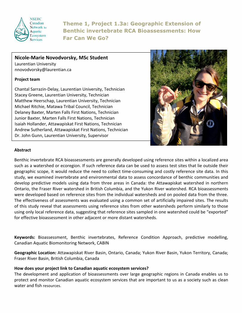
Nicole-‐Marie Novodvorsky, MSc Student Laurentian University [email protected]
Project team
Chantal Sarrazin-‐Delay, Laurentian University, Technician Stacey Greene, Laurentian University, Technician Matthew Heerschap, Laurentian University, Technician Michael Ritchie, Matawa Tribal Council, Technician Delaney Baxter, Marten Falls First Nations, Technician Junior Baxter, Marten Falls First Nations, Technician Isaiah Hollander, Attawapiskat First Nations, Technician Andrew Sutherland, Attawapiskat First Nations, Technician Dr. John Gunn, Laurentian University, Supervisor Dr. John Bailey, Ontario Ministry of the Environment and Climate Change -‐ Supervisor
Theme 1, Project 1.3a: Geographic Extension of Benthic invertebrate RCA Bioassessments: How Far Can We Go?

Abstract
With anticipated mining development in the “Ring of Fire” area, and ongoing climate change, current limnological data are needed for the far north of Ontario. To address this need, water chemistry and crustacean zooplankton surveys of northern lakes were conducted to examine regional differences between the Precambrian Shield and Hudson Bay Lowlands, focusing on the RoF area, which straddles the boundary between these Physiographic Regions. Lakes of the RoF area displayed highly variable chemistry, a product of the extensive peatland landscape with its mix of bog and fen watersheds. This peat cover appears to decouple, to varying degrees, the lakes from the influences of bedrock and surficial geology. Shield lakes in the western portion of our study area had ion concentrations (Ca, Mg) markedly higher than previously studied Shield lakes south of 50°N, likely due to the abundance of lacustrine and glacial end-‐moraine deposits throughout western Ontario north of 50°N. The zooplankton species collected during this survey were generally similar to those reported for lakes further south on the Canadian Shield. Zooplankton assemblages were strongly influenced by lake depth, with higher species richness in the deeper Shield lakes than in the shallower Lowlands lakes which offered less niche space.
Keywords: lakes, Hudson Bay Lowlands, Canadian Shield, chemistry, zooplankton
Geographic Location: “Ring of Fire” area of northwestern Ontario(95 x 45 km study area);A broad survey across the far north of Ontario above 50° N (740 x 420 km study area)
How does your project link to Canadian aquatic ecosystem services?
This study provides current information on the chemistry and zooplankton communities of lakes in the far north of Ontario. This baseline knowledge will allow future assessments of change to these ecosystems and their food-‐webs, and permit evaluations of the implications of changes for ecosystem services.
Josef MacLeod, MSc Student Laurentian University [email protected] Project Supervisors
Dr. John Gunn, Laurentian University Dr. Bill Keller, Laurentian University
Theme 1, Project 1.3b: Lakes in the Far North of Ontario: Regional Comparisons and Contrasts.

Collin McCarter, PhD candidate Univerisity of Waterloo [email protected] ca.linkedin.com/in/cprmccarter Supervisor: Dr. Jonathan Price, University of Waterloo
Abstract
Remote northern communities and mining operations require wastewater treatment for the discharge of residential wastewater into aquatic environments. Elevated levels of Nitrate (NO3-‐), Ammonium (NH4+) (Phosphate (PO33-‐), Sulfate (SO2-‐), and labile carbon are usually present in treated and untreated wastewater, typically requiring polishing before discharging into aquatic environments. Peatlands are used for wastewater polishing; however, there is limited information of the transport and transformations of these contaminants in sub-‐arctic peatlands and the ability of these systems to polish wastewater. Therefore the primary objective of this study is to determine the transport and retardation of these contaminants in a sub-‐arctic fen peatland through an ecosystem scale experiment. Initial results indicate that the solute plume traveled 49 % of the distance of the experimental site, while the water table increased across the entire site. Furthermore, differential transport of contaminants was observed due to microtopographical differences within the experimental site, yet vertical transport (downward) was limited to ~75 cm from the surface. This is the first experimental release of simulated wastewater in fen peatlands and represents a unique opportunity to determine how increased development pressures from both industrial and northern communities will alter the peatlands in the sub-‐arctic. Furthermore, understanding how fen peatlands transport and treat wastewater nutrients will allow for better management of human wastewater, which will provide the maximum anthropogenic benefit with minimal environmental disturbance.
Keywords: peatlands, wastewater, solute transport, advection/dispersion, retardation, dual porosity
Geographic Location: De Beers Group of Companies Victor Diamond Mine, Kenora Unorganized, Ontario, Canada How does your project link to Canadian aquatic ecosystem services? Remote northern communities rely on the surrounding aquatic ecosystems for sustenance, thus, understanding how to effectively manage wastewater treatment in fen peatlands can potentially decrease the risk of contamination in northern aquatic ecosystems. Furthermore, this project will directly assess the ability of these systems to treat wastewater and the associated effects on aquatic ecosystem services.
Theme 1, Project 1.4: Determining the biogeochemical and hydrological feedbacks in fen peatlands due to hydrological and treated wastewater additions

Abstract
Resource extraction and transportation activities in the Canadian Boreal zone can result in the unintentional release of contaminants in boreal peatlands. In the event of a release, a thorough understanding of flow within the variably saturated acrotelm is necessary to predict both the behaviour of the plume, and the potential impacts on the non-‐vascular moss species present. The implications of capillary action on the potential removal and release of solute in the unsaturated zone, and on the potential toxicity to surficial mosses, are currently unknown. The goal of this study is to better understand how bog peatland hydrology and peat structure control the nature and extent of solute transport in a variably saturated system. The objectives are to 1) determine the spatial and temporal evolution of a developing solute plume, and 2) to relate the physical structure of peat to the plume’s dispersion throughout the peat profile. Relationships and results obtained from this experiment can be used to predict the subsurface flow behaviour of a real-‐world contaminant spill given information on the topography, vegetation community distribution and basic hydrology of the system.
Keywords: hydrology, contaminant transport, unsaturated flow, peatland
Geographic Location: De Beers Victor Diamond Mine, James Bay Lowlands, Ontario, Canada
How does your project link to Canadian aquatic ecosystem services? Peatlands, characteristic features of the Canadian Boreal zone, are important ecological systems which act as natural regulators of surface and groundwater flow quantity and quality. Understanding contaminant transport behaviour in peatlands is essential to mitigate the short term release of attenuated pollutants, as well as a long term decrease in surrounding water quality.
Theme 1, Project 1.4: Subsurface Flow Behavior of a Continuous Solute Release in a Sub-Arctic Bog
Nicole Balliston, MSc candidate University of Waterloo [email protected] http://www.wetlandshydrology.com/ Supervisor Jonathan Price, University of Waterloo

Alexandra Sumner, MSc Candidate Laurentian University [email protected] www.linkedin.com/profile/edit?trk=hb_tab_pro_top Supervisor: Tom Jonhston, MNRF John Gunn, Department of Biology, Laurentian University Project Team: Gretchen Lescord, Laurentian University, PhD candidate, collaborator Michelle Gillespie, Laurentian University, Lab Manager and field technician
Abstract Increasing temperatures in Canada’s subarctic region are expected to alter many components of aquatic ecosystems, including the bioaccumulation of mercury in fish. It is important to understand how climate influences the concentration of this neurotoxin in fish in order to assess the future impacts that climate change might have on the safety of consuming wild fish in northern Ontario. To better understand how climate influences mercury bioaccumulation, I am investigating patterns in fish mercury concentrations across a climatic gradient in Ontario. Two species of large-‐bodied fish, walleye and white sucker, have been sampled from 75 lakes throughout the Near and Far North of Ontario. These lakes are distributed over 9.0° of latitude and represent a range of climatic conditions (annual growing degree days 604 -‐ 1599). Additionally, fish mercury concentrations are being analyzed with respect to chemical, physical and biological variables known to be influential, such as lake pH, dissolved organic carbon concentration and fish trophic positions and growth rates. The results of this study will address important gaps in our current understanding of how climate affects fish mercury levels, and will be useful in assessing reference conditions in advance of further climate change. Keywords: mercury, methylmercury, bioaccumulation, fish Geographic Location: See Excel file named “ASumner_LakeCoordinates_CNAES2015.xlsx” How does your project link to Canadian aquatic ecosystem services? The results of this study will provide current information on fish mercury levels in Canada’s sub-‐arctic and help update and refine fish consumption guidelines. We will also gain insight into how fish mercury levels may change with a changing climate and the implications for the food quality of fish in the northern diet.
Theme 1, Project 1.5a: Potential effect of climate on the bioaccumulation of mercury in two large-bodied fish species in northern Ontario

Abstract
The consumption of mercury (Hg), a toxic metal, is a concern for both wildlife and humans, and elevated concentrations of Hg in freshwater and wildlife have been reported in remote regions across Canada. The main goal of this project is to study mercury cycling and bioaccumulation in aquatic biota from the Attawapiskat drainage basin in Ontario’s Far North. This vast watershed begins as headwater lakes in the Boreal Shield and transitions into shallow lakes, small tributaries, and finally the Attawapiskat River in the Hudson Bay lowlands. Lakes located in the shield are deeper, more oligotrophic, and have markedly different water chemistry profiles compared to lowland lakes. This diverse watershed will allow us to better understand how physical, geological, biological, and chemical gradients affect Hg concentrations in water, sediments, invertebrates, and fish on a large scale. Sampling areas also include several lakes surrounding the mineral-‐rich area known as the “Ring of Fire,” where extensive mining development is expected over the next decade; this project will therefore provide vital baseline data for future monitoring programs in this area.
Keywords: Mercury, Far North, Subsistence Fisheries, Dissolved Organic Material (DOM)
Geographic Location: Attawapiskat Drainage Basin, Kenora District, Ontario, Canada How does your project link to Canadian aquatic ecosystem services? The Boreal Ecozone is facing major changes in the coming decades due to climate variability and industrial development and the data generated from this project (and others like it) will be vital in properly monitoring these systems to ensure their preservation, the conservation of their species, and continued traditional use by First Nation community members.
Theme 1, Project 1.5: Modeling mercury (Hg) cycling and accumulation in aquatic biota across the Attawapiskat watershed; implications for subsistence fisheries and the Ring of Fire development in Ontario’s Far North
Gretchen Lescord, PhD candidate Laurentian University [email protected] https://www.researchgate.net/profile/Gretchen_Lescord Supervisor: John Gunn, Laurentian University Tom Johnston, Ministry of Natural Resources

Theme II
Healthy Forests, Healthy Aquatic Ecosystems
Forests area key resource industry in Canada, and aquatic ecosystem services (AES) should be a central component of forest management practices. However, poor understanding of how forest ecosystems attributes regulate these AES, an increasing shift from harvesting for wood products to supplying biofuels to meet emerging markets, and complexities posed by predicted changes to Canada’s climate have all hindered formal integration of AES into the decision making progress. A comprehensive understanding of the controls on AES in forest landscapes via hypothesis testing will be developed using data collected from monitoring, experimental manipulation, modeling, and scenario planning. Leveraging previous investments in catchment studies across Canada and working closely with our partners, a predictive understanding of the multiple stressors associated with forest management and explore the links and trajectories of process controls on AES will be developed. This will underpin evaluations of the cumulative effects of forest management on these services. These results and partner participation within and among Themes will support scenario analyses to forecast future forest conditions and explore trade-‐offs between ecological and socio-‐economic risks in order to identify desired futures and management options to achieve these futures. AES indicators along with cumulative effect stresses and responses developed through the research will be used to evaluate strategies for forest protection, and compensation and mitigation strategies for offsetting impacts of disturbed forest lands on AES. The evaluation will result in a framework that can be implemented by government and industry to develop management policies and practices that ensure ongoing provision of AES. Forest management will have a critical influence on the future supply of AES upon which many communities depend; this research will develop strategies for ensuring sustained delivery of these services that can inform policy at a national scale.

Key Objectives: Use an integrated approach to explore first the reference condition of AES and then the effects of forest management practices, specifically forest harvesting on AES Determine how AES responds to disturbance by measuring targeted and rigorously evaluated indicators of the structural and functional integrity of the catchments (i.e. health) that can provide meaningful estimates of the value of these services to downstream users Integrate catchment studies from across Canada that include gradients of naturally and anthropogenically disturbed forest catchments to address how underlying differences in climate geology, topography, soils, forest types and disturbance regime affect the sustainability and delivery of the AES water purification, storage and flood control Design a series of manipulative experiments to test hypotheses about the mechanistic interactions among physical, chemical and biological responses to forest disturbance and how these affect AES Identify the driving forces that influence ecosystem services in forested aquatic ecosystems, define critical uncertainties in the determination of these drivers, describe major characteristics of alternative scenarios, and develop logical forest management policy and practice options and an associated set of indicators that target desired future forest states Integrate the theoretical advancements generated by network researchers and partners using scenarios associated with future landscapes Combine ecological and socioeconomic perspectives in assessing the best combination of planning versus incentivized approaches to managing AES

Abstract
I build the spatial (GIS and remote sensing) databases for Theme 2 research and monitoring projects and provide technical support and training for the research participants. This includes development of GIS and remote sensing image processing methods and protocols. In addition, I developed and conducted the introductory GIS course for the NSERC CNAES 2nd Annual Meeting & HQP Workshop in May 2014 in Montreal.
Keywords: GIS, remote sensing, data, analysis, training
How does your project link to Canadian aquatic ecosystem services? I support all Theme 2 research and monitoring projects investigating the effects of disturbances in forest ecosystems on aquatic ecosystem services.
Theme 2, All Theme 2 research projects: Cross-Project Research Enterprises
David Aldred, MSc Western University [email protected] Supervisor Dr. Irena Creed, Western University

Abstract
I provide technical and administrative support for Theme 2 research operations. This includes analyzing and interpreting data, writing and revising reports and manuscripts, and facilitating communication among the Theme 2 investigators, collaborators and HQP.
Keywords: data, analysis, reports, communication, organization
How does your project link to Canadian aquatic ecosystem services? I help support all the Theme 2 projects, which are investigating how disturbances in forest ecosystems affect aquatic ecosystem services.
Theme 2, Project 2 cross: Cross-Project Research Enterprises
Johnston Miller [email protected] https://www.linkedin.com/profile /view?id=107619576&trk=spm_pic Project team John Richardson, University of British Columbia Jim Buttle, Trent University Sarah Gergel, University of British Columbia Karen Kidd, University of New Brunswick Paul Sibley, University of Guelph Dave Kreutzweiser, Canadian Forest Service Marian Weber, University of Alberta

Abstract
Oligotrophic lakes in the temperate forests of eastern North America appear to be experiencing an increase in the frequency and duration of algal blooms. This has been the focus of numerous public and government reports, resulting in heightened public concern and reporting of algal blooms. We are conducting a detailed historical survey of numerous lakes, covering large spatial scales (the scale of region, province, or entire country) and temporal scales (decades) to determine if public observations are accurate. We used a remote sensing approach to (1) develop regression models that relate Landsat imagery reflectance to chlorophyll-‐a (Chl-‐a) as a proxy of algal biomass of lakes; and (2) apply these models to estimate Chl-‐a in lakes at the northern edge of the temperate forest biome in central Ontario over a 28-‐year period (1984–2011). The linear regression model was built using the normalized exoatmospheric reflectance values acquired from the utility of Landsat TM and ETM imagery and in situ measurements. Landsat band 3 (red) showed the strongest correlation with in situ data, explaining 84% of the variance in Chl-‐a (r2 = 0.84, p <0.001). We applied this model to all lakes within the region selected from atmospherically corrected Landsat data for the peak algal bloom period (late July to early November) for the entire 28 years. A time series revealed a cyclic stationary pattern in the average Chl-‐a. This pattern followed the regional patterns of major droughts, especially for the first part of the time period, making climate a major driver in the formation of algal biomass in lakes that, in turn, can lead to the rise of algal blooms. However, this climate driver appeared to become less predictable later in the record, with elevated algal biomass occurring in both normal and drought years, Keywords: biogeochemistry, climate change, water resources, nutrient cycling, phytoplankton, remote sensing applications
Geographic Location: The Algoma Highlands/Temperate Forest Ecozone, Ontario, Canada How does your project link to Canadian aquatic ecosystem services? The presence of phytoplankton communities and algal biomass can affect several aquatic ecosystem services, including fish populations, water quality and tourism. The outcomes of the project will identify which factors are associated with reported algal blooms and allow researchers to target monitoring efforts on the potentially susceptible lakes throughout Canada.
Theme 2, Project 2.1:Susceptibility of oligotrophic lakes in Ontario to formation of algal blooms
Aleksey Paltsev, MSc candidate Western University [email protected] Supervisor: Dr. Irena Creed, University of Western

Abstract
Models can be used to forecast large-‐scale ecological change, but physical processes are often complex and contain hidden frequencies at different times. Our goal is to develop models that characterize water discharge across time and space, and relate observed changes to large-‐scale natural oscillations including the El Nino, North Atlantic, Pacific Decadal and Atlantic Multidecadal Oscillations, which may be affecting water discharge. We use wavelet analysis, which allows us to understand not only which oscillations are occurring but also when they are occurring. By decomposing water discharge time series into frequency and time sub-‐space, we can relate causes of seasonality to large-‐scale oscillations. We know of no other study that evaluates the effects of these oscillations at a continental scale. By conducting a large-‐scale study, we may discover differences among sites that may have otherwise been missed.
Keywords: Discharge, catchment, wavelet analysis, time series, LTER.
Geographic Location:Acadia Research Forest, ME, USA Archer Watershed, NY, USA Baltimore Ecosystem Study, MD, USA Bear Brooke Watershed, ME, USA Coweeta, GA/NC Dorset Research Center, ON, CAN Experimental Lakes Area, ON, CAN Fernow Experimental Forest, WV, USA Harvard Forest, MA, USA
Hermine, QC, CAN Hubbard Brook, NH, USA Kejimikujik National Parks, NS, CAN Lac Clair, QC, CAN Lac Laflamme, QC, CAN Lac Tirasse, QC, CAN Leading Ridge, PA, USA Marcell Experimental Forest, MN, USA Mont St-‐Hilaire, QC, CAN
Neversink Research Watershed, NY, USA Noland Divide, TN/NC, USA Santee Experimental Forest, SC, USA Sleepers River Watershed, TN, USA Turkey Lakes Watershed, ON, CAN Walker Branch Watershed, TN, USA
How does your project link to Canadian aquatic ecosystem services? Aquatic ecosystems can be used to control floods and by characterizing water discharge. We have the potential to inform effective management practices.
Theme 2, Project 2.1: Elucidating climate forcing oscillations in water discharge across the temperate biome
Chris Brimacombe, MSc candidate University of Western Ontario [email protected] Supervisor: Dr. Irena Creed, University of Western

Abstract
To understand the effects of forest management activities on streamflow, we will classify streamflow regimes in different forest landscapes across Canada using a combination of empirical analysis of existing streamflow records and water balance modeling. First, we will use GIS techniques to classify hydrologically similar catchments across Canada into different groups and analyze how forest management and climate change affect streamflow. Then, we will use the Regional HydroEcological Simulation System (RHESSys) in the Turkey Lake Watershed to simulate and assess our state of knowledge of catchment controls on water quantity and quality. Keywords: Forest management, hydrological process, hydrological model, watershed managements
Geographic Location: Turkey Lake Watershed, Batchawana, Ontario, Canada How does your project link to Canadian aquatic ecosystem services? The objectives of the project are to define landscapes of similar hydrological characteristics using GIS and remote sensing technology and simulate the impacts of spatial and temporal forest management practices on aquatic ecosystem services within the specified hydrological region by a distributed hydrological model. Outcomes of the project may help explain how aquatic ecosystem services respond to disturbance.
Theme 2, Project 2.1: Classifying streamflow regimes in different forest landscapes across Canada
Junting Guo, Postdoctoral Research Fellow University of Western Ontario [email protected] Supervisor: Dr. Irena Creed, University of Western James Buttle, Trent University

Alex Yeung, PhD Student University of British Columbia [email protected] https://sites.google.com/site/yeungcheeyu/ Project Team: Collaborator: Dave Kreutzweiser, Canadian Forest Service, Natural Resources Canada Technician: Scott Capell, Canadian Forest Service, Natural Resources Canada Field assistant: Alexander Potter, Trent University John Richardson, Department of Forest and Conservation Sciences, University of British Columbia, supervisor
Abstract
Keeping nitrate concentrations below levels that cause ecological and health risks is a vital ecosystem service provided by the stream and riparian environment. Watershed disturbance, particularly forest harvesting, tends to enhance stream nitrate concentrations following leaching from soil, while producing variable effects on dissolved organic carbon (DOC) input to streams. With DOC-‐nitrate ratio known to be negatively related to microbially-‐controlled nitrate production, it has not been well established as to how logging influences ecological processes controlling this ratio, and hence stream nitrate levels. This research investigates logging-‐associated changes in selected stream and riparian biogeochemical processes that can control stream nitrification rates. Using a replicated Before-‐After-‐Control-‐Impact (BACI) approach, it examines how such outcomes vary across watersheds with contrasting nutrient retention potentials, which are within two distinct forest types (deciduous and coniferous) in Canada. Watersheds with higher deciduous cover is expected to leach more nitrates, and would be partly contributed by increased in-‐stream nitrification, given a reduced streamwater DOC-‐nitrate ratio. Results will help identify suitable ecological indicators which can mechanistically predict the extent of stream nutrient enrichment after forest harvests. Established indicators have the potential to be applied to inform pre-‐logging planning of harvesting practice and post-‐logging implementation of water monitoring regime. Keywords: Nitrates; forest harvesting; riparian; biogeochemistry; DOC; nitrification
Geographic Location: -‐ Malcolm Knapp Research Forest, Maple Ridge, British Columbia, Canada (E10-‐1; R20-‐4; G-‐4; East Creek; Mike Creek; Spring Creek)-‐ Turkey Lakes Watershed, Ontario, Canada (TLW34; TLW96; TLW97; AY1-‐1; AY3-‐1; AY4-‐1; AY13)
Theme 2, Project 2.2: Impacts of forest harvesting on stream nutrient processing mediated by organic carbon-nitrate
stoichiometry

S
Abstract
While forestry impacts on aquatic ecosystem services (AES) have been widely studied, few studies have examined impacts under operational selective-‐harvesting procedures. This study examines the effects of ongoing forest management activities on AES in northern hardwood forest headwater catchments in central Ontario. The following research questions are being addressed:
1. Does operational selective-‐harvesting impact AES in terms of stream hydrology and aquatic ecology? 2. Can benthic community structure be used as an indicator of selective-‐harvesting impacts on AES in northern
hardwoods? And 3. Does the response of benthic community structure to selective-‐harvesting change with harvesting intensity and
catchment scale in this landscape? This study hopes to understand any potential impacts forest management activities may have on the hydrological and biological qualities of headwater streams in central Ontario. This study may find a correlation between the quality of AES and forest management activities. This project hopes to also identify key macroinvertebrate species that can serve as indicators of impacts of forest management activities on AES. Keywords: Selective-‐harvesting, operational procedures, benthic community structure, streamflow response, headwaters, central Ontario
Geographic Location: Griffin Lakes Watershed, Sault Ste. Marie, Ontario, Canada
How does your project link to Canadian aquatic ecosystem services? Understanding the effects of forest harvesting on aquatic ecosystem services is an important aspect of forest management. While forestry impacts on AES have been widely studied, few studies have examined impacts under operational selective-‐harvesting procedures.
Alexander Potter, MSc candidate Trent University [email protected] Project team
Paul Sibley, University of Guelph, Co-‐investigator David Kreutzweiser, Canadian Forest Service, Research Scientist Scott Capell, Canadian Forest Service, Research Technician Kevin Good, Canadian Forest Service, Research Technician Jim Buttle, Trent University, supervisor
Theme 2, Project 2.2: Effects of operational harvesting practices on hydrological and biological indicators of aquatic ecosystem services in northern hardwoods of central Ontario.
inland lakes.

Abstract
Currently, it is unknown how forest management activities influence aquatic ecosystem services (AES) provided by streams. An emerging paradigm in forest management proposes the application of emulation of natural disturbance (END) principles to forested watersheds, based on the premise that natural disturbance is an integral part of sustaining healthy forests and retaining natural variation in forest condition, in-‐stream ecological processes, and biodiversity; all of which underpin many AES. The primary goal of this research is to advance understanding of how landscape disturbance influences riparian forest condition, eco-‐hydrological processes, and further explore organic matter decomposition and associated invertebrate communities as disturbance bio-‐indicators. The primary objectives of this project are to: 1) measure proposed bio-‐indicators across forest catchments with disturbance histories including logged with riparian buffers, forest-‐fire, and not-‐recently disturbed (at least 50 years) watersheds within the White River forest management area to see if there are significant differences at broad geographic scales and persisting after a ~10-‐20 year recovery time; 2) conduct landscape and stream-‐level habitat analyses to determine how landscape condition is affected by logging in comparison to natural fire disturbance; 3) interpret results within context of END and whether forest management change can be a means of sustaining AES.
Keywords: Boreal forest, organic matter processing, aquatic invertebrates, riparian forest, emulation of natural disturbance, forest fires, logging
Geographic Location: White River Forest Management Area, Ontario, Canada How does your project link to Canadian aquatic ecosystem services? This research aims to help identify risks and recovery rates of aquatic ecosystem services (AES) to forest catchment disturbance, and to understand how applying emulation of natural disturbance principles to forest management planning could help sustain AES. Natural disturbance processes support AES through the retention of natural variation in riparian forest condition, in-‐stream ecological processes, and biodiversity.
Jordan, Musetta-‐Lambert, PhD Student University of Guelph [email protected]
Project team
Dave Kreutzweiser, Canadian Forest Service, Natural Resources Canada, Co-‐investigator Irena Creed, Western University, Collaborator John Richardson, University of British Columbia (Collaborator) Karen Kidd, University of New Brunswick (Collaborator) Scott Capell, Canadian Forest Service, Natural Resources Canada (Technician) Dylan Bowes, University of Guelph (Technician)Dr. John Bailey, Ontario Ministry of the Environment and Climate Change, Supervisor Paul Sibley, University of Guelph, Supervisor
Theme 2, Project 2.2: Conserving Aquatic Ecosystem Services through the Emulation of Natural Disturbance Paradigm for Sustainable Forest Management

Abstract
Nearly two-‐thirds of Canada’s land base is forested, and this forms the basis of one of Canada’s most important resource industries. However, forests are also key suppliers of aquatic ecosystem services (AES); thus, it is critical to understand the relationship between forest management and the sustainability of these services. This thesis project intends to address this by accomplishing two main objectives: 1) to study how forest management affects food web structure (via stable isotopes and ecological stoichiometry of macroinvertebrates and their food resources) in headwater streams differing in degree of disturbance and consequent forest condition in Ontario, British Columbia and New Brunswick. 2) To develop indicators of AES in streams to understand the degree to which forest condition (structure and species composition) influences water quality, flow, productivity and biodiversity. This objective is being addressed in New Brunswick by measuring several aquatic endpoints (macroinvertebrate community structure, food web structure, water chemistry, litter decomposition capacity, sediment transport, discharge and temperature) across 15 streams ranging in area of the watershed that has been logged. These in-‐stream indicators of aquatic ecosystem integrity are being related to forest condition through advanced modeling of watershed characteristics using high-‐frequency LiDAR and other enhanced forest inventory tools. Keywords: Headwater stream, food web, forestry, ecological stoichiometry, macroinvertebrates, stable isotopes, LiDAR
Geographic Location: Black Brook Forestry District, Northern New Brunswick, Canada; Mount Carleton Provincial Park, Northern New Brunswick, Canada; White River, Ontario, Canada; Malcolm Knapp Research Forest, British Columbia, Canada
How does your project link to Canadian aquatic ecosystem services?
My project will help to understand how forest harvesting (important economic activity in Canada) affects aquatic ecosystem services such as biodiversity, clean water supply and stream productivity.
Maitane Erdozain, PhD Candidate University of New Brunswick [email protected] Project team
Dave Kreutzweiser, Canadian Forest Service, co-‐investigator Paul Sibley, University of Guelph, co-‐investigator John Richardson, University of British Columbia, collaborator Alex Yeung, University of British Columbia, collaborator Jordan Musetta-‐Lamber, University of Guelph, collaborator Dean Thompson, Canadian Forest Service, collaborator Greg Adams, JD Irving Ltd., industrial partner Karen Kidd, University of New Brunswick and Canadian Rivers Institute, supervisor
Theme 2, Project 2.2: Effect of forest condition on food web structure and other aquatic indicators in headwater streams in different regions of Canada.

Abstract
Dissolved organic carbon (DOC) affects nutrient and metal cycles by controlling their water-‐sediment distribution, bioavailability and/or toxicity. These effects are dependent on DOC type, concentration, and quality (degree of humification). We aim to describe how DOC quality controls primary production, food web structure and mercury bioaccumulation in lacustrine ecosystems in South-‐Central Ontario by focusing on four main questions: (1) How do type and age of forests affect DOC quantity and quality in lake ecosystems? (2) How does DOC control primary production in lakes? (3) What drivers determine food chain length? (4) How does DOC affect mercury bioaccumulation? Samples of organisms (phytoplankton, zooplankton and fish) from a set of lakes -‐ selected to represent a gradient of organic matter and phosphorus content-‐ will be analyzed using stable isotope analysis and elemental analysis. Stable isotope analysis helps define the position of an organism in the food chain and the dominating primary production in the ecosystem. Elemental analysis allows us to trace nutrients and metals in the food web. Our research will increase the knowledge about connectivity between forests and lakes and will therefore aid the development of management plans that consider aquatic food webs and ecosystem services Keywords: Dissolved organic matter, nutrients, catchment, primary production, food web, mercury, fish
Geographic Location: Temperate forest in the Canadian Shield, approximately from Kingston to Wawa.
How does your project link to Canadian aquatic ecosystem services? Understanding the processes regulating the length and complexity in aquatic food webs will help us define the links between forests and lakes, as well as the drivers of mercury accumulation in fish.
Theme 2, Project 2.3: Dissolved organic matter controls on aquatic food webs and mercury accumulation in fish
Oscar Senar, PhD candidate University of Western Ontario [email protected] Project team Dr. Irena Creed, University of Western, supervisor Dr. Karen Kidd, University of New Brunswick, supervisor Dr. Dave Kreutzweiser (Canadian Forest Services) -‐Collaborator Dr. John Gunn (Laurentian University) –Collaborator Chris Brimacombe (Western University) –Technician Jessica Clapp (Western University) –Technician PhD. Junting Guo (Western University) -‐Technician Jason Igras (Western University) -‐Technician

Abstract Truly understanding and managing aquatic ecosystem services (AES) requires understanding their interactions, feedbacks, and dynamics. Yet, most research into ecosystem services takes a static, one-‐time approach to measurement that is poorly suited to understanding these interactions. To better understand AES dynamics, we synthesize a suite of approaches, asking three main questions: (1) How dynamic and interrelated are AES along river-‐floodplain gradients? We integrate GIS and aerial photography to capture relationships among floodplain connectivity (e.g., lateral, longitudinal) and AES. Long-‐term spatial dynamics will be addressed using historical imagery. (2) How do AES capacity and demand differ in river-‐floodplain systems? Using participatory approaches, we engage with communities to map both the benefits provided by and demand for AES. We integrate this information to understand the community’s priorities and behaviors with respect to management of AES and the benefits they confer. (3) How might future management influence AES interactions and dynamics? We work with local communities to develop future scenarios, to assess the potential changes in AES that would come with these futures, and to understand how communities might best respond. Pairing spatially-‐explicit approaches with scenarios and long-‐term datasets provides a unique opportunity to explore interactions and trade-‐offs among AES across river-‐floodplain gradients.
Keywords: Landscape position, ecosystem service interactions, landscape history, participatory mapping, floodplain, rivers, aerial photography, connectivity
Geographic Location: Batchawana watershed, Northern Ontario, Ontario, Canada How does your project link to Canadian aquatic ecosystem services? Our project maps Drawing on datasets often available across Canada (aerial photograph, remote sensing, and local knowledge), our work represents a case study approach to understanding interactions among AES important in a local and Canada-‐wide context.
Stephanie Tomscha, PhD Candidate University of British Columbia [email protected] Project team Sarah Gergel, University of British Columbia, Supervisor D Irena Creed, Co-‐supervisor Elena Bennett, Co-‐supervisor Marian Weber, Co-‐supervisor
Theme 2, Project 2.3: Feedbacks and Dynamics of Aquatic Ecosystem Services in a Multi-use Watershed

Francesco Accatino, PhD Politecnico di Milano [email protected], [email protected] http://it.linkedin.com/pub/francesco-‐accatino/85/570/715 Supervisor: Irena Creed, University of Western Ontario Marian Weber, Alberta Innovates Abstract
Wetlands provide a number of ecosystem services, including biodiversity preservation, water purification, flood reduction, and human use. Increasing urban pressure caused a progressive loss of wetland ecosystem services over the last few decades. In addition, further urban expansion is predicted to occur and to impact existing wetlands. Policies protecting wetland ecosystem services need to account for the complexity of landscape dynamics. First, urban expansion emerges from a complex interaction between individual preferences for settling and accepting payment for developing. Second, different wetland offset schemes can drive urban development in different ways, and they have different impacts on wetland ecosystem services. Third, there are trade-‐offs between different ecosystem services. In my project, I use an agent-‐based approach to simulate the socio-‐economical interactions at the landscape scale under different wetland policy scenarios. In these models I also account for the feedbacks between wetland ecosystem services and socio-‐economical dynamics. Major aims are (i) predicting the impact of different policy choices on wetland ecosystem services and urban development, and (ii) identifying points of weakness and strength in different wetland management policies.
Keywords: Wetland, ecosystem services, agent-‐based modelling, socio-‐economical dynamics, urban expansion
Geographic Location: * Beaver Hills Initiative, Alberta, Canada How does your project link to Canadian aquatic ecosystem services? My project links to ecosystem services provided by wetlands, and in particular on the Alberta wetland policy.
Theme 2, Project 2.4/2.5: Simulating wetland ecosystem services under different policy scenarios

Jacqueline Serran, MSc Western University [email protected] Supervisor: Dr. Irena Creed, Western University
Abstract
Reliable estimates of wetland loss require improved wetland inventories and effective monitoring programs. To improve upon current wetland inventories, a novel method for mapping wetlands using an automated object-‐based approach was developed for a regional watershed located in central Alberta. This approach used digital terrain objects derived from Light Detection and Ranging (LiDAR) data for which 130,157 wetlands were identified. Using this LiDAR derived wetland inventory, wetland loss estimates (% number and % area) were obtained by applying a wetland area vs. frequency function to the wetland inventory for the watershed. Using this power law, it was found that historically, there has been a 69.3% number loss and a 9.96% area loss when we accounted for mixed pixels. When we removed any wetland less than the estimated minimum mapping unit (0.02 ha), a 16.17% number and a 2.56% area loss within the watershed was estimated. This wetland loss is a concern as it is concomitant with a loss of ecosystem services.
Keywords: wetland, object-‐based techniques, area, frequency, Alberta
Geographic Location: Beaverhill watershed, Alberta, Canada How does your project link to Canadian aquatic ecosystem services? My project links to Canadian aquatic ecosystem services by mapping wetlands and estimating wetland loss rates which will help policy makers and managers to better develop strategies to mitigate wetland loss and conserve the important aquatic ecosystem services wetlands provide.
Theme 2, Project 2.4/2.5: The Preferential Loss of Small Geographically Isolated Wetlands on Prairie Landscapes

Theme III
Quantitative Indicators & Metrics of Ecosystems Services, Health & Function
The challenges of mapping the capacity of landscapes to deliver aquatic ecosystem services (AES) are extensive, especially considering service assessment across scales varies from the regional to national levels. Aquatic ecosystems are hierarchically organized, and thus depend on processes that may occur far beyond the sites where AES are delivered (e.g., nutrient distribution across watersheds and its impact on local lake fish productivity). As a consequence, we need quantitative spatial frameworks to generate hydrological data at several scales that can then serve as predictors against known values of AES, which in turn can be used as a way to
predict key ecosystem services.
Key Objectives:
Utilize and further develop the HydroSHEDS database (Lehner et al. 2008) – a framework to generate consistent data and tools at multiple spatial scales to facilitate eco-‐hydrological modelling by generating information regarding watershed boundaries, drainage directions, flow accumulation, river networks, and others
Assess effects of single or multiple stressors in the river network through the use of HydroSHEDS model environment
Develop quantitative spatial frameworks to generate hydrological data at several scales that can predict key ecosystem services
Development of a Global River Classification (GloRiC), which will aim to derive functional ecosystem classifications based on physical and biological parameters at global and regional scales in order to better understand and recognize the various characteristics of habitats and their inter-‐connections

Abstract
In order to plan for economic development while minimizing the impact on the provision of Aquatic Ecosystem Services (AES), it is critical to understand (1) what and where ecosystem services are provided by rivers at the national scale, (2) how these services are spatially interlinked over large distances, and (3) how to ensure the lasting quality of these services through their integration into sustainable management practices of freshwater resources. Addressing such questions is challenging, in part because aquatic ecosystems are inherently complex, hierarchical and required a large-‐scale approach. My research will determine “What is the current state of AES in Canada and how can they be integrated to sustainable management strategies for freshwater resources?” My research has three specific goals: (1) to develop and apply a novel, holistic and multi-‐scale river classification scheme as a mechanism to organize the heterogeneous types of Canadian rivers at a national scale, (2) to map provision and demand of Canadian AES, and, ultimately, (3) to create guidelines for Environmental Flow (EF) requirements (quantity, quality and timing of water needed by ecosystems) that are uniquely tailored to Canadian systems. EF can be an integral part of the sustainable management of freshwater resources to maintain good ecological status of ecosystems.
Keywords: River classification, Aquatic Ecosystem Services, Canada, Environmental Flow Requirement,
Geographic Location: Include all locations that are applicable to your project, in bullet-‐point form. Example: Name of location/ field site, Region, Province, Country
How does your project link to Canadian aquatic ecosystem services? AES of Canadian rivers are at the core of this project. I will use river classification and GIS techniques to map the state of Canadian AES and investigate the synergies between AES and EF requirement.
Theme 3, Project 3.1: Using the concepts of river classifications, environmental flow requirements, and aquatic ecosystem services to inform sustainable management strategies for large river basins with a focus on Canada
Camille Ouellet Dallaire, PhD student McGill University [email protected] http://wp.geog.mcgill.ca/hydrolab/people/camille-‐ouellet-‐dallaire/ Supervisor Bernhard Lehner, McGill University

Abstract
The analysis of wildlife – habitat relationships has always been a central issue in ecology, being a relatively young subject, yet big accomplishments were achieved in the field in these last six decades. It has become a relevant tool to explore, comprehend and satisfactorily answer specific questions about the intricacies and mechanisms underlying species patterns. The savoir-‐faire generated by ecological modelling and its quantification of species-‐environment relationships is critical for conservation planning and ecosystem/population management. I propose: (i) the development a quantitative framework based on GLMs for analysis of multispecies data, using variation partitioning to better understand the different contributions of group of variables; (ii) a comparison of an ensemble of species distribution modelling approaches to be applied to important sport fish species that coexist in watersheds of Ontario, in order to understand the roles of different abiotic parameters on these species, and also study how the introduction of biotic factors like competition interfere with SDM modelling predictability; (iii) the investigation of how to relate fish productivity to SDMs, since this information can be useful for fisheries management of stocks, at the same time minimizing data gathering costs.
Keywords: Ecological modelling, generalized linear models, variation partitioning, species distribution models, ensemble methods, fish productivity.
Geographic Location: Ontario watersheds, data collected from MNR’s Broad Scale Fish Community Monitoring program. How does your project link to Canadian aquatic ecosystem services? The study of quantitative modelling approaches play a crucial role on the understanding of environmental processes that influence fish distribution and potential fish production, being both directly related to fishing practices, which consist of a key ecosystem service.
Theme 3, Project 3.2: Quantitative Frameworks to Improve the Analyses of Ecological Communities
Wagner da Costa Moreira, PhD candidate Université du Québec à Montréal. [email protected] br.linkedin.com/in/wagnermoreira Supervisors: Pedro Peres-‐Neto, Université du Québec à Montréal. Nigel Lester, Ontario Ministry of Natural Resources and Forestry
Abstract
Aquatic ecosystems are complex systems that include numerous small tendrils of streams flowing into ribbons of rivers and chains of lakes; water flows are filtered by wetlands, interrupted by dams and reservoirs, and fed by precipitation and groundwater inputs. Aquatic classifications simplify these complex systems in the absence of data on every lake, river, or wetland by grouping functionally similar aquatic units together on the basis of current knowledge of these systems. Watershed boundaries subdivide continuous aquatic networks and their contributing land areas into manageable units for classification, measurement, comparison, and interpretation. These boundaries are based on topography (changes in elevation) and the direction of water flow to a specific point on a river, lake, wetland, inlet or outlet. Watersheds are also referred to as catchments, basins, or drainage areas.
The goal of this research is to determine whether watershed-‐based ecosystem classification can be used to predict key aquatic services like the safe and sustained provision of food fisheries. The concentration and movement of mercury within a watershed and its uptake by fish are affected by a variety of complex factors including: climate and thereby fish growth rate; landcover (e.g., peatland cover); hydrology, lake size and position; and landuse change (e.g., forestry and mining). The ability to create baseline maps of expected mercury concentrations for food fish across all of Ontario and Quebec would serve the interests of industry, government, First Nations, subsistence and recreational fisheries. Geostatistical mapping or spatial interpolation is an established method used to make continuous predictions of environmental variables (e.g., of expected mercury concentration) at unsampled locations, but the assumptions of this method are violated in aquatic systems with directional flows that are restricted by lake, river, and watershed boundaries. Another goal of this research is to compare results using geostatistical mapping to results using watershed-‐based classification(s).
Outcomes
This research will create effective scientific communication tools (i.e., maps, models, and research papers) that will help describe the current state of knowledge about aquatic ecosystems and baseline mercury loadings across watersheds in the Provinces of Ontario and Quebec. The work will draw attention to various issues: the distribution of safe fish for consumption; knowledge gaps; potential high risks areas in northern regions; and the generation of working hypotheses about how these aquatic ecosystems behave.
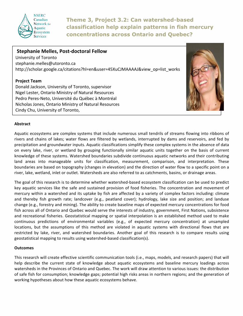
Theme 3, Project 3.2: Can watershed-based classification help explain patterns in fish mercury concentrations across Ontario and Quebec?
Stephanie Melles, Post-‐doctoral Fellow University of Toronto [email protected] http://scholar.google.ca/citations?hl=en&user=45XuCJMAAAAJ&view_op=list_works Project Team Donald Jackson, University of Toronto, supervisor Nigel Lester, Ontario Ministry of Natural Resources Pedro Peres-‐Neto, Université du Québec à Montréal Nicholas Jones, Ontario Ministry of Natural Resources Cindy Chu, University of Toronto,

S
Abstract
Freshwater lakes and rivers support a $234 million commercial fishery and a $2.3 billion recreational industry in Ontario. Habitat degradation, overexploitation, contaminants and the introduction of aquatic invasive species threaten the health of Ontario’s lakes and the productivity of their fisheries resources. In 2008, the Ontario Ministry of Natural Resources initiated the Broad-‐scale Fish Community Monitoring (BsM) program. This long-‐term program is designed to sample hundreds of lakes in Ontario in order to assess the status and trends in fisheries resources and stressors (habitat degradation, exploitation, contaminants and aquatic invasive species) over time. It provides a unique opportunity to assess the ecosystem health of hundreds of Ontario's inland lakes. This research is scientifically significant because it will provide a broad-‐scale assessment of the ecosystem health in Central Canadian lakes, and evaluate the potential causes of ecosystem health differences: climate, habitat, exploitation, contaminants and invasive species. It will: (i) provide a cost efficient, methodological tool to assess lake fish community production and ecosystem health, (ii) assess the relative importance of difference variables (climate, habitat, exploitation, contaminants and invasive species) on aquatic ecosystem health and services, and (iii) be used to prioritize research, monitoring and restoration efforts in e.g., lakes identified as at risk or lakes with degraded ecosystem health.
Keywords: lakes, fish communities, ecosystem health, biomass size spectra, environment, anthropogenic stress
Geographic Location: 721 lakes throughout Ontario, Canada
How does your project link to Canadian aquatic ecosystem services? This research will: (i) provide a cost efficient, methodological tool to assess lake fish community production and ecosystem health, and (ii) assess the relative importance of difference variables (climate, habitat, exploitation, and invasive species) on aquatic ecosystem health and services. It can be used to inform management decisions for inland lakes and their recreationally important fisheries.
Cindy Chu PhD 2009-‐Trent University [email protected] https://sites.google.com/site/cindychueco/ Project team
Brian Shuter, Adjunct Faculty, University of Toronto Henrique Giacomini, University of Quebec, Montreal, collaborator Don Jackson, University of Toronto, supervisor Nigel Lester, Ontario Ministry of Natural Resources and Forestry, supervisor
Theme 3, Project 3.3.1: Biomass size spectra as indicators of ecosystem health in Ontario’s inland lakes

Abstract
The relative importance of environmental temperature and prey availability in shaping somatic growth rate and reproductive allocation in freshwater fish has been the subject of much recent theoretical and empirical work. In this project, we use extensions of the biphasic growth model of Lester et al (2004) to make a quantitative assessment of: (i) the nature of the constraints that the seasonal water temperature cycle places on juvenile somatic growth rate; (b) the nature of the constraints that the prey size spectrum places on reproductive allocation and the consequences for adult somatic growth We will use six data sets that document continent-‐wide variation in the life-‐time somatic growth patterns of 2 cold water species (lake trout in North America, brown trout in Europe), 3 cool water species (walleye and yellow perch in North America, European perch in Europe) and 1 warm water species (smallmouth bass in North America). This comparative analysis will test predictions of optimal life history theory that in turn will allow a more mechanistic understanding of the response of fish populations to changes in climate and community structure.
Keywords:
Size spectrum, life history, fish, climate change, predation
Geographic Location: Canada, United States, Norway
How does your project link to Canadian aquatic ecosystem services? This project will provide subsidies to extend the theory underlying the community size spectrum models used in Project 3.3. More specifically, we will generate and test predictions about intraspecific variability and developmental plasticity in the size distributions of important fish species inhabiting temperate zones.
Theme 3, Project 3.3.2: Expanding biomass size spectra models
Henrique Correa Giacomini, Research Associate University of Toronto [email protected] https://www.researchgate.net/profile/Henrique_Giacomini Project team Brian J Shuter, Ontario Ministry of Natural Resources/University of Toronto, supervisor Cindy Chu, University of Toronto, collaborator Erin S Dunlop, Ontario Ministry of Natural Resources, collaborator Ander Finstad, Norwegian Institute for Nature Research, collaborator Nigel P Lester, Ontario Ministry of Natural Resources, collaborator

Abstract
Considering that the various types of reservoirs produce changes of different magnitudes in the aquatic environment, the use of the size distribution models will allow a better understanding of the ecological aspects of these developments and how their construction affects the structure size of the aquatic communities. The aim of this study is to estimate the size spectrum slopes of fish assemblages at different type of reservoirs in Southeastern Brazil. The comparative analysis of this information in several sites and period will allow evaluating the effect of different type of reservoirs in the structuring of the size of fish communities. To reach this goal, twelve samplings were carried out quarterly over three years. Six reservoirs of different sizes were selected. Samples were obtained in three different compartments of each reservoir (lotic, intermediate, and lentic). Large fish were collected with gill nets, whereas small fish were sampled with trawl nets. Concomitantly to the fish sampling, data of 16 limnological variables were taken. To test the project hypotheses and whether there is any association between the abiotic components with the patterns obtained, a size spectrum gradient estimated by maximum likelihood estimator (EMV) of the Pareto distribution type 1will be used.
Keywords: Allometry, size diversity, environmental assessment, Dams, Upper Paraná Basin, Brazil.
Geographic Location: Hydroelectric Reservoirs of São Paulo State, Brazil. How does your project link to Canadian aquatic ecosystem services? This research is scientifically significant because it will provide a new understanding of the ecological functioning of different types of hydroelectric reservoirs. This understanding will serve to improve concepts of reservoir projects, becoming a new and powerful tool for the assessment of its viability.
This research will also provide new insights for supporting decisions in energy policy, allowing proper management of multiple types of hydroelectric reservoirs.
Theme 3, Project 3.3.3: Size spectra of fish assemblages: longitudinal and temporal variation in neotropical reservoirs
Mateur Ferrareze, Postdoctoral Fellow University of Toronto [email protected] Supervisor: Dr. Donald A. Jackson, University of Toronto Dr. Brian J. Shuter, University of Toronto

Abstract
The size spectrum is the distribution of organisms across a range of organism size. It reflects size-‐dependent ecological and physiological processes that govern the energy flow and biomass distribution in aquatic ecosystems. Perturbations, such as overharvesting fish populations and eutrophication, which alter the flow of energy within a community should be captured by the parameters that describe the shape of the community size spectrum. Zooplankton are an important link between primary phytoplankton production and fish in lakes. Thus, the zooplankton community size spectrum has the potential to be used as an indicator of environmental perturbations affecting higher and lower trophic levels. Zooplankton size spectral parameters from 640 lakes across Ontario will be linked to data on climate, invasive species, basin morphometry, productivity, contaminant accumulation levels, and fish harvest rates. Multi-‐frequency hydroacoustic surveys are being evaluated as an alternative method of characterizing zooplankton size spectra that is more time and cost effective than traditional sampling approaches. Characterization of lake ecosystems by their zooplankton size spectra could provide a comprehensive and robust tool to monitor the health of aquatic ecosystems.
Keywords: size spectrum, parameters, zooplankton, hydroacoustic, perturbation, lake characteristics, indicator.
Geographic Location: 640 lakes across Ontario, Canada
How does your project link to Canadian aquatic ecosystem services? If zooplankton size spectral parameters respond in a consistent and predictable manner to environmental perturbations, they can be used as a tool to detect changes in the capacity of lake ecosystems to deliver services such as the sustainable harvests of fish that support recreational and commercial fisheries.
Theme 3, Project 3.3.4: Calibrating the zooplankton body-size spectrum to serve as an indicator of lake characteristics and environmental perturbations
Lauren Barth, PhD Student University of Toronto [email protected] Project team Brian, Shuter, University of Toronto, supervisor Gary, Sprules, University of Toronto, supervisor Nigel, Lester, ONMR, collaborator Paul, Blanchfield, DFO, collaborator Shelley, Arnott, Queens University, collaborator Don, Jackson, University of Toronto, co-‐investigator Cindy, Chu, University of Toronto, co-‐investigator Claudiu Tudorancea, independent contractor, technician James Rusak, Dorset Environmental Science Centre, collaborator Scott, Milne, Milne Technologies, collaborator
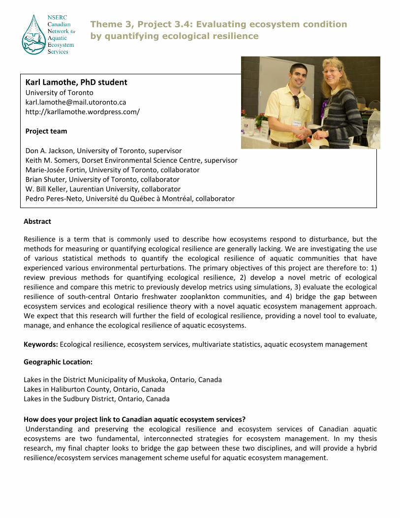
Abstract
Resilience is a term that is commonly used to describe how ecosystems respond to disturbance, but the methods for measuring or quantifying ecological resilience are generally lacking. We are investigating the use of various statistical methods to quantify the ecological resilience of aquatic communities that have experienced various environmental perturbations. The primary objectives of this project are therefore to: 1) review previous methods for quantifying ecological resilience, 2) develop a novel metric of ecological resilience and compare this metric to previously develop metrics using simulations, 3) evaluate the ecological resilience of south-‐central Ontario freshwater zooplankton communities, and 4) bridge the gap between ecosystem services and ecological resilience theory with a novel aquatic ecosystem management approach. We expect that this research will further the field of ecological resilience, providing a novel tool to evaluate, manage, and enhance the ecological resilience of aquatic ecosystems. Keywords: Ecological resilience, ecosystem services, multivariate statistics, aquatic ecosystem management
Geographic Location:
Lakes in the District Municipality of Muskoka, Ontario, Canada Lakes in Haliburton County, Ontario, Canada Lakes in the Sudbury District, Ontario, Canada
How does your project link to Canadian aquatic ecosystem services? Understanding and preserving the ecological resilience and ecosystem services of Canadian aquatic ecosystems are two fundamental, interconnected strategies for ecosystem management. In my thesis research, my final chapter looks to bridge the gap between these two disciplines, and will provide a hybrid resilience/ecosystem services management scheme useful for aquatic ecosystem management.
Theme 3, Project 3.4: Evaluating ecosystem condition by quantifying ecological resilience
Karl Lamothe, PhD student University of Toronto [email protected] http://karllamothe.wordpress.com/ Project team Don A. Jackson, University of Toronto, supervisor Keith M. Somers, Dorset Environmental Science Centre, supervisor Marie-‐Josée Fortin, University of Toronto, collaborator Brian Shuter, University of Toronto, collaborator W. Bill Keller, Laurentian University, collaborator Pedro Peres-‐Neto, Université du Québec à Montréal, collaborator

Abstract
Aquatic ecosystem integrity is essential for fisheries, recreation, flood control, and biodiversity. While ecosystem integrity can be affected by both natural dynamics and human pressures, increased infrastructure development and land-‐use changes further exacerbate these adverse effects on aquatic ecosystems globally. Yet aquatic ecosystems are also complex due to highly dynamic variations both spatially and temporally. Furthermore, species community responses to aquatic ecosystem changes vary according to spatio-‐temporal scales. Species in certain functional groups within aquatic ecosystems are more sensitive to anthropogenic development upstream and pollution within a watershed, which are cumulative downstream. Pulse disturbances from landscape pressures on species communities first require identifying key spatio-‐temporal scales to improve predictions of the aquatic ecological response to stressors. Press disturbances, such as obstacles and culverts in stream networks, negatively reduce connectivity for diadromous fish species that must migrate through both marine and freshwater habitats to complete their lifecycle. My research therefore aims to quantify species community responses within key spatio-‐temporal scales of analysis of the press and pulse disturbances at the watershed level. This research will be critical to maintain healthy ecosystem integrity by determining areas vulnerable to anthropogenic impact and potentially to Canadian health.
Keywords: connectivity, estuaries, fish community, functional group, indicator species, migratory fish, watersheds
Geographic Location: Ontario watersheds, Ontario, Canada,Miramichi River, New Brunswick, Canada, Northumberland Strait watersheds, New Brunswick, Canada
How does your project link to Canadian aquatic ecosystem services? Policy targets based on these improved predictions of species community responses will aid in the conservation of aquatic ecosystems services and human health in Canada.
Theme 3, Project 3.5: Fish community responses to spatio-temporal effects of global change in aquatic ecosystems
Andrew Chin, PhD candidate University of Toronto [email protected] Project team Marie-‐Josée Fortin, University of Toronto – Supervisor Julia Linke, University of Toronto, Co-‐investigator Roland Cormier, Eco-‐Risk, Collaborator Nigel Lester, Ontario Ministry of Natural Resources, Collaborator Keith Somers, Ontario Ministry of the Environment, Collaborator

Abstract Habitat quality of aquatic ecosystems is influenced by direct and indirect pressures across multiple spatial and temporal scales. Northeast New Brunswick has been host to a variety of extensive direct pressures (e.g. forestry, agriculture, roads) across space and time, while also supporting a vast network of streams and rivers draining into the Northumberland Straight. To support the active management of aquatic ecosystems, their vulnerabilities and risks need to be assessed not solely at the regional watershed level, but across the multitude of finer scales that they may operate under, requiring in turn the acquisition and development of spatio-‐temporally explicit data and techniques. The primary goal of this research is to determine the relative ecosystems. We focus on (1) estuarine nekton communities and water quality and (2) juvenile salmon abundance in headwaters and how both of these system components are a) linked to upstream water quality and b) impacted by “upstream” pressures across New Brunswick Northumberland Straight watersheds. The methods and models developed within the scope of this project will be applicable most environmental sciences dealing with spatial data and will help developing new expertise for managing spatially dynamic aquatic ecosystems.importance, and the key spatial scales, at which various pressures influence the vulnerability of these riverine Keywords: estuary, forestry, juvenile salmon, landscape mapping and monitoring, nekton communities, Northumberland Straight, spatial statistics Geographic Location: Northumberland Straight Study Region, New Brunswick, Canada: the study region covers 3.5 mha across all New Brunswick watersheds that drain into the Northumberland Straight. How does your project link to Canadian aquatic ecosystem services? This project works on developing techniques to assess and better understand the cumulative effects of pressures on indicator species and attributes of aquatic ecosystems (e.g. water quality, nekton communities, salmon populations), whereby the state of these populations and attributes in turn impacts various ecosystem services (e.g. provision service: drinking water; supporting service: water purification; cultural service: recreational fishing). As land-‐use management can mainly control direct pressures through policy, approaches to better understand their relative impacts on ecosystem components will subsequently enter into the improved understanding of the services they provide.
Theme 3, Project 3.5: Geospatial Risk Mapping - Relating Downstream Aquatic Species and Communities to Upstream Water Quality and Land Use in the New Brunswick Northumberland Straight Region
Julia Linke, Post Doctoral fellow University of Toronto [email protected] Project team Marie-‐Josée Fortin, University of Toronto – Supervisor Andrew Chin, PhD Student, University of Toronto – co-‐investigator Roland Cormier, Eco-‐Risk, Collaborator Nigel Lester, Ontario Ministry of Natural Resources, Collaborator Keith Somers, Ontario Ministry of the Environment, Collaborator

Abstract
Nearly all forests are on Vancouver Island, BC are managed for timber production with wide-‐spread impacts on non-‐timber benefits people derive from these forests. I estimate the long term recovery of a forest’s capacity to provide ecosystem services, including: timber, carbon storage, edible berries, habitat for an endangered sea bird (marbled murrelet), botanical forest products, regulation of aquatic environments, and the large cedar used traditionally by First Nations. I use two approaches. First, I estimate the recovery trajectories of these ecosystem services over a 215 year period using generalized additive modelling based on data from a forest chronosequence. Second, I contrast the ecosystem services provided by second-‐growth and old-‐growth forests in two different ecosystems: a high-‐productivity riparian forest and a medium-‐productivity forest located on mountain slopes. I collected the data for the second chapter using field sampling in August 2014 at Clayoquot Sound with help from local First Nations. A key methodology I have developed and which I use in both chapters is the use of forest stand structural features (eg, trees, logs, understory plants and forest floor thickness) as biophysical indicators to estimate capacity of different ecosystem services.
Geographic Location: Tofino Study area, BC, Canada Vancouver Island, BC, Canada
How does your project link to Canadian aquatic ecosystem services?
I study the temporal dynamics of tradeoffs from logging, including terrestrial forest harvesting interactions with aquatic ecosystem services. I am also leading a multi-‐author CNAES collaboration, the RegES project, which seeks to conceptualize how regulating services interact to maintain the quality of aquatic ecosystem services in face of external pressures.
Ira Sutherland, MSc Candidate McGill University [email protected] http://www.ecohydrology.ca Supervisor: Elena Bennett, McGill University, co-‐supervisor Project Team: Sara Gergel, UBC, co-‐supervisor Alex Yeung, PhD candidate, field technician
Theme 3, Project 3.6: Understanding the trade-offs among ecosystem services along disturbance gradients
