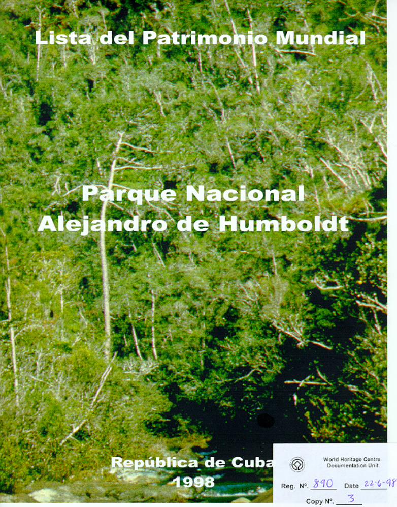
alejandro de humboldt national park - unesco
TRANSCRIPT

WHC Nomination Documentation File Name: 839rev.pdf UNESCO Region: LATIN AMERICA AND THE CARIBBEAN __________________________________________________________________________________________________ SITE NAME: Alejandro de Humboldt National Park DATE OF INSCRIPTION: 16th December 2001 STATE PARTY: CUBA CRITERIA: N (ii)(iv) DECISION OF THE WORLD HERITAGE COMMITTEE: Excerpt from the Report of the 25th Session of the World Heritage Committee
The Committee inscribed Alejandro de Humboldt National Park on the World Heritage List under natural criteria (ii) and (iv):
Criterion (ii): The size, altitudinal diversity, complex lithologies, and landform diversity of Alejandro de Humboldt National Park have resulted in a range of ecosystems and species unmatched in the Insular Caribbean. It was a Miocene-Pleistocene refuge site, particularly in the glacial eras, for the Caribbean biota. The fresh water rivers that flow off the peaks of the park are some of the largest in the insular Caribbean and because of this have high freshwater biological diversity. Because of the serpentine, peridotite, karst and pseudokarst geology of the region, the park is an excellent example of ongoing processes in the evolution of species and communities on underlying rocks that pose special challenges to plant survival.
Criterion (iv): Alejandro de Humboldt National Park contains the most important and significant natural habitats for in- situ conservation of terrestrial biological diversity in the entire insular Caribbean. It contains 16 of 28 plant formations defined for Cuba, the largest island in the Caribbean, which is a unique biogeographic province. It is one of the most important sites for conservation of endemic flora in the entire Western Hemisphere - nearly 70% of the 1,302 spermatophytes already described, of an estimated total of 1,800-2,000, are endemic to the park. The park is one of the most biologically diverse terrestrial tropical ecosystems in an island setting anywhere on earth. Endemism rates for vertebrates and invertebrates found in the park are also very high. Many of these are threatened because of their small range. Because of their uniqueness and the fact that they represent unique evolutionary processes, they are of outstanding universal value from the point of view of science and conservation.
The Committee requested that the management plan be finalized within a timeframe of 12 months and be sent to the World Heritage Centre in three copies. BRIEF DESCRIPTIONS Complex geology and varied topography have given rise to a diversity of ecosystems and species unmatched in the insular Caribbean and created one of the most biologically diverse tropical island sites on earth. Many of the underlying rocks are toxic to plants so species have had to adapt to survive in these hostile conditions. This unique process of evolution has resulted in the development of many new species and the park is one of the most important sites in the Western Hemisphere for the conservation of endemic flora. Endemism of vertebrates and invertebrates is also very high. 1.b State, Province or Region: Guantánamo and Holguín Provinces 1.d Exact location: 75°00' E , 20°27' N


1
1. IDENTIFICATION OF THE GOOD
a) Country: Republic of Cuba
b) Provinces: Guantánamo and Holguín
c) Name: Alejandro de Humboldt National Park
d) Accurate location in a map and geographic coordinates:
X: 75 ° 10' 22'' - 74 ° 38' 32' EY: 20 ° 22' 14'' - 20 ° 35' 34' E
e) Maps:
See Annexes 1 and 2
f) Extension
The Park sectors approved (Cupeyal del Norte – Ojito de Agua and Jaguaní) extend for 32560 ha (26 370ha and 6 190 ha respectively). Including terrestrial and marine areas in theprocess of approval, the whole Park comprises 66 700 ha of land and 2 641 ha of watertotaling 69 341 ha. The buffer zone extends for 34 330 ha.
1. JUSTIFICATION OF THE REGISTRATION
a) Declaration of values
Alejandro de Humboldt National Park is the most important strictly protected area (Cat. I-IV IUCN) in Cuba as far as biodiversity is concerned. This area stands out not only becauseit has the highest richness and endemism in the country but also because it is currently therepresentative of the highest remnant of preserved mountain ecosystems in Cuba. Its mostrelevant characteristics can be summarized as follows:
I. It has the highest levels of biodiversity and endemism in the West Indies and hasone of the highest levels of endemism at world level
II. It is one of the main evolutionary centers as well as a biogeographic bridge and aMiocene-Pleistocene refuge site (mainly in the Glacial period) of the Caribbean andthe American biota.
III. It is one of the most extensive and well-preserved mountainous ecosystemsremaining in the West Indies region.

2
IV. It is a representative example of the combination of neo-tectonic evolution underconditions of sea shelf development on old structures resulting from island arcs(Oligocene-Quaternary) with a foundation of transformed oceanic crusts (ophites)that have led to the formation of planation surfaces and weathering crusts that areone of the major exponents of their type at world level.
V. It is a representative world example of the development of karstic forms andsystems (“pseudokarst”) on non-carbonated lithologies.
VI. It is one of the best and most complete representatives of the tropical, insular, wetrain forests of the Neotropics.
VII. It is a representative world example of plant formations with an azonal character(wet forests and shrubs on peridotites and serpentines).
VIII. It shelters important (sometimes unique) populations of threatened species of floraan fauna among which, due to their threat degree or importance at world level, wecan mention the Ivory Billed Woodpecker (Campephilus principalis bairdi), theCuban Kite (Chondrohierax wilsoni), the Cuban Solenodon (Solenodon cubanus),the Cuban parrot (Amazona leucocephala), the Cuban parakeet (Aratinga euops),the Caribean manatee (Trichechus manatus manatus), the Painted Snail (Polymitapicta), the Dracena (Dracaena cubensis), the Podocarpus (Podocarpus ekmani), etc.
IX. It is the habitat of three of the smallest vertebrate species in the world.
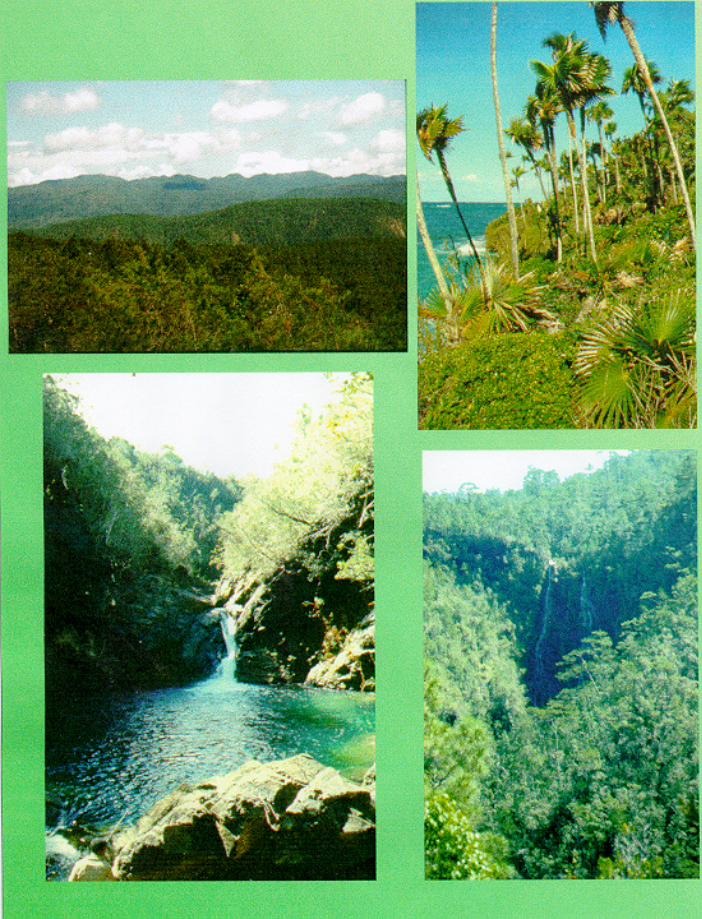
X. The conjunction of mountains with well-preserved broad leafed forests and pinewoods, clear-water rivers, ponds and cascades in a rainy and cool weather — typicalof this National Park — constitutes one of the most remarkable and contemplativesceneries of the Cuban nature.
XI. Alejandro de Humboldt National Park has enough territory and conservation degreeto guarantee the lasting functioning of the vital ecological processes as well as thesurvival of the species living there.
b) Comparative analysis as to the conservation status of similar goods:
This Park has conservation degrees and endemism figures comparable only to thoseterritories or countries considered the most important ones at world level (Hot Spots) suchas the serpentine areas in New Caledonia, which are broadly excelled by this Park withregard to fauna. These serpentine areas are frequently compared with Alejandro deHumboldt National Park due to their geological and geomorphological similitude. Afteranalyzing the different groups included in WCMC, 1992, we can state that this Park excelsHot Spots such as the Mountains to the east of Tanzania, southwestern Sri Lanka, andsouthwestern Ivory Coast (concerning endemic higher plants); southwestern Australia,eastern Himalaya, the Malaysia Peninsula, the Flora Province of California and others(regarding endemic reptiles). As to the different islands analyzed in WCMC, only NewCaledonia and the Hispaniola have more endemic plants than this National Park, while no

3
site in the Hispaniola has plant endemism levels and conservation degrees comparable tothose of Alejandro de Humboldt National Park. The other islands of the world have lessplant endemism, the ones with plant endemism closer to the Cuban National Park areJamaica, Taiwan, Hawaii and Fiji. Regarding almost all fauna groups, there are no islandswith endemism levels like those of this National Park, except some fauna groups in theislands of Papua New Guinea, New Zealand, Solomon Islands, and Fiji.
c) Authenticity / Integrity
Due to the characteristics of this National Park, there is no proliferation of naturalizedspecies in its territory. Plant species introduced in our country such as some gramineousplants have not succeeded in the Park as they develop only in areas previously disturbed byman. Within the Park area, areas disturbed by man are located only in small tracts in theperipheral zones or in very little patches, and there is no possibility of expansion because ofthe high compactness degree of the natural vegetation and the ecosystem maturity. In somehuman settled areas of the Park, there are some crops and small plantations of domesticatedplants, which occupy only small land portions and are not a threat. Other species such asthe Beefwood (Casuarina equisetifolia) affect small tracts of the coast; nevertheless, theyare small populations and their expansion is restricted to the coastline. The authenticity ofthe Park ecosystems is expressed mainly by the presence of huge blocks of undisturbedoriginal vegetation. In the case of fauna, some domestic species have turned naturalized,specifically the dog (Canis familiaris), the cat (Felis catus) and the pig (Sus scophra).Though having negative effects on the autochthonous fauna, the aforementioned species areconcentrated in zones near human settlements and are not abundant in the more naturalareas. On the other hand, relief conditions prevent these species from having access tomany places that therefore have an integral composition of fauna and flora communities.Species such as the Small Indian Mongoose (Herpestes auropunctata) — one of the mostharmful predators introduced in the West Indies and other regions of the world — have notpractically invaded the areas of the National Park so they are not a threat to the integrity ofits fauna communities.
Current activities such as crops for subsistence, chromium underground mining, andlogging are taking place in well located places (around villages) or in the Park periphery, sotheir influence does not significantly affect the Park integrity. In general, there are no formsof incompatible management in the Park. The ecosystem naturalness of this site as well asits dimensions make it the most integral mountainous ecosystem in Cuba.
d) Criteria underlying the registration proposal (and justification of the registrationaccording to these criteria).
Natural Heritage:
- Natural habitats and biodiversity: This Park has endemism and biodiversity levels thatare the highest in the West Indies and rank with the most outstanding ones at worldlevel.

4
- Ecological processes: This Park is both an ancient evolutionary center for the Caribbeanbiota and a Pleistocene refuge for the American migrations, and it has allowed for widediversification and irradiation of flora and fauna species.
- Outstanding natural phenomena and beauty: This Park has most developed forms ofkarstic relief (pseudokarst) on ultrabasic rocks, which is a very rare phenomenon atworld level, even on other non-carbonated lithologies. The Park sceneries areremarkably beautiful.
- Ecological evolution: This Park has planation surfaces and weathering crusts that rankwith the best exponents of their type in the world and represent the combination ofdifferent styles of geological evolution.
2. DESCRIPTION
a) Description of the good
Cuba is the most important territory for biodiversity conservation in the West Indies,according to conservation organizations such as the World Wildlife Fund (WWF) and TheNature Conservancy (TNC). Two percent of the world flora is located in Cuba; if comparedto the other Caribbean islands, Cuba has the highest number of plants and animals as wellas the highest endemism degrees. For some groups, endemism reaches figures of 94%(terrestrial mollusks, 1 381 sp.), 93.4% (amphibians, 43 taxa), 82.5% (myriapods, 104 sp.),75.2% (reptiles, 91 taxa), 52% (arachnids, 677 sp.), 51% (spermatophytic plants, 3 233 sp.),40% (mammals, 15 taxa). According to WCMC (1992), Cuba ranks first among insularecosystems when regarding endemic plants, eleventh at world level concerning endemicreptiles, and twenty-second at world level with regard to higher reptiles. Likewise, thisCaribbean island holds records such as the world smallest bat (Natalus lepidus 2-3 gr.), theworld smallest frog (Eleuterodactilus iberia., < 11 mm), the world smallest bird (Mellisugahelenae, 63 mm), and the world smallest scorpion (male) (Microtityus fundorai, 10 mm);one of the biggest insectivorous mammals (Solenodon cubanus, > 582 mm) can be foundhere too. An important part of the aforementioned biodiversity is represented in Alejandrode Humboldt National Park.
This Park constitutes the most important strictly protected area in Cuba as far asbiodiversity is concerned. Not only does this area have the highest richness and endemismin the country but it is also the representative of the widest remnant of well-preservedmountainous ecosystems in Cuba. Basic and ultrabasic igneous rocks (transformedremnants from ancient oceanic crusts) from the Cretaceous period are predominant here,they emerged continuously more than 40 million years ago and are some of the oldestevolutionary massifs in the Caribbean.
On these formations we can find the highest and oldest elongated, plain systems of plateausand watersheds in the Caribbean region, with large weathering crusts and karstic (orpseudokarstic) phenomena on peridotites that constitute unique elements (development of

5
dolines, endorheic basins, caves, karren, etc.) at national level and are uncommon — evenon other lithologies — at world level.
Located in Alejandro de Humboldt National Park is the limestone block of Farallones deMoa, a geological and biogeographic “island” composed of carbonated rocks amongserpentines and peridotites. Here is the karstic system of Farallones de Moa Great Cavern,one of the five natural sites regarded as national monuments and one of the major cavesystems in eastern Cuba.
The altitudes range from –220 m to 1 175 m above sea level (El Toldo Peak); therefore,mountains, tablelands, rivers, plains, purse-shaped bays, coral reefs, and keys are includedwithin the Park. In this Park, the altitude variation making the weather in the region beazonal (closer to equatorial types), the vigor of the relief, and the forest coverage accountfor the existence of the cleanest and most flowing rivers of Cuba, some of them are: Toa-Jaguaní, Duaba, Jiguaní, Nibujón, and Moa.
According to the evidence found by specialists, this region was not disturbed much by theclimate changes that took place during the glaciations of the Quaternary period; therefore,the area constituted a refuge for the Antillean biota. The aforementioned facts, the antiquityand relative stability of this region together with the relief complexity, the predominantlithologies and the huge variations in rainwater have determined the great variety ofhabitats and microhabitats where the most diverse animal and plant species have originatedand accumulated along millions of years.
Because of its richness in species, ecosystems and landscapes, this region is the main centerof diversity and diversification of the Antillean biota and one of the most important ones ofthe world, its influence goes as far as southern North America.
Not only are the values enclosed by this region part of the national heritage, but they arepart of the world heritage as well.
Flora values
Alejandro de Humboldt National Park is considered the least explored area of Cuba, sincethere are still locations where a collection has never been made and the ones that have beenmade are preliminary in many cases. This Park shelters 905 flora endemic species, almost30% of the ones reported for Cuba. Of this total figure, 343 species live exclusively in thisregion, and in some cases they have been spotted in one location that does not exceed somedozens of square feet. These figures do not represent the total amount of possible endemicspecies as some specimens collected by specialists remain to be classified. This territoryhas the highest plant diversity of the Cuban archipelago and the Insular Caribbean; besides,it is one of the most flora-endemism-sheltering regions in the earth as well as one of theregions with more endemism density per hectare.
Among these endemic species, there are botanical jewels from which we can mention fivecarnivore species — one of them is the only Cuban epiphyte (Pinguicola lignicola) — andtwo species of the genera Podocarpus and Dracaena that belong to the most primitive plant
6
groups in the plant realm. According to recent collections made in this region, five newspecies to science have been found, one of them being a pine. A species of the genus Buxus(reported as extinct) was found here too.
The plant endemism identified in representative areas of this massif (classical endemismcenters of this region such as El Toldo, Alto de Iberia, Cupeyal del Norte, etc.) reachesfrom 70-80%, which is the highest percent in the region and one of the highest in the world.
Though it is not complete nor does it include the new reports, the flora list of the protectedarea database existing at the National Center of Protected Areas (CNAP) provides a figureof 1 302 spermatophytes, which accounts for 69% of endemism, and 145 species ofpteridophytes. Recently made estimates (CNAP, 1998) indicate that the amount of floweredplant species may reach from 1 800-2 000 taxa.
There are 28 plant formations defined for Cuba (New National Atlas of Cuba, 1992), 16 ofthem can be found at Alejandro de Humboldt National Park: 3 Cuban rain forests (the low-altitude rain forest, the submontane rain forest, and the montane rain forest), the low cloudforest (sclerophyllous rain forest), the xeromorphic sub-thorny shrub on serpentine, the pinewood of Pinus cubensis, the mesophyllous evergreen forest, the semideciduous forest, theriver-rain forest, the microphyllous evergreen forest, the coastal xeromorphic shrub, thexeromorphic thorny shrub on serpentine, the mangrove forest, and the vegetationcomplexes on knolls and on sandy, rocky coasts. Such a diversity in formations(ecosystems) does not exist in any other strictly protected area in Cuba.
The main vegetation types (by extension and endemism) are the woodlands, which arerepresented here by all their Cuban variants and reach their climax with the low-altituderain forest; the pine woods; and the xeromorphic sub-thorny shrubs on serpentine. Rainforests in this area are part of the boreal limit of the American woodlands, and the plantendemism percent of xeromorphic shrubs is the highest one in the West Indies (80%) andone of the highest ones of the world as far as plant formation is concerned. Woodlands inthis region — specially those at low altitude that exist in only a few places besides this Park— and sclerophyllous woodlands are the most developed forests in Cuba (due to size oftheir trees, strata and species) and the most extensive and well-preserved representatives ofthese types of plant formations.
Fauna values
The fact that the evolutionary processes of flora, the geological history, the lithologies, theantiquity, etc. favored fauna species evolution should be taken into account. Because of itsabundance, diversity and endemism, fauna in this region is the richest one in Cuba. Amongthe most important vertebrate species we can mention the Ivory Billed Woodpecker(Campephillus principalis bairdi), a local generic endemic relic that is very threatened (ifnot extinct) as the other subspecies existing in North America and Mexico are alreadyextinct; the Cuban Kite (Chondrohierax wilsoni), an endemic species whose populationshave been so reduced that maybe just a few couples remain; and the Cuban Solenodon(Solenodon cubanus), a nocturnal living fossil that is threatened and can be found only veryrarely and in the most natural sites of this Park. These three species are practically present

7
only in this region and they constitute charismatic species that have been the subject ofattention of international bodies on behalf of their protection and conservation (BirdlifeInternational – CIPA; World Wildlife Fund – WWF; International Union for theConservation of Nature – IUCN; etc.) Forests in this region are also important refuges formany endemic, resident and migratory bird species, and there are significant populations ofparrots (Amazona leucocephala l.), and parakeets (Aratinga euops), which are speciesconsidered as extinction-threatened. In the Park marine area, we can find a significantcolony of caribbean manatees (Trichechus manatus m.). All the Cuban records, except thatof the scorpion (Microtityus fundorai) can be found in this Park. As to the frog(Eleuterodactilus iberia), considered the smallest frog in the world, its distribution isrestricted to only some locations in the Park.
Another example of the fauna richness are reptiles, which have their highest Cuban centerof diversity and diversification in this region, as 45 taxa (37% of Cuban taxa) have beencollected here. Concerning Anolis, 3 new species have been described recently. The genusEleutherodactylus stands out in the amphibian group, this genus has 97.4% of endemismhere and 2 new species collected in the area are in the process of description. Besides,Gambusia punctata, one of the few Cuban endemic freshwater fish, can be found in thiszone. The basin of Toa River and its tributaries constitute the largest reservoir ofCyclasoma ramsdeni, a freshwater fish that is endemic too and whose distribution isrestricted to eastern Cuba.
There are most valuable representatives of the invertebrate fauna such as the species of themollusks Polimyta picta, Xenopoma bexidersoni, Caracolus sagemon, Corida purpuragula,and C. uba. According to specialists, there are at least 50 species of this group, some ofthem are still to be described. Other important species are the scorpions Centruroidesanchorellus and Rhopalurus junceus, both have biomedical and conservation importance.The number of insects and other invertebrate groups is so high that it is not possible tomake preliminary estimates. In the forests of this area, there are many species of arachnids,crustaceans and insects that are new to science, the waters shelter 9 freshwater shrimpspecies (47% of Cuban species) and an undetermined number of other invertebrates. Theant fauna has approximately 50% of endemism (very high for this insect group).
The previous data are being constantly enlarged as a result of recent expeditions to the area.The preliminary analysis to classify the collection brought by the first of these expeditionsresulted in 37 new species out of 218 that were analyzed, the most outstanding groupsbeing the reptiles, with 3 new species out of 5 analyzed (60%); the amphibians, with 2 outof 7 (29%); and the arachnids, with 17 out of 61 (28%) -- in the case of opilionids, 6 newspecies were found out of 6 that were analyzed, for a 100%. As to crustaceans, 3 out of 12species are new, representing 25%. Moreover, a new genus and 2 new reports for Cubahave been found among arachnids. Some groups of this collection are still left to beclassified while some dubious species of the already classified groups could be new toscience too. Though the data of the other expeditions are not known yet, it is known that thefigures of new species have remained high.
Though not complete, mainly concerning invertebrates, the lists of the database at theNational Center of Protected Areas provide figures of 21 amphibian taxa (95.8% of
8
endemism and 45.6% of the species of this group for Cuba), 45 reptile taxa (83.3% ofemdemism and 37% of the species of this group for Cuba), 10 mammal taxa (30% ofendemism), 95 bird taxa (21% of endemism), 191 insect species (27.7% of endemism), and59 arachnid species.
Other outstanding natural values
The main constituent rocks of this Park, serpentines and peridotites, are remnants of ancientoceanic crusts (ophitic basal complex), main witnesses of the evolution of the Cubangeosynclinal through island arcs. These rocks have remained above sea level for at least 40million years. Such types of rock and the time they have been above sea level areresponsible for the considerable biodiversity values that this region encloses nowadays.
Likewise, on certain areas of this Park, the most singular exponents of a pseudokarsticrelief on ultrabasic rocks have developed. This relief is not repeated, at least at nationallevel, except in some units of the mountainous mesoregion of Nipe Sagua Baracoa.According to A. R. Magaz (1997), during the past 350 000 years the tendency of reliefevolution has brought about the formation of pseudokarst on the most elevated surfaces ofsome of the Park tablelands; these surfaces had a superficial (fluvial) drainage that becamesuperficial-underground and underground (fluvial-karstic and karstic), with the subsequentformation of karren, dolines, swallow-holes, caves, karstic funnels, and endorheic basins.These phenomena are widely spread in El Toldo and Iberia plateau, the latter one is famousfor its flooded dolines (lagoons).
b) History and Development
Alejandro de Humboldt National Park has historically been a poorly used territory. Only anarcheological site from the Pre-Columbian period is known in the Park, the archeologicalsite is located in the coastal zone (Aguas Verdes). Later on, during the XVIII and XIXCenturies, some peripheral places of the Park were used as shelter sites (Palenques) by therunaway slaves.
At the beginning and the middle of the XX Century, there was certain assimilation of theterritory in the valleys of the coastal area in order to raise coconut and cacao. In the zone ofLa Melba, during this period there was a development of human activity linked tochromium underground mining and mining exploitation in general, this human activity, inturn, propitiated the establishment of a town, with the subsequent development of smallfarms for self-consumption around the town.
Likewise, during the 40´s and the 50´s there was a development of farms in the Toa andJaguaní riverbanks for the purpose of timber extraction and crops, the farms were left at theend of the 50´s due to difficulties to get access and the poor crops.
During the 60-70´s there was some timber exploitation in the pine woods of the area ofOjito de Agua, this exploitation stopped definitely in mid-80´s as a result of the declarationof the area as a Fauna Refuge.
9
c) Type and date of the recent available documents about the good
All the recent information about this area has been gathered both in databases located at theNational Center of Protected Areas and in unpublished reports of works that have beencarried out during the last two years in order to create and manage this National Park.Practically all this information is synthesized in the Operational Plan (unpublished) for theNational Park.
c) Current conservation status
The territory of Alejandro de Humboldt National Park is the largest block of preservedmountainous ecosystems in Cuba and the second one concerning ecosystems above sealevel (only Zapata Swamp National Park – which is composed mostly of wetlandecosystems -- surpasses it). More than 80% of the territory in this Park is totally natural,this percent increases to more than 90% if we consider those sites where primaryecosystems are predominant or have been in a recovery phase for more than 40 years.
The anthropically influenced sites are located in the coastal valley of Santa María andNibujón rivers and in the vicinity of La Melba town, where there are small population coresthat are engaged in agriculture. Likewise, there is an old system of cross paths for miningexploitation in the Piloto Tableland. Most other anthropically influenced territories of thePark have been in the process of recovery for 40-50 years. This makes this Park the mostextensive preserved mountainous block in Cuba, where sclerophyllous rain forests andsubmontane rain forests reach their highest extension, splendor and conservation degree.
d) Policies and programs relating to assessing and promoting the good
Alejandro de Humboldt National Park is one of the first-priority areas for the NationalEnvironmental Strategy and the National Strategies for Biodiversity, Protected Areas andEnvironmental Education, so actions drawing upon these steering documents areimplemented in this Park.
3. MANAGEMENT
a) Right of ownership
The Cuban State, represented by the Ministry of Science, Technology and Environment(CITMA), located at the National Capitol, Havana City, Cuba.
b) Juridical status
The whole territory of the Park is included in Cuchillas del Toa Biosphere Reserve, whichwas so declared by UNESCO in 1987. Both territories, in turn, are included in Nipe –Sagua – Baracoa Special Region for Sustainable Development (Multiple-Use ProtectedArea), which was so declared by Decree 197/95. Alejandro de Humboldt National Park hasalso been so declared by the authorities of Guantánamo province.
10
Originally, part of the Park was declared as two Natural Reserves (Jaguaní and Cupeyal delNorte, Regulation 412 of 1963 by the National Institute of Agrarian Reform) and a FaunaRefuge (Ojito de Agua, Regulation 372 of 1991 by the Ministry of Agriculture, MINAG).After the passing of the Fauna Refuge from MINAG to CITMA (Regulation 454 of 1996by MINAG), the territory comprising the two Natural Reserves and the Fauna Refuge wasunified as a CITMA`s administrative unit managed as a National Park under the name ofAlejandro de Humboldt (Regulation 117 of 1996 by CITMA).
The remaining territory of this Park (communication among the already existing sectionsand the way out to the coast) that belongs to the Ministry of Agriculture is in the process ofa technical delimitation (refining and description of limits) that draws upon the criterionthat this Park is the core area of Cuchillas del Toa Biosphere Reserve (Annex 2).
c) Protection measures and ways to use them
The aforementioned legal bodies, the Law on Environment, the Decree-Law on ForestHeritage and Wild Fauna (136/93), and the Regulations for the Realization and Approval ofEnvironmental Impact Assessments and for the State Environmental Inspection (168/95)provide the legal framework to protect the zone. Effective protection of this National Parkis feasible since all this area is included in a Biosphere Reserve coordinated by the Ministryof Science, Technology and Environment, and this ministry has the tenancy of the portionof the Park that has been approved. There is a protection structure consisting of a mainadministration center (Guantánamo), two secondary centers (Piedra La Vela and Baracoa)and several posts (Taco, Cupeyal del Norte, La Melba, Farallones de Moa) that employ 60people including forest guards, professionals and workers to guarantee the protection andmanagement of this Park. Means and resources to manage this area are insufficient andallow only for general activities for protection, environmental education in somecommunities, basic research and environmental interpretation.
d) Body in charge of management
The Ministry of Science, Technology and Environment (CITMA).
e) Scales at which management is made and address of the responsible contactperson
National:
CITMA, Minister of Science, Technology and Environment; Dr. Rosa Elena SimeónNegrínCITMA, Deputy Minister of Science, Technology and Environment; Ricardo Sánchez SosaCITMA, President of the Environment Agency; Fabio Fajardo MorosCITMA, National Center of Protected Areas; Director, Lic. Antonio Perera PugaMinistry of Culture, National Council for Cultural Heritage; Lic. Marta Arjona Pérez

11
Provincial:
CITMA, Delegate, Lic. José Rodríguez OruñaCITMA, Director of Alejandro de Humboldt National Park; Lic. Rael Acebal Suárez
Responsible contact person:Antonio Perera Puga, Director CNAP, Calle 41 A # 4114, Playa, Ciudad de la Habana,Cuba.Fax: 240798. E-mail: [email protected]
f) Plans adopted in relation to the good
There is an operational plan to guarantee the short-term management of the area, this planis being applied in general, with some restraints concerning resources and equipment. Theoperational plan includes all management types to be carried out in the area, the mainstudies, and the necessary steps to carry out the Management Plan for this National Park.
g) Resources and financing levels
The area has national financing amounting to approximately 300 000 pesos a year, it wasrecently supported by external financing from the German NGO Oro Verde and theGerman Official Collaboration Agency (GTZ) that amounted to 16 000 USD, this externalfinancing has already finalized. Other minor aids to specific programs have been receivedfrom the British NGO Save the Children and the Cuban NGO Cubasolar. From thesecontributions, it is worth mentioning a pick-up, two solar cell systems to provide electricityto the administration and management centers within the Park, and the facilities existing inthe Park. Generally speaking, there is a serious shortage of resources and equipment.
h) Strong and weak points regarding conservation and management techniques
The technical staff of the Park has been partially trained through national courses onplanning and management of protected areas. In a general way, the staff is young. Theweakest point is lack of resources, means and equipment to perform work.
i) Arrangement and statistics per visitor
Practically all visitors to the Park are local people or researchers who are performing workfunctions. National or international ecotourism is incipient in this area. In order to developthe Park, two small visitor centers, accommodation facilities and camping sites, a self-guided interpretive trail, and several trails have been made, and guides have been preparedtoo. The coastal zone of the Park is crossed by a road that is used quite frequently byforeign tourists as a pathway.

12
j) Management plan for the good, and exposition of the objectives
What follows is the management types for this area that have been set up in the operationalplan and come from the general management types established for this managementcategory in Cuba:
a) Preserving biodiversity and ecological stability as well as the factors influencing theregulation of the environment;
b) Preserving representative examples of physical-geographical regions, bioticcommunities, genetic resources and species in their natural status; allowing their naturalevolution; and guaranteeing conservation of biological diversity;
c) Promoting respect for the ecological, geomorphologic, cultural or aesthetic attributesthat have justified the designation;
d) Meeting the needs of autochthonous populations, including the rational use of naturalresources, and guaranteeing that this does not affect the management objects adversely;
e) Providing opportunities for recreation and tourism in a natural environment, andconjugating all this with public education in the sense of interpreting nature and historyfor their knowledge, appraisal, and enjoyment;
f) Protecting and putting the cultural, historical and archeological values at public disposaland for research purposes as elements of the nation’s cultural heritage;
g) Protecting, managing, and fostering natural and scenery resources for spiritual,scientific, educational, recreational and tourist purposes in order to guarantee thepreservation of these values at such a level that allows to keep the area in its naturalstatus.
The management plan for the area is under way and takes the aforementioned generalobjectives as a starting point.
k) Number of people employed
Professionals: 12Technicians: 24Workers: 18Service workers: 6
4. FACTORS AFFECTING THE GOOD
a) Pressures arising from development
Since the 50`s, several sections of the Park have been regarded as having high potentialitiesdue to the minerals existing there, which are part of what are considered to be the biggest

13
deposits of iron, nickel and cobalt in the world. Therefore, there are some old cross pathswithin the Park for the purpose of exploration and geological research. The totalestablishment of the National Park and these mining interests are in the process of makingthem compatible.
There have been hydropower plans for a small section of the Park, but they do not affect itnowadays, at least, not directly. The presence of the National Park is being taken intoaccount in these plans.
Also, there have been strong forest interests within the Park, there are even some smallextractions in the zone of La Melba. The restart of one of the main extraction plans wasparalyzed in the year 1986 when specimens of the ivory billed woodpecker (Campephilusprincipalis bairdi) were discovered and Ojito de Agua Fauna Refuge – a current section ofthe Park -- was established. Forest interests are in the process of making them compatiblewith the total implementation of the Park.
Self-consumption productions by local settlers in the neighborhood of towns are generallyconsidered socioeconomic or restoration areas in the zoning that has been anticipated forthe Park, while management programs are carried out in these areas in order to diminishtheir impact and turn them sustainable and stable productions.
b) Disturbances related to the environment
These disturbances are minimal as the Park is natural and scarcely populated and most ofits areas occupy high and medium basins of much water-carrying rivers. There are smallfocuses of domestic organic pollution due to the human presence in the populated spots.
c) Natural disasters and previous planning
Hurricanes are the most potential dangers to the Park, this fact has been anticipated inevacuation and rescue plans. Fires and earthquakes are scarce and their magnitude is low.
d) Disturbances related to the flow of visitors and tourism
There is no disturbance because there is practically no flow of visitors.
e) Number of inhabitants living within the Park and the buffer zone
The population of this area is composed of about 2 000 people concentrated mainly in thecoastal zone. Within the Park, the largest settlement is that of La Melba, with about 400inhabitants. The population of the buffer zone is estimated in around 4 000 people.
7. DOCUMENTATION
a) Photos, slides, films, and videos
Photos, slides, and a film about the Park are attached.

14
c) Bibliography
• Alaín, Hno. (1964): Flora de Cuba. Vol.5. Public. Asoc. Est. Cienc. Biol., 5:1-362.
• Alayón, G. (1976): El almiquí como depredador de arácnidos. Miscelania Zoológica,ACC, No.2:4 pp.
• Alayón, G. (1987): Lista de las aves observadas en la Reserva Natural de Cupeyal,Provincia de Guantánamo, Cuba. Miscelania Zoológica, ACC, No.31:4 pp.
• Alayón, G. (1993): El género Barronopsis (Aranae: Agelenidae) en Cuba. Poeyana.ACC, No. 435: 16 pp.
• Berazaín, R. (1979): Fitogeografía. Univ. de la Habana. Fac. Biol. 313 pp.
• Bisse, J. (1974): Nuevos árboles de la flora de Cuba. Feddes Report, 85 (9-10): 587-608.
• Borhidi, A. (1985): Phytogeographical Survey of Cuba I. The phytogeographiccharacteristics and evolution of the Flora of Cuba. Acta Bot. Hunq. 31 (1-4): 3-34.
• ______ y O. Muñíz (1980): Die vegetation skarte von Kuba. Acta Bot. Acad. Scient.Hunq. 26 (1-2): 23-53.
• _____ (1986): The Phytogeographic Survey of Cuba II. Floristic relationship andphytogeographic subdivision. Acta Bot. Hung. 32 (1-4): 3-48.
• _____ (1983): Catálogo de plantas cubanas amenazadas o extinguidas. Acad de Ciencde Cuba, La Habana. 85 pp.
• Borhidi, A. (1991): Phytogeography and vegetation ecology of Cuba. Academiai kiado.Budapest. 830 pp.
• Capote, R.P. y R. Berazaín (1984): Clasificación de las formaciones vegetales de Cuba.Rev. J. Bot. Nac. V (2): 27-75.
• Centro Nacional de Biodiversidad, CenBio. –Compilador- (1995): Estudio Nacionalsobre Diversidad Biológica en la República de Cuba. Agencia de Medio Ambiente,Ministerio de Ciencia, Tecnología y Medio Ambiente; (inédito).
• Colectivo de Autores (1997): Plan Operativo del Parque Nacional Alejandro deHumboldt. Inédito
• CNAP. (1997): Base de datos de Areas Protegidas.

15
• De Armas, L. (1987): Depredación de Arácnidos por dos vertebrados cubanos.Miscelanea Zoológica. ACC, No. 34: 4 pp.
• Fontenla, J.L. y Rodríguez, R. (1990): Sistema de poblaciones de Calisto sibylla Bates,1934 (Lepidóptera: Satyridae) en Cuba. Poeyana, ACC, No.395: 13 pp.
• Fontenla, J.L. y de la Cruz, J. (1992): Consideraciones biogeográficas sobre lasmariposas endémicas de Cuba. Poeyana. ACC, No. 426: 34pp.
• Fontenla, J.L. (1992): Biogeografía ecológica de las mariposas diurnas cubanas.Patrones Generales. Poeyana. ACC, No. 427: 30 pp.
• Garrido, H. (1975): Distribución y variación de Anolis argillaceus cope (hacertilia:Iguanidea) en Cuba. Poeyana. ACC, No. 142: 28 pp.
• Garrido, O.H. (1976): Notas sobre conducta alimentaria en el Gavilán Caguarero (Aves:Accipitridae). Miscelania Zoológica. ACC, No.3: 4 pp.
• IGACC-ICGC (Instituto de Geografía. Academia de Ciencias de Cuba - InstitutoCubano de Geodesia y Cartografía) (1989): Nuevo Atlas de Cuba. De. Alber, España,226 pp.
• Iturralde - Vinent, M.A. (1982): Aspectos geológicos de la biogeografía de Cuba. Ciencde la Tierra y el Espacio. Acad. Cienc. Cuba, 5: 85-100.
• León, Hno. (1946): Flora de Cuba. Vol I. Contrib. Ocas. Mus. Hist. Nat., Col. La Salle,No.8, La Habana, 441 pp.
• _____ y Hno. Alaín (1951-1957): Flora de Cuba. Vols. II, III, IV. Contrib. Ocas. Mus.Hist. Nat. Col. La Salle, No. 10,456 pp. No.13,502 pp. No. 16,556 pp.
• León, Hno y Alain, Hno (1953): Flora de Cuba: Contr Ocas. Mus. Hist. Nat. Colegio LaSalle, 13: 1-502.
• López Almirall, A. (1982): Variabilidad del Género Pinus (Coniferales: Pinacea) enCuba. Acta Bot. Cubana, 12:1-43.
• Magaz, A.R. (1997): Factibilidad de la minería superficial y medidas generales deprotección y recuperación medioambientales desde el punto de vista de las condicionesgeomorfológicas. Inédito
• Pérez, E.; E. Osa; y Matamoros y U.S. Seal (1997): Conservation Breeding SpecialistGroup (SSC/IUCN). Briefing Book for Conservation Assessment and ManagementPlan Workshop for Selected Cuban Species. II: CBSG, Apple Valley, Minnesota,55124, USA.

16
• Samek, V. (1973): Regiones Fitogeográficas de Cuba. Acad. Cienc. Cuba. SerieForestal 15: 1-59.
• Sarasua, H. (1976): Moluscos de Monte Iberia, especies nuevas y Polymitas anómalas.Poeyana. ACC, No.156: 7 pp.
• Silva Taboada, G. (1979): Los Murciélagos de Cuba. Editorial Academia, La Habana,423 pp.
WCMC (1992): Global Biodiversity. Status of the Earth’s Living Resources. Chapman &Hall London. XX + 594 pp.
d) Address where inventories, files and archives are kept
Centro Nacional de Areas Protegidas (CNAP). Calle 41 A # 4114, Playa, Ciudad de laHabana. Cuba.Fax: 240798 E-mail: [email protected]
8. SIGNATURE IN THE NAME OF THE PARTY STATE
LIST OF ANNEXES
1. Location2. Alejandro de Humboldt National Park.3. Photos


PARQUE NACIONAL ALEJANDRO DE HUMBOLDT. SITUACIÓN ACTUAL (MAYO 2001) PARA LA RECONSIDERACION DE SU PROPUESTA COMO SITIO DE PATRIMONIO MUNDIAL. El Parque Nacional Alejandro de Humboldt luego de un proceso de compatibilización fue aprobado por el acuerdo 3880 del Comité Ejecutivo del Consejo de Ministros de la república de Cuba del 2 de febrero del 2001 como Parque Nacional , con los límites que se anexan. La situación en el Parque con respecto a la minería es la siguiente: En el interior del Parque, la actividad minera se inicio en los años 40 con la prospección de yacimientos ferroniquelíferos y de cromitas y con la explotación de pequeñas minas de cromo que provocaron el surgimiento del poblado de La Melba.. Luego de la segunda Guerra Mundial casi todas fueron abandonadas excepto dos: la primera en la propia Melba, ya agotada y cerrada en la actualidad y la segunda, en las inmediaciones, en la zona de la Mercedita, que aun funciona como tal y que constituye una base económica importante para el poblado por su carácter de fuente de empleo y por su responsabilidad en el mantenimiento del vial Melba-Moa, única vía de comunicación para esa comunidad. La actividad minera de extracción como tal no afecta al área ya que es una mina vieja, subterránea, con toda su infraestructura ya construida. Fuera del parque, aguas abajo, se localiza la zona minera de Moa. La situación con respecto a la obtención de recursos adicionales para el manejo del parque es la siguiente: En el presente año, el parque ha recibirá un notable apoyo financiero para fortalecer su administración a través de dos proyectos del Ministerio de Ciencia Tecnología y Medio Ambiente con instituciones y organismos internacionales: WWF Canada-CIDA, 389 000 USD Años 2001-2003 y United Nations Foundation 2 066 715 USD para el combate de especies exóticas en el Parque Nac. Alejandro de Humboltd y el Parque Nac. Desembarco del Granma (ver Pagina WEB UNF: http://www/grants/9_12_conserving_cuba.cfm). Además, el Parque Nac. Alejandro de Humboltd es una de las 7 áreas demostrativas del Proyecto GEF-PNUD Fortalecimiento del Sistema Nacional de Areas Protegidas de Cuba cuyo PDF B fue aprobado el pasado mes de enero y está en ejecución. Anexo 1: Derroteros: 1. El Parque Nacional Alejandro de Humboldt comprende una superficie de 71
140 ha (68 890 ha terrestres y 2250 ha marinas) en los municipios Baracoa y Yateras de la provincia Guantánamo y Moa y Sagua de la provincia Holguín.
2. Los límites de esta área se corresponden con la siguiente descripción, dada en
coordenadas planas rectangulares de la proyección Cuba Sur:

Partiendo del punto 728800 E, 208500 N, en el mar a un 1 Km al NNE de la desembocadura del río Nibujón, tomando al NO por la línea virtual paralela a la costa pasando por 725100 E, 210550 N hasta el punto ubicado en la coordenada 719900 E, 217 700 N. De este punto continúa en dirección SO hacia la costa hasta el punto 719 050 E, 216 950 N, siguiendo por la línea de costa pasando por 718350 E, 217050 N hasta 717750 E, 216900 N en la desembocadura del arroyo de Cañete y de este punto por el arroyo aguas arriba hasta 715300 E, 215300 N donde tuerce al SSE por el límite entre los charrascales y bosques pasando por el punto 716100 E, 214 000 N hasta su intersección con el río Yamaniguey en 716700 E, 213500 N, en este punto toma por el camino al S aguas arriba hasta el alto en 717000 E, 211700 N para proseguir por un parteaguas al S hasta la intersección con el río Jiguaní en 717000 E, 209700 N el cual toma aguas arriba hasta 710200 E, 208500 N, donde sube hasta el borde de la meseta 709400 E, 209500 N tomando al N hasta 709200 E, 210600 N y tuerce al O hasta una cabezada de un afluente del río Cayoguam en 708100 E, 210000 N el cual toma primero aguas abajo hasta su intersección con el cauce principal en 705800 E, 212300 N el cual sigue aguas arriba hasta 702700 E, 209500 N donde tuerce al O hasta su intersección con los charrascales en la cota 900 m (701700 E, 209200 N) la cual toma en sentido antihorario, primero al N y luego al S hasta su intersección con el camino a Moa en 700850 E, 210000 N, siguiendo al SO hasta intersectar la vieja trocha minera en 699400 E, 206700 N la cual toma al O hasta su intersección con el nacimiento de un afluente del río Calentura en 697500 E, 206700 N por donde sigue aguas abajo hasta su intersección con el río Calentura, el cual cruza para proseguir hacia el O por un parteaguas hasta el alto en 693200 E, 207000 N bajando con rumbo O por un afluente del río Moa hasta su intersección con otro afluente en 689000 E, 207400 N el cual toma aguas arriba hasta 688500 E, 206800 N subiendo hacia el firme de Dos Ventanas en 687300 E, 207000 N el cual toma al NO hasta 685300 E, 209400 N cogiendo una cabezada del río Castro, prosiguiendo aguas abajo hasta 676900 E, 208400 N continuando por el arroyo que ahí desemboca aguas arriba hasta su nacimiento en 676500 E, 205700 N siguiendo por el firme hasta intersectar el parteaguas y el camino viejo de Cupeyal del Norte a Majagual en 676200 E, 205500 N, tomando el parteaguas al SE hasta Cupeyal del Norte en 685500 E, 199800 N donde tuerce al S por el parteaguas hasta 685200 E, 198500 N girando al NE para tomar una cabezada del Toa, la cual sigue hasta 689600 E, 198000 N donde asciende al borde de la ladera O del cañón del río Toa en 689500 E, 198000 N tomando al Sur por una línea recta virtual hasta otro afluente del río Toa en 689500 E, 196800 N el cual sigue aguas arriba hasta su intersección con el camino viejo a la Munición en 687000 E, 195300 N tomando al SE hasta 688300 E, 193100 N en donde tuerce al NE por el parteaguas del borde de la meseta para salir al río Toa en 691300 E, 196000 N siguiendo aguas abajo hasta 696100 E, 195000 N donde continua al NE por un camino hasta salir al camino que va de Ojito de Agua a Riíto en 698000 E, 196200 N el cual gira al SE hasta 699000 E, 195400 N donde continua por otro camino con similar rumbo hasta el río Ceremonia en 700700 E, 195500 N
siguiendo aguas arriba hasta 703300 E, 193900 N por donde coge el camino que sube al parteaguas principal en 704500 E, 194400 N y toma con rumbo E hasta 709600 E, 193700 N a partir del cual prosigue por la cabezada del río Los Lirios en 710100 E, 192800 N y toma aguas abajo hasta 718000 E, 195300 N girando al E y atravesando el parteaguas salir al río Jaguaní en 720200 E, 195600 N el cual prosigue aguas abajo hasta su intersección con el río Toa en 722900 E, 193200 N donde toma por el parteaguas S del río Jaguaní hasta el alto en 724500 E, 190600 N descendiendo por el mismo hasta la intersección del río Jaguaní con el río Naranjo en 727800 E, 192600 N el cual asciende por el parteaguas hasta el alto en 129000 E, 196600 N siguiendo por el mismo hasta el borde de la meseta pasando por los puntos 728300 E, 196900 N; 728700 E, 197800 N; 727400 E, 198100 N; 727300 E, 199100N; 726000 E, 198600 N; 726000 E, 200000 N; 727400 E, 210200 N; 727800 E, 203100 N, tomando por el parteaguas hasta intersectar el río Nibujón en 726300 E, 204500 N el cual sigue aguas abajo hasta su desembocadura en 728050 E, 207700 N prosiguiendo al NNE por la línea recta virtual en el mar hasta 728800 E, 208500 N, punto inicial de este derrotero.
3. A los efectos de controlar adecuadamente las acciones que puedan repercutir
negativamente sobre esta área protegida se establece una Zona de Amortiguamiento que comprende los 500 m a partir del límite externo del área y que se indica en el Anexo Cartográfico.

498
498
516
649
625706
326
605
426
85
572
207
328
845
894
455
645
6801008
748
776
784606
126
33
571
1118
269
1118
5
12
2
Bahfa de Ca±eteBahfa de Ca±ete
Yaman
iguey
Que
sigua
Cayo
Gua
m
Yaman
iguey
Que
sigua
Cayo
Gua
m
JiguaniJiguani
Jaguani
Jaguani
MoaMoaYa
grum
aje
Arroy=n
Yagr
umaj
e
Arroy=n
Caba±aCaba±a
Moa
Moa
Calentura
Moa
Moa
Calentura
Toa
Toa
Toa
Toa
sa± sa±
ab
aa
bC
aC
vvo
no
nn
aa
Ca
na
C
Lom
La Plan
Vega La
El Nara
La
Maguana
Los Cayos de Navas
Camarones
La Lisa Navas
Punta Barlovento
RecreoTaco
MorelNibujon
La Jaragua
El Aguacate
D E T O A
La Perrera
Jimenez
Boca de Jaguani
El Junco
Bernardo deTacajo
El Naranjo
Miramar
Potosi
La Vega de Tacobay
La Vega de Taco
Jaragua
Santa Maria
Punta de Jaragua
Tacobay
Jiqueney
Punto Guarico
Yamanigney
Cayo Grande
Los GallitosCayo del Medio
Cocalito
Palmarito
Quemado del Negro
Canete
Mina la Mercedita
La Naza
El Pe±on
Jaragua
Arroyo Bueno La Melba
PurialitoLoma Redonda
PE-A PRIETA
Los Llanos
C U C H I L L A S
El Pe±on
SPELa VeguitaLa Mina
Cayo ChicoPunta Yagrumaje
PUNTA GORDA
Cupey
Augusto Sandino
C U C H I L L A S D E M O ACalentura del Medio
Calentura Arriba
CAYO FORTUNA
ROLO MONTERREYCenteno
Madre Vieja
Rifto
DagamalP ± Bl
RaisuLa Cuabita
San Rafael
VistaBuena
Dos Rios
Rancho Viejo
La Palma de Tiro
El Molino
Calentura
Cayo Grande
Ca±amazo
Caimanes Abajo
El Lirial Arriba
Cananova
Yaguaneque
Los Indios
La Fangosa
La Municion
La Demajagua
Lajas
Colorado
La Jaiba
El Manguito
Platanillo
Malpared Arriba
San Mateo
Cerrajon Abajo
Rinconcito
Malpared Abajo
Dulce
San Juan
so
Majagual
El Picado
El Carey
rrera
El Estado Arriba
6(9)A
lla
Catalina
enar
ante
400
80
400
400
400
800
800
800
800
800
800
800
ALEJANDRO DE HUMBOLDT
8
kilómetros
40


Alejandro de Humboldt National Park (Cuba) 143
WORLD HERITAGE NOMINATION - IUCN TECHNICAL EVALUATION
ALEJANDRO DE HUMBOLDT NATIONAL PARK (CUBA)
Background note: The IUCN technical evaluation of Alejandro de Humboldt National Park (AHNP), nominated by Cuba in 1999, was presented to the twenty-third session of the Bureau in July 1999. Based on IUCN’s advice the Bureau adopted the following recommendation: “The Bureau noted that Alejandro de Humboldt National Park is considered to meet natural criteria (ii) and (iv) but decided to defer the nomination to allow approval of the law expanding the Park and approval of an expanded boundary which links the currently isolated core zones. Until this law and this boundary is in place, the integrity of the site cannot be guaranteed.” ADDITIONAL INFORMATION IUCN has received a copy of recently approved legislation (Accord No. 3880 of the Executive Committee of the Council of Ministers, 1 February 2001), which establishes of a number of new protected areas as part of the development of the National Protected Areas System of Cuba. The legislation includes provisions for the expansion of AHNP. IUCN has also received a detailed map of the expanded park (see Map 1). The new boundaries link the core zones (Cupeyal-Ojito de Agua Sector and the Jaguaní Sector) which were separated from each other at the time of the 1999 nomination. The new boundaries also encompass a marine and coastal component; thus the expanded park covers a range of ecosystems from the sea to some of the highest peaks in eastern Cuba. IUCN considers that the expanded boundaries adequately respond to the Bureau’s concerns on the integrity of this site. APPLICATION OF CRITERIA/STATEMENT OF SIGNIFICANCE Criterion (ii): Ecological processes The size, altitudinal diversity, complex lithologies, and landform diversity of AHNP have resulted in a range of ecosystems and species unmatched in the Insular Caribbean. It was a Miocene-Pleistocene refuge site, particularly in the glacial eras, for the Caribbean biota. The fresh water rivers that flow off the peaks of the park are some of the largest in the insular Caribbean and because of this have high freshwater biological diversity. Because of the serpentine, peridotite, karst and pseudokarst geology of the region, AHNP is an excellent example of ongoing processes in the evolution of species and communities on underlying rocks that pose special challenges to plant survival. Criterion (iv): Biodiversity and threatened species AHNP contains the most important and significant natural habitats for in-situ conservation of terrestrial biological diversity in the entire insular Caribbean. It contains 16 of 28 plant formations defined for Cuba, the largest island in the Caribbean, which is a unique biogeographic province. It is one of the most important sites for conservation of endemic flora in the entire Western Hemisphere – nearly 70% of the 1,302 spermatophytes already described, of an estimated total of 1,800-2,000, are endemic to the park. AHNP is one of the most biologically diverse terrestrial tropical ecosystems in an island setting anywhere on earth. Endemism rates for vertebrates and invertebrates found in the park are also very high. Many of these are threatened because of their small range. Because of their uniqueness and the fact that they represent unique evolutionary processes, they are of outstanding universal value from the point of view of science and conservation. RECOMMENDATION That the Bureau recommend to the Committee that Alejandro de Humboldt National Park be inscribed on the World Heritage List under natural criteria (ii) and (iv). The Committee may also wish to recommend that the

144 Alejandro de Humboldt National Park (Cuba)
State Party consider requesting Technical Assistance to finalise the management plan for this site, taking into account the conservation requirements of the extended boundaries.

152 Parc national Alejandro de Humboldt (Cuba)
CANDIDATURE AU PATRIMOINE MONDIAL - ÉVALUATION TECHNIQUE UICN
PARC NATIONAL ALEJANDRO DE HUMBOLDT (CUBA)
Note d’information : L’évaluation technique, par l’UICN, du Parc national Alejandro de Humboldt (PNAH) proposé par Cuba en 1999, a été présentée à la vingt-troisième session du Bureau, en juillet 1999. Sur avis de l’UICN, le Bureau a adopté la recommandation suivante : «Le Bureau a noté que le Parc national Alejandro de Humboldt est considéré comme satisfaisant aux critères naturels (ii) et (iv) mais diffère la décision d'inscription en attendant l'adoption de la loi d'extension du parc et l'approbation des nouvelles limites afin de relier les zones centrales actuellement isolées. Tant que cette loi ne sera pas en vigueur et que les limites ne seront pas fixées, l'intégrité du site ne peut être garantie.» INFORMATION SUPPLÉMENTAIRE L’UICN a reçu copie d’une loi récemment adoptée (Accord N° 3880 du Conseil exécutif du Conseil des ministres, 1er février 2001) qui porte création de plusieurs aires protégées dans le cadre du développement du Réseau national d’aires protégées de Cuba. Cette loi contient des dispositions prévoyant l’agrandissement du PNAH. En outre, l’UICN a reçu une carte détaillée de l’agrandissement du parc (voir Carte 1). Dans les nouvelles limites, les zones centrales (secteur Cupeyal-Ojito de Agua et secteur Jaguaní), qui étaient séparées l’une de l’autre dans la proposition de 1999, sont désormais reliées. Les nouvelles limites englobent aussi un élément côtier et marin ; le parc agrandi contient donc une gamme d’écosystèmes qui vont de la mer à certains des sommets les plus hauts de l’est de Cuba. L’UICN considère que cet agrandissement répond de manière adéquate aux préoccupations du Bureau concernant l’intégrité du site. CHAMP D’APPLICATION DES CRITÈRES/DÉCLARATION D’IMPORTANCE Critère (ii): processus écologiques Les dimensions, la diversité altitudinale, les lithologies complexes et la diversité de la géomorphologie du PNAH nous donnent une gamme d’écosystèmes et d’espèces sans égal aux Antilles. Le site a été un refuge du Miocène-Pléistocène, notamment durant les ères glaciaires pour le biote antillais. Les rivières d’eau douce qui dévalent des sommets du parc sont parmi les plus grandes des îles des Antilles et, de ce fait, comptent une diversité biologique d’eau douce élevée. En raison de la présence de serpentine, de péridotite, de karst et de pseudo-karst dans la région, le PNAH est un exemple excellent de processus d’évolution en cours pour les espèces et communautés établies sur des roches sous-jacentes qui posent un défi particulier à la survie des plantes. Critère (iv): biodiversité et espèces menacées Le PNAH contient les habitats naturels les plus importants pour la conservation in situ de la diversité biologique terrestre de toutes les îles des Antilles. Il contient 16 des 28 formations végétales définies à Cuba, la plus grande île des Antilles, qui est une province biogéographique unique. C’est l’un des sites les plus importants pour la conservation de la flore endémique dans tout l’hémisphère occidental – près de 70% des 1302 spermatophytes déjà décrites, sur un total estimé entre 1800 et 2000, sont endémiques dans le parc. Le PNAH est un des écosystèmes terrestres insulaires et tropicaux les plus divers du monde sur le plan biologique. Le taux d’endémisme des vertébrés et des invertébrés du parc est également très élevé. Beaucoup d’entre eux sont menacés en raison de leur aire de répartition réduite. En raison de leur caractère unique et du fait qu’ils représentent des processus évolutionnaires uniques, ils ont une valeur universelle exceptionnelle pour la science et la conservation.
RECOMMANDATION Que le Bureau recommande au Comité d’inscrire le Parc national Alejandro de Humboldt sur la Liste du patrimoine mondial au titre des critères naturels (ii) et (iv). Le Comité pourrait aussi recommander à l’État partie

Parc national Alejandro de Humboldt (Cuba) 153
d’envisager de demander une assistance technique pour finaliser le plan d’aménagement du site tenant compte des besoins de conservation qui découlent de l’agrandissement du site.

154 Parc national A
lejandro de Hum
boldt (Cuba)
C
arte 1

Parc national Alejandro de Humboldt (Cuba)