airs and mopitt co arset applied remote sensing training co plumes at an altitude of roughly 2 km...
TRANSCRIPT

AIRS and MOPITT CO
ARSET
Applied Remote SEnsing Training
CO plumes at an altitude of roughly 2 km (700 millibars) over the Houston area and extending out over the Bay of Galveston. This image represents a composite of data collected over a 10-day period, September 6-15, 2002, by MOPITT.
http://earthobservatory.nasa.gov/IOTD/view.php?id=3173
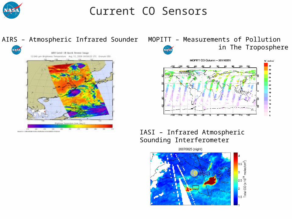
Current CO Sensors
AIRS – Atmospheric Infrared Sounder MOPITT – Measurements of Pollution in The Troposphere
IASI – Infrared Atmospheric Sounding Interferometer
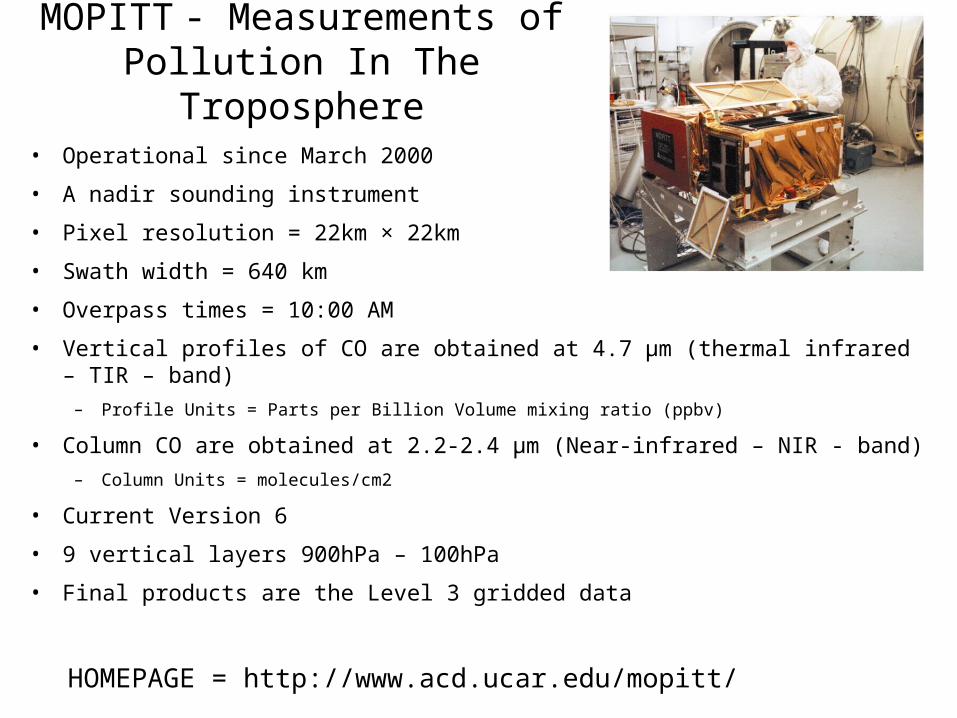
MOPITT - Measurements of Pollution In The Troposphere
• Operational since March 2000
• A nadir sounding instrument
• Pixel resolution = 22km × 22km
• Swath width = 640 km
• Overpass times = 10:00 AM
• Vertical profiles of CO are obtained at 4.7 μm (thermal infrared – TIR – band)
– Profile Units = Parts per Billion Volume mixing ratio (ppbv)
• Column CO are obtained at 2.2-2.4 μm (Near-infrared – NIR - band)
– Column Units = molecules/cm2
• Current Version 6
• 9 vertical layers 900hPa – 100hPa
• Final products are the Level 3 gridded data
HOMEPAGE = http://www.acd.ucar.edu/mopitt/

4
AIRS
• Operational since Sept. 2002• A nadir sounding instrument.• Pixel size = 14 km at nadir
41 x 21 km edges• Swath width = 1650 km• Overpass times
• 13:30 AM (Ascending orbit)• 13:30 PM (Descending orbit)
• 9 vertical layers (904.866 hPa – 0.016 hPa)• Profile Units = Volume mixing ratio
• Total Column CO measurements provided in units = molecules/cm2• Data Source: L2 orbit and L3 gridded 1o×1o resolution• Version 6 just came out – available Level 2 only. Level 3 still V5.
HOMEPAGE: http://airs.jpl.nasa.gov
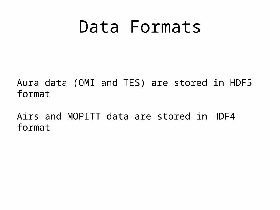
Data Formats
Aura data (OMI and TES) are stored in HDF5 format
Airs and MOPITT data are stored in HDF4 format

File Names
Level 3: AIRS.2013.03.07.L3.RetStd_IR001.v5.0.14.0.G13067153748.hdf
Level 2: AIRS.2009.12.03.131.L2.RetStd.v5.0.14.0.G2002123120634.hdf
Date Level ProductType
Version
Granule number = There are 240 granules/day
MOPITT L3: MOP03N-20020119-L3V3.1.2.hdf
AIRS
DateShort Name
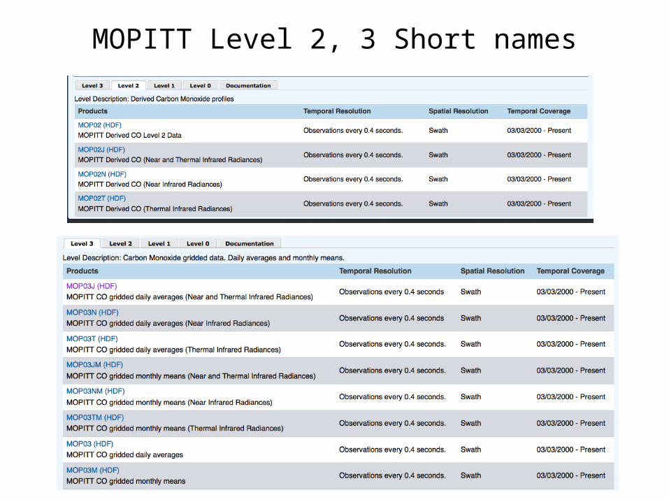
MOPITT Level 2, 3 Short names
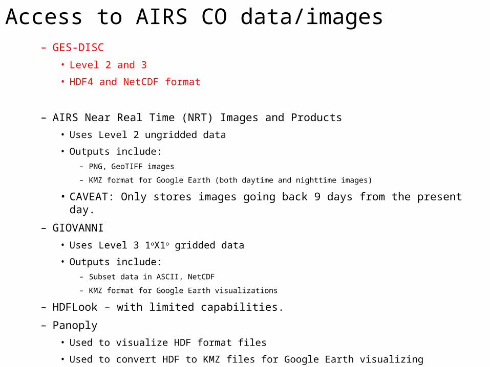
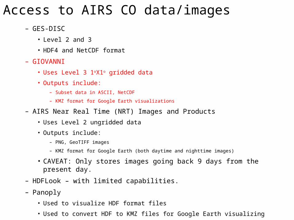
Access to AIRS CO data/images– GES-DISC
• Level 2 and 3
• HDF4 and NetCDF format
– AIRS Near Real Time (NRT) Images and Products
• Uses Level 2 ungridded data
• Outputs include:
– PNG, GeoTIFF images
– KMZ format for Google Earth (both daytime and nighttime images)
• CAVEAT: Only stores images going back 9 days from the present day.
– GIOVANNI
• Uses Level 3 1oX1o gridded data
• Outputs include:
– Subset data in ASCII, NetCDF
– KMZ format for Google Earth visualizations
– HDFLook – with limited capabilities.
– Panoply
• Used to visualize HDF format files
• Used to convert HDF to KMZ files for Google Earth visualizing
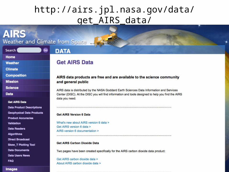
http://airs.jpl.nasa.gov/data/get_AIRS_data/

Goes to a product summary page with links to the Instrument and product documentation
Level 2 AIRS2RET andLevel 3 AIRS3STD are the standards daily products
HSB is a humidity sensor that failed in 2003
AMSU is a temperature sounder
Product Information and access to AIRS data can be found here: http://disc.sci.gsfc.nasa.gov/AIRS/data-holdings/by-data-product/data_products.shtml
Take you to the Mirador search engine. There is the optoin to on vert to Net CDF format
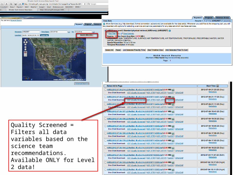
Quality Screened = Filters all data variables based on the science team recommendations.Available ONLY for Level 2 data!
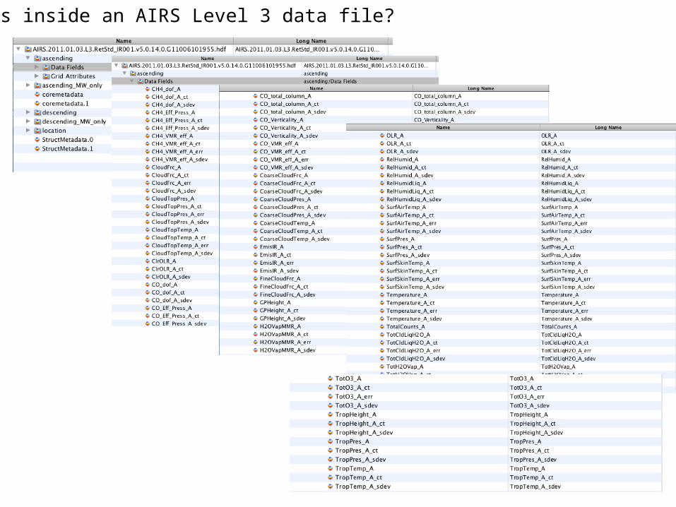
What’s inside an AIRS Level 3 data file?
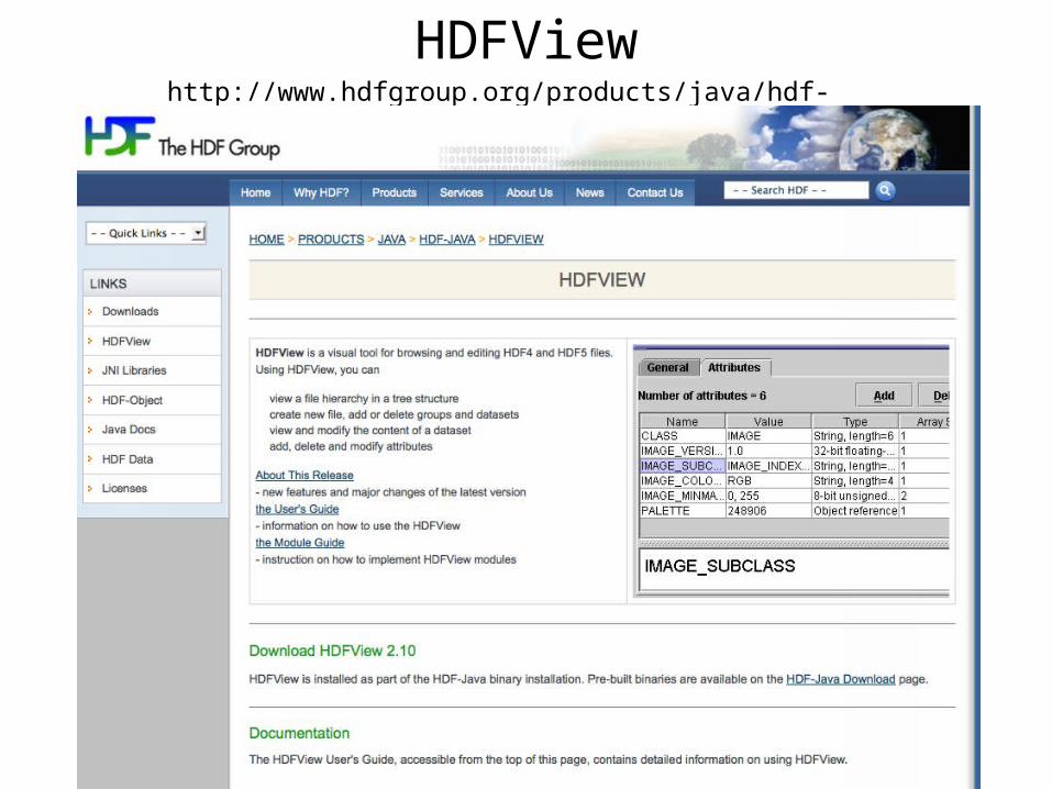
http://www.hdfgroup.org/products/java/hdf-java-html/hdfview/
HDFView
Access to AIRS CO data/images– GES-DISC
• Level 2 and 3
• HDF4 and NetCDF format
– GIOVANNI
• Uses Level 3 1oX1o gridded data
• Outputs include:
– Subset data in ASCII, NetCDF
– KMZ format for Google Earth visualizations
– AIRS Near Real Time (NRT) Images and Products
• Uses Level 2 ungridded data
• Outputs include:
– PNG, GeoTIFF images
– KMZ format for Google Earth (both daytime and nighttime images)
• CAVEAT: Only stores images going back 9 days from the present day.
– HDFLook – with limited capabilities.
– Panoply
• Used to visualize HDF format files
• Used to convert HDF to KMZ files for Google Earth visualizing

GIOVANNI Level 3http://gdata1.sci.gsfc.nasa.gov/daac-bin/G3/gui.cgi?instance_id=AIRS_Level3Daily
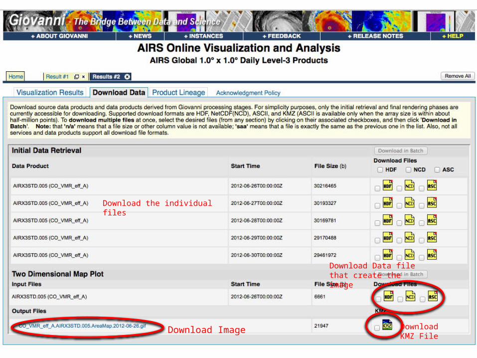
Download Image
Download Data file that create the image
Download the individual files
Download KMZ File

http://gdata1.sci.gsfc.nasa.gov/daac-bin/G3/gui.cgi?instance_id=AIRS_Level3DailyIF AIRS Level 3 1x1 degree resolution is too course then another option is to use Level 2 data – either NRT or downloaded from the Goddard DISC.
Access to AIRS CO data/images– GES-DISC
• Level 2 and 3
• HDF4 and NetCDF format
– GIOVANNI
• Uses Level 3 1oX1o gridded data
• Outputs include:
– Subset data in ASCII, NetCDF
– KMZ format for Google Earth visualizations
– AIRS Near Real Time (NRT) Images and Products
• Uses Level 2 ungridded data
• Outputs include:
– PNG, GeoTIFF images
– KMZ format for Google Earth (both daytime and nighttime images)
• CAVEAT: Only stores images going back 9 days from the present day.
– HDFLook – with limited capabilities.
– Panoply
• Used to visualize HDF format files
• Used to convert HDF to KMZ files for Google Earth visualizing

AIRS NRT Products and Images Website:http://disc.sci.gsfc.nasa.gov/nrt/data-holdings/airs-nrt-products/
There is a Near-Real Time (NRT) product that exports KMZ files but is available for data going back 9 days only. This product is great for capturing events as they happen!
NRT Level 2 data, PNG, GeoTIFF, and KMZ files are availabe at this site. BUT historic data is not available.

AIRS NRT Products and Images Website:http://disc.sci.gsfc.nasa.gov/nrt/data-holdings/airs-nrt-products/ To get KMZ files for Google Earth:1. click on “2. AIRS NRT Images”2. Click on where it says ‘KMZ’

Note: These NRT data are in parts per billionA = Ascending (daytime) and D = Descending (nighttime) are included.

CO ImageryAIRS – Atmospheric Infrared Sounder
• AIRS Homepage: http://airs.jpl.nasa.gov/• Version 5 documentation = http://disc.sci.gsfc.nasa.gov/AIRS/documentation/v5_docs• Data from GES DISC: http://disc.sci.gsfc.nasa.gov/AIRS/data-holdings/by-data-product/data_products.shtml• Near-Real-Time imagery and KMZ files for AIRS CO.
http://disc.sci.gsfc.nasa.gov/nrt/data-holdings/airs-nrt-products/airs-nrt-products - WMS• Link page for archival and Near-Real-Time imagery as well as special collections.
http://disc.sci.gsfc.nasa.gov/AIRS/additional/gallery

Access to AIRS CO data/images– GES-DISC
• Level 2 and 3
• HDF4 and NetCDF format
– GIOVANNI
• Uses Level 3 1oX1o gridded data
• Outputs include:
– Subset data in ASCII, NetCDF
– KMZ format for Google Earth visualizations
– AIRS Near Real Time (NRT) Images and Products
• Uses Level 2 ungridded data
• Outputs include:
– PNG, GeoTIFF images
– KMZ format for Google Earth (both daytime and nighttime images)
• CAVEAT: Only stores images going back 9 days from the present day.
– HDFLook – with limited capabilities and a large learning curve.
– Panoply
• Used to visualize HDF format files
• Used to convert HDF to KMZ files for Google Earth visualizing
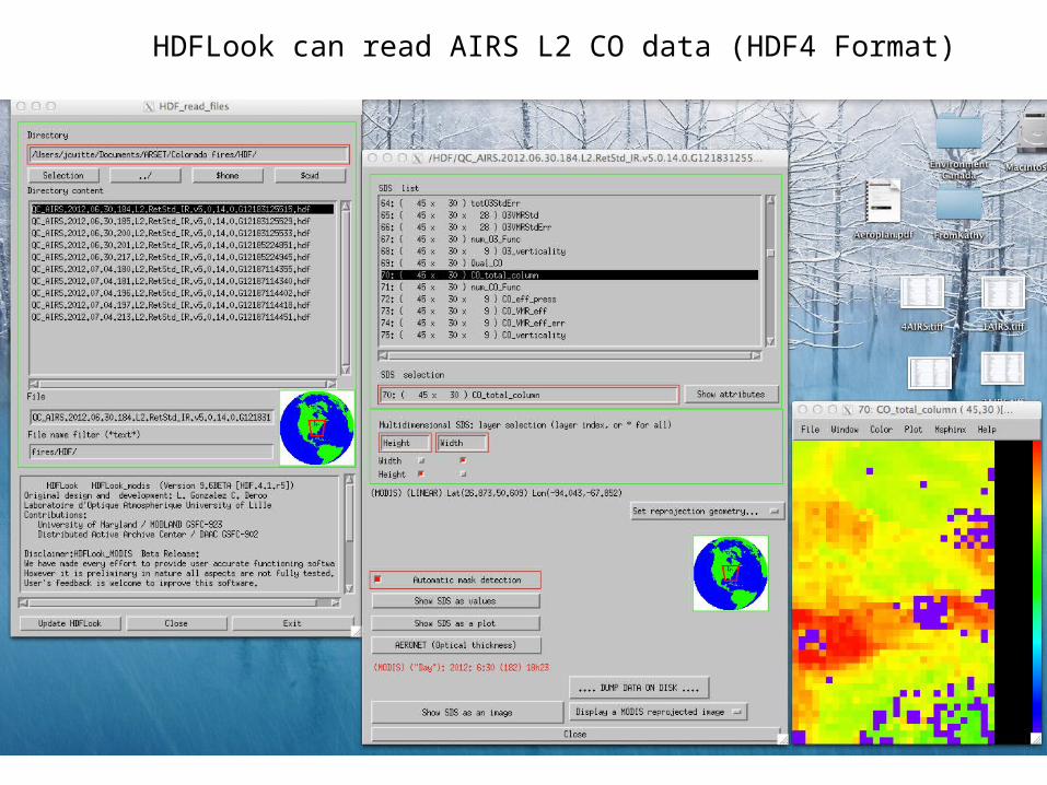
HDFLook can read AIRS L2 CO data (HDF4 Format)
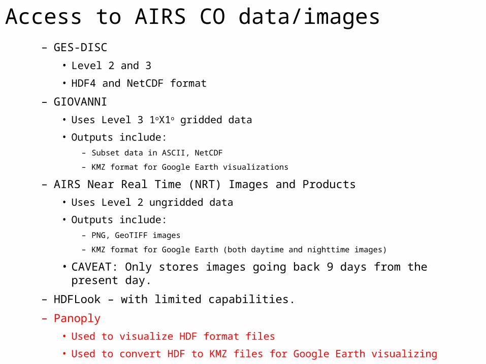
Access to AIRS CO data/images– GES-DISC
• Level 2 and 3
• HDF4 and NetCDF format
– GIOVANNI
• Uses Level 3 1oX1o gridded data
• Outputs include:
– Subset data in ASCII, NetCDF
– KMZ format for Google Earth visualizations
– AIRS Near Real Time (NRT) Images and Products
• Uses Level 2 ungridded data
• Outputs include:
– PNG, GeoTIFF images
– KMZ format for Google Earth (both daytime and nighttime images)
• CAVEAT: Only stores images going back 9 days from the present day.
– HDFLook – with limited capabilities.
– Panoply
• Used to visualize HDF format files
• Used to convert HDF to KMZ files for Google Earth visualizing
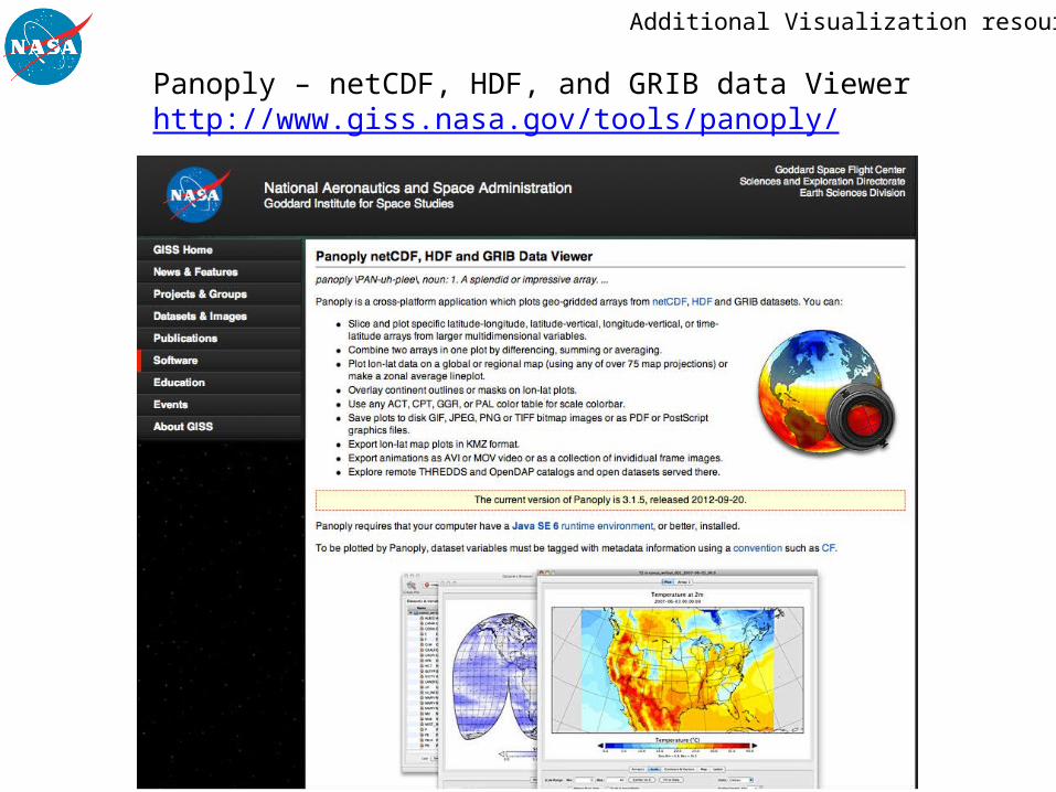
Panoply – netCDF, HDF, and GRIB data Viewerhttp://www.giss.nasa.gov/tools/panoply/
Additional Visualization resources

Worldview https://earthdata.nasa.gov/labs/worldview/
Filtered to show high CO events only, i.e. > 98.9 ppb

Access to MOPITT Data and Imagery

MOPITT now has an interactive visualizerHomepage: http://www.acd.ucar.edu/mopitt/
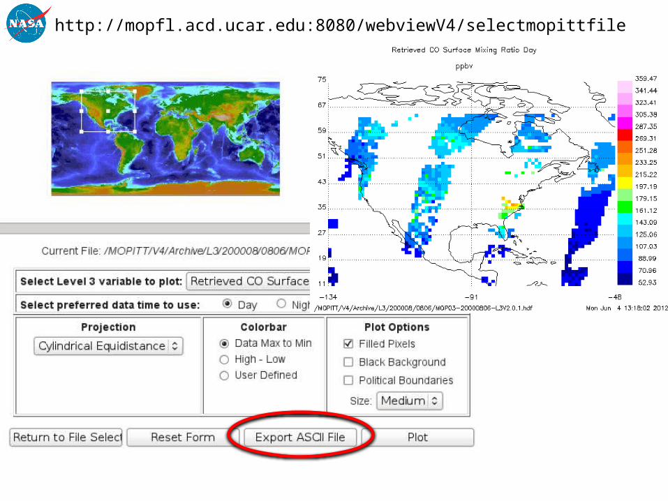
http://mopfl.acd.ucar.edu:8080/webviewV4/selectmopittfile

Unlike AIRS - there is NO real-time MOPITT data availablehttp://www2.acd.ucar.edu/mopitt/visualization.shtml

MOPITT (+ all NASA EOS satellite) data are available at EOSDIS – NASA’s Earth Observing System Data and
Information System
http://reverb.echo.nasa.gov
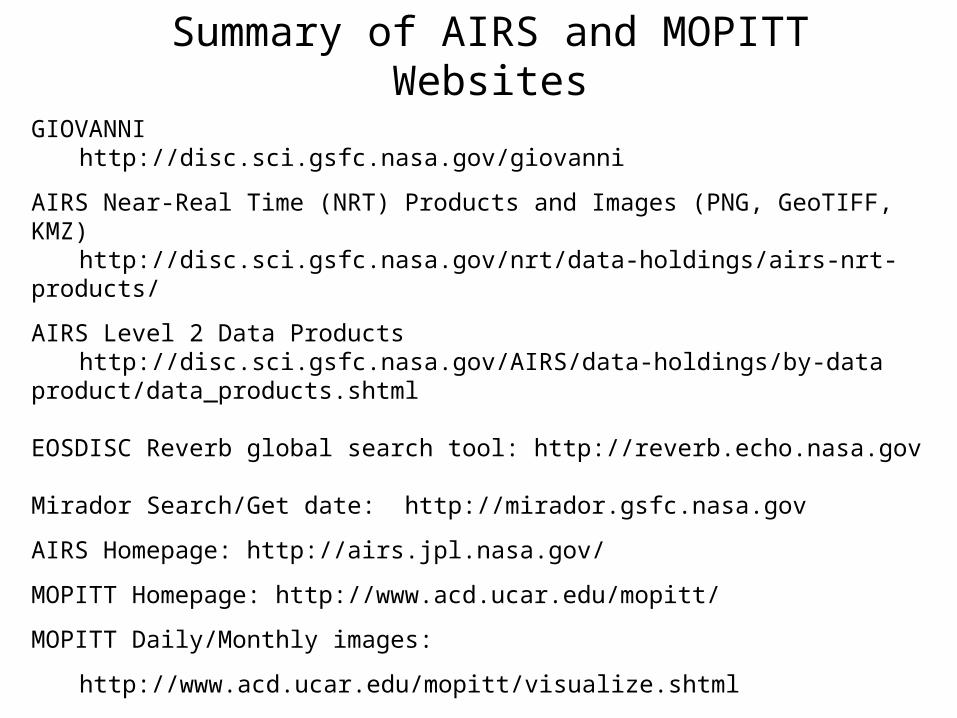
GIOVANNI http://disc.sci.gsfc.nasa.gov/giovanni
AIRS Near-Real Time (NRT) Products and Images (PNG, GeoTIFF, KMZ) http://disc.sci.gsfc.nasa.gov/nrt/data-holdings/airs-nrt-products/
AIRS Level 2 Data Products http://disc.sci.gsfc.nasa.gov/AIRS/data-holdings/by-data
product/data_products.shtml
EOSDISC Reverb global search tool: http://reverb.echo.nasa.gov
Mirador Search/Get date: http://mirador.gsfc.nasa.gov
AIRS Homepage: http://airs.jpl.nasa.gov/
MOPITT Homepage: http://www.acd.ucar.edu/mopitt/
MOPITT Daily/Monthly images:
http://www.acd.ucar.edu/mopitt/visualize.shtml
http://mopfl.acd.ucar.edu:8080/webviewV4/selectmopittfile
Summary of AIRS and MOPITT Websites
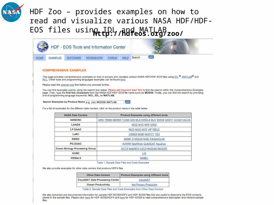
HDF Zoo – provides examples on how to read and visualize various NASA HDF/HDF-EOS files using IDL and MATLAB http://hdfeos.org/zoo/