agricultural site selection among permanent field
TRANSCRIPT

J. Ethnobiol. 6(2):279-288 Winter 1986
AGRICULTURAL SITE SELECTIONAMONG PERMANENT FIELD FARMERS:
AN EXAMPLE FROM EAST KALIMANTAN, INDONESIA
CHRISTINE PADOCHInstitute of Economic BotanyNew York Botanical Garden
Bronx, NY 10458
ABSTRACT.-Traditional cultivators usually examine a number of environmentalvariables before choosing a site for agricultural production. In contrast to most studiesof site selection, which focus on procedures followed by shifting cultivators, this articlediscusses the criteria employed by a population of permanent field cultivators of EastKalimantan, Indonesia. The Lun Dayeh, irrigated rice farmers of the Kerayan Subdistrict,differ from shifting cultivators in many of the criteria they employ in selecting a site,in their pattern of long-term observation of selected factors, and in their willingness tosubstantially alter the site. Important in their choice of a potential agricultural site isan assessment of the amount of labor that is required to render that site acceptable forpermanent cultivation.
INTRODUCTION
Many detailed studies of traditional fanning systems have noted the great competenceof tribal and peasant cultivators in judging and distinguishing the subsistence potentialof particular parts of their territories. It has been shown, for instance, that most farmersdo not select sites for new agricultural fields randomly, nor for arcane magical reasons.Farmers choosing cultivation sites review both past and present conditions; they recallthe cropping history, if any, of an area and carefully examine the standing vegetationits age and composition-before selecting a location for a new year's field (Conklin 1957,Clarke 1971,Watters 1970). Sound judgement of soils and their capabilities for agriculturalproduction also enters into decisions on siting of farms (Conklin 1957, Richards 1939,Allan 1965), as do several other concerns, among them relative distance to farms ofrelatives and co-workers (Freeman 1970, Deegan 1973), and proximity to other fieldsworked by the same household (Padoch 1982).
Geographers and anthropologists are not alone in noting the knowledge that manypre-industrial populations have of the physical characteristics of their environments.Development planners, among them agronomists, agricultural economists, and othershave concluded that especially in the agriculturally marginal tropical environments thatare often largely unknown to university-trained scientists, indigenous tribal peoples canbe extremely competent consultants on the use and development of their own territories(Brokensha et al. 1980).
Most studies of traditional soil classification and agricultural site selection havefocused on the procedures by which shifting cultivators choose an area for their annualfarms. With few exceptions (e.g. Conklin 1980), little has been written on the knowledgeof soils and other environmental variables that preindustrial or pre-literate permanentfield cultivators possess. This is at least partly because many swiddeners annually choosewhere to farm, while most permanent field farmers, as the designation implies, cultivatethe same fields each year. The latter tend to live at far higher population densities andfarm what land they already own. Patterns of land tenure therefore tend to be by farthe most important determinants of where a farm is situated. Most permanent field

280 PADOCH Vol. 6, No.2
fanners choose a new site to put into cultivation very infrequently and thus researchersrarely have the opportunity to observe the procedures involved in selecting new areasfor permanent fields.
"Permanent field farming" encompasses many different types of resource use andtherefore the environmental variables that farmers consider vary greatly from oneagricultural system to another. In all instances, however, decisions of where to site apermanent field take into account long-term agricultural suitability; swiddenerscommonly need judge only whether an area will support cultivation for a year or two.Thus choices made by permanent field farmers will differ from those of swiddeners intwo general ways: first, a great deal of long-term observation is usually involved inmaking selections of permanent sites. And second, since they regard the new field asa long-term investment and frequently are willing to change several environmentalfactors to make the site more acceptable, the choices made by permanent field cultivatorstypically include an estimate of the amount and type of labor needed to put a particulararea into a useable state. Shifting cultivators engage in far less environmental manipulation other than the clearing of sites.
THE LUN DAYEH OF NORTHEASTERN BORNEO
The Lun Dayeh of East Kalimantan in Indonesia practice both shifting and permanent field irrigated cultivation of rice and a number of subsidiary crops l, and are notedthroughout much of Borneo for their abundant annual rice harvests (Padoch 1985). Thesuccess of Lun Dayeh fanning has been attributed by many not familiar with the group'shomelands to extremely favorable natural conditions for agriculture, particularly tofertile soils. A closer examination, however, shows that the Kerayan Subdistrict, wheremost of East Kalimantan's Lun Dayeh live and farm, is a highly varied region, blessedonly in very limited areas with exceptionally good conditions for rice production. Thesuccess of Lun Dayeh agriculturists is more reasonably attributed to their detailedknowledge of the environments they exploit, to their sound judgments of where to sitetheir fields, and to their good management practices.
The site selection criteria employed by one Lun Dayeh population have beendescribed (Deegan 1973) and are, according to the report of the researcher, largely similarto those used by swiddeners throughout the tropics; the height or age of vegetationcovering a plot is apparently the prime factor considered. These farmers, recentimmigrants to the Lawas Damit Basin of Sarawak, are, however, quite atypical amongLun Dayeh agriculturists. They are mainly shifting cultivators and have few irrigatedrice fields. The wet rice cultivators living in the Kerayan uplands of East Kalimantan,Indonesia, the traditional Lun Dayeh homeland, observe other environmental factorsand emphasize different criteria in choosing sites for their irrigated permanent fields.
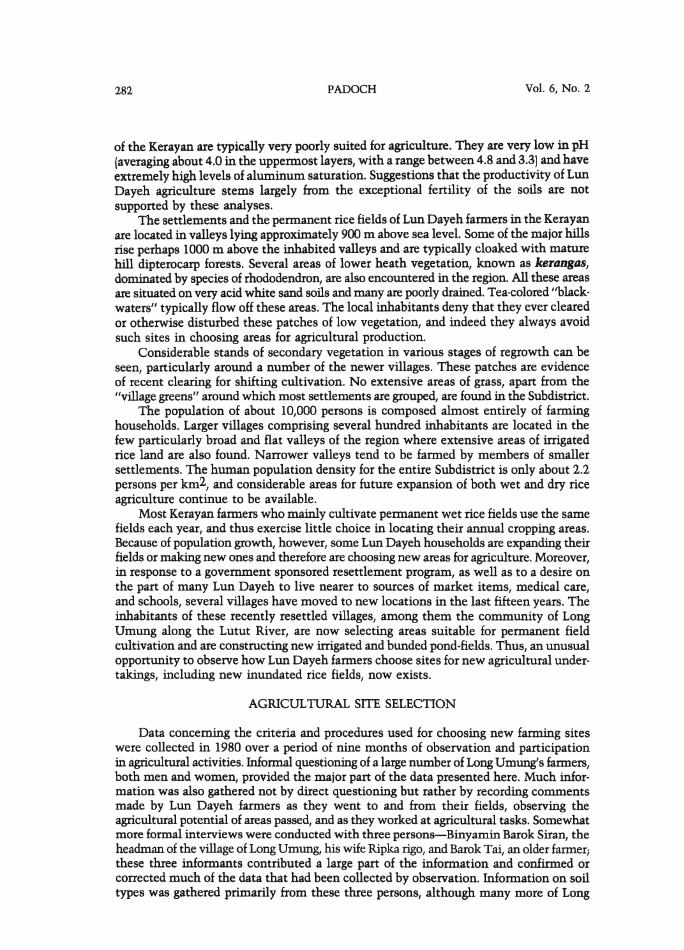
The Kexayan Subdistrict. -The Kerayan Subdistrict, located in the northeastern comerof the District of Bulungan, along the border with Malaysia, comprises an area of3,930 km2 (Fig. 1).Topographically, it is a region of hills, often steep, divided by severalbroad, flat valleys. The area was described in general terms by Schneeberger in 1945.Since then, no specific information on the topography or geology of this region has beenpublished. The geology and soils of the neighboring parts of the Malaysian state of Sarawakwere recently surveyed, mapped, and described (Eilers and Loi 1982); the maps,unfortunately, stopped at the international frontier. Although a government-sponsoredpreliminary geologic survey of the Kerayan Subdistrict was carried out in 1980, theinformation gathered has not been made available to the public.
The volume on northern interior Sarawak and information given by the geologicsurveyers in the Kerayan (J-L. Nagel, pers. comm.) both suggest that the area is underlain

Winter 1986
Malaysia
JOURNAL OF ETHNOBIOLOGY
East Kalimantan
\\~
\
Central Kalimantan r<j \.
,j
iSouth)\alimantan:).
..: ..t.: ••
281
IndonesiaScale 1:10,000,000
FIG. I-Map of Borneo (Kalimantan) indicating the location of the research area.
largely by alternating bands of sandstones and shales, which give rise both to the brokentopography and the variable soils of the region. The principal river draining the area,the Kerayan, and its tributaries, the Lutut and the Bawan, have their headwaters in theSubdistrict and are surprisingly slow flowing, silt-laden streams. Only farther downriverdoes the Kerayanbecome a rushing rapid-filledriver more characteristic of upland Borneowaters (see Schneeberger 1945, for details on the area's topography).
The underlying parent materials-sandstone and shale-have contributed to theformation of sandy and clayey soils characteristic of the Kerayan area. A chemical analysisof representative soils of the region (Padoch 1981: Appendix 1) showed that the soils
282 PADOCH Vol. 6, No.2
of the Kerayan are typically very poorly suited for agriculture. They are very low in pH(averaging about 4.0 in the uppermost layers, with a range between 4.8 and 3.3) and haveextremely high levels of aluminum saturation. Suggestions that the productivity of LunDayeh agriculture stems largely from the exceptional fertility of the soils are notsupported by these analyses.
The settlements and the permanent rice fields of Lun Dayeh farmers in the Kerayanare located in valleys lying approximately 900 m above sea level. Some of the major hillsrise perhaps 1000 m above the inhabited valleys and are typically cloaked with maturehill dipterocarp forests. Several areas of lower heath vegetation, known as kerangas,dominated by species of rhododendron, are also encountered in the region. All these areasare situated on very acid white sand soils and many are poorly drained. Tea-colored "blackwaters" typically flow off these areas. The local inhabitants deny that they ever clearedor otherwise disturbed these patches of low vegetation, and indeed they always avoidsuch sites in choosing areas for agricultural production.
Considerable stands of secondary vegetation in various stages of regrowth can beseen, particularly around a number of the newer villages. These patches are evidenceof recent clearing for shifting cultivation. No extensive areas of grass, apart from the"village greens" around which most settlements are grouped, are found in the Subdistrict.
The population of about 10,000 persons is composed almost entirely of farminghouseholds. Larger villages comprising several hundred inhabitants are located in thefew particularly broad and flat valleys of the region where extensive areas of irrigatedrice land are also found. Narrower valleys tend to be farmed by members of smallersettlements. The human population density for the entire Subdistrict is only about 2.2persons per km2, and considerable areas for future expansion of both wet and dry riceagriculture continue to be available.
Most Kerayan farmers who mainly cultivate permanent wet rice fields use the samefields each year, and thus exercise little choice in locating their annual cropping areas.Because of population growth, however, some Lun Dayeh households are expanding theirfields or making new ones and therefore are choosing new areas for agriculture. Moreover,in response to a government sponsored resettlement program, as well as to a desire onthe part of many Lun Dayeh to live nearer to sources of market items, medical care,and schools, several villages have moved to new locations in the last fifteen years. Theinhabitants of these recently resettled villages, among them the community of LongUmung along the Lutut River, are now selecting areas suitable for permanent fieldcultivation and are constructing new irrigated and bunded pond-fields. Thus, an unusualopportunity to observe how Lun Dayeh fanners choose sites for new agricultural undertakings, including new inundated rice fields, now exists.
AGRICULTURAL SITE SELECTION
Data concerning the criteria and procedures used for choosing new farming siteswere collected in 1980 over a period of nine months of observation and participationin agricultural activities. Informal questioning of a large number of LongUmung's fanners,both men and women, provided the major part of the data presented here. Much information was also gathered not by direct questioning but rather by recording commentsmade by Lun Dayeh farmers as they went to and from their fields, observing theagricultural potential of areas passed, and as they worked at agricultural tasks. Somewhatmore formal interviews were conducted with three persons-Binyamin Barok Siran, theheadman of the village of Long Umung, his wife Ripka rigo, and Barok Tai, an older fanner;these three informants contributed a large part of the information and confirmed orcorrected much of the data that had been collected by observation. Information on soiltypes was gathered primarily from these three persons, although many more of Long

Winter 1986 JOURNAL OF ETHNOBIOLOGY 283
Umung's inhabitants participated in soil sample collection, color and texture evaluation,and lengthy discussions of agricultural worth. All interviews and discussions wereconducted in the Lun Dayeh language.
LongUmung is a relatively new village having been settled approximately thirteenyears agoby Lun Dayeh migrants. When these settlers first arrived at their new site alongthe upper Lutut, they produced the rice they needed by cultivating impermanent swiddens. Virtually every year since their move to the Long Umung site, however, thesefarmers have been opening up more and more land for permanent field agriculture andreducing the size of their swiddens accordingly. The area around Long Umung offersconsiderable opportunities for irrigated field cultivation although abundant room forcontinued shifting cultivation can also be found.
When determining the use to which a plot of land in the Kerayan should be put,farmers consider many variables. As in other wet rice farming areas (Conklin 1980), thetopography, particularly the slope, of the area is an extremely important criterion.The farmers of LongUmung also assess the previous agricultural history of the site, andits vegetative, pedological, and hydrological characteristics before deciding on its useas a permanent, dyked and inundated field, a temporary swidden, a house site, or an areato be left in natural forest vegetation.
To be a prime site for inundated permanent field farming, a plot of land should belocated not far from the farmer's home. It should also be flat and extensive, close to aclear stream which flows in all seasons but is not subject to excessive natural flooding,with heavy, fertile soils (as indicated by the soil color and texture and/or by the sizeand type ofvegetation coveringthe plot), and, if it has previously been cultivated, it shouldhave a history of abundant rice production. Although most plots available for development now do not possess all of these desirable characteristics, a number of environmentalfactors can and usually are altered to some degree to approach more closely the ideal,even though such alterations are usually costly in time and labor.
Location of fields.-General considerations such as distance from the site of residence,as well as distance from other areas farmed by the same household, are rarely mentionedin published discussions of agricultural site selection. However, since location ofteninfluences the time and effort a farmer must put into activities such as travel, cropprotection, and the building of irrigation facilities, distance is often important in thedecision of where to locate a field whether it is to be a swidden or an irrigated farm.Farmers especially wish to locate permanent fields close to permanent homes. Swiddenscan often be made far from the village; a small shelter can serve as a temporary residencefor a year or so until that field is no longer intensively cultivated (Freeman 1970; Padoch1982, on dampa, temporary Iban residences).
The recent directive from the Indonesian government to group small villages ininterior Kalimantan into larger population concentrations, has met with some resistencein the Kerayan, since for many farmers such a move involves spending additional timein walking each day to and from fields. Lun Dayeh, like many other cultivators alsoattempt to locate new farms close to other farms being worked in the same season; awide scattering of fields increases the labor required in protecting crops from thedepredations of sparrows, monkeys, and other animals. (The Lun Dayeh constructingenious systems of alarm devices over large fields which can be operated by just oneperson sitting in a central location.) If fields are far apart, more labor, for many householdsa scarce resource, is required for proper protection of fields2.
Topography, Water, and Drainage.-Swiddeners consider a broad range of topographicconditions acceptable for swidden sites; slopes of up to 40° are often farmed in Borneo.However, in selecting a plot for an irrigated pond-field, minor differences in topography
284 PADOCH Vol. 6, No.2
become important. Flat valleys are ideal and slopes are avoided, if possible, becausealthough topography can be and usually is altered somewhat, a great deal of labor isconsumed in this task. Ideally, valleys should also be wide and long so that large areascan be enclosed and servedby a single set ofengineering works for irrigation and drainage.As the Kerayan Subdistrict is rather sparsely populated, terracing of sloping lands is stillminimal. Most farmers continue to be successful in locating plots where farms ofsignificant size can be made with minimal earth moving. Such opportunities areclearly decreasing.
At present Lun Dayeh consider almost level terrain to be a sine qua non forestablishing a new agricultural plot, another requirement is a nearby source of waterof suitable quality and availability. Two kinds of water are distinguished by LongUmungfarmers:black (tea-colored) waters and clear waters. It has been pointed out by researchers,particularly those working in the Amazon Basin (Sioli 1975; Klinge 1967), that blackwaters generally flow off white sand soils and are poor in nutrients and low in pH.Although no analyses were done of Kerayan black waters, their chemical characteristicswere assumed to be similar and indeed, the Lun Dayeh, also aware of the nutrient povertyof such black waters, avoid them in selecting areas for the practice of wet rice cultivation. Waters used for irrigating rice fields are always clear.
Availability of water is as important as quality. Farmers casually observe potentialareas for wet rice cultivation throughout a year or more to determine whether sufficientirrigation water is apt to be available in all seasons of the agricultural year. Again, aswith topography, water availability is a condition which can be altered and generallyis changed somewhat by the construction of irrigation canals, bamboo aqueducts, andwater gates. All these alterations, of course, require considerable labor and farmersattempt to minimize the changes that must be made by carefully selecting a proper site.
Areas that are naturally inundated can serve as favorable sites for wet rice farmingonly if the water is not too deep and the area does not flood excessively at any timeduring the year. Farmers often make note of the depth of standing water on such a siteeach time he or she passes through the area over a period of several years. Occasionallyvery deep areas are made shallower by dumping earth into the site, but because of thelarge investment of labor required for such improvements, deeply inundated areas aregenerally avoided.
Soils and Vegetation.-While permanent field wet rice cultivators differ from swiddenersin considering factors such as topography and water quality and availability in makingsite selections, they also take into account soils and vegetation, the two prime criteriathat concern shifting cultivators. Their judgements here differ as well: permanent fieldfarmers can and do choose at times to considerably modify the soils of their sites;swiddeners, as a rule, do not. As pointed out in several other studies of indigenous soilclassification systems, color and texture of soils tend to be considered most prominentlywhen sites for agricultural plots are chosen (Conklin 1957, Reina 1967, Carter 1967).The Lun Dayeh also focus largely on these two qualities.
Soils are classified by color into "white" (mebuda' , "black" (mitem), "red" (masia',and "yellow" (mebirar). ("Red" and "yellow" are rather poor translations of the last two;the distinction between "red" and "yellow' , and masIa' and mebirar is made verydifferently by an English-speaking investigator and a Lun Dayeh farmer.) Cutting acrosseach of these color categories are classifications relating largely to soil texture, that isIIsandy" (mebada?, IIclayey" (mesallt), livery hard or heavy clay" (metuelJ), and IIstony"(gdfere). There is also a term, meroko, for a layer or mat of roots that overlies somesoils, a condition found in several sites around Long Umung. And there are two othergeneral terms or categories applied to soils: one, mebaleng, denoting a generally fertileand easily worked soil, which is often an alluvial soil and metugelJ, a generally infertile,
Winter 1986 JOURNAL OF ETHNOBIOLOGY 285
poor soil, which is often also metuelJ or a very heavy clay. A few other soil type namesare used to refer to very specific soil types such as tana'luyan, a bright red heavy clayand tana' mefayelJ or bada' buda', an almost pure white sand, a soil to be avoided inalmost any agricultural undertaking.
This classification of soils is similar to the systems employed by swiddeners to findan appropriate site for a temporary field. What does distinguish Lun Dayeh observationand classification of soils from those employed by shifting cultivators is the care thesepermanent field cultivators take in examining soils in depth. Lun Dayeh farmers arewell aware of the fact that soils vary with depth and take into account the possiblitythat their efforts at leveling a site may result in their either removing or uncoveringa soil layer that is either more or less desirable for rice production. Thus some farmerswill dig to see what kinds of soils they are apt to uncover if they remove the top layerof soil in constructing a new field. Commonly occurring soil profiles, however, are ratherwell known and farmers know what sorts of "B" horizons are apt to be found under which/IA" horizons. Thus, an informant stated that although a layer of tana' meroko or analmost purely organic root mat can be removed when a field is being made, this is rarelyworth the effort and thus is seldom done because such root mats commonly overlie verypoor mefayelJ soils. It is recognized that changing the soil surface can result in theuncovering of both better or worse surfaces for rice production.
The possibilities for modifying a site's soils do not end with changes that result fromleveling the area; particular sites may also be given different treatments depending ontheir shortcomings. Although Lun Dayeh pond field making involves far less soilpreparation than is the norm in irrigated rice systems3, plots with soils judged to bemetugeh or hard and infertile are sometimes altered by tethering a water buffalo in thespot over a period of a week or so. The buffalo will both puddle the soil and fertilize itby defecating in the field. Thus a particular treatment can make a site more appropriatefor cultivation. The shifting cultivator, employing a particular site for only a very limitedperiod generally will not spend the time or resources on fertility enhancement proceduresother than the burning of slashed vegetation and perhaps the spreading of the resulting ash.
Invariably the prime cirteria used by a shifting cultivator in determining whethera spot is suitable for a swidden are the height and general composition of the vegetationon it, often indications of the age of the stand. For the Lun Dayeh permanent field farmerheight, or age of vegetation is only important if it serves to indicate whether thesoils are so poor that nothing other than scrub growth will appear or whether the plotis regularly inundated. The swiddener's preoccupation with the age of the stand whichdetermines the ease of forest clearance, the quality of the burn, and the quantity of theresultant ash, as well as the presence or absence of grasses and sedges that may becomeimportant pests do not concern the permanent irrigated field farmer.
Lun Dayeh cultivators survey vegetation to get some indication of the soils as wellas to judgethe flooding hazard at particular sites. Vegetation is important, as the presenceor absence of particular plants indicates a number of conditions, a "gestalt" importantfor the rice farmer. The particular species that the informants at LongUmung suggestedas especially useful for determining whether sites were suitable for the creation ofpermanent pond fields are listed in Table 1. It is interesting to note that judgementsof Lun Dayeh farmers as to the suitability of a site, as shown by the presence or absenceof these species of plants, were duplicated by a university trained ecologist well familiarwith Borneo. Dr. Paul Chai, Forest Botanist of Sarawak, identified the plant specimensand, relying on his extensive general knowledge of local ecology, independently evaluatedeach plant as an indicator of agricultural potential. His ratings were exactly the sameratings as those of the Lun Dayeh informants. The nine species listed are those mostcommonly known and identified. Many Lun Dayeh informants could also name dozens

286 PADOCH Vol. 6, No.2
Table I.-Common plant species indicating agricultural potential.
Lun Dayeh Condi.Species Family name indicat.
Rubus moluccensis L. Rosaceae serinit good
Selaginella aff. btevipes Fee Selaginaceae gugor good
Piper aff. caninum Blume Piperaceae buyu' berek good
Cutculigo bomeensis Merr. Hypoxidaceae lapa' good
Cyttandta tiisepala C.B.L. Gesneriaceae taneb luba' average
Lycopodium cernuum L. Lycopodiaceae lio fade poor
Curculigo villosa Wall. Hypoxidaceae tamar poor
Timonius [inlaysonianusHook f. Rubiaceae anur sia' poor
Clethia lonspicata J.J.Sm. Clethraceae anur ferian poor
of other plants, particularly tree species, which are characteristically found in associationwith known soil types and with known agricultural potential.
Areas that are deemed unsuitable for either permanent or swidden cultivation maystill be used as house or village sites or may be left in natural forest. Such areas oftenstill serve as sources of important subsistence products, among them spontaneouslyoccurring fruits, leaves, fern shoots, and fungi. Animals are hunted in these forests, andmaterials for building, fuel, and handicrafts are collected.
SUMMARY AND CONCLUSIONS
Like shifting cultivators and other traditional agriculturists throughout the world,the Lun Dayeh of East Kalimantan's Kerayan Subdistrict weigh a number of environmental variables before selecting a site for a new agricultural field. While the environmental variables most important to swiddeners, including the composition and heightof the vegetation covering the area are taken into account, Lun Dayeh permanent fieldcultivators tend to be more concerned with other environmental characteristics, includingslope, water quality and availability, drainage, and soil quality both on and below thesurface. Moreover, they attempt to judgethe long-term acceptability of the site. Therefore,continuing observation of an area, often for years before it is first used, is not unusual.While the criteria for an acceptable site for an irrigated farm field are many, Lun Dayehcultivators assume that some changes will be necessary to bring a field to the conditionrequired. Therefore, a most important consideration is the amount of labor that will beneeded to render a site acceptable for pond-field fanning. Since population density inthe Kerayan is still low and almost ideal areas are available at present, Kerayan Lun Dayehfarmers continue to reject any site that requires major improvements such as significantterracing work, the filling in of sites that tend to flood too deeply, or the digging of longirrigation canals. As most easily worked areas are claimed in the future, what is judgedan acceptable site will certainly change, and the construction of ever more labordemanding engineering works will be considered necessary and reasonable.
A rather extreme example of another phase of this process is found among the Ifugaoof Luzon. According to the reports of Conklin (1980), the Ifugao, in choosing a site,consider the incline of an area the most important criterion. Since flat or gently slopinglands are no longer available in Ifugao, an acceptable slope is far more steep than anysite that the Lun Dayeh would attempt to exploit. Also important is availability of a
Winter 1986 JOURNAL OF ETHNOBIOLOGY 287
water supply upslope from the chosen site and location of materials necessary for thebuilding of terraces in the vicinity of the selected area; these include walling rock, roughfill, and topsoil. In the Ifugao case, cultivators do not expect to find, but rather to createmost of the conditions necessary for pond-field farming and their fields, in contrast tothose found in the Kerayan, can be considered largely artifacts, since the soil, includingsubsoil and the entire surface of each terrace, have been created with human labor.
The willingness and ability to alter environmental conditions, which in large measuredistinguishes Lun Dayeh pond-field farmers from their swiddening counterparts, isconsiderably more developed among wet rice farmers such as the Ifugao whose homelandsoffer fewer unexploited ideal sites for irrigated cultivation. A comparison of laborneeded to create pond fields in different areas would be interesting but is difficult becauseof the great variability of sites available in each location (Conklin 1980; Padoch 1981).However, initial pond-field creation costs as well as subsequent labor for maintenancein regions like Ifugao surely far surpass those found in the Kerayan. With ever increasingalteration of the original environment, the need for human labor in maintenanceconstantly increases as well. The Lun Dayeh, therefore, in seeking out areas that naturallymost closely approach the conditions desirable in an irrigated pond-field are minimizingnot only initial construction costs, but also subsequent maintenance.
ACKNOWLEDGEMENTS
The field research upon which this article is based was sponsored by the Consortium for theStudy of Man and His Global Environment (U.S. Man and Biosphere Committee) and funded bythe D.S.D.A.-Forest Service. I would like to thank Dr. Paul Chai, Forest Botanist of Sarawak andDirector of the Sarawak Herbarium for identifying the plants mentioned. I am also grateful to thefollowing colleagues for reading and commenting on an earlier version of this manuscript: DavidCampbell, Steven King, William Balee, and Julie Denslow.
LITERATURE CITED
ALLAN, W. 1965. The African husbandman. Barnes and Noble, New York.
BROKENSHA, D., D. M. WARREN andO. WERNER, eds. 1980. Indigenousknowledge systems and development. Univ. Press of America,Washington.
CARTER, W. E. 1969. New lands andold traditions: Kekchi cultivators inthe Guatemalan lowlands. Univ.Florida Press, Gainesville.
CLARKE, W. E. 1971. Place and people.Univ. California Press, Berkeley.
CONKLIN, H. C. 1957. Hanunoo agriculture. FAD, Rome.
_____. 1980. ethnographic atlasof Ifugao. Yale Univ. Press, NewHaven.
DEEGAN, J. L. 1973. Change among theLun Bawang: a Borneo people. Unpubl. Ph.D. dissert. (Anthropology),Univ. ofWas~on.
EILERS, R. G. and K. S. LOI. 1982. Thesoils of northern interior Sarawak,East-Malaysia. Dept. of AgricultureSarawak, Kuching.
FREEMAN, D. 1970. Report on the Iban.Athlone Press, London.
KLINGE, H. 1967. Podzol soils: a sourceof blackwater rivers in Amazonia.Pp. 117-125in Atas do simposio sobrea biota amazonica, Vol 3, (H. Lent,ed.) Conselho Nacional de Pesquisasda Amazonia, Rio de Janeiro.
PADOCH, C. 1981. A study of a Borneansystem of intensive agriculture as amodel for development. Unpubl.report. Consortium for the Study ofMan and His Global Environment(U.S. Man and Biosphere Committee,Washington) .
______. 1982. Migration and itsalternatives among the Iban ofSarawak. Verhandelingen van het
288 PADOCH
LITERATURE CITED (continued)
Vol. 6, No.2
Koninklijk Institut voor Taal-. Land-,en Volkenkunde 98, Martinus Niihoff, The Hague.
______. 1985. Labor efficiencyand intensity of land use in rice production: an example from Kalimantan. Human Ecol. 13(3):271-289.
REINA, R. 1967. Milpas and milperos:implications for prehistoric times.Am. Anthropol. 69(1):1-21.
RICHARDS, A. 1939. Land, labour, anddiet in Northern Rhodesia. International Institute for African Lang-
NOTES
uages and Customs, London.SCHNEEBERGER, W. F. 1945.The Kera
yan-Kelabit plateau of central northeast Borneo. Geogr. Rev. 25(4):544562.
SIOLI, H. 1975.Tropical rivers as expressions of their terrestrial environments. Pp. 275-288 in TropicalEcological Systems (F. B.Golley andE. Medina, eds.). Springer-Verlag,New York.
WAlTERS, R. F. 1970. Shifting cultivation in Latin America. FAD, Rome.
lGeneral descriptions of swidden or shifting cultivation as well as of irrigated, inundated, wet, orsawah systems of rice production can be found in many publications, among them Hanks' Rice andMan (1972) and the introductory chapter to Geertz' Agricultural Involution (1963). Although theirrigated rice cultivation patterns employed by the Kerayan Lun Dayeh depart somewhat from theclassic sawah techniques described in the above works (Padoch 1985), the general characteristicsof Lun Dayeh farming, including their temporal aspects, are similar to the well-known models.
2For a general discussion on labor requirements in Kerayan Lun Dayeh agriculture see the articleby Padoch (1985). Freeman's (1970) and Padoch's (1978) monographs on Iban swiddeners discussthe need for guarding crops from animal depredations in one area of Borneo.
3Lyn Dayeh irrigated rice fanners do not plow or puddle their plots, as do most wet rice fanners.For further discussion of agricultural techniques and labor expenditure in the Kerayan, see Padoch(1985).