africa unit 6 grade social studies - the teachers’ loungejuliekeefe.com/5136/laurensunit.pdf · 7...
TRANSCRIPT
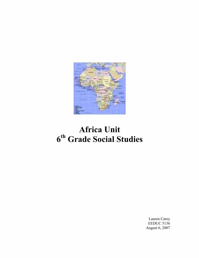
Africa Unit6th Grade Social Studies
Lauren CareyEEDUC 5136
August 6, 2007
2
Table of Contents
I. Overview
II. Research Summary – Teaching Geography – Beyond the Map
III. Lessons
a. Initial Lesson – Where in the world is Africa?
b. Inspiration Lesson - What makes one part of Africa different from another
part?
c. Cross Circular Lesson - Live from Africa – Weather forecast based on
climate and ecosystem
d. Primary Source Lesson - People and Cultures of Africa
e. Final Lesson - Using the Newspaper to Locate Africa
IV. Website Review – NationalGeographic.com
V. Evaluation – Day in the Life Journal Entry
VI. Annoted Bibliography

3
Overview
The unit was designed for a sixth grade class with the intention on teaching
students about the physical and cultural geography of Africa. The lesson were based on
the standards in the Massachusetts History and Social Science Curriculum Frameworks
for sixth grade classrooms. The lessons address history and geography standards that are
general (identifying how atlases are organized) as well as standards that are specific to
the continent of Africa, such as locating the continent on a world map and recognizing
countries and major cities of Africa.
Another factor in this unit selection was to promote personal learning of the
continent. I barely recall any learning in my prior education on the continent. I wanted
to learn not only about the physical landmarks of Africa, but also about the people of
Africa. I feel like in our technologically connected world, we should learn about the
various people that occupy our planet.
The Africa unit is an attempt to dispel myths of Africa that are perpetuated in
textbooks and through the media. Throughout the unit, students will learn that Africa is a
continent representing many countries and cultures. Students will learn the people of
Africa embody many different cultures. Students will also learn that Africa does not
consist solely of villages, Africa has major cities. Students will walk away from these
lesson with a greater understanding for the similarities and differences of Africa, not only
the people, but also the physical geography of the continent.

4
Research Summary
Teaching Geography – Beyond the Map
When some people think of geography, they may recall a class in which they
looked at a map and located states or nations on maps. They may have learned of
geographical terminology and learned the capitals of states or countries. The idea of
geography needs to be expanded as we are living in an increasingly connected global
sphere. Students need to study geography to dispel stereotypes, gain knowledge of
different cultures, and examine and scrutinize current events. How can we expect the
students of today to become leaders of tomorrow without an understanding of the world
that they live in?
Carano and Berson (2007) write that several studies have shown that youths and
young adults in the United States are lacking geographical wisdom. The deficiency of
geographical knowledge can be seen is stark when compared to the awareness of peers
from other industrialized nations from across the globe. Some American students are
unable to locate countries such as Brazil or Iraq on a world map.
Not only are students unable to locate where certain countries are on a map, they
are also susceptible to stereotypes that are portrayed in the media. It is important to note
that some stereotypes are perpetuated in classroom textbooks; these textbooks may show
a distorted view of foreign cultures. An important part of education, especially in the
case of social studies, is learning how to sort through bias in the media and textbooks.
Several suggestions are offered to aid students in geography scholarship. Carano
and Berson (2007) suggest using technology in the classroom to breakdown some of the
barriers in this discipline. They suggest that Internet offers interconnectivity to other
students across the globe. Through this strategy, learners can share their thoughts and
ideas with other learners. The website http://www.epals.com/?id=siteLogo, offers
students and teachers the opportunity to communicate with students across the globe.
Another suggestion is to use new web sites to allow students to be cognizant of
world events. This allows students to see what events are occupying the headlines and
thoughts of the countries that they are studying. It would be valuable for students to

5
compare and contrast foreign headlines with those of the world headlines that are
published in the United States.
A third technological initiative is to use map sites such as Google Maps to
become aware of the world’s physical makeup. Through map sites such as Google,
students are granted virtual access to new environments that are thousands of miles away
from their homes and classrooms. Students can explore terrain that they may never get to
experience first hand.
Another suggestion to enhance pupils’ global awareness is to immerse them in a
current “hot topic”. Sweeney (1997) captures the essence of a project done with fourth
grade students on the subject of the South African apartheid and elections of the mid
1990’s. The students were exposed to documentaries, photographs, literature, and news
headlines about the apartheid. The students connected this period with that of the
American Civil Rights movement.
These learners participated in a multi-disciplinary study of South Africa. Their
exposure to South Africa had connections to math, reading, writing, music, and art. The
students also taught their new knowledge to their peers at the school through a play that
was to be performed to other students at the school in grades three through five. Not
only did this experience expose the students to another culture and geography, they
became experts in the subject and were able to teach their peers.
Geography is not a subject that is just limited to maps and technical terms. It is a
subject that exposes learners to world events. Through the study of geography, students
can become citizens of the world by learning about other people is distant lands. This
allows students to be empathetic to plights of people who are not as fortunate as they are.
It also rejects myths that students may have of citizens of other countries. Students in the
United States may discover that their interests may mirror those of their peers in foreign
countries. The comprehensive study of geography exposes the commonalities that exist
between all people of the planet.
6
Lesson Plans

7
Where in the world is Africa?
Africa Unit – Initial Lesson Plan – Sixth Grade
Purpose:
Based on the Massachusetts State Frameworks, students have worked on map and globe
skills in their elementary school education. In this lesson students will extend their
knowledge of geographic terms and apply them to the continent of Africa.
Objectives:
• Students will locate the continent of Africa on a world map.
• Students will demonstrate an understanding that Africa is comprised of over fifty
countries.
• Students will label the African countries and their capitals.
• Students will distinguish the major regions of the continent.
• Students will name significant geographical features of Africa.
Connection to the MA State History and Social Science Frameworks (Sixth Grade):
5. Identify how current world atlases are organized and the kind of information they
provide for each continent and country.
A.1 On a map of the world, locate the continent of Africa, the Atlantic Ocean, the Indian
Ocean, the Mediterranean Sea, and the Great Rift Valley. On a map of Africa, locate the
northern, eastern, western, central, and southern regions of Africa, the Sahara Desert, the
Nile River, Lake Victoria, Mount Kilimanjaro, and the Cape of Good Hope.
A.2 Use a map key to locate the countries and major cities in Africa.
Materials:
Africa is Not a Country, by Margy Burns Knight
World map large enough for entire class to see
World map handouts for each student
Africa map copies for each student (countries labeled by number)

8
Corresponding numbered sheet for labeling countries
One atlas per four students
Pencils
Colored pencils, crayons, or markers
Social studies folder
Labeled African map for student assessment
Procedures:
Activating Activity: Read Africa is Not a Country aloud to the class.
Core Procedures:
1. Ask the class what they know about Africa (this can be country names, geographic
regions, major geographical landmarks, or notable Africans).
2. Distribute world maps to each student.
3. Ask a student volunteer to identify Africa on the large class map.
4. Instruct the class to locate Africa after they see their peer identify it on the classroom
map.
5. Ask a students how big Africa is in comparison to the rest of the continents.
6. Discuss the size of the continent.
7. Ask and then discuss how many countries Africa consists of.
8. Distribute blank maps of Africa to each student.
9. Assign students to six pre-determined groups.
10. Distribute atlas to each group.
11. Distribute crayons, colored pencils, and markers to the class.
12. Students will use atlases to identify African countries and label them on their maps.
13. Students will be instructed to also name and label each nations capital on the map.
14. Students will color each country and will be instructed to make sure that each
adjacent country is not the same color.
15. After completing the exercise, students (in their groups) will show the teacher their
Africa maps.
16. Students will file the completed maps in their social studies folder.

9
Closing Procedure: Students will be assigned different groups for the next day’s lesson.
There will be five groups to study the northern, eastern, western, middle, and southern
regions.
Assessment:
The teacher will look over each student’s map in comparison to the master copy to ensure
that all countries were identified correctly.
Modifications:
• Students with ADHD can be assigned the role of materials distributors.
• The map of Africa will be labeled by number and a separate sheet of paper with
those numbers will be available for students to label the smaller land-locked
countries.
• Students will be asked to identify twenty-five of the countries instead of all fifty-
three African countries.
Extensions:
Students can write down questions that they would like answers to about Africa.


11

12

Lesson Plan Sources
http://nationalgeographic.com/xpeditions/atlas/africa/africa-bw.pdf. Retrieved July 16, 2007This link is an unlabeled map of Africa.
http://nationalgeographic.com/xpeditions/atlas/africa/africa-dw.pdf. Retrieved July 16, 2007.This link is a labeled map of Africa which identifies each country.
http://nationalgeographic.com/xpeditions/atlas/world/world-d.pdf. Retrieved July 16, 2007This link provides a blank world map.
Knight, M.B. (2001). Africa is not a country. Brookfield, CT: Millbrook Press
14
What makes one part of Africa different from another part?
Africa Unit - Inspiration Lesson Plan – Sixth Grade
Purpose:
In this lesson, students will work cooperatively in groups to study the different regions of Africa. Their
study will include understanding the countries that exist in the region, the climate, wildlife, major physical
characteristics, and major natural resources. This lesson will be a jigsaw lesson, as different groups will
present their newly acquired knowledge to the rest of the class.
Objectives:
• Students will work cooperatively in groups to research their given region of Africa.
• Students will present their findings to the class.
• Students will use different research sources such as the Internet, textbook, and atlas to fill in their
graphic organizers.
• Students will expand on critical thinking skills to examine settlement and economies of African
countries based on climate, physical characteristics, natural resources, and population size.
• Students will demonstrate ability to use the Internet as a classroom resource
Connection to the MA State History and Social Science Frameworks (Sixth Grade):
A.3 Explain how the following five factors have influenced settlement and the economies of major African
countries and regions. (G, E)
A. absoulte and relative locations
B. climate
C. major physical characteristics
D. major natural resources
E. population size
Materials:
Regions of Inspiration® created Africa graphic organizers (multiple copies for each student)
One atlas per four students
Pencils and pens
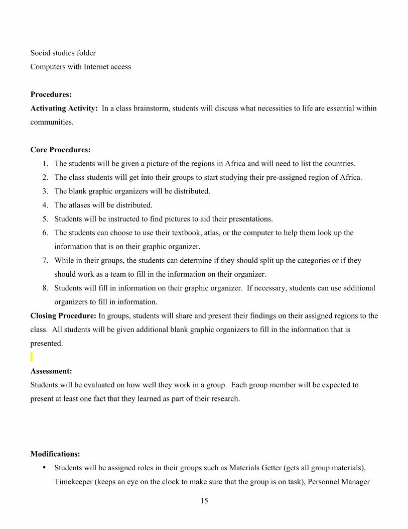
15
Social studies folder
Computers with Internet access
Procedures:
Activating Activity: In a class brainstorm, students will discuss what necessities to life are essential within
communities.
Core Procedures:
1. The students will be given a picture of the regions in Africa and will need to list the countries.
2. The class students will get into their groups to start studying their pre-assigned region of Africa.
3. The blank graphic organizers will be distributed.
4. The atlases will be distributed.
5. Students will be instructed to find pictures to aid their presentations.
6. The students can choose to use their textbook, atlas, or the computer to help them look up the
information that is on their graphic organizer.
7. While in their groups, the students can determine if they should split up the categories or if they
should work as a team to fill in the information on their organizer.
8. Students will fill in information on their graphic organizer. If necessary, students can use additional
organizers to fill in information.
Closing Procedure: In groups, students will share and present their findings on their assigned regions to the
class. All students will be given additional blank graphic organizers to fill in the information that is
presented.
Assessment:
Students will be evaluated on how well they work in a group. Each group member will be expected to
present at least one fact that they learned as part of their research.
Modifications:
• Students will be assigned roles in their groups such as Materials Getter (gets all group materials),
Timekeeper (keeps an eye on the clock to make sure that the group is on task), Personnel Manager

16
(group leader determines if the group will work together or individually to fill out their organizer),
and Reporter(s) (will present the group’s findings).
Extensions:
If some groups finish before the rest of the class, they can choose a book about Africa (fiction or non-
fiction) to read quietly.

17
Inspiration Maps

Eastern Region of
Africa
Climate Countries & Population
Sizes
Major Physical Characteristics
Major Natural
Resources
Wildlife
123
123
123
123
1234567891011
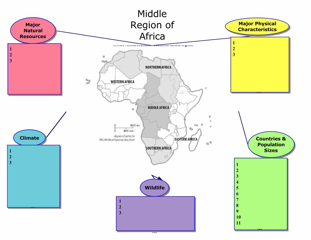
Middle Region of
Africa
Climate Countries & Population
Sizes
Major Physical Characteristics
Major Natural
Resources
Wildlife
123
123
123
123
1234567891011

Northern Region of
Africa
Climate Countries & Population
Sizes
Major Physical Characteristics
Major Natural
Resources
Wildlife
123
123
123
123
1234567891011

Southern Region of
Africa
Climate Countries & Population
Sizes
Major Physical Characteristics
Major Natural
Resources
Wildlife
1234567891011
123
123
123
123

Western Region of
Africa
Climate Countries & Population
Sizes
Major Physical Characteristics
Major Natural
Resources
Wildlife
123
123
123
123
1234567891011
18
Lesson Plan Sources
Brock, B.J. & LeVasseur, M. (2006). Africa contemporary issues content guide for educators. In National
Geographic Education and Children’s Programs. Retrieved July 23, 2007, from
http://www.nationalgeographic.com/xpeditions/guides/contempafricaguide.pdf
This document provided a map used in the Inspiration® graphic organizers.
Inspiration (Version 8) [Computer software]. Beaverton, OR: Inspiration Software Inc.
This software was used to create the graphic organizers used in the lesson.

19
Live from Africa – Weather forecast based on climate and ecosystem
Cross Circular Lesson Plan – Africa Unit – Sixth Grade
Purpose
The students have studied the various regions of Africa and have identified the climate, natural resources,
major physical landmarks, wildlife, and countries. In this lesson, the students will tie in their science
knowledge with geographic knowledge to examine the impact of climate in their given region. The student
groups will present their findings to the entire class in the form of a weather forecast.
Objectives
• The students will examine the ways how climate and land forms affect African ways of life.
• The students will explore pre-assigned regions of Africa and the major physical features such as the
Namib Desert and the Nile River Valley.
• The students will discuss the features of Africa’s landscape.
• The students will classify climates of Africa.
Connection to MS State History and Social Science Frameworks (Sixth Grade)
• MA.1. - Concepts and Skills: History and Geography: Explain the difference between absolute and
relative location and give examples of different ways to indicate relative location for countries or
cities across the world. (G)
• MA 6.4. - Concepts and Skills: History and Geography: Explain the difference between absolute and
relative location and give examples of different ways to indicate relative location for countries or
cities across the world. (G)
Connection to MA Science and Technology/Engineering Curriculum Framework (Sixth Grade)
• MA.2. - Living Things and Their Environment: Give examples of ways in which organisms interact
and have different functions within an ecosystem that enable the ecosystem to survive.
• MA 2.13. - Living Things and Their Environment: Give examples of ways in which organisms
interact and have different functions within an ecosystem that enable the ecosystem to survive.
• MA 2.17. - Changes in Ecosystems Over Time: Identify ways in which ecosystems have changed
throughout geologic time in response to physical conditions, interactions among organisms, and the

20
actions of humans. Describe how changes may be catastrophes such as volcanic eruptions or ice
storms.
Materials
Computer with projector
Notebooks
Pens/Pencils
Large Map of Africa
Pre-cut weather symbols, such as a sun, clouds, monsoon, etc…
List of student African region groups
Procedures:
Activating Activity
Using the computer and the projector, play Africa: Land and Resources video from United Streaming
http://www.unitedstreaming.com/search/assetDetail.cfm?guidAssetID=ccaa50f1-11ee-4c3e-89a2-
413083e3bae1
Core Procedures
1. The teacher informs the students that they are going to create a weather forecast for their region of
Africa.
2. The students will get into their Regions of Africa Group (they worked in these groups when they
were gathering data on the regions of Africa).
3. The students, in their groups, decide who will be the meteorologist, the forecast writers, the map
director, and the producer of their weather segment.
4. The students will discuss the climate(s) in their regions.
5. The students will work together to research what types of weather are applicable to the climate(s).
6. The forecast writers will write the broadcast. The producer will work with the meteorologist and map
director to decide how they will present their broadcast.
7. Students will write and print their forecast.
8. The “gopher” student will make copies of their groups forecast for each student in class.

21
Closing Procedures
Students will present their weather forecast to the class.
Assessment
Students will be graded against the rubric. Students will be assessed on working collaboratively in a group.
Students must define the climate and ecosystem for the class.
Modifications
There are various roles a student can have within their groups.
The map will be large so that all students can see it.
Groups will distribute a printed forecast to students with auditory difficulties.
Extensions
If students finish early, they can fill in a Word Search on regions and countries in Africa.

22
Lesson Plan Sources
Africa: Land and Resources. AIMS Multimedia(2001). Retrieved July 31, 2007, from unitedstreaming:
http://www.unitedstreaming.com/
This is a video about Africa’s land and resources. The video is 18 minutes long. A teacher’s guide
is also within this link. The guide includes instructions on how to use the video and includes
suggestions for after the video. The guide also includes an introduction to the vocabulary.

23
People and Cultures of AfricaAfrica Unit – Primary Source Lesson Plan – Sixth Grade
Purpose
Before this lesson, the students discovered and explored Africa. At this point, they are able to name the
countries in Africa and studied the major regions of Africa. They have examined the physical aspects of the
major regions of the continent (absolute and relative locations, climate, wildlife, major physical
characteristics, major natural resources, and population sizes). It is now time for the students to study and
be introduced to the people and cultures of Africa. This will be a four-day lesson and project. The students
have also had a mini-lesson on what constitutes a primary source.
Objectives
• Students will navigate the Internet to find reliable primary sources.
• Students will discern primary sources from secondary sources.
• Students will examine the people and cultures of the major regions of Africa.
• Students will utilize and demonstrate proficiency in using PowerPoint.
• Students will compile cultural information to be presented in PowerPoint.
• Students will present their learnings and teach the class.
Connection to the MA State History and Social Science Frameworks (Sixth Grade):
A.2 Use a map key to locate countries and major cities in Africa.
Optional topics for study:
Describe the major ethnic and religious groups in selected countries in Africa.
Describe the general level of education in selected countries in Africa and its relationship to the economy.
Describe the political and social status of women in selected countries in Africa.
Materials
Journal entry written by Richard Lipinski Jr.
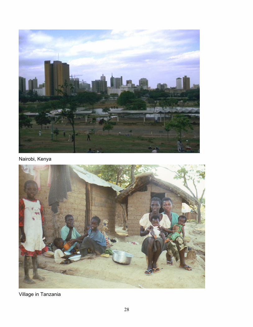
Pictures of village in Tanzania
Pictures of Nairobi, Kenya
Useful website list
Country names on separate pieces of paper
Empty bag or hat

24
Computer Lab
Computers with Internet access for each student
PowerPoint
Red plastic cups
Rubric
Computer projector
Procedures
Activating Activity –. The teacher will read the journal entry written by Richard Lupinski Jr. about life in a
small African village.
Core Procedures
1. The teacher will ask students if they think that all Africans live in small villages such as the one
described in the journal entry.
2. The teacher will show the class the picture of the city of Nairobi.
3. The teacher will inform the class that they are going to learn about the various cultures and people in
Africa.
4. The class will discuss what the definition of culture is.
5. The teacher will tell the class that they will teach their peers about various African cultures through
a PowerPoint presentation.
6. The teacher will walk around the classroom with a bag containing the names of pre-selected African
nations.
7. Each student will select one country name to study.
8. The students will be given the presentation rubric so that they are aware of which items they must
include in their presentation.
9. Students will be told that they can add extra items about the culture and people of their nation.
10. Students will be given a list of helpful websites for their project.
11. The class will discuss the difference between a primary and secondary source (this is an item on
their rubric).
12. The class will get in line to go to the computer lab.
13. The class will walk to the computer lab.
14. Computers will be turned on for students to start working immediately.
15. Students will be given two full class periods to research their country.
Day Three

25
1. Students will be given one class period to put their PowerPoint presentation together.
2. During Writer’s Workshop, students will share their presentation for peer editing with one classmate
(groups are pre-selected).
Day Four
1. The final class period for this lesson will be devoted to sharing the presentations.
Closing Procedures
Students will present their findings to the class.
Assessment
Presentations will be graded based upon a rubric.
Modifications
• Website lists are distributed to aid all students in their search, especially those with organizational
issues. The website list will also be posted on the class website so that students can simply click on
the links in the document.
• Red plastic cups will be next to each computer. If a student faces a roadblock he or she will place it
on top of the computer monitor indicating that they will need some help.
• Groups are pre-selected during peer-editing so that stronger writers are paired with students whose
writing skills are still developing.
Extensions
If students are finished early with peer editing, they can go to the music station in the classroom to listen to
African music. Students also have the option to read books about Africa.
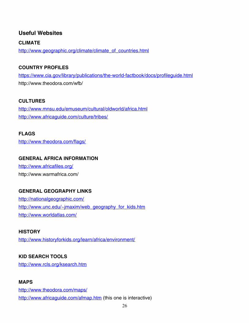
26
Useful WebsitesCLIMATEhttp://www.geographic.org/climate/climate_of_countries.html
COUNTRY PROFILEShttps://www.cia.gov/library/publications/the-world-factbook/docs/profileguide.html
http://www.theodora.com/wfb/
CULTUREShttp://www.mnsu.edu/emuseum/cultural/oldworld/africa.html
http://www.africaguide.com/culture/tribes/
FLAGShttp://www.theodora.com/flags/
GENERAL AFRICA INFORMATIONhttp://www.africafiles.org/
http://www.warmafrica.com/
GENERAL GEOGRAPHY LINKShttp://nationalgeographic.com/
http://www.unc.edu/~jmaxim/web_geography_for_kids.htm
http://www.worldatlas.com/
HISTORYhttp://www.historyforkids.org/learn/africa/environment/
KID SEARCH TOOLShttp://www.rcls.org/ksearch.htm
MAPShttp://www.theodora.com/maps/
http://www.africaguide.com/afmap.htm (this one is interactive)
27
MEDICALhttp://www.africaguide.com/health.htm
http://www.ncbuy.com/travel/health/report_country.html?code=ct
http://www.thirdworldtraveler.com/Disease/diseases_NAfrica.html
PEOPLEhttp://pbskids.org/africa/myworld/index.html (kids in Africa)
PICTUREShttp://images.google.com/imghp?hl=en&tab=wi
TEACHER RESOURCEShttp://www.pbs.org/wnet/africa/
VEGATATIONhttp://www.theafricangarden.com/page58.html
http://www.southafrica-travel.net/pages/e_plants.htm
WEBQUESThttp://members.tripod.com/africa_cms_cwr/home3.htm
WILDLIFEhttp://www.africanzebra.com/?f
http://www.awf.org/
http://www.ecotravel.co.za/Guides/Wildlife/Vertebrates/Mammals/Big_5/Big_5_of_Southern_Afric
a.htm
http://www.sa-venues.com/wildlife/default.htm
28
Nairobi, Kenya
Village in Tanzania
29
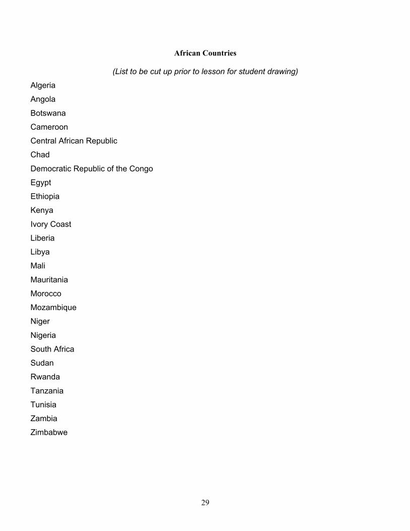
African Countries
(List to be cut up prior to lesson for student drawing)
Algeria
Angola
Botswana
Cameroon
Central African Republic
Chad
Democratic Republic of the Congo
Egypt
Ethiopia
Kenya
Ivory Coast
Liberia
Libya
Mali
Mauritania
Morocco
Mozambique
Niger
Nigeria
South Africa
Sudan
Rwanda
Tanzania
Tunisia
Zambia
Zimbabwe
30
African Culture Rubric

African Culture Rubric
No map or pictures.
No list of culturalitems (religion,language, homes,tribes)
Country map labeledwith capital city andeither major cities ornatural physicalcharacteristics.
Picture of capital city.
Pictures of people.
List of commonreligions.
List of commonlyspoke languages.
List of tribes.
Labeled countrymap with capital,major cities andmajor naturalphysicalcharacteristics.
Picture of capitalcity.
Pictures of people.
List of commonreligions.
List of commonlyspoke languages.
List of tribes.
Pictures of homes.
Labeled country mapwith capital, majorcities and majornatural physicalcharacteristics.
Picture of capital city.
Pictures of people.
List of commonreligions.
List of commonlyspoke languages.
List of tribes.
Pictures of homes.
Pictures of art.
Examples ofliterature.
Type of industry (ex.Agricultural,Manufacturing,Mining)
RequiredComponents
10 points
Not focused onresearch duringcomputer time.
No cited sources.
Made ample use ofcomputer time. Metminimum number ofrequired items.
Cited sources.
Made good use ofcomputer time andfound a few non-required items.
Cited sources.
Made excellent useof computer time andfound several extranon-required items.
Cited sources.
Research
10 points
Needs WorkSatisfactoryProficientExcellent

African Culture Rubric
Sometimes the fontsare easy-to-read, butin a few places the useof fonts, italics, bold,long paragraphs, coloror busy backgrounddetracts and does notenhance readability.
The layout is cluttered,confusing, and doesnot use spacing,headings andsubheadings toenhance thereadability.
Sometimes the fontsare easy-to-read, butin a few places the useof fonts, italics, bold,long paragraphs, coloror busy backgrounddetracts and does notenhance readability.
The layout showssome structure, butappears cluttered andbusy or distracting withlarge gaps of whitespace or uses adistractingbackground.
Sometimes the fontsare easy-to-read, butin a few places the useof fonts, italics, bold,long paragraphs, coloror busy backgrounddetracts and does notenhance readability.
The layout useshorizontal and verticalwhite spaceappropriately.
The fonts are easy-to-read and point sizevaries appropriately forheadings and text.
Use of italics, bold, andindentations enhancesreadability.
Text is appropriate inlength for the targetaudience .
Creative use of colorsand background.
The layout is visuallypleasing andcontributes to theoverall message withappropriate use ofheadings, subheadingsand white space.
PowerPoint
5 points
The text is written withno errors in grammar,capitalization,punctuation, andspelling.
The text is written withno errors in grammar,capitalization,punctuation, andspelling.
The text is written withno errors in grammar,capitalization,punctuation, andspelling.
The text is written withno errors in grammar,capitalization,punctuation, andspelling.
Content
10 points
Needs WorkSatisfactoryProficientExcellent

African Culture Rubric
Inaudible or too loud;no eye contact; ratetoo slow/fast; speakerseemed uninterestedand used monotone.
Did not captureaudience attention.
Some mumbling; littleeye contact; unevenrate; little or noexpression.
Held audience’sattention most of thetime.
Clear articulation butnot as polished.
Held audience’sattention most of thetime.
Poised, cleararticulation; propervolume; steady rate;good posture and eyecontact; enthusiasm;confidence.
Held attention ofaudience throughoutpresentation.
Oral
Presentation
5 points
Needs WorkSatisfactoryProficientExcellent

31
Lesson Plan Sources
http://members.tripod.com/africa_cms_cwr/index.htm. Retrieved on July 26, 2007.
This is WebQuest that has several informative links about various aspects of Africa.
http://images.google.com/imgres?imgurl=http://www.theodora.com/wfb/photos/kenya/KENYA2.jpg&imgr
efurl=http://www.theodora.com/wfb/photos/kenya/kenya_photos_01.html&h=407&w=593&sz=50&hl=en
&start=4&tbnid=icXS1fCOPHqU5M:&tbnh=93&tbnw=135&prev=/images%3Fq%3DKenya%26gbv%3D
2%26svnum%3D10%26hl%3Den. Retrieved on July 26, 2007.
This link shows a picture of the city of Nairobi, Kenya.
http://www.ridpa.org/photos/village-large.jpg. Retrieved on July 26, 2007.
This is a link to a photo of a village in Tanzania.
Lupinski, R. (2003-2005). Day to day life in a small African village. In Peace Corps Coverdell World Wise
Schools. Retrieved on July 26, 2007, from
http://www.peacecorps.gov/wws/stories/stories.cfm?psid=2&rid=afric##.
This link is a journal entry made by Richard Lupinski, Jr. It gives a good description of day-to-day
life in a small village in Tanzania.

32
Using the Newspaper to Locate AfricaAfrica Unit – Final Lesson Plan – Sixth Grade
Purpose
This is the final lesson in a unit on Africa. The students have located the continent of Africa as well as
countries and capitals. The have identified environmental concerns on the continent. In addition to
studying the physical geography, the students have educated their peers on various African cultures. In this
culminating lesson, the students will use the newspaper to study current issues on the continent.
Objectives
• Students will navigate the Internet to find reliable primary sources.
• Students will locate African current events in the newspaper or from online resources.
• Students will describe their current event findings to the class.
• Students will classify a current event into a category.
• Students will identify an African country on the map.
• Students will recall the names of African countries.
Connection to the MA State History and Social Science Frameworks (Sixth Grade):
A.2 Use a map key to locate countries and major cities in Africa.
Optional topics for study:
Describe the major ethnic and religious groups in selected countries in Africa.
Describe the general level of education in selected countries in Africa and its relationship to the economy.
Describe the political and social status of women in selected countries in Africa.
Materials
Article on recent event in Africa (found the day prior to the lesson)
Computer projector
Computer with Inspiration
Copies of the Boston Globe for each student (within the last few days)
Copies of Time for Kids for each student
Copies of National Geographic for each student
Computers with Internet access
List of news information websites
33
Class map
Pushpins
Procedures
Activating Activity –. The teacher will read an article about a recent event in Africa aloud to the class.
Core Procedures
1. The teacher will ask the class what they think constitutes a current event.
2. The class will brainstorm on general categories of current events.
3. The teacher and class will create description of current events using the Taba strategy on Inspiration.
4. The teacher will tell the students that they have to find an article on a current event in Africa.
5. The teacher will tell the students that they need to give a brief summary of their article in their own
words to the class at the end of the period.
6. The teacher instructs the students that there are various stations around the classroom to help them
with their search.
7. The list of useful news websites is distributed to the class.
8. The students can move around the classroom to each of the stations (newspaper, magazine, or
computer station) to find their article.
9. Once each student has found an article, they will go back to their desks or tables to read the article to
themselves and think how they will put it in their own words.
10. The students will present their articles to the class.
Closing Procedures
Students will take a push pin with a flag on it and stick their push pin in the classroom map to identify
where their event took place.
Assessment
Each student will be expected to find at least one article on one or more countries in Africa and give a brief
summary to the class. Students must locate their country on the classroom map.
Modifications
• Website lists are distributed to aid all students in their search, especially those with organizational
issues. The website list will also be posted on the class website so that students can simply click on
the links in the document.

34
• Red plastic cups will be next to each computer. If a student faces a roadblock he or she will place it
on top of the computer monitor indicating that they will need some help.
• A worksheet with definitions of current events will distributed to the class to help students with
classifying events.
Extensions
Students can create their own newspaper on African current events to share with their families. The
newspaper can be a compilation of articles that the class discovered.

35
USEFUL NEWS WEBSITES
http://news.nationalgeographic.com/news/index.html
This is a link from National Geographic. Sections found within the news section are; animals
& nature news, archeology & paleontology, environment, health, history & culture news, weird news,
space & science news, and travel & adventure news.
http://www.timeforkids.com/TFK/teachers/wr/1,27955,,00.html
This website is Time magazine for kids. Students can search through the current or past
issues. The site is also broken up into grade areas. This link is for grades 4-6.
http://pbskids.org/newsflashfive/?campaign=list_newsflashfive
This is the kids news section of the PBS website. Sections are broken into national
news, sports, arts and technology, science, and world news.

36
Some Types of Current Events
Weather
Sports
Politics
Arts
Science

37
Website Review
I found that nationalgeographic.com was an excellent resource in the development of the unit
on Africa. The maps available on the website are great and are available in a variety of formats. For
example, a map of Africa can be created without any of the political boundaries. There is an option
for a map with the boundaries. Further detail can be added with country labels.
Another feature that can be useful to students and teachers is the mapmachine section
available on the website. Within this section, theme maps can be created. This allows a visual
representation of some concepts that may be difficult to grasp. Students and teachers can create a
map that indicates projected environmental threats.
Finally, another area in which the website is useful in the ideas for lesson plans that are
available for educators. There seems to be an unlimited resource of lesson plans available.
Educators can take pieces of the lesson or use the entire lesson for instruction.
In summary, nationalgeographric.com provides several areas for use in the classroom. The
site offers maps and excellent lesson plans.
38
Africa Unit Assessment/Evaluation
The students have studied a unit on Africa. They have located Africa on a map. In addition, they
have identified the countries that comprise Africa with the state capitals. They have worked in a jigsaw to
learn about the regions of Africa. The students have explored various environmental concerns facing
Africa. They have also demonstrated an understanding of some of the numerous cultures. Finally, they
have also studied current events on the continent.
In this non-traditional assessment, the students will compose a day in the life journal entry of a
citizen of any country or region in Africa.

39
DAY IN THE LIFE JOURNAL ENTRY
You have studied the physical geography of Africa. You have also learned about the
people and cultures of Africa. This information has provided you with a solid base of knowledge
about what life is like in various countries in Africa.
In this take home assignment, you are asked to put yourself in the place of someone living
in Africa. You can choose to “live” in any country in Africa and can live in a village, town, or a city.
In this journal entry, you should describe what a typical day is like in your home. Please provide a
physical description of your home (city, village, or town). Include information about any major
natural physical landmarks. You must also discuss what is currently taking place in your country.
Feel free to include any pictures.
You will have one week to complete your assignment. Your notebooks and notes that you
took during your classmates’ presentations are a useful resource. Another useful resource is the
list of websites that was distributed towards the beginnings of our studies.
A rubric is attached to use a guide to evaluate your work.
HINT: It may be easier on you if you are writing from the country that you did your cultural
research on.
Have fun pretending that you are living somewhere far and exotic!

DAY IN THE LIFE JOURNAL ENTRY RUBRIC
EXCEPTIONAL COMMENDABLE SATISACTORY REWRITE
REQUIRED
INTRODUCTON
(15 Points)
First paragraph has a“grabber” or catchybeginning.
A catchy beginning wasattempted but wasconfusing rather thancatchy.
First paragraph has aweak “grabber”.
No attempt was made tocatch the reader’sattention in the firstparagraph.
CONTENT
(70 Points)
Detailed descriptions ofdaily life. The writerpaints a clear picture ofthis location. (25 points)Ideas communicatedclearly. (10 points)Physical description ofthe country is included.(10 points)A specifictown/city/village ismentioned. (10 points)Pictures are included. (5points)Current events arediscussed. (5 points)You mention youreducation and/or job. (5points)
A clear description ofthe location is discussed.(20 points)Ideas communicatedclearly. (10 points)Physical description ofthe country is included.(10 points)A specifictown/city/village ismentioned. (10 points)Pictures are included. (5points)You discuss youreducation and/or job. (5points)Current events arediscussed. (5 points)
A general region ofAfrica is describedwithout much detail. (15points)Communicated mainidea. (15 points)Major physicalcharacteristics aredescribed. (10 points)Current events arediscussed. (5 points)Pictures are included (5points)Minimal personal detailsare included. (5 points)
Vague description ofregion. (10 points)Ideas were vague. (10points)No mention of currentevents. (0 points)No personal details areincluded. (0 points)
MECHANICS
(10 Points)
Minimal spelling orgrammatical errors.All Ideas flow smoothlyinto each other.
A few grammatical orspelling errors, but doesnot impede reader’scomprehension.Most ideas flow intoeach other.
Several grammatical orspelling error, but doesnot interfere withreader’s understanding.Most ideas flow intoeach other.
Many grammatical orspelling errors thatresults in a hard tounderstand piece.Ideas and paragraphs arechoppy.
TIMELINESS
(5 Points)
Journal handed in ontime.
Journal handed in ontime.
Journal handed in ontime.
Journal was handed inpast the due date.

Bibliography
Africa: Land and Resources. AIMS Multimedia(2001). Retrieved July 31, 2007, from unitedstreaming:http://www.unitedstreaming.com/This is a video about Africa’s land and resources. The video is 18 minutes long. A teacher’s guide is alsowithin this link. The guide includes instructions on how to use the video and includes suggestions for afterthe video. The guide also includes an introduction to the vocabulary.
Brock, B.J. & LeVasseur, M. (2006). Africa contemporary issues content guide for educators. In NationalGeographic Education and Children’s Programs. Retrieved July 23, 2007, fromhttp://www.nationalgeographic.com/xpeditions/guides/contempafricaguide.pdfThis document provided a map used in the Inspiration® graphic organizers.
Carano, K., Berson, M. (2007, March/April). Breaking stereotypes: constructing geographic literacy and culturalawareness through technology. The Social Studies, 65(6). Retrieved on July 18, 2007, from ExpandedAcademic ASAP database.
http://images.google.com/imgres?imgurl=http://www.theodora.com/wfb/photos/kenya/KENYA2.jpg&imgrefurl=http://www.theodora.com/wfb/photos/kenya/kenya_photos_01.html&h=407&w=593&sz=50&hl=en&start=4&tbnid=icXS1fCOPHqU5M:&tbnh=93&tbnw=135&prev=/images%3Fq%3DKenya%26gbv%3D2%26svnum%3D10%26hl%3Den. Retrieved on July 26, 2007.
This link shows a picture of the city of Nairobi, Kenya.
http://members.tripod.com/africa_cms_cwr/index.htm. Retrieved on July 26, 2007.This is WebQuest that has several informative links about various aspects of Africa.
http://nationalgeographic.com/xpeditions/atlas/africa/africa-bw.pdf. Retrieved July 16, 2007This link is an unlabeled map of Africa.
http://nationalgeographic.com/xpeditions/atlas/africa/africa-dw.pdf. Retrieved July 16, 2007.This link is a labeled map of Africa which identifies each country.
http://nationalgeographic.com/xpeditions/atlas/world/world-d.pdf. Retrieved July 16, 2007This link provides a blank world map.
http://www.ridpa.org/photos/village-large.jpg. Retrieved on July 26, 2007.This is a link to a photo of a village in Tanzania.
Inspiration (Version 8) [Computer software]. Beaverton, OR: Inspiration Software Inc.This software was used to create the graphic organizers used in the lesson.
Knight, M.B. (2001). Africa is not a country. Brookfield, CT: Millbrook Press
Lupinski, R. (2003-2005). Day to day life in a small African village. In Peace Corps Coverdell World WiseSchools. Retrieved on July 26, 2007, fromhttp://www.peacecorps.gov/wws/stories/stories.cfm?psid=2&rid=afric##.This link is a journal entry made by Richard Lupinski, Jr. It gives a good description of day-to-day life in asmall village in Tanzania.
42
Massachusetts Department of Education. (2003, August). Massachusetts History and Social Science CurriculumFramework.
Sweeney, M. (1997, July). ‘No Easy Road to Freedom’: Critical literacy in a fourth-grade classroom. Readingand Writing Quarterly, 13(3), 279. Retrieved on July 20, 2007, from Academic Search Premier database.