africa soil profiles database - johan leenaars
TRANSCRIPT

Africa Soil Profiles database
Johan Leenaars (March 22nd, 2012)
• Goal
• Results
• Workflow
• Accuracy
This presentation

Goal. Input to soil mapping

Goal
2 profiles per 1000 km2 (20 * 20 minutes)
(= 30 - 40,000)
Minimally : geo-referenced & GSM data

Goal
2 profiles per 1000 km2 (20 * 20 minutes)
(= 30 - 40,000)
Minimally : geo-referenced & GSM data
(to produce medium resolution soil property maps
as covariate for high resolution soil property mapping)

2010 baseline : 2770 profiles
Wise3
2 / 13000 km2
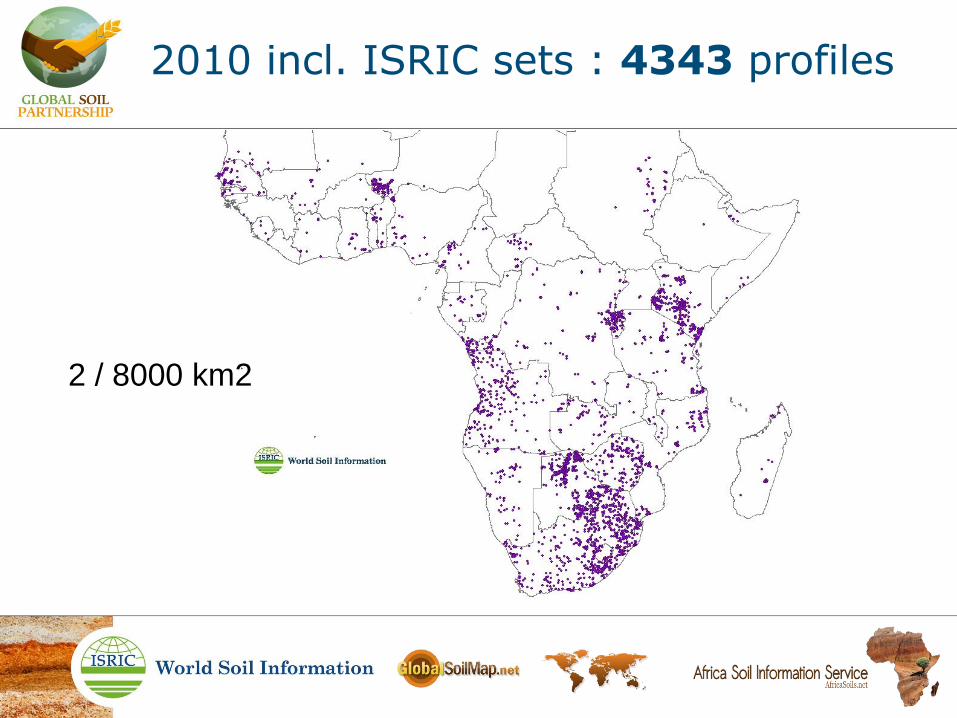
2010 incl. ISRIC sets : 4343 profiles
2 / 8000 km2

Excl. 2955 duplicates
2 / 8000 km2
2010 incl. ISRIC sets : 4343 profiles
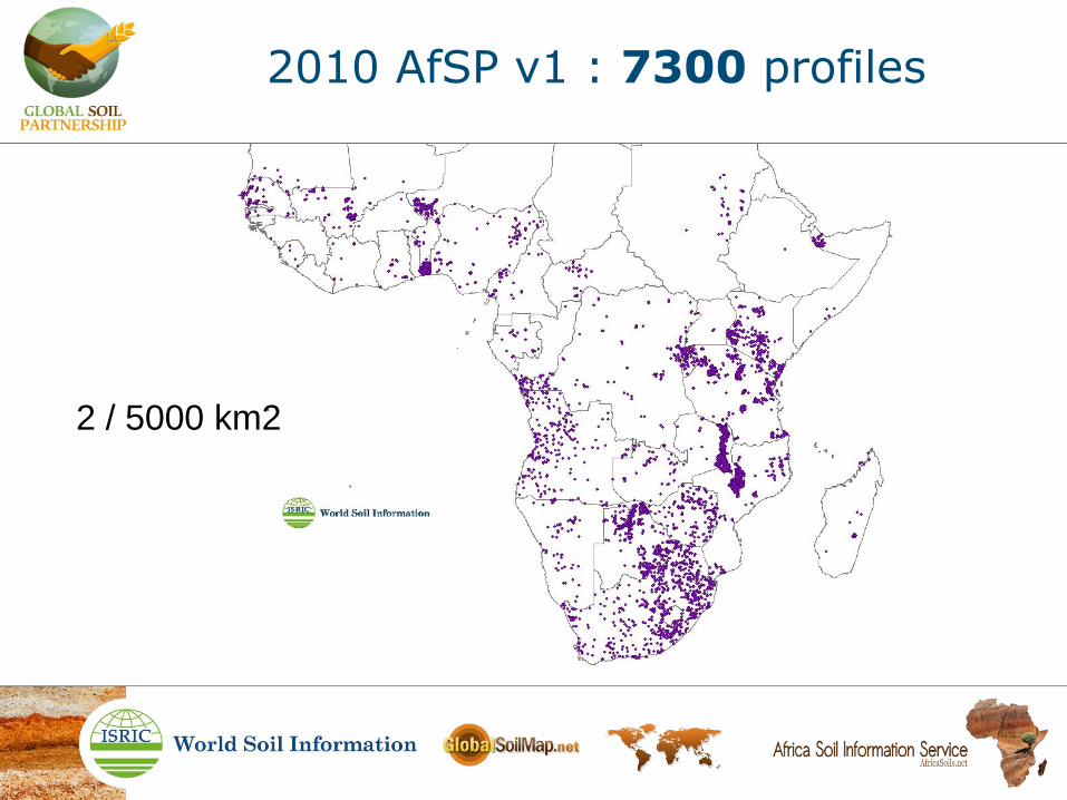
2010 AfSP v1 : 7300 profiles
2 / 5000 km2

2010 AfSP v1 : 7300 profiles
2 / 5000 km2

2011 AfSP v2 : 9200 profiles
2 / 4000 km2

2012 AfSP v3 : 12500 profiles
2 / 3000 km2

2012 AfSP v3 : 12500 profiles
2 / 3000 km2
> 50,000 profile layers

Data density
AfSP
Data completeness

AfSP
Reconnaissance calculation:
Total OC stock = 100-200 Pg (10 ¹⁵)
Query of
preliminary versions
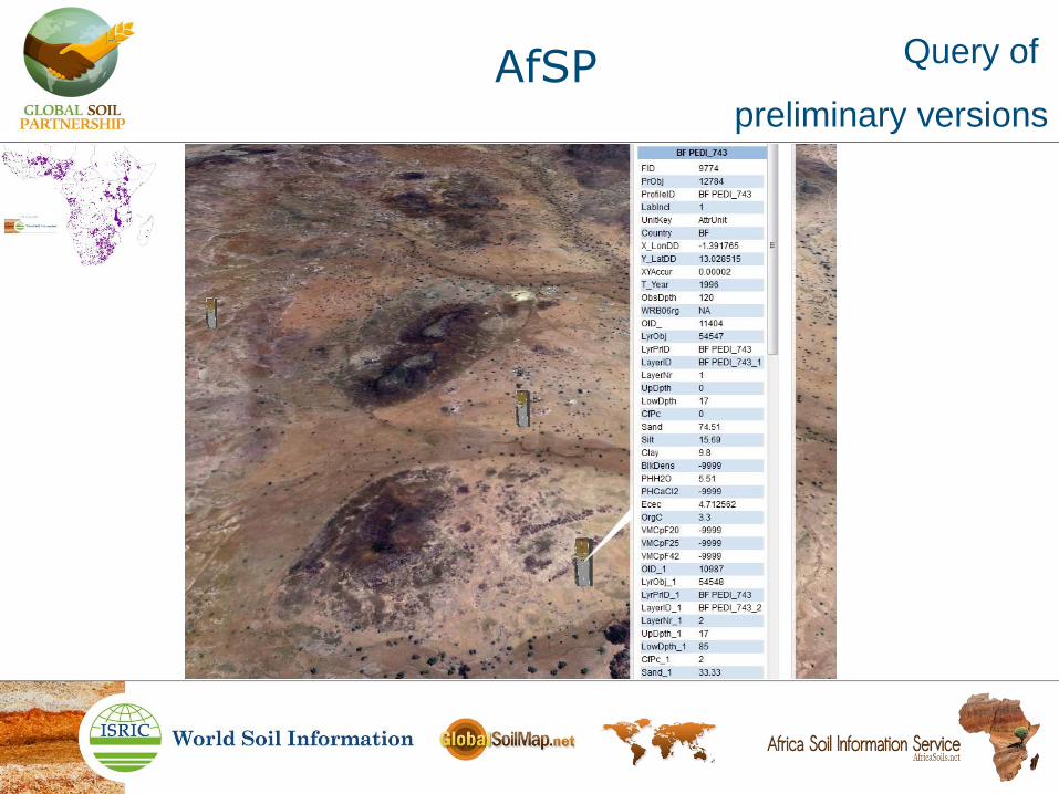
Query of
preliminary versions
AfSP
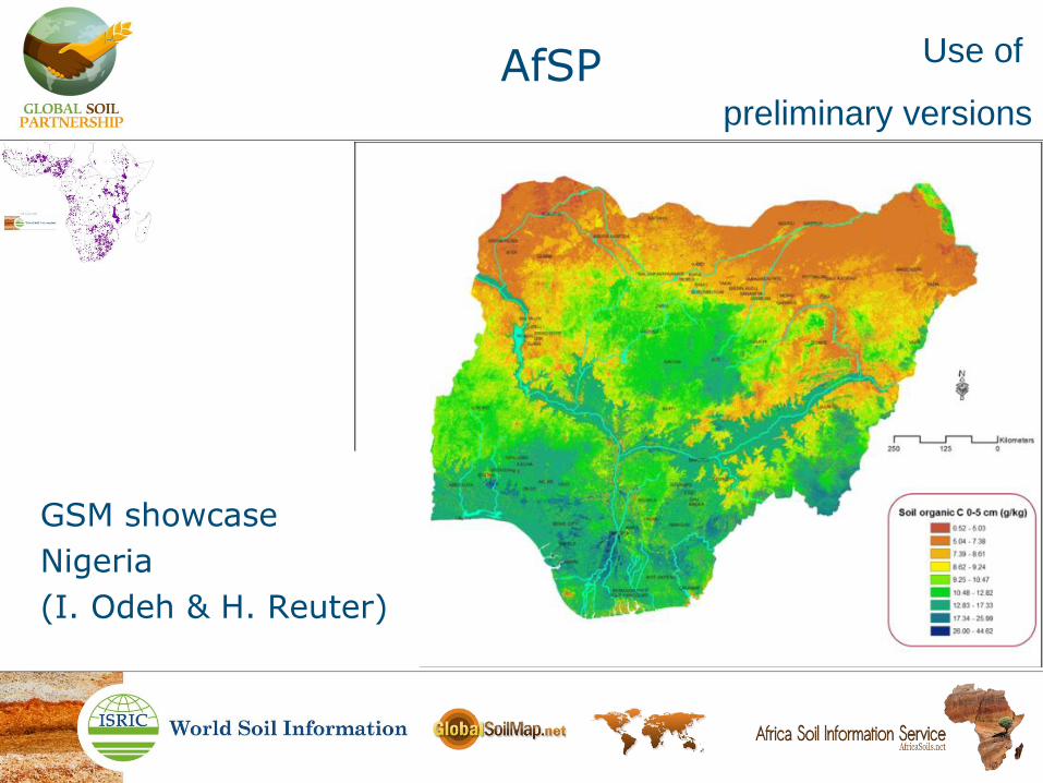
Use of
preliminary versions
AfSP
GSM showcase
Nigeria
(I. Odeh & H. Reuter)

Use of
preliminary versions
AfSP
SOTER
Malawi
(K. Dijkshoorn)
Profiles representative for soil components, and WRB classified.


- Africa DSM modelling (M. Walsh & Jiehua)
- Malawi DSM showcase (T. Hengl)
- Data entry template GSP-FAO (R. Vargas)
- Data entry template University of Sydney working with CI, CM, GH, NG, SN (I. Odeh)
Use of
preliminary versions
AfSP

AfSP Sharing of
preliminary versions

World Soil Information Service
• Africa Soil Profiles database will be embedded into WoSIS database
• Data can be downloaded through WoSIS
• Additional data can be uploaded through WoSIS
AfSP Sharing

• Inventory
• Collect
• Analogue -> digital
• Process (collate, standardize, quality control)
• Serve
Compile
• Inventory
• Collect
• Analogue -> digital
• Process (collate, standardize, quality control)
• Serve
• Just do it !
Compile

• Lineage
- Datasets & reports
Compile Basic principles
• Lineage
- Datasets & reports (IP rights)
Compile Basic principles

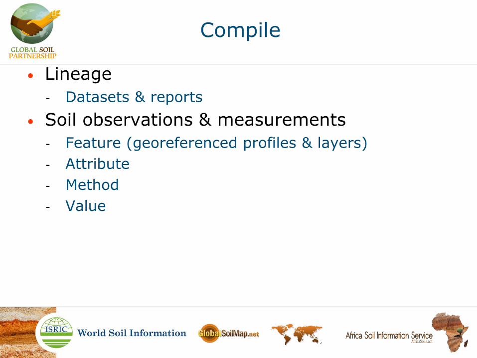
• Lineage
- Datasets & reports
• Soil observations & measurements
- Feature
- Attribute
- Method
- Value
Compile
• Lineage
- Datasets & reports
• Soil observations & measurements
- Feature (georeferenced profiles & layers)
- Attribute
- Method
- Value
Compile

• Lineage
- Datasets & reports
• Soil observations & measurements
- Feature (georeferenced profiles & layers)
- Attribute (x-y-z-t, map, class, site, layer-fld, layer-lab)
- Method
- Value
Compile
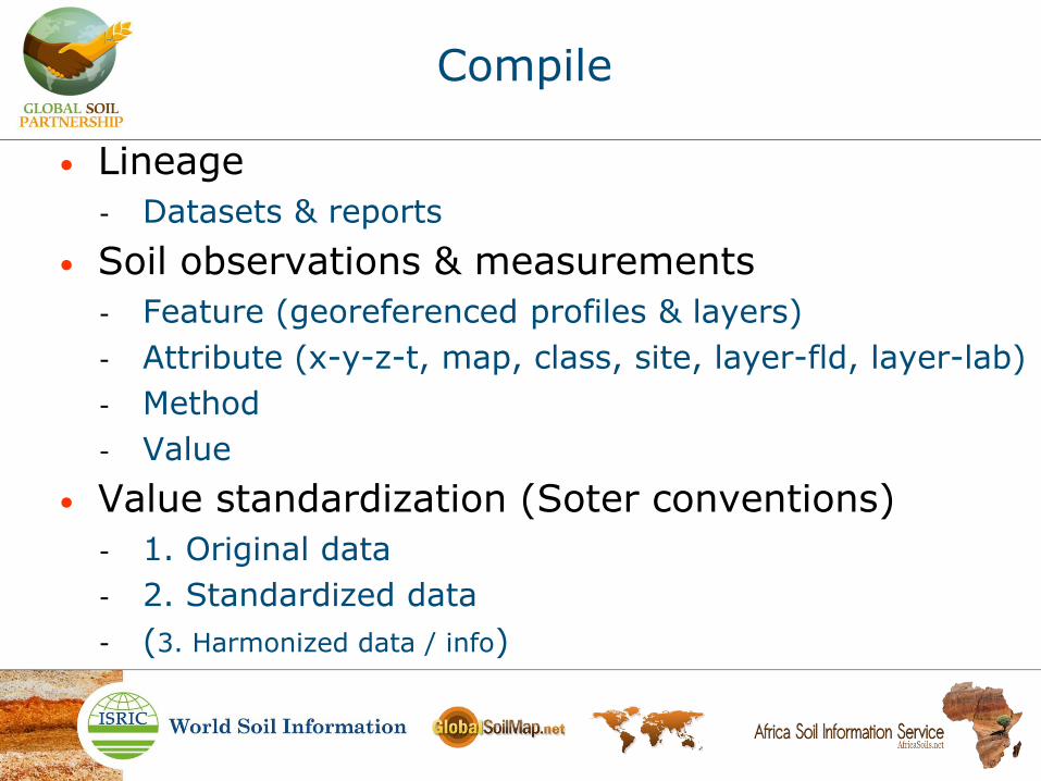
• Lineage
- Datasets & reports
• Soil observations & measurements
- Feature (georeferenced profiles & layers)
- Attribute (x-y-z-t, map, class, site, layer-fld, layer-lab)
- Method
- Value
• Value standardization (Soter conventions)
- 1. Original data
- 2. Standardized data
- (3. Harmonized data / info)
Compile

• Lineage
- Datasets & reports
• Soil observations & measurements
- Feature (georeferenced profiles & layers)
- Attribute (x-y-z-t, map, class, site, layer-fld, layer-lab)
- Method
- Value
• Value standardization (Soter conventions)
- 1. Original data - basic quality control
- 2. Standardized data - routine quality control
- (3. Harmonized data / info - full quality control)
Compile

Compile
1st record
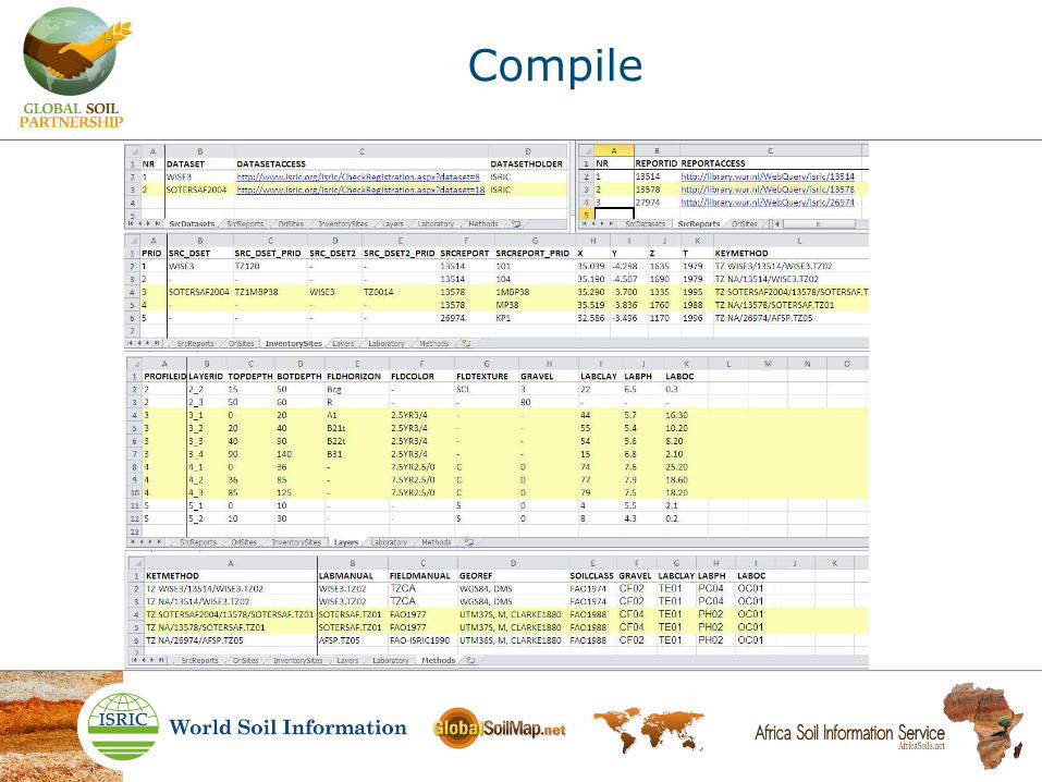
Compile

Compile
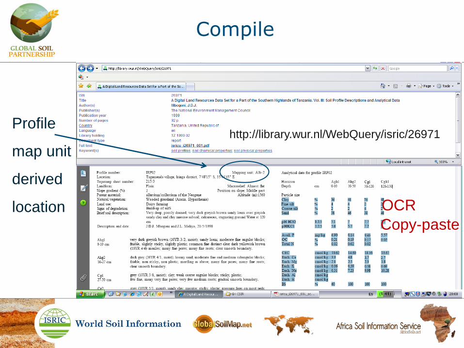
http://library.wur.nl/WebQuery/isric/26971

Compile
http://library.wur.nl/WebQuery/isric/26971
OCR
Copy-paste

Compile
UTM36s
UTM34n Original profile site values
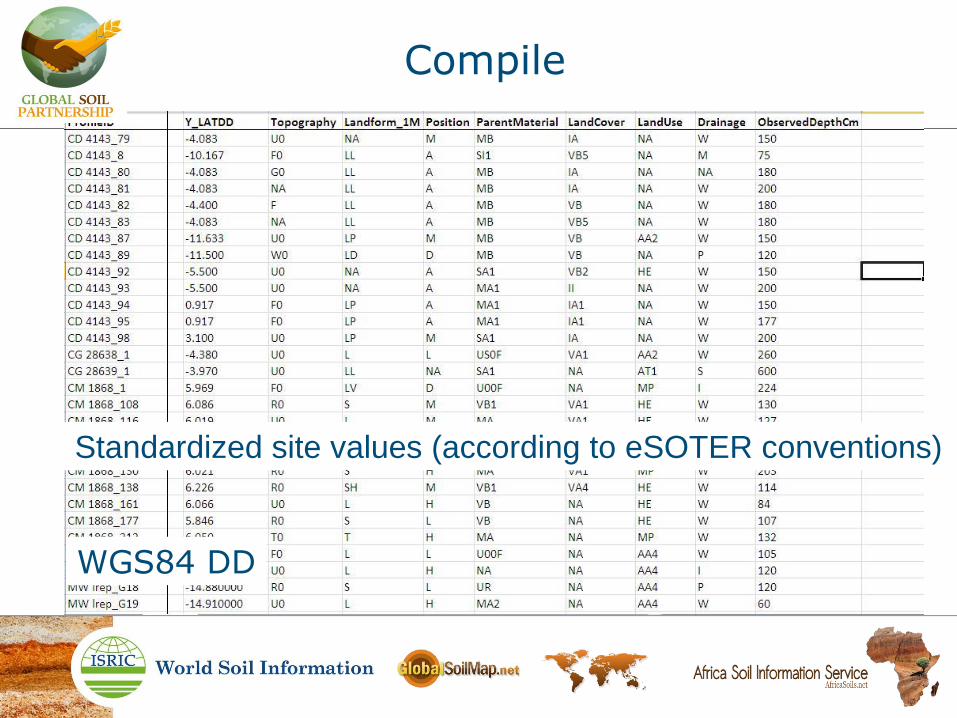
Compile
Standardized site values (according to eSOTER conventions)
WGS84 DD

Compile
http://library.wur.nl/WebQuery/isric/26971 Profile
point
location

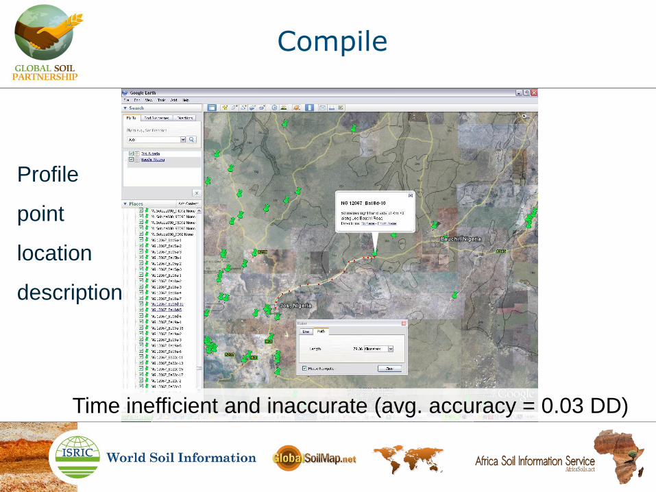
Compile
Profile
point
location
map
Compile
Profile
point
location
description
Time inefficient and inaccurate (avg. accuracy = 0.03 DD)
Compile
http://library.wur.nl/WebQuery/isric/26971
OCR
Copy-paste
Profile
map unit
derived
location

Compile
Profile
map unit
derived
point
location
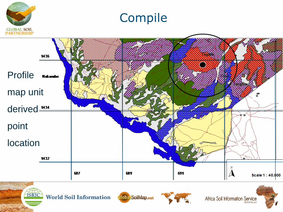
Compile
Profile
map unit
derived
point
location

Compile
Profile
map unit
derived
location
domain
Not in AfSP
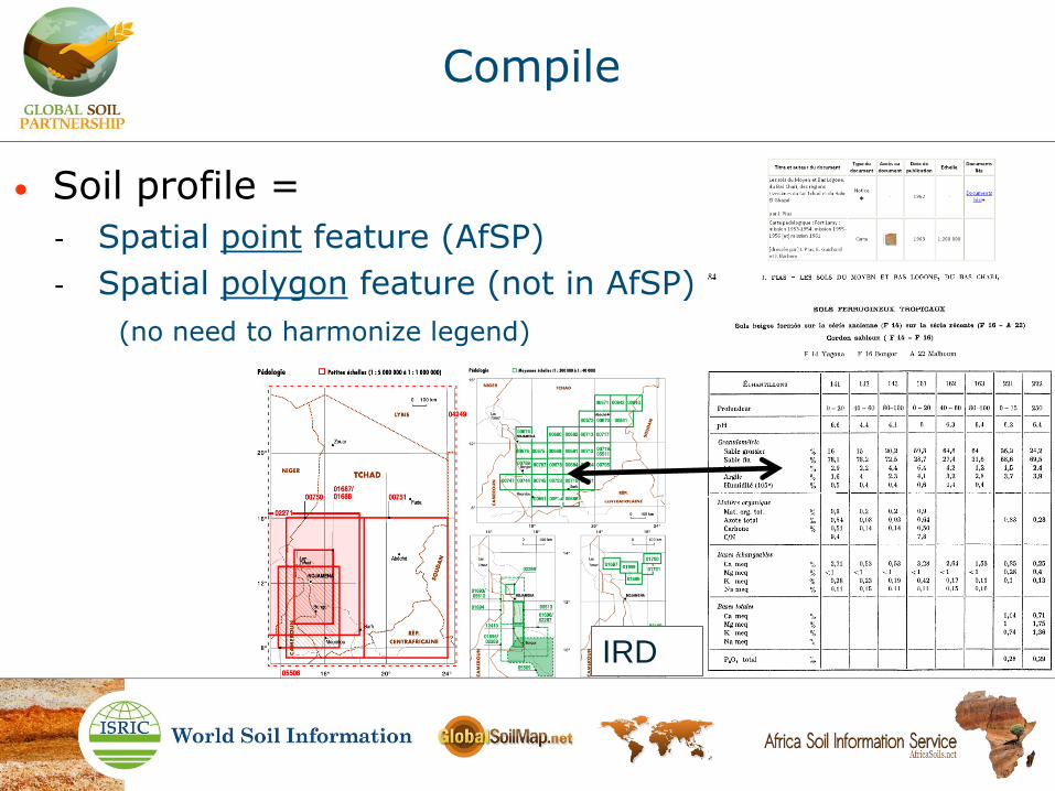
Compile
IRD
• Soil profile =
- Spatial point feature (AfSP)
- Spatial polygon feature (not in AfSP)
(no need to harmonize legend)
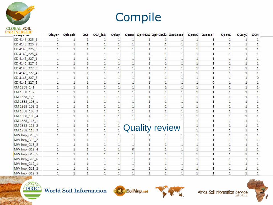
Compile
Quality review

Some sources of error
• Reporting of incorrect lab results
• Incorrect reporting of lab results
• Errors introduced during compiling process

Quality control
• Basic quality control, of source data upon entry
• Routine quality control, of collated data
• Full quality control, of in-pedon consistency

Quality control
• Basic quality control, of source data upon entry
- Original values and expressions
• Routine quality control, of collated data
- Standardized values assessed by various methods
• criteria applied in WoSIS enterprise environment
• Full quality control, of in-pedon consistency
- Harmonized values as if assessed by single method
• requires stratified and complete data
• criteria applied in WoSIS enterprise environment

Routine quality control
• Single attribute rules:
0 < OC < 1000 ‰
0 < clay < 100 %
0 < CEC < 150 cmol/kg
2 < pH < 11

Routine quality control
pH H2O
pH KCl (& CaCl2)
• Single attribute rules:
0 < OC < 1000 ‰
0 < clay < 100 %
0 < CEC < 150 cmol/kg
2 < pH < 11
• Multiple attribute rules:
4 < C/N < 45
Sand +silt +clay = 100%
(CEC OC + CEC clay) = CEC
pH H2O > pH KCl (& CaCl2), except geric

Routine quality control
pH H2O
pH KCl (& CaCl2)
• Single attribute rules:
0 < OC < 1000 ‰
0 < clay < 100 %
0 < CEC < 150 cmol/kg
2 < pH < 11
• Multiple attribute rules:
4 < C/N < 45
Sand +silt +clay = 100%
(CEC OC + CEC clay) = CEC
pH H2O > pH KCl (& CaCl2), except geric
What to do with inconsistencies ?

Routine quality control
• Multiple attribute rules
CEC = f (org C, clay / content, nature)
clay
OC
CEC CEC
CEC
CEC
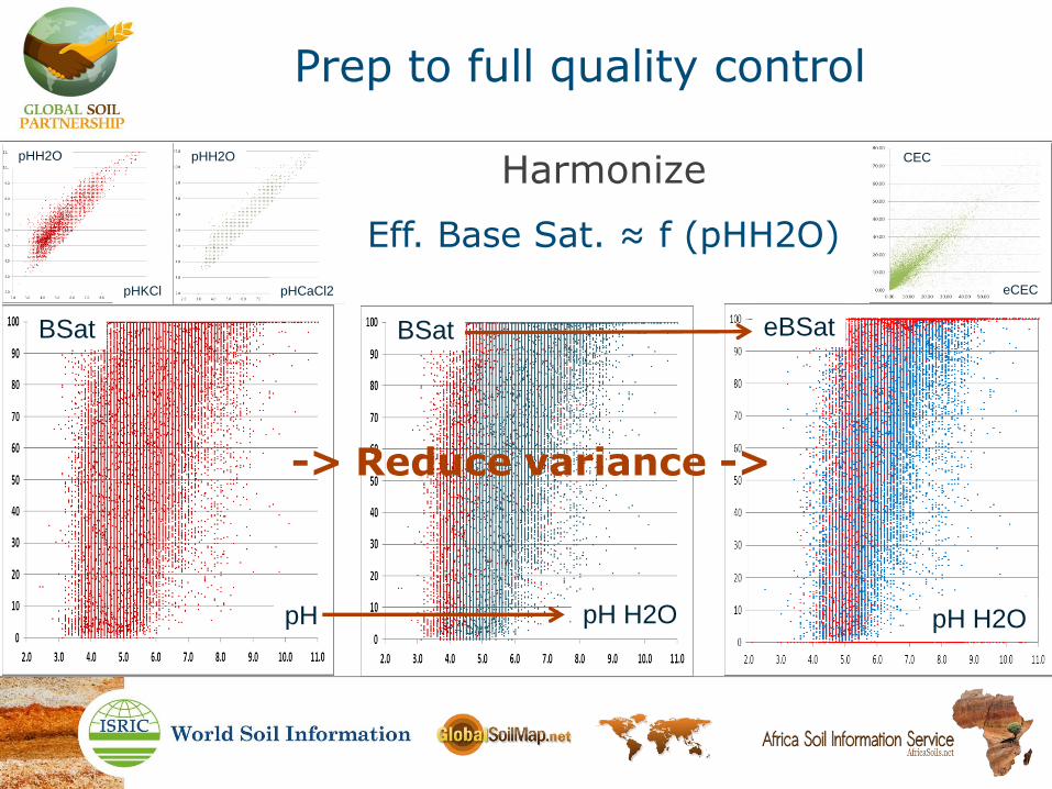
Prep to full quality control
Harmonize
Eff. Base Sat. ≈ f (pHH2O)
BSat
pH pH H2O pH H2O
BSat eBSat
eCEC
CEC pHH2O
pHCaCl2 pHKCl
pHH2O
-> Reduce variance ->
• Legacy soil data quality varies
Accuracy of final product
• Legacy soil data quality varies
• An accurate final product (Africa soil property maps) requires evidence; both quality ánd quantity
Accuracy of final product

• Legacy soil data quality varies
• An accurate final product (Africa soil property maps) requires evidence; both quality ánd quantity
Accuracy of final product
Soil data quality is use specific
Soil data quantity informs regression with covariates
Resolution !
Distribution !

Accuracy of final product
100 * 100 km
Resolution !
Data quality is use specific
10 * 10 km
1 * 1 km

Accuracy of final product
10 * 10 km
100 * 100 km
1 * 1 km
Resolution !
Data quality is use specific

Accuracy of final product
new soil data
Resolution !
0.1 * 0.1 km
10 * 10 km
100 * 100 km
1 * 1 km
Data quality is use specific

Accuracy of final product
new soil data
0.1 * 0.1 km
10 * 10 km
100 * 100 km
1 * 1 km
Soil data quantity informs regression with covariates

Accuracy of final product
legacy soil data
10 * 10 km
100 * 100 km
1 * 1 km
Distribution !
Soil data quantity informs regression with covariates
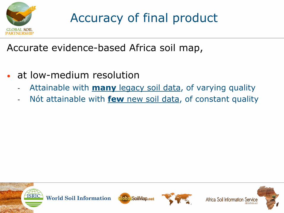
Accurate evidence-based Africa soil map,
• at low-medium resolution
- Attainable with many legacy soil data, of varying quality
- Nót attainable with few new soil data, of constant quality
Accuracy of final product

Accurate evidence-based Africa soil map,
• at low-medium resolution
- Attainable with many legacy soil data, of varying quality
- Nót attainable with few new soil data, of constant quality
= covariate for:
• at high resolution
- Attainable with many legacy data plus few new data
- Attainable with many new data (very EXPENSIVE)
Accuracy of final product

Accuracy of final product
Profiles
Evidence
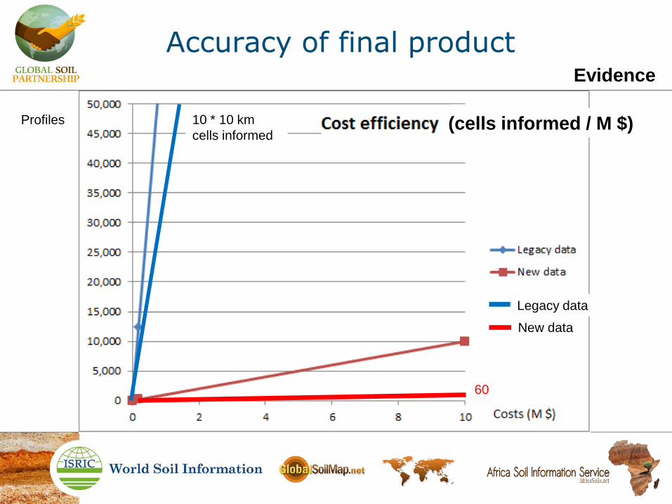
cells
Legacy data
10 * 10 km
cells informed
Profiles
New data
(cells informed / M $)
60
Accuracy of final product Evidence

Observations
• Legacy soil data are compiled very cost efficiently compiled, but not cost free (man months)
• Limiting factor is capacity (man months)
• An efficient way to effectively acquire and compile digital soil profile data, in quantities required to map Sub Saharan Africa, is to allocate facilitative resources to increase focused capacity
- Capacity in house
- Capacity out house (actively involve dataholders)

Next steps
• AfSP 3 release (report)
• AfSP 4 in WoSIS (add profiles) - Datasets (priority)
- Entry
• In house : focused steady manual entry
• Out house : partnering with data holders / GSP manual entry
• Out house: web crawl / semi automated manual entry
• Out house : crowd sourced manual entry
• AfSP – AfSM (link profiles to map-units) • Derive soil data from maps (requires data standardisation)
• Derive covariate from maps (requires legend harmonisation)
Thank you