advisory visit to st mary’s burn, holm, orkney ...1 advisory visit to st mary’s burn, holm,...
TRANSCRIPT
1
ADVISORY VISIT TO ST MARY’S BURN, HOLM, ORKNEY ISLES August 25, 2008
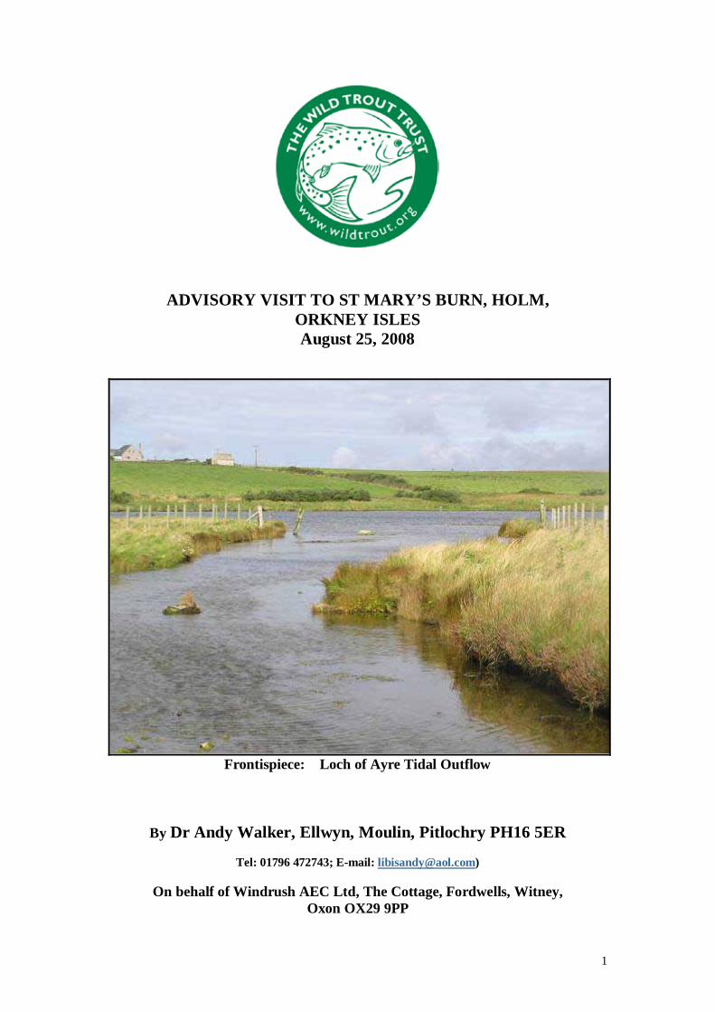
Frontispiece: Loch of Ayre Tidal Outflow
By Dr Andy Walker, Ellwyn, Moulin, Pitlochry PH16 5ER
Tel: 01796 472743; E-mail: [email protected])
On behalf of Windrush AEC Ltd, The Cottage, Fordwells, Witney,
Oxon OX29 9PP
2
1.0 BACKGROUND The Wild Trout Trust was invited to undertake a visit to advise on possible habitat remedial work on the St. Mary’s Burn on the Mainland of the Orkney Islands which used to be part of a very productive local sea trout system (two neighbouring catchments), but has suffered significant environmental and fishery decline. The advisory visit was instigated by Malcolm Thomson, who is carrying out a study of sea trout systems in Orkney for a PhD degree, supervised by Heriot Watt University. His study is supported by grant aid from the Wild Trout Trust (WTT), via the Orkney Trout Fishing Association (OTFA), to support research into local sea trout populations. The St. Mary’s Burn remediation programme, which is not part of Malcolm’s PhD study, is one of a series of local initiatives which may seek Heritage Lottery Funding through The Scapa Flow Landscape Partnership Scheme, the overall application being handled by the local community council. The Scheme consists of a total of 48 projects that will be implemented between 2009 - 12, subject to final approval by the Heritage Lottery in March 09. The broad aim of the scheme is to:
Create a deeper and more unified understanding of the Scapa Flow area’s landscape, including the natural, built, and historical landscapes, and to promote and support its sustainable management, use and enjoyment by as many people as possible – locally, nationally and across the world.
The Wild Trout Trust (www.wildtrout.org) was established in 1997 by a small group of people dedicated to the idea that ailing populations of wild trout can be given a helping hand through restoration and conservation of their habitat. It provides practical guidelines and encourages riparian owners, angling clubs and community volunteer groups to instigate habitat projects, not only to protect and improve stocks of wild trout, but also to deliver many gains to local bio-diversity. The Trust continues to grow in strength and now operates throughout the United Kingdom and Ireland.
1.1 SITE LOCATION AND HISTORY St. Mary’s Burn and its slightly larger neighbouring stream to the east, Graemeshall Burn, drain gently sloping, largely cattle-grazed, hillsides and small farmlands before descending into small (< 8 ha), shallow (c. one metre deep), brackish lochs that connect to the sea by short tidal streams. St. Mary’s Village lies between the two lochs, nearer to St. Mary’s Burn. The information about the past good status of the twin system for sea trout fishing comes by local reputation, but also is recorded in the extensive book on sea trout by G.H.Nall (1930). [More detail on the two systems is contained in the following ref: Nall, G.H., 1933. Orkney sea trout with appendix on growth rates of brown trout from St Mary’s Loch. Fisheries Board for Scotland – Salmon Fisheries, 1932, No VIII. HMSO, Edinburgh].
Nall describes correspondence with Mr Walter Grant of Hillhead, Kirkwall, who had leased the fishing in the two lochs over a span of 25 years and used to run a hatchery at Graemeshall producing about 18,000 fry annually for local release. Grant supplied information to Nall about his sea trout catches, the run-timing and spawning movements of stocks and sent samples of scales which indicated excellent marine growth. The best baskets that Mr Grant reported from his private water were 11 fish weighing 45 lbs 3 oz (27 March, 1928) and 6 weighing 27 lbs 1 oz, best 8 lbs 5 oz ( 31 October 1927). Plate 45 in Nall’s book, “The Life of Sea Trout” (1930) shows a

3
superb sea trout weighing 14 lb 10 oz, caught by Mr Grant in St Mary’s Loch, on 24 April, 1923 (Plate I below)
Plate I: see above description from Nall (1930)
Although there are no records of catches, sea trout can still be caught in the two lochs and along the coastline. St. Mary’s Loch now drains directly into Scapa Flow, via the Bay of Ayre, while Graemeshall Burn exits at the seaward side of Churchill Barrier No 1, part of group famously installed during the Second World War and since modified as part of the A961 road to South Ronaldsay. Both Graemeshall Burn and especially the smaller St. Mary’s Burn have suffered significant habitat degradation since the 1930s. An electrofishing survey carried out by Malcolm Thomson in 2005 at St. Mary’s Burn found only one trout at two sites. A habitat remediation project targeted at this burn could bring important benefits to juvenile sea trout production and local wildlife.
Plate II: Malcolm Thomson fishing for sea trout in St. Mary’s Burn outflow in the Bay of Ayre
(OS Ref. HY 470 012)

4
As Malcolm explained prior to the WTT advisory visit ‘Being located right next to St Mary's village, this could also be a project that a local community could really get behind and benefit from, not just in terms of a wild trout fishery, but also in terms of general improvements in bankside and wetland habitat. The idea was raised at the community council meeting last week and received unanimous support.’
James Green, Landscape Partnership Officer, outlined desirable outcomes for the St. Mary's Burn project as to:
1. Improve the river habitat for spawning sea trout 2. Enhance the river habitat for other local wildlife 3. Establish a proper habitat management regime, involving the
OTFA, landowners and the local community 4. Establish the site as an example of good practice in habitat restoration /
management and promote to other landowners and the wider community i.e. encourage other landowners to undertake similar projects
5. Establish regular survey and monitoring of fish stocks 6. Investigate potential for sea trout re-stocking from local sources, if
appropriate. 7. Interpret the cultural and environmental story of sea trout and its habitat in the
local area.
2.0 THE ADVISORY VISIT
The visit comprised a walking and photographic overview of the St. Mary’s Burn catchment and was not intended to be a proper biological survey, although we examined the substrate and underside of stones at various points for general invertebrate composition and looked for evidence of noxious discharges and any signs of fish. What was immediately apparent was the canalised and overgrown nature of the burn throughout almost all of its length (< 4 km) as illustrated:
Plates III&IV: Choked lower reaches above the loch

5
Plates V-VIII: Middle reaches including old landfill tip area showing willows
The channel is protected on both sides against overgrazing of the banks by cattle and other farm stock, but the vegetation has grown so thickly under zero grazing pressure that it chokes the stream. On the other hand, most of the sections we looked at held clear water under the vegetation and the substrate, while heavily silted in many places, contained gravel in places that could be suitable for spawning of trout. Invertebrates (water snails, caddis and small mayfly larvae) were common under the flattened stones, indicating good water chemistry (high level of calcium) with sufficient oxygen for juvenile fish, although none were seen. Conditions were very difficult to see fish and further electrofishing would be recommended in autumn or early winter when the vegetation will have died back and flows should be enhanced by rainfall. There had been very little rain for several weeks before the advisory visit. The burn receives some spring water here and there and we saw evidence of this in the upper reaches. The only point sources of pollution that we encountered were a small pipe discharging from a farm in the lower reaches (right bank – looking downstream) and a red-stained discharge from an old landfill tip. Neither of these discharges seemed to affect the stream for more than a few metres. We wondered whether willow bushes and reeds growing luxuriantly in the landfill tip site may have

6
been planted to assist nutrient uptake. Diffuse pollution in the farm of farm slurry or fertilisers would be expected to reach the stream from the surrounding fields during wet weather. SEPA may be able to advise on water quality and effects of local farm practices, although they may not have sampled there because of the small size of the catchment.
Plate IX: Steeper section nearer the top of the burn
Plate X: Covered springwater source by Hilltoft/Quoylobs

7
Plate XI: A little clearance of bankside vegetation exposes clean water
Plate XII: There is some mixed gravel which could be used by trout for redds, although the bottom was fairly silty and choked

8
Plate XIII: The underside of stones shows good invertebrate production
Loch of Ayre (St. Mary’s Loch) was found to be strongly brackish and contained a lot of marine or estuarine algae (e.g. Enteromorpha spp.). It was being grazed by a group of whooper swans. Large flounders were seen as we waded around the margins. Two finnock (0+ sea year sea trout) and a brown trout were seen to jump. Malcolm later caught a brown trout weighing 480 g (1lb 1oz), which proved to be a maturing female. It had eaten small mysid shrimps, indicative of estuarine conditions and might fairly be termed a ‘slob’ trout.
Plate XIV: Loch of Ayre Trout (310mm, 480g) 27.8.08
The loch was shallow enough to wade quite extensively and Nall’s description (1930) that the loch was 3.5 ft deep may still hold true. There is easy access for sea trout into the loch from the sea. Loch of Ayre and its neighbouring Graemeshall Loch probably

9
provide habitat for trout parr and smolts descending from the two burns prior to their migration into full strength seawater. They may also be used as overwintering habitat for finnock and sea trout kelts, originating from the two systems and perhaps including visiting fish. Sea trout from burns that lack low-lying lochs may come in for periods as they are inveterate wanderers that often visit other river systems than their own. However, the homing accuracy of sea trout at spawning time seems to be similar to that of salmon, based on genetic research. Walter Grant, Nall’s correspondent (1930), stated that the local sea trout began spawning about the middle of November and returned to the sea very soon afterwards, in most cases within twenty-four hours. This may have been due to the lack of depth and hiding cover in the spawning burns. Grant went on to explain that many sea trout return to the lochs in February and remain there for variable periods of time (i.e. sometimes moving repeatedly between fresh and seawater), until April, when they return properly to the sea, reappearing in autumn. Some of the overwintering sea trout found from February were maiden fish in better condition.
A quick visit was made to the neighbouring Graemeshall Burn which runs parallel to St. Mary’s Burn. According to Malcolm Thomson, both are fairly typical of small Orkney streams. Graemeshall Burn is like a larger version of St. Mary’s Burn and also is quite heavily overgrown, although the water is much more visible in the channel. Trout were seen from a bridge near Millhouse and the spawning and nursery habitat seemed good, although the habitat and the fish population should be surveyed in greater detail to assess whether a management programme could help. The St. Mary’s Burn project has been prioritised at present. It seems very likely that some of the productive capacity of both spawning burns has been lost by channel drainage and straightening and through progressive sedimentation, especially of the St. Mary’s Burn.
Plate XV: Graemeshall Loch and outflow burn
10
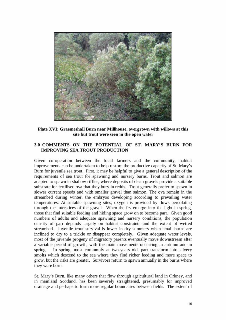
Plate XVI: Graemeshall Burn near Millhouse, overgrown with willows at this site but trout were seen in the open water
3.0 COMMENTS ON THE POTENTIAL OF ST. MARY’S BURN FOR
IMPROVING SEA TROUT PRODUCTION Given co-operation between the local farmers and the community, habitat improvements can be undertaken to help restore the productive capacity of St. Mary’s Burn for juvenile sea trout. First, it may be helpful to give a general description of the requirements of sea trout for spawning and nursery burns. Trout and salmon are adapted to spawn in shallow riffles, where deposits of clean gravels provide a suitable substrate for fertilised ova that they bury in redds. Trout generally prefer to spawn in slower current speeds and with smaller gravel than salmon. The ova remain in the streambed during winter, the embryos developing according to prevailing water temperatures. At suitable spawning sites, oxygen is provided by flows percolating through the interstices of the gravel. When the fry emerge into the light in spring, those that find suitable feeding and hiding space grow on to become parr. Given good numbers of adults and adequate spawning and nursery conditions, the population density of parr depends largely on habitat constraints and the extent of wetted streambed. Juvenile trout survival is lower in dry summers when small burns are inclined to dry to a trickle or disappear completely. Given adequate water levels, most of the juvenile progeny of migratory parents eventually move downstream after a variable period of growth, with the main movements occurring in autumn and in spring. In spring, most commonly at two-years old, parr transform into silvery smolts which descend to the sea where they find richer feeding and more space to grow, but the risks are greater. Survivors return to spawn annually in the burns where they were born. St. Mary’s Burn, like many others that flow through agricultural land in Orkney, and in mainland Scotland, has been severely straightened, presumably for improved drainage and perhaps to form more regular boundaries between fields. The extent of

11
its choking by dense vegetation is due largely to fencing of the adjoining fields. Ironically, the installation of riparian fencing is the first recommendation where streams are affected by overgrazing and agricultural run-off. Fencing from farm stock soon provides a luxuriant buffer zone, absorbing nutrients and giving hiding cover to salmonid fish, through overhanging grasses, shrubs and trees, as well as other wildlife. Trout in particular do better in small streams where they can hide under overhanging banks and vegetation. However, with the lack of rainfall in Orkney this summer, St. Mary’s Burn looked extremely small. In particular, the straightening of the channel appears to have left a generally shallow water depth, often only a few centimetres. There may be a lack of undercut sections of bank that would hold larger trout such as would normally be found on the outside of bends. However, it was very difficult to see much of the burn because of the dense vegetation. Streams and rivers flowing through relatively flat, erodable as opposed to rocky, areas form unstable meanders that move across flood plains over time. These winding, natural streams exhibit a repeating sequence of shallow riffle sections and pools at regular intervals of about five to seven channel widths. Artificially straightened channels, on the other hand, tend to return gradually to a sequence of pools and riffles as the bed and banks become eroded by spates and materials are deposited according to their relative density and the extent of flows (see Plate XVII).
Plate XVII: Straightened burn in the River Deveron catchment showing gradual return to riffle/pool sequence
Spawning burns that are subjected to digging and drainage may still provide good conditions for spawning of trout and so may be well-populated by fry. However, they tend to be deficient in parr numbers, due to inadequate cover. In this common situation, the densities of parr recover after a few years as a more natural stream profile reappears. Unfortunately, this recovery process may not happen if further drainage operations take place. Clearly, drainage operations tend to be bad for trout streams. However, the channel of St. Mary’s Burn needs to be cleared to inspect the water course in any detail and carry out an electrofishing and habitat survey. The

12
following suggestions are made for a work programme intended to examine the case for action to restore the burn as a good sea trout nursery. 4.0 RECOMMENDATIONS
· It will be necessary to undertake the study and subsequent improvement work in a stepwise fashion, building local experience, expertise and enthusiasm.
· Information about the overall project should be provided to local schools and the general public through interpretative boards and presentations stressing the benefits to habitat, trout and other wildlife that a restoration programme should achieve. It is essential to engage in a partnership approach with local schools, landowners and farmers and the Orkney Trout Fishing Association.
· A programme of electrofishing should be carried out in selected parts of the burn to gain information about the present densities of trout fry, parr and any adults. This work will need to be deferred until the vegetation dies back in autumn/early winter, although it may still be necessary to do some clearance manually to gain adequate access. Electrofishing will provide baseline data for assessing the case for improvements and measuring future change.
· At the same time, habitat information should be collected, following standard procedures used by the Scottish Fisheries Coordination Centre, including recording of water depths, velocity, chemistry and temperature, channel widths, substrate description, instream and bankside vegetation, bottom fauna, location and description of any barriers for upstream passage of trout.
· The electrofishing and habitat survey will establish the present status of the trout population that is essential to planning remedial work. Given unexpectedly high numbers of trout, well-dispersed through the catchment, there will be less need for action, although this finding seems unlikely.
· The next stage would be a targeted removal of large amounts of instream silt by mechanical digger and clearance of the much of the surrounding vegetation to expose the water surface to daylight. Some of the more vigorous vegetation may need to be sprayed periodically with herbicide (probably glyphosphate –consult with SEPA). Desilting and partial weed removal will promote stronger scouring action and hopefully expose gravel that may be used by spawning trout. Gravel and larger stones should be retained whenever possible. It may be necessary to import quantities of both materials to create better habitat for spawning and sanctuaries for parr and larger trout. Deeper sections also should be retained as cover for larger juveniles and ascending adults. Sections with stepped falls, providing they are passable by trout, should be retained for channel and biological diversity and oxygenation. Simple upstream pointing V groynes of wood beams or stones may be used to break the current in flatter sections, again promoting varying depths and flow patterns to the benefit of invertebrate diversity and trout (see The Wild Trout Survival Guide provided by WTT).
· Following clearance to expose much of the burn channel and promote stronger flows, selected sections of the burn may be narrowed and deepened by building vertical banks with local materials, probably stone slabs, laid like a dry stane dyke, but leaving wide crevices and overhangs. Sections running close to the road may be suitable for this. In doing so, it will be necessary to

13
make provision for the spates which will undoubtedly occur. Notched, removable, cross boards (perhaps 300mm high) may be used in places to deepen shallow runs. Lifting the boards periodically will flush away accumulated silt.
· Consideration should be given to widening the presently narrow fenced zone to create more opportunity to encourage meanders by strategic digging, or by positioning of deflecting boulders, plus providing additional habitat for wildlife and improved buffering capacity against slurries and fertilisers from neighbouring fields. However, it is appreciated that this will mean a loss of farmable land and it will come at a cost. Grant aid may be sought by interested farmers through government farm diversification schemes.
· Willow cuttings may be placed at points along the banks where additional cover for trout in the form of rootballs would be useful as hiding cover for larger fish. Willows already present in the area around the old tip can be used as sources of cuttings. However, there needs to be a regular maintenance programme to ensure that the willows are cut and dug back if they become over-rampant.
· Culverts to carry the burn under roadways need to be kept fish-friendly, ideally by using bridges with natural streambeds, rather than pipes that generate strong, jetted flows which trout may have difficulty in passing on their spawning migration. No obviously bad culverts were seen during the visit to St. Mary’s Burn, however, this is another problem to look for while carrying out an electrofishing and habitat baseline study.
· It may be necessary to obtain a licence from SEPA for all instream and bankside works and in any case their advice should be sought at an early stage.
· Limited gill-netting should be carried out in the loch to establish current information on the fish population. Data gathering should include scale sampling to ascertain trout growth rates and age structure.
· The option of stocking to assist the sea trout population should be delayed until more information is gathered about of the present status of the population and identifiable constraints. If natural spawning conditions prove to be inadequate and unsustainable, stocking may be considered. This could take the form of fertilised sea trout ova buried in gravel of springs that enter the burn. A suitable area for stocking in this way is at the top of the burn near Quoylobs and Hilltoft where water quality seems to be excellent and there is a lot of bottom fauna. The fry will emerge from the gravel early because groundwater is warmer than surface water during winter. Therefore, it would be prudent to carry out a trial stocking to ascertain whether egg and fry survival rates are satisfactory.
· Also, if natural gravel sites are found to be inadequate for spawning, streamside ova incubation boxes may be used where there is enough slope to provide a head of flow (see The Wild Trout Survival Guide). These provide a constant flow with clean gravel from which fry emerge and drop into the burn volitionally in spring. The steep section of burn shown in Plate IX (OS Ref 469030) may provide a suitable site.
· Ova for any planned stocking programme should be obtained from sea trout adults as locally as possible, ideally from the two burns straddling St. Mary’s village.
· To assist in any stocking programme, it may be possible to locate and restore the former hatchery site used in the 1920s and 30s by Walter Grant.

14
· Application should be made to the Wild Trout Trust for seedcorn funding in the form of an AV bursary scheme that awards up to £1500 for use in implementing recommended works.