a nnnuuaall rreeppoorrtt 22001122 - cartong · a nnnuuaall rreeppoorrtt 22001122 apppeall 22001133...
TRANSCRIPT

AANNNNUUAALL RREEPPOORRTT
22001122 AAPPPPEEAALL
22001133
Association CartONG
180 rue du Genevois, 73000 Chambéry, France
[email protected] | www.cartong.org | @assocCartONG
Mapping and information management for
humanitarian organizations
Annual report 2012
2
Mapping and information management
for humanitarian organizations
TABLE OF CONTENTS
Table of contents ........................................................................................... 2
Introduction................................................................................................... 3
Our activities/our actions .............................................................................. 4
Where CartONG works ............................................................................................. 4
2012 Projects................................................................................................. 5
I. Mobile technologies.................................................................................... 5
A. Mobile data collection with the NOMAD consortium ................................................ 5
B. Android surveys for UNHCR ................................................................................ 6
II. Database & emergency mapping ............................................................... 7
A. UNHCR (Lebanon for Syria Crisis) ........................................................................ 7
B. Infrastructure mapping for UNHCR (Uganda) ........................................................ 8
III. Development and Landscape Planning ....................................................... 8
GiZ Buffer Zone Management and Development Project (Vietnam) ................................ 8
IV. Other GIS and information management products for emergency operations .. 9
Geotagging guidelines & map packs for UNHCR ........................................................... 9
V. Communication and GIS webportals ........................................................ 10
International Media Support for diabetes patients ...................................................... 10
VI. Capacity building .................................................................................. 11
A. GeOnG 2012 ................................................................................................... 11
B. Google ReDD+ E-Learning Project ..................................................................... 12
C. International Committee of the Red Cross .......................................................... 12
D. Bioforce: Training of WASH and Logistics Experts ............................................. 13
VII. Outreach & advocacy ............................................................................ 13
Financial report ............................................................................................ 14
Perspectives for 2013 .................................................................................. 14
I. Professional projects ................................................................................ 14
II. Volunteers’ projects .............................................................................. 15
Annual report 2012
3
Mapping and information management
for humanitarian organizations
INTRODUCTION
During the last 12 Months CartONG has created maps, mapped infrastructure,
collected data with smartphones, compiled geodatabases, developed webportals,
trained local and international staff, produced videos and e-learning content, attended
solidarity and GIS events, organized the GeOnG 2012 forum... and provided many
more services for our partners and beneficiaries, all around the world.
2012 was a year of gradual growth for CartONG, with numerous projects with our
partners, around mobile technologies, mapping, data management, webportals or
capacity building.
The 2012 edition of GeOnG, now inscribed in the agenda of numerous NGOs and
international organizations as a landmark in terms of GIS and humanitarian event,
was a huge success: more than 130 participants from 50 organizations were present-
however, CartONG is conscious that some of the lessons of the past which we try to
push forward for in the humanitarian field are still far from being implemented even
with the very positive feedback from different organizations that this type of event
brings to the fore.
Hopefully, 2013 will be a year to continue implementing some of the lessons of this
GeOnG! The list of projects that we have concerning some of the aspects dealt with
during the event definitely seems to confirm this. On top of that, we have managed to
implement one of our key aims of 2012, the creation of a permanent post at the head
office for administrative purposes. The next step is to be able to have someone at the
head office permanently at the interface of all the professional projects. This will help
us continue to bring appropriate answers to your projects worldwide.
Many thanks for supporting us as partners, members and subscribers!
Maeve de France, President
Annual report 2012
4
Mapping and information management
for humanitarian organizations
OUR ACTIVITIES/OUR ACTIONS
CartONG offers services of geographic data management, of cartography and GIS, of
expertise in data management related to population displacement, of training sessions
and of awareness concerning the uses of geographic data management. In 2010,
CartONG started to work on mobile applications to collect information which remained
a focus topic in 2012.
Our activities:
Editing and Production of maps
Providing geographic information
Digitizing and Analyzing Spatial Data
Smart Phone based Mobile Data Collection and Mapping
Mapping of structures in the field inclusive of surveys to collect relevant
indicators
Webmapping, Google Map applications, Creation of KML Google Earth files,
installation of Geoserver
Analysis of Satellite images
Capacity Building: training in GIS, GPS, Android Mobile Data collection,
Databases, Data analysis
Creation of E-Learning Modules and Self study material like Screencasts
Visualizing data for Communication material, Donor reports
Managing information to support decision-making processes;
Creation of workflow: Establish routines for getting data from the field to the
desk/server in Headquarters
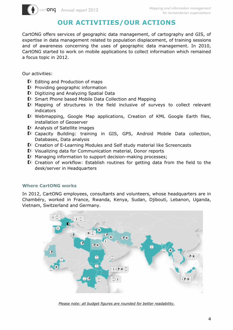
Where CartONG works
In 2012, CartONG employees, consultants and volunteers, whose headquarters are in
Chambéry, worked in France, Rwanda, Kenya, Sudan, Djibouti, Lebanon, Uganda,
Vietnam, Switzerland and Germany.
Please note: all budget figures are rounded for better readability.
Annual report 2012
5
Mapping and information management
for humanitarian organizations
2012 PROJECTS
I. Mobile technologies
A. Mobile data collection with the NOMAD consortium
OV
ER
VIEW
Staff involved
1 employee (manager/coordinator), 3 consultants (social
media, media specialist, designer) & 1 research
assistant/intern
Contractor
NOMAD consortium, funded by CNES (until August 2012),
then by Humanitarian Innovation Fund (December 2012-
March 2013)
Budget 9,000€1
Beneficiaries Any humanitarian actor interested in mobile data collection
Location Global
Content
NOMAD project is aimed to demonstrate the technological,
operational and economic feasibility of implementing
integrated digital data collection and communication systems
for rapid (real-time or near real-time) humanitarian
assessment and monitoring.
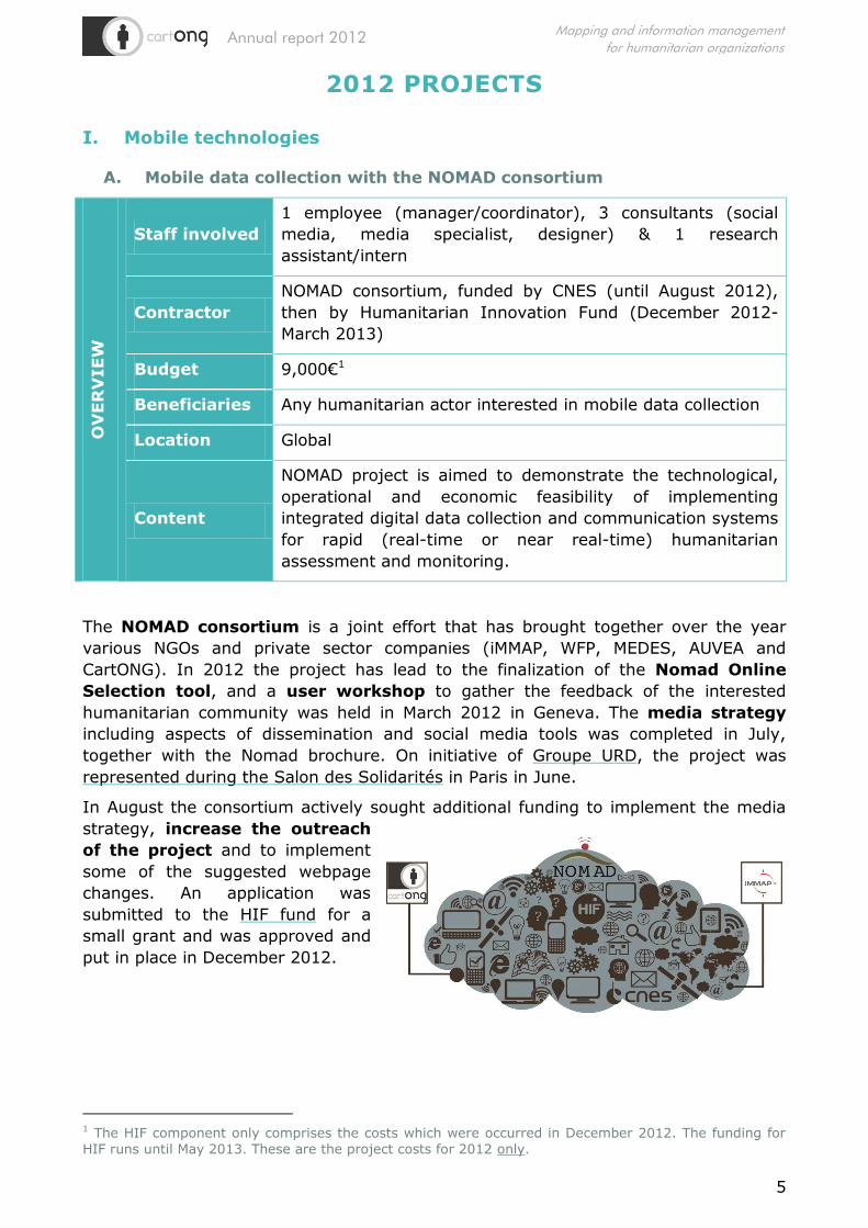
The NOMAD consortium is a joint effort that has brought together over the year
various NGOs and private sector companies (iMMAP, WFP, MEDES, AUVEA and
CartONG). In 2012 the project has lead to the finalization of the Nomad Online
Selection tool, and a user workshop to gather the feedback of the interested
humanitarian community was held in March 2012 in Geneva. The media strategy
including aspects of dissemination and social media tools was completed in July,
together with the Nomad brochure. On initiative of Groupe URD, the project was
represented during the Salon des Solidarités in Paris in June.
In August the consortium actively sought additional funding to implement the media
strategy, increase the outreach
of the project and to implement
some of the suggested webpage
changes. An application was
submitted to the HIF fund for a
small grant and was approved and
put in place in December 2012.
1 The HIF component only comprises the costs which were occurred in December 2012. The funding for
HIF runs until May 2013. These are the project costs for 2012 only.

Annual report 2012
6
Mapping and information management
for humanitarian organizations
B. Android surveys for UNHCR O
VER
VIEW
Staff involved 2 employees (developers), 1 research assistant
Contractor United Nations’ High Commissioner for Refugees (PHHIVS,
SSS and FICSS sections2)
Budget 89,000€3
Beneficiaries UNHCR
Location Rwanda, Kenya, Sudan, Lebanon, Djibouti
Content Building survey forms for rapid data gathering in the field
with Android mobile technologies.
The UNHCR Android project is one of CartONG’s key projects. It started in 2010 with
two pilots and two different technologies, of which one (ODK) was retained for
surveys in 2011. Field projects were directly supported in country in 2012 in
Rwanda, Kenya (Dadaab, next to the Somali border), Sudan, Lebanon and Djibouti.
Remote support was also provided to operations in Liberia and Kenya (Kakuma).
Android phones – which like other smartphones have a GPS, camera, sound and a
touch pad, basically function like a mini-computer – are extremely useful tools to
collect information and help gain time and money during humanitarian crisis.
The 2012 surveys covered topics such as nutrition surveys, shelter assessments
and evaluation of workshop events. Shelter assessments were implemented in
Lebanon with Shelter Actors during the emergency information management mission.
More training with shelter actors was conducted on global level, but did not result in a
deployment.
Additionally, the annual UNHCR NGO
Consultation event in July was supported
by CartONG; and a quick survey with
visitors for evaluation purposes was
conducted. It was also to demonstrate
how fast results can be obtained and
processed: from finishing the data
collection, the team had 45 min to
conduct a fast analysis and show the
results to the visitors of the events on a
screen.
2 Public Health and HIVS, Shelter, Field Information and Coordination Support 3 Estimated, since the full project with the respective UNHCR sections contained more elements than
Android surveys. The budget for Android surveys also includes any training activities related to the topic.

Annual report 2012
7
Mapping and information management
for humanitarian organizations
II. Database & emergency mapping
A. UNHCR (Lebanon for Syria Crisis)
OV
ER
VIEW
Staff involved 1 employee (emergency information manager)
Contractor UNHCR FICSS
Budget 14,000€
Beneficiaries UNHCR & public
Location Beirut, Lebanon
Content
Coordination and consolidation of all information
management products for countries affected by the Syria
situation: Lebanon, Jordan, Turkey, Iraq4.
A CartONG regional information manager was deployed to Beirut, to participate in an
emergency mission to Lebanon for the UNHCR coordinating and streamlining
information products for the Syria Regional Refugee Response – as refugees are
arriving in the neighboring countries Lebanon, Jordan, Iraq and Turkey.
CartONG, through a regional WebPortal displaying figures and statistics for the
public, helped share reliable, up-to-date information, streamlining the information
products from the different operations and their partners, while at the same time
finding the best solutions on reporting and information gathering suitable for
the mixed settings.
4 At the time, Egypt was not covered yet.

Annual report 2012
8
Mapping and information management
for humanitarian organizations
B. Infrastructure mapping for UNHCR (Uganda) O
VER
VIEW
Staff involved 1 employee (GIS officer)
Contractor UNHCR
Budget 4,000€
Beneficiaries UNHCR
Location Adjumani, Uganda
Content
Capacity building, trainers’ training for using OSM Tracker,
Google Earth and Google Fusion to map infrastructure, as
well as optimizing the database storage on Fusion and the
dissemination of the non-classified data.
CartONG completed a follow-up mission on OSM Tracker based infrastructure mapping
which was implemented for UNHCR in Uganda in 2011. This time the focus was on
reinforcing the training, rolling it out to other offices and improving the data storage,
symbology usage as well as the dissemination of the information hosted in Google
Fusion tables. The operation requested further training and rollout because the system
had proven to be very efficient and easy to manage by the local staff members.
III. Development and Landscape Planning
GiZ Buffer Zone Management and Development Project (Vietnam)
OV
ER
VIEW
Staff involved 1 employee (landscape planner)
Contractor GIZ (German Agency for International Cooperation)
Budget 13,500€
Beneficiaries Buffer Zone Development Actors, Province Quang Binh
Location Dong Hoi and Hanoi, Vietnam
Content
Documentation of the Elaboration of the Bufferzone
development plan and its related products, analysis of the
process and kick-starting associated REDD+5 activities.
After being responsible for the thematic and spatial component of the buffer
zone development plan for buffer zone communities of the Phon Kha Khe Bang
national park in 2011, CartONG was requested in 2012 to document the whole
process, analyze it and elaborate a step by step guideline. A side aspect was
also to describe potential REDD+ activities and assist in kick-starting the process.
5 United Nations "Reducing Emissions from Deforestation and Forest Degradation program.

Annual report 2012
9
Mapping and information management
for humanitarian organizations
IV. Other GIS and information management products for emergency
operations6
Geotagging guidelines & map packs for UNHCR
OV
ER
VIEW
Staff involved 2 employees
Contractor UNHCR FICSS
Budget 13,000€
Beneficiaries UNHCR staff members, Emergency Information Managers
and Coordinators, GIS staff
Location Geneva
Content
Elaborating a Geotagging guideline as well as Powerpoint
Map packs for 20 Emergency operations including review of
admin levels.
While in Lebanon, the CartONG Information Manager started working on elaborating a
guideline for using smartphones to take GPS coordinates and geotagged pictures. On
request of UNHCR, this product was turned into a White Paper on Geotagging and
Picture services which can easily read coordinates embedded in a camera picture.
Additionally, CartONG worked on the creation of 20 Powerpoint Map Packs for
Emergency Coordinators and Emergency Information Managers without any GIS
background. Template maps are pre-created for Emergency operations and can be
used to visualize new figures or the WWW (“Who What Where”). Part of this exercise
was also the review of all admin level boundaries utilized for the countries. The
admin levels were cleaned and integrated into a PostGreSQL database for UNHCR
to consume for their global dataset.
6 Other smaller Emergency mapping projects have contributed to 1400€ of the budget in 2012.

Annual report 2012
10
Mapping and information management
for humanitarian organizations
V. Communication and GIS webportals
International Media Support for diabetes patients
OV
ER
VIEW
Staff involved 4 employees (information manager, WordPress web
developer, web designer & Ushahidi developer)
Contractor International Media Support (IMS), funded through World
Diabetes Foundation
Budget 20,709 US$
Beneficiaries Diabetes patients, their supporters as well as researchers
Location Nairobi, Kenya
Content Creation of a collaborative information webportal to help
diabetes patient.
CartONG provided support for the Danish organization International Media Support
through a double mission to Kenya. Its aim was to create a collaborative portal (with a
Ushahidi platform) to increase knowledge on diabetes problems and the
services associated, with a linked SMS system (Frontline) used for improving the
communication between patients and health professionals. The project was locally
implemented through the Kenya Diabetes Information and Management Center (DMI)
and supported by the Ministry of Public Health and Sanitation in Nairobi.
Users subscribe to the SMS service and receive messages related to Diabetes management, self-care, prevention (For Diabetes Type II) and questions they sent in by SMS were answered in the next dissemination cycle. The project also focused on
getting journalists on board, get them educated on Diabetes through a workshop event and encourage them to establish links to specialists and report on diabetes on a
regular basis.
Annual report 2012
11
Mapping and information management
for humanitarian organizations
VI. Capacity building
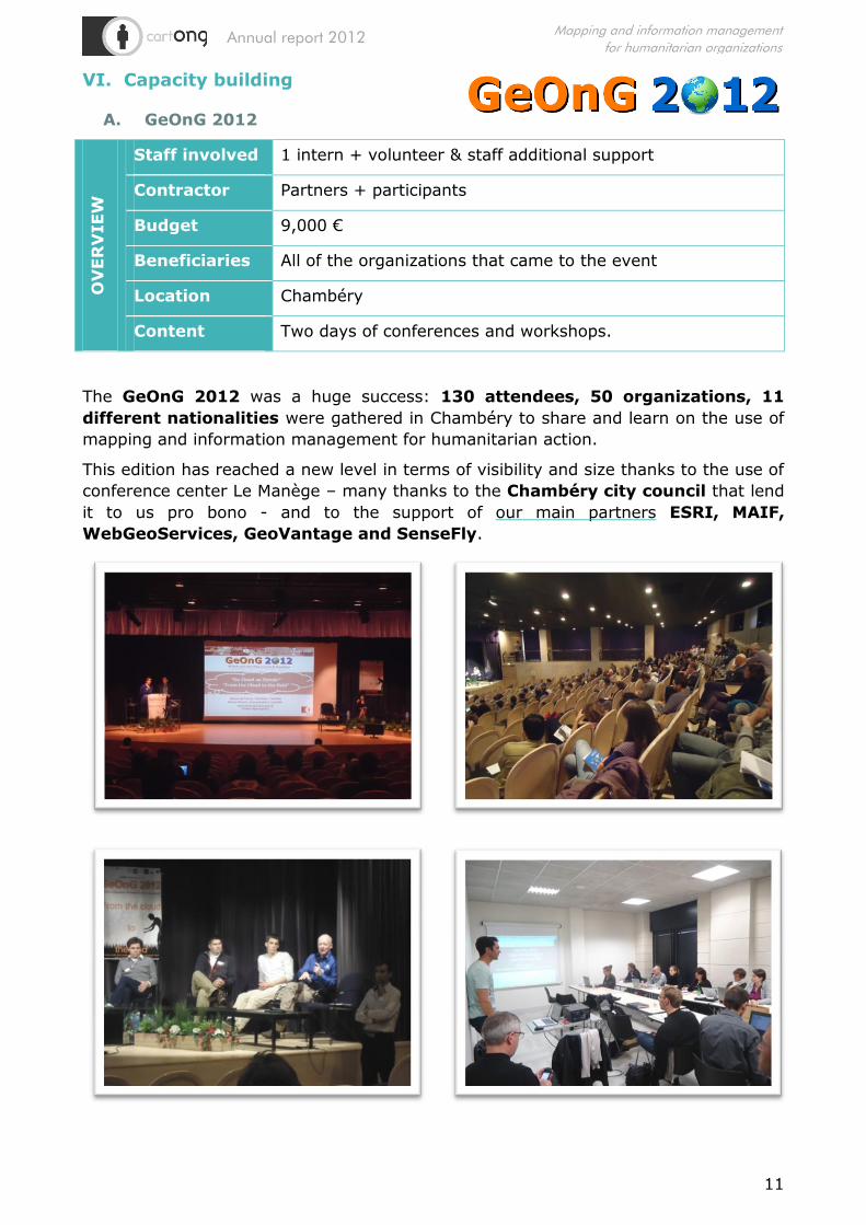
A. GeOnG 2012
OV
ER
VIEW
Staff involved 1 intern + volunteer & staff additional support
Contractor Partners + participants
Budget 9,000 €
Beneficiaries All of the organizations that came to the event
Location Chambéry
Content Two days of conferences and workshops.
The GeOnG 2012 was a huge success: 130 attendees, 50 organizations, 11
different nationalities were gathered in Chambéry to share and learn on the use of
mapping and information management for humanitarian action.
This edition has reached a new level in terms of visibility and size thanks to the use of
conference center Le Manège – many thanks to the Chambéry city council that lend
it to us pro bono - and to the support of our main partners ESRI, MAIF,
WebGeoServices, GeoVantage and SenseFly.

Annual report 2012
12
Mapping and information management
for humanitarian organizations
B. Google ReDD+ E-Learning Project O
VER
VIEW
Staff involved 2 employees (coordinator & tester), 4 consultants
(developers and implementation of training modules)
Contractor TIDES
Budget 38,200 US$ 7
Beneficiaries Online course attendees
Location Global (online)
Content Supplying E-learning module to map deforestation.
In the continuity of the Google REDD+ project of publication and mapping of
deforestation and forest degradation, CartONG finished the e-learning module on
Moodle platform on these questions to facilitate the training of actors and potential
actors on similar projects worldwide and allow them to plan and conduct a REDD+
project with local communities. The E-learning platform contains four modules: Forest
Inventory, Carbon Model, GIS and Remote Sensing. All modules are based on Open
Source Tools to make them easily usable by grassroot level organizations. All modules
can now be tested.
The next step is to disseminate the module as a
free resource but funding will need to be found.
C. International Committee of the Red Cross
OV
ER
VIEW
Staff involved 2 employees
Contractor ICRC
Budget 2,700€
Beneficiaries ICRC
Location France & Geneva
Content Production of six additional screencast videos for ICRC
internal GeoPortal Learning Corner.
CartONG started to create screencast videos explaining the functions of the GeoPortal
Learning Corner in easy terms and with illustration material and suitable examples
already in 2011. Six videos could not be completed at the time since the functions
they were meant to explain were being modified. Therefore ICRC commissioned
CartONG in 2012 to produce the missing screencasts, providing a generic storyline
and examples which was filled with narration and integrated into the existing web
browser.
7 2012 only

Annual report 2012
13
Mapping and information management
for humanitarian organizations
D. Bioforce: Training of WASH and Logistics Experts O
VER
VIEW
Staff involved 1 employee & 1 consultant
Contractor Bioforce
Budget 2,100€
Beneficiaries Course participants
Location Lyon, France
Content GIS trainings
CartONG started to deliver Google Earth as well as Quantum GIS trainings on a
regular basis since 2010. There are normally three series of trainings throughout the
year, lasting from 1-3 days; covering Google Earth functionalities and Quantum GIS
for WASH and Logistic Experts. They are directed towards water specialist and logistic
specialist.
VII. Outreach & advocacy
One of CartONG’s main aims is to transfer its skills and knowledge towards other
actors of the relief work field, we therefore use specific training sessions to achieve
this aim.
In addition to the trainings and events mentioned above, in 2012 CartONG staff and
volunteers also participated in:
Cash Learning Program Event organized by ODI and Concern (London, March
2012)
Roundtable on humanitarian mapping held by Médecins du Monde (Paris)
Intervention at GIS specialized Carthagéo Professional Master (Paris)
GIS for the United Nations and the international community (Geneva)
Humanitarian Jobs Exhibition (Annemasse, France, November 2012)
Salon des Solidarités (Paris, June 2012)
UNHCR NGO Consultation (Geneva, July 2012)
Marché des continents (Chambéry)
UN-SPIDER Expert Meeting Crowdsource Mapping (Vienna, December 2012)
Members of the association also wrote different articles to communicate on the need
of more organized geographic information in the humanitarian world (Youphil.com, La
Revue Humanitaire).
Annual report 2012
14
Mapping and information management
for humanitarian organizations
FINANCIAL REPORT
CartONG has finished the year with a positive balance of 8729.57€, an amount we
have managed to save by reducing our costs wherever it was possible8. This amount
will be added to our security savings, used for unexpected expenses and to develop
the association.
CartONG had a budget of 193,274€ in 2012, funded mostly (93.6%) by the partners
organizations we are working for, UNHCR for the two-thirds. The rest came from the
GeOnG organization (5.5%) and trainings (0.5%). CartONG only received 500€ of
public subventions in 2012 (0.26% of our budget).
The budget is inferior to last year’s (259.916€) due to the departure of several
employees who directly joined the organizations they were working for seconded by
CartONG.
Our expenses amount to 185,423€ (also decreasing from last year’s 233,872€).
They were split between material expenses, transports & general fees (52%), salaries
& social charges (46%) and taxes & other expenses (2%).
The objective for the coming years will be to develop our own projects &
activities, starting by new trainings, in order to stabilize the association’s finances.
This will allow us to recruit a permanent administrator based in Chambéry, who
will relieve our technicians from some of their administrative tasks, hence leaving
them more time to concentrate on their core tasks.
PERSPECTIVES FOR 2013
I. Professional projects
Several projects have already been planned or envisaged for 2013, most of them
being the continuation of ongoing projects:
Continuation of UNHCR Android Project with FICSS and PHHIVS
Global Shelter Advisor with UNHCR Shelter Section (SSS)
Continuation of GIS activities with UNHCR FICSS
Continuation of Landscape Planning and Bufferzone as well as REDD+ Activities
with GIZ in Vietnam
Continuation of NOMAD project through HIF funding
Closer collaboration with IMS on similar projects as the one conducted in Kenya
ODK Mobile Data Collection with REACH in South Sudan
Besides these projects, CartONG intends to develop its training activities (online and
classroom) in 2013, in order to fulfill our mission of capacity building but also to
stabilize our activities. And we will of course continue offering to NGOs and
international organizations a whole range of mapping and information
management services to improve their actions!
8 Note: not all projects and financing structures allow for savings, which is why the yearly amount
qualifying for saving is limited.

Annual report 2012
15
Mapping and information management
for humanitarian organizations
II. Volunteers’ projects
CartONG’s volunteers activities will get an important push-up in 2013 with the
recruitment of a volunteer’s project coordinator (for 6 months first). His objectives
will be to advance on the existing projects, identify new projects, research funding for
volunteer’s activities, induce partnerships with other NGOs, increase CartONG’s
outreach in France, and generally speaking to help the volunteers’ work.
Two important volunteers’ projects will be developed this year:
The project of participatory mapping, in partnership with native communities’
organizations in the East of the Democratic Republic of the Congo,
should enter in its operational phase with the creation of a pilot website and web
GIS. Volunteers are actively searching funds in order to finance the training field
mission and the material needed, please get in touch with us if you have ideas
or want to contribute!
The project of emergency mapping in collaboration with the NGO
GIS74 (Groupe d’Intervention et de Secours de Haute-Savoie)
will start this year with the creation of a roster of volunteers and
mapping procedures. The aim of this project is to provide context
maps for the firemen when they deploy for their rescue missions
after disasters.
CartONG also intends to develop its relations with small NGOs, locally, nationally
and internationally. The vocation of our volunteers is to provide pro bono services to
small NGOs who don’t have resources to finance professional resources in mapping
and information management.
We will also search for funds in order to continue the growth of the association. All
our resources are currently directly affected to professional projects
implementation and HQ support for them, leaving us almost nothing for volunteers
and their projects. In order to fulfill our mission of supporting small NGOs and citizen’s
initiatives, we will need some funding to organize and implement our activities – even
volunteer’s activities have a (small) cost: trainings, material, transports,
coordination, etc. If you have ideas of foundations or donors that could support us, or
want to help us in this effort, please contact us!
One of our objectives for next year is to adopt project management procedures for
volunteers, in order to improve their action and to assess the time spent. We will then
be able to measure the contribution of our volunteers more precisely.
Volunteers will also continue to give interventions in universities and attend events
(SIG la Lettre, OpenStreetMap’s State of the Map France, UNSPIDER, etc.). And, last
but not least, we will start the preparation of our flagship event, GeOnG 2014!
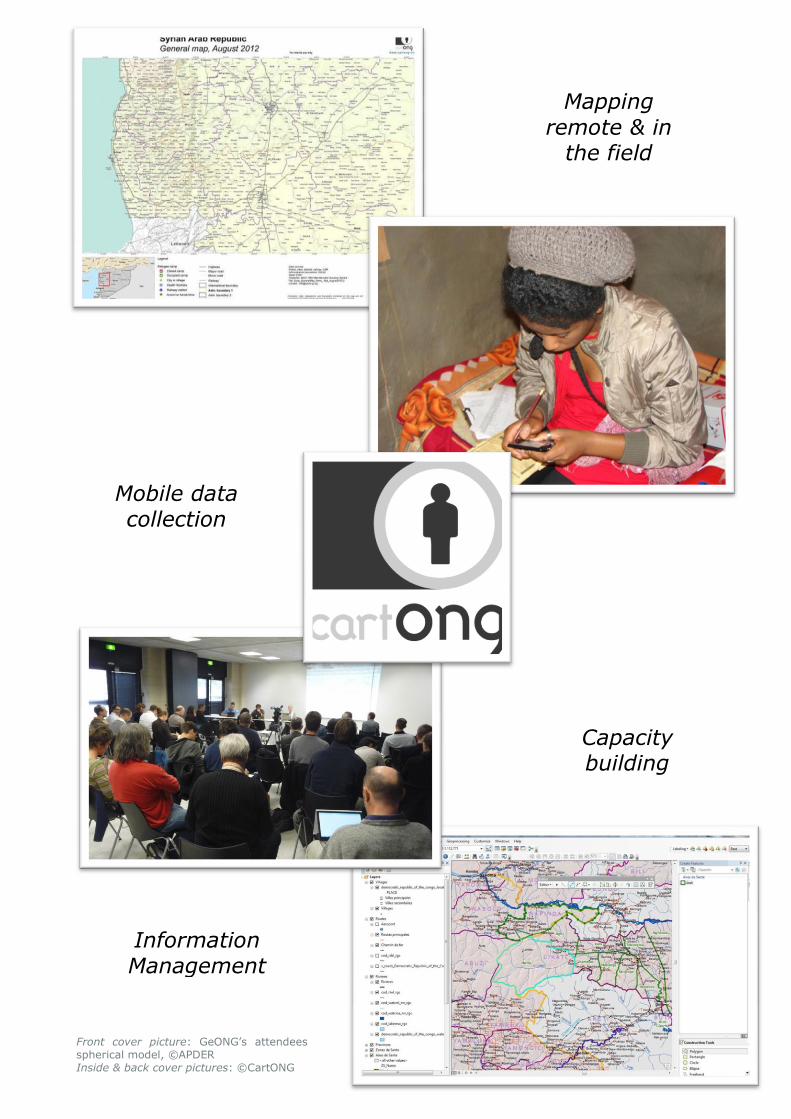
Mobile data collection
Mapping
remote & in the field
Capacity building
Information Management
Front cover picture: GeONG’s attendees spherical model, ©APDER Inside & back cover pictures: ©CartONG