a brief history of logan square - chicago complete...
TRANSCRIPT

A Brief History of Logan Square

1800 1825 1850 1875 1900 1925 1950 1975 2000
Pioneers Martin Kimbell and Sarah Smalley-Kimbell from New York establish the first farm
in the area surrounded by Kimball/Diversey, Fullerton, and Hamlin Avenues.
1836
1800 1825 1850 1875 1900 1925 1950 1975 2000
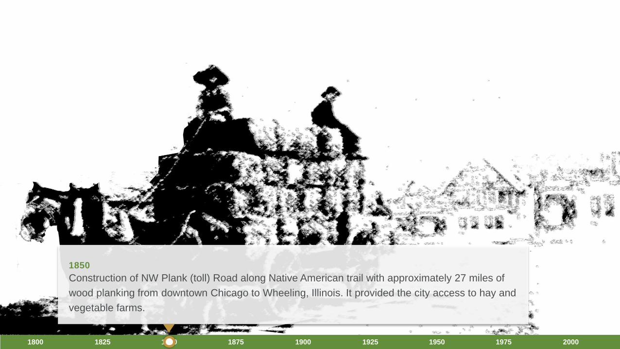
1850
Construction of NW Plank (toll) Road along Native American trail with approximately 27 miles of
wood planking from downtown Chicago to Wheeling, Illinois. It provided the city access to hay and
vegetable farms.
1800 1825 1850 1875 1900 1925 1950 1975 2000
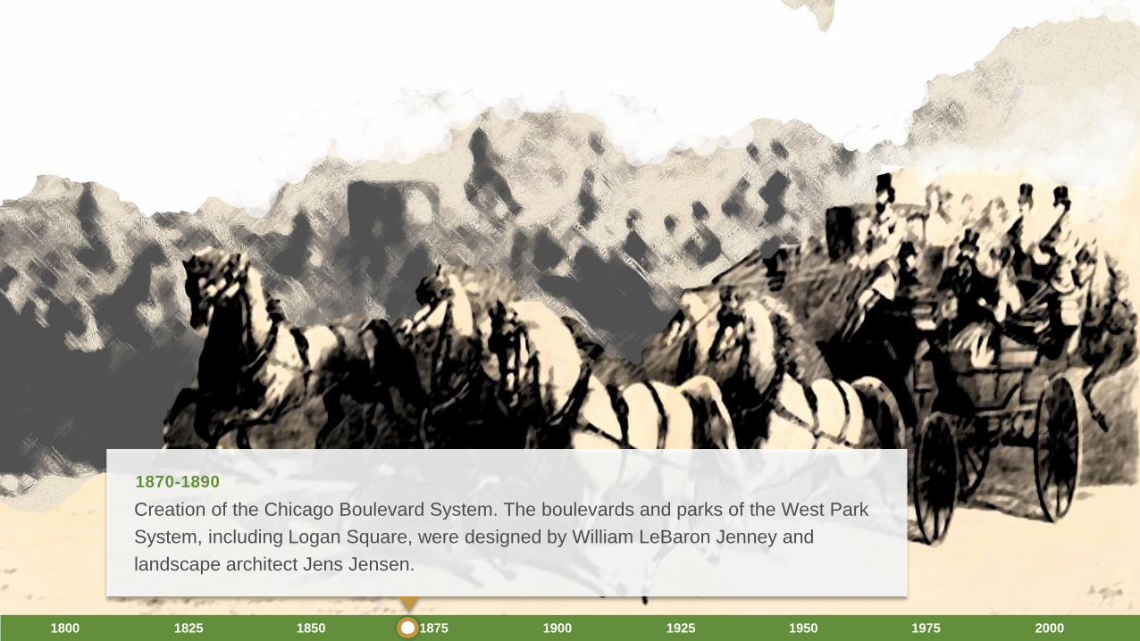
1870-1890
Creation of the Chicago Boulevard System. The boulevards and parks of the West Park
System, including Logan Square, were designed by William LeBaron Jenney and
landscape architect Jens Jensen.

1800 1825 1850 1875 1900 1925 1950 1975 2000
1881
The Kimbell Family farm (from which we get “Kimball” Ave.) sits among an
increasingly subdivided area near wide open prairie east of Kedzie.

The “Little Red Schoolhouse” is established as the first permanent
school. The four-bedroom brick building remained in use until 1914.
1800 1825 1850 1875 1900 1925 1950 1975 2000
1881

1800 1825 1850 1875 1900 1925 1950 1975 2000
1889
The town of Jefferson and Maplewood are annexed into the city of
Chicago, forming the community of Logan Square.
1800 1825 1850 1875 1900 1925 1950 1975 2000
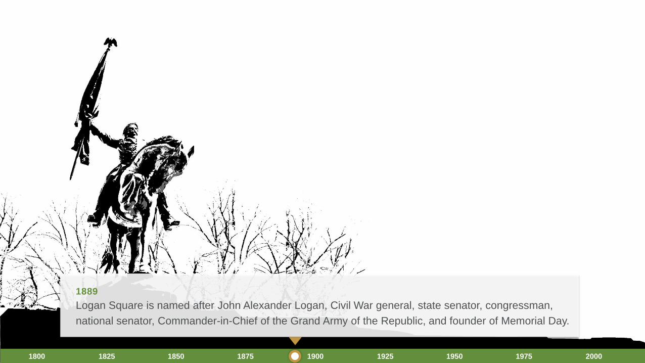
1889
Logan Square is named after John Alexander Logan, Civil War general, state senator, congressman,
national senator, Commander-in-Chief of the Grand Army of the Republic, and founder of Memorial Day.

1800 1825 1850 1875 1900 1925 1950 1975 2000
1895
The Metropolitan Elevated begins running trains from the Loop to Logan Square,
establishing the area as an important destination and transfer point.
Pictured: The Logan Square elevated terminal

1915-1918
Construction of the Illinois Centennial Monument designed by architect Henry Bacon with
sculpture by artist Evelyn Longman. This monument honored a century of statehood and
Illinois’ contributions to the Union from the 1818 to 1918.
1800 1825 1850 1875 1900 1925 1950 1975 2000

1800 1825 1850 1875 1900 1925 1950 1975 2000
Original Plan of the Centennial Monument
Note: “Humboldt Boulevard” is a two-way roadway that crosses the Square at a diagonal. Also notice the radii of the
corners.
1915-1918
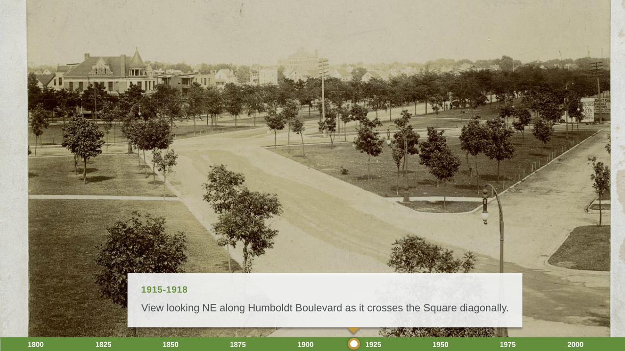
View looking NE along Humboldt Boulevard as it crosses the Square diagonally.
1800 1825 1850 1875 1900 1925 1950 1975 2000
1915-1918

1800 1825 1850 1875 1900 1925 1950 1975 2000
Pictured: Metropolitan Elevated Terminal, also known as the Logan
Square ‘L’ station.
1928

1800 1825 1850 1875 1900 1925 1950 1975 2000
Historic Milwaukee Avenue buildings front the Square.
Note: The buildings continue along the edge of the Square.
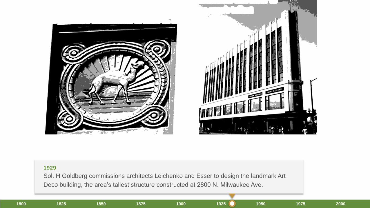
1929

1800 1825 1850 1875 1900 1925 1950 1975 2000
“Bird’s Eye” view looking east.
1929
1800 1825 1850 1875 1900 1925 1950 1975 2000
Sol. H Goldberg commissions architects Leichenko and Esser to design the landmark Art
Deco building, the area’s tallest structure constructed at 2800 N. Milwaukee Ave.
1929

1800 1825 1850 1875 1900 1925 1950 1975 2000
Streets are widened around the Square. Contemporary lighting replaces the
historic lamps.
1940s-1950s

1800 1825 1850 1875 1900 1925 1950 1975 2000
Boulevards are widened and Interstate 94 was constructed.
Pictured: Construction crews excavating Milwaukee Avenue through Logan Square for the new subway stations.
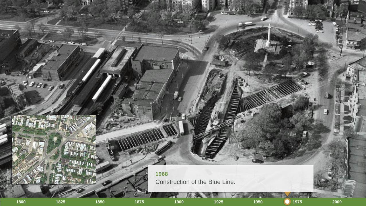
1950-1960
1800 1825 1850 1875 1900 1925 1950 1975 2000
Construction of the Blue Line.
1968
1800 1825 1850 1875 1900 1925 1950 1975 2000
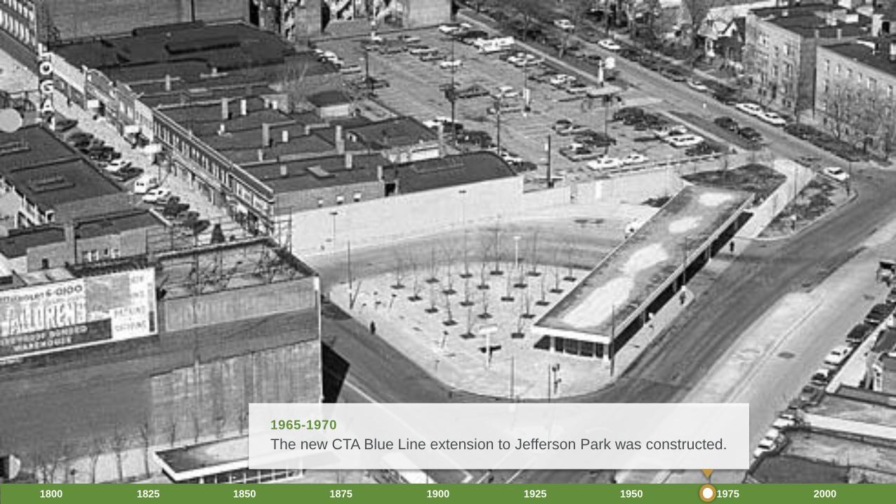
The new CTA Blue Line extension to Jefferson Park was constructed.
1965-1970
1800 1825 1850 1875 1900 1925 1950 1975 2000
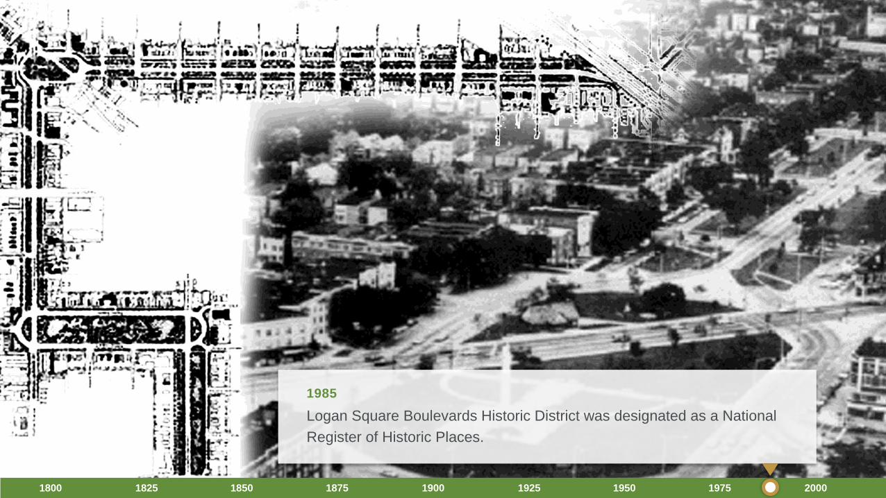
Logan Square Boulevards Historic District was designated as a National
Register of Historic Places.
1985
1800 1825 1850 1875 1900 1925 1950 1975 2000
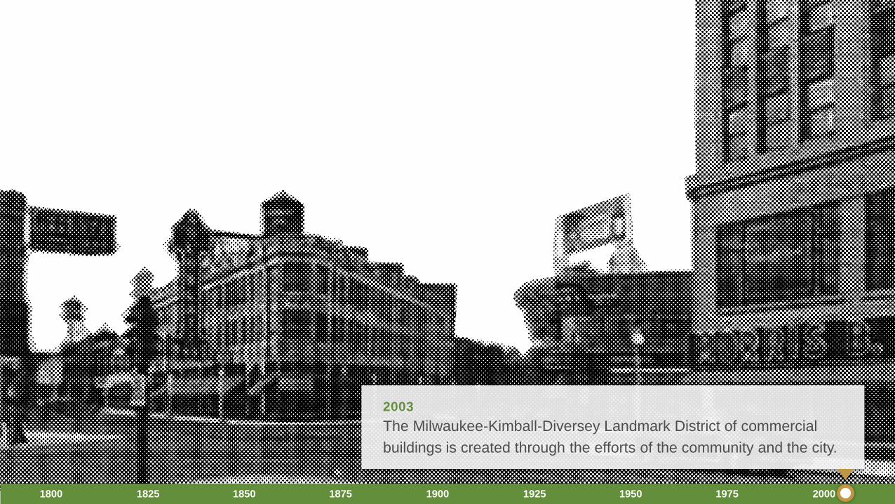
The Milwaukee-Kimball-Diversey Landmark District of commercial
buildings is created through the efforts of the community and the city.
2003
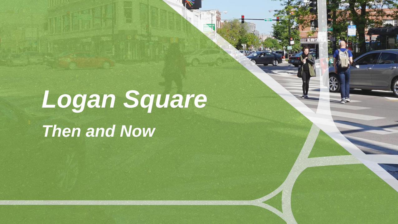
Logan SquareThen and Now

View looking south along Milwaukee Avenue from the SE corner of the Square.
THEN–1922

View looking south along Milwaukee Avenue from the SE corner of the Square.
NOW–2017

NW corner of Milwaukee Avenue and the Square.
THEN–1922

NW corner of Milwaukee Avenue and the Square.
NOW–2017
The Chicago Department of
Transportation wishes to acknowledge
the assistance of the following:
• The City of Chicago
DPD Historic Preservation Division
• Chicago Park District Archive at the Art Institute
• CTA Archive
• Chicago Tribune
• The Chicago History Museum
• Andrew Schneider Logan Preservation
Thank you