5. community design element updated - chico
TRANSCRIPT

5 . C O M M U N I T Y D E S I G N
Chico General Plan 5-1
VISION
Chico retains its distinct small-town charm in the year 2030, attractive to longtime and
new residents as well as the dynamic student population at California State University
Chico, all of who continue to replenish Chico’s multi-generational vitality and culture.
Rich agricultural lands, west to the Sacramento River, and scenic foothills of the Sierra
Nevada have been preserved. The City’s historic Downtown and adjacent
neighborhoods continue to serve as model neighborhoods that convey a unique
pedestrian-oriented character. Eclectic architectural styles, both old and new, continue
to define the built environment. Visitors easily recognize the community’s cultural
pride exhibited by timeless architecture, the beauty of the natural environment, public
art, gathering places, and neighborhood landmarks that establish Chico’s identifiable
sense of place.
INTRODUCTION
The Community Design Element focuses on the visual quality of the physical elements and
spaces that shape Chico.
The City’s natural attributes such as agriculture, foothills, trees, and creeks have contributed
to the shape and urban form of the City. These physical elements, as well as the City’s
development patterns, landmark buildings, and streets, contribute to Chico’s overall character
and identity.
Quality, compatible design is highly valued by the community. The differences between
development patterns in newer and older areas of the City are obvious. The original grid
pattern of the City streets and the architectural identity in the Downtown core and
surrounding older neighborhoods provide a sharp
contrast to the post-World War II development
with arterial streets, curvilinear street patterns,
and diverse architectural styles and forms.
In terms of the built community, the distinctive
qualities of Chico are best reflected in the older
areas of the City, which are generally located to
the west of State Route 99. Downtown Chico and
its surrounding neighborhoods, including the
South of Campus Neighborhood, the Avenues
Neighborhood, and the Southwest Chico
Neighborhood, are characterized by a grid street
pattern, well-defined borders, tree-lined streets, a diversity of lot sizes and housing types, and
a clear neighborhood identity that sets them apart from other parts of the City.
Urban Design Concepts and Elements

5 . C O M M U N I T Y D E S I G N
5-2 Chico General Plan
The Community Design Element is an optional element of the General Plan that is related to
several other General Plan elements. Specifically, this element prioritizes the importance of a
compact urban form and of creating, preserving and enhancing the distinct neighborhoods of
Chico. In addition to the community design policies established by this element, the City of
Chico Design Guidelines Manual provides more specific architectural design guidance and
solutions for a wide spectrum of project types. The Manual is intended to guide the aesthetic
qualities of development in Chico and maintain its dignified visual character by integrating
timeless architectural and landscape design with the natural beauty of its surrounding
environment. References to the Manual are made in this element where appropriate.
ISSUES AND CONSIDERATIONS
This section of the element identifies and addresses primary community design issues raised
during the outreach efforts for the General Plan Update. Policy guidance is found in the
goals, policies, and actions section of this element. An explanation of specialized terms can
be found in the General Plan Glossary (Appendix A).
INFILL DESIGN COMPATIBILITY
Chico is committed to a more sustainable development pattern by focusing new growth into
infill areas. Creating a more compact urban form strengthens communities by placing
residences, jobs, services and facilities in close
proximity to one another. While the goal of compact
urban form and encouraging infill is not new, infill
projects remain some of the most controversial
projects in Chico. Directing new development into
already developed areas raises the critical issues of
how new infill will relate to the existing context of an
area in terms of design and density. The Community
Design Element establishes policies and actions to
guide the design of infill development to be
compatible with its neighborhood.
NEIGHBORHOOD CHARACTER
As described in the Land Use Element, this General Plan focuses on establishing a balanced
plan for the mix and distribution of land uses. In terms of land use components, many Chico
residents identify most with their local neighborhoods and want to be involved in setting
priorities for their neighborhoods. In recent years, the City created the Housing and
Neighborhood Services Department which supports community efforts to develop and adopt
neighborhood plans. The Community Design Element recognizes the character of Chico’s
diverse neighborhoods and supports the development of neighborhood plans. This element
also establishes policies that guide the creation, maintenance, and enhancement of Chico’s
neighborhoods.

5 . C O M M U N I T Y D E S I G N
Chico General Plan 5-3
SENSE OF PLACE
Chico residents place a high value on maintaining the community’s sense of place. However,
this requires a common understanding of the characteristics which define that sense. This
element explains the defining qualities of existing development in Chico that are essential to
maintaining its sense of place in both developed and growing areas of the City. Emulating
desirable features of Chico’s older neighborhoods and commercial districts in new
development can lend continuity that reinforces the City’s sense of place and unique identity.
The Community Design Element includes goals, policies, and actions to (1) address
community-wide investment for improved urban
design, (2) ensure appropriate design continuity
between existing and future development and (3)
celebrate cultural and historic resources in Chico.
New development and redevelopment guided by this
element will exhibit quality design that is context
sensitive and contributes positively to the character
of the community. The City of Chico Design
Guidelines Manual relies on the sense of place
concept in its implementation.
COMPLETE STREETS AND SCENIC ROADS
The intent of the complete streets concept is to ensure that streets accommodate vehicle,
transit, bicycle, and pedestrian travel. The 2030 Vision Book, explained in the Introduction
chapter, states that in 2030, the City’s bicycle-friendly streets will continue to thrive, tree-
lined streets and boulevards will be a defining characteristic, and streets will be safe, friendly,
and multimodal with dedicated bike lanes. The Community Design Element strives for more
than complete streets; it also calls for enhancing the City’s unique scenic corridors that are
celebrated by Chico residents and visitors as vibrant and attractive public spaces.
WAYFINDING AS DESIGN OPPORTUNITY
Wayfinding is the ability of a person to navigate his or her way to a given
destination by various means including historic landmarks, public art, unique
architectural or design elements, signage, natural features, roads or paths.
Chico has many natural and manmade landmarks to help residents and visitors
orient themselves in the community, such as creeks and open space, foothills,
and major transportation corridors. However, over the past 20 years as the
community grew, it became more difficult to find one’s way around Chico.
There are significant opportunities to improve wayfinding throughout the
community and to improve the sense of arrival to Chico and its neighborhoods.
This element establishes policies and actions to create a comprehensive
wayfinding system in the community.
5 . C O M M U N I T Y D E S I G N
5-4 Chico General Plan
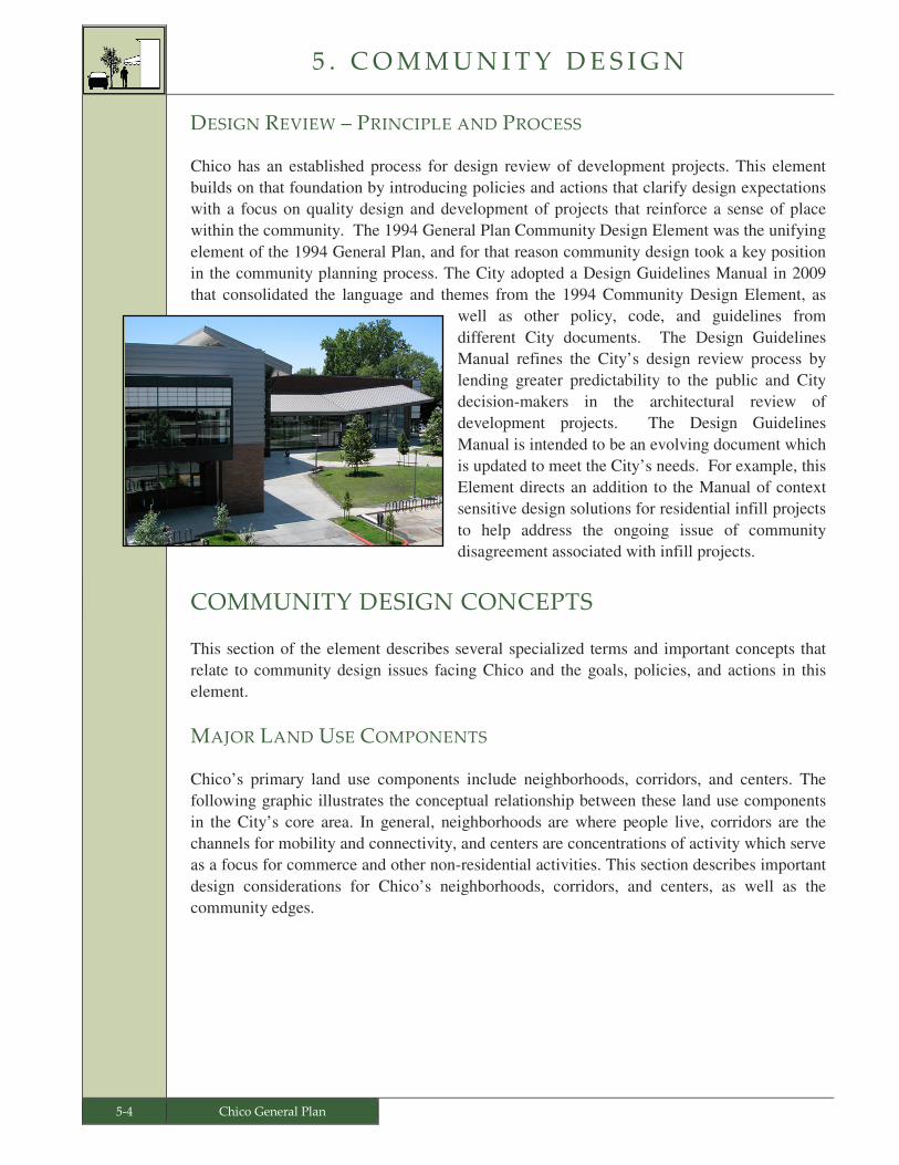
DESIGN REVIEW – PRINCIPLE AND PROCESS
Chico has an established process for design review of development projects. This element
builds on that foundation by introducing policies and actions that clarify design expectations
with a focus on quality design and development of projects that reinforce a sense of place
within the community. The 1994 General Plan Community Design Element was the unifying
element of the 1994 General Plan, and for that reason community design took a key position
in the community planning process. The City adopted a Design Guidelines Manual in 2009
that consolidated the language and themes from the 1994 Community Design Element, as
well as other policy, code, and guidelines from
different City documents. The Design Guidelines
Manual refines the City’s design review process by
lending greater predictability to the public and City
decision-makers in the architectural review of
development projects. The Design Guidelines
Manual is intended to be an evolving document which
is updated to meet the City’s needs. For example, this
Element directs an addition to the Manual of context
sensitive design solutions for residential infill projects
to help address the ongoing issue of community
disagreement associated with infill projects.
COMMUNITY DESIGN CONCEPTS
This section of the element describes several specialized terms and important concepts that
relate to community design issues facing Chico and the goals, policies, and actions in this
element.
MAJOR LAND USE COMPONENTS
Chico’s primary land use components include neighborhoods, corridors, and centers. The
following graphic illustrates the conceptual relationship between these land use components
in the City’s core area. In general, neighborhoods are where people live, corridors are the
channels for mobility and connectivity, and centers are concentrations of activity which serve
as a focus for commerce and other non-residential activities. This section describes important
design considerations for Chico’s neighborhoods, corridors, and centers, as well as the
community edges.

5 . C O M M U N I T Y D E S I G N
Chico General Plan 5-5
Neighborhood Design
From a community design perspective, the diverse neighborhoods that form the fabric of Chico
are among the community’s greatest assets. Neighborhoods are places where people live and
share a sense of identity. Neighborhoods vary widely in size, composition and configuration,
but they share certain common traits. Neighborhoods are predominantly residential, generally
include community gathering places, and share supporting service areas with other surrounding
neighborhoods. Consistent with the policies in the Land Use Element, new neighborhoods
will be designed and developed as complete neighborhoods. Additionally, infill and
redevelopment within existing neighborhoods should enhance developed areas consistent
with the complete neighborhood concept explained in the Land Use Element.
Key neighborhood design considerations include:
• Mix of Uses and Housing. Neighborhoods provide a variety of housing types, and
include non-residential uses that address the daily needs of residents.
• Transitions. Neighborhoods have transitions in scale, form and character between
different land uses such as between residential and non-residential or between the
natural and built environment.
• Walkability. Neighborhoods are pedestrian-friendly with design features such as
short block lengths, buildings of human scale and orientation, traffic calming
features, safe roadway crossings, and wide, well-lit sidewalks that are separated from
roadways by landscaped parkways.
Conceptual Illustration of Neighborhoods, Corridors, and Centers

5 . C O M M U N I T Y D E S I G N
5-6 Chico General Plan
• Linkages. Neighborhoods include convenient connections for all modes of travel to
key destinations such as schools, neighborhood centers, and adjoining
neighborhoods.
• Public Gathering Places. Neighborhoods have
desirable places for residents, customers, and
employees to socialize, such as plazas, community
centers, and parks.
• Connections to Open Space. Neighborhoods are
well-integrated with their natural surroundings and
are connected to open space and recreational
amenities by trails and bikeways.
• Urban Forest. Neighborhoods have street trees and landscaped parkways to enhance
neighborhood character and identity.
Corridor Design
Corridors, both natural and man-made, form boundaries, but also provide connections
between neighborhoods and centers. They are prominent places that reflect community
identity and character. Corridors in Chico include transportation corridors, commercial
corridors, and open space corridors.
• Transportation Corridors. Transportation corridors are roadways within the
community that primarily serve to move people from one area of the City to another.
They are typically multimodal arterial roadways connecting residents and employees
to destinations, such as shopping, jobs, recreation, and schools. Examples of
transportation corridors are Manzanita Avenue, Eaton Road, and East Avenue.
• Commercial Corridors. Commercial corridors are
significant roadways that are lined with businesses.
Traffic speeds are generally slower due to the
volume and frequency of turning movements.
Examples of commercial corridors include
Mangrove Avenue and 20th Street.
• Open Space Corridors. Open space corridors are
natural areas providing visual and physical linkages
and habitat along creeks and designated open spaces
and parks. Open space corridors include creekside
greenways such as Lindo Channel and linear parks
such as Bidwell Park.
5 . C O M M U N I T Y D E S I G N
Chico General Plan 5-7
Key corridor design considerations include:
• Creekside Considerations. Creeks are a benefit to the built environment and the
community. Development and infrastructure improvements need to consider public
access, views, and the protection of biological resources as fundamental design
elements.
• Streetscape Design. Well-designed streets accommodate multiple modes of
transportation and exhibit identifiable design elements that complement the character
of adjoining properties.
• Wayfinding System. Corridors guide movement and as such they are ideal locations
for incorporating wayfinding elements that help with orientation and direction.
Center Design
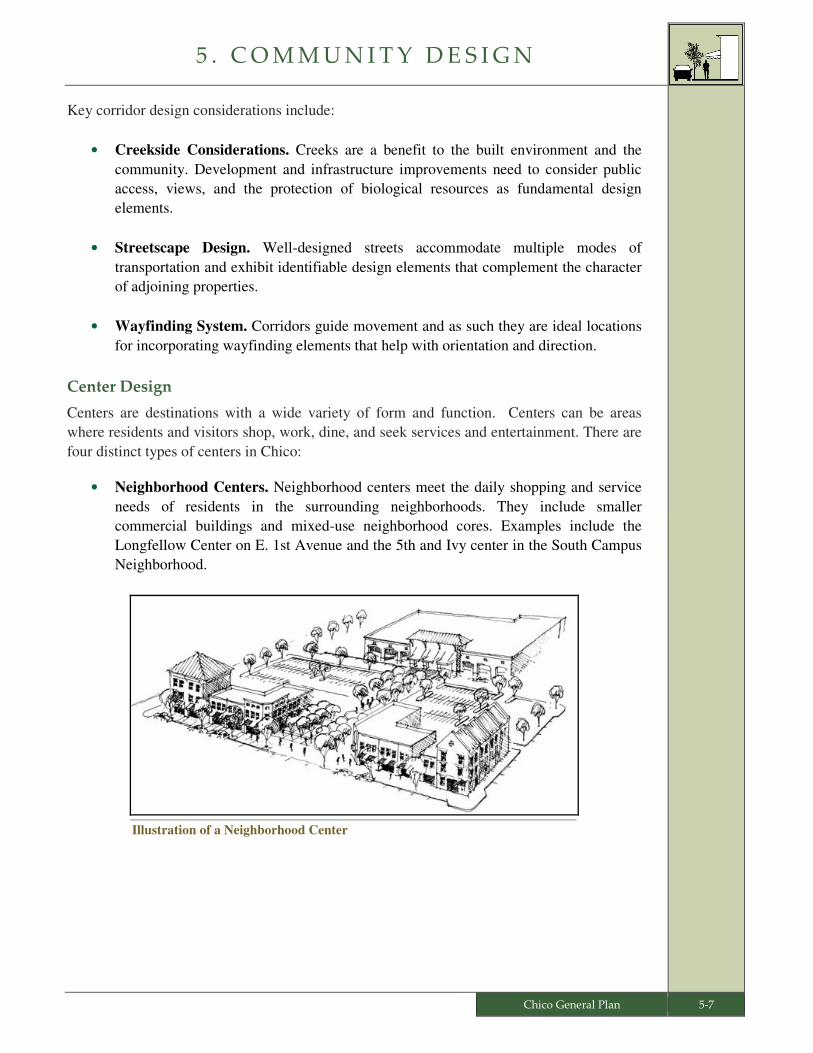
Centers are destinations with a wide variety of form and function. Centers can be areas
where residents and visitors shop, work, dine, and seek services and entertainment. There are
four distinct types of centers in Chico:
• Neighborhood Centers. Neighborhood centers meet the daily shopping and service
needs of residents in the surrounding neighborhoods. They include smaller
commercial buildings and mixed-use neighborhood cores. Examples include the
Longfellow Center on E. 1st Avenue and the 5th and Ivy center in the South Campus
Neighborhood.
Illustration of a Neighborhood Center
5 . C O M M U N I T Y D E S I G N
5-8 Chico General Plan
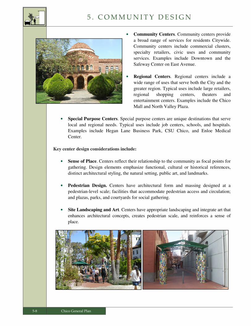
• Community Centers. Community centers provide
a broad range of services for residents Citywide.
Community centers include commercial clusters,
specialty retailers, civic uses and community
services. Examples include Downtown and the
Safeway Center on East Avenue.
• Regional Centers. Regional centers include a
wide range of uses that serve both the City and the
greater region. Typical uses include large retailers,
regional shopping centers, theaters and
entertainment centers. Examples include the Chico
Mall and North Valley Plaza.
• Special Purpose Centers. Special purpose centers are unique destinations that serve
local and regional needs. Typical uses include job centers, schools, and hospitals.
Examples include Hegan Lane Business Park, CSU Chico, and Enloe Medical
Center.
Key center design considerations include:
• Sense of Place. Centers reflect their relationship to the community as focal points for
gathering. Design elements emphasize functional, cultural or historical references,
distinct architectural styling, the natural setting, public art, and landmarks.
• Pedestrian Design. Centers have architectural form and massing designed at a
pedestrian-level scale; facilities that accommodate pedestrian access and circulation;
and plazas, parks, and courtyards for social gathering.
• Site Landscaping and Art. Centers have appropriate landscaping and integrate art that
enhances architectural concepts, creates pedestrian scale, and reinforces a sense of
place.
5 . C O M M U N I T Y D E S I G N
Chico General Plan 5-9
Edges
Chico is defined by its edges. The edge of a city can be “hard,” where there is an abrupt or
clearly defined transition between urban and rural or undeveloped uses, or “soft,” where the
transition between urban and rural is more gradual. Chico seeks to transition the density and
intensity of uses from an urban to rural character while maintaining a clear City edge and
establishing a sense of entry and arrival to the City.

5 . C O M M U N I T Y D E S I G N
5-10 Chico General Plan
GOALS, POLICIES, AND ACTIONS
Goal CD-1: Strengthen Chico’s image and sense of place by reinforcing the
desired form and character of the community.
Goal CD-2: Enhance edges and corridors that represent physical boundaries,
transitions and connections throughout the community.
Goal CD-3: Ensure project design that reinforces a sense of place with context
sensitive elements and a human scale.
Goal CD-4: Maintain and enhance the character of Chico’s diverse
neighborhoods.
Goal CD-5: Support infill and redevelopment compatible with the surrounding
neighborhood.
Goal CD-6: Enhance gateways and wayfinding systems for an improved sense of
arrival and orientation for residents and visitors throughout Chico.
Goal CD-7: Celebrate public art and expand the significant role the arts play in
the quality of life and economic vitality of Chico.
� Goal CD-1: Strengthen Chico’s image and sense of place by reinforcing the
desired form and character of the community.
• Policy CD-1.1 (Natural Features and Cultural Resources) – Reinforce the City’s
positive and distinctive image by recognizing and enhancing the natural features
of the City and protecting cultural and historic resources.
� Action CD-1.1.1 (Highlight Features and Resources) – Incorporate and
highlight natural features such as scenic vistas, creeks, and trees, as well as
cultural resources such as rock walls, into project design.
� Action CD-1.1.2 (Landscape Improvement) – Emphasize landscaping as a
fundamental design component, retaining mature landscaping when
appropriate, to reinforce a sense of the natural environment and to maintain an
established appearance.
• Policy CD-1.2 (Reinforce Attributes) – Strengthen the positive qualities of the
City’s neighborhoods, corridors, and centers.
� Action CD-1.2.1 (Design Considerations) – Review the Community Design
Concepts for neighborhoods, corridors, and centers from this element during
project review.

5 . C O M M U N I T Y D E S I G N
Chico General Plan 5-11
� Action CD 1.2.2 (Pride of Ownership) – Create a program to recognize
property owners for exemplary property care and maintenance along key
streets, gateways, and neighborhoods such as the Eastwood Park Subdivision
along E. 8th and 9th Streets, the south Esplanade, Mansion Park, and along
Woodland Avenue.
� Goal CD-2: Enhance edges and corridors that represent physical boundaries,
transitions and connections throughout the community.
• Policy CD-2.1 (Walkable Grid and Creek Access) – Reinforce a walkable grid
street layout and provide linkages to creeks and other open spaces.
� Action CD-2.1.1 (Circulation and Access) – As part of project review, integrate
a predominately grid-based street pattern into new development to enhance
walkability and public health.
� Action CD-2.1.2 (Bike Trails, Paths and Medians) – Establish linkages and an
improved sense of place through enhanced bike trails, pedestrian paths,
landscaped medians and parkways.
� Action CD-2.1.3 (Greenways) – Continue the City’s existing program to expand
creekside corridors by acquiring properties along creek edges for creekside
greenways.
� Action CD-2.1.4 (Creek Views and Access) – As part of the design review of
development and capital projects, improve visual and recreational public access
to creeks.
• Policy CD-2.2 (City Edge) – Maintain a clear City edge and establish a sense of
entry and arrival to the City.
• Policy CD-2.3 (Corridor Improvements) – Improve corridors traversing the City
to enhance their aesthetics and accessibility.
� Action CD-2.3.1 (Screen State Route 99) – Minimize the visual impact of
State Route 99 to new adjacent development through screening and buffering.
Cross reference CIRC-3.3
Cross reference LU-3.4.2
Cross reference CIRC-4.2
and OS 2.1
Cross-reference DT-6.1,
CIRC-2.2.1 and SUS 1.6
Cross reference
OS-2.2.1 and PPFS-2.1.1
Cross reference
DT-6.2.4 and PPFS 2.1.2
Cross reference
LU-1.2
5 . C O M M U N I T Y D E S I G N
5-12 Chico General Plan
� Action CD-2.3.2 (Specialized Treatment for Scenic Roads) – Incorporate
context sensitive roadway improvements on Chico’s scenic roads, including
Vallombrosa Avenue, E. 8th Street, the Esplanade, Chico Canyon Road,
Centennial Avenue, Manzanita Avenue, Humboldt Road, and Bidwell Avenue.
� Action CD-2.3.3 (Commercial Corridor Improvements) – Update the
Design Guidelines Manual to incorporate concepts from the Park Avenue
Visioning Study to apply to future roadway improvements along the City’s
commercial corridors.
• Policy CD-2.4 (Context Sensitive Foothill Development) – Protect viewsheds
from foothill development, through the careful location and design of roads,
buildings, lighting, landscaping, and other infrastructure.
� Action CD-2.4.1 (Protection of Foothill Viewshed) – Design and blend
foothill development with the surrounding landscape and topography to
diminish its visual prominence from the valley floor.
� Action CD-2.4.2 (Foothill Light Levels) – Design low light levels in foothill
settings to optimize views of dark skies and minimize light pollution.
� Action CD-2.4.3 (Foothill Streets) – In order to minimize cut and fill grading
operations in foothill areas, design new streets at the minimum dimension
necessary for access and parking.
� Action CD-2.4.4 (Block Lengths) – Minimize the length of street blocks in
foothill development.
� Action CD-2.4.5 (Contours of Natural Slope) – Limit the extent and amount
of grading in foothill areas, and where grading occurs, emulate the contours of
the natural slope.
� Goal CD-3: Ensure project design that reinforces a sense of place with context
sensitive elements and a human scale.
• Policy CD-3.1 (Lasting Design and Materials) – Promote architectural design
that exhibits timeless character and is constructed with high quality materials.
� Action CD-3.1.1 (Design Guidelines) – Utilize the City Design Guidelines
Manual for architectural review of discretionary projects.
� Action CD-3.1.2 (Update Design Guidelines) – Update the City Design
Guidelines Manual as necessary to maintain consistency with the General Plan,
Cross reference LU-5.1.4
Cross reference
OS-2.4.1 and LU 6.2.4
Cross reference
CIRC-2.3.1
Cross reference
OS-2.4 and LU-1.2.2
Cross reference
LU-2.4.4 and DT-3.1.1
5 . C O M M U N I T Y D E S I G N
Chico General Plan 5-13
the City’s Land Use and Development Regulations, and current architectural
solutions.
• Policy CD-3.2 (Bicycles and Pedestrians) – Maintain and enhance the
pedestrian- and bicycle-friendly environment of Chico.
� Action CD-3.2.1 (Pedestrian-Scale Site Planning) – Utilize design techniques
provided in the City’s Design Guidelines Manual that support pedestrian- and
bicycle-friendly site planning.
• Policy CD-3.3 (Pedestrian Environment and Amenities) – Locate parking areas
and design public spaces within commercial and mixed-use projects in a manner
that promotes pedestrian activity.
� Action CD-3.3.1 (Public Spaces) – Amend the Municipal Code to establish a
required minimum outdoor area dedicated to public (employee and customer)
gathering as part of new non-residential development.
• Policy CD-3.4 (Public Safety) – Include public safety considerations in
community design.
� Action CD-3.4.1 (Crime Prevention Design) – Incorporate appropriate crime
prevention principles in new development projects to enhance community
safety. Consider Crime Prevention Through Environmental Design (CPTED)
principles when amending development standards.
� Action CD-3.4.2 (Public Safety Project Review) – During design review,
consult with the Police Department to avoid physical conditions such as dark
parking lots or alleys, enclosed stairwells, and dark entrances that are
susceptible to criminal activity.
� Action CD-3.4.3 (Safe Parking Lot Design) – Require that commercial
parking lots be designed with adequate opportunities for surveillance by police.
� Goal CD-4: Maintain and enhance the character of Chico’s diverse
neighborhoods.
• Policy CD-4.1 (Distinctive Character) – Reinforce the distinctive character of
neighborhoods with design elements reflected in the streetscape, landmarks,
public art, and natural amenities.
Cross reference CIRC-9.3
Cross reference
S-5.5.1
Cross reference
LU-3.4
Cross reference CIRC-4.3
and DT-3.1
Cross reference DT-3.1.2
Cross reference S-5.5 and
DT-3.4
5 . C O M M U N I T Y D E S I G N
5-14 Chico General Plan
� Action CD-4.1.1 (Neighborhood Design Details) – Develop and implement
neighborhood plans that identify neighborhood design qualities and
characteristics.
� Action CD-4.1.2 (Urban Forest) – Protect and enhance the urban forest that
characterizes the community and particularly its older neighborhoods.
� Action CD-4.1.3 (Sense of Place) – As part of the design review of
development and capital projects, encourage the integration of civic, cultural,
natural, art, and other themes that create a sense of place for each neighborhood
and contribute to the overall character of the community.
� Goal CD-5: Support infill and redevelopment compatible with the surrounding
neighborhood.
• Policy CD-5.1 (Compatible Infill Development) – Ensure that new development
and redevelopment reinforces the desirable elements of its neighborhood
including architectural scale, style, and setback patterns.
� Action CD-5.1.1 (Residential Infill Design Guidelines) – Update the City’s
Design Guidelines Manual to specifically address residential infill design in terms
of building scale, height and setbacks, parking and access, transitions, and
landscaping.
• Policy CD-5.2 (Context Sensitive Transitions) – Encourage context sensitive
transitions in architectural scale and character between new and existing
residential development.
• Policy CD-5.3 (Context Sensitive Design) – For infill development, incorporate
context sensitive design elements that maintain compatibility and raise the
quality of the area’s architectural character.
� Action CD-5.3.1 (Adaptive Reuse) – Continue the City’s Façade Improvement
Program to support redevelopment and adaptive reuse of transitioning or aging
commercial developments.
� Goal CD-6: Enhance gateways and wayfinding elements for an improved sense
of arrival and orientation for residents and visitors throughout Chico.
• Policy CD-6.1 (Gateways at Landmarks) – Create a sense of arrival to Chico and
develop prominent community focal points at key locations within the City.
Cross reference
OS-6.1 and SUS-6.4
Cross reference
LU-4.2 and LU-5.1.1
Cross reference
LU-4.2.1 and DT-4.2.1
Cross reference LU-6.2.6
Cross reference
CRHP-2.2.1 and DT-8.1
Cross reference DT-4.2.1
Cross reference LU-3.3.1
5 . C O M M U N I T Y D E S I G N
Chico General Plan 5-15
� Action CD-6.1.1 (Gateway Integration) – As part of roadway improvement
projects, integrate artistic gateway features at the following locations:
• State Route 99 near Southgate and Entler Avenues
• Park Avenue near 20th Street
• East 8th and 9th Streets between State Route 99 and Main Street
• State Route 99 near Garner Lane
• Highway 32 between E. East Avenue and Lindo Channel
• Highway 32 near Yosemite Drive.
� Action CD-6.1.2 (Landmarks) – Construct landmarks to support wayfinding
at key locations throughout the City such as entries to historic neighborhoods,
points of interest, significant buildings, and natural features.
• Policy CD-6.2 (No Gated Subdivisions) – Do not allow new gated subdivisions
because they isolate parts of the community from others, create an unfriendly
appearance, and do not support social equity.
� Goal CD-7: Celebrate public art and expand the significant role the arts play in
the quality of life and economic vitality of Chico.
• Policy CD-7.1 (Public Art) – Include art in public projects.
� Action CD-7.1.1 (Art in Public Places) – Include art in public projects and in
all private development projects that use public funding by continuing
implementation of the City’s Art in Public Places Program Policy and
Procedures Manual.
� Action CD-7.1.2 (Funding for Public Art) – Continue the City’s program of
allocating a percentage of capital improvement project budgets to fund the
development and installation of public art projects.
• Policy CD-7.2 (Community and Art) – Foster civic pride with the use of public
art that highlights Chico’s natural resources, cultural heritage, and community
character.
� Action CD-7.2.1 (Public Art Plan) – Develop and maintain a Public Art Strategic
Plan to guide comprehensive integration of public art throughout the community.
• Policy CD-7.3 (City Art Programs) – Provide City programs that foster the arts
in Chico.
Cross reference PPFS-7.1
Cross reference
DT-6.2.1 and DT-6.3.1
Cross reference SUS-1.1
Cross reference
PPFS-7.1.2
Cross reference DT-1.5.3
Cross reference DT-6.2
5 . C O M M U N I T Y D E S I G N
5-16 Chico General Plan
� Action CD-7.3.1 (Update Arts Master Plan) – Update, as necessary, the Arts
Master Plan which guides the design and development of the City's cultural and
arts programs.