3d utility mapping - catt › pdf › trs_ses7_scaife.pdf• level d –historic records, gis and...
TRANSCRIPT

TRENCHLESS TECHNOLOGY ROADSHOW May 28-29, 2014 – Scotiabank Convention Centre, Niagara Falls, ON
3D Utility MappingJohn Scaife & Jeff Lyons
Cole Engineering Group Ltd.

Introduction to Cole Engineering
• Cole Engineering Group Ltd. (CEG) is a client‐focused, value driven consulting engineering company serving clients in the public and private sectors,
• Multi‐Disciplined firm with over 280 people in 3 locations (Markham, Mississauga, Caribbean)
• Service sectors in Municipal Engineering, Environmental Engineering and Science, Transportation and Land Development

What is Subsurface Utility Engineering?
An engineering process which assigns attributes to secured underground utility information Reduces project risks via better information Procured professional service
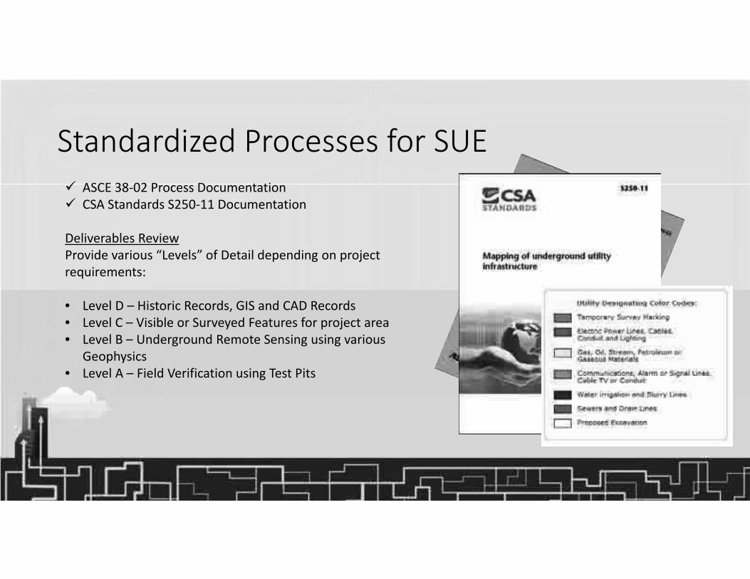
Standardized Processes for SUE ASCE 38‐02 Process Documentation CSA Standards S250‐11 Documentation
Deliverables ReviewProvide various “Levels” of Detail depending on project requirements:
• Level D – Historic Records, GIS and CAD Records• Level C – Visible or Surveyed Features for project area• Level B – Underground Remote Sensing using various
Geophysics• Level A – Field Verification using Test Pits

SUE Level ‘D’ ‐ Utility Records – Various Quality and Format

SUE – Level ‘C’
historic civil engineering practice ‘engineering’ survey of project area capture all visible utility appurtenances plot on composite drawing professional judgment in correlating these data to Level D information

SUE – Level ‘C’ Photo Evidence
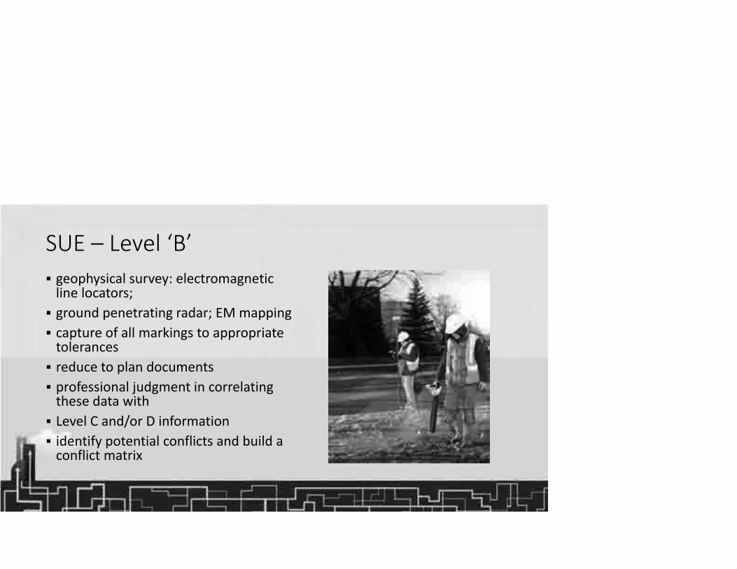
SUE – Level ‘B’ geophysical survey: electromagnetic line locators; ground penetrating radar; EM mapping capture of all markings to appropriate tolerances reduce to plan documents professional judgment in correlating these data with Level C and/or D information identify potential conflicts and build a conflict matrix

SUE Level ‘A’ typically ‘daylighted’ for visual confirmation capture to appropriate tolerances reduce to plan documents resolve or confirm conflicts deliver stamped drawings and support notes

Summary of SUE Process
Utility mapping aids with design SUE is recognized engineering process CSA S250 standardizes depiction Tremendous value to project owners and designers Better information means better design and safer and more productive construction

“3D” = “Building Information Modelling”
• BIM Process supports Collaboration on any project,
• Surveyors• Architects• Engineers• Planners• Clients/Owners• Construction• Government
• Single Model Environment linked to Project Survey, Design and Construction

Why use BIM for Subsurface Utility Engineering?Visualize, Analyze, Collaborate, Communicate...
Create the Existing Base Model from City GIS, Surveyor and other mapping suppliers
Collaborate with Trenchless Strategy in complex Utility projects
Integrate Detailed Design From Engineers using 3D Environment
Perform Crossing and Clash Detection to enhance SUE Services
Deliver GIS Ready Asset Data Sources to the Project Team
Provide Images and Video of the 3D Model for stakeholders

BIM Model of Urban Environment• Project Wide Model compiled from :
• Level ‘D’ ‐ GIS Datasets from City and Various Utilities
• Level ‘C’ – Topo and LiDaR Mobile Ground Survey
• Level ‘B’ – Locate Pickup and Survey
• Level ‘A’ – Test Pit Verification
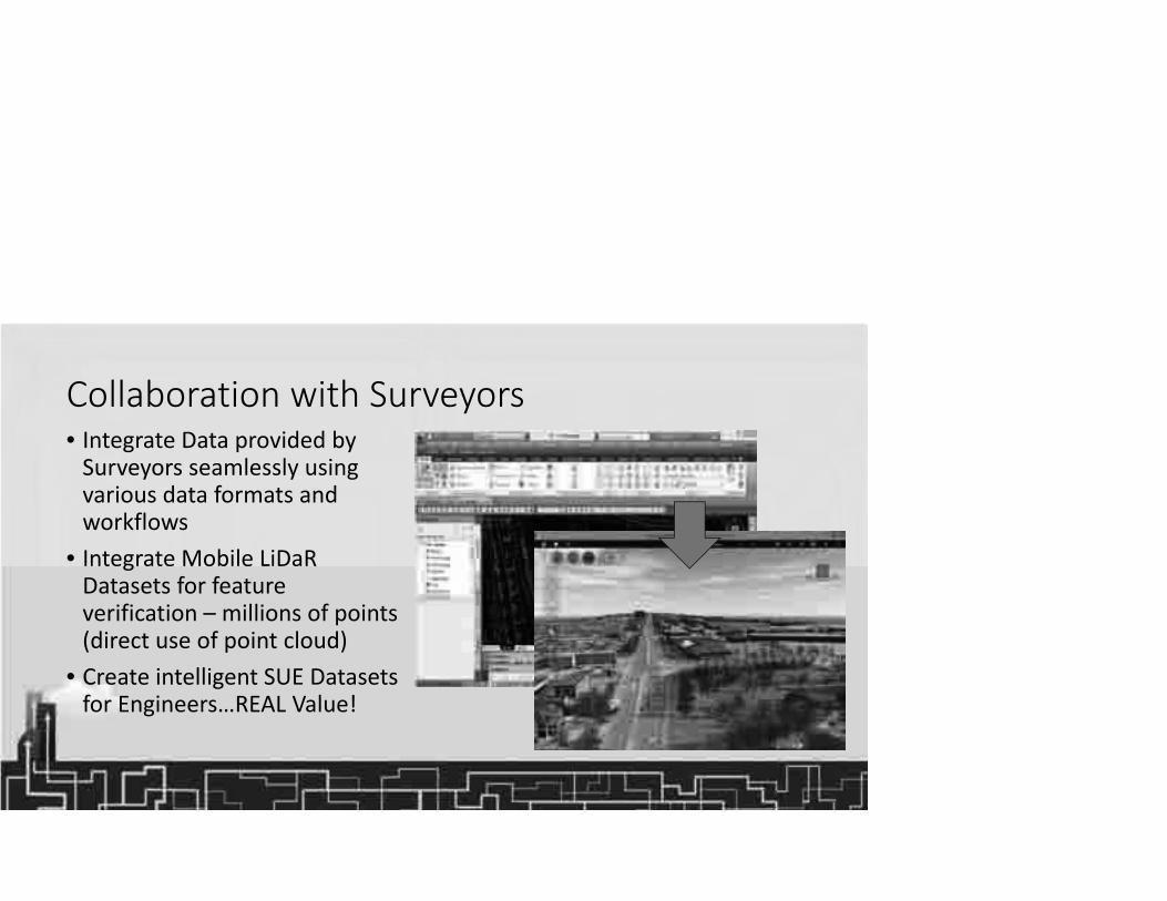
Collaboration with Surveyors• Integrate Data provided by Surveyors seamlessly using various data formats and workflows
• Integrate Mobile LiDaR Datasets for feature verification – millions of points (direct use of point cloud)
• Create intelligent SUE Datasets for Engineers…REAL Value!

Image of Mobile LiDaR, GIS and Survey Datasets
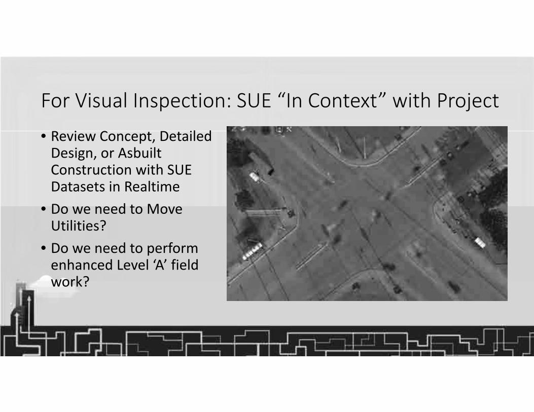
For Visual Inspection: SUE “In Context” with Project• Review Concept, Detailed Design, or Asbuilt Construction with SUE Datasets in Realtime
• Do we need to Move Utilities?
• Do we need to perform enhanced Level ‘A’ field work?

For Design Analysis: Crossing & Clash Detection• Crossing : Level ‘B’ Data between existing and proposed design infrastructure
• Clash : Level ‘A’ Enhanced Utility Data with Z Elevation can determine actual Clash (Hard or Soft)
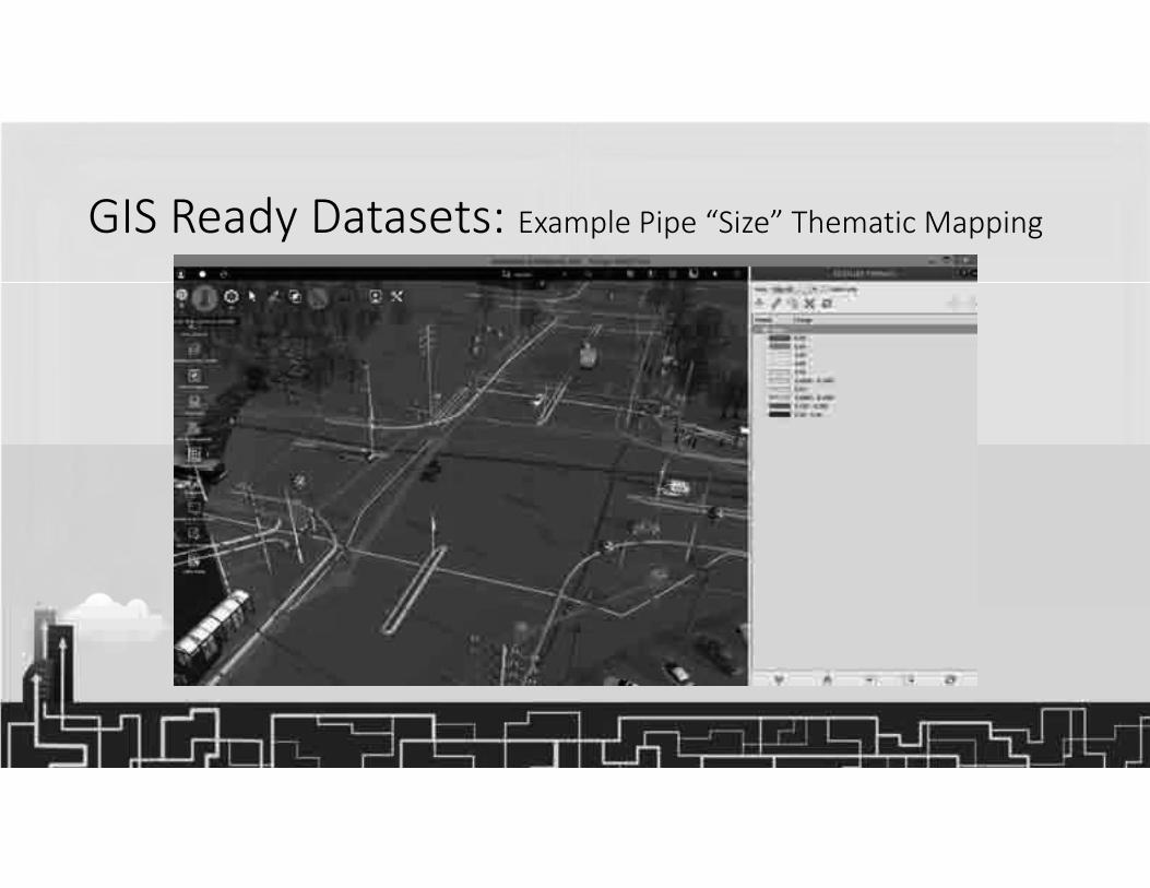
GIS Ready Datasets: Example Pipe “Size” Thematic Mapping
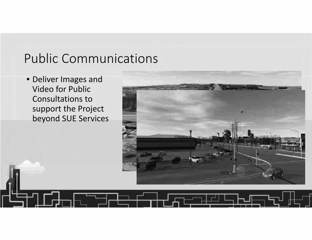
Public Communications• Deliver Images and Video for Public Consultations to support the Project beyond SUE Services

Online Access to SUE Model Data
• Share Models Online with Entire Project Team
• Supports Mobile or Browser based Viewing
• Supports “Augmented Reality” field inspection and review using iPAD

Sample Video from BIM ModelUnderground Yonge Street
Elgin Mills and Yonge Intersection
BIM Environment Navigation and Tooltips
Test Pit Alley

Final Summary
Cole has leading edge expertise and many resourcesSUE adds value to Infrastructure ProjectsBIM Visualization assist SUE Interpretations and Lower RisksBetter Information means Better Design

Questions?
See us at Booth# 46

Come see us at Booth #46 for more information about SUE and BIM Services
www.ColeEngineering.caMarkham Toronto Caribbean
Thank You