2019 cahuilla lodge where to go camping guide version 1
TRANSCRIPT
PRESENTED BY CAHUILLA LODGE # 127, ORDER OF THE ARROW
SERVING CALIFORNIA I N L A N D EMPIRE COUNCIL # 45 SINCE 1973
Cahuilla Lodge
Where to Go Camping
Guide
,
2021

2021 Where To Go Camping Guide – Cahuilla Lodge # 127, Order of the Arrow
www.SnakePower.org Page 1
Front Cover
The flag of California, Cahuilla Lodge Flap, California Inland Empire Council Shoulder Patch and the seals of San Bernardino County and Riverside County.
Contributors
The following people were instrumental in producing and completing this camping guide as a service to the California Inland Empire Council. Many spent countless hours doing research and writing. We would like to thank them for their service.
Mathew Brandt, Jeff Casey, Richard Covington, Brad Denbo, Brad Eells, Matt Harmon, James Hermes, Aaron Jones, Jeremy Long, Ian McLeod, Rosana McLeod, Scott McLeod, Jason Palmantier, Kim Readdy, Tracy Schultz, Jim Thomas, Steve Tyrrell, Vinney Williams, Cynthia Blessum, Jared Brandt, Frank Gruendner, Michael Hare.
We would also like to thank Don Salva, whose work on previous camping guides published by the Order of the Arrow was used in putting together this new edition.
Chapters: Aca – Sunrise District A-tsa – Grey Arrow District Navajo – Old Baldy and Temescal Districts Serrano – High Desert District Tahquitz – Tahquitz District Wanakik – Mt. Rubidoux District
Updates: Version 1.0 – Released December 31, 2006
Version 1.1 – Released January 16, 2007
Version 1.2 – Released December 22, 2010 Version 2.0 – Released October 12, 2014 Version 2.1 – Released October 3, 2015 Version 2.2 – Released September 23, 2016 Version 2.3 – Released September 6, 2017 Version 2.4 – Released September 13, 2018 Version 3.0 – Released September 6, 2019 Version 3.1 – Released August, 2020

2021 Where To Go Camping Guide – Cahuilla Lodge # 127, Order of the Arrow
www.SnakePower.org Page 2
Table of Contents
Contributors .............................................................................................................................. 1 Table of Contents ...................................................................................................................... 2 Letter From The Lodge Chief .................................................................................................... 3 Council Camping Opportunities ................................................................................................. 4
Camp Emerson at Boseker Scout Reservation .......................................................................5 High Adventure / E-Team ...................................................................................................6 Cub Scout Adventures ........................................................................................................7
Council Training Programs ..................................................................................................... 8 Cedar Badge (ILST) ........................................................................................................... 8 NYLT: National Youth Leader Training ................................................................................8 Foxfire ................................................................................................................................ 9
High Adventure Opportunities ...................................................................................................10 Philmont Scout Ranch ....................................................................................................... 10 Northern Tier National High Adventure Base ..................................................................... 10 Florida Sea Base ...............................................................................................................11 Summit Bechtel Reserve…………………………………………………………………………11 California Councils' High Adventure Awards ......................................................................11
Mountain Camping, Hiking, and Backpacking ........................................................................... 12 San Bernardino Mountains. ................................................................................................... 13
San Bernardino Mountain Hiking and Backpacking ........................................................... 14 San Bernardino Mountain Camping ................................................................................... 20
San Gabriel Mountains ..........................................................................................................22 San Gabriel Mountain Hiking and Backpacking ................................................................. 23 San Gabriel Mountain Camping ......................................................................................... 27
San Jacinto Mountains ..........................................................................................................32 San Jacinto Mountain Hiking and Backpacking.................................................................. 33 San Jacinto Mountain Camping ......................................................................................... 39
Desert Camping ........................................................................................................................40 Anza Borrego Desert State Park ....................................................................................... 42 Death Valley National Park ................................................................................................ 47 Mojave National Preserve.................................................................................................. 54 Joshua Tree National Park ................................................................................................ 58 Other Areas .......................................................................................................................64
Boating and Canoeing ...............................................................................................................67 Colorado River ......................................................................................................................67
One to Four Day Canoe Trips............................................................................................ 68 Five-Day Canoe Trips ....................................................................................................... 69
Pacific Ocean ........................................................................................................................70 Local Camping, Lakes, & Streams ............................................................................................ 73
San Bernardino County Locations ......................................................................................... 73 Riverside County Locations ................................................................................................... 74
Forms and Publications .............................................................................................................80 Camping Promotion Visitation Request Form .................................................................... 81
About The Order of the Arrow ...................................................................................................81 Introduction and Purpose of the Order of the Arrow ...........................................................81 Mission of the Lodge .........................................................................................................82 About Cahuilla Lodge ........................................................................................................ 82

2021 Where To Go Camping Guide – Cahuilla Lodge # 127, Order of the Arrow
www.SnakePower.org Page 3
Serving California Inland Empire Council
Western Region Section W-4S ⚫ Order of the Arrow ⚫ Boy Scouts of America
Dear Unit Leader,
I’d like to personally thank you for taking a look at the Cahuilla Lodge 127 Where
To Go Camping Guide. This guide is a resource that can be used to find local
locations where your unit can go on their next adventure.
This guide has been developed by the lodge and many hours have been put into
keeping it up to date. We hope you use this reference frequently throughout the year
and share it with your unit as you plan your calendar.
This guide shows you areas where your unit can go camping at almost any time. We
hope that you use our guide and find the next amazing trip for your unit!
Yours in Scouting,
Victor Vargas III
Cahuilla Lodge Chief, 2021

2021 Where To Go Camping Guide – Cahuilla Lodge # 127, Order of the Arrow
www.SnakePower.org Page 4
Welcome to Camp
(Photo: Monday Memo)
California Inland Empire Council Camping Opportunities
California Inland Empire Council offers Scouts and Scouters Camp Emerson and Camp Brown at Boseker Scout Reservation.
Boseker Scout Reservation is the home of Camps Emerson, Wiley, and Brown, and hosts a number of other Scouting events throughout the year. Located in Idyllwild, Ca. Boseker Scout Reservation is surrounded by the San Bernardino National Forest in the San Bernardino Mountains. A gift to the California Inland Empire Council by Dr. Edward Boseker and his wife, the reservation now bears the Boseker name in their honor.
Camp Emerson offers a beautiful camp in an old pine forest that has been serving Scouts since 1919, making it one of the oldest, continuous running Boy Scout Camp west of the Mississippi, and a number of major camp improvement projects were completed for the 100th anniversary in 2019. This camp focuses on both young and experienced Scouts through a variety of specialized programs including Trailblazers and E-Team. All of our camps are available and used for Scouting activities year-round, from their landmark summer programs to district activities and camporees, to spending the night in the snow during their Klondike Derbies. Check the council website for more information or to make reservations. http://www.ciecbsa.org/
All of our council camps are also available for weekend use for camping and service to the camps. Contact the camp ranger or the CIEC council office to see availability (plan ahead – they fill up fast).
The following pages offer just some of what Cub Scouts, Scouts BSA, Venturing Crews, and Sea Scouts can experience at Camp Emerson.
The tipis from Tribe of Wisumahi
(Photo: J. Hermes)
Tahquitz Rock is definitely a famous landmark at
Camp Emerson (Photo: M. Hare)

2021 Where To Go Camping Guide – Cahuilla Lodge # 127, Order of the Arrow
www.SnakePower.org Page 5
Camp Emerson at Boseker Scout Reservation Nestled on the outskirts of the beautiful mountain community of Idyllwild is Camp Emerson at Boseker Scout Reservation. At an elevation of 5,000 feet, the camp is built at the intersection of the lower-elevation Jeffrey Pines and the higher-elevation Ponderosas, providing a beautiful mountain landscape for all to enjoy.
Strawberry Creek, a main artery through Idyllwild, runs through the middle of camp. The camp offers a variety of campsites, from the furnished areas in Simond’s Flat to more rustic Alpine sites in the camp’s Northern and Eastern reaches. Camp Emerson offers the best combination of location, price, and quality in Southern California. With gas prices continuing to rise, location is very important and your local Scout camp rises to the challenge. This doesn’t mean you will lose out on program – Camp Emerson has its own special programs that are great for Scouts young and old that are hard to find elsewhere. Sign-ups for camp are happening now. Download the registration packet at and call the Council Service Center to make your deposit today!
Available Dates for Summer Camp: http://www.ciecbsa.org/
Trail to First Class The Trail to First Class program is offered to new Scouts that want to start the trail to Eagle running. By working with the Camp Staff and their unit leader, Scouts are able to
complete many items in the Tenderfoot, 2nd Class, and 1st
Class ranks.
The program only takes 2 sessions and is the perfect place
for a 1st year Summer Camp attendee to be. This leaves plenty of time for Scouts to enjoy the other programs in camp as well. Many other camps offer some kind of First Class program, but our Trail to First Class program keeps in mind that there are a lot of other areas and activities in camp that your Scouts will want to explore.
Camp Details
53155 Idyllbrook Road
Idyllwild, CA 92549
Phone: (951) 659-2690
Scouts from Troop 8, Yucaipa CA, put
together a pioneering table at Camp Emerson
(photo: K. Ready)
Scouts canoeing on the lake at
Camp Emerson (Photo: C. Blessum)

2021 Where To Go Camping Guide – Cahuilla Lodge # 127, Order of the Arrow
www.SnakePower.org Page 6
A scout does metalworking as
part of the E-Team program
(Photo: B. Denbo)
A Scout rappelling as part of the
E- Team program (Photo: B. Denbo)
Camp Brown High Adventure Area Featuring the E-team, this area offers programs that take the camper out of the base-camp comfort area and in to the backcountry where few Summer Camp campers have ventured. The E-team, which has been in operation since 1999, challenges Scouts with many activities, from COPE and Climbing, to metal working, mountain biking, and Geocaching. Participants have the option of completing the Climbing and Metalworking merit badges. The program is a full-day program, which means that participants will not have the option of completing other merit badges. The program is designed for the boys that have done everything else at Summer Camp and just want to have a whole lot of fun. Beyond the E-team, Camp Emerson has recently introduced two new programs: Mountain Biking and the Out-of-Camp Experience. The camp now owns at least 20 bikes which can be borrowed for a Troop or Patrol ride led by a competent and knowledgeable camp staff member. In the Out-of- Camp Experience, Scouts are given brief lessons in Leave No Trace, Orienteering, and Backpacking as they find their way to an outpost camp in the backcountry of Camp Emerson. They then cook their own dinner and spend the night under the stars (or in a tent) at their home away from home, then return the next morning for a camp-cooked hot meal. Resident Camping Camp Emerson at Boseker Scout Reservation is available throughout the year for service and camping. To find out availability, please contact the Camp Ranger/Manager by
phone or email. The camp is utilized near capacity, so we recommend you contact the Camp at least six (6) months in advance.
Scouts perform a flag ceremony at
Camp Emerson (Photo: S. McLeod)
NEW 60 foot climbing tower, tallest tower in the Boy Scouts of America!
2021 Where To Go Camping Guide – Cahuilla Lodge # 127, Order of the Arrow
www.SnakePower.org Page 7
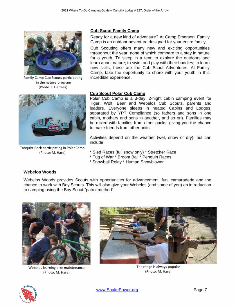
Cub Scout Family Camp
Ready for a new kind of adventure? At Camp Emerson, Family Camp is an outdoor adventure designed for your entire family.
Cub Scouting offers many new and exciting opportunities throughout the year, none of which compare to a stay in nature for a youth. To sleep in a tent; to explore the outdoors and learn about nature; to swim and play with their buddies; to learn new skills, these are the Cub Scout Adventures. At Family Camp, take the opportunity to share with your youth in this incredible experience.
Cub Scout Polar Cub Camp Polar Cub Camp is a 3-day, 2-night cabin camping event for Tiger, Wolf, Bear and Webelos Cub Scouts, parents and leaders. Everyone sleeps in heated Cabins and Lodges, separated by YPT Compliance (so fathers and sons in one cabin, mothers and sons in another, and so on). Families may be mixed with families from other packs, giving you the chance to make friends from other units. Activities depend on the weather (wet, snow or dry), but can include: * Sled Races (full snow only) * Stretcher Race * Tug of War * Broom Ball * Penguin Races * Snowball Relay * Human Snowblower
Webelos Woods
Webelos Woods provides Scouts with opportunities for advancement, fun, camaraderie and the chance to work with Boy Scouts. This will also give your Webelos (and some of you) an introduction to camping using the Boy Scout “patrol method”.
Family Camp Cub Scouts participating
in the nature program (Photo: J. Hermes)
Tahquitz Rock participating in Polar Camp
(Photo: M. Hare)
Webelos learning bike maintenance
(Photo: M. Hare)
The range is always popular
(Photo: M. Hare)
2021 Where To Go Camping Guide – Cahuilla Lodge # 127, Order of the Arrow
www.SnakePower.org Page 8
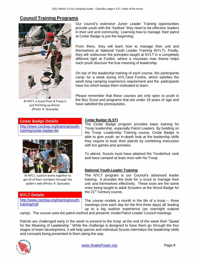
Council Training Programs Our council’s extensive Junior Leader Training opportunities provide youth with the “toolbox” they need to be effective leaders in their unit and community. Learning how to manage their patrol at Cedar Badge is just the beginning.
From there, they will learn how to manage their unit and themselves at National Youth Leader Training (NYLT). Finally, they will rediscover the principles taught at NYLT in a completely different light at Foxfire, where a mountain man theme helps each youth discover the true meaning of leadership.
On top of the leadership training of each course, the participants camp for a week during NYLTand Foxfire, which satisfies the week long camping experience requirement and the participants have fun which keeps them motivated to learn.
Please remember that these courses are only open to youth in the Boy Scout and programs that are under 18 years of age and have satisfied the prerequisites.
Cedar Badge (ILST) The Cedar Badge program provides basic training for Troop leadership, especially Patrol Leaders. By building on
the Troop Leadership Training course, Cedar Badge is able to give youth an in-depth look at the leadership skills
they require to lead their patrols by combining instruction
with fun games and activities.
To attend, Scouts must have attained the Tenderfoot rank and have camped at least once with his Troop.
National Youth Leader Training
The NYLT program is our Council’s advanced leader training. It provides the tools for a scout to manage their unit and themselves effectively. These tools are the same ones being taught to adult Scouters at the Wood Badge for the 21st Century course.
The course models a month in the life of a troop – three meetings (one each day for the first three days) all leading up to a big outdoor experience (an overnight outpost
camp). The course uses the patrol method and presents model Patrol Leader Council meetings. Patrols are challenged early in the week to present to the troop at the end of the week their “Quest for the Meaning of Leadership.” While the challenge is designed to have them go through the four stages of team development, it will help patrols and individual Scouts internalize the leadership skills and concepts being presented to them along the way.
Cedar Badge Details
http://www.ciecbsa.org/training/youth-training/cedar-badge-ilst
NYLT Details
http://www.ciecbsa.org/training/youth-training/nylt
At NYLT, a Scout from B Troop is
just finishing up dinner. (Photo: R. Quesada)
At NYLT, a patrol works together to
get all of their members through the spider's web (Photo: R. Quesada)

2021 Where To Go Camping Guide – Cahuilla Lodge # 127, Order of the Arrow
www.SnakePower.org Page 9
Throughout the course, the staff will be modeling the concepts and skills that are the core content of the course. The focus of each session is not only knowledge but giving the youth a “Toolbox of Skills” that equips them with the “how.”
Scouts must be at least 13 years old, have completed Cedar Badge (ILST), and have completed 1st
Class rank to attend NYLT. Council offers multiple times each year to attend NYLT, so find the course that is best for you.
Foxfire
Foxfire is a unique California Inland Empire Council program and will take what a Scout learned at NYLT and bring it to a whole new level.
Building on the skills learned at NYLT, Scouts will work as a Crew to complete many challenges put before them, including Dutch Oven Cooking, Tomahawk Throwing, Black Powder Rifle Shooting, Forging, and other team building games and activities.
Beyond developing a better understanding of the Leadership skills taught at NYLT, Scouts will gain knowledge that will help them in the “real world” including resume writing and interview skills.
Scouts that have completed Foxfire are sought after for positions on camp and event staffs due to Foxfire’s emphasis on Staff Development. Foxfire is a unique experience that should be the goal of any youth in our Council.
To attend Foxfire, a youth must be 14 years old and have completed NYLT or any other leadership training such as NAYLE, SEAL, NLS, or Wood Badge.
Foxfire Details
http://www.ciecbsa.org/training/youth-training/foxfire
At Foxfire, this Scout learned how to
make fire with flint and steel. (Photo: C. Dietrich)
At Foxfire, this Scout rappels down
a rock face for the first time (photo: C. Dietrich)
2021 Where To Go Camping Guide – Cahuilla Lodge # 127, Order of the Arrow
www.SnakePower.org Page 10
Canoeing Paradise (Photo: K Campbell)
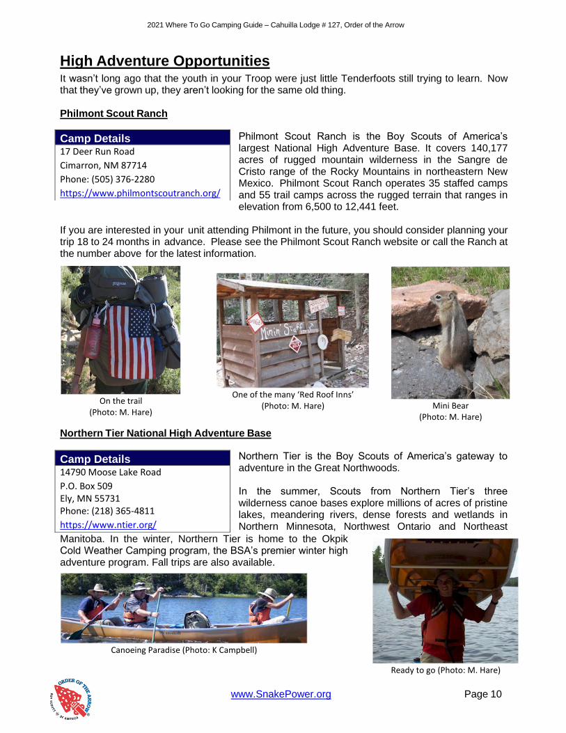
High Adventure Opportunities It wasn’t long ago that the youth in your Troop were just little Tenderfoots still trying to learn. Now that they’ve grown up, they aren’t looking for the same old thing. Philmont Scout Ranch
Philmont Scout Ranch is the Boy Scouts of America’s largest National High Adventure Base. It covers 140,177 acres of rugged mountain wilderness in the Sangre de Cristo range of the Rocky Mountains in northeastern New Mexico. Philmont Scout Ranch operates 35 staffed camps and 55 trail camps across the rugged terrain that ranges in elevation from 6,500 to 12,441 feet.
If you are interested in your unit attending Philmont in the future, you should consider planning your trip 18 to 24 months in advance. Please see the Philmont Scout Ranch website or call the Ranch at the number above for the latest information.
Northern Tier National High Adventure Base
Northern Tier is the Boy Scouts of America’s gateway to adventure in the Great Northwoods. In the summer, Scouts from Northern Tier’s three wilderness canoe bases explore millions of acres of pristine lakes, meandering rivers, dense forests and wetlands in Northern Minnesota, Northwest Ontario and Northeast
Manitoba. In the winter, Northern Tier is home to the Okpik Cold Weather Camping program, the BSA’s premier winter high adventure program. Fall trips are also available.
Camp Details 17 Deer Run Road
Cimarron, NM 87714
Phone: (505) 376-2280 https://www.philmontscoutranch.org/
Camp Details 14790 Moose Lake Road
P.O. Box 509 Ely, MN 55731 Phone: (218) 365-4811 https://www.ntier.org/
On the trail
(Photo: M. Hare)
One of the many ‘Red Roof Inns’
(Photo: M. Hare)
Mini Bear (Photo: M. Hare)
Ready to go (Photo: M. Hare)

2021 Where To Go Camping Guide – Cahuilla Lodge # 127, Order of the Arrow
www.SnakePower.org Page 11
Florida Sea Base Sea Base is a unique Scouting program that offers aquatics programs found nowhere else. Whether your interests lie in sailing, scuba diving, rustic camping on an undeveloped barrier island, fishing or a combination of all, this is the place for your Troop, Crew, Sea Ship or Explorer Post. Sea Base serves around 16,000 participants annually. Sea Base now operates 18 different adventures out of five locations: two in the Florida Keys, two in the US
Virgin Islands, and one in Marsh Harbour, Bahamas.
Summit Bechtel Reserve
Situated in the wilds of West Virginia, The Summit is training, Scouting, and adventure center for the millions of youth and adults involved in the Boy Scouts of America and anyone who loves the outdoors. The Summit Bechtel Reserve is also home to the National Scout Jamboree and the Paul R. Christen National High
Adventure Base which complements the three existing bases: Philmont Scout Ranch, Northern Tier and Florida Sea Base. Get ready for the next century of Scouting. With incredible facilities and amazing outdoor programs, The Summit is a place that takes Scouts and Venturers to the limits of what they think they can do, and then pushes them further.
There are also many opportunities to earn High Adventure Awards from a number of California Councils. See www.highadventureawards.com for a listing of councils and the high adventure awards offered. The awards are divided into 2 categories, Cub Scouts and Scouts/Venturers. The High Adventure Awards books are in PDF format for you to download.
Camp Details 73800 Overseas Highway
P.O. Box 1906 Islamorada, FL 33036 Phone: (305) 664-4173 https://www.bsaseabase.org/
Camp Details 2550 Jack Furst Drive
Glen Jean, WV 25846
Phone: (304) 465-2800 https://www.summitbsa.org/
Great Fishing (Photo: K. Campbell)
Scuba Diving (Photo: Christy Brown)
Bahamas Sailing (Photo L. Cole)
Zip Lines (Photo: K. Campbell)
Biking (Photo: M. Burk)
White water rafting
(Photo: M. Burk)

2021 Where To Go Camping Guide – Cahuilla Lodge # 127, Order of the Arrow
www.SnakePower.org Page 12
Mountain Camping, Hiking, and Backpacking
“The Mountains are calling, and I must go.” Those were the words of noted conservationist, John Muir.
The mountains are something of a magnet for a Scout. Maybe it’s the majestic peaks or the beautiful tall pines in their forests. Perhaps it’s the crisp, clear air in contrast to the smog and haze in the valleys below. Maybe it is just the quiet solitude, miles from homework and chores. Whatever it is, we are lucky to have these high places in our backyard.
You can bring your troop to a local campground and just let them have fun exploring all weekend. Or you can get them hiking, hoping to ascend the highest peaks in our local mountain ranges. Where there are peaks, there are patches to be earned, from the peaks of the most well-known mountains to the
ultimate, the 9 Peaks Award offered by our council. Any Scout with a 9 Peaks patch has instant credibility for his hiking and backpacking prowess.
These mountains are also great primers for the ultimate in Scout backpacking, Philmont. Many a troop before you prepared for the trip to Cimarron by taking these same steps upward and onward.
We have divided this section into the three major mountain ranges in the Inland Empire, the San Bernardino, the San Gabriel, and the San Jacinto Mountains. All three ranges offer a unique experience. With so many acres of land to be covered, this section can’t possibly be holistic. Rather, use it as a guide to find your own Troop adventures.
You may notice some of the major lakes are not in this section. To find information on those areas, go to the Local Camping, Lakes, & Streams section of this book.
A picturesque moment at Dry Lake in the
San Gorgonio Wilderness (Photo: T. Schultze)
Look closely, and you will find nature all
around you in the mountains (Photo: M. Harmon)
So much to do and see, from the mountins to sea to the deserts. Get out there and have fun!
2021 Where To Go Camping Guide – Cahuilla Lodge # 127, Order of the Arrow
www.SnakePower.org Page 13
A beautiful snowy morning in the
San Bernardinos (Photo: T. Schultze)
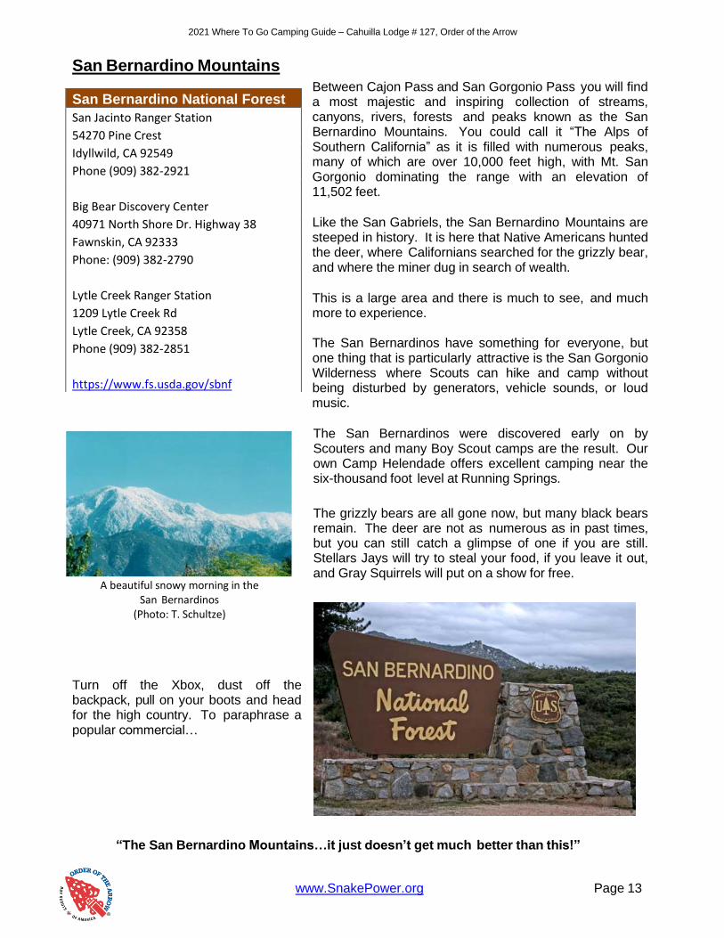
San Bernardino Mountains
Between Cajon Pass and San Gorgonio Pass you will find a most majestic and inspiring collection of streams, canyons, rivers, forests and peaks known as the San Bernardino Mountains. You could call it “The Alps of Southern California” as it is filled with numerous peaks, many of which are over 10,000 feet high, with Mt. San Gorgonio dominating the range with an elevation of 11,502 feet.
Like the San Gabriels, the San Bernardino Mountains are steeped in history. It is here that Native Americans hunted the deer, where Californians searched for the grizzly bear, and where the miner dug in search of wealth.
This is a large area and there is much to see, and much more to experience. The San Bernardinos have something for everyone, but one thing that is particularly attractive is the San Gorgonio Wilderness where Scouts can hike and camp without being disturbed by generators, vehicle sounds, or loud music.
The San Bernardinos were discovered early on by Scouters and many Boy Scout camps are the result. Our own Camp Helendade offers excellent camping near the six-thousand foot level at Running Springs.
The grizzly bears are all gone now, but many black bears remain. The deer are not as numerous as in past times, but you can still catch a glimpse of one if you are still. Stellars Jays will try to steal your food, if you leave it out, and Gray Squirrels will put on a show for free.
Turn off the Xbox, dust off the backpack, pull on your boots and head for the high country. To paraphrase a popular commercial…
“The San Bernardino Mountains…it just doesn’t get much better than this!”
San Bernardino National Forest
San Jacinto Ranger Station
54270 Pine Crest
Idyllwild, CA 92549
Phone (909) 382-2921
Big Bear Discovery Center
40971 North Shore Dr. Highway 38
Fawnskin, CA 92333
Phone: (909) 382-2790
Lytle Creek Ranger Station
1209 Lytle Creek Rd
Lytle Creek, CA 92358
Phone (909) 382-2851
https://www.fs.usda.gov/sbnf

2021 Where To Go Camping Guide – Cahuilla Lodge # 127, Order of the Arrow
www.SnakePower.org Page 14
San Gorgonio Peak from the South
Fork Trail
(Photo: M. Hare)
San Bernardino Mountain Hiking and Backpacking
South Fork Trail The South Fork Trailhead is on Jenks Lake Road, 2.5 miles from Highway 38. The trail begins at the large paved parking lot (6,900') on Jenks Lake Road East and climbs 2.5 miles where it crosses the Wilderness boundary just beyond a short side trail (NE) to a photo overlook (Poop-Out Hill, 7,740') and Wilderness information display. The trail then crosses the Wilderness boundary and continues another 1.7 miles to South Fork Meadows (8,200'). Here the trail forks: to the left (East) is Dry Lake (1.5 miles, 9,000') and to the right (West) is Dollar
The Dry Lake camping area (remember that camping is at least 200 feet from meadows, streams, springs, trails, and other occupied sites) is spread through two drainages. The first has only one or two good camping sites, the second, in the largest draw, has almost all the sites as well as Lodgepole Spring (about .25 mile up the trail towards Fish Creek Saddle-9,900').
One and three-tenths miles beyond Dry Lake is Trail Flats Camp (no water, 9,700'). Three- tenths mile further on is Mineshaft Saddle (9,960'), from which the hiker may choose to climb to the summit of San Gorgonio Mountain (11,499').
The 4.5 mile Sky High Trail from Mineshaft Saddle to the peak is occasionally steep, often rocky, and usually snow-covered in the early Fall, Winter, and late Spring. The climb should always be done with care. Warm garments are a necessity since the wind can and may pick up sharply at the peak. Just East of the true peak is Summit Camp, best reached by either the Sky High or Vivian Creek trail. Rocky and windswept, it presents a panoramic view of Southern California. Here you will find a few rock walled shelters to take protection from the frequent buffeting wind.
Camping at Dollar Lake is at Dollar Lakes Forks Trail Camp (9,300'), located approximately .3 miles from the lake. Camping is prohibited within ¼ mile of Dollar Lake, including camping on the ridges above the lake.
Dollar Lake Saddle (9,960' - no camping here, no water) is located .7 mile beyond Dollar Lake. From the Saddle, it is 5 miles to the summit of San Gorgonio Mountain (11,499'). One popular camp accessible from Dollar Lake Saddle is Red Rock Flat (10,100'), ¼ mile West of the saddle. High Meadow Springs (10,400') is ½ mile further with water available for both camps. Though beautiful, the South Fork Trail is one of the most heavily used trails. If you have visited this region before, consider a trip to one of the following trails.
2021 Where To Go Camping Guide – Cahuilla Lodge # 127, Order of the Arrow
www.SnakePower.org Page 15
Lost Creek Trail
The Lost Creek trailhead is across Highway 38 from the South Fork Campground. Beginning at the parking lot (6,320'), it crosses under the bridge. The beginning of the Lost Creek Trail follows the Santa Ana River Trail (2E03). After approximately .5 mile, the Lost Creek Trail splits from the Santa Ana River trail and heads up an old jeep road for about 1 mile before heading off (South/West) on a trail towards Grinnell Ridge Camp (no water-8,500'). From the Grinnell Ridge Camp, the trail descends into South Fork Meadows and meets with the South Fork Trail. This trail is one of the most underused and offers solitude and good views North to Santa Ana Canyon and Sugarloaf Peak.
Aspen Grove Trail
Turn right (South) off Highway 38 about 6 miles past the Barton Flats Visitor Center on Forest Service Road 1N02. Follow 1N02 until it forks right to 1N05. Go right up 1N05 (this is a rough unmaintained road not intended for low-slung autos) to the signed Aspen Grove Trail parking (7,400'), 2.6 miles in from Highway 38. After crossing the creek, take the trail to the left. After 1.5 miles, the trail joins the Fish Creek Trail (8,180'). This trail offers quiet and the opportunity for the visitor to explore a small remnant grove of Quaking Aspens (Populus tremuloides), only found in one other location outside of the Sierra Nevada range.
Fish Creek Trail
To reach the trailhead turn right (South) off Highway 38 about 6 miles past the Barton Flats Visitor Center, on Forest Service Road 1N02. Follow 1N02 until it forks right to 1N05. Follow 1N05 (not intended for low-slung autos) about 7 miles to the trailhead (8,180'). From the Fish Creek trailhead, it is 1.7 miles to Fish Creek Trail Camp (8,600'). Water is available (normally) approximately 1/2 mile beyond Fish Creek Trail Camp (Fish Creek crosses the trail). During early spring, water may be found flowing directly through camp. Three and three-tenths miles further is Fish Creek Saddle (no water-9,900'). Water is obtained from Lodgepole Spring (9,000'), seven-tenths of a mile down a trace trail to Dry Lake (9,000'), or packed up from Fish Creek. From Fish Creek Saddle, it is .9 mile to Mineshaft Saddle (9,960') where it meets the Sky High Trail. The summit of San Gorgonio (11,499') is 3.5 miles further. North Fork, Whitewater River
The best access to this trail is via the Fish Creek Trail (8,180'). Two camps are accessible from Mineshaft Saddle (9,960'). From Mineshaft Saddle, the trail descends Northeast to Mineshaft Flats (1.8 miles-9,600'). The camp lies to the West of the trail. Water is available approximately 3 miles along the trail below the camp. One mile beyond (and below) Mineshaft Flats is Big Tree Camp (8,400'). Water is available from the North Fork of the Whitewater River. This area is remote and rugged and offers the visitor solitude and far-off views of Yucca Valley and Joshua Tree National Park.
Vivian Creek Trail
The trailhead is reached by turning East off Highway 38 to Forest Falls. Continue through Forest Falls to the top end (East end) of the picnic area at the end of the road (6,080'). The Vivian Creek Trail is the shortest and the steepest route to the summit of Mt. San Gorgonio. One and two-tenths miles from the trailhead is Vivian Creek Camp (7,100'). Campsites are located upslope to the right of the trail after reaching the stream: one is halfway up the slope, and the other is at the top of the slope (no camping within 200 feet of the trail or creek).
2021 Where To Go Camping Guide – Cahuilla Lodge # 127, Order of the Arrow
www.SnakePower.org Page 16
Troop 8 Scouts learn the nuances of
filtering their water at John’s Meadow (Photo: R. Covington)
One and three-tenths miles from Vivian Creek Camp is Halfway Camp (8,100'). Water is obtained from the creek 200 yards before camp. Two and three-tenths miles further is High Creek Camp (water available - 9,200'). The summit of San Gorgonio (11,499') is 3 miles beyond High Creek. The upper end of this trail offers outstanding views of Yucaipa Ridge and Galena Peak, as well as sweeping panoramic views from the top of Mt. San Gorgonio. After the South Fork Trail, this is the second most used trail in the Wilderness.
Momyer Creek Trail
The trailhead is reached by turning east off Highway 38 to Forest Falls. Continue up the road 3 miles to the large parking area (5,400') on your left 100 yards before the fire station. Alger Creek Camp (7,100') is 3.7 miles. The single site is located about .25 miles below the trail.
Two miles further is Dobbs Camp (water available-7,200'). Another 1.5 miles is Saxton Camp (8,400'). Water here is obtained from a small spring .2 miles below the camp along the trail. Two miles further is Dollar Lake Saddle (no water-9,960'). This one of the most underused trails. This area offers the visitor solitude and good views of Mill Creek Canyon and Yucaipa Ridge from the upper end of the trail.
San Bernardino Peak Trail
The trailhead (5,960') leaves from behind the Camp Angelus Fire Station at Angelus Oaks. Stay to the right up the dirt road 300 yards. Columbine Camp (water available-8,000') is 4.7 miles from the trailhead just beyond Manzanita Flats. The camp is to the right (South) of the trail and .7 mile and 300 vertical feet below it.
Two miles beyond Columbine Springs Junction is Limber Pine Bench Camp (9,200'). Water is obtained from a spring .3 miles beyond the camp.
Two and two-tenths miles further beyond Limber Pine Camp located on the San Bernardino Peak Divide Trail is San Bernardino (10,624') and San Bernardino East Peaks. Another two mile East along the Peak Divide Trail is Trail Fork Springs (water available near trail junction-10,400’)
The San Bernardino Peak Trail and the Divide Trail both offer outstanding views in all directions. The flatlands of the Inland Empire lay nearly 10,000 vertical feet below Limber Pine Camp and the trail above.
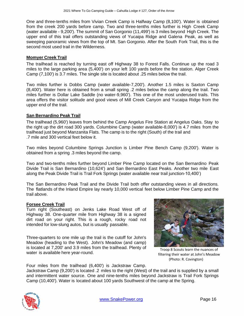
Forsee Creek Trail Turn right (Southeast) on Jenks Lake Road West off of Highway 38. One-quarter mile from Highway 38 is a signed dirt road on your right. This is a rough, rocky road not intended for low-slung autos, but is usually passable.
Three-quarters to one mile up the trail is the cutoff for John's Meadow (heading to the West). John's Meadow (and camp) is located at 7,200' and 3.9 miles from the trailhead. Plenty of water is available here year-round.
Four miles from the trailhead (6,400') is Jackstraw Camp. Jackstraw Camp (9,200') is located .2 miles to the right (West) of the trail and is supplied by a small and intermittent water source. One and nine-tenths miles beyond Jackstraw is Trail Fork Springs Camp (10,400'). Water is located about 100 yards Southwest of the camp at the Spring.
2021 Where To Go Camping Guide – Cahuilla Lodge # 127, Order of the Arrow
www.SnakePower.org Page 17
To the East along the Peak Divide Trail lie two additional camps. The first, Anderson Flat (no water-10,500'), is .4 miles up the trail. The second is Shields Flat (no water-10,400') 1.8 miles East of Anderson Flat, 2.3 miles East of Trail Fork, and only 1.2 miles West of High Meadow Spring (10,300') which is the preferred water source.
This trail is mostly shaded up to Jackstraw Springs Camp, and offers outstanding sunset views West from Trail Fork Springs Camp.
Kitching Peak Trail
Drive Interstate 10 to Fields Road exit. Turn right onto Fields Road over cattle guard, proceed .75 mile to Morongo Road and turn right. Drive through 3 S-curves to Millard Canyon Road. Take the East (right) branch of this road, following signs to Kitching Peak Trailhead (4,240'). It is 4 miles to Kitching Sink (5,570') and 5.5 miles to Kitching Peak (6,560'). No water is available at either site. This is the most underused region of the San Gorgonio Wilderness.
Deer Springs Trail
Follow the same directions as the Kitching Peak Trail (above). On Millard Canyon Road, take the left branch and look for signs to Deer Springs (4,400'). Only Explorer Permits are issued for this area. This is the most underused region of the San Gorgonio Wilderness.
Bear Wallow Trail
Follow the same directions for Deer Springs Trail (above). On Millard Canyon Road look for signs to Bear Wallow Trail (4,560') after passing the Deer Springs Trailhead (4,400'). The camp (4,880') is .5 miles up an easy trail. Water is obtained from the creek.
(Source: Write-ups from San Gorgonio Wilderness Association, available at http://www.sgwa.org)
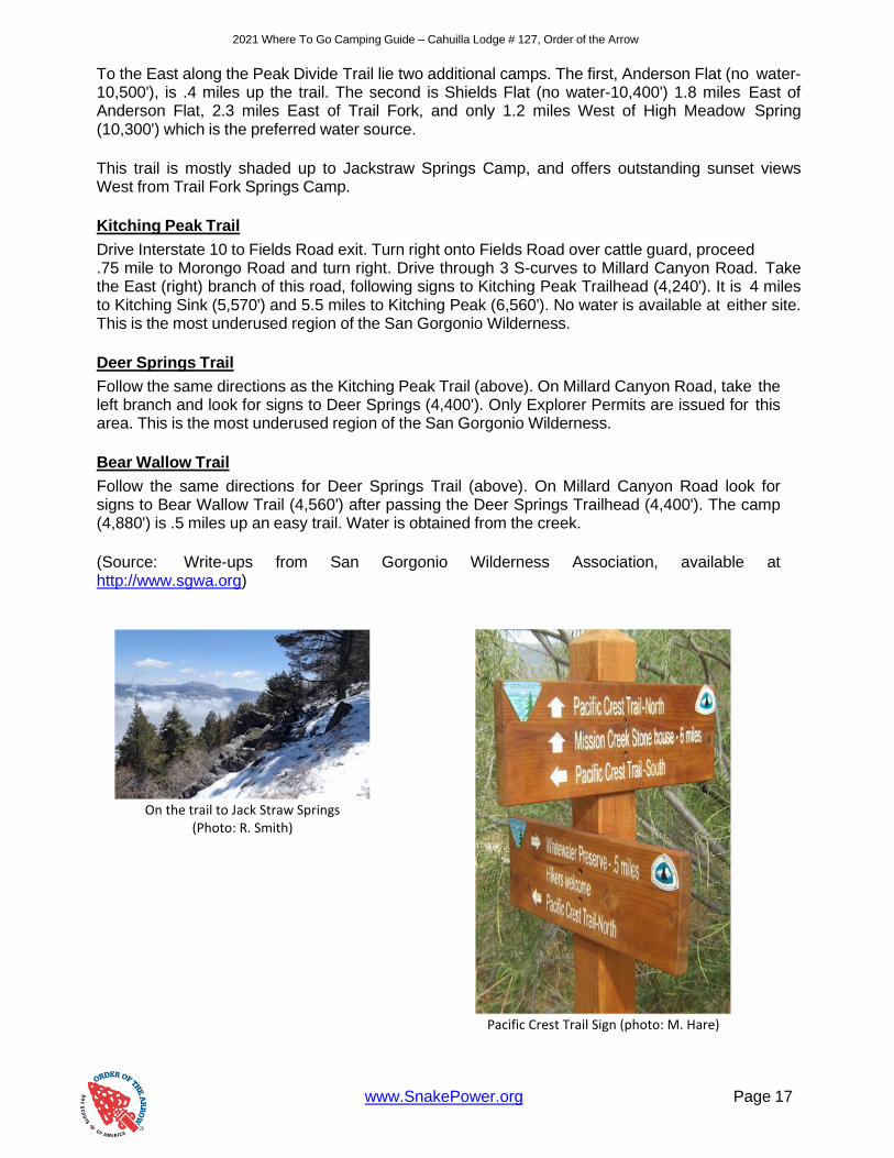
On the trail to Jack Straw Springs
(Photo: R. Smith)
Pacific Crest Trail Sign (photo: M. Hare)

2021 Where To Go Camping Guide – Cahuilla Lodge # 127, Order of the Arrow
www.SnakePower.org Page 18
Trailhead/ Elevation
Wilderness Location Elevation One Way Miles Water
South Fork Horse meadows * 7,360 1.3 N
6,880' Poopout Hill * 7,840 2.2 N
South Fork Meadow * 8,400 3.7 Y
Dry Lake / Lodgepole 9,101 5.9 Seasonal
Trail Flats 9,680 6.7 N
Mineshaft Saddle * 9,920 7.3 N
Via Dry Lake San Gorgonio Peak 11,502 11.3 N
Dollar Lake 9,219 5.7 Seasonal
Dollar Lake Saddle * 9,920 5.9 N
Dry Lake View 10,400 7 N
Via Dollar Lake San Gorgonio Peak 11,502 9.4 N
Lost Creek Grinnell Ridge 8,132 4.4 N
6320' South Fork Meadow * 8,400 5.7 Y
Dry Lake / Lodgepole 9,101 7.5 Seasonal
Mineshaft Saddle * 9,920 9.3 N
San Gorgonio Peak 11,502 13.3 N
Aspen Grove Fish Creek Camp 8,320 3.2 Seasonal
7,410' Fish Creek Saddle 9,805 6.2 N
Fish Creek Fish Creek Camp 8,320 1.9 Seasonal
8,160' Fish Creek Saddle 9,805 4.9 N
Mineshaft Saddle * 9,920 6 N
San Gorgonio Peak 11,502 10 N
Fish Creek to Mineshaft Flat 9,280 7 Seasonal
Big Tree 8,480 8.2 Y
Vivian Vivian Creek Camp 7,200 1.5 Y
6,080' Halfway Camp 8,040 3.1 Seasonal
High Creek Camp 9,260 5.6 Y
San Gorgonio Peak 11,502 9.2 N
Momyer Alger Creek 7,040 3.9 Y
5,440' Dobbs Cabin 7,280 6 Y
Saxton 8,560 7.4 Y
Dollar Lake Saddle * 9,920 9.7 N
San Gorgonio Peak 11,502 13.2 N
San Bernardino Manzanita Flats * 8,300 4.2 N
5,960' Columbine Springs 8,000 4.9 Seasonal
Limber Pine Bench 9,360 5.9 Y
San Bernardino Peak 10,649 8 N
San Gorgonio Peak 11,502 16.5 N
Forsee Creek Jackstraw Spring 9,200 4.1 Seasonal
6,760' Trail Fork Springs 10,440 5.8 Seasonal
Anderson Flat 10,560 6.3 N
Shields Flat 10,420 7 N
High Meadow Springs 10,320 8.1 Y
Red Rock Flat 10,080 8.6 N
Dollar Lake Saddle * 9,920 8.8 N
San Gorgonio Peak 11,502 12.3 N
Forsee Creek to Johns Meadow 7,260 3.1 Y
Manzanita Flats * 8,300 5 N
*NO Camping at these locations Verify Water Conditions Before Going
2007 Where To Go Camping Guide – Cahuilla Lodge # 127, Order of the Arrow
Page 19

2020 Where To Go Camping Guide – Cahuilla Lodge # 127, Order of the Arrow
www.SnakePower.org Page 20
San Bernardino Mountain Camping
There are more than enough camping locations in the San Bernardino Mountains for you. Below are the campsites managed by the Forest Service. Some campsites required reservations, which you can obtain by going to the San Bernardino National Forest website or the National Recreation Reservation Service at http://www.recreation.gov. Prices may change so be sure to check the website before going and to reserve. Applewhite Campground
This camp is located at 3,300 feet. 44 Sites are available. Fee is $10.00 per night and no reservations are required. Water and bathrooms are available. Barton Flats Campground
This campground is located at 6,500 feet just off Highway 38 in the Barton Flats area past Angelus Oaks. 52 Sites are available. Fee is $20.00 per night and reservations are required. Bathrooms, water, showers, and a dump station are available. Big Pine Flats
The elevation of this camp is 6,800 feet. 19 sites are available. Fee is $16.00 per night and reservations are not required. Bathrooms, water, and off-highway routes are available. Crab Flats
The elevation of this camp is 6,200 feet. 29 sites are available. Fee is $16.00 per night and reservations are required. Bathrooms, water, and off-highway routes are available. Dogwood
The elevation of this camp is 5,600 feet. 93 sites are available. Fee is $24.00 - $29.00 per night and reservations are required. Bathrooms, water, RV hookups, showers, a dump station, and fire lookout tower are available. Green Valley
The elevation of this camp is 7,000 feet. 36 sites are available. Fees are $16.00 per night and reservations are required. Bathrooms, water, fishing, and off-highway vehicle routes are available. Hanna Flats
The elevation of this camp is 7,000 feet. 88 sites are available. Fees are $20.00 per night and reservations are required. Bathrooms, water, and a fire lookout tower are available. Heart Bar
The elevation of this camp is 6,900 feet. Fees are $15.00 per night and reservations are required. Bathrooms and water are available.
Holcomb Valley
The elevation of this camp is 7,400 feet. 19 sites are available. Fee is $12.00 per night and reservations are not required. Bathrooms and off-highway vehicle routes are available. Horse Springs
The elevation of this camp is 5,800 feet. 15 sites are available. Fee is $10.00 and reservations are not required. Bathrooms are available.

2020 Where To Go Camping Guide – Cahuilla Lodge # 127, Order of the Arrow
www.SnakePower.org Page 21
Northshore
The elevation of this camp is 5,300 feet. 27 sites are available. Fee is $16.00 and reservations are required. Bathrooms, water, and off-highway vehicle routes are available. Pineknot
The elevation of this camp is 7,000 feet. 52 sites are available. Fee is $19.00 per night and reservations are required. Bathrooms and water are available. San Gorgonio
The elevation of this camp is 6,500 feet. 54 sites are available. Fee is $20.00 per night and reservations are required. Bathrooms, water, and showers available. Serrano
The elevation of this camp is 6,800 feet. 132 sites are available. Fees are $24.00 - $34.00 and reservations are required. Bathrooms, water, RV hookups, showers, fishing, and dump station are available. South Fork
The elevation of this camp is 6,400 feet. 24 sites are available. Fee is $15.00 and reservations are not required. Bathrooms, water, and fishing are available. Wildhorse Equestrian Camp
The elevation of this camp is 7,000 feet. 11 sites are available. Fee is $20.00 per night and reservations are required. Bathrooms, water, fishing are available and the campsite is equestrian friendly.

www.SnakePower.org Page 22
2020 Where To Go Camping Guide – Cahuilla Lodge # 127, Order of the Arrow
San Gabriel Mountains
Stretching for more than sixty miles from the Ridge Route to Cajon Pass, the San Gabriel Mountains provide us within as “urban wilderness,” easily accessible by most Southern Californians. This area offers the outdoorsman a truly beautiful landscape amid one of the world’s population centers.
Most of the San Gabriels are incorporated into Angeles National Forest. With nearly 700,000 acres, you can find a lot of places to go, and a lot of things to do. Over 1,300 miles of roads crisscross the forest and nearly 500 miles of hiking and riding trails assures you of being able to get into all but the most remote areas. Public campgrounds and picnic areas abound making the San Gabriels a great place for training, nature study, wildlife observation, fishing, or just plain
This mountain range is actually made up of two parallel ranges, with the front range having the lower peaks with most less than 6,000 feet tall. The Northern range contains such peaks as Throop, Islip,
and Baden-Powell, all over 8,000 feet. At 10,064 feet, Mt. San Antonio (Baldy) is the tallest peak in the San Gabriels and the hike to the top is particularly interesting. Through the years the San Gabriel Mountains has seen the passing of trappers, hunters, ranchers, and timber men. However, it was probably the gold seekers that did the most to open the canyon country. Today gold can still be found in the San Gabriel River and its feeder streams. The true richness, however, can best be found by wandering through the trails and canyons that divide this forest region.
Unlike many mountainous areas, the San Gabriels can offer excellent camping year-round. When the highlands are covered with snow you can still find quiet camps below snowline. You can also spend the winter months exploring the desert-facing sides of the range. It would be impossible to list all of the camping locations available in the San Gabriel Mountains, and that is not within the scope of this guide. Yet, a couple of locations must be brought to your attention. With luck you may just get a taste of the flavor of this wonderful “urban jewel.”
Angeles National Forest
Angeles National Forest
701 N. Santa Anita Ave.
Arcadia, CA 91006
Phone (747) 322-6574
San Gabriel Mountains National Monument
110 N. Wabash Ave
Glendora, CA 91741
Phone (747) 322-6643
Los Angeles Gateway Ranger District
12371 N. Little Tujunga Canyon Rd
San Fernando, CA 91342
Phone (818) 482-8937
https://www.fs.usda.gov/angeles/

www.SnakePower.org Page 23
2020 Where To Go Camping Guide – Cahuilla Lodge # 127, Order of the Arrow
San Gabriel Mountain Hiking and Backpacking
Mt. Baden-Powell Total Mileage (One-way): 4 mi; Elevation Gain: 2,800 feet
If a Boy Scout could only take one hike in his life this might well be it! Named for the founder of the Boy Scout movement, Lord Robert Baden-Powell, this 9,399 foot peak was originally known as North Baldy. C.J. Carlson, a well- recognized Scouter in the 1920s and 1930s, petitioned the government to make the name change. Incidentally, this was the same C.J. Carlson that was able to arrange for the donation of the original land that is now our own Camp Emerson in Idyllwild.
This is more than just a hike, it is a pilgrimage. Atop the peak you will find the cement monument dedicated to Scouting. The cement was carried on the backs of over 2,000 scouts in the late fifties all the way from the trailhead at Vincent Gap. When you view it take a moment to consider their dedication. About 5 miles from Big Pines, on the Angeles Crest Highway (Highway 2) you will find the Vincent Gap trailhead. The parking lot is quite large and parking should be no problem. The trail signs are highly visible. Take the trail the leads uphill, toward your right. You will soon hit the first of 41 switchbacks which make this hike so interesting. After about 1.5 miles you will come to a sign that reads “Lamel Springs ¼ mile.” Actually the distance is much less. This is the only water that you can count on along the trail. Soon you will begin to see breathtaking views of the Mojave Desert. At about 3.5 miles you will see the first of the Limber Pines (Pinus Flexilus) that maintain a foothold on the ridges. You will see a side trail leading to a forest of these trees about 350 yards away. A little farther you will see the trail sign that leads to Little Jimmy and Crystal Lake. Keep to the left trail (the main one) and in just a couple of more switchbacks you will reach the summit. This is where you will find the “hogback” which can be quite narrow in places and windswept. Not a good place to be after the snows fall unless you are a properly equipped, well-trained, mountaineer.
The view from the top is grand! Look at the monument, read the inscriptions on the plaques, and enjoy this mountain-top experience. During the summer months you may even be “buzzed” by sailplanes as they soar and play in the thermal updrafts. This is one of the very best conditioning hikes you can utilize as it packs a substantial elevation gain in a relatively short hike. This is a real “calf-stretcher!”
Troop 8 at the Baden-Powell monument
on the peak
(Photo: R. Covington)
www.SnakePower.org Page 24
2020 Where To Go Camping Guide – Cahuilla Lodge # 127, Order of the Arrow
The Devil’s Punchbowl
Total Mileage (One-Way): 3 mi; Elevation Gain: 1,000 feet
This is a “got to see” place as it is nearly impossible to describe! Mother Nature must have taken everything she had left when she was finished designing the world and dumped it here. It is really awesome. Actually two hikes are available; this one from South Fork Campground; and a shorter one into the bowl itself. The shorter 1 mile hike would be very good to introduce you to the local geology and to also visit the interpretive center at the park headquarters.
This is best if you plan to use a car shuttle. From Highway 138 turn South onto Big Rock Creek Road and continue to Sycamore Flat Campground. Sometimes, due to road conditions, this becomes your new trailhead.
South Fork is about 1 mile past Sycamore Flat and is well described on a local map. Due to heavy usage in past years it does not presently allow car camping. Walk through the campground to the Southern end and follow the signs. You will cross a stream and then proceed uphill then dropping into Holcomb Canyon. Here you will find an idyllic glade with splashing streamlets. Soon you will again continue an uphill climb leading you to a rock outcropping known as the Devil’s Chair. Be careful and don’t climb over (or fall under) the fence. It is very hard to contain yourself and not test your echo!
Head back to the trail split and follow the trail around and in a little over 2 miles you will reach the County Park, where, if you planned it right, your vehicles are waiting. This is a neat little excursion into the jumbled rocks region and is well worth the effort. Take a camera as the rocks seem to change color as the sun plays games especially in late afternoon.
While at the Park Headquarters visit the small, but well maintained, visitor center. Sometimes owls and other birds and mammals are available for viewing as they are cared for prior to release into the wilderness.
If you don’t have the time for a full hike, or if your Scouts are not up to this level of hiking, make it a point still to visit the Devil’s Punchbowl. You can even watch the rock climbers as they try to scale the shear walls. Third Stream Crossing Total Mileage (One-Way): 3 mi; Elevation Gain: 1,200 feet
This hike takes you from the gravel and rock strewn canyon bottom up to the forested, cool, streamside campsite known as Third Stream Crossing. If you actually count the crossings, including streamlets, you may or may not come up with the right number but the campsite will be there nonetheless.
This is one of the nicest hikes you can take. This hike is not very demanding and the trail is usually well maintained. The hike will, at times, insulate you from the outside world and you will find it hard to believe that you are so near the metropolis below.
www.SnakePower.org Page 25
2020 Where To Go Camping Guide – Cahuilla Lodge # 127, Order of the Arrow
If you are very quiet, you can even catch a glimpse of a bighorn sheep. If you feel lucky, you can even try your hand at panning for gold in the sands of the stream bottoms.
From Interstate 15 exit Sierra Avenue and proceed West, up the wash, on Lytle Creek Road. Soon you will come to the Lytle Creek Ranger Station where you must obtain a Wilderness Permit. This would also be a good time to talk with the Rangers about water availability, trail conditions, etc.
Continue on Lytle Creek Road about 2 more miles to the intersection of Middle Fork Road, on your left. This blacktop road will quickly turn to somewhat maintained dirt which you will follow for another 3 miles or so. You can then park in the “parking lot.” You will know you are there because the road ends and one of more trash barrels are in view. The trailhead here has attracted some theft, so you may consider someone providing security for the vehicles.
Follow the trail and you will soon come to a sign that reads “Cucamonga Wilderness.” Continue up the trail past the junction to Stone House Trail Camp, about a 1/2 mile up the trail, and in about 2 miles you will reach Third Stream Crossing. This “pie-shaped” campsite is located right along the stream. The trail continues across the stream and switchbacks up to Comanche Camp, then to Icehouse Saddle. At Third Stream Crossing you will find something that is not on your map. If you travel a few yards downstream you will see a streamlet entering from a canyon across the stream. Following this streamlet upstream a few hundred yards and your efforts will be rewarded with the sound, and view, of one of the most picturesque waterfalls in the San Gabriel Mountains. Take a moment to listen to the falls, or maybe even have a Scout’s Own. It would be hard to find a better location. Blue Ridge to Mt. Baldy 5 miles Trailhead at Big Pines Visitor Center I 15 North to Hwy 138 to Hwy 2 towards Wrightwood, CA. Go past Wrightwood on Hwy 2 three miles to Big Pines Visitor Center. The trailhead is just across the road from the center. Table Mountain Trail ½ mile See Table Mountain entry for directions. Trailhead is just off of the parking lot.
Lighting Ridge Trail ¾ mile
Interstate North to Hwy 138 to Hwy 2 towards Wrightwood. Go past Wrightwood 4.5 miles to Inspiration Point. The trailhead is on the North side of the parking lot. Mine Gulch from Vincent Gap 4 ½ miles Trailhead at Vincent Gap See Baden-Powell Little Fish Fork 3 ¼ miles Trailhead at Lupine CG See camp access above Upper Fish Fork 3 ¼ miles Trailhead at Lupine CG See camp access above

www.SnakePower.org Page 26
2020 Where To Go Camping Guide – Cahuilla Lodge # 127, Order of the Arrow
Big Pines ½ mile Trailhead at Big Pines Visitor Center Highway 2, West of Wrightwood Blue Ridge 2 miles Trailhead at Big Pines Visitor Center Highway 2, West of Wrightwood Deer Flat Group Camp Pacific Crest Trail intersect on a 2 mile hike (North through camp) See camp access above Grassy Hollow Pacific Crest Trail intersect See camp access above Jackson Flat Camp Pacific Crest Trail intersect on a short trail North of camp See camp access above Guffy Pacific Crest Trail intersect just outside camp See camp access above Manker Flat Camp Trail that leads out of camp and on to San Antonio Falls See camp entree
www.SnakePower.org Page 27
2020 Where To Go Camping Guide – Cahuilla Lodge # 127, Order of the Arrow
San Gabriel Mountain Camping
Apple Tree
There are eight tent sites and one group site for up to 50 people. Piped water, picnic tables, vault toilets and fire pits (see ranger station for fire permit) are provided. Pet on leashes are permitted. No reservations for individual sites; reservation necessary for group site; $10 fee per night. Contact at (805) 944-2187, and for group site information and reservation call (619) 249-3483 Location: From Interstate 15 near Cajon, take Highway 138 West. Turn left (West) on Angeles Crest Highway and drive five miles to Wrightwood. Continue for three miles to Big Pines. Turn right on Big Pines Highway (County road N4) and drive two miles to campground. Open May to November. Big Rock
There are 8 campsites for tents. Fire pits (see ranger station for fire permit), vault toilets and picnic tables are provided. There is no piped water so bring your own. Pets on leashes are permitted.
No reservations; no fee (must have forest adventure pass in car) Contact at (805) 944-2187 Location: From Highway 138 in Pearblossom, turn South on Longview Road. Turn left on Valyermo Road and drive past the ranger station. Turn right on Big Rock Road and continue up the canyon past the South Fork Camp turn and past Camp Fenner to the campground entrance road on the right. Open June to October. Blue Ridge
There are 8 campsites for tents or motor homes up to16 feet long. Fire pits, picnic tables and vault toilets are provided. Bring your own water. Pets permitted on leash. No reservations; no fee (must have forest adventure pass in car) Contact at (805) 944-2187 Location: From Interstate 15 near Cajon, take Highway 138 West. Turn left (West) on Angeles Crest Highway and drive 5 miles into Wrightwood. Continue past Wrightwood 3 miles to Big Pines Visitor Center. Continue on Angeles Crest Highway for 1.5 miles to Inspiration Point. Turn left (opposite Inspiration Point) on Blue Ridge Road (dirt) and drive three miles to campground. Open June to October. Cabin Flat
There are 12 tent sites. Picnic tables, fire pits and vault toilets are provided. No piped water. Pets permitted on a leash. No reservations; no fee (must have forest adventure pass in car) Contact at (805) 944-2187 From Interstate 15 near Cajon, take Highway 138 West. Turn left (West) on Angeles Crest Highway and drive five miles into Wrightwood. Continue for three miles to Big Pines. Turn left and continue on Angeles Crest Highway for 1.5 miles. Turn left (opposite Inspiration Point) On Blue Ridge Road and drive 12 miles to campground (the road becomes a rough, dirt road after the first three miles).Open May to October.

www.SnakePower.org Page 28
2020 Where To Go Camping Guide – Cahuilla Lodge # 127, Order of the Arrow
Camp Wrightwood Camp Wrightwood provides an alpine forest setting for youth and family camps and retreats. The camp is situated at an elevation 6300 feet and is only 4 miles from Mountain High Ski Area. Food service and self-cooking options are available with accommodations for 181 guests in lodges and cabins with communal and semi private bathrooms. This easily accessible camp is located adjacent to the community of Wrightwood. Contacts: 760-249-3453 and http://www.campwrightwood.com
Camp Sturtevant Perhaps the most unique United Methodist Camp in the country, Sturtevant's Camp is located in the Angeles Forest above Sierra Madre. The camp is accessible only by a scenic moderate-grade four mile hike. The camp is a great experience for hikers looking for a special getaway adjacent to the Los Angeles basin. At the camp you will find recreation opportunities which include a volleyball court, water slide and zip line. And you will want to take a turn on the spectacular tree swing.
Sturtevant's camp is a self-cooking camp with 40 beds and semi private and communal bathrooms. You can make arrangements to have your gear and food packed in on the last working mule pack train in the San Gabriel Mountains. The camp generates its electricity from a micro hydro generator using the water flow from the adjacent stream. Sturtevant's Camp provides that special camp or retreat experience for youth, families or adults looking to transcend time.They also have rates for use of the cabins, kitchen, lodge, etc. Contacts: 760-626-568-7333 and http://www.sturtevantcamp.org
Coulter Group Camp There is one large campsite that will accommodate up to 50 people. No motor homes are permitted. Piped water, fire pits, vault toilets and picnic tables are provided. Pets permitted on a leash. Reservations requested; $45 group fee per night Contact at (818) 449-1749 or (818) 578-1079
From Interstate 210 North of Pasadena, take the Angeles Crest Highway (Highway 2) exit and drive 26 miles to the signed campground. Open May to November.
Coldbrook
There are 25 for tents or motor homes up to 22 feet long. Piped water, fire pits, vault toilets and picnic tables are provided. Pets permitted on a leash. No reservations; $8 fee per night Contact at (818) 335-1251 From Interstate 210, take the Azusa Canyon exit. Drive 18 miles North on San Gabriel Canyon Road (Highway 39) to the campground. Open year-round.
A Scout along the Gabrielino Trail going into Camp Sturtevant (Photo: J. Casey)
He isn’t really drinking from Sturtevant
Falls, is he? (Photo: J. Casey)

www.SnakePower.org Page 29
2020 Where To Go Camping Guide – Cahuilla Lodge # 127, Order of the Arrow
Crystal Lake
There are 176 campsites for tents or motor homes up to 22 feet long. Piped water, fire pits and picnic tables are provided. Flush toilets are available. Pets permitted on leashes. No reservations; $8 fee per night Contact at (818) 335-1251
From Interstate 210, take the Azusa exit. Drive 25 miles North on San Gabriel Canyon Road (Highway 39) to the Crystal Lake Rec. Area. Open year-round Deer Flats Group Camp
There are nine group campsites which will accommodate up to 300 people. Piped water, fire pits, picnic tables and vault toilets are provided. A grocery store and a visitor center are nearby. Pets permitted on a leash. Reservations required; fees vary by site Contact at (818) 335-1251 From Interstate 210, take the Azusa Canyon exit. Drive 25 miles North on San Gabriel Canyon Road (Highway 39) to the Crystal Lake Recreation Area. Open May to October. Grassy Hollow
There are 15 campsites for tents or motor homes up to 18 feet in length. Piped water, fire pits (see ranger station for fire permit), vault toilets and picnic tables are provided. Pets permitted on leashes.
No reservations; $10 fee per night Contact at (805) 944-2187 Location: From Interstate 15 near Cajon, take Highway 138 West. Turn left (West) on Angeles Crest Highway and drive five miles to Wrightwood. Continue for three miles to Big Pines. Turn left and continue on Angeles Crest Highway for two miles. Turn left at the signed campground entrance. Open May to November. Guffy
There are 6 tent sites. Picnic tables and fire pits are provided. Vault toilets are available. There is no piped water. Pets are permitted on leashes.
No reservations; no fee (must have forest adventure in car) Contact at (805) 944-2187 From Interstate 15 near Cajon, take Hwy 138 West. Turn left (West) on Angeles Crest Hwy and drive 5 miles into Wrightwood. Continue for 3 miles to Big Pines. Turn left and continue on Angeles Crest Hwy 1.5 miles. Turn left (opposite Inspiration Point) on Blue Ridge Rd. and drive 6 miles to the campground (it’s dirt road after the first 3 miles). Open June to October. Jackson Flat Group Camp
There are five group campsites which can hold 40 to 50 people each. Piped water, picnic tables, fire pits (see local ranger station for fire permit) and vault toilets are provided. Pets on leashes are permitted. Reservations requested; call for fee Contact at (619) 249-3483 From Interstate 15 near Cajon, take Highway 138 West. Turn left (West) on Angeles Crest Highway and drive five miles to Wrightwood. Continue for three miles to Big Pines. Turn left and continue on Angeles Crest Highway for two miles. Turn right, opposite the sign for Grassy Hollow. Then drive one mile to campground. Open June to October.
www.SnakePower.org Page 30
2020 Where To Go Camping Guide – Cahuilla Lodge # 127, Order of the Arrow
Lake
There are 8 campsites for tents or motor homes up to 18 feet long. Piped water, fire pits (see ranger station for fire permit), vault toilets and picnic tables are provided. Pets permitted on leash. No reservations; $10 fee per night Contact at (805) 944-2187 Location: From Interstate 15 near Cajon, take Highway 138 West. Turn left (West) on Angeles Crest Highway and drive five miles into Wrightwood. Continue for three miles to Big Pines. Turn right on Big Pines Highway and drive 2.5 miles to the campground. Open May to November. Lupine
There are 11 tent sites. Picnic tables and fire pits are provided. Vault toilets are available. No piped water so bring your own. Pet on leashes permitted. No reservations; no fee (must have forest adventure pass in car) Contact at (805) 944-2187
From Interstate 15 near Cajon, take Highway 138 West. Turn left (West) on Angeles Crest Highway and drive 5 miles into Wrightwood. Continue for three miles to Big Pines. Turn left and continue on Angeles Crest Highway for 1.5 miles. Turn left (opposite Inspiration Point) on Blue Ridge Road (it’s a rough dirt road after the first three miles) and drive 10 miles to campsite. Open June to October. Manker Flats
There are 22 campsites for tents or motor homes up to 16 feet long. Piped water, fire pits, flush toilets and picnic tables are provided. Pets on leashes permitted. No reservations; $6 fee per night Contact at (818) 335-1251 From Ontario, drive six miles North on Highway 83 to Mt. Baldy Road to the campground. Millard
There are 5 tent sites. Piped water, picnic tables, fire pits and vault toilets are provided. Pets permitted on a leash No reservations; no fee (must have forest adventure pass in car) Contact at (818) 790-1151 Location: From Interstate 210 North of Pasadena, take the Lake Avenue exit North to Loma Alta Drive. Turn left (West) on Loma Alta Drive and drive to the Chaney Trail (at the flashing yellow light). Follow the signs to the campground. Open year-round. Mountain Oak
There are17 campsites for tents or motor homes up to 18 feet in length. Piped water, fire pits (see ranger station for fire permit) and picnic tables are provided. Flush toilets are available. Groceries and propane gas are nearby. Pets permitted on leashes.
No reservations; $10 fee per night Contact at (805) 944-2187 From Interstate 15 near Cajon, take Highway 138 West. Turn left (West) on Angeles Crest Highway and drive five in to Wrightwood. Continue for three miles to Big Pines. Turn right on Big Pines Highway (County road N4) and drive three miles to the campground. Open May to October.

www.SnakePower.org Page 31
2020 Where To Go Camping Guide – Cahuilla Lodge # 127, Order of the Arrow
Peavine
There are four tent sites. Piped water, picnic tales, fire pits and vault toilets are provided. A grocery store and propane gas are nearby. Pets permitted on leash. No reservations; $8 fee per night Contact at (805) 944-2187
Location: From Interstate 15 near Cajon, take Highway 138 West. Turn Left (West) on Angeles Crest Highway and drive five into Wrightwood. Continue for three miles to Big Pines. Turn right on Big Pines Highway and drive 2.6 miles to the campground. Open May to November Sycamore Flat
There are 11 campsites for tents or motor homes up to 22 feet long. Piped water, fire pits (see ranger station for fire permit), vault toilets and picnic tables are provided. Pet are permitted on leashes. No reservations; $7 fee per night Contact at (805) 944-2187
Location: From Highway 138 in Pearblossom, turn South on Longview Road. Drive to Valyermo Road and turn left. Drive past the ranger station. Turn right on Big Rock Road and drive about two miles up the canyon to the campground. Open year-round. Table Mountain
There are 115 campsites for tents and motor homes up to 32 feet long. Piped water, fire pits, picnic tables and vault toilets are provided. Pet permitted on leash. No reservations; $ 10 fee per night Contact at (619) 249-3483 From Interstate 15 near Cajon, take Highway 138 West, Turn left (West) on Angeles Crest Highway and drive five into Wrightwood. Continue three miles to Big Pines. Turn right on Table Mountain Road and one mile into the campground. Open May to October.
(Sources: “California Camping,” Tom Stienstra, Fog Horn Press, 1995, US Forest Service Big Pines Recreation Area literature, Cahuilla Lodge OA “Where To Go Camping Guide,” 1999, 2002, 2004)
www.SnakePower.org Page 32
2020 Where To Go Camping Guide – Cahuilla Lodge # 127, Order of the Arrow
San Jacinto Mountains
What they lack in area they make up for in impact. The San Jacinto Mountains may well be the repository for more Native American artifacts than
any other Southwestern mountain range.
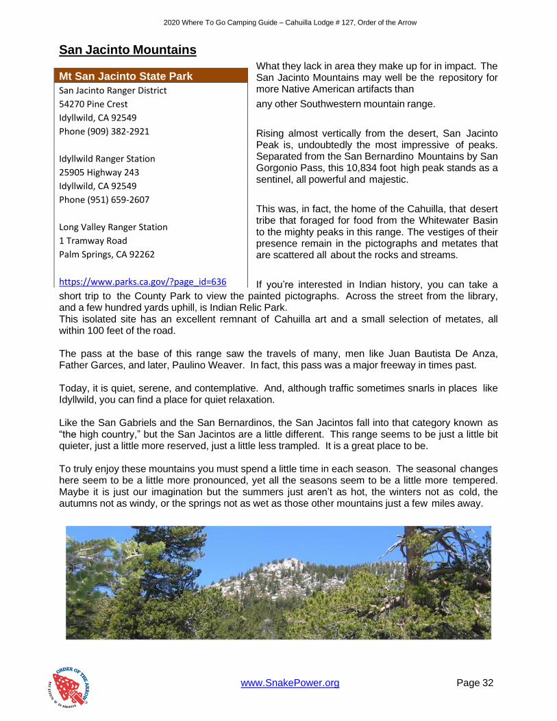
Rising almost vertically from the desert, San Jacinto Peak is, undoubtedly the most impressive of peaks. Separated from the San Bernardino Mountains by San Gorgonio Pass, this 10,834 foot high peak stands as a sentinel, all powerful and majestic.
This was, in fact, the home of the Cahuilla, that desert tribe that foraged for food from the Whitewater Basin to the mighty peaks in this range. The vestiges of their presence remain in the pictographs and metates that are scattered all about the rocks and streams.
If you’re interested in Indian history, you can take a short trip to the County Park to view the painted pictographs. Across the street from the library, and a few hundred yards uphill, is Indian Relic Park. This isolated site has an excellent remnant of Cahuilla art and a small selection of metates, all within 100 feet of the road. The pass at the base of this range saw the travels of many, men like Juan Bautista De Anza, Father Garces, and later, Paulino Weaver. In fact, this pass was a major freeway in times past. Today, it is quiet, serene, and contemplative. And, although traffic sometimes snarls in places like Idyllwild, you can find a place for quiet relaxation. Like the San Gabriels and the San Bernardinos, the San Jacintos fall into that category known as “the high country,” but the San Jacintos are a little different. This range seems to be just a little bit quieter, just a little more reserved, just a little less trampled. It is a great place to be. To truly enjoy these mountains you must spend a little time in each season. The seasonal changes here seem to be a little more pronounced, yet all the seasons seem to be a little more tempered. Maybe it is just our imagination but the summers just aren’t as hot, the winters not as cold, the autumns not as windy, or the springs not as wet as those other mountains just a few miles away.
Mt San Jacinto State Park
San Jacinto Ranger District
54270 Pine Crest
Idyllwild, CA 92549
Phone (909) 382-2921
Idyllwild Ranger Station
25905 Highway 243
Idyllwild, CA 92549
Phone (951) 659-2607
Long Valley Ranger Station
1 Tramway Road
Palm Springs, CA 92262
https://www.parks.ca.gov/?page_id=636
www.SnakePower.org Page 33
2020 Where To Go Camping Guide – Cahuilla Lodge # 127, Order of the Arrow
San Jacinto Mountain Hiking and Backpacking
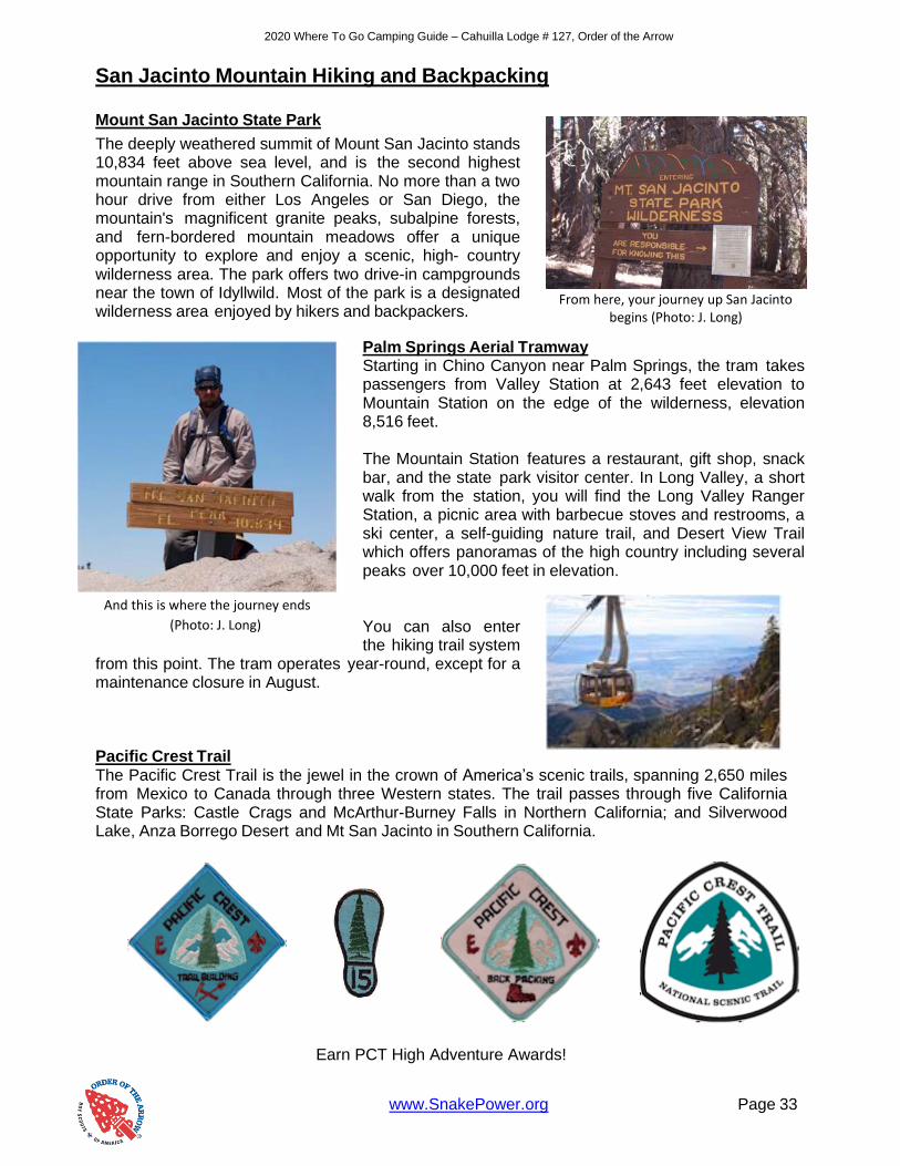
Mount San Jacinto State Park
The deeply weathered summit of Mount San Jacinto stands 10,834 feet above sea level, and is the second highest mountain range in Southern California. No more than a two hour drive from either Los Angeles or San Diego, the mountain's magnificent granite peaks, subalpine forests, and fern-bordered mountain meadows offer a unique opportunity to explore and enjoy a scenic, high- country wilderness area. The park offers two drive-in campgrounds near the town of Idyllwild. Most of the park is a designated wilderness area enjoyed by hikers and backpackers.
Palm Springs Aerial Tramway
Starting in Chino Canyon near Palm Springs, the tram takes passengers from Valley Station at 2,643 feet elevation to Mountain Station on the edge of the wilderness, elevation 8,516 feet. The Mountain Station features a restaurant, gift shop, snack bar, and the state park visitor center. In Long Valley, a short walk from the station, you will find the Long Valley Ranger Station, a picnic area with barbecue stoves and restrooms, a ski center, a self-guiding nature trail, and Desert View Trail which offers panoramas of the high country including several peaks over 10,000 feet in elevation. You can also enter the hiking trail system
from this point. The tram operates year-round, except for a maintenance closure in August.
Pacific Crest Trail The Pacific Crest Trail is the jewel in the crown of America’s scenic trails, spanning 2,650 miles from Mexico to Canada through three Western states. The trail passes through five California State Parks: Castle Crags and McArthur-Burney Falls in Northern California; and Silverwood Lake, Anza Borrego Desert and Mt San Jacinto in Southern California.
Earn PCT High Adventure Awards!
From here, your journey up San Jacinto
begins (Photo: J. Long)
And this is where the journey ends
(Photo: J. Long)

www.SnakePower.org Page 34
2020 Where To Go Camping Guide – Cahuilla Lodge # 127, Order of the Arrow
Wilderness Permit Information Everyone entering the Mount San Jacinto State Wilderness, both for the day and overnight camping, must have a permit in their possession. Groups are limited to 15 people, and juvenile groups must have at least one adult leader for each 14 juveniles. Dogs are not permitted in wilderness areas of the State Park System. The San Bernardino National Forest has a similar permit system in effect for its federal wilderness area known as the San Jacinto Wilderness. Both the State Park and National Forest honor each other's DAY USE PERMITS; however, each agency has its own camping permit system that you must apply for separately. San Bernardino National Forest permits are issued at the San Jacinto Ranger District Office:
San Jacinto Ranger District P.O. Box 518 Idyllwild, CA 92549 Fax: (909) 382-2921
U.S. Forest Service Permit Applications and Wilderness information can be accessed at http://ww.fsva.org. All visitors must display an Adventure Pass or Golden Passport in their vehicle when parked on National Forest land. A Permit is required to enter the San Jacinto Wilderness for either day hiking or overnight backpacking. Permits are issued for up to 12 people. A separate permit is needed for each trip. The Mount San Jacinto State Park issues camping permits for the following camps: Round Valley, Little Round Valley, Tamarack Valley, and Strawberry Junction. Permits are available up to 56 days in advance. Dogs are campfires are not allowed in the State Wilderness. For information call the Idyllwild office at (951) 659-2607. If you wish to camp in these areas you must send a self-addressed stamped envelope with your application to:
Mount San Jacinto State Park P.O. Box 308 Idyllwild, CA 92549 Phone: (951) 659-2607
Lily Rock
This is the most prominent feature in the Idyllwild area and is more often referred to as Tahquitz Rock. On any given day you can watch the numerous climbers trying to ascend the difficult face with ropes, carabiners, and pure strength. But you don’t have to do it that way. In fact you just have to walk up the trail to the top! The rock is greatly reduced but the view is just as spectacular.
Follow Fern Valley Road to Humber Park. No permits are required for access to Lily/Tahquitz Rock via the climbers trail or the Ernie Maxwell Trail. A USFS Adventure Pass is required for parking above the signed area. Limited parking is available in a county parking lot below the sign.
Follow the “Scenic Trail” from the parking lot, turning left in about a ¼ mile up the slope. This “trail” will zigzag uphill for several hundred feet to a place called Lunch Rock. To the right you will find a trail around the base of the rock. An easy scramble takes you to the summit.

www.SnakePower.org Page 35
2020 Where To Go Camping Guide – Cahuilla Lodge # 127, Order of the Arrow
San Jacinto Peak
This peak overlooks the land of “Ramona,” for it is here that Helen Hunt Jackson wrote about the plight of the Native American. And John Muir was touched by what he felt was the most beautiful sunrise in the world. Many trails lead up to the peak and every hiker has his favorite. Marion Mountain, Black Mountain, and Humber Park all contain trailheads that will get you to the top. Or you may choose to “cheat” and take the Palm Springs Aerial Tramway up Chino Canyon and begin your trek at 8,516 feet. It is worth taking the tramway just for the ride, but taking this route disqualifies you from earning the San Jacinto Peak patch. Use this route after you’ve conquered Humber Park. This is a singular mountain and it really doesn’t matter how you get to the top for the trip is a reward in itself. Hiking to the peak will take you through several climatic zones as Mt. San Jacinto passes through the Lower Sonoran, Upper Sonoran, Transition, Canadian/Hudsonian, and Arctic/Alpine. Naturally, as you climb you will see the botanic life, as well as mammalian life, changes. It is really astounding.
Look about the rocks near the streams and you may find metates. These remnants of our forbearers were caused by season and season of crushing and grinding seeds with hand held manos, or pestles. Seeds and acorns formed the mainstay of the local inhabitants prior to the coming of the Europeans. Certainly not the tallest peak in Southern California, Mt. San Jacinto stands alone along the San Gorgonio Pass. It stands alone in many other ways as well. Tahquitz Peak
When you sit in the Main Lodge at Camp Emerson, you can’t help but feel awed as the sun rises over Tahquitz Peak. It is really magnificent. This hike takes you there in very short order. This trail is well maintained and lacks many steep areas, it is just a constant climb, but quite manageable. Certainly, it is well worth the effort. It is 3.6 miles one-way with an elevation gain of 1,700 feet. The peak can also be accessed from the Humber Park Trailhead at 6,280 feet. It is 4.3 miles with an elevation gain of 1,850 feet from there. Follow Saunders Meadow Road from Highway 243 South of Idyllwild, turning left on Pine Avenue, then right on Tahquitz View Drive, then right up South Ridge Road. Park near the locked gate. Hike past the gate, up the dirt road, to the South Ridge Trail. The trail starts at 6,400 feet. You will climb and follow some switchbacks passing some good areas to rest and enjoy the view. Take your time to enjoy it. Eventually you will reach the summit and the lookout there.
Now that you have made it to the top, try to look down into Strawberry Valley and see if you can spot Camp Emerson!
Tahquitz Peak from Camp Emerson
(Photo: Monday Memo)

2020 Where To Go Camping Guide – Cahuilla Lodge # 127, Order of the Arrow
www.SnakePower.org Page 38

2020 Where To Go Camping Guide – Cahuilla Lodge # 127, Order of the Arrow
www.SnakePower.org Page 39
San Jacinto Mountain Camping
Below are the campsites managed by the Forest Service. Reservations are not required at these USFS campgrounds. Each campground has a number of “First Come, First Served” sites and a number of reservation sites. Boulder Basin
The elevation of this camp is 7,300 feet. The fee is $10.00 per night and reservations are required. Bathrooms, water, and a fire lookout tower are available. Dark Canyon
The elevation of this camp is 5,800 feet. The fee is $12.00 per night and reservations are required. Bathrooms, water, and fishing are available. Fern Basin
The elevation of this camp is 6.300 feet. The fee is $10.00 per night and reservations are required. Bathrooms and water are available. Marion Mountain
The elevation of this camp is 6,400 feet. The fee is $10.00 per night and reservations are required. Bathrooms and water are available. Pinyon Flat
The elevation of this camp is 4,000 feet. The fee is $8.00 per night and reservations are not required. Bathrooms and water are available. Ribbonwood Equestrian Camp
The elevation of this camp is 4,000 feet. The fee is $15.00 per night and reservations are available at the Ranger Station only. Bathrooms and water are available and the camp is equestrian friendly. Santa Rosa Springs
The elevation of this camp is 7,200 feet. There is no current fee and reservations are not required. A bathroom is available. Tool Box Springs
The elevation of this camp is 6,500 feet. There is no current fee and reservations are not required. A bathroom is available.
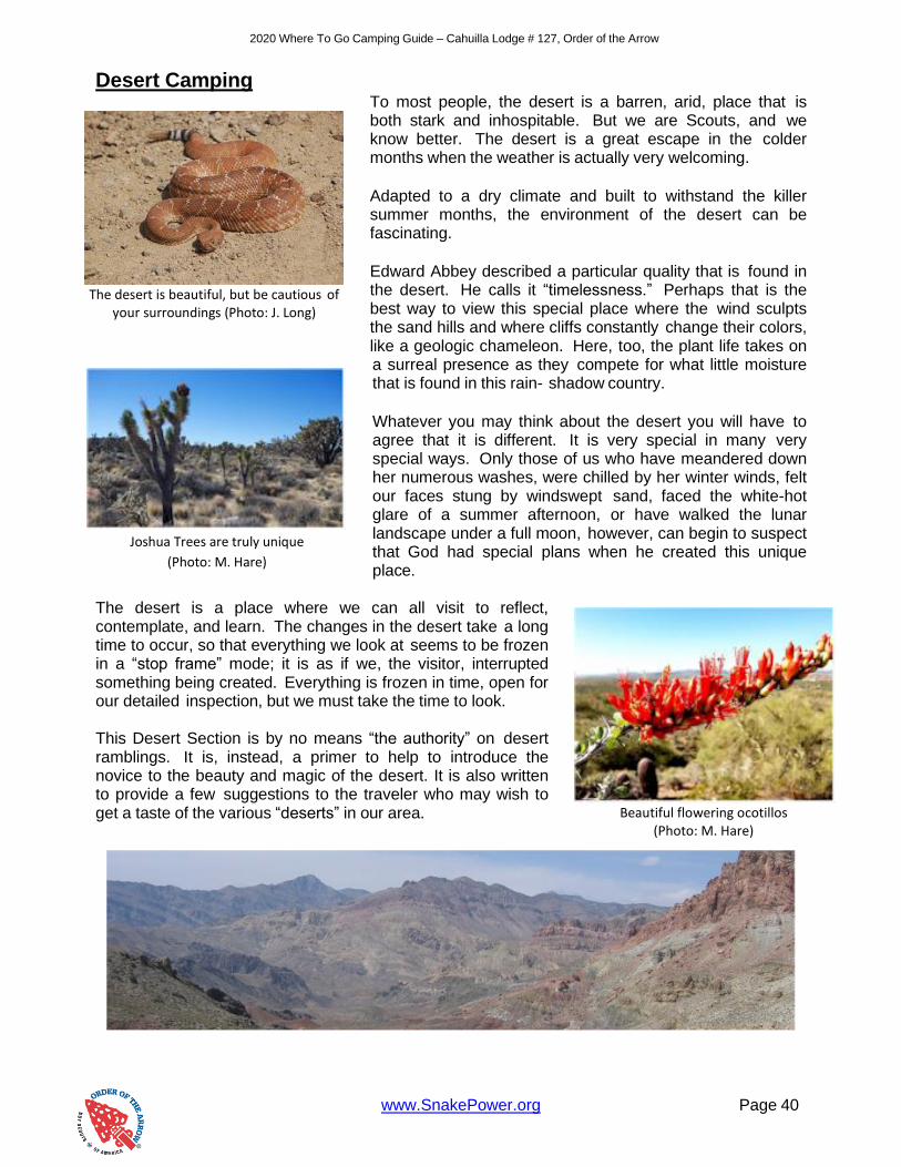
www.SnakePower.org Page 40
2020 Where To Go Camping Guide – Cahuilla Lodge # 127, Order of the Arrow
Desert Camping To most people, the desert is a barren, arid, place that is both stark and inhospitable. But we are Scouts, and we know better. The desert is a great escape in the colder months when the weather is actually very welcoming.
Adapted to a dry climate and built to withstand the killer summer months, the environment of the desert can be fascinating.
Edward Abbey described a particular quality that is found in the desert. He calls it “timelessness.” Perhaps that is the best way to view this special place where the wind sculpts the sand hills and where cliffs constantly change their colors, like a geologic chameleon. Here, too, the plant life takes on a surreal presence as they compete for what little moisture that is found in this rain- shadow country.
Whatever you may think about the desert you will have to agree that it is different. It is very special in many very special ways. Only those of us who have meandered down her numerous washes, were chilled by her winter winds, felt our faces stung by windswept sand, faced the white-hot glare of a summer afternoon, or have walked the lunar landscape under a full moon, however, can begin to suspect that God had special plans when he created this unique place.
The desert is a place where we can all visit to reflect, contemplate, and learn. The changes in the desert take a long time to occur, so that everything we look at seems to be frozen in a “stop frame” mode; it is as if we, the visitor, interrupted something being created. Everything is frozen in time, open for our detailed inspection, but we must take the time to look. This Desert Section is by no means “the authority” on desert ramblings. It is, instead, a primer to help to introduce the novice to the beauty and magic of the desert. It is also written to provide a few suggestions to the traveler who may wish to get a taste of the various “deserts” in our area.
The desert is beautiful, but be cautious of
your surroundings (Photo: J. Long)
Joshua Trees are truly unique
(Photo: M. Hare)
Beautiful flowering ocotillos
(Photo: M. Hare)

www.SnakePower.org Page 41
2020 Where To Go Camping Guide – Cahuilla Lodge # 127, Order of the Arrow
In the following pages you will travel into the Mojave or “high” desert where Joshua Trees spread their arms to the heavens and where winter nights can get particularly cold. You will see the transition as we move into the Colorado or “low” desert, actually an extension of the Sonoran or “Arizona” desert. Here cholla awaits, while mesquite and palo verde grow in the numerous washes. Farther North would bring you to the Great Basin Desert areas, but this guide will limit us to places closer to home.
This section is written to bring the desert to you. You must then bring yourself to the desert. Visit it. Stay a while. A good idea is to tour the different areas and limit your hiking and backpacking until a little later, after the desert grows on you. And it will!
This section is divided into the major parks in our area, Anza Borrego Desert State Park, Death Valley National Park, Joshua Tree National Park, and Mojave National Preserve. There is also an additional section which includes some areas you may want to see that are not within the boundaries of the parks above.
Joshua Tree in twilight (Photo: J. Long)
11 Thousand Vertical Feet, from
Badwater to Telescope Peak
(Photo: T. Schultze)
The OA hard at work replacing a split-rail
fence in Joshua Tree. (Photo: M. Hare)

www.SnakePower.org Page 42
2020 Where To Go Camping Guide – Cahuilla Lodge # 127, Order of the Arrow
Anza Borrego Desert State Park
Named after Juan Bautista De Anza, famed Spanish explorer who first crossed this country in 1774, and the “Borrego” or Bighorn sheep, the Anza Borrego Desert State Park straddles the Imperial County line in San Diego County. This is truly a land of many contrasts. It is also a land with a very colorful history.
Native Americans lived here for countless generations and the many petroglyphs and bedrock mortars remain as mute testimony to their existence. It is here, in Coyote Canyon, where the “White Child Monument” can be found; commemorating the birth of the first non-Indian in California. This took place on Christmas Even in 1776, the child later growing to become an important public official in San Francisco. The Mexican War brought Kearney’s “Army of the West” through these desert passes, followed by Philip St. George Cookie and the U.S. Mormon Battalion, who constructed the first wagon road. Some parts of this road can still be seen today, especially in Box Canyon. Known as “The Sonoran Road,” the “Southern Emigrant Trail,” or “Cooke’s Road,” this trail was later used by the Butterfield Overland Stages and was a major corridor into California in the time of the Gold Rush. Today San Diego County Highway S-2 follows much of the original road bed of this historic trail.
Here is also found the only year-round free flowing stream in San Diego County. Coyote Creek has been an important part of local history and was the site of one of the few violent encounters between Native American and non-Indian.
It is here, too, where legends of lost mines abound and stories originated by Pegleg Smith are still told around sparkling campfires. And there are ghosts. A small cemetery at Vallecito is reputed to be haunted) at least the sign at the visitor’s center says so) and Ghost Mountain contains the remains of Yaquitepec, home of
itinerant poet Marshal South who lived the primitive’s life in the early 20th century.
Here, in the Ana Borrego, you can follow the trails of the pioneers; contemplating what it may have really been like to cross this land over 100 years ago. But be careful, you may be rudely awakened from your daydream by the sound and vibration of a 500 pound bomb exploding at the nearby Carrizo Bombing range, followed by the roar of a fighter-bomber’s jet engines as it zooms overhead “on the deck” at treetop level. Here too, you will find “Foot and Walker Pass,” where a scar has been eroded into the hillside by the passage of uncountable wagon wheels. The name, incidentally, was given to this steep slope because in the late 1800’s most of the heavily loaded stagecoaches could not make it over the pass under the power of the team only. Therefore, to reduce the weight, and also sometimes to assist by pushing and pulling, the passengers were invited out of the coach so that they could get out on “Foot and Walk’er.”
Anza Borrego Desert State Park
Visitor Center
200 Palm Canyon Dr
Borrego Springs, CA 92004
Phone (760) 767-4205
http://www.parks.ca.gov/?page_id=638

www.SnakePower.org Page 43
2020 Where To Go Camping Guide – Cahuilla Lodge # 127, Order of the Arrow
Welcome to the Anza Borrego. Visit it at various times. It is especially beautiful in the late spring, particularly in years of greater than average rainfall when the valleys are carpeted in the pinks, yellows, and purples of millions of wildflowers. Come in the winter, when the air is crisp and maybe you will be fortunate enough to enjoy a rare desert snowfall. But be sure to visit at night, when a full moon turns the desert into a two-dimensional wonder world of grays, blacks, and whites. However, please plan your trip to allow for a lot of time to “do nuthin’.” The desert cannot be rushed; it must be experienced at a slow pace. Take your time. Look, listen, smell, touch, enjoy.

www.SnakePower.org Page 44
2020 Where To Go Camping Guide – Cahuilla Lodge # 127, Order of the Arrow
Blair Valley
Blair Valley attracted the Indians of old and it attracts hikers and campers today, with good reason.
Indian morteros and pictographs can be visited, and so can remnants of more recent history such as Foot and Walker Pass, where stage coach passengers had to get out and walk over the rocks, and the site of the former home of the poet Marshall Scott and his family on Ghost Mountain.
Blair Valley’s altitude contributes to its attractiveness. You are at about 2,400 feet when you turn off County Road S-2. Five miles to the Southeast, at the trailhead for the one-mile walk to the pictographs, the elevation is a mere 3,200 feet. The California Juniper thrives in this area, as do the Desert Agave and the Mohave Yucca. Up above, in the Vallecito Mountains, the plant community changes from desert to woodland. De Anza Trail Historic Hike
Juan Batista De Anza left Tubac, Mexico with a small army to explore and discover an overland route to the missions of California. This took place in 1774. Soon after, in 1776, he again led a party overland. This group, however, consisted of men, women, children, and cattle; as well as soldiers. The journey pretty much followed the route taken in 1774. One of the most interesting places along the trek North can be found in Coyote Canyon. This where the De Anza Trail Historic Hike takes place. This is an especially significant hike as it was mapped and marked as an Eagle Scout Service Project, by a Riverside Scout.
The hike guide, titled De Anza Trail is available. It explains the details of the hike, as well as much of the history. The trail features several interesting places. The Turkey Track is the name given to the confluence of three canyons, Nance, Horse, and Tule. From above it resembles a huge turkey footprint. As you proceed downhill from the Track (you could also begin the hike from the other direction, but why would you want to hike uphill?) you will enter a sheltered valley that is alive with birds. This entire area, incidentally, is closed during the summer months as it is a protected breeding habitat for bighorn sheep. Soon the foliage grows denser as you arrive at “Upper Willows” and the “White Child Monument.” This is the location where the first non-Indian was born in California. This took place, at this site, on Christmas Eve in 1776. This makes a pleasant rest stop.
Following the trail you will come, in a few miles, to “Middle Willows.” Here Coyote Creek lives up to its name. This is a real nice lunch stop, or you may consider making it your overnight location if you want to enjoy a more relaxed hike. From here the hike gets wet, as the trail is in the stream bottom. Soon the valley begins to open and you will pass “Monkey Hill,” then on to “Lower Willows.” A short side trip to “Santa Catarina Springs” is a pleasant diversion. The hike continues downstream to “El Vado” (the crossing) it is here where it is believed that Juan Batista De Anza made the actual crossing. The entire trail constitutes about 25 miles and should be rated as a moderate hike.
The hike can be especially pretty from late February through early April, but don’t forget your insect repellant, you just might need it!

www.SnakePower.org Page 45
2020 Where To Go Camping Guide – Cahuilla Lodge # 127, Order of the Arrow
U.S. Mormon Battalion Trail Historic Hike
In 1846, United States President Jefferson was facing as serious problem. Relations between the U.S. and Mexico were deteriorating and war appeared imminent. Jefferson has no military sources ready to cross the frontier into California and had to look for options. During this time, members of the Church of Jesus Christ of Latter Day Saints were beginning their Westward trek to locate a land where they would not be persecuted for their religious beliefs. An agreement was reached between Brigham Young, leader of the Church, and Jefferson. A Battalion would be formed from the able-bodies men of the Mormon Church. They would be trained, armed, and equipped by the Army. They would the march, on foot, the 2,000 miles to California. At the end of this one-year enlistment the men would be discharged and allowed to return to their families. What resulted was the longest march, by volunteers, in the history of American warfare. These citizen-soldiers crossed the plains and deserts, suffered numerous hardships, and completed the arduous task in a commendable fashion. They were responsible for the digging of many wells, which provided for later travelers. They also completed the first wagon road into Southern California that was later used by the Butterfield stages.
The hike, or at least one variation of it, begins in the parking area across San Diego County Road S-2 at mile marker 26. You enter the wash and begin your journey which soon leads you to historic Box Canyon. Here is where the Volunteers had to actually cut away the walls of stone to widen the canyon so that the wagons could pass. The first of the wagons had to be unloaded and disassembled, but the last ones were able to pass intact. This is a monument to their strength and courage.
Once through Box Canyon the trail crosses into Blair Valley, and on to Foot & Walker Pass. Here,
on January 27th, 1847, the Mormon Battalion crossed Earthquake Valley, through Sentenac Cienega, and into the ancient Indian Village of San Felipe. The next day found them at Warner’s Ranch where they were able to partake in their first “Full Meal” since leaving Yuma. This consisted of two pounds of beef per person. From here they proceeded, after a short rest, to Temecula where they were told that the War was over and that instead of continuing on to Los Angeles, they were to change direction and go to San Diego, where they acted as an occupying force.
This is a fantastic hike which can open the history books to many Scouts. The hike itself is well described in the Hike Guide issued by the San Diego-Imperial County Council, titled: “U.S. Mormon Battalion Trail Historic Hike.” The guide tells about the history and gives all the hike particulars. One of the award requirements is that you must visit a memorial or museum dedicated to the Mormon volunteers. A very good one is the “U.S. Mormon Battalion Museum” located in Old Town San Diego. The free exhibit tells about the ordeal and many interesting dioramas and displays. The hike is moderately strenuous and, of course, should not be attempted during the hotter times of year. Late winter and early spring will mean crisp nights, with pleasant days…usually!
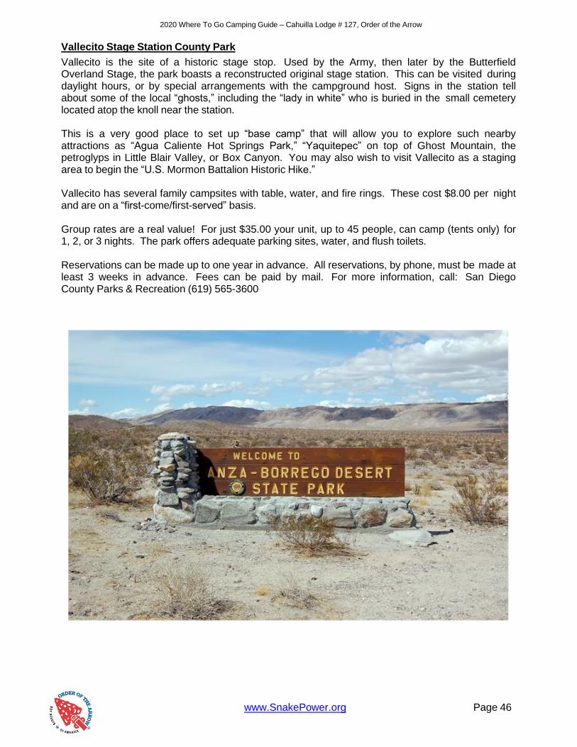
www.SnakePower.org Page 46
2020 Where To Go Camping Guide – Cahuilla Lodge # 127, Order of the Arrow
Vallecito Stage Station County Park
Vallecito is the site of a historic stage stop. Used by the Army, then later by the Butterfield Overland Stage, the park boasts a reconstructed original stage station. This can be visited during daylight hours, or by special arrangements with the campground host. Signs in the station tell about some of the local “ghosts,” including the “lady in white” who is buried in the small cemetery located atop the knoll near the station. This is a very good place to set up “base camp” that will allow you to explore such nearby attractions as “Agua Caliente Hot Springs Park,” “Yaquitepec” on top of Ghost Mountain, the petroglyps in Little Blair Valley, or Box Canyon. You may also wish to visit Vallecito as a staging area to begin the “U.S. Mormon Battalion Historic Hike.” Vallecito has several family campsites with table, water, and fire rings. These cost $8.00 per night and are on a “first-come/first-served” basis. Group rates are a real value! For just $35.00 your unit, up to 45 people, can camp (tents only) for 1, 2, or 3 nights. The park offers adequate parking sites, water, and flush toilets.
Reservations can be made up to one year in advance. All reservations, by phone, must be made at least 3 weeks in advance. Fees can be paid by mail. For more information, call: San Diego County Parks & Recreation (619) 565-3600

www.SnakePower.org Page 47
2020 Where To Go Camping Guide – Cahuilla Lodge # 127, Order of the Arrow
Death Valley National Park
Located in an area whose local attractions carry names like: Funeral Mountains, Furnace Creek, Coffin Peak, Starvation Canyon, and Hell’s Gate, Death Valley is one of the most beautiful and fascinating places on earth.
In fact not a valley at all, this area was formed when the ground between the two mountain ranges subsided, leaving it wedged between towering
mountains above, mountains that deny Death Valley much needed rainfall. Originally named, according to popular folklore, by one of the members of the Jayhawker party who tried to find a shortcut to the goldfields by crossing this unmapped land, the valley is home to quite a few varieties of mammals, bird, reptile, and insects. It also boasts a visitor rate that has to be described as phenomenal. One of the best ways to get acquainted with Death Valley, and many other desert areas for that matter, is to plan an auto tour. By selecting the areas that you find interesting, you can easily plan a route by using standard maps that will allow you to visit the sites. A phone call or two to the local Rangers can help you get “filled in’ on local weather and road conditions, campsite and water availability, and other important bits of information. Death Valley is best visited in the late fall, early winter, or spring months. March and April can, during the wet years, offer spectacular floral displays, which the winter months mean crowded camps and hard to find campsites. A tour, such as the one described, will allow you to “meet” Death Valley. This is just an introduction. After your first visit, you will be in a better position to decide what things about Death Valley you like that would merit additional trips and exploration. Death Valley is, to the desert, what Yosemite is to the mountains. It, too, exemplifying the majesty, the beauty, the scope, the glory, and the preciousness of our natural resources. Until you have experienced Death Valley your desert wanderings will remain incomplete.
Death Valley National Park
Furnace Creek Visitor Center
P.O. Box 579
Death Valley, CA 92328
Phone (760) 786-3200
https://www.nps.gov/deva/
Death Valley (Photo: M. Hare)

www.SnakePower.org Page 48
2020 Where To Go Camping Guide – Cahuilla Lodge # 127, Order of the Arrow
Central Death Valley Attractions
Furnace Creek Inn
Did you know that Death Valley is home to one of the few 4 star resorts in California? The Furnace Creek Inn is definitely an impressive place to visit but think twice about staying there. Nightly rates can be upwards of $300.00 per night!
Sand Dunes Off Highway 190, and easily viewed from miles away, are the famous sand dunes of Death Valley. These are the classic dunes that people think deserts are, though most people know they are quite rare. Look closely, and you might see the tracks of a beetle, or see one slowly but surely venturing over the dunes. Yes, this land with its never-ending changing landscape supports life. This is a great place for some interpretive photography, particularly at sunrise or sunset. Be prepared to hike though, finding a patch of undisturbed sand will take you possibly a mile out into the dunes. Be sure to use the buddy system. It is very easy to get disoriented and lost at the sand dunes. Stovepipe Wells Along with Furnace Creek, this is one of the few areas where you can eat, and get gas. The famous sand dunes are nearby.
The Furnace Creek Visitor Center is a must-visit location for you to get the information you need to decide where to go and what to do in Death Valley. It has outstanding displays, guidebooks, maps, slides, and videos for sale that cover virtually everything that lives, walks on, flies over, swims in, or can be found in Death Valley. There are also two major campgrounds within a short distance, which is a great place to set up your home base for the trip.
A moment captured in time
(Photo: J. Long)
Scouts compete to see who can slide the farthest (Photo: M. Hare)

www.SnakePower.org Page 49
2020 Where To Go Camping Guide – Cahuilla Lodge # 127, Order of the Arrow
Northern Death Valley Attractions
The Racetrack
The Racetrack valley is a playa where rocks seem to move by themselves leaving trails that last for years. It is 26 miles down a rough dirt road so don’t try this with a car! If you want to catch the sunrise, plan to leave very early in the morning.
There are two stops once you come to the playa. The first is near a large outcropping at the lake’s North edge. This is called the “Grandstand”. No Climbing
Continue South for about a mile and you will come to the playa’s Southern edge. This is where the moving rocks can be found. There is a parking area. From there, walk out onto the lake (do not walk on the lake if wet or moist, your footprints will be there for years!) for about ½ half and you will come to the rocks. They are everywhere and no two rocks make the same tracks. It is pretty easy to find large rocks with deep tracks along the lake. The tracks themselves can make some interesting patterns as well.
Ubehebe Crater and Little Hebe
These two extinct volcanic craters are easy to see from a trail just off the road at the North end of the park. The crater and caldera of Ubehebe are quite spectacular. The Little Hebe crater is located up the trail past Ubehebe. Imagine what this area must have been like during an eruption. Look all around you and you will see the volcanic deposits that are the evidence of a more violent past. Be careful on the side of the crater though, because it is a falling hazard.
Scotty’s Castle
Strangely out of place, this was the magnificent home of Death Valley Scotty, a desert character, showman, legend, and part-time con artist. Yes, there is a castle in Death Valley.
Walter Scott, as his formal name was, convinced Chicago millionaire Albert Johnson to invest in a fraudulent gold mine in the Death Valley Area. Despite this, they became friends and companions. Death Valley Scotty was a welcome respite for Johnson, who nearly went bankrupt in the Great Depression. You can view evidence of this from the empty pool at the front of the castle that was never finished!
Tours of the Castle are given daily. There is a small visitor center and a ticket office to attend one of the tours. Park rangers dress in 1930s clothing. Even if you don’t do the tour, you can wander around the castle’s outskirts, look at old timber lines including abandoned vehicles from the Depression, and hike up to Scott’s grave.
Nature works in mysterious ways
(Photo: T. Schultze)
A look into the Ubehebe caldera
(Photo: M. Hare)
Scotty’s Castle (Photo: M. Hare)

www.SnakePower.org Page 50
2020 Where To Go Camping Guide – Cahuilla Lodge # 127, Order of the Arrow
Southern Death Valley Attractions Artist’s Drive Located off Badwater Road, Artist’s Drive is named after the palette of colors found in the hills alongside this one-way, narrow, paved road. Different ore deposits are responsible for the array of coloring in the hillside. There are several areas for you to pull off and look at the hillside and Death Valley as well. The main pull-off where the colors are at their most vibrant is quite amazing. Badwater Badwater is the lowest point in the United States. There is a salt spring here, and it is easy to surmise just where the name came from. Here you can look up to a sheet of plywood on a hillside over 200 feet above you that has been labeled for your convenience, “Sea Level.” At this spot you can see the lowest point in the United States; an interesting- smelling pool of stagnant water amid the salt flats, and, beyond Telescope Peak which is the tallest peak within the park’s boundaries, you can see snow-covered Mt. Whitney the tallest peak in the lower 48 states. This is a short trip that will always be remembered. The road South from
Badwater eventually will lead you to Highway 127 that ends at Interstate 15 in the town of Baker. Devil’s Golf Course If you view Death Valley from above, you’ll find the white salt flat surrounds a much darker, mysterious region. This is the Devil’s Golf Course. Here, the salt crystals form hard structures that can be very difficult to hike through.
Sometimes, you will come across new crystals forming like a cup. Leave those alone and be careful not to touch them. This is nature at work and is best left undisturbed.
Hiking around, you will find some pools. These are the “holes” in the golf course. Be careful strolling through the area though. It is very easy to turn an ankle and hurt yourself. The tough walking is well worth the effort.
Natural Bridge
Do you know the difference between an arch and a natural bridge? A natural bridge is actually rarer. It is an arch with a natural water flow inside of it. Death Valley has one, off Badwater Road. A short drive which is mostly dirty and occasionally asphalt takes you to the wash where the bridge exists. Simply walk up the wash and you’ll come to the point of the bridge. The hike is about 1 mile and is moderate, though the sand will slow you down.
Mountain coloring of Artist’s Pallet
(Photo: J. Long)
The salt flat forms unique patterns
(Photo: M. Hare)
One of the “holes” at sunrise
(Photo: J. Long)
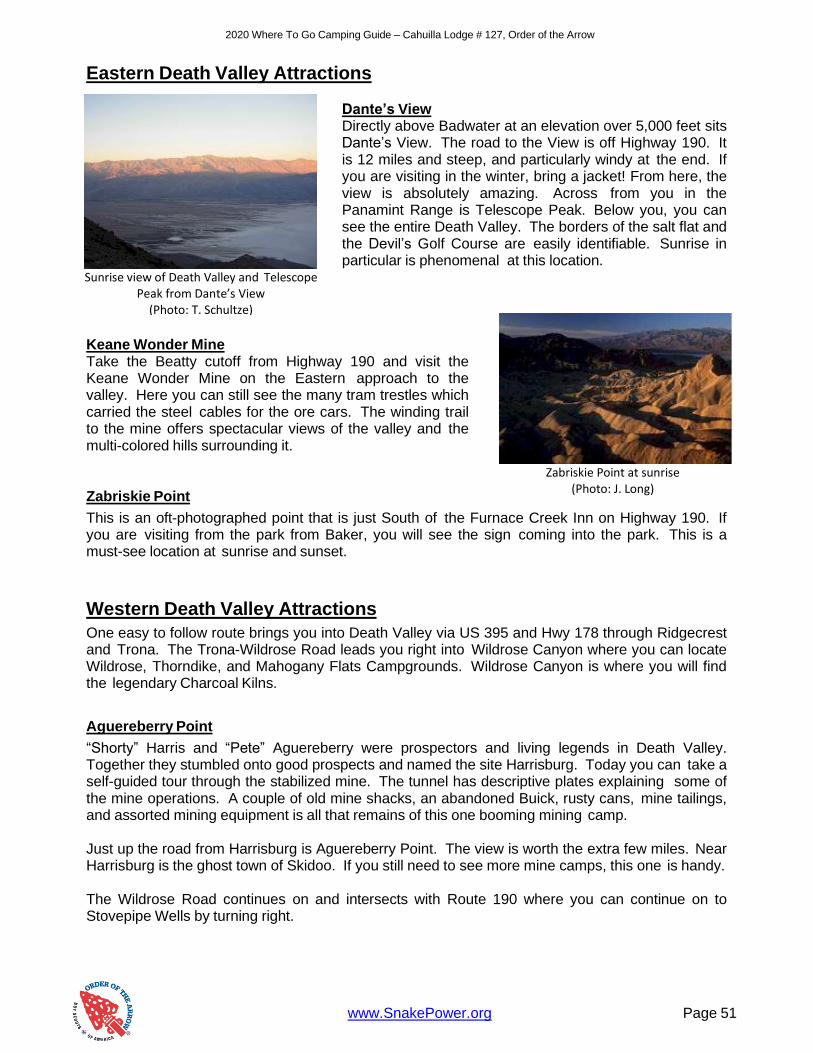
www.SnakePower.org Page 51
2020 Where To Go Camping Guide – Cahuilla Lodge # 127, Order of the Arrow
Eastern Death Valley Attractions
Dante’s View Directly above Badwater at an elevation over 5,000 feet sits Dante’s View. The road to the View is off Highway 190. It is 12 miles and steep, and particularly windy at the end. If you are visiting in the winter, bring a jacket! From here, the view is absolutely amazing. Across from you in the Panamint Range is Telescope Peak. Below you, you can see the entire Death Valley. The borders of the salt flat and the Devil’s Golf Course are easily identifiable. Sunrise in particular is phenomenal at this location.
Keane Wonder Mine Take the Beatty cutoff from Highway 190 and visit the Keane Wonder Mine on the Eastern approach to the valley. Here you can still see the many tram trestles which carried the steel cables for the ore cars. The winding trail to the mine offers spectacular views of the valley and the multi-colored hills surrounding it. Zabriskie Point
This is an oft-photographed point that is just South of the Furnace Creek Inn on Highway 190. If you are visiting from the park from Baker, you will see the sign coming into the park. This is a must-see location at sunrise and sunset.
Western Death Valley Attractions
One easy to follow route brings you into Death Valley via US 395 and Hwy 178 through Ridgecrest and Trona. The Trona-Wildrose Road leads you right into Wildrose Canyon where you can locate Wildrose, Thorndike, and Mahogany Flats Campgrounds. Wildrose Canyon is where you will find the legendary Charcoal Kilns.
Aguereberry Point
“Shorty” Harris and “Pete” Aguereberry were prospectors and living legends in Death Valley. Together they stumbled onto good prospects and named the site Harrisburg. Today you can take a self-guided tour through the stabilized mine. The tunnel has descriptive plates explaining some of the mine operations. A couple of old mine shacks, an abandoned Buick, rusty cans, mine tailings, and assorted mining equipment is all that remains of this one booming mining camp.
Just up the road from Harrisburg is Aguereberry Point. The view is worth the extra few miles. Near Harrisburg is the ghost town of Skidoo. If you still need to see more mine camps, this one is handy. The Wildrose Road continues on and intersects with Route 190 where you can continue on to Stovepipe Wells by turning right.
Sunrise view of Death Valley and Telescope
Peak from Dante’s View (Photo: T. Schultze)
Zabriskie Point at sunrise
(Photo: J. Long)

www.SnakePower.org Page 52
2020 Where To Go Camping Guide – Cahuilla Lodge # 127, Order of the Arrow
Charcoal Kilns
Used to produce charcoal needed for the mines across the valley in the Argus Range, these “Ten Sentinels” look totally out of place. Step inside one of these stone structures and walk around, it is awesome!
The interior is shaped in the form of a parabola, which was designed to concentrate the heat during the firing of the wood to make charcoal, however, the shape also allows for interesting sound transmission, with “dead” spots at one place and amplified sound a few steps away. Even today, you can still easily detect the smell of creosote left from the numerous fires.
From the Kilns, you can begin a pleasant auto tour by taking Wildrose Road to the site of Harrisburg, and then on to Aguereberry Point. Mahogany Flat
Mahogany Flat, at 8,400+ elevation is an often-used trailhead for a really great day hike to the tallest peak in the area, Telescope Peak. This hike should only be considered when the snows have melted from the 11,000+ summit. Telescope Peak
You may hear about Death Valley’s impressively low elevation, but did you know the park also has a peak over 11,000 feet? The trailhead can be accessed from the Mahogany Flat Campground and is a moderate to strenuous hike to the top.
Darwin Falls Darwin Falls is a waterfall located on the western edge of Death Valley National Park near the settlement of Panamint Springs, California. Although there exists a similarly named Darwin Falls Wilderness adjacent to the falls, the falls themselves are located in and administered by Death Valley National Park and the National Park Service. There are several falls, but they are mainly divided into the upper and lower with a small grotto in between. At a combined 80 feet (24 m), it is the highest waterfall in the park. The canyon is walled by dramatic plutonic rock.
A view of the Death Valley charcoal kilns
(Photo: J. Long)
On the trail to the falls
(Photo: M. Hare)
Darwin Falls (photo: M. Hare)

2020 Where To Go Camping Guide – Cahuilla Lodge # 127, Order of the Arrow
2007 Where To Go Camping Guide – Cahuilla Lodge # 127, Order of the Arrow
Page 52

www.SnakePower.org Page 54
2020 Where To Go Camping Guide – Cahuilla Lodge # 127, Order of the Arrow
Mojave National Preserve
Bordered roughly by Interstate 40 to the South, Interstate 15 to the West, the Nevada State Line, the Mojave National Preserve covers a huge tract of lands that offers much to the desert visitor. Managed by the National Park Service (a Preserve is essentially a National Park, but limited hunting is allowed), this large expanse contains volcanic domes, lava flows and tubes, sand dunes, dry lakes, petroglyph sites, abandoned army camps, historic roads, underground caverns, mine sites, ghost towns, and several state-operated campsites. This is a place of solitude. Here you may watch a hawk, or an eagle soar. Here you can listen to the plaintive cries
of coyotes, trying to shut out the moon’s light with their howls. Here you may find a solitary spring, providing host to myriad animal forms.
A great way to learn about the Mojave National Preserve is to visit the Kelso Visitor Center and get some of their free pamphlets, or purchase some of their excellent maps. These people are very helpful, and if you tell them that you are involved with Boy Scouts they will even volunteer extra information. One, easy to follow, route begins at Kelso Sand Dunes. Here you can climb some of the tallest sand dunes in California. The view from the top is worth the struggle to get there. These are known as “singing” dunes. The movement of the sand deep within the dunes makes sounds that, at time, are quite audible. After a visit here, maybe to have lunch, you can continue on to other nearby attractions.
There is the Kelso Depot, now the Preserve Visitor Center, located just a few miles up Kelbaker Road. This old railroad station can be a very interesting stop for railroad buffs. The Cima Dome is a truly unusual site as it is the most symmetrical geological formation in the United States. This intrusion is visible over a great distance with a particularly good view from Mid-Hills Campground. Mid-Hills, which charges a fee, is a spacious campground situated at 5,000 feet elevation. Here the nights can be chilly in the winter, but very comfortable for the rest of the year. Since water is available, along with fire rings, tables, and pit toilets; this is a very good campsite. Also, here you will find a trail that runs about 9 miles to another popular campground, Hole-In-The Wall. And from the Desert Interpretative Center at Hole-In-The Wall, it is just a short drive to the underground world of Mitchell Caverns. This campground is quite limited in size. You can still benefit from the fascinating Ranger-guided tours. If time still remains, you can take a neat side- trip to Amboy Crater where you can hike and climb up into a real volcano.
Mojave National Preserve…you have to see it to believe it!
Mojave National Preserve
Kelso Depot Visitor Center
90942 Kelso Cima Rd
Kelso, CA 92309
Phone (760) 252-6108
Hole-in-the-Wall Information Center
1 Black Canyon Rd
Essex, CA 92332
Phone (760) 252-6104
https://www.nps.gov/moja
There are over 150 cinder cones in
Mojave National Preserve (Photo: T. Schultze)

www.SnakePower.org Page 55
2020 Where To Go Camping Guide – Cahuilla Lodge # 127, Order of the Arrow
Camp Rock Springs
If the boys in your unit are interested in military history, especially in regards to the time period involving the Civil War, then a trip to Camp Rock Springs might be in order.
Located just South of Cedar Canyon, about 5 miles East of the intersection with Black Canyon Road (near Mid-Hills Campground), you will find, after a little searching, all that remains of this old desert military outpost.
As you proceed Eastward from Black Canyon Road, an old windmill will come into view on the right. This was originally called “Banning’s Well” after Phineas Banning who operated a freight line. Banning was, at the time, one of the wealthiest men in Southern California, responsible for many of the installations at the port of Wilmington, where the military had there stores. The name was later changed to “Government Holes” after the wells that the Army dug there to increase water flow. On a low knoll, to the right, you will see a structure, resembling a blockhouse, made of rock. This was the headquarters, for many years, of a local cattle company. A dirt road leads to the house, take it and park in the area outside the fence.
This is a private residence and this is private property. However you can walk past the gate and look around the property. A sign on the door warns trespassers that the caretaker lives nearby and watches the house with binoculars. Believe it! South of the house you will find the remains of an old mine with some of the machinery and timbers, as well as tailings, scattered about.
Back at the gate, you will see a corral fence leading downhill. Follow the road in front of the fence to lead you to the streambed. Depending on the time of year, substantial water flows. Walk downstream. You can sometimes find Indian “birdpoint” arrowheads in the sand. On the walls of the cliffs around you petroglyphs can be found, as well as some graffiti painted there by Civil War era soldiers.
The streambed changes from the meandering horizontal toward the more inclined vertical in a very short distance, requiring in-stream boulder hopping (a lot of fun); or you may elect to follow the patch around the steep places, on the South side of the stream. One February we were rewarded by being able to sit “inside” a small waterfall here, letting the spray thoroughly drench us! Where the canyon mouth opens you will find what remains of Camp Rock Springs. A plaque on a solitary boulder tells about the camp. The rock walls, obviously man-made, were part of the original corral, with the “mineshafts” being used as commissary storage areas.
Duty at Camp Rock Springs was so bad in the 1860s that most soldiers assigned there merely deserted! Little water, little food, poor rations, no feed for the horses (and at one time no horses at all), miles from nowhere, cold winter nights, unbearably hot days, and constant threat of hostile Indian attack made Camp Rock Springs one of the least desirable duty assignments.
Today a visit lets you walk quietly through the dust of the past. Perhaps, like the last time I was there, you may turn around and find yourself staring at a 1,000 pound hunk of living range cattle answering to the name of Mr. Bull! Camp Rock Springs is certainly not for everyone, but if you are a history buff or just enjoy solitude, then you may want to add it to you list of places to go.

www.SnakePower.org Page 56
2020 Where To Go Camping Guide – Cahuilla Lodge # 127, Order of the Arrow
Hole-In-The-Wall
This is a “must see!” Hole-in-the-Wall is located in a volcanic area that invites boulder scrambling. Near the West end of the campground you will find a marked trail leading you to “The Hole.” Farther West of “The Hole” is a trail leading down into the mud-hills that were formed from volcanic ash. The colorful walls invite you to explore further. The trail winds down and around, with passages getting narrower and walls getting higher. Iron rings have been installed by someone to help you climb down some of the steeper spots. In a little while you will end the trip through Banshee Canyon (the name of the passage) and enter colorful Wildhorse Canyon with Wildhorse Mesa in plain view. It is hard to tell why the mesa was so named as wild horses never set foot on its top. You can return to Hole-in-the-Wall by returning through Banshee Canyon, or you can turn this into a loop hike by traveling East (left) along the hills to Black Canyon Road. A short walk North (left) will return you to the campground. If you decide to follow this route be sure to stop and turn around after you leave the mouth of Banshee Canyon. Because of the nature of the rocks the entire cliff face, which extends for quite some distance, appears unbroken. You cannot see the opening that leads to Banshee Canyon. This, therefore, becomes a Hole-in-the-Wall. Legend tells us it was used by horse thieves in the 1800s. In any case it is a fabulous place to visit.
Hole-in-the-Wall also has a Desert Interpretative Center where Rangers will explain the collections and offer much interesting information about the local desert area. Make it a point to stop here to increase your knowledge and awareness of this most interesting desert area. Hole-in-the-Wall is located at a lower elevation than Mid-Hills and is better sheltered from the strong winds that often blow here. A trail links both camps and it would seem to be easier to follow the trail from Mid-Hills downhill than the other way around. This campground has tables, a picnic area, fire-rings, pit toilets, and limited water. It would be a good idea to bring water with you, if possible, and not rely on what may be a questionable supply. And bring firewood, especially for the colder winter evenings. The campsites in the Mojave National Preserve are on a first-come/first-served basis. Although you may find a sufficient number of sites available, they may not be situated next to each other so plan to arrive early or have a back-up plan. The area around Hole-in-the-Wall can be particularly stunning when the spring wildflowers bloom. Then carpets of pink, yellow, orange, purple, and white blooms flow between the mesas and cliffs. This camp is also centrally located and can be used as a “base camp” where short trips can be taken to explore the local areas.
View from the Hole-in-the-Wall lookout
(Photo: T. Schultze)
Trapped volcanic gas formed the “holes”
in the rock formations
(Photo: T. Schultze)

www.SnakePower.org Page 57
2020 Where To Go Camping Guide – Cahuilla Lodge # 127, Order of the Arrow
Kelso Sand Dunes
The Kelso Sand Dunes are found just South of the Kelso Depot and Visitor Center. There is a marked dirt road heading West from Kelbaker Road. About 2.5 miles down the road, you will find a parking area to the right. The Dunes are a short talk North from the parking area. Plan between one and one and a half hour if you want to do a little exploring and climb to the top of the dunes. The view of Kelso, the Cima Dome, and the surrounding mountains is excellent. Kelso Station
Nearly forgotten as a small railroad stop along the Union Pacific, Kelso Station was recently renovated and turned into a museum and Visitor Center for Mojave National Preserve.
Plan to visit it. Here you will find two floors of excellent exhibits which include the telegraph used to send messages down the rail line, the beds used by the engineers which include Union Pacific-branded blankets, and a host of other interesting historical items. There is a small book store as well.
At the foot of the sand dunes
(Photo: T. Schultze)
Kelso Station
(Photo: T. Schultze)

www.SnakePower.org Page 58
2020 Where To Go Camping Guide – Cahuilla Lodge # 127, Order of the Arrow
Joshua Tree National Park
Created in 1994 as part of the California Desert Protection Act, Joshua Tree National Park covers 560,000 acres within Riverside and San Bernardino Counties. This is the wide open spaces at its best! In the Northern part of the park you will find a rock climber’s paradise. Quartz monzonite boulders and monoliths abound and people come from around the world to practice their skills on these particularly challenging climbs. Here is, also, the land of the Joshua Tree. Actually a member of the lily family, this “tree trunk with daggers for leaves” was named by Mormon pioneers who thought that, in the moonlight, the tree looked like the prophet Joshua, with his arms extended to heaven. The Northern parts of the park are situated in the Mojave, or “high” desert where it is not unusual to find snow during the winter months. Here, besides Joshua Trees, you will find Mojave Yuccas, Nolina, and Creosote.
Firearms are not permitted in the park and therefore the wildlife has not developed a fear of hunters or humans. Rabbits can often be found wandering around the campgrounds, and quail sometimes seem to get underfoot. Coyotes are often seen, especially near twilight, as they cross roads near the many desert washes. As you travel South you reach the transition zone between the Mojave and Colorado, or “low” desert. This is where the Joshua Trees thin out and mesquite and, especially, cholla rule. The “Cactus Garden” is home to a particularly dense crop. In the park you will find intriguing geologic formations, including several natural arches. Malapai Hill is a unique volcanic formation that begs you to run to the top. At Cottonwood, you can find a plush oasis with palm trees and cottonwoods thriving. If you are real lucky you might even spy some desert bighorn sheep. Short hikes abound throughout the park. It is really an explorer’s paradise with several well-marked trails, and many more not so well-marked. Old mine roads lead to abandoned prospects, adits, and shafts. DO NOT ENTER these long- abandoned mines. Shafts can be particularly dangerous as they may be undercut. Merely standing near the edge could cause the lip to cave in bring you, and tons of earth, tumbling down.
Joshua Tree National Park
Joshua Tree Visitor Center
6554 Park Boulevard
Joshua Tree, CA 92256
Phone (760) 366-1855
Oasis Visitor Center
74485 National Park Dr
Twentynine Palms, CA 92277
Phone (760) 367-5500
Black Rock Nature Center
9800 Black Rock Canyon Rd
Yucca Valley, CA 92284
Phone (760) 367-3001
https://www.nps.gov/jotr
Trevor Denbo rappels down a rock
face. (Photo: B. Denbo)
Nothing quite matches the beauty of a Joshua Tree (Photo: T. Schultze)

www.SnakePower.org Page 59
2020 Where To Go Camping Guide – Cahuilla Lodge # 127, Order of the Arrow
Some mines, however, such as the Lost Horse, can be viewed in reasonable safety. These mines are very well preserved, due to the fact that the air is dry and that you can’t remove artifacts from park lands. Joshua Tree offers several group campgrounds which can be reserved. Some family sites can be reserved also. Most sites, thought, are on a first-come/first-served basis. Those that do not offer water (most of them) do not have a fee. The rangers, especially the backcountry rangers, can be a great resource in assisting in your planning. Many areas exist that have particular qualities that may be attractive to certain members of your group. If you tell the rangers what you are looking for, they will certainly try to give you some good suggestions. The Oasis Visitor Center, which features a well-designed nature trail, has a wonderful selection of books, guides, and maps to help you to learn more about the plans, animals, rocks, and history of the monument. This would be a great place to visit before your first outing to the park. Joshua Tree National Park has its special charm. Give it a change to work its magic on you! Barker Dam
There is a standing lake at Joshua Tree, and it is quite surprising and impressive. The water is actually from a man-made lake, and Barker Dam is the source. The turnoff is near Hidden Valley Campground. A short road takes you to a large parking area. This is a loop trail of only about 1 mile on mostly flat terrain.
Even when the lake gets low, it is still a great visit. The reflections from the rocks above are begging to be photographed. On good days, you can see a great meeting of the Park’s wildlife. Ducks frolic on the lake and birds can be seen everywhere. The loop takes you through some
petroglyphs that were vandalized, which is a great lesson on damaging the ancient wonders we find.
Boy Scout Trail
Your troop can’t drive past this trailhead without wanting to hike it! The Boy Scout Trail is a 7.5 mile (one way) leads from Indian Cove into the main part of the park on Park Boulevard. If you are camping at Indian Cove, you can make this a round-trip and head back for the evening from a 15 mile trip. Or, if you are going to visit other areas of Joshua Tree, you will need a waiting vehicle on the other side to pick you up. This is easy to do, with the drive back down Highway 62 and through the Park Boulevard entrance only taking a few minutes.
The trail meanders through rocks, washes, and valleys and is a moderate hike. Be sure to have plenty of water. This trail is not recommended in the hotter months where dehydration can stop any Scout in his tracks. In the milder months, however, it can be quite pleasant.
Reflections from the lake at Barker Dam
(Photo: T. Schultze)

2020 Where To Go Camping Guide – Cahuilla Lodge # 127, Order of the Arrow
www.SnakePower.org Page 60
Cholla Cactus Gardens Where the Colorado and Mojave deserts meet, the ecology can be quite dense and interesting. Nowhere is this more apparent than the Cholla Cactus Gardens off Pinto Basin Road. Here is an especially dense forest of cholla. This is a great place for viewing at sunrise at sunset. Given the right light and the right angle, you can get a particularly amazing photo as the sunlight bounces off the needles of the cactus. Cottonwood Because this campsite is in the Southernmost part of the monument, which does not contain the huge quartz monzonite boulders for climbing, or the Joshua Trees after which the park was named, you will usually find smaller crowds.
A group camp, consisting of several sites, can be reserved at Cottonwood. The sites feature fire rings and sun shelters. The sites also have tables. Water is available, the parking lot is paved, and flush toilets have been installed. For this there is a nominal fee, but the group site is still a great value. As with some of the other, larger, campsites periodic nature programs are conducted in the amphitheatre by knowledgeable rangers. Programs can cover things from plants, mammals, geology, and even star study. You cannot imagine the number of stars in the sky until you camp at Cottonwood. From Cottonwood you can visit the old town site of Winona, perched on the shoulder of a nearby hill. Foundation stones and a few walls still remain. You can also follow the Nature Trail out of the camp and link up with the trail to Cottonwood Springs. The Springs has been a haven for the thirsty traveler for untold centuries. Although I would not consider drinking the water now without purification, at one time it was so valuable that it was piped across the desert to the mines of the Dale District. The water flow has subsided much since then but many plans and cottonwoods still grow. Be careful climbing along the rocks, they are often wet and moss covered. The arrester near the springs indicates local gold mining activity. From this oasis you can travel down the main wash toward Little Chilcoot Pass, built by teamsters in the 1800s (look at the singular boulder in the side wash as you begin the trip to the Pass and you will find a great example of a metate, indicating early man’s presence), then on to Morton’s Mill. The Mill site now contains the wreck of an old truck, some rusting cyanide tanks, and a few foundations. Like at Cottonwood, if you are very quiet, and very lucky, you may catch the glimpse of a rare desert bighorn sheep. From Cottonwood Springs you can also take an 8 mile, roundtrip, hike to Lost Palms Oasis. This is a nice hike over moderate terrain. The Oasis is well worth the visit, especially the overlook to the trees. Dozens of Washingtonia Palms are scattered up and down the narrow recesses of this quiet canyon. For those who don’t want to travel all the way to Lost Palms, a short trail leads up the hill to the Mammoth Mine near the top of Mastodon Peak. This easy-to-moderate hike will take you about an hour and the view from the peak is worth it. You can usually see the Salton Sea glittering in the distance. The Mammoth Mine is on the other side of the peak, but please, be careful.
The color of the cholla changes by the
second (Photo: J. Hermes)

2020 Where To Go Camping Guide – Cahuilla Lodge # 127, Order of the Arrow
www.SnakePower.org Page 61
Another landmark can be found near Cottonwood, it is “Matt Riley’s Grave.” This unfortunate miner perished in the summer heat and was buried where he was found. This grave is about a quarter mile North of the Cottonwood Visitor Center, 60 yards East of the road. This is a silent reminder of the Boy Scout Motto…”Be Prepared!” Geology Tour Road One real good way to investigate Joshua Tree National Park is to take a drive, or a hike, along Geology Tour Road. This maintained dirt road leads into the heart of one of the most fascinating portions of the park. A “Guide To Geology Tour Road” is available at the visitor center, which describes in detail, the 18 stops along the road. This 16 mile round trip is a definite “must see” for anyone who wants to really appreciate the park. Malapai Hill, located within walking distance of the road, is pretty much a volcano that did not reach the surface. Since it did not come into contact with the air, the black basalt is particularly dense and heavy. Look around and find a specimen that is broken. With a small magnifying glass, or loupe, you can see olivine and quartz crystals that sparkle. Other minerals are tinged red, yellow, and violet. On the way to the hill, look for the “Balanced Rock.” This is a great photo opportunity for your unit. A large boulder is precariously perched on a relatively small base. It looks like just a little effort could cause it to roll down the valley. I first read about Squaw Tanks in a book published in 1919. Written by Joseph Smeaton Chase, the story described the tanks as they were back then. Mr. Chase, it seems, fell in love with the desert. To learn more about it he spent two years, with his horse Kaweah, roaming the land. “The tanks,” he wrote, “were well known in the area.” These tanks are merely depressions in the rock where water accumulates during the rare rains. After awhile, however, animals fall into the tanks and drown. Spiders, lizards, snakes, rats, and other assorted creatures combine with algae to form a particularly disgusting concoction. When he arrived at Squaw Tanks the aroma was so bad that even his thirsty horse refused to drink. The horse would just “…curl his lips and make an angry sound, but he wouldn’t drink.” The tank was improved by range cattlemen during the late 1880s, by the addition of a concrete dam, which is now filled with silt. Near the tank, which is a popular climbing area, you can find several excellent examples of “metates” which were used to grind seeds by the local Indians. It is not wise to drive any farther than this spot during rainy season unless you have 4-wheel drive, and even at that, caution should still be exercised. A short way from Squaw Tank you can find petroglyphs chipped into the Pinto Gneiss. This ancient “graffiti” occurred when the dark “desert varnish” covering the rocks was chipped away to expose the lighter stone underneath. Remember to leave these artifacts as you found them. Continuing on the one-way road will take you to the remains of the Gold Coin Mine. A few shafts and prospect holes can be found, as well as the remains of two cyanide tanks used in the amalgamation process. The road then leads in a big circle through Pleasant Valley and returns to the spot near Squaw Tank. The view is worth the drive. You can look toward Lost Horse Valley from the heights and you also are able to get a good view of Malapai Hill and the entire basin. Allow 2 to 3 hours to travel Geology Tour Road. Take your time, get out, and walk around. Be sure to have your Scouts climb the rock pile West of the road near marker # 6. The giant, rectangular, block of quartz monzonite is a good backdrop for a Troop picture. Another Kodak moment!

2020 Where To Go Camping Guide – Cahuilla Lodge # 127, Order of the Arrow
www.SnakePower.org Page 62
Keys View Off of Park Boulevard is a turnoff for Keys View, and you must visit this point, especially for sunrise! On a clear day (and air quality can be an issue), you have a breathtaking view of both San Jacinto and San Gorgonio Peaks. In twilight, you can clearly see the light of the Palm Springs Tramway. To the South, the Salton Sea sits quietly in the distance. If you’re lucky, you can even see into Mexico! Lost Horse Mine Trail Still, on many days, the smog that slowly pushes its way through San Gorgonio Pass obscured the view. This is a great lesson for your Scouts on the impact humans have on the environment, even in these out of the way places.
Located on the road to Key’s View, the visitor can stop at a small roadside exhibit, on the right, a few yards before the turnoff to the Lost Horse Mine. Here, amongst the Joshua Trees, you will find a rock-lined grave with a small headstone. This is the final resting place of Johnny Lane, one-time owner of the Lost Horse Mine. He died, probably of dehydration, and his mummified body was buried in a shallow grave, near where it was found, another victim of the desert.
Just past the gravesite, on the left side of the road, is the entrance to the Lost Horse Mine Trailhead. The dirt road leads a short distance to a small parking area. The 2 mile trail begins just past the gate. This easy-to-moderate hike leads you uphill past the remnants of past mining activity. The Lost Horse Mine, located near a hilltop, was one of the best producers in the park area with over 9,000 ounces of gold removed during the years of its operation. Since the mine is on park lands, most of the machinery remains.
The 10-stamp mill looks like it could be active again with just a few belts and a little work. These iron-headed stamps moved up and down, like an automobile intake valve, curing the gold-bearing ore as it passed beneath. The gold ore was taken out through a series of tunnels that operated on several levels. The opening to the 500 foot-deep main shafts can still be seen.
Concrete water tanks are still visible above the stamp works. The water was pumped from miles away in the Ryan area. Across the wash from the main mill site you can see the foundation remains of several houses, as well as several admits, shafts, and tunnels. The openings have been sealed, but erosion can undermine them at any time, so exercise caution.
A large plaque at the stamp mill has a diagram of the mine operation and briefly describes some of the machinery. Follow the trail uphill, past the abandoned main winch, to the top of Lost Horse Mountain. Here you will have a spectacular panorama of most of Joshua Tree National Park. Dark-colored Malapai Hill lies alone like a “bulge” in the desert floor. Just beyond, at the point of rocks, is Squaw Tank. You can see the dry lake in Pleasant Valley just sound of the Gold Coin Mine.
The view is perhaps the best in the park. You can look into the Jumbo Rocks area, you can see the boulders near Belle and White Tank. To the North is the Wonderland of Rocks, whose colors change with the moods and movement of the sun.
The Salton Sea as seen from Keys View
(Photo: T. Schultze)

2020 Where To Go Camping Guide – Cahuilla Lodge # 127, Order of the Arrow
www.SnakePower.org Page 63
Below you is the old mining town. You can take a little time and try to visualize what it must have been like to have been at this spot 100 years ago. The stamp mill, and the incredible noise it must have made as it attempted to wrest the minute particles of gold from solid rock, filed the air with steam and smoke on a 24 hour a day, 7 day a week basis. Dynamite blasts rocked the earth, filling the canyon with the sound of exploding rock, and hydraulic drills noisily chewed into the quartz veins in preparation for the next series of blasts. Machinery screeching, men yelling, winches straining, ore cars dumping rock in the stamp mill’s hopper. Smoky, dirty, and noisy, all this work for just one thing… Gold!
The mines are quiet now, with the only sound that of the wind whistling through the weathered timbers of the headframe. The only vibrations are those of an occasional hiker’s footfall on the winding hillside trail.
Gold…it can still be found here, but more important things can be found here, too.
White Tanks
The White Tanks actually contains several tanks, with this one being the easiest to find. This first-come/first- served campground offers parking for 2 cars in each site and is limited to 6 people per site, tents only. The sites are nestled among large boulders and are particularly attractive. Each site has a fire ring. Remember that through the park no collecting of anything is allowed, including firewood. Bring your own. A well-marked nature trail takes the visitor on a short loop trip. Plans and geological information is given at the several sites. One spot you will want to visit is “The Arch.”
This natural arch was formed by a combination of wind and rain eroding the White Tank Quartz Monozite. Bring your camera. At night, you can get some remarkable photographs as the moon rises over the arch. At this point you might want to leave the marked trail and search for White Tank. One easy way is to boulder hop down the slot with the arch to your left. In a couple hundred yards you will find a wash (usually dry) on your left. Slightly downstream from this spot you will find the remains of White Tank. All that you will see is the 8 foot, or so, tall cement dam. This was put here to trap water for cattle near the turn of the century. If you decide that you like dams, you can continue to search in a generally Easterly direction where, if you are lucky, you will find Grand Tanks. This is a truly large tank. Search the nooks and crannies upstream from the concrete dam and you may find the initials and date that are carved into a nearby rock. Perhaps this was an old time cowboy’s attempt at immortality. The White Tanks area is a splendid area to boulder hop, explore, and practice rock climbing without getting very high off the ground. The maze of giant, tumbled, boulders offers numerous, cave-like, alcoves that just scream to be investigated. Watch for droppings and try to guess what types of critters call it home.
Another beautiful day at The Arch
(Photo: J. Long)

2020 Where To Go Camping Guide – Cahuilla Lodge # 127, Order of the Arrow
www.SnakePower.org Page 64
Across the paved road from the entrance to White Tank, and a short distance to the South, is a parking area and dirty road. This road leads to Hidden and Stirrup Tanks. This is a really worthwhile sidetrip. Again, giant boulders prevail. This area is unusually quiet with rarely even the sound of a bird to disturb the silence. Just North of White Tanks is another small campground named Belle. Like White Tank it is a first-come/first-served site with fire rings. This too has no water available so no fee is charged. Both sites offer the vest best in state-of-the-art pit toilets, so if you insist on restrooms without odors, you might want to consider heading down the road to Cottonwood. Belle does have some remarkable boulders, especially Breadloaf Rock. West of Belle, you might be able to locate Twin Tanks. The White Tanks area is easily accessible from the Park Headquarters Entrance Station. Just be sure to turn left (South) at Pinto Wye Road. This paved road crosses the monument from the North to South linking up with Interstate 10 25 miles East of Indio. The sign at the turnoff reads “Cottonwood 26 Miles.” Joshua Tree Campgrounds Most campsites require reservations which you can reserve online at http://www.recreation.gov. In the popular winter months, you should do your reservation at least 30 days in advance, even sooner if possible. Campsites are located at Belle (just North of White Tank), Black Rock Canyon (off Joshua Lane in Yucca Valley), Cottonwood (South end of the park off Interstate 10), Hidden Valley (centrally located), Indian Cove (in an “island” by itself, you have to leave the park and enter from Joshua Tree or Twentynine Palms), Jumbo Rocks (largest camp in the park), Ryan Mountain (good access to Lost Horse Valley and Ryan Mountain), Sheeps Pass (impressive sites and protected from the wind), and White Tank (small site but location of the Joshua Tree arch). Other Areas The following are some other desert areas that are not located in the areas mentioned in this section. Two of them, Amboy Crater and Mitchell Caverns, are located next to the Mojave National Preserve, and naturally should be part of your itinerary. Calico Ghost Town is a great weekend outing that teaches Scouts history and desert camping. On the way, check out the early man site off Minneola Road, just a few miles down Interstate 15 from the Calico Ghost Town exit. Amboy Crater National Natural Landmark Located near the town of Amboy and South of Mojave National Preserve, Amboy Crater is what remains of intense volcanic activity in the fairly recent geologic past. Surrounding this 400’ or so cinder cone you will find a vast field of dark colored rocks. From the parking area at Crater Road, follow a faint trail to the crater. The Bureau of Land Management (BLM) has set up signs pointing you in the right direction. It looks a lot taller and steeper from here! Although you will see a trail leading from the North side of the crater to the top, please do not use this point of entry. This is an example of how sensitive the crater is to erosion. The Sunset Crater in Arizona had to be closed due to erosion. There is a breech on the West side of Amboy Crater and the BLM trail will lead you to it. This is the only way you should go.
Amboy Crater
(Photo: T. Schultze)

2020 Where To Go Camping Guide – Cahuilla Lodge # 127, Order of the Arrow
www.SnakePower.org Page 65
From the summit you can gain a greater appreciation for Mother Nature’s power. The lava flow is very easy to see and you cannot help but wonder how much energy is required to melt rock and then redeposit it, in semi-liquid form over the several square miles of terrain. Also, from the summit, you can look down into the caldera. Sometimes you will find water in the interior base of the cone. Actually there are two calderas, indicating separate volcanic events. You will, of course, want to hike down inside the volcano’s opening. Go for it! If it looks you can’t work Amboy Crater into your outing plans, you may want to just take a few moments to drive Old Route 66 past it. It is quite visible from the highway and is easily spotted on the horizon, or you may decide to make this a lunchstop where you can use the cone as a backdrop for your sandwiches. Should you plan to visit Amboy Crater, or many of the other geological offerings in the Mojave National Preserve, you might want to plan to take someone along who has experience in geology. Many of the boys become quickly fascinated when they “discover” minerals in volcanic rock, or begin to learn the names of common desert rocks. They may even decide to earn the Geology Merit Badge. Calico Ghost Town Regional Park
More than a century ago, the town of Calico was bustling with prospectors. Founded in March 1881, it grew to a population of 1,200 with 22 saloons and more than 500 mines. Silver was king, and the Calico Mining District became one of the richest in California, producing $86 million in silver, $45 million in borax and, of course, gold. After 1907, when silver prices dropped and borax mining moved to Death Valley, Calico became a ghost town.
Today, Calico is one of the few remaining original mining towns of the Western United States and became a regional park in 1966. See the Calico Ghost Town Regional Park Website for prices and more information. Minneola Early Man Site Since you are heading to Calico Ghost Town, why not drive a few miles North along Interstate 15 and exit Minneola Road. Here you will find the Calico Early Man Site two miles from the freeway. Amateur archaeologists discovered this location in 1942. Modern archaeology work continues at the site, which is believed to be a stone tool workshop dating back thousands of years. There are guided tours (9:30 AM, 11:30 AM, 1:30 PM, and 3:30 PM). Mitchell Caverns
Although considered part of Mojave National Preserve, Mitchell Caverns is actually found in the Providence Mountains State Recreation Area, making it a state park entirely surrounded by the Preserve.
When Hollywood needed a cave as a location for the filming of the movie “The Doors,” Mitchell Caverns was chosen. Unfortunately, during the filming the crew caused considerable damage to the pictographs that exist near the cabin mouth.
Calico Ghost Town Regional Park
Ghost Town
36600 Ghost Town Rd
Yermo, CA 92398
Phone (800) 862-2542
https://parks.sbcounty.gov/venue/calico-ghost-town/
Providence Mountains SRA
Mitchell Caverns
38200 Essex Rd
Essex, CA 92332
Phone (760) 928-2586
http://www.parks.ca.gov/?page_id=615

2020 Where To Go Camping Guide – Cahuilla Lodge # 127, Order of the Arrow
www.SnakePower.org Page 66
Chemehuevi Indians used these caverns for many years. One chamber has the fossilized remains of a ground sloth indicating the caved was used for more than just a religious or ceremonial site. It was also used for shelter.
These are actual limestone caverns and not “caves” or “tunnels.” Created by the effect of carbonic acid seeping through the soil eroding the softer limestone, the caverns are truly impressive. A 1 hour (sometimes longer) tour costs very little and teaches much. The knowledgeable guides explain how the caverns were formed, the various types of formations, the history of the local Native American’s use of them, and the future of this remarkable site.
The tour takes you into the two main caverns, “El Pakiva” and “El Tecopa” (there is a third cavern not open to the general public that features a multi- hundred foot drop). The caverns are artificially lighted, with stairs and walkways to
make the tour safe and easy. The guides point out the various formations and describe how each was formed. It seems that there are only a handful of different cavern formations besides stalactites and stalagmites and Mitchell Caverns is unique in that it contains most of them. It also has one formation that is extremely rare with only 3 or 4 known to exist in the entire world.
Some tour guides can be prompted to turn all of the lights off at some time during the tour. This is a really incredible experience. When you put your hand in front of your face, touching your nose and you still can’t see it, then that is real darkness.
The caverns maintain the same temperature throughout the year and are quite comfortable with just a light jacket or medium weight shirt. A flashlight is handy to bring and for the photographers out there, we recommend you take a monopod for your camera in the low light.
Beside the caverns the State Park operates a Visitor Center with displays of old mining implements, rocks and minerals, native American artifacts, and history of Jack Mitchell, who developed the caverns as a tourist attraction in the early 1900s. The Mary Beale Nature Trail begins at the Visitor Center. This short nature trail is extremely well planned, offering
excellent views of the desert and mountains, as well as descriptions of the plants along the walk. If a longer walk is desire, you may hike up to Crystal Springs, a short distance above the Visitor Center on Foshay Peak. At night, the sky to the North bears an unusual brightness, caused by the lights of Las Vegas. Mitchell Caverns is one of the best-kept secrets of Southern California, well worth the journey.
A view of stalactites in the first cavern in
Mitchell Caverns (Photo: T. Schultze)
Mitchell Caverns has an excellent visitor
center and a small campground
(Photo:T Schultze)

2020 Where To Go Camping Guide – Cahuilla Lodge # 127, Order of the Arrow
www.SnakePower.org Page 67
Boating and Canoeing
While many Scouts, Scouters, and units dominate the lowlands and mountainous terrains of Southern California, there remains a worthy frontier for those seeking new adventures.
Despite Southern California’s reputation for being an exceptionally dry area, there are water activities everywhere. In the West is the Pacific Ocean, the largest body of water in the world. In the East is the mighty Colorado River, which drains most of the Great Southwest. In between, there are lakes and streams waiting to be explored.
Whether you are using a boat, canoe, or raft, adventure awaits you on the water in Southern California. It isn’t enough to just camp near a lake. For the experience to be truly fulfilling, one needs to venture out onto the water. On a day with nice sunny weather, a lake’s quiet solitude is a solemn experience.
This section is organized by area, beginning with some canoe trips down the Colorado River, thanks to the Jerkwater Canoe & Kayak Company. Next, you will switch to the Pacific Ocean, with a few local Scouting facilities for canoeing, and a truly special experience hiking & camping in Channel Islands National Park. Finally, we cover several of the local lakes that allow boating or canoeing.
High Adventure awaits you as well. Maybe your Troop is ready to do a 50-mile canoe trip down the Colorado River, or you want to introduce your Scouts to kayaking. When you think of it, the water is just an extension of the land your Troop is exploring and learning from.
Without it, your experience as a Troop will be incomplete.
Colorado River
Draining a significant portion of the Southwest United States, the Colorado is our region’s greatest river. It is famous to most people because it flows through the majestic Grand Canyon in Arizona, and most Scouts and Scouters know of the excellent canoeing adventures on the river’s California/Arizona border.
The river also provides your Scouts and important lesson. Despite the river’s massive size and scale, manmade activities including dams and farm irrigation have changed the Colorado dramatically. Much of the Grand Canyon’s water ecology has changed due to the Glen Canyon Dam, and the warm water that fed the beautiful delta in Mexico is diverted elsewhere. It is a beautiful river to behold, but one to be concerned with for the future.
Your Scouts will cherish the chance to canoe the Colorado. The River Rat patch is easy to complete, and the 50-miler award will commemorate a memorable trip for your unit. While we can’t possibly provide every iteration of starting and ending points, we wish to share just a few that you can choose from.

2020 Where To Go Camping Guide – Cahuilla Lodge # 127, Order of the Arrow
www.SnakePower.org Page 68
One-Day Canoe Trips
Topock Gorge: Launch from Park Moabi Regional Park or Topock Marina and travel downstream through Topock Gorge to Castle Rock. Distance is 16 or 17 miles, respectively. While spectacular, this is a moderate to strenuous trip. Needles to Park Moabi: Launch from Jack Smith Park and head to Park Moabi. This is a shorter, easy trip that is great for introducing your unit to canoeing. It is an easy to moderate journey. Black Canyon: Launch from the base of Hoover Dam and head to Willow Beach. Total distance is 12 miles. This is a moderate to strenuous trip that can also be done as a 2 or 3 day trip. Permits are required.
Two-Day Canoe Trips Needles To Castle Rock: On day one, paddle from Needles to Park Moabi, and on the second day head to Topock Gorge. This is an excellent intermediate trip with one day being easy and leisurely and the second more moderate. Park Moabi to Windsor Beach: Launch from Park Moabi and paddle through Topock Gorge, past Castle Rock, and into the camping area. On the second day, paddle on to London Bridge. Black Canyon: Launch at the base of Hoover Dam. Spend the day exploring the side canyons and hot springs. Take out the next day is at Willow Beach. Permits are required in Black Canyon. Norton’s Canoe Base to Fisher’s Landing: Begin at Norton’s Canoe Base and stay overnight. The next day, paddle 15 miles downstream to Fisher’s Landing. You can also being at Draper Lake and paddle 12 miles down to Norton’s Canoe Base.
Three-Day Canoe Trips Bullhead City to Castle Rock: Launch from Bullhead Community Park. The first night, wilderness camp along the river and the second night, camp at Park Moabi. Needles to Windsor Beach: Launch in Needles and paddle to Park Moabi. The second day, head through Topock Gorge and wilderness camp just at the mouth of Lake Havasu. The third day, paddle to your takeout at Windsor Beach.
Four-Day Canoe Trips Hoover Dam to Placer Cove (El Dorado): This trip starts at the Hoover Dam and you will paddle through Black Canyon and onto Lake Mohave, wilderness camping along the way. Launch permit required.

2020 Where To Go Camping Guide – Cahuilla Lodge # 127, Order of the Arrow
www.SnakePower.org Page 69
Bullhead City to Windsor Beach: This trip covers over 50 miles with some wilderness camping and civilized camping.
Five-Day Canoe Trips Bullhead City to Windsor Beach: This trip covers over 50 miles with a day layover for Scouts to complete their merit badges. The day layover would be a Park Moabi in the middle of your trip. With advance arrangements a service project can be planned with Park Moabi. Hoover Dam to Cottonwood Cove: Begin at the base of Hoover Dam. This trip takes you through Black Canyon on to Lake Mohave, wilderness camping along the way to Cottonwood Cove. Launch permit required.
Moabi Regional Park
Moabi Regional Park is on the banks of the Colorado River 11 miles Southeast of Needles. It is a well-known starting and ending point for treks down the Colorao River. It is one of the most well-known starting areas along the Colorado River for canoeing groups. Need Help With Your Trip? There are highly-rated experts available. In particular, the Jerkwater Canoe & Kayak Company has been
helping Scouts canoe the Colorado River for years. Much of this section was adapted from information you can receive from their website. They offer everything from canoe rentals to guided tours. They are conveniently located in Topock, Arizona and Boulder City, Nevada, two major points along the Colorado River. Visit their website at http://www.jerkwater.com or call them at (928)768-7753.
Moabi Regional Park
Moabi Regional Park
100 Park Moabi Rd.
Needles, CA 92363
Phone (760) 326-9000
https://parks.sbcounty.gov/park/moabi-regional-park/
Scouts working on their canoeing merit
badge at Moabi (Photo: M. Hare)
Canoeing on the Colorado
(Photo: M. Hare)
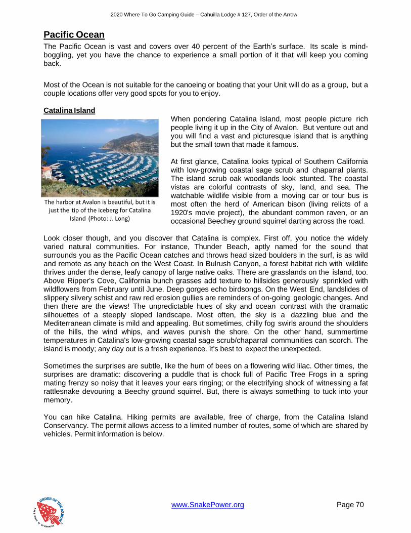
2020 Where To Go Camping Guide – Cahuilla Lodge # 127, Order of the Arrow
www.SnakePower.org Page 70
Pacific Ocean
The Pacific Ocean is vast and covers over 40 percent of the Earth’s surface. Its scale is mind- boggling, yet you have the chance to experience a small portion of it that will keep you coming back.
Most of the Ocean is not suitable for the canoeing or boating that your Unit will do as a group, but a couple locations offer very good spots for you to enjoy. Catalina Island
When pondering Catalina Island, most people picture rich people living it up in the City of Avalon. But venture out and you will find a vast and picturesque island that is anything but the small town that made it famous. At first glance, Catalina looks typical of Southern California with low-growing coastal sage scrub and chaparral plants. The island scrub oak woodlands look stunted. The coastal vistas are colorful contrasts of sky, land, and sea. The watchable wildlife visible from a moving car or tour bus is most often the herd of American bison (living relicts of a 1920's movie project), the abundant common raven, or an occasional Beechey ground squirrel darting across the road.
Look closer though, and you discover that Catalina is complex. First off, you notice the widely varied natural communities. For instance, Thunder Beach, aptly named for the sound that surrounds you as the Pacific Ocean catches and throws head sized boulders in the surf, is as wild and remote as any beach on the West Coast. In Bulrush Canyon, a forest habitat rich with wildlife thrives under the dense, leafy canopy of large native oaks. There are grasslands on the island, too. Above Ripper's Cove, California bunch grasses add texture to hillsides generously sprinkled with wildflowers from February until June. Deep gorges echo birdsongs. On the West End, landslides of slippery silvery schist and raw red erosion gullies are reminders of on-going geologic changes. And then there are the views! The unpredictable hues of sky and ocean contrast with the dramatic silhouettes of a steeply sloped landscape. Most often, the sky is a dazzling blue and the Mediterranean climate is mild and appealing. But sometimes, chilly fog swirls around the shoulders of the hills, the wind whips, and waves punish the shore. On the other hand, summertime temperatures in Catalina's low-growing coastal sage scrub/chaparral communities can scorch. The island is moody; any day out is a fresh experience. It's best to expect the unexpected. Sometimes the surprises are subtle, like the hum of bees on a flowering wild lilac. Other times, the surprises are dramatic: discovering a puddle that is chock full of Pacific Tree Frogs in a spring mating frenzy so noisy that it leaves your ears ringing; or the electrifying shock of witnessing a fat rattlesnake devouring a Beechy ground squirrel. But, there is always something to tuck into your memory. You can hike Catalina. Hiking permits are available, free of charge, from the Catalina Island Conservancy. The permit allows access to a limited number of routes, some of which are shared by vehicles. Permit information is below.
The harbor at Avalon is beautiful, but it is
just the tip of the iceberg for Catalina Island (Photo: J. Long)

2020 Where To Go Camping Guide – Cahuilla Lodge # 127, Order of the Arrow
www.SnakePower.org Page 71
Another way to hike and get into otherwise inaccessible remote areas of the island, like Silver Canyon, is on the monthly HIKE with professional naturalists of the Catalina Island Conservancy. The Conservancy, steward of 88% of the island, has stepped up conservation and restoration efforts in the last half decade. Part of the conservation effort is to give people more opportunities to understand the elegant and fragile ecology of the island. The HIKE, on the first Saturday of every month, exposes people to island ecology with an exploratory approach. Hiking permits are required but are free and easy to get. You need to obtain them in person; none are given by phone or email.
• Catalina Island Conservancy (125 Claressa Street in Avalon)
• Wrigley Memorial and Botanical Garden (1402 Avalon Canyon Road in Avalon)
• Catalina Airport-in-the-Sky
• Two Harbors Visitors Information Center
Channel Islands
Close to the California mainland, yet worlds apart, Channel Islands National Park encompasses five remarkable islands (Anacapa, Santa Cruz, Santa Rosa, San Miguel, and Santa Barbara) and their ocean environment, preserving and protecting a wealth of natural and cultural resources.
Isolation over thousands of years has created unique animals, plants, and archeological resources found
nowhere else on Earth and helped preserve a place where visitors can experience coastal Southern California as it once was. You need to boat or fly to get into the park’s islands – we recommend two companies who regularly shuttle people to the National Park. Island Packers (http://www.islandpackers.com) and Truth Aquatics at Sea Landing (http://www.truthaquatics.com) are recommended by the National Park Service. Both companies also offer whale watching when in season, something your Scouts will love.
San Diego Youth Aquatic Center
The San Diego Youth Aquatic Center is nestled in a protected cove on the water on Fiesta Island in the heart of Mission Bay Park, San Diego, California.
The beautiful facility occupies one acre of land adjacent to the Fiesta Island Youth Camp and is surrounded by sandy bay front beaches with access to the Pacific Ocean. On a hot summer day with the cool ocean breeze in your face take advantage of the many
instructional and recreational opportunities in sailing (catamaran and small boat), water-skiing, canoeing, rowing, kayaking, surfing, swimming and windsurfing that are available.
The Aquatics Center’s beach front facilities include: a boat ramp, a marine biology lab and touch tanks, a shark and sting ray tank, locker rooms with hot showers, meeting and program rooms, a kitchen, and court yard.
Channel Islands National Park
Channel Islands National Park
1901 Spinnaker Dr.
Ventura, CA 93001
Phone (805) 658-5730
https://www.nps.gov/chis
San Diego Youth Aquatic Center
Fiesta Island Youth Camp
1750 Fiesta Island Rd.
San Diego, CA 92109
Phone (619) 298-6121
https://camping.sdicbsa.org/YAC/

2020 Where To Go Camping Guide – Cahuilla Lodge # 127, Order of the Arrow
www.SnakePower.org Page 72
The Fiesta Island Youth Camp, which is adjacent to the Youth Aquatic Center, holds up to 400 campers, with approximately 100 parking spaces. There are 25 campsite clusters, which can accommodate a maximum of 8 campers. Each campsite has a barbeque, fire pit and picnic table. A centrally located restroom has water availability and rinsing showers. Overlooking the bay is an amphitheatre, which has an accessible platform and bonfire ring, which is great for large group campfires and watching the nightly fireworks from Sea World during the summer. The San Diego Youth Aquatics Center and Fiesta Island Youth Camp are available for any organized youth group for day use and overnight camping in a beach setting. Newport Sea Base
The Newport Sea Base has a history of providing quality maritime programs for youth since 1937. With a commitment to developing character, our desire is to inspire a love for the marine environment in the hearts of youth. The Sea Base is located on 400 feet of beautiful waterfront in Newport Beach, California. The site is provided courtesy of the Orange County Board of
Supervisors, and operated by the Orange County Council, Boy Scouts of America. The base has a fleet of boats includes kayaks, canoes, rowboats and over 3 dozen sailboats. It is also home to three Sea Scout Ships; Del Mar, Renegades and Triton, as well as the Chapman University Crew Team. In 2002, the Sea Base began a $6.8 million project to transform the facility into a modern teaching and aquatics center. The expanded Newport Sea Base now features additional classrooms, a library, conference room, crew center, picnic area and new boating equipment.
Newport Sea Base
Newport Sea Base
1931 West Coast Highway
Newport Beach, CA 92663
Phone (949) 642-5031
https://www.newportseabase.org/
Entrance to the San Diego Youth Aquatic Center (Photo: V. Williams)
Newport Sea Base Harbor (Photo: Sea Base Website)

2020 Where To Go Camping Guide – Cahuilla Lodge # 127, Order of the Arrow
www.SnakePower.org Page 73
Local Camping, Lakes, & Streams
San Bernardino County Locations
Big Bear Lake
The U.S. Forest Service operates the campgrounds in the National Forest, and RV camping is also available in the Valley. Call or visit the Big Bear Discovery Center for camping information. Their phone number is (909) 382-2791.
Paddle boating, pontoon boating, sailing or power boating... windsurfing, sailboarding, waterskiing or jet skiing - Big Bear Lake offers it all! And all boats and equipment can be rented at any one of the marinas that dot the lake's 23 miles of shoreline. Private boat permits are required and can be purchased at any marina. Bass, trout and catfish are abundant in Big Bear Lake. Licenses and supplies can be purchased at sporting goods stores and marinas.
Attend a Ranger/Naturalist talk at the Discovery Center and learn to see the forest with new eyes. This tour can meet both Webelos and Boy Scout merit badge requirements if you inform the ranger ahead of time and bring your requirements book with you.
Ride the Summit Sky Chair, have lunch, then hike or ride your bike back down. Take a boat tour around the lake, or be the captain of your own canoe and visit a beaver dam. There are many things to do in and around Big Bear Lake.
Glen Helen Regional Park
2555 Glen Helen Parkway, San Bernardino, CA 92407 / Phone: (909) 887-7540
http://www.co.san-bernardino.ca.us/parks/glen.htm
Glen Helen Regional Park offers 1,340 acres of land that your Scouts can use to camp, hike, swim, and fish. Please note though that Glen Helen holds many events, including concerts, at the Pavilion in the park. This could affect fees on certain weekends, and not every concert will invite a Scout-like crowd. Make sure you check the schedule.
Lake Gregory Regional Park
24171 Lake Drive, Crestline, CA 92325 / Phone: (909) 338-2233
http://www.co.san-bernardino.ca.us/parks/lake.htm
Lake Gregory Regional Park is an alpine jewel nestled in the pine forests of Crestline. Here you can fish from the shore, hike, swim, or boat on over 150 acres.
Mojave Narrows Regional Park
18000 Yates Road, Victorville, CA 92392 / Phone: (760) 245-2226
http://www.co.san-bernardino.ca.us/parks/mojave.htm
Mojave Narrows is located off Interstate 15 at Bear Valley Road. Head East and go North on Ridgecrest. Here, you can fish, boat, camp, hike nature trails and just enjoy the scenery.

2020 Where To Go Camping Guide – Cahuilla Lodge # 127, Order of the Arrow
www.SnakePower.org Page 74
Mojave River Forks Regional Park
18395 Highway 73, Hesperia, CA 92345 / Phone: (760) 389-2322
http://www.co.san-bernardino.ca.us/parks/mojave_river_forks.htm
Mojave River Forks Regional Park offers camping and hiking with direct access to the Pacific Crest Trail.
Prado Regional Park
16700 S. Euclid Avenue, Chino, CA 91710 / Phone: (909) 597-4260
http://www.co.san-bernardino.ca.us/parks/prado.htm
Prado Regional Park offers a rural getaway on more than 2,000 acres in the Chino Valley Basin near the borders of Orange and Los Angeles Counties. Here you can enjoy fishing and camping.
Silverwood Lake State Recreation Area
Phone: (760) 389-2281 or (760) 389-2303
http://www.parks.ca.gov/?page_id=650
Lake Silverwood is located just 30 miles from the city of San Bernardino. This beautiful 2400 acre recreation area is at an altitude of 3380 feet. The surface area of the lake is 980 acres with 13 miles of shoreline.
For your convenience, there is a bait shop, snack bar, fishing boat rentals and groceries available. There is a seven lane boat ramp, 13.5 miles of paved bike trails, and a 136 site campground with six group sites.
Yucaipa Regional Park
33900 Oak Glen Road, Yucaipa, CA 92399 / Phone: (909) 790-3127
http://www.co.san-bernardino.ca.us/parks/yucaipa.htm
Yucaipa Regional Park is a favorite among Inland Empire Scouts. It is situated on 885 acres of land with Crafton Hills to the West and the San Bernardino Mountains to the East.
Riverside County Locations
Bogart Park
9600 Cherry Avenue, Cherry Valley CA 92223 / Phone: (951) 845-3818
4.5 mi. N of Beaumont at N end of Cherry Valley.26 sites available, no hook ups. 414-acre facility located at 9600 Cherry Avenue, 4.5 miles North of Beaumont at the North end of Cherry Valley. Facilities include: Individual camping, available on a first-come, first-served basis or by reservation. Group camping, an equestrian campground and group picnics are also available, by reservation only. The Park is located approximately 4.5 miles North of Beaumont at the North end of Cherry Valley.
2020 Where To Go Camping Guide – Cahuilla Lodge # 127, Order of the Arrow
www.SnakePower.org Page 75
Collis Mayflower Park
4980 Colorado River Road, Route 1, Box 190E, Blythe CA 92225 / Phone: (760) 922-4665
Features 152 campsites with water, electricity, and a dump station, as well as additional dry camping sites. A day use picnic area, shuffleboard, horseshoes, boat launch are also available. The park is on a first-come, first-served basis. Water skiers appreciate the convenient boat launching facilities and dock.
The park is tailor made for those who enjoy swimming, water skiing, fishing, beach picnics or just lying on the beach. Monthly camping rates in winter are popular for extended visits. The Park is located 6 miles Northeast of Blythe just North of 6th Avenue and Colorado River Road. Restrooms, shower facility, dump station available free of charge to registered campers. Located 6 miles North of Blythe, CA and 25 miles West of Quartzite, AZ.
Diamond Valley Lake
2615 Angler Avenue, Hemet, CA 92545 / Phone: (951) 926-7201
http://www.dvlake.com
Diamond Valley Reservoir is located in Riverside County near the city of Hemet, CA. Take the I-215 to California Highway 74 exit East to Hemet. The highway name will change to Florida Avenue and turn right (South) on Sanderson Ave. Turn left (East) on Domenigoni Parkway and take it to Searl Parkway and turn right (South) to the East Marina. You can also take the I-215 to Winchester Rd East and look for the signs.
Diamond Valley Reservoir consist of over 4,500 surface acres and rests at an elevation of 1,756 feet. The lake is 4.5 miles long by 2 miles wide. It is managed by the Metropolitan Water District. The dams were constructed from 1995-2003 to provide additional water storage for the Southern California area. The lake is open year-round from sunrise to sunset. Entrance fee is $7 per vehicle. No pets allowed. Body contact with the water is not allowed. For more information contact (800) 590-LAKE
Launching is currently available at the East Marina only. Launch Fee is $6. Only boats with four- stroke engines or 2001 and later model direct-injection two strokes that comply with CARB emission requirements are allowed. Refueling is prohibited except in designated areas. Sail, electric and man-powered boats are permitted. Float tubes and kayaks are not allowed. Rental boats are available at the marina.
"All boats-power boats, fishing boats, sailboats, rowboats, kayaks, canoes and certain types of catamarans-and respective engines must pass inspection and be registered to be allowed on the lake."
Fishing Info:
The lake has been stocked with large and smallmouth bass, bluegill, red-eared sunfish, blue and channel catfish and rainbow trout. There are also a few striped bass and crappie which entered through the aqueduct. Fishing permits are $3 per person.
Tent camping for groups/individuals is also available year round. Prices depend on the size of your group.

2020 Where To Go Camping Guide – Cahuilla Lodge # 127, Order of the Arrow
www.SnakePower.org Page 76
Idyllwild Park 54000 Riverside County Playground Rd., Idyllwild CA 92549 / Phone: (951) 659-2656 1 mi. N of Idyllwild at end of Riverside County Playground Road. 83 sites available, no hook- ups. A 202 acre facility located approximately 1 mile North of Idyllwild at the end of Riverside County Playground Road. Camping (reservations recommended), equestrian trail, hiking/interpretive trail, picnic facilities. Hurkey Creek Park 56375 Highway 74, Mountain Center CA 92561 / Phone: (951) 659-2050 Located 4 miles SE of Mountain Center off Hwy 74. 119 sites available, no hook-ups. A 59-acre facility located 4 miles Southeast of Mountain Center off Highway 74. Hurkey has 100 developed individual campsites, available by reservation or on a first-come, first serve basis. A large group area is also available by reservation only. Other amenities include centrally located showers and a day-use picnic area. Lake Cahuilla
58-075 Jefferson Street, La Quinta CA 92253 / Phone: (760) 564-4712
4 mi. SE of La Quinta. Take Interstate 10 to Monroe St., Monroe S to Ave. 58, Ave. 58 W two miles to park. 56 sites available, 46 with water & electric, 10 with water only. 710 acre developed park has individual campsites, with electricity and water. Individual camping is available on a first come, first serve basis or by reservation. A primitive group camping area is also available by reservation. Other amenities include shore fishing in the 135-acre stocked lake, centrally located showers, a dump station, equestrian and hiking trails and picnicking. The swimming pool is open for the public from mid April to mid October, Saturday and Sunday only.
Cost is $1.00 per session. Session Schedule: Session 1 (11:00 a.m.-1:00 p.m.), Session 2 (1:30 p.m.-3:30 p.m.), Session 3 (4:00 p.m.-6:00 p.m.) During special events or adversity of the weather this schedule is subject to change without notice. Please call the park in advance to check for schedule. SORRY NO SWIMMING IN THE LAKE! The Park is located approximately 4 miles Southeast of La Quinta
Lake Elsinore
32040 Riverside Dr., Lake Elsinore, CA 92530
Lake Elsinore is located in Riverside Co. off I-15 then go West at the Main St. exit and follow the signs to the Lake.
The lake has 3,300 surface acres and 15 miles of shoreline, including 5 miles of foot-access beach for fishing. Elevation is 1,228 feet. Entrance fee is $5 per car and $6 to use the launch ramp. There are numerous campgrounds around the lake from $15-$20 per night. There is also numerous snack bars and marinas around the lake. (909) 674-3124, (909) 471-1212.

2020 Where To Go Camping Guide – Cahuilla Lodge # 127, Order of the Arrow
www.SnakePower.org Page 77
Lake Hemet
Lake Hemet is located in the San Jacinto Mountains, approx. 25 miles East of the city of Hemet in Riverside Co. From I-10 in Beaumont, exit on hwy 79 South (Lamb Canyon Road). Turn Left on Ramona Expressway, then turn left at the end at hwy. 74 (Florida Ave.). Continue on Hwy. 74 18 miles to the lake.
Lake Hemet consists of 420 surface acres and has 4.5 miles of shoreline set at an elevation of 4,340 feet. It is part of the San Bernardino National Forest. Lake Hemet is a very beautiful lake with crystal clear water and the surrounding mountains provide spectacular scenery. The lake is open year round. Entrance fee is $8.00 per car for 1 or 2 persons with additional costs for extra adults, children, and pets. There is a free parking side but you need to have a Forrest Adventure pass displayed. There are six campgrounds with 900 developed sites for tents or RV's.
Camping rates begin at $17.00 per night. There are also picnic areas, horseshoe pits, a kid's playground and hiking trails. There is a lake store for tackle and supplies. Swimming and wading are prohibited. (909) 659-2680.
There is a launch ramp available for $4. Boats must be over 10 feet and obey a 10 mph speed limit. Rental motor boats are available in summer season for an all day charge of $45.00 (or $30.00 for 1/2 day) and row boats rent for $20.00 and 15.00 respectively. Lower rates in winter season are available (-$5). Float tubing is not allowed.
Lake Perris State Recreation Area
17801 Lake Perris Drive, Perris, CA 92571 / Phone: (951) 940-5603
http://www.parks.ca.gov/?page_id=651
Lake Perris is located Southeast of the city of Riverside, CA. From L.A. take I-10 East to I-15 South. Take 215 South and exit Ramona Expressway. Follow the signs to the lake entrance.
Lake Perris consists of 2,250 surface acres and 10 miles of shoreline at capacity. It sets at an elevation of 1,588 feet. The Park is open from 6AM-8PM (OCT-APR) and 6AM-10PM (APR- OCT). Entrance fee is $8.00 per car. There is a bait shop and a mini-mart to serve your needs. Camping is available for $25 for non hookup and $34 for hookups. Call for reservations! (800) 444-7275. (909) 657-0676. Ranger Station (951) 940- 5600. Visit the Perris Lake Website for fees, camping info. and reservations.
Boating, Skiing and Float-tubing are allowed. There is an excellent launch facility for $8 per vessel. Rental boats and over-night slips are available at the marina (909) 657-2179. ALL VESSELS MUST BE OFF THE WATER BY SUNSET.
Lake Perris is also open to divers and snorkelers and has at least 15 feet visibility but usually more. The summer time is usually very crowded with jet skiers and ski boats flying around but the swells can be used to your advantage in some of the small coves if you are an experienced fisher.
2020 Where To Go Camping Guide – Cahuilla Lodge # 127, Order of the Arrow
www.SnakePower.org Page 78
Lake Skinner Reservoir 37701 Warren Road, Winchester, CA 92596
Skinner Reservoir, also known as Lake Skinner, is a reservoir in western Riverside County, California, located at the foot of Bachelor Mountain in the Auld Valley, approximately 10 miles northeast of Temecula.
Lake Skinner is located in Riverside Co. near the city of Temecula. Take the I - 215 to Rancho California Road then East through wine country and follow the signs to the Lake.
The lake consists of 1,200 surface acres and is open 7 days a week from sunup to sunset. Entrance fee is $5 per car. Camping is available and there is a lake store that is well supplied for your needs.
There is a nice launch ramp available for $6 per launch. Only boats with four-stroke engines or 2001 and later model direct-injection two strokes that comply with CARB emission requirements are allowed. Refueling is prohibited except in designated areas. Sail, electric and man-powered boats are permitted. Float tubes and kayaks are not allowed. Rental boats are available at the marina. Rental boats are available at the marina. Boat slips, dry storage and pull-thru storage is also available. Lake Skinner Marina: (951) 926-1505x4
Fishing permits are $4 per day. There are trout, catfish, largemouth bass and striped bass. No Swimming/Skiing is allowed and boat speed is limited to "NO WAKE" which makes this a nice, quiet lake for fishing. Fish Report: (800) 234-FISH
This is a family friendly and quiet place to have a group campout. There is also a nice museum near the entrance with a wide variety of things for younger Scouts to do and animals to see.
Rancho Jurupa Park
4800 Crestmore Road, Riverside CA 92509-6839 / Phone: (951) 684-7032
1.5 mi. S of Mission Blvd. on Crestmore Road) 67 sites available, 12 with full hook-ups, 55 with water & electric. Located along the Santa Ana River near Riverside, Rancho Jurupa Park is the perfect setting for a quick escape from the city. Its 200-acre recreation and fishing area, individual camping available by reservation or on a first come, first served basis. There are also primitive camping, primitive equestrian camping group areas and group day-use facilities, all requiring reservations. In a setting of stately cottonwood trees and pleasant meadows, visitors can camp, fish, picnic, and ride horses and bikes. The 3-acre lake is a favorite local fishing spot. Trout are stocked in the park during cooler months and catfish in summer. Bring a fishing pole, and try your luck!
Vail Lake
Once the site of a stopover on the historic Butterfield Overland Stage Coach Line, scenic Vail Lake was created in 1948 when the owners of the Vail Cattle Ranch constructed the 132 foot high Vail Lake Dam. Owned and operated by the Rancho California Water District since 1978, the 1,000+ acre lake is a well known bass fishing destination and recreational mecca. Vail Lake Resort is provides a natural, rustic camping experience.

2020 Where To Go Camping Guide – Cahuilla Lodge # 127, Order of the Arrow
www.SnakePower.org Page 79
Enjoy the beauty of nature in over 8,000 acres of ancient, shady oaks and natural California chaparral hillsides. Call for more information: 951-303-0173 or go to http://www/vaillakeresort.com
A few more places to find awesome campgrounds, activities and volunteer opportunities:
http://www.californiasbestcamping.com/index.html California's Best Camping, A Guide to the Golden State's Finest Campgrounds lists complete Information about more than 600 of California's Best Campgrounds
CLM Services manages several hundred facilities in California, Oregon, Washington, and Nevada. The company serves the USDA Forest Service, the US Army Corps of Engineers, Inyo County, and a variety of other agencies in campground operations. Check their site for great places to visit. http://www.clm-services.com/
2020 Where To Go Camping Guide – Cahuilla Lodge # 127, Order of the Arrow
www.SnakePower.org Page 80
People across the country have come together for National Public Lands Day for over 25 years - the largest, single-day volunteer event for America’s public lands. This year, National Public Lands is September 28, but events will be held across the country between September 1 and October 8. Hundreds of thousands of individuals and volunteer organizations join hands on National Public Lands Day for maintenance, restoration, improvement, and cleanup projects as well as recreation and hands-on learning activities.
National Public Lands Day is also a fee-free day, meaning entrance fees are waived on all public lands. Learn more about National Public Lands Day and find an event near you at the National Environments Education Foundation website: https://www.neefusa.org/event-locator
https://www.recreation.gov/
Discover Camping Spots, National Parks & Forests, Tours and More. Discover the best American experiences; learn about epic camping spots, national monument tours, hiking through pristine national parks and forests, renting a cabin on federal lands and so much more.
Find you next adventure with the help of recreation.gov. They will help you dream up your next trip, figure out the details, and reserve experiences at over 3,500 facilities and 100,000 individual sites across the country. There's something for everyone on Recreation.gov, so get out there, experience America, and bring home a story!
Prefer to start with local adventures? Discover areas in our council, local opportunities for camping and outdoor adventures.
https://www.rivcoparks.org/
Forms and Publications
Tour Plans - BSA’s tour and activity plan was eliminated as of April 1, 2017.
Consult the flexible risk-assessment tools in the Guide to Safe Scouting and the Enterprise Risk Management Guidebook when planning. The Guide to Safe Scouting is available online.
NOTE: Always check the park, lake or camp website for current conditions and closures due to fires, floods or other conditions.
Camping Promotion Visitation Request Form At the heart of the Order of the Arrow’s program is the promotion of camping traditions to its local units. We want to be responsive to your unit’s needs whenever they arise. Local chapters normally provide a camping promotion presentation between January and May each year in conjunction with our Unit Membership Elections. While we will probably contact you personally to schedule at time to meet with you Troop or Team, we would also like to give you chance to contact us. You can request a Camping Promotion Visitation at any time of the year.

2020 Where To Go Camping Guide – Cahuilla Lodge # 127, Order of the Arrow
www.SnakePower.org Page 81
About The Order of the Arrow
Introduction and Purpose of the Order of the Arrow
The Order of the Arrow is Scouting's National Honor Society.
The purpose of the Order of the Arrow is fourfold:
• To recognize those Scout campers who best exemplify the Scout Oath and Law in their daily lives
• To develop and maintain camping traditions and spirit
• To promote Scout camping
• To crystallize the Scout habit of helpfulness into a life purpose of leadership in cheerful service to others
History The Order of the Arrow (OA) was founded by Dr. E. Urner Goodman and Carroll A. Edson in 1915 at the Treasure Island Camp of the Philadelphia Council, Boy Scouts of America. It became an official program experiment in 1922 and was approved as part of the Scouting program in 1934. In 1948 the OA, recognized as the BSA's national brotherhood of honor campers, became an official part of the national camping program of the Boy Scouts of America. Membership The OA has more than 160,000 members located in lodges affiliated with approximately 270 BSA local councils. As of August 2018, there is now an OA lodge in every council across the US. Eligibility As of February 1, 2019, unit elections are permitted in Scouts BSA, Venturing, and Sea Scout units. The Order of the Arrow membership requirements are as follows:
• Be a registered member of the Boy Scouts of America.
• Have experienced 15 nights of Scout camping while registered with a troop, crew, or ship within the two years immediately prior to the election. The 15 nights must include one, but no more than one, long-term camp consisting of at least five consecutive nights of overnight camping, approved and under the auspices and standards of the Boy Scouts of America. Only five nights of the long-term camp may be credited toward the 15-night camping requirement; the balance of the camping (10 nights) must be overnight, weekend, or other short-term camps of, at most, three nights each. Ship nights may be counted as camping for Sea Scouts.
• At the time of their election, youth must be under the age of 21, and hold one of the following ranks corresponding to the type unit in which they are being considered for election: Scouts BSA First Class rank, the Venturing Discovery Award, or the Sea Scout Ordinary rank or higher, and following approval by the Scoutmaster, Crew Advisor or Sea Scout Skipper, be elected by the youth members of their unit.
• Adults (age 21 or older) who meet the camping requirements may be selected following nomination to and approval by the lodge adult selection committee.

2020 Where To Go Camping Guide – Cahuilla Lodge # 127, Order of the Arrow
www.SnakePower.org Page 82
Lodges Each local Boy Scout council is encouraged to have an Order of the Arrow lodge. Each lodge is granted a charter from the National Council, BSA, upon annual application. The OA lodge helps the local council provide a quality Scouting program through recognition of Scouting spirit and performance, development of youth leadership and service, promotion of Scout camping and outdoor programs, and enhancement of membership tenure.
This material was adapted from the "OA Factsheet" from the BSA national office.
Mission of the Lodge The mission of the lodge is to achieve the purpose of the Order of the Arrow as an integral part of the Boy Scouts of America in the council through positive youth leadership under the guidance of selected capable adults. About Cahuilla Lodge
Cahuilla Lodge # 127 was formed January 1, 1973. It was formed from the merger of two older Lodges, Tahquitz Lodge # 127 and Wisumahi Lodge # 478 when the
California Inland Empire Council was formed. In 1974, when Grayback Council was absorbed by our council, A-tsa Lodge # 380 also joined Cahuilla. In 2006, the portion of Navajo Lodge # 98 in San Bernardino County joined our Lodge. For more information or to contact the Order of the Arrow, visit us at http://www.snakepower.org.
Scouts from the Order of the Arrow refurbished the Strawberry Creek Bulletin
Board at Camp Emerson (Photo: J. Hermes)
Members of Cahuilla Lodge work on a
reproofing project on Boyce Lodge at Camp Emerson (Photo: S. McLeod)
Lodge members working in Joshua Tree National Park
(Photo: M. Hare)
Lodge members playing ‘Lodgeball’ in the snow
(Photo: M. Hare)