1 toward modeling of river-estuary-ocean interactions to enhance operational river forecasting in...
DESCRIPTION
Weather Forecast Offices (Outlined in Black) Current NOAA/NWS Hydrologic Service Delivery 13 River Forecast Centers (Colored)TRANSCRIPT

1
Toward Modeling of River-Estuary-Ocean Interactions to Enhance Operational River
Forecasting in the NOAA National Weather Service
Hassan MashriquiSeann Reed
Cecile Aschwanden
Office of Hydrologic Development (OHD)National Weather Service (NWS)
4 March, 2009

2
Acknowledgement
• Jon Janowicz
Federal Emergency Management Agency (FEMA), Region 3
• Kevin Hlywiak
Middle Atlantic River Forecast Center (MARFC), NWS

33
122 Weather Forecast Offices (Outlined in Black)
CurrentCurrentNOAA/NWS Hydrologic Service DeliveryNOAA/NWS Hydrologic Service Delivery
13 River Forecast Centers (Colored)

4
Current Forecast HydrographsCurrent Forecast Hydrographs

5
Coastal Areas Outside the Forecast ZonesLMRFC
SERFCMARFC

6
Freshwater
River-Estuary-Ocean (REO) Interactions
Estuary
Ocean
Often we use numerical models to simulate these complex coastal environments
7
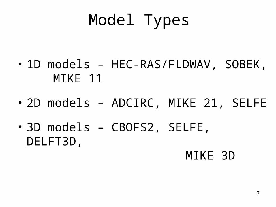
Model Types
• 1D models – HEC-RAS/FLDWAV, SOBEK, MIKE 11
• 2D models – ADCIRC, MIKE 21, SELFE
• 3D models – CBOFS2, SELFE, DELFT3D, MIKE 3D

8
Project Goals
Provide an accurate hydraulics model that extends from the river-estuary confluence to existing forecast points and beyond if necessary to achieve accuracy.
Provide accurate river flow forecasts to NOS operational estuary models

9
MARFC
Daily Forecast Boundary
Estuary
Ocean
Interactions
River
River
River
Tide & Wind
River-Estuary-Ocean (REO) Interactions Modeling
Freshwater

10
Approach
Evaluate 2D/3D models and a combination of HEC-RAS and 2D/3D models Evaluate ADCIRC, SELFE/ELCIRC, Mike Flood FM in the Chesapeake Bay Region Use operational models, e.g. the NWS SLOSH and NOS CBOFS2, to establish downstream boundary conditions for the evaluations Requirements for 2D Models Allow time series of freshwater inflows Continuously model both astronomical tides and storm tides or surges Allow for wetting and drying on the land surface

11
The Chesapeake Bay Operational Forecast System (CBOFS)
Operational forecast system by Center for Operational Oceanographic Products and Services (CO-OPS)/Coastal Survey Development Lab (CSDL) since August 2001
Nowcast and forecast Water Level
Nowcast and forecast WindForecast for the ports within
Baltimore Harbor and Hampton Roads.

12
Little Falls near Washington, DCMARFC’s Forecast Point
on the Potomac River
Daily Streamflow
020000400006000080000
100000120000140000160000
10 11 12 13 14 15 16 17 18 19 20 21 22 23 24 25 26 27 28 29 30
September, 2003
Disc
harg
e (ft
^3/s
)
Little Fall Bumps, DC
Point of Rocks, MD
Hancock, MDPaw Paw, WV
Inflow boundary for the CBOFS is 7 miles from
Little Falls forecast point

13
Model Geometry is Important
Error due to inaccurate boundary

14
The Potomac River 1D HEC-RAS

15
1936 Potomac River Flood

16
1D HEC-RAS allows bridges to be coded in the model to determine the backwater effects. Many 2D/3D models do not
have this capability

17
HEC-RAS simulated water level profiles for the Potomac River near Washington DC
Chain Bridge near DC

18
Potomac River HEC-RAS domain
19
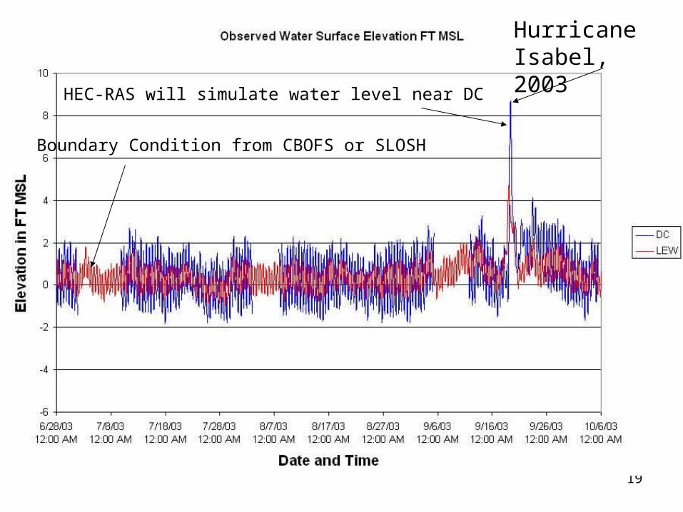
Boundary Condition from CBOFS or SLOSH
HEC-RAS will simulate water level near DC
Hurricane Isabel, 2003

20
HEC-RAS test simulation without freshwater inflow or wind forcing. Boundary tide at Lewisetta, Va and simulated water level near Washington DC
September 2003
Sta
ge (f
t)
Predicted water level near Washington DC
Input water level near Lewisetta, Va

21
Summary
1D – Fast, ready to use, accounts for bridges
2D/3D – Better physics, complex
Application – depends on the customer need, project location etc.

22
Thank you