1 2 3 4 5 6 7 8 9 10 b c d e - amazon s3 · geography of the united states 3 75˚n 60˚n 45˚n...
TRANSCRIPT

P r e v i e w
Map A Look at the area of the classroom your teacher has marked off with tape. Draw all the objects in the area, placing them as accurately as possible on Map A. When you finish your map, compare it to the maps of two or three other students. How closely does your map match the maps of other students? How could this map be drawn more accurately?
Map B Now map the same area again. Be careful to locate each object on the grid before drawing it on Map B. When you complete the map, compare it with two or three maps other students made. Is Map A or B more accurate? Why? How does a grid help us create accurate maps?
A
B
C
D
E
F
1 2 3 4 5 6 7 8 9 10
Geography of the United States 1© Teachers’ Curriculum Institute
© Teachers’ Curriculum Institute Geography of the United States 2
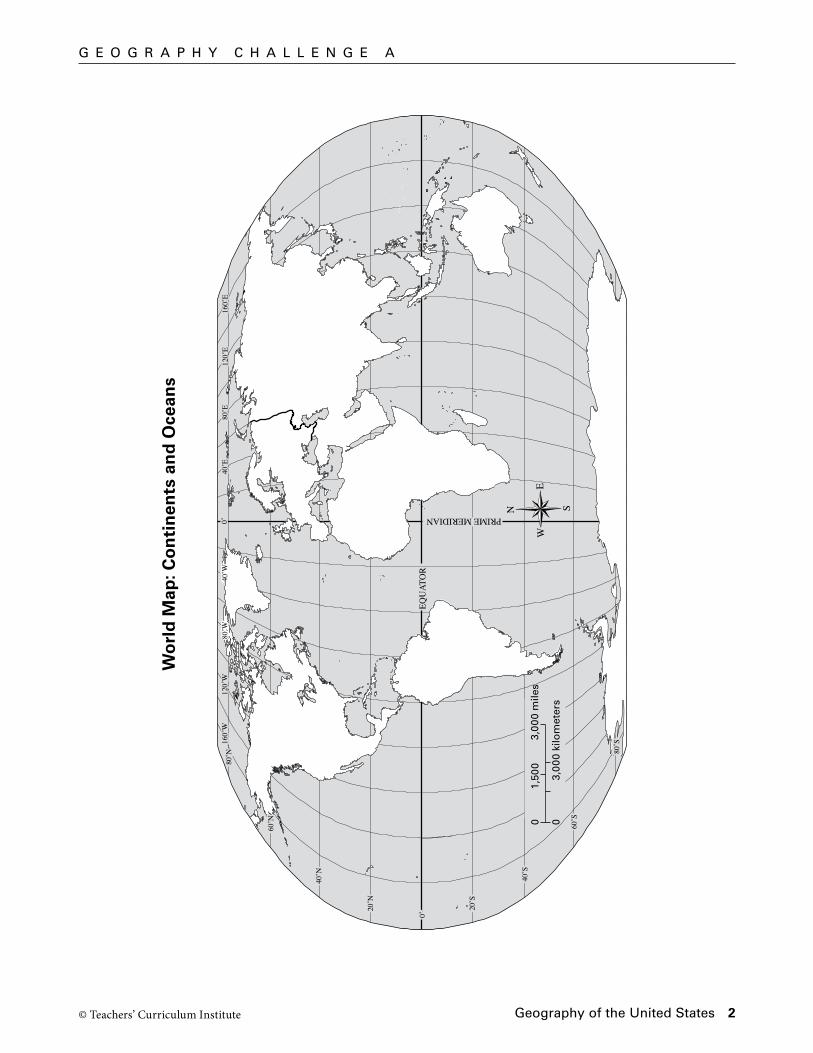
G e O G r A P H Y C H A L L e N G e A
Wo
rld
Map
: Co
nti
nen
ts a
nd
Oce
ans
20˚S
0˚
20˚N
40˚N
60˚N
80˚N
40˚S
60˚S
80˚S
EQU
ATO
R
PRIME MERIDIAN
60˚W
80˚W
120˚
W20
˚W40
˚E80
˚E12
0˚E
160˚
E0˚
03,
000
kilo
met
ers
01,
500
3,00
0 m
iles
N S
EW
20˚S
0˚
20˚N
40˚N
60˚N
80˚N
40˚S
60˚S
80˚S
EQU
ATO
R
PRIME MERIDIAN
80˚W
120˚
W16
0˚W
40˚W
40˚E
80˚E
120˚
E16
0˚E
0˚
SS
A5_
ISN
_1.1
Bla
ck C
yan
Mag
enta
Yel
low
S
eco
nd
Pro
of
TC
I14
27
Geography of the United States 3
45˚S
30˚S
15˚S
15˚N
30˚N
45˚N
60˚N
75˚N 0˚ 60˚S
75˚S
N S
EW
0˚30˚W
60˚W
90˚W
120˚W
150˚W
30˚E
60˚E
90˚E
120˚E
150˚E
02,
500
5,00
0 ki
lom
eter
s
02,
500
5,00
0 m
iles
N S
EW
45˚S
30˚S
15˚S
15˚N
30˚N
45˚N
60˚N
75˚N 0˚ 60˚S
75˚S
0˚30˚W
60˚W
90˚W
120˚W
150˚W
30˚E
60˚E
90˚E
120˚E
150˚E
SS
A5_
ISN
_1.2
Bla
ck C
yan
Mag
enta
Yel
low
T
hir
d P
roo
fT
CI1
4 28
© Teachers’ Curriculum Institute
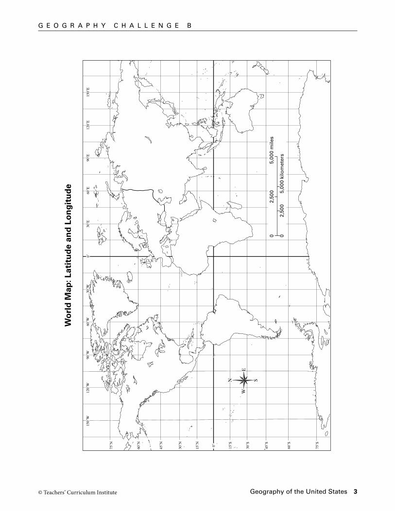
G e O G r A P H Y C H A L L e N G e B
Wo
rld
Map
: Lat
itu
de
and
Lo
ng
itu
de

© Teachers’ Curriculum Institute Geography of the United States 4
G e O G r A P H Y C H A L L e N G e C
Geo
gra
ph
ic T
erm
s
Geography of the United States 5© Teachers’ Curriculum Institute
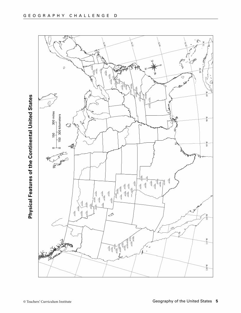
G e O G r A P H Y C H A L L e N G e D
Phy
sica
l Fea
ture
s o
f th
e C
on
tin
enta
l Un
ited
Sta
tes
125˚
W12
0˚W
115˚
W11
0˚W
105˚
W10
0˚W
95˚W
90˚W
25˚N
30˚N
35˚N
40˚N
120˚
W11
5˚W
110˚
W95
˚W90
˚W85
˚W
80˚W
75˚W
25˚N
30˚N
35˚N
40˚N
N
S
EW
015
030
0 ki
lom
eter
s
015
030
0 m
iles
SS
A5_
ISN
_1.3
Bla
ck C
yan
Mag
enta
Yel
low
S
eco
nd
Pro
of
TC
I14
29

© Teachers’ Curriculum Institute Geography of the United States 6
r e A D i N G F U r t H e r
100°W 80°W 60°W 40°W
40°S
20°S
20°N
40°N
0°
120°W
0 1,000 kilometers
0 500 1,000 miles
N
S
EW
CapeHorn
New York City
SanFrancisco
A T L A N T I CO C E A N
PA C I F I CO C E A N
Independence
Sacramento
Isthmus of Panama
100°W 80°W 60°W 40°W
40°S
20°S
20°N
40°N
0°
120°W
SSA5_ISN_1.aBlack Cyan Magenta Yellow First ProofTCI14 80
Choose a route, overland or by water, that you would take from New York to the goldfields of California in 1849. Draw your route on the map below.
My Route to California
© Teachers’ Curriculum Institute Geography of the United States 7
r e A D i N G F U r t H e r
Write a journal entry about your trip to California. Include some details about how the geographic features along the way affected your journey. You may include an illustration to show one geographic feature you saw along the way.
My Journal

P r O C e S S i N G
© Teachers’ Curriculum Institute Geography of the United States 8
Write a Challenge Question and its answer in each of the boxes below. Then choose your five best questions to put on Challenge Question Cards.
Question:
Answer:
Question:
Answer:
Question:
Answer:
Question:
Answer:
Question:
Answer:
Question:
Answer:
Question:
Answer:
Question:
Answer:
Question:
Answer:
Question:
Answer: