˘ ˇˇˆ - greeley, colorado
TRANSCRIPT

������ �������� � �������
� �� �� ����� �� �� �� � ��������
� �� ��� � ���� � � �
East Greeley / Weld County Sub-Area Study September 2009 Table of Contents Study Summary Chapter 1 – Study Overview (with Chapter Table of Contents from full study)
I. Study Background II. Key Facts and Objectives
III. Progress IV. Key Findings V. Recommendations
Chapter 2 – Area History (with Chapter Table of Contents from full study)
I. Background II. Key Facts and Objectives
Chapter 3 - Demographics (with Chapter Table of Contents from full study) I. Background
II. Key Facts III. Key Findings
Chapter 4 - Existing Conditions & Characteristics (with Chapter Table of Contents from full study)
I. Background II. Key Facts
III. Key Findings
Chapter 5 - Development Suitability (with Chapter Table of Contents from full study) I. Background
II. Key Facts III. Key Finding
Chapter 6 – Study Methods & Findings (with Chapter Table of Contents from full study)
I. Background II. Key Findings
Chapter 7 – Study Conclusions & Recommendations (with Chapter Table of Contents from full study)
I. Background II. Key Findings
III. List of Recommendations by Full Study Chapters Chapter 8 – Implementation/Timetable
I. Implementation Options II. Recommendation for Implementation of IGA

3
Study Summary The East Greeley/Weld County Study is a joint exploration of the existing and future land uses in a defined area of incorporated and unincorporated land in eastern Greeley. This study can be a useful tool to help address the existing combination of industrial, commercial and residential uses that may lead to land use conflicts in the future if they are uncoordinated. While there has been planning in East Greeley since its inception as part of the Union Colony, no overarching plan exists that would effectively guide land uses, services and infrastructure development in order to achieve complementary growth of this community. The Colorado State Demography Office identified the Weld County population to be about 237,000 in 2006 and projects a population of around 550,000 in the year 2035. This growth represents an increase of 317,000 people in less than 27 years – an average increase of a new town the size of Windsor every year for the next 27 years (Windsor’s 2006 population being approximately 11,800). While most of the growth will be in municipalities, there also will be pressure for development in rural areas adjacent to municipalities such as in the East Greeley area, the subject area for this East Greeley/Weld County Study. Land management efforts should take into account natural boundaries that are not always aligned with existing political boundaries. The multi-jurisdictional efforts to produce this East Greeley/ Weld County Study have encouraged cooperative thinking about the study area, which includes land within both the municipal boundaries of the City of Greeley and unincorporated Weld County. The study area encompasses 8.8 square miles of land and 3,183 structures. Cohesive development of this land, given its size and diversity, will benefit from involvement and cooperation between the governmental jurisdictions, agencies and organizations involved in this area. This Study Summary is a brief composite of the full East Greeley / Weld County Sub-Area Study, dated September 2009. Readers are advised to consult the entire study in order to fully understand the data supporting the findings and recommendations. The full study also functions as a complete reference document for historic, existing, and projected conditions in East Greeley. Study Elements The East Greeley/Weld County Study includes the following elements: 1. An inventory of natural features, infrastructure and demographics within the study area. 2. An analysis of current land uses and impacts (including zoned, assessed and actual uses). 3. Results from a field survey and research. 4. Results from a citizen survey. 5. Results from citizen open house meetings and citizens involvement in small group meetings
on specific topics such as stormwater drainage, transportation, land uses and schools. Findings The Study resulted in numerous findings, which are listed and explored in detail in Chapters 4 and 6 of the full Study.

4
Recommendations Over 60 recommendations are presented in the full study, based on findings from each of the study elements. These recommendations are for future on-going consideration by the elected officials of Greeley and Weld County. Implementation The Study can be implemented through a number of tools, which are discussed in greater detail in Chapter 8: 1. An Intergovernmental Agreement (IGA) between Weld County and the City of Greeley has been anticipated with the State grant that helped initiate the Study. The grant does not specify the nature of an IGA, but it is envisioned that an IGA would establish procedures and standards pursuant to which the City and the County will move toward greater coordination in the exercise of their land use powers within the unincorporated areas surrounding East Greeley. 2. Sub-Area Plans. Either jurisdiction may want to translate the findings and recommendations of this study into goals or policies that would apply as a portion of its regulatory framework. Implementation of the recommendations of this study is at the sole discretion of the respective jurisdictions, but could take the form of a sub-area plan, land use regulations or changes to capital planning programs. 3. Resolution of immediate issues. Where citizens identified a specific community problem or concern, such issues have been addressed while the Study was being conducted. Some resulted in immediate actions such as monitoring of speeding or reviewing stormwater fee policies, while others have resulted in separate initiatives such as exploring the possibility of constructing sidewalks leading to the Bella Romero Elementary School. 4. On-going coordination. Implementation of the findings and information from this study can and should be on-going. The Study becomes a common point of reference for both the City and County, with each jurisdiction utilizing it as a basis for on-going communication and coordination on issues of mutual interest.

5
Chapter 1. Study Overview Chapter 1 - Project Content (Full Study Table of Contents)
A. Authorization, Scope and Goal E. Public Involvement . B. Study Area F. Related Plans
C. Key Objectives G. Study Methods D. Participants
I. Study Background
In 2007, the City of Greeley and Weld County received a Colorado Heritage Planning Grant from the Colorado Department of Local Affairs to conduct a comprehensive plan-study of the East Greeley/Weld County area. The purpose of this study is to evaluate existing conditions and plan for growth and land uses in the area in a cooperative and coordinated manner. (See Attachment A, page 21.) The intent of this study process has been to provide residents, business and property owners, community leaders and elected officials a means to articulate a shared vision of the community they hope to enjoy in the future and leave as a guide to those who follow. It defines how the area is expected to grow in ways that support its City and County citizens’ values by providing guidance through recommendations that will help decision-makers move toward this desired future.
II. Key Facts and Objectives Table 1 ~ Study Area Acreage
Area Acres Percent Total Study Area 5,708 100% Unincorporated Weld County 3,488 61% Incorporated City of Greeley 2,220 39%
Area # of
Parcels Percent Total Study Area 2,024 100% Unincorporated Weld County 502 25% Incorporated City of Greeley 1,522 75%
Ten key objectives for the East Greeley/Weld County Study are:
1. Strengthen public partnership to facilitate shared goals for the area, while protecting private property rights.
2. Address infrastructure service issues in a coordinated and area-wide fashion including clarifying which entities will provide service or the infrastructure, the costs and associated fees of development and overall development standards, while protecting the property of existing residents from new development impacts to the degree possible.
3. Reduce development conflict including urban/rural adjacency issues and those associated with stormwater, the flood plain/floodways and the airport.

6
4. Limit urban growth within a designated “urban growth area,” which is urban-scale development that is either in current Greeley city limits or is envisioned to be eventually.
5. Promote high quality future development that is complementary to both urban and rural lifestyles, which helps protect family farms.
6. Promote quality industrial development, particularly in the northwest and airport regions.
7. Explore better shopping in the area, particularly a full service grocery store. 8. Promote public safety and the coordination of police and sheriff efforts, reduce
nuisance issues, address vandalism and increase traffic safety. 9. Reduce negative impacts of growth in the area, particularly scenic and wildlife areas. 10. Promote safer equestrian, pedestrian and bicycle use in the area, particularly for
students at Bella Romero Elementary School. III. Progress Public input has been a critical component in the conduct of the study. The public has
been involved through three public meetings (August 30, 2007, December 13, 2007 and March 19, 2009), a mail-out survey to all landowners, an on-line survey located on both the City of Greeley and the Weld County Web sites and a series of public utility and service meetings that included property owners.
As of May 2009, Greeley and Weld County already have begun a more concerted effort
to:
1. Consider the East Greeley neighborhood input in the development of capital construction plans.
2. Consider East Greeley neighborhood input in the development of the update of the Greeley transportation master plan and development of the Weld County transportation master plan.
3. Dramatically reduce rural residential stormwater drainage fees, in most cases, by up to 75%.
4. Hire additional law enforcement personnel in 2008, which has increased the overall police on the beat in Greeley. While there continues to be vandalism problems, particularly at the Discovery Bay pool, there seems to be overall improvement in the area.
5. Fully staff Greeley Code Enforcement, implement new technology, and streamline the City enforcement process, which is beginning to see positive results.
6. Coordinate efforts to investigate the feasibility of pedestrian sidewalks from the neighboring residential subdivisions to Bella Romero Elementary School.
IV. Key Findings A representative sample of neighborhood meeting and citizen survey comments include:
1. The rural residents love the quiet environment of the rural areas. 2. Rural residents do not want to be annexed by Greeley. 3. Residents want more law enforcement present. 4. There is concern about heavy truck traffic. 5. Rural streets are dusty.

7
6. Speeding traffic on 16th and 18th Streets is a concern. 7. There are weed and trash problems. 8. Pedestrian and bicycle safety in the area is a concern. 9. Concern is felt about the negative impacts of growth in the area.
V. Recommendations
A list of recommendations based on these and other findings is compiled. See Chapter 7.

8
Chapter 2. Area History Chapter 2 – Area History (Full Study Table of Contents) A. Overview and General History F. Sewer Infrastructure
B. Sugar Beets and Migrant Labor G. Residential Development C. Sugar Beets to Cheese H. Schools D. Airport I. Cache la Poudre River E. Highways J. Projecting Land Uses
I. Background
The east side of Greeley was referred to by early settlers as “The Delta.” A rise in the sugar beet industry resulted in East Greeley area growth that included the construction of the Greeley Sugar Factory at the east end of 13th Street. In 1905, Colorado entrepreneur Charles Boettcher helped finance a new venture called the Great Western Sugar Company. In 2008, Leprino announced it will build a new cheese factory on the site. The $265 million facility (1st phase) is set to open in 2012.
East Greeley has also been defined by its small truck farms/markets, many of which
remain today. The 1930s brought the current sewer plant which has grown in capacity and is an award winning modern facility. In the 1940s, Greeley-Weld County Airport moved to its current location. The 1940s to the 1970s saw the development of the highways that define two of the study area boundaries. In the early part of the 2000’s, there was rapid residential development due in part to lower cost land and water in the study area. It is as a result of this rapid growth that many rural residents are concerned about the future of the East Greeley area.
II. Key Facts and Objectives
The Colorado Historical Society (CHS) has indicated there are no designated historical sites in the East Greeley study area, though this should not be considered as evidence that there are no historically significant sites. In fact, at least one resident, speaking at an open house, asserted that the area included an Indian wintering area and burial grounds. The CHS indicated that since the areas in question are private, there is little opportunity for exploration of the area unless it is with the property owners’ consent. The CHS has indicated it could conduct a study for no cost if given the opportunity. This service could be of great value if interest in preserving such property develops, or if there is a possibility of public projects in the area in the future.

9
Chapter 3. Demographics Chapter 3 - Demographics (Full Study Table of Contents) A. Overview D. Median Income B. Population E. Home Ownership C. Age F. Summary I. Background
According to the 2000 U.S. Census, there were 4,336 residents living in the area with over 73% of the population living in the Greeley City limits. Approximately 650 dwelling units have been built in the study area since 2000, adding between 1,600 and 1,800 new residents.
II. Key Facts
Table 2 ~ Population Comparison
2000
Census
2001- ’07
Growth
Total
Percent Growth
Study Area 4,281 1,700 5,981 39.7%
Airport 0 0 0 0.0%
Eastern Delta 132 0 132 0.0%
Central 587 0 587 0.0%
N.W. Industrial 464 0 464 0.0%
S.W. Residential 3,141 1,700 4,841 45.8%
Greeley 76,818 16,568 93,384 21.6%
Weld County 180,963 243,579 62,616 34.6%
1. The majority of residents live in the central and south west portions of the study area. 2. The southwest residential sector of the study area grew at almost 10% per year
between 2000 and 2004, which was more than double, sometimes triple, the rate of growth for the rest of Greeley.
III. Key Finding
1. Rural residents do not want further residential growth in the area.

10
Chapter 4. Existing Conditions and Characteristics Chapter 4 - Existing Conditions & Characteristics (Full Study Table of Contents)
A. Physical Characteristics B. Comparison of Zoning Districts C. Analysis of Existing Land Uses D. Land Use/Growth E. Gateway Elements F. Airport G. Railroads
H. Sewer I. Water
J. Stormwater K. Irrigation L. Gas & Electric
M. Transportation N. Law Enforcement
Oil & Gas Sand & Gravel Prime Farmland Natural Environment Areas of Ecological Significance Wetlands Floodplain/Floodway Rivers Water Quality
O. Parks and Recreation
I. Background The East Greeley/Weld Study area is a 5,708-acre area bordered by U.S. Highway 34 on the south, Highway 85 on the west, the South Platte River from its confluence with the Cache la Poudre River on the east, and Colorado Highway 263 and the Greeley/Weld County Airport on the north. Over three-fourths of the study area acreage is in unincorporated Weld County with the remaining portion within the municipal limits of the City of Greeley.
II. Key Facts
Greeley and Weld County zoning are similar and have been generalized for the purpose of analysis for the Study.
Table 5 ~ Percent of Generalized Zoning in the Study Area
City County Total Zoning Type Acres Percent Acres Percent Acres Percent Total Study Area 2,225 39.0% 3,483 61.0% 5,708 100% Agricultural 0 0% 2,330 41% 2,330 41% Residential Estate 102 2% 1 0% 103 2% Residential Low Density 264 5% 611 11% 875 15% Residential Medium Density 59 1% 13 0% 72 1% Residential High Density 0 0% 0 0% 0 0% Residential Mobile Home 40 1% 0 0% 40 1% Commercial Low Intensity 4 0% 7 0% 11 0% Commercial High Intensity 48 1% 75 1% 122 2% Industrial Low Intensity 34 1% 34 1% 68 1% Industrial Medium Intensity 1,356 24% 8 0% 1,364 24% Industrial High Intensity 115 2% 405 7% 520 9% Planned Unit Development (PUD) 48 1% 0 0% 48 1% Conservation District 155 3% 0 0% 155 3%
1. Approximately 625 acres, or 70%, of the total residentially zoned property in the study area is located in unincorporated Weld County. If the Weld County residentially zoned areas were to fully develop, there could be approximately 2,500 new dwelling units, though 1000 units is a more likely limit. Even if developed at

11
lower densities, the area could support double the number of units that were built in East Greeley between 2000 and 2008.
2. Bella Romero Elementary School is surrounded by Weld County residentially zoned land. The high study area population growth from 2000 - 2004, the potential for East Greeley residential growth and the expected doubling of Greeley and Weld County population are all factors that may impact Bella Romero Elementary School.
3. Raw water dedication required for development is often more complicated in East Greeley because of Greeley Ditch #3 water, though it may provide an overall price advantage.
4. Stormwater management in the study area is a major concern. 5. Virtually the entire study area is within the Greeley Wastewater 208 Service Area.
Central sewer service generally stops at Cherry Avenue due to topography. Of the 318 septic sewer permits in the East Greeley Study Area, nineteen are in Greeley.
6. East Greeley has two of Greeley’s seven major entryways and is poised to be a major employment center, with industrial development at Leprino and the airport. Such development may prompt the need for construction of an extension County Road 49 through the area, at the preferred alignment designated by County Commissioners in 2004 as part of the Weld County Road 49 Arterial Corridor Study.
7. An East Greeley Traffic Study speed analysis indicated the following three areas of concern in the unincorporated areas:
1. 16th Street at about Bluebell 2. 18th Street east of Elder 3. 20th Street east of Bella Romero Elementary School
There were no significant areas of traffic speed concern within the Greely portion of the study area.
8. The 97 existing oil and gas wells in the East Greeley Study area have a significant land use impact on future development due to the required 200’ setback for habitable structures from well heads and tank batteries.
Table 10 ~ Oil and Gas Locations
Area Acres Percent Total Study Area 5,708 100% Restricted Land Use, City 75 1.3% Restricted Land Use, County 230 4.0% Restricted Land Use, Total 305 5.3%
Well Type In
City In
County Producing 10 83 Shut In 0 4 Permitted, Not Drilled 1 8
9. The confluence of the Cache la Poudre and South Platte Rivers (the delta
region) makes up about one-third of the entire study area. The flood plain and floodway for the two rivers impact about 27% of the total study area.
10. Commercially viable gravel deposits located on the Poudre River make up approximately 20% of the study area, while the South Platte River has none in the study area.
11. The Greeley parks in the East Greeley Study area include 123 acres of soccer fields, picnic areas, a dog park and the Discovery Bay swimming pool that opened in 2008.

12
III. Key Findings
1. The full development of the Weld County R-1 residential zone district at higher densities is the alternative to which unincorporated rural residents are most opposed.
2. Weld County has a Right to Farm policy that supports agricultural users of the land who are not expected to change their long-established agricultural practices to accommodate the encroachment of urban uses into a rural area.
3. Rural residents and property owners would like to maintain and protect the rural nature of the East Greely area.
4. That future development in the East Greeley area is of quality design, an asset to the area that also honors the rural nature of East Greeley.
5. The operation of the sewer plan in relation to odor and truck traffic will require continued management.
6. Residents desire the opportunity to convert from septic to standard sewer service, if affordable
7. The cost of water to rural residents is high. 8. The poor stormwater drainage system in rural East Greeley and negative impacts to
the stormwater system by other improvements such as street overlays are a concern. 9. Increasing traffic volume in the area, speeding and truck traffic increasingly
jeopardize pedestrian safety. 10. Increased law and code enforcement presence and coordination in the area to deal
with speeding, vandalism, gangs, weeds and trash is appreciated. 11. There is a desire to protect the natural beauty of the East Greeley area, particularly
along the rivers.

13
Chapter 5 - Developability Analysis
Chapter 5 - Analysis of Development Suitability (Full Study Table of Contents) A. Overview B. Assumptions C. Observations and Recommendations
I. Background
As part of the East Greeley study, an inventory was made and mapped of the natural features such as the rivers and floodways as well as the location and capacity of infrastructure such as roads, the airport, water and sewer systems to understand both the opportunities and constraints. Developability analysis involves creating maps of inventory information superimposed on one another to identify areas that provide, first, opportunities for particular land uses and, second, constraints to development. (See Attachment B.)
II. Key Facts
The composite map suggests that, generally, the area from the western study boundary to Cherry Avenue offers minor levels of infrastructure and regulatory incompatibility for development. Development to the east of Cherry Avenue has increasing levels of cost and incompatibility between specific land uses and regulatory restrictions, including development prohibitions in the floodway, the oil and gas tank battery setback requirements, and impacts from the airport critical flight zones.
III. Key Finding The mapping exercises identified areas most suitable for urban-level development, and
also indicated areas where it appears urban development would not be as supportable. Table 17 ~ Developability Map Observations # Key Factors Observations for “Any Development Category” 1 Flood Flood plain – Impacts almost one-third of the non-airport study area
Flood way – Exact percent undetermined since not yet designated on S. Platte 2 Mineral Extraction Gravel – Extraction required by statute when feasible, provides income & opportunities
Oil & Gas Wells – Buyout, capping, directional drilling etc. can add significant cost 3 Water & Fire Lines North Weld Water has very limited capacity in area. Cost to loop lines is very expensive
4 Roadways Access and roadways in delta region is very limited but could change with WCR 49
5 Fire Service Response
Access and water availability significantly limit service beyond main roads. A fire sub-station at the airport could improve service
6 Sewer Gravity service is only available to Cherry Ave. Airport has excess capacity and development of Terra Ciea may open most land south of 18th St. to gravity service
7 Airport Critical flight zone impacts residential development east of Cherry to S. Platte River
8 Ecological Category includes critical wildlife, plants and wetlands areas. This map does not impose any new restrictions but only identifies items regulated elsewhere

14
Chapter 6. Study Methods and Findings
Chapter 6 – Study Methods (Full Study Table of Contents) A. Citizen Survey & Citizen Comments B. Field Survey C. Utility and Citizen Advisory/Focus D. Notice
I. Background
A survey was sent to all landowners in the study area in August 2007. The purpose of the study was to measure residents’ level of satisfaction with services and facilities in the East Greeley/Weld County area. In addition to multiple choice questions, citizens were invited to make open-ended comments. Residents were asked questions about how much they like living in the area, their perceptions of the condition of facilities such as access and street signs, their satisfaction with schools and other public services and their sense of safety and comfort. The survey and results, the analysis and citizen comments are presented in the appendix of the full study.
University of Northern Colorado interns physically viewed each parcel and primary structure in the study area during the summer of 2007 to verify the condition of the site and structures against the zoning and Weld County Assessor information. The information gathered through this effort formed much of the basis for the mapping and analysis efforts found in Chapter 4 – Existing Conditions and Characteristics. Individual meetings were held with all of the service and utility providers in the study area. Typically, the meetings were also attended by two to four area property owner/residents interested in the particular topics. The citizen representatives were individuals that had signed up for participation at the two open houses. The summary and final report were also reviewed with the citizens that had participated in the advisory review throughout the process and their comments have been incorporated throughout the report. Initial notice of the study and the first neighborhood meeting were provided by a letter to all property owners and businesses and Home Owner Associations. There was also notice posted in the Greeley Tribune, on the Greeley and Weld County Web sites and utilizing A-frame signs that were posted five days in advance of the meetings in strategic locations. There were three neighborhood meetings, held on August 20, 2007, December 13, 2007, and March 19, 2009.
II. Key Findings 1. Two-thirds of the citizen survey respondent are 55 years of age or older. 2. Almost 80% of the citizen survey respondents were unincorporated Weld residents. 3. Stormwater drainage is an important issue to unincorporated residents. 4. Almost 75% of the survey respondents were concerned about traffic volume and speed. 5. Both law and code enforcement are very important in the study area.
15
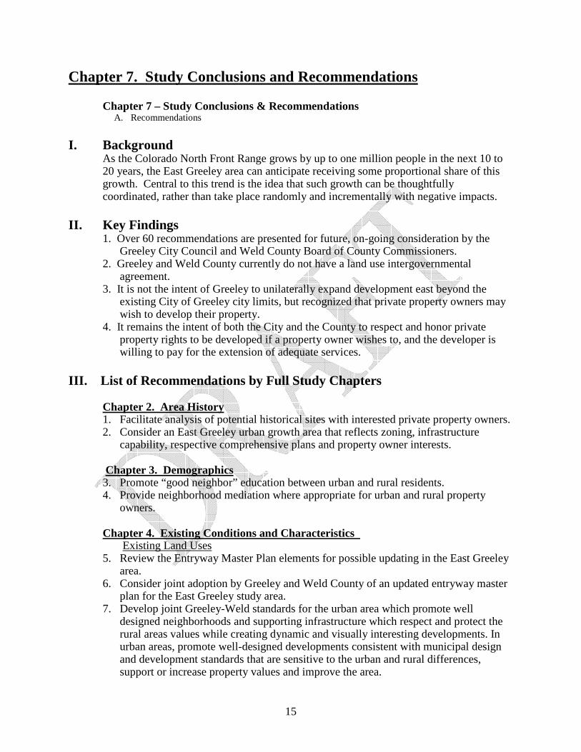
Chapter 7. Study Conclusions and Recommendations
Chapter 7 – Study Conclusions & Recommendations A. Recommendations
I. Background
As the Colorado North Front Range grows by up to one million people in the next 10 to 20 years, the East Greeley area can anticipate receiving some proportional share of this growth. Central to this trend is the idea that such growth can be thoughtfully coordinated, rather than take place randomly and incrementally with negative impacts.
II. Key Findings
1. Over 60 recommendations are presented for future, on-going consideration by the Greeley City Council and Weld County Board of County Commissioners.
2. Greeley and Weld County currently do not have a land use intergovernmental agreement.
3. It is not the intent of Greeley to unilaterally expand development east beyond the existing City of Greeley city limits, but recognized that private property owners may wish to develop their property.
4. It remains the intent of both the City and the County to respect and honor private property rights to be developed if a property owner wishes to, and the developer is willing to pay for the extension of adequate services.
III. List of Recommendations by Full Study Chapters
Chapter 2. Area History 1. Facilitate analysis of potential historical sites with interested private property owners. 2. Consider an East Greeley urban growth area that reflects zoning, infrastructure
capability, respective comprehensive plans and property owner interests. Chapter 3. Demographics 3. Promote “good neighbor” education between urban and rural residents. 4. Provide neighborhood mediation where appropriate for urban and rural property
owners. Chapter 4. Existing Conditions and Characteristics Existing Land Uses 5. Review the Entryway Master Plan elements for possible updating in the East Greeley
area. 6. Consider joint adoption by Greeley and Weld County of an updated entryway master
plan for the East Greeley study area. 7. Develop joint Greeley-Weld standards for the urban area which promote well
designed neighborhoods and supporting infrastructure which respect and protect the rural areas values while creating dynamic and visually interesting developments. In urban areas, promote well-designed developments consistent with municipal design and development standards that are sensitive to the urban and rural differences, support or increase property values and improve the area.

16
8. Where requested, facilitate rezoning to support the Weld County R-1 zoning to a lower density zone and in rural areas, where appropriate, promote cluster residential development to encourage open space.
9. Explore more balanced shopping in the area, such as a full service grocery store. 10. Promote local professional services to help meet the needs of the area. 11. Examine the continued need for the amount of high intensity/I-3 zoning and the
potential for promoting the area as “shovel ready” for development. 12. Explore joint Greeley/Weld corridor design guidelines that would be appropriate
particularly along 8th Street/Colo. Hwy 263 as an entryway corridor and which will compliment developing industrial development, the airport and the Poudre Trail.
13. Explore farmland trusts, CSA, “agriburbia” and related concepts in East Greeley 14. Develop an agreement on how Greeley and Weld County can best handle land use
referrals and public notice Airport 15. Determine appropriate and inappropriate use of properties in and around the Greeley-
Weld County Airport in the study area to support the strategic location of compatible business and industry and minimize the impacts of incompatible land uses.
Rail 16. Pursue the removal of 16th Street railroad spur line to the Union Pacific mainline. Sewer Plant 17. Continue educational outreach to residents on the operation of the sewer plant –
perhaps offering special tours to area residents. 18. Inform residents of the odor complaint line and procedure. 19. Monitor sewer related truck traffic speed out of the south exit to the Greeley
Wastewater Treatment Plant. Water 20. Explore alternatives for the provision of Greeley water to the East Greeley Urban area
without prior annexation. 21. Continue to improve water service and quality in the East Greeley Area. Stormwater 22. Continue education programs on the need for improvement of stormwater quality. 23. Coordinate county and state construction projects with rural area property owners
with regard to stormwater impacts. 24. Explore alternatives for specific drainage problem areas such as north of Dilmont
Street where there is no culvert exit. 25. Conduct drainage basin study to determine needed East Greeley stormwater
improvements. 26. Work with Weld County in consideration of adopting MS4 standards for
unincorporated Weld County in the East Greeley Study Area.

17
Transportation 27. Work with area citizens and child safety representatives to secure funding for
sidewalks to Bella Romero Elementary School. 28. Continue to monitor traffic volumes and speeds and promote traffic calming where
appropriate. Specifically develop 2 lane street designs within the existing rights-of-way in the Bella Romero Elementary School area, to act as traffic calming, incorporate sidewalks and, perhaps, bike lanes and preserve existing trees and front yards.
29. Provide citizen traffic concerns to both Greeley and Weld County as they update their Transportation Master Plans.
30. Periodically monitor the unpaved roads in unincorporated Weld County to determine if they qualify for dust abatement or paving.
31. Promote the implementation of US 85 Access Control Plan by the state of Colorado. 32. Monitor the status for potential development of WCR 49 in the East Greeley Study
Area. 33. Develop common city/county street and pedestrian design standards for the
unincorporated portion of the East Greeley urban area. 34. Pursue the removal of 16th Street railroad spur line to the Union Pacific mainline 35. Continue coordinated transportation and capital improvement planning between
Greeley and Weld County regarding East Greeley and make information available to the area residents.
36. Connect the schools and residential areas to the future Poudre River Trail. 37. Explore the desire, feasibility and financial cost to unincorporated residents for street
lights. Public Safety 38. Pursue the establishment of neighborhood watch groups in both the incorporated and
unincorporated areas of the study area. 39. Continue to monitor the noise produced at the Greeley Police Department shooting
range and training grounds. If the East Greeley area does continue to urbanize, consider either moving high noise producing activity, such as grenade and small explosive training, to a more remote site or increasing the sound berms.
40. Work with appropriate governmental jurisdictions to promote pedestrian, equestrian, bicycle and motor vehicle safety.
Mineral Extraction 41. Greeley track oil and gas activity in the unincorporated portions of the proposed
Urban Growth Area, so that Greeley may comment and make recommendations to the Colorado Oil and Gas Commission when it is permitting a well.
42. Encourage land uses adjacent to the Poudre and South Platte Rivers to treat the rivers as neighborhood and community amenities, and by minimizing long term negative impacts.
43. Maintain a multi-use corridor in which the river and surrounding lands are protected and enhance a diverse set of public values while allowing appropriate private uses within the corridor.
44. Work with industry for the development of sand and gravel pit reclamation that would facilitate multi-parcel reclamation, thus reducing the need for water augmentation, and increasing the public amenity aspect.
18
45. Explore the development of wetland banking particularly as part of sand and gravel mining reclamation areas of the Cache la Poudre River.
River Quality 46. Consider recommending a flood study for the South Platte River in the East Greeley
area. 47. Explore opportunities to implement portions of the Cache la Poudre River national
heritage area designation as a natural, cultural, historic and recreational resource in the on-going development of the river.
48. Consider limiting development to outside the 100-year floodplain and explore incentives to limiting such development.
49. Update the area of Ecological significance maps with the Colorado Department of Wildlife
50. Explore the possibility of Weld County adopting the area of ecological significance or its equivalent.
51. Work with the Poudre Trail, schools, civic groups and others to help clean the river corridors.
52. Investigate coordinating river water quality sampling with Weld County Health Department.
Parks and Recreation 53. Continue to develop and work with neighborhood watch groups to promote safety and
reduce vandalism in the parks. 54. Strive to include the unincorporated property owners in any update of the Parks and
Trails Master Plan. 55. Update the Weld County Open Space Plan. 56. Encourage the incorporation of open space during land use reviews by both Greeley
and Weld County. 57. Encourage support for the Poudre-Platte River Trail Plan for East Greeley. Land Use and Growth 58. Explore rezoning the undeveloped R-1 zone in Weld County to a low density
Residential Estate or to Agricultural. 59. As part of an intergovernmental agreement, examine the possibility of developing a
comparable Weld County and City of Greeley permit fee structure. 60. Develop joint Greeley-Weld design standards for the urban area which promote a
well designed area which respects and protects the rural areas while creating dynamic, and visually interesting developments which protect property values in the East Greeley community.
61. Develop and implement a strategic growth management plan that promotes and protects East Greeley as an attractive and appealing area to live and work.
62. Direct growth in a manner which respects the rural unincorporated areas as well as the natural environment.
63. Establish clear standards under which a property may be annexed and/or developed. 64. Consider an East Greeley study urban growth area that reflects zoning, infrastructure
capability, respective comprehensive plans and property owner interests.
19
Chapter 5 - Developability Analysis 65. Greeley and Weld County adopt a jointly selected Urban Growth Boundary.

20
Chapter 8. Implementation/Timetable
Chapter 8 – Implementation/Timetable (Full Study Table of Contents) A. Implementation Options B. Recommendation for Implementation of IGA
I. Implementation Options
A range of options are reviewed in the study ranging from doing nothing to adopting an intergovernmental agreement, or to adopting a sub-area plan that would be a part of the comprehensive plan for that jurisdiction choosing to do so.
II. Recommendation for Implementation of IGA
In particular, a recommendation is presented to the Greeley City Council and the Weld County Board of County Commissioners for the adoption of an intergovernmental agreement (IGA), which will provide for an enhanced reciprocal notice for annexation, subdivision, site plan, variance, rezoning and conditional use grant proposals in the study area.

Attachment A. East Greeley/Weld County Sub-Area Study Boundaries
East Greeley Study Area

22
Attachment B