© 2011 pearson education, inc. chapter 7 ocean circulation
TRANSCRIPT
© 2011 Pearson Education, Inc.
CHAPTER 7Ocean Circulation
What is the temperature of the water in the deepest oceans?
© 2011 Pearson Education, Inc.
Chapter Overview
• Ocean currents are moving loops of water.
• Surface currents are influenced by major wind belts.
• Currents redistribute global heat.
• Thermohaline circulation affects deep currents.
• Currents affect marine life.
© 2011 Pearson Education, Inc.
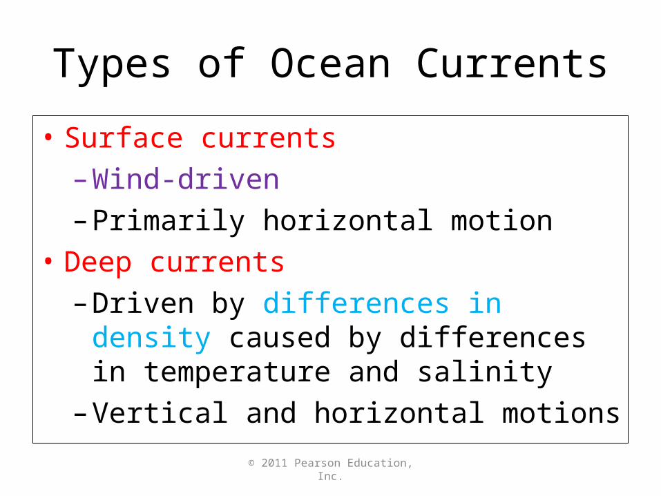
Types of Ocean Currents
• Surface currents
– Wind-driven
– Primarily horizontal motion
• Deep currents
– Driven by differences in density caused by differences in temperature and salinity
– Vertical and horizontal motions
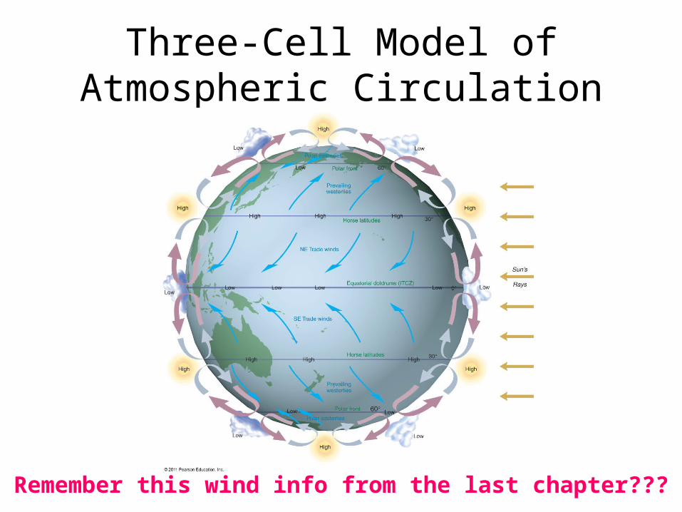
Three-Cell Model of Atmospheric Circulation
Remember this wind info from the last chapter???
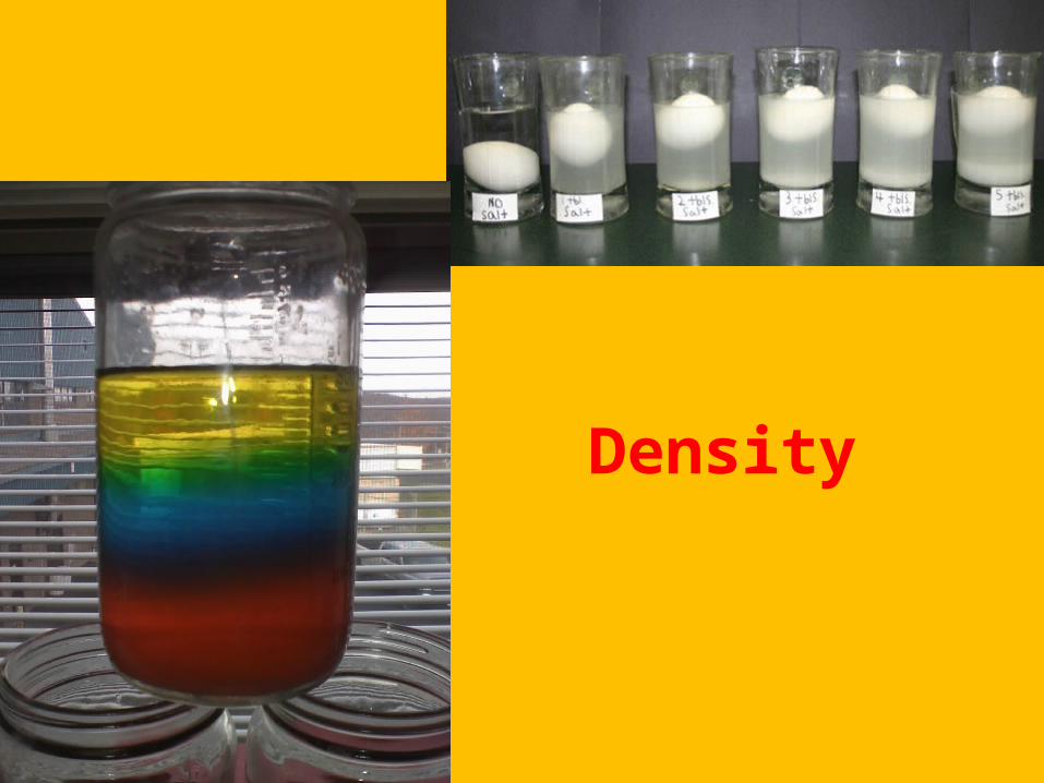
Density
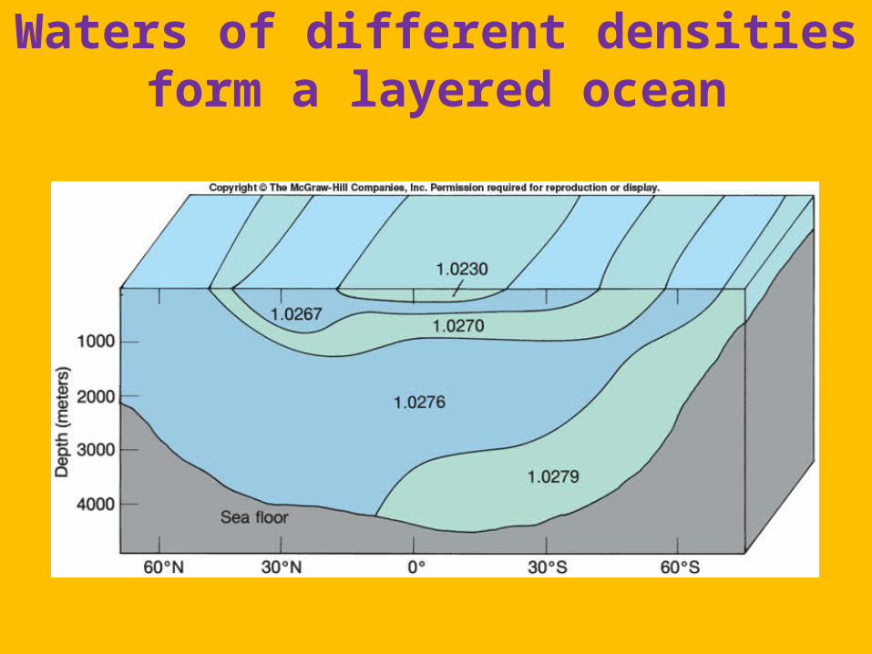
Waters of different densities form a layered ocean
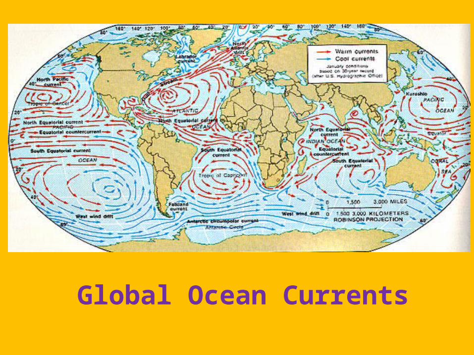
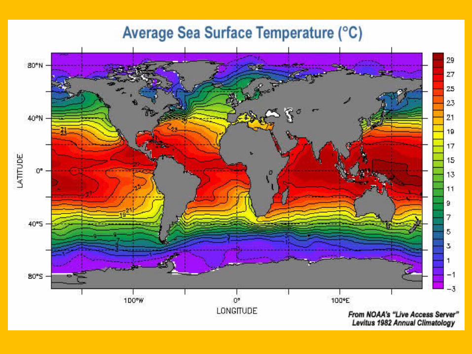
Global Ocean Currents
© 2011 Pearson Education, Inc.
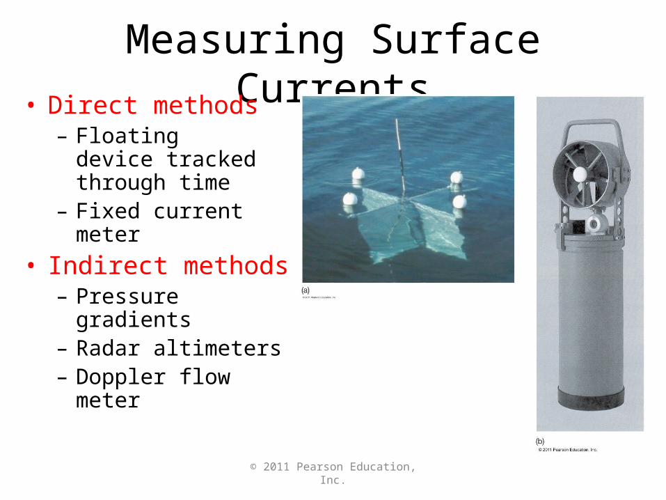
Measuring Surface Currents• Direct methods
– Floating device tracked through time
– Fixed current meter
• Indirect methods– Pressure gradients– Radar altimeters– Doppler flow meter
© 2011 Pearson Education, Inc.
© 2011 Pearson Education, Inc.
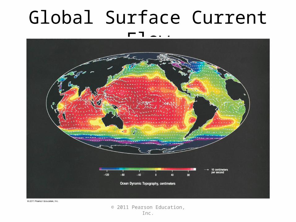
Global Surface Current Flow
© 2011 Pearson Education, Inc.
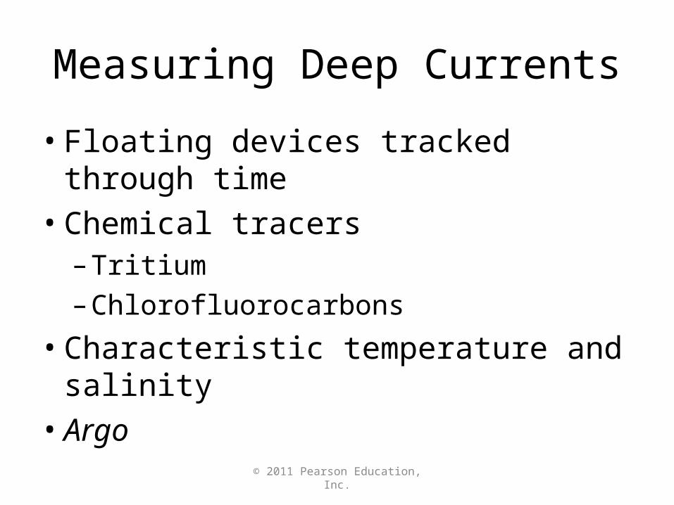
Measuring Deep Currents
• Floating devices tracked through time
• Chemical tracers– Tritium
– Chlorofluorocarbons
• Characteristic temperature and salinity
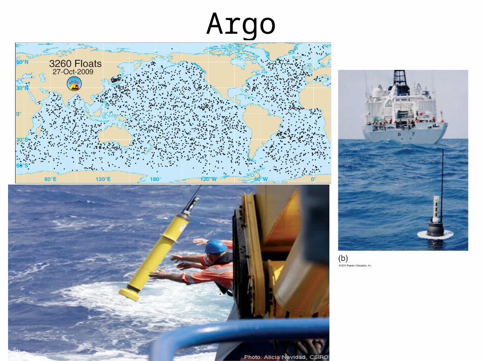
• Argo
© 2011 Pearson Education, Inc.
Argo
© 2011 Pearson Education, Inc.
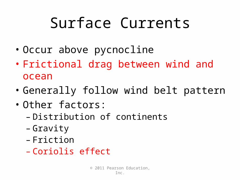
Surface Currents
• Occur above pycnocline
• Frictional drag between wind and ocean
• Generally follow wind belt pattern
• Other factors:– Distribution of continents– Gravity– Friction– Coriolis effect
© 2011 Pearson Education, Inc.
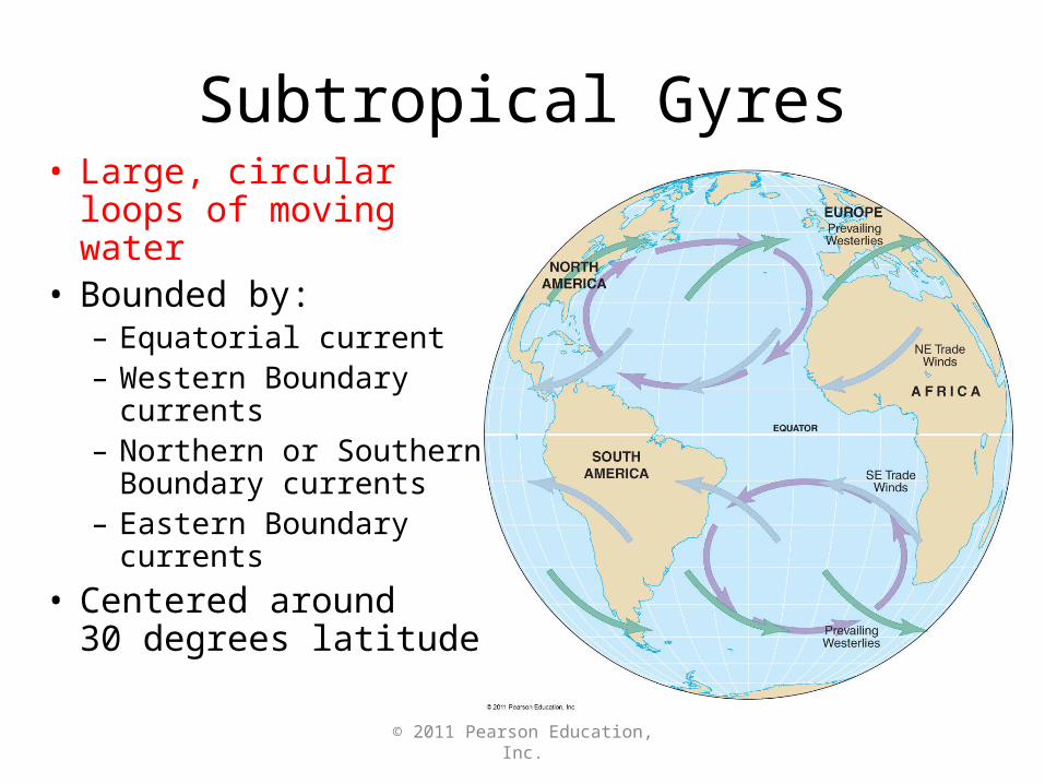
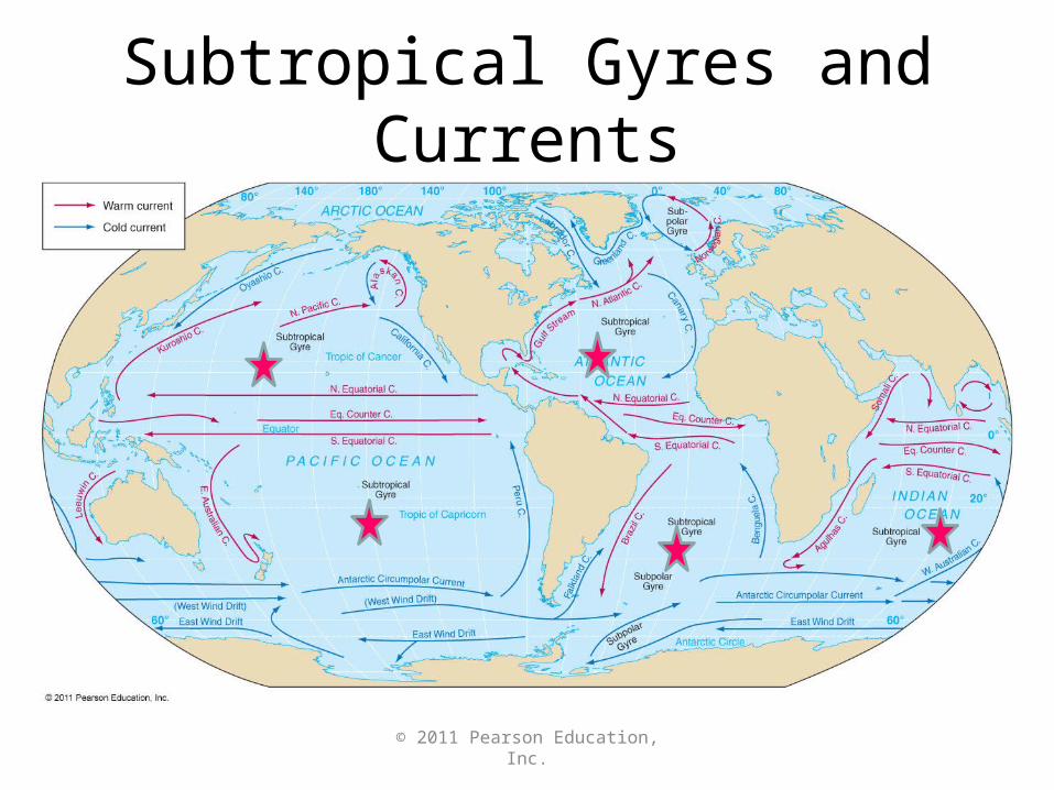
Subtropical Gyres• Large, circular loops
of moving water• Bounded by:
– Equatorial current– Western Boundary
currents– Northern or Southern
Boundary currents– Eastern Boundary
currents
• Centered around 30 degrees latitude
© 2011 Pearson Education, Inc.
Five Subtropical Gyres
• North Atlantic – Columbus Gyre
• South Atlantic – Navigator Gyre
• North Pacific – Turtle Gyre
• South Pacific – Heyerdahl Gyre
• Indian Ocean – Majid Gyre
© 2011 Pearson Education, Inc.
Subtropical Gyres and Currents
© 2011 Pearson Education, Inc.
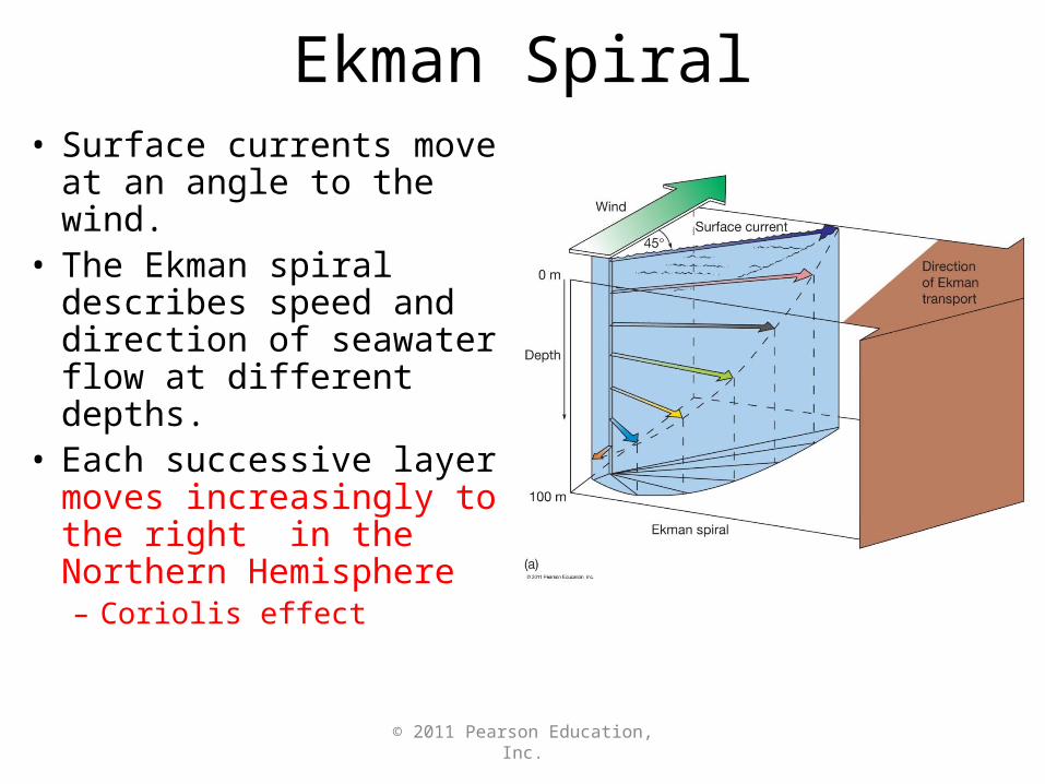
Ekman Spiral• Surface currents move
at an angle to the wind.• The Ekman spiral
describes speed and direction of seawater flow at different depths.
• Each successive layer moves increasingly to the right in the Northern Hemisphere– Coriolis effect
© 2011 Pearson Education, Inc.
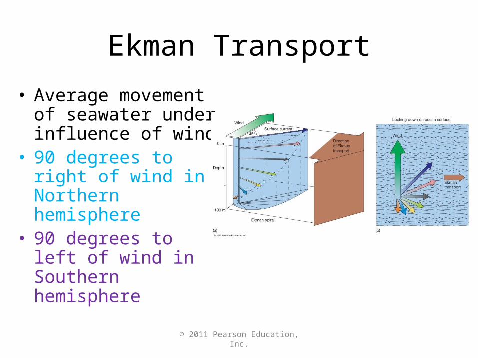
Ekman Transport
• Average movement of seawater under influence of wind
• 90 degrees to right of wind in Northern hemisphere
• 90 degrees to left of wind in Southern hemisphere
© 2011 Pearson Education, Inc.
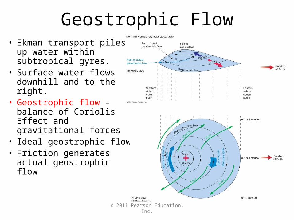
Geostrophic Flow• Ekman transport piles up
water within subtropical gyres.
• Surface water flows downhill and to the right.
• Geostrophic flow – balance of Coriolis Effect and gravitational forces
• Ideal geostrophic flow• Friction generates actual
geostrophic flow
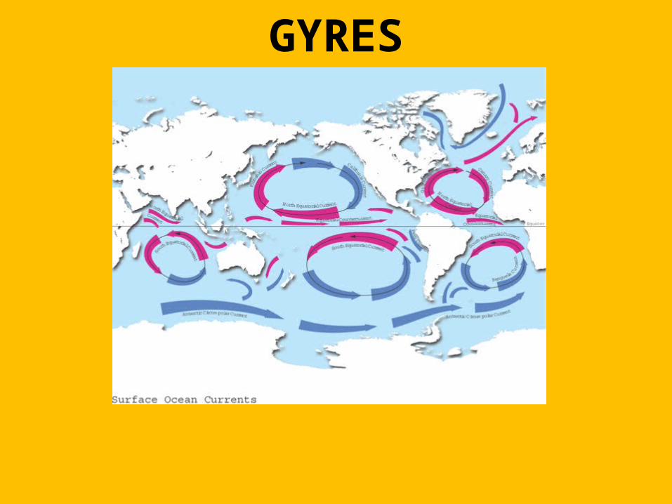
GYRES
© 2011 Pearson Education, Inc.
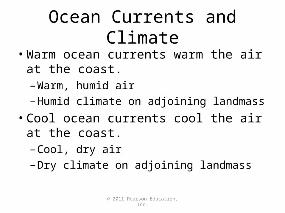
Ocean Currents and Climate
• Warm ocean currents warm the air at the coast.– Warm, humid air– Humid climate on adjoining landmass
• Cool ocean currents cool the air at the coast.– Cool, dry air– Dry climate on adjoining landmass
© 2011 Pearson Education, Inc.
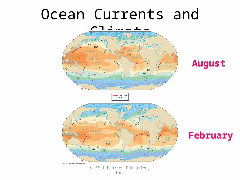
Ocean Currents and Climate
August
February
© 2011 Pearson Education, Inc.
Upwelling and Downwelling
• Upwelling – Vertical movement of cold, nutrient-rich water to surface– High biological productivity
• Downwelling – Vertical movement of surface water downward in water column
© 2011 Pearson Education, Inc.
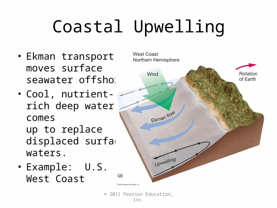
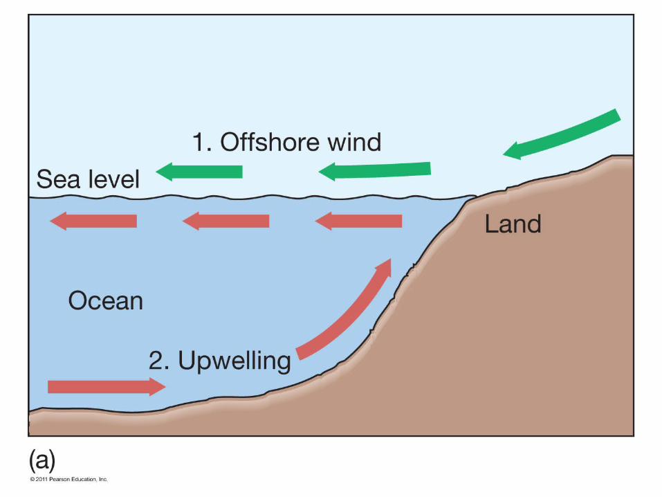
Coastal Upwelling
• Ekman transport moves surface seawater offshore.
• Cool, nutrient-rich deep water comes up to replace displaced surface waters.
• Example: U.S. West Coast
© 2011 Pearson Education, Inc.
© 2011 Pearson Education, Inc.
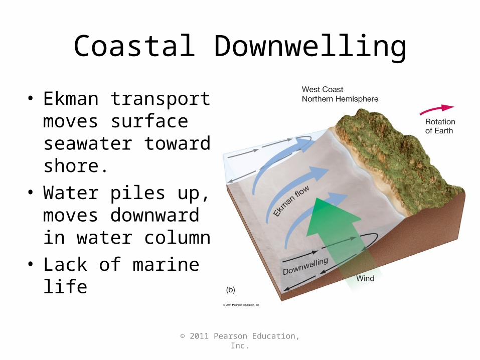
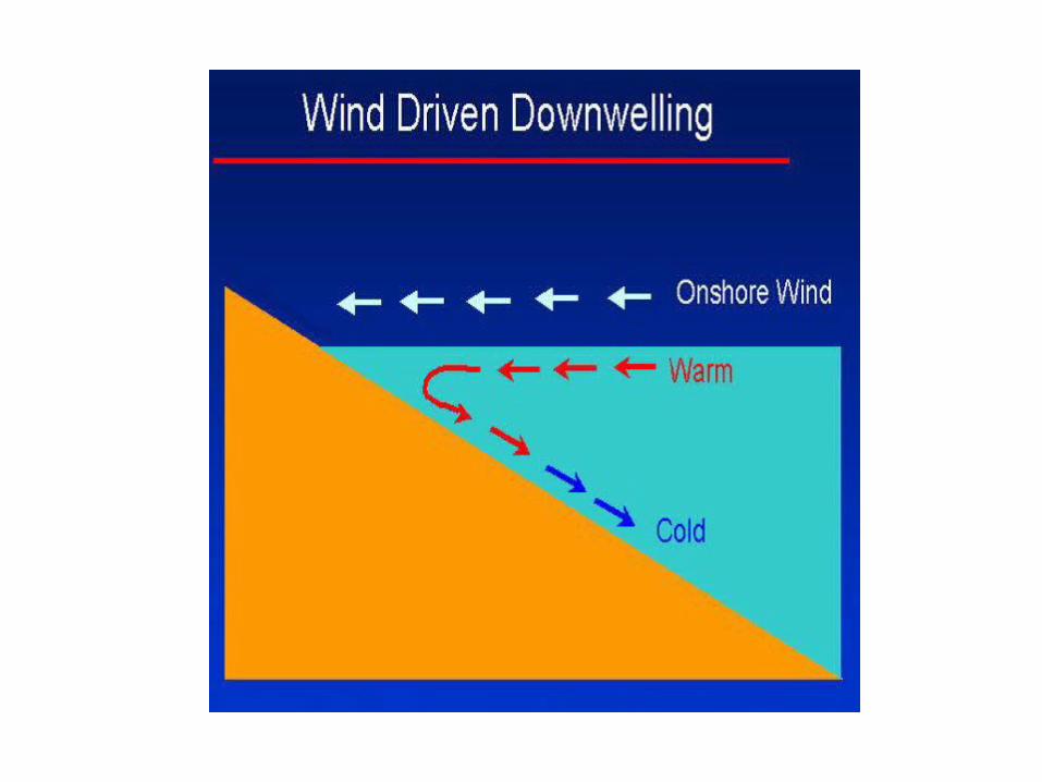
Coastal Downwelling
• Ekman transport moves surface seawater toward shore.
• Water piles up, moves downward in water column
• Lack of marine life
© 2011 Pearson Education, Inc.
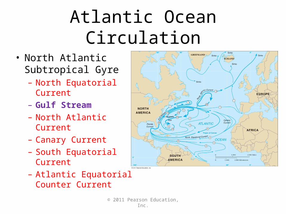
Atlantic Ocean Circulation
• North Atlantic Subtropical Gyre– North Equatorial
Current– Gulf Stream– North Atlantic Current– Canary Current– South Equatorial
Current– Atlantic Equatorial
Counter Current
© 2011 Pearson Education, Inc.
© 2011 Pearson Education, Inc.
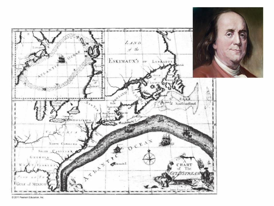
Gulf Stream
• Best studied of all ocean currents• Meanders and loops• Merges with Sargasso Sea
– Circulates around center of North Atlantic Gyre
– Unique biology – Sargassum
© 2011 Pearson Education, Inc.
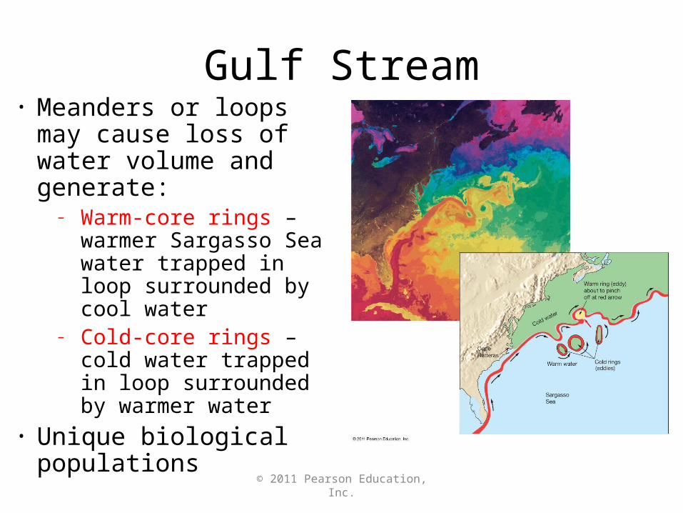
Gulf Stream• Meanders or loops may
cause loss of water volume and generate:
– Warm-core rings – warmer Sargasso Sea water trapped in loop surrounded by cool water
– Cold-core rings – cold water trapped in loop surrounded by warmer water
• Unique biological populations
© 2011 Pearson Education, Inc.
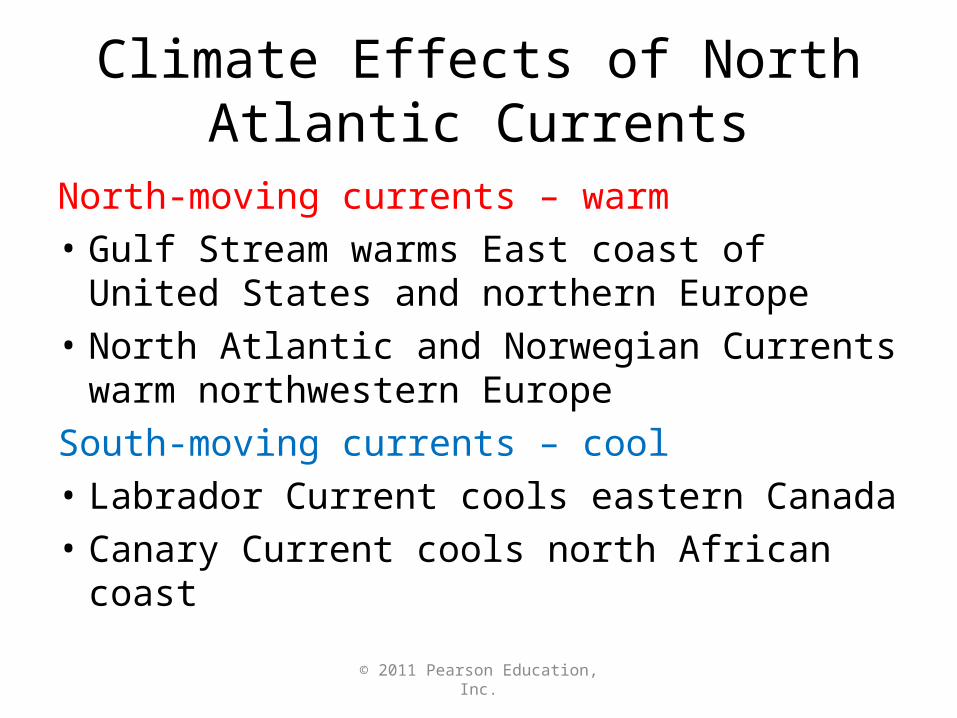
Climate Effects of North Atlantic Currents
North-moving currents – warm
• Gulf Stream warms East coast of United States and northern Europe
• North Atlantic and Norwegian Currents warm northwestern Europe
South-moving currents – cool
• Labrador Current cools eastern Canada
• Canary Current cools north African coast
© 2011 Pearson Education, Inc.
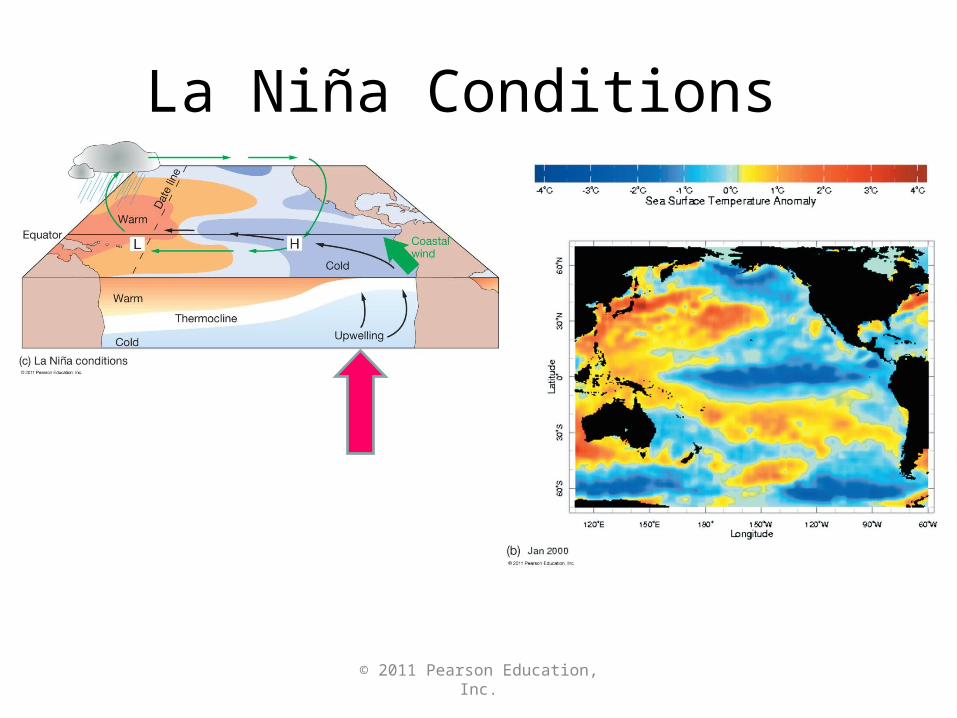
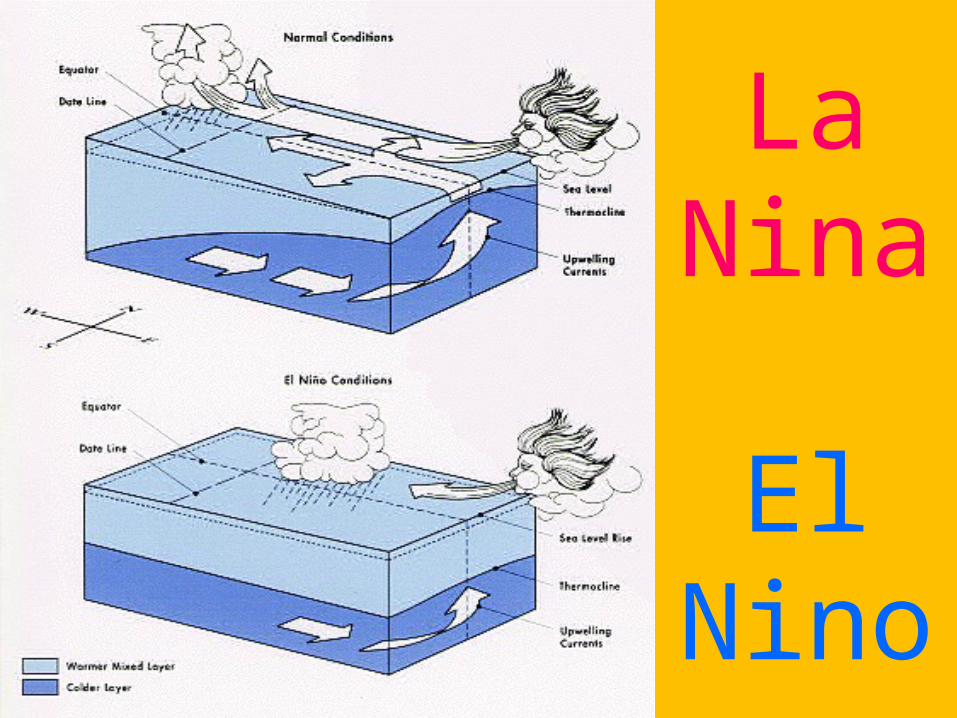
La Nina Conditions
© 2011 Pearson Education, Inc.
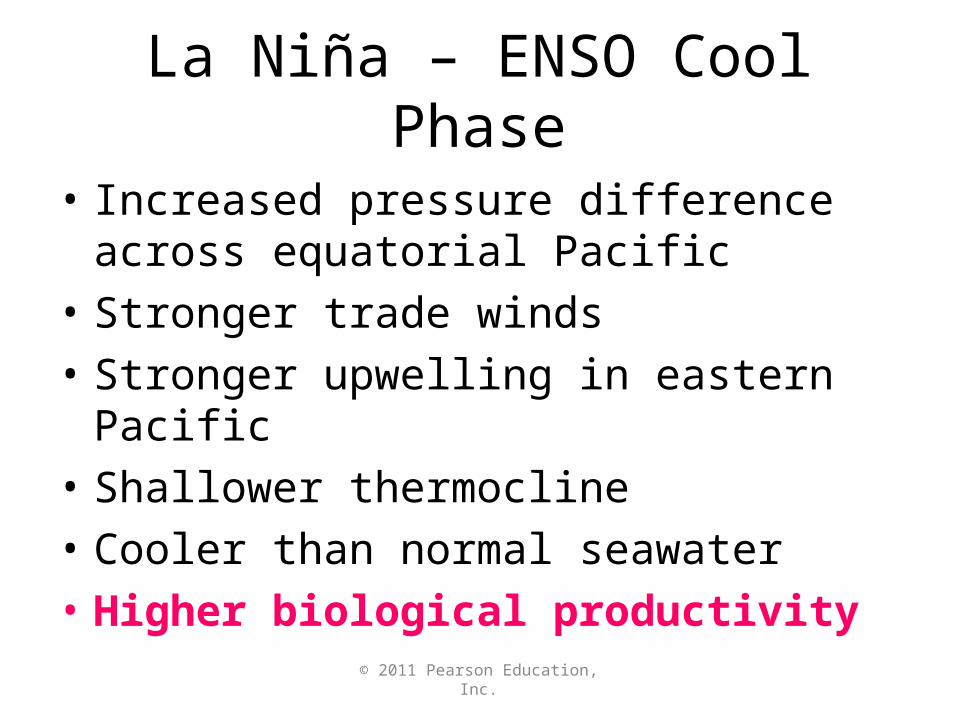
La Nina – ENSO Cool Phase
• Increased pressure difference across equatorial Pacific
• Stronger trade winds
• Stronger upwelling in eastern Pacific
• Shallower thermocline
• Cooler than normal seawater
• Higher biological productivity
© 2011 Pearson Education, Inc.
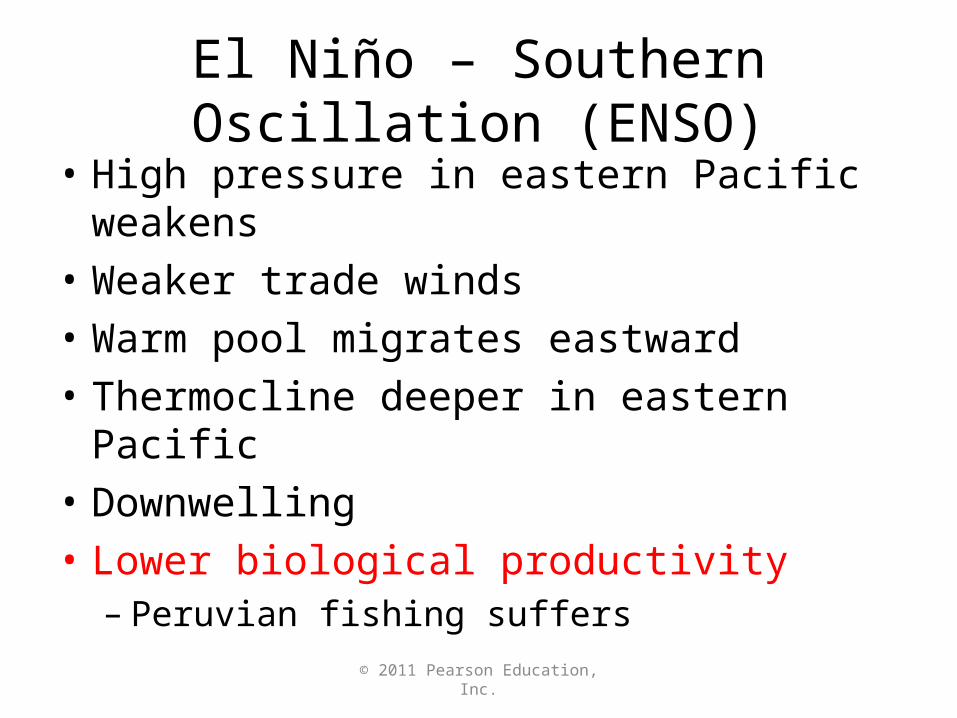
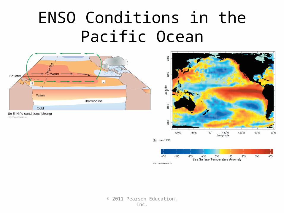
El Nino – Southern Oscillation (ENSO)
• High pressure in eastern Pacific weakens
• Weaker trade winds
• Warm pool migrates eastward
• Thermocline deeper in eastern Pacific
• Downwelling
• Lower biological productivity– Peruvian fishing suffers
© 2011 Pearson Education, Inc.
ENSO Conditions in the Pacific Ocean
La Nina
El Nino
© 2011 Pearson Education, Inc.
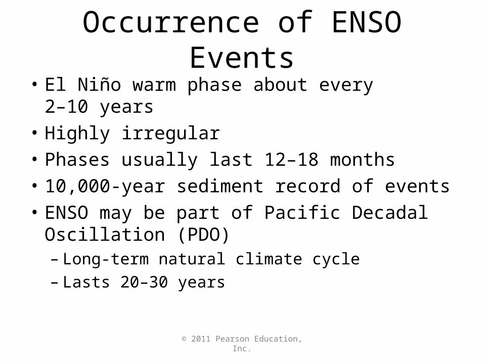
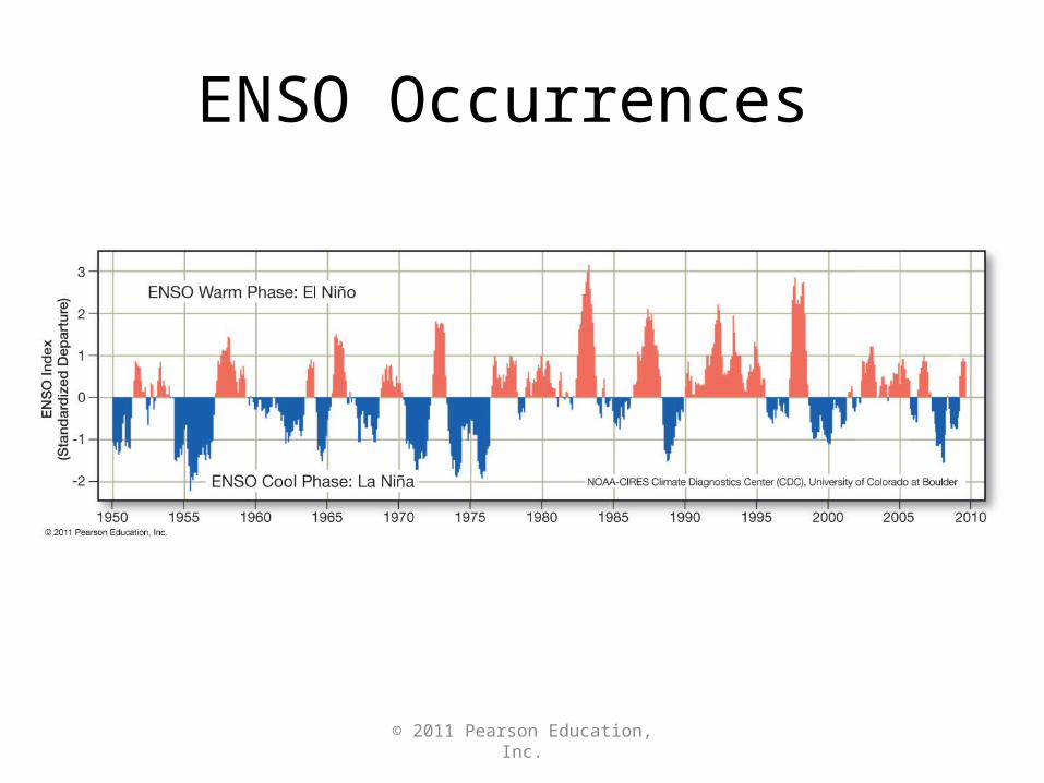
Occurrence of ENSO Events
• El Nino warm phase about every 2–10 years
• Highly irregular
• Phases usually last 12–18 months
• 10,000-year sediment record of events
• ENSO may be part of Pacific Decadal Oscillation (PDO) – Long-term natural climate cycle– Lasts 20–30 years
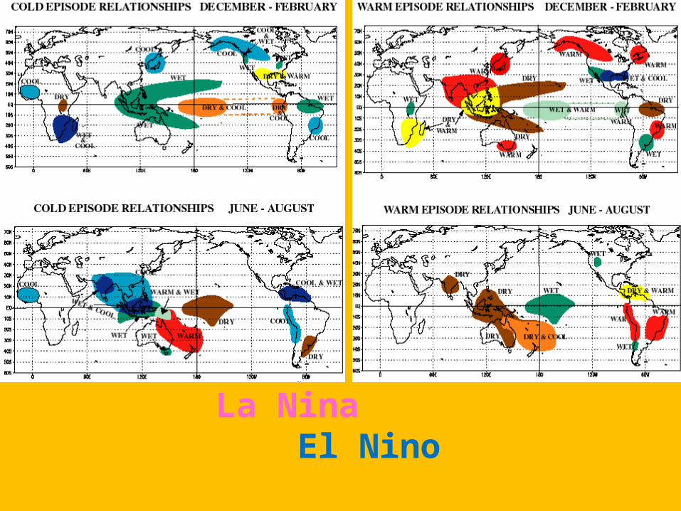
La Nina El Nino
© 2011 Pearson Education, Inc.
ENSO Occurrences
© 2011 Pearson Education, Inc.
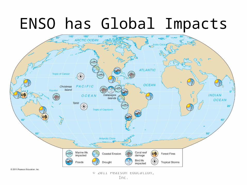
ENSO has Global Impacts
© 2011 Pearson Education, Inc.
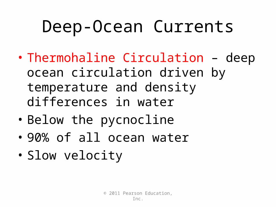
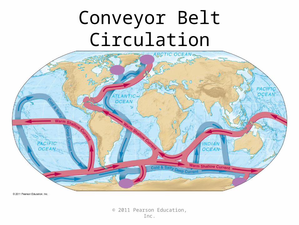
Deep-Ocean Currents
• Thermohaline Circulation – deep ocean circulation driven by temperature and density differences in water
• Below the pycnocline
• 90% of all ocean water
• Slow velocity
© 2011 Pearson Education, Inc.
Conveyor Belt Circulation
© 2011 Pearson Education, Inc.
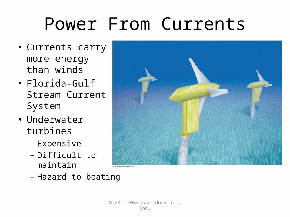
Power From Currents• Currents carry
more energy than winds
• Florida–Gulf Stream Current System
• Underwater turbines– Expensive
– Difficult to maintain
– Hazard to boating
© 2011 Pearson Education, Inc.
End of CHAPTER 7Ocean Circulation