weatherman walking pontypridd -...
TRANSCRIPT

Start
End
3
4
67
5
Weatherman Walking Pontypridd
bbc.co.uk/weathermanwalking © 2015
1
Reproduced by permission of Ordnance Survey on behalf of HMSO. © Crown copyright and database right 2009.All rights reserved. Ordnance Survey Licence number 100019855
The Weatherman Walking maps are intended as a guide to help you walk the route. We recommend using an OS map of the area in conjunction with this guide. Routes and conditions may have changed since this guide was written. The BBC takes no responsibility for any accident or injury that may occur while following the route. Always wear appropriate clothing and footwear and check weather conditions before heading out.
Approximate distance: 8 milesFor this walk we’ve included OS grid references should you wish to use them.
N
S
W E
1
2

Weatherman Walking Pontypridd
bbc.co.uk/weathermanwalking © 2015
2
Start: Berw Road, Pontypridd Starting ref: ST 077 910Distance: 8 milesGrade: Moderately strenuous Walk time : Allow 4.5 hours (4 hours + stops)
This walk over the hills above Pontypridd follows in the footsteps of pilgrims across the Rhondda. Walkers might be
surprised by the stunning scenery to be found in the former heartland of industrial Wales, with reclaimed tips and
regenerated forestry creating a green and peaceful landscape high above the bustling valleys towns.
On this walk you can visit the grave of legendary runner Guto Nyth Bran - the Jamie Baulch of his day! There’s
also ‘Old Smokey’, which resembles a volcano but thankfully is nice and safe, and a religious shrine which
dominates the skyline for miles around. Just don’t forget to save some energy for a leg-aching haul of steps right
at the end of this long and challenging route!
DirectionsThe walk starts from the road bridge over the River Taff between Berw Road and The Parade (there is on-street parking on both sides of the river). It’s a busy bridge for traffi c but there is a pavement, where you can look upriver to the Victorian railway bridge – and the spot of an even older crossing!
The shrine at Penrhys overlooks the Rhondda Fawr and Rhondda Fach valleys

Weatherman Walking Pontypridd
bbc.co.uk/weathermanwalking © 2015
3
The railway bridge has a distinctive support in the middle of the road!
At the fork, keep left , leaving the Pontypridd Circular route, which goes right
Derek and walking guide Maddy stand on the spot where pilgrims used to cross the River Taff
Pilgrim crossing at the River Taff (ST 078 910)
In late medieval times, pilgrims from Llantarnam Abbey near Newport would regularly make the
journey to the shrine of Our Lady at Penrhys. At Pontypridd they had to cross the River Taff – and, of
course, the road and rail bridges weren’t there back in those days! So they built a timber bridge on this
spot; no one knows exactly when, but records show it was still standing and in good condition in 1540.
By 1580, however, the bridge was in disrepair. The monasteries had been dissolved and, without the
monks to organise maintenance, the bridge had gone to rack and ruin.
The enormous fl at rocks you can see in the river today were quarried at nearby Craig yr Hesg, which
we’ll come to soon.
1
From the bridge, turn left onto Berw Road, walk past the terraced houses and take the fi rst turning on the right, following the Pontypridd Circular signpost. Walk uphill under the railway bridge and continue to the green metal gate.
Go through the gate and immediately right, to the Craig yr Hesg Nature Reserve board, and follow the well-defi ned path running gently uphill (still signposted Pontypridd Circular). This is Darren Ddu Road – the name ‘road’ is slightly confusing as it is a footpath, but this used to be the main Pontypridd to Ynysybwl route.
The path skirts a grassy fi eld and enters woodland, where it becomes stonier and can be slippery in wet weather. Keep going uphill, eventually passing the bulk of a quarry to the right and ruined quarry buildings on the left . At the clear fork, the Pontypridd Circular is signposted to the right, but our route goes left and steeply uphill.
At the top, the path meets a T-junction. Turn right and follow the path as it narrows to a thin, stony footpath, which runs parallel to a small brook and almost becomes a brook itself at times following rain! Soon a few large boulders mark the end of the footpath; turn left onto the country road (which is also Darren Ddu Road) and walk past the pretty cottages of Tai’r Heol, continuing downhill to Ynysybwl.
Weatherman Walking Pontypridd
bbc.co.uk/weathermanwalking © 2015
4
It looks like a driveway, but this is our route!
Maddy and Derek enjoy a downhill stretch aft er a steep climb!
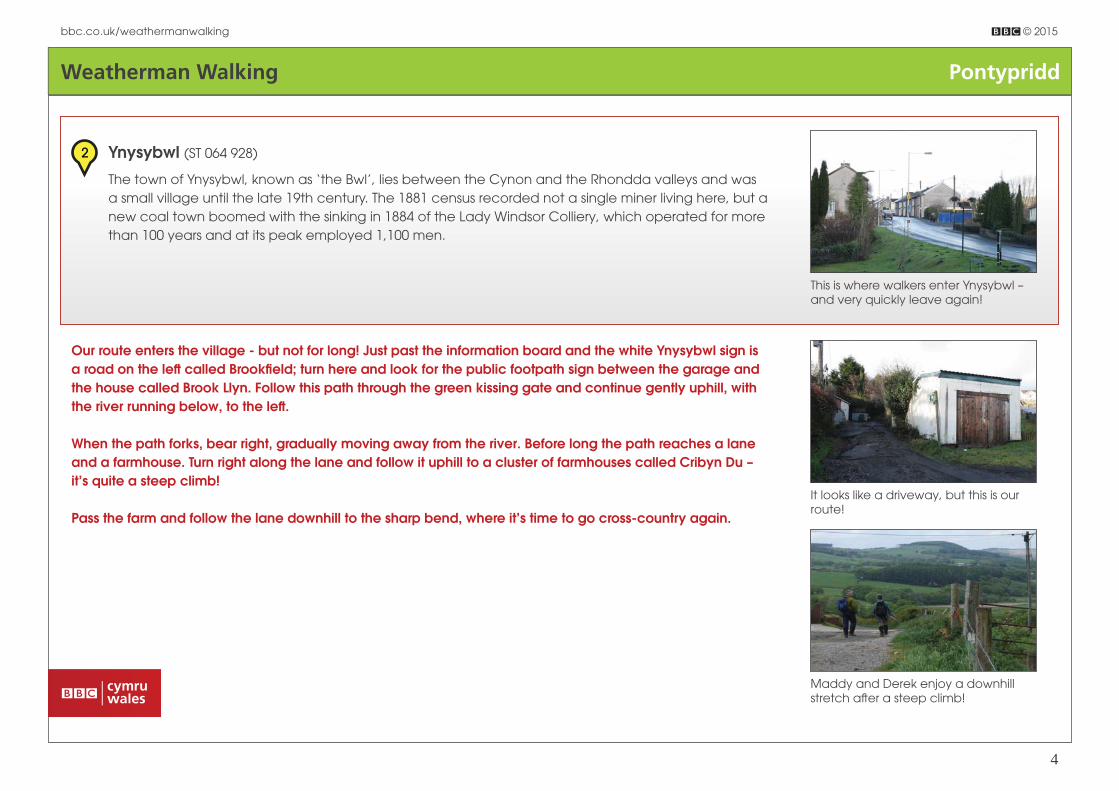
This is where walkers enter Ynysybwl – and very quickly leave again!
Ynysybwl (ST 064 928)
The town of Ynysybwl, known as ‘the Bwl’, lies between the Cynon and the Rhondda valleys and was
a small village until the late 19th century. The 1881 census recorded not a single miner living here, but a
new coal town boomed with the sinking in 1884 of the Lady Windsor Colliery, which operated for more
than 100 years and at its peak employed 1,100 men.
2
Our route enters the village - but not for long! Just past the information board and the white Ynysybwl sign is a road on the left called Brookfi eld; turn here and look for the public footpath sign between the garage and the house called Brook Llyn. Follow this path through the green kissing gate and continue gently uphill, with the river running below, to the left .
When the path forks, bear right, gradually moving away from the river. Before long the path reaches a lane and a farmhouse. Turn right along the lane and follow it uphill to a cluster of farmhouses called Cribyn Du – it’s quite a steep climb!
Pass the farm and follow the lane downhill to the sharp bend, where it’s time to go cross-country again.
Weatherman Walking Pontypridd
bbc.co.uk/weathermanwalking © 2015
5
Go over the stile next to the metal gate to the left of the road (ST 054 938). Cross the fi eld to the boundary and follow it uphill, to the top right corner, where a large boulder sits just ahead of a small wooden bridge / stile over the brook. Cross into the next fi eld and look ahead, slightly to the right. A hill lies in the distance, with a thick wood and two copses in the foreground. We’re heading for the wood by walking downhill between the copses.
Heading over the brow of the fi eld you might be able to make out a tiny white marker to the left edge of the copse on the right. This marks a stile into the next fi eld; cross the stile and follow the yellow RCT waymarker across the fi eld towards the middle of the wood, which has a wall running around it. In the wall is a metal gate leading into the woods, through which our path runs.
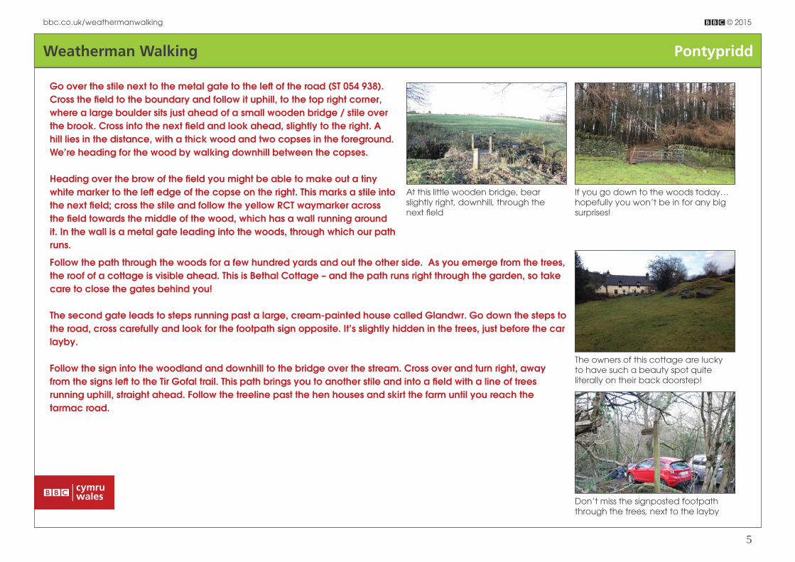
Follow the path through the woods for a few hundred yards and out the other side. As you emerge from the trees, the roof of a cottage is visible ahead. This is Bethal Cottage – and the path runs right through the garden, so take care to close the gates behind you!
The second gate leads to steps running past a large, cream-painted house called Glandwr. Go down the steps to the road, cross carefully and look for the footpath sign opposite. It’s slightly hidden in the trees, just before the car layby.
Follow the sign into the woodland and downhill to the bridge over the stream. Cross over and turn right, away from the signs left to the Tir Gofal trail. This path brings you to another stile and into a fi eld with a line of trees running uphill, straight ahead. Follow the treeline past the hen houses and skirt the farm until you reach the tarmac road.
At this little wooden bridge, bear slightly right, downhill, through the next fi eld
If you go down to the woods today… hopefully you won’t be in for any big surprises!
Don’t miss the signposted footpath through the trees, next to the layby
The owners of this cottage are lucky to have such a beauty spot quite literally on their back doorstep!

Weatherman Walking Pontypridd
bbc.co.uk/weathermanwalking © 2015
6
Keep left , towards the forest
Mynachdy (SST 048 950)
Just ahead is Mynachdy Farm. Mynachdy means ‘monk’s house’, and a monastery called Pendar was founded in this area by the monks of
Margam in the middle of the 12th century. They were given some land by the monks of Llantarnam Abbey, who owned most of the land above
Ynysybwl, but the exact spot is unknown as Pendar means ‘head of the oak tree’ - and the whole area was covered in oak! But the Margam
monks, who were Anglo-Norman, didn’t prosper in this Welsh heartland and soon returned west, leaving a grange farm at Mynachdy.
3
Turn left along the tarmac road, which is open to vehicles. Continue uphill until you reach two gates side by side; go through the left gate and continue towards the forest, passing between an off -road scrambling track and its car park. The road loops to the right, passes through a metal gate and enters the forest.
Aft er a short, sharp climb, you’ll reach a ‘crossroads’. Go through the green and white metal gate on the right, which takes you into the heart of St Gwynno Forest. Before long, a well-defi ned path is signposted on the left . You can take this as a direct path to Llanwonno but, if you fancy a short detour to a scenic picnic spot, carry on to the next forest crossroads, marked with a Loops and Links signpost on the right. Take the left -hand path, which is cycle route 47, towards the car park and a cluster of picnic benches perfect for a well-earned rest (ST 032 958)!
Join the road, left , towards Llanwonno.

Weatherman Walking Pontypridd
bbc.co.uk/weathermanwalking © 2015
7
Llanwonno is a tiny place – but this building has all a hungry walker could need!
Llanwonno and Guto Nyth Bran (ST 029 956)
Despite being a tiny place, with just the Brynff ynon Hotel and St Gwynno’s Church, Llanwonno is well
worth a visit. The Brynff ynon is extremely popular with walkers and visitors, whilst the churchyard of St
Gwynno’s contains a legendary grave!
Buried here, next to the church door facing the Brynff ynon, is Guto Nyth Bran, an almost super-human
runner said to be able to outrun a horse! Named Griffi th Morgan, he gained his nickname from his
parents’ farm, which was called Nyth Bran. In his 20s he won huge amounts of prize money in races
but retired in his 30s, only to be persuaded by his girlfriend, Sian, to stage a comeback in a gruelling
12-mile race between Newport and Bedwas against a newcomer called the Prince of Bedwas. Guto
won, completing the race in an astonishing 53 minutes, but when Sian clapped him on the back to
congratulate him, he collapsed and died.
Every year on New Year’s Eve, the Nos Galan 5k road race is held in Guto’s memory in the nearby
town of Mountain Ash, where his spirit is said to still sprint through the streets! The event, which started in
1958, attracts more than 1,000 runners each year and is always started by a mystery runner, including
famous faces such as Shane Williams, Linford Christie and Nicole Cooke.
4
Guto Nyth Bran, buried here, was said to be able to run faster than a horse!

Weatherman Walking Pontypridd
bbc.co.uk/weathermanwalking © 2015
8
Standing with the Brynff ynon Hotel on your left and St Gwynno’s Church on your right, take the road left , passing the side of the hotel. Aft er a few hundred yards, look out on the right for a yellow-painted signpost pointing between the trees.
Follow this path, which can be a little rough and boggy in places, a short distance to a forestry track. Here there are a few options; in summer, a couple of sheep tracks straight ahead can be picked out, taking you over the ridge and down the mountainside. But these paths can be hard to spot and the ground underfoot very boggy and uneven, so an alternative is to turn left and detour along the forestry track. Soon you will see a few large boulders; it looks like a dead end but hop up onto the boulders and you’ll see another stony track running past. Follow this byway right and continue over the ridge, where you’ll soon get a very interesting view!
The footpath between the trees is not far along the forestry road
The crew stop to admire the far-reaching views across the valley to Penrhys
‘Old Smokey’ was named by locals for its volcanic shape
Old Smokey spoil tip, Tylorstown (ST 019 955)
Along the route so far, you may have caught glimpses through the trees of an iconic, fl at-topped
peak, and now, as you round the mountain, it comes fully into view. This is ‘Old Smokey’, a spoil tip
dominating the skyline above the Rhondda Fach valley, which has been reclaimed by the land. It’s
a fun challenge to climb and a superb spot from which to enjoy panoramic views – but you might
decide it’s a detour best saved for another day!
5

Weatherman Walking Pontypridd
bbc.co.uk/weathermanwalking © 2015
9
The mountain track continues down towards the valley fl oor and the village of Stanleytown, passing Cefn-Llechau-Uchaf and Ty Mynydd Farm. Join the tarmac road and, at the junction with Witherdene Road, bear right, continuing steeply downhill to cross the road bridge with cheerful community paintings along the side.
Cross the road at the roundabout, keeping to the right and taking care as this is the main A4233 through the valley. Immediately on the other side are some steep steps – yes, this is the way we’re going, and there are lots of them!
Climb the steps and turn left , along Deri Terrace. Look on the right for another fl ight of steps and keep climbing – it’s certainly a tough fi nale to a reasonably strenuous walk! Follow the walled path and climb more fl ights of steps, past the playing fi elds and past (not across) a stone bridge with green painted railings. A little further on is a second bridge, also with painted railings. Cross this to reach Penrhys Road and turn left , passing the rugby club on the corner.
Continue to the roundabout at the top and take the fi rst exit into the car park and to the shrine of Our Lady of Penrhys, where an enormous statue of the Virgin Mary overlooks the Rhondda valleys.
Up the steps… and there are lots more where these came from!
Derek and Maddy enjoy a well-deserved rest at the top of Penrhys hill
Weatherman Walking Pontypridd
bbc.co.uk/weathermanwalking © 2015
10
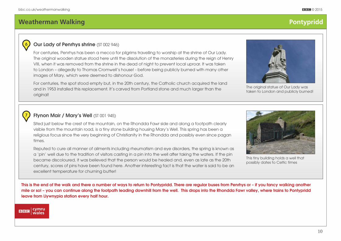
Our Lady of Penrhys shrine (ST 002 946)
For centuries, Penrhys has been a mecca for pilgrims travelling to worship at the shrine of Our Lady.
The original wooden statue stood here until the dissolution of the monasteries during the reign of Henry
VIII, when it was removed from the shrine in the dead of night to prevent local uproar. It was taken
to London – allegedly to Thomas Cromwell’s house! - before being publicly burned with many other
images of Mary, which were deemed to dishonour God.
For centuries, the spot stood empty but, in the 20th century, the Catholic church acquired the land
and in 1953 installed this replacement. It’s carved from Portland stone and much larger than the
original!
6
The original statue of Our Lady was taken to London and publicly burned!
Ffynon Mair / Mary’s Well (ST 001 945)
Sited just below the crest of the mountain, on the Rhondda Fawr side and along a footpath clearly
visible from the mountain road, is a tiny stone building housing Mary’s Well. This spring has been a
religious focus since the very beginning of Christianity in the Rhondda and possibly even since pagan
times.
Reputed to cure all manner of ailments including rheumatism and eye disorders, the spring is known as
a ‘pin’ well due to the tradition of visitors casting in a pin into the well aft er taking the waters. If the pin
became discoloured, it was believed that the person would be healed and, even as late as the 20th
century, scores of pins have been found here. Another interesting fact is that the water is said to be an
excellent temperature for churning butter!
7
This tiny building holds a well that possibly dates to Celtic times
This is the end of the walk and there a number of ways to return to Pontypridd. There are regular buses from Penrhys or – if you fancy walking another mile or so! – you can continue along the footpath leading downhill from the well. This drops into the Rhondda Fawr valley, where trains to Pontypridd leave from Llywnypia station every half hour.