waters figure 36. muddy fork watershed of … of jefferson county: july 1, 1999 – june 30, ......
TRANSCRIPT
WATERS of Jefferson County: July 1, 1999 – June 30, 2000 Muddy Fork Watershed
12/28/00 Page 152
3.3 BEARGRASS CREEK – MUDDY FORK
This report is an update to the WATERS of Jefferson County – Year Zero Report. For additional information on the Muddy Fork of Beargrass Creek Water-shed, refer to the WATERS – Year Zero Report located on the CD in Appendix I. Exhibit 8 illustrates several features of the Municipal Separate Storm Sewer System (MS4), Combined Sewer Over-flow (CSO), and Sanitary Sewer Over-flow (SSO) Programs in the Muddy Fork of Beargrass Creek Watershed.
3.3.1 HISTORY, DEMOGRAPHIC AND COMMUNITY INFORMATION
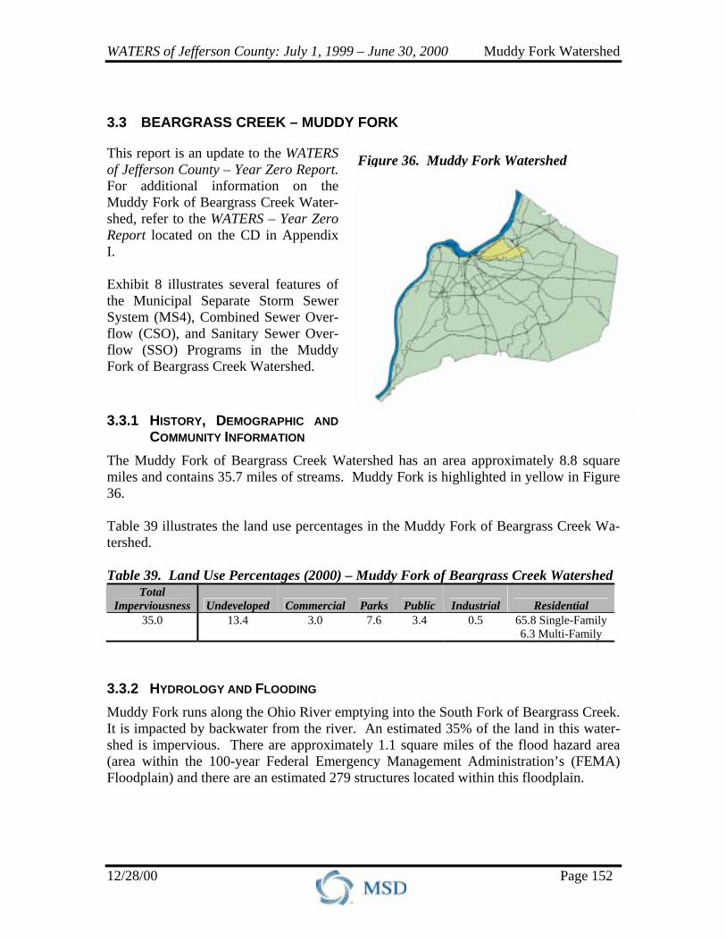
The Muddy Fork of Beargrass Creek Watershed has an area approximately 8.8 square miles and contains 35.7 miles of streams. Muddy Fork is highlighted in yellow in Figure 36. Table 39 illustrates the land use percentages in the Muddy Fork of Beargrass Creek Wa-tershed. Table 39. Land Use Percentages (2000) – Muddy Fork of Beargrass Creek Watershed
Total Imperviousness Undeveloped Commercial Parks Public Industrial Residential
35.0 13.4 3.0 7.6 3.4 0.5 65.8 Single-Family 6.3 Multi-Family
3.3.2 HYDROLOGY AND FLOODING Muddy Fork runs along the Ohio River emptying into the South Fork of Beargrass Creek. It is impacted by backwater from the river. An estimated 35% of the land in this water-shed is impervious. There are approximately 1.1 square miles of the flood hazard area (area within the 100-year Federal Emergency Management Administration’s (FEMA) Floodplain) and there are an estimated 279 structures located within this floodplain.
Figure 36. Muddy Fork Watershed
WATERS of Jefferson County: July 1, 1999 – June 30, 2000 Muddy Fork Watershed
12/28/00 Page 153
3.3.2.1 Flood Prevention Measures There are two site detention basins in the Muddy Fork of Beargrass Creek Watershed and no regional detention basins. These detention basins are for small local developments. These basins are typically too small to generate measurable water quality benefits from retrofitting.
3.3.3 STATUS OF WATER QUALITY The Muddy Fork of Beargrass Creek Watershed has almost seven miles of second prior-ity stream on the 1998 303(d) list for violations of the State Water Quality Standards (Table 40). Table 40. 303(d) List of Waters for TMDL Development – Muddy Fork of Beargrass Creek Watershed
Stream Priority Impaired Use Pollutants of Concern Muddy Fork Second Swimmable Pathogens
3.3.4 WATER QUALITY IMPACTS Water quality data collected during the reporting period is being analyzed. The majority of the data was collected with minimonitors from the ambient monitoring sites. The re-sults of the data analysis will be presented in the WATERS of Jefferson County: July 1, 2000 – June 30, 2001 Report.
3.3.4.1 Point Source Table 41 summarizes point sources in the Muddy Fork of Beargrass Creek Watershed. Table 41. Summary of Point Sources – Muddy Fork of Beargrass Creek Watershed
Sanitary Sewer Overflows
Combined Sewer
Overflows Storm Water
Outfalls General
Permittees
Significant Industrial
Users Wastewater
Treatment Plants
Recurring: 3 Investigated: 4 Eliminated: 2
3 Year Sampled: 1994
Total: 60 Contaminated: 0
1 2
MSD Regional: NA
MSD small: NA Private: 6
SSO fact sheets and an Exhibit illustrating the SSO locations are located in Appendix V.
3.3.4.2 Non-Point Source The Muddy Fork of Beargrass Creek Watershed is mostly urban. Much of the watershed is paved in the form of roads/streets, parking lots, neighborhoods, shopping centers, and industrial sites. This imperviousness contributes to high levels of pollutants from storm water runoff. Nutrient levels in the Muddy Fork of Beargrass Creek Watershed are very
WATERS of Jefferson County: July 1, 1999 – June 30, 2000 Muddy Fork Watershed
12/28/00 Page 154
high. Most of the nutrients originate from lawn chemicals and package wastewater treatment plants. Previous data indicated that the impacts to Muddy Fork are predominantly non-point source/wet weather related. Data collected from 1998 to fall 2000 will be available in the WATERS of Jefferson County: July 1, 2000 – June 30, 2001 Report.
3.3.4.3 Habitat and Biological Quality During the reporting period, fish, algae, and macroinvertebrates were sampled at the am-bient stream monitoring locations. Algae were sampled on five different days at these locations. Three-day growth rates, maximum carrying capacity, community structure, and biomass estimates are being analyzed for each sample. Fish and macroinvertebrates samples were also collected. The results of this investigation will be presented in the WATERS of Jefferson County: July 1, 2000 – June 30, 2001 Report and the next Synthe-sis Report.
3.3.5 TRACKING CHANGES IN WATER QUALITY A minimum of five years of data from the ambient monitoring sites will be required to analyze water quality trends. The trend analysis will be available in 2003 or 2004. How-ever, the Louisville and Jefferson County Metropolitan Sewer District (MSD) anticipates that over the next decade, trends for those constituents related directly to CSOs, SSOs, and storm water impacts will begin to decline. The water quality data collected dur-ing the reporting period will be com-pared with previous violations (dis-solved oxygen, temperature, and pH) to determine if the higher resolution yields more violations.
3.3.6 MS4 PROGRAM – CO-PERMITTEES
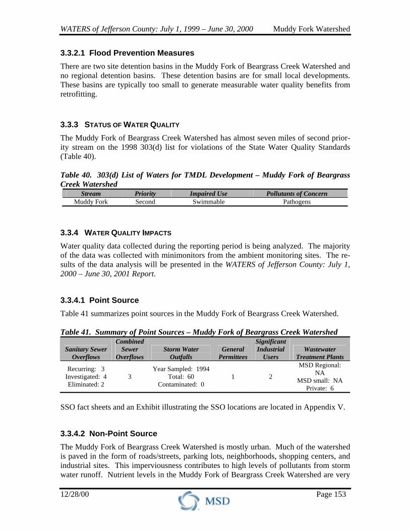
There are five co-permittees in the Muddy Fork of Beargrass Creek Wa-tershed that are responsible for fulfill-ing the requirements of the MS4 Per-mit (see Figure 37). The co-permittees include:
• City of St. Matthews • City of Louisville
Figure 37. Co-Permittee Locations

WATERS of Jefferson County: July 1, 1999 – June 30, 2000 Muddy Fork Watershed
12/28/00 Page 155
• Jefferson County • Kentucky Transportation Cabinet, District Five • MSD
Following are highlights from the co-permittees’ MS4 Programs. Refer to Appendix III for a complete listing of co-permittee MS4 activities.
3.3.6.1 City of St. Matthews The City of St. Matthews is a fourth-class city occupying approximately 4.1 square miles in north central Jefferson County. The population of St. Matthews is approximately 15,800 resi-dents. St. Matthews contains 7.7 miles of streams and spans across portions of the Middle Fork of Beargrass Creek and Muddy Fork of Beargrass Creek Watersheds (See Figure 38). The sections below describe St. Matthews’ MS4 Permit activities over the reporting period. Illicit Discharge Program, St. Matthews MSD performs the Illicit Discharge Program activities for St. Matthews under the inter-local agreement. The 2000 Student Outfall Program, conducted as part of the Illicit Dis-charge Program, involved students from Waggener Magnet Career Academy. Construction Site Construction Controls, St. Matthews St. Matthews has an ordinance in place to control construction site runoff that is similar to, but less stringent than, the Erosion Prevension and Sedimant Control (EPSC) Ordi-nance that will be effective in January 2001. To ensure that construction sites comply with the City’s current ordinance, the City has a full-time code enforcement officer for construction inspections. St. Matthews will comply with the new EPSC Ordinance when effective and plans to have the City Engineer attend EPSC training. Post Construction Controls, St. Matthews The City has undertaken the following activities to provide water quality protection and water quantity control:
• St. Matthews passed legislation that prohibits new construction of front yard pavement parking pads in order to maximize green space. This initiative will help prevent expansion of impervious areas, which increase quantities of storm water runoff.
• The City also has a “Green-up” Policy. At no charge to the residents, pavement-parking pads can be replaced with sod. Fifty residents have participated in this program to date.
• Next year, St. Matthews will investigate stenciling or stamping catch basins with the phrase “Dump No Waste, Drains To Stream.”
I 64 I 264
SHELBYVILLE RD
BROWNSBORO RD
FRANKFORT AVE
ST. MATTHEWS
MUDDY FORK
SOUTH FORKMIDDLE FORK
Figure 38. The City of St. Matthews
WATERS of Jefferson County: July 1, 1999 – June 30, 2000 Muddy Fork Watershed
12/28/00 Page 156
Good Housekeeping/Pollution Prevention, St. Matthews The following items describe St. Matthew’s Good Housekeeping/Pollution Prevention procedures:
• Street maintenance is performed on an as-needed basis and debris is removed by hand and landfilled.
• Street sweeping is performed on an as-needed basis, mainly along Bowling Boulevard and other curbed streets in St. Matthews. The City purchased a new street sweeping vacuum that has a bucket attachment to collect debris. The debris is landfilled.
• Catch basins are cleaned manually on an as-needed basis. New catch basins are installed with smaller slotted grates to prevent debris from entering the storm sewer system. The debris is landfilled.
• Storm sewers are cleaned manually on an as-needed basis. The City rents an au-ger to clean the storm sewers. The debris is landfilled.
• Public Works performs channel maintenance on an as-needed basis. Problem ar-eas are on a schedule for regular cleaning.
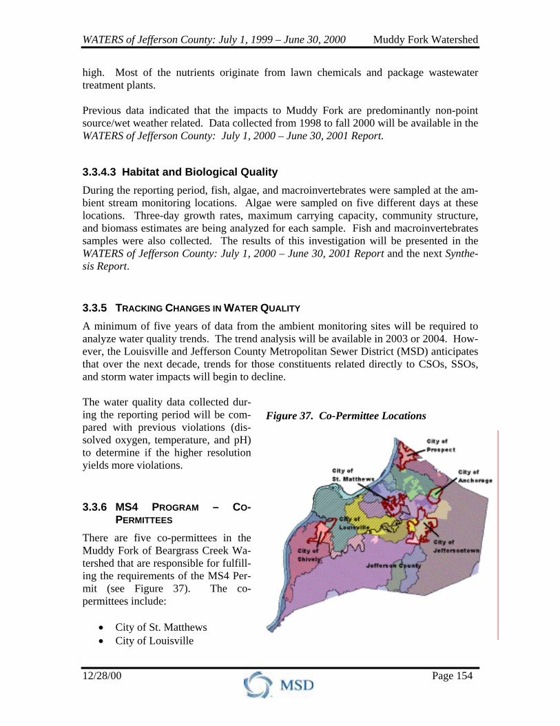
• The City calibrates salt spreaders an-nually and emphasizes salt applica-tion at the beginning of the storm to minimize the amount of salt neces-sary. Salt is stored in a covered area (see Figure 39).
• The City uses Round-Up® sparingly on weeds.
• A contractor collects municipal waste, yard waste, and recyclables weekly. The City collects leaves in the fall. Yard waste and leaves are taken to a compost facility.
Public Education/Outreach Programs, St. Matthews Public education takes place through a quarterly newsletter, which discusses recycling procedures. In addition, St. Matthews has joined Louisville and Jefferson County Infor-mation Consortium (LOJIC) and is exploring using ArcView applications for public edu-cation. Monitoring, St. Matthews MSD performs Monitoring activities for St. Matthews under the interlocal agreement. Reporting, St. Matthews MSD performs Reporting activities for St. Matthews under the interlocal agreement. MS4 Related Costs, St. Matthews Table 42 summarizes St. Matthews’ MS4 Permit costs for the reporting period and pro-jected costs for the next three years in the Muddy Fork of Beargrass Creek Watershed.
Figure 39. Salt Dome, St. Matthews
WATERS of Jefferson County: July 1, 1999 – June 30, 2000 Muddy Fork Watershed
12/28/00 Page 157
Table 42. St. Matthews MS4 Permit Related Cost for July 1999 – June 2003, Muddy Fork of Beargrass Creek Watershed
MS4 Program July 1999 – June 2000
July 2000 – June 2001
July 2001 –June 2002
July 2002 – June 2003
City of St. Matthews $52,300 $195,600 $100,100 $52,300 St. Matthews’ costs are estimated based on MS4 related components of its total budget. The reporting period MS4 Permit costs were used to estimate projected costs for the next three years. St. Matthews’ MS4 Permit costs represent activities related to Construction Site Runoff Controls, Post Construction Controls, Good Housekeeping/Pollution Preven-tion, Public Education/Outreach Program, and the interlocal agreement fee. St. Mat-thews’ MS4 costs in the Muddy Fork of Beargrass Creek Watershed represent a percent-age of the total MS4 costs based upon the percentage of stream miles within this water-shed.
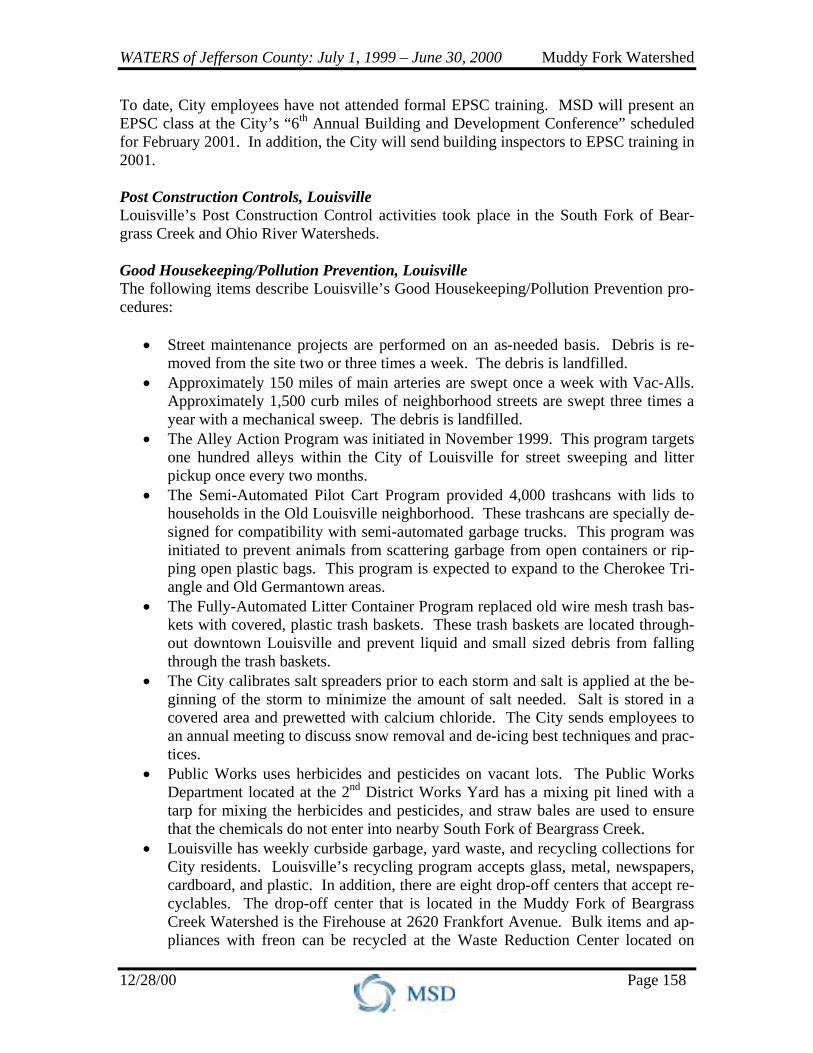
3.3.6.2 City of Louisville Founded in 1778 by George Rogers Clark, Louisville was charted by the state of Virginia in 1780 and made the county seat of Jefferson County. The City of Louisville is a first-class city with a population of approximately 269,555 residents, and occupies roughly 66.2 square miles along the Ohio River in northwestern Jefferson County. Louisville contains approximately 63.2 miles of streams and spans across portions
of the Muddy Fork of Beargrass Creek, Middle Fork of Beargrass Creek, South Fork of Beargrass Creek, Ohio River, Mill Creek, and Pond Creek Watersheds (see Figure 40). The sections below describe Lou-isville’s MS4 Permit activities over the reporting period. Illicit Discharge Program, Lou-isville MSD performs the Illicit Dis-charge Program activities for Lou-isville as an agency representing the City of Louisville and Jeffer-son County. Construction Site Runoff Controls, Louisville The City of Louisville and Jefferson County adopted the EPSC Ordinance in November 2000 and it will be effective in January 2001. The City of Louisville and Jefferson County are also revising the Louisville and Jefferson County Zoning Regulations. These revisions will include items such as buffering and open space requirements.
Figure 40. City of Louisville
WATERS of Jefferson County: July 1, 1999 – June 30, 2000 Muddy Fork Watershed
12/28/00 Page 158
To date, City employees have not attended formal EPSC training. MSD will present an EPSC class at the City’s “6th Annual Building and Development Conference” scheduled for February 2001. In addition, the City will send building inspectors to EPSC training in 2001. Post Construction Controls, Louisville Louisville’s Post Construction Control activities took place in the South Fork of Bear-grass Creek and Ohio River Watersheds. Good Housekeeping/Pollution Prevention, Louisville The following items describe Louisville’s Good Housekeeping/Pollution Prevention pro-cedures:
• Street maintenance projects are performed on an as-needed basis. Debris is re-moved from the site two or three times a week. The debris is landfilled.
• Approximately 150 miles of main arteries are swept once a week with Vac-Alls. Approximately 1,500 curb miles of neighborhood streets are swept three times a year with a mechanical sweep. The debris is landfilled.
• The Alley Action Program was initiated in November 1999. This program targets one hundred alleys within the City of Louisville for street sweeping and litter pickup once every two months.
• The Semi-Automated Pilot Cart Program provided 4,000 trashcans with lids to households in the Old Louisville neighborhood. These trashcans are specially de-signed for compatibility with semi-automated garbage trucks. This program was initiated to prevent animals from scattering garbage from open containers or rip-ping open plastic bags. This program is expected to expand to the Cherokee Tri-angle and Old Germantown areas.
• The Fully-Automated Litter Container Program replaced old wire mesh trash bas-kets with covered, plastic trash baskets. These trash baskets are located through-out downtown Louisville and prevent liquid and small sized debris from falling through the trash baskets.
• The City calibrates salt spreaders prior to each storm and salt is applied at the be-ginning of the storm to minimize the amount of salt needed. Salt is stored in a covered area and prewetted with calcium chloride. The City sends employees to an annual meeting to discuss snow removal and de-icing best techniques and prac-tices.
• Public Works uses herbicides and pesticides on vacant lots. The Public Works Department located at the 2nd District Works Yard has a mixing pit lined with a tarp for mixing the herbicides and pesticides, and straw bales are used to ensure that the chemicals do not enter into nearby South Fork of Beargrass Creek.
• Louisville has weekly curbside garbage, yard waste, and recycling collections for City residents. Louisville’s recycling program accepts glass, metal, newspapers, cardboard, and plastic. In addition, there are eight drop-off centers that accept re-cyclables. The drop-off center that is located in the Muddy Fork of Beargrass Creek Watershed is the Firehouse at 2620 Frankfort Avenue. Bulk items and ap-pliances with freon can be recycled at the Waste Reduction Center located on
WATERS of Jefferson County: July 1, 1999 – June 30, 2000 Muddy Fork Watershed
12/28/00 Page 159
Meriwether Avenue. The City of Louisville also collects office paper from down-town businesses for recycling.
Public Education/Outreach Programs, Louisville The City of Louisville’s website, www.louky.org, addresses water quality and recycling issues. Mass mailings are sent to residents once a year detailing the entire recycling pro-gram. In addition, new residents receive this information when they move into the City. Representatives from agencies within the City meet once a month to discuss environ-mental issues as part of the Environmental Compliance Committee (ECC). Examples of discussion topics include the Kentucky Pollutant Discharge Elimination System (KPDES) Permit, Groundwater Protection, and Hazardous Material Management. The ECC proposes initiatives to the Mayor through the Louisville Development Authority. Monitoring, Louisville MSD performs the Monitoring activities for Louisville as an agency representing the City of Louisville and Jefferson County. Reporting, Louisville MSD performs Reporting activities for Louisville as an agency representing the City of Louisville and Jefferson County. MS4 Related Costs, Louisville Table 43 summarizes Louisville’s MS4 Permit costs for the reporting period and pro-jected costs for the next three years in the Muddy Fork of Beargrass Creek Watershed. Table 43. Louisville MS4 Permit Related Cost for July 1999 – June 2003, Muddy Fork of Beargrass Creek Watershed
MS4 Program July 1999 – June 2000
July 2000 – June 2001
July 2001 –June 2002
July 2002 – June 2003
City of Louisville $181,600 $186,400 $198,100 $208,000 Louisville estimated MS4 Permit costs based on MS4 related components of its total budget. Louisville’s MS4 Permit costs represent activities related to Construction Site Runoff Controls, Post Construction Controls, Good Housekeeping/Pollution Prevention, and the Public Education/Outreach Program. Budget information was provided from the following City of Louisville Departments: Office of Health and Environment; Inspec-tions, Permits, and Licenses (IPL); and SWMS. The reporting period MS4 Permit costs were used to estimate projected costs for the next three years. Louisville’s MS4 costs in the Muddy Fork of Beargrass Creek Watershed represent a percentage of the total MS4 costs based upon the percentage of stream miles within this watershed.

WATERS of Jefferson County: July 1, 1999 – June 30, 2000 Muddy Fork Watershed
12/28/00 Page 160
3.3.6.3 Jefferson County Chartered in 1780 (in what was then Virginia), Jefferson County covers approximately 398 square miles in central Kentucky along the Ohio River. With a current population of over 675,000, Jefferson County con-tains approximately 1,427 miles of streams and is located in portions of all eleven Jefferson County Watersheds (see Figure 41).
Jefferson County’s MS4 Permit activities over the re-porting period are described below. Illicit Discharge Program, Jefferson County MSD performs the Illicit Discharge Program activities for Jefferson County as an agency representing the City of Louisville and Jefferson County. The 2000 Student Outfall Program, conducted as part of the Illicit Dis-charge Program, involved a teacher and students from Valley Magnet Career Acad-emy, located in southwestern Jefferson County. Construction Site Runoff Controls, Jefferson County The City of Louisville and Jefferson County adopted the EPSC Ordinance in November 2000 and it will be effective in January 2001. Jefferson County and the City of Louis-ville are also revising the Louisville and Jefferson County Zoning Regulations. These revisions will include items such as buffering and open space requirements. To date, Jefferson County employees have not attended formal EPSC training. Jefferson County plans to send Ordinance enforcement employees (both actual enforcement and referral of violating conditions) to training. Post Construction Controls, Jefferson County Jefferson County developed a tree preservation program during 1999. Trees are desig-nated for preservation either in two categories: temporary policy or permanent “woodland protection” policy. The temporary tree preservation policy protects trees during construc-tion, while the permanent “woodland protection” policy protects trees for the lifespan of the tree. This becomes a deed with restriction for the property.
Figure 41. Jefferson County

WATERS of Jefferson County: July 1, 1999 – June 30, 2000 Muddy Fork Watershed
12/28/00 Page 161
Good Housekeeping/Pollution Prevention, Jefferson County The following items describe Jefferson County’s Good Housekeeping/Pollution Preven-tion procedures:
• Street maintenance is performed on an as-needed basis. • Jefferson County uses a vacuum street sweeping machine on an as-needed basis.
The debris is landfilled. • Jefferson County calibrates salt spreaders annually. Salt is stored in a covered
area and prewetted with calcium chloride. Truck drivers receive annual training from the Jefferson County Public Works Department.
• Jefferson County uses Round-Up® and other herbicides and pesticides. Opera-tors are licensed by the State of Kentucky.
• Jefferson County has contracted weekly garbage and yard waste pickup. Hazard-ous waste pickup is also done by contract. In addition, Jefferson County provides curbside recycling and there are six drop-off centers that accept recyclables. The drop-off center that is located in the Muddy Fork of Beargrass Creek Watershed is the County Government Center at 595 Hubbards Lane.
Public Education/Outreach Programs, Jefferson County Jefferson County’s website, www.jefferson.ky.us, addresses recycling issues and has the Operations Manual for Snow and Ice Removal.
Monitoring, Jefferson County MSD performs the Monitoring activities for Jefferson County as an agency representing the City of Louisville and Jefferson County. Reporting, Jefferson County MSD performs Reporting activities for Jefferson County as an agency representing the City of Louisville and Jefferson County. MS4 Related Costs, Jefferson County Table 44 summarizes Jefferson County’s MS4 Permit costs for the reporting period and projected costs for the next three years in the Muddy Fork of Beargrass Creek Watershed. Table 44. Jefferson County MS4 Permit Related Cost for July 1999 – June 2003, Muddy Fork of Beargrass Creek Watershed
MS4 Program July 1999 – June 2000
July 2000 – June 2001
July 2001 –June 2002
July 2002 – June 2003
Jefferson County $1,500 $1,800 $1,900 $2,000 Jefferson County estimated MS4 Permit costs based on MS4 related components of its total budget. Jefferson County’s MS4 Permit costs represent activities related to Con-struction Site Runoff Controls, Post Construction Controls, Good Housekeep-ing/Pollution Prevention, and the Public Education/Outreach Program. Budget informa-tion was provided from Planning Review Services. MS4 related activities from the Main-tenance Department were not available at print time. The reporting period MS4 Permit
WATERS of Jefferson County: July 1, 1999 – June 30, 2000 Muddy Fork Watershed
12/28/00 Page 162
costs were used to estimate projected costs for the next three years. Jefferson County’s MS4 costs in the Muddy Fork of Beargrass Creek Watershed represent a percentage of the total MS4 costs based upon the percentage of stream miles within this watershed.
3.3.6.4 Kentucky Transportation Cabinet, District Five The Kentucky Transportation Cabinet, District Five (KYTC) is responsible for maintaining state roads within Jefferson, Bul-litt, Franklin, Henry, Oldham, Shelby, Spencer, and Trimble Counties. KYTC’s Jefferson County service area includes ap-proximately 468 miles of state roads and spans across portions of all eleven Jefferson County Watersheds. The sections below describe KYTC’s MS4 Permit activities over the reporting period.
Illicit Discharge Program, KYTC MSD performs the Illicit Discharge Program activities for KYTC under the interlocal agreement. Construction Site Runoff Controls, KYTC KYTC requires construction projects to have an EPSC plan, which is reviewed by the Division of Water. Best Management Practices (BMPs) must be incorporated into con-struction plans for “grade and drain” projects. Prior to the start of construction, KYTC’s project engineer and the contractor are required to sign an agreement regarding the par-ticular BMPs that will be included on the construction site. To ensure that construction sites comply with the EPSC plan, KYTC has inspectors on site at “grade and drain” projects over 90% of the time. BMPs are inspected weekly and after rain events of certain intensities. KYTC has between 30 and 40 full-time inspectors assigned to Jefferson County and brings in additional inspectors from surrounding coun-ties when needed. KYTC maintenance personnel received four hours of instruction during the past year on BMPs. The training concentrated on KYTC’s new BMP manual entitled “Best Manage-ment Practices for Maintenance Activities in and around Streams.” Topics covered in this manual include:
• Seeding and mulching disturbed areas located near streams. • Minimizing the length and steepness of slopes on construction sites. • Using sediment barriers, such as staked hay bales and silt fences. • Prohibiting bulldozers from performing work within the confines of stream chan-
nels. • Requiring work in streams to be performed during low flow conditions when pos-
sible.
WATERS of Jefferson County: July 1, 1999 – June 30, 2000 Muddy Fork Watershed
12/28/00 Page 163
KYTC has indicated that it will be exempt from the Louisville and Jefferson County EPSC Ordinance that will be effective in January 2001 because the Kentucky Division of Water (KDOW) reviews their plans. Post Construction Controls, KYTC KYTC’s Post Construction Control activities took place in the Pond Creek and Mill Creek Watersheds. Good Housekeeping/Pollution Prevention, KYTC The following items describe KYTC’s Good Housekeeping/Pollution Prevention proce-dures:
• State road and interstate maintenance is performed on a schedule and as needed. Maintenance personnel received four hours of training regarding BMPs.
• KYTC sweeps state roads outside of the City of Louisville boundaries on an as-needed basis using a state owned sweeper. KYTC dedicates approximately 1,200 hours per year for sweeping state roads, or approximately 400 street miles per year. KYTC contracts out interstate sweeping work. The contract provides for 95 miles of interstate to be swept in Jefferson County: 37 miles are swept six times per year, 45.5 miles are swept 12 times per year, and 12.5 miles are swept 18 times per year. The debris is landfilled.
• KYTC uses a contractor to clean catch basins manually or with a vacuum in two cycles per year. KYTC crews also perform cleaning on an as-needed basis. The debris is landfilled.
• KYTC uses a contractor to clean storm sewers using a vacuum. The debris is landfilled.
• KYTC maintains channels on a regular basis. The debris is landfilled. • KYTC calibrates salt spreaders annually and stores salt in covered areas. Salt is
prewetted with liquid calcium chloride and brine was used to reduce the total amount of salt and calcium chloride required. KYTC provides annual “Sensible Salting” training for all contract salt truck drivers and all new KYTC drivers.
• KYTC distributes guidance documents on herbicide and pesticide application to their maintenance department and certifies their agronomic crews annually. All guardrails and concrete or asphalt medians are sprayed twice a year.
Public Education/Outreach Programs, KYTC KYTC’s website, www.kytc.state.ky.us, has “Adopt-A-Highway” information for groups interested in adopting a stretch of highway. KYTC provides safety vests, garbage bags, and signs for groups in this program. KYTC sponsors a “Keep Kentucky Clean, Don’t Litter” poster contest for grade school and high school students each year. The winning posters are printed in an annual “Adopt-A-Highway” calendar. KYTC sold environmentally oriented t-shirts during Earth Day. The proceeds from the sales were used to cover the cost of the t-shirts and to help raise awareness on Earth Day.
WATERS of Jefferson County: July 1, 1999 – June 30, 2000 Muddy Fork Watershed
12/28/00 Page 164
KYTC provides internal training for its employees as outlined in the above sections. Monitoring, KYTC MSD performs Monitoring activities for KYTC under the interlocal agreement. Reporting, KYTC MSD performs Reporting activities for KYTC under the interlocal agreement. MS4 Related Costs, KYTC Table 45 summarizes KYTC’s MS4 Permit costs for the reporting period and projected costs for the next three years in the Muddy Fork of Beargrass Creek Watershed. Table 45. KYTC MS4 Permit Related Cost for July 1999 – June 2003, Muddy Fork of Beargrass Creek Watershed
MS4 Program July 1999 – June 2000
July 2000 – June 2001
July 2001 –June 2002
July 2002 – June 2003
KYTC $64,900 $67,500 $70,200 $72,900 KYTC estimated MS4 Permit costs based on MS4 related components of its total budget. KYTC’s MS4 costs represent activities related to Construction Site Runoff Controls, Post Construction Controls, Good Housekeeping/Pollution Prevention, Public Educa-tion/Outreach Program, and the interlocal agreement fee. The reporting period MS4 Permit costs were used to estimate projected costs for the next three years. KYTC’s MS4 costs in the Muddy Fork of Beargrass Creek Watershed represent a percentage of the total MS4 costs based upon the percentage of area within this watershed.
3.3.6.5 MSD MSD maintains the MS4 in the City of Louisville and Jefferson County. MSD’s service area does not include the MS4 systems within the Cities of Anchorage, Jeffersontown, Prospect, St. Mat-
thews, and Shively. The service area contains 1,835 miles of streams and is located in all eleven Jefferson County Watersheds. MSD is responsible for 35 miles of streams in the Muddy Fork of Beargrass Creek Watershed. MSD’s activities in the Muddy Fork of Beargrass Creek Watershed that fulfill elements of the MS4 Permit are described below. Illicit Discharge Program, MSD Illicit Discharge Program activities took place during the reporting period in the South Fork of Beargrass Creek, Cedar Creek, and Floyds Fork Watersheds. Construction Site Runoff Controls, MSD The EPSC Ordinance was approved by Jefferson County Fiscal Court in November 2000 and will be effective in January 2001. A copy of the approved EPSC Ordinance is lo-cated in Appendix IV.
WATERS of Jefferson County: July 1, 1999 – June 30, 2000 Muddy Fork Watershed
12/28/00 Page 165
MSD held EPSC training sessions for Designers, Planners, Developers, and Operators:
• EPSC Design Training took place in November 1999. MSD Area Team mem-bers, Plan Reviewers, Customer Specialists, and Inspectors attended the training.
• The EPSC Design and Construction Seminar took place in January 2000. The seminar was open to the public.
• Plan Review Training took place in May 2000. The training was for MSD em-ployees and emphasized the design of sediment basins.
• EPSC training modules are in place and are being scheduled. Guidance materials are being prepared and will be distributed at these training sessions.
MSD continues to inspect construction sites for EPSC plan compliance. MSD is using a coaching process during the inspections to familiarize inspectors and contractors with the Ordinance. In the coaching process, a MSD inspector is paired with a MSD EPSC trainer to discuss EPSC issues at the site with the contractor. MSD is establishing EPSC General Permits for:
• City of Anchorage • City of Jeffersontown • City of Prospect • City of Shively • City of St. Matthews • City of Louisville • Jefferson County • KYTC • BellSouth
• Insight Communications • Jefferson County Public Schools • LG&E • Louisville Water Company • Louisville and Jefferson County
Parks Department • SuperView of Louisville • United States Postal Service
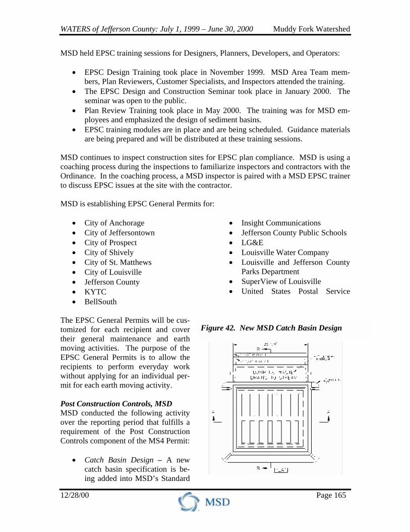
The EPSC General Permits will be cus-tomized for each recipient and cover their general maintenance and earth moving activities. The purpose of the EPSC General Permits is to allow the recipients to perform everyday work without applying for an individual per-mit for each earth moving activity. Post Construction Controls, MSD MSD conducted the following activity over the reporting period that fulfills a requirement of the Post Construction Controls component of the MS4 Permit:
• Catch Basin Design – A new catch basin specification is be-ing added into MSD’s Standard
Figure 42. New MSD Catch Basin Design
WATERS of Jefferson County: July 1, 1999 – June 30, 2000 Muddy Fork Watershed
12/28/00 Page 166
Specifications. It will read “Dump No Waste; Drains To Stream” and could in-clude an outline of a fish stamped on catch basin covers. This will become stan-dard on new catch basins on March 1, 2001 (see Figure 42 on previous page).
Good Housekeeping/Pollution Prevention, MSD The following items describe MSD’s Good Housekeeping/Pollution Prevention proce-dures:
• MSD cleaned approximately 20,900 catch basins during the reporting period and anticipates to clean approximately 35,000 to 40,000 catch basins in the next re-porting period. Maintenance services are performed as a routine practice on catch basins. Catch basins are cleaned using an auger or a bucket and are occasionally cleaned by hand. The debris is landfilled.
• MSD handles an average of 3,600 storm sewer cleaning work orders a year.
Storm sewers are flushed and the debris is vacuumed prior to entering the stream. The debris is landfilled.
• No channels were dredged for silt removal within the reporting period. • MSD assists Jefferson County with salt application on streets on an as-needed ba-
sis. MSD’s salt spreaders are calibrated annually and drivers receive annual train-ing on salt application. The County determines the amount of salt to be used dur-ing each application.
• MSD does not use herbicides and pesticides on a regular basis. Herbicides and
pesticides are only used when conditions are unsafe to remove items by hand. • MSD continues its internal recycling program. In addition, MSD provides the
public with locations and hours of recycling drop-off program via MSD’s website and billing inserts.
Public Education/Outreach Program, MSD MSD participated in the following activities over the reporting period that fulfill require-ments of the Public Education/Outreach Program component of the MS4 Permit:
• Clean Sweeps – MSD provided the Beargrass Creek, Floyds Fork, and Mud Creek (in the Pond Creek Watershed) Clean Sweeps with gloves, garbage bags, and equipment to haul away large items.
• Pamphlets – MSD’s Reclaiming the Health and Value of Our Streams is a pam-
phlet that has been distributed during the reporting period, which educates the public and promotes clean water and a green environment for the community.
WATERS of Jefferson County: July 1, 1999 – June 30, 2000 Muddy Fork Watershed
12/28/00 Page 167
• Billing Inserts – Billing inserts are provided for residential, commercial, and in-dustrial customers. These inserts include information regarding water quality, water conservation, drainage improvements, and current projects.
• Newsletters – MSD newsletters are prepared for over forty neighborhoods each
year. These newsletters include information regarding water quality improve-ments occurring through sanitary sewer projects, drainage projects, the number of package treatment plants eliminated, and the number of customers taken off septic tanks.
• MS4 Stakeholders Group – MSD completed a yearlong series of meetings with
the MS4 Stakeholders Group that represented MSD’s and the co-permittees’ ser-vice areas. The goal of the Stakeholders Group was to have community involve-ment on decisions that will correct or address water quality issues. Stakeholders throughout Jefferson County were invited to discuss a variety of water quality topics. The Stakeholders Group recommended that a Watershed Advisory Group be formed in the Goose Creek Watershed as a pilot group. If this pilot group is successful, Watershed Advisory Groups will be formed for every watershed within Jefferson County.
• Operation Brightside Program – MSD finances an "Operation Brightside Pro-
gram,” which teaches elementary and secondary school children about environ-mental issues.
• Website – MSD’s website, www.msdlouky.org, contains water quality informa-
tion including the Water Quality Report, Project XL, the status of water quality by watershed, Stream Monitoring Program, Greenways Program, No Mow Zones, and stream restoration.
• External Training/Education – Over 50 presentations, training sessions, newspa-
per articles, and other forms of public education were given countywide on the following topics: MS4 Permit, macroinvertebrate training, avian botulism, sam-pling methods, revegetation efforts and special tree needs, fish kill and pond prob-lems, WEFTEC abstracts, Watershed 2000 abstracts, Kentucky Water Resources Symposium abstracts, wet weather permitting, the Synthesis Report, general water quality, BMPs, pesticides and herbicides, habitat assessment, and stream restora-tion.
• Earth Day – MSD had a booth at the Louisville Zoo for Earth Day 2000 to draw
attention to the status of water quality in Jefferson County streams. The booth was lined with shopping carts and tires that had been pulled out of streams. Booth visitors were provided a copy of the Water Quality Report to educate them on the quality of water within each watershed.
WATERS of Jefferson County: July 1, 1999 – June 30, 2000 Muddy Fork Watershed
12/28/00 Page 168
• Newspaper Articles – Newspaper articles detailing the Water Quality Report were published in the Courier Journal around Earth Day. The articles appeared on the front page of the paper and the front page of each neighborhood section.
• Volunteer Monitoring Support – MSD employees participate in the Salt River
Watershed Watch monitoring and gave presentations on water quality issues and macroinvertebrates to the volunteer monitors. MSD spent $6,000 on the program in addition to providing 90 pH kits, 90 dissolved oxygen kits, meter sticks, ther-mometers, tubs, nets, pens, and 360 sample bottles. Additionally, MSD continues to provide guidance as science advisor for the data that is collected.
• Volunteer Monitoring Support – MSD is coordinating with the Friends of Bear-
grass Creek on a wet weather fecal study. • Internal Training – Internal training topics included the MS4 Permit, the EPSC
Ordinance, ECO Process, stream sampling process, the Synthesis Report, BMPs, and wetlands delineation. Approximately 12 training sessions were conducted.
• Co-Permittee Meetings – MSD held three quarterly meetings with the co-
permittees to discuss the MS4 Permit and water quality issues. MSD also participated the following activities over the reporting period that are related to the Public Education/Outreach Program component of the MS4 Permit::
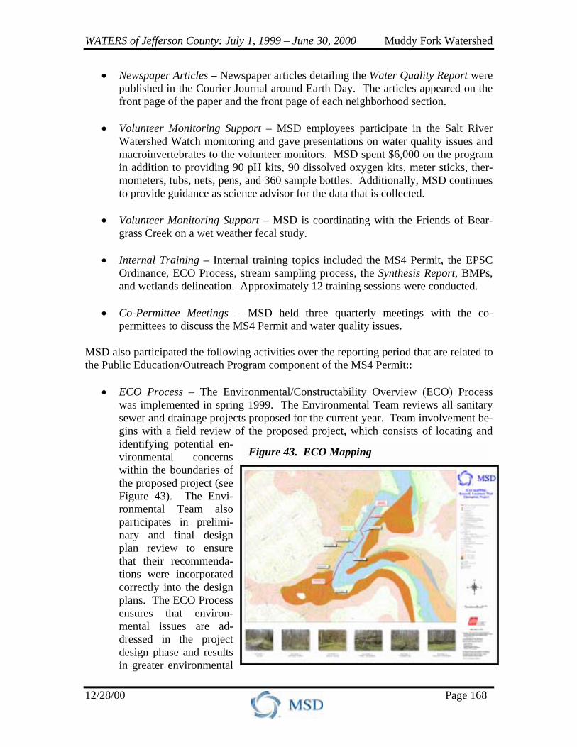
• ECO Process – The Environmental/Constructability Overview (ECO) Process was implemented in spring 1999. The Environmental Team reviews all sanitary sewer and drainage projects proposed for the current year. Team involvement be-gins with a field review of the proposed project, which consists of locating and identifying potential en-vironmental concerns within the boundaries of the proposed project (see Figure 43). The Envi-ronmental Team also participates in prelimi-nary and final design plan review to ensure that their recommenda-tions were incorporated correctly into the design plans. The ECO Process ensures that environ-mental issues are ad-dressed in the project design phase and results in greater environmental
Figure 43. ECO Mapping
WATERS of Jefferson County: July 1, 1999 – June 30, 2000 Muddy Fork Watershed
12/28/00 Page 169
sensitivity. During the reporting period, four projects were reviewed using the ECO Process in the Muddy Fork of Beargrass Creek Watershed.
• “State of Affairs” Interview – WFPL Radio Station broadcast a program, “State of Affairs,” on the status of water quality in Jefferson County. The broadcast coin-cided with Earth Day. Gordon Garner, MSD’s Executive Director; Bruce Scott, President of the Friends of Beargrass Creek; and David Wicks from Jefferson County Public Schools were interviewed. This interview focused on MSD’s Wa-ter Quality Report and the status of water quality in Jefferson County streams. Specific issues discussed during this interview included:
! MSD’s program to eliminate CSOs and SSOs throughout Jefferson County ! The elimination of package wastewater treatment plants ! The CDS unit installed at CSO 108 off Newburg Road ! The EPSC Ordinance ! The impact of sediment on Jefferson County streams
Residents were encouraged to become familiar with the streams in Jefferson County and to take steps to improve water quality. Residents were also encour-aged to maintain their septic systems, disconnect sump pumps from sanitary sew-ers, and clean up pet waste.
• NPDES Environmental Noncompliance Notification Project, An USEPA
EMPACT Project – The United States Environmental Protection Agency (USEPA) and MSD held several meetings regarding the technology transfer from an Environmental Monitoring for Public Access and Community Tracking (EMPACT) project from the tri-City area of Houston, Galveston, and Brazoria, Texas to Louisville, Kentucky. The objective of the National Pollutant Discharge Elimination System (NPDES) Environmental Noncompliance Notification Project is to notify the public of any 24-hour noncompliance with the NPDES permitting program of the Clean Water Act. A second objective is to explain the environ-mental and heath significance of this noncompliance so that community residents can make educated decisions on the use of local water resources. MSD is inter-ested in incorporating the public outreach, education, and the risk communication components from this project into MSD’s wet weather program.
Monitoring, MSD MSD conducted the following activities over the reporting period that fulfill requirements of the Monitoring component of the MS4 Permit:
• Volunteer Monitoring Coordination – MSD is coordinating with the Friends of Beargrass Creek (FOBC) on a wet weather fecal study. This study will collect fe-cal samples two to four hours prior to a rainfall event, during the rainfall event, and for 24 to 48 hours after the rainfall has stopped. FOBC hopes to sample five locations. MSD will provide a technician to assist in this sampling effort.

WATERS of Jefferson County: July 1, 1999 – June 30, 2000 Muddy Fork Watershed
12/28/00 Page 170
• The Collection System Monitoring Program – In order to be proactive in its ap-proach to wastewater treatment, MSD created the Collection System Monitoring Program. Seventeen sites have been selected for flow monitoring and data sample collection within four treatment plant areas. These four treatment plants, which include Morris Forman, Jeffersontown, West County, and Hite Creek, are the only plants in Jefferson County that have permitted industrial dischargers. During 1998, the sites were selected and the following was approved by MSD: ! Installation of permanent flow monitors at the 17 approved sites. ! Flow monitors to be placed on the MSD telemetry system. ! Periodic sampling at the 17 approved sites.
Sampling is tentatively scheduled to be conducted quarterly. The flow and mass loading data will be used for many purposes, including system trend analysis. During the next reporting period, it is projected that seven flow meters will be purchased and/or installed in the Morris Forman collection system.
• Monitoring at Indian Hills – MSD is evaluating the impacts of construction ac-
tivities due to sewering in Indian Hills. Low flow samples are being collected at several sites surrounding the construction area. Pre-construction data analysis will begin this fall and will be included in next year’s report. Monitoring will continue at these sites for approximately three more years.
Reporting, MSD MSD conducted the following activities over the reporting period that fulfill requirements of the Reporting component of the MS4 Permit:
• Annual Report and ArcView Applica-tion – This document serves as the an-nual report that covers the MS4 Permit activities in Jefferson County. MSD compiled the report from information provided by the co-permittees, includ-ing MSD. This document also includes the ArcView application located on the CD in Appendix I.
• Water Quality Report – MSD released a Water Quality Report entitled Our Streams are Dying in April 2000. This release was timed to coincide with Earth Day. The report is intended to provide the public with a basic under-standing of the water quality issues af-fecting each watershed in Jefferson County (see Figure 44).
Figure 44. Water Quality Report

WATERS of Jefferson County: July 1, 1999 – June 30, 2000 Muddy Fork Watershed
12/28/00 Page 171
Additional Projects to Enhance Water Quality MSD conducted the following sanitary projects during the reporting period that are not required by the MS4 Permit but enhance water quality:
• Sanitary Projects – In the Muddy Fork of Beargrass Creek Watershed, there are nine sanitary projects ongoing or planned that will provide approximately an addi-tional 4,100 linear feet of sewer, eliminate three pump stations, create one new pump station, and provide sanitary sewer service for approximately 200 custom-ers. For more detailed information on these sanitary projects, refer to MSD’s Wastewater and Operations Capital Program binder.
Planning, MSD In addition to ongoing efforts, MSD is planning several activities during the next three reporting periods (July 2000 – June 2003) that fulfill requirements of the MS4 Permit. Highlights of the planned activities include:
• Illicit Discharge Program ! Continue the Student Outfall Program and contaminated outfall follow-up
program. ! Continue to develop the database/case tracking system. ! Provide Wastewater Discharge Regulation (WDR) training for co-permittees.
• Construction Site Runoff Controls
! Finalize EPSC General Permits. ! Proceed with EPSC Ordinance training. ! Finalize EPSC guidance materials.
• Post Construction Controls
! Develop a storm water BMP manual to aid designers in the BMP choices for a given set of circumstances.
! Research locations for possible BMPs. ! Help initiate greenways development throughout Jefferson County. ! Expand the use of the Water Quality Evaluation Tool to other watersheds. ! Cast the phrase “Dump No Waste; Drains To Stream” on all new catch basins
and storm sewer manholes. Permanent stickers with the same phrase could be placed on existing catch basins and storm sewer manholes.
• Good Housekeeping/Pollution Prevention
! Incorporate additional BMPs into good housekeeping activities. ! Train maintenance and plan review personnel on MS4 Permit requirements.
• Public Education/Outreach Programs
! Develop and implement a comprehensive Strategic Education Plan. ! Assist in developing watershed groups in each watershed. ! Continue current education efforts. ! Education of typical types of BMPs.
WATERS of Jefferson County: July 1, 1999 – June 30, 2000 Muddy Fork Watershed
12/28/00 Page 172
• Monitoring ! Maintain an aggressive monitoring program for continuous and discrete
physical and chemical parameters, and a biological monitoring program for macroinvertebrates, fish, and algae.
! Develop new monitoring efforts to delineate point and non-point source pollu-tion.
! Initiate land use characterization analysis. ! Continue wet weather data collection efforts.
• Reporting ! Provide annual updates of the WATERS Report and ArcView application. ! Develop another water quality report to aid in public education. ! Provide water quality data from the ambient monitoring sites in a Data Re-
port. ! Provide a new Synthesis Report, which analyzes 1998 – fall 2000 data.
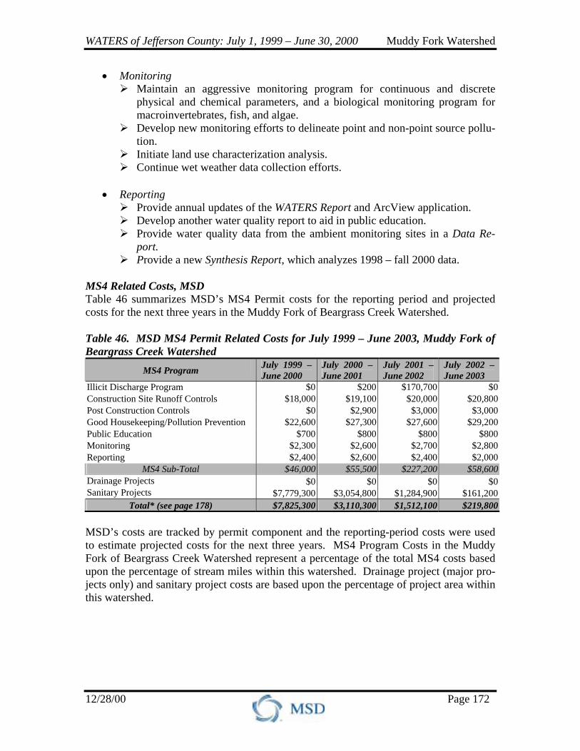
MS4 Related Costs, MSD Table 46 summarizes MSD’s MS4 Permit costs for the reporting period and projected costs for the next three years in the Muddy Fork of Beargrass Creek Watershed. Table 46. MSD MS4 Permit Related Costs for July 1999 – June 2003, Muddy Fork of Beargrass Creek Watershed
MS4 Program July 1999 – June 2000
July 2000 – June 2001
July 2001 –June 2002
July 2002 – June 2003
Illicit Discharge Program $0 $200 $170,700 $0 Construction Site Runoff Controls $18,000 $19,100 $20,000 $20,800 Post Construction Controls $0 $2,900 $3,000 $3,000 Good Housekeeping/Pollution Prevention $22,600 $27,300 $27,600 $29,200 Public Education $700 $800 $800 $800 Monitoring $2,300 $2,600 $2,700 $2,800 Reporting $2,400 $2,600 $2,400 $2,000
MS4 Sub-Total $46,000 $55,500 $227,200 $58,600 Drainage Projects $0 $0 $0 $0Sanitary Projects $7,779,300 $3,054,800 $1,284,900 $161,200
Total* (see page 178) $7,825,300 $3,110,300 $1,512,100 $219,800 MSD’s costs are tracked by permit component and the reporting-period costs were used to estimate projected costs for the next three years. MS4 Program Costs in the Muddy Fork of Beargrass Creek Watershed represent a percentage of the total MS4 costs based upon the percentage of stream miles within this watershed. Drainage project (major pro-jects only) and sanitary project costs are based upon the percentage of project area within this watershed.
WATERS of Jefferson County: July 1, 1999 – June 30, 2000 Muddy Fork Watershed
12/28/00 Page 173
3.3.6.6 Stakeholders Over the past year, groups other than co-permittees have participated in activities that improve water quality. The following organizations/agencies performed countywide ac-tivities and are summarized in Section 2.1.3.8.
• Farm Bureau Federation • FEMA Community Rating
System • Girl Scouts • Health Department • Jefferson County Environmental
Trust (JCET) • Jefferson County Soil and Water
Conservation District and Natural Resources Conservation Service (NRCS)
• Jefferson County Waste Management Program
• Kentuckiana Regional Planning and Development Agency (KIPDA)
• Kentucky Division of Forestry • Kentucky Fish and Wildlife • Kentucky Institute for the
Environment and Sustainable Development (KIESD), University of Louisville
• Kentucky Waterways Alliance (KWA)
• Planning Commission – Cornerstone 2020
• Salt River Watershed Watch • Sierra Club
The following organizations/agencies performed activities that are watershed specific: Audubon Society The Louisville Audubon Society has 1,000 members and their mission is to conserve and restore natural ecosystems, focusing on birds and other wildlife for the benefit of humanity and the earth’s biological diversity. During the past year, the Audubon Society has applied for an Urban Forestry Grant in the Clifton neighborhood. If awarded this grant, the Society will use the money for an urban forest inventory and the Beargrass Creek restoration project. Beargrass Creek Task Force (BCTF) The BCTF was appointed by Mayor Abramson in 1991 and re-appointed by Mayor Armstrong in 1998. The goals of the BCTF are en-hancing, preserving, and protecting of the Beargrass Creek Watershed. This citizen vol-unteer group is funded by the City of Louisville and MSD, and is headquartered at the Louisville Nature Center. During the reporting period, the Beargrass Creek Task Force was involved in the follow-ing activities in the Muddy Fork of Beargrass Creek, Middle Fork of Beargrass Creek, and South Fork of Beargrass Creek Watersheds:
• BCTF offered a spring and fall two-day watershed study to students attending Jefferson County Public Schools (JCPS).
• With assistance from LOJIC, the BCTF produced watershed maps of school loca-tions to educate the students about water quality issues affecting the watersheds.
WATERS of Jefferson County: July 1, 1999 – June 30, 2000 Muddy Fork Watershed
12/28/00 Page 174
• With funding from the Virginia Environmental Endowment, the BCTF offered minigrants to local schools for projects related to watersheds, and hosted two minigrant conferences.
• BCTF organizes the annual “All Species Parade for Earth Day,” which is de-signed to increase biodiversity awareness.
• BCTF co-sponsored a teacher in-service seminar and a bioengineering seminar. • Received National Educational Achievement Award from American Rivers. • Developed two educational brochures. • Developed a signage program (vehicular and interpretive) for the watershed. • Conducts ongoing water quality and biological assessments of Beargrass Creek. • Procured conservation easements for Audubon Medical Plaza, Audubon Ridge
Subdivision, Little Sister of the Poor, Day Springs, and Calvary Cemetery. • Organizes the annual fall Beargrass Creek Clean Sweeps. • In June 1999, the BCTF was awarded a grant form the Virginia Environmental
Endowment to offer minigrants to local schools, to create a teaching lab at the Louisville Nature Center, and to cover ongoing costs of fecal coliform lab analy-sis of water samples taken from Beargrass Creek.
• The BCTF Water Quality and Education Committees are designing and imple-menting a minigrant program.
• The BCTF Conservation Easement/Greenways Committee is developing monitor-ing standards for conservation easements.
• The BCTF Marketing Committee is working with the University of Louisville to host and Trinity High School students to design and maintain a BCTF website.
• The BCTF Water Quality Committee is working with LOJIC to set up GIS at the Louisville Nature Center. The GIS system will be used to begin a student-generated database for the Beargrass Creek Watershed.
Friends of Beargrass Creek (FOBC) During the last year, the Friends of Beargrass Creek were involved in the following activities in Muddy Fork of Beargrass Creek Wa-tershed:
• Published the quarterly newsletter, “Riparian Journal.” • Organized and trained water quality monitoring teams. • Participated on the Steering Committee of the Salt River Watershed Watch. • Hosted a booth at “Neighborfest.” • Commented on KPDES renewal applications for the MS4 Storm Water Permit. • Member of advisory committee for the EPSC Ordinance. • Member of advisory committee for Cornerstone 2020. • Participated in the annual Beargrass Creek Clean Sweep.
Operation Brightside Operation Brightside is a non-profit organization funded largely by private contributions. Since 1986, Operation Brightside has partnered with neighbor-hoods, churches, businesses, organizations, and schools to perform civic pride partnering with citizens to keep the community clean, green, and environmentally aware.
WATERS of Jefferson County: July 1, 1999 – June 30, 2000 Muddy Fork Watershed
12/28/00 Page 175
Thousands of volunteers join Operation Brightside each year for neighborhood clean-ups for organized projects such as the annual spring Pre-Derby and Great American Clean-ups. The annual Block-by-Block Challenge is a competition to recognize the cleanest block in Louisville. The competition has added green space to many urban areas and has turned overpasses into works of art, while inspiring neighborhood pride. Perhaps the most visible effort made by Operation Brightside is the beautification of small street side parks, intersections, and medians – better known as BrightSites. These highly visible public spaces are adopted and maintained by neighborhood associations, civic groups, businesses, and neighbors. Public spaces are revitalized with an annual and perennial plant give-a-way known as “Louisville in Bloom.” The Tree-Membrance Pro-gram provides citizens a lasting way to honor special individuals and events and enhance the reforestation of City parks. Since its inception in 1990, over 700 trees have been planted in local parks, parkways, and golf courses. Environmental Stewardship is at the heart of Operation Brightside’s programs. The pro-gram encourages citizens to look around and see what they can do to improve their homes, neighborhoods, and workplace. The Fred Wiche Award is given annually to rec-ognize members of the community who exemplify a commitment to outstanding envi-ronmental stewardship. The school award gives a $2,500 grant toward the best campus beautification proposal submitted. The Operation Brightside School Program uses entertainment to spread the environ-mental message with groups such as the Garbage Can Band, who use music to educate students on how to better their environment. In addition, schools are given educational materials such as the “ABC’s of the Environment.” Students are encouraged to join in clean-ups and special projects, which help instill a sense of environmental responsibility in our youth.
3.3.7 CSO PROGRAM – MSD CSO Projects There were no CSO projects in the Muddy Fork of Beargrass Creek Watershed during the reporting period. CSO Planning MSD is planning several CSO Projects during the next three reporting periods (July 2000 – June 2003):
• RTC Program Planning – As discussed in Section 3.6.7 of the Ohio River Water-
shed, Phase 2 of the Real Time Control (RTC) Strategy Study is being undertaken in fiscal year 2001 and will include evaluation of Region 1.
• Solids and Floatables Design Project – The proposed project will control solids
and floatables from the five large CSOs that discharge directly upstream of the
WATERS of Jefferson County: July 1, 1999 – June 30, 2000 Muddy Fork Watershed
12/28/00 Page 176
Downtown Waterfront either by direct discharge to the Ohio River or via Lower Beargrass Creek downstream of the Beargrass Creek Flood Pumping Station. MSD has given high priority to cleaning up CSOs in this location. This project provides preliminary engineering for a CDS facility for CSO 20 and 62 and to a separate CDS facility for CSOs 132, 154, and 167. Refer to Exhibit 7 for the CSO locations. This project will also provide final plans and specifications for one of these facilities. The preliminary study will recommend which facility should be designed first. The second facility will be designed at a later date. It is anticipated that the facility selected for final design will have construction initi-ated during fiscal year 2002.
CSO Education CSO public education activities in the Muddy Fork of Beargrass Creek Watershed in-clude:
• MSD is in the process of implementing a CSO Public Information and Notifica-
tion Program. • MSD is exploring opportunities with the local Health Department relative to
health advisories when CSOs are discharging. • MSD is committed to continuing public education efforts relative to the CSO Pro-
gram. The Beargrass Creek Area Team and their consistent interaction with the public will enhance these efforts.
• Several Public meetings were held. CSO Related Costs Table 47 summarizes the CSO Program related costs for the reporting period and pro-jected costs for the next three years in the Muddy Fork of Beargrass Creek Watershed. Table 47. CSO Program Related Cost for July 1999 – June 2003, Muddy Fork of Beargrass Creek Watershed
CSO Program July 1999 – June 2000
July 2000 – June 2001
July 2001 –June 2002
July 2002 – June 2003
Solids and Floatables Design Project $0 $376,543 $745,595 $2,234,814 Total* (see page 178) $0 $376,543 $745,595 $2,234,814
WATERS of Jefferson County: July 1, 1999 – June 30, 2000 Muddy Fork Watershed
12/28/00 Page 177
3.3.8 SSO PROGRAM – MSD SSO Projects MSD conducted the following projects during the reporting period as part of the SSO Program:
• Middle Fork Sanitary Sewer Evaluation Study (SSES) Phase 1B – The purpose of this project is to identify problem areas contributing inflow and infiltration (I/I) sources to the sanitary sewer system in the Middle Fork area for eventual rehabili-tation. This is the second phase of a five-part program designed to evaluate the entire Middle Fork collection system. This project consisted of: ! 1,400 manhole inspections. ! Smoke testing 325,000 linear feet of sewer main. ! 65,000 linear feet of TV inspection, including 160 hours of service lateral
inspection. ! 125 dyed-water flooding tests. ! 140 flow isolation tests. ! 120 hours of wet weather inspections.
• High School Inflow Source Identification Program – The purpose of this project is
to create interest for disadvantaged youth in careers in engineering while collect-ing inflow and infiltration data for the MSD sanitary sewer collection system. Area high school students obtain smoke testing, downspout and sump pump con-nection information on homes within the separate sewer system in the MSD ser-vice area to assist the ongoing SSES program.
SSO Planning SSO Project Planning is revised constantly based on the results of ongoing investigations and rehabilitation projects. The following projects are included in the current 5-year plan approved by the MSD Board:
• High School Inflow Source Identification Program – fiscal year 2002 • High School Inflow Source Identification Program – fiscal year 2003 • I/I General Services – fiscal year 2002 • I/I General Services – fiscal year 2003 • Beargrass Rehabilitation Phase 1 • Muddy Fork Rehabilitation Phase 2 • Muddy Fork Rehabilitation Phase 1 • Muddy Fork SSES Phase 2 • Muddy Fork SSES Phase 3
Planned SSES or rehabilitation will be similar to ongoing SSES or rehabilitation projects.
WATERS of Jefferson County: July 1, 1999 – June 30, 2000 Muddy Fork Watershed
12/28/00 Page 178
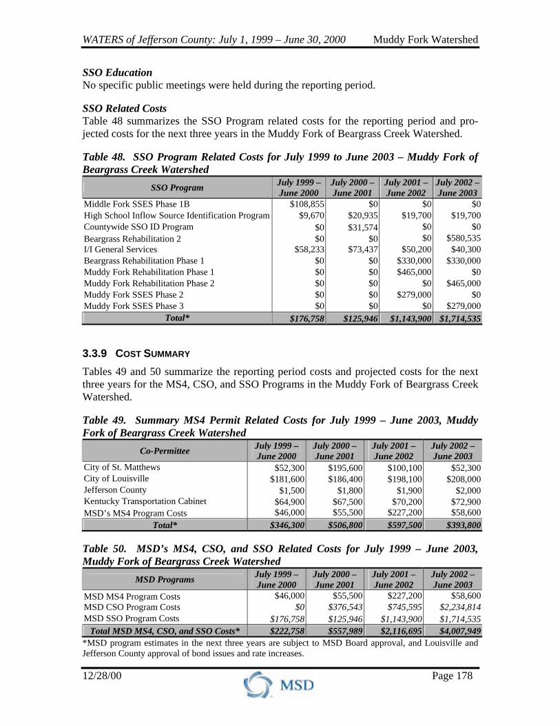
SSO Education No specific public meetings were held during the reporting period. SSO Related Costs Table 48 summarizes the SSO Program related costs for the reporting period and pro-jected costs for the next three years in the Muddy Fork of Beargrass Creek Watershed. Table 48. SSO Program Related Costs for July 1999 to June 2003 – Muddy Fork of Beargrass Creek Watershed
SSO Program July 1999 – June 2000
July 2000 – June 2001
July 2001 – June 2002
July 2002 – June 2003
Middle Fork SSES Phase 1B $108,855 $0 $0 $0 High School Inflow Source Identification Program $9,670 $20,935 $19,700 $19,700 Countywide SSO ID Program $0 $31,574 $0 $0 Beargrass Rehabilitation 2 $0 $0 $0 $580,535 I/I General Services $58,233 $73,437 $50,200 $40,300 Beargrass Rehabilitation Phase 1 $0 $0 $330,000 $330,000 Muddy Fork Rehabilitation Phase 1 $0 $0 $465,000 $0 Muddy Fork Rehabilitation Phase 2 $0 $0 $0 $465,000 Muddy Fork SSES Phase 2 $0 $0 $279,000 $0 Muddy Fork SSES Phase 3 $0 $0 $0 $279,000
Total* $176,758 $125,946 $1,143,900 $1,714,535
3.3.9 COST SUMMARY Tables 49 and 50 summarize the reporting period costs and projected costs for the next three years for the MS4, CSO, and SSO Programs in the Muddy Fork of Beargrass Creek Watershed. Table 49. Summary MS4 Permit Related Costs for July 1999 – June 2003, Muddy Fork of Beargrass Creek Watershed
Co-Permittee July 1999 – June 2000
July 2000 – June 2001
July 2001 –June 2002
July 2002 – June 2003
City of St. Matthews $52,300 $195,600 $100,100 $52,300City of Louisville $181,600 $186,400 $198,100 $208,000Jefferson County $1,500 $1,800 $1,900 $2,000Kentucky Transportation Cabinet $64,900 $67,500 $70,200 $72,900MSD’s MS4 Program Costs $46,000 $55,500 $227,200 $58,600
Total* $346,300 $506,800 $597,500 $393,800 Table 50. MSD’s MS4, CSO, and SSO Related Costs for July 1999 – June 2003, Muddy Fork of Beargrass Creek Watershed
MSD Programs July 1999 – June 2000
July 2000 – June 2001
July 2001 –June 2002
July 2002 – June 2003
MSD MS4 Program Costs $46,000 $55,500 $227,200 $58,600 MSD CSO Program Costs $0 $376,543 $745,595 $2,234,814MSD SSO Program Costs $176,758 $125,946 $1,143,900 $1,714,535
Total MSD MS4, CSO, and SSO Costs* $222,758 $557,989 $2,116,695 $4,007,949*MSD program estimates in the next three years are subject to MSD Board approval, and Louisville and Jefferson County approval of bond issues and rate increases.