village of surfside beach
TRANSCRIPT
September30,2015
Texas General Land Office Coastal Resources Division Attn: Jason Pinchback P.O. Box 12873 Austin, TX 78711-2873
•-
.
( '
Village of Surfside Beach 1304 Monument Drive
Surfside Beach, Texas 77541 Office: 979) 233-1531 Fax: 979) 373-0699
www.surfsidetx.org
Re: Dune Access and Beach Protection Plan
Mr. Pinchback,
Attached herewith is the formal submission of the latest amendment to the Village of Surfside Beach plan as referenced.
Please let me know if you have any questions.
Thank you,
Amanda Davenport City Secretary
Attachment
s 20:1-5
(
()
u
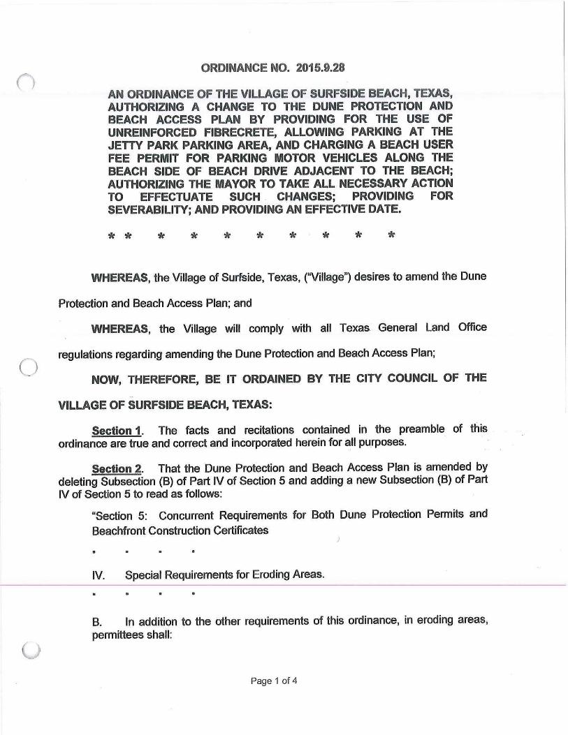
ORDINANCE NO. 2015.9.28
AN ORDINANCE OF THE VILLAGE OF SURFSIDE BEACH, TEXAS, AUTHORIZING A CHANGE TO THE DUNE PROTECTION AND BEACH ACCESS PLAN BY PROVIDING FOR THE USE OF UNREINFORCED FIBRECRETE, ALLOWING PARKING AT THE JETTY PARK PARKING AREA, AND CHARGING A BEACH USER FEE PERMIT FOR PARKING MOTOR VEHICLES ALONG THE BEACH SIDE OF BEACH DRIVE ADJACENT TO THE BEACH; AUTHORIZING THE MAYOR TO TAKE ALL NECESSARY ACTION TO EFFECTUATE SUCH . CHANGES; PROVIDING FOR SEVERABILITY; AND PROVIDING AN EFFECTIVE DATE.
* * * * * * * * * *
WHEREAS, the Village of Surfside, Texas, ("Village") desires to amend the Dune
Protection and Beach Access Plan; and
WHEREAS, the Village will comply with all Texas. General Land Office
regulations regarding amending the Dune Protection and Beach Access Plan;
NOW, THEREFORE, BE IT ORDAINED BY THE CITY COUNCIL OF THE ..
VILLAGE OF SURFSIDE BEACH, TEXAS:
Section 1. The facts and recitations contained in the preamble of this ordinance are true and correct and incorporated herein for all purposes.
Section 2. That the Dune Protection and Beach Access Plan is amended by deleting Subsection (B) of Part IV of Section 5 and adding a new Subsection (B) of Part IV of Section 5 to read as follows:
"Section 5: Concurrent Requirements for Both Dune Protection Permits and Beachfront Construction Certificates
IV. Special Requirements for Eroding Areas.
8. In addition to the other requirements of this ordinance, in eroding areas, permittees shall:
Page 1 of 4
1. elevate all structures on pilings in accordance with FEMA minimum standards or above the natural elevation (whichever is greater);
2. design structures located on property adjacent to the public beach so that they can be relocated;
3. not pave or alter the ground within the footprint of the habitable structure only if .the alteration or paving will be entirely undertaken, constructed, and located landward of 200 feet from the line of vegetation or landward of an eroding area boundary established in the local Beach/Dune Plan, whichever distance is greater. Gravel, crushed limestone, or stabilized base material may be used to stabilize driveways within 100 feet of the line of vegetation under the footprint of the habitable structure, not including deck areas;
4. demonstrate and assure financial ability to fund eventual relocation or demolition of the proposed structure;
5. notwithstanding paragraph 3 of this section, perrnittees may place unreinforced fibercrete in four foot by four foot sections, four inches thick, separated by expansion joints beneath the footprint of the habitable structure, not including the area under decks, only if the fibercrete is not structurally attached to the pilings and placement of the fibercrete will be entirely undertaken, constructed, and located at least 25 feet from the landward toe of the dune. If no dunes exist, placement of fibercrete may only be undertaken, constructed, and located at least 100 feet landward from Line of Vegetation; and
6. notwithstanding paragraph 3 of this section, perrnittees may place unreinforced fibercrete in four foot by four foot sections, four inches thick, separated by expansion joints for a driveway, provided that it is located at least 100 feet landward from the Line of Vegetation, is no greater than twenty (20) feet wide and does not exceed ten ( 10) percent of the lot square footage."
Section 3. That the Dune Protection and Beach Access Plan is amended by deleting Subsection (B) of Part II of Section 6 and adding a new Subsection (8) of Part II of Section 6 to read as follows:
"Section 6: Management of the Public Beach
• •
II. Designation of Access Ways, Parking Areas, and Beaches Closed to Motor Vehicles .
•
Page 2 of4
', '
B. The following areas shall be maintained as public pedestrian access ways to and from the public beach:
1. from parking along Seagull Avenue and includes wheelchair access;
2. from Stahlman Park and includes wheelchair access;
3. from parking along Ocean Drive and includes wheelchair access;
4. from the parking lot along Highway 332 and includes wheelchair access;
5. from parking along Whelk Street and includes wheelchair access;
6. from along the entire length of Beach Drive adjacent to the pedestrian beach;
7. from the parking lot at Jetty Park to the beach and includes wheelchair access;
8. (Ord. No. 98-08) Prohibiting parking on east side of Thunder Road from Surf Drive seaward to the dead end. Parking along west side of Thunder Road includes wheelchair access;
9. From the parking along all the remaining ten (10) streets that run from Bluewater Highway to the beach."
Section 4. That the Dune Protection and Beach Access Plan is amended by deleting Subsection (A) of Part I of Section 8 and adding a new Subsection (A) of Part I of Section 8 to read as follows:
"SECTION 8. BEACH USER FEE PLAN.
I. Beach User Fee.
A. To establish and maintain beach-related services and facilities for the preservation and enhancement of access to and from the public beach, and to provide for safe and healthy use of the public beaches, (Ord. No. 96-17A) a vehicle entry permit fee of $12.00 for an annual permit expiring on December 31 of each year, may be charged in the following public beach areas:
1. From the Hwy 332 entrance . to the beach, North Easterly to the Seagull Street entrance. No fee shall be charged for pedestrian access to this area.
Page 3 of4
2. Parking motor vehicles along the beach side of Beach Drive, immediately adjacent to the beach.
3. No vehicle fee shall be charged for access to any other area of public beach within the city limits.
4. No fee for pedestrian access to the beach shall be charged anywhere in the City limits."
Section 5. The City Council authorizes the Mayor to undertake any necessary action to effectuate this Ordinance and represent the Village's interest to the Texas General Land Office.
Section 6. Severability. In the event any clause, phrase, provision, sentence or part of this Ordinance or the application of the same to any person or circumstances shall for any reason be adjudged invalid or held unconstitutional by a court of competent jurisdiction, it shall not affect, impair, or invalidate this Ordinance as a whole or any part or provision hereof other than the part declared to be invalid or unconstitutional; and the City Council of the Village of Surfside Beach, Texas, declares that it would have passed each and every part of the same notwithstanding the omission of any part thus declared to be invalid or unconstitutional, or whether there be one or more parts.
Section 7. Effective date. immediately.
This Ordinance shall become effective
PASSED, APPROVED, AND ADOPTED this, the 28th day of September, 2015.
~~ Larryvison,Mayor
ATTEST:
Page 4 of 4
\ )
Notice of SPECIAL COUNCIL MEETING Monday September 28, 2015 - 6:00 PM
Village of Surfside Beach
1304 Monument Drive
Surfside Beach, TX 77541
The City Council reserves the right to meet in closed session on any agenda item, should the
need arise and if applicable, pursuant to authorization by Title 5, Chapter 551, of the Texas
Government Code.
1) CALL TO ORDER, QUORUM IN AITENDANCE
2) Discuss and take possible action to approve Ordinance 2015.9.28 regarding changes to
the Village Dune Protection and Beach Access Plan.
3) Discuss and take possible action on re-plat of Block 552 lots 7 & 8 of the FJ Calvit Survey
located at the corner of Thunder Road and Treaty Road.
4) Adjourn special meeting.
CERTIFICATION
I hereby certify that a true and correct copy of the above and foregoing "Notice of Meeting'' was posted on the front
door of the City Hall of the VIiiage of Surfside Beach, Texas, a place convenient and readily accessible to the general public at all
times, and said notice was posted Friday, September 25, 2015 at 12:00 PM, and remained so posted continuously for at least 72
hours before the scheduled time and date of the above mentioned meeting.
If you plan to attend this publlc meeting, and you have a disability that requires special arrangements at this meeting, please
contact Amanda Davenport, City Secretary, at (979) 233-1531, Extension 103, within 48 hours of the scheduled meeting date and
time. We will make reasonable accommodations to assist you in your needs.
This publlc notice was removed from the official posting place at the Village of Surfside Beach City Hall on the following date
and time: at PM.
ORDINANCE NO. 201414
AN ORDINANCE OF THE VILLAGE OF SURFSIDE BEACH, TEXAS, AUTHORIZING A CHANGE TO THE DUNE PROTECTION AND BEACH ACCESS PLAN BY INCREASING THE BEACH USER FEE FROM $8.00 TO $12.00 AND CHANGING THE PERMITS FOR RESALE FEES; AUTHORIZING A CHANGE TO THE DUNE PROTECTION AND BEACH ACCESS PLAN BY INDICATING THAT SEAGULL AVENUE IS A VEHICLE BEACH ACCESS POINT; AUTHORIZING THE MAYOR TO TAKE ALL NECESSARY ACTION TO EFFECTUATE SUCH CHANGES; PROVIDING FOR SEVERABILITY; AND PROVIDING AN EFFECTIVE DATE.
* * * * * * * * * *
WHEREAS, the Village of Surfside, Texas, ("Village") desires to amend the
Dune Protection and Beach Access Plan;
NOW, THEREFORE, BE IT ORDAINED BY THE CITY COUNCIL OF THE
VILLAGE OF SURFSIDE BEACH, TEXAS:
Section 1. The facts and recitations contained in the preamble of this ordinance are true and correct and incorporated herein for all purposes.
Section 2 That the Dune Protection and Beach Access Plan is amended as follows:
"SECTION 8. BEACH USER FEE PLAN.
1. Beach User Fee.
A. In order to establish and maintain beach-related services and facilities for the preservation and enhancement of access to and from the public beach, and to provide for safe and healthy use of the public beaches, (Ord. 96-17A) a vehicle entry permit fee of $12.00 for an annual permit expiring on December 31 of each year, may be charged in the following public beach area:
1. From the Hwy 332 entrance to the beach, North Easterly to the Seagull Street entrance. No fee shall be charged for pedestrian access to this area.
2. No fee for pedestrian access to the beach shall be charged anywhere in the City limits.
Page 1 of 2
B. (Ord, 96-17A) No person shall drive a motor vehicle onto the beach unless they have properly displayed a valid vehicle entry permit, issued by the Village of Surfside Beach or its agents. Permits shall be issued under the following rules and regulations:
1. Permits shall be issued by the Village of Surfside Beach or its authorized agents upon application made by the owner or agent of the owner of the subject vehicle containing and accompanied by the appropriate fee:
2. Permits for resale - Any reta iler located within Surfside Beach may Purchase from the Village for resale of permits to the public. Such person or entity shall pay the Village $11 .00 for each permit and shall sell such permit for no more than $12.00."
Seagull Avenue is designated a vehicle beach access point.
Section 3. The City Council authorizes the Mayor to undertake any necessary action to effectuate this Ordinance and represent the Village's interest to the Texas General Land Office.
Section 4. Severability. In the event any clause, phrase, provision, sentence or part of this Ordinance or the application of the same to any person or circumstances shall for any reason be adjudged invalid or held unconstitutional by a court of competent jurisdiction , it shall not affect, impair, or invalidate this Ordinance as a whole or any part or provision hereof other than the part declared to be invalid or unconstitutional; and the City Council of the Village of Surfside Beach, Texas, declares that it would have passed each and every part of the same notwithstanding the omission of any part thus declared to be invalid or unconstitutional, or whether there be one or more parts.
Section 5. Effective date. This Ordinance shall become effective immediately.
PASSED, APPROVED, _tx:::....=_L-=u-b-e __ r ___ , 2014
AND ADOPTED this, the day of
~A .. O&' Mayor arry Davison
ATTEST:
--- Sandra Miller, City Secretary
Page 2 of 2
' I
-
( )
Dune Protection and Beach Access Plan Village of Surfside Beach
VILLAGE OF SURFSIDE BEACH
Dune Protection and Beach Access Plan
1304 Monument Drive ~
Surfside Beach, TX 77541-9522 ~
979-233-1531

r,
( )
Dune Protection and Beach Access Plan Village of Surfside Beach
()
()
Dune Protection and Beach Access Plan Village of Surfside Beach

Dune Protection and Beach Access Plan Village of Surfside Beach
(~
(J
Dune Protection and Beach Access Plan Village of Surfside Beach
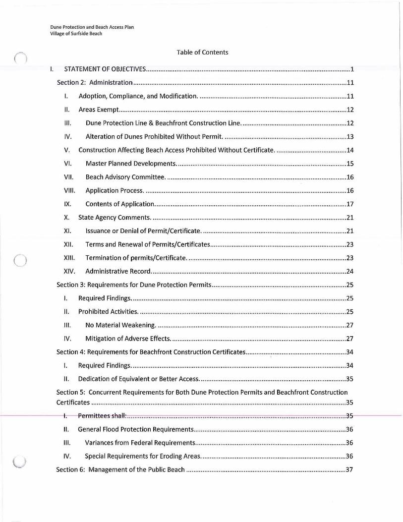
Table of Contents
I. STATEMENT OF OBJECTIVES .................... ...... ........................ ....... .. ......... ...... ...... .. ............................. .. . !
Section 2: Administration .... .......... .... .... ... ...... .... .............. .... ..... .... ... .......... ........ ..... ......... ...................... 11
I. Adoption, Compliance, and Modification ... ......... ............................ ................... ........................ 11
II. Areas Exempt ...... ...... ................ ..... .............................................................. ..... ... .................... .... 12
111. Dune Protection Line & Beachfront Construction Line ................ .......... ..... ............... ............. 12
IV. Alteration of Dunes Prohibited Without Permit. ..... ......... ... ..................... .. .... ...... .................. 13
v. Construction Affecting Beach Access Prohibited Without Certificate ........................................ 14
VI. Master Planned Developments .......... ... .. ................................................ ......... ......... .............. 15
VII. Beach Advisory Committee ... .. ....... .... .... ........ .... ........... ........ .... .... ...... ............ ........... .. ..... ...... 16
VIII. Application Process ...... ... .... .......... .... ...... ....... ..... ..... ....... .. ... .............. .. .. ..... ........ ...... .... .... .... .. 16
IX. Contents of Application .. ..... ..... .......... ........................................................................... ..... ..... 17
x. State Agency Comments ............. ..... .... ..... ................... ..................... ........................................ .. 21
XI. Issuance or Denial of Permit/Certificate .............................. ............ .. ....................... .... ... ....... 21
XII. Terms and Renewal of Permits/Certificates ..................... ....................................................... 23
XIII. Termination of permits/Certificate . .. ... .......... .... .... ............. .............. ........ .......... .................... 23
XIV. Administrative Record ..................... ..... ....................... ........... ......... ......... ............ ....... ............ 24
Section 3: Requirements for Dune Protection Permits ............................... ..... ........................ ............ .. . 25
I. Required Findings .... .. .... .... .... ..... .... ..... .... ...................... ...... ....... ...... ............. .......................... .... 25
II. Prohibited Activities ..... ..... .... .... ........... ..................... ...... ... .......... .............................. .... ............. 25
Ill. No Material Weakening .... .............. .............. ......... .......................................... ...... .. ....... ..... ... 27
IV. M itigation of Adverse Effects .................. ...... ......................... ................................................. 27
Section 4: Requirements for Beachfront Construction Certificates ........................................ ............ ..... 34
I. Required Findings ............ ..... .... .................. ......... .......... .... ....................... .... .... ...... .... ................. 34
II. Dedication of Equivalent or Better Access . ... ...... .................................... ..... ....... ...... ............. ..... 35
Section 5: Concurrent Requirements for Both Dune Protection Permits and Beachfront Construction
Certificates ..... ...... ... .. ...... ....... ...... .................... ....................... .. ........ ............ ........ ..... ............................. 35
---------+1.- ____..,,Per-m-ittees--shall : .... ... ........ .... ... ...... ........ ...... ............ ............. ..... ........ .... ........................ ........... ... 35
II. General Flood Protection Requirements ..................................................................................... 36
Ill. Variances from Federal Requirements .............................. ...................................................... 36
IV. Special Requirements for Eroding Areas ...................................................... ... .... ......... ........... 36
Section 6: Management ofthe Public Beach ......................................................................... ..... ........... 37 L
0
(_
Dune Protection and Beach Access Plan Village of Surfside Beach
I. General Access Standards ............... ...... .............................................. ............. ........................... 38
Designation of Access Ways, Parking Areas, and Beaches Closed .................... .. ....... .. ..... ...... .... 38
II. to Motor Vehicles ............................ ............................................................................................ 38
Ill. Abandonments of Public Access or Parking Areas Prohibited ................................................ 40
IV. Interfering with Access Prohibited .......................................................................................... 40
V. Post-Storm Assessment ... ............................ ............ ......... ............... .................. ........... ............... 40
VI. Beach Closures ..................... ............................... .. ....... ...... .... ..... ................................... ......... 40
VII. Littering Prohibited ............... ............................................................... ......... ........................ .. 41
VIII . Camping ... ........................................................................... ........... ............... ........................... 41
IX. Animal Control ..... ......... ................... ......... ............................................. ............................ .. .. .. 41
X. (Ord. No. 94-11) Beach Recreation Area Rules ................................... ............. .......................... 42
XI. Monitoring .. ......... ........ ...... ........... .................... .... ........................ ..... .... ........ ..... ....... ...... .. ...... 42
XII. Beach Nourishment Standards ... .......... .... ....... ..... ...................................................... .... ......... 43
XIII. Dune Restoration Standards ....... ................ .................... ................. ....................................... 43
XIV. Dune Walkover Standards ................................................................................................. ...... 45
XV. Standards for Beach Maintenance and Other Activities ..................................... ................... .45
Section 7: Motor Vehicles ........................................ ............ .................................... ............ ................ .. 49
I. Operation of Motor Vehicles ...... ................................................................................................. 49
II. (Ord. No. 91-11) Beach Traffic Control. ......... ........... ...... .......... ..... ......................... ..................... 50
111. Emergency Vehicles ....................................................................................... ... ..... ..... ............. 51
Section 8: Beach User Fee Plan ... ................. ................... .................................. ........... ...... ... ............. .. .. 51
I. I. Beach User Fee . ............................ .. ..... ................................................ ........... .......................... 51
II. Use of Fee Revenue ........ ... .... ............................................... ... .............. ...................................... 52
Ill. Indirect Costs and Accounting ................................................................. ....... ............. ........ .. .. 52
Section 9: Penalties .... ...... ............. ........................... ................ ...... ............... .................................... ..... 53
Section 10: General Provisions ..................................... .................. ........... ............ ..... ..... .... ................... 53
I. Construction ..... .......... ... .... ........... .......... .... ... ............. ......... .......... ..... ... ......... ...... .... ....... ............ 53
II. Boundary Determinations .. ..... ....... ................................. .... ............... .............. ... ................... ..... 54
Ill. Beaches Presumed to be Public ... ................................................. .......................................... 54
IV. General Prohibition ................... ............................................ ... ................. ..... ......................... 54
v. Appeals .... ............. .. ... ........ ................................................... .. .. .............. ............. ........... ............. 54
(
l)
Dune Protection and Beach Access Plan Village of Surfside Beach
I. STATEMENT OF OBJECTIVES
The Village of Surfside beach has identified the following goals as the basis for
managing and regulating human impacts on the beach /dune system.
A. 'to protect public health and safety while preserving, restoring, and
enhancing coastal natural resources
B. to assist coastal landowners in using beachfront property in a manner
compatible with preserving public and private property, public access to the
beach coastal natural resources, and the protective and recreational function
of the beach I dune system
C. to prevent the destruction and erosion of public beaches
D. to insure that construction is in compliance with the Federal Emergency Management Agency guidelines
E. to provide coordinated, consistent, responsive, timely, and predictable
permitting process
F. to educate the public about coastal issues such as dune protection, beach
access, erosion, and flood protection
G. to promote dune protection and ensure that adverse effects on critical dunes
and critical dune vegetation are avoided whenever practicable;
if such adverse effects are unavoidable, to insure that such adverse effects
are minimized and mitigated
1
Dune Protection and Beach Access Plan Village of Surfside Beach
Section 1: Definitions
The following words and terms, when used in this ordinance, shall have the following
meanings, unless the context clearly indicates otherwise.
Affect - As used in this subchapter regarding dunes, dune vegetation, and the public
beach, "affect" means to produce an effect upon dunes, dune vegetation, or public
beach use and access.
Amenities - Any nonhabitable major structures including swimming pools, bathhouses,
detached garages, cabanas, pipelines, piers, canals, lakes, ditches, artificial runoff
channels and other water retention structures, roads, streets, highways, parking areas
and other paved areas (exceeding 177 square feet in area),underground storage tanks,
and similar structures.
Applicant - Any person applying to a local government for a permit and/or certificate
for any construction or development plan .
Backdunes - Dunes located landward of the foredune ridge, which are usually well
vegetated but may also be non-vegetated and migratory. These dunes supply
sediment to the beach after the foredunes and foredune ridge have been destroyed by
natural or human activities.
Beach access - The right to use and enjoy the public beach including the right of free and
unrestricted ingress and egress to and from the public beach.
Beach/Dune Rules -31 Texas Administrative Code§§ 15.1 - 15.17
Beach/Dune System - The land from the line of mean low tide of the Gulf of Mexico to
the landward limit of dune formation.
Beach maintenance practice - Any activity undertaken by the Village of Surfside Beach
for the purpose of maintaining tl,e beach for public use i11cludi11g, a king, scraping, trash removal, debris removal, or any moving of sand.
Beachfront construction certificate - The document a local government issues that
certifies that the proposed construction is either consistent with the local government's
2
(
Dune Protection and Beach Access Plan Village of Surfside Beach
dune protection and beach access plan or is inconsistent with the local government's
dune protection and beach access plan. In the latter case, the local government must
specify how the construction is inconsistent with the plan, as required by the Open
Beaches Act, Section 61.015.
Beach maintenance - The cleaning or removal of debris from the beach by handpicking,
raking, or mechanical means.
Beach profile - The shape and elevation of the beach as determined by surveying a
cross-section of the beach.
Beach-related services - Reasonable and necessary services and facilities directly related
to the public beach which are provided to the public to ensure safe use of and access to
and from the public beach, such as vehicular controls, management, and parking
(including acquisition and maintenance of off-beach parking and access ways);
sanitation and Jitter control; lifeguarding and lifesaving; beach maintenance; law
enforcement; beach nourishment projects; beach/dune system education; beach/dune
protection and restoration projects; providing public facilities such as restrooms,
showers, Jockers, equipment rentals, and picnic areas; recreational and refreshment
facilities; liability insurance; and staff and personnel necessary to provide beach-related
services. Beach-related services and facilities shall serve only those areas on or
immediately adjacent to the public beach.
Beach user fee - A fee collected by the local government in order to establish and
maintain beach-related services and facilities for the preservation and enhancement of
access to and from and safe and healthy use of public beaches by the public.
Blowout - A breach in the dunes caused by wind erosion.
Breach -A break or gap in the continuity of a dune caused by wind or water.
Buffer area - A ten-foot-wide zone that the Texas General Land Office {GLO) and the
Village established in front (seaward) of the dunes in which organic material shall be
placed aAd stored uAtil removal is Aecessary. Tlie eurreAt dLme liAe will coAstitute tlie
landward boundary of the buffer area. The buffer area will be the (10) feet wide,
extending seaward from the dune line. The seaward extent of the buffer area will be
clearly marked on the beach. Where feasible, trashcans will mark the seaward boundary
of the buffer area.
3
()
( )
u
Dune Protection and Beach Access Plan Village of Surfside Beach
Bulkhead - A structure or partition built to retain or prevent the sliding of land. A
secondary purpose of a bulkhead is to protect the upland against damage from wave
action.
Coastal and shore protection project - A project designed to slow shoreline erosion or
enhance shoreline stabilization, including, but not limited to, erosion response
structures, beach nourishment, sediment bypassing, construction of manmade
vegetated mounds, and dune re-vegetation.
Commercial facility - Any structure used for providing, distributing, and selling goods or
services in commerce including but not limited to hotels, restaurants, bars, rental
operations, and rental properties.
Construction - The causing or carrying out ariy building, bulkheading, filling, clearing,
excavation, or substantial improvement to land or the size of any structure. "Building"
includes, but is not limited to, all related site work and placement of construction
materials on the site. "Filling" includes, but is not limited to, disposal of dredged
materials. "Excavation" includes, but is not limited to, removal or alteration of dunes
and dune vegetation and scraping, grading, or dredging a site. "Substantial
improvements to land or the size of any structure" include but are not limited to
creation of vehicular or pedestrian trails, landscape work that adversely affects dunes or
dune vegetation, and increasing the size of any structure.
Coppice mounds - The initial stages of dune growth formed as sand accumulates on the
downwind side of plants and other obstructions on or immediately adjacent to the
beach seaward of the foredunes, and may be unvegetated.
Critical dune areas - Those portions of the beach/dune system as the Texas General
Land Office designates that are located within one thousand (1,000) feet of mean high
tide of the Gulf of Mexico that contain dunes and dune complexes that are essential to
the protection of public beaches, submerged land, and state- owned land, such as public
roads and coastal public lands, from nuisance, erosion, storm surge, and high wind and
waves. Critical dune areas include, but are not limited to, the dunes that store sand in
the beach/dune system to replenish eroding public beaches.
Cumulative impact - The effect upon beach use and access, upon a
4
(
u
Dune Protection and Beach Access Plan Village of Surfside Beach
critical dune area, or upon an area seaward of the dune protection line that results from
the incremental effect of an action when added to other past, present, and reasonably
foreseeable future actions, regardless of what agency or person undertakes such other
actions. "Cumulative impacts" can result from individually minor but collectively
significant actions taking place over a period of time.
Dune - An emergent mound, hill, or ridge of sand, either bare or vegetated, located on
land bordering the waters of the Gulf of Mexico. Windward transport of sediment
naturally forms dunes, and manmade, vegetated mounds can also create dunes. Natural
dunes are usually adjacent to the uppermost limit of wave action, and are marked by an
abrupt change in slope landward of the dry beach. The term includes coppice mounds,
foredunes, dunes comprising the foredune ridge, backdunes, swales, and manmade,
vegetated mounds.
Dune complex - Any emergent area adjacent to the waters of the Gulf of Mexico in
which several types of dunes are found or in which dunes have been established by
proper management of the area (In some portions of the Texas coast, dune complexes
contain depressions known as "swales.").
Dune Protection Act - Texas Natural Resources Code, Sec. 63.001 et seq.
Dune Protection and Beach Access Plan or Plan - A local government's legally
enforceable program, policies, and procedures for protecting dunes and dune
vegetation and for preserving and enhancing use of and access to and from public
beaches, as required by the Dune Protection Act and the Open Beaches Act.
Dune Protection Line - A line established by a county commissioners court or the
governing body of a municipality for the purpose of preserving, at a minimum, all critical
dune areas identified by the General Land Office pursuant to the Dune Protection act,
§63.011. A municipality is not authorized to establish a Dune Protection Line unless the
authority to do so has been delegated to the municipality by the county in which the
municipality is located. Such lines will be located no farther landward than 1,000 feet
landward of the mean high tide ofthe Gulf of Mexico.
Dune Protection Permit - The document issued by a local government to authorize
construction or other regulated activities in a specified location seaward of a dune
protection line or within a critical dune area. as provided in the Texas Natural Resources
Code, §63.051.
5
n
Dune Protection and Beach Access Plan Village of Surfside Beach
Dune vegetation - Flora indigenous to natural dune complexes, and growing on
naturally-formed dunes or man-made vegetated mounds on the Texas coast and can
include coastal grasses and herbaceous and woody plants.
Effect or effects - "Effects" include: direct effects - those impacts upon public beach use
and access, upon critical dune areas, or upon dunes and dune vegetation seaward of a
dune protection line which are caused by the action and occur at the same time and
place; and "indirect effects" - those impacts upon beach use and access, upon critical
dune areas, or upon dunes and dune vegetation seaward of a dune protection line that
are caused by an action and are later in time or farther removed in distance than a
direct effect but are still reasonably foreseeable. Indirect effects may include growth
inducing effects and other effects related to induced changes in the pattern of land use,
population density, or growth rate, and related effects upon air and water and other
natural systems including ecosystems. "Effects" and "impacts" as used in this ordinance
are synonymous. "Effects" may be ecological (such as the effects upon natural resources
and upon the components, structures, and functioning of affected ecosystems),
aesthetic, historic, cultural, economic, social, or health, whether direct, indirect, or
cumulative.
Erosion - The wearing of land or the removal of beach and/or dune sediments by wave
action, tidal currents, wave currents, drainage, or wind. "Erosion" includes but is not
limited to, horizontal recession and scour and can be induced or aggravated by human
activities.
Erosion Response Structure - A hard or rigid structure built for shoreline stabilization
which includes, but is not limited to, a jetty, retaining wall, groin, breakwater, bulkhead,
seawall, riprap, rubble mound, revetment, or the foundation of a structure that is the
functional equivalent of these specified structures.
FEMA - The United States Federal Emergency Management Agency.
Foredunes - The first clearly distinguishable, usually vegetated, stabilized large dunes
encountered landward of the Gulf of Mexico. On some portions of the Texas Gulf Coast,
foredunes may also be large, unvegetated, and unstabilized. Although they may be
large and continuous, foredunes are typically hummocky and discontinuous and may be
interrupted by breaks and wash-over areas. Foredunes offer the first significant means
of dissipating storm-generated wave and current energy issuing from the Gulf of
6
(
Dune Protection and Beach Access Plan Village of Surfside Beach
Mexico. Because various heights and configurations of dunes may perform this function,
no standardized physical description applies. Foredunes are distinguishable from
surrounding dune types by their relative location and physical appearance.
Foredune ridge - The high, continuous line of dunes which are usually well vegetated
and rise sharply landward of the foredune area but may also rise directly from a flat,
wave-cut beach immediately after a storm.
Habitable structure perimeter or footprint - The area of a lot covered by a structure
used or usable for habitation. The habitable structure perimeter or footprint does not
include incidental projecting eaves. balconies, ground-level paving, landscaping, open
recreational facilities (for example, pools and tennis courts). or other similar features.
Habitable structures - structures suitable for human habitation including but, not
limited to, single or multi-family residences, hotels, condominium buildings, and
buildings for commercial purposes. Each building of a condominium regime is
considered a separate habitable structure, but if a building is divided into apartments,
then the entire building, not the individual apartments, is considered a single, habitable
structure. Additionally, a habitable structure includes porches, gazebos, and other
attached improvements.
Industrial facilities - Include, but are not limited to, those establishments listed in Part 1,
Division D, Major Groups 20-39 and Part 1, Division E, major Group 49 of the Standard
Industrial Classification manual as adopted by the Executive Office of the President,
Office of Management and Budget {1987 ed.). However, for the purposes of this
ordinance, the establishments listed in Part 1, Division D, Major Group 20, Industry
Group Number 209, Industry Numbers 2091 and 2092 are not considered "industrial
facilities."
Large-scale construction - Construction activity greater than 5,000 square feet or
habitable structures greater than two stories in height. Both the area beneath the
lowest habitable level of an elevated structure and a cupola (i.e. "widow's walk") with
an area of 400 square feet or less on the top of the second habitable story are not
eoAsielereel stories for die purpose of this section. Multirile family habitable st1 uetu1 es are typically of this type of construction.
7
()
u
Dune Protection and Beach Access Plan Village of Surfside Beach
Line of vegetation - The extreme seaward boundary of natural vegetation that spreads
continuously inland typically used to determine the landward extent of the public
beach.
Local government - A municipality, county, any special purpose district, any unit of
government, or any other politieal subdivision of the state.
Man-made vegetated mound - a rise, hill, or ridge of sand created by the deliberate
placement of sand or sand trapping devices including sand fences, trees, or brush and
planted with dune vegetation.
Material changes - Changes in project design. construction material. or construction
methods or in the condition of the construction site which occur after an application is
submitted to a local government or after the local government issues a permit or
certificate. Material changes are those additional or unanticipated changes which have
caused or will cause adverse effects on dunes, dune vegetation, or beach access and
use, or exacerbation of erosion on or adjacent to the construction site.
Meteorological event - Atmospheric conditions or phenomena resulting in avulsion,
erosion, accretion, or other impacts to the shoreline that alter or change the location of
the line of vegetation.
Mitigation sequence - The series of steps that one must take if dunes and dune
vegetation will be adversely affected. First, such adverse effects shall be avoided.
Second, adverse effects shall be minimized. Third, the dunes and dune vegetation
adversely affected shall be repaired, restored, or replaced. Fourth, the dunes and dune
vegetation adversely affected shall be replaced or substituted to compensate for the
adverse effects.
Motor vehicle or vehicle - A vehicle as defined by the Texas Uniform Traffic Act, Art.
6701d, Texas Revised Civil Statutes Annotated.
National Flood Insurance Act - 42 United States Code Sec. 4001, et seq.
Natural resources - Land, fish, wildlife, insects, biota, air, surface water, groundwater,
plants, trees, habitat of flora and fauna, and other such resources.
Open Beaches Act - Texas Natural Resources Code Sec. 61.001, et seq.
8
( )
Dune Protection and Beach Access Plan Village of Surfside Beach
Owner or operator - Any person owning, operating, or responsible for operating
commercial or industrial facilities.
Parties - The parties to this plan consist of the Texas General Land Office and the Village of Surfside Beach.
Permit or certificate condition - a requirement or restriction in a permit or certificate
necessary to assure protection of life, natural resources, property. and adequate beach
use and access rights (consistent with the Dune Protection Act) which a permittee must
satisfy in order to be in compliance with the permit or certificate.
Permittee - Any person authorized to act under a permit or a certificate issued by a
local government.
Person - An individual, firm, corporation, association, partnership, consortium, joint
venture, commercial entity, the United States government, a state, a municipality,
commission, political subdivision, or any international or interstate body or any other
governmental entity.
Pipeline - A tube or system of tubes used to transport oil, gas, chemicals, fuels, water,
sewerage, or other liquid, semi-liquid, or gaseous substances.
Practicable - In determining what is practicable, the Village council shall consider the
effectiveness, scientific feasibility, and commercial availability of the technology or
technique. The Village council shall also consider the cost of the technology or technique.
Production and gathering facilities - The equipment used to recover and move oil or gas
from a well to a main pipeline, or other point of delivery such as a tank battery and to
place such oil or gas into marketable condition. Included are pipelines used as gathering
lines, pumps, tanks, separators, compressors, and associated equipment and roads.
Project area - the portion of a site or sites which ·.viii be affected by proposed construction.
Public beach - As used in this ordinance, "public beach" is defined in the Texas Natural
Resources Code, Sec. 61.013(c).
9
(
(}
l )
Dune Protection and Beach Access Plan Village of Surfside Beach
Recreational activity - Includes, but is not limited to, hiking and sunbathing for fewer
than twenty-one (21) days. For purposes of permits, recreational activities are limited to
the private activities of the person owning the land and the social guests of the owner.
Operation of recreational vehicles is not considered a recreational activity, whether
private or public.
Recreational off-highway vehicle - has the same meaning assigned by §502.001
Transportation Code.
Recreational vehicle - A dune buggy, marsh buggy, minibike, trail bike, jeep, or any
other mechanized vehicle used for recreational purposes.
Restoration - the process of constructing man-made, vegetated mounds, repairing
damaged dunes, or vegetating existing dunes.
Retaining wall - A structure designed primarily to contain material and to prevent the
sliding of land. Retaining walls may collapse under the forces of normal wave activity.
-Sand budget - The amount of all sources of sediment, sediment traps, and transport of
sediment within a defined area. From the sand budget, it is possible to determine if
sediment gains and losses are in balance.
Seawall - An erosion response structure that is specifically designed to withstand wave
forces.
Seaward of a dune protection line - The area between a dune protection line and the
line of mean high tide.
Small-scale construction - Construction activity less than or equal to 5,000 square feet
or habitable structures less than or equal to two stories in height. Both the area beneath
the lowest habitable level of an elevated structure and a cupola (i.e. "widow's walk")
with an area of 400 square feet or less on the top of the second habitable story are not
considered stories for the purpose of this section. Single-family habitable structures are
typical of this type of construction.
10
)
L >
Dune Protection and Beach Access Plan Village of Surfside Beach
Structure - Includes, without limitation, any building or combination of related
components constructed in an ordered scheme that constitutes a work or improvement
constructed on or affixed to land.
Swales - Low areas within a dune complex located in some portions of the Texas coast
that function as natural rainwater collection areas and are an integral part of the dune
complex.
Unique flora and fauna - Endangered or threatened plant or animal species listed
pursuant to 16 United States Code Annotated, §1531 et seq., the Endangered Species
Act of 1973, and/or the Parks and Wildlife Code, Chapter 68, or any plant or animal
species that a local government has determined in their local Beach/Dune Plan are rare
or uncommon.
Wash-over area - Low areas that are adjacent to beaches and are inundated by waves
and storm tides from the Gulf of Mexico. Wash-overs may be found in abandoned tidal
channels or where foredunes are poorly developed or breached by storm tides and wind
erosion.
Section 2: Administration
I. Adoption, Compliance, and Modification.
A. This ordinance is adopted pursuant to the authority granted local
governments under the Open Beaches Act, Chapter 61. Texas Natural
Resources Code, the Dune Protections Act, Chapter 63, Texas Natural Resources
Code, Subchapter I of Chapter 16, Texas Water Code, and other statutes of
general applicability.
B. All Village officers, employees, and contractors shall comply with this
ordinance in authorizing or undertaking any activity affecting dunes seaward of
the dune protection line or public use of and access to and from the public
C. Amendments to this Village ordinance shall be effective only upon approval by
the Texas General Land Office.
1 1
( l
Dune Protection and Beach Access Plan Village of Surfside Beach
11. Areas Exempt.
A. This ordinance applies to all private and public land within the Village's
corporate limits and extraterritorial jurisdiction that lies seaward of the Dune
Protection Line and the Beachfront Construction Line except state or national
parks, wildlife refuges, preserves, or similar state or federal areas.
B. Other than state or national parks, wildlife refuges, preserves, and similar
areas, this ordinance applies to land owned by state agencies, subject to the
provisions of the Texas Natural Resources Code, Sec. 31.161 et seq.
Ill. Dune Protection Line & Beachfront Construction Line.
A. The Village council establishes the foilowing line as the Dune
Protection Line for the purpose of protecting critical dune areas:
From the easterly town limit, the dune protection line shall follow Bluewater
Highway west to Starfish Street, then south on Starfish Street to Surf Drive, then
west on Surf Drive to Whelk Street, then south on Whelk Street to Seashell Drive,
then west on Seashell Drive to Texas Street, then north on Texas Street to Surf
Drive, and west on Surf Drive projected to the westerly town limit. This shall be
designated as the "Dune Protection Line" for the purpose of protecting critical
dune areas.
B. The Village council establishes the following as the Beachfront Construction
Line for the purpose of delineating areas in which construction is likely to affect
beach access and use, and wherein a beachfront construction certificate shall be
required:
A Beachfront Construction Certificate is required for construction on land
adjacent to and landward of the public beach to Bluewater Highway / Fort
Velasco Drive or 1,000 feet landward of mean high tide, whichever is greater.
C. The Dune Protection Line and beachfront construction line are depicted on
the map attached to this ordinance as Appendix I.
D. The Village council shall review the location of the dune protection line and
beachfront construction line at least once every five (5) years to determine if the
12
(
Dune Prot ection and Beach Access Plan
Village of Surfside Beach
lines are adequately located to achieve their stat ed purposes. In addition, the
Village council shall review the adequacy of the location of t he lines within 90
days after a tropical storm or hurricane affects the portion of the coast lying
within the Village's jurisdiction. The village council shall amend this ordinance, if
necessary, to adjust the lines whenever required to achieve their stated
purposes.
E. Before acting upon any amendment to this ordinance that would modify
either line, the Village council shall hold a public hearing to consider the
modifications. Not less than one (1) week nor more than three (3) weeks before
the date of the hearing, the village council shall post both public notices of the
hearing at least three (3) times in the newspaper with the largest circulation in
the county and notify the Texas General Land Office in writing. The notice to the
Texas General Land Office shall include a map or drawing of the proposed line, a
written description of the line, or both (including Texas State Plane Coordinates).
IV. Alteration of Dunes Prohibited Without Permit.
A. Unless the Building Official properly issues a dune protection permit
authorizing the conduct, no person shall damage, destroy, or remove a sand
dune or a portion of a sand dune seaward of the dune protection line, or kill,
destroy, or remove in any manner any vegetation growing on a sand dune
seaward of the dune protection line.
B. The following activities are exempt from the requirement for a permit but may
nevertheless require a beachfront construction certificate or a permit pursuant
to the other Village ordinances:
1. exploration for and production of oil and gas and reasonable and
necessary activities directly related to such exploration and production,
including construction and maintenance of production and gathering
facil ities seaward of the dune protect ion line which serve wells located
outside the dune protection line, provided that such facilities are located
no farther than two (2) miles from the well being served;
2. grazing livestock and reasonable and necessary activities directly
related to grazing; and
1 3
('
()
;
Dune Protection and Beach Access Plan Village of Surfside Beach
v.
3. recreational activities other than operation of a recreational vehicle.
C. (Ord. No. 97-05) Building Code Ordinance: Section Two - Building Code
Adopted; A. Except as provided by subsection B. (the following Sections of the
Standard Building Code are deleted and are not adopted: 101.4.3, 101.4.4,
101.4.5, 101.4.3, 102.2 in its entirety, 103.5, 108.1, and 108.2 in its entirety), the
2009 Edition of the Standard Building Code and Appendices A through H,
inclusive, thereof, published by the Southern Building Code Congress
International, Inc. (hereinafter called the Standard Building Code), are hereby
adopted and are incorporated herein by reference.
1. Standard Building Code Section 103.3 Stop Work Orders: Upon notice
from the building official, work on any building, structure, electrical, gas,
mechanical, or plumbing system that is being done contrary to the provisions
of this code or in a dangerous or unsafe manner, shall immediately cease.
Such notice shall be in writing and shall be given to the owner of the
property, or to his/her agent, or to the person doing the work, and shall state
the conditions under which work may be resumed. Where an emergency
exists, the building official shall not be required to give a written notice
before stopping work.
Construction Affecting Beach Access Prohibited Without Certificate.
A. Unless the building official properly issues a beachfront construction
certificate authorizing the conduct, no person shall cause, engage in, or allow
construction seaward of the beachfront construction line. Construction not
affecting public beach access and use may nevertheless require a dune
protection permit or a permit pursuant to other Village ordinances.
B. (Ord. No. 97-05) Building Code Ordinance: Section Two - Build ing
Code Adopted; A. Except as provided by Subsection B. (the Following Sections
of the Standard Building Code are deleted and are not ado ted: 101.4.3
101.4.4, 101.4.5, 101.4.6, 102.2 in its entirety, 103.5, 108.1, and 108.2 in its
entirety), the 2009 Edition of the Standard Building Code and Appendices A
through H, inclusive, thereof, published by the Southern Building Code Congress
International, Inc. (hereinafter called the Standard Building Code), are hereby
adopted and are incorporated herein by reference.
1 4
(
Dune Protection and Beach Access Plan Village of Surfside Beach
1. Standard Building Code Section 103.3 Stop Work Orders: Upon notice from
the building official, work on any building, structure, electrical, gas,
mechanical, or plumbing system that is being done contrary to the provisions
of this code or in a dangerous or unsafe manner, shall immediately cease.
Such notice shall be in writing and shall be given to the owner of the
property, or to his/her agent, or to the person doing the work, and shall
state the conditions under which work may be resumed. Where an
emergency exists, the building official shall not be required to give a written
notice before stopping work.
VJ. Master Planned Developments.
A. "Master planned developmental" means proposed development for
which approval is requested by submittal of a comprehensive plan containing
maps, drawings, narrative, tables, and other information about the proposed
use of specific land and/or water including descriptions of uses and use
intensities, building and/or site improvement locations and sizes, relationships
between buildings and improvements, vehicular and pedestrian access and
circulation systems, parking, utility systems, storm water management and
treatment systems, geography, geology, impact assessments, regulatory -
approved checklist, and phasing. Information in the master plan may be
conceptual or detailed, depending upon the status of its regulatory approval.
B. At least sixty (60} days prior to acting on a request for approval of a
master planned development within the area subject to this ordinance the
Building Official shall send the plan to the Texas General Land Office for
review.
C. When acting on a request for approval of a master planned development,
the Village council shall consider:
1 the development1s potential effects on the dunes, dune vegetation, public
beach use and access, and the applicant's proposal to mitigate for such
effects throughout the construction;
2. the contents of the plan; and
15
Dune Protection and Beach Access Plan Village of Surfside Beach
3. whether any component of the development, such as installation of roads
or ut ilit ies, or construction of structures seaward of a dune protection
line, will subsequently require a permit or a certificate.
D. If the Village council determines that all development contemplated by
the plan complies with all requirements of this ordinance, a permit and/or
certificate for the development may be issued.
E. If the Village council determines that any development contemplated
by the plan does not comply with the requirements of this ordinance and
therefore cannot be approved without an amendment to this ordinance, the
Village council shall not issue a permit and/or certificate, but shall submit the
plan to the Texas General Land Office for approval as an amendment to this
ordinance.
VII. Beach Advisory Committee.
The Beach Advisory Committee function shall be to take the local lead in the
implementation of the standards for beach maintenance, resolution of issues, and to
address and respond to local concerns.
VIII. Application Process.
A. No person shall cause, engage in, or allow construction on land adjacent to
and landward of public beaches and lying in the area either up to the first public
road generally parallel to the public beach or to any closer public road not
parallel to the beach, or to within 1,000 feet of mean high tide, whichever is
greater without acquisition of a beachfront construction certificate from the
Village of Surfside Beach. The initial step requires the landowner or his
representative to provide the Village of Surfside Beach building official the
location and nature of the proposed work. All construction shall make
application for a beachfront construction certificate as defined below. (See
Attachment A.)
B. Potential applicants may submit descriptions of proposed construction to the
Village Building Official for a determination of whether a permit or certificate
would be required for the construction. If the potential applicant seeks to
1 6
(
(>
(_)
Dune Protection and Beach Access Plan Village of Surfside Beach
establish that no permit or certificate is required, the description shall
demonstrate that the proposed construction will not adversely affect dunes or
public beach use and access. The building official shall send notice of any
proposed determination that the construction does not require a permit or
certificate to the Texas General Land Office for review at least ten {10) working
days before the determination is made. Upon making the determination, the
Building Official shall notify the potential applicant whether the proposed
construction requires a permit or certificate.
IX. Contents of Application.
A. "Large-scale construction" means construction activity greater than 5,000
square feet in area and habitable structures greater than two (2) stories in
height. Multiple-family habitable structures are typical of this type of
construction.
B. "Small-scale construction11 means construction activity less than or equal to
5,000 square feet and habitable structures less than or equal to two (2) stories
in height. Single-family habitable structures are typical of this type of
construction.
C. For all proposed construction (large- and small-scale), applicants shall submit
the following items and information:
1. the name, address, phone number, and, if applicable, fax number of the
applicant, and the name of the property owner, if different from the
applicant;
2. a complete legal description of the tract and a statement of its size in
acres or square feet;
3. the number of proposed structures and whether the structures are
amenities or habitable structures;
4. the number of parking spaces;
5. the approximate percentage of existing and finished open space(those
areas completely free of structures);
17
(
C>
l
Dune Protection and Beach Access Plan Village of Surfside Beach
6. the floor plan and elevation view of t he structure proposed to be
constructed or expanded;
7. the approximate duration of the construction;
8. a description (including location)of any existing or proposed walkways or
dune walkovers on the tract;
9. a grading and layout plan identifying all elevations (in reference to the
National Oceanic and Atmospheric Administration datum), existing
contours of the project area (including the location of dunes and swales),
and proposed contours for the final grade;
10. current color photographs of the site that clearly show the current
location of the vegetation line and the existing dunes on the tract;
11. a description of the effects of the proposed activity on the beach/dune
system that cannot be avoided should the proposed activity be
permitted, including but not limited to damage to dune vegetation,
alteration of dune size and shape, and changes in dune hydrology;
12. a comprehensive mitigation plan which includes a detailed description
of the methods that will be used to avoid, minimize, mitigate, and/or
compensate for any adverse effects on dunes or dune vegetation;
13. where a mitigation plan is required, the contact information for all
landowners immediately adjacent to the t ract and affirmation by the
applicant that the adjacent landowners will be provided with notice of
the hearing at least 10 days prior to the hearing on the application .
14. proof of applicants financial capability which is acceptable to the local
government to mitigate or compensate for adverse effects on dunes and
dune vegetati
15. an accurate map or plat of the site identifying:
1 8
{
Dune Protection and Beach Access Plan Village of Surfside Beach
a. the site by its legal description, including, where applicable, the
subdivision, block, and lot;
b. the location of the property lines and a notation of the legal
description of adjoining tracts;
c. the location of the dune protection line, the line of vegetation,
proposed and existing structures, and the footprint or perimeter of the
proposed construction on the tract;
d. proposed roadways and driveways and proposed landscaping activities
on the tract;
e. the location of any retaining walls, seawalls or any other erosion
response structures on the tract and on the properties immediately
adjacent to the tract; and
f. if known, the location and extent of any manmade vegetated mounds,
restored dunes, fill activities, or any other pre-existing human
modifications on the tract.
D. For all proposed large-scale construction, applicants shall submit the following
additional items and information:
1. if the tract is located in a subdivision and the applicant is the owner or
developer of the subdivision, a certified copy of the recorded plat of the
subdivision, or, if not a recorded subdivision, a plat of the subdivision certified
by a licensed surveyor, and a statement of the total area of the subdivision in
acres or square feet;
2. in the case of multiple-unit dwellings, the number of units proposed;
3 alternatives to the proposed location of constr11ction on the tract or to the
proposed methods of construction that would cause fewer or no adverse
effects on dunes and dune vegetation or less impairment of beach access; and
4. the proposed activity's impact on the natural drainage pattern of the site and
the adjacent lots.
19
( )
u
Dune Protection and Beach Access Plan Village of Surfside Beach
E. For all proposed construction (large-and small sca le), if applicants already have the following items and information, local governments shall require them to be submitted in addition to the other information required :
F.
1. a copy of a blueprint of the proposed construction;
2. a copy of a topographical survey of the site;
3. the most recent local historical erosion rate data as determined by the University of Texas at Austin, Bureau of Economic Geology) and the activity's potential impact on coastal erosion; and
4. a copy of the FEMA "Elevation Certificate"
For all proposed construction (large- and small-scale), the building official shall provide to the state the following information:
1. a copy of the community's most recent flood insurance rate map identifying the site of the proposed construction;
2. a preliminary determination as to whether the proposed construction complies with all aspects of the local government's dune protection and beach access plan;
3. the activity's potential impact on the community's natural flood protection and protection from storm surge; and
4. how the proposed beachfront construction complies with and promotes the local government's beach access policies and requ irements, particularly the dune protection and beach access plan's provision relating to public beach ingress/egress, off-beach parking, and avoidance of reduction in the size of the public beach because of erosion.
5. incomplete applications will not be accepted for processing by the Village and will not be forwarded to the Texas General Land Office for review.
6. large- and small-scale construction will be prohibited without a permit; a stop work order will be issued for all unauthorized construction; and fines will be assessed by th~ municipal court.
20
Dune Protection and Beach Access Plan Village of Surfside Beach
X. State Agency Comments.
The building official shall fo rward t he complete application, including any associated mat erials, to the Texas General Land Office . After receipt by the Texas General Land Office, the building official may not act on the application until ten (10) working days for small-scale construction or thirty (30) working days for largescale construction. Thereafter, the permit or certificate may be issued or denied regardless of whether the state agency submits comments on the application.
XI. Issuance or Denial of Permit/Certificate.
A. To determine whether to issue or deny a permit or certificate, the building official shall review and consider:
1. the information in the permit or certificate application;
2. the proposed activity's consistency with this ordinance and the Texas General Land Office Rules for the management of the beach/dune system;
3. any other law relevant to dune protection and public beach use and access that affects the activity under review;
4. the comments of the building official and the Texas General Land Office;
5. with respect to dunes and dune permits:
a. cumulative and indirect effects of the proposed construction on all dunes and dune vegetation within critical dune areas or seaward of a dune protection line;
b. cumulative and indirect effects of other activities on dunes and dune vegetation located on the proposed construction site;
c. the preconstruction type, height, width, slope, volume, and continuity of the dunes, the preconstruction condition of the dunes, the type of dune vegetation, and percent of vegetative cover on the site;
d. the most recent historical erosion rate as determined by the University of Texas at Austin, Bureau of Economic Geology, and whether the proposed construction may alter dunes and dune vegetation in a manner that may aggravate erosion;
21
(1
()
Dune Protection and Beach Access Plan Village of Surfside Beach
e. all practicable alternatives to the proposed activity, proposed site, or proposed methods of construction;
f. the applicant's mitigation plan for any unavoidable adverse effects on dunes and dune vegetation and the effectiveness, feasibility, and desirability of any proposed dune reconstruction and re-vegetation;
g. the impacts on the natural drainage patterns of the site and adjacent · property,
h. any significant environmental features of the potentially affected dunes and dune vegetation such as their value and function as floral or faunal habitat or any other benefits the dunes and dune vegetation provide to other natural resources;
i. wind and storm patterns including a history of wash-over patterns;
j . location of the site on the flood insurance rate map;
k. success rates of dune stabilization projects in the area;
I. all comments submitted to the Village by the Texas General Land Office;
and
6. any other information the building official considers useful, including resource information made available to them by federal and state natural resource entities And landowners immediately adjacent to the tract. The Village shall not issue a dune protection permit or beachfront construction certificate that is inconsistent with its plan, the 31 Texas Administrative Code §§15.1 - 15.17, and other state, local, and federal laws related to the requirements of the Dune Protection Act and Open Beaches Act.
B. The building official shall not issue a permit or certificate that is inconsistent with this ordinance, Texas General Land Office rules for Management of the Beach/Dune System (31 TEXAS ADMINISTRATIVE CODE Sec. 15.1-15.10), the Open Beaches Act (Chapter 61, Texas Natural Resources Code), the Dune Protection Act (Chapter 63, Texas Natural Resources Code), and other state, local, and federal laws related to the requ irements of the Dune Protection Act, the Open Beaches Act, and the Texas General Land Office rules for the Management of the Beach/Dune System, and [the Open Beaches Act,] the requirements of which are incorporated into this ordinance by reference.
2 2
( '
Dune Protection and Beach Access Plan
Village of Surfside Beach
XII. Terms and Renewal of Permits/ Certificates
A. Permits or cert ificates shall be valid for three (3) years from the dat e of issuance.
B. The building official may renew a permit or certificate for a period not exceeding ninety
(90) days if the activity as proposed in the application for renewal complies with this
ordinance and the permittee supplements the original application materials with
additional information indicating any changes to the activity or information. The building
official shall issue only two (2) renewals for each permit or certificate. Thereafter, the
permittee must apply for a new permit or certificate.
C. If the proposed construction is changed in any manner that causes or increases adverse effects on dunes, dune vegetation, and public beach use and access, the permittee shall not be eligible for a renewal but must apply for a new permit or certificate.
XIII. Termination of permits/Certificate.
A. The building official may void a permit or certificate if:
1. a material change occurs after the permit or certificate is issued; or
2. a permittee fails to disclose any material fact in the application
3. the permit or certificate is inconsistent with the Village of Surfside Beach Dune Protection and Beach Access plan or the Texas General Land Office rules for the Management of the Beach/Dune System at the time of issuance.
4. (Ord. No. 97-05) Building Code Ordinance: Section Two - Building Code Adopted; A. Except as provided by subsection B. (the following Sections of the Standard Building Code are deleted and are not adopted : 101.4.3, 101.4.4, 101.4.5, 101.4.6, 102.2 in its entirety, 103.5, 108.1, and 108.2 in "t
Appendices A through H, inclusive, thereof, published by the Southern Building Code Congress International, Inc. (hereinafter called the Standard Building Code), are hereby adopted and are incorporated herein by reference.
2 3
\_ I
Dune Protection and Beach Access Plan
Village of Surfside Beach
5. Standard Building Code Section 103.3 Stop Work Orders: Upon notice from the building official, work on any building, structure, electrical, gas, mechanical or plumbing system that is being done contrary to the provisions of this code or in a dangerous or unsafe manner, shall immediately cease. Such notice shall be in writing and shall be given to the owner of the property, or to this agent, or to the person doing the work, and shall state the conditions under which work may be resumed. Where an emergency exists, the building official shall not be required to give a written notice before stopping work.
B. "Material change" includes human or natural conditions that have adversely affected dunes, dune vegetation, or beach access and use that either did not exist at the time of the original application, or were not considered by the building official in making the permitting decision because the permittee did not provide information regarding the site condition in the original application.
C. A permit or certificate automatically terminates if construction comes to lie within the boundaries of the public beach by artificial means or by action of storm, wind, water, or other naturally influenced causes. Nothing in the certificate shall be construed to authorize the construction, repair, or maintenance of any construction within the boundaries of the public beach at any time.
XIV. Administrative Record.
A. The building official shall compile and maintain an administrative record which demonstrates the basis for each final decision regarding issuance or denial of a permit or certificate. The administrative record shall include copies of the following:
1. all materials received from the applicant as part of or regarding the permit or certificate application;
2. the transcripts, if any, or the minutes and/or tape of the Village council meeting during which a final decision regarding the permit or certificate was made; and
3. all comments received regarding the permit or certificate.
B. The building official shall keep the administrat ive record for four (4} years from the date of a final decision on a permit or certificate. The building official shall send to the Texas General Land Office, upon request, a copy of those portions of the administrative record that were not originally sent to the Texas General Land Office for review and
24
()
u
Dune Protection and Beach Access Plan Village of Surfside Beach
comment. The building official shall provide to the permittee upon request copies of any mat erials in the administrative record regarding the permit or certificate not submitted by the permittee in the application.
Section 3: Requirements for Dune Protection Permits
I. Required Findings.
Before issuing a permit, the building official must find that:
A. the proposed activity is not a prohibited activity as defined in Subsection II of this section (Prohibited Activities);
B. the proposed activity will not materially weaken dunes or materially damage dune vegetation seaward of the dune protection line based on substantive findings under Subsection Ill of this section (Material Weakening);
C. there are no practicable alternatives to the proposed activity and adverse effects cannot be avoided as provided in Subsection IV of this section (Mitigation of Other Adverse Effect);
D. the applicant's mitigation plan will adequately minimize, mitigate, and/or compensate for any unavoidable adverse effects, as provided in Subsection IV of this section (Mitigation of Other Adverse Effects);
E. where mitigation is required, that the applicant has provided landowners immediately adjacent to the tract with notice of the hearing at least 10 days prior to the hearing on the application; and
F. the proposed activity complies with any applicable requirements of Section 4 (Requirements for Beachfront Construction Certificates), Section 5 (Concurrent Requirements for Both Dune Protection Permits and Beachfront Construction Certificates), and Section 6 (Management of the Public Beach) of this ordinance.
II . Prohibited Activities.
The building official shall not issue a permit authorizing the following actions seaward of the dune protection line:
25
r
()
( _
Dune Protection and Beach Access Plan Village of Surfside Beach
A. Activit ies that are likely to result in the temporary or permanent removal of sand from the portion of the beach/dune system located on or adjacent to the const ruction site, including:
1. moving sand to a location landward of the dune protection line; and
2. temporarily or permanent ly moving sand off the site, except for purposes of permitted mitigation, compensation, or an approved dune restoration or beach nourishment project and then only from areas where the historical accretion rate is greater than one (1) foot per year, and the project does not cause any adverse effects on the sediment budget;
B. depositing sand, soil, sediment, or dredged spoil which contains any of the toxic materials listed in Volume 40 of the Code of Federal Regulations, Part 302.4, in concentrations that are harmful to people, flora, and fauna as determined by applicable, relevant, and appropriate requirements for toxicity standards established by the local, state, and federal governments;
C. depositing sand, soil, sediment, or dredged spoil that is of an unacceptable mineralogy or grain size when compared to the sediments found on the site (This prohibition does not apply to materials related to the installation or maintenance of public beach access roads running generally perpendicular to the public beach.);
D. creating dredged spoil disposal sites, such as levees and weirs, without the appropriate local, state, and federal permits;
E. constructing or operating industrial facilities not in full compliance with all relevant laws and permitting requirements prior to the effective date of this ordinance;
F. operating recreational vehicles;
G. mining dunes;
H. constructing concrete slabs or other impervious surfaces within two hundred (200} feet landward of the vegetation line, except for such a s not extend beyond the perimeter of a habitable structure elevated on pilings, provided no walls are erected that prohibit the natural transfer of sand, Permeable materials such as brick pavers, limestone, or gravel is recommended for drives or parking areas;
2 6
( )
Dune Protection and Beach Access Plan Village of Surfside Beach
I. depositing trash, waste, or debris including inert materials such as concrete, stone, and bricks t hat are not part of t he permitted on-site const ruct ion;
J. constructing cisterns, septic tanks, and septic fields seaward of any structure serviced by the cisterns, septic tanks, and septic fields; and
K. detonating bombs or explosives.
Ill. No M at erial W eakening.
The building official may issue a permit only if he/she finds as a fact, after a full investigation, that the particular conduct proposed will not materially weaken any dune or materially damage dune vegetation or reduce the effectiveness of any dune as a means of protection against erosion and high wind and water. To find that there will be no such material weakening or damage, the Village council must find that:
A. the activity will not result in the potential for increased flood damage to the proposed
construction site or adjacent property;
B. the activity will not resu lt in runoff or drainage patterns that aggravate erosion on or
off the site;
C. the activity will not result in sigoificant changes to the natural permeability of a dune or its ability to transmit rainwater to the water table;
D. the activity will not disturb unique flora or fauna or result in adverse effects on dune complexes or dune vegetation; and
E. the activity will not significantly increase the potential for wash-overs or blowouts to
occur.
IV. Mitigation of Adverse Effects.
A. If the building official finds that no material weakening of dunes or material damage to dunes will occur, the building official shall then determine whether any adverse effects will result from the activity. If the village council finds there will be adverse effects on dunes or dune vegetation seaward of the dune protection line, the building official may issue a permit only if the applicant demonstrates that adverse effects can be mitigated as requ ired by the mitigation sequence. If the building official
27
0
()
Dune Protection and Beach Access Plan Village of Surfside Beach
issues a permit, the permit shall include appropriate permit conditions incorporating the requirements of t his sect ion.
B. The mitigation sequence consists of the following requirements.
A. Avoidance. (a) "Avoidance" means avoiding adverse effects altogether by not taking a certain action or parts of an action. The building official shall not issue a permit allowing any adverse effects on dunes or dune vegetation seaward of the dune protection line unless the applicant proves there is no practicable alternative to the proposed activity, proposed site, or proposed methods for conducting the activity [that has fewer adverse effects on dunes and dune vegetation than the proposed activity], And the activity will not materially weaken dunes and dune vegetation. The Village shall require applicants to include information as to practicable alternatives in the permit application. The Village shall require applicants to employ construction methods which will have no adverse effects, unless the applicant can demonstrate that the use of such methods is not practicable.
(b) To avoid adverse effects on dunes and dune vegetation seaward of the dune protection line as required by Subdivision (B)(l)(a) of this section, permittees shall not:
i) construct a non-exempt pipeline (non-exempt pipelines are any pipelines other than those subject to the exemption in Sec. 15.3(s)(2)(A) of the Texas General Land Office Rules for the Management of the Beach/Dune System) unless there is no practicable alternative;
ii) engage in any construction unless it is located as far landward of dunes as practicable; except construction providing access to and from a public beach;
iii) construct any road parallel to the beach within 200 feet landward of the vegetation line, nor construct any other road parallel to the beach unless it is located as far landward of dunes as
rac · be·
iv) construct new artificial channels, including storm water runoff channels, unless there is no practicable alternative; or
28
(
( )
l )
Dune Protection and Beach Access Plan Village of Surfside Beach
v) cause any such adverse effects for which the Village council determines t here is a practicab le alternative t hat would avoid adverse effects.
2. Minimization. (a) "Minimization" means mm1m1zmg adverse effects by limiting the degree or magnitude of the action and its implementation. (Ord. No. 98-13) The Village council shall not issue a permit authorizing a private driveway/or access way on any property seaward of Beach Drive beginning at 611 Beach Drive on the east side and ending at Jettyview Road, although the Village council may determine in other locations of a dune system that there is no practicable alternative that would have fewer adverse effects on dunes or dune vegetation seaward of the dune protection line, it shall set appropriate permit conditions requiring the permittee to minimize such adverse effects to the greatest extent practicable.
(b) To minimize unavoidable adverse effects as required by Subdivision (B) (2) (a) of this section, permittees shall :
i) locate nonexempt pipelines across previously disturbed areas, such as blowout areas, and minimize disturbance of dune surfaces where use of previously disturbed areas is not practicable;
ii) minimize construction and pedestrian traffic on/or across dune areas to the greatest extent practicable, accounting for trends of dune movement and beach erosion in area;
iii) route all pedestrian access to and from beaches through wash-over areas or over elevated walkways, and conspicuously mark all such access that is public with permanent signs so indicating;
iv) minimize the number of private access ways from any proposed subdivision, multiple dwelling, or commercial facility. In some cases, the minimum beach access may be only one access way. In determining the appropriate grouping of access ways, the Village council shall consider the size and scope of the development;
v) post signs in areas where pedestrian traffic is high explaining the functions of dunes an t e importance o vege a ion m preserving dunes;
vi) where practicable, provide vehicular access to and from beaches by using existing roads or from roads constructed in accordance with
29
()
()
lJ
Dune Protection and Beach Access Plan Village of Surfside Beach
Subdivision (B)(l)(b)(iii) of this subsection, unless public beach access is restricted, and where possible, improve existing access roads with elevated berms near the beach that prevent channelization of floodwaters;
vii) where practicable, locate new beach access roads in wash-over areas, blowout areas or other areas where dune vegetation has already been disturbed, construct such roads along the natural land contours, and minimize their width;
viii) where practicable, locate new beach access roads at an oblique angle to the prevailing wind direction;
ix)
x)
xi)
prohibit persons from using (walking) or parking any motor vehicle on, through, or across dunes outside designated access ways;
max1m1ze use of natural or existing drainage patterns when providing for storm water runoff and retention;
locate and construct new artificial storm water runoff channels and retention basins so as to avoid erosion and unnecessary construction of additional channels and to direct all runoff inland and not to the Gulf of Mexico through dune areas; and xii) not cause any adverse effects that the Village council finds can be minimized.
xii) not cause any adverse effects that the Village council finds can be minimized.
3. Mitigation. (a) "Mitigation" means repairing, rehabilitating, or restoring affected dunes and dune vegetation. Where adverse effects on dunes and dune vegetation cannot be avoided or minimized, the Village council shall set appropriate permit conditions requiring that permittees repair, rehabilitate, or restore affected dunes to the same volume as the pre-existing dunes and dune vegetation so that will be superior or equal to the preexisting dunes in their ability to protect adjacent public and private property from potential flood damage, nuisance, and erosion and to protect natural resources.
(b) Permittees may mitigate adverse effects on dunes using vegetative or mechanical means. Permittees shall:
30
()
lJ
Dune Protection and Beach Access Plan Village of Surfside Beach
i) restore dunes to approximate t he naturally fo rmed dune position or location, contour, volume, elevation, vegetative cover, and sediment content in the area;
ii) allow for the natural dynamics and migrat ion of dunes;
iii) use discont inuous or continuous temporary sand fences or a Village council approved method of dune restoration, where appropriate, considering the characteristics of the site; and
iv) restore or repair dunes using indigenous vegetation that will achieve the same protective capability as or greater capability than the surrounding natural dunes.
(c) In authorizing or requiring restoration of dunes, the building official shall give priority to stabilization of blowouts and breaches [rather than wash-over area]. Before permitting stabilization of wash-over areas, the Village council
shall:
i) assess the overall impact of the project on the beach/dune system
ii) consider any adverse effects on hydrology and drainage which will
result from the project; and
iii) require that equal or better public beach access be provided to compensate for impairment of any public beach access previously
provided by the wash-over area.
4. Compensation. (a) "Compensation" means compensating for adverse effects on dunes and dune vegetation by replacing or providing substitute dunes and dune vegetation. The building official shall set appropriate permit conditions requiring permittees to compensate for all adverse effects on dunes and dune vegetation that cannot be avoided, minimized, or otherwise mitigated. In setting appropriate conditions, the building official shall consider the recommendations of the Texas General Land Office, federal and state natural resource agencies, and dune vegetation experts.
(b) Permittees shall follow the requirements of Subdivisions (3)(b-c) and (4)(e)(iii-v) of this section when replacing dunes or dune vegetati
(c) On-site compensation consists of replacing or restoring the affected dunes or dune vegetation on the site where the dunes and dune vegetation were originally located. Permittees shall locate compensation work on the construction site, where practicable.
31
(J
u
Dune Protection and Beach Access Plan Village of Surfside Beach
(d) Off-site compensation consists of replacement of t he affected dunes or dune vegetation in a location outside the boundary of the property where the damage to dunes and dune vegetation occurred. The landward limit of allowable off-site mitigation is the dune protection line. The Village shall require that a permittee's compensation efforts take place on the construction site unless the permittee demonstrates the following facts to
the Village: i) on-site compensation is not practicable;
ii) the off-site compensation will be located as close to the
construction site as practicable;
iii) the off-site compensat ion has achieved a 1:1 ratio or proposed adverse effects on successful, completed, and stabilized restoration prior to beginning construction; and
iv) the permittee has notified FEMA, Region 6, of the proposed off-site
compensation.
(e) Permittees shall provide the following information when proposing off-site
compensation.
i) the name, address, phone number, and fax number, if applicable, of the owner of the property where the off-site compensation will
be located;
ii) a legal description of property intended to be used for the proposed off-site compensation;
iii) the source of the sand and dune vegetation to be used;
iv) all information regarding permits and certificates issued for the restoration of dunes on the compensation site;
v) all relevant information regarding the success, current status, and stabilization of the dune restoration efforts on the compensation
site;
vi) any increase in potential flood damage to the site where the adverse effects on dunes and dune vegetation will occur and to the public and private property adjacent to that site; and
32
u
Dune Protection and Beach Access Plan Village of Surfside Beach
vii) the proposed date of initiation of the compensation. The Village shall include a condition in each permit authorizing off-site compensation which requires permittees to notify the Village in writing of the actual date of initiation within ten working days after compensation is initiated. If the permittee fails to begin compensation on the date proposed in the application, the permittee shall provide the Village with the reason for the delay. The Village shall take this reason into account when determining whether a permittee has violated the compensation deadline
(f) Permittees shall compensate for adverse effects on dune vegetation by planting indigenous vegetation on the affected dunes. Permittees may not remove existing vegetation from property not owned by the permittee unless the permittee includes in the permit application written permission from the property owner. In addition to the requirement that permission be obtained from the property owner, all persons are prohibited from removing vegetation from a critical dune area or seaward of a dune protection line unless specifically authorized to do so in a dune protection permit. The Village shall include conditions in such permit requiring the permittee to provide a copy of the written permission for vegetation removal and to identify the source of any sand and vegetation which will be used to compensate for adverse effects on dunes and dune vegetation in the mitigation plan contained in the permit application.
(g) Permittees shall begin compensation prior to or concurrently with the commencement of construction . If compensation is not to be completed prior to commencement of construction, the permittee shall provide proof of financial responsibility in an amount necessary to complete the compensation, in the form of an irrevocable letter of credit, performance bond, or any other instrument acceptable to the city council.
(h) Permittees shall notify the building official in writing of the actual date of initiation within ten (10) working days after compensation is initiated. If the permittee fails to begin · compensation on the date proposed in the application, the permittee shall state the reason for the delay. The building official shall take this reason into account when determining whether a permittee has violated the compensation deadline.
(h) Permittees shall conduct compensation efforts continuously until the repaired, rehabilitated, and restored dunes and dune vegetation are equal or superior to the pre-existing dunes and dune vegetation. These efforts shall include preservation and maintenance pending completion of compensation.
33
l
Dune Protection and Beach Access Plan Village of Surfside Beach
(i) A compensation project is deemed complete when the position, contour, volume, elevation, and vegetative cover of t he restored dunes have reached a level that matches or exceeds the pre-existing dunes.
(j) The building official shall provide written notification to the Texas General Land Office upon determining that the compensat ion is complete. If the building official does not receive an objection from the Texas General Land Office regarding the completion of compensation within thirty (30) working days after the Texas General Land Office is notified in writing, the Building Official may certify to the permittee that the compensation is complete.
(k) The permittee shall be deemed to have failed to achieve compensation is a 1:1 ratio has not been achieved within three years after the beginning of compensation efforts.
Section 4: Requirements for Beachfront Construction Certificates
I. Required Findings.
Before issuing a certificate authorizing proposed construction, the building official must find that the construction is consistent with this ordinance. Construction is inconsistent with this ordinance if it:
A. reduces the size of the public beach or encroaches on the public beach in any manner, except for man-made vegetated mounds and dune walkovers constructed in compliance with the requirements of the ordinance;
I
B. functionally supports or depends on or is otherwise related to proposed or existing structures that encroach on the public beach, regardless of whether the encroaching structure is on land that was previously landward of the public beach;
C. closes any existing public beach access or parking area, unless equivalent or better public access or parking is established as required in Subsection II of this section (Dedication of Equivalent or Better Access);
D. cumulatively or indirectly impairs or adversely affects public use of or access to and from a public beach, mcludmg failure to comply with any requirements of Section 6 of th is ordinance (Management of the Public Beach) unless equivalent or better access or parking is established as required in Subsection II of this section (Dedicat ion of Equivalent or Better Access); or
3 4
(
Dune Protection and Beach Access Plan Village of Surfside Beach
E. fails to comply with any requirements of Section 3 of this ordinance (Requirements for Dune Protection Permits) or Section 5 of this ordinance (Concurrent Requirements for Dune Protection Permits and Beachfront Construction Certificates).
II. Dedication of Equivalent or Better Access.
A permittee shall dedicate to the public new public beach Access or parking areas if the permittee's activities will close any existing public beach access or parking area, w_ill impair or adversely affect public use of or access to and from the beach, or if dedication is necessary to comply with any requirements of Section 6 of this ordinance. The area dedicated shall provide access or parking equivalent to or better than the access or parking impaired and shall be consistent with the provisions of this ordinance regarding beach access and use, vehicular Controls and beach user fees. Dedication shall be by restrictive covenant, permanent easement, or fee simple conveyance.
Section 5: Concurrent Requirements for Both Dune Protection Permits
and Beachfront Construction Certificates
I. Permittees shall:
A. locate all construction as far landward as is practicable;
B. not engage in any construction which may aggravate erosion;
C. not construct any new erosion response structure, except a retaining wall located greater than two hundred (200) feet landward of the line of vegetation;
D. not maintain or repair an existing erosion response structure located on the public
beach;
E. not enlarge or improve an existing erosion response structure located fewer than two hundred (200) feet landward of the vegetation line;
F. not maintain or repair an existing erosion response structure located fewer than two hundred (200) feet landward of the vegetation line that is more than 50% damaged,
except:
1. when failure to repair the damaged structure will cause unreasonable hazard to a public building, public road, public water supply, public sewer system, or other public facility immediately landward of the structure; or
35
( _ )
Dune Protection and Beach Access Plan Village of Surfside Beach
2. when failure to repair the damaged structure will cause unreasonable flood hazard to habitable structures because adjacent erosion response structures will channel floodwaters to the habitable structure;
II. General Flood Protection Requirements.
A. Must not engage in construction that does not comply with FEMA's regulations governing construction in flood hazard areas; and
B. design construction so as to minimize impacts on natural hydrology. Construction shall not cause erosion to adjacent properties, critical dune areas, or the public beach.
Ill. Variances from Federal Requirements.
The village council shall inform the Texas General Land Office and FEMA Region 6 before it issues any variance from FEMA's regulations found in Volume 44 of the Code
of Federal Regulations, Parts 59-77.
IV. Special Requirements for Eroding Areas.
A. "Eroding areas" are portions of the shoreline experiencing a historical erosion rate of greater than one foot per year based on published data of the University of Texas at Austin, Bureau of Economic Geology.
B. In addition to the other requirements of this ordinance, in eroding areas, permittees shall:
1. elevate all structures on pilings in accordance with FEMA minimum standards or above the natural elevation (whichever is greater);
2. design structures located on property adjacent to the public beach so that they
can be relocated;
3. not pave or alter the ground within the footprint of the habitable structure only if the alteration or paving will be entirely undertaken, constructed, and located landward of 200 feet from the line of vegetation or landward of an eroding area boundary established in the local Beach/Dune Plan, whichever distance is greater. Gravel, crushed limestone, or stabilized base material may be
36
(
( )
Dune Protection and Beach Access Plan Village of Surfside Beach
used to stabilize driveways within 100 feet of the line of vegetation under the footprint of the habitable structure, not including deck areas;
4. demonstrate and assure financial ability to fund eventual relocation or demolition of the proposed structure;
5. not withstanding paragraph 3 of this section, permittees may place unreinforced fibercrete in four foot by four foot sections, four inches thick, separated by expansion joints beneath the footprint of the habitable structure, not including the area under decks, only if the fibercrete is not structurally attached to the pilings and placement of the fibercrete will be entirely undertaken, constructed, and located at least 25 feet from the landward toe of the dune. If no dunes exist, placement of fibercrete may only be undertaken, constructed, and located at least 100 feet landward from Line of Vegetation; and
6. notwithstanding paragraph 3 of this section, permittees may place unreinforced fibercrete in four foot by four foot sections, four inches thick, separated by expansion joints for a driveway, provided that it is located at least 100 feet landward from the Line of Vegetation is no greater than twenty (20) feet wide and does not exceed ten (10) percent of the lot square footage.
C. If there is any conflict between the requirements of this subsection and the requirements of any other provision of this ordinance, this subsection control.
Section 6: Management of the Public Beach
(Ordinance 94-11) The public beach within the Village of Surfside Beach, Texas, constitutes a public recreational resource is endangered when motor vehicle traffic is not sufficiently regulated and controlled.
It is in the best interest of and for the general health, safety and welfare of the inhabitants as well as users of the public beach to provide facilities, a high level of maintenance and policing of the beach and access which is necessitated by public demand.
Such services shall be provided by direct charge to the users, as the Village only has a population of fewer than 2,500 inhabitants, while the users of the beach number in the hundred of thousands in any calendar year.
All continuous beach within the corporate limits of the Village of Surfside Beach, Texas, is designated as the Surfside Beach Recreation Area.
37
c
()
Dune Protection and Beach Access Plan Village of Surfside Beach
I. General Access Standards.
The Village council shall comply with the following standards when authorizing
activities affecting or relating to public beach access and use.
A. parking areas on or adjacent to the beach shall accommodate one {1) car for each
fifteen (15) linear feet of beach.
B. Where vehicles are prohibited from driving on and along the beach, access ways providing both ingress and egress shall be no farther apart than Yz mile.
C. Signs shall be posted which conspicuously explain the nature and extent of vehicular controls, parking areas, and access points.
II. Designation of Access Ways, Parking Areas, and Beaches Closed to
Motor Vehicles.
A. The following areas shall be maintained as public vehicular access ways to and
from the public beach:
1. Highway 332 - entrance and exit
2. Ocean Avenue - entrance and exit
3. Seagull Avenue - entrance and exit
4. Yucca Avenue - entrance and exit
5. Starfish Street - entrance and exit
6. Bay Avenue - entrance and exit.
B. The following areas shall be maintained as public pedestrian access ways to and from the public beach :
1. from parking along Seagull Avenue and includes wheel chair Access;
2. from Stahlman Park and includes wheelchair access;
3. from parking along Ocean Drive and includes wheelchair Access;
38
()
()
u
Dune Protection and Beach Access Plan Village of Surfside Beach
4. from the parking lot along Highway 332 and includes wheelchair access;
5. from parking along Whelk Street and includes wheel chair access;
6. from along the entire length of Beach Drive adjacent to the pedestrian beach;
7. from the parking lot at Jetty Park to the beach and includes wheel chair
access;
8. (Ord. No. 98-08) Prohibiting parking on east side of Thunder Road from Surf Drive seaward to the dead end. Parking along west side of Thunder Road includes wheel chair access;
9. From the parking along all the remaining ten (10) streets that run from Bluewater Highway to the beach;.
C. The following areas shall be maintained as public beach access parking areas:
1. All areas listed in 11-B above may be used as off-beach parking areas;
D. Provisions facilitating wheelchair access to the beach for disabled persons shall be maintained at the following entry points as needed to comply with the Americans with Disabilities Act:
1. See 11-B, above.
E. The following areas of the public beach are closed to vehicles:
1. The area between Starfish Street and the Jetties
a. (Ord. No. 92-09) Due to the health, safety and general welfare of the inhabitants of said City and pedestrians, it has been declared that the driving, operation, stopping, standing, or parking vehicles upon the public beach w ithin the corporate limits of said City does constitute a hazard to pedestrians using such beach by reason of the narrow width of the beach within the area as above defined.
2. (Ord. No. 136) The area in front of the Bluewater Beach Estates Subdivision and Gulf Park Beach Subdivision.
a. Due to the health, safety, and general welfare of the inhabitants of said Village, it has been determined that the stopping, standing and parking of motor vehicles upon those portions of the public beach within the
39
(
Dune Protection and Beach Access Plan Village of Surfside Beach
incorporated limits described above, in ·effect block access to the homeowners who live in the areas described above, as well as prevent access to emergency fire and ambulance vehicles.
F. Areas set out in this subsection are shown on Appendix II attached to this ordinance.
Ill . Abandonments of Public Access or Parking Areas Prohibited.
The Village shall not abandon, relinquish, or convey any right, title, easement, right-ofway, street, path, or other interest that provides existing or potential beach access or parking area, unless an equivalent or better beach access or parking area is first
provided consistent with this ordinance.
IV. Interfering with Access Prohibited.
A. No person shall create, erect, construct or maintain any obstruction, barrier, or restraint on or within a public beach or public access way to and from the beach, that will interfere with the free and unrestricted right of the public to use any public beach .
B. No person shall display or cause to be displayed on or adjacent to any public beach any sign, marker, or warning, or make or cause to be made any written or oral communication or other representation that the public beach, or a public access way to and from the public beach, is private property not subject to use by the public. This provision does not prohibit signs or other written or oral communications that areas landward of the vegetation line and access ways thereon, other than public access ways,
are private property.
v. Post-Storm Assessment.
The Village council shall assess the status of th,e public beach boundary within 30 days after a major storm or other event causing significant landward migration of the public beach. After the assessment, the Village shall inform the Texas General Land Office of any encroachments on the public beach within ten (10) days of completing the
assessment.
VI . Beach Closures.
A. The mayor or Village council, may by order, close areas of the public beach in cases of public necessity. "Public necessity" shall be limited to environmental emergencies, public health and safety emergencies, and the Village or other government entities'
40
Dune Protection and Beach Access Plan Village of Surfside Beach
performance of cleaning and maintenance functions, the importance of which justifies
t he temporary restriction of public access. The mayor or
Village council shall limit the closure to the smallest possible area and the shortest
possible time necessary.
B. This ordinance does not restrict the authority of the mayor, or any peace officer, in
any emergency situation, to protect the safety or property by exercising powers or
carrying out duties conferred on the mayor or Peace Officer under generally applicable
law.
C. The Village council may by order close part of the public beach for a maximum of three (3) days each year to allow a nonprofit organization to hold an event on the
beach to which the public is invited and to which the organization charges no more than a nominal admission fee.
VII. Littering Prohibited.
No person shall litter any public beach. "Litter" includes Leaving unattended at any
place other than a proper disposal receptacle any trash or debris of any character,
including food or vegetable material or any remnant or residue thereof, used containers or packaging, or other refuse such as glass, metal, wood, paper, or plastic materials.
VIII. Camping.
A. (Ord. 229_ No person shall camp within the Village of Surfside Beach.
IX. Animal Control.
A. No person shall intentionally, knowingly, or recklessly allow a dog or other animal to
attack or threaten any other animal or any person on a public beach.
B. (Ord. No. 94-11) The owner of a dog must restrain such animal at all times.
C. The owner of a dog over the age of four (4) months shall require such animal to wear --------a--t-abies vaccination tag at al ·
D. No person shall possess a horse, pony, mule, or donkey on a public beach unless it is controlled by means of a headstall, bridle, lead rope, reins, or similar device. No person shall allow a horse, pony, mule, or donkey to run at large on a public beach or
ride it on a public beach in willful and wanton disregard for the
41
(
( _ I
Dune Protection and Beach Access Plan Village of Surfside Beach
safety of persons or property or if the person is under the influence of alcohol.
E. (Ord. No. 94-11) No person shall be in possession of horse on the public beach between the water's edge and the vegetation line from May 15 through September 15, or any Saturday or Sunday in the months of April, May, September and October of each year.
X. (Ord. No. 94-11) Beach Recreation Area Rules
To provide a safe beach accessible to the general public, the following beach rules are established:
A. No person shall possess a glass bottle or container on the beach.
B. Campfires are permitted, but must be controlled at all times.
C. Fireworks are prohibited on the beach and elsewhere within the Surfside Beach corporate limits.
D. The use of sound systems, radios, or creation of noise so loud as to disturb others is prohibited, as defined in the village sound ordinance (Ord No. 236).
E. No mobile vendors are allowed .
F. Temporary vendors on private property only, with a valid village temporary vendor's permit are allowed.
G. The Christmas trees are in place to stop erosion and to rebuild the dunes. No person shall remove trees from dunes or burn trees in the dunes or on the beach.
H. State of Texas Alcoholic Beverage Law prohibits the public consumption of alcoholic beverages on Sunday between the hours of two (2) A.M. and twelve (12) noon.
XI. Monitoring.
The Village council may, or at the request of the Texas General Land Office shall, require rn,ittee to conduct 01 pay for a monttorin-g-pre-gfam to stt:t-El-y----tRe-effe~e----
public beach of the permittee's coastal and shore protection project, and shall require the permittee to notify the Texas General Land Office and the Village council of any discernible change in the erosion rate caused by the project.
42
( )
Dune Protection and Beach Access Plan Village of Surfside Beach
XI I. Beach Nourishment Standards.
The Village council shall not authorize a beach nourishment project unless it finds and the project sponsor demonstrates that:
A. the project is consistent with all applicable requirements of this ordinance;
B. the sediment to be used is of effective grain size, mineralogy, and quality or is the same as the existing beach material;
C. the proposed nourishment material does not contain any toxic materials listed in Volume 40 of the Code of Federal Regulations, Part 302.4, in concentrations which are harmful to people, flora, and fauna as determined by applicable, relevant, and appropriate requirements for toxicity standards established by the local, state, and federal governments;
D. there will be no adverse environmental effects on the property surrounding the area from which the sediment will be taken or on the site of the proposed nourishment;
E. the removal of sediment will not have any adverse impacts on flora and fauna; and
F. there will be no adverse effects from transporting the nourishment material.
XIII . Dune Restoration Standards.
Except as otherwise expressly provided in this ordinance, the Village council shall not authorize restoration of dunes on a public beach unless it finds and the project sponsor demonstrates that the following requirements are met.
A. Except as provided in Subdivision (B.) of this subsection, restored dunes:
1. shall extend no more than twenty (20) feet seaward of the vegetation line and shall follow the natural migration of the vegetation line; and
2. shall not restrict or interfere with public use of the beach at normal high tide.
B. Restored dunes may be located farther seaward than twenty (20) feet of the vegetation line only upon:
1. an affirmative demonstration by the sponsor that substantial dunes would likely form farther seaward naturally; and
43
l )
Dune Protection and Beach Access Plan Village of Surfside Beach
2. prior written approval of the General Land Office.
C. All restored dunes shall be continuous with any surrounding naturally formed dunes; shall approximate the natural position, contour, volumes elevation, vegetative cover, and sediment content of any naturally formed dunes in the proposed dune restoration area; and shall be planted with indigenous vegetation that will achieve the same protective capability as the surrounding natural dunes.
D. The following methods or materials may be used to restore dunes:
1. piles of sand having similar grain size and mineralogy as the surrounding beach;
2. temporary sand fences conforming to the Texas General Land Office guidelines;
3. organic brushy materials such as used Christmas Trees and seaweed; and
4. sand obtained by scraping accreting beaches only if the scraping is approved by the local government and the project is monitored to determine any changes that may increase erosion of the public beach.
E. The following methods or materials shall not be used to restore dunes:
1. hard or engineered structures;
2. materials such as bulkheads, riprap, concrete, or asphalt rubble, building construction materials, and any non-biodegradable items;
3. fine clay, or silty sediments;
4. sediments containing the toxic materials listed in Volume 40 of the Code of Federal Regulations, Part 302.4 in concentrations which are harmful to people, flora, and fauna as determined by applicable, relevant, and appropriate requirements for toxicity standards established by the local, state, and federal governments; and
5. sand obtained by scraping or grading dunes or the beach.
F. Activities affecting restored dunes shall be subject to the requirements of this ordinance. Permittees shall not construct or maintain private structures on restored dunes, except for dune walkovers or similar access ways meeting the requirements of this ordinance.
44
(
Dune Protection and Beach Access Plan Village of Surfside Beach
G. All applications or proposals for reconstructing dunes on the public beach shall be forwarded to the Texas General Land Office at least ten (10} working days prior to the decision on the application.
XIV. Dune Walkover Standards.
Walkover Permit Applications will be presented to the Texas General Land Office for review and comment ten (10} working days before the Village issues the permit.
A. The walkover is restricted, to the greatest extent possible, to the most landward point ofthe public beach.
B. The walkover is constructed and located in a manner that will not interfere with or otherwise restrict public use of the beach at normal high tides.
C. Permittees shall construct walkovers in a manner that allows for the growth of dune vegetation and the migration of dunes under the walkovers to the greatest extent practicable.
D. Permittees shall relocate walkovers to follow any landward migration of the public beach or seaward migration of dunes using the following procedures and standards.
1. After a major storm or any other event causing significant landward migration of the landward boundary of the public beach, permittees shall shorten any dune walkovers encroaching on public beach to the appropriate length for removal of the encroachment.
2. In cases where the migration of the landward boundary of the public beach occurs slowly over a period of time or where a dune walkover needs to be lengthened because of the seaward migration of dunes, the permittee shall apply for a permit or certificate authorizing the modification of the structure.
The above procedures and other acceptable standards can be found in the Texas General Land Office Dune Protection and Improvement Manual for the Texas Gulf Coast and the Texas General Land Office Texas Beach Accessibility Guide.
All sand moved or redistributed due to beach maintenance activities of the Village shall be returned to the area between the line of vegetation and the mean high tide; maintenance of beach access roads will be placed between the mean high tide line and the line of vegetation.
45
(
()
l.)
Dune Protection and Beach Access Plan
Village of Surfside Beach
A. (Ord. No. 95- 26) - Beach Maintenance Agreement between the Village of Surfside Beach and the Texas General Land Office.
B. General Beach Cleaning Practice Guidelines
1. Removal of trash and organic material shall be conducted in accordance with this agreement, the Texas General Land Office Beach /Dune rules and the Village's Beach/Dune Plan.
2. Beach cleaning practices are prohibited if the practice will:
(a) materially weaken dunes or dune vegetation, (b) reduce the protective functions of the dunes, (c) result in significant redistribution of sand. (d) significantly alter the beach profile, or (e) significantly alter or destroy dune vegetation.
C. Organic Material Pickup and Disposal
1. The Village and Land Office established and visually marked a ten {10) foot wide buffer area in front of the dunes in which organic material shall be placed and stored until removal is necessary. The current dune line will constitute the landward boundary of the buffer area. The buffer area will be ten (10) feet wide,
1. extending seaward from the dune line. Where feasible, trash cans will be placed at the seaward boundary of the buffer area.
2. Dunes and dune vegetation which form or grow in the buffer area will constitute protected dunes or dune vegetation under the terms of this agreement. However, every effort will be made to allow organic material to remain in the buffer area as long as possible.
3. The following conditions apply to the removal of seaweed and other organic material from the beach.
a) Normal accumulations of seaweed and other organic material will be left on the beach.
b) Organic material may be periodically raked. Raked material shall be deposited in the buffer area, as determined by the mayor.
c) Organic material will be collected using a mechanical rake. A front loader may not be used to scrape or collect organic material except during an extraordinary seaweed landfall event. . Raking or collecting organic
46
( )
()
u
Dune Protection and Beach Access Plan Village of Surfside Beach
material shall be done in a manner which minimizes sand collected with the debris. Organic material will be sifted to remove as much sand as possible before it is deposited in the buffer area.
d) In cases of extraordinary disposition of organic material, the Village may use a grader to windrow the material into the buffer area, after notice and consultation with the Beach Advisory Committee and prior determination is made by the mayor and prior notice to the Texas General Land Office. The Village will make every effort to provide the Texas General Land Office with at least twenty-four (24) hours advance
notice.
e) Motorized equipment shall be prohibited in the buffer area except to deposit or remove organic material from the buffer area. Parking shall be prohibited in the buffer area.
f) Trash shall be removed from the organic material land is not to be deposited in the buffer area. Any trash in the buffer area shall be removed by hand.
1. The following conditions apply to the removal of organic material from the
Buffer Area
a) Organic material shall be allowed to accumulate in the buffer area, as this material provides additional protection from high tides and storm waves, and helps stabilize the foredune area. The frequency of removing organic material from the buffer area and placing it in the dunes shall be limited to avoid frequent disturbance of the dunes and dune vegetation.
b) Whenever possible, organic material shall be placed in low, unvegetated areas of the dunes.
c) Organic material will not be cleared from the buffer area except in consultation with the Beach Advisory Committee and the mayor.
D. Trash Pickup and Disposal
1. For routine trash problems, the Village will establish a program to hand-pick trash off the beach, and inform the Texas General Land Office when it is established. Hand-picking is the preferred method to remove trash from the beach. The trash pickup program may rely on:
(a) local volunteers (b) prison inmates/adult probationers,
47
()
(j
u
Dune Protection and Beach Access Plan Village of Surfside Beach
(c} summer students, or (d} any other group organized by the village.
1. Mechanical collection of trash is acceptable, but is not preferred and should be
minimized.
2. Trash is to be removed by hand from the Buffer Area.
3. Trash will be disposed of at appropriate off-beach locations.
4. Other efforts parties will explore:
a} handing out t rash bags to beach visitors upon entry b} sorting recyclable materials from trash, with revenue to be returned to
the Village c} public education programs through merchants and others.
E. Inspections and Field Visits
a. The Beach Advisory Committee will take the local lead in the implementation of this agreement, resolution of issues, and to address and respond to local concerns. The Beach Advisory Committee shall act in accordance with the terms of this agreement.
1. The Texas General Land Office and the Beach Advisory Committee will meet upon written request of either party, to review this agreement, discuss problems with implementat ion of th is or the local beach/dune plan, or review recent
actions.
a} Complaints received by the Texas General Land Office will be referred first to the Beach Advisory Committee. The Village will establish a process for handling local complaints and for placing items before the committee.
b} The Beach Advisory Committee will keep records of all complaints received and of the responses to those complaints; records will be available for review by the Texas General Land Office upon reasonable notice to the Committee.
1. Field visits - The Texas General Land Office will conduct field visits to evaluate implementation of this agreement, identify problems, and assist the Village in ensuring that the agreement is followed. Following each field visit, the Texas
1. General Land Office will submit a report to the mayor and Beach Advisory Committee.
48
(
()
Dune Protection and Beach Access Plan Village of Surfside Beach
F. Enforcement
1. If, based upon a field visit, citizen complaint, or other information, the Texas General Land Office has reasonable cause to believe the Village has violated this agreement, the local Beach/Dune Plan or the Land Office's Beach/Dune rules, or has failed to resolve a legitimate complaint, the Texas General Land Office shall notify the mayor and Beach Advisory Committee in writing of the alleged violations or unresolved complaint.
2. At the request of the Texas General Land Office, the Village, or the Beach Advisory Committee, a meeting will be held to address the alleged violation or unresolved complaint identified in the Notice sent pursuant to 7.1 Within a time period mutually agreed upon by the Village, Texas General Land Office and the Beach Advisory Committee, a written settlement shall be developed. Any corrective measures required of the Village shall be delineated in the settlement.
3. If the process described in 7.1 and 7.2 fails to result in a written settlement, or if such a settlement is not implemented as provided, a notice of intent to decertify the local beach/dune plan, pursuant to 31 TAC 15.lO(g), will be issued.
G. Procedure for Amending this Agreement
Upon the written request of either party, this Beach Maintenance Agreement may be subject to further negotiations between the parties. Any amendments to this agreement shall be by mutual agreement, reduced to writing and duly executed by the parties. The terms and conditions of the existing agreement will remain in effect until any revised agreement is executed.
Section 7: Motor Vehicles
I. Operation of Motor Vehicles.
A. No person shall operate or cause to be operated any vehicle at a speed in excess of fifteen (lS)_miles per hour on any public beach.
B. No vehicle shall travel or park closer than ten (10) feet to any dune or closer than ten (10) feet to the landward water's edge, provided that a vehicle may travel and temporarily park at or near the water's edge for the purpose of launching a boat.
49
()
(J
(_)
Dune Protection and Beach Access Plan Village of Surfside Beach
C. Pedestrians shall have the right of way and vehicles shall stop and allow pedestrians to cross to and from the beach.
D. No person shall operate or cause to be operated any vehicle on any beach designated in this ordinance as closed to vehicular traffic.
E. No person shall drive or operate for recreational purposes any dune buggy, marsh buggy, minibike, trail bike, jeep, or any other mechanized vehicle on a dune seaward of the dune protection line, or landward of the prevailing vegetation line.
F. (Ord. No. 94-11) No person shall operate a vehicle in a manner that endangers public safety or property is prohibited. The beach is a public roadway and all applicable vehicle regulations apply.
G. No person shall operate vehicles not licensed for street use on the beach.
H. (Ord. No. 47) It shall be unlawful for any person to sell or offer to the public upon the public beach any commodity from a mobile vending vehicle. It shall be unlawful for the driver or operator of a mobile vending vehicle to permit any person to sell any commodity from such vehicle to the public upon the public beach.
II. (Ord. No. 91-11) Beach Traffic Control
A traffic control plan will alleviate automobile congestion on the public beaches; will create a safer area for pedestrians, and will allow faster access to all points on the beach by emergency vehicles.
A. One way traffic on the beach to be established on major holidays and weekends as determined by the mayor in coordination with the Chief of Police and the Sheriff's Department. The operator of a motor vehicle on the public beach shall observe the following one way traffic rules:
1. Beginning at the intersection of Highway 332 and the beach, and proceeding northeast on the beach to the Village corporate limits, the operator of a motor vehicle shall drive only in a one-way direction, northeast bound.
2. The operator of a motor vehicle on the public beach shall observe single ane par rng; egrnnrng a e rn ersec ron o lgt,way-332 and the beach, and proceeding northeast on the beach to the Village corporate limits, the operator of a motor vehicle shall park only in a single lane at the dune line, and perpendicular to the dune line.
50
(
Dune Protection and Beach Access Plan Village of Surfside Beach
B. Because of the littoral drift of soft, coarse grain sands from beach nourishment projects, the mayor and police chief shall evaluate beach accessibility by test ing with a typical passenger vehicle.
c. (Ord 91 - 17) Item II will apply only between March 1 and September 30, inclusive, each year.
Ill. Emergency Vehicles.
The prohibitions in this section do not apply to an authorized emergency vehicle,
beach patrol, police, safety, or maintenance vehicle operating within the scope of official duties.
Section 8: Beach User Fee Plan
I. I. Beach User Fee.
A. To establish and maintain beach-related services and facilities for the preservation and enhancement of access to and from the public beach, and to provide for safe and healthy use of the public beaches, (Ord . No. 96-17A) a vehicle entry permit fee of $12.00 for an annual permit expiring on December 31 of each year, may be charged in the following public beach areas:
1. From the Hwy 332 entrance to the beach, North Easterly to the Seagull Street entrance. No fee shall be charged for pedestrian access to this area.
2. Parking motor vehicles along the Beach side of Beach Drive, immediately adjacent to the Beach.
3. No vehicle fee shall be charged for access to any other area of public beach within the city limits.
4. No fee for pedestrian access to the beach shall be charged anywhere in
the City limits.
B. (Ord. No. 96-17A) No person shall drive a motor vehicle onto the beach unless he/she has properly displayed a valid vehicle entry permit, issued by the Village of Surfside Beach or its agents. Permits shall be issued under the following rules and regulations:
51
Dune Protection and Beach Access Plan Village of Surfside Beach
1. Permits shall be issued by the Village of Surfside Beach or its authorized agents upon application made by the owner or agent of the owner of the subject vehicle containing and accompanied by the appropriate fee:
2. Permits for resale - Any person or entity may Purchase from the Village for resale of permits to the public. Such person or entity shall pay the Village $11.00 for each permit and shall sell such permit for no more than $12.00.
C. Display of Permit
1. Annual Permits shall be placed on the inside upper left corner of the driver's side of the windshield at the time of purchase.
2. Motorcycles shall apply annual permits adjacent to the safety sticker at the time of purchase.
D. Transferring an annual permit from the subject vehicle to another vehicle shall be unlawful.
II. Use of Fee Revenue.
A. Revenues from beach user fees may be used only for beach-related services.
B. "Beach-related services" means reasonable and necessary services and facilities directly related to the public beach which are provided to the public to ensure safe use of an access to and from the public beach, such as vehicular controls, management, and parking (including acquisition and maintenance of off-beach parking and access way); sanitation and litter control; lifeguarding and lifesaving; the cleaning or removal of debris from the beach by hand-picking, raking, or mechanical means; law enforcement; beach nourishment projects; beach /dune system education; beach/dune protection and restoration projects; providing public facilities such as restrooms, showers, lockers, equipment rentals, and picnic areas; recreational and refreshment facilities; liability insurance; and staff and personnel necessary to provide beach-related services. Beach-related services and facilities shall serve only those areas on or immediately adjacent to the public beach.
Ill. Indirect Costs and Accounting.
A. No more than 10% of beach user fee revenues shall be expended on reasonable indirect costs related to beach-related services.
52
(
Dune Protection and Beach Access Plan Village of Surfside Beach
B. "Indirect Costs" means costs of administrative programs, services, or personnel that partially support beach - related services and to which beach user fee revenues are applied using a general rather than detailed method of apportionment.
C. The Village shall send quarterly reports to the General Land Office stating the amount of beach user fee revenues collected and itemizing how beach user fee revenues are expended. Beach user fee revenues shall be maintained and accounted for so that fee collections may be directly traced to expenditures on beach-related services. Beach user fee revenues shall not be commingled with any other funds and shall be maintained in separate revenue accounts. Beach user fee revenue expenditures shall be documented in a separate financial statement for each different beach user fee. Beach user fee revenue account balances and expenditures shall be documented according to generally accepted accounting principles.
Section 9 : Penalties
Any person who violates either the Dune Protection Act, the Open Beaches Act, this ordinance, or a permit or certificate condition is liable for a civil penalty of not less than $50 nor more than $1,000 per violation per day. Each day the violation occurs or continues constitutes a separate violation. Violations of the Dune Protection Act, the Open Beaches Act, and the rules adopted pursuant to those statutes are separate violations. The assessment of penalties under an Act does not preclude another assessment of penalties under the other Act for the same act or omission. Conversely, compliance with one statute and the rules adopted thereunder does not preclude penalties under the other statute and the rules adopted pursuant to that statute. The Village council shall consider the following mitigating circumstances when referring violations for assessment of penalties: acts of God, war, public riot, or strike; unforeseeable, sudden, and natural occurrences of a violent nature; and willful misconduct by a third party not related to the permittee by employment or contract.
Section 10: General Provisions
I. Construction.
A. This ordinance and all orders, resolutions, or other enactments related or ------ ---vur..suant-.this-or.dinance shall be read in harmony with Village ordinances of general
applicability. If there is any conflict between them which cannot be reconciled by ordinary rules of legal interpretation, this ordinance controls.
u B. This ordinance and all orders, resolutions, or other enactments related or
pursuant to this ordinance shall be read in harmony with the Open Beaches Act, the
53
(
Dune Protection and Beach Access Plan Village of Surfside Beach
Dune Protection Act, and General Land Office rules implementing them. If there is any conflict between them which cannot be reconciled by ordinary rules of legal
interpretation, state law provisions control.
II. Boundary Determinations.
An individual seeking a line of vegetation determination for a proposed purchase of property or for proposed construction must initially file a request with the Village. After review by the Village, the request and initial determination by the Village must be forwarded to the Texas General Land Office for review and approval. If the Land Commissioner has issued an order under 31 Texas Administrative Code § 15.12 (relating to Temporary Orders Issued by the Land Commissioner) or 31 Texas Administrative Code § 15.13 (relating to Disaster Recovery Orders) the line of vegetation shall be delineated in accordance with the order(s) and an initial determination by the Village is not
required.
Il l. Beaches Presumed to be Public.
The Village council shall presume that any beach fronting the Gulf of Mexico is a public beach unless the owner of the adjacent land obtains a declaratory judgment otherwise under the Open Beaches Act, Sec. 61.019. That section provides that any person owning property fronting the Gulf of Mexico whose rights are determined or affected by this ordinance may bring suit for a declaratory judgment against the state to
try the issue or issues.
IV. General Prohibition.
No person shall violate any provision of this ordinance or any permit or certificate or
the conditions contained therein.
V. Appeals.
The Dune Protection Act, Sec. 63.151, and the Open Beaches Act, Sec. 61.019,
contain the provisions for appeals related to this ordinance.
54
0
u
Dune Protection and Beach Access Plan
Village of Surfside Beach
Ordinance Reference
Beach Maintenance Agreement with Texas Sand Dune Mitigation/Private Access Roads General Land Office ....................... ........ 52 .................. ..... ...................... .. ............. ... 34
Beach Recreation Area Ordinance 43, 48, 57 Standard ............ ........ .... .. ...... .. .. .. .. .... .. ... ... 20
Beach Traffic Control Ordinance .............. . 57 Standard Building Code ....................... 20, 29
Bluewater Beach Estates and Gulf Park Standard Building Code ................ .... ... 21, 29
Estates No Parking Areas ............... ....... 45 Standard Building Code .. .............. ............ . 20 Building Code Ordinance ........ .. ................ 20 Starfish Street and Thunder Road Parking
Dates for Ordinance 91- 11.. ........... .. ....... 58 Ordinance .. ..... .. ...... .. ...... .. ..................... 44
Beach Recreation Area Ordinance .... .. ...... 48 Traffic Ordinance .. ........... ................ .. ....... 57 Ord. No. 97-05 ......................... .. .......... 20, 29 Vehicle Entry Fee in Designated Areas
Pedestrian Beach Ordinance ... ....... .. ... ...... 45 Ordina nee ....... .. .... .. .. .. ........... .. .. .... ........ 58
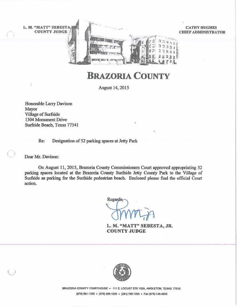
( )
L. M. "MATT" SEBEST A1•
COUNTY JUDGE f'., l'I , , . . l I
Honorable Larry Davison Mayor Village of Surfside 1304 Monument Drive Surfside Beach, Texas 77541
BRAZORIA COUNTY August 14, 2015
Re: Designation of 52 parking spaces at Jetty Park
Dear Mr. Davison:
On August 11, 2015, Brazoria County Commissioners Court approved appropriating 52 parking spaces located at the Brazoria County Surfside Jetty County Park to the Village of Surfside as parking for the Surfside pedestrian beach. Enclosed please find the official Court action.
L. M. "MATT" SEBESTA, JR. COUNTY JUDGE
BRAZORIA COUNTY COURTHOUSE • 111 E. LOCUST STE 102A, ANGLETON, TEXAS 77515
(979) 86(·~200 • (979) 388-1200 • (281) 756-1200 • Fax (979) £.49-4655
Date: 8/11/2015
THE REGULAR COMMISSIONERS COURT SESSION OF BRAZORIA COUNTY, TEXAS
ORDER NO. <item_outline>
RE: Authorization for Village of Surfside Beach to utilize parking spaces atSurfside Jetty County Park
The Court hereby authorizes the Village of Surfside Beach to utilize 52 parkingspaces located at the Brazoria County Surfside Jetty County Park. Said parkingspaces shall be utilized by beach goers intending to utilize the Surfsidepedestrian beach. Said parking will assist the Village in meeting the GeneralLand Office requirements for parking requirements for pedestrian beaches. TheVillage of Surfside will be responsible for constructing and maintaining a beachaccess walkover from the parking area to the pedestrian beach.
CERTIFIED COPY BRAZORIA COUNTY COMMISSIONERS' COURT
ORDER NO. VII.A.14.a. RE: AUTHORIZATION FOR VILLAGE OF SURFSIDE BEACH TO UTILIZE PARKING SPACES AT SURFSIDE JETTY COUNTY PARK
The Court hereby authorizes the Village of Surfside Beach to utilize 52 parking spaces located at the Brazoria County Surfside Jetty County Park. Said parking spaces shall be utilized by beach goers intending to utilize the Surfside pedestrian beach. Said parking will assist the Village in meeting the General Land Office requirements for parking requirements for pedestrian beaches. The Village of Surfside will be responsible for constructing and maintaining a beach access walkover from the parking area to the pedestrian beach.
Motion to Approve by Commissioner Adams, seconded by Commissioner Linder that the above action be taken by the Court.
Passed: 5-0
Aye: Commissioner Payne, Commissioner Adams, Commissioner Linder, Commissioner Cade, Judge Sebesta Nay: (None)
STATE OF TEXAS § COUNTY OF BRAZORIA §
I , J oyce Hudman, Clerk County Court and Ex-Officio Clerk of the Com missioners' Court of Brazoria County, Texas , do hereby certify that the foregoing is a true and correct copy of that certain:
ORDER NO. VII.A.14.a . RE: AUTHORIZATION FOR VILLAGE OF SURFSIDE BEACH TO UTILIZE PARKING SPACES AT SURFSIDE JETTY COUNTY PARK
as passed by the Commissioners' Court on the 11th day of AUGUST, A.D., 2015, REGULAR Term of Commissioners' Court and as the same appear(s) in the Commissioners' Court Records of Brazoria County, Texas.
GIVEN UNDER MY HAND AND SEAL OF OFFICE, this the 14th DAY OF AUGUST, A. D., 20 15.
JOYCE HUDMAN, Clerk County Court and Ex-Officio Member of the Commissioners'
By: ~ ~
)
( )
THE STATE OF TEXAS
COUNTY OF BRAZORIA
§ § §
INTERLOCAL AGREEMENT CONCERNING BEACH PARKjNG PERMIT SYST!iM
This agreement is made at Angleton, Brazoria County, Texas between BRAZORIA
COUNTY, TEXAS acting through its Commissioner's Court (hereinafter "County"), and
THE VILLAGE OF SURFSIDE BEACH, TEXAS, acting through its Mayor (hereinafter
"Village").
PREAMBLE
WHEREAS. Tex. Gov. Code Section 791.011, the lnterlocal Cooperatlon Act,
provides that any local government may contract with another local government to perform
governmental functions and services; and
WHEREAS, the lnterlocal Cooperation Act Section 791.003 states that
•governmental functions and services• means any function or service Including the general
area of public health and welfare which is of mutual concern to the contracting parties; and
WHEREAS, it Is the duty and responsibility of the governing body of any
incorporated city, town, or village located or bordering on the Gulf of Mexico to clean and
maintain the condition of all public beaches within the corporate boundaries, but the duty to
clean and maintain the condition of public beaches does not extend to any public beach
within the corporate boundaries that Is owned by the county In which It is located; and
WHEREAS, It ls the duly and responslbUity of the commissioners court of any
county located or bordering on the Gulf of Mexico to clean and maintain the condition <>fall
public beaches located Inside the county but outside the boundaries of any incorporated
city located or bordering on the Gulf of Mexico and all public beaches owned by the county
and located Inside the boundaries of an incorporated city, town, or vlllage; and
\
{_)
u
WHEREAS, under Secllon 61.011 of the Texas Natural Resource Code local
government responsible for the regulation, maintenance, end use of such beaches may
charge reasonable fees pursuant to its authority to cover the cost of discharging Its
responsibi1illes with respect to such beaches, provided such fees do not exceed the cost of
such public facilities and services. and do not unfairly limit public access to and reasonable
exercises of the police power by local governments with respect to public beaches; and
WHEREAS, each of the parties to this lnterfocal cooperation agreement have In
place an approved Beach Access and Use Plan, as required by Section 61.015 of the
Texas natural Resource Code.
WHEREAS, Village's approved Beach Access and Use Plan currently authorizes
beach parking permit fees for parking on beaches maintained by the party; and
WHEREAS. County is currently seeking authorization from the General Land Office
to charge permit fees at two of Its County parks; and
WHEREAS. the General Land Office has adopted regulations In Section 15.8 of
Title 31, Texas Administrative Code, that control the imposition of beach user fees by local
gov~rnments; and
WHEREAS, Section 15.8(b) of Title 31, Texas Administrative Code. requires focal
governments to establish a state-approved system for reciprocity of fees and fee privileges
among the different local governments authorized to charge beach user fees; and
WHEREAS, the County will have a beach user fee for two County Parks : Quintana
Beach County Park and San Luis Beach County Park. •
WHEREAS. The Village has an annual beach pennlt which Is required to drive on
any of the public beaches located In City's Jurisdictional limits;
WHEREAS, the establishment of a system of beach user fee reciprocity is a
condition of state approval of local dune protection and beach access plans
T ) NOW THEREFORE. THE COUNTY AND VILLAGE agree as follows:
\ )
l)
1.1 Each party shall only recognize Beach Parking Permit System slickers within their
respective jurisqiction;
1.2 Each party will be responsible for enforcement of the beach parking permits within
their Jurisdiction:
1.3 Each party is responsible for the on-site beach parking permit sales within their
jurisdiction.
1.4 Each party represents that this Agreement has been duly passed and approved by
the governing body of the party as required by the Texas lnterlocal Cooperation Act,
Chapter 791, Texas Government Code.
1.5 Each party verifies that they are complying with the requirements of the Texas
Government Code §791 .011.
SIGNED this the ) ·i:.
BRAZO~IA COUNTY, TEXAS
•
By~ Brazoria County Judge
d f {fi · \_ .... _.L..() 2012 ayo --~'-·-.,...-·I~ --· -.....,_. _____ ., . ; \ \l
VILLAGE OF SURFSIDE BEACH, TEXAS
By~ i2.:..;,, Mayotrrfbavison · <..:
ATTEST:
-~I~ Attest: '1- l'l - :J--0 lh
City Clerk
3
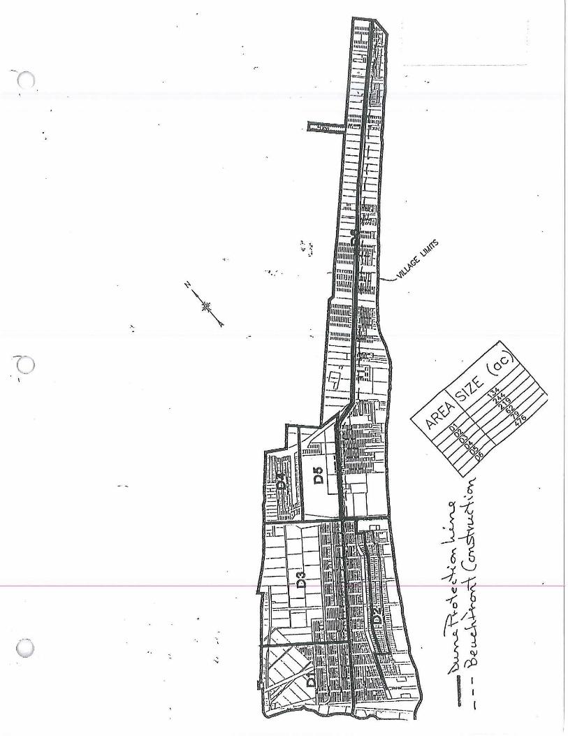
-- ·I-- _,._ -r-:1=
·' ·
t . .,,
Ji Jj v
~ i rt;/ I
JJ u ' ...
I I l
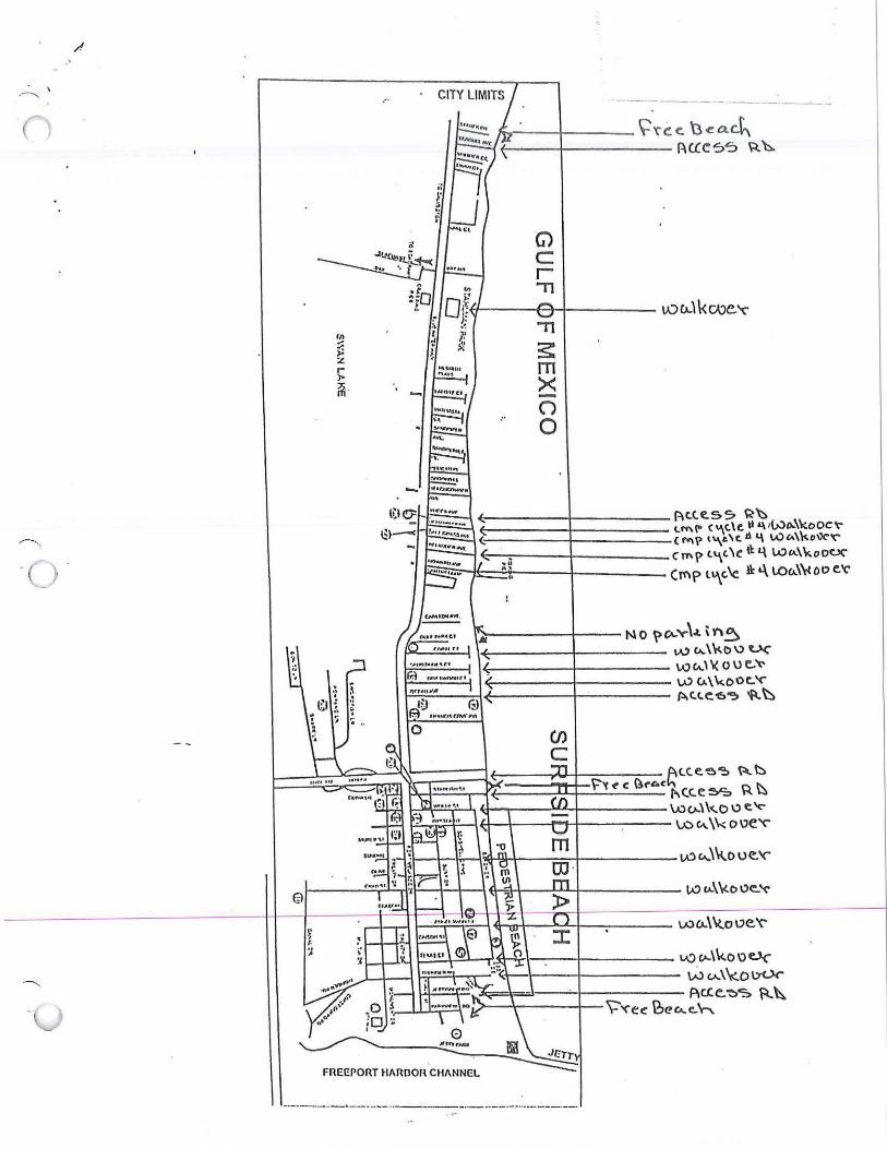
~ \
•. ,.
,,. .. ~ ~ r ,.. ~ -
,r,-- -+---~ 'C' (! c. 'a ca.Ck ~ - -+--- -- ~ue '=>"=> ~ 'h.
G) c r .,,
\A) u.\ \< CAJC. '(" .,, 3:: m >< -CJ 0
~----+-- NO \)~'c"\.L \Y'\~ v.., c,.. \'Ko" U('
i--c...,;:;;.;.J ,~~----!------ \)J c...l\i( 0 \) e.. 't' i--:~- _;_.j ~-- --+------ w CA.\ 'w.ooc.. ~
P.C.C.C'6~ ~~
'"):;l.;.:.=::,----,~~-_-_-_-::-:;~~i:::.!\:"~l~~~c~~~f'~~c:~ <.C. e. ~ ~ ~ ~ I "'(C.C ~ R ~
c..i-,-~'!!--~----w u..\ ko \:> c ~ \.o (.\. \ \,;; o "e'<'"
r-·t;:""·t-i~~i----.=;;;;-1--------------IA'.>c•.\~ou~'<'"
FREEPORT Hl\fmon"CH/1.NNl:L
~ I
Surfsiae Beach
Legend
t PUBLIC ACCESS
A PUBLIC PARKING
& VERY SOFT SAND - HAZARD TO VEHICULAR TRAFFIC
! .
CJ ca Cl)
m

~ ... . :,:,.
~ 'Beach L.ain Entrance ~-~' -C-~·~:i
~egen~, ~ ;j
showing the main ~ntrance * Hwy 332 public access and public parking
•411i
•.:.·. -:..
(-'
L
Surfsftse Beach Public Access Points from Beachcomber to Sanpiper Public WalkoverS ·

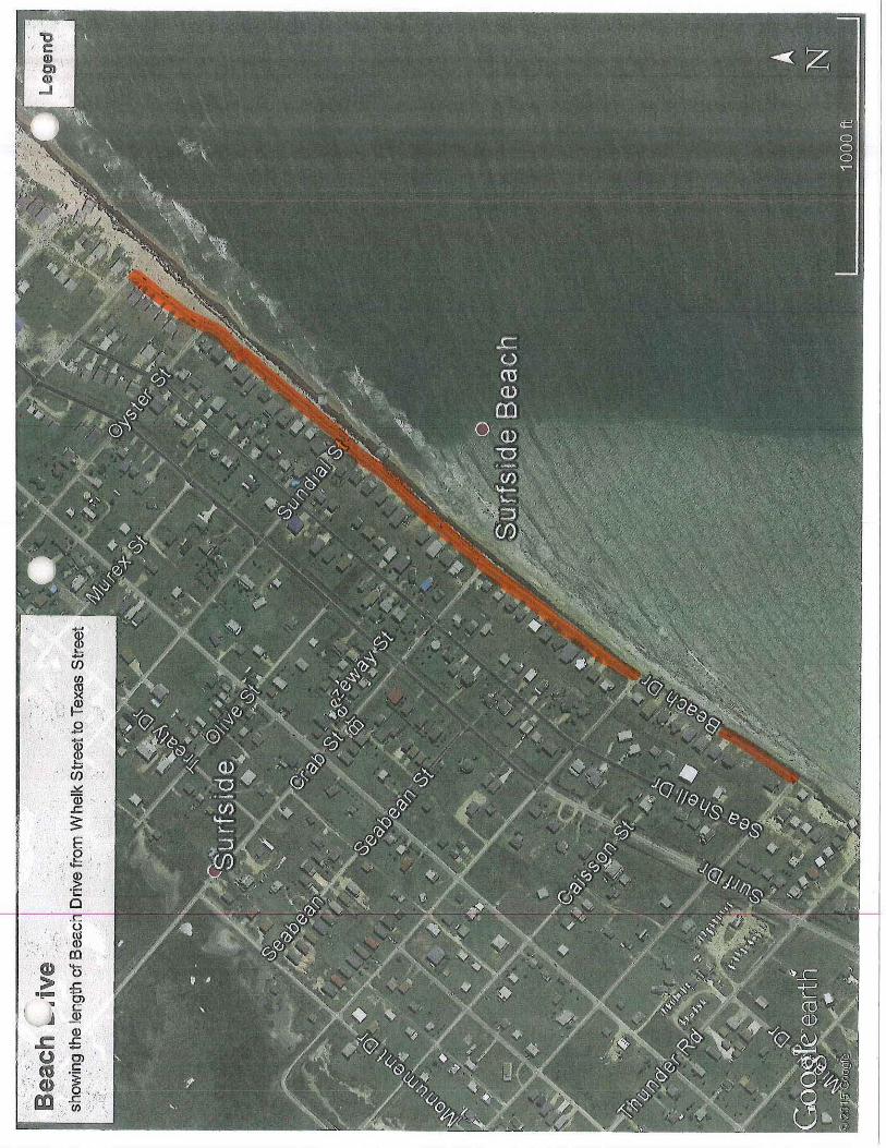
$ .z Cl)
Cl)
~ '.:--! ~
I,_' ~· ,.-. '
Cl)
> "!!"'"
'"
.. .9
I en ~ Q) ..c. ~ E 0
J= .· . ;·, Q)
-~ .... 0 ..c. 0 . ro
. Q)
II) -Q .
..c. -O> c: ~ Q)
.c £ · u . 0) flS .. £: .
''/ Cl) . ~ _.: .. m ·. _g ., ' · Cl)
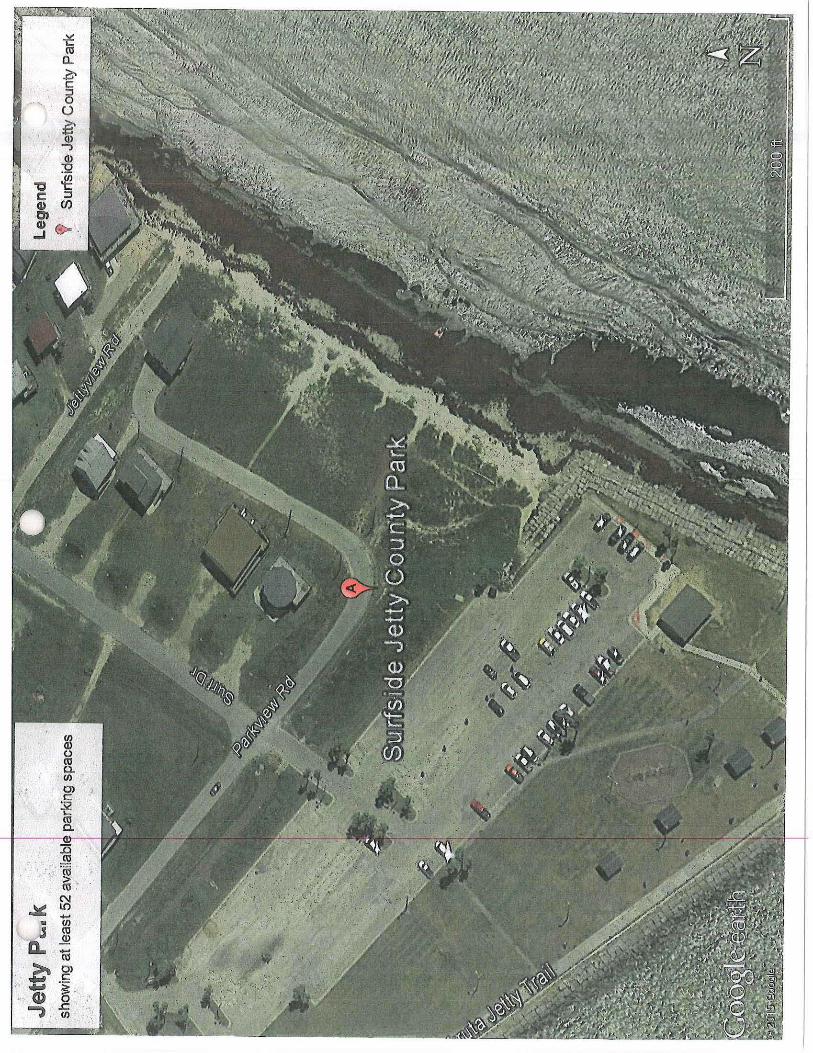
]5 «I ·a; > , «I '
~ ~ ..... • en ., m
a..
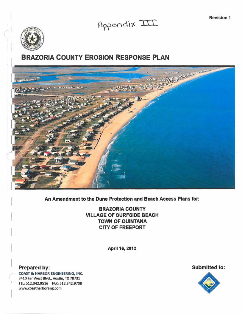
Revision 1 01
~;;:;W~;;t~
l]<> "
. ~ . &; ,..'<:
"".. ,.;~ ~~~~.~ .. "
BRAZORIA COUNTY EROSION RESPONSE PLAN
An Amendment to the Dune Protection and Beach Access Plans for:
Prepared by: COAST & HARBOR ENGINEERING, INC. 3410 Far West Blvd., Austin, TX 78731 TEL: 512.342.9516 FAX: 512.342.9708 www.coastharboreng.com
BRAZORIA COUNTY VILLAGE OF SURFSIDE BEACH
TOWN OF QUINTANA CITY OF FREEPORT
April 16, 2012
Submitted to:
Erosion Response Plan· County of Brazoria
TABLE OF CONTENTS
1 Introduction ................................................................................................................... 1
2 Local Government Jurisdiction ................................................................................... 2
3 Geomorphology ............. ............................................................................................... 2
3.1 Geomorphology .. .. ..... ...... .... .... ..••....................................... ............................................. 2
3.2 Erosion Rates ......................... ................. .... ...... ....... ....... ........ ...... ... ...... ....... ................... 4
3.2. 1 ViIlageofSurfilide Beach .. ... .... ... ...... ... ........ .. ...... ...... .......... ....... ........ ..... 4
3.2.2 Town of Quintana ....... ...... .. ... ............... .... ..... ..... ..... .......... ...... ........ ... .. ..... 4
3.2.3 City of Freeport ...... ...... .. .. .. ... ... .. ..... ............ ... ...... ............ ....... ... .............. . 4
3.2.4 Brazoria County .. ... .......... .... .......... .... .................................. ... .............. .... 4
4 Development of Building Set-Back Line ..................................................................... 4
4.1 Criteria Considered ............. ........ ...... ....... ...... ... ............. ......... ................. .. ..................... 5
4.1.1 Historical Erosion Rates ............................. ......... .................. .. ..... ........... .. 5
4.1.2 Line of Vegetation ............................................................... ..... .... ............. 6
4.1.3 Mean High Tide ........ .. .... .. ........................................................................ 6
4.1.4 Coastal Boundary Surveys ...................................................... .. ............. ... 7
4.1.5 Dune Protection Line ............................ .. ......................... .... .............. ....... 7
4.2 Established Set·Back Line .................................................................... .......... .. ........ ..... . 7
5 New Construction Guidelines ...................................................................................... 8
5.1 Exemption Considerations ........ ...................................................... .... ............................ 8
5.2 Construction Requirements for Exempt Properties ..................................... ...... .. ............ 8
5.3 Variances of Construction Requirements for Exempt Properties ................................... 9
6 Preservation & Restoration ....................................................................................... 11
6.1 Evaluation of Beach Access Points .... .... ....................................................................... 11
6.1.1 City of Freeport ..................................... .................... ................... ...... ..... II
6.1.2 Town of Quintana .......... .. ....................... .............................. ..... .............. 12
6.1.3 Village of Surfside Beach ..................................... .......... .. ...................... 12
6.1.4 Brazoria County ............................................ .... .. ..... ............................... 12
6.1.5 Post·Storm Assessment Procedures .. .. ... .......... .... ................................... 15
6.1.6 Beach Access Goals and Implementation Schedule ................. .. ............. 15
6.1.7 Publicly Funded Existing Amenities ... ......... ..... .............. .... ........ ............ 16
6.2 Evaluation of Critical Dunes ........................................................ .. ............................... 17
April 16, 2012
6.2.1
6.2.2
6.2.3
City of Freeport ........... ....... ......... ... .......... .............. ......... .. ..... .............. ... 18
Town of Quintana ............................................ .. ...... ... .... .. ... .. ... ............... 18
Village of Surfside Beach ....................................................................... 18
Pagei

Erosion Response Plan - County of Brazoria
6.2.4 Brazoria County .. ..... ..... ..... .... .. ... ..... .... .. .. ... .... ............ " .......... .. ...... ... .. .. . 18
6.2.5 Dune Material Properties .. .............. .. .......... .. ................... .... .. .... .. .. .. .... ... 18
6.2.6 Vegetation Requirements .. ..... ....... ...... ...... ...... .. .... .... ... .. ........ .. .... .... .. ... .. 19
6.2.7 Post-Storm Assessment Procedures ........... .. .... .. ............... ... ....... .. ...... .. .. 19
6.2.8 Critical Dune Goals and Implementation Schedule ........ .. .................... .. 20
7 Acquisition of Property Seaward of the Set-back Line ..................................... _ ..... 21 8 Public Outreach .......................................................................................................... 22
9 References .................................................................................................................. 23
INDEX OF FIGURES
Figure I . Vicinity Map of Brazoria County, Texas ............ ....... .. .... .. .... .. .............. .. .. ............ .. .... .. .. .. .. 1
Figure 2. Coastal Jurisdiction within Brazoria County ................... .. .......... .. .. .. ........ .............. ........ .... 2
Figure 3. Approximate Vegetation Line based on 2010 Aerial Photography .. .. .. .. ............... .. .. .......... 6
INDEX OF TABLES
Table I . Data Collected and Used for Set-Back Line Development.. .. .. .... .. .. .... ..... .... ................ .. .... .. 5
Table 2. Beach Access Locations in Brazoria County ......... .................................... .. ...... .. ............... 14
Table 3. Beach Access Locations in need of Repair . .. .... .. .......... .... .. .... .. .. .. .. .................. .. .......... .. .. .. 15
Table 4. List and Cost Breakdown of Amentities Within Each Jurisdiction . .. ....................... .... .... .. 17
APPENDICES
Appendix A.
Appendix B.
Appendix C.
Appendix D.
Appendix E.
Appendix F.
April 15. 2012
Brazoria County Base Maps
Beach Access, Potential Dune Enhancements, & Site Visit Photo Locations
Site Photographs: Beach Access Points
Site Photographs: Potential Dune Enhancement Areas
FEMA Base Flood Elevation (BFE) Zones & Cross-Section
Meeting Attendee Lists
Page ii
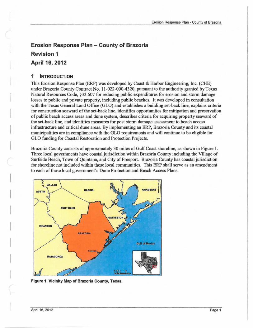
Erosion Response Plan - County of Brazoria
Revision 1
April 16, 2012
1 INTRODUCTION
Erosion Response Plan - County of Brazoria
This Erosion Response Plan (ERP) was developed by Coast & Harbor Engineering, Inc. (CHE) under Brazoria County Contract No. 11-022-000-4320, pursuant to the authority granted by Texas Natural Resources Code, §33 .607 for reducing public expenditures for erosion and storm damage losses to public and private property, including public beaches. It was developed in consultation with the Texas General Land Office (GLO) and establishes a building set-back line, explains criteria for construction seaward of the set-back line, identifies opportunities for mitigation and preservation of public beach access areas and dune system, describes criteria for acquiring property seaward of the set-back line, and identifies measures for post storm damage assessment to beach access infrastructure and critical dune areas. By implementing an ERP, Brazoria County and its coastal municipalities are in compliance with the GLO requirements and will continue to be eligible for GLO funding for Coastal Restoration and Protection Projects.
Brazoria County consists of approximately 30 miles of Gulf Coast shoreline, as shown in Figure 1. Three local governments have coastal jUl1sdiction within Brazoria County including the Village of Surfside Beach, Town of Quintana, and City of Freeport. Brazoria County has coastal jurisdiction for shoreline not included within these local communities. This ERP shall serve as an amendment to each of these local government's Dune Protection and Beach Access Plans.
CHAMOO." t
WHA~TON
MATAGORDA
Figure 1. Vicinity Map of Brazoria County, Texas.
April 16. 2012 Page 1
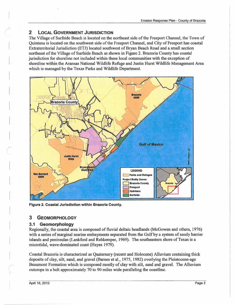
Erosion Response Plan - County of Brazoria
2 LOCAL GOVERNMENT JURISDICTION The Village of Surfside Beach is located on the northeast side ofthe Freeport Channel, the Town of Quintana is located on the southwest side of the Freeport Channel, and City of Freeport has coastal Extraterritorial Jurisdiction (ETJ) located southwest of Bryan Beach Road and a small section northeast of the Village of Surfside Beach as shown in Figure 2. Brazoria County has coastal jurisdiction for shoreline not included within these local communities with the exception of shoreline within the Aransas National Wildlife Refuge and Justin HID'st Wildlife Management Area which is managed by the Texas Parks and Wildlife Department.
Figure 2. Coastal Jurisdiction within Brazoria County.
3 GEOMORPHOLOGY
3.1 Geomorphology
D Park. and Refuges
ProJKt entity Zones: D Brar:ort. County
o Fr.eport o Quintana
Regionally, the coastal area is composed of fluvial deltaic headlands (McGowen and others, 1976) with a series of marginal marine embayments separated from the Gulf by a system of sandy barrier islands and peninsulas (Lankford and Rehkemper, 1969). The southeastern shore of Texas is a microtidal, wave-dominated coast (Hayes 1979).
Coastal Brazoria is characterized as Quaternary (recent and Holocene) Alluvium containing thick deposits of clay, silt, sand, and gravel (Barnes et aI., 1975, 1982) overlying the Pleistocene-age Beaumont Formation which is composed mostly of clay with silt, sand and gravel. The Alluvium outcrops in a belt approximately 70 to 90 miles wide paralleling the coastline.
April 16. 2012 Page 2
Erosion Response Plan - County of Brazoria
Previous geotechnical investigations in the vicinity ofthe Freeport Jetties indicate that the sand on the upper beach is approximately 18 - 20 ft thick and is underlain by mud or the Beaumont Clay formation. The sand layer thins offshore to about 6 ft thick at the end of the jetties. Just offshore of the jetties, the sand layer disappears completely and the bottom is composed of silt and stiff Beaumont Clay.
The majority of the Brazoria County coast has experienced a general erosional trend over at least the past 100 years leading to shoreline retreat throughout most of the County shoreline with the exception of the shoreline southwest ofthe Brazos River mouth which has in general advanced.
The three main features influencing the shoreline morphology along the Brazoria County shoreline are the relic Brazos River Delta, the Freeport Jetties, and Freeport Channel. The Freeport Channel was the mouth of the Brazos River until the mouth was relocated 8 miles southwest in 1929 as the sediment carried by the river made maintenance of the Freeport Channel too expensive. Since the river mouth was relocated, the delta bottom (the sea bed offshore of the Brazoria County shoreline) has eroded and dropped more than 12 ft in the last 75 years; erosion is continuing and is expected to continue in the future. This lowering of the bottom allows higher wave energy to propagate closer to the shoreline which increases erosion and sediment transport along the shoreline.
The shape of the relic Brazos River Delta and the local wave climate cause a divergent node in the longshore transport at the Freeport Channel so the net sediment transport is away from the Channel. Net sediment transport moving along the Surfside shoreline is to the northeast, and net sediment transport along the Quintana shoreline is to the southwest. Due to these transport patterns and the presence of the Freeport Channel and Jetties, a deficit in the littoral system is present along the majority of the central Brazoria County shoreline which leads to erosion and shoreline retreat. Any increase in wave energy from the eroding offshore bottom (relic delta) will increase the volume of sediment being transported along the shoreline causing further erosion due to a lack of sediment supply.
At the same time, maintenance of the Freeport Channel removes approximately 2.6 million cy/yr from the channel, which is estimated to be composed of approximately 10% sand. The maintenance material is being permanently removed from the Brazoria County littoral system through deepwater disposal.
On the northern end of the County shoreline, San Luis Pass acts a sediment sink accumulating approxin13tely 100,000 cy/yr and trapping sediment that would otherwise be available for transport along Follet's Island, which leads to shoreline retreat along most of that reach of shoreline. South of the Brazos River mouth, the shoreline is supplied with sediment from the Brazos River, and is generally stable or accretional, except the shoreline west of the San Bernard River.
The cumulative effects from relocation of the Brazos River, dams trapping sandy sediment inland, Freeport Channel improvement projects, and continued dredging of the navigation channel all lead to the two main causes of erosion: 1) an overall loss of sediment from the littoral system and 2) erosion of the relic delta which translates into shoreline erosion. These causes have worked together to form a positive feedback loop which accelerates the erosion and associated shoreline retreat along most of the Brazoria County shoreline. This system will continue to accelerate for the foreseeable future. Additionally, future efforts to deepen andlor widen the Port of Freeport Channel
April 16.2012 Page 3
Erosion Response Plan· County of Brazoria
are likely to have additional impact (increase) on the morphological system inertia and shoreline retreat (CHE 2008).
3.2 Erosion Rates Texas has some of the highest erosion rates in the country. When the Texas coast erodes, homes are lost, property values decrease, tow;sm suffers, and local economies arc negatively impacted. Additionally, without a healthy beach/dune system to protect the coast, the impact of major storms is more severe. Sixty-four percent of the Texas coast is eroding at an average (mean) rate of 5.9 feellyear with some areas experiencing greater than 30 feellyear (McKenna 2009).
Of the communities studied, average erosion rates are among the highest at West Galveston Island, Village of Surfside Beach, and in the City of South Padre Island, and these communities are the top three with the greatest value in land lost and structure damage (McKenna 2009).
In April 20 II, the Bureau of Economic Geology (BEG) published long-term erosion rates for Brazoria County which are shown in Appendix A. These average erosion rates were calculated based on aerial photography from the \930's to 2007, prior to Hurricane Ike. While these rates show the long-term erosion trends along the Gulf of Mexico shoreline in Brazoria County, they do not reflect accelerated erosion experienced along some sections of shoreline such as in Surfside Beach adjacent to the Freeport Jetties.
3.2.1 Village of Surfside Beach The average long-term coastal erosion rate for the shoreline along the Village of Surfside Beach ranges from stable to 8 ftlyr with the most severe erosion within the pedestrian beach portion of the shoreline near the Freeport Jetties.
3.2.2 Town of Quintana The average long-term erosion rate for the shoreline along the Town of Quintana is 6 to 15 ftlyr with erosion rates over the majority of the shoreline greater than 10 ftlyr.
3.2.3 City of Freeport The average long-term erosion rate for the shoreline along the City of Freeport is 8 to 19 ftlyr with the highest erosion rates near the Brazos River mouth where washover and blowouts have occurred during recent hurricane events such as Rita and Ike.
3.2.4 Brazoria County The average long-term crosion rate for the shoreline along the remainder of the county ranges from stable to 16 ftlyr with the most severe erosion rates on the northeast end of the county around Treasure Island.
4 DEVELOPMENT OF BUILDING SET-BACK LINE
The ERP, including the building set-back line, was developed in anticipation of coastal erosion and is intended to restore and enhance the critical dune system, protect and restore beach access infrastructure, and minimize loss to private and public infrastructure during storm events. The setback line was established to provide guidelines for new construction seaward of the set-back line and reduce damage to these structures during storm events. Additionally, the building set-back line
April 16, 2012 Page 4
Erosion Response Plan - County of Brazoria
may not be located fUlther landward than the Dune Protection Line (DPL) and must encompass as much of the critical dune area as practicable. The criteria evaluated and utilized in the establishment of the building set-back are described below.
4.1 Criteria Consldered CRE collected data from the GLO, BEG, Texas Natural Resources Tnformation System (TNRIS), as well as local governments in Brazoria County. A list of collected data is presented in Table I.
T bl 1 D t C II t d dUd f S t B k L' D a a aa o ee B an sa or e .. ac ma ave of t men. DATA DETAILS SOURCE
Aerial Photography May 2010 Aerial Photography in Downloaded from Texas Natural UTM83z10m Coordinate System Resources Information System (TNRIS).
Historical Erosion Analysis spans 1930 to September Bureau of Economic Geology: Shoreline
Rates of 2007 (Pre-Ike). Results are Feet Change Study Historical Erosion Results per Year Erosion Released in April 2011 .
Beach Access Plans Brazoria County, Surfside. Acquired from entity. Quintana. & Freeport
Dune Protection Line Brazoria County. Surfside. CHE digitized the DPL based on each (DPL) Quintana. & Freeport local government's Beach Access Plans.
Approximate Line of Based on May 2010 Aerial CHE delineated vegetation line. Vegetation Photography
Base Flood Elevation Based on May 1992 Flood CHE received rectified FIRMS from Michael Baker Jr.. Inc. (c/o Brazoria (BFE) Zones Insurance Rate Maps (FIRMS). County) and digitized the BFE Zones
Mean Higher High Based on April 2010 Lidar Data General Land Office (GLO) Water (MHHW) (NAVD88 Feet).
Coastal Boundary Coverage Years varied from 2002 to General Land Office (GLO) Surveys (CBS) 2010.
Public Beach Access Vehicular and Pedestrian Beach Verified by CHE on May 3 and May 24. Access Points. 2011 Site Visit
4.1.1 Historical Erosion Rates Historical erosion rates, as determined by the BEG Shoreline Change Study (2011), in conjunction with onsite observations by CHE coastal engineers, were reviewed and considered in the development of the set-back line. It should be noted that although the Shoreline Change Study is a recent release, erosion rates provided by the BEG in this study do not include data from Hurricane Ike or any data post-Tke. See Appendix A for the 2011 BEG long-term erosion rates for Brazoria County; erosion rates are given at approximately 175ft intervals along the shoreline.
April 16.2012 PageS
Erosion Response Plan - County of Brazoria
4.1.2 Line of Vegetation The Line of Vegetation (LOV) is the extreme seaward boundary of natural vegetation, which spreads continuously inland and is typically used to determine the landward extent ofthe public beach. A natural vegetation line, seen in Figure 3 and shown in Appendix A, is visible through portions of Brazoria County. CHE used ArcMap to manually delineate the visible vegetation line from the 5/312010 rectified aerial photography that was acquired by the National Agriculture Imagery Program (NAIP). In areas where the LOV was not present, the line was extrapolated from one existing point of vegetation to another and for the purposes of this plan will be referred to as the approximate LOV. The approximate LOV was visually verified during a site visit conducted in May of2011. The approximate LOV presented in the maps of Appendix A is not intended to be used to identify, delineate, or fix the landward boundary of the public beach, but merely to be used as a reference point in determining the location of the building set-back line.
Figure 3. Approximate Vegetation Line based on 2010 Aerial Photography.
4.1.3 Mean High Tide The Texas Gulf Coast experiences approximately two tidal cycles per solar day, referred to as a semidiumal tide. The tide cycles through a high and low twice each day, with one of the two high tides being higher than the other and one of the two low tides being lower than the other. For the purpose of developing a set-back line, CHE used the Mean High Tide datum which is considered the average of the highest tide level in each day observed over the most recent National Tidal Datum Epoch, a 19 year period from 1983 to 200 I. The name for this tidal mean (Mean High Tide) according to NOAA is the Mean Higher High Water or MHHW.
The MHHW line for Brazoria County was delineated on a 20 I 0 topographic contour map provided by the GLO. The 2010 topographic contour map was created by the GLO from 2010 Lidar data which was collected in April 2010 by the BEG with Vertical Datum: NAVD88 Feet. CHE imported the 2010 GLO contours into AutoCAD and created a Surface and then extracted the 1.90ft MHHW contour line. See Appendix A for the location of MHHW along Brazoria County.
April 16,2012 Page 6
I
I
Erosion Response Plan - County of Brazoria
4.1_4 Coastal Boundary Surveys Coastal Boundary Surveys (CBS) for Brazoria County were purchased from the GLO on March 22, 2011, but were not used for establishing the set-back line due to the following reasons:
• CBS were not available for the entire county. • The CBS published dates were not consistent and varied from 2002 to 20 10. • The CBS coverage areas were not continuous from one area to the next for the entire
County.
4.1 .5 Dune Protection Line Brazoria County and its local governments have established a DPL for thc purpose of protecting critical dune areas. This line runs parallel and adjacent to the Gulf of Mexico and extcnds a distance landward of the MHHW. The DPLs within each entity are described below and depicted in AppendixA.
Village of Surfside From the easterly town limit, the DPL follows Bluewater Highway west to HWY 332, then south on HWY 332 to Surf Drive, then west on Surf Drive to Whelk St., then south on Whelk St. to Seashell Dr., then west on Seashell Dr. to Texas St., then north on Texas st. to Surf Dr., and west on Surf Dr. to the westerly town limit.
Town of Quintana The DPL in Quintana is a line running parallel to the beach 1 ,ooon landward ofMHHW. The DPL was recently updated by the Town of Quintana in 2011 and is shown on the Appendix A maps.
CIty of Freeport The DPL in the City of Freeport is a line running in a southwesterly direction parallel and adjacent to the Gulf of Mexico and I ,ooon landward of the MHHW between the northeasterly right-of-way ofFM HWY 1495 and the bank of the Brazos River Diversion Channel.
Brazoria County The Brazoria County DPL runs along the centerline of County Road 257, also known as Bluewater Highway. The location of this DPL was coordinated with Brazoria County and will be reflected in their newly updated Dune Protection and Beach Access Plan.
4.2 Established Set-Back Line Shoreline retreat along the Brazoria County Gulf of Mexico shoreline is one of the highest in the state of Texas with the average long-teon erosion rate ranging from stable to 19 feet per year (see Section 4.1.1). Based on the assessment of the high shoreline retreat rates and the location of the critical dune areas, the sct-back line was established as far inland as allowed by the Texas Natural Resources Code, §33.607 which is the existing DPL for the entire County (See Appendix A for location of DPUSet-Back Line). Additionally, site visits by CHE coastal engineers were pelformed to verify that the location of all dunes is seaward of the DPL. As a result, it was determined that all dunes 1,000 feet from mean high tide are included in the Critical Dune Area (seaward of the established DPL). A set-back line was not delineated along the San Bernard National Wildlife Refuge or along the shoreline adjacent to the Justin Hurst Management Area. .
Aprl116,2012 Page 7
Erosion Response Plan ~ County of Brazoria
5 NEW CONSTRUCTION GUIDELINES
Guidelines for new construction shall be the same for all of Brazoria County including each local entity, except where noted within this section. To the maximum extent practicable, all structures should be constructed landward of the set-back line. Construction of structures landward of the setback line must comply with mitigation sequence requirements for avoidance and minimization of effects on dunes and dune vegetation as specified in Texas Administrative Code (TAC) § 15.4(f) Mitigation. The permittee is not exempt from compliance with compensatory mitigation requirements for unavoidable adverse effects on dunes and dune vegetation.
All jurisdictions will implement the new construction standards through the local Beach/Dune Plan and the local DunelBeach Plan will be modified to reference the ERP as an appendix, thereby connecting both documents in the permitting process. Additionally, all jurisdictions within Brazoria County will ensure that public facilities are constructed landward of the set-back line or constructed in accordance with the requirements for exempt structures.
5,1 Exemption Considerations Exemption from prohibition of construction seaward of the set-back line shall be the same for all of Brazoria County including each local entity, except as noted herein. Dune walkovers, beach access roadways, public parking, and associated public facilities constructed seaward of the set-back line shall be constructed in accordance with the GLO construction standards.
Brazoria County may consider exemptions from the prohibition of residential and commercial construction seaward of the set-back line for:
I. Properties for which the owner has demonstrated to the satisfaction of the local government that no practicable alternatives to construction seaward of the building set-back line exist. For purposes ofthis section, practicable means available and capable of being done after taking into consideration existing building practices, siting alternatives, and the footprint of the structure in relation to the area of the buildable portion of the lot, and considering the overall development scheme for the property;
2. Properties for which construction is permitted under a dune protection and beach access plan establishing a building set-back line certified by the General Land Office prior to the effective date of this section and if there are no changes from the originally permitted construction plans; and
3. Structures located seaward of the building set-back line prior to the effective date of this section for which modifications are sought that do not increase the footprint of the structure. However, structures seaward of the building set-back line that are damaged more than 50% or destroyed should be subject tojIMs seeti61l before an repairs or recons~ction IUay b? conducted. I\. _ vLL. ~ ~~~s .
. c .
5.2 Construction Requirements for Exempt Properties Where the local government allows an exemption from the prohibition for building seaward ofthe building set-back line, it should require the following conditions of construction:
I. Plans and certi fications for the structure shall be sealed by a registered professional engineer licensed in the State of Texas providing evidence of the following:
April 16, 2012 PageS
Erosion Response Plan - County of Brazoria
a. A minimum two-foot freeboard above the Federal Emergency Management Agency (FEMA)'s Base Flood Elevation (BFE);
b. No enclosures below BFE; c. Consistency with the latest edition of specifications outlined in American Society of
Civil Engineers, Structural Engineering Institute, Flood Resistant Design and Construction, ASCE 24-05;
d. That habitable structure will be feasible to relocate; e. All construction will be designed to minimize impacts on natural hydrology.
2. Location of all construction should be landward of the landward toe of the foredune ridge, where practicable.
5.3 Variances of Construction Requirements for Exempt Properties The following variances were developed by Brazoria County and the Village of Surfside. These variances are developed with the intent of reducing public expenditures due to erosion and storm damage losses and are described and justified below. There are no variances proposed by the City of Freeport or the Town of Quintana.
The Village of Surfside has developed the following variances to Section 5.2 of this document:
I. Owners of all front row construction, adjacent to the beach, will build their structure as landward as possible on the lot and provide a map delineating the location of the dune system within the property. If no dune exists on the property, the owner will submit a dune construction plan to be approved by the Village of Surfside as part ofthe permitting process. The dune plan must propose a 30ft base dune construction project that lies between the pFel'6Sea property and the beach along the entire seaward edge of the property. The Village of Surfside will ensure that all construction seaward of the set-back line is not located within the public beach easement, including dune restoration projects. The proposed dune restoration requirements must identify a maximum seaward distance from the natural LOV (the rules require no farther than 20 feet seaward), but shall not interfere with the public's ability to use the beach at normal high tides.
2. The Village of Surfside proposes to lower the minimum two-foot freeboard above the BFE to a minimum one-foot freeboard above the BFE. The Village of Surfside is currently negotiating an insurance rate reduction with FEMA and has decided to use a minimum onefoot freeboard elevation for all construction within the city limits. By setting this requirement on all new construction within the city limits, a greater reduction of public expenditures for erosion and storm damage losses will be achieved.
3. Under FEMA construction guidelines, enclosures below the BFE are allowed as Ion as all walls for the enclosure are designed to breakaway under wind, surge, and wave impact to reduce impacts on water movement underneath and around the structure. Therefore, the Village of Surfside will allow a variance to the no enclosures below BFE rule as long as all walls of the enclosure are designed and constructed to breakaway under flood and wave action while minimizing impacts to hydrology. The Village of Surfside will limit the area of enclosures below BFE to 299 square feet.
April 16. 2012 Page 9
Erosion Response Plan - County of Brazoria
Allowing enclosures below the BFE, with breakaway wall construction seaward of the setback line, is a reasonable altemative in view of the fact that the set-back line for the entire County is located at the most landward point (the DPL) allowed by the rules and that this variance satisfies federal requirements by the NFIP. Allowing this variance will reduce the total footprint of structures thus reducing the potential impact to critical dune and natural ground cover.
Enclosures below BFE shall consist of breakaway construction to meet the requirements of the NFIP regulations for V zone construction codified in Title 44 Section 60.3(a)(3) of the Code of Federal Regulations. As defined by FEMA, a breakaway wall is not part of the structural support of the building and is intended through its design and construction to collapse under specific lateral loading forces without causing damage to the elevated portion of the building or suppOlting foundation system. Any walls below the lowest floor in a building in a V Zone should give way under wind and water loads without causing collapse, displacement, or other damage to the elevated portion of the building or the supporting pilings or columns.
4. Lots which span the set-back line will be considered as two separate lots with all ofthe construction requirements for exempt property listed in Section 5.2 and variances listed in Section 5.3 applying to the seaward portion of the lot.
Brazoria County has developed the following variances to Section 5.2 of this document:
I . Under FEMA construction guidelines, enclosures below the BFE are allowed as I~ as all walls for the enclosure are designed to brea away un erwm ,surge,and wave imp!!Ct to reduce impacts on water movement underneath and around the structure. Therefore, the County Will a low avaniiIiCe to e no enclosures be-iow BFErule as Ion as all walls of the enclosure are desi an constructed to breakawa under flood and wave action while minimizing impacts to hydrology. The County will limit the area or enclosuresbe~-BF!\ tom s uare eet.
Allowing enclosures below the BFE, with breakaway wall construction, seaward of the setback line is a reasonable alternative in view ofthe fact that the SBL for the entire County is located at the most landward point (the DPL) allowed by the rules and that this variance satisfies federal requirements by the NFIP. Allowing this variance will reduce the total footprint of structures thus reducing the potential impact to critical dune and natural ground cover.
Enclosures below BFE shall consist ofbreakawa construction to e ~quiremen National Flood Insurance Program FIP re lations for V zone constructioJl..CQ.dified in Title 44 Se . n a l _of.lhe..cod. fFed gylations. As defined by FEMA a breakaway wall is not part of the structural support of the building and is intended through its design and construction to collapse under specific lateral loading forces, without causing damage to the elevated portion ofthe building or supporting foundation system. Any walls below the lowest floor in a building in a V Zone should give way under wind and water loads without causing collapse, displacement, or other damage to the elevated portion of the building or the supporting pilings or columns.
April 16, 2012 Page 10
Erosion Response Plan - County of Brazoria
2. Lots which span the set-back line will be considered as two separate lots with all of the construction requirements for exempt property listed in Section 5.2 and variances listed in Section 5.3 applying to the seaward portion of the lot. This variance is considered reasonable in view of the fact that Brazoria County currently requires that all new construction within their coastal jurisdiction, seaward and landward of the set-back line, comply with a minimum two-foot freeboard above the FEMA's BFE.
6 PRESERVATION & RESTORATION
This section presents procedures for I) preserving and enhancing the public's right of access to and use of the public beach from losses due to erosion and storm damage and 2) preserving, restoring, and enhancing critical dunes for natural storm protection and conservation purposes.
On May 3m and 24th 0[2011 , a conditions assessment was performed to determine the existence, location, and condition of all vehicular and pedestrian beach access points along the Brazoria County shoreline. The beach access points were evaluated to determine their functionality, condition, and need for protection, enhancement, or restoration. A similar assessment was also performed for the existing dune system along the Gulf of Mexico shoreline in Brazoria County.
6.1 Evaluation of Beach Access Points As erosion continues along most of the Brazoria County Gulf shoreline, damage to beach access points is expected. The assessment of beach access points performed by CHE in May 20 II gives a snapshot of the condition, location, and functionality of the accesses and serves as a starting point for planning the preservation and enhancement measures to be implemented by the County and local governments as funding becomes available. All local governments presently perform continual monitoring of beach access points and maintenance of these accesses was evident in the conditions assessment.
The conditions assessment consisted of a site visit by a CHE coastal engineer who evaluated, prioritized, indexed, and photographed all vehicular and pedestrian beach access points in Brazoria County. Table 2 lists all of the existing beach access points, jurisdiction, type of access, and location of site visit photograph within Appendix C. Appendix B shows the exact location in plan view ofthe access point.
The following section summarizes the conditions assessment of all access points within each local government jurisdiction and describes measures to improve and protect beach access in view of the ongoing erosion along Brazoria County. Improvements identified herein will be designed and constructed using methods that will reduce costs associated with repair, rebuilding, or replacement due to storm damage and erosion.
6.1.1 CIty of Freeport There are two vehicular access points within the City of Freeport jurisdiction. Beach Access #2 at CR 241 is in good working condition and vehicular access onto the beach was easy. Beach Access #2 is angled to the beach and to the prevailing wind direction which may help reduce storm surge propagation inland during a storm. Beach Access #1 at CR 750 needs some improvement and will benefit from additional crushed limestone road base at the entrance to the beach. Additionally, this entrance is not perpendicular to the beach which helps reduce storm surge propagation. However,
April 16, 2012 Page 11
Erosion Response Plan - County of Brazoria
Beach Access #1 could be improved to reduce potential storm surge propagation by increasing the elevation of the road at the dune location by an elevation of 4 feet. Any improved protection project would be subject to available funding.
6.1.2 Town of Quintana There are two vehicular access points within the Town of Quintana. These access points are in good condition, allow easy driving onto the beach, and do not need any improvements at the present time. However, these roads are aligned to the prevailing wind direction and beach and could be avenues for storm surge propagation during a storm. These vehicular access points can be improved by increasing the elevation ofthe road by 4 feet at the dune location. Any improved protection project would be subject to available funding.
6.1.3 Village of Surfside Beach There are five vehicular beach access points and twenty pedestrian beach access points within the Village of Surfside Beach.
Each of these access points were evaluated and it was determined that they are all in good condition and functioning properly. All pedestrian access points, which are dune walkovers, have a good entrance on the back of the dune and avoid impacts to the existing dune. The dune walkovers land on the upper beach just on the front toe of each dune without impacting the dune and on the upper beach as landward as possible so as to reduce interaction with the highest tide levels. Vehicular access points were determined to be in good condition and allow easy access for vehicles on to the beach. Access points in the Village of Surfside are optimally placed to eliminate impact to the dune and minimize damage from erosion. However, due to their orientation (perpendicular to the beach), the roads could act as avenues for storm surge propagation during a storm if the winds were in the direction of road alignment. All five vehicular access points in the Village of Surfside could benefit by increasing the elevation of the road by 4 feet at the location of the dune. Changing the alignment of the roads would require purchase of adjacent property and is therefore cost prohibitive. All of the access points were improved after Hurricane Ike with raised road elevation and increased road base
Stahlman Park, a publicly funded existing amenity in the Village of Surfside Beach, was completely rebuilt after Hurricane Ike and consists of a 4,000 sq ft conference center and wheelchair accessible beach access. These facilities are in good condition.
Note: Vehicular access at Hwy 332 will benefit from additional crushed limestone road base at the entrance to the beach. Due to its heavy use by the public, this entrance is in continual need of monitoring and maintenance to allow easy access onto the beach.
6.1.4 Brazoria County There are seven vehicular beach access points and three pedestrian access points within the Brazoria County jurisdiction. Each of these access points were evaluated and is functioning properly. Based on the limitations of space and few alternatives available for protection, these access points are optimally placed to minimize their damage from erosion and storm surge; however, Beach Access #1 and #3 will benefit from additional crushed limestone road base at the entrance to the beach and raising their elevation by 4 feet at the dune location will mitigate storm surge propagation. Beach Access #4 has deep scour holes on each side of the road caused by Hurricane Ike. These scour holes
April 16, 2012 Page 12
Erosion Response Plan· County of Brazoria
should be filled and stabilized with vegetation to improve safety to vehicles entering the beach through this road. Vehicular Beach Access points 1-6 are perpendicular to the beach and could be realigned to reduce storm damage. However, changing the angle of the roads to the beach would require the purchase of private property and may impact the secondary dune at some of the locations. Therefore, raising the elevation of the roads at the dune location as stated is the best solution to reduce storm surge propagation.
The pedestrian access point located at the Quintana Beach County Park is in adequate working conduction. Some repairs were being implemented at the time of the site visit to give higher elevation to the dune walkover which will improve access to the beach by pedestrians and will allow for natural development of the dune underneath the structure. These improvements were completed within a couple of months of the site visit.
April 16, 2012 Page 13
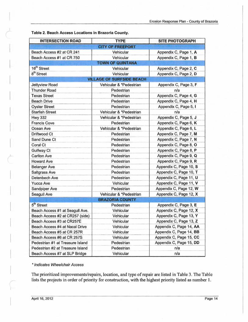
Erosion Response Plan - County of Brazoria
Table 2. Beach Access Locations in Brazoria County.
INTERSECTION ROAD TYPE I SITE PHOTOGRAPH
CITY OF T ,
Beach Access #2 at CR 241 Vehicular Appendix C, Page 1, A
Beach Access #1 at CR 750 Vehicular Appendix C, Page 1, B TOWN OF-QUINTANA
16th Street Vehicular Appendix C, Page 2, C
8th Street Vehicular Appendix C, Page 2, 0
VLLAGE OF SURFSIDE BEACH Jetlyview Road Vehicular & 'Pedestrian Appendix C, Page 3, F
Thunder Road Pedestrian nla -
Texas Street Pedestrian Appendix C, Page 4, G
Beach Drive Pedestrian Appendix C, Page 4, H
Oyster Street Pedestrian Appendix C, Page 5, I -Starfish Street Vehicular & 'Pedestrian nla Hwy 332 Vehicular & 'Pedestrian Appendix C, Page 5, J Francis Cove Pedestrian Appendix C, Page 6, K
Ocean Ave Vehicular & 'Pedestrian Appendix C, Page 6, L --Driftwood Ct Pedestrian Appendix C, Page 7, M --- -- -Sand Dune Ct Pedestrian Appendix C, Page 7, N
- - -Coral Ct Pedestrian Appendix C, Page 8, 0
- -GulfwayCt Pedestrian Appendix C, Page 8, P
Carlton Ave Pedestrian Appendix C, Page 9, Q -
Howard Ave Pedestrian Appendix C, Page 9, R - - -- -
Belanger Ave Pedestrian Appendix C, Page 10, S -
Saltgrass Ave Pedestrian Appendix C, Page 10, T
Detenbech Ave Pedestrian Appendix C, Page 11 , U
Yucca Ave Vehicular Appendix C, Page 11 , V Sandpiper Ave Pedestrian Appendix C, Page 12, W
-Seagull Ave Vehicular & 'Pedestrian Appendix C, Page 12, X
BRAZORlA.coutft'Y 5th Street Pedestrian Appendix C, Page 3, E
-
Beach Access #1 at Seagull Ave. Vehicular Appendix C, Page 12, X -
Beach Access #2 at CR257 (side) Vehicular Appendix C, Page 13, Y
Beach Access #3 at CR257E Vehicular Appendix C, Page 13, Z -Beach Access #4 at Nacal Drive Vehicular Appendix C, Page 14, AA
-Beach Access #5 at CR 257R Vehicular Appendix C, Page 14, BB Beach Access #6 at CR 257S Vehicular Appendix C, Page 15, CC
Pedestrian #1 at Treasure Island Pedestrian Appendix C, Page 15, DO ---Pedestrian #2 at Treasure Island Pedestrian nla -- --Beach Access #7 at SLP Bridge Vehicular nla
• Indicates Wheelchair Access
The prioritized improvements/repairs, location, and type of repair are listed in Table 3. The Table lists the projects in order of priority for construction, with the highest priority listed as number 1.
April 16, 2012 Page 14
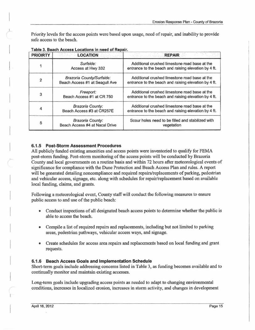
Erosion Response Plan - County of Brazoria
Priority levels for the access points were based upon usage, need of repair, and inability to provide safe access to the beach.
Table 3. Beach Access Locations in need of Repair.
PRIOIRTY LOCATION REPAIR
1 Surfside: Addilional crushed limestone road base at the
Access at Hwy 332 entrance to the beach and raising elevation by 4 It.
2 Brazoria County/Surfside: Additional crushed limestone road base at the
Beach Access #1 at Seagull Ave entrance to the beach and raising elevation by 4 ft.
3 Freeport: Additional crushed limestone road base at the
Beach Access #1 at CR 750 entrance to the beach and raising elevation by 4 ft.
4 Brazoria County: Additional crushed limestone road base at the
Beach Access #3 at CR257E entrance to the beach and raising elevation by 4 ft.
5 Brazoria County: Scour holes need to be filled and stabilized with
Beach Access #4 at Nacal Drive vegetation
6.1.5 Post-Storm Assessment Procedures All publicly funded existing amenities and access points were inventoried to qualify for FEMA post-storm funding. Post-storm monitoring of the access points will be conducted by Brazoria County and local governments on a routine basis and within 72 hours after metcorological events of significance for compliance with the Dune Protection and Beach Access Plan and rules. A report will be generated detailing noncompliance and required repairs/replacements of parking, pedestrian and vehicular access, signage, etc. along with schedules for repair/replacement based on available local funding, claims, and grants.
Following a meteorological event, County stafl' will conduct the following measures to ensure public access to and use of the public beach:
• Conduct inspections of all designated beach access points to determine whether the public is able to access the beach.
• Compile a list of required repairs and replacements, including but not limited to parking areas, pedestrian pathways, vehicular access ways, and signage.
• Create schedules for access area repairs and replacements based on local funding and grant requests.
6.1.6 Beach Access Goals and Implementation Schedule Short-term goals include addressing concems listed in Table 3, as funding becomes available and to continually monitor and maintain existing accesses.
Long-term goals include upgrading access points as needed to adapt to changing environmental conditions, increases in localized erosion, increases in storm activity, and changes in development
April 16.2012 Page 15
Erosion Response Plan - County of Brazoria
in an attempt to mitigate impacts from erosion, minimize stonn damage, and continue to provide realizable and safe beach accesses to the public.
As part of Brazoria County's continual commitment to public access, the County plans to construct a beach access park from CR 257 to the gulf beach on a 5 acre tract about 2 miles southwest of Treasure Island.
6.1.7 Publicly Funded Existing Amenities The following is a list of publicly funded existing amenities included in the jurisdiction of Brazoria County and the Village of Surfside.
I. Surfside Jetty County Park - Jetty Park consists of paved parking, picnic areas, restrooms, jetty walkway, playground and a trail. The cost to replace this facility if it was destroyed by a tropical stonn is approximately $1,200,000. This estimate is based on current prices which can fluctuate depending on market conditions. Over the next several years, there will be additional facilities and improvements added at this location that could increase the cost of replacement by several thousand dollars.
2. Quintana Beach County Park - Quintana Beach County Park is a 5 I-acre beachfront park with paved full-service RV campsites, cabins, restrooms/showers, a day house, five covered pavilions, one covered screened pavilion, picnic tables, playground, volleyball court, horseshoe pits, paved trail, wooden lighted fishing pier, and paved parking. The cost to replace this facility if it was destroyed by a tropical stonn is approximately $2,500,000. This estimate is based on current prices which can fluctuate depending on market conditions. Over the next several years, there will be additional facilities and improvements added at this location that could increase the cost of replacement by several thousand dollars.
3. San Luis Pass County Park - San Luis Pass County Park is a IS-acre bay park with both day-use amenities and overnight facilities . The park features paved full service RV camping, cabins, a meeting room with kitchenette, interpretive center, restrooms, a playground, fish cleaning stations, paved parking, and a boat launch. The cost to replace this facility if it was destroyed by a tropical storm is approximately $1,750,000. This estimate is based on current prices which can fluctuate depending on market conditions. Over the next several years there will be additional facilities and improvements added at this location that could increase the cost of replacement by several thousand dollars.
4. Stahlman Park - Stahlman Park is a Community Center that overlooks the beach. 11 is available to the public for rental for all sorts of functions and is typically booked a year in advance. Underneath the elevated structure is an area with picnic tables, shelter from the sun as well as restrooms and with a public shower for beach goers. The facility has a new parking lot open to the public as well as an area for volleyball. Attached to the building are walkovers that lead to the beach. The replacement cost on this is set at $850,000.00. This was just recently assessed by a TML actuary.
In addition to the large facilities listed above, the amenities shown in Table 4 are also maintained by the jurisdictions within Brazoria County for beach users.
April 16. 2012 Page 16
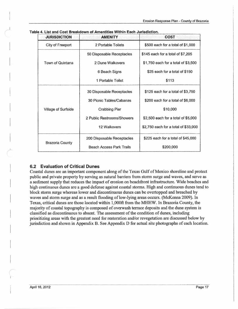
ErosIon Response Plan - County of Brazoria
Table 4 List and Cost Breakdown of Amentitles Within Each Jurisdiction ·JURISDICTION AMENITY. ' . .. COST .
City of Freeport 2 Portable Toilets $500 each for a total of $1,000
50 Disposable Receptacles $145 each for a total of $7,205
Town of Quintana 2 Dune Walkovers $1,750 each for a total of $3,500
6 Beach Signs $25 each for a total of $1 50
1 Portable TOilet $113
30 Disposable Receptacles $125 each for a total of $3,750
30 Picnic Tables/Cabanas $200 each for a total of $6,000
Village of Surfside Crabbing Pier $10,000
2 Public Restrooms/Showers $2,500 each for a total of $5,000
12 Walkovers $2,750 each for a total of $33,000
200 Disposable Receptacles $225 each for a total of $45,000 Brazoria County
Beach Access Park Trails $200,000
6.2 Evaluation of Critical Dunes Coastal dunes are an important component along of the Texas Gulf of Mexico shoreline and protect public and private property by serving as natural barriers from stonm surge and waves, and serve as a sediment supply that reduces the impact of erosion on beachfront infrastructure. Wide beaches and high continuous dunes are a good defense against coastal storms. High and continuous dunes tend to block stonm surge whereas lower and discontinuous dunes can be overtopped and breached by waves and stonm surge and as a result flooding oflow-lying areas occurs. (McKenna 2009). In Texas, critical dunes are those located within 1,000ft from the MHHW. In Brazoria County, the majority of coastal topography is composed of overwash terrace deposits and the dune system is classified as discontinuous to absent. The assessment of the condition of dunes, including prioritizing areas with the greatest need for restoration and/or revegetation are discussed below by jurisdiction and shown in Appendix B. See Appendix D for actual site photographs of each location.
April 16, 2012 Page 17
Erosion Response Plan· County of Brazoria
6.2.1 City of Freeport The dune system within the City of Freeport's jurisdiction is classified as discontinuous with numerous overwash terraces. All of the shoreline within the City of Freeport jurisdiction, such as Bryan Beach, is undeveloped. Locations along this length of shoreline that could benefit from filling in the gaps and restoring the critical dune where overwash andlor blowouts have occurred are depicted in Appendix B. All of the short-term dune restoration components for this shoreline are classified as low priority.
6.2.2 Town of Quintana The dune system within the Town of Quintana is classified as discontinuous with numerous overwash terraces and the area is considered low-density development. Due to the high erosion rate and the location of infrastructure along the shoreline, high priority critical dune restoration elements are identified at South Lake Drive, the dune system west of Cortez Dr., and an overwash area between 16th Street and 8th Street. These locations are depicted in Appendix B. Several other locations along this length of shoreline could also benefit from filling in the gaps and restoring the critical dune where overwash andlor blowouts have occurred and are displayed as low priority.
6.2.3 Village of Surfside Beach A dune system within the Village of Surfside Beach is mostly absent, particularly to the west of Hwy 332. The Village of Surfside is considered a high·density development area and due to the lack of dune, all public and private infrastructures are considered at high risk from storm and erosion impacts. The shoreline west ofHwy 332 does not have an active system and therefore; a dune restoration project along this section of shoreline is considered an immediate need. Since the Village of Surfside shoreline is critically eroding with historical erosion rates up to 8 ft/yr and the Gulf is continually encroaching on existing infrastructure, there is very limited space for dunes. Any dune restoration effort has to be accompanied by beach nourishment. East ofHwy 332, the shoreline is stable when looking at the long·term erosion rates. However, the dune system ~ severely damaged during Hurricane Ike and should be enhanced to protect infrastructur~ture storms. The restoration of the dune system along this section of shoreline is considered a medium priority and short-term objective.
6.2.4 Brazoria County The dune system along Brazoria County jurisdiction is discontinuous to absent. The dune restoration from Matagorda County in the southwest moving northeast up to the new Brazos River mouth is not a priority because it is undeveloped and not accessible by public road or ferry. The next section of dunes from the Village of Surfside Beach on Follett's Island northeast to Treasure Island has low to moderate density of development and is considered high priority for critical dune restoration due to the high erosion rates along this section of shoreline. Treasure Island on the northeastern end of the County is a medium to high priority for critical dune restoration. Locations along this length that could benefit from filling in the gaps and restoring the critical dune where overwash andlor blowouts have occurred are depicted in Appendix B. These areas were prioritized based the proximity of CR257 to the active beach system.
6.2.5 Dune Material Properties Due to the lack of sand borrow areas near the Brazoria County shoreline and the estimated quantity of material needed for the execution of short and long-term dune restoration projects, the County will allow the use of a mixture of 60% sand and 40% fines for the construction of the core of the
April 16, 2012 Page 18
Erosion Response Plan - County of Brazoria
dune protection projects proposed within this ERP. The proposed dunes will also have a minimum one-foot sand cover over the core.
This allowance will reduce the costs of implcmenting dune restoration projccts and increase the potential for larger and longer dune construction projects. For example, if it cost $25/cy to bring in sand with less than 10% fines to construct a 1,000 ft dune that contains 5cy of sand per linear foot, the total cost for the dune restoration project would be $125,000. However, the cost for a 60/40 mixture per cubic yard is approximately $ I 5 due to its availability and proximity to the Gulf of Mexico shoreline. Therefore, the same dune project would cost $75,000. Alternatively, a longer dune project could be constructed with a budget of$125,000 ifthc 60/40 mix was allowed; the length of this project would be 1,667 ft. Execution oflonger dune restoration projects due to the cost savings will provide better protection of public and private infrastructure and create more habitat for endangered species.
6.2.6 Vegetation Requirements Vegetation is a critical component to the dune system. Mowing/cutting of dune vegetation seaward of the set-back line will not be allowed. Mitigation projects requiring dune vegetation shall include:
• bitter panicum (Panicum amarum), • sea oats (Uniola paniculata), and • marshhay cordgrass (Spartina patens).
Bitter panicum has proved to be the best species for dune stabilization on the Texas coast. This native beach plant has a higher salt tolerance than many other coastal species and is a hardy grower. Sea oats are less tolerant of salt spray than bittcr panicum but grow rapidly enough to avoid being smothered in rapidly shifting sand. Interplanting sea oats and bitter panicum will reduce the risk of disease or pest infestation. Marshhay cordgrass is a small, wiry pcrennial, which spreads by rhizomes. This grass shall be planted on the landward side of dunes.
Beach morning glory and seagrape vines can form a dense cover on the seaward side of dunes within a few growing seasons. Low-growing plants and shrubs to be used on the backside of the dunc include seacoast bluestem, cucumber leaf sunflower, rose ring gallardia, partridge pea, prickly pear, and lantana. The optimum time for transplanting in Brazoria County is February, March, or April. Standard slatted wood sand fencing is ideal for dune-building structures because it is inexpensive, readily available, easy to handle, and can be ercctcd quickly.
6.2.7 Post-Storm Assessment Procedures All critical dune areas were invcntoried to qualify tor FEMA post-storm funding. Post-storm monitoring of the dune system will be conducted by the County and local governments on a routine basis and within 72 hours aftcr meteorological evcnts of significance. A report will be generated detailing dune restoration needs along with schedules for repair based on available local funding, claims, and grants.
Each jurisdiction within Brazoria County will review the location of the DPL at least once every five years to detennine whether the lines are adequately located to achieve their stated purposes. In addition, each jurisdiction will review the adequacy of the location of the DPL within 90 days after a tropical storm or hurricane affects the Brazoria County Gulf shoreline. Each jurisdiction will amend the dune and beach plan and ERP whenever necessary to achieve their stated purposes.
April 16. 2012 Page 19
Erosion Response Plan - County of Brazoria
6.2.8 Critical Dune Goals and Implementation Schedule Procedures and implementation priorities for restoring and enhancing critical dunes for natural storm protection and conservations purposes are presented in this section. Short-term and long-telm implementation goals were developed to address immediate needs. The overall goal of dune restoration for the County is to have a continuous foredunc ridge along the entire County. Since dunes along Brazoria County are very small or non-existent, the short-term goals focus on filling gaps in the existing dune system to match adjacent areas; these projects will be less costly and easier to implement than the long-term projects. The long-term projects will require identification of sand sources, acquisition of permits, and large-scale funding. All dune projects to be constructed in Brazoria County will follow the guidelines for dune construction presented in the Dune Protection and Improvement Manual for the Texas Gulf Coast, 5th Edition.
Short-Term Goals Short-term goals include filling in gaps and blowouts in the foredune ridge and re-vegetating these areas. Gaps should be filled to match existing dune height and width. Appendix B illustrates the areas that would benefit from immediate restoration . Many areas along Brazoria County are devoid of a dune system altogether. Prioritization of these critical areas was based on the rate of erosion and the need to protect public and private property and infi'astructure from erosion and stonn damage. As illustrated in Appendix B, the highest priority levels for proposed dune restoration elements include dune areas located within the Town of Quintana, the Village of Surfside and Treasure Island, as well as portions along Follet's Island in Brazoria County such as those near private infrastructures and where CR 257 is in close proximity to the MHHW. Medium priority dune restoration components are identified along the most eastern portion of the Village of Surfside and some sections of dune along Follet's Island, Brazoria County jurisdiction, which received severe damage during Hurricane Ike. The critical areas within the City of Freeport are considered lowest priority.
Long-Term Goals Long-term goals include promoting the formation of a continuous foredune ridge throughout the length ofthe County. The dune shall be 10.5 - 13.5ft in height (75% of the BFE depending on location), with a minimum base width of 100-ft measured perpendicular to the gulf beach and which contains at least 85% of vegetative cover. FEMA, thru the NFIP, has created flood zone determination maps that indicate a Velocity Zone or V- Zone. A V-Zone is an area predicted by FEMA that contains high velocity flowing floodwater during meteorological events. BFEs have been designated for coastal zones and the BFEs for Brazoria County are depicted in Appendix E. BFEs in Brazoria County range from 12 to 18 ft above mean sea level. The minimum dune height shall exceed 75% ofthe BFE height from mean sea level for all of the V-Zones in Brazoria County. It is recommended that dune restoration projects be designed to meet USACE standards as defined in Chapter 4 of the Coastal Engineering Manual (USACE, 2008).
Schedule A schedule for implementation of goals is dependent upon the availability of funding and the procurement of grants. The County is continually pursuing opportunities and has identified current and potential projects to help meet these goals.
April 16, 2012 Page 20
Erosion Response Plan - County of Brazoria
Current Dune Restoration Projects • Dune Day - Brazoria County and Save Our Beach Association along with volunteers place
Christmas trees in January of each year along the Brazoria County coastline in Quintana, Surfside, and along Follet's Island to trap sand to initiate dune creation. The County supplements this effort with sand fencing.
• Dune Revegetation - Brazoria County has planted 100,000 dime plants on the county beaches on Follett's Island and in front of the Quintana County Park with funds from a CMP grant.
Potential Dune Restoration Projects • CR 257 Dune Restoration - Reconstruction of dunes along CR 257 will be completed
with CIAP FY 09 funds. • Quintana Beaeh and Dune Restoration - FEMA claims are pending from Hurricane Rita
and Hurricane Ike for restoration ofthe Beach/Dune System.
Potential Funding Sources for Dune Restoration Projects The following grant opportunities and funding programs were identified and are listed below. Some of these programs such as CMP, ClAP, and FEMA are currently being engaged to execute dune restoration projects in Brazoria County. Additional funds will be pursued from future funding cycles for CEPRA and CMP for long-term dune restoration projects.
• Coastal Impact Assistance Program (ClAP) 2010 Funding Cycle • Coastal Management Program (CMP) • Coastal Erosion Planning and Response Act (CEPRA) • Federal Emergency Management Agency (FEMA)
7 ACQUISITION OF PROPERTY SEAWARD OF THE SET-BACK LINE
Brazoria County developed criteria for identifying properties for voluntary acquisition of fee simple title or a lesser interest acquisition. These properties have structures located entirely seaward of the building set-back line that experience severe damage during storms, impedes the development of a natural dune system and restrict/impact the public's ability to use the public beach. Criteria for acquisition includes:
• A structure that is entirely seaward of the building set-back line. • Sbuctures that impede beach access or impact the public's ability to use the public beach. • A structure that is more than 25% on the public beach. • A structure that affects hydrology of the public beach, adjacent property or along dune
system, as determined by a registered professional geologist/engineer licensed in the State of Texas.
• A structure that is deemed a hazard to health and safety. • A structure that is causing erosion of adjacent property, dunes, or public beach. • A structure that affects public health and increases safety risks on the public beach, as stated
in the BeachlDune rules.
April 16, 2012 Page 21
Erosion Response Plan - Counly of Brazoria
Property will be prioritized based on severity and amount of criteria met. Brazoria County or local goverrunent can implement a removal strategy on the most prioritized property. Acquisition strategy will consist of:
• Identification of potential property. • Negotiation of acquisition. • Funding procurement. • Agreement execution • Removal or relocation of structure.
8 PUBLIC OUTREACH Brazoria County, Village of Surfside Beach, Town of Quintana, and City of Freeport conducted educational meetings to discuss the ERP prior to submitting this document to the GLO. These meetings were held at the date and times listed below. See Appendix F for the meeting attendee lists.
• Brazoria County - May 23,2011,5:00 PM, Public Meeting at Stalhman Park. • Village of Surfside Beach and Town of Quintana - May 24, 2011,6:30 PM, Public Meeting
at Stalhman Park. • City of Freeport - May 5, 2011, 9:00 AM, Conference Call/Meeting.
In accordance with TAC Title 31 Chapter 15 Rule §15.17, the local government's governing body will formally approve the ERP at formal hearings. The date, time, and location oftbese hearings have not been determined and will be finalized once comments from the GLO have been received and implemented into the final ERP.
April 16, 2012 Page 22
1
Erosion Response Plan - County of Brazoria
9 REFERENCES
Coast & Harbor Engineering, Inc. (2008) Surfside Beach Shoreline Stabilization Feasibility Study. Report to the Texas General Land Office.
Barnes, V. E. 1975. Geologic Atlas of Texas, Beeville-Bay City Sheet. The University of Texas at Austin, Bureau of Economic Geology, Austin (Revised 1987).
Hayes, M.O., 1979, Barrier island morphology as a function of tidal and wave regime, in S. P. Leatherman, ed., Barrier Islands froID the Gulf ofSt. Lawrence to the Gulf of Mexico: Academic Press, New York, p. 1- 28.
Lankford, R. R., and Rehkemper, 1969. The Galveston Bay Complex, A Summary of Characteristics. In: R.R. Lankford and j.J.W. Rodgers, eds. Holocene Geology of Galveston Bay Area.
McGowen, J.H., Brown, L.F., Jr. , Evans, T.1., Fisher, W.L., and Groat, e.G., 1976. Environmental Geologic Atlas of the Texas Coastal Zone - Bay City-Freeport Area: Bureau of Economic Geology, The University of Texas at Austin, 98p.
McKenna, K. K., 2009 Update, Texas Coastwide Erosion Response Plan, Report to the Texas General Land Office.
Paine, J. G., Mathew, S., and Caudle, T., 2011, Long-term Texas gulf shoreline change rates, 1930 to 2007: Bureau of Economic Geology, The University of Texas at Austin, draft report and digital data prepared for the Texas General Land Office.
April 16. 2012 Page 23
Appendix A Brazoria County Base Maps
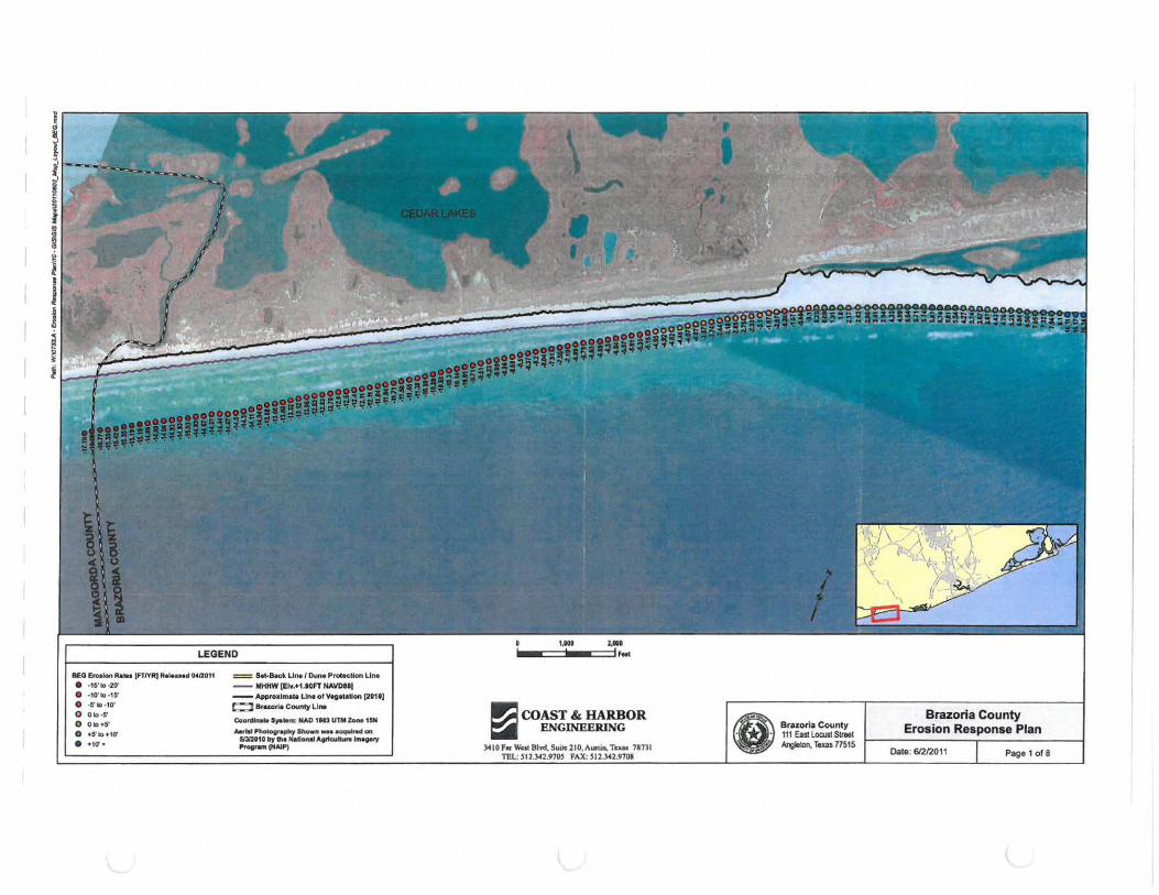
I!IE.O &oIolon RIo_ [FT/YR) iii .... " 0(12011
• -15'10-20' • -10'10-15' • -6' 10 _10' 00 10-5'
o 0 "·5-
• . 5'1, .. ,0'
• _10'_
= SeI-e..ck LIM! o.w.. ProtK UOfl Un. __ MHHW IElw.t1 .U FT HAVDnj
-- Appro"III'~ U",. 01 V",,,.UCNI [nUj ~ a,azorI. Coumy lint
Coonllnlolt S,.1Itm: HAD 1113 IITfII z.o.. 15M ...... P"-grooploJ "'-II _ ........ _
SIlI2t10 by .". National ... ,.tao .... 180....., ~'"AlPI
1';1 COAST & HARBOR ~ ENGINEERING
Teus 781)1
Brazoria County 111 East Locust Street Aoglt1oll, Taxa 77515
Brazoria County Erosion Response Plan
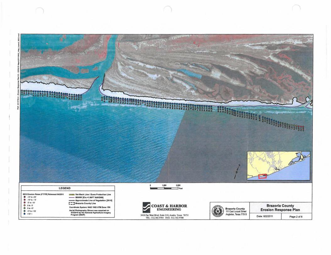
lEO l!",slon "-1ft 1"1"rRJ R ..... MlIMIZ011
• -15-10-20'
• _10"1O ·1S' • -S'IO-,O' o 0 " -5' o 0 ".5'
• _5'k>_,0"
• _10'_
= Set·a.;k LIM / Dune Protection LIM
-- MtlHW "' ..... UOfT HAVOUl -- Appro.'m.tl Lift. ofVegftltlon (2010] ~ 8rH0fI1 County LIM
c.onan.e. .~ ....... : NAD ltll IITMZMMUH .... rI .. PhofOl'~ a1'lown _ 1tCQtII .... 011
snnGlI by '"_ N.H_ ".ncul1U,. ...... ~ PrOOf .... (HAlP)
~ COAST & HARBOR ~ ENGINEERING
J~ 10 Far Wac BIYd, Sll~C 210, AlI;!1tin. Tun 78731 m .: SI2.UU70$ fAX, S I2 .3 ~2.9708
e.. . Brazoria County . . 111 Ea$lloeusl Street
!r9 Angleton, TeKaI1751S
Brazoria County Erosion Response Plan
Date: 612/2011
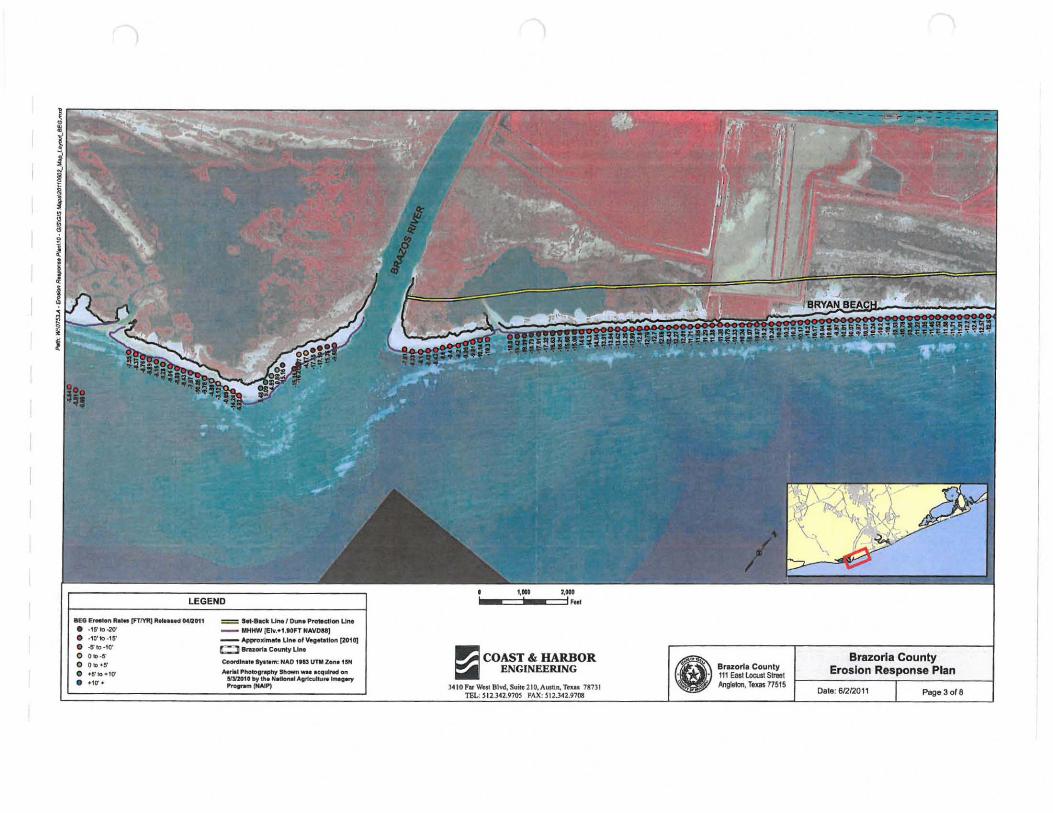
IIEG EfMIotIlbI .. (FTMtJ It_1M "'I2Oft
• · lS'Io-2(l'
• · 10'1o ·1S'
• oSlO·llr o Ob·S·
o Ob ·S'
• ·5'10· '0'
• .'0-*
= S-a. IIKII L.Jn.-1 Duft, ProMctlOO'l UrM _ _ MHHW [Elu1.tOfT HAVD&8)
-- ,t,ppraxlrMte UrM ofv.e~tlon (2DtD] t:::J llruorta C-.ty LIM
Coonllnata ay. .. ",: HAO 1113 UTM Zen. 15M IIMIII P-If.,.n, 311 __ acqulnd on
I!lJl1tIlllly u.. H.uon.aI.lgrkuIIu .. lfNa..,. --,...., ~ COAST & HARBOR =:r.I ENGINEERING
Tn.I.7SHI e·, . . ~
Braort. County 111 east LoaJIt Street .Angleton, rtxas nS1S
Brazoria County Erosion Response Plan
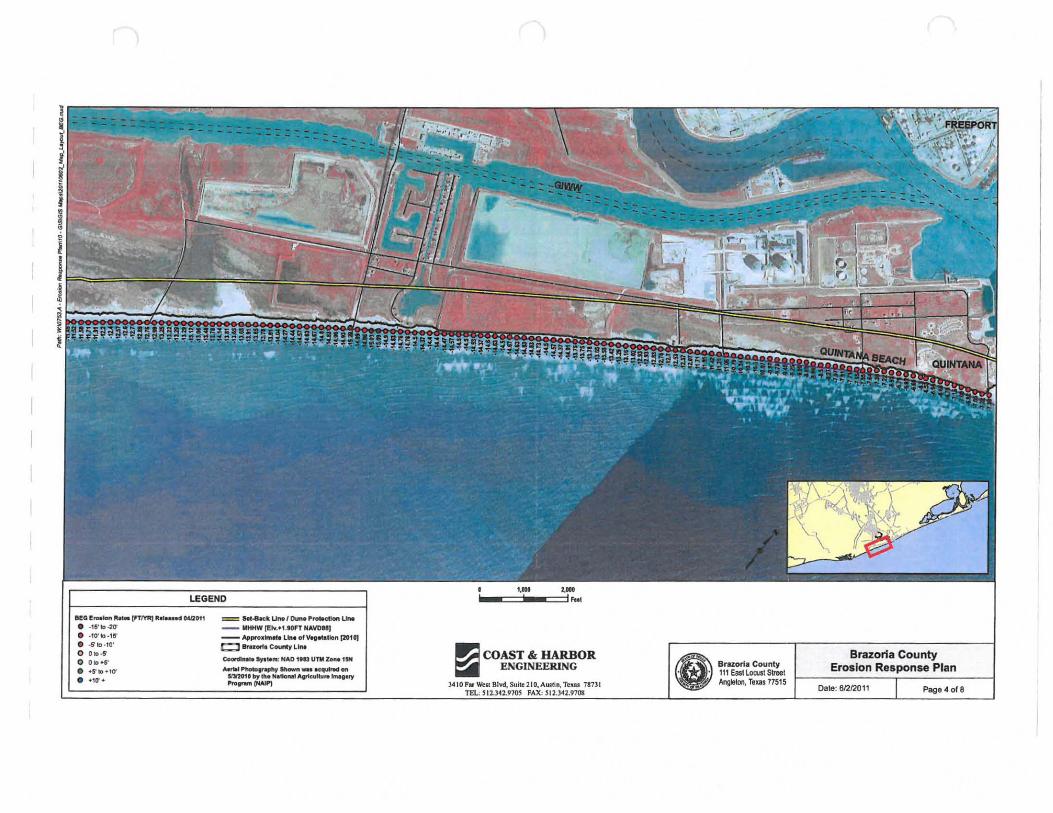
8I!:O 1! ...... Ib_I"1'I'RJ 1I~.Hed 00IQ011
• ·15'10-20' • .10'1o·1~' • · 5"10 ·10' o 01O·$"
o 010."
• '6'10 010'
• +10'·
= s.t-8ac:k u...1 o..n.. ,"*o;:t!on un. __ MHHW[I!lv .• '.9DFTNAVDU]
--ApproJfIm ... Llnl ofVegltatlon (201 QJ t:l8ru«11 COUIICy LIM
Coonhat. s,at. .. : HAD 1113 UTM Zone ISM __ '""'*'.....,. ar.-n_ ecquINd on nl!01' by I~. N"1one! ",,",,"'tu ....... vert 'ro..-(NAJPI
I'};I COAST & HARBOR ~ I!NGINEERJNG
3410 F. Tn .. 78731 e-. . ~
Brazoria County 111 Easl LOOJst Street Angleton, Tlu! 17515
Brazoria County Erosion Response Plan
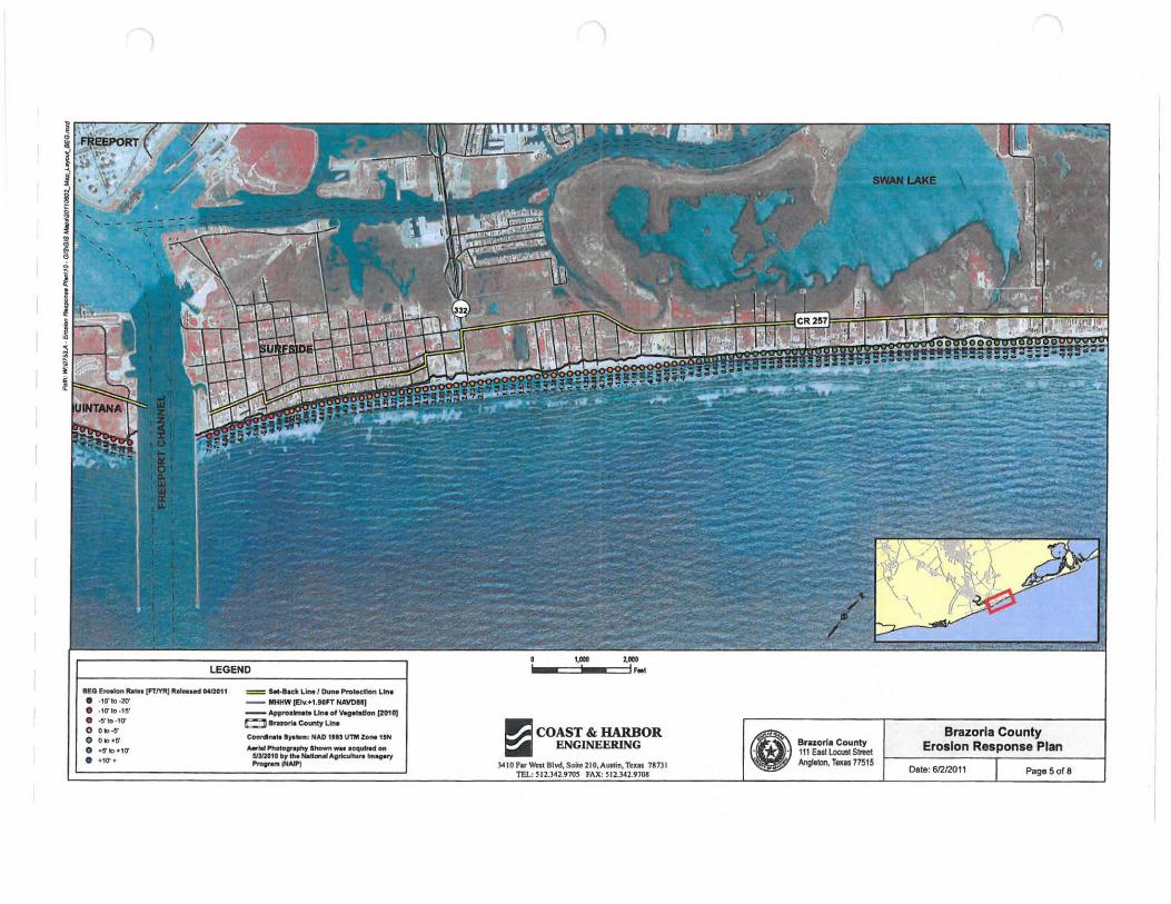
IIf.G f.ro .... n Ita ... [FTI"I'A) ItIN .. "", MnOU
• ,1&'10-20' • ,10'10 · 111' • -S'1o,10' o OlooS o OIo.S
o '5'10.,0'
• .10"
= kI,lI.dlL""DuM~l.b
__ MHHW [EIv,+f.9GFT HAYDel]
-- AptItOxm.ho Unoofv.g.tatloft [2010) ~.~CO\Qy lJllot
c-dI ..... lya.m: HAD I'" UTM Zo ... ,iN ..... 1I1~. __ lCquln"OfI
51212010 bJ the NdanIII .... IicuIIu ..... ...., -..-~ COAST & HARBOR ~ ENGINEERING
3410P ... ~B1Yd,S!>ile 210,A.lin,1'I: • • 7U31 TEL: ~ 12.3U970S FAX: ~12.1~2.9108
Bruorll County 111 Easll.ocust Street Angleton, TaxI! 17515
Brazoria County Erosion Response Plan
D.!Ite:
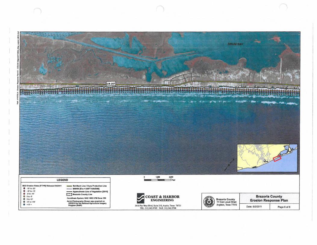
BEG 1!! .... 1on ..... fFTmQ 1I00NMd OoIDOH
• -IS'Io-2O' • · 1(r1O·15' • .s1O-, (r o O .. .s o OIO~S'
• +S'loH(r
• +\0'+
= a.t-eact u....1 0.- P ..... ctlcwo u.... __ MHHW [l!ly.H .IDFT HAWN)
--ApproJdnlete LIne of v.glltatlon (201 0) C]1Iraqri1 county LIM
c.-« ..... ty.e.nr. HAO ,.a UTMz.o ... ISN ..... iaI Phototrwpll~ 1lII-" _ I cqul...t on
S/1I201f by 1M Hlllo ..... A"cull",. 1IM;eoy ............ ., ~ COAST & HARBOR =:r.I ENGINEERING
JAIO F. West Blvd, Suile 1IO,AUJlin, Teall 187)1 TEL: SI1.341.97~ FAX: 511.342.9708
Brazoria County 111 EastloatslStleet Angleton, r,xas nS1S
Brazoria County Erosion Response Plan
Date: 6/Z12011 Page 6of8
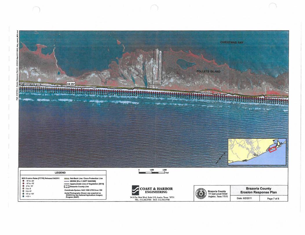
BeO E,.lon Rat .. [FTtvRJ It ...... d lM12011
• -1&'10-20' • _10'1O_1S'
• -6'10-10' o Olo-ti'
o 01o . S'
• 0-5'10 ·10' • _10'_
= !!eM'lICk UM f Dun. "rotecUon LIn. -- MHHW (tIv,+UO FT "AVON)
- - """' ...... LIII. ofVtg""on [201 01 t=l Brazelrill Covnl1 LIM
c-dho~. S,,"' .. : MAD 1113 UTM lo ... 1i1oN
........ I~~_ ' <quirfd00l 1IJI201' 'Y Itt. N.tIoMI ... , rIco.IH\n'e N,., --..... ~
~ COAST & HARBOR ~ ENGINEERJNG
)410F ... Tau 71731
Brazoria County 111 East Locusl Streel Ang~1on, TeXIS 77515
Brazoria County Erosion Response Plan
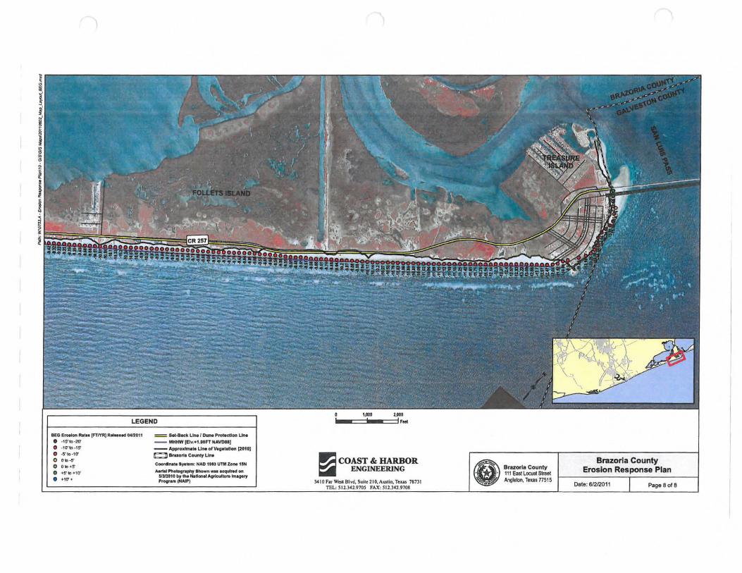
BEa e ..... "" ItaIft [FTIY'R) R ..... .d 0412011
• -15'10-20' • _10' 10 _1$'
• -5' 10 -'0' o 010 -15' o 0 10 ·5
• +5' 10 .. 1(' • ·10'·
= ht-8Kt< Uneo l 0.- Prat.etI"" UrM -- MHtIW 1E1v.'" .IOFT HAWU]
-- ApprO.,""I~ Un. of V'1tf'IHon (2010J t::D ar_rl, COunty LIM
c-d .... '''_: HAO IIA!JTM 10 ... 1!SH
........ ~.p/It' "'-" - K'qUINoII "" !IIY.IGtG by n.. N. ...... A.,teuI ..... WIrH)' I'TOII .... /HAIP)
I'.:l COAST & HARBOR ~ ENGINEERlNG e BrazorlaCounty
. 111 Easi LocustStreet '" Ang!elon, Texas nS1S 7873 1
Brazoria County Erosion Response Plan
Date: 612/2011 Page 8 018
Appendix B Beach Access, Dune Enhancements, & Site Visit Photo Locations
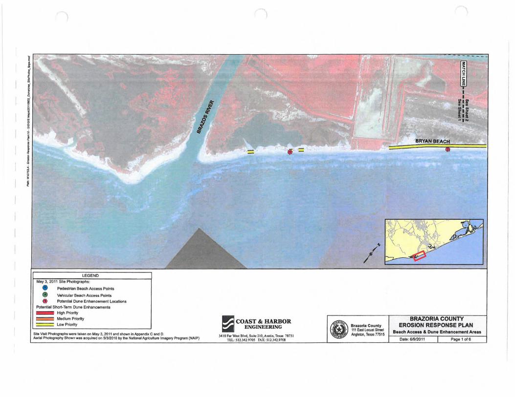
} f I i I I I ! j ~ ~ ,
• Pedestrian Beach Access Points
• VehiQJllf Beach Access Points
• Potential Dune Enhancement Locallons Potential Short· Term Dune Enhancement. _ High Priority
c::=:=! Medium Priority ==== Low Priortty
Site V .. PhotogfllPh$_laken on tAsy 3, 20111nd shown In Appendix CandO.
I I
Aefllli Pnotography Stlown _. acquin:ld on 51312010 by the National Agriculture Imagery PrognIm (NAlP)
,= •
...:I COAST & HARBOR ~ ENGINIlERlNG
J.410ParWw S1Iitc
Br'l ori, County 111 Easllocust Street Ang\eIon, Texas 77515
~ I I
fir
,." a ~IN
~'''\/'
!
, \.,
EROSION RESPONSE PLAN B.ach Access & Dune Enhancemtnt Ar ...
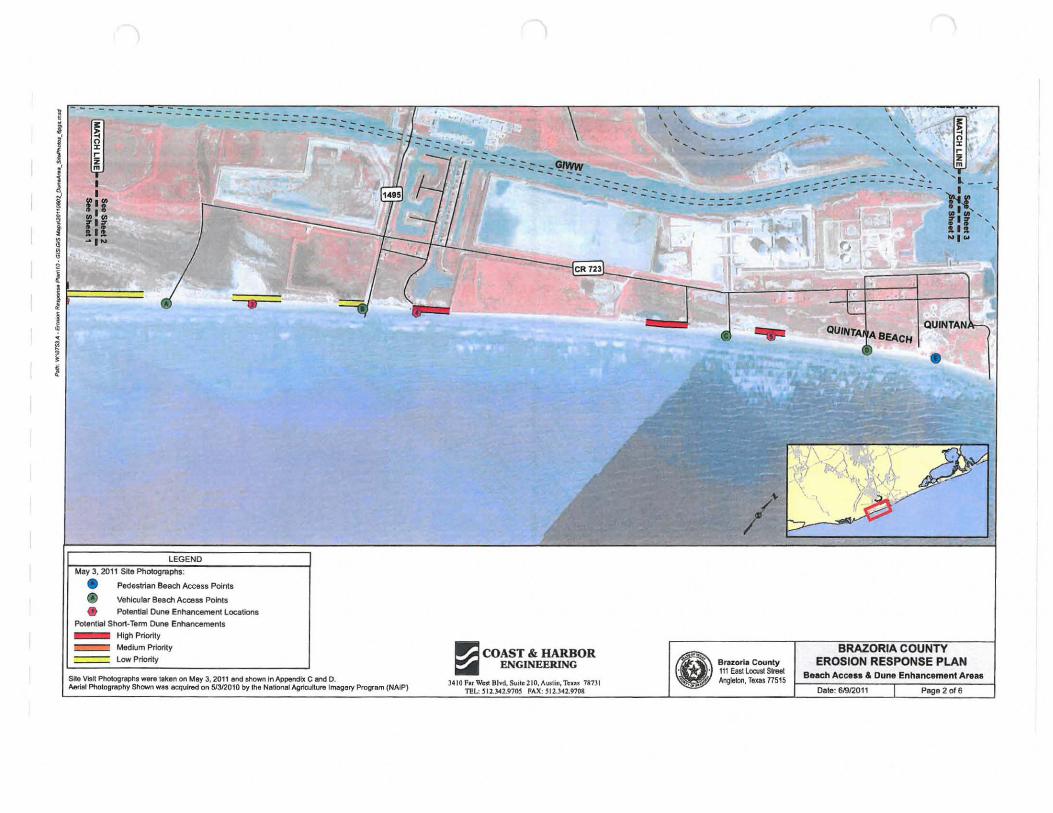
LEGEND
Mav 3, 2011 Site Photogruphs:
• Pedestrian Beach Access Points
• Vehicular Beach Acce53 Points • Potential Dune Enhancement L.ocations
PoIential Shaft· Term Dune Enhancements _ High Priority
~ Medium Priority
~ Low Priority
Site VisH PhoIographl _a liken on May 3, 2011 end showI1ln Appeodbl C and D. Aerifli PhotoPrlIl>hY Shown wu ecqulred on 51312010 by the Nationlll AgrIculture Imagery Program (NAIP)
, ' , , , , , ... _- - -:::::::: :::: :::::: :: ::::::::::~:: ::
- =:: :: ::-===- -- --
...= COAST & HARBOR ~ ENGINEERING
)410 F •• W~ 8Ivd. S\llt~210,Alllt;n, Tn .. 71t73 1 TEL 512.l41.91OS FAX; 512.30.9708
8- Bnu:orl. County . • 111 East lowst SAIl!
".. .. Anglebn, Texas 71515
,\< ~.~ , r .
.. "'... I: , , m , , ... ; :: = :: :: :: :: :: :: : .:. - ' t ---
fj{ f:f ' NI~
QUINTAN
BRAZORIA COUNTY EROSION RESPONSE PLAN
B.llch Acc ••• & Dune Enhancement Areas
Dale: 6J9I2011 Page 2 0' 6
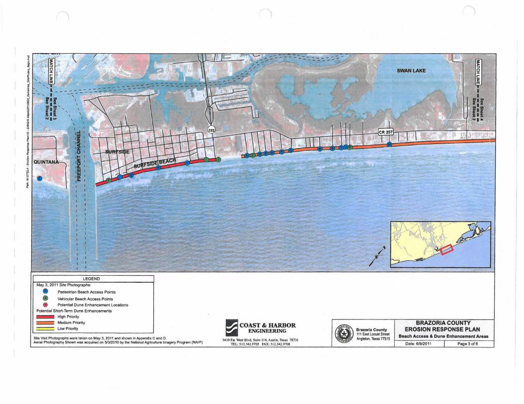
LEGEND
May 3 , 2011 Site Photographs:
• Pedestrtan Beach Access Points
• Vehicular Beach Access Points
• Potential Dune Enhancemenl locelionl Potential Shor1-Term Dune Enhancements _ High Priority
c=:::::!' Medium Prioriy === Low Priortty
s., Viall PI'IotogrJiPhS-" t.ken on Mey 3, 2011 lind shown In~jx Cancl D. Aorlal Pl"IokJ9rlIphy Shown _I acquired on 5f3I2010 by !he National AgricuItu,.lmagery Program (NNP)
~ COAST &: HARBOR ~ ENGINEERING
).410 far WcSl Blvd., S.ilc 210, Austin, T_ ?ln l TEL: S 12.J.42.97OS FAX: SI2.J.42.9108
e= BrazorIa County . • 111 East locust SInMt '.. Angleton, Texss 77515
BRAZORIA COUNTY EROSION RESPONSE PLAN
B •• ch Ace ••• & Dune Enhancement Area.
Date: 61912011 Page 3 ofe
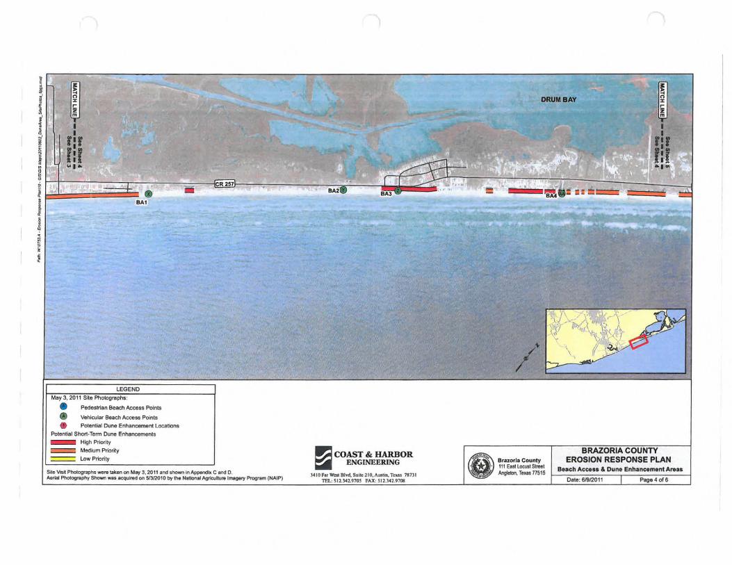
LEGEND
May 3, 2011 SIte Photographs:
• Pedestrian Beach Access PoInts
• Vehicular Beach Access Points
• Potential Done Enhancement locations Potential Short-Term Dune Enhancements _ High Priority
c:=::::R Medium Priority ==== low Priority ~ COAST & HARBOR ~ ENGINEERING
}410FnWestBIvd,Sui1e210, 1I1111m, Teus 71n l ntt...: SIl.J042.910S fAX: SI1.141.97(l1
DRUM BAY
e·' '", Brazoria County . . 111 Ent locust Street
AngIeIon. Texas 77515
BRAZORIA COUNTY EROSION RESPONSE PLAN
Beach Ace . .. & Dune EnhancementAreas
Date: 61912011 Page 4 01"6
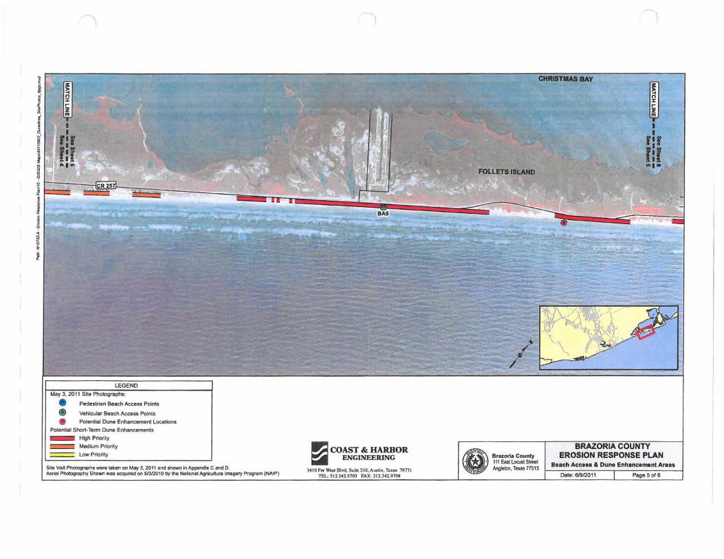
I
" f ~
I I I J ~ ~ ~ ~
, 1;
LEGEND
May 3, 2011 SKe Photographs: • • Pedestrian Beaeh Access PoInts
Vehicular Beach Access Points
• Po!ential Dune Enhancement locations Potential Short-Term Dune Enhancements _ High Priority
c::::=::::l Medium Priority
===. Low Priority
Site Vlsn photograpn, ware leken on MIJ'f 3, 2011 lind ShOWn InAWendlx CandO Aorlol Photogmphy Shown W&!l IlCQl,llred on 51312010 by the Nallonal AgrIculture I~ry Program (NAIP)
..= COAST & HARBOR ~ ENGINF..ERlNG
3410 f. \VQ!;I 81...:1, S~; .. 210,Austin. Tn .. 787)1 1l!L: 512.l~2.9105 " .... X; jI2.)U9108
CHRU1T11A8 BAY
~ FOLl!TS ISLAND
B WI
Bra;a:or'- Co unty 111 Easi loaJCl Street Angleton, Teus 77515
I I
flf rlr ~I·
BRAZORIA COUNTY EROSION RESPONSE PLAN
Beach Acc ... & Dune Enhancement Arltu
Date: 61912011 Page 5 of 6
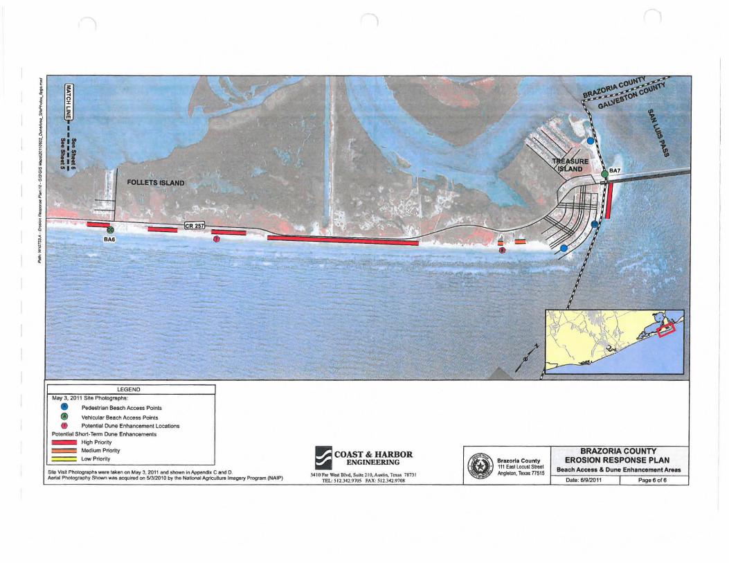
l ~'~-------:~~~~~--~~~~~--------~~-'
~ r1r i Ilr M OllO. • FOlJ.ET& I81.AND
LEGEND
May 3,2011 Site Photographs:
• Pede5l.rian Beam Access Points
• VehiQJlaf Beach Access Points • Potential Dune Enhancement Locations
Potential Short-Term Dune EiYlancemeols _ High Priority
c:=:=i Medium Priority
~ Low Priority
Site VlsI: photog~, __ teken on May 3, 2011 and shown In Appencb CandO. A8flIII Photography Shown WIIS acquired on 513/2010 by II'KI NaIioMt AgrIculur. Imagery Program (NAIP)
~ COAST & HARBOR ~ ENGINEERING
3410 F ... Well Blvd. Su~e210.AII&Iin. Tcus 78131 TEL: 5 12.342.9705 FAX: 512.1<'2.9703
•
e"'· Btazort. County . • 111 East locust Sml
... Jjl Ang/elon, TUls nS1S
BRAZORIA COUNTY EROSION RESPONSE PLAN
Beach Access & Dune Enhancement Ar •••
Date: 61912011 Page 6 of 6
Appendix C Site Visit Photographs: Beach Access Areas
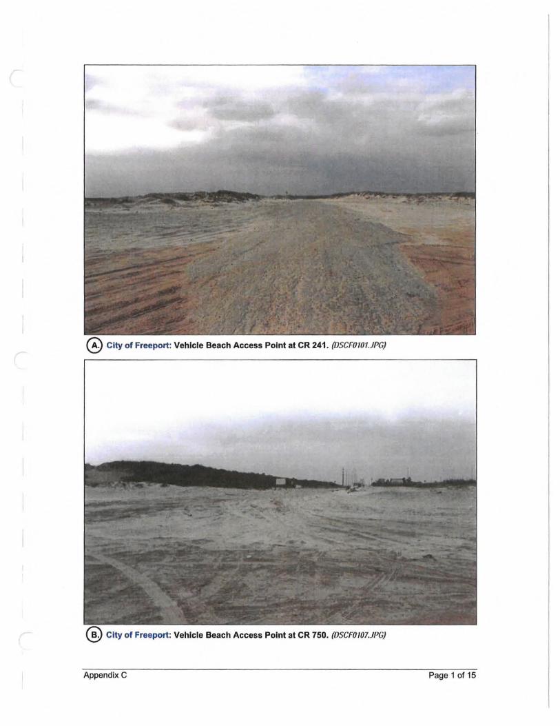
@ City of Freeport: Vehicle Beach Access Point at CR 241 . (DSCF0101.JPG)
@ City of Freeport: Vehicle Beach Access Point at CR 750. (DSCF0101.JI'G)
Appendix C Page 1 of 15
Town of Quintana: Vehicle Beach Access Point at 16th Street. (OSCF011O.JPG)
® Town of Quintana: Vehicle Beach Access Point at ath Street. (OSCF0087.JPG)
Appendix C Page 2 of 15
Village of Surfside Beach: Vehicle Beach Access Point at Jettyvlew Road. (OSCFOI50.JI'G)
Appendix C Page 3 of 15

_ ... ;.. ~ .. - .....
.; ' . . . ..... . Village of Surfside Beach: Pedestrian Beach Access Point at Texas Street. (DSCFOI61.JPG)
® Village of Surfside Beach: Pedestrian Beach Access Point at Beach Drive.
Appendix C Page 4 of 15
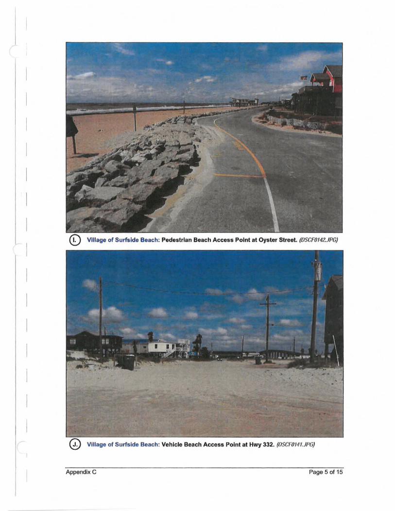
Village of Surfside Beach: Vehicle Beach Access Point at Hwy 332. (OSCFOI41.JPG)
Appendix C Page 5 of 15
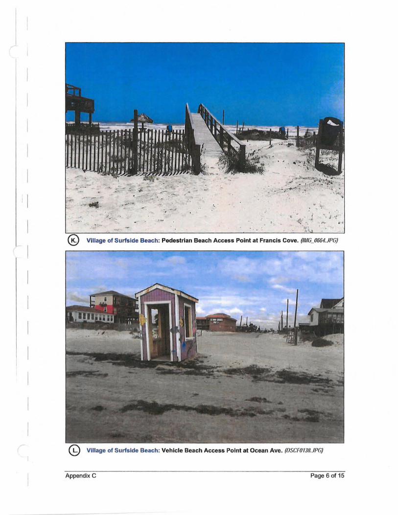
.,- r' - .. , • .,..... "T . '.
"
.. -. '. ' .
Village of Surfside Beach: Pedestrian Beach Access Point at Francis Cove. (IMG_0664.JPG)
Village of Surfside Beach: Vehicle Beach Access Point at Ocean Ave. (OSCF0138.JPG)
Appendix C Page 6 of 15
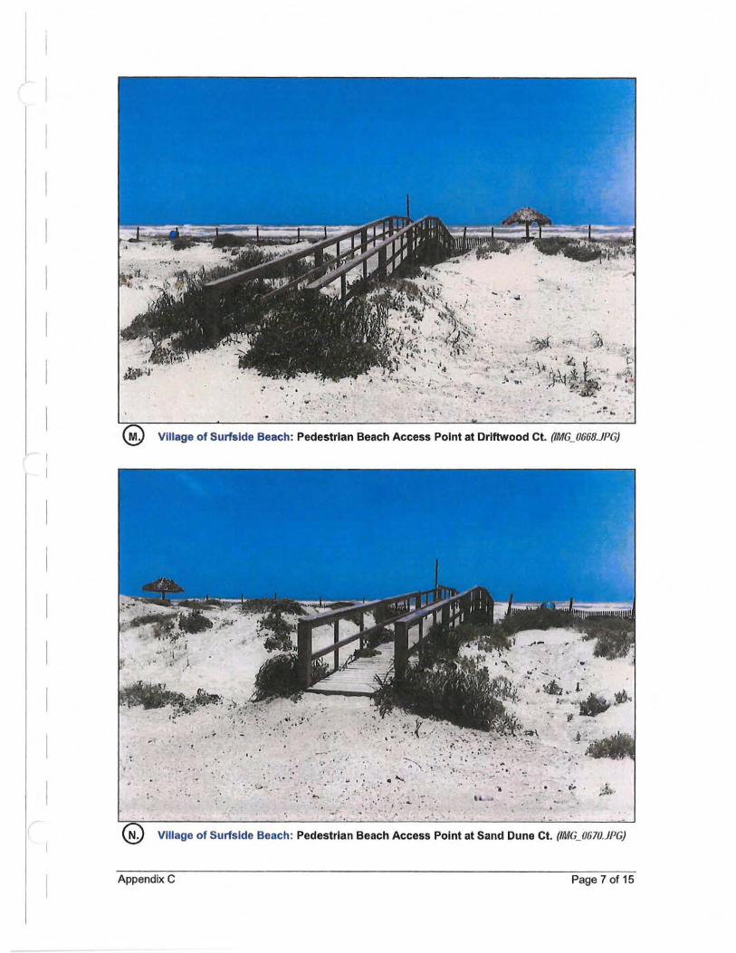
_.
.... ... .. , ,
, " " ":'. ~ . I , '. . ' , , . ' ,.
. ,. .. .. Village of Surfside Beach: Pedestrian Beach Access Point at Driftwood Ct. (IMG_0660,JPG)
... .,
" , , ,'
. '
.-4 ' I', " .. ~
, , - ' .. : .....
'.
' . ... . . .," . \-,
, ,
.... ....:. .-=-:.; .. (
"
.;., , "
j.,.,
.. ' "
Village of Surfside Beach: Pedestrian Beach Access Point at Sand Dune Ct. (IMG_0670.JPG)
Appendix C Page 7 of 15
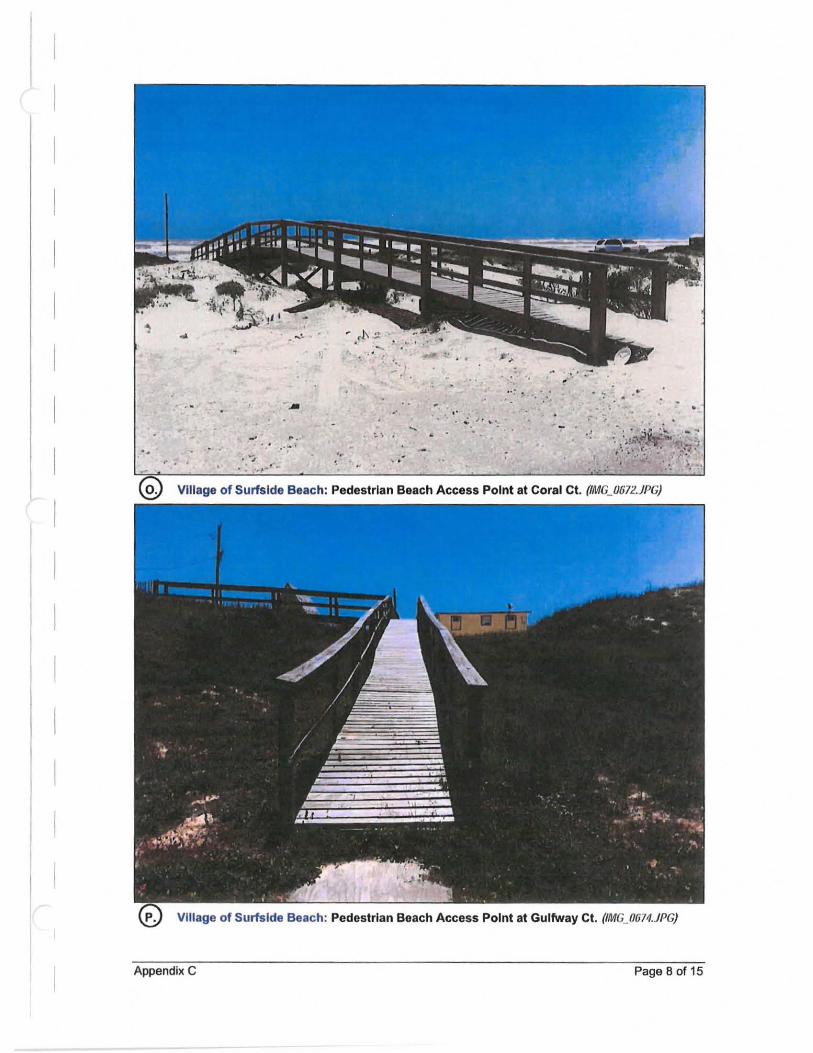
I
", , .
-'
.'
... r . -.
" .. .'
" .. ':' .-' .. .'
• • t ' ..• ..:. .I , ... .. . ' ,. •
Village of Surfside Beach: Pedestrian Beach Access Point at Coral CI. (IMG_U672.1PG)
Village of Surfside Beach: Pedestrian Beach Access Point at Gulfway CI. (IMG_0674.JPG)
Appendix C Page B of 15
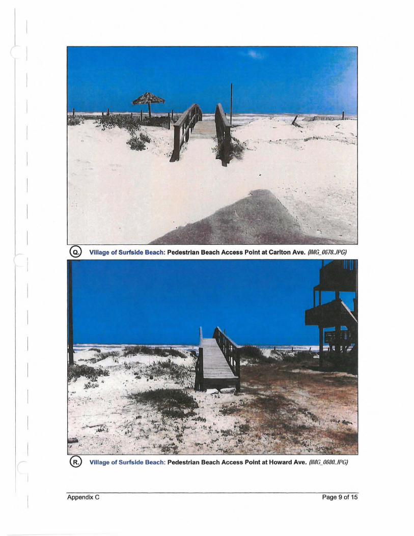
· !#" ... <~ 'o.~- _ '0 ,...~
'.
Village of Surfside Beach: Pedestrian Beach Access Point at Carlton Ave. (IMG_061B.1PG)
.~'
.' ~ .. ;~;i:.' . . 0.,
Village of Surfside Beach: Pedestrian Beach Access Point at Howard Ave. (IMG_0600.1PG)
Appendix C Page 9 of 15
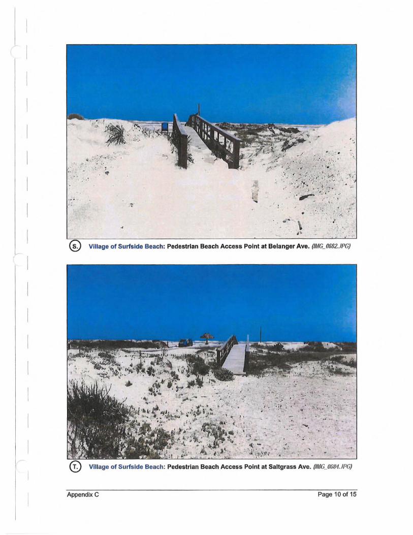
'. ~ " .. ,;, :~ .. ;:" L'"
(> • "
, or ' .. ~
1 t " ~ ,-
:, :: • '. ' ,~
Village of Surfside Beach: Pedestrian Beach Access Point at Belanger Ave. (IMG_0682,JPG)
" , - .:. .. , ~.' -,;' ~ ." 'l . '" . -
.. ',' ',' ......... ,: ... ' J 0- :~~ • ' . 'l ~ ' ...... . _ :-
.... .. .. . . -. : ~ ~ ~ .-
.. ' """ ',:; . ,,' ~ - .
,., .. : 'J:' . ', .. ').: ' 1riI .'
, ,
Village of Surfside Beach: Pedestrian Beach Access Point at Saltgrass Ave. (IMG_Ofi81.JPG)
Appendix C Page 100f15
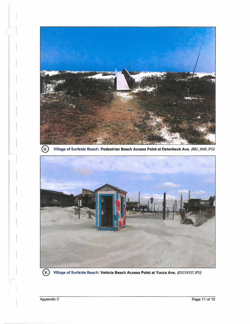
Village of Surfside Beach: Pedestrian Beach Access Point at Detenbeck Ave. (IMG_0686.JPG)
Village of Surfside Beach: Vehicle Beach Access Point at Yucca Ave. (DSCFOI31.JPG)
Appendix C Page 11 of 15
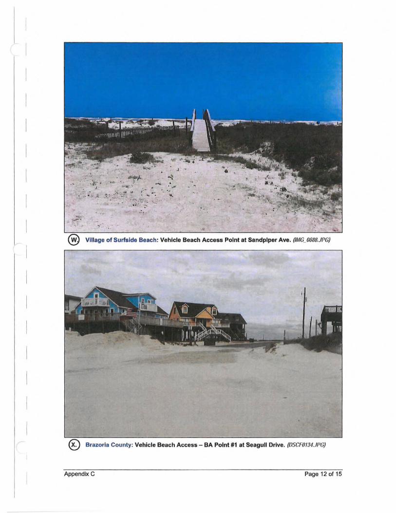
' . ...... ~ ..
.... , . . - . '. ~ .. .. , - .-:.: . ~:.'-' ...... \'; -
.'
J -
. . .", • '. '. , ..
,- " .
.'
Village of Surfside Beach: Vehicle Beach Access Point at Sandpiper Ave. (IMG_0688.JPG)
® Brazoria County: Vehicle Beach Access - BA Point #1 at Seagull Drive. (DSCF0734.JPG)
Appendix C Page 12 of 15
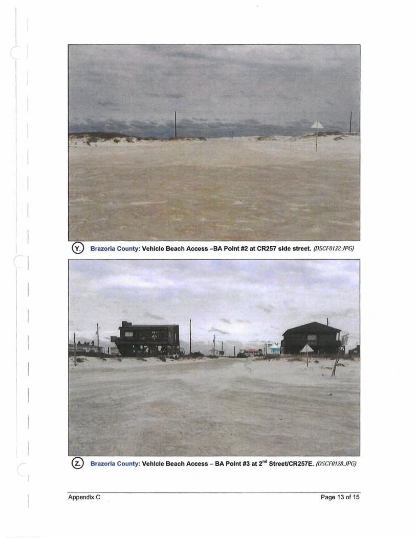
Brazoria County: Vehicle Beach Access -SA Point #2 at CR257 side street. (DSCF0732.JPG)
Brazoria County: Vehicle Beach Access - BA Point #3 at 2nd StreetlCR257E. (DSCF0728.JPG)
Appendix C Page 130115
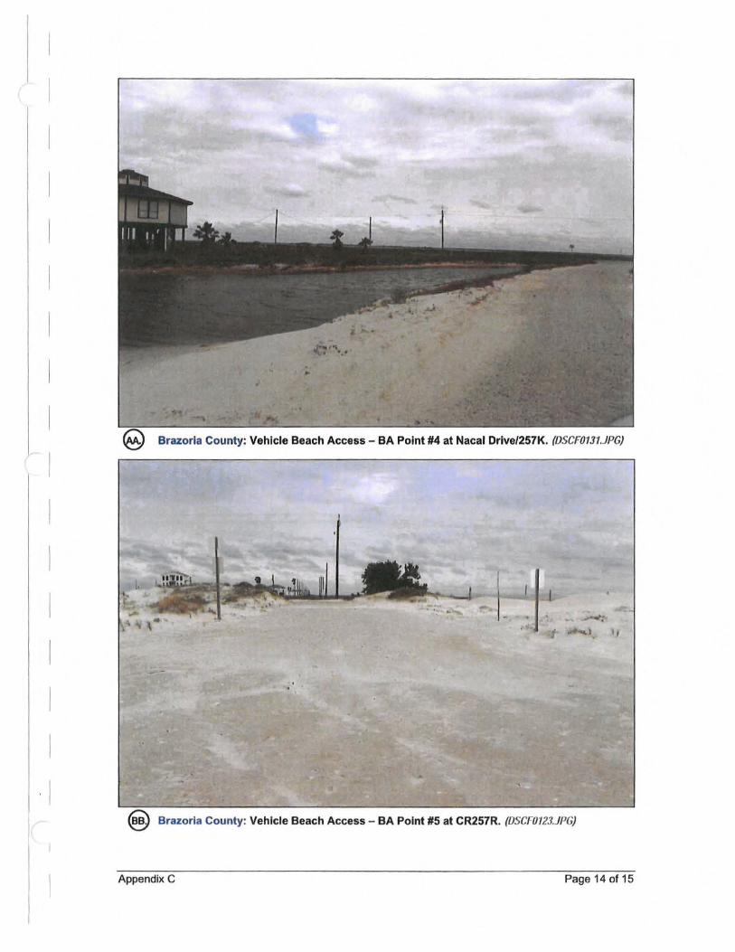
Brazoria County: Vehicle Beach Access - BA Point #4 at Nacal Drlve/257K. (OSCF0131.JPG)
: I f
· 1 ® Brazoria County: Vehicle Beach Access - BA Point #5 at CR257R. (OSCroI23.JPG)
Appendix C Page 14 of 15
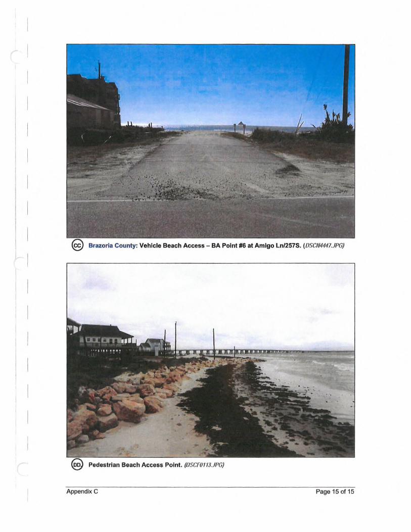
Brazoria County: Vehicle Beach Access - BA Point #6 at Amigo Ln/257S. (DSCN4441.JPG)
Appendix C Page 15 of 15
Appendix D Site Visit Photographs: Potential Dune Enhancement Areas
Potential Short-term Dune Enhancement Area. (DSCF0097.JPG)
Potential Short-term Dune Enhancement Area.(OSCFOII.'J9.JPG)
Appendix D Page 1 of 4
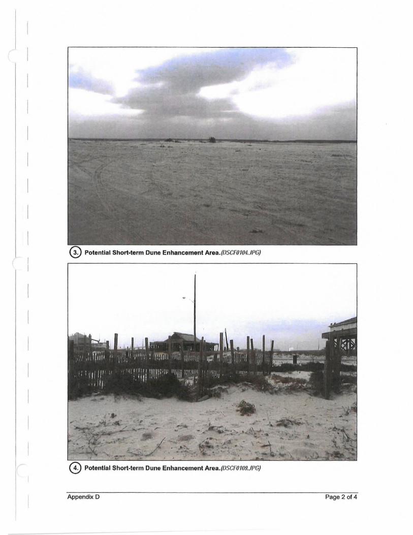
Potential Short-term Dune Enhancement Area.(DSCF0104.JPG)
•
o Potential Short-term Dune Enhancement Area.(DSCF0109.JPG)
Appendix D Page 2 of 4
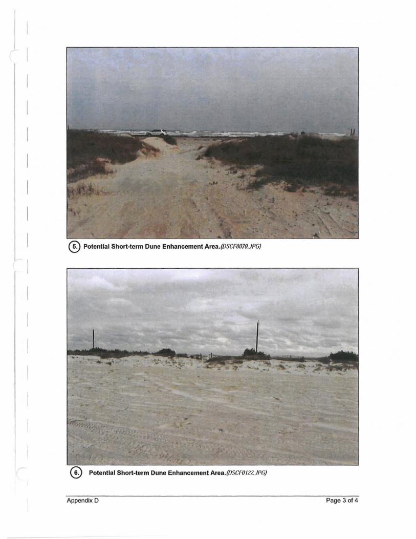
Potential Short-term Dune Enhancement Area_(DSCF0079.JPG)
•
Potential Short-term Dune Enhancement Area. (DSCF0122.JPG)
Appendix D Page 3 of 4
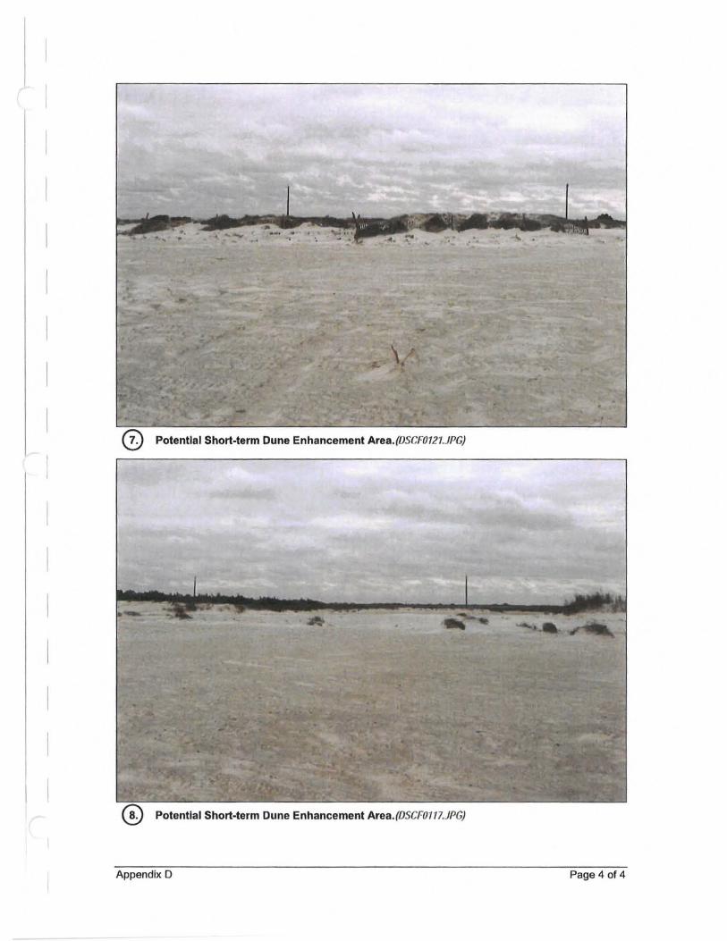
o Potential Short·term Dune Enhancement Area. (OSCFOI27.JPG)
Potential Short·term Dune Enhancement Area.(OSCFOII7.JPG)
Appendix D Page 4 of 4

Appendix E FEMA BFE Zones & Long-Term Critical Dune Typical Sections
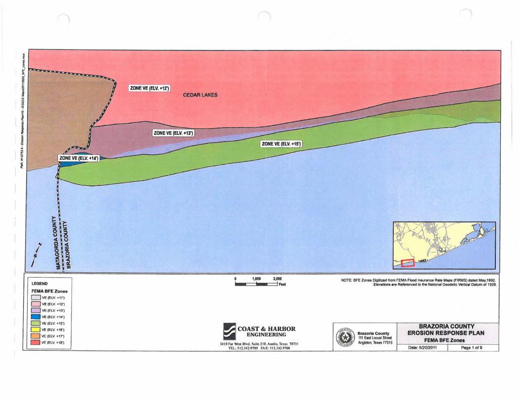
i i Ii' ) J I ZONE VE (ElV. +12') I -
) CEDAR lAKES • §
i j • .1 ZONE VE (ElV. +13') L
.
~ --I ZONE VE (ELV. +15') r • ~ ; • I ZONE VE (ELV. +14') • f~
r----
~ ~ 8 ~ .. & u 8 c u
'" § \ I ~\ -~ - ~ ~ ~ --/' I
, I.'" 2 .... NOTE: 8FE Zen .. Oigitl.ted from FEMA Flood I"ur~ R.te M"PIIFIRMS) dated M.y.'892. LEGEND . . I .... Elevatlons.f. ReferwIced 10 !he National Geodellc: v.rtJcIII o.lUm of 1929.
FEMA BFE Zon •• D VI: (ELV. ·11')
o 'If (ElY . • '2")
o VE (ElV. ·13')
_ VE(EW . • '4')
o VE (ElV . • ,51
D VE(ELV. +UI') ~ COAST & HARBOR e BRAZORIA COUNTY
CJ VE (ElV . • tTl ENGINEERING * Bruorl. Coynty EROSION RESPONSE PLAN
a \IE (ElV . • 18') • • 111 Eat Locust Streel
FEMA 8FE ZO""O )410 f.,. 'l\Tsl Olvd. Suile 210. A.slill. Teu. 711nl I.,~ ... ~ Anglelon, Texas 77515
-mI.: S 12.J.42.91O!i fAX ; 512.)42.1)708 Dale: 512012011 I Peg810f9
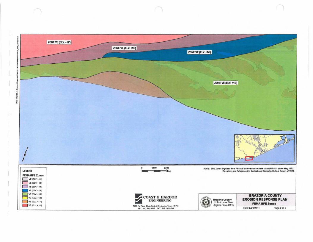
/ LEGEND
FEMA BFE Zan ..
o VE (ELV. +11',
o VE IELV. ·'2'1
DVE(Elv. ·m _ lie (ELV. ·1 .. ,
DVElElv . • ,S')
o VE (ELII • • '8')
D ve(1:lv. +,1' )
\IE (ELY . • 1!')
ZONE VE (ELV, +t2')
o 1,010 2,100
.' .o::::::j'.-=:::::jl Fttt
1'.;1 COAST & HARBOR ~ ENGINEERING
;WIO f. ~ OIYd.s...ik 210. A'l>Iln. TUII. 711731 1m.: ~ 12..l42.970$ FAX; SI2.l4'.970M
ZONE VE (ELV, +tS)
NOTE- BfE ZQI'IH DIgitiZed from FEMA Flood InlUranat Rate Mlp, (FIRMS) dated MIy.I992. • E1e ... .cIon .... Refetenced 10 !he Nationlll Geodetic Vert~ Olltwn of 1921
e .. ~ ' · BrazortlCounty . • 111 ElltLocusl SIrHI. ~"''' ''!1P Angleton, Te.", 71515
EROSION RESPONSE PLAN FEMA BFE Zone.
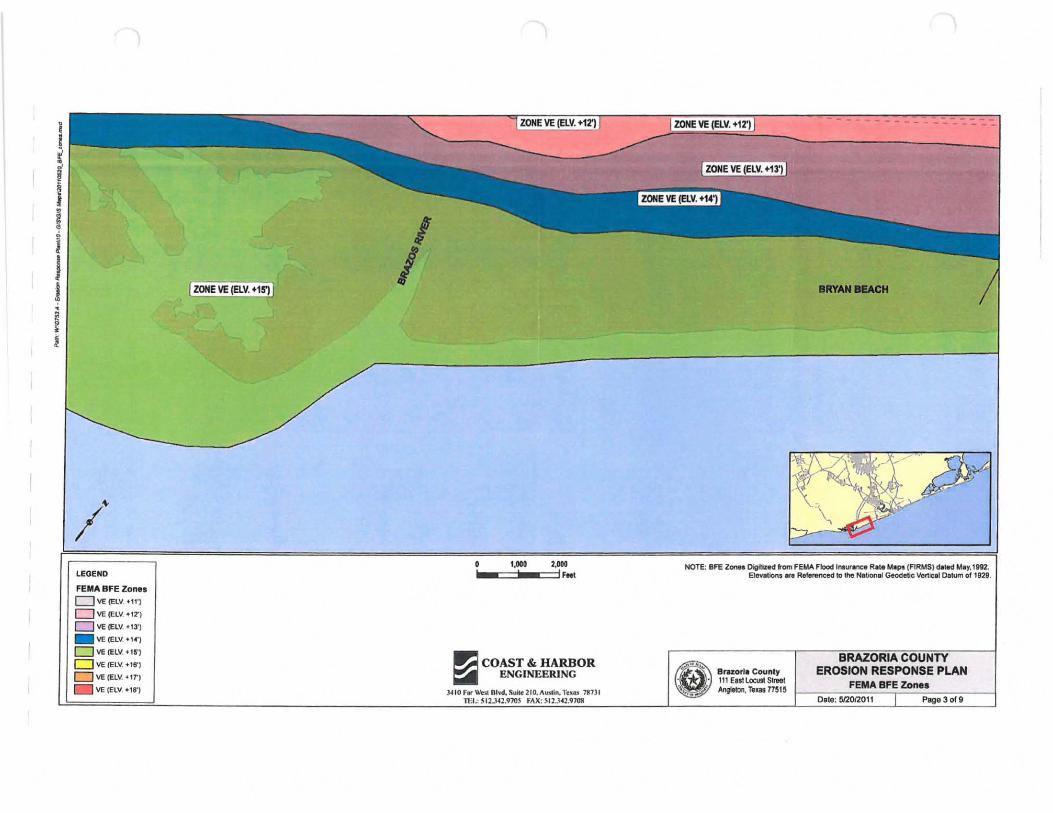
LEGEND
FEMA BFE Zones o 'IE (ELV. +11')
DVE(Elv. tl2')
o \IE (ElV. f IJ')
_ 'IE (ELV'. +'4')
o \IE (ElV . • 15'J
o 'IE (El". +18")
D VEIELv" ,r) 'IE (ElV . • '8')
ZONE VE (ELY. +15')
I I
' ,000 2,000 .... ==j· .. OC:=jIFM'
~ COAST & HARBOR ~ ENGINEERING
J. ,O F., WnI OI~d. Silk 210. Avuin. 1'r u , lin, n il.: 511.J42.970S fAX : SI2.H2.910!1
BRYAN IIIIACH
Digltlzltd tom FEMA Flood InlUJaI'ICe Rli. Map. (FIRMS) MIMI May,lm.. NOTE: BFE ZonI'I E1eyatior1'.It R.fereneed to lhe Naliofl.1 Geodetic Vcrllc.1 Oatum 01 1929.
e;.o!" ~'" BnzoriaCounly
. • 111 Eesl locust Sireet 1'1",.. AngItton, TeUl71515
EROSION RESPONSE PLAN FEMA BFE Zones
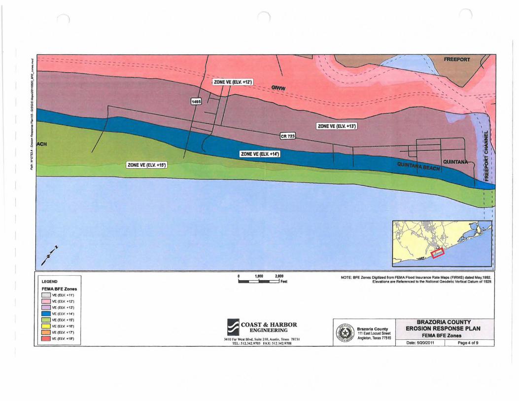
I~
LEGEND
FEYA BFE Zone. DVE(ElY . • 11')
o \IE (ELY . • 12')
DVE(ElV, +l3')
_ \IE eeL\', .1"')
o \IE (ElY . • 15')
D \IE (ELY . • 15')
o ve (ELY. tIT)
\IE (elY . • 18')
ZONE VE (ELV. +151
t,toO 2.'00 1000-==-1 _=11 'HI
~ COAST & HARBOR ~ ENGINEERING
J4ID F.~ 81...". S"i~lIO."'Ultl n. TI'JIa) 117)1 TEl.: '12.:W1.9705 fAX ; ~12.l·U.9708
::- -----
, , I'IIIIPORT
.. = ~ = = = :- ~ ... ' -.. ... -- --:;. ---
ZONE VE (ELV. +131
NOTE: BFE Zona Dlgltlred from FEMA. Flood In.uranc4I Rat. M.~ (ARMS) d.1ed 1.4 • .,.1892. EleYllllon. Ir. Referenced to the Nalional Geodetic Vertlcl ' Datum of 1m .
Br.zorl. County 111 EntlocuslSlreet AngIlIOO, TIJIS 71515
EROSION RESPONSE PLAN FEMA BFE Zone.
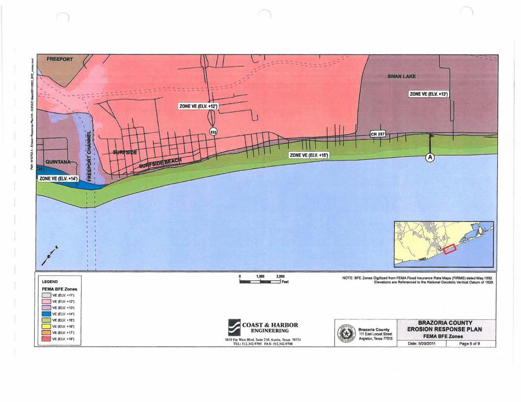
PIUII!PORT
- :. :. : .':. '- - ~~ - ----------,, - - -
I~
LEGEND
FEMA BFE Zone. D VE (ELV. +11',
o VE (ELY .'T) D VE IEL ..... . '3')
_ VE (ElV . • ,4',
o VE (ElV. "$"
D VE:('ElV . • ,ei
D VE(Elv. +n')
VE (ELY, .18',
, , , I
,
, , , ' , , , ,
- :. :...
~ COAST & HARBOR ~ ENGINEERING
.w 10 F. \\'01 nl .... Sloik210.All5li., Tuft lIn. .: ~12.142.')1OS "AX: SI2.J4B1OS
, , , ,
8"'···· .~. ' ..
Bl'llzorla County 11 1 East lOCllSl Slsael Anglelon, Teus 17515
EROSION RESPONSE PLAN FEMA BFE Zon ••
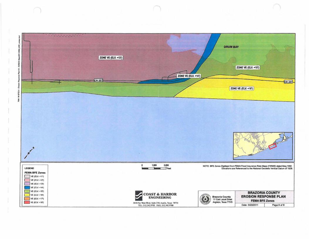
I t' i'
t i j
-- --...... --
J~==~====~~==~_
DRUIlBAY
ZONE VE (ay. +151
~ i ~-----------------------------L~----________________ -J t
I ZONE VE (ELY. +16') I
I~
lEGEND
FEMA BFE Zon •• D \IE (ELV +11') o \IE (ELV. <12')
D \IE (ELV . • '3')
_ VE(ELV <14')
D \IE (ELV. + 15')
D \IE (ELV. +16')
DVE(ELv. +1T)
\IE (ELV. <liS')
1,101 2,ooa i.ooc:=-' _:::::j) , ...
~ COAST & HARBOR ~ ENGINEERING
).410 far WeIll or...!. Suik ]'0. A"";II. To:u. 71131
NOTE· 8FE Zoon OIgItIzed from Fad .... Flood los~.-.ce R.te M.pt (FIRMS) d.1Itd M • .,.1m. • Elevation, ,til RlNireneed to the N'tlon,1 GIOd,1lc VIIr1icai Oalum of 1929.
_'" '" Bnlzori,County
• • 111 ElSl l OCUll SC,., • '... A/J;IIftJn. rex" 77515
EROSION RESPONSE PLAN FEMA BFE Zon ••
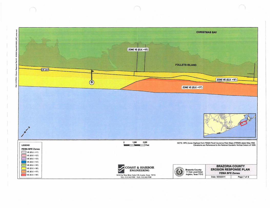
I
~ CHRl8TMAIBAY
~' ., J i I ZOHE VE (ELY. +15') I
• ~ • i
J Flll.Ur8I11.AND
j R 257 ..
J -< =---~ I ZOHE VE (ELY. +161 • B , l I ZONE VE (ELY. +171 .
~.?k I~
/ .~ ""'\ --, ",00 UOO NOTE: BFE Z_ Digltlzltd "om FEMA Flood Imll ..... nc. Rite ~p, (FIRMS) deled "bY,1992.
LEGEND , .
IFNI EJeyIltlonI Ire Referenced to 1M NaIIoMi Gtodelic V.rticlll Datum 01' 1 ;28.
FEMA 8FE Zon •• D VE (ELV. +11 ')
o \IE "'LV. ·'2')
o VE (fLV. ·'3,) _ \IE (elV. +1~1
o \IE (Ell I . + '!Ii' )
o \IE (ElV . • 'e') ~ COAST & HARBOR e.' .... '. Co.nly
BRAZORIA COUNTY a ~ (ELV. +17') ENGINEERING EROSION RESPONSE PLAN
lIE (ElV. +18') '" '*- . 111 ElstLorustSll'Ul FEMA BFE Zon ••
)410 F. \\'w Oh'll. SIIMl l0, AtI5I;n. TrlU n1l1 "', ... .. ;: AngIetIn, TeQl11515 n il.: S'2 . l42 .910~ ft\X : '12.342.9?08 Dale: 512012011 I Page T of 9
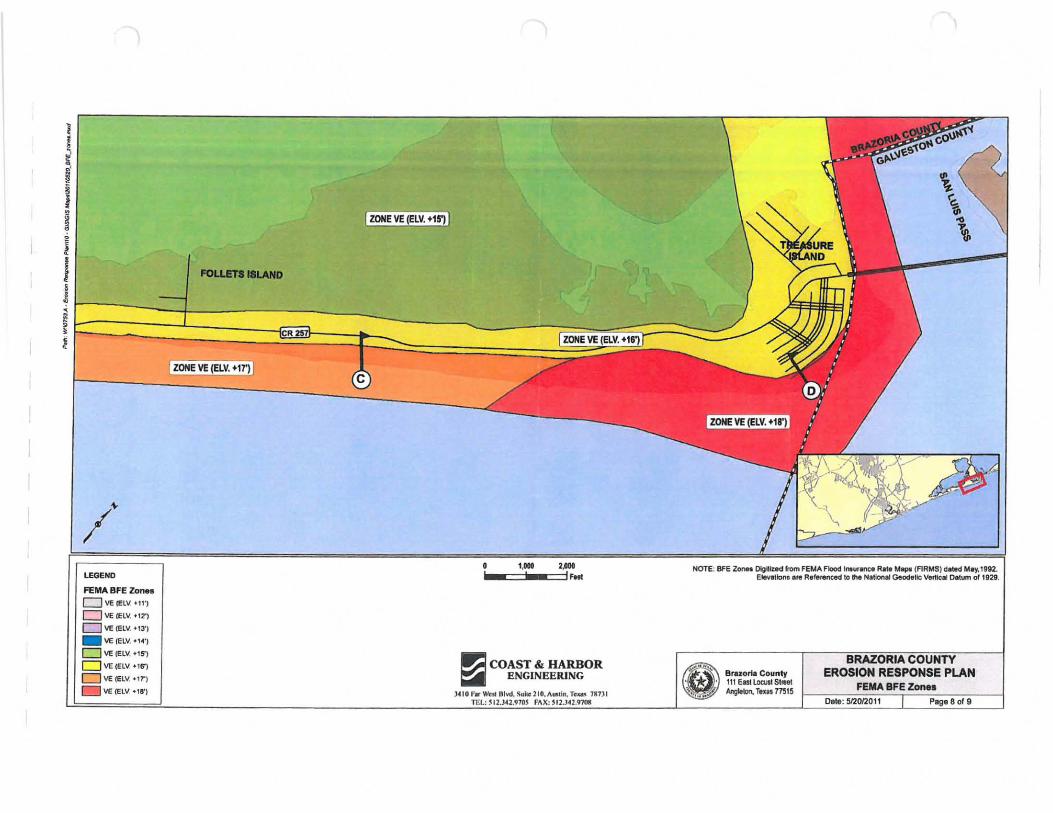
LEGEND
FEMA BFE Zon ••
D \IE IE lV. +11',
o VE (ELV. +12')
o \IE (ELV. "3')
_ \IE (ElV. "<1')
o \IE (ElY. "5')
o lIE lELV. " 6')
D VE (ELV. "r)
\IE (ElV . '8')
ZONE VE (ElV. +15')
FOi.UTIIlLAND
ZONE VE (ElV. +11')
1,00II 2,D011 _-=:::11' _==:11 foot
II';! COAST & HARBOR ~ ENGINEERING
}4 10 1'. Well 0Iw1. SOle 21(1, AIIi.hI, Texa. lU)1 n i!.: ~ 12.l42,970' "AX: "2_Hl.97011
NOTE' BFE Z_ Dlgltlled tom FeUA Flood 'l'IIurenee RN MIIJ» (RRMS) d.wd May.II112. . elevation. ere R_"ren'*' to the N.!Ion.1 Geod,lIc verticil Oelum of '1129.
e'~ Brnori. Count)'
• • 111 Eas1loall! SIIMI ~ .,.~.. Anglltotl. rem 71515
EROSION RESPONSE PLAN FEMA BFE Zon ••
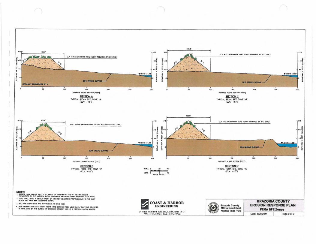
·, 100.0-
... '\Ik r.~.., I ELY •• n.28 ~ otM HOCJt T II(QUIIICO IV 1If[ lON()
... . " 1.,0 .r.; l L, • § ~ ,
" .. , . " DlS TAHC( AlONG 5[CJtOH {l"UTI
· .. F------c·~~·,,-----" ... ,.'0 ! or'; .; ..•. . ,: .: •.. "'1., •
~., " ",~~. ". ' ... : U~
i ~:::..·:..~.~" .. ~b·."". ,~· '-"-'-~'-':"":>1.-------------7-----.·;';;-iii"iii·"~ ; i s' , H _ ..... .., .
...
MQIEl! , . WI_~ DUH[ ~T SHO..l.O 11£ 'A5(O !;IN __ C1' ' " " n« 11ft KlQ.ll
n'AA1.I9U1 IT nt£ II ... 1\OIIN.. nooo "SUIINt(( I"IOCIU.V nooo N$UIlAIICIi: IIAl[ IoIAPS.
2. IU« $HAll MA'oI( ... ........ _114 (I \00 ,tlT Wl(A5U'(0 I'D!I'OIOICllVJ JO IH£ CI.U" ~ AMI MA"oI[ II" "':«1""'11[ CCMJI,
). en:: ZON£ £\.[YUIOHS NI£ ~ TO "'A\tI ,tH.
• • 2010 CIIOlIIO SUlll"AClS SMOWi "'IM _ DI:IIM:O nIOW I..OAII OII'A 1HAl w.s COU(CIUl .. -.. "lOlD 1'1" M M!fItI,IJ (J" EaMUC ctOlOOT AlII) IS .. ,UfICAl OII~ ..... \(1 ...
..= COAST & HARBOR ~ ENGINEERING
J<I 10 F. ~II Blvd, Suik 2Io.Aus" n, TC'U. 1117.H TEL: SIl ,l~B10~ FAX: ~IU.a).4'Hll
" .
[t.Y • • '2.1, (~H"'UM 011": HOQtT II[Q.IMO (IT !Itt lQf()
_.1.10'
---".
DlSlANCf: 1rl.0PfC !l:C_ [fUr]
SECDONC TYPICAL F'E MA BrE ZONE \£
(ELV . .. 17')
[LY, . ' ).!III
'"
__ ---. ....1
aE9DONP TWlCAI. FDlA. er E ZOHE 'IE
(ELV, He')
Bmort. County 111 EIISI Locust Snel Angleton. Tl o s 77515
BRAZORIA COUNTY EROSION RESPONSE PLAN
FEMA BFE Zon •• Date: 512onOff Pagll 9 of 9
...
Appendix F Meeting list of Attendees
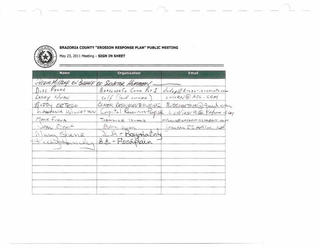
BRAZORIA COUNTY "EROSION RESPONSE PLAN" PUBUC MEETING
May 23, 2011 Meeting - SIGN IN SHEET
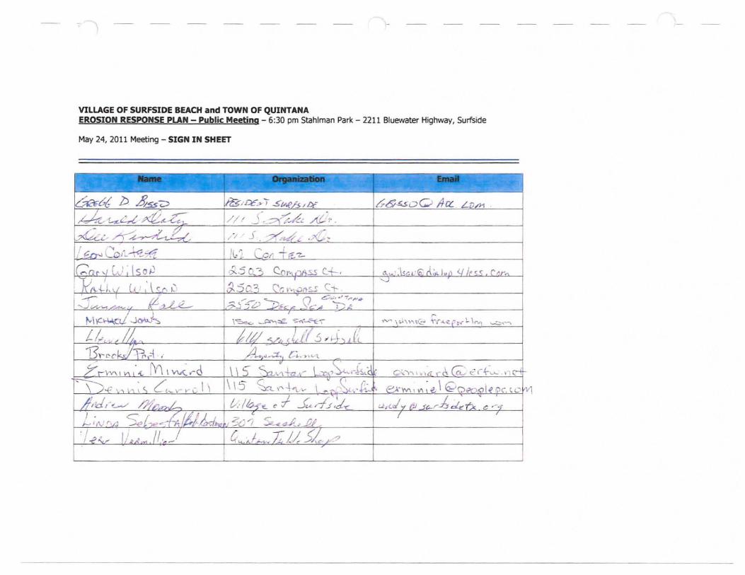
VILLAGE OF SURFSIDE BEACH and TOWN OF QUINTANA EROSION RESPONSE PLAN - Public Meeting - 6:30 pm Stahlman Park - 2211 Bluewater Highway. Surfside
May 24. 2011 Meeting - SIGN IN SHEET
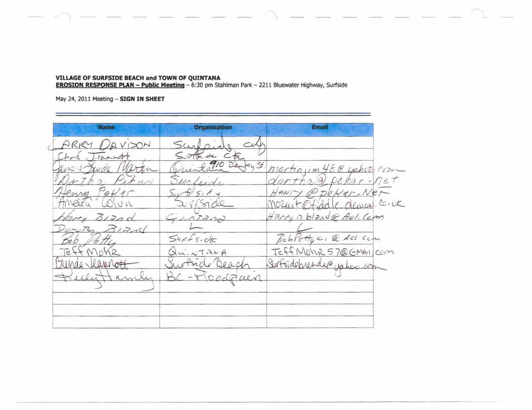
VILLAGE OF SURFSIDE BEACH and TOWN OF QUINTANA EROSION RESPONSE PLAN - Public Meeting - 6:30 pm Stahlman Park - 2211 Bluewater Highway, Surfside
May 24, 2011 Meeting - SIGN IN SHEET
RESOLUTION NO 06292012A
Amending the Beach AccesslDune Protection Plan
By adopting the Erosion Response Plan (ERP)
WHEREAS, the Village of Surfside Beach recognizes that it is necessary to reduce public expenditures for erosion and storm damage losses to public and
private property, including public beaches.
*******************
WHEREAS the Village of Surfside understands that the ERP was developed in consultation with the GLO and establishes building set back lines and
standards for construction seaward of that line.
*******************
WHEREAS the Village of Surfside acknowledges that the plan identifies opportunities for mitigation and preservation of public beach access areas and
dune systems.
********************
WHERAS the Village of Surfside Beach agrees with further fmdings of the plan and WILL adhere to the contents. Now hereby adopting the Brazoria County Erosion Response Plan prepared by Coast and Harbor Engineering,
Inc. in conjunction with the GLO dated June 3, 201l.
NOW, THEREFORE BE IT RESOLVED BY THE VILLAGE OF SURFSIDE BEACH AS FOLLOWS:
Read, Passed and approved this 29th day of June 2012.
Attest: Sandra Miller, City Secretary
MINUTES - Surfside Beach City Council - June 29, 2012 City Council Meeting.
Elected Officials Present: Mayor James Bedward - Georgia Keeney, Mark Corey, Bob Petty and Chris Jeannott - Bob Eastman was excused.
City Employees Present: Sandra Miller, City Secretary
The Surfside Beach City Council convened in a special meeting on June 29, 2012.
Moment of Silence and Pledge of Allegiance
1) REGULAR ITEMS
A) "Discuss and consider adopting Erosion Response Plan (ERP) as an amendment to Beach Access/Dune Protection Plan"
Mark Corey asked if this would have any significant impact on Surfside, Jim advised that the changes were positive and were necessary in order for Surfside to be able to receive CEPRA funding.
Motion was made by Georgia to adopt, second by Bob Petty with all in favor the motion passed.
Meeting Adjourned.
Attest: ~j11 ~ Sandra Miller, City Secretary 7/10/2012
December 15, 2014
Village of Surfside Beach
1304 Monument Drive
Surfside Beach, Texas 77541
Main Line: 979-233-1531
RE: Joint Erosion Response Plan
Surfside Beach adopted the Brazoria County Erosion Response Plan
as an amendment to our local Surfside Beach Dune Protection and Beach
Access plan with Resolution 06292012A on June 29th, 2012. No changes
have occurred to this plan since that date by any of the four localities.
Thank you,
~~ fY\~
Sandra Miller
City Secretary
Surfside Beach Stahlman Park. Shelter, walkover access, public parking, public showers and restrooms and pinic tables.
" . .,""- , ;':'
;.': .~"". " ......
_ .. ~'" ~t'
"~
·.1
.. ~ . .-' .. . '., :,~, :'
. < .. f .. : '" .. ~.:-~ ......
".".,.~ -" '~ :. -~