unsd-celade regional workshop on census cartography for the 2010 latin america’s census round...
TRANSCRIPT
UNSD-CELADE Regional Workshop on Census Cartography for the 2010 Latin America’s census round
Definition of the
National Census Geography

UNSD-CELADE Regional Workshop on Census Cartography for the 2010 Latin America’s census round
Overview
National Census geography Criteria for EA delineation Coding scheme Geocoding Conclusion
UNSD-CELADE Regional Workshop on Census Cartography for the 2010 Latin America’s census round
National Census Geography
An early decision in census planning pertains to the administrative areas for which census data will be reported
List of all administrative and reporting units in the country, with the relationships among all types of administrative and statistical reporting unit boundaries defined
Consists of an administrative hierarchy
UNSD-CELADE Regional Workshop on Census Cartography for the 2010 Latin America’s census round
Administrative hierarchy
Every country has its own specific administrative hierarchy
Definition: A system by which the country and each lower level
set of administrative units (except the lowest) are subdivided to form the next lower level.
UNSD-CELADE Regional Workshop on Census Cartography for the 2010 Latin America’s census round
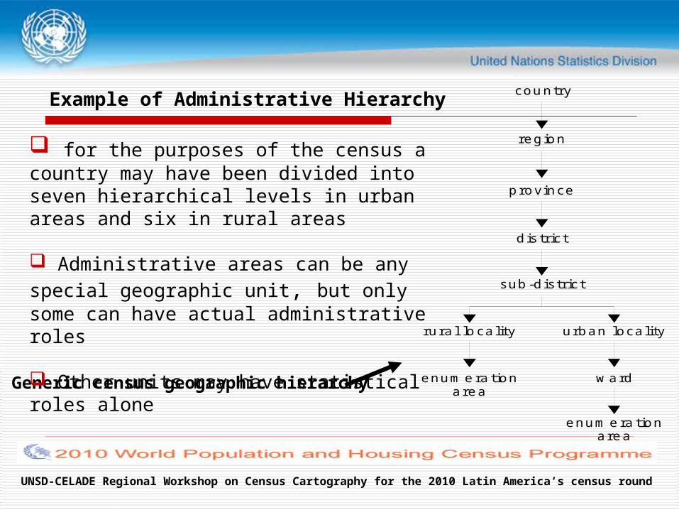
Example of Administrative Hierarchy country
region
province
district
sub-district
urban localityrural locality
ward
enumerationarea
enumerationarea
Generic census geographic hierarchy
for the purposes of the census a country may have been divided into seven hierarchical levels in urban areas and six in rural areas
Administrative areas can be any special geographic
unit, but only some can have actual administrative roles
Other units may have statistical roles alone
UNSD-CELADE Regional Workshop on Census Cartography for the 2010 Latin America’s census round
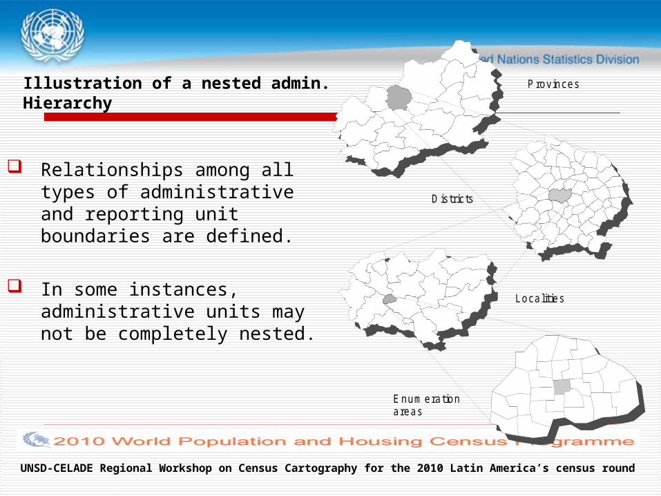
Illustration of a nested admin.Hierarchy
Relationships among all types of administrative and reporting unit boundaries are defined.
In some instances, administrative units may not be completely nested.
Provinces
Districts
Localities
Enum erationareas
UNSD-CELADE Regional Workshop on Census Cartography for the 2010 Latin America’s census round
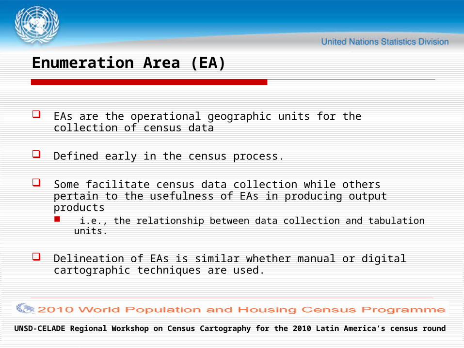
Enumeration Area (EA)
EAs are the operational geographic units for the collection of census data
Defined early in the census process.
Some facilitate census data collection while others pertain to the usefulness of EAs in producing output products i.e., the relationship between data collection and tabulation units.
Delineation of EAs is similar whether manual or digital cartographic techniques are used.
UNSD-CELADE Regional Workshop on Census Cartography for the 2010 Latin America’s census round
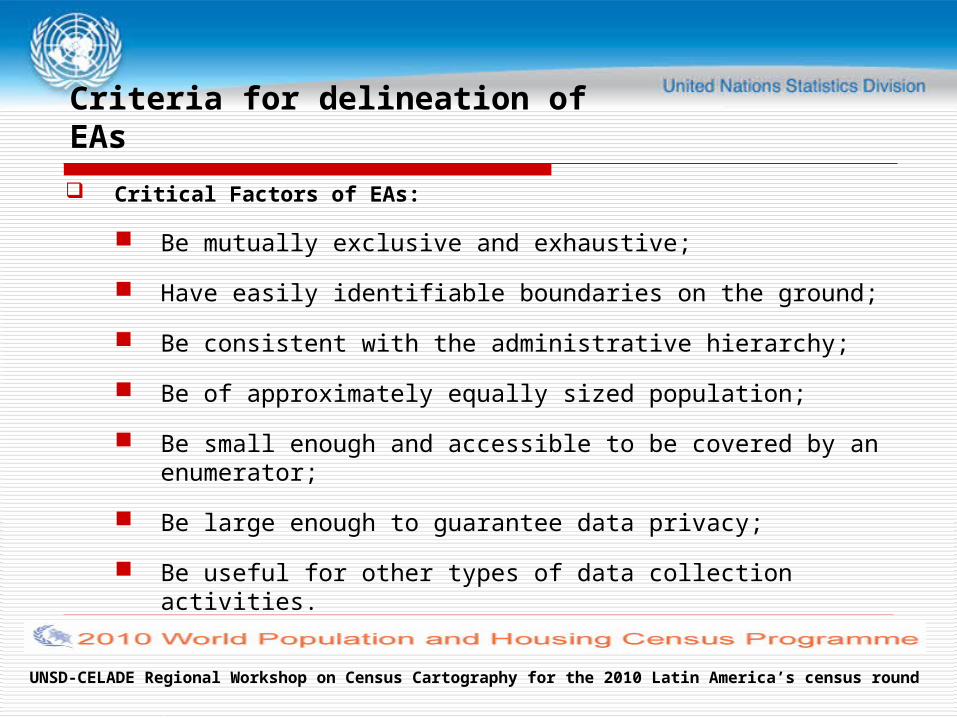
Criteria for delineation of EAs
Critical Factors of EAs:
Be mutually exclusive and exhaustive;
Have easily identifiable boundaries on the ground;
Be consistent with the administrative hierarchy;
Be of approximately equally sized population;
Be small enough and accessible to be covered by an enumerator;
Be large enough to guarantee data privacy;
Be useful for other types of data collection activities.
UNSD-CELADE Regional Workshop on Census Cartography for the 2010 Latin America’s census round
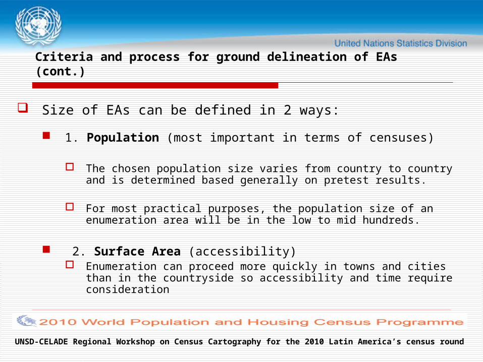
Criteria and process for ground delineation of EAs (cont.)
Size of EAs can be defined in 2 ways:
1. Population (most important in terms of censuses)
The chosen population size varies from country to country and is determined based generally on pretest results.
For most practical purposes, the population size of an enumeration area will be in the low to mid hundreds.
2. Surface Area (accessibility) Enumeration can proceed more quickly in towns and cities than in the
countryside so accessibility and time require consideration
UNSD-CELADE Regional Workshop on Census Cartography for the 2010 Latin America’s census round
Criteria and process for ground delineation of EAs (cont.)
Pre-delineation of EA’s requires:
Estimating the number of persons living in an area and their geographic distribution. (e.g. Count the housing units, determine the associated number of households and multiply by an average household size. )
Commonly done from information from a recent survey or registration system
The number of housing units can be determined through cartographic field work, cooperation with government officials, extrapolation from previous census results, aerial photographs or satellite imagery
UNSD-CELADE Regional Workshop on Census Cartography for the 2010 Latin America’s census round
Criteria and process for ground delineation of EAs (cont.)
In the Delineation of EA boundaries:
EA boundaries need to be clearly observable and easily identifiable on the ground
Enumerators need to be able to find the boundaries of the area for which they are responsible. Natural features that can be used for this purpose are
Roads; Railroads; Lakes, creeks and rivers; Fences, or any other feature that defines a sharp boundary.
UNSD-CELADE Regional Workshop on Census Cartography for the 2010 Latin America’s census round
Criteria and process for ground delineation of EAs (cont.)
In some instances, it is unavoidable to use EA boundaries that are not clearly visible on the ground.
In this case, an exact textual description and appropriate annotation on the EA maps is required.
UNSD-CELADE Regional Workshop on Census Cartography for the 2010 Latin America’s census round
Criteria and process for ground delineation of EAs (cont.)
Population estimates are essential for proper EA delineation
Criteria in determining ideal EA size:
Based on the number of people one enumerator can count in the time period scheduled for data collection. A census pretest can determine the number of housing units (HUs)
that an enumerator can cover per day. Local officials can be called upon to provide small-area estimates, or
the areas in question can be visited by NSO field personnel.
In areas that have not experienced dramatic change, estimates can be adjusted from the previous census based on the time elapsed.
UNSD-CELADE Regional Workshop on Census Cartography for the 2010 Latin America’s census round
Delineation of supervisory (crew leader) areas
Supervisory areas provide the means for crews of enumerators to be effectively managed
The design of supervisory maps is usually straightforward Supervisory areas consist of groups of usually eight to twelve
contiguous EAs which share some of the same characteristics as enumeration areas
The EAs assigned to the same supervisory area must be compact to minimize travel times and of approximately equal size
They should be included in the same field office area, which usually is defined according to administrative units
UNSD-CELADE Regional Workshop on Census Cartography for the 2010 Latin America’s census round
Coding Scheme
A unique numeric code needs to be assigned to each enumeration area or administrative unit.
This is the numeric code that provides the link between the aggregated census data and the digital EA boundary database stored in a GIS.
Ideally the coding scheme needs to be determined on a country by country basis.
UNSD-CELADE Regional Workshop on Census Cartography for the 2010 Latin America’s census round
Coding Scheme (cont.)
The rules used to assign codes need to be unambiguous and should be designed in collaboration within the NSO, especially between the mapping/GIS unit and those managing the data core.
The most important principles when designing a coding scheme are flexibility, expandability, intuitiveness and compatibility with other coding schemes in use in the country.
UNSD-CELADE Regional Workshop on Census Cartography for the 2010 Latin America’s census round
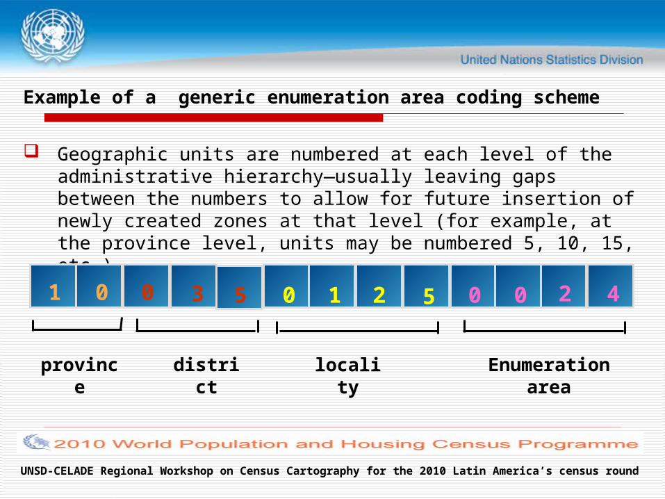
Example of a generic enumeration area coding scheme
Geographic units are numbered at each level of the administrative hierarchy—usually leaving gaps between the numbers to allow for future insertion of newly created zones at that level (for example, at the province level, units may be numbered 5, 10, 15, etc.).
province district locality Enumeration area
1 0 0 3 5 0 1 2 5 0 0 2 4
UNSD-CELADE Regional Workshop on Census Cartography for the 2010 Latin America’s census round
Storage of the unique code
The unique code is stored in the database as a long integer or as a thirteen character string variable
Storage as an integer variable has the advantage that subsets of records can be selected easily using standard database query commands (in any DMS or GIS)
Storage of the code as a character variable can improve consistency, for example through the use of leading zeros.
UNSD-CELADE Regional Workshop on Census Cartography for the 2010 Latin America’s census round
Coding scheme (cont.)
In cases where administrative and reporting units are not hierarchical, special coding conventions need to be developed.
Important to be completely consistent in defining and using the administrative unit identifiers, since they are the link between the GIS boundaries and the tabular census data.
The census office should therefore maintain a master list of EA and administrative units and their respective codes and commit any changes made to the master list to the GIS and census databases.
UNSD-CELADE Regional Workshop on Census Cartography for the 2010 Latin America’s census round
Coding scheme (cont.)
The NSO might also consider publishing a list of EAs including relevant coding, along with the latitudes and longitudes of centroids (central points) and perhaps populations enumerated as well.
Geocoding concept
UNSD-CELADE Regional Workshop on Census Cartography for the 2010 Latin America’s census round
Geocoding Concept
UN definition: Geocoding represents the connection between statistical
observations and real-world locations expressed in terms of latitude and longitude or other locational attributes
Geo-coding concept: not limited to address-matching
Geocoding covers a continuum of spatial scales: from individual housing units to enumeration are level up to higher administrative or national levels.
UNSD-CELADE Regional Workshop on Census Cartography for the 2010 Latin America’s census round
Conclusion
Administrative areas for which census data will be reported: One of the earliest decisions in Census planning
A census geographic hierarchy A coding scheme: flexible and expandible Geocoding: link with geographic database (GIS)
UNSD-CELADE Regional Workshop on Census Cartography for the 2010 Latin America’s census round
Thank You!