unnatural contract: boise’s comprise with nature unnatural contract: boise’s comprise with...
TRANSCRIPT
1
Unnatural Contract: Boise’s Comprise with Nature
Gone is the river that drained the Boise valley in the
days of the Oregon Trail.
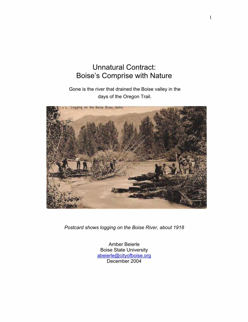
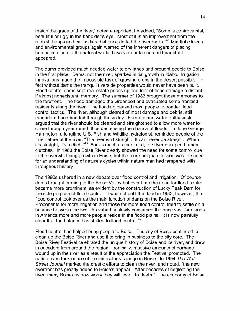
Postcard shows logging on the Boise River, about 1918
Amber Beierle Boise State University
[email protected] December 2004
2
We came out on the last long bench above the valley of the Boise and saw, across a bridge in the distance, the little city which was called the metropolis of the desert plains, the heaven of old teamsters and stage drivers crawling in at nightfall; saw the wild river we had come to tame, slipping from the hold of the farms along its banks that snatched a season's crops from it as it fled.
Mary Hallock Foote A Victorian Gentlewoman in the Far West
At the rivers edge whispering cottonwoods rustle aimlessly in a light breeze, bending toward and away from the flowing waters below. Ducks float and fly about giving little notice to the vivacious activities of the squirrels on the shore, chasing each other and pausing only to curiously sniff out food to store in their elastic cheeks. The stillness and inescapable spirituality of one quiet moment captured only in the serenity of nature. A car honks to avoid a collision with a truck, the ducks fly off, the squirrels scurry away and disappear in the trees, and the stillness vanishes once again. A scene set by nature, but engineered by man. The braided, meandering river that flooded the early pioneers of Boise no longer exists. In its place a sophisticated marvel of engineering wanders through southern Idaho as a representation of the best of nature built by man. Nature is a process of cycles; times of extreme drought followed by years of average rainfall and expansion of wildlife, and then crushing floods. Humans often fail to recognize these cycles. They build homes and invest capital on the profitable commodities nature provides. Unfailingly nature runs its cycle that, at times, equates to prosperity for humans, but devastation almost always follows. The continuation of the natural world through this natural process allows people to procure a false sense of security in those prosperous times. The floodplains, occupied by vast farmlands in previous years, become prime real estate in low water years. When floods ultimately return these river residents are genuinely surprised but finally, amidst destruction, recognize the fury of nature. They seek to control the cycle by building dams and reservoirs. The city of Boise and its people serve as an excellent example of how humans have ignored, recognized and attempted to reconstruct the inherent cycles of nature. Their reaction to the Boise River typifies the lengths at which man will go to harness and construct a more conducive nature. Today the Boise River stands as a peace offering from man to nature.1 March 4, 1863, marked the beginning of Boise’s relationship with nature, when the United States Congress established the Territory of Idaho. On July 5, 1863, Major Pinkney Lugenbeel and a small company of soldiers completed their mission through Idaho to found and construct a military outpost, Fort Boise.2 On July 7, 1863, in the confines of Tom Davis and William R. Ritchie’s pioneer cabin, Boise’s earliest residents platted the city.3 Henry Chiles Riggs drew up the plat that included twenty lots and a grid of streets. The city of Boise was born.4 The
3
first residents of Boise personify the entrepreneurial spirit the West became known for in history. The disposition of those early settlers provided a foundation of ideals that, while adapted through time, explained the unique perspective Boiseans held about their river. Citizens built the downtown center nearly a mile from the river. The spring floods kept them from building any type of permanent residence near the river. The high desert area of southern Idaho and in particular Boise, never garnered much attention. Boise served as little more than a stopping ground for settlers headed west to Oregon, via the Oregon Trail, and novice miners hoping to strike it rich in the hills above the city. Merchants supplied miners in Bannock (Idaho) City and provided goods and services to weary travelers. In less than a year of existence Boise more than doubled in size from 725 residents to 1,658 residents.5 On December 7, 1864, evidence of Boise’s growth and prestige came to fruition. Territorial legislators voted to move the Idaho territorial capital from Lewiston to Boise. 6 The individualism and unique pioneer spirit that defined its early history proved to grow and adapt along with the city. The Boise River, however, did little to attract settlers headed west. Unlucky miners soon left town and while the spring floods brought some farmers to the area the freezing winters and dry summers convinced others to settle elsewhere. The river that explorer Captain Benjamin Bonneville earlier referred to as “the most enchanting…seen in the west,” 7 flowed on with no such awe-inspiring fanfare from its human neighbors. To early Boise residents the Boise River, like any other in the vast expanse of the West, proved predictably unpredictable in the spring. The early settlers did not recognize any cycles of nature because floods were standard in the spring. Many regarded the flooding waters as a waste especially in the exceptionally hot summer months. Savvy pioneers, however, started to divert water to their farms and orchards, Tom Davis being the first among them. His land included a 160-acre homestead right along the river that established the southern boundary of Boise’s city limits.8 A substantial plot, Davis’ sprawling acreage no doubt provided the earliest known meaning to the city’s current nickname, “City of Trees.” In 1864, 7,000 trees, mostly apple, lined Tom Davis’s extensive orchards. In 1863, Davis began building a ditch to irrigate his land and expanded it in 1864 to accommodate “forty acres of potatoes, cabbage, onions, and a little grain.” Davis sold the ditch to another prominent Boisean, Cyrus Jacobs, but the deal stipulated that Davis would receive free water for all his land.9 In 1864 many other canal systems and refined ditches sprang up near Boise and the surrounding counties. In July 1864 the Andrews Canal was constructed. Also, in 1864 the following water systems initiated irrigation to farmlands: the Pioneer Canal, the Boise City Canal, the New Union Ditch Company Canal, the Center Point Ditch, the Coston Ditch and the Dahlberg Canal. 10 Several more followed in subsequent years.11 From its inception Boise citizens, mostly farmers at first, harnessed what they could from the river, but they carefully kept their distance due to the inconvenient floods that helped crops but burdened residential growth.
4
In the proceeding year’s, farmers followed the irrigation practices of Tom Davis. The population within Boise City limits actually dropped between 1864 and 1870, but the surrounding areas grew substantially with the advent of irrigation practices for farming. Canal and ditch companies expanded the canals and quickly gobbled up the all-important water rights to the surrounding lands. In less than fifteen years 2,675 people resided in Ada County, many of which lined the sixty-mile stretch of the Boise River. These figures are perhaps not statistically impressive until one remembers the unforgiving climate of southwestern Idaho. Pioneers experienced cold, harsh winters, soggy, sometimes flooding, springs and scorching hot summers. With new irrigation techniques and a substantial number of ditch companies to assist them, the new settlers relied on the Boise River to sustain them. In order to remain on their riverside land, farmers built levees and other diversions to curb the spring freshets. In 1876, however, their humble settlements faced a devastating blow. The consistent floodwaters the pioneers expected yearly grew exponentially. In When the River Rises: Flood Control on the Boise River author Susan Stacy noted the destructive work of the 1876 flood, “Water had gone over the banks at two or three farms, inundated an orchard, and floated lumber away from one of the lumber mills above the city. The river had cut a new channel and left the old one nearly dry. As a rule, spring floods overwhelmed the farmers’ crude water diversion works.” Boise’s urban center stood less than a mile north of the river and avoided much of the damage. Part of the Ninth Street Bridge, however, fell victim to the wrath of the river and cost the city $6000 to remedy. The flood inflicted damage, chaos and mayhem on the farms built directly in the flood plain. Floodwaters seeped into some homes and caused structural damage. Farmers lost precious topsoil, erosion ate away levees and farmland, and debris scattered fields. The river quieted for years to follow, but proved a formidable foe to growth and development outside of agriculture.12
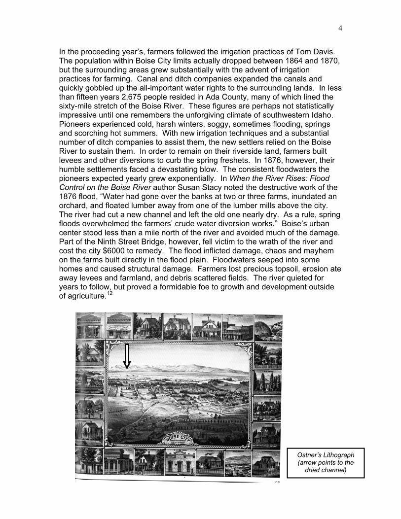
Ostner’s Lithograph
(arrow points to the dried channel)
5
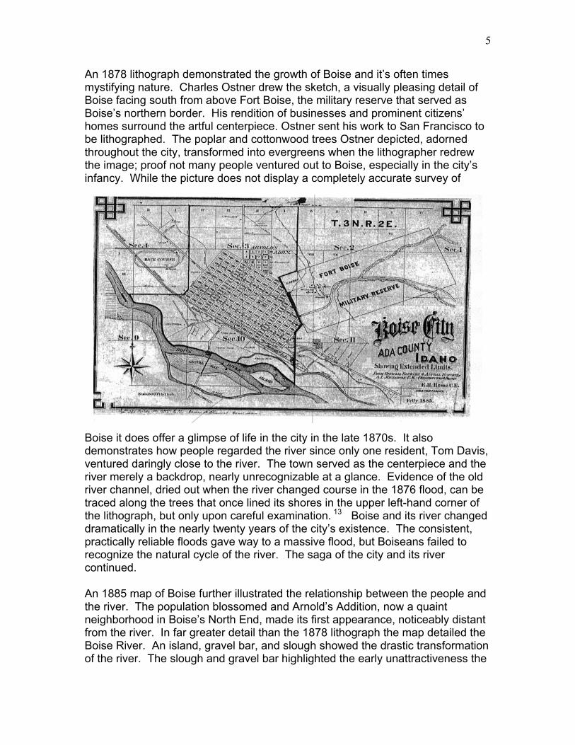
An 1878 lithograph demonstrated the growth of Boise and it’s often times mystifying nature. Charles Ostner drew the sketch, a visually pleasing detail of Boise facing south from above Fort Boise, the military reserve that served as Boise’s northern border. His rendition of businesses and prominent citizens’ homes surround the artful centerpiece. Ostner sent his work to San Francisco to be lithographed. The poplar and cottonwood trees Ostner depicted, adorned throughout the city, transformed into evergreens when the lithographer redrew the image; proof not many people ventured out to Boise, especially in the city’s infancy. While the picture does not display a completely accurate survey of
Boise it does offer a glimpse of life in the city in the late 1870s. It also demonstrates how people regarded the river since only one resident, Tom Davis, ventured daringly close to the river. The town served as the centerpiece and the river merely a backdrop, nearly unrecognizable at a glance. Evidence of the old river channel, dried out when the river changed course in the 1876 flood, can be traced along the trees that once lined its shores in the upper left-hand corner of the lithograph, but only upon careful examination. 13 Boise and its river changed dramatically in the nearly twenty years of the city’s existence. The consistent, practically reliable floods gave way to a massive flood, but Boiseans failed to recognize the natural cycle of the river. The saga of the city and its river continued. An 1885 map of Boise further illustrated the relationship between the people and the river. The population blossomed and Arnold’s Addition, now a quaint neighborhood in Boise’s North End, made its first appearance, noticeably distant from the river. In far greater detail than the 1878 lithograph the map detailed the Boise River. An island, gravel bar, and slough showed the drastic transformation of the river. The slough and gravel bar highlighted the early unattractiveness the
6
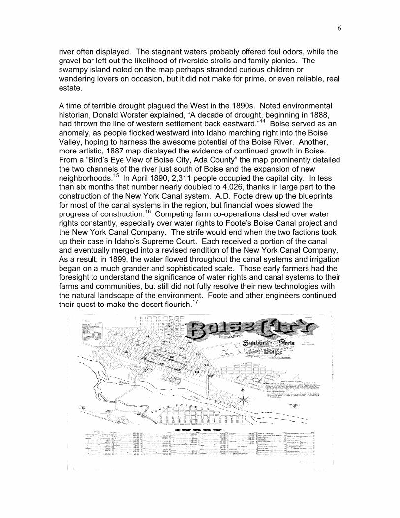
river often displayed. The stagnant waters probably offered foul odors, while the gravel bar left out the likelihood of riverside strolls and family picnics. The swampy island noted on the map perhaps stranded curious children or wandering lovers on occasion, but it did not make for prime, or even reliable, real estate. A time of terrible drought plagued the West in the 1890s. Noted environmental historian, Donald Worster explained, “A decade of drought, beginning in 1888, had thrown the line of western settlement back eastward.”14 Boise served as an anomaly, as people flocked westward into Idaho marching right into the Boise Valley, hoping to harness the awesome potential of the Boise River. Another, more artistic, 1887 map displayed the evidence of continued growth in Boise. From a “Bird’s Eye View of Boise City, Ada County” the map prominently detailed the two channels of the river just south of Boise and the expansion of new neighborhoods.15 In April 1890, 2,311 people occupied the capital city. In less than six months that number nearly doubled to 4,026, thanks in large part to the construction of the New York Canal system. A.D. Foote drew up the blueprints for most of the canal systems in the region, but financial woes slowed the progress of construction.16 Competing farm co-operations clashed over water rights constantly, especially over water rights to Foote’s Boise Canal project and the New York Canal Company. The strife would end when the two factions took up their case in Idaho’s Supreme Court. Each received a portion of the canal and eventually merged into a revised rendition of the New York Canal Company. As a result, in 1899, the water flowed throughout the canal systems and irrigation began on a much grander and sophisticated scale. Those early farmers had the foresight to understand the significance of water rights and canal systems to their farms and communities, but still did not fully resolve their new technologies with the natural landscape of the environment. Foote and other engineers continued their quest to make the desert flourish.17
7
The earlier floods taught some valuable lessons to these farmers, engineers and new settlers alike. They commenced the construction of a sophisticated irrigation system and realized the importance of securing water rights, especially due to low water years that often beleaguered the Boise River and its people. Many in the Boise Valley kept their farms near the river but they wisely moved their homes away from the potential of rising waters. In town, however, Boiseans moved toward the seemingly stable banks of the river. Years of sluggish spring run-off and drought dissipated the stagnant waters and low, calm moving waters appeared to be the new standard. New emigrants had little reason to be cautious not having observed the disastrous floods nearly two decades earlier. An 1893 map demonstrated the growth and development closer to the river highlighting the newfound trust, or pioneer forgetfulness, in the seemingly tamed river. The map illustrated several new neighborhoods nestled right up to the Boise River’s edge.18 Boise progressed south of the river as well, with the advent of the Broadway Bridge encouraging much of that growth. Due to the burgeoning growth in Boise the incidents in the spring of 1896 affected more than just crops and farmhouses its 1876 predecessor hassled. The 1876 flood released approximately 15,200 cubic feet per second (cfs),19 during peak flows, of the Boise River’s water on the valley, according to the Army Corps of Engineers. The 1896 flood unleashed a runoff of 35,500 cfs (a more certain figure due to newer advances in technology to measure cfs) at its peak. With the increased volume of water and people in the valley, the floods affected the entire community not just scattered individuals. From mid-May to June the Idaho Statesman reported the daily havoc the river wrought. The river freed logs from a sawmill upstream and the timber floated down the river, wedging up against the Broadway Bridge. Weary crews tirelessly cut the logs to save the battered and bruised bridge and, more importantly, prevent a change in the course of the river. They feared diverted waters might create a new channel and wipe out the bridge. “The battle took on a human dimension,” wrote Susan Stacy, “when a group of Central Addition residents concluded that if the river were left alone to cut behind the Broadway Bridge on the south side, it would reduce their own…side.” Inevitably crews cut the logs and the channel remained. Although the Central Addition homes avoided flood damage, the debate over flood control and human management of the once natural following waters of the Boise River began in earnest during the 1896 flood.20 At the turn of the century almost 150,000 acres required and used irrigation. Due to the amount of substantial growth on the Boise Bench (just south of Boise on the other side of the river) and the overwhelming need for an advanced irrigation system in the area, local farmers pleaded for support at the federal level. The Reclamation Act, passed in 1902, provided the starting point for an advanced system in the Boise Valley.21 In 1905, the Reclamation Service, now dubbed the Bureau of Reclamation, commenced the “Boise Project.” Diversion Dam, completed in 190922, came first, followed by Arrowrock Dam in 1915. The people

8
of Idaho, and, more specifically, Boise, recognized the need to harness the river for farming and, eventually, for the purposes of curbing floods. While the city of Boise averted damage to its downtown core during previous Boise River floods, water still found its way down Main Street. The Idaho Statesman reported that Cottonwood Creek, flowing down from Rocky Canyon just east of Boise, often inundated the city in times of hard rainfall. At least three times in the late 1890s and early 1900s the creek flowed through the city streets. The creek “completely gutted the Pioneer cemetery at Boise Barracks [on the northwest side of town],” reported the Statesman. A picture, labeled “When Cottonwood Creek Went Berserk,” that accompanied the article showed the tiny river flowing through Main Street. Perhaps the most telling item the article contributed resided in its title, “Cottonwood, Now Tamed, Enjoyed Periodical Sprees.” Written in 1929, the article suggested that an element of nature could be, and in fact was, “tamed.”23 This sentiment supports Donald Worster’s assertion that “There is…a kind of order underlying this jumbled, discordant West, though it is not in the main order of nature or of landscape aesthetics or of closely integrated community life.”24 Boise recognition of nature as “tame” did not account for the natural course of the river, nor did it consider the aesthetic value of the river. After the construction of two dams, both marvels of modern engineering in their time, the people assumed that nature in Boise was largely contained. The Southern Idaho arid wasteland of pre-settlement had been transformed into lush, green, and lucrative farmlands. The reverence Boiseans once held for the ever-changing Boise River quickly vanished. Neighborhoods expanded closer to its banks, dams captured any power or command the sinuous waters demanded, and bridges allowed the people of Boise to avoid any admiration or awe that still resided in their collective memory. The river, once an overwhelming force to be reckoned with, proved to be little more than an obstacle for motorists. The aesthetic value of the tripping, slow-bending waters was lost on minds distracted by the glitz of concrete and gilded technological advances. The May 1931 dedication of the Oregon Trail Memorial Bridge stood as a shining example of Boiseans perspective of their river. The dramatic description of the bridge resembled the opening of a masterful work of art, “Four low-swung, graceful arches that span Boise River. Glistening white concrete sides that reflect the sun’s rays,” the Statesman commentated. The reporter mentioned the river as little more than the thing under the bridge that only served to focus the observer on the greater wonder of the bridge. The article detailed the challenges workers faced in constructing the bridge, only then commenting on the influence of the river and even then referring to the “irrigation season,” a man-made construct. More significantly the article boasted, “Motorists entering Boise immediately will be struck by the panoramic view of the city before them.”25 The view of industry and modernity trumped any beauty that might be found on the Boise River.
9
With crushing floods a hazy memory of the pioneer past the advanced city soldiered on through World War I, the great stock market crash, and the Great Depression. Evidence of President Franklin D. Roosevelt’s progressive New Deal emerged throughout Boise. In 1934, some 1,000 Civilian Conservation Corps members appeared in Boise on their way to the mountain camps located all over Idaho. Construction on the Ada County courthouse and several other buildings, one of which served as City Hall for a time, popped up in town courtesy of New Deal projects.26 In 1936, the Works Projects Administration (WPA) offered Boise important assistance. The spring of 1936 ushered in warm temperatures and increased runoff in the mountains. Spring, always a touchy time for floods, left the citizens of Boise concerned and officials mildly alert. Boise Project managers and the Bureau of Reclamation seemed to minimize the possibility of flooding, “There is nothing alarming about the present situation,” the Reclamation’s state commissioner declared on April 20, 1936. He added, “We have inspected the dams of our reclamation projects and they are in good shape throughout the state.”27 As sure as the commissioner appeared, the people of Boise feared for the worst. The next day officials called upon WPA workers to dig in and manage the overflowing banks of the river. WPA men lined the banks with sandbags and gripped their shovels with intensity as they fought the river. Boise Project leaders, now reported to be “apprehensive,” demonstrated considerably more caution. The project manager W.H Tuller warned people, “Right now, there doesn’t appear to be any great danger of a bad flood, but then we aren’t too sure about it. We’ll just have to wait and hope for the best.” The project watermaster William Welsh offered more telling explanations, “The biggest reason for flood danger now is that the river has no channel. It has been choked by trees, shrubs and just plain junk until it has only part of the capacity it used to have.”28 Dams brought people into the valley with the promise of prosperity. Dams harnessed the river but people underestimated the power of the Boise River by attempting to dominant its flow instead of comprising with its natural power and beauty. Boiseans crowded and scoffed at the river’s strength, and the river, without conscience or reason, spilled over the dam and into the valley as it had done for years before its construction. On April 22, 1936, the swelled banks of the Boise River overcame George Denton.29 Denton and a young friend used the flooding waters to travel downstream when their boat capsized, sealing Denton’s fate. His death reminded the people of Boise once again to respect nature, but a nature they had a hand in creating and had largely ignored. Boise Project officials and most citizens felt that the accident was a product of Denton’s own carelessness, and in not way the fault of the dams. Warm temperatures continued to enhance flood conditions while the water storage and flow rates troubled everyone. On April 22, 1935, Arrowrock Reservoir held 200,300 acre-feet30 of water. Exactly one year later during the 1936 flood the reservoir held 259,800 acre-feet. The flow rate dramatically changed as well. On April 22, 1935, it measured 8,311 cfs while it
10
more than doubled that in 1936 with 17,109 cfs.31 The 1896 flood pushed far more water into the valley, but far fewer people resided in the area at that time. The effects of nature, largely disregarded over a period of years, swamped the backyard of Boise. The 1936 flood caused determined reaction from Idaho’s leaders. The damage, destruction to property, and possibly Watermaster William Welsh’s comments on the condition of the Boise River, led legislators to allocate $10,000 dollars to control the channel that had been overwhelmed with “junk.”32 The WPA continued support and the state highway department contributed resources as well. Some felt that another dam should be built in order to protect the valley from flooding. Another more costly flood in 1943 substantiated their beliefs. The 1943 flood recorded peak flows that topped out at around 20,000 cfs. The cost quashed the destruction of earlier floods. Agriculture accumulated the most considerable losses with a reported $649,710 of the total $997,350 worth of damages. Susan Stacy reflected on the toll of the 1943 floods, “Boise Valley managed the…fight with no loss of life and little structural damage in the city except for the bridges…If there had been a flood-control dam above the Boise Valley, most or all of the 1943 damage might have been prevented.”33 Officials of the Boise Project and other agencies began to discuss the need for a flood control dam immediately after the 1943 flood, but Boiseans again seemed to distance themselves from the floods of the past. The Army Corps of Engineers, water conservationist, and politicians may have seen a threat enough to build another dam, but the public seemed unconcerned. In 1949, Statesman reporter Walter M. Williams reminisced about old floods. He told anecdotal tales of a former ranch hand who reminded Idahoans, “When them high waters starts acomin’ they sure comes. And when they does a feller had better be a gittin’ to high ground or a watery grave will be hisin.” Williams described the “waste land of gravel bars and scattered clumps of willows,” and the renovation of the area, “where once swirling silt laden waters flowed unrestricted has arisen the imposing building of the Boise Junior College.” The story accounted the clearing of the channel through Boise and the introduction and beautification of Julia Davis Park, a tract of land gifted to the city by Tom Davis one of Boise’s earliest citizens in memory of his deceased wife. The city had to bring in dirt fill and the park essentially served as a recycling center for Boise’s garbage, all in order to minimize the swampy grounds left by the river. Car frames and household wastes established the frame of the park and the surrounding grounds. So in 1949 a reporter could boast, “In time the channel was straightened and the old river bed filled in and now that the flood waters are under better control they are no longer a serious menace.”34 From widely revered and left alone, to irrigated, dammed and reconstructed, the Boise River appeared a tamed shell of its former self in the first half of the twentieth-century. The issue of flood control truly came to the forefront as the Bureau of Reclamation and the Army Corps of Engineers fought over the rights to build
11
dams within the Boise Project. The issue of control and operation divided both factions. The Bureau of Reclamation of course wanted to maintain control of the Boise Project since they built Diversion and Arrowrock Dams, but the Corps of Engineers vied for the opportunity to construct new dams. In April 1949 both sides reached an agreement regarding all dam construction in the Columbia Basin (which included almost all of Idaho’s river systems). The agreement allowed the Corps of Engineers to construct all the flood-control projects and the Bureau of Reclamation then maintained all the irrigation projects. In 1955 the Corps completed the Lucky Peak Dam and continues to operate the dam. The Corps and Bureau also agreed to maintain the reservoirs at Anderson Ranch, Arrowrock, and Lucky Peak together.35 The taming of the river began with small ditches and accumulated into the massive Boise Project and the construction of dams. The three larger dams (Anderson, Arrowrock, and Lucky Peak) served two main purposes: irrigation and flood control. Both of which disrupted the natural flow of the river. A 1964 article in Wildlife Review cited four major problems that plagued the Boise River: irrigation development, domestic waste, detergents, and industrial development. The wildlife habitat suffered, especially trout populations because of low river flows in summer months and increased silt due to the abundance of drainage ditches. The advent of sewage treatment plants downgraded some of the threat of human waste dumping in the river. As the population grew so did waste, which made treatment more difficult. Detergents were far more evident remnants of waste. Alkyl benzene sulfonate (ABS) caused “mountains of foam” to develop and seep into the river even through treatment plants. Food processing plants near the river also led to increased pollution. Organic waste from these plants like “grease, potato peelings, beet pulp, paunch manure, blood, dissolved sugars, starch, silty wash water, domestic sewage,” to name a few, caused problems. All these organic items require high amounts of oxygen to decompose and in turn “produce bacterial slimes, algae blooms and high bacterial counts.” The many afflictions of the Boise River did not end there. Companies coveted the gravel below the river. They scooped up the gravel and disregarded the displaced river they left behind. Several of the businesses put “silt-laden wash-water back into the river.”36 Health hazards in the river during the 1950s and 1960s initiated concern among many environmental groups. Even hunters and outdoorsmen, normally in conflict with environmental watchdogs, were alarmed at the substantial decrease of game at or near the river. Years of ignoring and disregarding the frailty of the natural world left the Boise River a slow-moving sludge stream, nearly uninhabitable to wildlife and visually revolting. The condition of the world in the 1950s and 1960s had much to do with the shift in ideals about the environment. With the Cold War well under way many Americans feared nuclear attack, but often neglected the very place they feared they would lose. Families moved from the city into the suburbs. Tract housing flooded the once “barren” lands. Highways cleared out wetlands and other natural habitat to accommodate the new commuters. But slowly a
12
consciousness of nature and the human impact on nature developed. In 1953 businessmen organized the Keep America Beautiful campaign. They used mass media such as radio ads, public service announcements, etc., in order to stop and reduce the mammoth amounts of garbage produced and dumped in the United States. Through the mid 1950s and 1960s amendments to the Clean Water Act passed.37 Each of these small acts demonstrates the shift in the relationship between man and nature. In 1962 the most dramatic evidence of this shift arose, when a monumental book by Rachel Carson revolutionized the way people viewed the environment. In Silent Spring Carson warned of the dangers certain pesticides and other harmful chemicals had on people and animals.38 She explored the long term effects of new technologies, scrutinizing the notion that temporary conveniences outweighed the harmful, lasting impact on nature. In short, her work changed the way people looked at the natural world. The far-reaching impact of her book put the spotlight on everything in nature and instigated a more respectful symbiotic relationship between man and nature. The new consciousness toward the natural world apparently awakened the people of Boise as well. On February 6, 1966 Boise city councilmen, the city planning director and the city park superintendent went for a walk. The blistery conditions kept their hands confined to their pockets, but their eyes focused squarely on a stretch of quiet riverfront land. The four strolled purposefully down the banks of the Boise River outlining a vision adopted less than a month before. On January 25, the Boise City Planning and Zoning Commission in collaboration with the Board of Park Commissioners approved a conceptual plan for a “green belt.” City planners and leaders envisioned a place where “hiking, picnicking, camping, nature study…and fishing,” would be commonplace. Ann Morrison Park, completed in January 1959, and Julia Davis Park offered a fresh, green start but the acquisition of land on the North banks proved more problematic. Still, city leaders toured the possibility of restoring “aesthetic values to the community.”39 A revived hope for beautification and a deeper appreciation of the river began to immerge in Boise. Boiseans no longer ignored the power of the river, but they ignored much of its inherent value. The gradual process of changing minds and building beauty along the river labored on with little progress made until the early 1970s. Slowly Boise recognized exactly how much the natural world had to offer. In April 1970 Boise Mayor Dick Eardley broke ground for a bridge connecting Julia Davis Parking and Boise State University.40 The Friendship Bridge encouraged interaction between the park and the university as well as fostered activity on the river. It provided more community support for an active relationship with nature. Unfortunately another, more tragic incident garnered the attention. In June 1970 a 12-year bold drowned while floating the river on a tube. Pipes sticking out from a small diversion dam snagged the tube and pinned young Neal Capener in the suction of the river. Some questioned whether other debris and materials in the river contributed to the death of Capener.41 His death led to more awareness
13
of human entanglements in the river and produced efforts to clean up the noticeable rubbish that littered its banks. The river held some recreational value but it lacked an enticing element. The construction of the Greenbelt supplied that spark and forced people to take notice. Design and property debates slowed the evolution of the Greenbelt. The original architects intended one hundred feet to be set aside for the pathway. In August 1971 the planning and zoning commission proposed fifty feet be set aside and presented that figure to the public. Property owners along the river objected to even that allotment. Many, like James A. Quinn of Boise, believed fifty feet would turn into one hundred feet, and one hundred into two hundred, and so on. The Greenbelt coordinator, Mrs. H. Tom Davis, understood the impact their decision could have on the river and property lining its banks. She reminded Boiseans, “Whether or not we are able to acquire the lands, as is the ideal, the basic question of setbacks is, are we going to try to preserve that river? The setback would accomplish that.” A Boise State professor of zoology, Dr. Fenton Kelley, echoed Davis’ sentiments and added that the “value of that beautiful river is the shoreline. If it is to be preserved we have to have a buffer area to keep the river viable.” In 1971 the very first Greenbelt Ordinance passed and required a setback of seventy feet for all buildings and vehicle lots. Over the years the city secured land through donations, lease, purchase, and exchange.42 The acquisition of lands for the Greenbelt demonstrated the complete shift in values. The business industries and citizens of Boise dumped hazardous material in the river without concern for years. They slowly realized the devastating effects and cleaned up the river. Their preliminary efforts to beautify the river made people take notice of the natural world. People desired the quaint escape from city life the Greenbelt provided. Developers planned neighborhoods on the once swampy, uninhabitable land around the riverbanks. Restrictions on dumping waste and other material revived the trout population. Ducks and other game returned. The makeover of the river continued. The Greenbelt, not the bridges, grabbed the headlines. “A person wandering along the Greenbelt easily forgets Idaho’s busy capital city, with its exhaust-choking, rush hour traffic, billboards and gray buildings,” reported the Statesman.43 Boiseans, encouraged to respect the wonder of nature, shifted their focus from the modern marvels of the cityscape to the simplicity of a natural landscape, even if that nature was largely a construct of man. In the 1980s consumerism and kept the river in the spotlight. Oftentimes developers, businesses, and property owners referred to the river as an “amenity” or a “hot commodity.” Neighborhoods had crept closer to the river for decades, but not nearly as close as the high-end developments of the 1980s and 1990s. The property along the river, “with the advent of the Greenbelt system,” brought in an “influx of newcomers to the city.”44 People from out of state flocked to the improved city hoping to take advantage of the unrealized potential of the Boise River. “Some of that development is inspired, testimony to man’s ability to
14
match the grace of the river,” noted a reported, he added, “Some is controversial, beautiful or ugly in the beholder’s eye. Most of it is an improvement from the rubbish heaps and car bodies that once dotted the riverbanks.”45 Mindful citizens and environmental groups again warned of the inherent dangers of placing homes so close to the natural world, however contained and beautiful it appeared. The dams provided much needed water to dry lands and brought people to Boise in the first place. Dams, not the river, sparked initial growth in Idaho. Irrigation innovations made the impossible task of growing crops in the desert possible. In fact without dams the tranquil riverside properties would never have been built. Flood control dams kept real estate prices up and fear of flood damage a distant, if almost nonexistent, memory. The summer of 1983 brought those memories to the forefront. The flood damaged the Greenbelt and evacuated some frenzied residents along the river. The flooding caused most people to ponder flood control tactics. The river, although cleared of most damage and debris, still meandered and bended through the valley. Farmers and water enthusiasts argued that the river should be cleared and straightened to allow more water to come through year round, thus decreasing the chance of floods. In June George Harrington, a longtime U.S. Fish and Wildlife hydrologist, reminded people of the true nature of the river, “The river isn’t straight. It can never be straight. When it’s straight, it’s a ditch.”46 For as much as man tried, the river escaped human clutches. In 1983 the Boise River clearly showed the need for some control due to the overwhelming growth in Boise, but the more poignant lesson was the need for an understanding of nature’s cycles within nature man had tampered with throughout history.. The 1990s ushered in a new debate over flood control and irrigation. Of course dams brought farming to the Boise Valley but over time the need for flood control became more prominent, as evident by the construction of Lucky Peak Dam for the sole purpose of flood control. It was not until the flood in 1983, however, that flood control took over as the main function of dams on the Boise River. Proponents for more irrigation and those for more flood control tried to settle on a balance between the two. As suburbia slowly consumed the once vast farmlands in America more and more people reside in the flood plains. It is now painfully clear that the balance has shifted to flood control.47 Flood control has helped bring people to Boise. The city of Boise continued to clean up the Boise River and use it to bring in business to the city core. The Boise River Festival celebrated the unique history of Boise and its river, and drew in outsiders from around the region. Ironically, massive amounts of garbage wound up in the river as a result of the appreciation the Festival promoted. The nation even took notice of the miraculous change in Boise. In 1994 The Wall Street Journal marked the drastic efforts to clean the river, and noted, “the new riverfront has greatly added to Boise’s appeal…After decades of neglecting the river, many Boiseans now worry they will love it to death.” The economy of Boise
15
thrived with the support of a healthy river rejuvenating its downtown soul. The attractive nature brought its own problems; more people want to “enjoy” it up close.48 In his efforts to understand the ‘agricultural landscape’ in the West historian Mark Fiege recognized the importance of man’s relationship with nature. Fiege contends that while humans have manipulated the landscape of the West they have recognized the need to maintain a compromise with nature. “Yet no matter what humans do to nature, the moral of the story remains the same: whether grand and imperialistic, or small and apparently benign, attempts to shape or control the environment do not necessarily have predictable outcomes. People indeed make their landscapes, but they do not make them exactly as they please.”49 Boise exemplifies Fiege’s conclusions. Man essentially can render some control over nature but must be careful to establish controls that highlight and utilize the natural order of nature. The Boise River changed the way Boiseans thought. Donald Worster described “the true West which we see reflected in the waters of the modern irrigation ditch. It is, first and most basically, a culture and society built on, and absolutely dependent on, a sharply alienating, intensely managerial relationship with nature.”50 The evolution of Boiseans’ relationship with the river counters Worster’s notions. The river guided settlers into the valley, but they avoided its springtime wrath at all cost. They built the city of Boise far from its unstable banks, a fearful reverence for an unpredictable menace. In order to establish a permanent home farmers dug in and manipulated the river to provide water to arid lands. Settlers realized the overwhelming potential the river held within its flowing waters. Archaic ditches transformed into sophisticated dams and canal systems. Engineers conjured up ways to harness the river’s power. The river held much more value, as it provided the means to farm, but it did not rampage through the valley as it had in past years. Valley residents jeered the river and counted it “tame,” a broken beast of nature outwitted by the mind of man. Citizens quickly forgot the important elements the river provided. They dumped piles of refuse and dangerous chemicals into the already choked channel. Boiseans no longer took the river for granted they just completely disregarded it. Those mistakes soon caught up with them, however, and they started to see the detrimental side-effects of their disregard. So they strapped on their waders, picked up their shovels and rakes, and cleaned up the neglected river. They built a shrine along its banks and vowed to reverently walk beside it and count the many blessings it yielded. Of course the devout flock strayed once again and built idols of capital and domesticity on the shorelines. But the rivers periodic fury, part of the natural cycles, served as a warning that what the river provided, the river could take away. Boiseans created a nature to enjoy, but also to compensate for the exploitation and abuse they inflicted on the Boise River. They inevitably proved that the natural world and human civilization are inherently intertwined. The cycles of
16
nature, thus, involve humans. Boiseans finally, at least in part, recognized those cycles and provided a means to live within the changing natural world, albeit an altered world. The destruction of nature on the Boise River led to the construction of a new nature. Determined to make it better, Boiseans planted trees and cleared out the garbage, and their changes ultimately reintroduced wildlife that had been absent for years. And so the squirrels and ducks assemble once again and tolerate the nuisance of honking horns and hurried joggers, lost habitat rebuilt, a monument to what was and a reminder of what could be.
Endnotes
1 Mark Fiege, Irritgated Eden: The Making of an Agricultural Landscape in the American West, University of Washington Press: Seattle and London, 1999.
2 Not to be confused with the fur trading post established on the confluence of the Boise and Snake
Rivers. 3 Merle Wells and Arthur A. Hart, Boise: An Illustrated History, Sun Valley, CA: American
Historical Press, 2000, pgs. 13-19. 4 Boise City Plat July 1863, Henry Chiles Riggs, Idaho State Historical Society, Map G4274.S1
5 “Boise City and Urban Area Population, 1863-1980,” Idaho State Historical Society Reference Series, Number 363, 1995.
6 Merle Wells and Arthur A. Hart. Boise: An Illustrated History, pgs. 17-21. …, see also, Hugh H.
Hartman. The Founding Fathers of Boise: 1863-1875. Idaho State Historical Society, 1989. Opponents of the shift argued the validity of Boise as a worthy capital. Since the city had no formal incorporation or city government, reasoned some detractors, it did not fully serve the purposes of the territory. A widening sectional division also occurred between southern and northern Idaho. So divisive was the issue of the capital location that northern Idaho wanted to join Washington Territory. While their arguments failed to keep the capital in Lewiston they succeeded at calling attention to Boise’s need for incorporation.
7 Helen Lowell and Lucile Peterson, Our First Hundred Years: A Biography of Lower Boise Valley – 1814-1914, The Caxton Printers, Caldwell, Idaho, 1976, pg. 2.
8 “Thomas and Francis M. (Frank) Davis January 2, 1838-June 9, 1908 and July 7, 1840-September 16, 1937,” Idaho State Historical Society Reference Series, Number 573, 1981. Davis eventually owned 800-acres just south of the river and beneath a plateau above Boise known as the Bench. He also claimed land 1000-acres west of Boise in present day Garden City and 153-acres near the Boise foothills.
9 “Thomas Davis and the Jacobs Canal Company, LTD.,” Idaho State Historical Society, Number
504, 1974. 10 Idaho State Historical Society Reference Series, Numbers 504-524. Many of the canal
companies have changed ownership; as a result some of the names have changed. These are the names given by the historical society reference. The Graham Gilbert Ditch
11 Ibid. The Graham Gilbert Ditch, Perrault Ditch, Caldwell Canal, Siebenberg Co-Operative
Ditch, and the Ridenbaugh-Ross Mill Ditch are a few that sprang up in 1865 and early 1866.
17
12 Susan M. Stacy, When the River Rises: Flood Control on the Boise River 1943-1985, Institute
of Behavioral Science, Natural Hazards Research and Applications Information Center: University of Colorado, Boulder, Colorado and College of Social Sciences and Public Affairs: Boise State University, Boise, Idaho, 1993, pgs. 2-5.
13 Merle Wells and Arthur A. Hart. Boise: An Illustrated History…, pg. 47. 14 Donald Worster, Rivers of Empire: Water, Aridity, and the Growth of the American West,
Pantheon Books, New York, 1985, pg. 131. 15 Map of Boise ca. 1887, Idaho State Historical Society, 77-22.1 16 Mary Hallock Foote, wife of A.D. Foote, supported their family during the hard financial times
of the canal project. She wrote and illustrated extensively during her years in the Boise Valley (1884-1895), and introduced frontier life to the high society of the East. The Pulitzer Prize winning novel by Wallace Stegner, Angle in Repose, depicted her life and times in the West.
17 Merle Wells and Arthur A. Hart. Boise: An Illustrated History…, pg. 55-58. 18 Sanborn Map of Boise 1893, September 2004 http://sanborn.umi.com.libproxy.boisestate.edu/. 19 The term cubic feet per second is a measure of the amount of water passing a given place in one
second. 20 Susan M. Stacy, When the River Rises: Flood Control on the Boise River 1943-1985, pgs. 6-
10… 21 “Boise Project: Idaho and Oregon,” September 2004, http://www.usbr.gove
/dataweb/html/boise/html. 22 The Boise Project originally consisted of only Diversion Dam, the New York Canal, and Lake
Lowell in the Caldwell/Nampa area. As the need for more irrigation, and later flood control, became necessary more dams and reservoirs were built.
23 “Cottonwood, Now Tamed, Enjoyed Periodical Sprees,” The Idaho Statesman, January 20,
1929. 24 Donald Worster, Rivers of Empire …, pg. 6.
25 “Glistening White Span Over Boise River Shows Craftsmanship of Crews,” The Idaho
Statesman, May 24, 1931.
26 Merle Wells and Arthur A. Hart. Boise: An Illustrated History, pg. 101…. 27 “Cool Weather Slows Runoff in Boise River,” The Idaho Statesman, April 20, 1936. 28 “Boise River Threatens To Overflow Its Banks; Dam Reaches Capacity,” The Idaho Statesman,
April 21, 1936. 29 “River Continues to Rise; Farm Areas Under Water; Man Drowns Near Airport,” The Idaho
Statesman, April 22, 1936. 30 The term Acre-feet is a measure of the volume of water. One acre foot is the amount it would
take to cover one acre of land with water one foot deep.
18
31 Flood Believed At Crisis As Moderate Temperature Causes River to Subside,” The Idaho
Statesman, April 23, 1936. 32 Susan M. Stacy, When the River Rises: Flood Control on the Boise River 1943-1985, pg. 10…,
see also, “Boise River Threatens To Overflow Its Banks; Dam Reaches Capacity,” The Idaho Statesman, April 21, 1936.
33 Ibid, pg. 16. 34 Walter M. Williams, “Boise River, Once Moving Through Two Channels Near City, Was
Fearsome During Flood Season, The Idaho Statesman, April 3, 1949. 35 Susan M. Stacy, When the River Rises… pgs. 36-39, see also, “Boise Project: Idaho and
Oregon,” September 2004, http://www.usbr.gove/dataweb/html/boise/html. 36 William E. Webb, “The Boise River…A Problem Stream,” Wildlife Review,
September/October 1964. 37 “Environmental Events,” October 2004, http://www.ametsoc.org
/sloan/cleanair/cleanairenvev.html. 38 Rachel Carson, Silent Spring, Houghton Mifflin Company, Boston, 2002. 39 Bob Lorimer, “Capital Officials Inspect Boise River Banks with Eyes on Green Belt,” The
Idaho Statesman, February 7, 1966. 40 “Ground Broken for BSU-Park Bridge,” The Idaho Statesman, April 20, 1970. It is important to
note that Boise Junior College was founded in 1934 with only one campus building. The college received four-year status in 1965 and university status in 1973. Boise State University is worth mentioning because its buildings have inched closer to the river through time. A stretch of the Boise River Greenbelt is sandwiched between the river and the University running through the entire campus. Enrollment has sky-rocketed in recent years to over 17,000 students which creates concern given the increased traffic right next to the fragile riverbanks. For more information on Boise State University and its history consult www.boisestate.edu, see also MerleWells and Arthur A. Hart. Boise: An Illustrated History.
41 Carrie Ewing, “Boise Editor Tells of Try to Correct River ‘Death Trap,’” The Idaho Statesman,
June 30, 1970. 42 Mindy Cameron, “Preserving Banks of Boise River Questioned at Greenbelt Design Hearing,”
The Idaho Statesman, August 12, 1971, see also, “Boise River Greenbelt-Features,” September 2004, http://www.cityofboise.org/parks.
43 Pete Zimowsky, “Boise River path lets travelers escape rush of city life,” The Idaho Statesman,
October 25, 1979. 44 Linda Funaiole, “Prime real estate: Developers take advantage of Boise jewel, the river,” The
Idaho Statesman, April 29, 1981 45 Tom Knappenberger, “Down by the river: The Boise changes under the hand of nature – and
civilization,” The Idaho Statesman, January 30, 1983. 46 Paul Pugmire, “Taming the river: Control debate ignites as Boise’s waters rage,” The Idaho
Statesman, June 15, 1983.
19
47 Rocky Barker, “Built for irrigation, reservoirs find more reason to put priority on flood control,”
The Idaho Statesman, March 18, 1997. 48 Timothy Noah, “The River That Runs Through Boise Runs Clear Once Again --- Cleanup
Buoys Environment, Stirs Local Economy and Lures Birds, Bathers,” The Wall Street Journal, April 22, 1994.
49 Mark Fiege, Irritgated Eden…, pg. 209. 50 Donald Worster, Rivers of Empire …, pg. 5.