tsunami risk mitigation strategy for thailand risk mitigation strategy for thailand about the study...
TRANSCRIPT

Tsunami Risk Mitigation Strategy for Thailand
PPhiilipp
manAndamdamAnAninBasin
CelebesSea
SuluSSeaS
Gulfof
Tonkin
SSouththChina Seahina Sea
EasChi
SStraa
iit
SStraitt oofff
TTTTTaaiiww
an
SSttrrraaaiitt ofof Malacca
mmmmmaaaapppa uuutttttttuu rrraaa
Salween
Salween
SSalween
Salwee
Sn
MMMe
Mkkoonnngggg
HonggnggHongHongHon
ngnggMekongMekongM
ng
YYaan
ggngDongtingDongtinDongtingntintingtiD tiD tiuHuHugggg oyy gyangangPoooyoyanganggPooyanyanPoyanPoyang
HuuHHHHy
HainananHaHHHa PPPhhiliippppppppppiiinnneeees
aaa
Sumatra
Sumatra
Sumatr
SSmatrmatraa
orneoorBorneoBor
sahasahasasa
alayalayyalanddalaalayalaMaaMMManddalaynda
ang Mg MMaiMg MMaig aiMMMhianiaChCCCC anCh
gggg
ngnggqingqiningqinngng ngnggngqgqinngngqChonoCChCC n
CantonCantonanCaningNanningNanningNannNaNa ingNanningg
gingmingmmiminminunmunmKunmKunmKKKunmmiyangGuiyangGu gGGuGuGui
hangshaChanngshaCh sha h
uuzhouzhouFFuzzFFuzhou
HangzhougHanggHan
chachachanghanngghaNancanccNNN hhN cha
HaikouHH
TaiainnaannTaTaTTa n
akanakaaSandaandaS a
CebuuCebebbebeCebu
KuKuchingchingKu hinghinghiKuc
PontianakkkP t kkkP ti kaamarindaSamarSSaam aS
ManadoManadoManad
dddPPP d
Meedaedandanne
DavaDaDaDavaoD vaoaaDavaD ao
Hong KongHHMacao
o ChiHo ChHo ChHo CMinh CitCitytyMM
HaiphongHaiphongHHaiphong
angoananRa goungoounoun
hhhhhPhnom PenPePenPePenenPeen
Bangkokgngkokk kgkogkkogngkokkokokkok
ViangchanViangchanViV chanViangchanV ngchanngViV angc
SingaporeSSSS
Lumpuruumuala KuaKuua a K
anoianoiaan iHaHaHaHHaa
TaipeiaipeipeiTTa
aaaaaalallManilMani lalaa
SHHSHSHSH
NMARNMARMARRMAARANMNMMYAAMYAYAYM ANMA
THAILANDT ILATHAILTTH LANDHAILAILAN
ODIAAAADODCAMBOCAACAC MBMBBOAMBO
BRUNUNEINEIEIUNENNEN
LAOSLAOOSOSSLAOSAO
AAIIWANWANATATTTA W
ILIPPINESSILI SNEENINPIILIP NESIP SIPPI SNENLIPPINNESESPHPHPHHH
ANANANANANANAAA
VIETNTNAAMV VV V VV V
MMMMM AA L A Y S I AAA
NNNNAAAAGGGGGGAAAAAA
HHHHHHHHHHHIIIIILLLLLLLLLLSSSSSS
MMMMMAAALLLLAAAAYYYYYYPPPPENNII NNNNNNSSSSSUUUUULLLLLL AAA
IIIIINNNNNNDDDDDDOOOOOOOOOOCCCCHHHHHIIIIIINNNNNNAAAAA
AAAAAAAA SSSSSSSSS
Report prepared by
Norwegian Geotechnical Institute9 February 2006
15-02-06 11:09:2415-02-06 11:09:24

Tsunami Risk Mitigation Strategy for Thailand
About the studyThe primary objectives of the study presented in this report were to assess the tsunami risk, and to help develop a reconstruction and rehabilitation strategy for the tsunami-affected areas of Thailand. In addition, the study is intended to serve as an example project for other countries around the Indian Ocean affected by the 26 December 2004 tsunami. The project included the following main elements:
1. Identifi cation of possible future seismic and tsunami-triggering scenarios, and their associated hazard level.
2. Analyses of possible tsunami heights for the various seismic scenarios. 3. Assessment of possible measures to reduce or eliminate the potential consequences
of future tsunamis. 4. Propose specifi c reconstruction and rehabilitation plans for three selected study areas. 5. Facilitate transfer of knowledge through workshops and seminars on local and regional
levels.
The Norwegian Geotechnical Institute (NGI) took the initiative for the study, but the Scope of Work was prepared in cooperation with the Department of Mineral Resources (DMR) of the Ministry of Natural Resources and Environment in Thailand and the Coordinating Committee for Geoscience Programs in East and Southeast Asia (CCOP).
The study was done for DMR with fi nancial support from the Royal Norwegian Ministry of Foreign Affairs (RNMFA). CCOP served as Project Responsible Institution and contract partner against RNMFA. NGI, with the support of a number of other Norwegian institutions and specialists, have conducted the work and prepared the report.
The present summary report provides information to the public at large about the future tsunami risk and the recommended short-, medium- and long-term risk reducing measures. For detailed technical documentation, assessments and analyses, the reader is referred to:
NGI report No. 20051267-1, dated 14 January 2005, “Tsunami Risk Reduction Measures with Focus on Land use and Rehabilitation – Main Report”
2547-NGI-rapport-omsl.indd Sec1:2-Sec1:32547-NGI-rapport-omsl.indd Sec1:2-Sec1:3

Summary
The Indian Ocean tsunami of 26 December 2004 was triggered by a gigantic magnitude 9.3 earthquake. The earthquake was caused by stress release on the Sunda Arc, a subduction zone created by the movement of the Indo-Australian plate underneath the Burma/Sunda plate. The tsunami caused over 250,000 casualties, whereof about 8000 in Thailand, and devastated large areas along the coastlines of Indonesia, Thailand, Malaysia, Myanmar, Sri Lanka, India, the Maldives and even some parts of the east African coast. Along the most severely affected parts of the west coast of Thailand, the tsunami caused inundation levels of 5 to 12 m above the mean sea level.
The study presented in this report was launched in July 2005 to assist the Thai authorities with development of plans for dealing with the future tsunami risk in a short term, as well as in a long term perspective. The main conclusions regarding future tsunami risk are:1. Within the next 50 to 100 years, the largest credible earthquake to be prepared for is a
magnitude 8.5 event. The event could cause a tsunami which at the most gives an inundation level of 1.5 to 2.0 m above sea level. If the tsunami occurs at high tide, the inundation level could be 2.5 to 3.0 m above the mean sea level.
2. After about 100 to 200 years, the potential for earthquakes greater than M 8.5 will increase gradually, and so does the potential for generating larger tsunamis than that for the M 8.5 earthquake scenario. This implies that, as time passes by, the tsunami risk will gradually increase from tolerable to highly unacceptable.
3. Within the next 50 to 100 years, the potential risk from tsunamis to human life and property in Thailand will be small and can be regarded as tolerable. Therefore, in the short to medium term perspective, no mitigation measures would strictly be required. However, already now steps should be taken to reduce the more long term risk of human casualties
To reduce future risk and vulnerability to tsunamis, the following actions are recommended for Thailand:• Within a few years time implement measures to ensure a lasting long term awareness of the
tsunami risk. Such measures may include new requirements to land use, site planning and building codes in potentially affected areas, and construction of some form of “monuments” along the coast that will give a clear warning to future generations about the tsunami risk.
• Within the next 5 to 10 years, implement at least some physical measures to reduce the consequences of future tsunamis and to serve as examples for the future. Physical measures considered most attractive are establishment of safe escape routes and elevated escape hills, and construction of local protection dikes near the waterfront.
For other countries around the Indian Ocean, the tsunami risk and the need for mitigation measures may be signifi cantly greater than for Thailand. These countries are encouraged to undertake similar risk assessment and mitigation studies as presented herein for Thailand.

2

The 26 December 2004 tsunami
Figure 1: Seismicity in the Northeast Indian Ocean Region between 1900 and 2004. The epicentres of all earthquakes with magnitude M > 6 are shown. Epicentre of the 26 December 2004 M 9.3 and the 28 March M 8.6 earthquakes are marked with green stars (Source: Lay et al 2005, Science, Vol. 308)
Cause“The Indian Ocean tsunami of 26 December 2004 was caused by a gigantic magnitude 9.3 earthquake along the northern part of the Sunda Arc subduction zone. The generated tsunami was one of the most devastating natural catastrophes recorded in historical time.”
The epicentre of the earthquake was west of the Aceh Province of Indonesia, Figure 1. This is an active fault zone where earthquakes occur frequently, although very rarely of such a magnitude as the 26 December 2004 event. The generated tsunami devastated large areas along the coastlines of Indonesia, Thailand, Malaysia, Myanmar, Sri Lanka, India, the Maldives and even some of the countries in East Africa. It caused over 250,000 casualties, including 8,000 in Thailand, making it one of the most devastating natural disasters that has ever been registered.
3

Figure 2: Typically observed range of tsunami inundation levels in the three areas selected for case studies.
This event clearly demonstrated the catastrophic consequences of a tsunami that strikes an area unexpectedly, or where there is little or no public awareness of what a tsunami is and how to react to it when the fi rst signs emerge.
The tsunami inundation levels varied along the west coast of Thailand as illustrated by examples from three areas selected for case studies in Figure 2.
Data on casualties and damages show a clear correlation between consequences of the tsunami and the maximum inundation level of the tsunami.
4

The earthquake was caused by stress release on
the subduction zone known as the Sunda Arc,
which is created by the steady movement of the
Indo-Australian plate underneath the Burma/
Sunda plate.
As the subducting Indo-Australian plate slowly
moved down, it pulled the overlying Burma/Sunda
plate along, increasing the stress until the strength
was exceeded and the overlying plate bounced
back. The vertical component of fault movements,
extended all the way to the sea bottom, causing
the seabed to move up on the west side of the
fault and down on the east side. The sudden
vertical displacement of the sea bottom caused
an immediate corresponding displacement of the
sea that initiated the tsunami.
Tsunami modelling of the 2004 event“Numerical simulation of the Indian Ocean tsunami of 26 December 2004 shows very good agreement with observed wave patterns, arrival times and inundation levels.”
Figure 3: Seabed displacements used to reproduce the 26 December 2004 tsunami. Maximum rise in sea level is 5 m and maximum drop in sea level is 3.5 m.
Box 1: How was the 26 December 2004 tsunami initiated?
5

Box 2: Some tsunami defi nitions• The term ‘surface elevation’ (η) is
used to indicate the water level above equilibrium (mean sea)
• ‘Wave height’ (h) refers to the height difference between the crest and the trough.
• λ is the wavelength of the tsunami.• ‘Inundation level’ refers to the water
level above equilibrium reached by the tsunami at any point on land
• ‘Run-up height’ refers to the maximum vertical level reached by the wave on land.
• ‘Inundation length’ refers to the maximum horizontal distance reached by the tsunami inland from the equilibrium shore line.
Figure 3 shows the vertical earthquake-induced seabed movements that were used as input for the tsunami modelling. The red colour indicates upward seabed displacement and blue colour indicates downward displacement. The boundary between the Indo-Australian plate and the Burma plate (Sunda Arc) is indicated with black bullets, while the epicentre of the earthquake is shown with a red bullet. The enormous initial dimensions of the 26 December 2004 tsunami should be noted. It covered an area of about 1200 km in length and 200 km in width, and involved a maximum rise in sea level of about 5 m and drop of about 3.5 m.
Beyond the wave generation area, the shape of the wave will change due to variations in water depth, spreading of energy and other effects. Figure 4 shows a snapshot of the calculated tsunami 1 hour and 20 minutes after its initiation.
6

As the tsunami approaches the shoreline, the wave height increases and the wave length decreases. Even with the reduction in wave length, it is still very long (typically 10-20 km in the current case) compared to wind generated waves. As the wave hits land it will therefore be experienced as a fl ood and not a wave, in some cases with an almost vertical highly turbulent fl ow at front.
The model predicted that the sea level fi rst dropped (blue area at the wave front), causing the initial retreat of the sea when the tsunami reached the shore in Phuket. This is in agreement with the observations. The calculated inundation levels predicted by the computer model of the tsunami agreed closely with the observed inundation levels at the case study areas.
Figure 4: Snapshot of the calculated tsunami 1 hour and 20 minutes after the earthquake, just before it reaches the tip of Phuket. The crest is 3 meters above mean sea level, whereas the trough is 3 meters below mean sea level.
7

Box 3: How fast does a tsunami travel?The tsunami velocity in the ocean depends on the water depth. For the deepest parts of the Indian
Ocean with water depths of about 5000 m, the tsunami propagation speed is slightly more than 800
km/h. At a water depth of 1000 m the propagation speed is 360 km/h, and at 100 m depth it reduces
to 110 km/h. This dependency of wave speed on water depth is the reason why the tsunami reached
Sri Lanka and parts of India, about 1500 km from the fault zone, at essentially the same time (1.5 to
2.0 hours after the earthquake) as it reached the coast of Thailand 500 km from the fault.
“The largest credible earthquake within the next 50-100 years, which could cause a tsunami hitting the coasts of Thailand, is a magnitude 8.5 earthquake on the Sunda Arc”
The underlying basis for assessing the future earthquake hazard scenarios is the fact that the 26 December 2004 earthquake was an event resulting from geologic processes (continental plate movements) that change signifi cantly only over time spans of millions of years. This means that similar events will inevitably happen again in the future. However, due to the enormous stress relief that occurred in the December 2004 event, it will take at least 300 to 400 years before a similar earthquake and tsunami event could occur again along this part of the Sunda Arc subduction zone.
In a shorter time span, smaller earthquakes will occur. Within the next 50-100 years, the largest credible earthquake that could generate a tsunami affecting the coasts of Thailand is conservatively estimated to be a magnitude M 8.5 event. Since the magnitude scale of earthquakes is logarithmic, the energy release for an M 8.5 earthquake is roughly a factor of 20 smaller than for an M 9.3 earthquake. Figure 5 shows the seabed displacement scenario corresponding to an M 8.5 earthquake at a critical location (with respect to tsunamis affecting Thailand) on the Sunda Arc. Compared to the 26 December 2004 earthquake (see Figure 3), the area of the affected sea fl oor is much smaller; typically 300 km × 130 km as compared to 1200 km × 200 km. The maximum vertical seabed displacements are 1.8 m upwards and 1.3 m downwards, i.e. a factor of about three smaller than those for the 2004 tsunami event.
Future Earthquake and Tsunami Risk in Thailand
Earthquake and tsunami scenarios
8

Figure 6: Snapshot of the calculated tsunami (maximum credible scenario in the next 50 to 100 years) 1 hour and 20 minutes after the earthquake, just before it reaches the tip of Phuket. The crest is 0.5 m above the mean sea level, whereas the trough is 0.5 m below.
Figure 5: Estimated future maximum credible seabed displacements in the short to medium term for Thailand (Magnitude 8.5 earthquake).
Figure 6 shows a snapshot from a tsunami simulation based on the initial seabed displacements from Figure 5. When this tsunami reaches the shoreline, it will cause an inundation level of 1.5 to 2.0 m above the mean sea level. The inundation levels for other potential locations of magnitude M 8.5 earthquakes along the Sunda Arc that could impact the coast of Thailand are about the same.
9

Figure 7 presents an overall assessment of the future risk to human life along the west coast of Thailand. The risk in the fi rst 50 to 100 years is primarily associated with the casualties resulting from earthquake magnitudes M 8.5 or smaller. In such a time perspective, the potential risk to human life will be small and can be regarded as tolerable compared to the proposed acceptance criteria.
Overall risk assessment and design criteria “An M 8.5 earthquake could cause a tsunami which at the most causes an inundation level of 1.5 to 2.0 m along the west coast of Thailand. If the tsunami occurs at normal high tide, the total inundation would be 2.5 to 3.0 m above the mean sea level. The potential for earthquakes greater than M 8.5 will increase gradually after about 100 to 200 years. This implies that, as time passes by, the tsunami risk will gradually increase from tolerable to highly unacceptable.”
One of the key challenges in the study was the defi nition of the characteristics of the design tsunami event that would be the basis for the risk-mitigating recommendations.
Tsunami risk is defi ned as the product of the annual probability of occurrence of a tsunami (hazard), times its consequence in terms of economic loss and/or loss of human life. The focus of this study was the risk to human life.
Box 4: Acceptable risk to human life is a controversial issue which is debatable and may vary depending
on a large number of factors (detailed discussion can be found the project Main Report). In this
study, the societal risk acceptance criteria presently used in relation to landslide hazard in Hong
Kong were adopted. The criteria are given in “Landslides and Boulder Falls from Natural Terrain:
Interim Risk Guidelines. GEO Report No.75” from Geotechnical Engineering Offi ce, Hong Kong; and
are summarised in the table below:
Criteria Risk to human life 1)
Acceptable Less than 10-5
Tolerable 10-5 to 10-3
Not acceptable Greater than 10-3
1) Equal to the annual probability of occurrence of an event causing casualties times the number of expected
casualties.
10

1 10 1002 5 20 50 200 500Years after 26 December 2004
1E-006
1E-005
0.0001
0.001
0.01
0.1
1
10
100
Ris
k to
Hu
man
Lif
e
Acceptable
Tolerable
Unacceptable
Conservative risk estimate
Average risk estimate
Low risk estimate
Figure 7: Estimated risk of human fatalities due to future tsunamis assuming no mitigation measures are implemented. The vertical axis represents the risk in terms of the expected number of fatalities per year, averaged over several hundred years.
After about 100 to 200 years, the potential for earthquakes greater than M 8.5 will increase gradually. The same applies to the possibility of generating larger tsunamis than that for the M 8.5 earthquake scenario. This implies that, as time passes by, the future tsunami risk will gradually increase from tolerable to highly unacceptable.
The conclusions above are based on the present state of knowledge and understanding of the tsunami-generating seismic scenarios, and represent a reasonably broad consensus among international experts regarding the assessment of earthquake and tsunami risk scenarios.If the tsunami occurs during high tide and/or a storm surge, the maximum inundation level will be correspondingly higher than the 1.5 to 2.0 m mentioned earlier. The normal high tide in the area of interest is approximately 0.80 m above the mean sea level. Twice a month, during the spring tide, the water level is as much as 1.5 m above the mean sea level. As a conservative basis for the design of risk mitigation measures, 1.0 m was added to the computed tsunami height for the design event to obtain the design water level. This represents a situation where the tsunami occurs at the same time as a high tide which is slightly greater than the normal high tide.
11

Similarly, if a tsunami strikes during a storm, the combination of the tsunami and the storm surge will increase the inundation levels and thus the potential impact of the tsunami. However, the probability that these two independent events would occur at the same time is extremely low, and the increased risk because of this combination is marginal. The risk to human life might even be lower for the combined tsunami and the storm surge event, as the beaches will be less populated during a storm. Therefore the combined tsunami – storm surge event was not considered in the design of mitigation measures.
The conclusion drawn from the analyses of all potential magnitude M 8.5 earthquake scenarios was that they will cause about the same maximum inundation level of 1.5 to 2.0 m above mean sea level along most parts of the west coast of Thailand. Effects of earthquakes smaller than M 8.5 were also analysed. The conclusion was that it takes a larger earthquake than M 8.0 to cause a tsunami of any signifi cance.
It should be noted that not all M 8.5 earthquakes will cause as large seabed displacements as those used in the simulations. The earthquake-induced seabed displacements depend on the depth and direction of the earthquake slip along the subduction zone. The earthquakes considered in the tsunami analyses were conservatively assumed to occur at a shallow depth. Fault slips on the Sunda Arc subduction zone could be much deeper, causing little or no seabed displacement. The relatively small tsunami generated by the 28 March 2005 magnitude M 8.6 Nias earthquake (epicentre shown in Figure 1) illustrates this quite well.
One cannot infl uence the earthquake and tsunami hazard, but one can mitigate their consequences as discussed in the next section. Based on the assessments described above, the following water levels are recommended for design of tsunami risk mitigation measures:
• Short- to medium termThe risk mitigation measures to be implemented within the next 50 to 100 years should be designed for maximum water level of 2.5 to 3.0 m above the mean sea level (1.5 – 2.0 m due to tsunami and about 1.0 m due to possible high tide).
12

General recommendations“If no risk mitigation measures are planned and implemented in the reasonably near future, it is likely that the long term tsunami risk will be forgotten within one or two generations. No signifi cant tsunamis are likely to occur within the next 50 years or so, and the collective memory of the society in relation to natural hazards that occur infrequently has repeatedly been proven to be short. It is therefore recommended that the authorities in Thailand already now plan for implementation of some mitigation measures that can reduce the risk posed by severe tsunamis to future generations.”
Mitigation measures can broadly be categorised as follows: • awareness building and warning systems• land use master plans• project planning• developing functional networks of escape routes and safe escape places• constructing physical protection barriers
In the short term perspective of the next few years, it is important to take steps to ensure a lasting long term awareness of the tsunami risk. This may be, for instance, in the form of “monuments” constructed along the coast that give a clear warning to future generations about the tsunami risk. Such monuments can also be designed to function as part of the physical protection measures against tsunamis. The authorities in Thailand have already planned and implemented several monuments of this type.
Recommended risk mitigation measures
• Long termThe long-term (100 to 200 years) risk mitigation measures should protect the exposed population from a tsunami similar to the one that occurred on 26 December 2004, i.e. 5 to 12 m above the mean sea level. It should be noted that the maximum tsunami heights along the west coast of Thailand and their spatial variation for a future M 9.3 earthquake may be quite different from those observed during the 26 December 2004 event. The possible range of characteristics of a future extreme tsunami event needs further investigation.
13

The authorities should also consider including tsunami risk in the school curriculum and textbooks, establishing a yearly national tsunami or natural hazard day, and showing the inundation zone for the 2004 tsunami in the land use master plans.
It was outside the scope of work for this project to deal directly with tsunami warning systems. However, following the 2004 tsunami, signifi cant efforts have been made by affected countries, including Thailand, and international organisations, to establish a tsunami warning system for the Indian Ocean region. Thailand has engaged itself in this work and has already started implementing a tsunami warning system. On the basis of this study, a tsunami warning system may not be strictly required for Thailand in the short to medium term (within the next 50 to 100 years). However, the tsunami warning system will be important in a long term perspective, and it will help maintain the public awareness.
To ensure the long term awareness, Thailand and other countries exposed to similar hazards, are strongly encouraged to centralise all their efforts in dealing with warning against all kinds of natural hazards, be it tsunami, fl ooding, landslides, storm surges etc. The same applies to hazard mapping, and how to deal with a a catastrophic event when it fi rst occurs.
In the short term perspective, it is also recommended to developed specifi c plans for physical measures that over time can be implemented to reduce the tsunami risk. At least some of the recommended physical measures should be implemented in the next 5 to 10 years, to serve as examples for the future. It is also important that steps are taken to ensure that land areas are available for mitigation measures in a long term perspective.
14

a) Organisation of buildings, in order to increase security:
b) Artifi cial elevated land, for location of buildings, as safe areas or as
escape routes:
c) Different types of offshore or onshore walls may stop the water,
reduce maximum water levels, slow the currents or reduce the wave
energy:
Physical protection measures “A well planned and maintained network of escape routes and establishment of safe places to stay at or escape to, are vital elements for limiting the potential for human casualties in future tsunamis.”
There is in principle no problem to design buildings to withstand impact by tsunamis and be safe to the inhabitants, Figure 8a. The best principle would be to place dwelling and sleeping areas at a fl oor level safe from tsunami. The walls and windows in the fl oors directly exposed to tsunami should then be designed to collapse upon impact, limiting the loads on load bearing columns. The buildings must have easily accessible stairs to the safe upper levels. Alternatively, the land upon which the building is located can be artifi cially elevated in order to reach the levels set in the criteria.
If several buildings are planned as one project and/or on the same site, Figure 8b, the criterion regarding maximum distance to safe places can be met by
Figure 8: Example of physical mitigation measures
15

elevating a part of the site to safe heights (an escape hill), and use this as a common safety zone for all the buildings on the site.
Physical protection barriers, Figure 8c, may be used to stop or delay the tsunami, reduce the maximum level of inundated water, or dissipate the energy in the tsunami. Such barriers could be “soft” onshore structures in the form of dikes, or embankments or “hard” waterfront structures like a vertical concrete wall or a stone block wall. Offshore, jetties, moles and breakwaters, including submerged breakwaters, could act as barriers.
The analyses performed in the study showed that dikes and breakwaters may reduce or delay tsunami impact even if they are overtopped or have been built with some openings. Protective dikes and seawalls have been used for tsunami protection in coastal areas of Japan for more than a hundred years. Ohta et al. (Proceedings International Conference on Geotechnical Engineering for Disaster Mitigation and Rehabilitation, Singapore, 2005) describe, for instance an interesting example of a dike that was built to protect the Hiro village in Japan shortly after a tsunami that struck the village in 1854. The dike actually protected the village when a new tsunami struck in 1946.
If dikes or sea walls of any kind are considered, they must fi rst be dealt with in the community’s master plan, and then be subject to detailed analyses to account for their potential negative environmental impact.
When some form of tsunami warning system is established, it will require a well planned and maintained network of escape routes and safe places to escape to. A network of escape routes and safe places would also increase the tsunami survival rate, even if an early warning system is not in place, is out of order, or fails to function properly.
Developing functional networks of escape routes and safe places could include a number of different measures, strongly depending on the local context. Area, village or city analyses should provide maximum tolerable distance from buildings and activities to a safe place, and assess how to achieve this maximum distance. Distances between buildings and safe areas could be shortened by reducing the escape routes, or by establishing new safe areas as artifi cial escape hills and safe buildings that are accessible to people at large. When assessing warning-and-escape systems, it is necessary to consider the potential for chaos, how to escape at night and the consequences of system failure.
16
Case studies
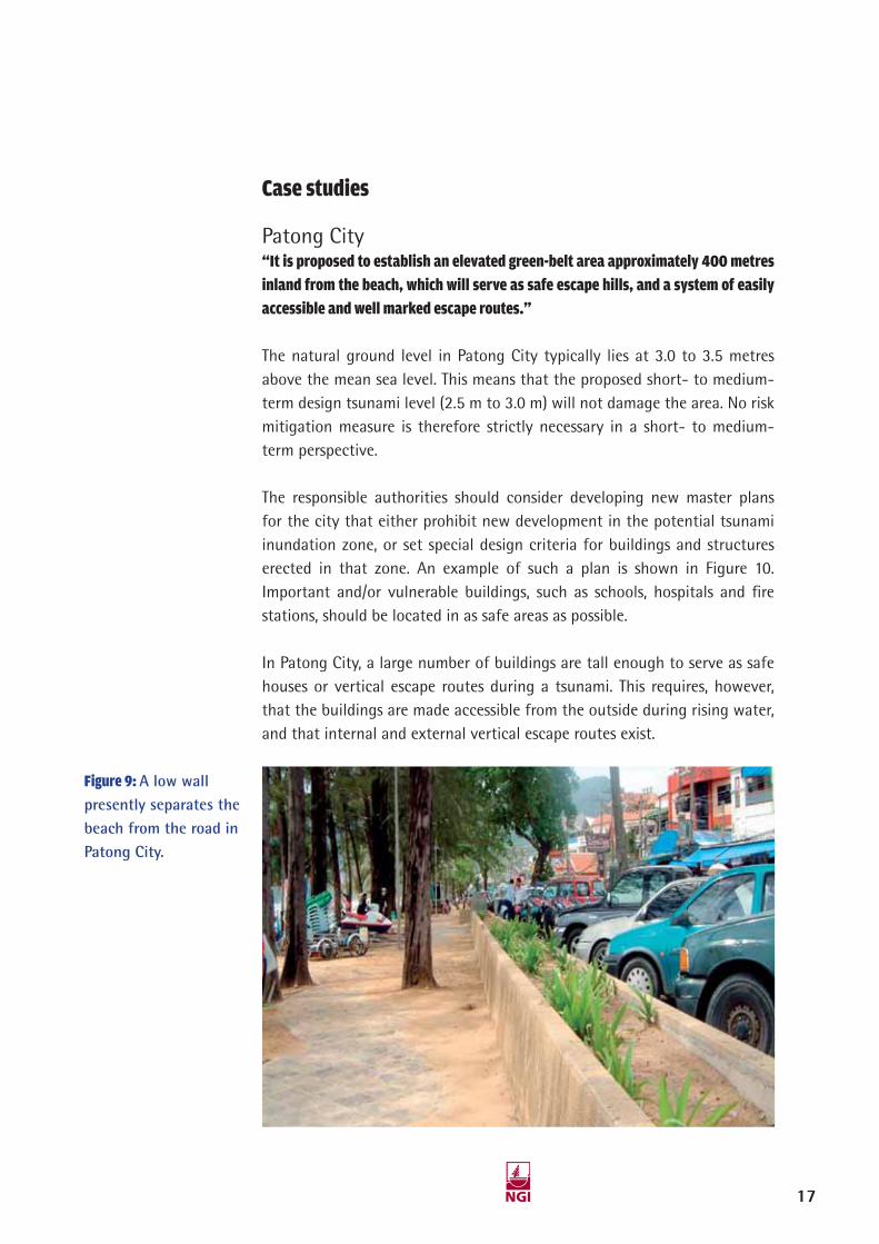
Figure 9: A low wall presently separates the beach from the road in Patong City.
Patong City “It is proposed to establish an elevated green-belt area approximately 400 metres inland from the beach, which will serve as safe escape hills, and a system of easily accessible and well marked escape routes.”
The natural ground level in Patong City typically lies at 3.0 to 3.5 metres above the mean sea level. This means that the proposed short- to medium-term design tsunami level (2.5 m to 3.0 m) will not damage the area. No risk mitigation measure is therefore strictly necessary in a short- to medium-term perspective.
The responsible authorities should consider developing new master plans for the city that either prohibit new development in the potential tsunami inundation zone, or set special design criteria for buildings and structures erected in that zone. An example of such a plan is shown in Figure 10. Important and/or vulnerable buildings, such as schools, hospitals and fi re stations, should be located in as safe areas as possible.
In Patong City, a large number of buildings are tall enough to serve as safe houses or vertical escape routes during a tsunami. This requires, however, that the buildings are made accessible from the outside during rising water, and that internal and external vertical escape routes exist.
17

A physical protection barrier along the beach road should be seriously considered as an alternative to or supplement to mitigation measures discussed above. A seawall may be established by raising the already existing (i.e. pre-tsunami) wall to a higher level. An earth dike between the road and the beach may be an option. For instance, analyses show that a dike or seawall only up to elevation 4 m above sea level, would reduce the water level behind the dike to about 4.7 m for a tsunami reaching 6.0 m inundation level without any seawall, i.e. it would reduce the inundation level by 1.3 m. For a 5-meter dike the water level behind the dike would only be at level 3.5 m, i.e. reduce the inundation level by 2.5 m Ten openings, each 2.5 m wide, in the dikes would not reduce the effect of the dikes signifi cantly (less than 0.1 m increase in water level because of the openings).
Box 5: Consequences of the 2004 tsunami in Patong City. Patong City
is located within a 3-4 km long and 3-4 km wide bay. The natural
ground level is typically 3 m above sea level. The inundation level
during the December 2004 tsunami was 5 to 6 m, which means that
the water level reached just under the second fl oor of the buildings.
For buildings facing the sea/beachfront located typically 50 m
from the sea, most brick walls, plaster walls, windows and doors
facing the sea were blown out by the tsunami. The buildings did
not collapse because they had load carrying concrete columns that
remained intact. This damage picture also partly applied to the
front of buildings facing the streets running perpendicular to the
beachfront within about 200 m distance from the sea.
Further back from the sea the damage was generally limited
to broken windows and damage associated with fl ooding of the
buildings. The number of casualties in Patong City was 160 out of
the approximately 20,000 people that were in the city when the
tsunami struck. Most casualties were caused by people who could
not escape from the basement fl oor in a shopping store and a
parking garage.
View of part of Patong City
Damaged building in Patong City
18

Figure 10: Patong City. Example of a master plan. The main elements are elevated green-belt areas approximately 400 metres inland from the beach, which will serve as safe escape hills, and a system of easily accessible and well marked escape routes. Normal car traffi c should be banned from these escape routes.
19

Figure 11: Classical traditional wooden Thai houses with open ground level and pole-supported upper fl oors may provide an interesting concept for tsunami safe tourist resorts. The cross-section illustrates how this may be built in a more modern context.
Bang Niang“Landscaping seems to be an interesting approach to longer term tsunami safety in
Bang Niang. One could artifi cially elevate the land on which houses, hotels and other buildings are sited, individually, in clusters or as parts of wider developments.”
About 100 tourist resorts were located on the 12 km long stretch of the Bang Niang beach. The natural ground level behind the beachfront typically lies at 4 to 5 m above sea level and is therefore safe for the short- to medium term tsunami scenarios.
Landscaping seems to be an interesting approach to longer term tsunami safety in Bang Niang. Since the area is fl at, the only safe areas during a severe tsunami are the hills about 1 to 3 km inland. For many areas, this means far too long escape routes. One way of shortening the escape routes would be to build elevated escape routes eastwards from the beach, until reaching safe heights.
20

Box 6: Consequences of the 2004 Tsunami in Bang Niang. The Bang Niang tourist resort area stretches
about 12 km north of Khao Lak. In this area the tsunami inundation level was generally around 10 m,
but locally up to 12 m near the beachfront. The natural ground level behind the beachfront typically
lies 4 to 5 m above the sea level. The resorts consisted mainly of 2 to 3-storey buildings. The tsunami
smashed through both the 1st and 2nd fl oors of the buildings. The tsunami blew out most brick and
plaster walls at front, back and sides of most buildings within 500 m distance from the sea. The
damage gradually decreased with distance from the shoreline. In Bang Niang relatively few buildings
collapsed completely because they had reinforced concrete columns that were able to carry the loads,
even though the walls were blown out by the tsunami impact, as seen in the photograph. There were
about 100 resorts in the Bang Niang area with about 15,000 people present in the area when the
tsunami struck, whereof about 3000 lost their lives.
Damaged resort building, Bang Niang
21

Plan:
Section:
Figure 12: Plan and section, illustration of landscaping as means for improving tsunami safety as well as the resort and holiday qualities. Escape hill as part of the project design.
One could also artifi cially elevate the land on which houses (see example bungalow in Figure 11), hotels and other buildings are sited, individually, in clusters or as parts of wider developments, as illustrated in the proposed plan and section of a Bang Niang beach resort in Figure 12. Escape hills could be erected to protect several resorts, possible through the combined efforts of local authorities and private landowners. Landscaping could actually improve the beauty of the Bang Niang resort areas, and enhance the tourist attraction.
22

Nam Khem“The most attractive solution may be to combine a protection dike with a new system of well marked and accessible escape roads leading to a safe, higher lying area about one kilometre inland.”
The Nam Khem fi shing village was severely hit by the 2004 tsunami, losing more than half of its population. The village ground level lies at 3 to 6 metres above mean sea level, making the village generally safe from short-
Box 7: Consequences of the 2004 tsunami in Nam Khem. In the fi shing village of Nam Khem, located
close to the border with Myanmar, the tsunami inundation level was about 8 m. The houses consisted
for the most part of rather simple 1 to 2-storey brick structures without solid columns. 4800 people
lived in the village whereof 3000, or approximately two-thirds of the population, lost their lives in
the tsunami. This is, relatively speaking much more than in the Bang Niang tourist resort area, which
may be explained by the following factors:
• Many people were at the fi shing harbour at the seafront, and were killed by debris from wharf
structures and boats that were thrown around by the tsunami.
• Many buildings collapsed completely due to poor quality and lack of solid columns to support the
structure.
• The main roads in the area ran more or less parallel to the waterfront giving long or diffi cult
escape paths to safer high areas inland.
• A number of mining ponds are located in the village. These ponds represented a hazard when
the tsunami struck, as some people were fl ushed into the ponds where they were even more
vulnerable to drowning.
23

to medium-term tsunami events (2.5 m to 3.0 m). The greatest risk would be faced by people involved with their boats or in other activities at the waterfront.
If the local authorities want to reduce possible tsunami consequences in a long-term perspective, Nam Khem represents a challenging and diffi cult case, for the following reasons:
• As seen in Figure 13, the village is almost completely surrounded by water.
• The distance from the harbour to safe areas (in terms of the 2004 tsunami) is 1 – 2 km.
• The main village street runs parallel to the waterfront, which lengthens the escape routes.
• There are several large (abandoned) mining ponds in the village, making escape inland more diffi cult.
• The mining ponds are also a tsunami risk in themselves. It was reported that many drowned in them during the 2004 tsunami.
In the centre of the village, there are (mostly) two-storied houses built wall to wall along the streets. Small shops, restaurants and workshops are located at street level, with living areas on the fi rst fl oor. The village outskirts host detached, relatively simple bungalows, located more independently from the road. The village has a harbour as well as facilities for handling and distributing fi sh. The pier houses relatively large aqua farming facilities.
After the tsunami, the villagers with help from the Thai army have rebuilt the village, more or less as it was before the tsunami. These houses are as vulnerable to tsunamis as before. A new school has however, been built in a safe, higher lying area about one kilometre inland. Escape routes from the village to safe areas have been marked with large signs.
24

Because Nam Khem was so badly affected by the 2004 tsunami, radical long term changes should be considered. Moving the main part of the village to tsunami safe areas could have been an option, but does not seem a viable approach because the reconstruction of the village is nearly completed and the fi shermen need to have easy access to the sea. The most attractive solution may be to combine a protection dike with a new system of well marked and accessible escape roads as outlined in the proposed master plan in Figure 13.
The suggested dike protects a far larger area than the present village and could be made shorter. The combination of an overtopping dike and effi cient escape routes or escape hills will probably add substantially to the tsunami safety in Nam Khem. As indicated, part of the barrier/dike could be commercial buildings for receiving and processing of the catch of the local fi shing fl eet. These buildings must be designed to withstand forces from the tsunami.
Figure 13: Layout of possible protection dike around Nam Khem with escape routes to safe high areas.
25

Comments regarding other areas in the regionThe work presented herein was also intended to be of some general use to other countries in the Indian Ocean region that may be exposed to future tsunamis. For that purpose a number of workshops and seminars were arranged with invited participants from these countries.
It is the opinion of NGI that similar country-specifi c studies should be carried out also for other countries in the region. Such studies will form a rational basis for long term development and mitigation measures and design of warning systems. Such studies might show that the short- to medium-term tsunami risk for the northern part of the west coast of Sumatra is signifi cantly higher than in Thailand. The situation may also be worse for the Andaman and Nicobar Islands, Sri Lanka, parts of the Indian coastline, Myanmar and Bangladesh.
The Sunda fault and subduction zone located southwards from the area that slipped in 2004 may, in the opinion of several researchers, pose an even greater threat today than prior to the megathrust earthquake of 26 December 2004. A megathrust event along this part of the Sunda Arc subduction zone will be disastrous for Sumatra and areas further south, but will not have any signifi cant effect on Thailand and the other areas north and west of Sumatra that were affected by the December 2004 earthquake.
26

Tale of a Norwegian victimWe stayed at a hotel in Khao Lak and were down at the poolside playing with our little son early in the morning of 26 December. There were other Norwegians there as well, and suddenly someone shouts: “There is a fl ood wave approaching”. There were only two stories in the hotel, which had its 1st fl oor located about 4 m above sea level. We rushed up to a room on the 2nd fl oor which was the highest level in our vicinity, and looked out at the sea. I thought: ”Oh my god, something is wrong here, I cannot remember that the tidal fl at went so far out here”. It was as if the water had disappeared. Far out we could see a fl ood wave quietly rolling towards us. When it was within about 50-100 m from the beach, it started to build up and break, and we could see the gigantic wave approaching. Some people on the ground start to react and run. We try to scream to people, there are still people on the beach, some are taking photographs, but nobody reacts. “You must come up here”. Then they panic, and those working at the hotel also come to the room we are in. After some time there are about 20 people in this little room on the 2nd fl oor. We see that the wave becomes very large, and try to get onto the roof, but there is no way to get there.
Then the water hits against the windows and fi lls the room. I see a brown wall of water against the bathroom window and the water rapidly fi lls the room completely. I felt like being in a movie, I am stuck in a tank and the water rises rapidly and fi lls the tank, and I was going to drown. And just at the moment when that thought struck me I get blown out of the room because the wall behind me explodes-or the building in a way explodes-and we are dragged or fl ushed out by the water.
I rapidly get hold of a door, and surf on the wave with that door, maybe with a speed of 30-35 km/hour. We rush over the palm trees, and barely see their tops sticking up. In the water there are entire buildings, palm trees, refrigerators, minibars, you name it. I try to manoeuvre away from the debris, but see power lines collapse in front of me and I think: “Now I will be caught by the wires and get strangled”. Then everything goes black. When I regain consciousness I have lost the door. I still try to manoeuvre in the strong current and manage to avoid dangerous debris. Finally my legs reach the bottom and the water becomes calmer. A local Thai woman tells me that I am on the other side of the road. I have travelled a distance of 2 km inland from the seashore.
15-02-06 11:09:4115-02-06 11:09:41

Norwegian Geotechnical InstituteP.O. Box 3930 Ullevaal Stadion, N-0806 Oslo, Norway
Street address: Sognsveien 72, 0855 Oslo, Norway Tlf: +4722023000, Fax: +4722230448
2547-NGI-rapport-omsl.indd 4-Sec1:12547-NGI-rapport-omsl.indd 4-Sec1:1