transit oriented development - unescap.org. transit oriented_resource person.pdf · transit...
TRANSCRIPT
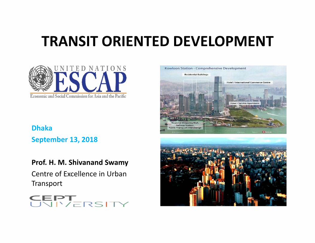
TRANSIT ORIENTED DEVELOPMENT
DhakaSeptember 13, 2018
Prof. H. M. Shivanand SwamyCentre of Excellence in Urban Transport
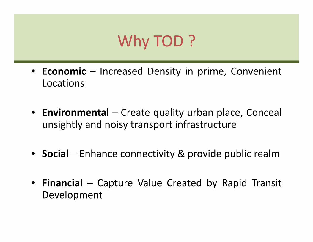
Why TOD ?
• Economic – Increased Density in prime, ConvenientLocations
• Environmental – Create quality urban place, Concealunsightly and noisy transport infrastructure
• Social – Enhance connectivity & provide public realm
• Financial – Capture Value Created by Rapid TransitDevelopment
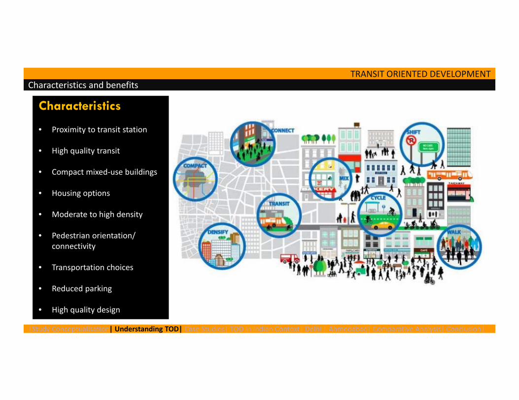
TRANSIT ORIENTED DEVELOPMENT Characteristics and benefits
|Study Conceptualisation| Understanding TOD| Case Studies| TOD in Indian Context| Delhi | Ahmedabad| Comparative Analysis| Conclusion|
Characteristics
• Proximity to transit station
• High quality transit
• Compact mixed‐use buildings
• Housing options
• Moderate to high density
• Pedestrian orientation/ connectivity
• Transportation choices
• Reduced parking
• High quality design
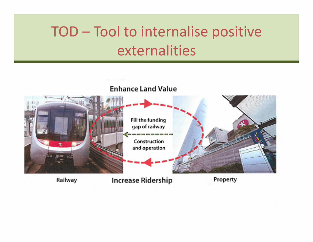
TOD – Tool to internalise positive externalities
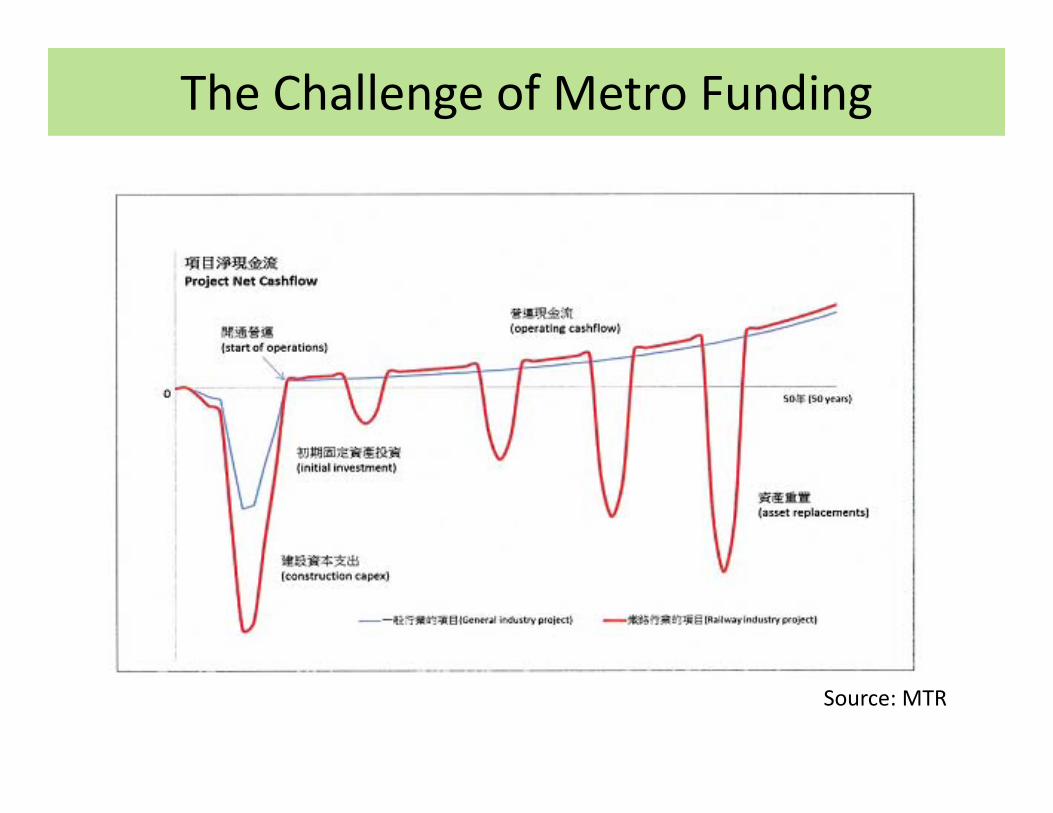
The Challenge of Metro Funding
Source: MTR
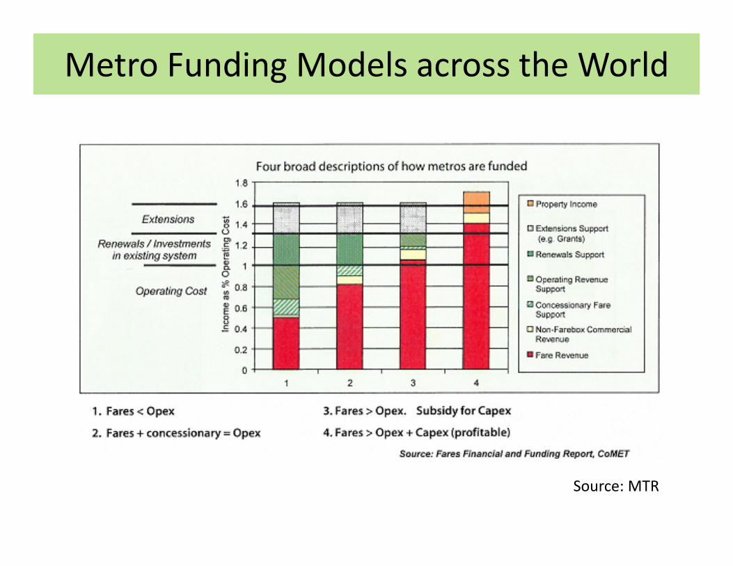
Metro Funding Models across the World
Source: MTR

SOME SUCCESSFUL TOD EXAMPLES
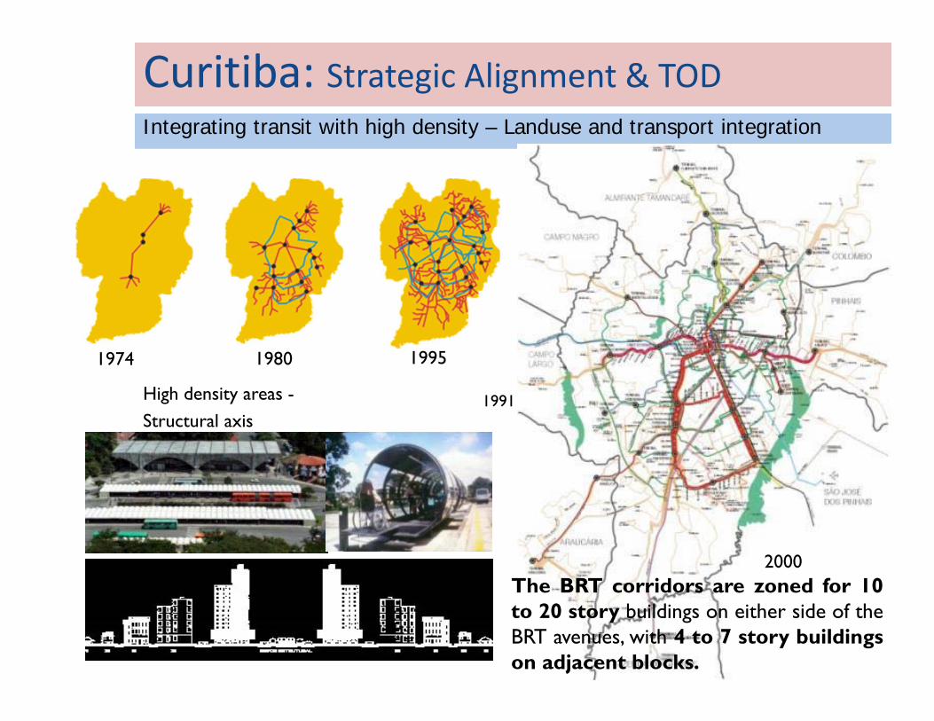
Curitiba: Strategic Alignment & TOD Integrating transit with high density – Landuse and transport integration
1974 19951980
High density areas -Structural axis
2000
1991
The BRT corridors are zoned for 10to 20 story buildings on either side of theBRT avenues, with 4 to 7 story buildingson adjacent blocks.
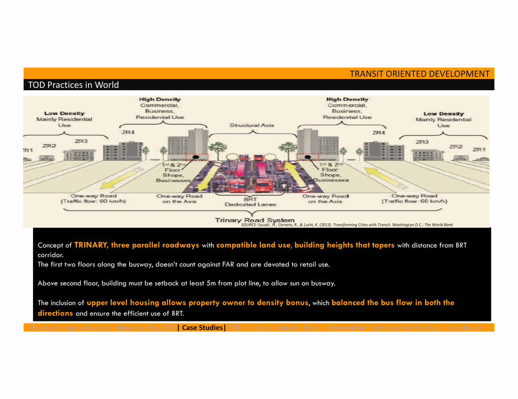
TRANSIT ORIENTED DEVELOPMENT TOD Practices in World
Concept of TRINARY, three parallel roadways with compatible land use, building heights that tapers with distance from BRT corridor. The first two floors along the busway, doesn’t count against FAR and are devoted to retail use.
Above second floor, building must be setback at least 5m from plot line, to allow sun on busway.
The inclusion of upper level housing allows property owner to density bonus, which balanced the bus flow in both the directions and ensure the efficient use of BRT.
SOURCE: Suzuki , H., Cervero, R., & Luchi, K. (2013). Transforming Cities with Transit. Washington D.C.: The World Bank
|Study Conceptualisation| Understanding TOD| Case Studies| TOD in Indian Context| Delhi | Ahmedabad| Comparative Analysis| I Conclusion|
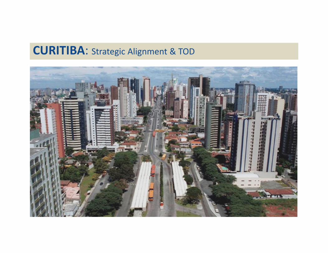
CURITIBA: Strategic Alignment & TOD
TRANSIT ORIENTED DEVELOPMENT
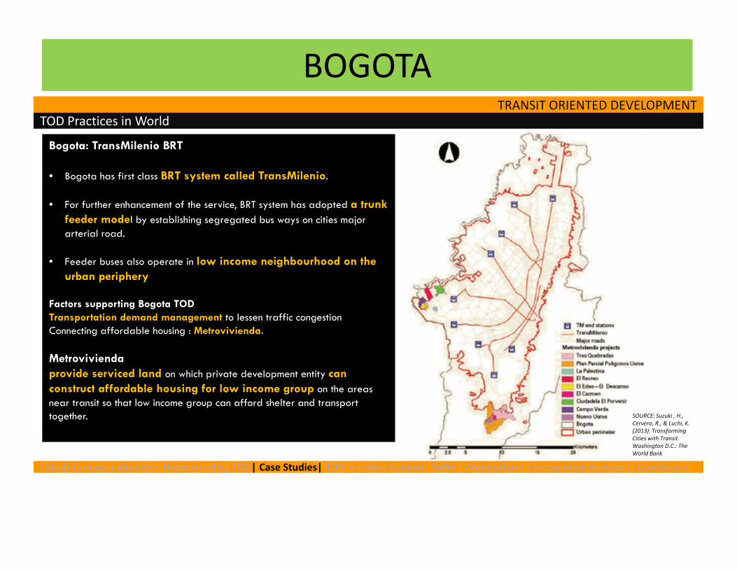
Bogota: TransMilenio BRT
• Bogota has first class BRT system called TransMilenio.
• For further enhancement of the service, BRT system has adopted a trunk feeder model by establishing segregated bus ways on cities major arterial road.
• Feeder buses also operate in low income neighbourhood on the urban periphery
Factors supporting Bogota TOD Transportation demand management to lessen traffic congestionConnecting affordable housing : Metrovivienda.
Metroviviendaprovide serviced land on which private development entity can construct affordable housing for low income group on the areas near transit so that low income group can afford shelter and transport together.
TOD Practices in World
SOURCE: Suzuki , H., Cervero, R., & Luchi, K. (2013). Transforming Cities with Transit. Washington D.C.: The World Bank
|Study Conceptualisation| Understanding TOD| Case Studies| TOD in Indian Context| Delhi | Ahmedabad| Comparative Analysis| I Conclusion|
BOGOTA
12
BOGOTA – World’s Best BRTS
Population (City): 68 Lakh.
Urban Pop. Density: 184 PPH
PT Share: 64%
Corridors:110 KMs
BRTS Buses: 1140
(Articulated) ‐17 lakh
passangers
Feeder Buses: 20000
Daily Ridership: 60 Lakhs
13
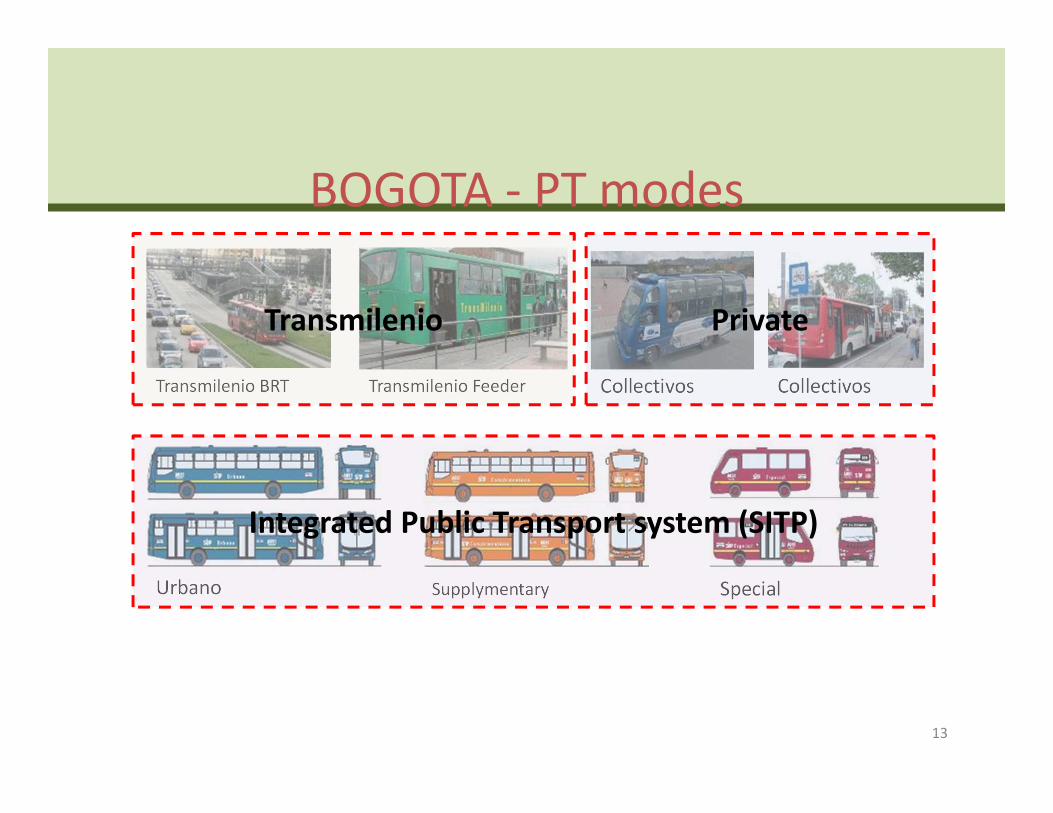
BOGOTA ‐ PT modes
Transmilenio BRT Transmilenio Feeder
Urbano Supplymentary Special
CollectivosCollectivos
Transmilenio Private
Integrated Public Transport system (SITP)
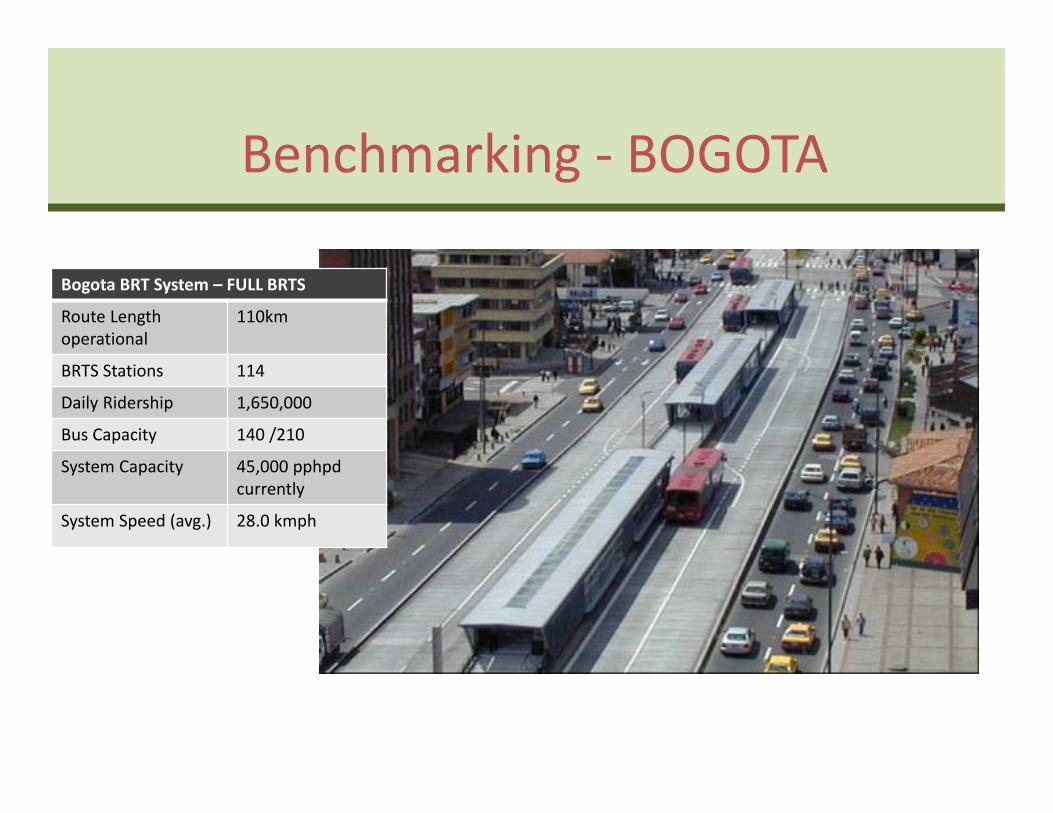
Benchmarking ‐ BOGOTA
Bogota BRT System – FULL BRTS
Route Length operational
110km
BRTS Stations 114
Daily Ridership 1,650,000
Bus Capacity 140 /210
System Capacity 45,000 pphpdcurrently
System Speed (avg.) 28.0 kmph
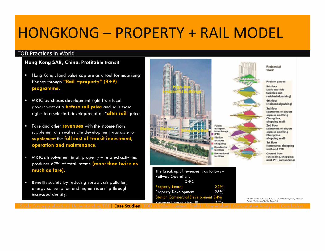
HONGKONG – PROPERTY + RAIL MODEL
Hong Kong SAR, China: Profitable transit
• Hong Kong , land value capture as a tool for mobilising finance through “Rail +property” (R+P) programme.
• MRTC purchases development right from local government at a before rail price and sells these rights to a selected developers at an “after rail” price.
• Fare and other revenues with the income from supplementary real estate development was able to supplement the full cost of transit investment, operation and maintenance.
• MRTC’s involvement in all property – related activities produces 62% of total income (more than twice as much as fare).
• Benefits society by reducing sprawl, air pollution, energy consumption and higher ridership through increased density.
TOD Practices in World
The break up of revenues is as follows –Railway Operations
24%Property Rental 22%Property Development 26%Station Commercial Development 24%Revenue from outside HK 04%
SOURCE: Suzuki , H., Cervero, R., & Luchi, K. (2013). Transforming Cities with Transit. Washington D.C.: The World Bank
|Study Conceptualisation| Understanding TOD| Case Studies| TOD in Indian Context| Delhi | Ahmedabad| Comparative Analysis| I Conclusion|
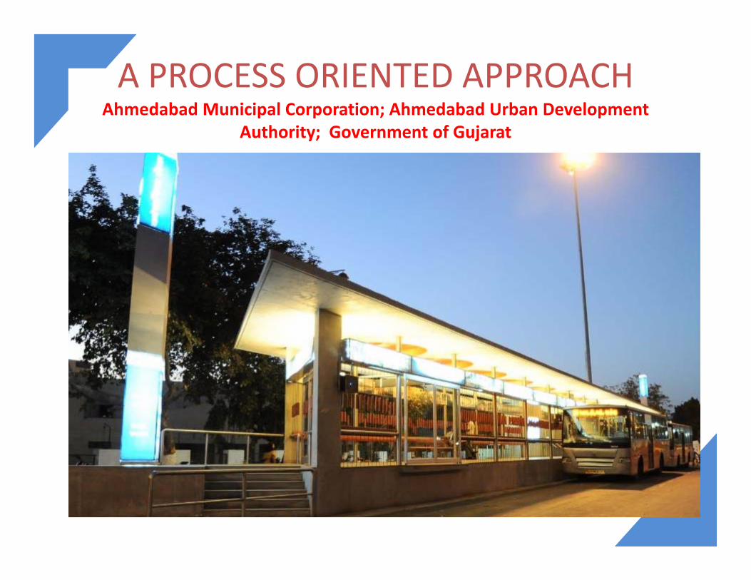
A PROCESS ORIENTED APPROACHAhmedabad Municipal Corporation; Ahmedabad Urban Development
Authority; Government of Gujarat
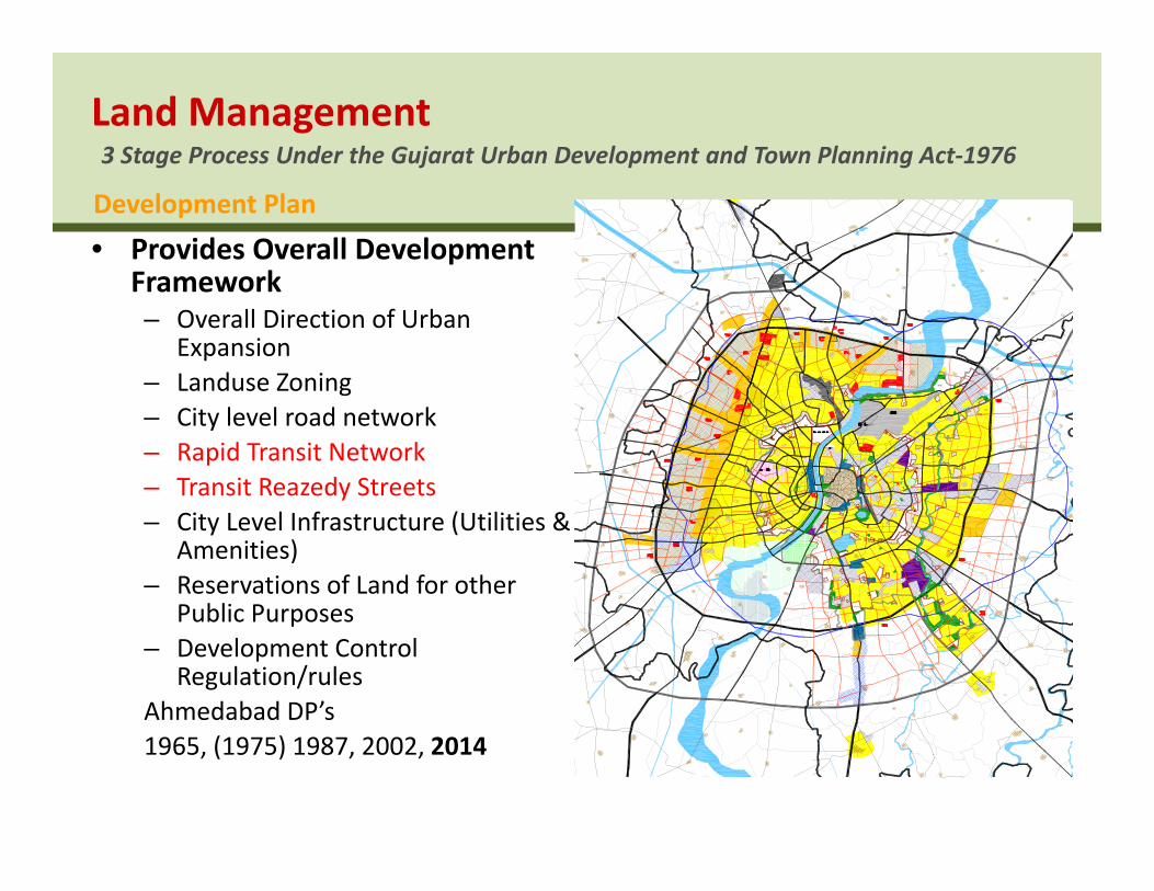
• Provides Overall Development Framework– Overall Direction of Urban
Expansion– Landuse Zoning– City level road network– Rapid Transit Network– Transit Reazedy Streets– City Level Infrastructure (Utilities &
Amenities)– Reservations of Land for other
Public Purposes– Development Control
Regulation/rulesAhmedabad DP’s1965, (1975) 1987, 2002, 2014
3 Stage Process Under the Gujarat Urban Development and Town Planning Act‐1976Land Management
Development Plan
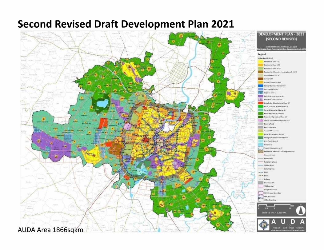
AUDA Area 1866sqkm
Second Revised Draft Development Plan 2021
18
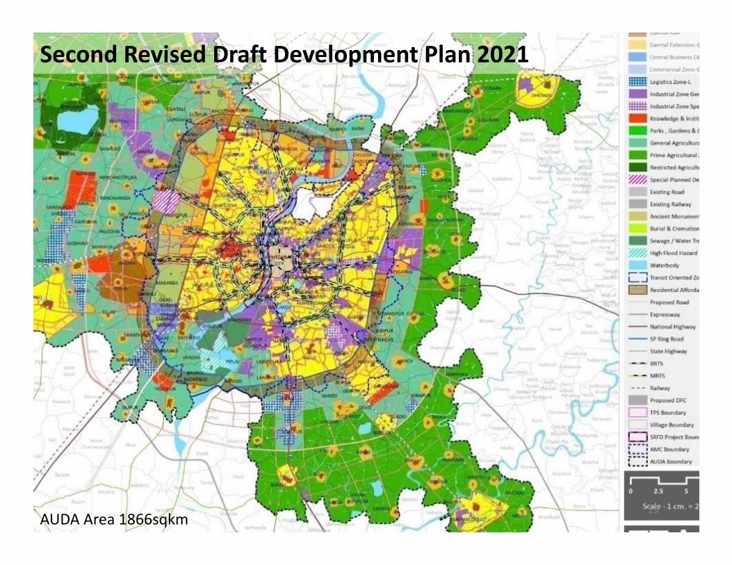
AUDA Area 1866sqkm
Second Revised Draft Development Plan 2021
19
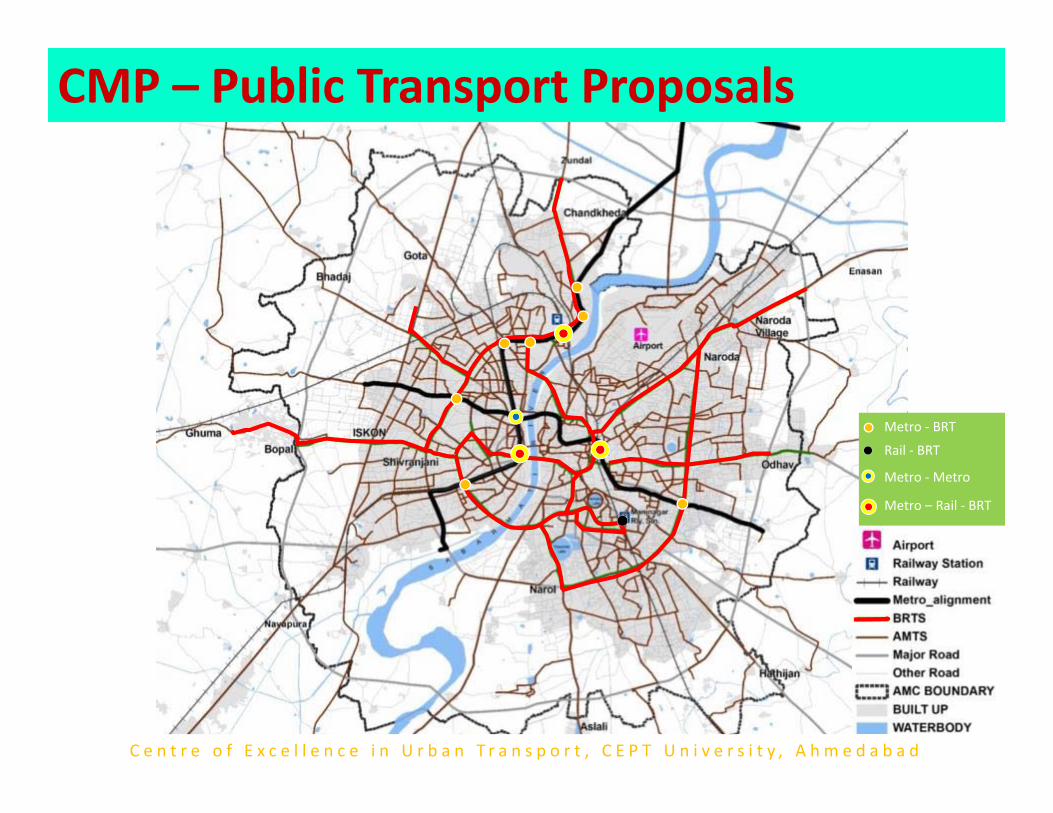
Integrated Transit Network Plan
Metro – Rail ‐ BRT
Metro ‐Metro
Metro ‐ BRT
Rail ‐ BRT
CMP – Public Transport Proposals
C e n t r e o f E x c e l l e n c e i n U r b a n T r a n s p o r t , C E P T U n i v e r s i t y , A h m e d a b a d
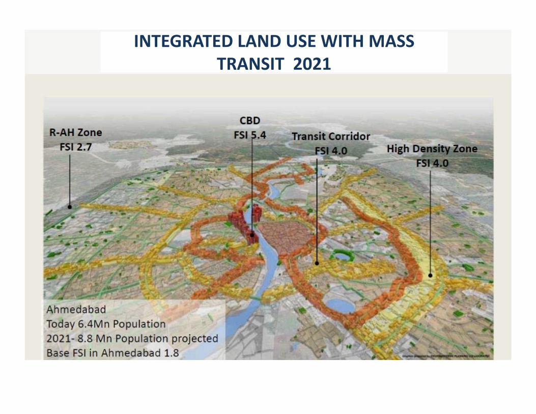
INTEGRATED LAND USE WITH MASS TRANSIT 2021
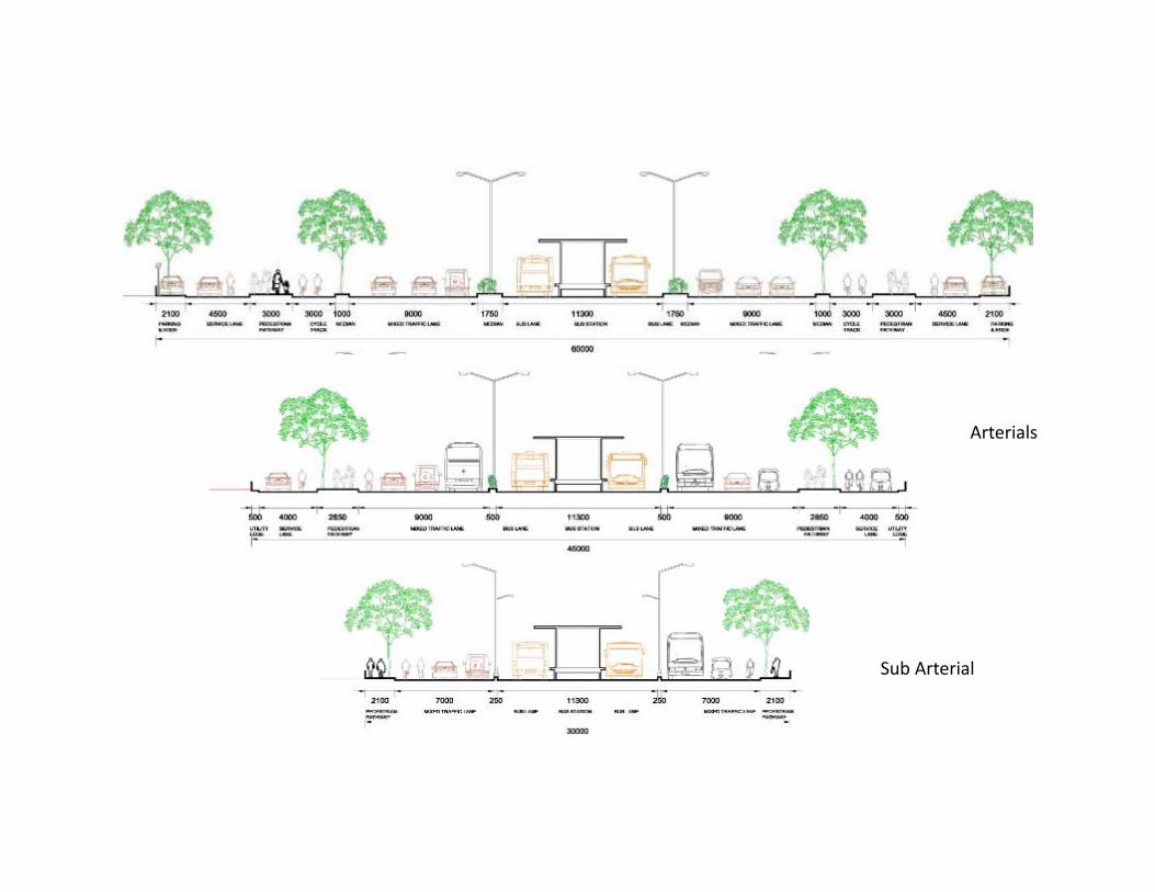
Arterials
Sub Arterial
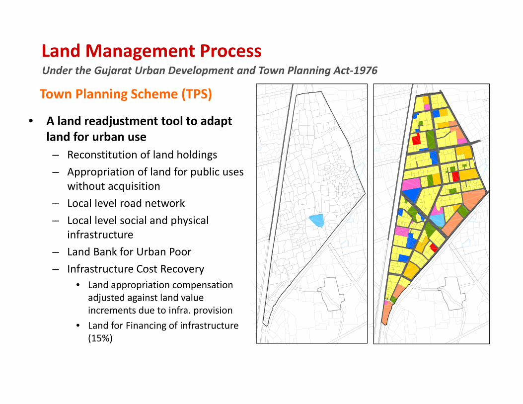
Under the Gujarat Urban Development and Town Planning Act‐1976Land Management Process
• A land readjustment tool to adapt land for urban use– Reconstitution of land holdings– Appropriation of land for public uses
without acquisition – Local level road network– Local level social and physical
infrastructure– Land Bank for Urban Poor– Infrastructure Cost Recovery
• Land appropriation compensation adjusted against land value increments due to infra. provision
• Land for Financing of infrastructure (15%)
Town Planning Scheme (TPS)
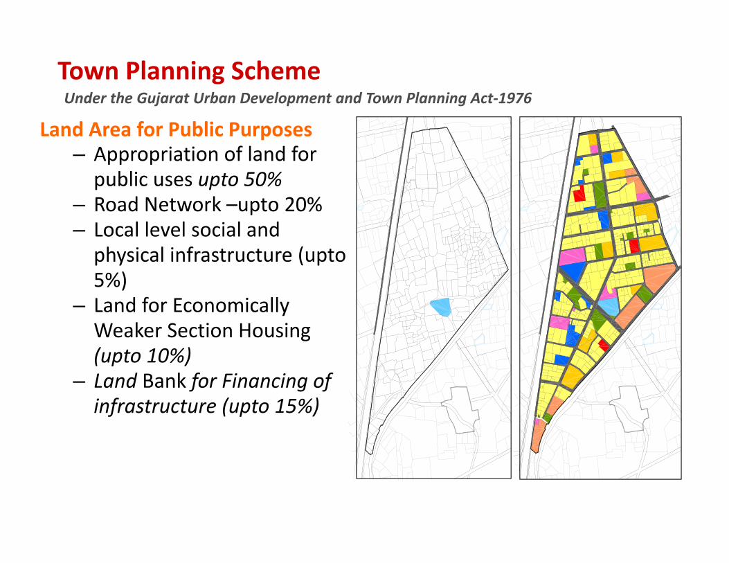
Under the Gujarat Urban Development and Town Planning Act‐1976Town Planning Scheme
Land Area for Public Purposes– Appropriation of land for public uses upto 50%
– Road Network –upto 20%– Local level social and physical infrastructure (upto 5%)
– Land for Economically Weaker Section Housing (upto 10%)
– Land Bank for Financing of infrastructure (upto 15%)
25
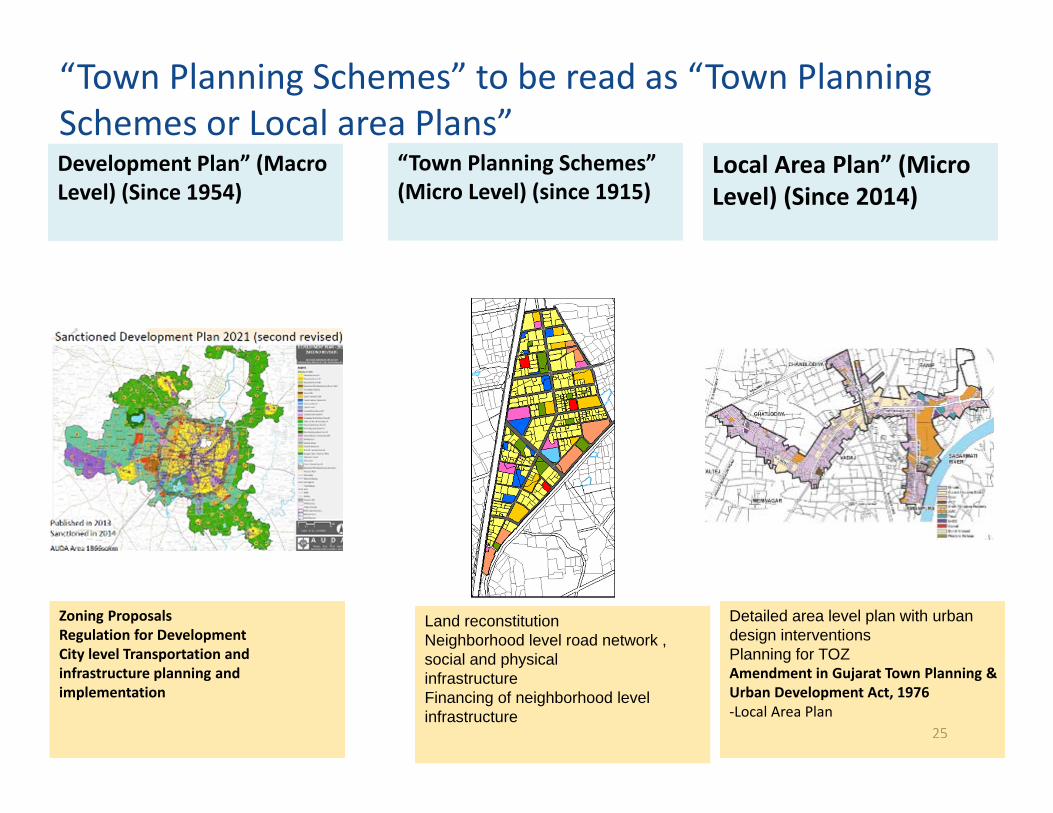
“Town Planning Schemes” to be read as “Town Planning Schemes or Local area Plans” Development Plan” (Macro Level) (Since 1954)
Zoning ProposalsRegulation for DevelopmentCity level Transportation and infrastructure planning andimplementation
“Town Planning Schemes” (Micro Level) (since 1915)
Local Area Plan” (Micro Level) (Since 2014)
Land reconstitutionNeighborhood level road network , social and physicalinfrastructureFinancing of neighborhood level infrastructure
Detailed area level plan with urban design interventionsPlanning for TOZAmendment in Gujarat Town Planning & Urban Development Act, 1976‐Local Area Plan
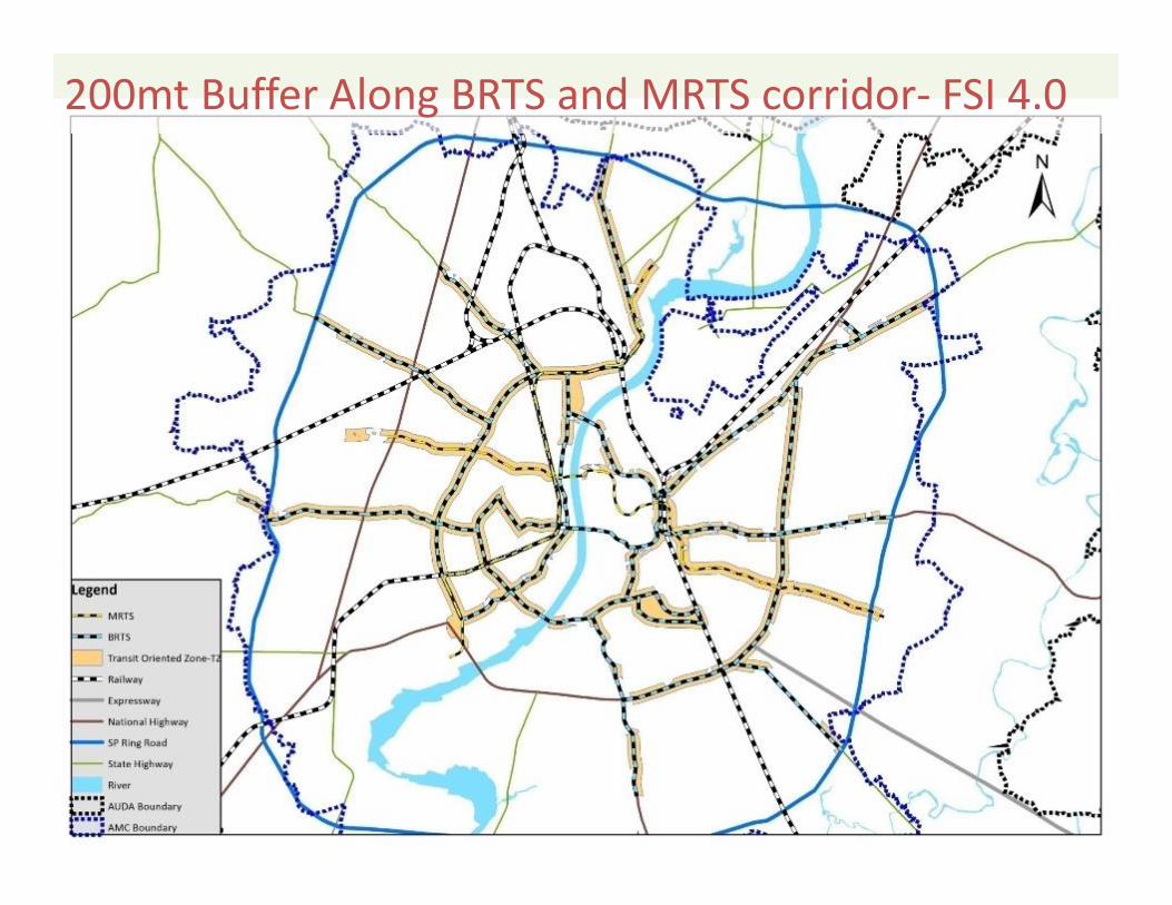
200mt Buffer Along BRTS and MRTS corridor‐ FSI 4.0
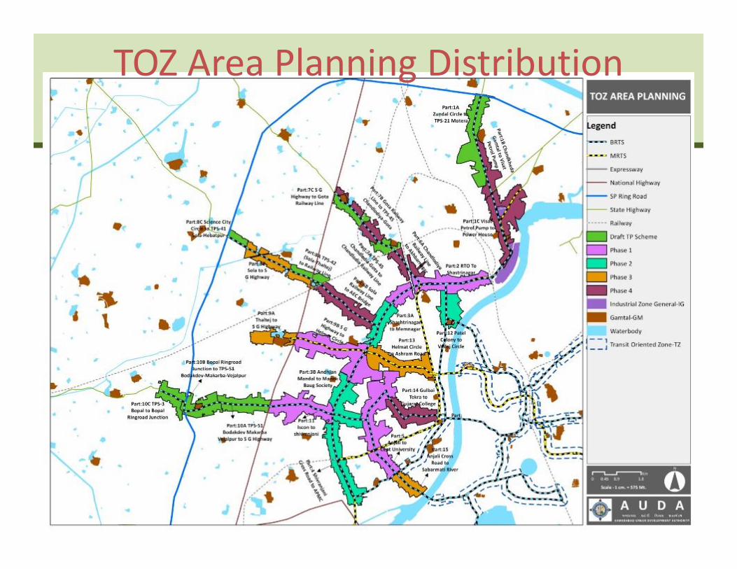
TOZ Area Planning Distribution
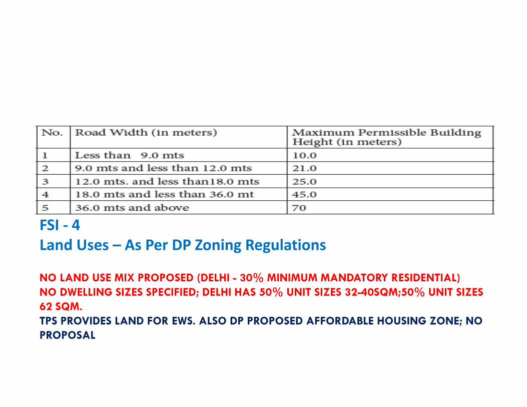
NO LAND USE MIX PROPOSED (DELHI - 30% MINIMUM MANDATORY RESIDENTIAL)NO DWELLING SIZES SPECIFIED; DELHI HAS 50% UNIT SIZES 32-40SQM;50% UNIT SIZES 62 SQM.TPS PROVIDES LAND FOR EWS. ALSO DP PROPOSED AFFORDABLE HOUSING ZONE; NO PROPOSAL
FSI ‐ 4Land Uses – As Per DP Zoning Regulations
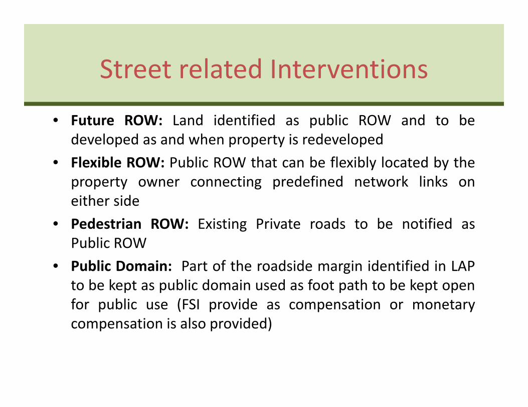
Street related Interventions
• Future ROW: Land identified as public ROW and to bedeveloped as and when property is redeveloped
• Flexible ROW: Public ROW that can be flexibly located by theproperty owner connecting predefined network links oneither side
• Pedestrian ROW: Existing Private roads to be notified asPublic ROW
• Public Domain: Part of the roadside margin identified in LAPto be kept as public domain used as foot path to be kept openfor public use (FSI provide as compensation or monetarycompensation is also provided)
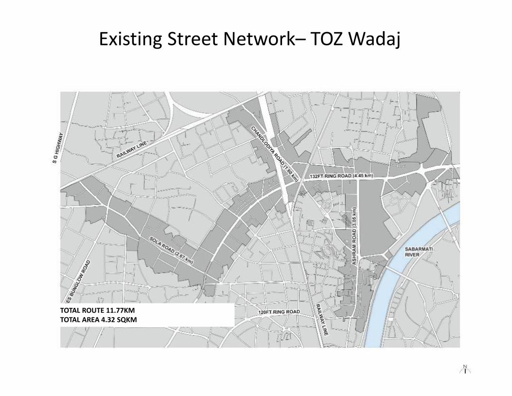
TOTAL ROUTE 11.77KMTOTAL AREA 4.32 SQKM
Existing Street Network– TOZ Wadaj
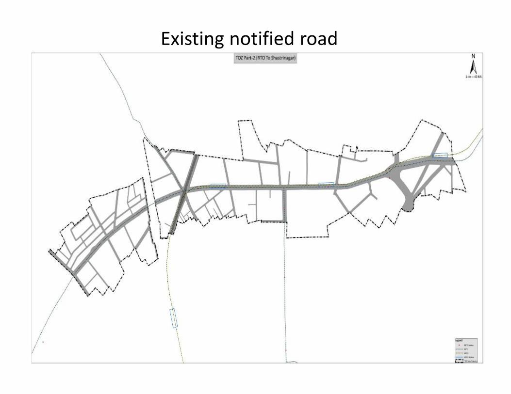
Existing notified road
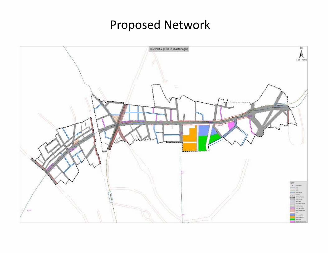
Proposed Network
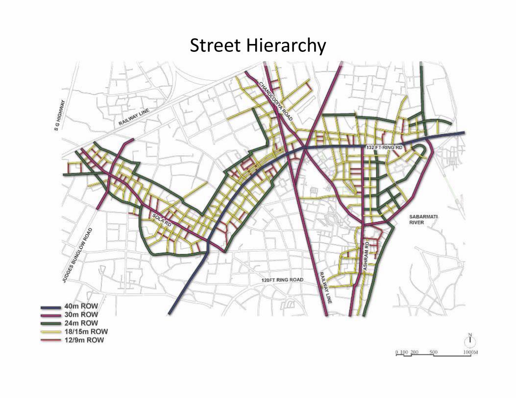
Street Hierarchy
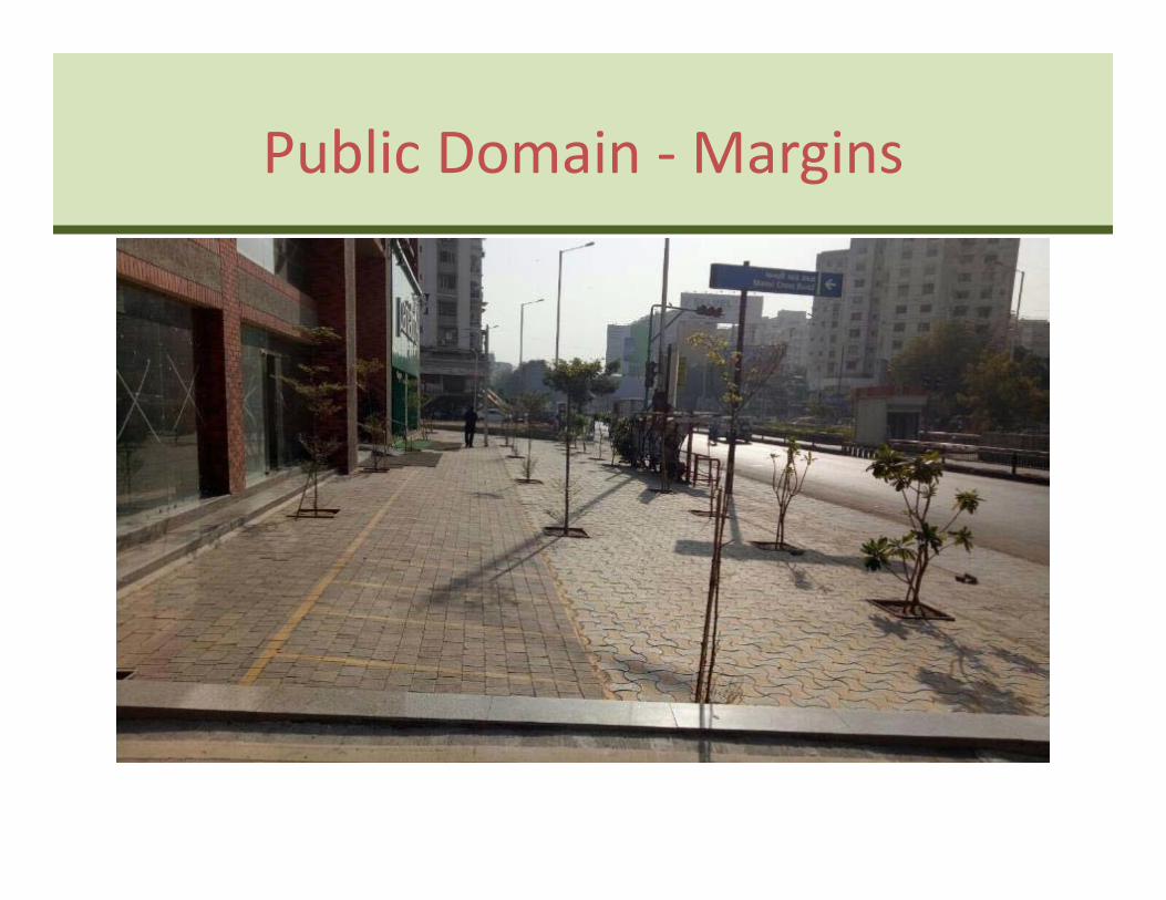
Public Domain ‐Margins
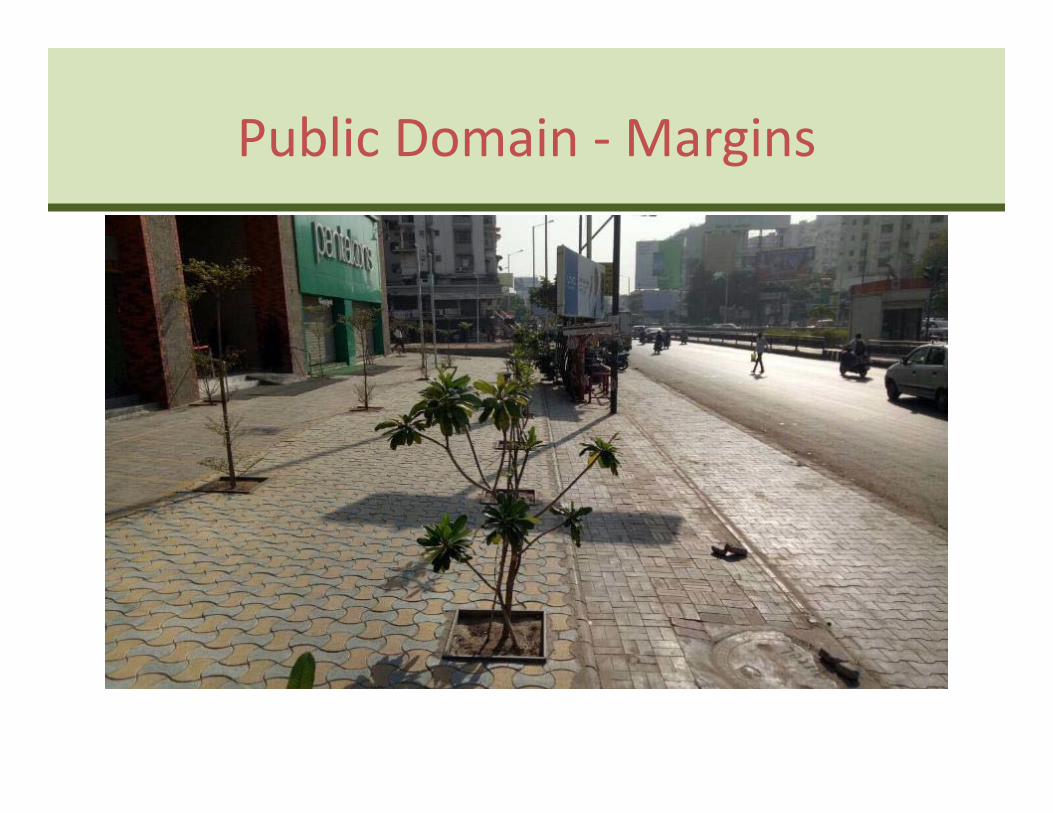
Public Domain ‐Margins
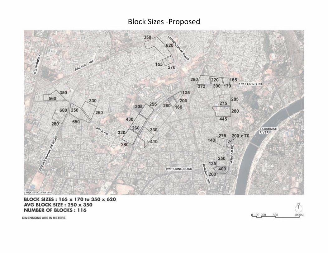
Block Sizes ‐Proposed
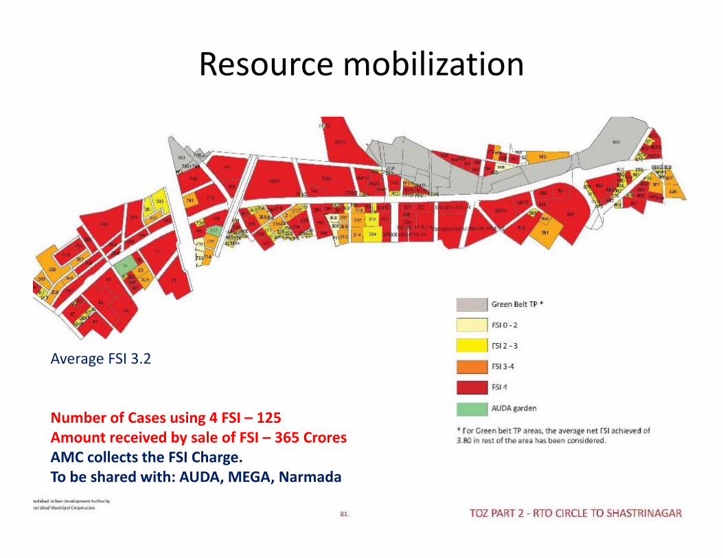
Resource mobilization
Average FSI 3.2
Number of Cases using 4 FSI – 125Amount received by sale of FSI – 365 CroresAMC collects the FSI Charge. To be shared with: AUDA, MEGA, Narmada
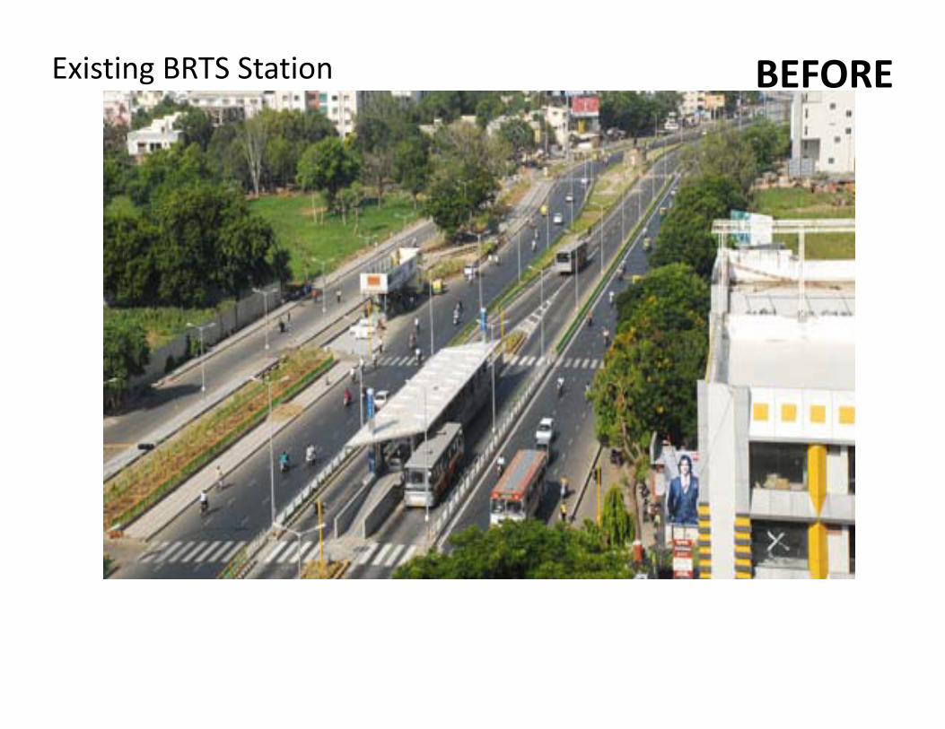
BEFOREExisting BRTS Station
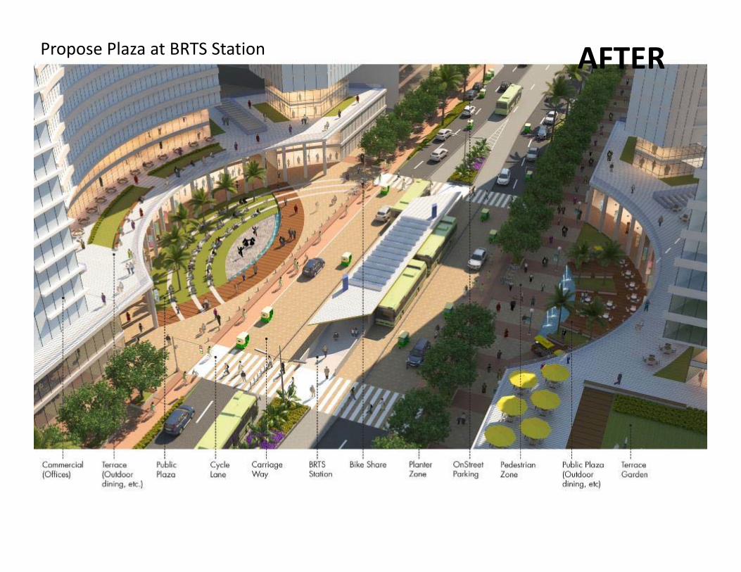
AFTERPropose Plaza at BRTS Station
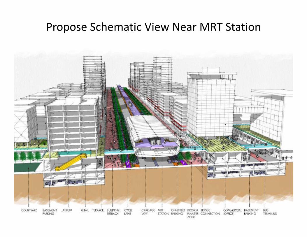
Propose Schematic View Near MRT Station
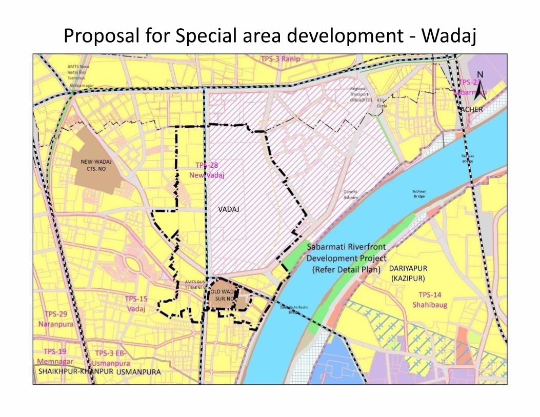
Proposal for Special area development ‐Wadaj
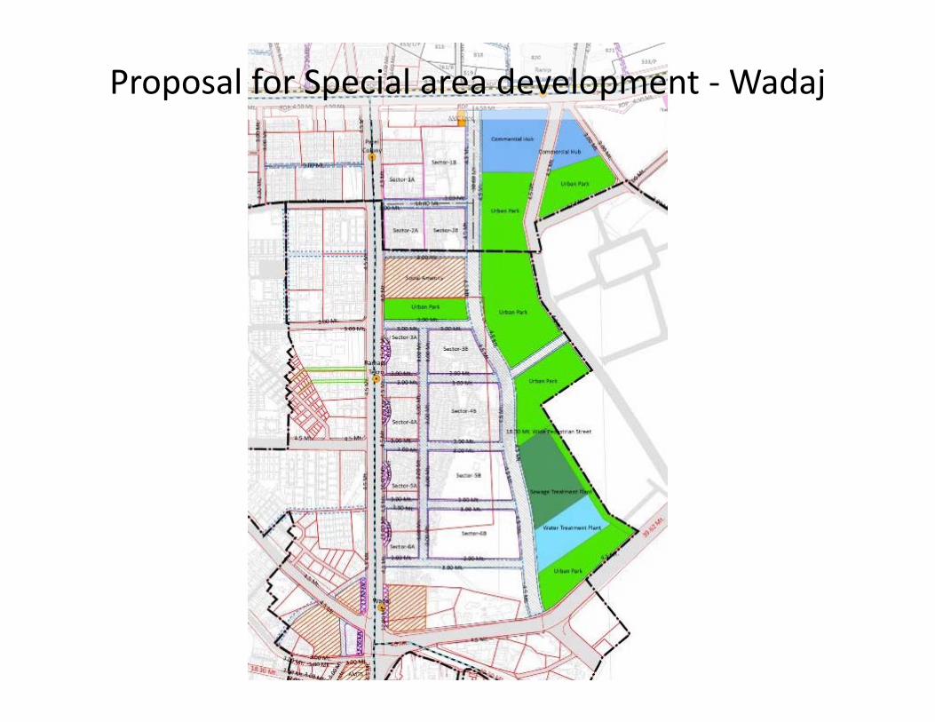
Proposal for Special area development ‐Wadaj
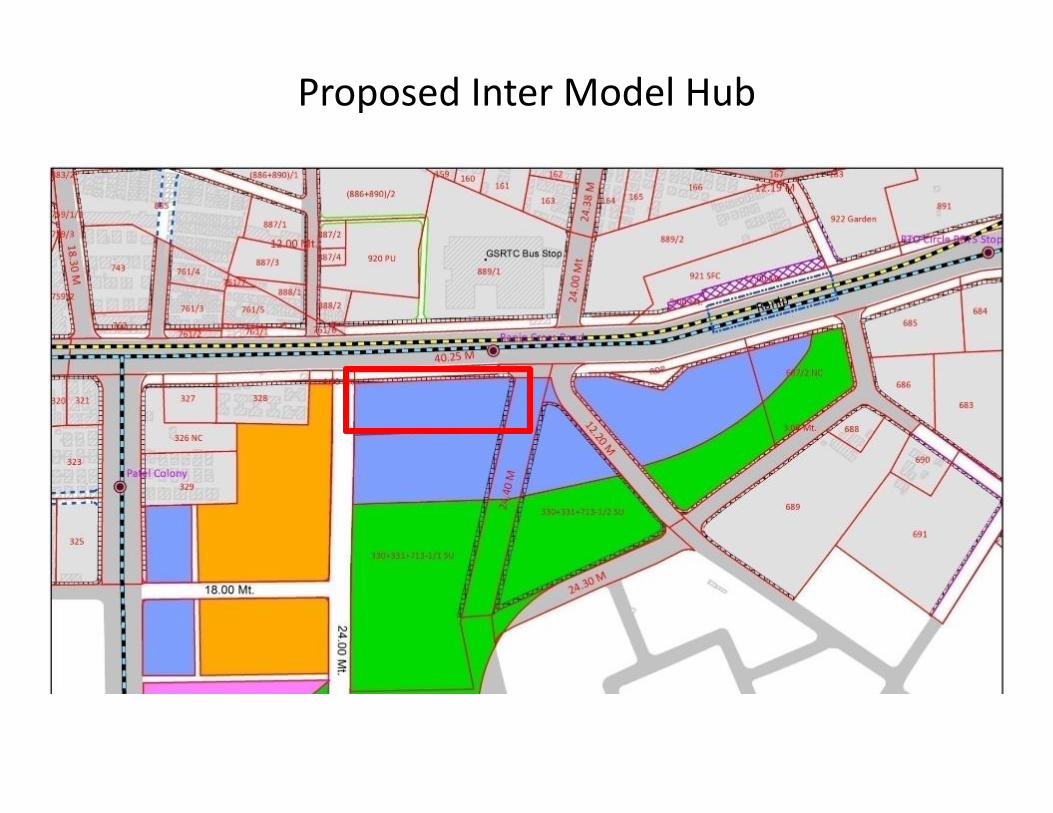
Proposed Inter Model Hub
45
Thank YouAMC/AUDA/CEPT