topic 2: frozen water grade 8 science. distribution of water on earth groundwater = 0.63%...
TRANSCRIPT
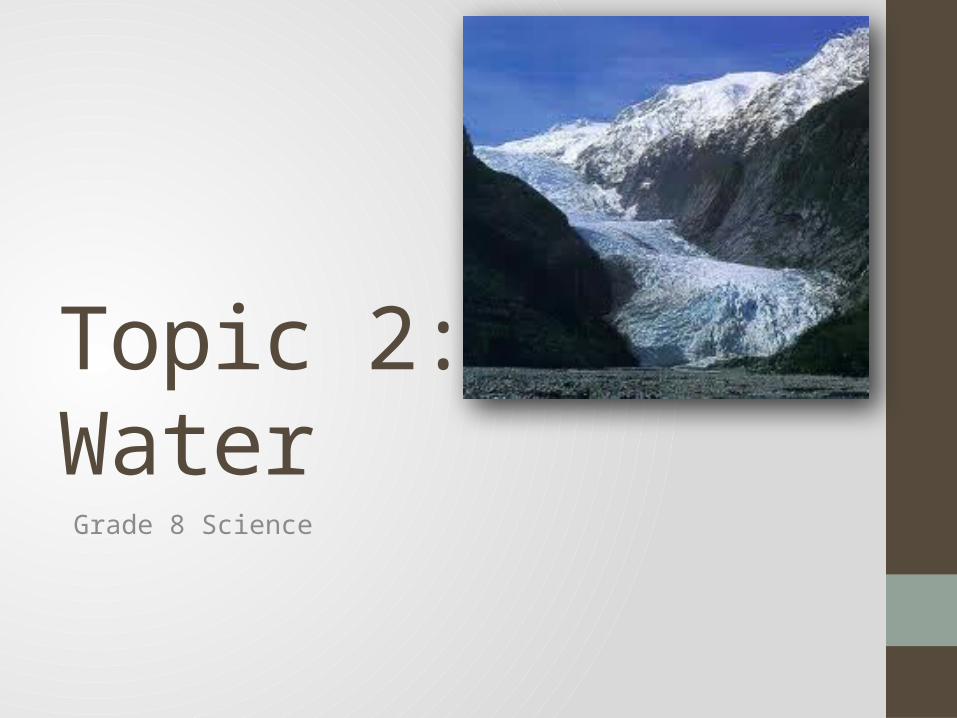
Topic 2: Frozen WaterGrade 8 Science

Distribution of water on earthGroundwater = 0.63%
Rivers/Lakes/Ponds = 0.02%
Glaciers/Ice sheets = 2.15%
Oceans / Seas = 97.02%
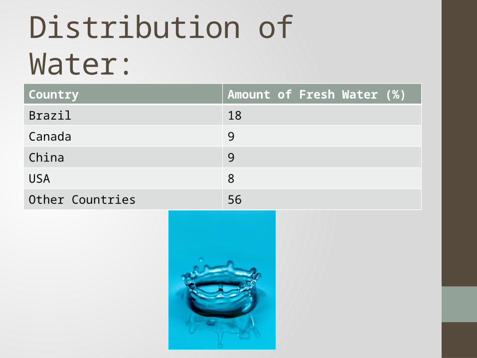
Distribution of Water:Country Amount of Fresh Water (%)
Brazil 18
Canada 9
China 9
USA 8
Other Countries 56

Ice is the second largest deposit of water on earth
after ocean.It covers ~10% of the earth’s land.
Snow can build up so high that the lower levels are
compressed into ice. The pressure on the ice
eventually causes it to melt and slide down the hill.A glacier is a moving mass of ice and snow.
An ice cap is a glacier that forms on an extensive
area of relatively level land and so it just flows out
from the center.
An ice field is an upland area of ice that feeds two or
more glaciers.
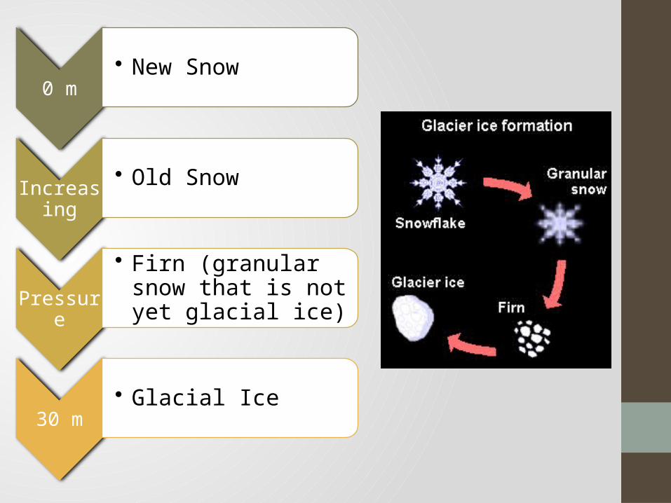
0 m• New Snow
Increasing
• Old Snow
Pressure
• Firn (granular snow that is not yet glacial ice)
30 m
• Glacial Ice
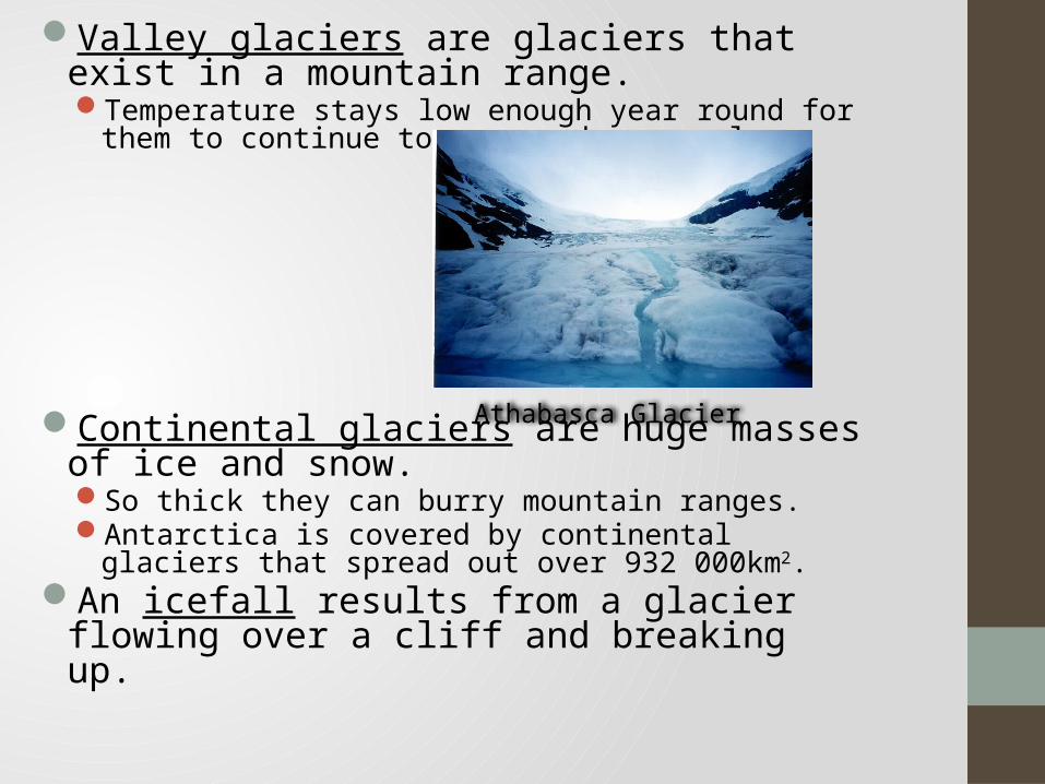
Valley glaciers are glaciers that exist in a mountain range.Temperature stays low enough year round for them to continue
to grow and creep along.
Continental glaciers are huge masses of ice and snow.So thick they can burry mountain ranges.Antarctica is covered by continental glaciers that spread out over
932 000km2.An icefall results from a glacier flowing over a cliff and
breaking up.
Athabasca Glacier
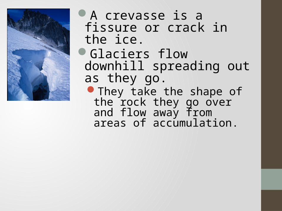
A crevasse is a fissure or crack in the ice.
Glaciers flow downhill spreading out as they go.They take the shape of the rock
they go over and flow away from areas of accumulation.

A retreating glacier looks like it is flowing uphill even though it is still actually flowing downhill.
This occurs when the ice melts faster than it is replaced. This causes the glacier to shorten and retreat.
Glaciers can also do the opposite process and be known as advancing glaciers.
Athabasca Glacier, Jasper National Park

Pack Ice & IcebergsPack ice is a sheet of ice rarely more than 5m
thick.It breaks easily.Formed from freezing seawater.
Icebergs are large chunks
of ice that calve (break loose) from continental glaciers and flow into the ocean. They can be several km
long and 100m high. The tops melt faster from
the sun and wind.

As they move, glaciers push any loose materials aside.Eroded sediments pile up
along the sides.Water flows into rock cracks,
refreezes and expands splitting the rock and carrying pieces away. This catches the boulders, gravel, and sand.

The new material scrapes the bottoms and side causing scars or scratches in the rocks called striations.
Cirques are bowl shaped basins in sides of mountains caused by glacier erosion.
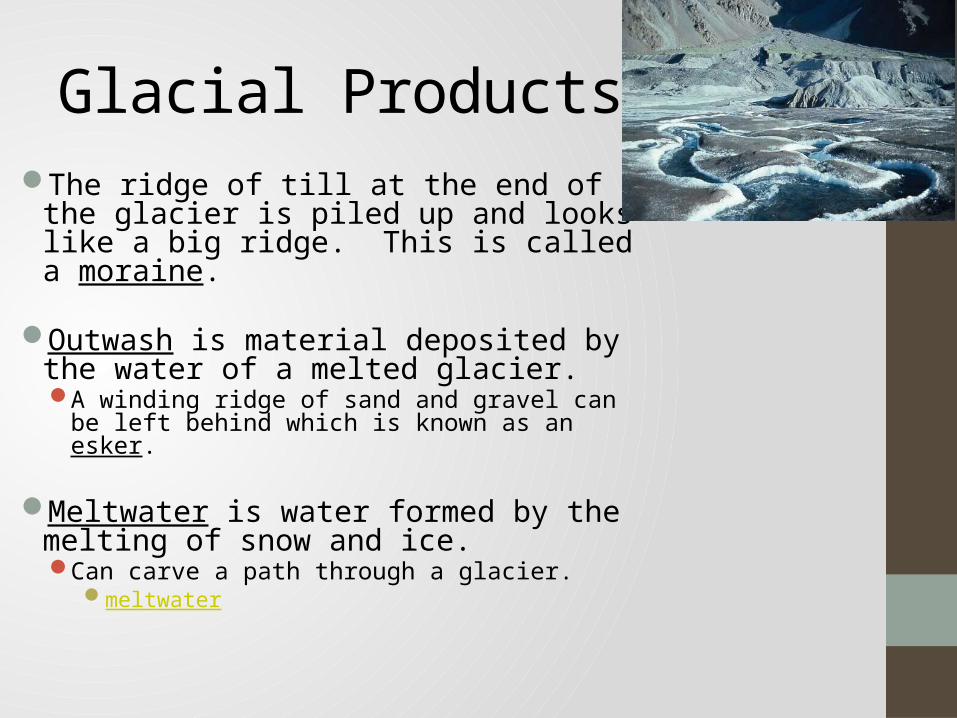
Glacial ProductsThe ridge of till at the end of the glacier is
piled up and looks like a big ridge. This is called a moraine.
Outwash is material deposited by the water
of a melted glacier.A winding ridge of sand and gravel can be left behind
which is known as an esker. Meltwater is water formed by the melting
of snow and ice.Can carve a path through a glacier.
meltwater
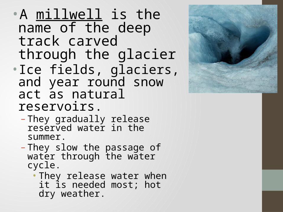
• A millwell is the name of the deep track carved through the glacier
• Ice fields, glaciers, and year round snow act as natural reservoirs.– They gradually release reserved water in
the summer.– They slow the passage of water through
the water cycle.• They release water when it is needed
most; hot dry weather.

• Earth has had at least seven ice ages during the last several million years.– Ice ages are periods of
major cooling.– The last one started 120
000 years ago and lasted for 109 000 years.• Glaciers covered 28%
of the land.

Ice Ages It is hypothesized that ice ages happen
because of:1. A reduction of thermal energy given off by the sun.2. Increased dust in the atmosphere from volcanic activity reduces the suns energy hitting the earth.3. Increased mountain formation holds snow that reflects sunlight to reduce earth’s temperature.4. Movement of tectonic plates prevents ocean currents from mixing hot and cold regions.5. Change of the earth’s axis or tilt facing the sun.