the use of rtk gps in blast optimization “the case of gold ... · the use of rtk gps in blast...
TRANSCRIPT
WE DELIVERWE DELIVER
THE USE OF RTK GPS IN BLAST THE USE OF RTK GPS IN BLAST OPTIMIZATION OPTIMIZATION ““THE CASE OF GOLD THE CASE OF GOLD
FIELDS GHANA LTD, TARKWAFIELDS GHANA LTD, TARKWA””
BY
FRANCIS MENSAH
EILAT 2009, FIG WORKING WEEK
2
PRESENTATION OUTLINEPRESENTATION OUTLINE
THE USE OF RTK GPS IN BLAST OPTIMIZATIONTHE USE OF RTK GPS IN BLAST OPTIMIZATION
WE DELIVERWE DELIVER
3
BACKGROUNDBACKGROUND
● Tarkwa Gold Mine is owned by Gold Fields Ghana, IAMGOLD and the Government of the Republic of Ghana in a 71%, 19% and 10% ratio.
● Tarkwa is a large, low-grade open pit gold mining operation being operated by Gold Fields Ghana Limited (GGL).
● Annual production average is 110 million tonnes.
● Tarkwa Mine is located in Southern Ghana between Latitude 5˚ – Nۥ15 5˚˚N and Longitude 1ۥ30 – Wۥ50 2˚ .Wۥ 05
● The concession covers an area of approximately 295 km2 extending from the town of Tarkwa in the south for a distance of 25 km to Huni Valley in the northeast limit.
THE USE OF RTK GPS IN BLAST OPTIMIZATIONTHE USE OF RTK GPS IN BLAST OPTIMIZATION
4
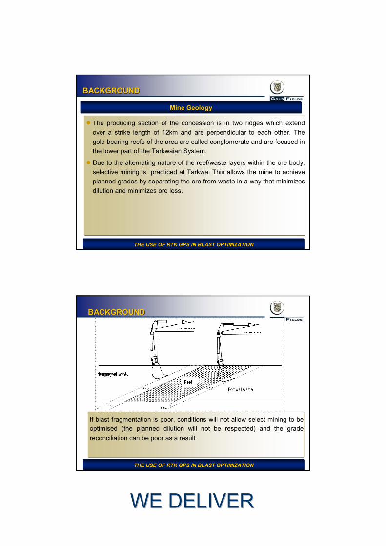
BACKGROUNDBACKGROUND
THE USE OF RTK GPS IN BLAST OPTIMIZATIONTHE USE OF RTK GPS IN BLAST OPTIMIZATION
Location of GGL ConcessionLocation of GGL Concession
WE DELIVERWE DELIVER
5
BACKGROUNDBACKGROUND
● The producing section of the concession is in two ridges which extend over a strike length of 12km and are perpendicular to each other. The gold bearing reefs of the area are called conglomerate and are focused in the lower part of the Tarkwaian System.
● Due to the alternating nature of the reef/waste layers within the ore body, selective mining is practiced at Tarkwa. This allows the mine to achieve planned grades by separating the ore from waste in a way that minimizes dilution and minimizes ore loss.
Mine GeologyMine Geology
THE USE OF RTK GPS IN BLAST OPTIMIZATIONTHE USE OF RTK GPS IN BLAST OPTIMIZATION
6
BACKGROUNDBACKGROUND
If blast fragmentation is poor, conditions will not allow select mining to be optimised (the planned dilution will not be respected) and the grade reconciliation can be poor as a result..
THE USE OF RTK GPS IN BLAST OPTIMIZATIONTHE USE OF RTK GPS IN BLAST OPTIMIZATION
WE DELIVERWE DELIVER
7
BACKGROUNDBACKGROUND
Machine TypeMachine Type QuantityQuantity
Liebherr 984 Excavators 4
Liebherr 994_200 Excavators 4
Liebherr 9250 Excavators 1
Liebherr 994B Excavators 2
Liebherr 994B Face Shovel 1
O&K RH120 Excavator 3
Caterpillar 785C Trucks 44
Tamrock Pantera 1500 Drill Rigs 22
THE USE OF RTK GPS IN BLAST OPTIMIZATIONTHE USE OF RTK GPS IN BLAST OPTIMIZATION
Mining Mining –– Haulage & Drilling Fleet Haulage & Drilling Fleet
8
STATEMENT OF PROBLEMSTATEMENT OF PROBLEM
● Before the introduction of RTK GPS into the blasting process at Gold Fields Ghana limited (GGL), blast fragmentation was resulting in sub-optimal feed size to crushers on the Mine and an unfriendly floor conditions resulting in excessive sheeting of digging floor to prevent tyre damage.
● Using RTK GPS to improve blast fragmentation through accurate drill depth and design pattern in order to achieve a constant throughput.
● Increase pit loading efficiency.
● Decrease rock breaker hours.
● Reduce equipment damage.
● Reduce in-pit sheeting costs respectively.
THE USE OF RTK GPS IN BLAST OPTIMIZATIONTHE USE OF RTK GPS IN BLAST OPTIMIZATION
WE DELIVERWE DELIVER
9
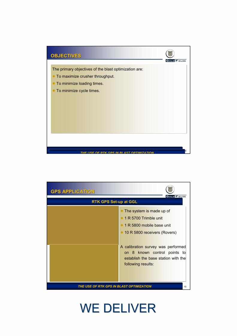
OBJECTIVESOBJECTIVES
The primary objectives of the blast optimization are:
● To maximize crusher throughput.
● To minimize loading times.
● To minimize cycle times.
THE USE OF RTK GPS IN BLAST OPTIMIZATIONTHE USE OF RTK GPS IN BLAST OPTIMIZATIONTHE USE OF RTK GPS IN BLAST OPTIMIZATIONTHE USE OF RTK GPS IN BLAST OPTIMIZATION
10
GPS APPLICATIONGPS APPLICATION
● The system is made up of
● 1 R 5700 Trimble unit
● 1 R 5800 mobile base unit
● 10 R 5800 receivers (Rovers)
A calibration survey was performed on 8 known control points to establish the base station with the following results:
THE USE OF RTK GPS IN BLAST OPTIMIZATIONTHE USE OF RTK GPS IN BLAST OPTIMIZATION
RTK GPS SetRTK GPS Set--up at GGLup at GGL
WE DELIVERWE DELIVER
11
GPS APPLICATIONGPS APPLICATION
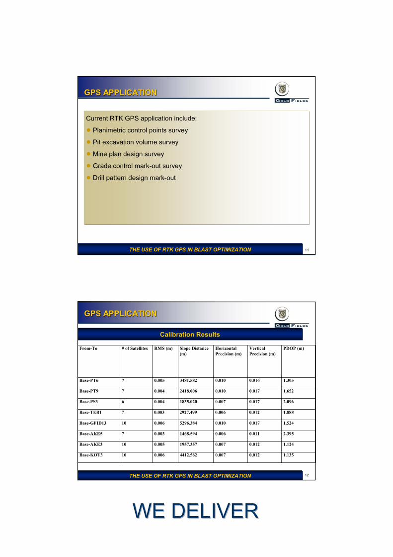
Current RTK GPS application include:
● Planimetric control points survey
● Pit excavation volume survey
● Mine plan design survey
● Grade control mark-out survey
● Drill pattern design mark-out
THE USE OF RTK GPS IN BLAST OPTIMIZATIONTHE USE OF RTK GPS IN BLAST OPTIMIZATION
12
GPS APPLICATIONGPS APPLICATION
Calibration ResultsCalibration Results
From-To # of Satellites RMS (m) Slope Distance (m)
Horizontal Precision (m)
Vertical Precision (m)
PDOP (m)
Base-PT6 7 0.005 3481.582 0.010 0.016 1.305
Base-PT9 7 0.004 2418.006 0.010 0.017 1.652
Base-PS3 6 0.004 1835.020 0.007 0.017 2.096
Base-TEB1 7 0.003 2927.499 0.006 0.012 1.888
Base-GFID13 10 0.006 5296.384 0.010 0.017 1.524
Base-AKE5 7 0.003 1468.594 0.006 0.011 2.395
Base-AKE3 10 0.005 1957.357 0.007 0.012 1.124
Base-KOT3 10 0.006 4412.562 0.007 0,012 1.135
THE USE OF RTK GPS IN BLAST OPTIMIZATIONTHE USE OF RTK GPS IN BLAST OPTIMIZATION
WE DELIVERWE DELIVER
13
GPS APPLICATIONGPS APPLICATION
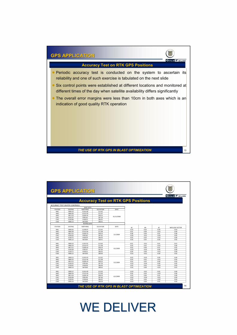
● Periodic accuracy test is conducted on the system to ascertain its reliability and one of such exercise is tabulated on the next slide
● Six control points were established at different locations and monitored at different times of the day when satellite availability differs significantly
● The overall error margins were less than 10cm in both axes which is an indication of good quality RTK operation
Accuracy Test on RTK GPS PositionsAccuracy Test on RTK GPS Positions
THE USE OF RTK GPS IN BLAST OPTIMIZATIONTHE USE OF RTK GPS IN BLAST OPTIMIZATION
14
GPS APPLICATIONGPS APPLICATION
THE USE OF RTK GPS IN BLAST OPTIMIZATIONTHE USE OF RTK GPS IN BLAST OPTIMIZATION
Accuracy Test on RTK GPS PositionsAccuracy Test on RTK GPS PositionsACCURACY TEST ON RTK CONTROLS
BASE DATASTATION EASTING NORTHING ELEVATION DATE
MK1 9983.53 11241.00 212.65
31/12/2008
MK2 9866.60 11513.59 211.97MK3 9813.33 11826.45 208.25CW1 9235.97 9783.92 187.59CW2 9130.80 9748.52 186.01CW3 9006.13 9678.89 188.41
ROVING DATA
STATION EASTING NORTHING ELEVATION DATEdE dN dZ MISCLOSE VECTOR
MK1 9983.65 11240.97 212.65
3/1/2009
-0.01 0.03 0.00 0.03MK2 9866.49 11513.49 211.98 0.01 0.09 -0.01 0.09MK3 9813.25 11826.55 208.24 0.08 0.00 0.01 0.08CW1 9236.02 9783.82 187.62 -0.05 -0.01 -0.03 0.05CW2 9130.75 9748.39 186.03 0.05 0.03 -0.02 0.06CW3 9006.22 9678.84 188.41 0.00 0.05 0.00 0.05
MK1 9983.53 11241.01 212.64
4/1/2009
0.01 -0.01 0.01 0.01MK2 9866.54 11513.47 211.98 0.05 0.02 -0.01 0.06MK3 9813.31 11826.45 208.24 0.02 0.00 0.01 0.02CW1 9236.00 9783.97 187.60 -0.03 -0.05 0.00 0.06CW2 9130.71 9748.52 186.02 0.09 0.00 -0.01 0.09CW3 9006.15 9678.90 188.40 -0.02 -0.01 0.00 0.02
MK1 9983.51 11241.03 212.65
5/1/2009
0.02 -0.03 0.00 0.04MK2 9866.55 11513.46 211.98 0.04 0.02 -0.01 0.05MK3 9813.21 11826.43 208.25 0.02 0.02 0.00 0.03CW1 9236.01 9783.96 187.59 -0.03 -0.04 0.00 0.05CW2 9130.81 9748.49 186.04 -0.01 0.03 -0.03 0.03CW3 9006.13 9678.90 188.42 -0.01 0.00 -0.01 0.01
MK1 9983.57 11241.09 212.63
6/1/2009
-0.03 -0.01 0.02 0.04MK2 9866.56 11513.44 212.00 0.04 0.04 -0.03 0.06MK3 9813.24 11826.39 208.24 -0.01 0.06 0.01 0.06CW1 9236.00 9783.96 187.60 -0.02 -0.04 -0.01 0.04CW2 9130.81 9748.48 186.02 -0.01 0.04 -0.02 0.04CW3 9006.16 9678.89 188.39 -0.03 0.00 0.01 0.03
WE DELIVERWE DELIVER
15
GPS APPLICATIONGPS APPLICATION
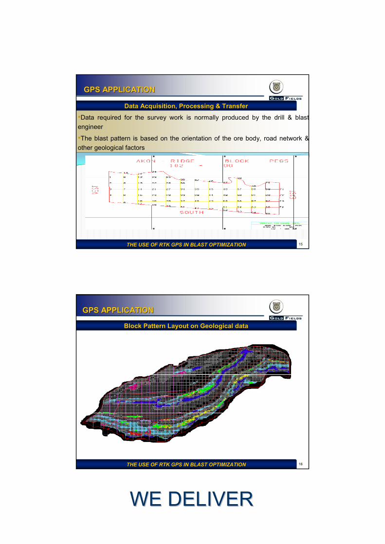
•Data required for the survey work is normally produced by the drill & blast engineer
•The blast pattern is based on the orientation of the ore body, road network & other geological factors
Data Acquisition, Processing & TransferData Acquisition, Processing & Transfer
THE USE OF RTK GPS IN BLAST OPTIMIZATIONTHE USE OF RTK GPS IN BLAST OPTIMIZATION
16
GPS APPLICATIONGPS APPLICATION
Block Pattern Layout on Geological dataBlock Pattern Layout on Geological data
THE USE OF RTK GPS IN BLAST OPTIMIZATIONTHE USE OF RTK GPS IN BLAST OPTIMIZATION
WE DELIVERWE DELIVER
17
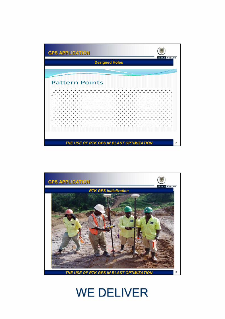
GPS APPLICATIONGPS APPLICATION
Pattern Points
THE USE OF RTK GPS IN BLAST OPTIMIZATIONTHE USE OF RTK GPS IN BLAST OPTIMIZATION
Designed HolesDesigned Holes
18
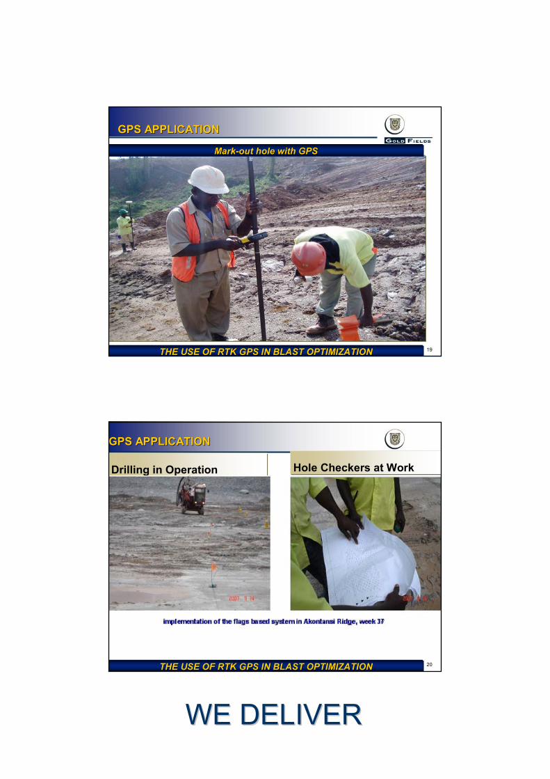
GPS APPLICATIONGPS APPLICATION
RTK GPS InitializationRTK GPS Initialization
THE USE OF RTK GPS IN BLAST OPTIMIZATIONTHE USE OF RTK GPS IN BLAST OPTIMIZATION
WE DELIVERWE DELIVER
19
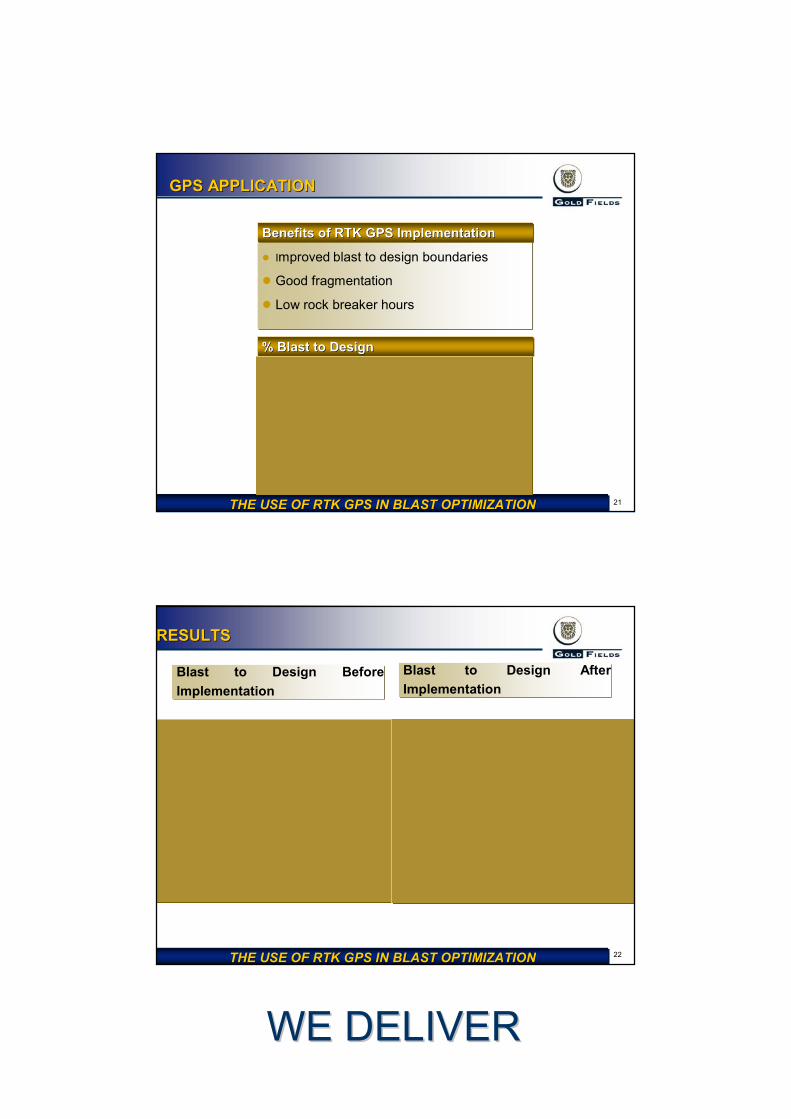
GPS APPLICATIONGPS APPLICATION
THE USE OF RTK GPS IN BLAST OPTIMIZATIONTHE USE OF RTK GPS IN BLAST OPTIMIZATION
MarkMark--out hole with GPSout hole with GPS
20
GPS APPLICATIONGPS APPLICATION
Drilling in Operation Hole Checkers at Work
THE USE OF RTK GPS IN BLAST OPTIMIZATIONTHE USE OF RTK GPS IN BLAST OPTIMIZATION
WE DELIVERWE DELIVER
21
GPS APPLICATIONGPS APPLICATION
● Improved blast to design boundaries
● Good fragmentation
● Low rock breaker hours
Benefits of RTK GPS ImplementationBenefits of RTK GPS Implementation
% Blast to Design% Blast to Design
THE USE OF RTK GPS IN BLAST OPTIMIZATIONTHE USE OF RTK GPS IN BLAST OPTIMIZATION
22
RESULTSRESULTS
Blast to Design Before Implementation
Blast to Design After Implementation
THE USE OF RTK GPS IN BLAST OPTIMIZATIONTHE USE OF RTK GPS IN BLAST OPTIMIZATION
WE DELIVERWE DELIVER
23
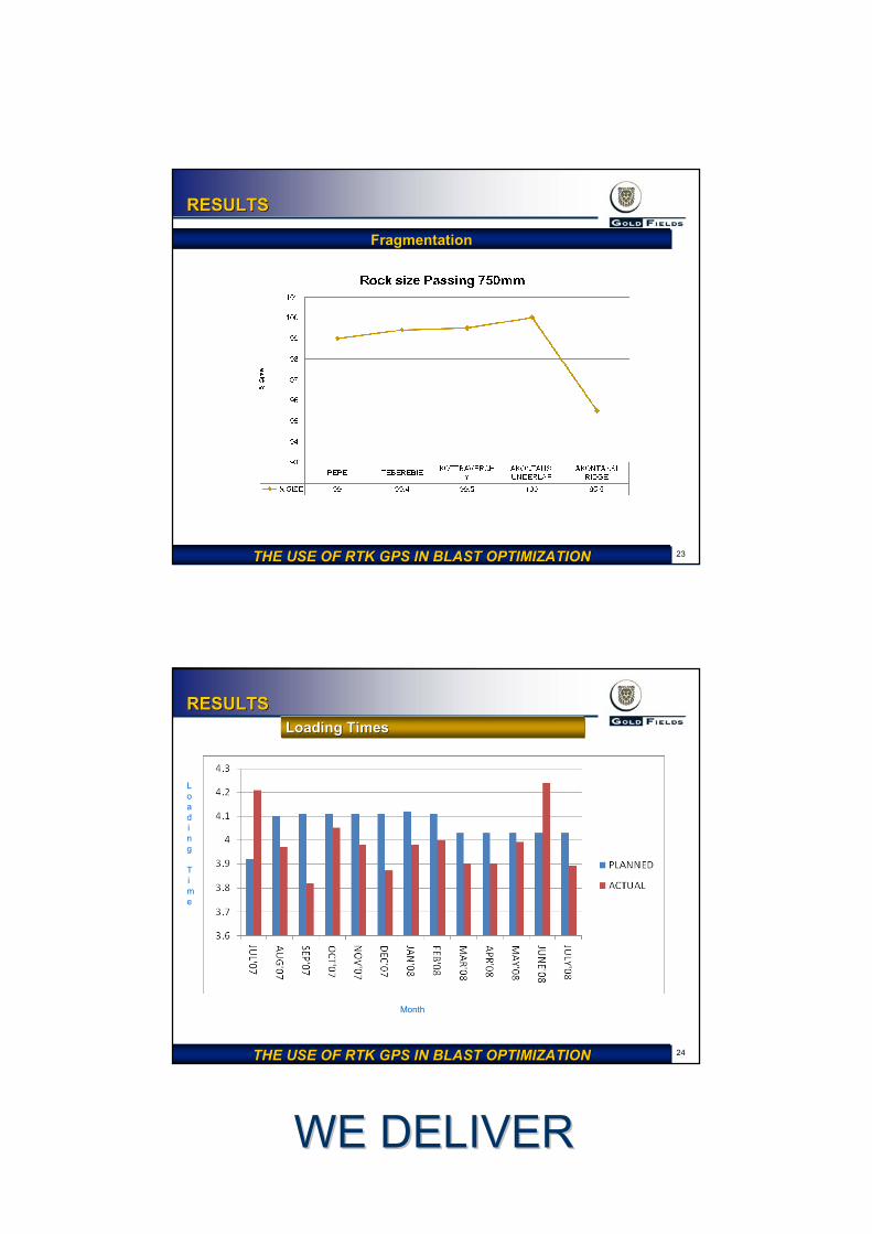
RESULTSRESULTS
THE USE OF RTK GPS IN BLAST OPTIMIZATIONTHE USE OF RTK GPS IN BLAST OPTIMIZATION
FragmentationFragmentation
24
RESULTSRESULTSLoading TimesLoading Times
THE USE OF RTK GPS IN BLAST OPTIMIZATIONTHE USE OF RTK GPS IN BLAST OPTIMIZATION
Month
Loading
Time
WE DELIVERWE DELIVER
25
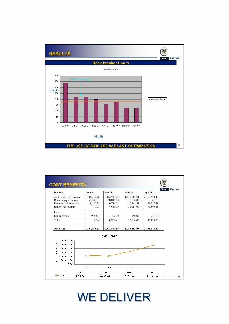
RESULTSRESULTS
Rock breaker HoursRock breaker Hours
THE USE OF RTK GPS IN BLAST OPTIMIZATIONTHE USE OF RTK GPS IN BLAST OPTIMIZATION
Month
26
COST BENEFITSCOST BENEFITSBenefits Jan-08 Feb-08 Mar-08 Apr-08
Additional gold revenueReduced equip damagesReduced R/Breaker hrsExplosives savings
1,106,947.9150,000.008,450.26
0.00
1,012,933.7250,000.00
9,756.044,623.09
1,610,617.3450,000.00
-10,164.4131,111.00
2,363,474.4650,000.00
-10,222.3976,898.23
CostDrilling flags 750.00 750.00 750.00 750.00
Tulip 0.00 3,715.00 25,000.00 46,127.50
Net Profit 1,164,648.17 1,072,847.85 1,655,813.93 2,433,272.80
WE DELIVERWE DELIVER
27
CONCLUSIONCONCLUSION
● RTK GPS is less labor intensive and saves cost
● Reduced significantly pit floor sheeting as a result of good floor
● Increased tonnage throughput
● Reduced rock breaker hours
● Improved digger loading times
● Improved truck cycle times
28
QUESTION TIMEQUESTION TIME
THANK YOU
QUESTIONS