the nubian sandstone aquifer system - cieliparalleli.com · müller, dengler, leicht the nubian...
TRANSCRIPT
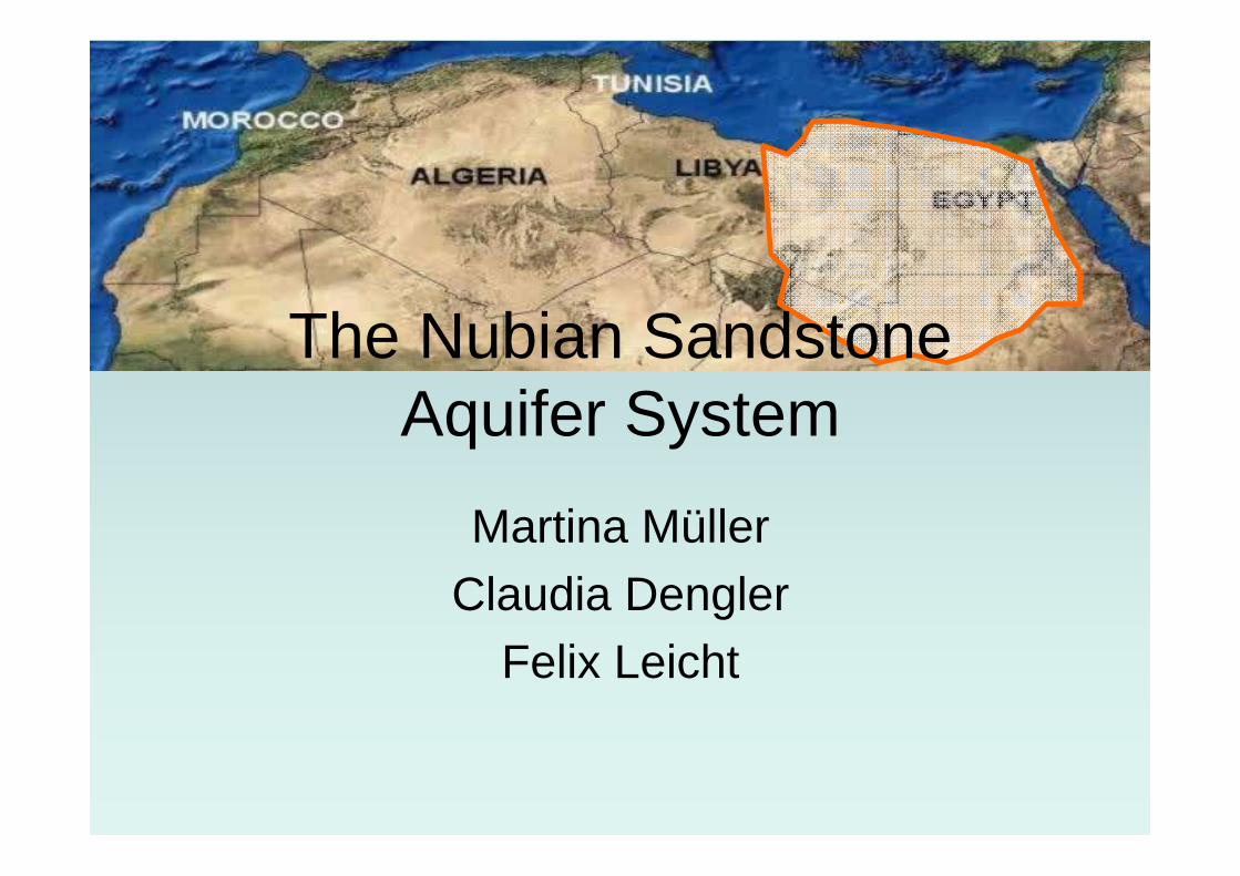
The Nubian Sandstone Aquifer System
Martina MüllerClaudia Dengler
Felix Leicht
Müller, Dengler, Leicht The Nubian Sandstone Aquifer System 1
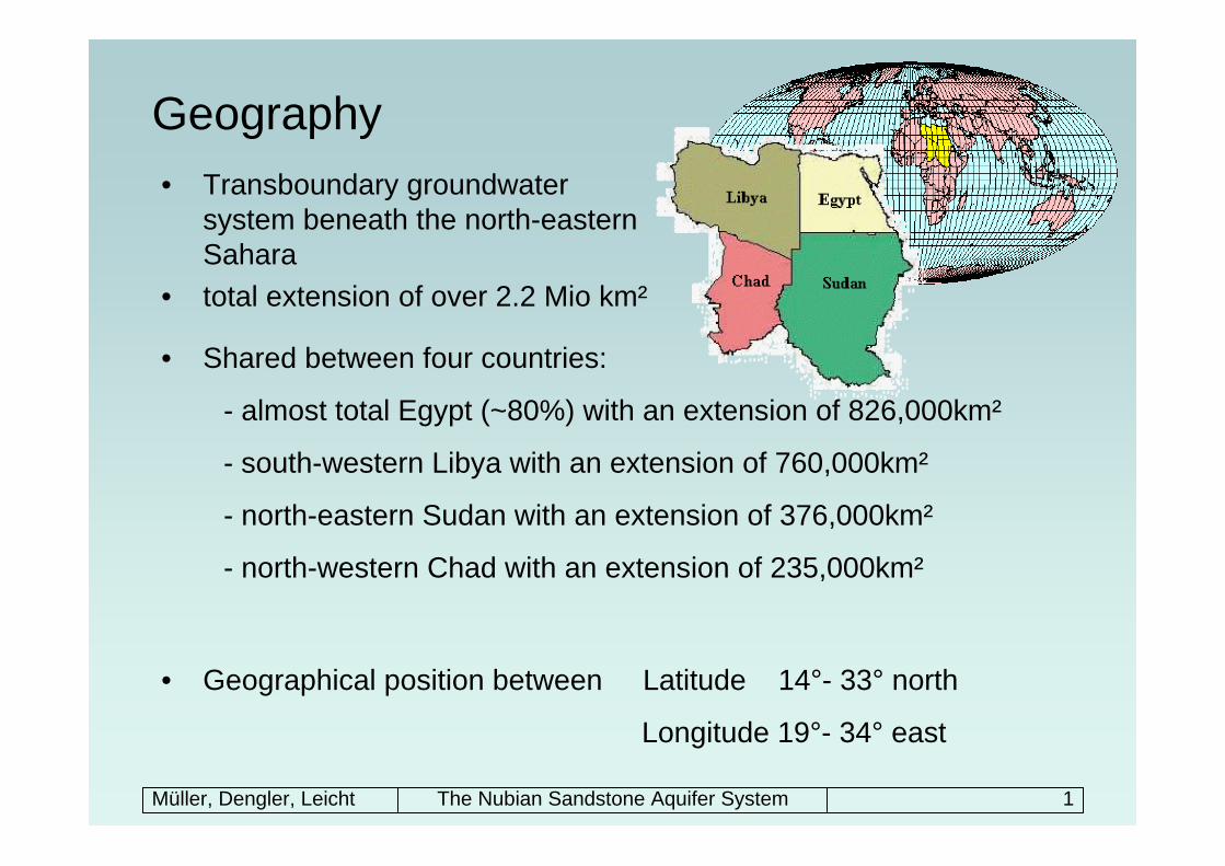
Geography • Transboundary groundwater
system beneath the north-eastern Sahara
• total extension of over 2.2 Mio km²
• Shared between four countries:
- almost total Egypt (~80%) with an extension of 826,000km²
- south-western Libya with an extension of 760,000km²
- north-eastern Sudan with an extension of 376,000km²
- north-western Chad with an extension of 235,000km²
• Geographical position between Latitude 14°- 33° north
Longitude 19°- 34° east
Müller, Dengler, Leicht The Nubian Sandstone Aquifer System 2
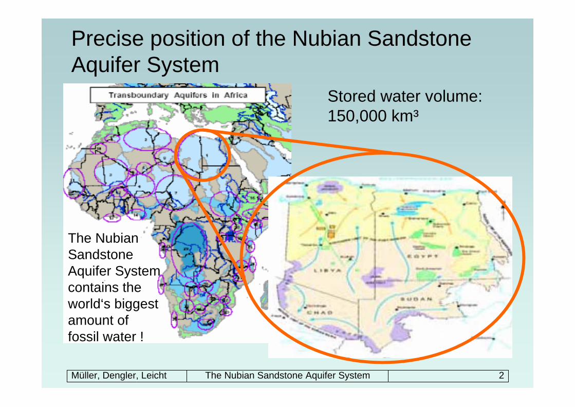
Precise position of the Nubian Sandstone Aquifer System
The Nubian Sandstone Aquifer System contains the world‘s biggest amount of fossil water !
Stored water volume: 150,000 km³
Müller, Dengler, Leicht The Nubian Sandstone Aquifer System 3
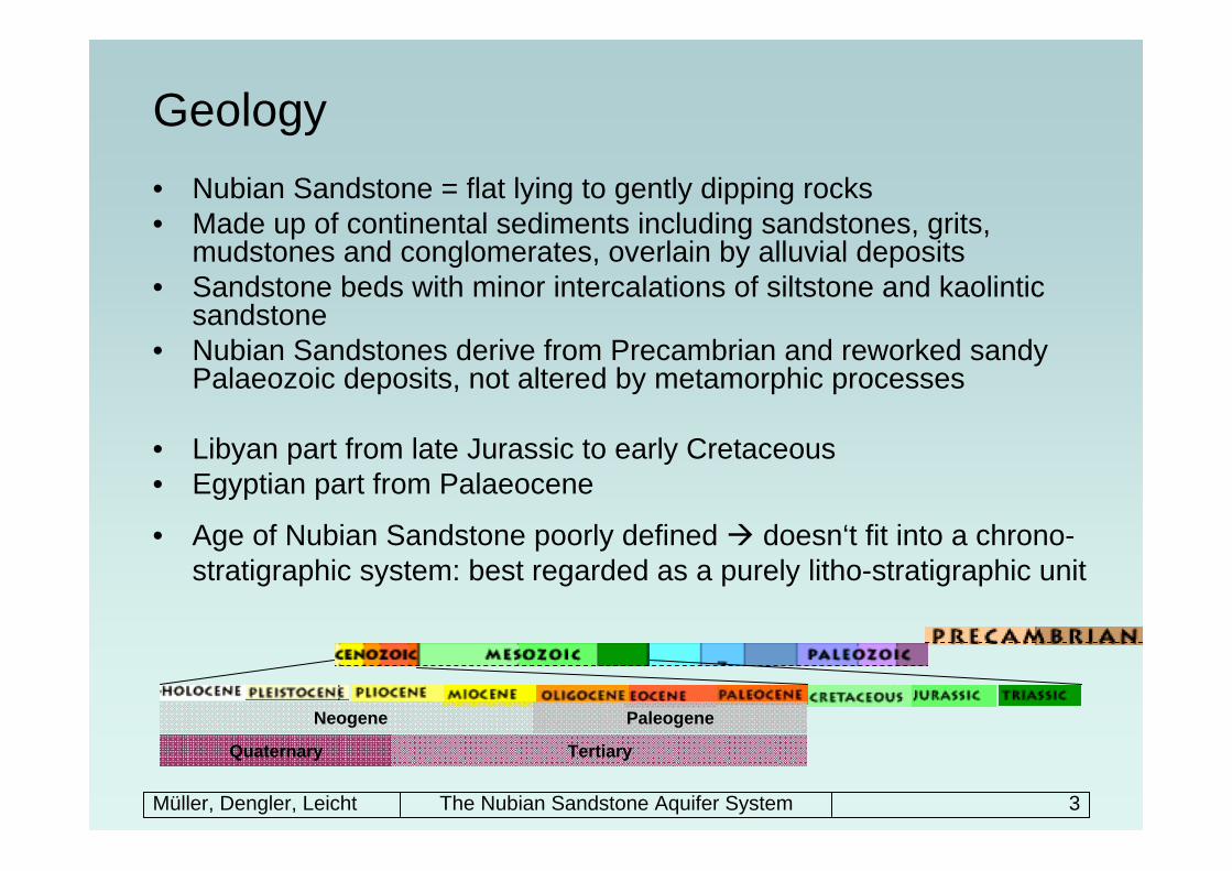
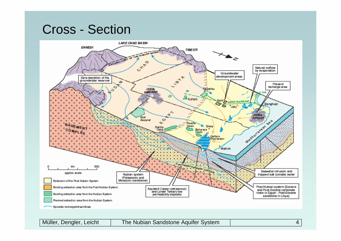
Geology• Nubian Sandstone = flat lying to gently dipping rocks• Made up of continental sediments including sandstones, grits,
mudstones and conglomerates, overlain by alluvial deposits • Sandstone beds with minor intercalations of siltstone and kaolintic
sandstone• Nubian Sandstones derive from Precambrian and reworked sandy
Palaeozoic deposits, not altered by metamorphic processes
• Libyan part from late Jurassic to early Cretaceous• Egyptian part from Palaeocene
• Age of Nubian Sandstone poorly defined doesn‘t fit into a chrono-stratigraphic system: best regarded as a purely litho-stratigraphic unit
PaleogeneNeogene
TertiaryQuaternary
Müller, Dengler, Leicht The Nubian Sandstone Aquifer System 4
Cross - Section
Müller, Dengler, Leicht The Nubian Sandstone Aquifer System 5
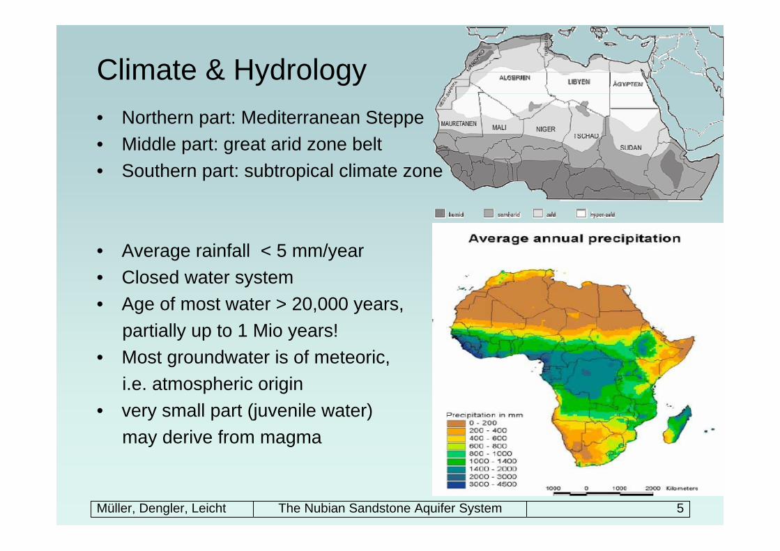
Climate & Hydrology• Northern part: Mediterranean Steppe• Middle part: great arid zone belt• Southern part: subtropical climate zone
• Average rainfall < 5 mm/year • Closed water system• Age of most water > 20,000 years,
partially up to 1 Mio years!• Most groundwater is of meteoric,
i.e. atmospheric origin • very small part (juvenile water)
may derive from magma
Müller, Dengler, Leicht The Nubian Sandstone Aquifer System 6
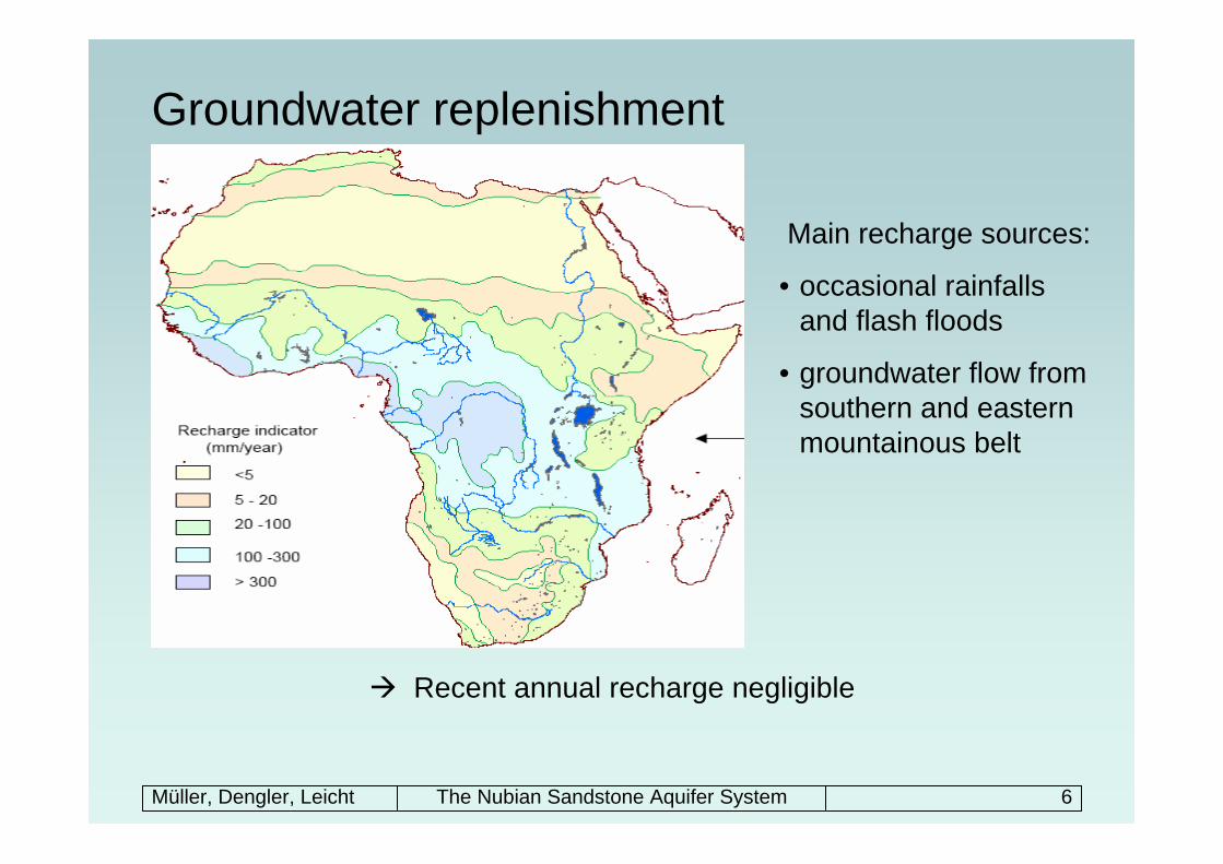
Groundwater replenishment
Recent annual recharge negligible
Main recharge sources:
• occasional rainfalls and flash floods
• groundwater flow from southern and eastern mountainous belt
Müller, Dengler, Leicht The Nubian Sandstone Aquifer System 7
Groundwater systems – definition of fossil aquifers• No appreciable modern recharge, can‘t discharge naturally• Water is stagnant with little or no flow• Groundwater is trapped in geologic formation because of paucity of
recharge• Stored water hundreds to thousands or millions of years old
Some dates regarding the replenishment of the NSAS:• Last recharge time at transition between Pleistocene and Holocene
(late Quaternary) • Dramatic climate changes: water stored before climate turned
extremely arid
Müller, Dengler, Leicht The Nubian Sandstone Aquifer System 8
Groundwater systems• Deep rock aquifer of sedimentary origin (sand- / limestone)• Hydraulic gradient from the south-west to the north-east• Basin thickness in between 500m – 3500m• Saturated thickness in between 100m – 650m• Transmissivity of Nubian Sandstone from 2.72 m²/d to 72.4 m²/d
Two principal closed drainage basins:1) Kufra Basin of Libya, Chad and Sudan2) Dakhla Basin of Egypt
• Multi-layered chambers hold many secrets
Müller, Dengler, Leicht The Nubian Sandstone Aquifer System 9
Groundwater systemsTwo different systems because of different water bearing strata:• The Nubian Aquifer System (NAS):
– spreads over the whole area defined for the NSAS – medium to coarse grained sandstone– comprises Palaeozoic and Mesozoic deposits, overlies the Precambrian
basement complex – lower one of the systems, over 400 m thick– semi-confined or partially confined aquifer
• The Post Nubian Aquifer System (PNAS):– only in the northern part down to the north of 26th latitude (Egypt & Libya)– comprises Tertiary continental deposits and tertiary carbonate rocks– sands, gravels and silts– upper one of the systems,10-300 m thick– higher permeability than NAS, unconfined aquifer
• Separating caprock:– Upper Cretaceous & lower Tertiary sediments
Müller, Dengler, Leicht The Nubian Sandstone Aquifer System 10
Groundwater use
• Hyper arid region: main use of NSAS-water for irrigation purposes and as drinking water
• Actual withdrawal rates:– Egypt: 1029 Mio m³/yr– Libya: 851 Mio m³/yr– Sudan: 406 Mio m³/yr– Chad: very low rate
• ‘Dream of blooming deserts’
• Example of agricultural use: private farms located in old traditional oasis in Egypt (New Valley)
• Example for extensive allocation: The Great Man-made River Project (GMRP) in Libya
Müller, Dengler, Leicht The Nubian Sandstone Aquifer System 11
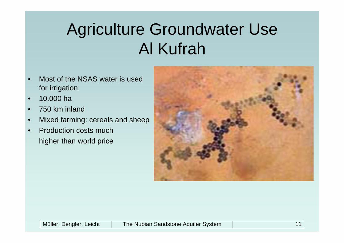
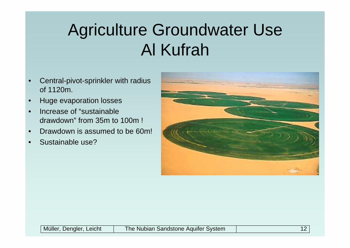
Agriculture Groundwater UseAl Kufrah
• Most of the NSAS water is used for irrigation
• 10.000 ha • 750 km inland• Mixed farming: cereals and sheep• Production costs much
higher than world price
Müller, Dengler, Leicht The Nubian Sandstone Aquifer System 12
Agriculture Groundwater UseAl Kufrah
• Central-pivot-sprinkler with radius of 1120m.
• Huge evaporation losses• Increase of “sustainable
drawdown” from 35m to 100m !• Drawdown is assumed to be 60m! • Sustainable use?
Müller, Dengler, Leicht The Nubian Sandstone Aquifer System 13
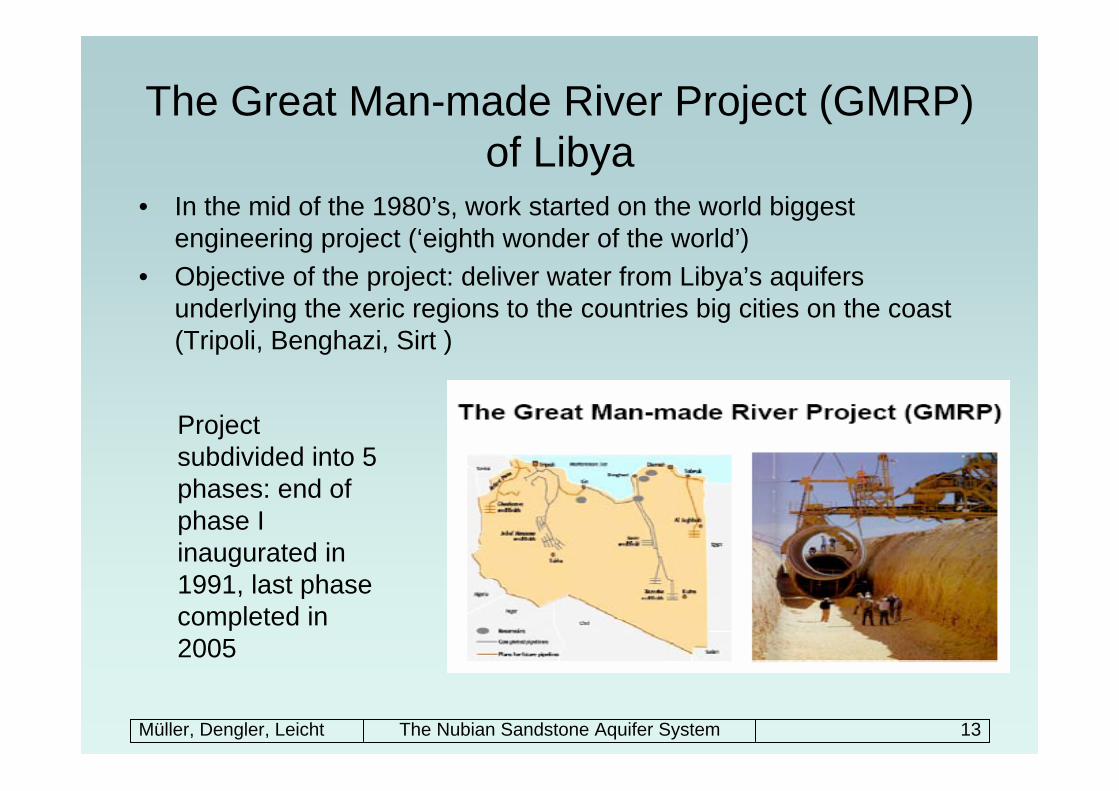
The Great Man-made River Project (GMRP) of Libya
• In the mid of the 1980’s, work started on the world biggest engineering project (‘eighth wonder of the world’)
• Objective of the project: deliver water from Libya’s aquifers underlying the xeric regions to the countries big cities on the coast (Tripoli, Benghazi, Sirt )
Project subdivided into 5 phases: end of phase I inaugurated in 1991, last phase completed in 2005
Müller, Dengler, Leicht The Nubian Sandstone Aquifer System 14
The Great Man-made river project of Libya
• Some facts:– Pipelines: in total ~ 4,000km, Ø 4m– Wells: ~ 3,000, depth of 450m-650m, pumping rate ~ 100 m³/day– Total withdrawal capacity: 6.18 Mio m³ (= 71.5 m³/s)– Estimated cost of total project: US$ 25 billion– Cost per m³: 0,35 US $ (compare desalinated seawater: > 3 US $)– Lowering of piezometric head after first year: 15m– Estimated duration until final exhaustion of the aquifers: 50 years
• Withdrawn water for municipal, industrial and agricultural use should be enough to produce adequate water and food to meet the countries own needs
• Reduce the dependency on imports from foreign marketacceptance of high production costs and soon exhausting the source
Müller, Dengler, Leicht The Nubian Sandstone Aquifer System 15
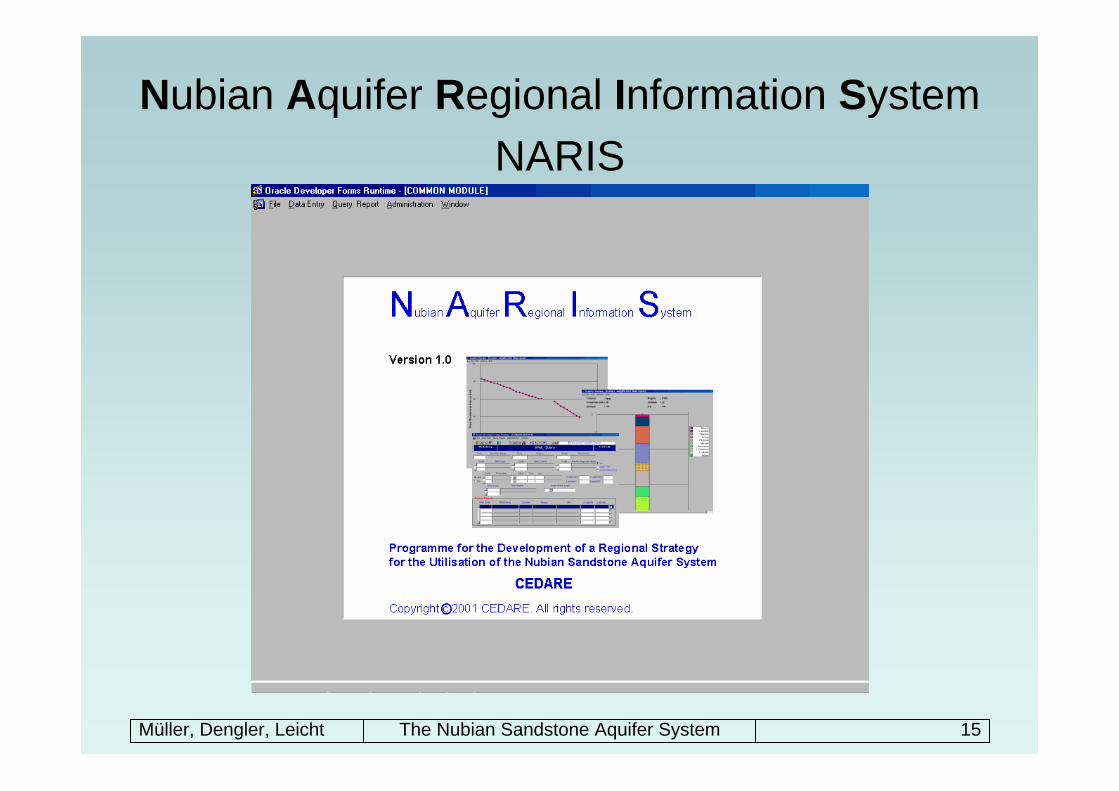
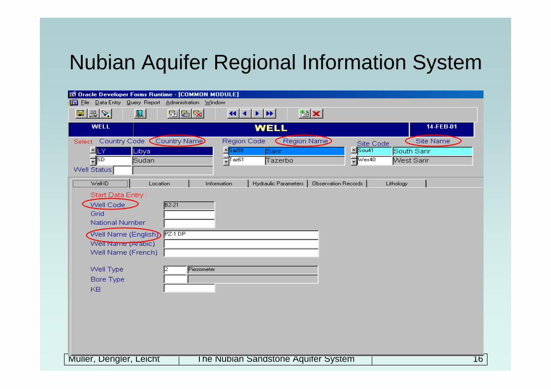
Nubian Aquifer Regional Information SystemNARIS
Müller, Dengler, Leicht The Nubian Sandstone Aquifer System 16
Nubian Aquifer Regional Information System
• Provide a standardized method for data collection and entry • Collection of data from all wells within the Nubian Sandstone Aquifer
System• Observation of the aquifer status• information is retrieved either by country, region, site, well name,
well code, location, tapped aquifer, date and water levels ranges• data will be stored on a server and accessed via internet by the four
countries • Any update of information can be viewed online by the other parties• The System was developed in a User Friendly Interface that enables
easy entry, retrieval, querying of information and production ofreports
Müller, Dengler, Leicht The Nubian Sandstone Aquifer System 17
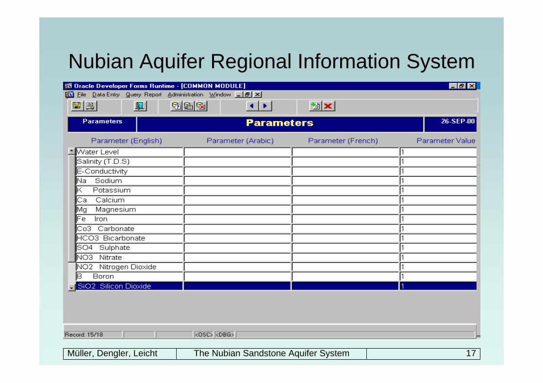
Nubian Aquifer Regional Information System
• 732 observation wells:– from the early 60s readings till the 1998 readings– information of geographic location (longitude, latitude), total depth,
elevation of measuring point, the tapped aquifer, bore type, piezometricheads
• 1088 production wells– information of geographic locations, ground elevations, initial water
level, hydraulic parameters (hydraulic conductivity, transmissivity and storage coefficient or storativity) in addition to quality parameters (e.g. salinity of groundwater)
• 198 exploration wells– main source of information– geographic locations, ground elevations, water levels and stratigraphy
Müller, Dengler, Leicht The Nubian Sandstone Aquifer System 18
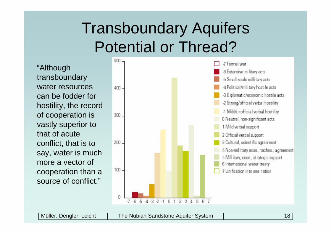
Transboundary AquifersPotential or Thread?
“Although transboundarywater resources can be fodder for hostility, the record of cooperation is vastly superior to that of acute conflict, that is to say, water is much more a vector of cooperation than a source of conflict.”