the federal policy on wetland conservation implementation …nawcc.wetlandnetwork.ca/fed policy...
TRANSCRIPT
page 1
THE FEDERAL POLICY ON WETLAND CONSERVATION
IMPLEMENTATION GUIDE FOR FEDERAL LAND MANAGERS
Wildlife Conservation BranchCanadian Wildlife ServiceEnvironment Canada
page 2
Printed 1996Ottawa, OntarioISBN: 0-662-24081-2Cat. No.: CW66-145/1996E
Copies of this report are available from:
Wildlife Conservation BranchCanadian Wildlife ServiceEnvironment CanadaOttawa, OntarioK1A 0H3
Ce rapport est également disponible en français sous le titre : La Politique fédérale sur la conservation des terreshumides : Guide de mise en oeuvre à l’intention des gestionnaires des terres fédérales.
page 3
THE FEDERAL POLICY ON WETLAND CONSERVATION
IMPLEMENTATION GUIDE FOR FEDERAL LAND MANAGERS
ByPauline Lynch-StewartPaula NeiceClayton RubecIngrid Kessel-Taylor
1996
Wildlife Conservation BranchCanadian Wildlife ServiceEnvironment Canada
page 4
CONTENTS
ACKNOWLEDGEMENTS
FOREWORD
I. INTRODUCTION
II. UNDERSTANDING THE WETLAND POLICY
II.1 Why does the federal government have a policy on wetlands?II.2 Who is responsible for wetland conservation in the federal government?II.3 What does the Policy say about wetlands and federal land management?
III. IMPLEMENTING THE WETLAND POLICY (PREPARATION AND PLANNING)
III.1 Inventory and evaluationIII.2 Conservation guidelinesIII.3 A network of contactsIII.4 Conservation partnershipsIII.5 Applying the Federal Policy on Wetland Conservation in the North
IV. INTEGRATING THE WETLAND POLICY INTO EXISTING DECISION-MAKINGPROCESSES
IV.1 Implementing the Policy under the Canadian Environmental Assessment ActIV.2 Integration of the mitigation sequence and the environmental assessment processIV.3 Other decision processesIV.4 Policies, plans and programsIV.5 Real property transactions IV.6 Environmental quality monitoring and enforcement IV.7 Regulatory actions that may affect off-site, non-federal wetlands
V. SELECTED BIBLIOGRAPHY
APPENDICES
1. The Canadian Wetland Classification System 2. Special Geographic Areas referred to in the Policy 3. Other Wetland Policies and Regulations across Canada 4. Major Wetland Inventories
page 5
ACKNOWLEDGEMENTS
Pauline Lynch-Stewart of Lynch-Stewart and Associates of Ottawa, Ontario, prepared the first draft of this Guide(released in July 1994) under contract to the Canadian Wildlife Service, Environment Canada and the Secretariatto the North American Wetlands Conservation Council (NAWCC) (Canada). Paula Neice, Planning Consultantof Kars, Ontario, provided the section on Conservation Partnerships. Appendix 4, Major Wetland Inventories,was compiled by Clayton Rubec of the Canadian Wildlife Service. Review comments received in the 1994 - 1995period were incorporated by Ingrid Kessel-Taylor under contract to the NAWCC (Canada).
Environment Canada extends its appreciation to the NAWCC (Canada) Secretariat for assistance in facilitatingthe production, editing, and printing of this document.
page 6
FOREWORD
The Federal Policy on Wetland Conservation was released in March 1992, under Canada's Green Plan. Federaldepartments have now had several years to consider the goals, guiding principles, and strategies articulated by thePolicy, and how these might best be integrated with their program delivery.
Environment Canada, specifically the headquarters office of the Canadian Wildlife Service and regionalEnvironmental Conservation Branch offices, is responsible for coordinating the implementation of the Policy. Asa result, these offices have been consulted on the application of the Policy to many different federal decisions,mostly involving federal land management. This experience not only reaffirmed the range of opportunitiesafforded the federal government to practise wetland conservation, but also identified a need for guidance forfederal land managers on how to effectively apply the Policy.
It was clear that a general guide was required to field front-line questions such as: When and how should thePolicy be brought to bear on federal land management decisions? What does the Policy mean to real propertytransactions, federal land planning programs, or environmental assessments? How does the federal wetlandpolicy relate to provincial wetland policies? Where can federal land managers obtain further advice, assistance, orinformation required to make decisions that involve wetlands?
The Government of Canada is pleased to present this Guide and to confirm the continued support of theCanadian Wildlife Service and the Environmental Conservation Branch of Environment Canada in each regionin helping federal land managers to understand and apply the Federal Policy on Wetland Conservation.
David BrackettDirector GeneralCanadian Wildlife Service
page 7
I. INTRODUCTION
The Federal Policy on Wetland Conservation (the Policy) promotes wetland conservation through the full range offederal decisions and responsibilities. Although the Policy is not a regulatory document, the federal Cabinetdirected that it should be applied to all policies, plans, programs, projects, and activities carried out by the federalgovernment. This document, The Federal Policy on Wetland Conservation: Implementation Guide for Federal Land Managers (the Guide), isintended to help federal land managers uphold their environmental commitments as described in the Policy. TheGuide is designed to assist federal land managers when making decisions that may affect wetlands, whether theseinvolve granting permits, constructing facilities, buying, selling or leasing land, or preparing a master land use plan. The Guide can also assist departmental policy makers in developing "customized" departmental plans anddirectives for implementing the Policy.
The Guide provides:
• a reference on policy interpretation, explaining the wording and intent of Policy statements;• practical information on the roles and responsibilities of federal land managers and the Canadian Wildlife
Service, as well as on the processes and tools for implementing those responsibilities; and,• references and resources available to assist land managers in carrying out their wetland conservation
responsibilities. The Guide is organized into three major sections:
• Understanding the Policy – answers such questions as "Why does the government have a policy onwetlands?", "Who is responsible?" and "What does the Policy mean?"
• Implementing the Policy – encourages federal land managers to take a proactive approach toimplementing the Policy by conducting wetland inventories and evaluations, developing wetland conservationguidelines, establishing networks of contacts to assist in making timely and informed decisions, and gainingan understanding of conservation partnerships.
• Integrating the Policy into existing decision-making processes – identifies the ways and means ofimplementing the Policy through processes such as environmental assessment, real property transactions, andusing federal legislation for environmental protection.
The Guide will also assist personnel, in the headquarters office of the Canadian Wildlife Service andEnvironmental Conservation Branch offices across Canada, to respond in an efficient and consistent manner tothe growing number of inquiries concerning the implications of the Policy to federal land management decisions.
Guidelines for implementation of the Policy through policies, programs, and projects not related to federal landmanagement, are not included in this document but may be prepared in the future.
page 8
II. UNDERSTANDING THE WETLAND POLICY
II.1 Why does the federal government have a policy on wetlands?
Wetlands are worth conserving. They are among the most highly productive natural systems on earth, andprovide habitat for a great diversity of vegetation and wildlife in Canada. Wetlands play a role in cleansing andsupplying water, preventing floods, and protecting shorelines. Canadians depend on wetlands for recreation,open space, food, and timber. But despite growing recognition of the substantial contribution of wetlands to thelives of all Canadians, wetland losses continue at an alarming rate. These losses affect the health, safety, andquality of life of all Canadians.
In view of their significant, but undervalued, importance, wetland conservation is now a matter of public policy. And although wetland conservation is a shared responsibility among many levels of jurisdiction in Canada, thefederal government can be a major part of the solution. The federal government, as a major landowner in itsown right, has direct management responsibility for large tracts of wetlands across the country. About 29% of allCanada's wetlands are located on federal lands or waters, mainly in our northern territories. Wetlands are foundin national parks, federal ports and harbour lands, wildlife areas, community pastures, and a wide range of otherCrown land holdings. Wetlands cover 18% of the combined area of Canada's National Parks, National WildlifeAreas, and Migratory Bird Sanctuaries.
Wetlands are critical to federal responsibilities for maintaining the quality of the environment, migratory birdpopulations, inland and ocean fisheries, and international or transboundary resources such as water and wildlife.The federal government is also responsible for managing the impacts of over 900 of its policies and programs inCanada. Many of these directly or indirectly affect wetlands.
The Federal Policy on Wetland Conservation:
• States the federal commitment to wetland conservation, and provides a catalyst for mutually supportingactions across the country;
• Calls attention to wetland benefits – both socio-economic and environmental – ensuring that wetlands
receive greater consideration in decision-making processes; • Provides direction and support to individual decision-makers to ensure that opportunities for the sustained
wise use of wetlands are realized, and to avoid or resolve wetland-related conflicts;
• Clarifies specific responsibilities for wetlands, and links complementary legislation, policies and programswhich support wetland conservation; and,
• Encourages a consistent, coordinated federal approach to wetland conservation, ensuring progress towardspecific objectives and goals.
page 9
II.2 Who is responsible for wetland conservation in the federal government?
Wetland conservation in areas of federal jurisdiction, as defined and described by the Policy, is the responsibility ofall departments, agencies, and corporations of the Government of Canada. These agents of the Crown arereferred to as "federal authorities" in this Guide, consistent with the terminology of the Canadian EnvironmentalAssessment Act (CEAA).
All federal land managers should consider the Policy's objectives and strategies in their daily decisions, whetherthat involves granting a permit for work access or an easement for a service corridor, leasing Crown land to athird party for timber harvesting, or developing a maintenance plan for a riverside greenbelt.
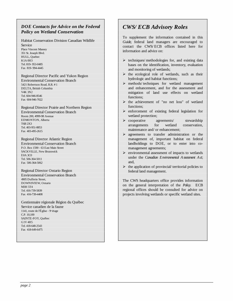
To the federal land manager, the Canadian Wildlife Service (CWS) headquarters office and the EnvironmentalConservation Branch (ECB) regional offices of Environment Canada are the primary windows or entry pointsto the full range of federal government skills, expertise, and services regarding wetland conservation (see sidebar).
The CWS and ECB offices are responsible for coordinating the implementation of the Policy. These offices promote theconservation, maintenance, enhancement and management of wetlands on federal lands for their full range of functions. These include wildlife habitat, water supply and purification (e.g. groundwater recharge, flood control, maintenance offlow regimes, and shoreline erosion buffering), and soil and water conservation, as well as tourism, heritage, recreational,educational, scientific, and aesthetic opportunities.
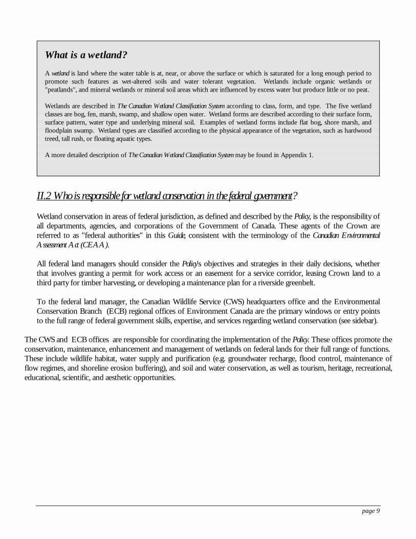
What is a wetland?
A wetland is land where the water table is at, near, or above the surface or which is saturated for a long enough period topromote such features as wet-altered soils and water tolerant vegetation. Wetlands include organic wetlands or"peatlands", and mineral wetlands or mineral soil areas which are influenced by excess water but produce little or no peat.
Wetlands are described in The Canadian Wetland Classification System according to class, form, and type. The five wetlandclasses are bog, fen, marsh, swamp, and shallow open water. Wetland forms are described according to their surface form,surface pattern, water type and underlying mineral soil. Examples of wetland forms include flat bog, shore marsh, andfloodplain swamp. Wetland types are classified according to the physical appearance of the vegetation, such as hardwoodtreed, tall rush, or floating aquatic types.
A more detailed description of The Canadian Wetland Classification System may be found in Appendix 1.
page 2
CWS/ECB Advisory Roles
To supplement the information contained in thisGuide, federal land managers are encouraged tocontact the CWS/ECB offices listed here forinformation and advice on:
Ø techniques/methodologies for, and existing databases on the identification, inventory, evaluationand monitoring of wetlands;
Ø the ecological role of wetlands, such as theirhydrologic and habitat functions;
Ø methods/techniques for wetland managementand enhancement, and for the assessment andmitigation of land use effects on wetlandfunctions;
Ø the achievement of "no net loss" of wetlandfunctions;
Ø enforcement of existing federal legislation forwetland protection;
Ø cooperative agreements/ stewardshiparrangements for wetland conservation,maintenance and/or enhancement;
Ø agreements to transfer administration or themanagement of, important habitat on federallandholdings to DOE, or to enter into co-management agreements;
Ø environmental assessment of impacts to wetlandsunder the Canadian Environmental Assessment Act;and,
Ø the application of provincial/territorial policies tofederal land management.
The CWS headquarters office provides informationon the general interpretation of the Policy. ECBregional offices should be consulted for advice onprojects involving wetlands or specific wetland sites.
DOE Contacts for Advice on the FederalPolicy on Wetland Conservation
Habitat Conservation Division Canadian WildlifeServicePlace Vincent Massey351 St. Joseph Blvd.HULL, QuebecK1A 0H3Tel. 819- 953-0485Fax 819- 994-4445
Regional Director Pacific and Yukon RegionEnvironmental Conservation Branch5421 Robertson Road, R.R. #1DELTA, British ColumbiaV4K 3N2Tel. 604-946-8546Fax 604-946-7022
Regional Director Prairie and Northern RegionEnvironmental Conservation BranchRoom 200, 4999-98 AvenueEDMONTON, AlbertaT6B 2X3Tel. 403-951-8853Fax 403-495-2615
Regional Director Atlantic RegionEnvironmental Conservation BranchP.O. Box 1590 - 63 East Main StreetSACKVILLE, New BrunswickE0A 3C0Tel. 506-364-5011Fax 506-364-5062
Regional Director Ontario RegionEnvironmental Conservation Branch4905 Dufferin Street,DOWNSVIEW, OntarioM3H 5T4Tel. 416-739-5839Fax 416-739-4408
Gestionnaire régionale Région du QuébecService canadien de la faune1141, route de l'Église - 9e étageC.P. 10,100SAINTE-FOY, QuébecG1V 4H5Tel. 418-648-2543Fax 418-649-6475
page 3
Accordingly, for those wetland functions not falling within the expertise of the CWS and ECB, other expertdepartments within the federal government will be consulted as appropriate. For example, the conservation ofwetlands integral to fish habitat and management is guided by the Policy for the Management of Fish Habitat, requiring theexpertise of Fisheries and Oceans Canada.
The CWS headquarters office can provide information on the general interpretation of the Policy, while ECBregional offices should be consulted for advice on projects involving wetlands or information on specific wetlandsites. Both offices can also be contacted for referrals to private sector agencies and provincial/territorial ministriesthat could support a federal authority's conservation efforts.
Under the CEAA, expert departments, including Environment Canada, must provide specialist information andexpertise when requested by the federal authority responsible for an environmental assessment. If wetlands are afactor in a self-directed assessment, the ECB regional office should be contacted to provide specialist informationor expertise, and to comment on environmental assessment reports.
Another source of national level expert advice and information is the Secretariat of the North AmericanWetlands Conservation Council (NAWCC) (Canada), established in 1990 by the Minister of the Environment. The Council promotes wetland programs in Canada through the coordination and support of management,science and policy initiatives. The NAWCC (Canada) Secretariat publishes the Sustaining Wetlands Issues PaperSeries, and various other public reports, to increase awareness of the importance of wetland ecosystems and togive practical guidance to land managers. This Secretariat also supports the implementation of the NorthAmerican Waterfowl Management Plan.
II.3 What does the Policy say about wetlands and federal land management?
Two of the seven strategies presented in the Policy pertain directly to federal lands. Those strategies, andassociated action items relevant to federal land managers, are reproduced here. (Key phrases that requireexplanation are presented in bold type, and are defined and explained in the sidebar). The full text of the Policyshould also be reviewed.
Strategy 2: "Develop exemplary practices in support of wetland conservation and sustainable wetland use to beincorporated in ... the management of federal lands and waters."
• Encourage actions to enhance wetland functions on federal lands and waters ... especially in those areasof Canada where the continuing loss or degradation of wetlands has reached critical levels, or wherewetlands are important ecologically or socio-economically to a region.
• Commit all federal departments to the goal of no net loss of wetland functions on federal lands andwaters, in areas affected by the implementation of federal programs where the continuing loss or degradationof wetlands has reached critical levels, and where federal activities affect wetlands designated as ecologicallyor socio-economically important to a region. Due to local circumstances where wetland losses have beensevere, in some areas no further loss of any remaining wetland area may be deemed essential.
• Promote a cooperative approach to wetland conservation initiatives for lands and waters held by the federalgovernment for native peoples (such as Indian Reserves and lands and waters transferred to native peoplesunder comprehensive land claim settlements) in consultation and cooperation with native institutions andpeoples.
page 4
Strategy 3: "The federal government will continue to manage the use of National Parks, National Wildlife Areas,Migratory Bird Sanctuaries, National Capital Commission lands and other federal areas established for ecosystemconservation purposes so as to sustain their wetland functions and natural processes."
• Require the creation of management plans which adequately reflect the special role of the wetland resourceon federal lands secured for ecosystem conservation purposes, and the periodic review and update of theseplans. Management of such wetlands should only support those activities that are compatible with sustainingwetland functions.
• Commit federal land managers to the goal of no net loss of wetland functions in all federal areas securedfor conservation purposes.
• Protect these wetlands from impacts resulting from land or water use and environmental quality changes,both internal and external to the federal area boundaries, by applying the Federal Environmental Assessmentand Review Process, by enforcing compliance with federal regulations, by working cooperatively with otherlevels of government, non-government organizations and the private sector and, if required, by interveningin legal or decision-making processes. It should be noted that the Federal Environmental Assessment andReview Process has been superceded since the writing of the Policy by the Canadian Environmental AssessmentAct, passed June 1992.
• Encourage recreational, scientific, and educational uses of wetlands as long as these uses are not detrimentalto wetland functions and do not conflict with the purposes of the area.
page 5
... and what does it mean?
"Exemplary practices" refers to wetland conservation actions or procedures that serve as examples of the ways andmeans of maintaining or enhancing wetland functions, and that demonstrate the high standards that are attainable.
"Wetland functions"* means the natural processes and derivation of benefits and values associated with wetlandecosystems, including economic production (e.g. peat, agricultural crops, wild rice, peatland forest products), fish andwildlife habitat, organic carbon storage, water supply and purification (groundwater recharge, flood control, maintenanceof flow regimes, shoreline erosion buffering), and soil and water conservation, as well as tourism, heritage, recreational,educational, scientific, and aesthetic opportunities.
The Policy focuses on wetland functions as the target for conservation efforts. Wetland functions provide the bestrationale for applying the policy to decisions involving wetlands, and the best basis for identifying and implementing themitigation of wetland impacts. It is not the fact that there is a wetland on or near the project site that determines what canand cannot be done. Rather, it is the ecological functioning of the wetland, that is, the role of the wetland in thesurrounding environment, that should determine the fate of the site.
"Enhance wetland functions"* means to increase the capacity of a wetland for natural processes or to provide benefits. For example, improving water supply to the wetland, or changing water levels across the wetland basin, could increaseplant diversity and attract more wildlife species to the area. The phrase can also refer to the gain in wetland functions in ageographic area through rehabilitation, enhancement or creation.
"Areas of Canada where ... " describes geographic areas where wetland losses or functional values require that specialmeasures, such as wetland enhancement, be applied. A map which approximates these geographic areas is in Appendix 2.
"No net loss of wetland functions" recognizes that further degradation of the wetland resource is not acceptable. However, all wetland loss cannot be avoided: some loss occurs naturally, some results from past activities, and somelosses may result from beneficial human activities. The goal ventures to balance the unavoidable loss of wetlandfunctions, through rehabilitation of former degraded wetland or enhancement of healthy, functioning wetland. As a lastresort, compensation for lost functions could be sought through non-wetland replacement of functions, or creation ofwetland where there was none before. In short, "no net loss of wetland functions" means that unavoidable losses ofwetland functions must be compensated.
In practice, the "no net loss" goal provides a structured approach to land management decisions involvingwetlands. No net loss requires project proponents to work through a strict sequence of mitigation alternatives –avoidance, minimization, and compensation – with clear criteria and defined outcomes. Mitigation alternatives andassociated criteria should recognize the limitations in our understanding of wetland functions (and ways and means toassess such functions), as well as our capacity to rehabilitate or create new wetlands.
In some areas of Canada "no further loss of any remaining wetland area" is prescribed. Impacts and intrusions onwetlands in these regions must be avoided: "minimization" and "compensation" cannot be considered as mitigationoptions in this region. *Definitions from the Federal Policy on Wetland Conservation
page 6
III. IMPLEMENTING THE WETLAND POLICY(PREPARATION AND PLANNING)
Federal land managers are urged to take a proactive approach to implementing the Policy by conducting wetlandinventories and evaluations; developing wetland conservation guidelines customized to their operations;establishing networks of contacts to assist in making timely and informed decisions; and gaining an understandingof conservation partnerships.
III.1 Inventory and evaluation
A wetland inventory of a federal authority's propertiesprovides basic, factual information about the resourceand is an important first step to making landmanagement decisions with respect to wetlandconservation. A wetland inventory could containinformation such as the location and size of wetlands;wetland type, condition, flora and fauna; and a list ofexisting information sources. More detailedinventories of sites of particular interest to the landmanager for development or protection purposesmight describe the soils, hydrology and peatdevelopment of the wetland, including the physicaland chemical properties of the soil and water.
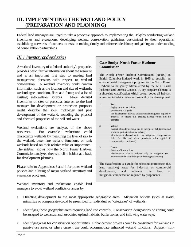
Wetland evaluations are analyses of the aboveresources. For example, evaluations couldcharacterize wetlands by measuring the level of risk tothe wetland, determine wetland functions, or rankwetlands based on their relative value or importance. The sidebar shows how the North Fraser HarbourCommission analyzed their shoreline habitat as a basisfor development planning.
Please refer to Appendices 3 and 4 for other wetlandpolicies and a listing of major wetland inventory andevaluation programs.
Wetland inventory and evaluations enable landmanagers to avoid wetland conflicts or issues by:
• Directing development to the most appropriate geographic areas. Mitigation options (such as avoid,mimimize or compensate) could be prescribed for individual or "categories" of wetlands;
• Identifying those geographic areas requiring land use controls. Conservation designations or zoning couldbe assigned to wetlands, and associated upland habitats, buffer zones, and inflowing waterways;
• Identifying areas for conservation opportunities. Enhancement projects could be considered for wetlands inpassive use areas, or where current use could accommodate enhanced wetland functions. Adjacent non-
Case Study: North Fraser HarbourCommission
The North Fraser Harbour Commission (NFHC) inBritish Columbia initiated work in 1985 to establish anenvironmental management program for the North FraserHarbour to be jointly administered by the NFHC andFisheries and Oceans Canada. A key program element isa shoreline classification which colour codes all habitatsaccording to habitat value and suitability for development:
1. Red:-highly productive habitat-prevention as a guide-no development allowed unless suitable mitigation applied toproposal to ensure that existing habitat would not bealienated
2. Yellow:-habitat of moderate value due to the type of habitat involvedor due to past alienation by industry-development allowed subject to mitigation/ compensation(Like for like and close proximity rules applied ifcompensation considered)
3. Green:-habitat of lower values-development allowed subject only to mitigation (i.e. environmentally sound design and timing restrictions)
The classification is a guide for selecting appropriate, (i.e.least sensitive) areas for industrial or commercialdevelopment, and indicates the level ofmitigation/compensation required by proponents.
page 7
federal lands which are ecologically/hydrologically linked to federal wetlands could be identified as prioritiesfor acquisition programs, or promoted as candidates for conservation partnership or stewardship programs(see section III.4);
• Providing a context to consider development applications (for permits, licences, plan approvals). Wetlandinventories and evaluations allow land managers to make informed decisions, by providing information toanswer such questions as: What is the size and type of the wetland that will be affected? How much morewetland is in the immediate area, watershed, or region? What is the relative health of these wetlands/whatare the risks to their health? How important is this wetland? To what ecological processes/functions is thewetland contributing (clean water, flood control, habitat for fish, moose or geese)? Which of these functionswill likely be affected by the project?
• Establishing a baseline for monitoring environmental quality, the effectiveness of wetland conservationprograms, and assessing progress in implementing policies affecting wetlands.
Wetland inventories and evaluations can be expensive and time consuming in the short term, but provideconsiderable long term environmental and economic benefits:
• Improved environmental quality through planned, comprehensive protection of functioning wetlands;
• Savings of time and money in project planning and environmental assessment phases, by guidingdevelopment away from areas of potential concern. The screening of wetland mitigation plans under theCEAA reduces the workload for individual project assessments later on;
• A more efficient, streamlined process of development approvals, with increased predictability andconsistency in development decision making; and,
• A context for assessing the cumulative effects of loss or degradation of individual wetlands within awatershed or region, which is a requirement under the CEAA.
Wetland inventory and evaluation may seem daunting, but federal land managers should be aware that:
• Wetland inventory and evaluation data bases are already available for much of Canada. Environment Canadaand numerous other government and non-government agencies have surveyed many of the wetlands inCanada. Appendix 4 identifies the scope and range of existing wetland inventories.
• Federal land managers can obtain expert advice from regional Environmental Conservation Branch offices(see section II.2). Professional ecologists, biologists, and hydrologists can be consulted by federal landmanagers on strategies for advance planning, existing data, and available resource materials.
page 8
III.2 Conservation guidelines
It is the responsibility of each federal authority to develop plans and directives for wetland conservation specificto their operations. Various government agencies have developed wetland conservation and evaluationguidelines. These could assist the federal land managers in a proactive approach to wetland conservation throughalready existing land management activities (see sidebar). For example, a federal authority may want to develop,or adapt existing:
• Standard conditions for operating in and around wetland areas, to be attached to permit approvals whichmay affect wetlands;
• Mitigation guidelines or codes of practice for particular types of activities, such as forest harvesting, shorelinestabilization projects, or routine maintenance, in and around wetlands;
• Environmental assessment guidelines for wetlands, such as checklists of functions or effects; or guides toevaluating wetland values, in the face of competing values and to determine the most appropriate use;
• Environmental quality guidelines, that establish acceptable standards for various wetland components, suchas water quality; or
• Marketing and communication strategies to increase public awareness of wetland values.
page 9
For further information on developing federal land management guidelines respectingwetlands...
Bond, W.K., K.W. Cox, T. Heberlein, E.W. Manning, D.R. Witty, and D.A. Young. 1992. Wetland EvaluationGuide: Final Report of the Wetlands Are Not Wastelands Project. Sustaining Wetlands Issues Paper, No. 1992-1. North American Wetlands Conservation Council (Canada). Ottawa, Ontario.
• A three-stage evaluation approach to identify the benefits of a wetland, to establish their value to society, and to compare theirvalue to the value of proposed alternatives.
Department of Fisheries and Oceans Canada. 1994. Habitat Conservation and Protection Guidelines. FirstEdition. Ottawa, Ontario.
• Describes an approach to implementing the DFO no net loss principle, and includes a hierarchy of preferred options for habitatconservation and protection and a sequence of decision steps.
Environment Canada. 1993. Report on Codes, Guidelines and Objectives in Conservation and Protection. Regulatory andEconomic Affairs Division, Environmental Protection Directorate. Hull, Quebec.
Lynch-Stewart, P. 1992. No Net Loss: Implementing "No Net Loss" Goals to Conserve Wetlands In Canada. Sustaining Wetlands Issues Paper, No. 1992-2. North American Wetlands Conservation Council(Canada). Ottawa, Ontario.
• Contains a review of current implementation procedures, and a recommended approach to implementing "no net loss" in Canada.
Norman, A. and K. Coleman. 1993. Interim Checklist for Scoped Environmental Impact Studies. Ontario Ministry ofNatural Resources, Southern Region Science and Technology Transfer Unit Technical Note TN-002. Aurora, Ontario.
• A checklist for use in the field, as a means of rapidly reviewing small-scale development proposals adjacent to wetlands.
Ontario Ministry of Natural Resources. 1994. Guidelines for Wetland Environmental Impact Studies. OntarioMinistry of Natural Resources, Southern Region Science and Technology Transfer Unit TechnicalReport. Aurora, Ontario.
• Technical guidelines for environmental impact studies as required by the Ontario Wetlands Policy Statement. Includes definitionof what is meant by "no net loss of function".
Ontario Ministries of Natural Resources and Municipal Affairs. 1992. Manual of Implementation Guidelinesfor the Wetlands Policy Statement. Toronto, Ontario.
• Presents options and approaches for incorporating wetland protection and management into the land use planning process inOntario, and further explanation of the Ontario Wetlands Policy Statement.
Sheehy, G. 1993. Conserving Wetlands in Managed Forests. Sustaining Wetlands Issues Paper, No. 1993-2. NorthAmerican Wetlands Conservation Council (Canada). Ottawa, Ontario.
• Describes potential impacts of forestry practices on wetland ecosystems and suggests practical measures to prevent or reduce theseimpacts.
page 10
Guidelines for achieving "no net loss" of wetland functionDevelopment of "no net loss" (NNL) directives should be guided by No Net Loss: Implementing "No Net Loss"Goals to Conserve Wetlands in Canada and should contain the following elements:
• A sequence of mitigation alternatives (e.g. "avoidance" of impacts, "minimization" of unavoidable impacts,and "compensation" for unavoidable impacts), with criteria associated with each option;
• Compensation requirements (i.e. related to function or area basis, type of wetland, geographic context, timeframe), including definition of priorities and criteria;
• Compensation alternatives to restoration or creation of wetlands (direction on the acceptability of mitigationbanking or non-wetland creation activities in working toward NNL goals); and,
• Monitoring and maintenance requirements.
The directives should also recognize that this federal no net loss goal came into effect in 1992, and thatcompensation requirements are not retroactive to losses incurred prior to announcement of the Policy.
III.3 A network of contacts
An established network of contacts can be an invaluable aid to conserving wetlands. Federal land managersshould establish contacts in agencies such as those listed below, to keep them informed of plans, policies or landuse changes that might affect federal land holdings, or to whom they can go for advice on wetland management. Wetland contacts may include representatives of:
• CWS Headquarters and ECB offices in the regions (see CWS/ECB Advisory Roles, section II.2).
• Provincial/territorial and municipal governments can be a source of baseline environmental information,technical expertise in the evaluation of wetlands, and assessment of mitigation of adverse effects. Theypotentially could advise you on the importance of wetlands on your property to the local environment, localstrategies for wetland conservation in the region or watershed, and proposed changes in adjacent land usewhich may affect wetlands on your landholdings.
• Non-government organizations, such as:
Wildlife Habitat Canada, which provides a focus for cooperation and partnership in conservation programsacross Canada, facilitating cooperation among government and non-government groups for a variety ofhabitat projects with particular emphasis on wetlands (see next section on Conservation partnerships).
Ducks Unlimited Canada, a major national conservation organization, actively involved in partnership projectswith provincial, federal and non-government agencies and private landowners, in wetland and related habitatsecurement and enhancement projects across Canada (see section III.4 on Conservation partnerships).
• Adjacent landowners may be interested in cooperating to ensure conservation of mutually beneficial wetlandfunctions, such as maintaining water flows and quality in a stream (see section III.4 on Conservationpartnerships).
CWS/ECB offices should be contacted for referrals to private sector agencies and provincial/ territorialministries that could support a federal authority's conservation efforts.
page 11
III.4 Conservation partnerships
Advance planning should also include becoming familiar with conservation partnerships. Such partnershipsbenefit agencies, the private sector, the community, and most importantly, wetlands. They provide a range ofopportunities to supplement and support federal efforts often enabling a federal land manager to carry outconservation activities that would be difficult or impossible to achieve alone. Potential conservation partnersinclude non-government organizations, provincial governments, private landowners and non-profit associations.
Conservation partnerships also give local communities and individuals the opportunity to learn more about theintrinsic value of these resources and play an active role in protecting them into the future.
A partnership may be an annual, verbal commitment or handshake agreement with adjacent landownersregarding the use and management of a wetland site. It may be an easement or a 20-year legal agreement with anon-government organization to implement management objectives or it may take the form of a legal covenanton private property to protect the wetland function in perpetuity without the responsibilities of ownership.
Partnerships can include fundraising efforts by non-profit organizations for land acquisition or the donation ofland. They can include management agreements between federal and provincial agencies identifying managementroles and responsibilities. Partnerships can embrace whatever the situation requires.
Wetlands have been the focus of numerous examples of conservation partnerships in Canada. This sectionidentifies five types of partnerships that have been struck for wetland protection. These were developed to meetthe shared desire to protect, restore, and educate the wider community on the value of wetlands and the need toprotect these environments.
Agreements with non-government organizationsFederal managers are able to leverage time, expertise and dollars with non-government organizations (NGOs)that have an interest in the conservation and management of wetlands that fall under federal ownership. Forexample, agreements between numerous federal and provincial government agencies and Ducks UnlimitedCanada have been designed across Canada to undertake various forms of wetland management.
Agreements are based on mutually supported plans that identify the wetland objectives to be met; the nature,type, and location of structures to restore and maintain wetland sites; the proposed management strategies andresponsibilities; and the period of the agreement. Some agreements have granted access to Crown lands forconstruction and maintenance of structures and for co-management of sites.
Ducks Unlimited Canada, for example, entered into a 21-year agreement with Natural Resources Canada for awetland site at the Petawawa National Forestry Institute, Ontario. This is a beaver pond management projectdesigned to optimize the habitat quality and waterfowl productivity of 52 wetland and upland sites. Theagreement provides an easement to Ducks Unlimited Canada to access the property to construct and maintain astructure. The agreement allows for renegotiation at the end of the 21 years.
Multi-jurisdictional agreementsWetland conservation in an area can fall under the jurisdiction of several agencies. An example of a multi-jurisdictional agreement is a Rideau Canal wetland agreement which is being drafted between Parks Canada, thelocal offices of the Ontario Ministry of Natural Resources, and two regional conservation authorities.
The Rideau Canal, an historic waterway managed by Parks Canada, stretches 212 kilometres from Ottawa toKingston, Ontario and is home to numerous provincially and regionally significant wetlands. The waters and
page 12
riverbed of the canal are federally owned whereas the shorelines fall under the jurisdiction of the OntarioMinistry of Natural Resources. Both governments have prepared policies on wetland management with parallelphilosophies but varying applications. The Canal also falls under the auspices of two regional conservationauthorities that are responsible for flood control and 26 municipal governments with responsibilities for localplanning. The majority of canal frontage is privately owned.
A Rideau Canal wetland agreement is to ensure a consistent application of policy and procedures to meet theintent of both government wetland management policies, and to alleviate the present confusion amongmunicipal governments, landowners, and land managers. The draft agreement identifies agency roles andresponsibilities and suggests protocol to follow in issues of environmental impact and assessment, fill andconstruction regulations, management, and protection of wetlands.
Fundraising partnershipsAcquisition funds are often limited or difficult to access when significant properties come on the market. TheNature Conservancy of Canada (NCC) is a private, non-profit organization which seeks donations fromindividuals, foundations and corporations to acquire significant properties for conservation. It also acceptsdonations of property.
The NCC works with partners, including federal land managers to purchase significant properties. It seldomretains title but passes the property on to a third party. In cases where the Conservancy holds title, it arrangeswith others by means of a lease or agreement to manage the property. The Nature Conservancy of Canada hassecured more than 46 500 hectares across the country including over 14 000 hectares of wetland.
Private land stewardshipA proactive approach to private wetland conservation has been initiated in Ontario and supported under theEastern Habitat Joint Venture of the North American Waterfowl Management Plan (NAWMP). A partnershipbetween Wildlife Habitat Canada, Ducks Unlimited Canada and the Ontario Ministry of Natural Resourcesprovided the resources to initiate a four-year landowner contact program for selected provincially significantwetlands in southern Ontario. It is one of the many such provincially-based stewardship initiatives implementedthrough the NAWMP across southern Canada.
A first step in conservation, private land stewardship gives federal land managers an opportunity to speak directlywith landowners to increase the knowledge of the importance of wetlands and influence land managementchange. It also provides a way for federal agencies to recognize individual conservation initiatives.
This non-regulatory approach to influencing the use and management of wetland areas is successful in Ontario. During a four-year period, the private land stewardship program resulted in influencing 1 203 landowners toprotect 17 326 hectares of wetland in 114 wetland areas.
Land trustsLand trusts are generally non-government agencies that work with landowners and public agencies throughprivate sector initiatives to protect land. They can be either community or regionally based. Land trusts dedicatethemselves to a range of interests and goals and choose to operate in a number of ways. To the land manager,land trusts offer an avenue into the community, a local advocate for conservation and often a partner infundraising, monitoring, and public education.
The Island Nature Trust is a non-government, non-profit conservation organization "... devoted to theprotection and management of natural areas" on Prince Edward Island. It aims to acquire lands to be held intrust for future generations and to manage these lands as an example of appropriate and sustained use." For
page 13
example, the Island Nature Trust owns a portion of DeRoche Point which is directly adjacent to Prince EdwardIsland National Park. The Trust is involved with monitoring and working with other private landowners toprotect the natural values of this and many other sites in the province.
For further information on Conservation partnerships...
Cox, K.W. (Chairman). 1993. Wetlands: A Celebration of Life. Final Report of the Canadian WetlandsConservation Task Force. Sustaining Wetlands Issues Paper, No. 1993, North AmericanWetlands Conservation Council (Canada). Ottawa, Ontario.
Denhez, M. 1992. You Can't Give It Away: Tax Aspects of Ecologically Sensitive Lands. Sustaining WetlandsIssues Paper, No. 1992-4. North American Wetlands Conservation Council (Canada). Ottawa,Ontario.
Endicott, E. (ed). 1993. Land Conservation Through Public/Private Partnerships. LincolnInstitute of Land Policy. Island Press. Washington, D.C.
Findlay, B. and A. Hillyer. 1993. Here Today, Here Tomorrow - Legal Tools for Voluntary Protection of PrivateLand in British Columbia. West Coast Environmental Law Research Foundation. Vancouver,British Columbia.
Hilts, S. and R. Reid. 1994. Creative Conservation: A Handbook For Ontario Land Trusts.Published byFederation of Ontario Naturalists. Don Mills, Ontario.
Silver, T. M., I. C. Attridge, M. MacRae, and K. W. Cox. 1995. Canadian Legislation for ConservationCovenants, Easements and Servitudes. The Current Situation. Report No. 95-1. North AmericanWetlands Conservation Council (Canada). Ottawa, Ontario.
page 14
III.5 Applying the Federal Policy on Wetland Conservation in the North
The distinct land management regime of Canada's Northwest and Yukon Territories, and theimplications for implementing the Policy, must be recognized. Not only is the jurisdiction of theDepartment of Indian and Northern Affairs more like that of a province's, but vast areas of theTerritories are subject to comprehensive land claims by aboriginal peoples. Accordingly, theprinciples, objectives, and strategies of the Policy will be carried out as much as possible, throughEnvironment Canada representation/ participation in:
• co-management structures in land claim settlement areas, such as land and water boards, impactreview boards, and planning commissions;
• advisory councils/boards in comprehensive land claim areas; • land selection negotiations, to address wildlife and habitat issues and to establish cooperative
management systems; • the Regional Environmental Review Committee, for the approval of land use permits and
dispositions; and, • environmental assessments of all proposed development. It is also recognized that wetland characteristics and impacts are also substantially different in theNorth. The Policy is still relevant in this environment, due to its focus on sustaining wetland functions(see section II.3), and to the structured approach to mitigation (see section IV.2) which considers therelative importance of the wetland within the context of environmental assessment.
page 15
IV. INTEGRATING THE WETLAND POLICY INTO EXISTINGDECISION-MAKING PROCESSES
The Policy emphasizes the importance of incorporating wetland conservation considerations into existingdecision-making processes. The ways and means of implementing the Policy through the Canadian EnvironmentalAssessment Act (CEAA) and other decision-making processes are described in this section.
IV.1 Implementing the Policy under the Canadian Environmental Assessment Act
The CEAA provides a legislated framework within which the Policy can be used to guide the actions anddecisions of a responsible authority when preparing an environmenal assessment (EA) for a project affectingwetlands. A responsible authority is defined by the CEAA as the federal authority that has either proposed theproject or has been asked to provide support in the form of funding, land, permit, licence or other approvalspecified by the regulation. Federal land managers should refer to the Canadian Environmental Assessment Act andThe Responsible Authority's Guide to the Canadian Environmental Assessment Act (Canadian Environmental AssessmentAgency 1994) for detailed information regarding compliance to the Act.
The majority of federal projects under the CEAA, require a self-directed environmental assessment. Self-directed assessments, through either a screening or comprehensive study, provide a systematic approach foridentifying the environmental effects of a proposed project. Should wetlands be affected by a project, the Policyand this Guide can be valuable tools for incorporating wetland considerations into an EA report. Previoussections of this Guide have identified contacts and resources available to the responsible authority for undertakinga wetland inventory and evaluation.
It is a requirement of a self-directed assessment that the responsible authority identify mitigation measures whichwill eliminate, reduce, or control a project's adverse environmental effects. The mitigation of adverseenvironmental effects on wetlands should be guided by the Policy goal of achieving "no net loss" of wetlandfunction (see section II.3). As previously identified in this Guide, "no net loss" can be achieved by using ahierarchical sequence of mitigation alternatives: avoidance, minimization, and compensation.
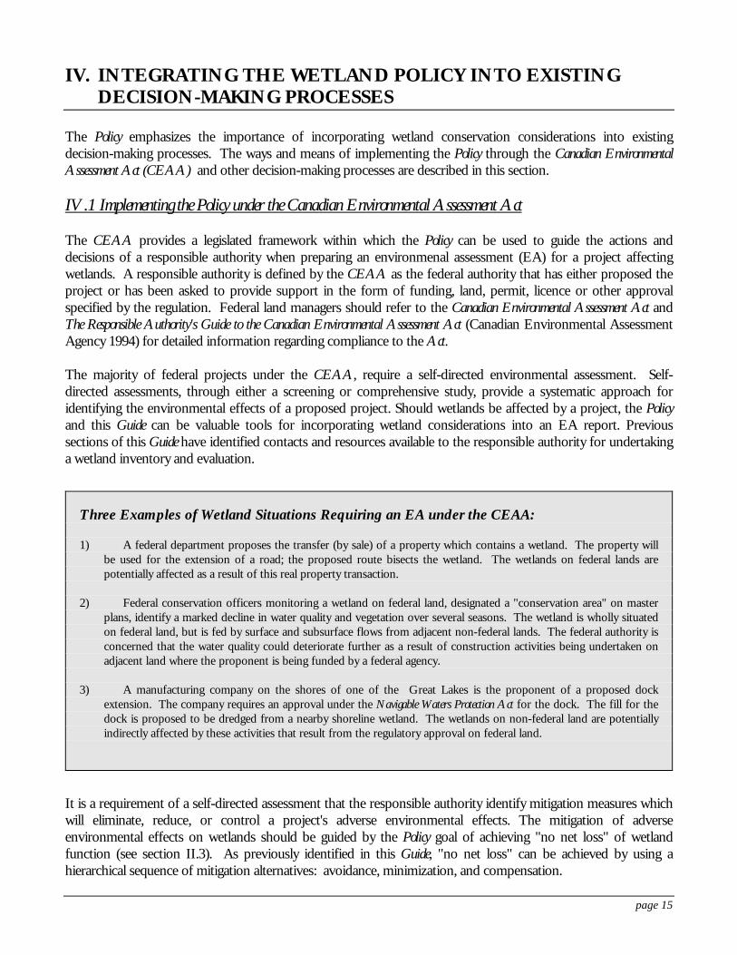
Three Examples of Wetland Situations Requiring an EA under the CEAA:
1) A federal department proposes the transfer (by sale) of a property which contains a wetland. The property willbe used for the extension of a road; the proposed route bisects the wetland. The wetlands on federal lands arepotentially affected as a result of this real property transaction.
2) Federal conservation officers monitoring a wetland on federal land, designated a "conservation area" on masterplans, identify a marked decline in water quality and vegetation over several seasons. The wetland is wholly situatedon federal land, but is fed by surface and subsurface flows from adjacent non-federal lands. The federal authority isconcerned that the water quality could deteriorate further as a result of construction activities being undertaken onadjacent land where the proponent is being funded by a federal agency.
3) A manufacturing company on the shores of one of the Great Lakes is the proponent of a proposed dockextension. The company requires an approval under the Navigable Waters Protection Act for the dock. The fill for thedock is proposed to be dredged from a nearby shoreline wetland. The wetlands on non-federal land are potentiallyindirectly affected by these activities that result from the regulatory approval on federal land.
page 16
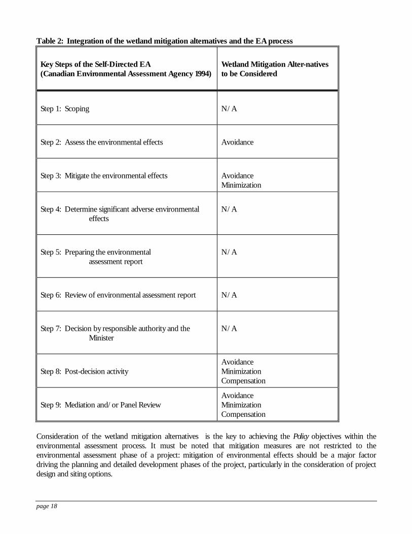
IV.2 Integration of the mitigation sequence and the environmental assessment process
The Responsible Authority's Guide to the Canadian Environmental Assessment Act (Canadian Environmental AssessmentAgency 1994) identifies eight steps to be taken by the responsible authority to complete the environmentalassessment process. Table 2 shows how the mitigation alternatives, described in Table 1, fit into this step-by-stepprocess. A number of points should be emphasized concerning the assessment and mitigation of adverse effectson wetlands:
• Mitigation of adverse effects on wetlands should be initially considered in Step 2 "Assess the environmentaleffects". At this step, all feasible alternatives to carrying out the project are assessed. Efforts should be madehere to avoid adverse effects through project siting or design.
• Compensation cannot be used to reduce the assessment of "significance" of adverse effects, and thereforeonly avoidance and minimization of environmental effects is considered in Step 3 "Mitigate theenvironmental effects".
• In Step 7, the responsible authority is able to implement one of two courses of action with respect to themitigation alternatives:
1) The responsible authority may take action that enables the project to proceed, if the project is not likely to cause significantadverse environmental effects.
In this case, the responsible authority must ensure implementation of appropriate avoidance andminimization measures, and compensate for any residual effects on wetland functions.
2) The responsible authority must not take any action that enables the project to proceed, if the project is likely to causesignificant adverse environmental effects that cannot be justified.
In this case, the project may be abandoned, modified and reassessed, or referred to a public review. Public review would clarify whether the project is likely to cause significant adverse environmental effects,and/or to decide whether these significant adverse effects are justified. If the significant adverse effectson wetland functions are declared justifiable by the public review, then compensation as described inTable 1 for lost wetland functions, is required under the Policy.
Table 1 defines the wetland mitigation alternatives and describes the situation within which each option shouldbe applied, based on factors such as relative importance of wetland functions, wetland losses in the region orwatershed, the nature of the project and available alternatives. Rather than creating yet another set of standardsfor assessing environmental effects on wetlands, the sequence encourages the use of existing wetland evaluations. By working through the sequence of mitigation alternatives, federal land managers can determine the acceptablecourse of action when wetlands may be affected by their project.
page 17
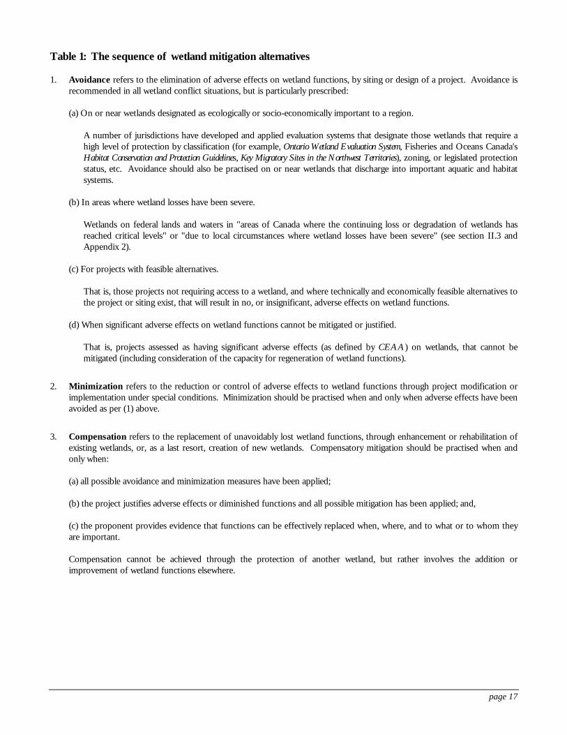
Table 1: The sequence of wetland mitigation alternatives
1. Avoidance refers to the elimination of adverse effects on wetland functions, by siting or design of a project. Avoidance isrecommended in all wetland conflict situations, but is particularly prescribed:
(a) On or near wetlands designated as ecologically or socio-economically important to a region.
A number of jurisdictions have developed and applied evaluation systems that designate those wetlands that require ahigh level of protection by classification (for example, Ontario Wetland Evaluation System, Fisheries and Oceans Canada'sHabitat Conservation and Protection Guidelines, Key Migratory Sites in the Northwest Territories), zoning, or legislated protectionstatus, etc. Avoidance should also be practised on or near wetlands that discharge into important aquatic and habitatsystems.
(b) In areas where wetland losses have been severe.
Wetlands on federal lands and waters in "areas of Canada where the continuing loss or degradation of wetlands hasreached critical levels" or "due to local circumstances where wetland losses have been severe" (see section II.3 andAppendix 2).
(c) For projects with feasible alternatives.
That is, those projects not requiring access to a wetland, and where technically and economically feasible alternatives tothe project or siting exist, that will result in no, or insignificant, adverse effects on wetland functions.
(d) When significant adverse effects on wetland functions cannot be mitigated or justified.
That is, projects assessed as having significant adverse effects (as defined by CEAA) on wetlands, that cannot bemitigated (including consideration of the capacity for regeneration of wetland functions).
2. Minimization refers to the reduction or control of adverse effects to wetland functions through project modification orimplementation under special conditions. Minimization should be practised when and only when adverse effects have beenavoided as per (1) above.
3. Compensation refers to the replacement of unavoidably lost wetland functions, through enhancement or rehabilitation ofexisting wetlands, or, as a last resort, creation of new wetlands. Compensatory mitigation should be practised when andonly when:
(a) all possible avoidance and minimization measures have been applied;
(b) the project justifies adverse effects or diminished functions and all possible mitigation has been applied; and,
(c) the proponent provides evidence that functions can be effectively replaced when, where, and to what or to whom theyare important.
Compensation cannot be achieved through the protection of another wetland, but rather involves the addition orimprovement of wetland functions elsewhere.
page 18
Table 2: Integration of the wetland mitigation alternatives and the EA process
Key Steps of the Self-Directed EA(Canadian Environmental Assessment Agency 1994)
Wetland Mitigation Alter-nativesto be Considered
Step 1: Scoping N/A
Step 2: Assess the environmental effects Avoidance
Step 3: Mitigate the environmental effects AvoidanceMinimization
Step 4: Determine significant adverse environmentaleffects
N/A
Step 5: Preparing the environmentalassessment report
N/A
Step 6: Review of environmental assessment report N/A
Step 7: Decision by responsible authority and theMinister
N/A
Step 8: Post-decision activityAvoidanceMinimizationCompensation
Step 9: Mediation and/or Panel ReviewAvoidanceMinimizationCompensation
Consideration of the wetland mitigation alternatives is the key to achieving the Policy objectives within theenvironmental assessment process. It must be noted that mitigation measures are not restricted to theenvironmental assessment phase of a project: mitigation of environmental effects should be a major factordriving the planning and detailed development phases of the project, particularly in the consideration of projectdesign and siting options.
page 19
IV.3 Other decision processes
Policy objectives should also be considered in carrying out the following responsibilities that do not requireenvironmental assessment under the CEAA.
IV.4 Policies, plans and programs
In addition to the CEAA which focuses on projects, a separate non-legislated process for the environmentalassessment of policy and program proposals was approved as part of the Environmental Assessment and ReviewProcess (EARP) Reform in June 1990 and issued as a Cabinet Directive. The Cabinet Directive requires that anenvironmental assessment process be applied to policy and program proposals submitted to Cabinet forconsideration and approval. It requires that environmental factors be considered in the development of theproposal, and that the appropriate documentation, public statements and public consultations concerning theenvironmental implications of the proposal be undertaken.
IV.5 Real property transactions
The disposal, acquisition, or lease of properties undertaken when the essential details of a project are not known,do not require an EA under the CEAA. If the property involved in the transaction contains wetlands, thefederal authority should consider:
• Restrictive covenants, legal easements (where provincial legislation is in place, see Silver et al. 1995 as listedin section III.4), or conditions or caveats in legal agreements, to ensure wetland conservation; and,
• In the acquisition of property that contains wetlands, federal authorities have an obligation to conservewetland functions, and that functional protection is facilitated by ownership of the entire wetland and anadequate buffer. It is particularly important to ensure that the hydrological reach is protected. Responsible authorities should also be aware of the wetland mitigation alternatives that must be appliedto any projects planned for the newly acquired property.
IV.6 Environmental quality monitoring and enforcement
Wetland conservation should not be confined to considering the ecosystem in the context of possibledevelopment. The ongoing health of wetlands on federal lands should be monitored. If signs of deteriorationare evident, such as change in vegetation or water quality, two avenues are open to the federal authority:
• if the adverse effects on the wetland are the result of a project that was subject to a legal permit orenvironmental assessment, the project proponent should be required to audit the effectiveness of themitigation measures to determine the success in preventing impacts. If the measures are unsuccessful,the proponent must work with the appropriate agency to ensure (other) effective mitigation measures areidentified and implemented; or,
page 20
• a variety of legal tools can be used to enforce protection of wetlands, such as the:- Canada Wildlife Act- Canadian Environmental Protection Act- Fisheries Act and the Policy for the Management of Fish Habitat- Historic Canals Regulations- Migratory Birds Convention Act- National Parks Act- Navigable Waters Protection Act
IV.7 Regulatory actions that may affect off-site, non-federal wetlands
In light of the Supreme Court of Canada's decision on Friends of the Oldman River Society v. Canada (1992),environmental assessments cannot be used to invade or unduly intrude in matters of provincial jurisdiction.
The scope of an EA essentially depends on the federal trigger that created the initial need for an assessment. Ifthe EA is "triggered" because a federal authority is a proponent or provides money or an interest in land to theproject, then the federal EA may consider all potential environmental effects, not only those that fall withinfederal jurisdiction. If the EA is "triggered" by federal regulatory involvement in a project – that is, whenever aproject requires a federal license, permit or other authorization for it to proceed – the EA must be restricted toareas of federal jurisdiction (i.e. those covered by federal legislation, including: migratory birds, navigable waters,fish and fish habitat, federal protected areas such as National Parks and National Wildlife Areas, historic canals,Indian Reserves, and transboundary issues) as well as those areas of provincial jurisdiction that directly impact onan area of federal jurisdiction or that are within the scope of the legislation that require the issuance of a license,permit or other authorization.
Therefore, if federal authorization is required, on either federal or non-federal land, potential environmentaleffects on wetlands which would result from that authorization to proceed, can only be considered if: i) theaffected wetland is on federal land; or, ii) the potential effects are within an area of federal jurisdiction. Otherwise,federal authorities can promote the conservation of wetlands through cooperative, voluntary means such as thoseoutlined in the section "Conservation partnerships" (see section III.4 and also Appendix 3).
page 21
V. SELECTED BIBLIOGRAPHY
Alberta Water Resources Commission. 1993. Wetland Management in the Settled Area of Alberta: An Interim Policy. Developed by the Alberta Water Resources Commission in cooperation with the provincial departments ofAgriculture, Environment, Forestry, Land and Wildlife, Municipal Affairs, and Transportation and Utilities. Edmonton, Alberta.
Alberta Water Resources Commission. 1993. Beyond Prairie Potholes - A Draft Policy for Managing Alberta's Peatlandsand Non-settled Area Wetlands. For discussion purposes. Developed by the Alberta Water ResourcesCommission in cooperation with the provincial departments of Agriculture, Food and Rural Development,Environmental Protection, Municipal Affairs, and Transportation and Utilities. Edmonton, Alberta.
Bond, W.K., K.W. Cox, T. Heberlein, E.W. Manning, D.R. Witty, and D.A. Young. 1992. Wetland EvaluationGuide: Final Report of the Wetlands Are Not Wastelands Project. Sustaining Wetlands Issues Paper, No. 1992-1.North American Wetlands Conservation Council (Canada). Ottawa, Ontario.
Canadian Environmental Assessment Agency. 1994. The Responsible Authority's Guide to the Canadian EnvironmentalAssessment Act. Hull, Quebec.
Cox, K.W. (Chairman). 1993. Wetlands: A Celebration of Life. Final Report of the Canadian WetlandsConservation Task Force. Sustaining Wetlands Issues Paper, No. 1993-1. North American WetlandsConservation Council (Canada). Ottawa, Ontario.
Fisheries and Oceans Canada. 1986. The Department of Fisheries and Oceans Policy for the Management of Fish Habitat. Ottawa, Ontario.
Fisheries and Oceans Canada. 1994. Habitat Conservation and Protection Guidelines. Developed from the Policy for theManagement of Fish Habitat (1986). First Edition. Ottawa, Ontario.
Government of Canada. 1991. The Federal Policy on Wetland Conservation. Environment Canada. Ottawa, Ontario.
Government of Canada. 1992. The Canadian Environmental Assessment Act. An Act to establish a federalenvironmental assessment process. Assented to 23rd June, 1992. Ottawa, Ontario.
Government of Manitoba. 1994. Sustainable Development: Applying Manitoba's Water Policies. Winnipeg, Manitoba.
Government of New Brunswick. 1994. Draft Wetlands Policy Framework for New Brunswick. Department of NaturalResources and Energy. Fredericton, New Brunswick.
Government of Quebec. 1994. The Protection of Wildlife Habitats on Land in the Public Domain. Provisions of theJune 22, 1993 Act Respecting the Conservation and Development of Wildlife (R.S.Q., c. C-61.1). Fact sheet. Quebec, Quebec.
Government of Saskatchewan. 1995. Your Guide to Saskatchewan Wetland Policy. Regina, Saskatchewan.
page 22
Haygood, L.V. and R.B. Reed. 1988. Advance Planning for Wetlands Management: An Overview. In Proceedingsof the National Wetland Symposium: Urban Wetlands. Association of State Wetland Managers. June 26-29, 1988. Oakland, California. pp. 176-186.
Laux, F.A. 1993. Some Comments on the Application of Provincial Statutes to Activities on Federal Crown Lands. Preparedfor the Conference on Real Property, Ottawa, November 17 and 18, 1993. Faculty of Law, University ofAlberta. Edmonton, Alberta.
Lynch-Stewart, P. 1992. No Net Loss: Implementing "No Net Loss" Goals to Conserve Wetlands in Canada. SustainingWetlands Issues Paper, No. 1992-2. North American Wetlands Conservation Council (Canada). Ottawa,Ontario.
Lynch-Stewart, P., C.D.A. Rubec, K.W. Cox, and J.H. Patterson. A Coming of Age: Policy for Wetland Conservation inCanada. Report No. 93-1. North American Wetlands Conservation Council (Canada). Ottawa, Ontario.
National Wetlands Working Group. 1987. The Canadian Wetland Classification System. Ecological LandClassification Series, No. 21. Canadian Wildlife Service, Environment Canada. Ottawa, Ontario.
National Wetlands Working Group. 1988. Wetlands of Canada. Ecological Land Classification Series, No. 24. Sustainable Development Branch, Environment Canada, and Polyscience Publications Inc. Ottawa,Ontario.
National Wetlands Working Group. 1997. The Canadian Wetland Classification System. Second Edition. Edited byB.G. Warner and C.D.A. Rubec. Wetlands Research Centre, University of Waterloo. Waterloo, Ontario.
Nova Scotia Department of Environment. 1995. Wetlands Directive. Halifax, Nova Scotia.
Ontario Ministries of Municipal Affairs and Natural Resources. 1992. Wetlands: A Statement of Ontario GovernmentPolicy. Issued under the authority of Section 3 of the Planning Act, 1983. Toronto, Ontario.
Ontario Ministries of Natural Resources and Municipal Affairs. 1992. Manual of Implementation Guidelines for theWetlands Policy Statement. Toronto, Ontario.
Ontario Ministry of Natural Resources. 1993. Ontario Wetland Evaluation System - Northern Manual. NESTTechnical Manual TM-001. MNR Warehouse #50254. Toronto, Ontario.
Ontario Ministry of Natural Resources. 1993. Ontario Wetland Evaluation System - Southern Manual. NESTTechnical Manual TM-002. MNR Warehouse #50254-1. Toronto, Ontario.
Penney, L. 1993. Draft Discussion Paper. Interagency Management and Conservation of Rideau Canal Wetlands. ParksCanada, Heritage Canada, Rideau Canal. Smiths Falls, Ontario.
Province of Saskatchewan. 1993. One Resource Many Benefits: Managing Saskatchewan Wetlands. SaskatchewanWetland Policy Working Group, coordinated by the Saskatchewan Wetland Conservation Corporation. Regina, Saskatchewan.
Rubec, C.D.A. 1993. The Federal Policy on Wetland Conservation in Canada. In Towards the Wise Use ofWetlands. Report of the Ramsar Convention Wise Use Project. Edited by T.J. Davis. Ramsar ConventionBureau. Gland, Switzerland. pp 35-43.
page 23
Saskatchewan Wetland Policy Working Group. 1994. Proposed Wetland Management Policy for the Agricultural Zone ofSaskatchewan. Prepared for the Saskatchewan Wetland Conservation Corporation in cooperation with theprovincial departments of Agriculture and Food, Environment and Resource Management, and Sask Water. Regina, Saskatchewan.
Sheehy, G. 1993. Conserving Wetlands in Managed Forests. Sustaining Wetlands Issues Paper, No. 1993-2. NorthAmerican Wetlands Conservation Council (Canada). Ottawa, Ontario.
Sustaining Wetlands Forum. 1990. Sustaining Wetlands, International Challenge for the 90s. Proceedings of a Forumheld in April 1990. North American Wetlands Conservation Council (Canada). Ottawa, Ontario.
Williams, G.L. and G.W. Colquhoun. 1987. North Fraser Harbour Environmental Management Plan. Reprinted from Coastal Zone '87. A Conference sponsored by the WW Div./ASCE. May 26-29, 1987. Seattle, Washington.
page 24
APPENDICES
1. The Canadian Wetland Classification System
2. Special Geographic Areas referred to in the Policy
3. Other Wetland Policies and Regulations across Canada
4. Major Wetland Inventories
page 25
APPENDIX 1. THE CANADIAN WETLAND CLASSIFICATION SYSTEM
The Canadian Wetland Classification System (National Wetlands Working Group 1987, 1997) contains threehierarchical levels: (1) class; (2) form; and (3) type. Five wetland classes are recognized on the basis of the overallgenetic origin of wetland ecosystems. Wetland forms are differentiated on the basis of surface morphology,surface pattern, water type, and morphology of underlying mineral soil. Wetland types are classified according tovegetation physiognomy.
Wetland Class: Wetland classes are recognized on the basis of properties of the wetland that reflect the overallgenetic origin of the wetland ecosystem and the nature of the wetland environment.
Wetland Form: Wetland forms are subdivisions of each wetland class based on surface morphology, surfacepattern, water type and morphological characteristics of underlying mineral soil. Many of the wetland formsapply to more than one wetland class. Subforms of various wetland forms are also recognized and some of theseare described in the book Wetlands of Canada (National Wetlands Working Group 1988).
Wetland Type: Wetland types are subdivisions of the wetland forms and are classified according to vegetationphysiognomy. Some wetland types occur in several wetland classes whereas others are unique to specific classesand forms.
The Bog Wetland ClassA bog is a peatland, generally with the water table at or near the surface. The bog surface, which may be raised orlevel with the surrounding terrain, is virtually unaffected by the nutrient-rich groundwaters from the surroundingmineral soils and is thus generally acidic and low in nutrients. The dominant materials are weakly to moderatelydecomposed Sphagnum and woody peat, underlain at times by sedge peat. The soils are mainly Fibrisols, Mesisols,and Organic Cryosols (permafrost soils). Bogs may be treed or treeless, and they are usually covered withSphagnum spp. and ericaceous shrubs.
The Fen Wetland ClassA fen is a peatland with the water table usually at or a few centimetres above or below the surface. The watersreaching the fens have passed through mineral soil and therefore have enhanced mineral content(minerotrophic). The water table is not stagnant, but moves through the peat by seepage or, in some cases, inopen channels. The dominant materials are moderately decomposed sedge and/or brown moss peat of variablethickness. The soils are mainly Mesisols, Humisols, and Organic Cryosols.
The Marsh Wetland ClassA marsh is a wetland which periodically retains shallow surface water, whose levels usually fluctuate daily,seasonally or annually due to tides, flooding, evapotranspiration, or seepage losses, often exposing intermittentdrawdowns or mudflats. Water sources of a marsh include surface water catchment, stream inflow, precipitation,storm surges, groundwater discharge and tidal action. A marsh, which is dependent upon variations in surfacerunoff and subject to a gravitational water table, usually retains less permanent water than one supplied bygroundwater. The water table usually remains at or below the soil surface, but soil water remains within therooting zone for most of the growing season, except in years of extreme drought.
The Swamp Wetland ClassA swamp can be defined as forested or thicketed (tall shrub-covered) wetland that is influenced by minerotrophicgroundwater, occurring either on mineral or organic soils. The water table is below the major portion of theground surface, and the dominant ground surface is at the level of hummock, that is, 20 cm or more above theaverage summer groundwater level. It is the usually aerated (or partly aerated) zone of substrate above the water
page 26
which is available for growth of roots by trees and/or tall woody shrubs. A swamp is distinguished by having arelatively closed canopy of forest trees or tall shrubs, with at least 25% cover. A swamp occurs on mineral soilsas well as peat. The associated mineral soils are various textures, ranging from clay to sand, and usually areGleysols. On sands, iron-rich ortstein or fragipans are often present, acting as dense layers which impede waterdrainage. A swamp on mineral soils tends to accumulate peat by the paludification process. If peat is present, itusually has abundant wood (ligno) peat, intermixed with material derived from leaf litter, mosses, herbs andgraminoids, shrubs, and other forest plants. Organic soils are Mesisols or Humisols.
The Shallow Open Water Wetland ClassShallow open water wetlands are distinct wetlands transitional between those wetlands normally saturated orseasonally wet (bog, fen, marsh or swamp), and aquatic ecosystems (lakes) which are permanent, deep waterbodies usually with a developed profundal zone. Shallow waters are subject to aquatic processes typical of upperlimnetic or infralittoral lake zones, such as nutrient and gaseous exchange, oxidation, and decomposition. Ioniccomposition of waters varies widely since dissolved solids, acid-base balances, and nutrient levels are influencedby hydrological origins, underlying geological materials, nutrient fluxes, and autogenic succession. Usually limnicdeposits of sedimentary peat, organic-mineral mixtures and marl accumulate in stable water regimes, but littleaccumulation occurs in shallow waters influenced by high energy systems such as tidal regimes, rivers or largelakes. In semi-arid regions, shallow waters dry intermittently, often leaving evaporite deposits of alkaline salts. Except in highly saline or acid waters, these deposits provide a substrate for rooted submerged and floatinghydrophytic vegetation, as well as for algae and aquatic mosses.
The Canadian Wetland Classification System in a first provisional edition was published by the National WetlandsWorking Group in 1987 as Report No. 21 of the Ecological Land Classification Series, Canadian Wildlife Service,Environment Canada, Ottawa. A second revised edition of the Classification System will be published incooperation with the Canadian Wildlife Service of Environment Canada, the Wetlands Research Centre of theUniversity of Waterloo, and the Secretariat of the North American Wetlands Conservation Council (Canada). Itis hoped that this revised edition will be completed by the National Wetlands Working Group during 1997.
page 27
APPENDIX 2. SPECIAL GEOGRAPHIC AREAS REFERRED TO IN THEPOLICY
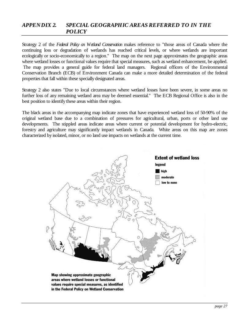
Strategy 2 of the Federal Policy on Wetland Conservation makes reference to "those areas of Canada where thecontinuing loss or degradation of wetlands has reached critical levels, or where wetlands are importantecologically or socio-economically to a region." The map on the next page approximates the geographic areaswhere wetland losses or functional values require that special measures, such as wetland enhancement, be applied. The map provides a general guide for federal land managers. Regional officers of the EnvironmentalConservation Branch (ECB) of Environment Canada can make a more detailed determination of the federalproperties that fall within these specially designated areas.
Strategy 2 also states "Due to local circumstances where wetland losses have been severe, in some areas nofurther loss of any remaining wetland area may be deemed essential." The ECB Regional Office is also in thebest position to identify these areas within their region.
The black areas in the accompanying map indicate zones that have experienced wetland loss of 50-90% of theoriginal wetland base due to a combination of pressures for agricultural, urban, ports or other land usedevelopments. The stippled areas indicate areas where current or potential development for hydro-electric,forestry and agriculture may significantly impact wetlands in Canada. White areas on this map are zonescharacterized by isolated, minor, or no land use impacts on wetlands at the current time.
page 28
APPENDIX 3. OTHER WETLAND POLICIES AND REGULATIONS ACROSSCANADA
Generally, provincial enactments cannot bind the federal Crown. In particular, where a provincial law interfereswith land use, the law will be inoperative in relation to federal lands (Laux 1993). However, the Federal Policy onWetland Conservation emphasizes a coordinated, cooperative approach to wetland conservation, involving all levelsof government and the public. Strategy 2 concerning federal lands and waters makes specific reference to theconservation of wetlands designated as "ecologically or socio-economically important to a region." Strategy 4,Enhancing Cooperation, states "The federal government will continue to be a partner in cooperative activitiesand agreements with the provinces and territories and non-government agencies to advance wetlandconservation." Action items of note include "encourage and support provincial and territorial policies thatpromote wetland conservation" and "enhance and, where necessary, develop new mechanisms for the resolutionof interjurisdictional wetland problems."
Current provincial wetland policies for several provinces (see Lynch-Stewart et al. 1993) complement the federalstrategies. Federal departments are encouraged to work with the provinces (and agencies which promulgateprovincial laws such as municipalities), to realize the objectives and intent of provincial laws and policies withrespect to wetlands. In some areas, it may be useful to develop agreements among agencies with jurisdiction overwetland areas, describing an approach that will be taken for regulating land use on wetlands, satisfactory to allparties, such as that proposed for interagency management and conservation of Rideau Canal wetlands (Penney1993).
Provincial wetland policies are under development or being implemented in Alberta, Saskatchewan, Manitoba,Ontario, New Brunswick, and Nova Scotia. Several provinces have addressed wetland protection throughlegislative mechanisms – Prince Edward Island, Quebec, and Ontario. Environmental assessment regulations areused in all provinces to promote conservation of wetland functions. References for the provincial documentsnow available are included in the "Selected Bibliography" of this report (see Section V).
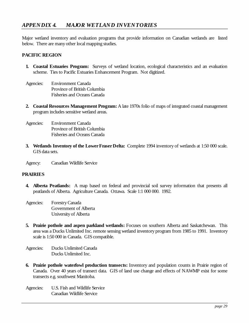
page 29
APPENDIX 4. MAJOR WETLAND INVENTORIES
Major wetland inventory and evaluation programs that provide information on Canadian wetlands are listedbelow. There are many other local mapping studies.
PACIFIC REGION
1. Coastal Estuaries Program: Surveys of wetland location, ecological characteristics and an evaluationscheme. Ties to Pacific Estuaries Enhancement Program. Not digitized.
Agencies: Environment CanadaProvince of British ColumbiaFisheries and Oceans Canada
2. Coastal Resources Management Program: A late 1970s folio of maps of integrated coastal managementprogram includes sensitive wetland areas.
Agencies: Environment CanadaProvince of British ColumbiaFisheries and Oceans Canada
3. Wetlands Inventory of the Lower Fraser Delta: Complete 1994 inventory of wetlands at 1:50 000 scale.GIS data sets.
Agency: Canadian Wildlife Service
PRAIRIES
4. Alberta Peatlands: A map based on federal and provincial soil survey information that presents allpeatlands of Alberta. Agriculture Canada. Ottawa. Scale 1:1 000 000. 1992.
Agencies: Forestry CanadaGovernment of AlbertaUniversity of Alberta
5. Prairie pothole and aspen parkland wetlands: Focuses on southern Alberta and Saskatchewan. Thisarea was a Ducks Unlimited Inc. remote sensing wetland inventory program from 1985 to 1991. Inventoryscale is 1:50 000 in Canada. GIS compatible.
Agencies: Ducks Unlimited CanadaDucks Unlimited Inc.
6. Prairie pothole waterfowl production transects: Inventory and population counts in Prairie region ofCanada. Over 40 years of transect data. GIS of land use change and effects of NAWMP exist for sometransects e.g. southwest Manitoba.
Agencies: U.S. Fish and Wildlife ServiceCanadian Wildlife Service
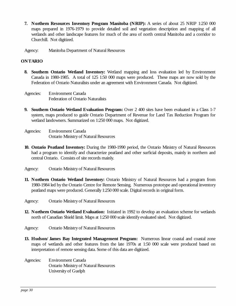
page 30
7. Northern Resources Inventory Program Manitoba (NRIP): A series of about 25 NRIP 1:250 000maps prepared in 1976-1979 to provide detailed soil and vegetation description and mapping of allwetlands and other landscape features for much of the area of north central Manitoba and a corridor toChurchill. Not digitized.
Agency: Manitoba Department of Natural Resources
ONTARIO
8. Southern Ontario Wetland Inventory: Wetland mapping and loss evaluation led by EnvironmentCanada in 1980-1985. A total of 125 1:50 000 maps were produced. These maps are now sold by theFederation of Ontario Naturalists under an agreement with Environment Canada. Not digitized.
Agencies: Environment CanadaFederation of Ontario Naturalists
9. Southern Ontario Wetland Evaluation Program: Over 2 400 sites have been evaluated in a Class 1-7system, maps produced to guide Ontario Department of Revenue for Land Tax Reduction Program forwetland landowners. Summarized on 1:250 000 maps. Not digitized.
Agencies: Environment CanadaOntario Ministry of Natural Resources
10. Ontario Peatland Inventory: During the 1980-1990 period, the Ontario Ministry of Natural Resourceshad a program to identify and characterize peatland and other surficial deposits, mainly in northern andcentral Ontario. Consists of site records mainly.
Agency: Ontario Ministry of Natural Resources
11. Northern Ontario Wetland Inventory: Ontario Ministry of Natural Resources had a program from1980-1984 led by the Ontario Centre for Remote Sensing. Numerous prototype and operational inventorypeatland maps were produced. Generally 1:250 000 scale. Digital records in original form.
Agency: Ontario Ministry of Natural Resources
12. Northern Ontario Wetland Evaluation: Initiated in 1992 to develop an evaluation scheme for wetlandsnorth of Canadian Shield limit. Maps at 1:250 000 scale identify evaluated sited. Not digitized.
Agency: Ontario Ministry of Natural Resources
13. Hudson/James Bay Integrated Management Program: Numerous linear coastal and coastal zonemaps of wetlands and other features from the late 1970s at 1:50 000 scale were produced based oninterpretation of remote sensing data. Some of this data are digitized.
Agencies: Environment CanadaOntario Ministry of Natural ResourcesUniversity of Guelph
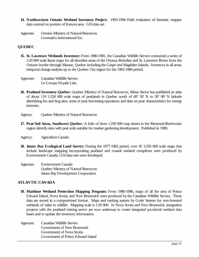
page 31
14. Northwestern Ontario Wetland Inventory Project: 1993-1994 Field evaluation of thematic mapperdata centred on portion of Kenora area. GIS data set.
Agencies: Ontario Ministry of Natural ResourcesGeomatics International Inc.
QUEBEC
15. St. Lawrence Wetlands Inventory: From 1980-1981, the Canadian Wildlife Service contracted a series of1:20 000 scale linear maps for all shoreline areas of the Ottawa, Richelieu and St. Lawrence Rivers from theOntario border through Matane, Quebec including the Gaspé and Magdalen Islands. Inventory in all areas;temporal change analysis up to the Quebec City region for the 1965-1980 period.
Agencies: Canadian Wildlife ServiceLe Groupe Dryade Ltée.
16. Peatland Inventory Quebec: Quebec Ministry of Natural Resources, Mines Sector has published an atlasof about 110 1:250 000 scale maps of peatlands in Quebec south of 49o 50' N to 50o 00' N latitudeidentifying fen and bog sites, areas of peat harvesting operations and data on peat characteristics for energyinterests.
Agency: Quebec Ministry of Natural Resources
17. Peat Soil Areas, Southwest Quebec: A folio of three 1:250 000 map sheets in the Montreal-Sherbrookeregion identify sites with peat soils suitable for market gardening development. Published in 1989.
Agency: Agriculture Canada
18. James Bay Ecological Land Survey: During the 1977-1982 period, over 45 1:250 000 scale maps thatinclude landscape mapping incorporating peatland and coastal wetland complexes were produced byEnvironment Canada. GIS data sets were developed.
Agencies: Environment CanadaQuebec Ministry of Natural ResourcesJames Bay Development Corporation
ATLANTIC CANADA
19. Maritime Wetland Protection Mapping Program: From 1980-1986, maps of all the area of PrinceEdward Island, Nova Scotia, and New Brunswick were produced by the Canadian Wildlife Service. Thesedata are stored in a computerized format. Maps and ranking system by Golet System for non-forestedwetlands of value to wildlife. Mapping scale is 1:50 000. In Nova Scotia and New Brunswick, integrationprojects with the peatland/mining sector are now underway to create integrated provincial wetland databases and to update the inventory information.
Agencies: Canadian Wildlife ServiceGovernment of New BrunswickGovernment of Nova ScotiaGovernment of Prince Edward Island
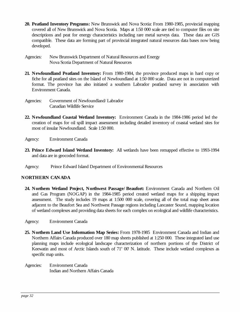
page 32
20. Peatland Inventory Programs: New Brunswick and Nova Scotia: From 1980-1985, provincial mappingcovered all of New Brunswick and Nova Scotia. Maps at 1:50 000 scale are tied to computer files on sitedescriptions and peat for energy characteristics including rare metal surveys data. These data are GIScompatible. These data are forming part of provincial integrated natural resources data bases now beingdeveloped.
Agencies: New Brunswick Department of Natural Resources and EnergyNova Scotia Department of Natural Resources
21. Newfoundland Peatland Inventory: From 1980-1984, the province produced maps in hard copy orfiche for all peatland sites on the Island of Newfoundland at 1:50 000 scale. Data are not in computerizedformat. The province has also initiated a southern Labrador peatland survey in association withEnvironment Canada.
Agencies: Government of Newfoundland/LabradorCanadian Wildlife Service
22. Newfoundland Coastal Wetland Inventory: Environment Canada in the 1984-1986 period led the creation of maps for oil spill impact assessment including detailed inventory of coastal wetland sites formost of insular Newfoundland. Scale 1:50 000.
Agency: Environment Canada
23. Prince Edward Island Wetland Inventory: All wetlands have been remapped effective to 1993-1994and data are in geocoded format.
Agency: Prince Edward Island Department of Environmental Resources
NORTHERN CANADA
24. Northern Wetland Project, Northwest Passage/Beaufort: Environment Canada and Northern Oiland Gas Program (NOGAP) in the 1984-1985 period created wetland maps for a shipping impactassessment. The study includes 19 maps at 1:500 000 scale, covering all of the total map sheet areasadjacent to the Beaufort Sea and Northwest Passage regions including Lancaster Sound, mapping locationof wetland complexes and providing data sheets for each complex on ecological and wildlife characteristics.
Agency: Environment Canada
25. Northern Land Use Information Map Series: From 1978-1985 Environment Canada and Indian andNorthern Affairs Canada produced over 180 map sheets published at 1:250 000. These integrated land useplanning maps include ecological landscape characterization of northern portions of the District ofKeewatin and most of Arctic Islands south of 71o 00' N. latitude. These include wetland complexes asspecific map units.
Agencies: Environment CanadaIndian and Northern Affairs Canada
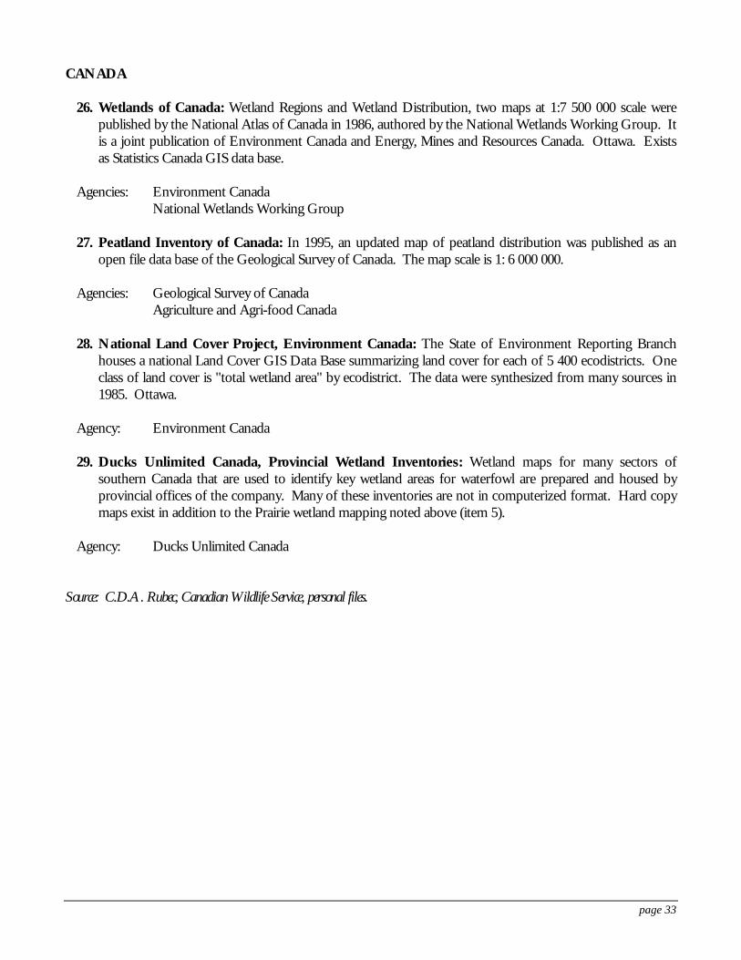
page 33
CANADA
26. Wetlands of Canada: Wetland Regions and Wetland Distribution, two maps at 1:7 500 000 scale werepublished by the National Atlas of Canada in 1986, authored by the National Wetlands Working Group. Itis a joint publication of Environment Canada and Energy, Mines and Resources Canada. Ottawa. Existsas Statistics Canada GIS data base.
Agencies: Environment CanadaNational Wetlands Working Group
27. Peatland Inventory of Canada: In 1995, an updated map of peatland distribution was published as anopen file data base of the Geological Survey of Canada. The map scale is 1: 6 000 000.
Agencies: Geological Survey of CanadaAgriculture and Agri-food Canada
28. National Land Cover Project, Environment Canada: The State of Environment Reporting Branchhouses a national Land Cover GIS Data Base summarizing land cover for each of 5 400 ecodistricts. Oneclass of land cover is "total wetland area" by ecodistrict. The data were synthesized from many sources in1985. Ottawa.
Agency: Environment Canada
29. Ducks Unlimited Canada, Provincial Wetland Inventories: Wetland maps for many sectors ofsouthern Canada that are used to identify key wetland areas for waterfowl are prepared and housed byprovincial offices of the company. Many of these inventories are not in computerized format. Hard copymaps exist in addition to the Prairie wetland mapping noted above (item 5).
Agency: Ducks Unlimited Canada
Source: C.D.A. Rubec, Canadian Wildlife Service, personal files.