the ability of pollen from small lakes and ponds to sense fine-scale vegetation patterns in the...
TRANSCRIPT

REVIEW OF
PALAEOBOTANY AND
PALYNOLOGY E L S E V I E R Review of Palaeobotany and Palynology 94 (1996) 197-210
The ability of pollen from small lakes and ponds to sense fine-scale vegetation patterns in the Central Rocky Mountains, USA
Elizabeth A. Lynch *
Department of Ecology, Evolution, and Behavior, University of Minnesota, St. Paul, MN 55108, USA
Received 31 October 1995; accepted 20 May 1996
Abstract
Pollen ratios and linear discriminant analysis were used to detect fine-scale vegetation patterns in the subalpine zone of the central Rocky Mountains, USA. The vegetation of this zone is a mosaic of conifer forests and treeless parks dominated by sagebrush (Artemisia spp.) and grasses. Previous work with pollen surface samples in the region has correlated modern pollen rain to broad-scale vegetation zones (e.g. steppe, montane forest, subalpine forest, and tundra), but little effort has been made to detect fine-scale (hundreds to thousands of meters) patterns within these vegetation zones. Previous theoretical studies suggest that vegetation patterns on the scale of hundreds of meters should be recorded in the pollen deposited in small ponds.
Pollen surface samples were collected from small ponds and lakes (30-350 m diameter) from subalpine vegetation in Colorado and Wyoming. An additional set of samples was collected from small ponds in a park and the surrounding forest in the Wind River Range of northwest Wyoming. Pollen percentages were not dramatically different in park and forest assemblages, but the ratio of conifer to herb and Artemisia pollen (C:H) and the linear discriminant score were successful in separating park and forest pollen assemblages.
Key words: Wind River Range; pollen surface samples; park vegetation; Quaternary; paleoecology
1. Introduction
A common feature throughout the mid-eleva- tions of the mountains of western Nor th America is treeless areas dominated by sagebrush (Artemisia spp.), grasses, and other forbs. Called 'parks' , these areas range in size from less than 1 ha to several km 2. The objective of this study was to determine whether the pollen assemblage in surface samples collected from ponds in parks differs from the
* Present address: Great Lakes Indian Fish and Wildlife Commission, P.O. Box 9, Odanah, WI 54861, USA. Fax: 715 682-9294. E-mail: [email protected]
0034-6667/96/$15.00 © 1996 Elsevier Science B.V. All rights reserved PII S0034-6667 (96) 00040-1
assemblage in samples collected from ponds in neighboring subalpine forests. If it can be estab- lished that these two vegetation types are repre- sented by distinct pollen assemblages accumulated in pond sediments, then it will be possible to use fossil pollen to reconstruct the former distribution of park and forest vegetation on the landscape.
Existing records of vegetation history in the subalpine zone of Colorado and Wyoming show only subtle changes in the composition of forests since the development and stabilization of the modern subalpine forest zone three to five thou- sand years ago (Waddington and Wright, 1974; Baker, 1976; Burkhart, 1976; Fall, 1985; Whitlock,

198 E.A. Lynch~Review of Palaeobotany and Palynology 94 (1996) 197-210
1993; Fall et al., 1995). However, these studies addressed vegetation changes on a regional scale and were not concerned with smaller-scale changes in the distribution of forest and park communities within the subalpine zone. Changes in the extent and location of forest and park vegetation provide insight into the stability and origin of this fine- scale vegetation mosaic (Lynch, 1995). While it has been possible to demonstrate mechanisms for the historic invasion of trees into parks (reviewed by Jakubos and Romme, 1993), the origin of parks has remained a vexing mystery (Patten, 1963; Peet, 1988; Doering and Reider, 1992; Knight, 1994 and others).
Previous studies of the relationship between pollen deposition and modern vegetation in the Rocky Mountains focused on the recognition of broad vegetation zones oriented along elevational transects (Maher, 1963; McAndrews and Wright, 1969; Baker, 1976; Burkhart, 1976; Davis, 1983; Beiswenger, 1987; Fall, 1992, 1995; Whitlock, 1993) rather than on the differences between small patches of park and forest vegetation within subal- pine or montane forest zones. However, surface samples from the Big Horn Mountains (Burkhart, 1976) and Yellowstone and Grand Teton National Parks (Baker, 1976; Whitlock, 1993) do show higher percentages of grass and forb pollen and lower percentages of pine pollen in samples from open areas within the subalpine zone than in samples from forests. The emphasis of the present study is to distinguish open and forested vegetation occurring in patches on the scale of hundreds to thousands of meters. By using pollen samples primarily from small ponds (<30 m diameter), I maximized the possibility of detecting distinct pollen assemblages in relatively small patches of park and forest vegetation.
Theoretical studies (Jacobson and Bradshaw, 1981; Prentice, 1985, 1988; Sugita, 1993, 1994) and empirical studies (Andersen, 1967; Bradshaw, 1981; Heide and Bradshaw, 1982; Bradshaw and Webb, 1985) have demonstrated that the source area for pollen dominating the pollen signal decreases when the size of the sampling basin is decreased. Based on the assumption that 75% of the total pollen inputs to a lake are derived from the vegetation surrounding a lake, Prentice et al. (1987) and
Bradshaw and Webb (1985) estimated that moder- ate to large lakes (> 10 ha) in forested areas receive the majority of their pollen from vegetation grow- ing within 30-50 km of the lake. The source area of vegetation contributing substantial amounts of pollen to smaller lakes (1 10 ha) was estimated to be approximately the area within 6 km of the lake (Schwartz, 1989). Jackson (1990) compared vegeta- tive composition at different sampling radii to pollen assemblages in small ponds (0.1-0.5 ha) in New England. He demonstrated that in small ponds correlations between percent pollen abun- dance and percent tree abundance are highest when the vegetation sampling radii are at least 100 1000 m.
Sugita (1994) demonstrated that the 'relevant source area' of pollen contributions to lakes may be much smaller than those cited above; if the background pollen inputs are uniform, a local pollen signal of only 35-40% of the total pollen inputs may be sufficient to provide information about the local vegetation around the site. Sugita's (1994) simulation model shows that for a small lake with a radius of 50 m (0.8 ha area), correlation of pollen data with distance-weighted vegetation data ceases to increase beyond a sampling distance of 300-400 m from the lake basin. This distance is much smaller than the several km suggested by earlier theoretical studies, but agrees with Jackson's (1990) experimental evidence for some tree taxa. Calcote's (1995) empirical study comparing pollen percentage data to distance-weighted tree abun- dance at different sampling radii supports Sugita's model for forest hollows in northern Michigan and Wisconsin.
The results of empirical work (Jackson, 1990; Calcote, 1995) and Sugita's (1994) simulation study suggest that small ponds should have a relevant source area with a radius of hundreds of meters. This scale of vegetation sampling would be suffi- ciently small to detect a park-forest vegetation mosaic that exists on a scale of hundreds to thousands of meters. However, there are some complications in this study that were not present in Sugita's model and Jackson's and Calcote's study areas.
Fine-scale vegetation sampling in the subalpine zone of the Rocky Mountains presents challenges
E.A. Lynch~Review of Palaeobotany and Palynology 94 (1996) 197-210 199
not found in the relatively diverse forests of eastern North America. Rocky Mountain forests are com- posed primarily of three conifer genera (Pinus, Picea, and Abies), but pollen assemblages produced by these forests are dominated by pine (Pinus), which produces abundant, well-dispersed pollen that tends to overwhelm other taxa (Mack and Bryant, 1974; Watts and Wright, 1966). With the exception of Artemisia, grasses (Poaceae), and sedges (Carex spp.), the park vegetation is com- posed largely of insect-pollinated species that are almost invisible in the pollen record; thus park pollen assemblages also contain high percentages of pine pollen. An additional complication in mountains is that vegetation zones are packed close together along elevational gradients and the mountain topography creates strong orographic winds that transport pollen long distances (Markgraf, 1980; Gaudreau et al., 1989; Jackson and Whitehead, 1991; Fall, 1992). Because some of the ponds used in the present study are surrounded by an open landscape occupied by plants that are poor pollen producers, these small ponds may collect pollen in a manner similar to larger lakes.
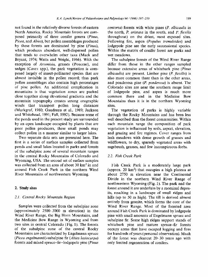
Two separate data sets are presented here. The first is a series of surface samples collected from ponds and small lakes located in parks and forests of the subalpine zone of several mountain ranges in the central Rocky Mountains of Colorado and Wyoming, USA. The second set of surface samples was collected from an area of about 30 km 2 in and around Fish Creek Park in the northern Wind River Mountains of northwestern Wyoming.
2. Study sites
2.1. Central Rocky Mountain Region
Samples were collected from the subalpine zone (approximately 2500-3000 m elevation) in the Wind River Range, the Big Horn Mountains, and the Medicine Bow Range in Wyoming and from two sites in central Colorado (Fig. 1). The forests of the subalpine zone of the central Rocky Mountains are characterized by Engelmann spruce (Picea engelmannii)-subalpine fir (Abies lasiocarpa) forests and mixed spruce-fir-lodgepole pine (Pinus
contorta) forests with white pines (P. albicaulis in the north, P. aristata in the south, and P. flexilis throughout) on the driest, most exposed sites. Following fire, aspen (Populus tremuloides) and lodgepole pine are the early successional species. Within the matrix of conifer forest are parks and wet meadows.
The subalpine forests of the Wind River Range differ from those in the other ranges sampled becauseextensive areas of whitebark pine (Pinus albicaulis) are present. Limber pine (P. flexilis) is also more common there than in the other areas, and ponderosa pine (P. ponderosa) is absent. The Colorado sites are near the southern range limit of lodgepole pine, and aspen is much more common there and in the Medicine Bow Mountains than it is in the northern Wyoming sites.
The vegetation of parks is highly variable through the Rocky Mountains and has been less well described than the forest communities. Within each mountain range the composition of park vegetation is influenced by soils, aspect, elevation, and grazing and fire regimes. Cover ranges from lush meadows with dense growth of grasses and wildflowers, to dry, sparsely vegetated areas with sagebrush, grasses, and few inconspicuous forbs.
2.2. Fish Creek Park
Fish Creek Park is a moderately large park (approx. 20 km 2) that occupies a high plateau at about 2750 m elevation near the Continental Divide in the northern Wind River Range of northwestern Wyoming (Fig. 1). The park and the forest around it are underlain by a morainal depos- its, resulting in a landscape of small ridges and hills (up to 50 m high). The till is derived almost entirely from granite, which forms the core of the Wind River Range. Most of the forested area around Fish Creek Park is dominated by lodgepole pine with small amounts of Engelmann spruce and subalpine fir. Some high ridges support stands of whitebark pine and mature spruce-fir forests occupy areas that have escaped logging and fires for hundreds of years (personal observation). Much of the forest was clearcut 20-30 years ago with only limited regeneration of conifers.

200 E.A. Lynch~Review of Palaeobotany and Palynology 94 (1996) 197 210
Fig. 1. Locations of Rocky Mountain sample sites. Map adapted from Raisz, 1957. (Copyright by Erwin Raisz, 1957, reprinted with permission by Geoplus, P.O. Box 27, Danvers, MA 01923-0027.)
Within the park, vegetation varies with topogra- phy. Ridges and other areas of coarse soils support relatively sparse growth of big sagebrush (Artemisia tridentata), Selaginella densa, grasses, and some forbs, while finer-grained soils between ridges have denser vegetation cover, including more grasses, sedges, and the partial replacement of big sage- brush with silver sage (A. cana).
3. Methods
3.1. Sample collection and processing
Surface samples in the central Rocky Mountain series were collected from a variety of sites ranging from very small ponds (< 10 m diameter) to small lakes (150 350 m diameter). Some samples, especi-
ally those from larger and deeper basins, were collected near the center of the basin with a modi- fied Hongve corer (Hongve, 1972) which collects the top several centimeters of unconsolidated sedi- ment, including the sediment water interface. The uppermost 2-3 cm of sediment were extruded for pollen analysis. One sample was collected with an Eckman dredge, a small open box that is lowered to the sediment surface and closes around a sample of sediment (Welch, 1948). In small ponds, samples were collected by wading out to the middle and collecting the top 2-3 cm of sediment by hand. In a few cases these 'grab samples' were collected near the edge of the pond. The site location, elevation, vegetation, and basin size and depth, and collection method for each of the sample sites are shown in Table 1. Fig. 1 shows the location of the 30 collec- tion sites in the central Rocky Mountains.

E.A. Lynch/Review of Palaeobotany and Palynology 94 (1996) 197-210
Table 1 Central Rocky Mountain surface sample sites
201
Site Location Lat. (N)/Long. (W) Elevation Vegetation Basin diameter Water depth Sample type (m) (m) (m)
1 BH 44°11'50"/107°9'44" 2761 mesic park 30 < 1.5 grab 2 BH 44°11'41"/107°9'48" 2761 mesic park 60 0.6 grab 3 BH 44°11'34"/107°10'2" 2761 mesic park 30 0.2 grab 4 BH 44°11'43"/107°9'54 " 2762 mesic park 30 2 Hongve 5 BH 44°15'49"/106°53'56" 2384 mesic park 30 0.3 Hongve 6 BH 44°33'4"/107°13'57 " 2530 mesic park 30 0.6 Hongve 7 WR 43°29'20"/109°51'41" 2835 dry park 50 0.3 Hongve 8 WR 43°29'16"/109°51'43 " 2835 dry park 50 0.6 grab 9 WR 43°29'12"/109°51'50 " 2835 dry park 30 0.5 grab
10 WR 43°28'58"/109052'7" 2822 dry park 60 0.8 Hongve 11 WR 43°24'5"/110°2'55" 2981 dry park 200 0.5 grab 12 WR 42°36'24"/109037'24 " 2774 dry park 60 0.3 grab 13 WR 43°20'33"/110°00'16 " 2377 dry park 350 6.5 Hongve 14 SR 38°56'48"/10607'27" 2375 dry park 70 2 Hongve 15 SR 38°56'36"/106°37'24" 2981 dry park 70 0.6 Eckman 16 South Park 39°14'23"/105°57'39 " 3010 dry park 300 5 Hongve 17 BH 44°11'34"/107°11'4" 2 7 9 8 lp/spr/fir (near large burn) 30 0.5 grab 18 BH 44°11'37"/107°10'57 " 2 7 8 6 lp/spr/fir 30 0.3 grab 19 BH 44°34'9"/107°12'20" 2481 lp/spr/fir 30 <2 grab 20 BH 44°34'10"/107°12'24 " 2 9 9 3 lp/spr/fir 30 <2 grab 21 WR 43°25'57"/109°56'9 " 2 7 7 4 lp/spr/fir 30 1.5 grab 22 WR 43°27'3"/109057'36 " 2 7 7 4 lp/spr/fir 30 0.3 grab 23 WR 43°26'/109055'75 " 2 7 7 4 lp/spr/fir 30 < 1 grab 24 MB 41°25'6"/106°26'8 " 2 8 5 3 lp/spr/fir 30 0.3 grab 25 MB 41°25'5"/106°25'41 " 2 8 5 3 lp/spr/fir 30 < 2 grab 26 MB. 41°25'11"/106°23'22 " 2 8 9 6 lp/spr/fir (20 yr? post cut) 30 0.5 Hongve 27 SR 38°55'37"/106°35'10 " 2993 lp 30 0.6 grab 28 SR 38°55'50"/106035'8 " 2993 lp w/occasional spr 30 0.3 grab 29 SR 38°53'27"/106°39'45 " 3420 spr/fir 150 < 10 Hongve 30 SR 38°53'40"/106039'48 " 3444 spr/fir 70 < 10 Hongve
BH = Big Horn Mountains, WR = Wind River Mountains, SR = Sawatch Range, MB = Medicine Bow Mountains; lp = lodgepole pine, spr= Engelmann spruce; fir= subalpine fir.
The area within and a r o u n d Fish Creek Park is dot ted with dozens of small kettle ponds. These ponds provide an ideal setting in which to calibrate the mode rn surface pollen with existing vegetation. All ponds are of similar size (20-30 m diameter) and depth (approximately 50 cm). G r a b samples of the top 2 -3 cm of sediment were collected from the center of each p o n d from an inflatable raft. Ten forest ponds, ten park ponds, and four ' t ransi- t ional ' sites were sampled (Fig. 2). Two t ransi t ional sites (23, 24) are ponds located at the park-fores t ecotone. Sample 21 is from a park p o n d that is completely su r rounded by of mature conifer trees in a belt that is less than 10 m wide. Sample 22 is
from a pond located within a patch of scattered trees that occupies approximate ly 15 ha in the park.
S tandard techniques (F~egri and Iversen, 1989) were used in the prepara t ion of pollen samples. Samples were subjected to t rea tment with hot K O H , H F acid, and acetolysis, and stored in silicone oil. Genera l ly a m i n i m u m of 750 terrestrial pollen grains were counted in each sample, bu t in a few samples total pollen counts were lower.
Because it is no t indicative of the su r round ing up land vegetation, pollen from aquat ic plants was not included in the pollen totals for calculat ion of pollen percentages, nor is it shown in the percen- tage diagrams. Al though Cyperaceae are often

202 E.A. Lynch~Review of Palaeobotany and Palynology 94 (1996) 197~10
I C°nt°ur r28°6mJ I Stream .... Forest Q
Fig. 2. Locations of sample sites in Fish Creek Park and surrounding forest. (Shaded area shows potential forest cover. Clear cuts are not shown.)
terrestrial, all Cyperaceae pollen was excluded from the terrestrial pollen sum because many ponds were surrounded by sedges growing in shallow water. Because several pollen types were rare or absent from some samples, the non-aquatic pollen types and spores are grouped into eleven categories: pine, spruce, fir, other trees/shrubs, Artemisia, Tubuliflorae, Poaceae, park herbs, general herbs, or long distance (Table2). The spruce, fir, Artemisia, Tubuliflorae, Poaceae, and Arceuthobium pollen categories each consist of a single pollen type, and these pollen types were common in all of the samples. It was difficult to differentiate Diploxylon-type and Haploxylon-type pine grains because the tenutitas was often rup- tured and the presence or absence of verrucae could not be verified. However, the vast majority of identifiable pine grains were Diploxylon-type. Haploxylon, Diploxylon, and undifferentiable pine grains were combined in the pine category. The
other trees/shrubs category consists of pollen types representing woody plant taxa that were rare, but could have been produced in the surrounding forest or park vegetation. Pollen representing her- baceous taxa other than Tubuliflorae or Poaceae were assigned to the park herb category if plants of those taxa were found growing in parks but not in other plant communities in the study area. Herb pollen types were assigned to the general herb category if the plants were common in plant com- munities other than parks in the study area. The park herb and general herb categories were created to balance the need to retain information that would maximize the possibility for multivariate analyses to differentiate park and forest vegetation with the need to eliminate many rare pollen types from the analysis. The division between park and general herb categories is based on observed distri- butions of plant taxa in the study areas rather than on the presence of those pollen types in

E.A. Lynch~Review of Palaeobotany and Palynology 94 (1996) 197-210 203
surface samples derived from park or forest sites. Pollen types representing taxa not occurring within the subalpine vegetation zone are combined in the long-distance category.
3.2. Data analysis
Multivariate statistical techniques provide a way to organize the surface samples using several pollen categories simultaneously. The patterns revealed by these techniques complement the information gained from pollen percentages and ratios and indicate trends that might otherwise pass unno- ticed. Pollen percentage data for ten of the eleven pollen categories (Table 2) are used in linear dis- criminant analyses of the central Rocky Mountain and Fish Creek Park data sets. Pollen of 'other trees/shrubs' is eliminated because in many samples variations in Salix pollen percentages reflect differences in vegetation growing at the pond mar- gins rather than in the surrounding upland vegeta- tion. Percentages of pollen from trees and shrubs other than Salix in this category are extremely low so little information about terrestrial plant commu- nities is lost by excluding this category.
Linear discriminant analysis is the most appro- priate multivariate technique to use when pollen samples are pre-assigned to vegetation groups as in this study (Davis, 1986). Discriminant functions are developed to maximize the differences in park and forest pollen assemblages. These functions are then used to assign samples with unknown origins to one of the groups. This technique was used by Liu and Lam (1985) in a paleoecological study based on modern and fossil data from Ontario. A program for linear discriminant analysis based on algorithms in Davis (1986) and written by S. Sugita was used to separate samples from park and forest sites. Transitional sites were eliminated from the Fish Creek Park data set because too few samples represent this extremely heterogenous group.
4. Results and discussion
4.1. Pollen percentages and ratios
4.1.1. Central Rocky Mountains Pine pollen percentages are uniformly high
(70-89%) in pine-spruce-fir mixed forest samples
(17-28), and much lower (less than 50%) in spruce-fir forest samples (29, 30) (Fig. 3). Low pine percentages combined with relatively high spruce percentages (14-24%) distinguish spruce-fir forest samples from those of the mixed forests adjacent to parks.
Park samples (1-16) have intermediate pine percentages ranging from 43 to 77%. Percentages of Artemisia, Poaceae, Tubuliflorae, general herbs, and park herbs are all higher than in forest samples (Fig. 3). In addition, inputs of pollen transported from long-distance sources tend to be slightly higher in park samples, reflecting lower local pollen productivity than in forest sites.
The ratio of conifer (pine, spruce, and fir) to herb and Artemisia pollen (C:H ratio) provides a useful index for separating park and mixed forest samples. The C:H ratio ranges from 0.95 to 4.00 (n=16) in park samples, and in mixed forest samples it ranges from 3.53 to 9.05 (n= 12). Box plots (Fig. 4) show median values and 25% and 75% quartiles for C:H ratios from park and forest samples. Ranges of park and forest samples indi- cate that, in the majority of cases, park and mixed forest samples can be separated using the C:H ratio. Outliers come from Fish Creek Park, indicat- ing that in the northern Wind River Range it may be more difficult to separate park and forest pollen assemblages than in other areas. For this reason a more extensive study of surface samples was made in the Fish Creek Park area.
4.1.2. Fish Creek Park The general trends in relative contributions of
different pollen categories are similar to the south- ern Rocky Mountain data set (Fig. 5). Pine per- centages are similar in both sets, but the percentages of Artemisia pollen are higher in the samples from the Fish Creek Park area than in the southern Rocky Mountain data set, while general herb percentages are lower in Fish Creek Park samples than in the regional samples. It is not possible to determine if higher percentages of Artemisia are derived from local sources in the park, or if they are a result of lower local produc- tivity coupled with large inputs from steppe at lower elevations.
C:H ratios range from 1.23 to 3.12 (n= 10) in

204 E.A. Lynch~Review of Palaeobotany and Palynology 94 (1996) 197-210
Table 2 Pollen categories used in analysis of surface samples; the taxa represented by pollen types are inferred from species ranges (nomenclature follows Dorn, 1988)
Category Pollen/spore types Plant taxon represented Common name
PINUS undifferentiated Pinus Pinus spp. pine Pinus Diploxylon-type P.contorta, P. ponderosa lodgepole pine, ponderosa pine Pinus Haploxylon-type P. albicaulis whitebark pine
P. flexilis limber pine P. aristata bristlecone pine
PICEA Picea Picea engelmannii Engelmann spruce
ABIES Abies Abies lasiocarpa subalpine fir
OTHER TREES/ Betula Betula glandulosa bog birch SHRUBS
Alnus Alnus incana alder Populus Populus tremuloides trembling aspen Salix Salix spp. willow Ericaceae Vaccinium spp. whortleberry Shepherdia canadensis Shepherdia canadensis buffalo berry Rhamnaceae Ceanothus spp. buckbrush
ARTEMISIA Artemisia Artemisia spp. sage
POACEAE Poaceae Poaceae grass family
TUBULIFLORAE Tubuliflorae Tubuliflorae aster subfamily
PARK H E R B S Caryophyllaceae Caryophyllaceae chickweed family Eriogonum Eriogonum wild buckwheat Polygonum Polygonum bistort bistortoides-type bistortoides Rosaceae Potentilla cinquefoil
Geum avens Selaginella densa-type Selaginella densa spike moss
the park samples and from 3.2 to 6.8 (n= 10) in the forest samples (Figs. 4 and 5). C:H ratios of three transitional samples (22, 23, 24) have interme- diate values, and the fourth sample (20) from a pond in the park but surrounded by a narrow fringe of conifers has a C:H ratio well within the range of the samples collected in the forest (Fig. 4).
In both data sets differences between park and forest pollen assemblages are easily detected when summarized as a C:H pollen ratio. Separation was improved in the Fish Creek Park set where sam- pling basins were more uniform and samples were collected from a relatively small geographic area.
The advantage of using a ratio to separate park and forest samples is that it is easy to calculate and can be included on a pollen diagram. Maher (1963) and Baker (1976) also recognized the utility of pollen ratios in detecting differences that are masked in the percentage data where pine pollen percentages are high.
4.2. L inear discriminant f unc t i on analysis
4.2.1. Central R o c k y M o u n t a i n s
Using all pollen categories except for 'other trees/shrubs', the discriminant function successfully

E.A. Lynch/Review of Palaeobotany and Palynology 94 (1996) 197-210 205
Table 2 continued
Category Pollen/spore types Plant taxon represented Common name
GENERAL HERBS Thalictrum Thalictrum meadow rue cf. Argemone Argemone ? prickly poppy cf. Cannabis Cannabis sativa ? hemp Urtica Urtica dioica stinging nettle Chenopodiaceae/Amarathaceae Chenopodiaceae/Amarathaceae lambsquarters/amaranth families Polygonum Polygonum spp. knotweed aviculare-type Rumex Rumex dock Fabaceae Lupinus spp. lupine Epilobium Epilobium angustifolium fireweed Apiaceae Apiaceae parsely family Plantago Plantago plaintain cf. Penstemon Penstemon ? beard tongue cf. Galium Galium ? bedstraw Ambrosia-type Ambrosia ragweed Liguliflorae Liguliflorae aster subfamily Liliaceae Liliaceae lily family undifferentiated and unknown pollen Lycopodium Lycopodium club moss Selaginella Selaginella selaginoides spike moss selaginoides-type trilete spores Pteridophytes Pteridophytes monolete spores Pteridophytes Pteridophytes
LONG DISTANCE
ARCEUTHOBIUM
Quercus Quercus gambelii scrub oak Ephedra Ephedra viridis mormon tea Sarcobatus Sarcobatus vermiculatus wormwood
Arceuthobium Arceuthobium americanum A. cyanocarpum A. douglassi
lodgepole pine dwarf mistletoe limber pine dwarf mistletoe Douglas-fir dwarf mistletoe
separates the forest and park surface samples (Fig. 6). The separation of the two groups indicates that forest and park assemblages are sufficiently different to allow for interpretation of pollen samples from analogous vegetation in the fossil pollen record using the linear discriminant function.
The loadings on each of the ten pollen types are shown in Fig. 7. Comparison of Figs. 6 and 7 indicates that the park herb, Artemisia, and general herb pollen categories are important park indica- tors, while fir pollen is an important forest indica- tor. It is reasonable to expect this pattern, given the lack of trees in the park and the poor dispersal of fir pollen. The relative importance of the long- distance pollen types in defining forest samples is not clear, especially because it is important in the
classification of the park samples in the Fish Creek Park data set. It is also not clear why the spruce pollen type does not behave in a manner similar to fir since they are both poorly dispersed pollen types produced by forest vegetation.
4.2.2. Fish Creek Park As in the central Rocky Mountain samples, the
discriminant function successfully separates the park and forest samples (Fig. 6), indicating that by using the ten pollen categories it should be possible to correctly assign a sample of unknown origin to either park or forest, provided it does not come from transitional vegetation, or from any other vegetation that is not represented by the suite of modern surface samples used in the analysis.

206 E.A. Lynch~Review of Palaeobotany and Palynology 94 (1996) 197-210
Cenfrol Rocky Mounfoin Surfoce Somples E.A. Lynch, onolyst
/
6- 7- 8-
10- 11- -
12- 13- 14- - 15- - - 16- 17- 18- 19- 20
.+J
m
m
m
m
u
m
m
m
m
m
m
m
m
J
B
m
m
' ' 528 938 355 452 793 ! 574
1118 1238 ~_ 686 526 547 841 636 476 314 531 532 ~
402 i 760
1409 21- 22- 23- 24- 25- 26- 27- 28- 29 30
- - 360
-- 632
- - - 1132
-- 1053
- - - 806
- - -- • 1185
-- -- - 334
- - - - 361
. . . . 578 398
6 8 10 Percenl of pollen sum C:H ratio ¢D
Fig. 3. Pollen percentages and C:H ratios for central Rocky Mountain surface samples.
The loadings on each of the ten pollen types are shown in Fig. 7. Comparison of Figs. 6 and 7 provides some insight into which pollen types contribute most heavily to the separation of park and forest samples in the discriminant analysis. As in the central Rocky Mountain surface samples, fir is an important pollen type in defining samples derived from forest vegetation. Relatively small loadings on the park herb, long-distance, grass, and spruce pollen types contribute to the classifi- cation of park samples. One would expect pollen of park herbs and grasses to be important in defining park samples. Also, because pollen pro- ductivity is lower in parks than in the forest, it is reasonable to expect long-distance pollen types to be relatively more common in park samples. The
significance of relatively low loadings for spruce pollen is unclear.
5. Conc lus ions
This study demonstrates that subalpine vegeta- tion patterns on the scale of hundreds to thousands of meters can be detected using pollen surface samples collected from small ponds and lakes, even in open park vegetation with relatively low local pollen inputs and high regional pine pollen inputs. Although pollen percentage data are similar in samples collected from parks and the surrounding forest, the C:H ratio provides an index for separat- ing park and forest samples. Provided that the

E.A. Lynch~Review of Palaeobotany and Palynology 94 (1996) 197-210 207
- - ' - - ' n - -°" " " ' ' I I I Park, I1--1
Forest
I ' I 0.0 2.0
I I
4.0 C:H RATIO
I 6.0
I ' I 8.0 10.0
Fish Creek Park surface samples
• l-r T T
Park
I ' I ' I ' I 0.0 2.0 4.0 6.0
C:H RATIO
[ O Forest
I
8.0 10.0
Fig, 4, Box plots showing median, 25%-tile, and 75%-tile values for park and forest surface samples. Outliers ( ~ ) are values > 1.5 x the interquartile distance from the median. Ts indicates samples from transitional sites,
Fish Creek Park Surface Samples E.A. Lynch, analyst
2 3 4 5 g-
7 8- 9
10 11 12 13 14 15 16 17 18 19 2() 21 22 23 24
. . . . . . . . . . . , , , . . . . . ~ . ~ , ~ , ~ . , . . . . . ~_ ~ ~ _ ~ !
r ~
_ - - ) 4
. . . . -- 2,,. . . . . . .
Percent of pollen sum C:H ratio
Fig. 5. Pollen percentages and C:H ratios for Fish Creek Park surface samples.
S / 856
474
1272
848
774
1080
869
828
1091
1072
629
552
602
508
884
770
586
970
642
442
1135
1034
860
1046

208 E.A. Lynch~Review of Palaeobotany and Palynology 94 (1996) 197-210
Central Rocky Mountain surface s a m p l e s
,~e), i1> ~!3
-0.80 -0.40 0.00 0.40 Discriminant Score
080
< Forest samples
Park samples
Fish Creek Park surface samples
-1.20 -0.80 -0,40 0.00 0.40 Discriminant Score
Fig. 6. Sample scores calculated by linear discriminant analysis.
0.80
Central Rocky Mountain surface samples P o a c e a e Tubuliflorae Arceuthobium P i c e a
I . G e n e r a l herbs Abies Long distance ,4[~nu s ,~,4~rtemisi a
-0.20 -0.10 0.00 0.10 0.20 LDA Coefficient
,~,herbs
i ~r- i
0.30
Fish Creek Park surface s a m p l e s
P o a c e a e
Park herbs / Picea Pinus General herbs ,~d aL ~ubuhflorae 2 LO istance I ~ L Art2isi rceuthobium ,4~Abies
I V I V V V I V w - - ~ V ' l - - - ~ 0.00 0.20 0.40 0.60
LDA Coefficient
Fig. 7. Coefficient loadings from linear discriminant function.
pollen assemblages are from vegetation similar to that represented by the surface samples, fossil samples can be assigned to either park or forest vegetation depending on whether the C:H ratio is lower or higher than the critical value established in this study. For fossil studies in other regions
more surface samples should be gathered locally to provide a reliable index for that site.
Linear discriminant analysis with modern sur- face samples was also successful at separating samples derived from park and forest vegetation. For samples of unknown origin, this linear discrim-

E.A. Lynch~Review of Palaeobotany and Palynology 94 (1996) 197-210 209
inan t funct ion can be used to calcula te a single score f rom pol len percentages. This score can be used to des ignate the sample as being f rom ei ther p a r k or forest vegeta t ion, p r o v i d e d tha t the sample comes f rom vegeta t ion s imilar to tha t represen ted by the m o d e r n surface samples used to derive the d i sc r iminan t function. The sepa ra t ion of p a r k and forest surface samples was heavi ly inf luenced by rare pol len types (fir and p a r k herbs) and m a y be less robus t than the C:H rat io.
The C:H ra t io and l inear d i sc r iminan t funct ion p rov ide index values to assign samples in a pol len d i a g r a m to ei ther forest or p a r k vege ta t ion type. G iven an a p p r o p r i a t e sampl ing design consis t ing of several s t ra tegica l ly loca ted small ponds , the pas t d i s t r ibu t ion of p a r k and forest can be recon- s t ruc ted t h rough the use of pol len percentages , pol len rat ios , and l inear d i sc r iminan t analysis.
Acknowledgements
I t h a n k R. Calcote , S. Sugita, and M. Davis for their encou ragemen t and for m a n y discussions on the in t e rp re t a t ion of the d a t a presented here. Zoe Richards and M a r k Meisner p rov ided cheerful and pa t i en t ass is tance in the col lect ion of surface samples. Valuable commen t s on ear l ier drafts of the manusc r ip t were p rov ided by R. Calcote , M. Davis , S. Sugita, T. Webb, and C. Whi t lock . This research was s u p p o r t e d by a N S F Disse r t a t ion I m p r o v e m e n t Award, a D o c t o r a l Disse r t a t ion Fe l lowship f rom the Univers i ty of Minneso ta , and grants f rom The Geo log ica l Society of Amer ica , S igma Xi, N S F G l o b a l Pa l eo reco rds Research Tra in ing G r o u p , D a y t o n - W i l k i e F u n d of the Bell M u s e u m of N a t u r a l His tory , and the C a r o l y n C r o s b y Award f rom the Univers i ty of Minneso ta .
References
Andersen, S.Th., 1967. Tree-pollen rain in a mixed deciduous forest in South Jutland (Denmark). Rev. Palaeobot. Palynol., 3: 267-275.
Baker, R.G., 1976. Late Quaternary vegetation history of the Yellowstone Lake basin, Wyoming. US Geol. Surv. Prof. Pap., 729-E: E1 E48.
Beiswenger, J.M., 1987. Late Quaternary vegetation history of
Gray's Lake, Idaho and Ice Slough, Wyoming. Ph.D. disser- tation. Univ. Wyoming, Laramie, WY.
Bradshaw, R.H.W., 1981. Modern pollen-representation factors for woods in south-east England. J. Ecol., 69: 45-70.
Bradshaw, R.H.W. and Webb, III., T., 1985. Relationships between contemporary pollen and vegetation data from Wis- consin and Michigan, USA. Ecology, 66: 721-737.
Burkhart, M.R., 1976. Pollen biostratigraphy and late-Quater- nary vegetation history of the Big Horn Mountains, Wyo- ming. PhD thesis. Univ. Iowa.
Calcote, R., 1995. Pollen source area and pollen productivity: evidence from forest hollows. J. Ecol., 83: 591-602.
Davis, J.C., 1986. Statistics and Data Analysis in Geology. Wiley, New York, NY, 2nd ed.
Davis, O.K., 1983. Pollen frequencies reflect vegetation patterns in a Great Basin (U.S.A.) mountain range. Rev. Palaeobot. Palynol., 40: 295-315.
Doering, W.R. and Reider, R.G., 1992. Soils of Cinnabar Park, Medicine Bow Mountains, Wyoming, USA: indicators of park origin and persistence. Arct. Alp. Res., 24: 27-39.
Dorn, R.D., 1988. Vascular Plants of Wyoming. Mountain West, Cheyenne, WY.
F~egri, K. and Iversen, J., 1989. Textbook of Pollen Analysis. Hafner, New York, NY.
Fall, P.L., 1985. Holocene dynamics of the subalpine forest in central Colorado. AASP Contrib. Ser., 16: 31-46.
Fall, P.L., 1992. Spatial patterns of atmospheric pollen dispersal in the Colorado Rocky Mountains, USA. Rev. Palaeobot. Palynol., 74:293 313.
Fall, P.L., 1995. Modern pollen spectra and vegetation in the Wind River Range, Wyoming, U.S.A. Arct. Alp. Res., 26: 383-392.
Fall, P.L., Davis, P.T. and Zielinski, G.A., 1995. Late Quater- nary vegetation and climate of the Wind River Range, Wyo- ming. Quat. Res., 43: 393-404.
Gaudreau, D.C., Jackson, S.T. and Webb, III., T., 1989. Spatial scale and sampling strategy in paleoecological studies of veg- etation patterns in mountainous terrain. Acta Bot. Neerl., 38: 369-390.
Heide, K.M. and Bradshaw, R., 1982. The pollen-tree relation- ship within forests of Wisconsin and Upper Michigan, USA. Rev. Palaeobot. Palynol., 36: 1-23.
Hongve, D., 1972. En Bunnhenter som er lett a lage. Fauna, 25: 281-283.
Jackson, S.T., 1990. Pollen source area and representation in small lakes of the northeastern United States. Rev. Palaeo- bot. Palynol., 63: 53-76.
Jackson, S.T. and Whitehead, D.R., 1991. Holocene vegetation patterns in the Adirondack Mountains. Ecology, 72: 641-653.
Jacobson, G.L. and Bradshaw, Jr., R.H.W., 1981. The selection of sites for paleovegetational studies. Quat. Res., 16: 80-96.
Jakubos, B. and Romme, W.H., 1993. Invasion of subalpine meadows by lodgepole pine in Yellowstone National Park, Wyoming, USA. Arct. Alp. Res., 25: 382-390.
Knight, D.K., 1994. Mountains and Plains: The Ecology of Wyoming Landscapes. Yale Univ. Press, New Haven, CT.

210 E.A. Lynch~Review of Palaeobotany and Palynology 94 (1996) 197~10
Liu, K. and Lain, N.S., 1985. Paleovegetational reconstruction based on modern and fossil pollen data: an application of discriminant analysis. Ann. Assoc. Am. Geogr., 75:115 130.
Lynch, E.A., 1995. Origin of a park-forest vegetation mosaic in the Wind River Range, Wyoming. PhD dissertation. Univ. Minnesota, St. Paul, MN.
Mack, R.N. and Bryant, Jr., V.M., 1974. Modern pollen spectra from the Columbia Basin, Washington. Northwest Sci., 48: 183-194.
Maher, Jr., L.J., 1963. Pollen analyses of surface materials from the southern San Juan Mountains, Colorado. Geol. Soc. Am. Bull., 74: 1485-1504.
Markgraf, V., 1980. Pollen dispersal in a mountain area. Grana, 19: 127-146.
McAndrews, J.H. and Wright, Jr., H.E., 1969. Modern pollen rain across the Wyoming basins and the northern Great Plains. Rev. Palaeobot. Palynol., 9:17 43.
Patten, D.T., 1963. Vegetational pattern in relation to environ- ments in the Madison Range, Montana. Ecol. Monogr., 33: 375-406.
Peet, R.K., 1988. Forests of the Rocky Mountains. In: M.G. Barbour and W.D. Billings (Editors), North American Ter- restrial Vegetation. Cambridge Univ. Press, New York, NY, pp. 63-101.
Prentice, I.C., 1985. Pollen source representation, source area, and basin size: toward a unified theory of pollen analysis. Quat. Res., 23: 76-86.
Prentice, I.C., 1988. Records of vegetation in time and space: the principles of pollen analysis. In: B. Huntley and T. Webb III (Editors), Vegetation History. Kluwer, Dordrecht.
Prentice, I.C., Berglund, B.E. and Olsson, T., 1987. Quantitative forest-composition sensing characteristics of pollen samples from Swedish lakes. Boreas, 16: 43-54.
Schwartz, M.W., 1989. Predicting tree frequencies from pollen frequency: an attempt to validate the R value method. New Phytol., 112: 129-143.
Sugita, S., 1993. A model of pollen source area for an entire lake surface. Quat. Res., 39:239 244.
Sugita, S., 1994. Pollen representation of vegetation in Quater- nary sediments: theory and method in patchy vegetation. J. Ecol., 82:881 897.
Waddington, J.C.B. and Wright, Jr., H.E., 1974. Late Quaternary vegetational changes on the East side of Yellowstone Park, Wyoming. Quat. Resi, 4: 175-184.
Watts, W.A. and Wright, Jr., H.E., 1966. Late Wisconsin pollen and seed analysis from the Nebraska Sandhills. Ecology, 47:202 210.
Welch, P.S., 1948. Limnological Methods. Blakiston, Philadel- phia, PA.
Whitlock, C., 1993. Postglacial vegetation and climate of Grand Teton and southern Yellowstone National Parks. Ecol. Monogr., 63:173 198.