tdms a traffic data repository for government and business use
TRANSCRIPT

TDMS – A Traffic Data Repository for Government and Business Use
Prepared for:
Arizona Association of County Engineers
Prescott, Arizona
February 13, 2014
Presented by:
Mark Catchpole
ADOT Multimodal Planning Division
Transportation Analysis Section
Traffic Monitoring Team
Phoenix, Arizona
Presentation Objectives
The objective of this presentation is to -
Help attendees gain a better understanding of the purpose and intent behind the TDMS application.
Explain its role and significance.
Demonstrate some of its basic tools and features.
Traffic Monitoring Program
Traffic Monitoring defined –
A systematic process for the collection, analysis, summary, and retention of highway vehicular traffic data.
Includes provisions for developing and reporting reasonable estimates of vehicle travel activity measures that are generated on a road or street network.
Traffic Monitoring - Relative Statutes, Mandates and Procedural Guidelines
Statutes and Mandates
Federal (23 CFR Part 500 Subpart B) – A continued operation of a Highway Traffic Monitoring Program is required to be maintained
by each state.
State – There are no known state statues that specifically
mandate traffic monitoring programs.
Guidelines
FHWA Traffic Monitoring Guide (TMG)
AASHTO Guidelines for Traffic Data Programs
Primary Uses of Traffic Data
Satisfies traffic-related HPMS data requirements
Inputs to highway and pavement design criteria
Generates vehicle travel estimates (current and projected)
Supports Air Quality initiatives and mandates
Provides input to Travel Demand Modeling activity
Provides data for various traffic studies (i.e. vehicle crash analysis and rates, intersection improvements, etc.)
Used to justify road or street reclassification requests
Other Stakeholders of Traffic Data
Community development / Chamber of Commerce
Private enterprise (realtors, developers, appraisers)
Research (marketing, economic, etc.)
Academics
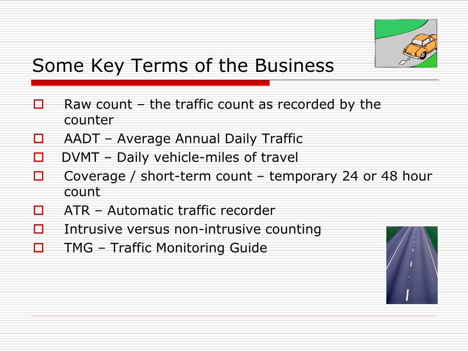
Some Key Terms of the Business
Raw count – the traffic count as recorded by the counter
AADT – Average Annual Daily Traffic
DVMT – Daily vehicle-miles of travel
Coverage / short-term count – temporary 24 or 48 hour count
ATR – Automatic traffic recorder
Intrusive versus non-intrusive counting
TMG – Traffic Monitoring Guide
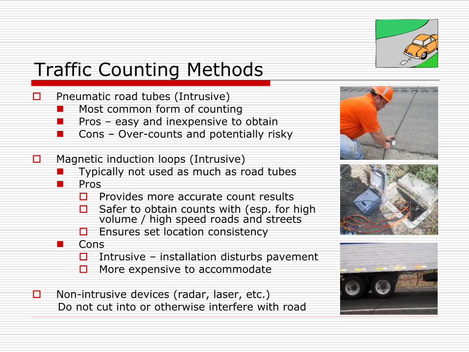
Traffic Counting Methods
Pneumatic road tubes (Intrusive) Most common form of counting Pros – easy and inexpensive to obtain Cons – Over-counts and potentially risky
Magnetic induction loops (Intrusive)
Typically not used as much as road tubes Pros
Provides more accurate count results Safer to obtain counts with (esp. for high
volume / high speed roads and streets Ensures set location consistency
Cons Intrusive – installation disturbs pavement More expensive to accommodate
Non-intrusive devices (radar, laser, etc.) Do not cut into or otherwise interfere with road

Basic Types of Vehicular
Traffic Data
Volume
Vehicle Classification
Vehicle Length
Speed
Weight

Data Types – Traffic Volumes
Basic measurement of highway usage
Highway segments counted in 15 minute recording intervals
Directional counts are captured where feasible

Data Types – Continuous Traffic Counters
(Also known or referred to as ATR stations)
Over 300 locations statewide
Records various traffic information 24/7/365
Station data is collected by telemetry
ATR network includes FMS detector stations located on urban freeways in metro Phoenix
(and in the near future – Tucson)
Data is used to “factor” short-term counts
Best and most comprehensive source of traffic data available
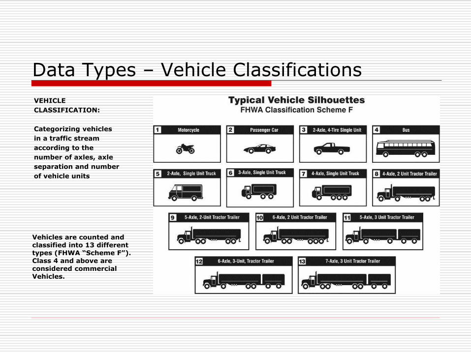
Data Types – Vehicle Classifications
VEHICLE
CLASSIFICATION:
Categorizing vehicles
in a traffic stream
according to the
number of axles, axle
separation and number
of vehicle units
Vehicles are counted and classified into 13 different types (FHWA “Scheme F”). Class 4 and above are considered commercial Vehicles.
Data Types – Vehicle Lengths
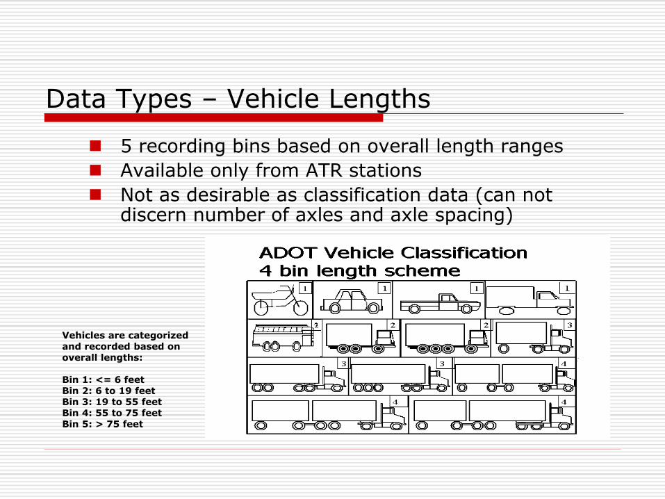
5 recording bins based on overall length ranges
Available only from ATR stations
Not as desirable as classification data (can not discern number of axles and axle spacing)
Vehicles are categorized and recorded based on overall lengths: Bin 1: <= 6 feet Bin 2: 6 to 19 feet Bin 3: 19 to 55 feet Bin 4: 55 to 75 feet Bin 5: > 75 feet
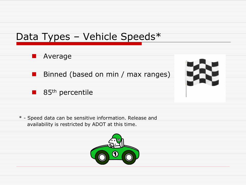
Data Types – Vehicle Speeds*
Average
Binned (based on min / max ranges)
85th percentile
* - Speed data can be sensitive information. Release and
availability is restricted by ADOT at this time.
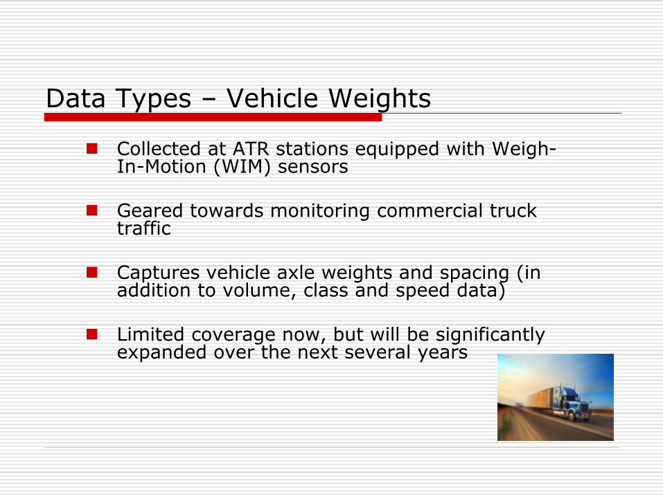
Data Types – Vehicle Weights
Collected at ATR stations equipped with Weigh-In-Motion (WIM) sensors
Geared towards monitoring commercial truck
traffic
Captures vehicle axle weights and spacing (in addition to volume, class and speed data)
Limited coverage now, but will be significantly expanded over the next several years
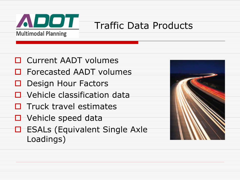
Traffic Data Products
Current AADT volumes
Forecasted AADT volumes
Design Hour Factors
Vehicle classification data
Truck travel estimates
Vehicle speed data
ESALs (Equivalent Single Axle Loadings)
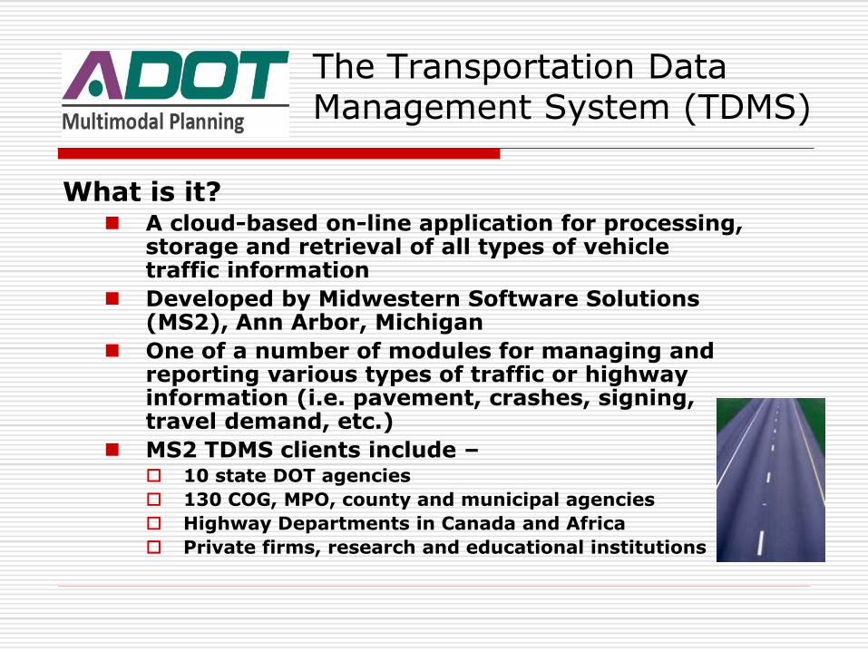
The Transportation Data Management System (TDMS)
What is it? A cloud-based on-line application for processing,
storage and retrieval of all types of vehicle traffic information
Developed by Midwestern Software Solutions (MS2), Ann Arbor, Michigan
One of a number of modules for managing and reporting various types of traffic or highway information (i.e. pavement, crashes, signing, travel demand, etc.)
MS2 TDMS clients include – 10 state DOT agencies
130 COG, MPO, county and municipal agencies
Highway Departments in Canada and Africa
Private firms, research and educational institutions
TDMS – Advantages and Key Features
Combines the power of the internet and GIS technology to provide the user with tools to obtain voluminous sets of traffic data
Provides a centralized repository for traffic data storage, retrieval, analysis and reporting
Contains built-in tools for uploading, validating and posting traffic data
Used to process raw count data into average annual daily traffic volumes
Contains built-in tools for performing data searches, generating reports and graphical displaying of information
Requires no software purchase and installation
Cloud-based – requires no hardware to store massive amounts of data
Instantaneous count results are possible to provide end users and stakeholders
Why did ADOT buy into TDMS?
To replace an existing contracted traffic data processing service that –
Was becoming expensive to annually subscribe to
Had no graphical interface
Was not cloud-based and accessible on-line
Could not provide for direct data uploading
To better facilitate assembly of traffic data for the
annual HPMS data submittal to FHWA
To make it easier for stakeholders to obtain and use
traffic data collected on State Highways
TDMS Chronology
2007 – ADOT purchases a TDMS site license from MS2 and begins using the application for processing and reporting its traffic data (http://adot.ms2soft.com/).
2010 – A project investment justification is initiated and a federal grant for $187,000 is requested by ADOT to extend the TDMS capability to include local government agencies.
2011 – The investment justification is approved and the grant is awarded to ADOT so it can purchase permanent TDMS site licenses and web portals for each Arizona COG and MPO.
2012 – ADOT informs the COGs and MPOs of the creation of their TDMS websites. MS2 later conducts a series of instructional webinars with each. These were typically held during a monthly COG or MPO street TAC meeting .
2012 to present – MS2 provides administrative and technical support to COG or MPO member agency staffs as needed.
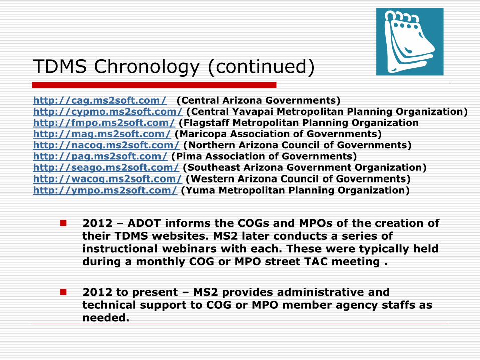
TDMS Chronology (continued) http://cag.ms2soft.com/ (Central Arizona Governments) http://cypmo.ms2soft.com/ (Central Yavapai Metropolitan Planning Organization) http://fmpo.ms2soft.com/ (Flagstaff Metropolitan Planning Organization http://mag.ms2soft.com/ (Maricopa Association of Governments) http://nacog.ms2soft.com/ (Northern Arizona Council of Governments) http://pag.ms2soft.com/ (Pima Association of Governments) http://seago.ms2soft.com/ (Southeast Arizona Government Organization) http://wacog.ms2soft.com/ (Western Arizona Council of Governments) http://ympo.ms2soft.com/ (Yuma Metropolitan Planning Organization)

Each COG / MPO serves as its own site administrator
COG / MPO creates user accounts for each member agency
Local agencies collect traffic count data on their road or street network
Local agencies upload, validate and post count results
TDMS Site Administration
Reasons why ADOT extended TDMS to the COG and MPOs
To better facilitate FHWA traffic data reporting requirements
To ensure consistency with derivation of AADT volumes
To develop more accurate estimates of vehicle travel activity which provides better performance measures and transportation policy decisions
To expand the concept of a centralized and standardized traffic data repository that can be used by multiple stakeholders in and out of government
To promote the concept of data sharing
To provide local government agencies with a free tool to archive, process, validate, display and retrieve traffic data they collect on their roads and streets
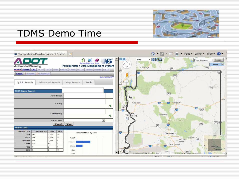
TDMS Demo Time
Take-aways and Parting Thoughts
The TDMS application accommodates traffic monitoring activities that are basic and necessary functions for a highway agency to perform.
Data generated from a traffic monitoring system produces critical measures of highway usage and performance. What gets measured can get managed.
A traffic count should be collected once and used many times. The TDMS application is a tool that allows for multiple users of traffic data.
ADOT assistance is available for local agency traffic monitoring (i.e. buying equipment, setting up a count program, traffic data collection).
Misconceptions and misunderstandings about traffic counting abound.
“Not everything that counts can be counted. Not everything
that can be counted counts.”
- Albert Einstein
Questions / Comments / Suggestions