strategies for sustainable hydrology and waterhydrology .... narbo - hlsda.pdf · strategies for...
TRANSCRIPT
1
The Sixth General MeetingNetwork of Asian River Basin Organizations
Strategies for Sustainable Hydrology and WaterHydrology and Water Resources Environment Management in IndonesiaManagement in Indonesia
Jakarta, February 23rd 2017
Dr. Eka Nugraha Abdi, ST, MPPMDeputy Director for Hydrology and Water Resources EnvironmentDeputy Director for Hydrology and Water Resources Environment
Directorate General of Water Resources | Directorate of Water Resources Management
Outline
• Issues of the National Water Resources Managementg
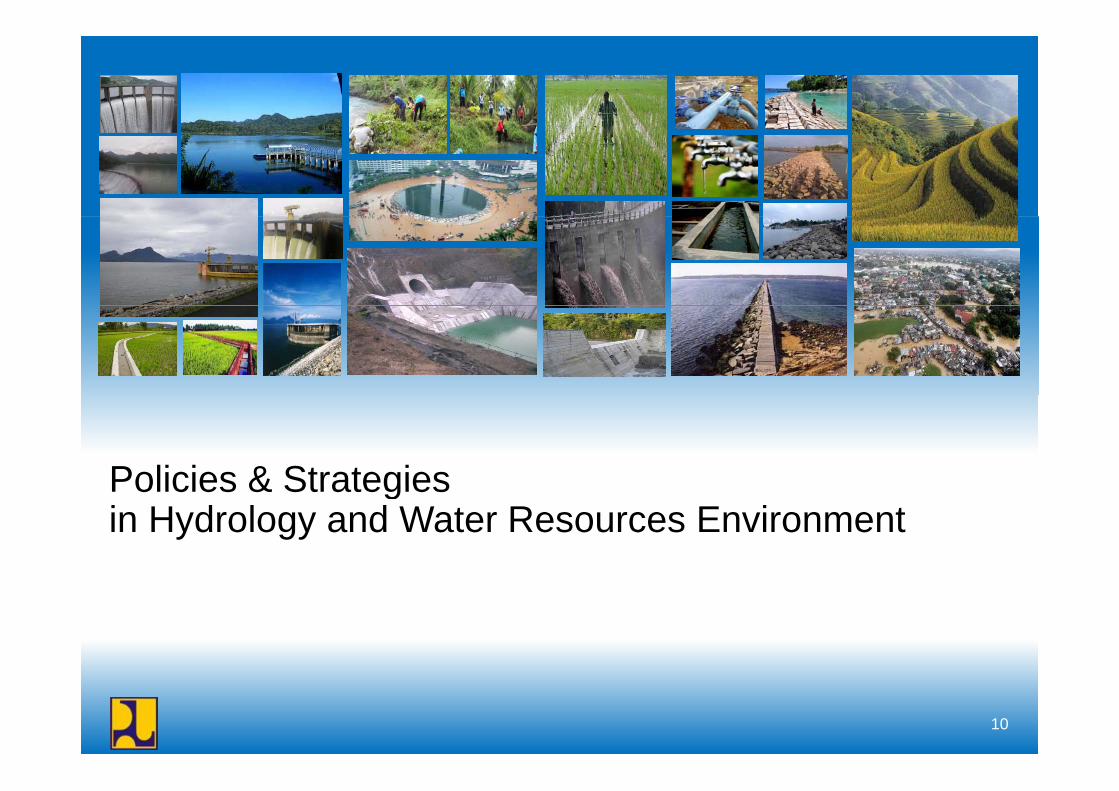
• Policies & Strategies in Hydrology and Water Resources• Policies & Strategies in Hydrology and Water Resources Environment
• Strategic Programs in Hydrology & Water Resources EnvironmentEnvironment
2
Issues of the National Water Resources Management
3
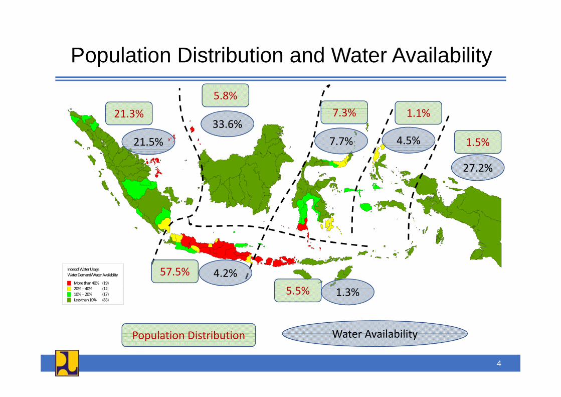
Population Distribution and Water Availabilityp y
5.8%21.3% 7.3% 1.1%
1.5%21.5%33.6%
7.7% 4.5%
27.2%
Indeks Pemakaian AirKebutuhan air / Ketersediaan air
besar dari 40% (19)20% 40% (12)
57.5%
5 5%4.2%
1 3%
Index of Water UsageWater Demand/Water Availability
More than 40% (19)20% 40% (12)20% - 40% (12)10% - 20% (17)kecil dari 40% (83)
5.5% 1.3%
Population Distribution Water Availability
20% ‐ 40% (12)10% ‐ 20% (17)Less than 10% (83)
Population Distribution Water Availability
4
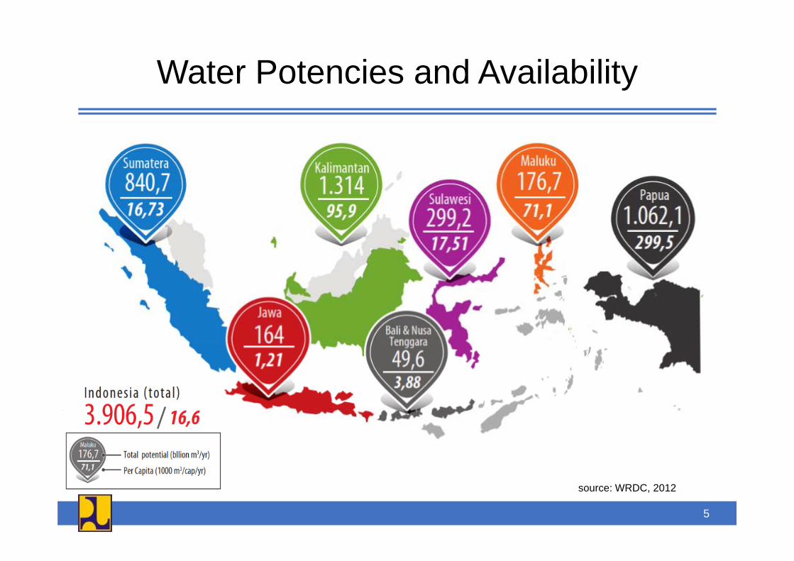
Water Potencies and Availabilityy
source: WRDC, 2012
5
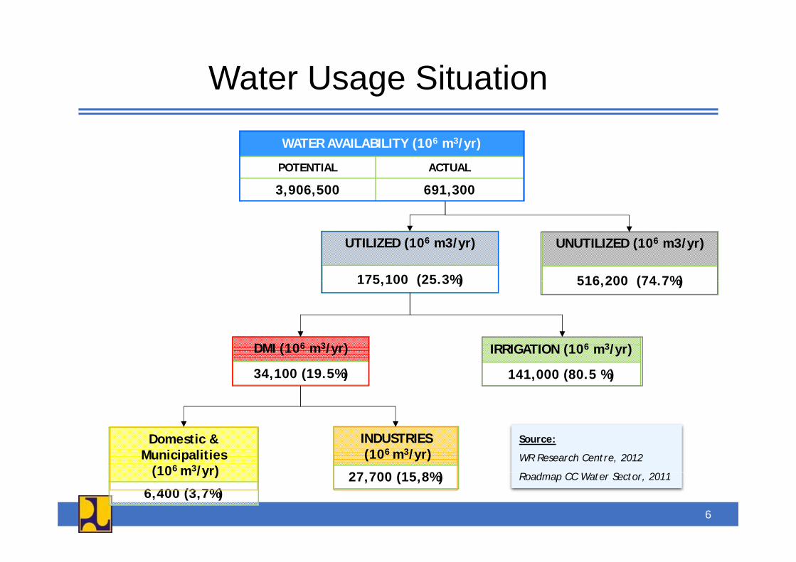
Water Usage Situationa e Usage S ua o
WATER AVAILABILITY (106 m3/yr)
POTENTIAL ACTUAL
3,906,500 691,300
UTILIZED (106 m3/yr)
175 100 (25 3%)
UNUTILIZED (106 m3/yr)
516 200 (74 7%)
DMI (106 3/ ) IRRIGATION (106 3/ )
175,100 (25.3%) 516,200 (74.7%)
DMI (106 m3/yr)
34,100 (19.5%)
IRRIGATION (106 m3/yr)
141,000 (80.5 %)
Domestic & Municipalities
(106 m3/yr)
INDUSTRIES(106 m3/yr)
27 700 (15 8%)
Source:
WR Research Centre, 2012
d CC S 20(10 m /yr)
6,400 (3,7%)27,700 (15,8%) Roadmap CC Water Sector, 2011
6
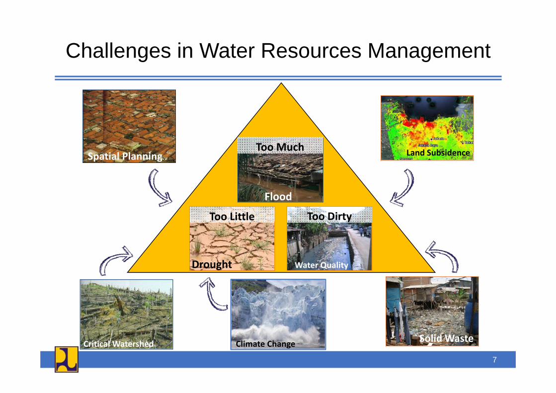
Challenges in Water Resources Management
Land SubsidenceToo MuchSpatial Planning Land Subsidence
FloodFlood
Too DirtyToo Little
Drought Water Quality
Critical Watershed Solid WasteClimate Change
7
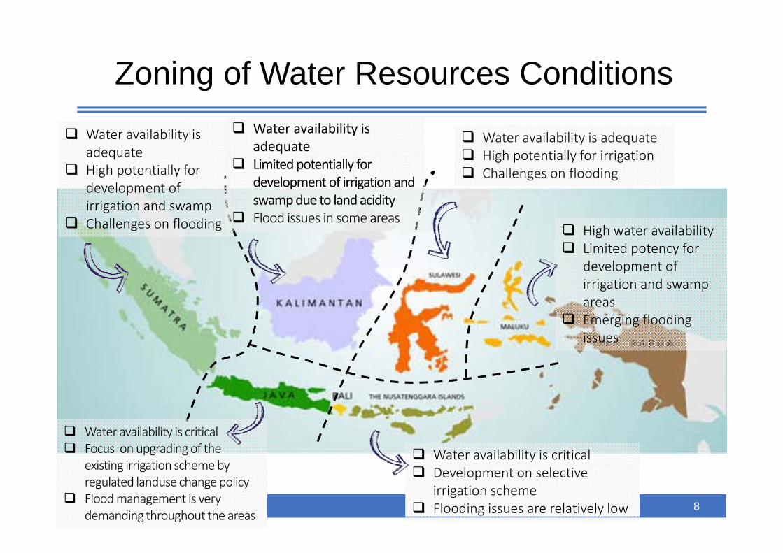
Zoning of Water Resources Conditions
Water availability is adequate
Water availability is adequate Water availability is adequate
Hi h i ll f i i i
g
adequateHigh potentially for development of irrigation and swamp
adequateLimited potentially for development of irrigation and swamp due to land acidityFl d i i
High potentially for irrigationChallenges on flooding
Challenges on flooding Flood issues in some areasHigh water availability Limited potency for development of irrigation and swamp areasEmerging flooding issuesissues
Water availability is criticalFocus on upgrading of the existing irrigation schemeby
Water availability is criticalexisting irrigation scheme by regulated landuse change policyFlood management is very demanding throughout the areas
Development on selective irrigation schemeFlooding issues are relatively low 8

Challenges of Water Resources Managementin Decadesin Decades
Low perceived complexity
1960s Engineering
1970s Engineering + agriculture + economics1970s Engineering + agriculture + economics
1980s Engineering + agriculture + economics + management + user organization
nd 2
010
1990s Engineering + agriculture + economics + management + user organization + institution + gender
High percieved complexity 60s
–be
yon
g p p y
2000 Engineering + agriculture + economics + management + user organization + institution + gender + policies/politics + environmental and intersectoral aspects + green water
196
2005 Engineering + agriculture + economics + management + user organization + institution + gender + policies/politics + environmental and intersectoral aspects + green water + climate change
Beyond 2010 Engineering + agriculture + economics + management + user organization + institution + gender + policies/politics + environmental and intersectoral aspects + green water + climate change + culture
9
Policies & StrategiesPolicies & Strategiesin Hydrology and Water Resources Environment
10
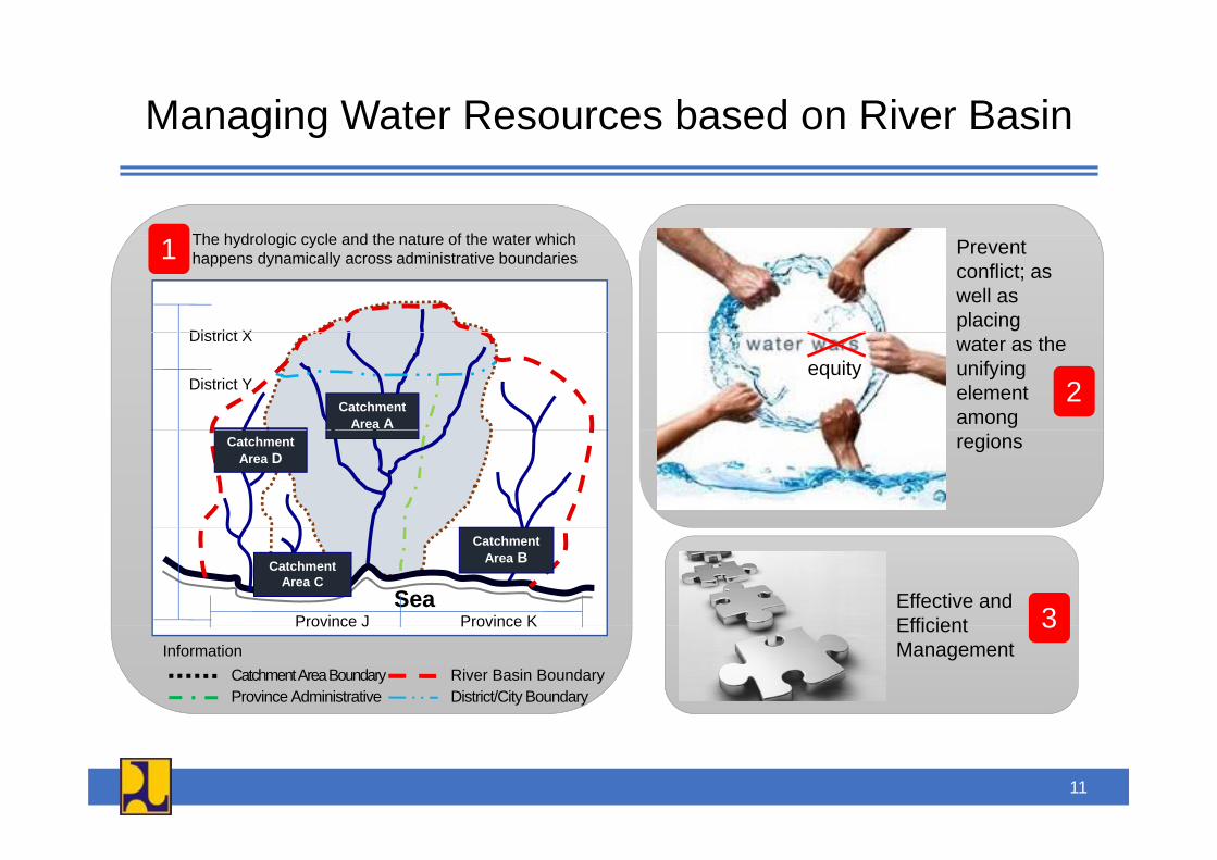
Managing Water Resources based on River Basing g
Th h d l i l d th t f th t hi h
Di t i t X
The hydrologic cycle and the nature of the water which happens dynamically across administrative boundaries1 Prevent
conflict; as well as placing
Catchment Area A
District X
District Yequity
water as the unifying element among
2Catchment
Area Dregions
Catchment Area BCatchment
Area CSea
Province J Province KEffective and Efficient 3
Catchment Area Boundary River Basin BoundaryInformation
Province Administrative District/City Boundary
Province J Province K Efficient Management
3
11
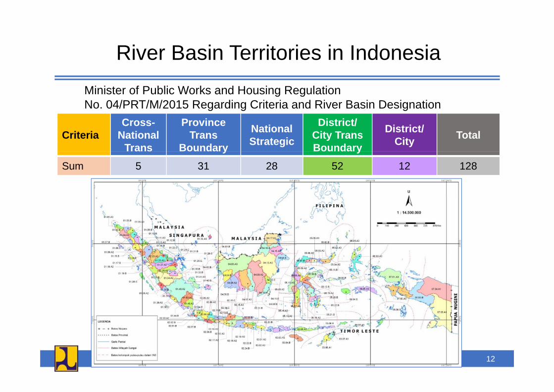
River Basin Territories in IndonesiaMinister of Public Works and Housing RegulationNo 04/PRT/M/2015 Regarding Criteria and River Basin DesignationNo. 04/PRT/M/2015 Regarding Criteria and River Basin Designation
CriteriaCross-
National Trans
Province Trans
Boundary
National Strategic
District/ City TransBoundary
District/ City Total
y ySum 5 31 28 52 12 128
12
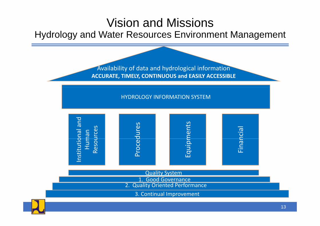
Vision and MissionsHydrology and Water Resources Environment ManagementHydrology and Water Resources Environment Management
Availability of data and hydrological informationACCURATE, TIMELY, CONTINUOUS and EASILY ACCESSIBLE
HYDROLOGY INFORMATION SYSTEM
onal and
man
urces
dures
men
ts
ncial
Institu
tioHu
mRe
sou
Proced
Equipm
Finan
Quality System1. Good Governance
2. Quality Oriented Performance3. Continual Improvement
13
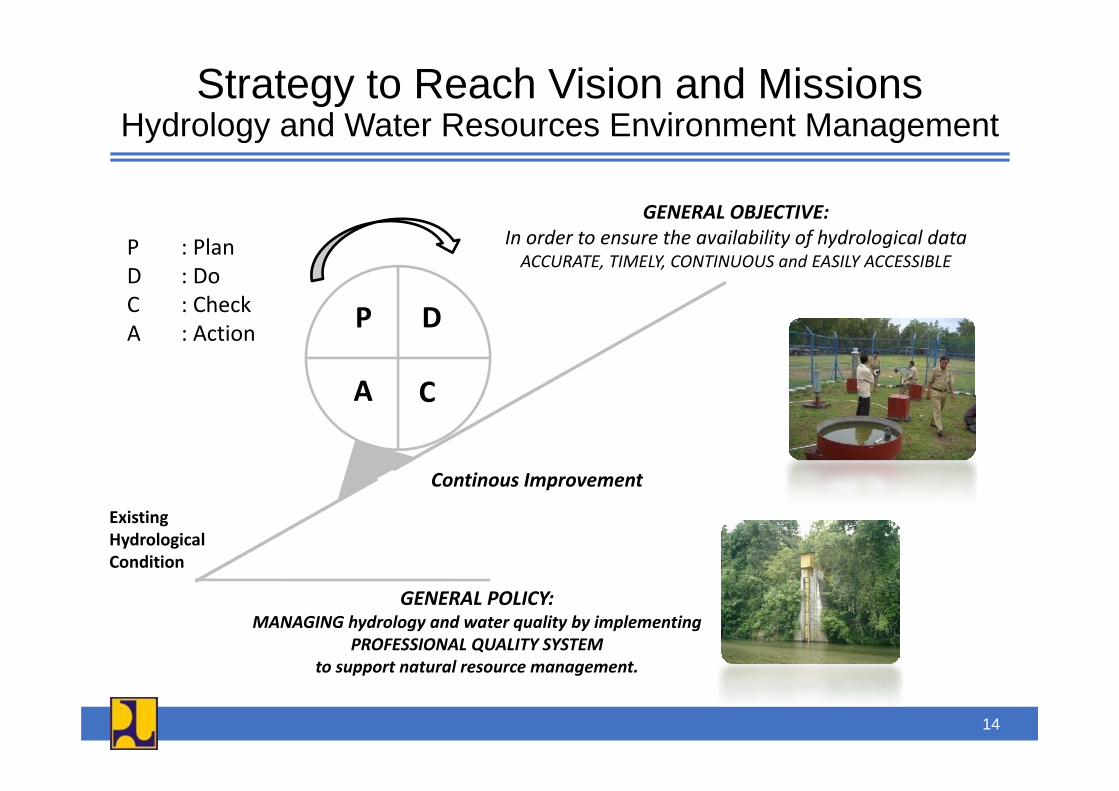
Strategy to Reach Vision and MissionsHydrology and Water Resources Environment ManagementHydrology and Water Resources Environment Management
GENERAL OBJECTIVE:GENERAL OBJECTIVE:In order to ensure the availability of hydrological dataACCURATE, TIMELY, CONTINUOUS and EASILY ACCESSIBLE
P : PlanD : DoC : Check P D
A C
C : CheckA : Action
A C
Continous Improvement
ExistingHydrologicalCondition
Continous Improvement
GENERAL POLICY:MANAGING hydrology and water quality by implementing
PROFESSIONAL QUALITY SYSTEMto support natural resource managementto support natural resource management.
14

Paradigm Shiftin Hydrology and Water Resources Environmentin Hydrology and Water Resources Environment
Future Situations• Service‐based data and information management
• Reveal the potencies of
E i ti Sit ti
pwater resources
• Providing the information for early warning system d llExisting Situations
• Business as usual data and information management
and water allocation• Installation of hydrological stations based on the “rationalization” study and
• Installation of hydrological stations based on the needs of water resources plans and infrastructures
rationalization study and water related issues
15
Action Plan of Hydrology and Water Resources Environment Management
2015 2016 2017 2018 2019
Hydrology and Water Resources Environment Management
Data and Information Development Services and Access to Information
CONTINUAL IMPROVEMENT1. Reinforcement
of institutions (HR, Procedurs,
1. Institutional development (HRD, NSPK, 1. 100% of national
CONTINUAL IMPROVEMENT
Equipments, the working mechanism)
2. Retrofitting the
equipment, the working mechanism)
2. Improving
hydrology managers certified ISO 9001
1. The quality of hydrology & water quality data and
1. Stabilization of the quality of data and i f imanagement
(planning, implementation, monitoring,
management3. Improving
technology4. Financing
2. Integrated information system
3. Implementation
data and information
2. Improving the performance and continuity
information2. Professional
data and information
idissemination)3. Improving
technology4. Community
5. Increasing the community participation
of Standard financing
4. Policy of community and b
yof data and information services
3. Improving the
services3. Improvement
and development thand business
participationbusiness empowerment
p gaccess to information
the access information
16
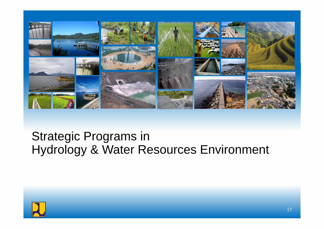
Strategic Programs ing gHydrology & Water Resources Environment
17
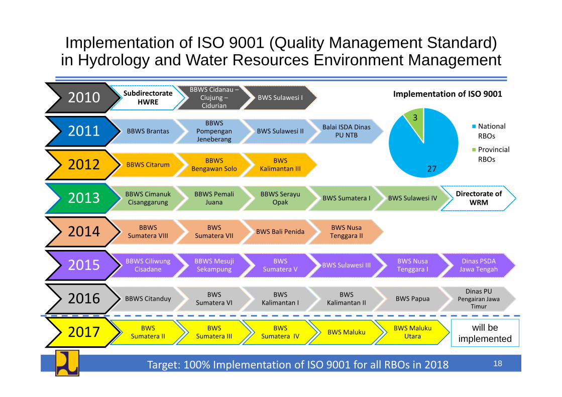
Implementation of ISO 9001 (Quality Management Standard) in Hydrology and Water Resources Environment Managementin Hydrology and Water Resources Environment Management
2010 SubdirectorateHWRE
BBWS Cidanau –Ciujung –Cidurian
BWS Sulawesi I Implementation of ISO 9001
2011 BBWS BrantasBBWS
PompenganJeneberang
BWS Sulawesi II Balai ISDA DinasPU NTB
3National RBOs
Provincial
2012 BBWS Citarum BBWS Bengawan Solo
BWS Kalimantan III
2013 BBWS Cimanuk BBWS Pemali BBWS Serayu BWS Sumatera I BWS Sulawesi IV Directorate of
27RBOs
2013 Cisanggarung Juana Opak BWS Sumatera I BWS Sulawesi IV WRM
2014 BBWS Sumatera VIII
BWS Sumatera VII BWS Bali Penida BWS Nusa
Tenggara II
2015 BBWS CiliwungCisadane
BBWS Mesuji Sekampung
BWS Sumatera V BWS Sulawesi III BWS Nusa
Tenggara IDinas PSDA Jawa Tengah
2016 BBWS Citanduy BWS Sumatera VI
BWS Kalimantan I
BWS Kalimantan II BWS Papua
Dinas PU Pengairan Jawa
Timur
2017 BWS BWS BWS BWS Maluku BWS Maluku will be 2017 Sumatera II Sumatera III Sumatera IV BWS Maluku Utara
Target: 100% Implementation of ISO 9001 for all RBOs in 2018
implemented
18
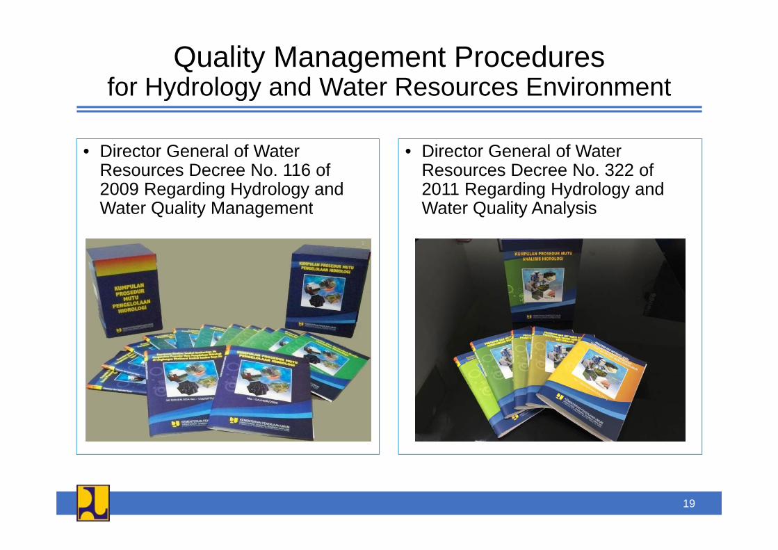
Quality Management Proceduresfor Hydrology and Water Resources Environmentfor Hydrology and Water Resources Environment
• Director General of Water • Director General of Water• Director General of Water Resources Decree No. 116 of 2009 Regarding Hydrology and Water Quality Management
• Director General of Water Resources Decree No. 322 of 2011 Regarding Hydrology and Water Quality AnalysisWater Quality Management Water Quality Analysis
19
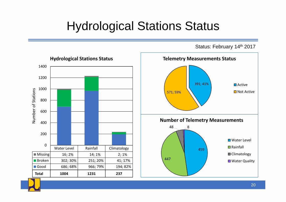
Hydrological Stations Statusy gStatus: February 14th 2017
1200
1400
Hydrological Stations Status Telemetry Measurements Status
800
1000
1200
Stations
391; 41%
571; 59%
Active
Not Active
400
600
800
Num
ber o
f S
Number of Telemetry Measurements
l f ll l l0
200
48 8
Water Level
RainfallWater Level Rainfall ClimatologyMissing 16 14 2Broken 302 251 41Good 686 966 194; 68%
; 30%; 2%
; 79%; 20%; 1%
; 82%; 17%; 1%
459
447
Rainfall
Climatology
Water Quality
Total 1004 1231 237
20
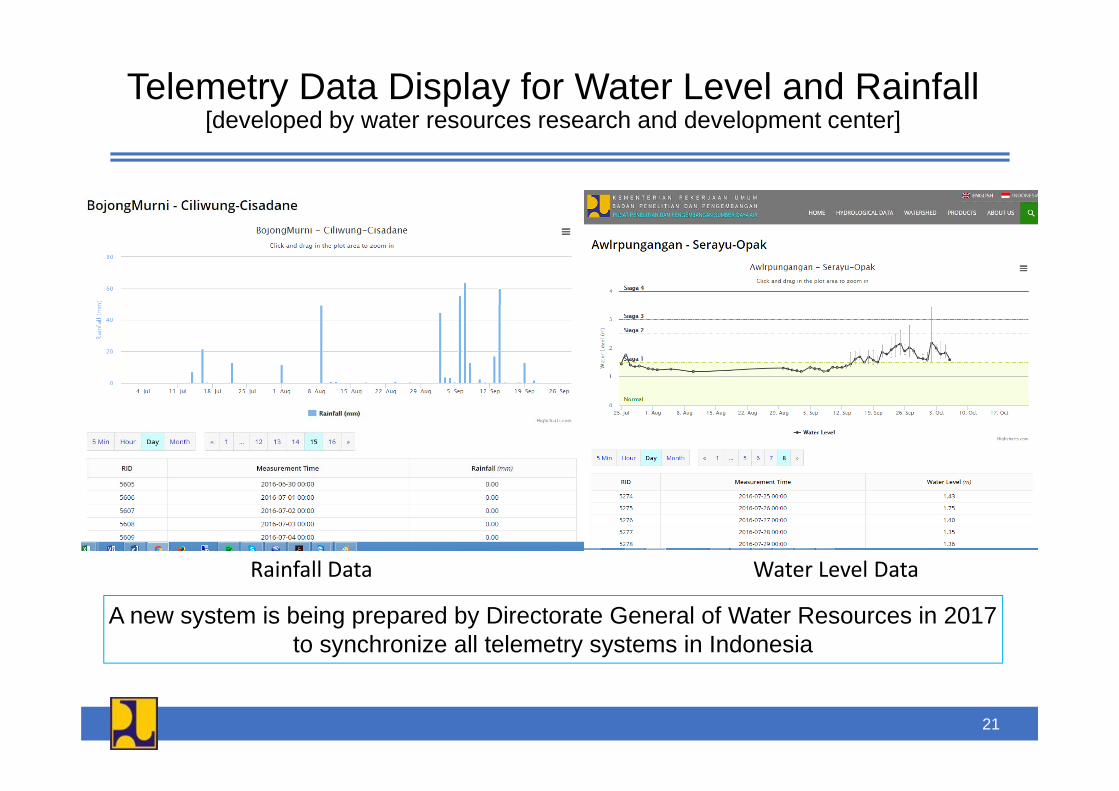
Telemetry Data Display for Water Level and Rainfall[developed by water resources research and development center][developed by water resources research and development center]
Rainfall Data Water Level DataRainfall Data Water Level Data
A new system is being prepared by Directorate General of Water Resources in 2017to synchronize all telemetry systems in Indonesia
21
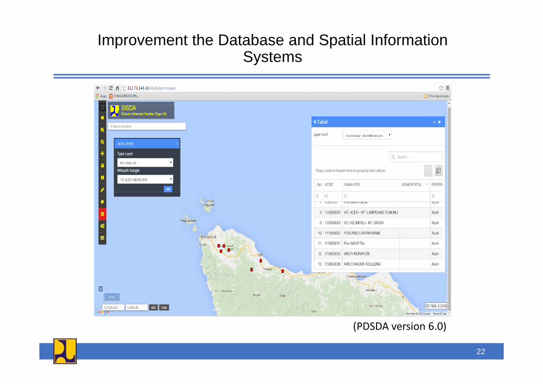
Improvement the Database and Spatial Information SystemsSystems
(PDSDA i 6 0)(PDSDA version 6.0)
22
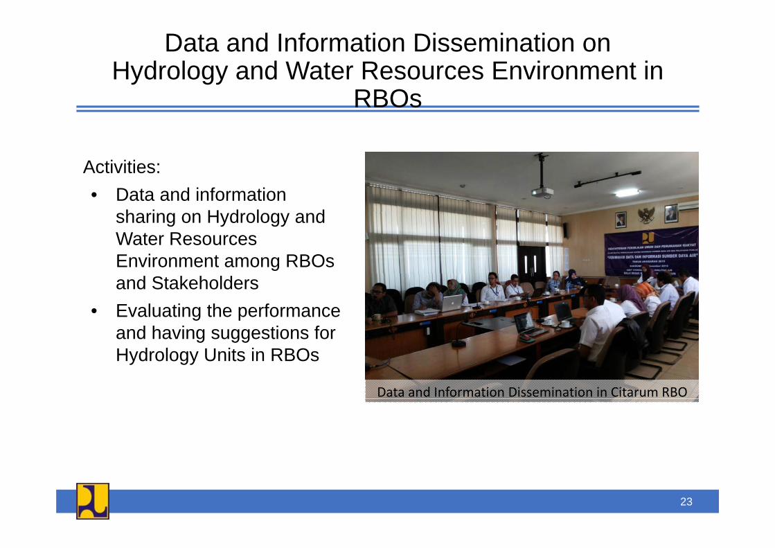
Data and Information Dissemination onHydrology and Water Resources Environment in
RBOs
Activities:• Data and information
h i H d l dsharing on Hydrology and Water Resources Environment among RBOs and Stakeholders
• Evaluating the performance and having suggestions for
Data and Information Dissemination in Citarum RBO
and having suggestions for Hydrology Units in RBOs
23

Information System Management on Hydrology, Hydrometeorology and Hydrogeology (H3)Hydrometeorology and Hydrogeology (H3)
G l M i i tit ti th H3 i f tiGoals:1. To improve the H3 data and
information accuracy, correctness
Main institutions on the H3 informationsystem management:1. Ministry of Public Works and
and timeliness of the submission.2. To ensure continual services of the
H3 data and information.
Housing2. Meteorology, Climatology and
Geophysics Agency3. To guarantee the compatibility of the
H3 data and information processingin related institutions.
p y g y3. Ministry of Energy and Mineral
Resourcesin related institutions.
4. To ensure sustainability the H3 dataand information services which issupported by the availability ofsupported by the availability ofadequate resources.
24
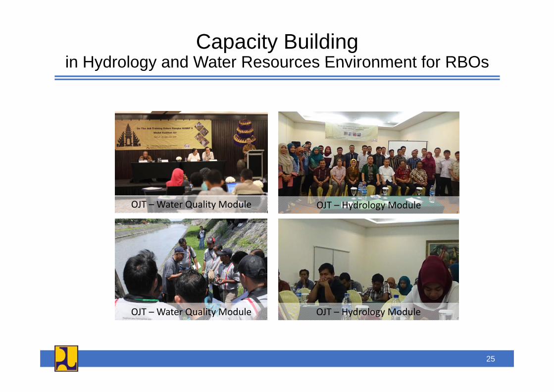
Capacity Buildingin Hydrology and Water Resources Environment for RBOsin Hydrology and Water Resources Environment for RBOs
OJT – Water Quality Module OJT – Hydrology Module
OJT – Water Quality Module OJT – Hydrology Module
25

Pilot Project :Flood Early Warning System in Citarum River Basin
[i ti ith KOICA][in cooperation with KOICA]
Hydrological stations CCTVLocationHydrological stations CCTVLocation
Present : Rain 25, W.L. 20New : Rain 13, W.L. 8
2 Flood Watch CamerasPtoP method
Warning Post
LED Display Board
At 5 vulnerable areaMosque’s speakers if possible
Delivering RT flooding informationEvacuation alert forvacuation alert forresidents
26
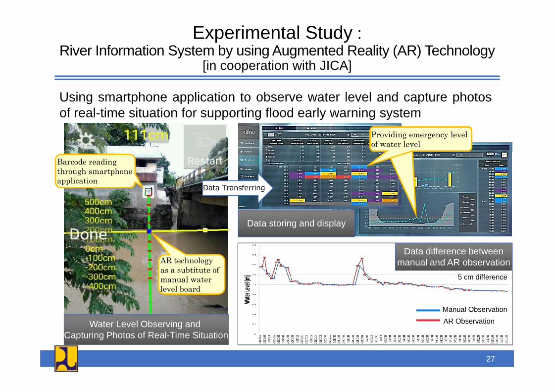
Experimental Study :River Information System by using Augmented Reality (AR) Technology
[i ti ith JICA][in cooperation with JICA]
Using smartphone application to observe water level and capture photosof real-time situation for supporting flood early warning system
Providing emergency level of water levelProviding emergency level of water level
Barcode reading through smartphone application
Data Transferring
Data storing and display
5 cm difference
AR technology as a subtitute of manual water
Data difference betweenmanual and AR observation
Manual ObservationAR Observation
level board
Water Level Observing and Capturing Photos of Real-Time Situation
27
28
Thank You
Directorate General of Water Resources | Directorate of Water Resources Management