state of the map us 2015
TRANSCRIPT
Mobile Data, Maps, &
Place Attachment
Tyler Bell@twbell
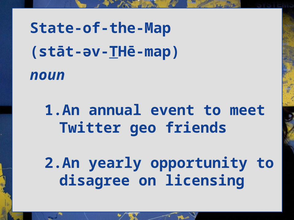
State-of-the-Map
(stāt-əv-T͟� Hē-map)
noun
1. An annual event to meet T͟witter geo friends
2. An yearly opportunity to disagree on licensing

Do You View 'Mapping' as T͟his….
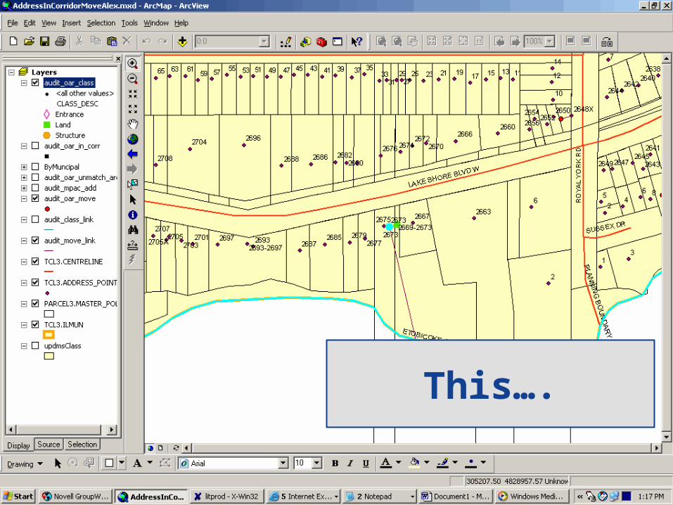
T͟his….
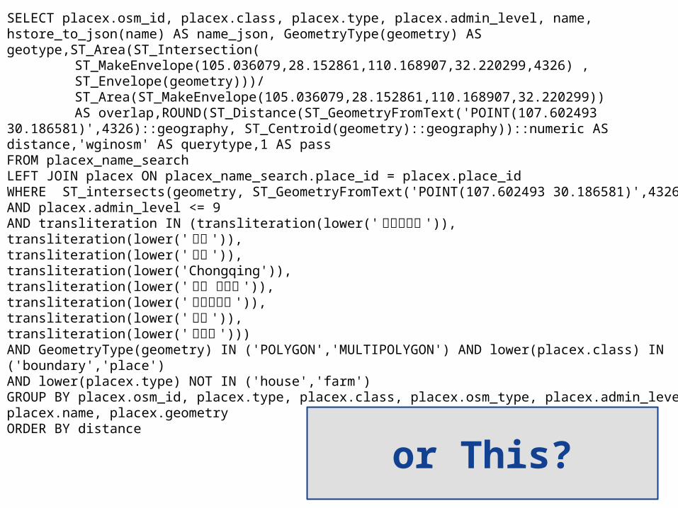
SELECT placex.osm_id, placex.class, placex.type, placex.admin_level, name, hstore_to_json(name) AS name_json, GeometryType(geometry) AS geotype,ST_Area(ST_Intersection(
ST_MakeEnvelope(105.036079,28.152861,110.168907,32.220299,4326) , ST_Envelope(geometry)))/ST_Area(ST_MakeEnvelope(105.036079,28.152861,110.168907,32.220299)) AS overlap,ROUND(ST_Distance(ST_GeometryFromText('POINT(107.602493
30.186581)',4326)::geography, ST_Centroid(geometry)::geography))::numeric AS distance,'wginosm' AS querytype,1 AS passFROM placex_name_searchLEFT JOIN placex ON placex_name_search.place_id = placex.place_idWHERE ST_intersects(geometry, ST_GeometryFromText('POINT(107.602493 30.186581)',4326)) AND placex.admin_level <= 9 AND transliteration IN (transliteration(lower('重庆直辖市 ')),transliteration(lower('重庆 ')),transliteration(lower('重慶 ')),transliteration(lower('Chongqing')),transliteration(lower(' 重慶直轄市 ')),transliteration(lower('じゅうけい ')),transliteration(lower('충칭 ')),transliteration(lower('重慶市 '))) AND GeometryType(geometry) IN ('POLYGON','MULTIPOLYGON') AND lower(placex.class) IN ('boundary','place') AND lower(placex.type) NOT IN ('house','farm')GROUP BY placex.osm_id, placex.type, placex.class, placex.osm_type, placex.admin_level, placex.name, placex.geometryORDER BY distance
or T͟his?

Consumer-FocusedSensor Platform

'Classic' Geofencing

T͟he understanding of a 'user' is Informed by the
Map
Increasingly, the Map is Informed by T͟he User
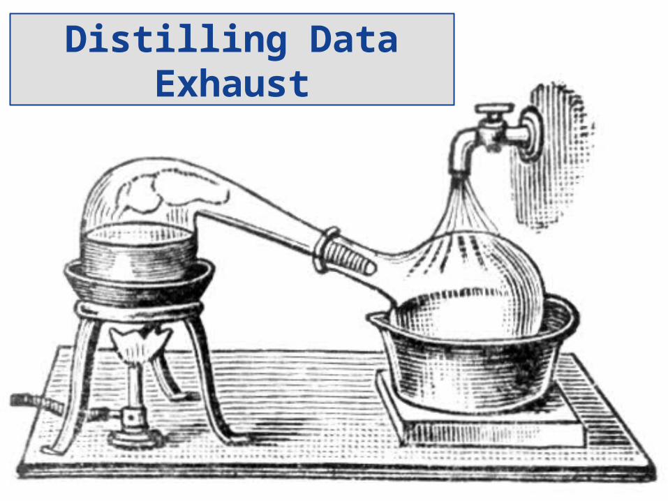
Distilling Data Exhaust
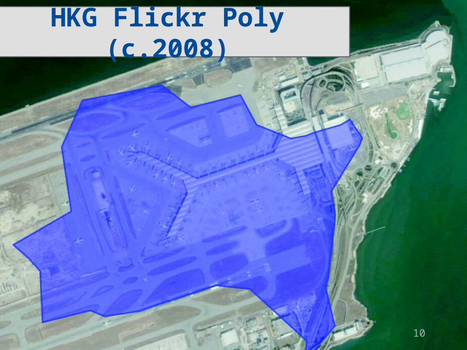
HKG Flickr Poly (c.2008)
10
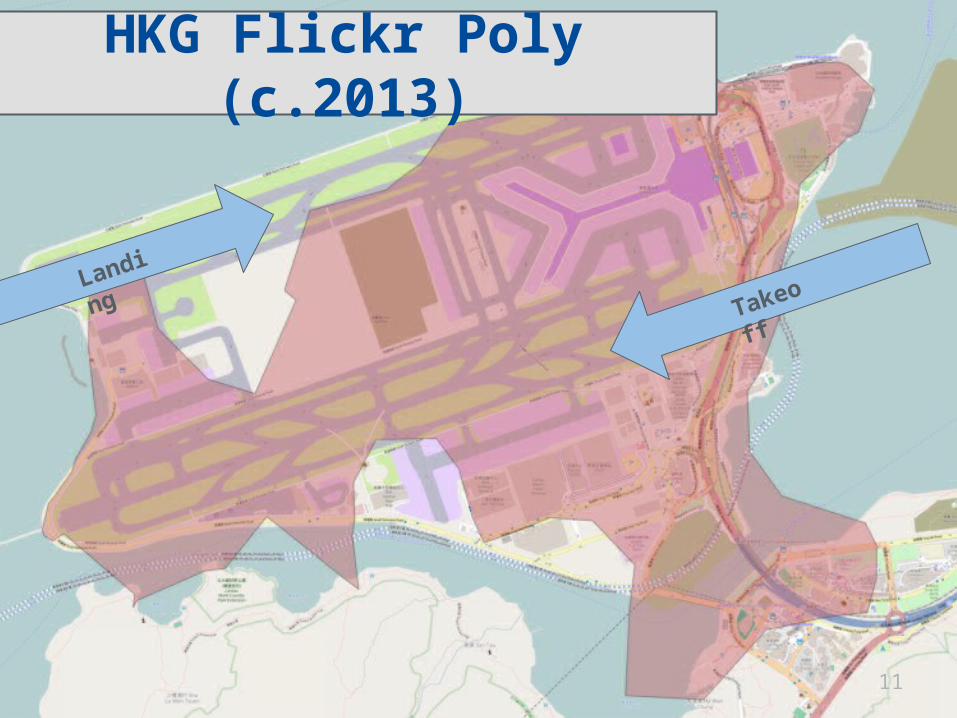
11
TakeoffLand
ing
HKG Flickr Poly (c.2013)
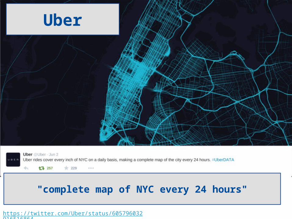
https://twitter.com/Uber/status/605796032916516864
Uber
"complete map of NYC every 24 hours"

Marketing...

...and Ad T͟ech

"Google 'near me' searches have increased 34x since 2011, and nearly doubled since 2014"
-Google (natch)
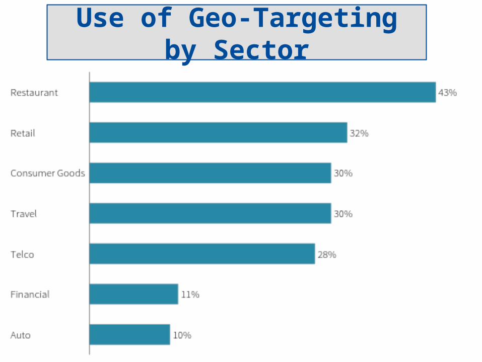
Use of Geo-T͟argeting by Sector

Apps are a Massive Data Source
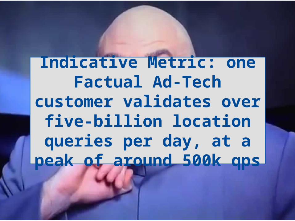
Indicative Metric: one Factual Ad-T͟ech customer validates over five-billion
location queries per day, at a peak of around 500k qps
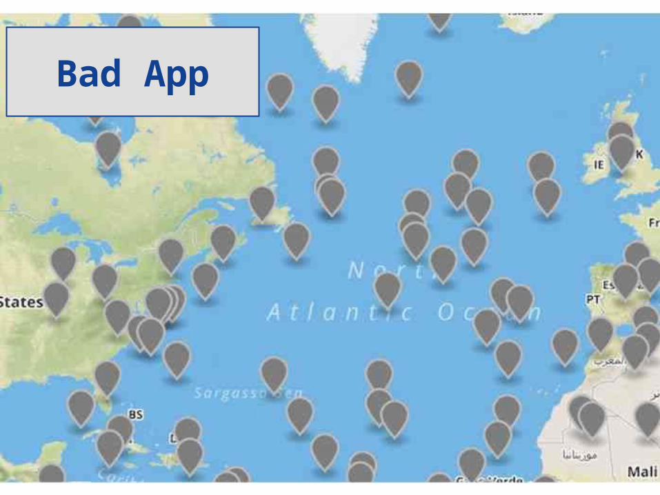
Bad App
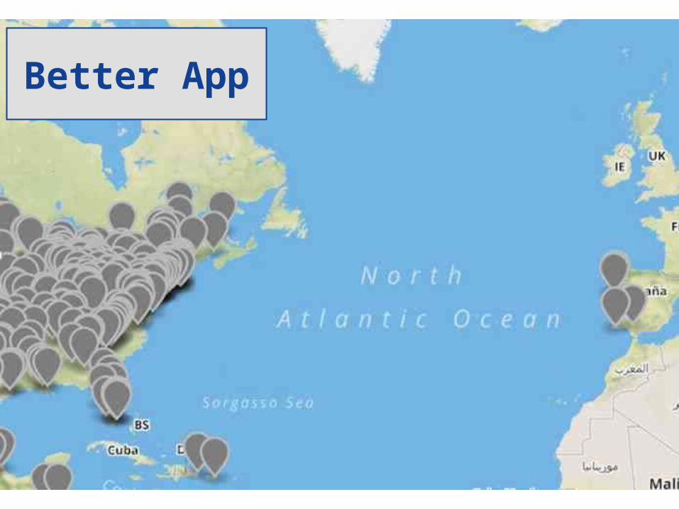
Better App
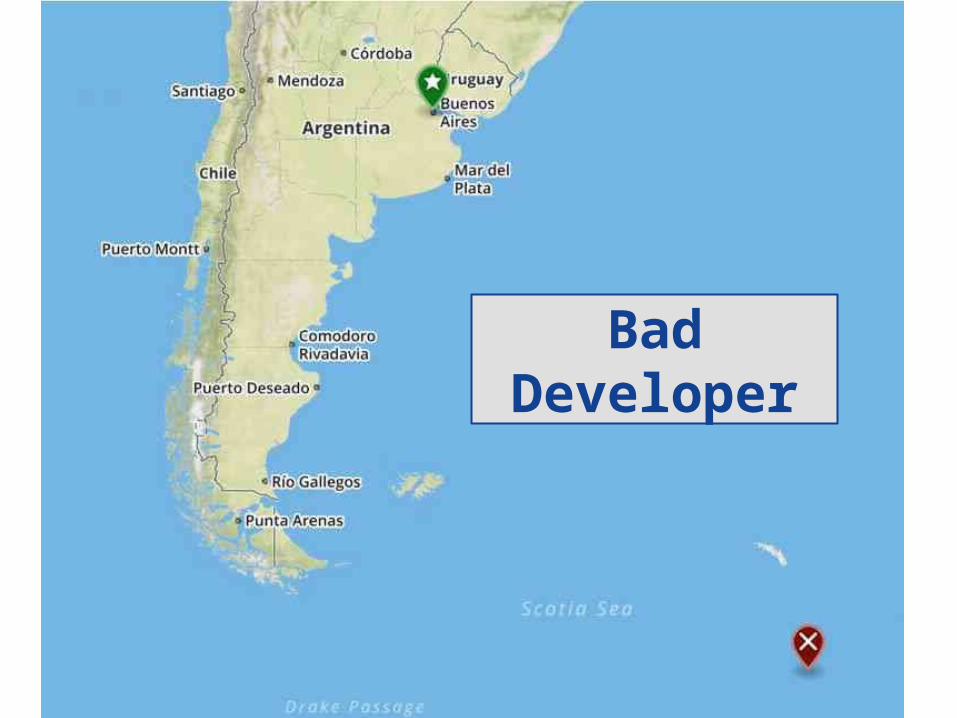
Bad Developer
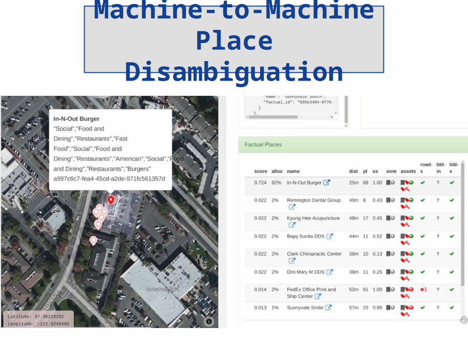
Machine-to-MachinePlace Disambiguation
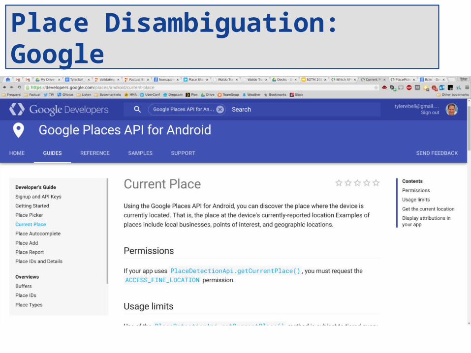
Place Disambiguation: Google
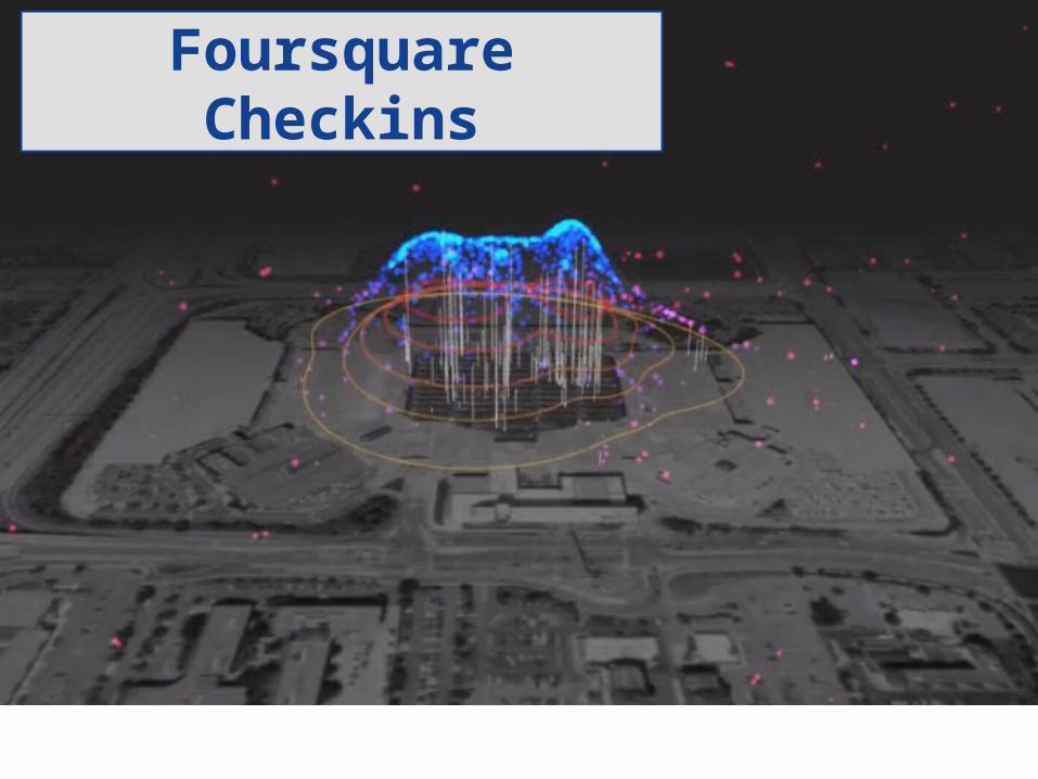
Foursquare Checkins

Uber Pins
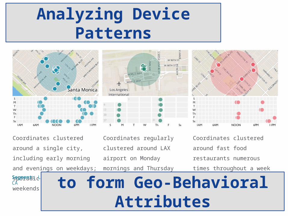
Coordinates regularly clustered
around LAX airport on Monday
mornings and Thursday evenings
Coordinates clustered around fast
food restaurants numerous times
throughout a week
Coordinates clustered around a
single city, including early morning
and evenings on weekdays; sporadic
usage on weekends
Segment: Lives in Santa Monica, CA Segment: Business Traveler Segment: Quick-Serve Restaurant Diner
Analyzing Device Patterns
to form Geo-Behavioral Attributes
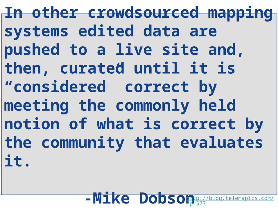
In other crowdsourced mapping systems edited data are pushed to a live site and, then, curated until it is “considered” correct by meeting the commonly held notion of what is correct by the community that evaluates it.
-Mike Dobsonhttp://blog.telemapics.com/?p=577

"Kind of Like a Ping-Pong Match"

(More Like a Forge)

T͟yler Bell@twbell
T͟hanks