standards for kytc road centerlines · pdf filestandards for kytc road centerlines version 1.1...
TRANSCRIPT

Standards forKYTC Road Centerlines
Version 1.1
June 19, 2003
Kentucky Transportation Cabinet Office of Technology Engineering and GIS Branch
Office of Program Planning and Management, Division of Planning

Standards for KYTC Road Centerlines Version 1.1
Kentucky Transportation CabinetOffice of Technology Office of Program Planning and
Engineering and GIS Branch Management, Division of Planningi
CONTENTS
GENERAL ...................................................................................................................................... 1OBJECTIVES ............................................................................................................................. 1CONSTRAINTS ......................................................................................................................... 2
Access Constraints .................................................................................................................. 2Use Constraints ....................................................................................................................... 2
DISCLAIMER ............................................................................................................................ 2DEFINITIONS............................................................................................................................ 2
SPECIFICATIONS ......................................................................................................................... 6PRODUCT DESCRIPTION ....................................................................................................... 6
Current Products...................................................................................................................... 6Future Products ....................................................................................................................... 6
GEOGRAPHIC EXTENT........................................................................................................... 7COORDINATES & DATUM..................................................................................................... 7
METHODOLOGY.......................................................................................................................... 9COLLECTION METHODS ....................................................................................................... 9
Previous Collection Methods .................................................................................................. 9New Data Collection Methods ................................................................................................ 9
DATA CLEAN-UP................................................................................................................... 10ACCURACY VERIFICATION................................................................................................ 10
Horizontal Accuracy Verification Methods .......................................................................... 10Accuracy Statement............................................................................................................... 11
KYTC ROAD CENTERLINE FILE FORMATTING ............................................................. 11CODING CONVENTIONS FOR LRS_ID............................................................................... 16
Valid COUNTY Numbers..................................................................................................... 16Valid Route PREFIX Abbreviation Values: ......................................................................... 17Valid PARKWAY Route Designations: ............................................................................... 17Valid Route NUMBER ......................................................................................................... 17Valid SUFFIX Abbreviations Values: .................................................................................. 18Valid Section (Couplet) -ID Values: ..................................................................................... 18
ROAD AND STREET NUMBERING CONVENTIONS........................................................ 21Numbering City Streets......................................................................................................... 21Federal Agency Roads .......................................................................................................... 22Private Roads......................................................................................................................... 22County Roads ........................................................................................................................ 22
DELIVERED FILE FORMATS ................................................................................................... 23CONTACT INFORMATION....................................................................................................... 24REFERENCES.............................................................................................................................. 25APPENDIX I: Table of County Numbers and FIPS Codes .......................................................... 26
Format of document following a modified format of the USGS’ Standard for DOQQs < http://giac.state.ky.us/giac_standards_doq.htm>

Standards for KYTC Road Centerlines Version 1.1
Kentucky Transportation CabinetOffice of Technology Office of Program Planning and
Engineering and GIS Branch Management, Division of Planning
1
GENERAL
OBJECTIVES
The Kentucky Transportation Cabinet (KYTC) is recognized as the lead agency for the collection anddistribution of statewide road centerline data. The standards specified in this document pertain to thecollection, processing, quality control and distribution of road centerline data. KYTC centerline dataproduced to this standard are shared as one of the Kentucky Statewide Digital Basemap Layers.
A statewide digital road centerline map layer has been in existence since 1991. This has been widelyavailable to external (non-KYTC) users since 1994. The current standard is a set of centerlinecoverages based from USGS topographic maps (1:24,000) combined into county-based files formaintenance and storage. These are being replaced by Global Positioning System (GPS)-basedcoverages (< 4-meter accuracy). The conversion process should be completed by mid-2004.
This document will detail data structure and both old and new collection, processing, and distributionmethods. The initiative by the Cabinet’s Division of Planning to accurately locate (GPS) all publicroads is a tremendous boon for the entire state. While this initiative is driven and defined by theCabinet’s internal needs, it is recognized that it will continue to have significant benefits to a broadrange of external agencies and individuals.
This document acts as both a standard and a general metadata document. The standard aspect iscritical for building road GIS information that can be incorporated into a statewide dataset. In order tounderstand some of the idiosyncrasies of the standard it is necessary to incorporate the metadataaspect of the document. This provides users with guidelines for evaluating and using the roadcenterlines. Current and future centerlines are a conglomeration from many different sources withvarying collection methods and accuracies. Users must be aware of the data’s strengths and knownlimitations. It is the user’s responsibility to properly employ the data.
This effort to build a statewide road centerline standard, database, and associative metadata supportsthe Governor’s Office of Technology’s (GOT) effort to build enterprise based information systems.KYTC’s statewide road centerline GPS effort along with this documentation and the KYTCinformation distribution method follows GOT’s guiding principles found within the StrategicInformation Technology Plan:
1. Support the business objectives of Commonwealth Government;2. Conduct Commonwealth business electronically;3. Treat information as a strategic resource;4. View technology investments from an enterprise perspective; and,5. Ensure electronic access to information and services while assuring privacy.
(See http://www.state.ky.us/kirm/edspol.htm )

Standards for KYTC Road Centerlines Version 1.1
Kentucky Transportation CabinetOffice of Technology Office of Program Planning and
Engineering and GIS Branch Management, Division of Planning
2
CONSTRAINTS
Access ConstraintsThis data set is publicly accessible via the Office of Geographic Information’s web site:http://www.state.ky.us/agencies/finance/depts/ogis/gisdept.htm
Use ConstraintsThis data is intended for general use. No restrictions are set upon it. See disclaimer and accuracystatements below for guidance on use.
DISCLAIMER
While all attempts are made to insure the correctness and suitability of information under KYTC'scontrol and to correct any errors brought to their attention, no representation or guarantee can be madeas to the correctness or suitability of that information or any linked information presented, referenced,or implied. All critical information should be independently verified. Any questions should bedirected to the administrator/s of this or any other specific datasets.
DEFINITIONS
Accuracy - This is an indication of how close a measurement is to the true value. The best accuracyany GPS receiver can expect to attain depends on the quality of the receiver, position of the satellites,environmental variables (weather, sunspots, terrain, etc.) and Selective Availability (SA). Greateraccuracy is obtained when the occupation time is increased and differential correction techniques areapplied. (See KYTC, Planning 2002).
ADD - Area Development District
ASPEN® - Software is Trimble's GIS data collection and data maintenance tool that runs on pen ornotebook computers. It is used in the field while collecting GPS data. (Seehttp://www.trimble.com/aspen.html )
Attribute - These are characteristics of features in a Geographic Information System (GIS). Everyidentifiable feature has attributes. One common attribute of all survey features is geographic position.Other attributes depend on the type of feature. For example, a road has a name or designation number,surface type, etc. Each attribute has a range of possible values, called a domain. (See KYTC, Planning2002).
Cardinal Direction - The direction a road is mile pointed. On state maintained roads, the origin isfrom the county line or beginning point to an ending mile point at another location, as described in theOfficial Orders for the county. This, generally, is north or eastbound. On city streets or county roadsthe cardinal direction is the direction of traffic flow away from a US, state or more highly traveledcounty road toward a lesser traveled street, county road or dead end. If you have a local road traveling

Standards for KYTC Road Centerlines Version 1.1
Kentucky Transportation CabinetOffice of Technology Office of Program Planning and
Engineering and GIS Branch Management, Division of Planning
3
between two roads of equal system level (i.e. US Highway to US Highway), then the origin pointwould be from the lower numbered road (Figure 1). When referring to one way streets, it is thedirection of traffic flow.
Figure 1 Cardinality Rules Example
Control Point (NGS Control Point) - An accurately known reference point used for comparing tofield data. Control points must achieve an accuracy level of Horizontal B-order stations (a relativeaccuracy of 8 mm +/- 1:1,000,000 relative to other A-order and B-order stations). (See KYTC,Planning 2002 AND http://ngs.state.ky.us/).
County Number - is a three digit number (001 – 120) assigned to each county in Kentucky based onits position in alphabetical order (See County Prefix Section below, Appendix I & GOT 1999:32).
County Quadrant (Quad or County Quad) - This is an arbitrary splitting of a county into fourquadrants for road name indexing purposes for the KYTC Division of Rural and Municipal Aid. The
CR-1160A
CR
-1160B
US 25
US 421
CR-1160A
US
25

Standards for KYTC Road Centerlines Version 1.1
Kentucky Transportation CabinetOffice of Technology Office of Program Planning and
Engineering and GIS Branch Management, Division of Planning
4
numbering starts in the Northeast quadrant and progresses clockwise. There is no intended correlationwith USGS 7.5’ topographic quad boundaries, if any occurs it is purely coincidental.
Couplet-ID - is the traditional name for a marker in the road identification field (LRS_ID) thatindicates a non-standard configuration of the roadway. For example non-cardinal divided highways,cross-overs, connectors, rest areas, weigh stations, etc.. Its position in the LRS_ID is after the suffix.The “Couplet-id” is being replaced by the Section-ID (see below).
Coverage – A digital version of a map layer forming the basic unit of vector data storage forARC/INFO. A set of thematically associated data considered as a unit. A coverage usually representsa single theme such as soils, streams, roads, or land use. ((See ESRI 1994:Glossary –14)
Data Dictionary - Information that describes features located in the field is the data dictionary. Thisdescription includes data type classification (point, line, or area), attribute names, attribute types, anda list of valid attribute values. After being created, a data dictionary is downloaded to a data loggerand used when collecting data in the field. (See KYTC, Planning 2002).
DD - Abbreviation for Geographic Coordinates stored in Decimal-Degrees.
Differential GPS (DGPS) - The term "differential" is generally used with pseudorange methods,which resolve the errors in a single position. One of these methods is real-time DGPS, which resolvethe errors in real time, in contrast to the approach of relative GPS. This is achieved by clearacquisition (C/A) code-phase (pseudo-range) error measurements at one or more stations andtransmitting the data to the remote station(s). (See KYTC, Planning 2002).
DMS - Abbreviation for Geographic Coordinates stored in Degrees-Minutes-Seconds.
Domain - The range of possible values for an attribute.
Epoch - This is the measurement interval of a GPS receiver. (See KYTC, Planning 2002).
ESRI - Environmental Systems Research Institute. Their software suite is defined as the standard forGIS in Kentucky State Government. (See www.ESRI.com ).
GIS - A Geographic Information System is an organized collection of computer hardware, software,geographic data, and personnel designed to efficiently capture, store, update, manipulate, analyze, anddisplay all forms of geographically referenced information.
GPS - Global Positioning System is a tool for determining your location on the earth. It is based on aconstellation of 24 satellites sending very precise time signals. Differences between these signalsallow the GPS unit to triangulate its location.
GPS Pathfinder Office - Software used in the office for preparation for and post-GPS-fieldwork datamanipulation in preparation of importing into a GIS.(See http://www.trimble.com/pathfinderoffice.html)

Standards for KYTC Road Centerlines Version 1.1
Kentucky Transportation CabinetOffice of Technology Office of Program Planning and
Engineering and GIS Branch Management, Division of Planning
5
GRS(80) - The spheroid used in the Kentucky State Plane Coordinate System Projection.
HIS - Kentucky Transportation Cabinet’s Oracle-based Highway Information System. It is theCabinet’s main repository for highway attribute information.
Local Road - Non-state maintained road. (See KYTC, Planning 2002).
National Standard For Spatial Data Accuracy (NSSDA) - implements a well-defined statistic andtesting methodology for positional accuracy of maps and geospatial data derived from sources such asaerial photographs, satellite imagery, or maps. Accuracy is reported in ground units. The testingmethodology is a comparison of a dataset’s coordinate values with coordinate values from a higheraccuracy source for points that represent features readily visible or recoverable from the ground. (Seehttp://www.fgdc.gov/standards/status/sub1_3.html )
Non-cardinal Direction - The direction that is opposite to the cardinal direction. This term is primarilyused to refer to the traffic flow lanes of a divided road that are not in the cardinal direction.
Official Order – in this context, it is a legal document prepared by the Division of Planning (approvedby the Commissioner of Highways or an authorized representative), that officially modifies the StatePrimary Road System, the National Truck Network, or the Scenic Highways and Byways Program.Possible modifications may include to accept, transfer, reclassify, close, redefine and/or re-describevarious routes. NOTE: there are many other sources of Official Orders within the Cabinet that do notimpact the GIS/GPS effort. These others are not intended to be referenced here and would not meetthe above definition.
Private Road - A road is considered a private road if it; (1) serves only one home, business, or otherfacility, (2) Is signed as private, (3) is closed to the public by a gate or chain, unless it is maintainedby a public authority (i.e. cemetery road owned by a local government or a county park) or (4) isimpassable to a standard highway vehicle. All private roads within the KYTC coverages/shapefiles areaccessible to the public. (See KYTC, Planning 2002).
Public Road - A “Public Road” is any road that is open to public travel. Examples include: statemaintained roads, county maintained roads, state park roads, city streets, federally owned roads (forestservice, national park, etc.), private roads, private subdivision roads, coal mine owned roads (open topublic travel). (See KYTC, Planning 2002).
Road Centerline - This is a representation of a road with the spatial position following theapproximate center of the road. It is commonly used on small-scale maps to represent roads.
Section-ID - is the name for a marker in the road identification field (LRS_ID) that indicates a non-standard configuration of the roadway. For example non-cardinal divided highways, cross-overs,

Standards for KYTC Road Centerlines Version 1.1
Kentucky Transportation CabinetOffice of Technology Office of Program Planning and
Engineering and GIS Branch Management, Division of Planning
6
connectors, rest areas, weigh stations, etc.. Its position in the LRS_ID is after the suffix. The “Section-ID replaces the Couplet-id” (see discussion in the “Valid Section-ID Values” below).
Selective Availability (SA) - Artificial degradation of the satellite signal by the United States ofAmerica Department of Defense. It has been turned off and so is not currently an issue on GPSaccuracy. It could be turned back on with an executive order by the President.
Shapefile - An ESRI-based file format for storing spatially enabled data. See the “ESRI ShapefileTechnical Description.” It can be found on the ESRI web site (Seehttp://www.esri.com/library/whitepapers/pdfs/shapefile.pdf )
State Road - A road that is under jurisdictional and operational control of the Commonwealth ofKentucky.
WGS-84 - The World Geodetic System (1984) is the mathematical ellipsoid used by GPS since 1984.Data captured by WGS(84) varies positionally from GRS(80) referenced data by approximately 1meter.
SPECIFICATIONS
PRODUCT DESCRIPTION
Current ProductsKYTC has developed road centerline GIS files for all publicly accessible roads in Kentucky. KYTCshares the road data via OGI using two statewide map layers: state-maintained roads (staterds) andlocal roads (localrds). These are also broken down and shared by county (naming conventions aredescribed in the Delivered File Formats Section).
Future ProductsIn the near future KYTC will be delivering a single statewide map layer that combines both local andstate-maintained roads into one map layer. County-level breakdowns of this will still be provided aswell.
Standards for KYTC Road Centerlines Version 1.1
Kentucky Transportation CabinetOffice of Technology Office of Program Planning and
Engineering and GIS Branch Management, Division of Planning
7
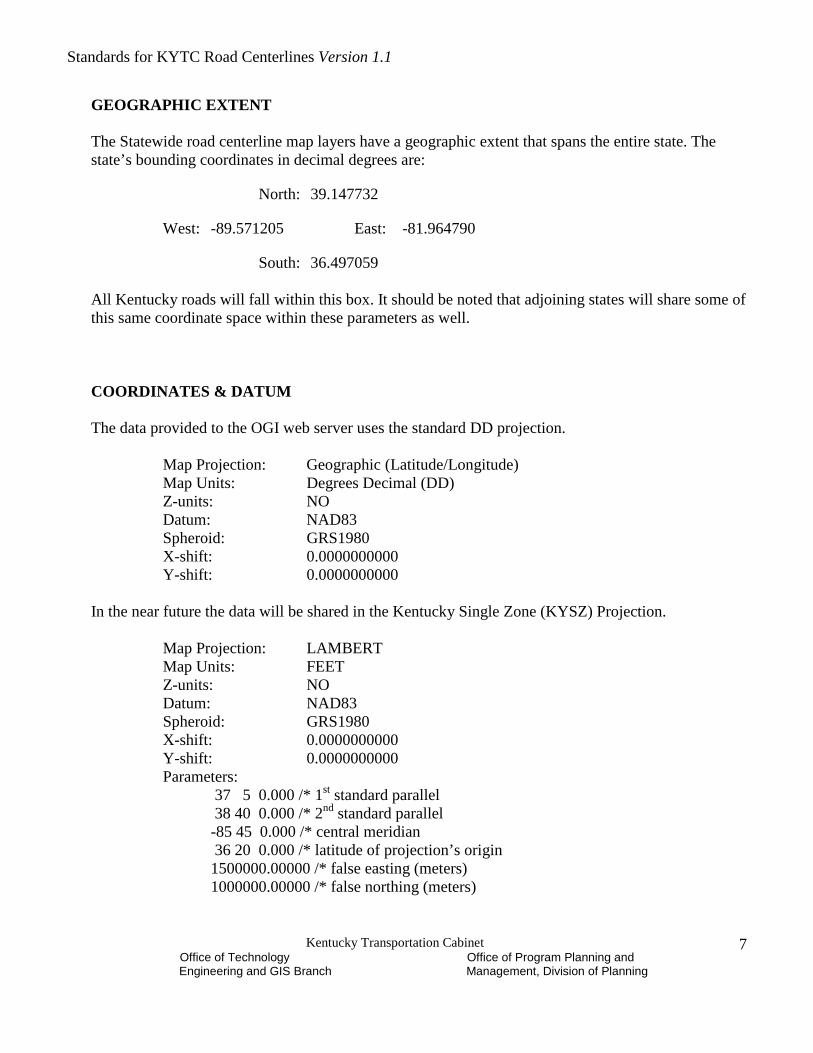
GEOGRAPHIC EXTENT
The Statewide road centerline map layers have a geographic extent that spans the entire state. Thestate’s bounding coordinates in decimal degrees are:
North: 39.147732
West: -89.571205 East: -81.964790
South: 36.497059
All Kentucky roads will fall within this box. It should be noted that adjoining states will share some ofthis same coordinate space within these parameters as well.
COORDINATES & DATUM
The data provided to the OGI web server uses the standard DD projection.
Map Projection: Geographic (Latitude/Longitude)Map Units: Degrees Decimal (DD)Z-units: NODatum: NAD83Spheroid: GRS1980X-shift: 0.0000000000Y-shift: 0.0000000000
In the near future the data will be shared in the Kentucky Single Zone (KYSZ) Projection.
Map Projection: LAMBERTMap Units: FEETZ-units: NODatum: NAD83Spheroid: GRS1980X-shift: 0.0000000000Y-shift: 0.0000000000Parameters:
37 5 0.000 /* 1st standard parallel 38 40 0.000 /* 2nd standard parallel-85 45 0.000 /* central meridian 36 20 0.000 /* latitude of projection’s origin1500000.00000 /* false easting (meters)1000000.00000 /* false northing (meters)

Standards for KYTC Road Centerlines Version 1.1
Kentucky Transportation CabinetOffice of Technology Office of Program Planning and
Engineering and GIS Branch Management, Division of Planning
8
NOTE: Due to a software limitation in ArcView 3.2 and ArcMap 8.1.2 one must tweak the view frameprojection definition in order to overlay DD vector data onto KY1Z raster data. Convert the FalseNorthings and Eastings to US Survey feet to match the map units:
False Northing = 3280833.33333 (USFt)False Easting = 4921250.00000 (USFt)
The base data is stored and edited in the standard State Plane projections:
State Plane - NORTHMap Projection: STATEPLANEZone: 3976Datum: NAD83 (NADCON)Z-units: NOUnits: FEET (US Survey)Spheroid: GRS1980X-shift: 0.0000000000Y-shift: 0.0000000000
State Plane - SOUTHMap Projection: STATEPLANEZone: 4001Datum: NAD83 (NADCON)Z-units: NOUnits: FEET (US Survey)Spheroid: GRS1980X-shift: 0.0000000000Y-shift: 0.0000000000
The GPS-ed data is originally collected in Latitude/Longitude (DMS).
Map Projection: Geographic (Latitude/Longitude)Map Units: Degrees (DMS)Z-units: METERSDatum: WGS(84)Spheroid: WGS(84)X-shift: 0.0000000000Y-shift: 0.0000000000

Standards for KYTC Road Centerlines Version 1.1
Kentucky Transportation CabinetOffice of Technology Office of Program Planning and
Engineering and GIS Branch Management, Division of Planning
9
METHODOLOGY
The centerline data goes through the following processes: data collection, data clean up, verification ofaccuracy, formatting into distributable GIS files, and publication/sharing. Due to the complexity ofbuilding the LRS_ID field, two independent sections (Coding Conventions for LRS_ID & RoadNumbering) are devoted to this. The following sections describe these individual processes.
COLLECTION METHODS
Both the previous (USGS Topographic Map-based) and current (GPS-based) collection methods aredescribed below. The new methods include the KYTC example for centerline collection that meets thedefined accuracy level.
Previous Collection MethodsIn the early 1990s, KYTC’s Division of Planning used the USGS 7.5’ Topographic Quadrangle(quads) maps as the foundation for digitizing all public roads within the state. The paper quads werescanned in and registered. Heads-up digitizing captured the roads from the quads into two coverages(state-maintained & local roads). The individual quads for each layer (state-maintained/local) wereknitted together to form county-level coverages for maintenance and distribution. New roads andalignment changes to the existing road layers were added using As-Builts, field maps, and a variety ofexternal agencies’ documents. A formal accuracy assessment methodology and statement were notdeveloped during this time period. See the Accuracy Section below for a general accuracy statementfor data collected using this methodology.
New Data Collection MethodsKYTC’s Division of Planning has defined the current accuracy criteria and methodology for roadcenterline data collection. While the majority of the fieldwork is being performed by external entities(commonly ADDs), each county’s centerline collection must conform to these criteria. There is someinclusion of alternative data collection methods (photogrammetry, etc.). However, all data to beincorporated into KYTC coverages must meet or exceed the accuracy level defined in this documentand are subject to independent accuracy validation. The methods described below are provided as asuccessful blueprint for collecting centerline data at the KYTC defined accuracy level.
KYTC Data Collection MethodAll public roads (defined above) are to be collected. The primary technology designated for use inroad centerline collection is GPS. A GPS unit is mounted on vehicles (with the antenna on the driver’sside) and roads are driven at normal traffic speeds. Antenna location on the vehicle & height (in feet& meters) is recorded in order to offset properly the centerline from the collection point. At least 95%of the mileage of all state maintained roads is located with differential GPS. At least 95% of the totalmileage should be collected with DGPS. KYTC and its current contractors are using ASPENsoftware for the collection of road centerline GPS data. Epoch recording rate is to be 1 second for allroads except for Interstates. The epoch rate for Interstate should be 5 seconds. This provides efficientdata capture while meeting the accuracy requirements.

Standards for KYTC Road Centerlines Version 1.1
Kentucky Transportation CabinetOffice of Technology Office of Program Planning and
Engineering and GIS Branch Management, Division of Planning
10
Alternative less accurate methods for collecting road position can be employed, such as DOQQs, butmust be identified in the “Mapsource” field of the raw GPS data and cannot exceed 5% of the totalmileage or 5% of the state maintained road mileage. See KYTC - Planning 2002.
Two important data attributes that should be addressed in field data collection are directionality andarc breaks. KYTC’s experience has found that more errors occur if these are left to the office cleanupphase.
Directionality: All non-divided state roads were driven in two directions and then collapsed togenerate a centerline. Divided Highways (where medians exist) were driven in both directions andthen retained separately in the coverage. All local and one-way roads were driven in one directionand the appropriate offset applied.
Arc Breaks: Arcs must break at pavement changes and the beginning and ending points of allramps, Y-intersections, crossovers, and connectors. (Post-fieldwork processing will add breaks atcity and county boundaries).
DATA CLEAN-UP
After field collection of GPS centerline data, it should be brought into a GIS and processed to removeobvious errors (both spatial and attribute). This involves cleaning up a variety of errors includingspatial (multipath, over and undershoots, arc directionality reversals, etc.) and attribute errors (data-entry miscoding, omission, transposition and “fat-finger”). The data is also compared to knowncontrol points and lines for spatial verification of accuracy (see accuracy section below).
ACCURACY VERIFICATION
Horizontal Accuracy Verification MethodsKYTC’s spatial accuracy verification methodology is an adoption of the National Standard For SpatialData Accuracy (NSSDA) testing methodology (FGDC-SBCD 1998:3-4). A minimum of 20 roadintersection control points is taken within each county using DGPS. These locations are distributedproportionately throughout each county to reflect the geographic area of interest and distribute anyerror. Each control point is monumented with a P-K (a hardened masonry nail with a central dimple)or MAG nail (magnetized nail that is detectable even if buried). A DGPS unit is mounted onto a tripodover the point and a minimum of 180 positions is taken using a 1-second point-logging interval.KYTC then randomly tests a subset of these control points for each county to corroborate accuracy ofthe centerlines. Please note that these control points are for GPS centerline accuracy testing purposesonly. They should not be used for land surveying purposes.

Standards for KYTC Road Centerlines Version 1.1
Kentucky Transportation CabinetOffice of Technology Office of Program Planning and
Engineering and GIS Branch Management, Division of Planning
11
Accuracy Statement
Previous Collection AccuracyFor the pre-GPS-ed road centerline data, the target horizontal accuracy for the road layers was1:24,000 (+/- 40 feet). Given the variety of sources for the data, it is recognized that the oldercenterlines do not always meet published national map accuracy standards.
Current Collection AccuracyFor data currently being collected and all GPS-based road centerline data, the KYTC Division ofPlanning uses the geospatial positional accuracy standards proposed by the Federal Geodetic ControlSubcommittee (FGCS 1994). Road centerline collection methods are based on pseudorangemeasurements (FGCS Classification Band IX). These differential GPS (DGPS) methods, either in postprocessed or real-time modes, normally provide a resulting horizontal accuracy of 0.500 – 2.000 meterradius of the relative positional error circle with a 95% confidence.
Initially, the target accuracy for new collection was sub-meter (< 1.0 meter) to two meters for allcenterlines in the state. However, due to terrain, satellite positions and other constraints, thesoutheastern part of the state is achieving only sub-4 meter accuracy consistently. With the currentlimitations, it is cost-prohibitive to achieve the additional accuracy in this area of the state.
KYTC ROAD CENTERLINE FILE FORMATTING
The KYTC road centerline structure has traditionally been based on an ArcInfo coverage model. Aroad centerline coverage must be structured to allow for use with the existing HIS database. The roadcenterlines maintain direction flows following the cardinality and arc break rules described above.
The table below describes the tabular data structure maintained in the state-maintained and local roadcoverages and corresponding shapefiles. Any data to be incorporated into the KYTC road centerlinedataset must have this structure.

Standards for KYTC Road Centerlines Version 1.1
Kentucky Transportation CabinetOffice of Technology Office of Program Planning and
Engineering and GIS Branch Management, Division of Planning
12
File Structure Description and Field Definitions
TABLE 1COLUMNPOSITION ITEM NAME WIDTH OUTPUT TYPE N.DEC
1 FNODE# 4 5 B -5 TNODE# 4 5 B -9 LPOLY# 4 5 B -
13 RPOLY# 4 5 B -17 LENGTH 8 18 F 525 COVER# 4 5 B -29 COVER-ID 4 5 B -
----Default ArcInfo items above this line -----------------------------------------33 LRS_ID 17 17 C -50 BEGIN_MP 7 7 N 357 END_MP 7 7 N 364 DRAWCODE 4 4 I -68 RD_NAME 40 40 C -
108 SURFTYPE 2 2 I -110 ROUTE 13 13 C -123 ROUTE_NBR 10 10 C -133 GRAPHIC_LEN_MI 7 7 N 3140 DMI_LEN_MI 7 7 N 3147 GOV_LEVEL 2 2 I -149 RSE_UNIQUE 17 17 C -166 LOCAL_KEY 50 50 C -216 CO_NUMBER 3 9 I -219 RT_PREFIX 2 9 C -221 RT_NUMBER 4 9 I -225 RT_SUFFIX 2 9 C -227 RT_SECTION 3 9 I -230 ROUTE_TYPE 4 10 C -234 ROUTE_LBL 9 9 C -243 SHIELD_LBL 6 6 C -249 CO_NAME 35 35 C -284 LAST_UPDT 8 10 D -292 OWNER_DATE 8 10 D -300 STATUS 25 25 C -325 KYGEONET 100 100 C -
Below is a data dictionary describing the fields in Table 1 (excluding the default ArcInfo Fields).

Standards for KYTC Road Centerlines Version 1.1
Kentucky Transportation CabinetOffice of Technology Office of Program Planning and
Engineering and GIS Branch Management, Division of Planning
13
LRS_ID - Linear Referencing System (LRS) Identifier - It corresponds to the HIS fieldRSE_UNIQUE and is part of a compound primary key. This compound key is comprised of theLRS_ID, BEGIN_MP and END_MP fields.
The LRS_ID is recorded as follows <CCC XX-YYYYZZ-NNN>. Its structure is a three-digitcounty number (CCC), white space (ASCII Character #32), route prefix (XX), dash, route number(YYYY), route suffix (ZZ), dash, section-ID (NNN). A “section-ID” (sometimes called a couplet-ID) designates highway network anomalies such as one-way streets, Y-intersections, etc.. Anexample of an LRS_ID for a segment of US Highway 127 in Franklin County is “037 US-127X-002”. NOTE: the LRS_ID field is a replacement to the RSE_UNIQUE. All future projectdevelopment should reference LRS_ID rather than the RSE_UNIQUE field.
BEGIN_MP - Beginning Milepoint - This data represents the official state beginning milepostvalue of a route. Example: 111.327
END_MP - End Milepoint - This data represents the official state ending milepost value of aroute. Example: 125.435
DRAWCODE - Drawing code represents highway system or pavement types. These values areused to produce colored lines during editing sessions and do not contain official highwaycharacteristic information. Seehttp://www.kytc.state.ky.us/planning/gisourky/Documents/RtPrefix.doc for a list of valid codevalues.
RD_NAME - Road Name - This is the unabbreviated, complete city street or county road name asdefined by the local authorities. There are two sources for road names. The County Physical Courtand the MSAG emergency database. These should be in agreement, but if the local authoritiescannot reach agreement the physical court name will be recorded.
SURFTYPE - Roadway surfacing type - Its corresponding HIS field is (SURFTYPE in PavementView). An additional KYTC reference document is the HIS- Inventory Types/Attributes/ValuesReport.
Values:20 Unimproved40 Soil, Gravel, or Stone52 Bituminous70 Concrete
ROUTE - This field is a textual highway route description without the county number. It is usedto label roadway graphics. NOTE: An item with the same name is found in the Route AttributeTable (RAT) and does not contain the same information. The RAT file represents unique state roaddesignations.
ROUTE_NBR - Route Number - This field is another text field containing the highway route

Standards for KYTC Road Centerlines Version 1.1
Kentucky Transportation CabinetOffice of Technology Office of Program Planning and
Engineering and GIS Branch Management, Division of Planning
14
number that is used to insert route labels into route shields for map labeling. This is composed of[RT_NUMBER + RT_SUFFIX + RT_SECTION] fields. It is different from the SHIELD_LBLfield because it includes the RT_SECTION which denotes non-cardinality and other roadanomolies.
GRAPHIC_LEN_MI - is the computed length of each arc (in miles). This is computed from thearc length in map units (feet) divided by 5280.
DMI_LEN_MI - This is the official length of the road based on an official order measured with aDistance Measuring Instrument (DMI). This data is computed by subtracting the ‘begin_mp’column from the ‘end_mp’.
GOV_LEVEL - is the ownership or government level of control for the roadway.Values:01 - State02 - County04 - City11 - State Park or State Forest12 - Local Park or Forest21 - Other State Agency Roads25 - Other Local Agency Roads26 - Private Roads60 - Other Federal Agency Roads64 - U S Forest Service Roads66 - National Park Service Roads70 - Military & Corps of Engineers Roads89 - New Location: Open to traffic, but not yet accepted98 - Route belongs to adjacent state (e.g. US-52, Grant Bridge, etc.)99 - New Location: Proposed or Under Construction
RSE_UNIQUE - this is the original linear referencing system identifier. It has been replaced onthe GIS side by the LRS_ID field. All future project development should reference LRS_ID ratherthan the RSE_UNIQUE field. See the LRS_ID description above.
LOCAL_KEY - this is a new field added (12/2001) in order to accommodate the incorporation oflocally collected data and to allow for external databases (like local address ranges) to be tied toKYTC spatial data. The field is intentionally large in order to accommodate a variety of possiblestructures for a unique ID.
If a local entity is in the process of developing a GIS, we recommend using the FIPS County Code(See Appendix I) plus a “-“ plus a five digit arbitrary number for each unique arc. The Structurewould look like “ These unique IDs should not be repeated and if an arc is split or combined withanother arc the unique ID should be retired and a new ID assigned.

Standards for KYTC Road Centerlines Version 1.1
Kentucky Transportation CabinetOffice of Technology Office of Program Planning and
Engineering and GIS Branch Management, Division of Planning
15
CO_NUMBER - County Number - is a three digit numeric code representing one of the 120counties of Kentucky. See Appendix I. This is the first part of the LRS_ID and RSE_UNIQUEfields.
RT_PREFIX - Route Prefix - is a one or two-digit designation that generally identified levels ofownership and specific types of roads. It is also an indicator of how a route is signed. This is thesecond part of the LRS_ID and RSE_UNIQUE fields.
RT_NUMBER - Route Number - is the official number of the road. It is a number with up to fourdigits. The number will not have leading zeros. This is the third part of the LRS_ID andRSE_UNIQUE fields.
RT_SUFFIX - Route Suffix - defines the subtype of road, such as a bypass, connector, etc.. Thisstring makes up the fourth part of the LRS_ID and RSE_UNIQUE fields.
RT_SECTION - Route Section ID - designates segments of particular roads as highway networkanomalies. Examples include one-way streets, Y-intersections, crossovers, etc.. This is the finalpart of the LRS_ID and RSE_UNIQUE fields.
ROUTE_TYPE - is a field to categorize roads for common mapping purposes. Valid abbreviationsand their types are:
• I - Interstate• US - US Highway• PKWY - Kentucky Parkway• KY - Other State Road• CNTY - County Road• CITY - City Street• PRIV - Private• OTHR - Other (Including Forest Service Roads and IC roads)
ROUTE_LBL - Route Label - is derived from [RT_PREFIX + "-" + RT_NUMBER +RT_SUFFIX] and would look like "US-460WB" or "KY-9A." This field has been added to aidusers who produce generalized maps. In some circumstances, this is better to label with than ashield. While some software can build multi-field labels, this is more CPU intensive than pullingfrom a single field and therefore effects performance for labeling on-the-fly.
SHIELD_LBL - Shield Label - This would be derived from [RT_NUMBER + RT_SUFFIX] andwould look like "460WB" for US 460 West Bypass or "9A" for Kentucky 9 Alternate. This fieldhas been added to aid users whose software will automatically label on the fly.
CO_NAME - County Name - (Stored in UPPERCASE). While it is recognized that this is aredundant field, it facilitates users querying and defining subsets of roads.
LAST_UPDT - Last Update - The date that the last changes were made to the record (spatial orarc attribute).

Standards for KYTC Road Centerlines Version 1.1
Kentucky Transportation CabinetOffice of Technology Office of Program Planning and
Engineering and GIS Branch Management, Division of Planning
16
In the initial loads of this field, GPS centerline loads will calculate a single date based on when theroads were collected. For non-GPS-ed counties during the initial load, it will be calculated fromthe fields to be deleted (LINKDATE or ORDERDATE) whichever is more recent. Note that errortrapping for "Null" or erroneous dates (> today e.g. 1/1/2099) needs to be in place for long termmaintenance.
OWNER_DATE - Date of arc's last recognition of its ownership status. Dates will be assigned asfollows. For state maintained roads, it will be the date of the Official Order. For county or cityroads, it will be the date the Fiscal Court signed off on ownership. Private roads will be assigneda date based on when the roads were last verified by local officials as private. During the initialload of this field, a global date of (1/1/2000) will be assigned. All subsequent road changes willresult in specific dates assigned to only the effected roads.
STATUS - The current status of the arc. Valid entries are:• Not Evaluated• Accepted• Rejected• To Be Deleted.
This field will allow the inclusion of arcs that have not been through the complete KYTCevaluation process. This is necessary to facilitate rapid inclusion of new roads to support local andstate emergency dispatch initiatives. All roads will be included in the KYTC review process, butlocal roads will not be addressed until their scheduled time in the update cycle. See furtherdiscussion of road update cycles in GIAC's Standards for Address-Enabled Road Centerlines(http://giac.state.ky.us/standards.htm).
KYGEONET - This field provides a link to published metadata on the Kentucky GeographyNetwork. This will encourage users to review the metadata and encourage appropriate use.
CODING CONVENTIONS FOR LRS_ID
The LRS_ID is part of the primary key for KYTC road information. The complete primary key isLRS_ID plus Begin_MP plus End_MP. This uniquely identifies exactly where information occursalong the roadways of Kentucky. Due to the importance and the complexity of the information withinthe LRS_ID, this section details the different pieces and their respective coding. Below are the validcodes for route prefixes, parkways, and suffixes. Seehttp://www.kytc.state.ky.us/planning/gisourky/Documents/RtPrefix.doc for additional reference.
Valid COUNTY NumbersSee GOT’s (1999:32) definition of valid county numbers and Appendix I below.

Standards for KYTC Road Centerlines Version 1.1
Kentucky Transportation CabinetOffice of Technology Office of Program Planning and
Engineering and GIS Branch Management, Division of Planning
17
Valid Route PREFIX Abbreviation Values:Federal Routes
I = InterstateUS = Federal RouteFD = Forest Service or Federal Agency
State RoutesKY = State RouteST = Other State AgencyIC = State Park RoadNL = New Location of State Highway not Officially Open
Local RoutesCR = County RoadCS = City Street
Private RoadsPR = Private RoadPV = Private DrivewayPS = Private Subdivision
Valid PARKWAY Route Designations:Parkways are special state routes designated by unique Route prefix (except for the MountainParkway and its extension) and a 9000 series route number. See the list below.
KY-9000 Bert T. Combs Mountain Parkway WK-9001 Wendell H. Ford Western Kentucky Parkway
BG-9002 Bluegrass ParkwayJC-9003 Julian M. Carroll ParkwayEB-9004 Edward T. Breathitt ParkwayAU-9005 Audubon ParkwayHR-9006 Hal Rogers Parkway (formerly Daniel Boone)WN-9007 William H. Natcher ParkwayLN-9008 Louie B. Nunn ParkwayKY-9009 Mountain Parkway Extension
Valid Route NUMBERThe number must be between 1 and 9,999. The leading zeros are dropped.

Standards for KYTC Road Centerlines Version 1.1
Kentucky Transportation CabinetOffice of Technology Office of Program Planning and
Engineering and GIS Branch Management, Division of Planning
18
Valid SUFFIX Abbreviations Values:(for State Maintained roads (Gov_Level = 01):
A - AlternateB - BypassC - ConnectorE - EastEX - East BusinessNL – New LocationS - SpurT – TruckW – WestWB - West BypassWX – West BusinessX – Business
Valid Section (Couplet) -ID Values:1 - 9 Non-Cardinal Sections
NOTE: In the example 003 US-127-1, the”-1” indicates a Section-ID that marks thenon-cardinal side of a state maintained route.
10 Non-Cardinal side of Divided Highway11-19 Rest Areas, Weigh Stations, Scenic Views in conjunction with Interstates and
Parkways20 - 29 Y's30 - 69 Crossovers70 - 79 Connectors80 - 99 Other: bays, cul-de-sacs, spurs, frontage roads, etc. plus any overflow from the above
111 - 999 Interchange rampThe consistent coding of interchanges is quite complex. Figure 2 (below) is anexample of the challenges of developing a method to consistently identify and recordinformation on or within interchanges.

Standards for KYTC Road Centerlines Version 1.1
Kentucky Transportation CabinetOffice of Technology Office of Program Planning and
Engineering and GIS Branch Management, Division of Planning
19
Figure 2: Example of the Challenges of Coding Ramp Information
Below is the system KYTC has developed to uniquely code each road segment within aninterchange. ( See http://www.kytc.state.ky.us/planning/gisourky/images/pdf/gps/ramps.pdf for avisual example )
The FIRST DIGIT is the Interchange Number - a sequential number increasing in the cardinaldirection from the county line.

Standards for KYTC Road Centerlines Version 1.1
Kentucky Transportation CabinetOffice of Technology Office of Program Planning and
Engineering and GIS Branch Management, Division of Planning
20
*NOTE: for routes with more than 9 interchanges in a county the SECOND Digit (codedwith a number between 5 and 8) in combination with the FIRST Digit is used to designatethe Interchange Number AND its Quadrant Number.
The SECOND DIGIT is the Quadrant Number - a sequential number starting to the right of thecardinal side of the primary route as it approaches and increasing counterclockwise from 1 to 4and 5 to 8 (for interchanges numbered above 9).
NOTES• If it is coded from 5 to 8 (to designate an interchange number greater than 9), subtract
4 from the coded number to get the true quadrant. Example: Coded = 7; TrueQuadrant is 3 (7-4 = 3).
• The numbers 0 and 9 are not allowed.
The THIRD DIGIT is the Ramp Location - a sequential number marking the ramp position. Theoutermost lane is assigned the number 1 with subsequent lanes assigned sequential numbers to theinside lane.
See Table 2 Below.

Standards for KYTC Road Centerlines Version 1.1
Kentucky Transportation CabinetOffice of Technology Office of Program Planning and
Engineering and GIS Branch Management, Division of Planning
21
Table 2 Examples of Sections/Couplets and What Their Coding Represents
Couplet
True Interchange Number
Assigned Interchange Number (First Digit)
True Quadrant Number
Assigned Quadrant Number (Second Digit)
Ramp Location (Third Digit) Comment
111 1 1 1 1 1112 1 1 1 1 2 Second ramp from outside lane 121 1 1 2 2 1131 1 1 3 3 1141 1 1 4 4 1151 10 1 1 5 1162 10 1 2 6 2 Second ramp from outside lane 171 10 1 3 7 1183 10 1 4 8 3 Third ramp from outside lane211 2 2 1 1 1221 2 2 2 2 1231 2 2 3 3 1241 2 2 4 4 1251 11 2 1 5 1261 11 2 2 6 1274 11 2 3 7 4 Fourth ramp from outside lane281 11 2 4 8 1
… … … … … …361 12 3 2 6 1471 13 4 3 7 1581 14 5 4 8 1665 15 6 2 6 5 Fifth ramp from outside lane771 16 7 3 7 1812 8 8 1 1 2 Second ramp from outside lane863 17 8 2 6 3 Third ramp from outside lane911 9 9 1 1 1921 9 9 2 2 1951 18 9 1 5 1971 18 9 3 7 1
ROAD AND STREET NUMBERING CONVENTIONS
Numbering City StreetsAll roads owned by an incorporated area use the prefix “CS.” The preference is for all street numberswithin a city to be clustered. Therefore cities will be assigned blocks of numbers to allow for futuremoderate growth. The County seat receives the first assignment starting at CS-1000. Then as a generalrule all other cities are assigned moving from the largest population center to the smallest based on thecurrent census figures when street numbers are first assigned. There may be exceptions to this. Within

Standards for KYTC Road Centerlines Version 1.1
Kentucky Transportation CabinetOffice of Technology Office of Program Planning and
Engineering and GIS Branch Management, Division of Planning
22
each county, city streets will be numbered from 1000 to 9999. Counties with more than 8,999 distinctcity streets will use a suffix to uniquely identify streets that may share the same four-digit streetnumber.
Federal Agency RoadsAll roads owned by Federal Agencies that have had a number previously assigned by that agencyshould retain the number with an “FD” added in the prefix position. They have a valid range from 1 to9999 within each county.
Private RoadsPrivate Abbreviation Conventions
PR – A privately owned and maintained road that is public in usePS – A privately owned and maintained development (e.g. trailer park, recreationaldevelopment, or private subdivision) that is public in use.PV – A privately owned and maintained route that is not public in use (factory entrance,driveway)
Private Numbering SchemeThe numbering convention for “PR” (Private Road), “PS” (Private Subdivision), and “PV”(Private Driveway) should follow the same format as County Road Series maps’ numbering ofcounty roads (see below). For example, the first private road in county quad #1 should begin withthe number of “PR-1001”, with following roads numbered consecutively (e.g., the second privateroad “PR-1002, and so on). The sequence of numbering the roads should be as follows:
Quad 1 PR-1001 – PR-1099Quad 2 PR-1101 – PR-1199Quad 3 PR-1201 – PR-1299Quad 4 PR-1301 – PR-1399
Since the prefix field (PR, PS, or PV) allows the number to be unique the same rules will alsoapply to the “PS” and “PV” roads:
County RoadsCounty roads are uniquely identified by the LRS_ID. This numbering system is a perpetuation of along-standing paper-map based method that ties into a variety of accounting systems within theCabinet. Therefore “adjustments” have been required over time to keep the current system functional.
All county-owned roads must have a route number between 1000 and 1999. For counties that havemore than 1000 roads, a suffix of the “County Quad” (Q1…Q4) can be assigned to allow for moreroutes. Example: 003 CR-1201 would be a distinct route from 003CR-1201Q1.
Additionally, in cases where too many county roads lie too close together to adequately label theCounty Road Aid Series Maps’ defined scale (1:125,000), inset suffixes have been applied. The targetroads will be assigned a single unique number with the individual roads receiving an alphabetic suffixof up to two characters (a … zz). A road number example in Scott County in Inset 2 is “105 CR-1123A to 105 CR-1123G”

Standards for KYTC Road Centerlines Version 1.1
Kentucky Transportation CabinetOffice of Technology Office of Program Planning and
Engineering and GIS Branch Management, Division of Planning
23
However the suffixes used by county roads do not carry meaning beyond uniquely identifying a road.In some instances, the suffix will indicate what county quadrant the road falls within, but this cannotalways be assumed.
Road Numbering Shortage ProceduresIn counties where roads outnumber the currently used numbering scheme and all original 1000numbers have been assigned, any additional roads shall be assigned a number using the originalnumbering scheme of that county with a suffix (Q1, Q2, Q3, or Q4) added for the correspondingquad. All original 1000 numbers must have been used first. For instance, if the county numberingscheme has a pattern of:
Quad 1 1000-1099 & 1500-1599Quad 2 1100-1199 & 1600-1699Quad 3 1200-1299 & 1700-1799Quad 4 1300-1399 & 1400-1499
Then 1800-1899 would be assigned to first quad that needed more than 200 numbers and 1900-1999would be assigned to second quad that needed more than 200 numbers.
Once the numbers for the individual quads have been exhausted, then the numbers already assigned toeach quad shall be repeated and a “Q” with the corresponding county quad number added as a suffix.
One example, assuming quad 3 had used all 200 numbers, originally assigned, plus theadditional numbers (1800 and/or 1900 series) and it is then found that quad 3 needs still morenumbers. The next step would be to use the numbers that have already been assigned to quad 3 with“Q3” added as a suffix (CR-1200Q3, CR-1201Q3, CR-1202Q3, and so on).
It is important that the original numbering scheme of the individual counties stay intact and thenrepeated once all other options have been exhausted. This would preclude using the same routenumber with different suffixes for different streets in an inset since the “Q1” would already occupythe suffix position. Therefore, neither the number “CR-1001Q1A” nor “CR-1001AQ1” are valid foruse in an inset since the “Q1” is already in the suffix position. In this case, “CR-1001Q1” would beused and then the next sequential number “CR-1002Q1” should be used. See KYTC Planning 2002document.
DELIVERED FILE FORMATS
Data delivered to the OGI server for public distribution are in ESRI E00 and shapefile formats. See the“Coordinates and Datum” section above for projection information. The data may be downloaded bystatewide or county formats.

Standards for KYTC Road Centerlines Version 1.1
Kentucky Transportation CabinetOffice of Technology Office of Program Planning and
Engineering and GIS Branch Management, Division of Planning
24
The statewide naming conventions for E00 and shapefiles are as follows:State Roads
Staterds.e00Staterds.shp, .shx, .dbf
Local RoadsLocalrds.e00Localrds.shp, .shx, .dbf
NOTE: For shapefiles, all three file types must be present for a shapefile to work properly. Otherindexing files may also be included and will have the same name other than a unique filetype (i.e.Localrds.aix).
The county level files are named with a county abbreviation followed by a suffix to mark the level of roadownership (State vs. Local). The files are assigned by the first 4 letters of each county name with thefollowing exceptions: Lee (LEE), Greenup (GRNP), McCracken (MCRA), and McCreary (MCRE). Thesuffix “strd” marks state road files and “loca” designates local road files. Examples are “adailoca” forAdair County local roads and “fultstrd” for Fulton County state roads.
CONTACT INFORMATION
For questions regarding this standard please contact:
Greg WittDivision of PlanningKentucky Transportation CabinetPhone #: (502) 564-7183E-mail: [email protected]

Standards for KYTC Road Centerlines Version 1.1
Kentucky Transportation CabinetOffice of Technology Office of Program Planning and
Engineering and GIS Branch Management, Division of Planning
25
REFERENCES
Environmental Systems Research Institute (ESRI) 1994 ARC/INFO Data Management
Geographic Information Advisory Council (GIAC) 2002 Standards for Address-Enabled Road Centerlines, Street Centerline & Addressing Subcommittee,
Adopted December 19, 2002, Version 1.0
Governor’s Office of Technology (GOT) 1999 Appendix D: Common Data Definitions: Developing Enterprise Data Elements To Identify
Individuals And Businesses, Common Data Definitions Committee, April 14, 1998, TechnicalRevisions and Updates February 1999. (See http://www.state.ky.us/kirm/cdd_98.pdf )
Kentucky Transportation Cabinet, Department of Highways, Division of Planning (KYTC, Planning)2002 “Standards for Road Data Collection Using Global Positioning System (GPS) Techniques,”
January 8, 2002, Version 2.4
2000 HIS- Inventory Types/Attributes/Values Report (HIS 5050 Report). Printed October 2000. (Toobtain a copy of this document please contact the Data Management Branch within Planning).
Kentucky Transportation Cabinet, Office of Technology, Engineering & GIS Branch (KYTC, GIS) 2001 “SPATIAL DATA GUIDELINES FOR GIS DEVELOPMENT,” Manuscript on file, November
18, 2001
Federal Geographic Data Committee, Subcommittee for Base Cartographic Data (FGDC-SBCD) 1998 Geospatial Positioning Accuracy Standards Part 3: National Standard for Spatial Data Accuracy
American National Standards Institute (ANSI) 1986 Representations of Geographic Point Locations for Information Interchange (ANSI X3.61-1986),
Cited in FGDC-SBCD (1998)

Standards for KYTC Road Centerlines Version 1.1
Kentucky Transportation CabinetOffice of Technology Office of Program Planning and
Engineering and GIS Branch Management, Division of Planning
26
APPENDIX I: Table of County Numbers and FIPS Codes
County Name CountyPrefix
FIPSCode
CountyNumber
Adair Adai 001 1Allen Alle 003 2Anderson Ande 005 3Ballard Ball 007 4Barren Barr 009 5Bath bath 011 6Bell bell 013 7Boone boon 015 8Bourbon bour 017 9Boyd boyd 019 10Boyle boyl 021 11Bracken brac 023 12Breathitt brea 025 13Breckinridge brec 027 14Bullitt bull 029 15Butler butl 031 16Caldwell cald 033 17Calloway call 035 18Campbell camp 037 19Carlisle carl 039 20Carroll carr 041 21Carter cart 043 22Casey case 045 23Christian chri 047 24Clark clar 049 25Clay clay 051 26Clinton clin 053 27Crittenden crit 055 28Cumberland cumb 057 29Daviess davi 059 30Edmonson edmo 061 31Elliott elli 063 32Estill esti 065 33Fayette faye 067 34Fleming flem 069 35Floyd floy 071 36Franklin fran 073 37Fulton fult 075 38Gallatin gall 077 39Garrard garr 079 40Grant gran 081 41Graves grav 083 42
County Name CountyPrefix
FIPSCode
CountyNumber
Grayson gray 085 43Green gree 087 44Greenup grnp 089 45Hancock hanc 091 46Hardin hard 093 47Harlan harl 095 48Harrison harr 097 49Hart hart 099 50Henderson hend 101 51Henry henr 103 52Hickman hick 105 53Hopkins hopk 107 54Jackson jack 109 55Jefferson jeff 111 56Jessamine jess 113 57Johnson john 115 58Kenton kent 117 59Knott knot 119 60Knox knox 121 61Larue laru 123 62Laurel laur 125 63Lawrence lawr 127 64Lee lee 129 65Leslie lesl 131 66Letcher letc 133 67Lewis lewi 135 68Lincoln linc 137 69Livingston livi 139 70Logan loga 141 71Lyon lyon 143 72McCracken mcra 145 73McCreary mcre 147 74McLean mcle 149 75Madison madi 151 76Magoffin mago 153 77Marion mari 155 78Marshall mars 157 79Martin mart 159 80Mason maso 161 81Meade mead 163 82Menifee meni 165 83Mercer merc 167 84

Standards for KYTC Road Centerlines Version 1.1
Kentucky Transportation CabinetOffice of Technology Office of Program Planning and
Engineering and GIS Branch Management, Division of Planning
27
County Name CountyPrefix
FIPSCode
CountyNumber
Metcalfe metc 169 85Monroe monr 171 86Montgomery mont 173 87Morgan morg 175 88Muhlenberg muhl 177 89Nelson nels 179 90Nicholas nich 181 91Ohio ohio 183 92Oldham oldh 185 93Owen owen 187 94Owsley owsl 189 95Pendleton pend 191 96Perry perr 193 97Pike pike 195 98Powell powe 197 99Pulaski pula 199 100Robertson robe 201 101Rockcastle rock 203 102Rowan rowa 205 103Russell russ 207 104Scott scot 209 105Shelby shel 211 106Simpson simp 213 107Spencer spen 215 108Taylor tayl 217 109Todd todd 219 110Trigg trig 221 111Trimble trim 223 112Union unio 225 113Warren warr 227 114Washington wash 229 115Wayne wayn 231 116Webster webs 233 117Whitley whit 235 118Wolfe wolf 237 119Woodford wood 239 120