seaford town centre conservation area appraisal...seaford town centre conservation area appraisal...
TRANSCRIPT

Seaford Town Centre Conservation Area Appraisal
Date of Designation: 1969
Extended: 1976 and 1988
Reviewed: 2005

CONTENTS
1. INTRODUCTION 3
1.1 What is a Conservation Area? 3
1.2 The Purpose of this Conservation Area Appraisal 3
2. ASSESSMENT OF SPECIAL INTEREST 4
2.1 Location & Setting 4
2.2 Origins and Historic Development of the Area 4
2.3 Archaeological significance 5
3. SPATIAL ANALYSIS 5
3.1 Character & Interrelationship of Spaces 5
3.2 Important Views 6
4. CHARACTER ANALYSIS 7
4.1 Summary of Features which Contribute to the Special Architectural and Historic Interest 7
4.2 Identification Character Areas 7
4.3 Architectural and Historic Qualities of the Buildings 10
4.4 Building Materials and Local Details 16
4.5 Historic Shop Fronts and Advertising 16
4.6 Contribution of Green Spaces, Trees, Hedges and other Natural or Cultivated Elements 17
5. POTENTIAL FOR IMPROVEMENT 17
5.1 Summary of Negative Features 18
6. SUGGESTED BOUNDARY REVISIONS 19
7. RECOMMENDATIONS FOR MANAGEMENT ACTION 22
8. THE PLANNING POLICY CONTEXT 22
9. USEFUL INFORMATION & CONTACT DETAILS 23
10. FURTHER READING 24
2

1. INTRODUCTION
1.1 What is a Conservation Area? A Conservation Area is designated under the provisions of Section 69 of the Planning (Listed Buildings and
Conservation Areas) Act (1990) and is defined as ‘an area of special architectural or historic interest, the
character or appearance of which it is desirable to preserve or enhance’. The quality and interest of the area
as a whole, rather than individual buildings, is the main consideration when designating such areas.
Section 71 of the Act requires the local planning authority to formulate and publish proposals for the
preservation & enhancement of Conservation Areas within the district. Section 72 requires that in
considering applications for development in a Conservation Area, attention shall be paid to the desirability of
conserving or enhancing the character of that area.
1.2 The Purpose of this Conservation Area Appraisal Conservation Area Appraisals are considered by English Heritage to be vital to the conservation of these
special areas. The content of this statement is based on the preferred approach set out in English Heritage’s
publication Understanding Place: Guidance on Conservation Area Appraisals (2005).
The Council has a duty to pay special attention to preserving and enhancing the character and appearance
of Conservation Areas in exercising its planning powers. This statement will therefore provide a consistent
and sound basis upon which to determine planning applications. It will also help in defending appeals
against refusals of planning applications, which could have a detrimental impact on the Conservation Area.
This statement also identifies features which contribute towards the character of the area and those features
that detract from it. This provides a useful base upon which to develop proposals for preservation and
enhancement through development if the opportunity should arise through the planning system.
The preparation of the statement also enables local residents to participate in the identification of features
which are important to the special character of the area in which they live. Visitors to the area also may find
this statement provides interesting information about special and interesting local features.
3
2. ASSESSMENT OF SPECIAL INTEREST
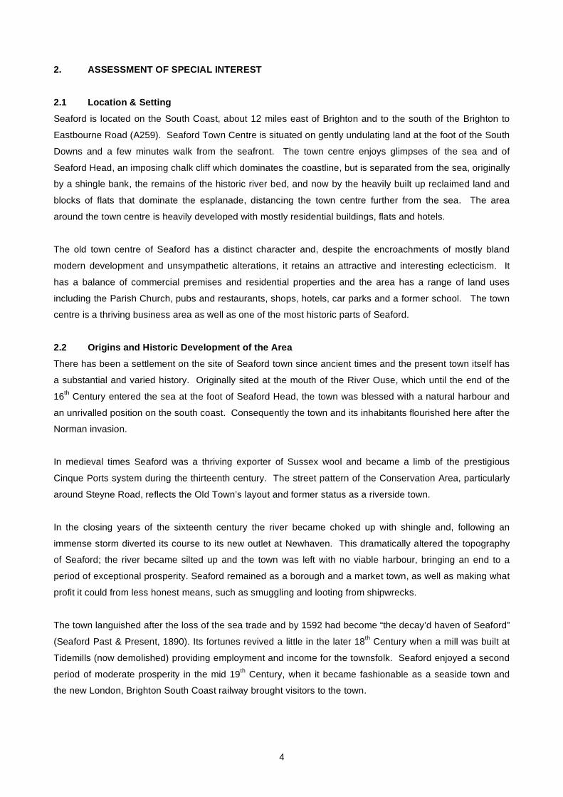
2.1 Location & Setting Seaford is located on the South Coast, about 12 miles east of Brighton and to the south of the Brighton to
Eastbourne Road (A259). Seaford Town Centre is situated on gently undulating land at the foot of the South
Downs and a few minutes walk from the seafront. The town centre enjoys glimpses of the sea and of
Seaford Head, an imposing chalk cliff which dominates the coastline, but is separated from the sea, originally
by a shingle bank, the remains of the historic river bed, and now by the heavily built up reclaimed land and
blocks of flats that dominate the esplanade, distancing the town centre further from the sea. The area
around the town centre is heavily developed with mostly residential buildings, flats and hotels.
The old town centre of Seaford has a distinct character and, despite the encroachments of mostly bland
modern development and unsympathetic alterations, it retains an attractive and interesting eclecticism. It
has a balance of commercial premises and residential properties and the area has a range of land uses
including the Parish Church, pubs and restaurants, shops, hotels, car parks and a former school. The town
centre is a thriving business area as well as one of the most historic parts of Seaford.
2.2 Origins and Historic Development of the Area There has been a settlement on the site of Seaford town since ancient times and the present town itself has
a substantial and varied history. Originally sited at the mouth of the River Ouse, which until the end of the
16th Century entered the sea at the foot of Seaford Head, the town was blessed with a natural harbour and
an unrivalled position on the south coast. Consequently the town and its inhabitants flourished here after the
Norman invasion.
In medieval times Seaford was a thriving exporter of Sussex wool and became a limb of the prestigious
Cinque Ports system during the thirteenth century. The street pattern of the Conservation Area, particularly
around Steyne Road, reflects the Old Town’s layout and former status as a riverside town.
In the closing years of the sixteenth century the river became choked up with shingle and, following an
immense storm diverted its course to its new outlet at Newhaven. This dramatically altered the topography
of Seaford; the river became silted up and the town was left with no viable harbour, bringing an end to a
period of exceptional prosperity. Seaford remained as a borough and a market town, as well as making what
profit it could from less honest means, such as smuggling and looting from shipwrecks.
The town languished after the loss of the sea trade and by 1592 had become “the decay’d haven of Seaford”
(Seaford Past & Present, 1890). Its fortunes revived a little in the later 18th Century when a mill was built at
Tidemills (now demolished) providing employment and income for the townsfolk. Seaford enjoyed a second
period of moderate prosperity in the mid 19th Century, when it became fashionable as a seaside town and
the new London, Brighton South Coast railway brought visitors to the town.
4

Over the centuries the town has grown and adapted to changing topographic, economic and social
conditions and the needs of its residents. Most of Seaford's listed buildings are found here, along with later
developments, reflecting the numerous phases of the town’s development.
2.3 Archaeological Significance The Conservation Area lies within a larger Archaeological Trigger Site, due to its Iron Age origins and later
Stone Age and Roman settlements. This is a non-statutory designation identified by East Sussex County
Council; should the site be affected by a development proposal, a watching brief will be set up and rescue
archaeology will be implemented in order to record details of the site. Significant Ancient Monuments in the
vicinity are The Martello Tower on the Esplanade, The Medieval Crypt on Church Street and Seaford Head
Camp, an Iron Age Hill Fort and Bowl Barrow.
3. SPATIAL ANALYSIS
3.1 Character and Interrelationship of Spaces The buildings in the Conservation Area are built closely together in a dense pattern, with mostly narrow
streets and lanes, although wider streets characterise the later areas towards the top of the town. There is
little relief from the intense development on all sides which crowds the historic core, however a few
remaining public spaces help to break up the density of the town, which used to be surrounded by open
Downland on three sides, and coastline to the south.
The open space of St. Leonard’s Churchyard
makes an important contribution to the
character of the Conservation Area. The
spacious grounds provide the setting for the
most important and prominent listed building in
the Conservation Area and the spacious
churchyard provides a welcome contrast and
relief to the denser urban grain of the town
centre. The grassy space and clusters of small
trees and bushes along the boundaries
introduce greenery into a town that is
otherwise rather lacking in natural vegetation.
The churchyard is surrounded by flint boundary walls and is slightly elevated, giving pleasant views out into
the surrounding town. The important enclosure of the churchyard wall is listed Grade II in its own right.
The eastern boundary of the churchyard is at the edge of the Conservation Area (which excludes Broad
Street). Unfortunately, views eastward from the churchyard are into car parking and service yards and the
rear elevations of commercial premises which front onto Broad Street. Many of these buildings are of a
modern, utilitarian appearance and form an unsympathetic contrast to the Conservation Area. Conversely,
5

the painted terrace of cottages along Church Lane to the south encloses the churchyard space, creating an
overall ambience of tranquillity within the otherwise bustling town centre.
The “Millennium Garden”, a small triangular area of green on Steyne Road at the southern edge of the
Conservation Area also makes a contribution to the character of the area, providing a foreground setting for
an attractive grouping of listed terraced cottages. These terraced cottages contain this space to the north
and west; however development outside of the Conservation Area to the south is ordinary in form and less
dense in layout, losing the sense of enclosure which is a characteristic of the old town.
A small informal open space located at the junction of East Street and Crooked Lane where several smaller
roads converge. Several trees and a walled garden area in front of Martello Cottage contribute to this open
area. There are attractive views to the south over lower land to the Martello Tower and the sea and towards
Seaford Head to the south east.
The Crouch Gardens provide a pleasant open relief on the eastern edge of the Conservation Area. The flint
walls provide a complete sense of enclosure and mature trees and flowerbeds contribute to the established
and tranquil surroundings.
The town contains a number of car
parks. These are often dead spaces
and make little contribution to the
character and appearance of the
Conservation Area. These spaces
could be improved with planting.
There are no significant private gardens
that contribute to the character of the
area.
3.2 Important Views The town centre is located on a slight incline away from the coast, although not enough to provide many
viewpoints. There are however several gaps through which glimpses of the sea, Seaford Head and the
surrounding countryside can be seen, as well as views into the town of the church. One of these is from the
top of the churchyard or Place Lane where a heartening glimpse of the cliffs at Seaford Head can be seen,
connecting the bustling town with its coastal roots. A similar view can be enjoyed along South Street from the
junction with Church Street. These views are important in the overall setting of the Conservation Area and
should be considered when new development is proposed.
6

4. CHARACTER ANALYSIS
4.1 Summary of features which contribute to the special architectural and historic interest: • The old town’s historic street pattern of narrow lanes leading off the High Street and Church Street
down towards the coast
• The predominance of St Leonard’s Parish Church and churchyard, set in spacious grounds in a
eminent position above the dense grain of the old town
• The architectural and historic interest of the individual buildings in the town centre, 39 of which are
listed
• The predominance of flint walling of which six sections are listed
• The association with the Cinque Ports system
• The vestigial atmosphere of a ‘working’ riverside town, now bereft of river and harbour, with evidence of
past industry in areas off the high street such as Pelham Yard and Phoenix Yard, emphasised by the
significant number of historic taverns and hostelries
• The tranquil green spaces of Crouch Gardens and the churchyard
• Glimpses of Seaford Head and the sea from vantage points throughout the town
• The terraces of brightly painted & stuccoed cottages
• The small groups of Edwardian buildings
• Distinctive local streetscape features such as traditional red paviors, and decorative lamp-posts and
street furniture along Broad Street and the High Street
• The eclectic mix of buildings from different eras with no single dominant style
4.2 Identification of character areas Seaford Town Centre does not easily divide into ‘character areas’. There is a gradual shift in character from
the oldest parts to the newer areas as the town expanded in all directions. In addition, constant development
has given the town an eclectic feel, so that many different styles and periods sit side by side and the
character is thus not easily categorized into historical zones. There are however general differences of
character in some areas, identified by the contemporary prevailing fashions and the gradual emphasis over
the years to residential and retail usage.
High Street and roads leading off including Saxon Lane and Crouch Lane and Church Street The oldest part of the town, this area has the best of the historic buildings and an uncontrived charm in their
irregular arrangement and diversity. The buildings are small in scale (except for some ill proportioned
modern impositions) and though struggling to cope under the onslaught of modernisation, advertising and
inappropriate alterations and development, they largely retain their historic character and have many
associations with past residents and events.
7

The Church and cottages on Church Lane and the lower part of Church Street are a remnant of residential
Seaford in its early days, domestic in scale and unpretentious. The cheerfully painted stucco of the cottages
establishes the sea-side vernacular of the area and the narrow streets and lanes, now somewhat cluttered
with parking, street signs and road markings, follow the historic layout of the area. It is unfortunate that
traditional street paving has been lost.
Marine Terrace/Steyne Road This street marks the old boundary of the town, first circumscribed by the river, then the shingle bank which
took its place. The reclaimed land is now fully developed, but the sweep of the road indicates the route of
the river and the large, elegant houses along this street are testament to its original desirable location, facing
out to fine views of the sea. This consequently has a much more open feel to it, compared to the narrow,
crowded streets around the High Street, and retains its air of understated gentility. The houses are larger
and more imposing, in distinct contrast to the modest cottages that occupy the adjacent lanes.
8

Pelham Road, top of Dane Road, Clinton Road These ‘newer’ areas of town are a vestige of Seaford’s brief but significant flourishing as a fashionable
seaside resort in the late 19th Century. The Italianate stuccoed townhouses have a slightly pretentious feel
to them, as the town attempted to emulate its neighbours Brighton and Eastbourne in seaside refinement.
These buildings and those on Clinton Place, are built in the same style as Seaford Station, which is listed,
and were clearly intended to create a prestigious and attractive initial impression of Seaford, being the first
buildings that visitors to the town on the newly
opened railway would have seen. The
character of these areas has been eroded by
unsympathetic modern alterations but could be
improved to recapture the genteel, Regency-
esque character of the area. The composition
of repeated details such as curved headed
windows, pediments, shell motifs, scrolls and
decorative finials is locally distinctive and give
the buildings increased group value. Some
buildings, such as Lloyds Bank, serve as
examples of how this area used to and
potentially could look like. Oddly, this building
is currently excluded from the Conservation Area.
East Street and Croft Lane area This quiet area has a distinctly residential feel
to it, quite different from Broad Street and the
rest of Seaford town centre which is largely
mixed use. The modest cottages are
reasonably well preserved, despite many
having modern windows and some dormers.
This area’s special interest lies in its neat rows
of traditional stuccoed cottages, with repeated
details such as decorative window surrounds,
mouldings and small, neat front gardens. This
repetition confers group value on individually
unremarkable buildings, but is threatened by
unsympathetic alterations.
9

4.3 Architectural and historic qualities of the buildings and the contribution they make to the special interest of the area.
The town centre has a significant number of buildings on the statutory list of Buildings of Special
Architectural or Historic Interest. The main cluster of listed buildings is around the South Street, Steyne Road
and Church Street area, which is the original nucleus of the town (as shown on historic maps). In addition to
those buildings on the statutory list, there are many other buildings, which although not listed make a
significant positive contribution to the character of the Conservation Area. The Conservation Area covers the
entire area of the town as shown on the OS map of 1875, although many buildings have been lost or
replaced since then, and all but a few green spaces in-filled with development. This appraisal is not intended
to be comprehensive, and omission of any particular building, feature or space should not be taken to imply
that it is of no interest.
Due to the range of the age of buildings and the variety of uses there is a wide diversity of building styles and
materials with no single historic style dominating. The buildings range from the medieval Crypt in Church
Street (a scheduled ancient monument located beneath the modern building of the Crypt Gallery), and St.
Leonard’s Church (twelfth and fifteenth centuries) to the later buildings of the eighteenth Century in the High
Street and Steyne Road such as The Old House, dated 1712, residence of Thomas Tufton (Bailiff of the
Town & Cinque Port), genteel nineteenth century buildings such as those of Marine Terrace, through to the
later Edwardian development around Sutton Road, East Street and Croft Lane. In addition to these buildings
is a diverse mix of buildings that form the main bulk of the street grain and have group value in the character
of this lively Conservation Area. The variety of styles, including the best of those from the mid 20th Century,
is a characteristic of the town centre and this should be borne in mind when considering the appropriate
conservation of the area.
The triangular shaped area contained by Church Street, South Street and Steyne Road, and bisected by the
south-western end of High Street is the historic core of the town and contains the highest concentration of
listed buildings. This area is denser and less regular in grain, with narrow roads and lanes and
predominantly two-storey, steep pitched roof buildings. It also contains a great deal of historic flint walling,
some listed in its own right. These characteristics lend a distinct quality to this part of the town which is not
present elsewhere.
Area to West of Broad St The charming Parish Church of St. Leonard, the heart of worship in Seaford for nine centuries, is a well
preserved and beautifully detailed Early English and later medieval building which remains the focal point of
the Conservation Area. The Church is listed Grade I and the oldest part dates from around 1090; it was
restored in 1862 but its Norman origins are still evident. Its characteristic scale, form and open setting make
it an important landmark in views up and down Church Street and the tower can be glimpsed from various
vantage points in the town. When viewed from the north the fifteenth century tower forms a familiar pointer
in the orientation of the town centre. It is built largely of flint with a red tile roof.
10

Above the church is a row of mid 19th Century terraced houses originally built in a similar style to those on
Clinton Place, although these are much altered, all having lost their decorative window surrounds, replaced
with box dormers and uPVC windows. This is a commercial area of Seaford and is occupied by various
businesses. Modern illuminated shop-fronts are dominant and this area has lost its restrained Victorian
appeal. Plastic windows predominate and there is no definable character. Stricter controls on signage,
lighting, and alterations could help make this area more worthy of inclusion in the Conservation Area. At
present its inclusion seems for completeness only, on account of its being directly adjacent to the most
important historic building in Seaford. Immediately opposite the church is a flint and brick Victorian building,
originally a school, now converted to a nursery and doctors’ surgery, but there are no further buildings of
merit on the west side of the street until the cottages at the lower end. The intervening space is occupied by
the post office and police station, both bland modern brick buildings with no interesting features.
Street signage, road markings and clutter
detract from the simple charm of this
historic street (junction of Church Street
and South Street)
Church Lane Running along the southernmost boundary of the churchyard is Church Lane; a quiet, narrow lane which
retains is peaceful, almost secretive character. The buildings are small, cheerfully painted, stuccoed
cottages, six out of ten of which retain their timber sash windows. Apart from the loss of windows, these
cottages are mostly unadulterated, a small corner of Seaford town centre which retains its vernacular charm.
All the buildings along this lane and from the church to the bottom of Church Street are of merit in the overall
townscape and should be retained.
Church Street & South Street Nos. 1-21 Church Street is a row of bright painted cottages, modest in scale and contrasting with the grander
buildings on Steyne Road. This row has suffered from some unfortunate replacement of traditional windows,
but nevertheless provides a remnant of old Seaford which has sadly been lost further up Church St. The
view from the bottom of Church Street up to St Leonards is important and should be protected. Phoenix
Corner House, a stuccoed Grade II listed building on the corner of Church Street and South Street, is
prominent in views down Church Street. The same building continues along Church Street as Alma House.
The adjacent building to the east, the Old Town Hall, was the administrative centre of the town from Tudor
11

times and is listed Grade II. The Old Town Hall is still used and has retained its community role. Alma
House, Phoenix Corner House and the Old Town Hall form a group
Pelham Road Pelham Road marks the western boundary of the old town and the current limit of the Conservation Area. At
the very bottom, West House, listed Grade II, is a very old building, possibly dating from 1700, with earlier
foundations. The two adjacent buildings are later, but form an attractive group, distinct in character to the tall,
elegant balconied townhouses along the rest of the street. Opposite (outside the CA) Nos. 18-26 are well
proportioned stuccoed town houses, though many have lost their original windows, these may be worth
including in the Conservation Area, forming suitable boundary and complementing the tall stuccoed buildings
along the rest of the street. The Bay Hotel, completed in 1874, is an attractive, dignified Victorian building,
despite its modern signage, and is built in the same style as the Pelham Road townhouses. The
complementary nature of the detailing, which is replicated with variations along this street, is important to the
character and the loss of architectural details, original windows and changes to roof covering should be
resisted.
Welbeck Court, deliberately omitted from the
Conservation Area due to its featureless
modernity, replaced Victorian stuccoed
townhouses which once formed a continuous
row completed by the building on the corner
(now Lloyds Bank). These were destroyed in
a bombing raid in 1942. Nos. 1-8 still form a
uniform and attractive terrace. The Lloyds
Bank building (left) forms an important part of
this group and should be included in the
Conservation Area boundary.
Steyne Road, Southern edge of CA A run of listed buildings forms the edge of the Conservation Area along the northern side of Steyne Road
between Pelham Road and South Street. Nos. 5, 5a, 7 & 9 are early 19th century terraced cottages with a
white painted pebbledashed ground floor, tile-
hung first floor and red tile roof. This pleasant
terrace is domestic in scale and set back
slightly behind a low flint wall.
On Steyne Road, east of Church Street, are
Nos. 1 to 4 Marine Terrace. This is a
particularly prominent building which forms a
visual stop to views from the south along the
12

Causeway, standing in isolation between two narrow streets. Built in the early to mid-nineteenth century it
has three storeys with a painted stucco elevation and a hipped slate roof. The building has an ornate cast
iron veranda to the first floor supported on columns with french doors giving access from the first floor. This
feature lends the front elevation an elegant, almost colonial, feel compatible with the seaside character of
this part of the town and the high status of this row of dwellings. The cobbled garden wall in front is
separately listed Grade II.
The Wellington Public House, Steyne House and the adjacent Causeway House form a group of traditional
stuccoed buildings in a style that continues along Steyne road, intersected by the junction with South Street,
where a small green public space provides a break between buildings and opens up the street scene.
Opposite, Steyne Hall and the Methodist Chapel are late Victorian gothic style buildings, attractive enough to
warrant inclusion in the Conservation Area and marking the transition between the old town and the new
developments that have since swallowed up the area up to the coast.
Nos. 1 & 3 South Street (Honeysuckle Cottage and Saxon Cottage respectively) face south on to the
triangular "green" formed by the acute angled junction of South Street and Steyne Road. Built in the
nineteenth century, the stuccoed cottages have been added to in this century but still retain original features.
Aberdeen House (No. 41 Steyne Road), listed Grade II, is set back behind a low flint wall fronting onto the
triangular "green". It is a two storey, stuccoed house with a tile roof and end brick chimney stacks. The
remaining houses along this street are in a complementary style, well established and the whole combines to
create an open, attractive street scene.
Saxon Lane Turning northwards into Saxon Lane, the intimate and contained character of this narrow street flanked by
high flint walls is immediately apparent. Saxon Lane was previously called Dark Lane, and is thought to
have been the route used to lead to the public gallows. Pear Tree Cottage and Saxon Lodge, both flint and
brick buildings and the flint boundary walls to the south and north are listed Grade II.
Saxon Lane retains its shaded and enclosed feel as it leads up to meet the High Street, with minimal
commercial presence. The ambience is created by the high flanking walls and high trees and foliage,
unusual for this coastal part of Seaford. It joins the High Street opposite the southern end of Broad Street.
There are views from the upper end of the lane all the way up Broad Street to the former United Reformed
Church at the top.
Crouch Lane This has always been a genteel corner of Seaford, and despite modern infill development, retains its rather
upmarket feel, with several large houses enjoying fine views to the sea and Seaford Head from their elevated
position, notably Stone House, Crouch House and Martello Cottage. The modern Seaford House is the third
building of this name to stand on the site, the previous Seaford House being built in 1879 and demolished in
the 1970’s. The flint walled car park at the lower end of Crouch Lane was once gardens to Seaford House,
13

now sadly concreted over. In the wall at the corner is a cannon, taken from the roof of the original Hurdis
House. It now protects the corner from car damage. Stone House, an elegant stuccoed Georgian building,
halfway up Crouch Lane, dates from the mid 18th Century and was built by Robert Stone, Bailiff of Seaford in
1762. The northern end of Crouch Lane, where it joins the High Street, has a picturesque group of cottages
with traditional details which contribute to the charm of the area,
The sixteenth century archway into Crouch Gardens is listed Grade II. It is constructed in stone with
chamfered jambs and dripstone. Originally part of the Courthouse or Town Hall in South Street when
Seaford was associated with the Cinque Ports it was brought to this site and reconstructed in 1931, as a
tablet beside the arch explains.
The High Street The High Street is the oldest shopping thoroughfare in the town, and was the scene of the Oxford Militia
mutineers’ looting of butchers and bakers shops in 1795. Several of the buildings along this older part of the
High Street are protected by listing, but many others have been rather spoilt by insensitive modernisation.
There is a marked difference in character between the lower end of the High Street which has retained its
historic buildings and intimate feel, and the stretch which runs to either side of the junction with Broad Street,
where poor quality modern infil buildings predominate.
A small number of buildings retain historic shop fronts, such as 41-43 High Street, Self (No. 48), and Pamalle
restaurant (No. 42), which has a fine moulded, polished timber shop front.
Many of the old buildings in this historic street have been lost, but towards the upper end of the High Street
there are some more traditional buildings and a sense of place is recaptured with a terrace of late Victorian
(1881) stuccoed houses and a cluster of attractive vernacular buildings on the junction of The High Street
and Crouch Lane. This group comprises Nos.
44, 46, 48 & 50 High Street and Nos. 1, 2 & 3
Crouch Lane. Dating from the early 17th
Century and re-fronted in the 19th and 20th
centuries, the High Street buildings were
formerly one house, now subdivided. The
three cottages fronting Crouch Lane were built
in around 1820 and have original features
such as decorative hopper heads, panelled
doors and lozenge patterned detail. All are
two storey faced with either render or
pebbledash with clay tile or slate roofs. On
the whole the High Street contains a large number of buildings from various periods in the town’s
development and the majority are of merit. Unfortunately the modern infill buildings and unsympathetic
shopfront details have a dominant effect. The character of this historic street could be greatly enhanced by
14

tighter control of development and encouraging a more sympathetic approach to signage in line with
published guidance.
On the corner with Saxon Lane in a prominent position is No. 30 and 30a; a fine squared knapped flint
fronted building, dating from the early 19th Century and once a high status dwelling. It has been sadly spoilt
by modern shops built in the garden at the front, but nevertheless is an important building in the street scene
and in views down Broad Street.
Regency House (No. 20) is a three-storey building fronted with red mathematical tiles. It has a modern
shopfront and a doorway with pilasters and pediment. The Old House (Nos. 15 & 17), almost opposite, is an
eighteenth century Grade II Listed three-storey stuccoed house with modern shop windows. An inscription
on the building says the house was the residence of Thomas Tufton, bailiff of the town and Cinque Port of
Seaford in 1712. On the south-eastern side again, Nos. 12 to 16 (even numbers) are also listed Grade II.
They form a nineteenth century block of three 3-storey houses now re-fronted with roughcast and with
modern shopfronts to Nos. 12 and 14. Further towards Steyne Road, on the north western side Nos. 5 to 9
(odd) are three-storey stuccoed with two first floor bays and projecting shopfronts. South of the junction with
South Street, Albion House (No. 2) is a two storey stuccoed nineteenth century building with a Grade II listed
garden wall.
The area around Pelham Yard is in the very core of the Old Town. Though presently rather run down, it
contains a cluster of humble buildings remaining from the period when this area was the main hive of activity
in the town. Several buildings in this area have recently been renovated, and further careful conservation
and redevelopment of this area could maximise its historic assets. A traditional building currently used as an
antique shop would benefit from conservation work.
Area to East Side of Broad Street (Croft Lane, Sutton Road, East Street) Broad Street has several buildings of local interest, including Hurdis House, site of one of the oldest buildings
on Broad Street and home to Seaford Town Council. Cameron’s Pharmacy has a well preserved historic
shopfront of copper letters, dated 1855 with a decorative red orb gas light to the front. This is one of the few
surviving original shopfronts in Seaford and should be protected.
The Conservation Area presently extends along East Street including the bland modern brick houses
between Croft Lane and the High Street. The rest of this street made up of attractive terrace cottages,
although the majority now have uPVC windows, which greatly detracts from the overall character of the
street. The top of East Street terminates in a car park.
Sutton Road is a potentially attractive street but rather spoilt by gaudy shop fronts. The row of semi-
detached Edwardian style houses on the north side indicate the beginning of later development in the town
and are a smart and well proportioned row. This street retains several mature trees, a reminder of how much
of Seaford, including Broad Street and Clinton Place, both originally tree-lined, would once have looked.
15

There are several car parks in this area, which are utilitarian spaces contributing nothing to the character of
the area.
Croft Lane is a quiet, inviting street, lined on one side with cheerfully painted terraced cottages, of the style
typically seen elsewhere in Seaford. Again, the charm of these is been marred by replacement uPVC
windows. Fitzgerald House is the only listed building in this area, 19th Century gothic style flint and brick
former almshouses, now flats.
4.4 Building Materials and Local Details Whilst the predominant building surface treatment is painted stucco, Seaford town centre is constructed from
a wide variety of other building materials including flint, brick and even some mathematical tiling, which is
used on No. 20 High Street, Regency Restaurant, and No 10 High Street. No. 30 High Street is of fine
knapped flint, an expensive product that denotes a building of some status. At the southern end of Church
Street, the stuccoed buildings are painted in a variety of colours, which creates a lively street scene. Roof
materials vary between tiles and slate with some modern concrete tile replacements.
The buildings on the southern edge of the Conservation Area are domestic in scale and there is more use of
flint. Flint walls are a very common feature of enclosure in the area particularly around the churchyard and in
Saxon Lane.
Overall, the windows are a mixture of casement and sash and many still have their original glazing bars
intact, although uPVC replacement windows have begun to erode the character of the buildings particularly
in the residential areas on the north eastern edge of the Conservation Area.
Existing traditional paving should be retained in the following locations:
• High Street (both sides),
• Church Street (both sides) between Dane Road and Place Lane,
• Crouch Lane (western side) between High Street and Crooked Lane.
4.5 Historic Shopfronts and Advertising The front of Harvey’s in the High Street, now a dentists, Pamalle Restaurant, and No 48 High Street (Self)
have good quality traditional shopfronts which should be retained, as does Cameron’s Chemist in Broad
Street, and Sedici Boutique on the corner of Church St and Church Lane.
16

4.6 Contribution of Green Spaces, Trees, Hedges and other Natural or Cultivated Elements The town lacks obvious natural features; its character is largely formed of closely-knit built development
formed on the gentle swell of land from the Downs towards the coast. There is a scarcity of green spaces,
and sadly the trees which used to line Broad Street and Clinton Place have been lost. Those that are
present are especially valued, particularly the large mature trees in Crouch Gardens and the randomly
scattered trees and flora in St. Leonard’s Churchyard (below).
Two large trees, a Monterey Cypress and a Leyland Cypress sit in front of Martello Cottage, and frame a
distant view out toward Seaford Head. A notable Wych Elm in the garden of Saxon Lodge is a rare survival.
In addition to these individual specimens, the Sycamores in Saxon Lane and along the edge of the far end of
Broad Street (to the north of the United Reformed Church) make a significant contribution to the character of
the area, emphasising the contained and intimate character of the narrow lanes.
The Gardens in East Street are the only formal public gardens in the area and make an invaluable
contribution to the character of the area as well as providing a rare space to escape the bustle and traffic of
the town centre.
5. POTENTIAL FOR IMPROVEMENT
There are a number of buildings in Seaford which are derelict and have a very negative effect on the
surrounding area, for example No 18 South Street and the buildings in Phoenix yard, and one or two
buildings on South Street. Renovation of these buildings will significantly improve the streetscape and
ambience of the area. There are also some areas where bland and poor quality modern development
detracts from the character of the area and creates a ‘soul-less’ feel. This is particularly prevalent in the area
where the High Street joins Broad Street. The erosion of the character of the areas can be seen plainly in
these two photographs below, taken on the High Street, the first showing the view down the road towards
17

South Street, which retains its historic character, the second showing the view up the high street, practically
unrecognisable as a historic street so much has the character been eroded by modern development.
Lower end of High Street Looking up towards junction with Broad Street
5.1 Summary of Negative Features
The key aspects having a negative impact are:
• The dominance of inappropriate, poor quality plastic shop fascias and illuminated signs. A change from
these to traditional materials and designs could transform the appearance of the area.
• Replacement of original with modern features, specifically timber windows with uPVC, greatly damage
the integrity of individual buildings and the Conservation Area as a whole. The Council has no powers
to prevent this at present.
• Unsympathetic modern development: there are several modern infill developments, particularly at the
lower end of Broad Street and the High Street, which seriously impair the character of the area, having
no relationship in style, materials or scale to the adjacent traditional buildings.
• Street parking: as with so many towns, street parking has a serious impact on the character of the
area, despite Seaford being well served with car parking. Broad Street and the High Street are the
worst affected.
• Street Clutter: There are areas where a proliferation of traffic signage, street furniture and general
clutter detracts from the street scene. An audit of street clutter and removal of unnecessary items in
line with recent guidance from English Heritage (Streets for All, 2005) would improve the area.
18

Shop fronts in inappropriate materials and designs can have a detrimental impact on the area, especially if
illuminated (Sutton Road and Church Street)
Inappropriate and mismatching uPVC windows detract from the
uniform character of these traditional cottages in Croft Lane
6. SUGGESTED BOUNDARY REVISIONS
6.1 Broad Street Up until the mid 20th Century, Broad Street was a pleasant, wide, tree lined, mostly residential Avenue with a
variety of buildings from different periods. This is the central part of Seaford town, leading up from the High
Street towards Clinton Place. Currently only a section of the east side is included in the Conservation Area.
Modern shop front development and some unsympathetic infill has resulted in a loss of character to the
street scene. However behind the mostly modern shopfronts, many buildings of townscape merit remain and
are worthy of enhancement and protection. To the south of the street there are some featureless modern
flats which detract from the heterogeneous nature of the street front. Car parking on both sides of the street
dominates the street and has a negative impact on the street scene. Implementation of the Council’s
19
published guidance for shopfronts and
advertisements in Seaford could help return
this street to its former elegance.
The corner building at north end of Broad
Street (now Barclays bank) is a fine flint and
stone fronted building, occupying a prominent
position at the top of the street. The United
Reformed Church opposite is a flint building in
the Victorian Gothic style built in 1887, largely
unspoilt and worthy of preservation, it is very
visible on the approach up Broad Street and
occupies a prominent corner location. A key building in
this phase of later development in the town, it adds to
the eclectic mix of established building styles.
It is proposed to add the 1930’s former Caffyns building
which has a strong character contributing to the
Conservation Area and the adjacent Bank, which are
located together on the opposite corner of the street.
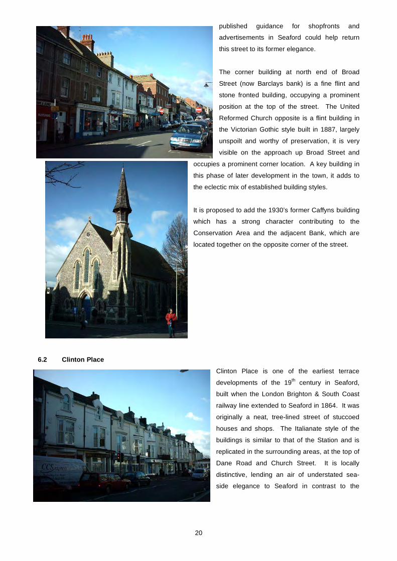
6.2 Clinton Place Clinton Place is one of the earliest terrace
developments of the 19th century in Seaford,
built when the London Brighton & South Coast
railway line extended to Seaford in 1864. It was
originally a neat, tree-lined street of stuccoed
houses and shops. The Italianate style of the
buildings is similar to that of the Station and is
replicated in the surrounding areas, at the top of
Dane Road and Church Street. It is locally
distinctive, lending an air of understated sea-
side elegance to Seaford in contrast to the
20

grandeur of the nearby more fashionable towns of Brighton and Eastbourne. Now largely converted to
modern shops, the houses have lost their decorative balconies and many have had windows replaced in
modern materials. However, despite these disfigurements, they mark an important period in the town’s
historic development, and in conjunction with Seaford Station, which is Grade II listed, form a snapshot of
this corner of the town in the mid 19th Century. Careful control of development resulting from inclusion in the
Conservation Area boundary, along with appropriate restoration, could go some way to returning this street
to its former elegance.
6.3 North End of Broad Street, Clinton Lane and Top end of Blatchington Road, Currently an Area of Established Character, this leafy area has a quiet, suburban feel to it, and the rows of
cheerfully painted cottages are better preserved than some within the Conservation Area. An attractive
traditional shop front at No. 65 (Raymond Austen Photography) adds to the quality and interest of the area.
Included in this area at the top of Blatchington
Road are Twyn Cottage and Twyn House (Nos.
3 and 5). These Grade II listed, white stuccoed
cottages date from the 18th Century and were
formerly a workhouse before being converted to
residential use in c.1810. The cottages stand
on the site of the medieval leper hospital of
St James. These historic buildings and their
associations add to the character and
significance of the area.
This small area of the town marks a transition
from the bustling, commercial centre of Seaford, to the quieter suburban area, the density gradually reducing
as Blatchington Road continues, culminating in the spacious, leafy development of East Blatchington
Conservation Area.
Development outside this area is generally larger, semi detached houses, while this cluster of terraced
cottages is more in keeping with the predominant style in the existing Conservation Area (Croft Lane, Church
St, Church Lane etc). It is therefore felt that it is appropriate to include this area in the Town Centre
Conservation Area.
The trees and hedges which line the road contribute substantially to the character of the area and would
benefit from the protection that Conservation Area status would afford.
6.4 Summary of Boundary Revisions (see attached map) • Include Clinton Place and the top of Broad Street to Place Lane, the United Reformed Church, the
former Caffyns Garage, Old Market Cottages and the Drill Hall.
21

• Include North end of Broad Street up to junction with Blatchington Road, and section of Blatchington
Road, currently areas of established character.
• Bring CA boundary up Broad Street on the west side to include up to 17 Broad Street
• Include the bank on the corner of Dane Road and Pelham Road
• Include row of town houses/ apartments at lower end of Pelham Road on west side.
7. RECOMMENDATIONS FOR MANAGEMENT ACTION
Without a more stringent method of control in place the character of Seaford will inevitably be eroded by
further unsympathetic development, plastic windows and doors and inappropriate roof coverings, shop fronts
and signage. The following action is therefore recommended:
• An Article 4 Direction to cover replacement windows and alterations to front of buildings.
• A shopfront improvement scheme (in association with the Town Council)
• Re-publication and distribution of LDC’s ‘Shopfronts and Advertisements in Seaford’ guidance note.
• An Audit of Street Clutter and removal of unnecessary items, in line with English Heritage’s ‘Streets for
All’ campaign and ESCC Public Realm Initiative.
8. THE PLANNING POLICY CONTEXT
The Adopted East Sussex and Brighton & Hove Structure Plan [1991] contains broad policies which
require the impact of proposed development on Conservation Areas and Listed Buildings to be given due
consideration. This plan can be viewed at:
County Hall,
St Anne's Crescent
Lewes.
Switchboard number: (01273) 481000.
Website: www.eastsussexcc.gov.uk
These policies are reflected in more specific detail in the Adopted Lewes District Local Plan [2003].
Chapter Eight of the plan specifically covers 'The Historic Environment' and these planning policies
clearly outline the criteria that will be applied to development in, or affecting, a Conservation Area and the
approval or refusal of any planning or Conservation Area application will be determined against them.
Anyone thinking of applying for consent within a Conservation Area is therefore strongly advised to
consider these policies first. The Local Plan can be viewed at the District Council offices in Lewes or on
the website at www.lewes.gov.uk/coun/planning/index.html. Pre-application advice can also be obtained
from Development Control Officers or the Conservation Officers.
22

The existing policies are currently being reviewed as part of the new planning system, the Local Development Framework. Consultation will be taking place to determine where policy changes need to
be made to improve the protection and enhancement of the district’s heritage. As part of the new
planning system Structure Plans will be phased out and the Regional Spatial Strategy (South East Plan)
and the LDF will take their place. Over time the two adopted plans which you should presently refer to for
conservation policies will be replaced by these two documents.
9. USEFUL INFORMATION & CONTACT DETAILS
For further information on this leaflet, please contact: Design & Conservation Team
Planning and Environmental Services
Lewes District Council
Southover House
Southover Road
Lewes
BN7 1AB
(01273) 471600
This is one of a series of leaflets about the 35 Conservation Areas in the Lewes District. A full list can be
obtained by contacting the above officers, or by visiting the Councils web site
(www.lewes.gov.uk/environment), or from Lewes Tourist Information Centre.
• Visitors can find out about Walks and facilities in the area from Lewes Tourist Information Centre.
• Historic maps and records can be consulted at the East Sussex Record Office in Lewes.
• The Seaford Museum at the Martello Tower in Seaford has extensive records on the history and
development of the area.
23

10. FURTHER READING
Conservation Area Appraisals – Defining the Special Architecture or Historic Interest of Conservation Areas. English Heritage, 1997
Understanding Place: Guidance on Conservation Area Appraisals, English Heritage, 2005
Conservation Area Practice: English Heritage Guidance on the Management of Conservation Areas, English
Heritage, 1995
Shopfronts and Advertisements in Seaford, Lewes District Council
Street Improvements in Historic Areas. English Heritage, 1993
Seaford Past and Present, Patricia Berry, 1993
Then & Now in Seaford, Seaford Museum of Local History, 1988
24