sct file no.: sct - 4001-12€¦ · sct file no.: sct - 4001-12 specific claims tribunal between:...
TRANSCRIPT
SCT File No.: SCT - 4001-12
SPECIFIC CLAIMS TRIBUNAL
BETWEE N:
WAYWAYSEECAPPO FIRST NATIONClaimant
v.
HER MAJESTY THE QUEEN IN RIGHT OF CANADAAs represented by the Minister of Aboriginal Affairs and Northern Development Canada
Respondent
RESPONSEPursuant to Rule 42 of the
Specific Claims Tribunal Rules ofPractice and Procedure
This Response is filed under the provisions of the Specific Claims Tribunal Act and the
Specific Claims TribunaL Rules ofPractice and Procedure.
TO: Waywayscccappo First NationAs represented byJ.R. Nonnan Boudreau/Earl C. StevensonBooth Dennehy LLPBarristers and Solicitors387 BroadwayWinnipeg, Manitoba R3C OV5Telephone: (204) 957-1717Facsimile: (204) 943-6199E-mail: [email protected]
I. Status of Claim (R. 42(a»
1. Waywayseecappo First Nation ("the First Nation") submitted a specific claim to the
Minister of Indian Affairs and Northern Development ("the Minister") on September 20, 1995.
The claim remained inactive due to insufficiency of research. The First Nation provided
research and resubmitted the Claim to the Specific Claims Branch in October 2004. The Claim
alleged that the 1881 surrender of 30 square miles of Indian Reserve No. 62 was illegal and that
the Crown breached the Indian Act and its treaty and fiduciary obligations to the First Nation.
2. The Minister accepted the Claim for negotiation on January 3, 2007 and the Claim was
deemed to have been accepted on October 16, 2008, pursuant to section 42(1) of the Specific
Claims Tribunal Act. The Crown says except for this fact, the contents of paragraph 4 are
without prejudice communications, privileged and irrelevant to the Claim, as is the phrase
"including the three compensation criteria" at the end of the first sentence of paragraph 5 and the
contents of paragraphs, 6,7,8 and 9 of the Declaration of Claim.
3. The Crown further states that paragraphs 5, 6, 7, 8, 9, 12 and 13 render the claim to be
based in part on recent events that occurred after the claim was filed with the Minister and are
invalid pursuant to sections 15(1 )(a) and 16 of the Specific Claims Tribunal Act.
4. The Claim remains unresolved.
5. The Crown states that the proper legal name of the Respondent is "Her Majesty the
Queen in Right of Canada, as represented by the Minister of Indian Affairs and Northern
Development."
II. Validity (R. 42(b) and (c))
6. The Crown denies the validity of the First Nation's Specific Claim and that the First
Nation has suffered any losses or damages resulting from the 1881 surrender. Specifically the
Crown denies:
2
a. that the surrender was illegal;
b. any breach of Treaty, the Indian Act or obligations arising from the Crown's
fiduciary duties; and
c. that there are any consequential losses or damages.
7. The Crown says if the Tribunal finds the Claim to be valid in that the 1881 surrender was
illegal, pursuant to Section 20(3) of the Act, the Crown is entitled to a set-off for the value of
lands received by the First Nation or its predecessors in exchange for the lands surrendered.
III. Allegations of Fact - Declaration of Claim (R. 41(e)): Acceptance, denial or no
knowledge (R. 42(d))
8. Unless expressly admitted, the Crown denies each and every allegation of fact or law in
the Claim and puts the Claimant to the strict proof thereof.
9. The Crown admits the facts set out in paragraphs 1, 10, 11, 14, 16, 17, and 29 of the
Claim.
10. The Crown also admits to the facts set out in paragraph 2, although the word "agreement"
was omitted at the end 0 f the direct quotation from section 16(1)(d) of the Specific Claims
Tribunal Act.
11. The Crown denies the allegations in paragraphs 3, 21, 22, 25, 28, 32, 33 and 34, of the
Claim.
12. In response to paragraphs 18, 19,20,21 and 22, the Crown denies that Joseph Sharman's
purchase of lands in the Wa}'\Vayseecappo reserve and Mr. Sharman's subsequent actions were
the sale causes for the Crown's decision to seek a surrender of 32 square miles of land from the
Waywayseecappo reserve.
3

13. The Crown admits the facts set out in paragraph 18. However, Shannan paid for the
land by tendcring Metis Scrip.
14. The Crown admits the facts set out in the first three sentences of paragraph 20 of the
Claim, but states that Joseph Sharman's letter was addressed to the Minister of the Interior. Sir
John A. McDonald was also the Minister of the Interior at the time. Mr. Sharman expressed
regret for the difficulty with his family's choice of the land selected but indicated that his family
"were not desirous that any precedent be established in copying the American plan (too often
adopting of urging Indians to give up their claim)". With respect to the last sentence of the
paragraph, Sharman was advised that he would be allowed to relocate with certain restrictions.
He was accorded the privilege of purchasing, to an equal extent, lands elsewhere "wherever they
may be vacant in the North West Territory, exclusive of the Hudson's Bay Company and school
sections."
15. In response to paragraph 23, the Crown admits the fact thcre was a surrender meeting
and there were 23 men all over twenty-years of age present at the meeting but denies that the
meeting was ealled by an Agent on behalf of Crown.
16. The Crown admits the 1880 Indian Act specifies the requirements for release or surrender
of a reserve or portion of a reserve but denies that the provision referenced in paragraph 24 is
found in section 36 of the 1880 Indian Act.
17. The Crown admits only the facts set out in the third sentence of paragraph 26. The
Crown denies the allegations in the rest of the paragraph.
18. In response to paragraph 27, the Crown admits only that the Council held on February
24,1881 continued to February 25,1881 and that ChiefWaywayseecappo proposed giving up 3
miles on the west side of the reserve from north to south which the Indian Agent rejected. The
Crown denies all remaining allegations in the paragraph.
4
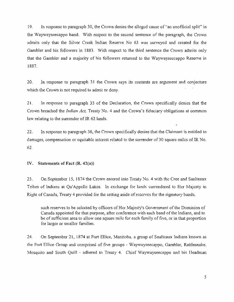
19. In response to paragraph 30, the Crown denies the alleged cause of "an unofficial split" in
the Waywayscecappo band. With respect to the second sentence of the paragraph, the Crown
admits only that the Silver Creek Indian Reserve No 63 was surveyed and created for the
Gambler and his followers in 1883. With respect to the third sentence the Crown admits only
that the Gambler and a majority of his followers returned to the Waywayseecappo Reserve in
1887.
20. In response to paragraph 31 the Crown says its contents are argument and conjecture
which the Crown is not required to admit or deny.
21. In response to paragraph 35 of the Declaration, the Crown specifically denies that the
Crown breached the Indian Act, Treaty No.4 and the Crown's fiduciary obligations at common
law relating to the surrender of IR 62 lands.
22. In response to paragraph 36, the Crown specifically denies that the Claimant is entitled to
damages, compensation or equitable interest related to the surrender of 30 square miles ofIR No.
62.
IV. Statements of Fact (R. 42(a))
23. On September 15,1874 the Crown entered into Treaty No. 4 with the Cree and Saulteaux
Tribes of Indians at Qu'Appelle Lakes. In exchange for lands surrendered to Her Majesty in
Right of Canada, Treaty 4 provided for the setting aside ofreserves for the signatory bands,
such reserves to be selected by officers of Her Majesty's Government of the Dominion ofCanada appointed for that purpose, after conference with each band of the Indians, and tobe of sufficient area to allow one square mile for each family of five, or in that proportionfor larger or smaller families.
24. On September 21, 1874 at Fort Elhee, Manitoba, a group of Saultcaux Indians known as
the Fort Ellice Group and comprised of five groups - Waywayseecappo, Gambler, Rattlesnake,
Mosquito and South Quill - adhered to Treaty 4. Chief Waywayseecappo and his Headman
5
signed on behalf of himself and members of his band. The band consisted of 58 families, 7 of
whom lived at Round and Crooked Lakes.
25. ill July 1877 Lizard Point (IR 62) was surveyed and set aside for the Fort ElIiee Groups,
also known as Waywayseecappo's band. The reserve contained 45,869 acres (71.67 square
miles).
26. The 1876 Indian Act defines "reserve" as any tract or tracts of land set apart by treaty or
otherwise for the use or benefit of or granted to a particular band of Indians, of which the legal
title is in the Crown, but which is unsurrendered, and includes all the trees wood, timber, soil,
stone, minerals, metals or other valuables thereon or therein.
The Sharman SalelPurchase
27. In April 1879 Joseph Sharman, a non-Indian and settler, applied to the Department of the
Interior to purchase seven sections of land along the Birdtail Creek. On July 24, 1879, he paid
for the lands by tendering Metis Scrip.
28. On or about March 23, 1880 the Department of the Interior became aware that the lands
purchased by the Sharman family were within the boundaries of an Indian reserve.
29. By letter dated April 10, 1880 Joseph Sharman proposed to the Minister of the Interior
that he be allowed to locate another area of seven sections en bloc in any township or locality
without restrictions.
30. Bya letter dated April 12, 1880 the Surveyor General instructed A.E. Fisher, Local Agent
Dominion Lands, to cancel the sale made to the Sharman family in the Birdtail Creek Indian
reserve. He subsequently instructed Fisher not to cancel the sale without further notice.
31. On April 28, 1880 the Minister of the Interior accorded Joseph Sharman, in lieu of the
Indian lands withdrawn from his purchase, the privilege of purchasing an equal extent of lands
6
elsewhere in one bloc or otherwise wherever they may be vacant in the North West Territories,
exclusive of the Hudson's Bay Company and School lands.
The Land Exchange Proposal
32. By mid 1880 a portion of the members of the Waywayseecappo band (followers of the
Gambler) asked to have a reserve of their own away from the current reserve, and the
Waywayseecappo band would agTce to cede from the reserve a corresponding area. The Indian'
Agent raised with the Shannan family the possibility of making an exchange with the
Waywayseecappo band.
33. By letter dated November 2 l, 1880 Indian Agent McDonald advised L. Vankoughnet,
Deputy Superintendent General of Indian Affairs ("DSGIA") that about thirty families from the
Waywayseecappo band had applied to be allowed to part from the band and take a reserve 6
miles by 5, sixty-five miles North of Ellice, East of the Assiniboine. There were no settlers on
the land but the Gambler and his party had built six houses on it. Agent McDonald
recommended the change as it would not only settle the Sharman claim but also settle the minds
of"discontented Indians".
34. Surveyor-General, Lindsay Russell, supported the proposed exchange as desirable to
meet the wishes of the members of the Waywayseecappo band in this matter. He recommended
that the seceding portion of the band be granted a reserve at Shell River.
35. On February 2, 1881, Indian Commissioner, E. Dewdney, recommended to the Minister
of the Interior that Indian Agent McDonald be instructed to obtain, ifpossible, a surrender of the
southern portion of the Waywayseecappo reserve, the northern boundaries of the part
surrendered being the centre line of sections 35 & 36 Range 24 - Sections 31, 32, 33 and 34
Range 25. The Commissioner concluded that by this arrangement the Indians "will not be
disturbed in their improvements and the land selected by the Sharmans will be surrendered".
7
36. By telegram on February 2, 1881 DSGIA, L. Vankoughnet, instructed Agent McDonald
to obtain the surrender of 32 square miles and informed him of the approval of a "reserve of
same area Shell River in Range."
The 1881 Surrender
The Requirements for a VaLid Surrender
37. Under Section 37 of the 1880 Indian Act a valid release or surrender of a reserve or
portion of a reserve must be assented to by a majority of male members of the band of the full
age of 21 years at a meeting or council of the band summoned for that purpose according to their
rules and held in the presence of the Superintendent-General or of an officer duly authorised to
attend such council by the Governor in Council or by the Superintendent-General.
38. Those entitled to vote or be present at the meeting must have resided habitually on or
near the reserve and be interested in the reserve.
39. The fact that the surrender had been assented to by the band had to be certified on oath
before a judge or stipendiary magistrate by the Superintendent-General or by an officer
authorized to attend the meeting and one of the chiefs or principal men who were present at the
meeting and entitled to vote.
The Record orProceedings or the Surrender Meeting
40. On February 24, 1881 a Council of the Waywayseecappo band was convened by Chief
Waywayscecappo on the reserve at Birdtail Creek. 23 male members over the full age of 21
years were present, including ChiefWaywayseecappo and Headman Gambler. Peter Haurie, an
interpreter, was also present at the Council.
41. Agent McDonald's February 28, 1881 report on proceedings of the Council indicates
that Chief Waywayseecappo had invited him and whatever Councillors and Indians of the
Waywayseecappo band were at Ellice to attend the Council. Chief Waywayseecappo stated that
8
the object of the meeting was that he had heard that the Gambler and other members 0 f the band
desired to give up part of their reserve and wished to take another reserve.
42. Agent McDonald confirmed that at the request of the Gambler and others, he had applied
to the authorities in Ottawa to allow them what they asked for, viz: the surrender of 32 square
miles of the south end of their reserve and be allowed the same area on the east side of the
Assiniboine River.
43. The Gambler did not dispute that he had made the request but raised his discontent with
the shape and location selected for the current reserve and his and others' dissatisfaction with
ChiefWaywayseecappo. He confirmed that he had asked the Indian Agent about getting another
reserve for himself and his followers. He expressed his willingness to give up to the government
32 square miles of the south end of the Waywayseecappo reserve.
44. Chief Waywayseecappo confirmed that the Gambler had raised those issues with him
earlier and an August 23, 1877 report by DLS Wagner to the Minister records soon after the
Waywayseecappo boundary was surveyed in July 1877, the Gambler had asked for different
reserve boundaries.
During this time, an Indian belonging to the Fort Ellice band, the Gambler, came to meand asked me to resurvey the reserve.... he wished it to be 4 x 18 miles and shifted 3miles more cast.
45. Agent McDonald's record of the proceeding of the surrender meeting shows that
members voted against giving up the south end of the reserve by a majority of one. The Chief
then proposed giving up three (3) miles on the west side from North to South but the Agent said
he could not allow it because the Chiefs proposal would destroy their reserve.
46. Agent McDonald then proposed that the band surrender:
that portion of the reserve cast of Birdtail Creek from the south Boundary to within a mileor so of the Agency farm. Whatever more is required to make up 32 square miles is to be
9
taken from the north end of the reserve, but not farther south than the northern boundary ofthe Agency farm, and should there be more required, then from the south end.
47. According to Agent McDonald's record oftlle proceedings:
After some talk amongst themselves, the Chief rose and said, the whole thing was settled.He and all the band members surrender what I have proposed and that he and his Headman would sign the papers whenever required to do so.
The technical requirements ofthe surrender were met
48. The surrender document was signed on March 7, 1881 - by Agent McDonald, ChiefWa
wa-se-capow, Headman Oo-ta-ka-wenin, and Headman Sauvage and witnessed by Stipendiary
Magistrate Hugh Richardson. It was first read over and interpreted in the Saulteaux language.
Peter Hourie, the interpreter who was at the surrender meeting was present at signing.
49. The land to be surrendered was described as:
all that portion of the said reserve, as it now exists and is defined, lying to theeastward of the Birdtail Creek, extending from its southern boundary, northwards toa point from which a line is drawn east.and west will intersect the southern boundaryof school section eleven of township twenty, range twenty-five, west of the principalMeridian, and also so much of the northerly part of the said reserve, across the sameas, with the portion thereof hereinbefore described, will when surveyed be surveyedand measured, contain in all thirty square miles.
50. The March 7, 1881 document indicates that in lieu of the lands surrendered, other lands
of equal extent will be assigned to the Waywayseeeappo band.
51. The affidavit requirements of section 37 of the 1880 Indian Act were met on the same day
that the surrender deed was signed. Stipendiary Magistrate Hugh Richardson swore an affidavit
attesting to the fact Agent McDonald and Chief Waywayseecappo appeared before him and
swore that the surrender had been assented to by the band as set out in the said surrender. Agent
McDonald and ChiefWaywayseecappo also signed the document.
10
'[he surrender was accepted
52. The Minister's April 21, 1881 report to the Privy Council on the surrender notes that the
Chief and members of the Waywayseecappo Band had surrendered 30 sections of their reserve
on Birdtail Creek in consideration of another reserve of equal area to be assigned them at a more
suitable point.
53. The Governor in Council accepted the surrender by Order-In-Council P.C 654 dated
April 27, 1881.
54. According to a report by DLS, A.W. Ponton, to J.C. Nelson, dated February 15, 1884
when he was resurveying the Waywayseecappo Reserve in 1883, he interviewed Chief
Waywayseecappo, his Headman and several others of the band. The Chief and his followers
believed that they had surrcndered morc land east of the Birdtail Creek, than was calculated in
the earlier survey by DLS Dumais. The fact that there had been a surrender was not disputed.
Survey for Gambler and Resurvey ofllie Waywayseecappo Reserve.
55. Order in Council PC 1151, dated May 17, 1889 confirmed a nwnber of reserves in
Manitoba and the North West Tenitories. In June 1883, DLS, A.W. Ponton surveyed LR 63 for
44 families under the Gambler and those who wished to follow him. The reserve contained 30
square miles located on the east side of the Assiniboine River at Silver Creek, nine miles north of
Fort Ellice. On July 13, 1883 DLS A.W. Ponton completed the resurvey of the Waywayseecappo
reserve.
V. Relicf (R 42(f»)
56. The Crown seeks dismissal of the claim as it relates to the validity of the surrender and
compensation.
11
57. To the extent that the Crown may be found liable to pay compensation for losses incurred
by the Claimant as a result of the 1881 surrender, the Crown seeks an offset pursuant to s.20(3)
for any such losses, because the Claimant was provided with the same amount of lands in
exchange for the lands surrendered.
58. The Crown seeks costs in these proceedings.
59. Such other relief as this Honourable Tribunal deems just.
Communication (R.42(g))
The Respondent's address for service is:
[email protected] of JusticeSuite 30 I, 310 BroadwayWinnipeg, MB R3C OS6Tel: (204) 984-7731Fax: (204) 984- 5910.
"J.ofhDated: September 1 2012
resentati e/SQlicitorMyl ., J. Kirvan
Deputy Attorney General of CanadaPer: Yvette Creft
Suite 301,310 BroadwayWinnipeg, MB R3C OS6
TeL (204) 984 -7731Fax: (204) 984- 5910.
Solicitors for the Respondent.
12