saint james parish communications tower saint … james parish communications tower . saint james...
TRANSCRIPT
Draft Environmental Assessment
Saint James Parish Communications Tower Saint James Parish, Louisiana Port Security Grant Program Project # 2008-GB-T8-K093 (01) October 2011
Federal Emergency Management Agency Department of Homeland Security 500 C Street, SW Washington, DC 20472
Table of Contents 1.0 INTRODUCTION………………………………………………….….………. 1
2.0 PURPOSE AND NEED…………………………………………….………….. 1
3.0 ALTERNATIVES…………………………………………………….……….. 2
4.0 ALTERNATIVES CONSIDERED AND DISMISSED………………………. 2
5.0 GEOLOGY, SOILS, AND SEISMICITY……………….…………................. 3
6.0 WATER RESOURCES…...….……………………………………….……….. 4
7.0 WETLANDS…………………………………………………………………… 4
8.0 FLOODPLAIN……………………………………………………….………… 4
9.0 COASTAL RESOURCES………………………………………….…………... 5
10.0 WILD AND SCENIC RIVERS………………………………………………… 5
11.0 THREATENED AND ENDANGERED SPECIES AND CRITICAL HABITAT .………………………………………………………………….…. 6
12.0 MIGRATORY BIRDS…………………………….……………………..……. 7
13.0 HISTORIC PROPERTIES…………………………………………………….. 7 14.0 AMERICAN INDIAN/RELIGIOUS SITES………………………………...… 8
15.0 AIR QUALITY………………………………………………………………… 9
16.0 NOISE………………………………………………………………………….. 9
17.0 INFRASTRUCTURE, UTILITIES, TRANSPORTATION, AND WASTE MANAGEMENT……………………………………………………………… 10
18.0 SOCIECONOMIC CONCERNS……………………………………………… 10
19.0 CUMULATIVE IMPACTS…………………………………………………… 10
20.0 LIST OF PREPARERS…………………………………………………….… 12
21.0 INFORMATIONAL SOURCES…………………………………………..… 12
Tables: Table 1 Summary of Impacts…………………………………………..……. 11
Appendixes
Appendix A: Site Photographs Appendix B: Site Location Maps Appendix C: Agency Consultation Letters Appendix D: NEPA Summary Report and Checklist
1
1.0 Introduction Saint James Parish has been awarded, under a Port Security Grant Program (PSGP), authorization to construct a four hundred (400) foot new communications tower. This communications tower will enhance the interoperable communications among all first responder disciplines during times of natural or man-made disasters. The PSGP provides grant funding to port areas for the protection of critical port infrastructure from terrorism. PSGP funds are primarily intended to assist ports in enhancing maritime domain awareness, enhancing risk management capabilities to prevent, detect, respond to and recover from attacks involving improvised explosive devices (IEDs), weapons of mass destruction (WMDs) and other non-conventional weapons, as well as training and exercises and Transportation Worker Identification Credential (TWIC) implementation. This Environmental Assessment (EA) has been prepared according to the requirements of the National Environmental Policy Act (NEPA), as applied to the Federal Emergency Management Agency (FEMA) at 44 CFR Part 10. This section of the federal code requires that FEMA take into account environmental considerations when authorizing or approving actions and pursuant to the National Environmental Policy Act. The purpose of this EA is to analyze the potential environmental impacts of the proposed construction of a communications tower facility. FEMA will use the findings in this EA to determine whether to prepare an Environmental Impact Statement (EIS) or a Finding of No Significant Impact (FONSI). 2.0 Purpose and Need Saint James Parish Government is located in the community of Convent, Louisiana along the Mississippi River. The site for the construction of the proposed communications tower is adjacent to an existing three hundred (300) foot communications tower already in operation. The existing tower, which is over twenty-five (25) years old, was severely damaged during Hurricane Gustav in September 2008 and now is in a state of disrepair. The objective of the PSGP 2008, as per Fiscal Year 2008 (FY2008) Grant Guidance is to “support increased port-wide risk management; enhanced domain awareness… and further capabilities to prevent, detect, and respond to and recover from attacks involving improvised explosive devices (IEDs) and other non-conventional weapons” (FY 2008 PSGP Grant Guidance). A new regional communications tower is needed in Saint James Parish to improve public safety and interoperable communications among emergency responders during an emergency event.
2
3.0 Alternatives Alternative No. 1- No Action Under this alternative, the tower would not be replaced. The condition of the existing tower would continue to degrade and eventually become inoperable. Losing the function of the communication tower would jeopardize public safety because communications among emergency responders would be compromised during an emergency event. Alternative No. 2- Proposed Action The proposed action is to construct a four hundred (400) foot new communications tower that exceeds the current standards for American National Standards Institute/Electronic Industries Alliance/Telecommunications Industry Association (ANSI/EIA/TIA) Rev. G (class III supporting public safety and mission critical communications). Furthermore, the installation of antennae and associated equipment will provide integrated emergency communications between federal, state, and local agencies during emergency situations. This antenna would include microwave dishes that are to be used to send and receive information over long distances without the limitations associated with connection to land lines/cables (primarily interruptions in service due to damage to land lines/cables during emergencies or natural disasters). The proposed communications tower will be designed for future enhancements to mission critical hardware. The footprint of the tower is proposed next to the existing tower (Appendix A). The existing three hundred (300) foot communications tower already in use will be will be “de-stacked” to a height of one hundred ninety (190) feet. The proposed tower is to be located along5800 Highway 44, Convent, LA 70723 at coordinates 29.994972 Latitude and -90.817417 Longitude. The site of the proposed tower is located adjacent to the regional Emergency Operations Center, on land currently owned by the Saint James Parish Government. Alternatives Considered and Dismissed Two alternatives were considered but dismissed because they did not meet the Parish’s purpose and need or were considered not feasible. Alternative No. 3- Foundation and Structural Modifications Under this alternative, the existing tower would require modifications to the entire structure. Modifications would include remediation of the existing foundation and removing and replacing bolts and torqueing all nuts and bolts to ANSI/EIA/TIA standard “Structural Standards for Steel Antenna Towers and Antenna Supporting Structures (Rev G). This alternative is not a viable option because the existing structure’s foundation could not be retrofitted due inadequacies associated with the age of the structure.
3
Alternative No. 4- Structural Modifications Under this alternative, the existing tower would require installation of guyed wires. This alternative would increase the stress of an already overstressed structure. In addition, the land adjacent to the tower footprint is not large enough to accommodate the guyed wires As previously mentioned, both alternatives 3 and 4 were dismissed and they will not be discussed any further in this EA. 4.0 Geology, Soils, and Seismicity Under the No Action alternative, there would be no short- or long-term impacts to soils, geologic resources, or seismic features. According to the Louisiana Geologic Survey, the project site is underlain with Alluvium from the Holocene Period. The Alluvium deposits are a result of Mississippi, Red, Ouachita, and other rivers and smaller tributaries, and coastal marsh deposits. The alluvium consists of sandy and gravelly channel deposits mantled by sandy to muddy natural levee deposits, with organic-rich muddy backswamp deposits in between; coastal marsh deposits are chiefly mud and organic matter. According to the United States Department of Agriculture (USDA) Soil Conservation Service, the proposed site is underlain with Cancienne silty clay loam, 0 to 1 percent slopes. Predominately, this is a mixture of deposits of sediments from the Mississippi River. Soil consistency is medium stiff to very soft gray and brown silt, clay top soil to medium dense gray and brown silt and sand with organics at deeper depths. The elevation is approximately twenty (20) feet above National Geodetic Vertical Datum (NGVD). Ground disturbance would be confined to the boring of the tower footings. The proposed cement footings are cement in nature, six (6) feet in diameter, eighty nine and one-half (89 ½) feet deep. The site consists of a partially asphalt parking lot and grassed land that slopes gradually downward to the west. The fenced tower and equipment compound will also be located in an existing parking lot. Adjacent undeveloped areas are not expected to be impacted. The proposed site would be accessed by locked gate. Appropriate signage will be installed as required by local, state and federal laws. There are no known tectonic faults near the proposed site. Appropriate best management practices (BMPs) would be implemented during site development to minimize sediment migration from the site into nearby water bodies. Surface runoff will be controlled by using biodegradable barriers such as hay bales to minimize erosion. Proper disposal of any hazards will be utilized. Therefore, the Proposed Action will not impact geologic resources and will not have significant impacts to soils.
4
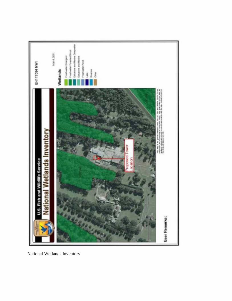
5.0 Water Resources Under the No Action alternative, there would be no short- or long-term impacts to water resources. The National Pollutant Discharge Elimination System (NPDES) was established under the Clean Water Act and regulates wastewater discharges from point sources. NPDES regulations require that construction sites resulting in greater than one acre of disturbance obtain a permit from the Environmental Protection Agency (EPA), or the corresponding state agency where the permitting role has been assumed by the state. In Louisiana, the Louisiana Department of Environmental Quality is the state agency that has assumed this responsibility. The tower footprint is three hundred fifty (350) square feet. The staging area for the construction is an asphalt parking lot that is approximately eighteen thousand (18,000) square feet located adjacent to the existing tower. There are no utility connections. Land-disturbing activities at the proposed communication tower facility will be below the one-acre threshold requiring an NPDES permit. Appropriate BMPs would be implemented during site development to minimize sediment migration from the site into nearby water bodies. Surface runoff will be controlled by using biodegradable barriers such as hay bales to minimize erosion. Proper disposal of any hazards will be utilized. Therefore, the Proposed Action would have no significant impacts to water quality in the area of the site. 6.0 Wetlands Under the No Action alternative, there would be no short- or long-term impacts to wetlands. Under the Clean Water Act (40 CFR 230.3), and Executive Order 11990, wetlands are defined as “those areas that are inundated or saturated by surface or ground water at a frequency and duration sufficient to support, and that under normal circumstances do support, a prevalence if vegetation typically adapted for life in saturated conditions. Wetlands generally include swamps, marshes, bogs and similar areas.” Based on the United States Fish and Wildlife Services (USFWS) National Wetlands Inventory map available online at the National Wetlands Inventory website (http://fws.gov/wetlands/), no wetland were identified in the project area (Appendix B). The proposed communication tower site is currently an asphalt parking lot and maintained lawn. Therefore, the Proposed Action will not impact wetlands. 7.0 Floodplain Under the No Action alternative, there would be no short- or long-term impacts to floodplains.
5
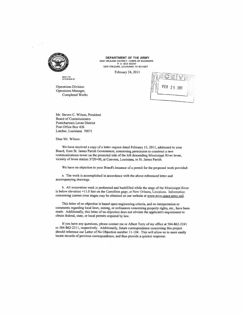
The proposed site, which is within fifteen hundred (1,500) feet of the Mississippi River, is within the levee jurisdiction of U.S. Army Corps of Engineers, The Board of Commissioners of the Pontchartrain Levee District, and the Office of Coastal Protection and Restoration Authority of Louisiana. All three regulating agencies conditionally approved the project (Appendix C). Mississippi River Mainline Levees protect the area from seasonal flooding. Based on the review of applicable FEMA Flood Insurance Rate Map (FIRM), Panel No. 22093C0175C, revised July 4, 2011 retrieved from the FEMA website (http://msc.fema.gov), the proposed communication tower site is located in a Shaded Zone X, defined as an area being protected from the 1% percent annual chance or greater flood hazard by a levee system. (Appendix B). Therefore, the Proposed Action would not impact or be impacted by the 100-year floodplain 8.0 Coastal Resources Under the No Action alternative, there would be no short- or long-term impacts to coastal resources. The Coastal Zone Management Act (CZMA) was established in 1972 to preserve, protect, and (where possible) restore or enhance the resources of the coastal zones of the United States. The Coastal Zone in Louisiana runs from the Louisiana/Mississippi Stateline to the Louisiana/Texas Stateline encompassing fifteen thousand (15,000) miles of the Gulf of Mexico. Most of Saint James Parish is within the Louisiana Coastal Zone. The Louisiana Department of Natural Resources, Office of Coastal Management indicated in a letter dated September 9, 2011 that in accordance with the State and Local Coastal Resources Management Act of 1978, as amended (La. R.S. 49:214.34.a), the proposed activity is exempt and a Coastal Use Permit is not required (Appendix C). Therefore, the Proposed Action does not require a coastal use permit and would not impact coastal resources. 9.0 Wild and Scenic Rivers Under the No Action alternative, there would be no short- or long-term impacts to Wild and Scenic Rivers. A review of information available through the www.rivers.gov website indicates that one Wild and Scenic River is located in Louisiana. This Wild and Scenic River is Saline Bayou in the Kisatchie National Forest in northeastern Louisiana. Saint James Parish is located more than 200 miles southeast of the Kisatchie National Forest. The proposed communications tower would have no impacts to any designated Wild and Scenic River.
6
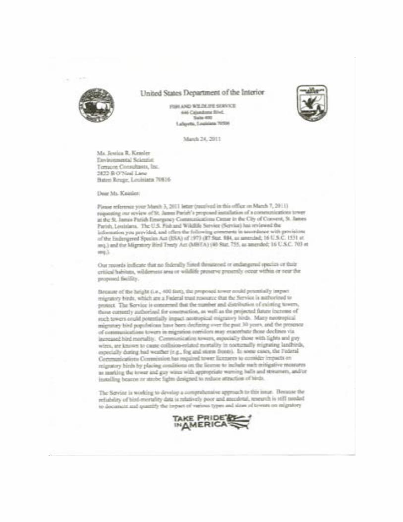
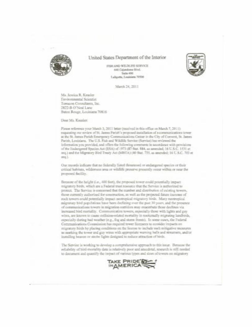
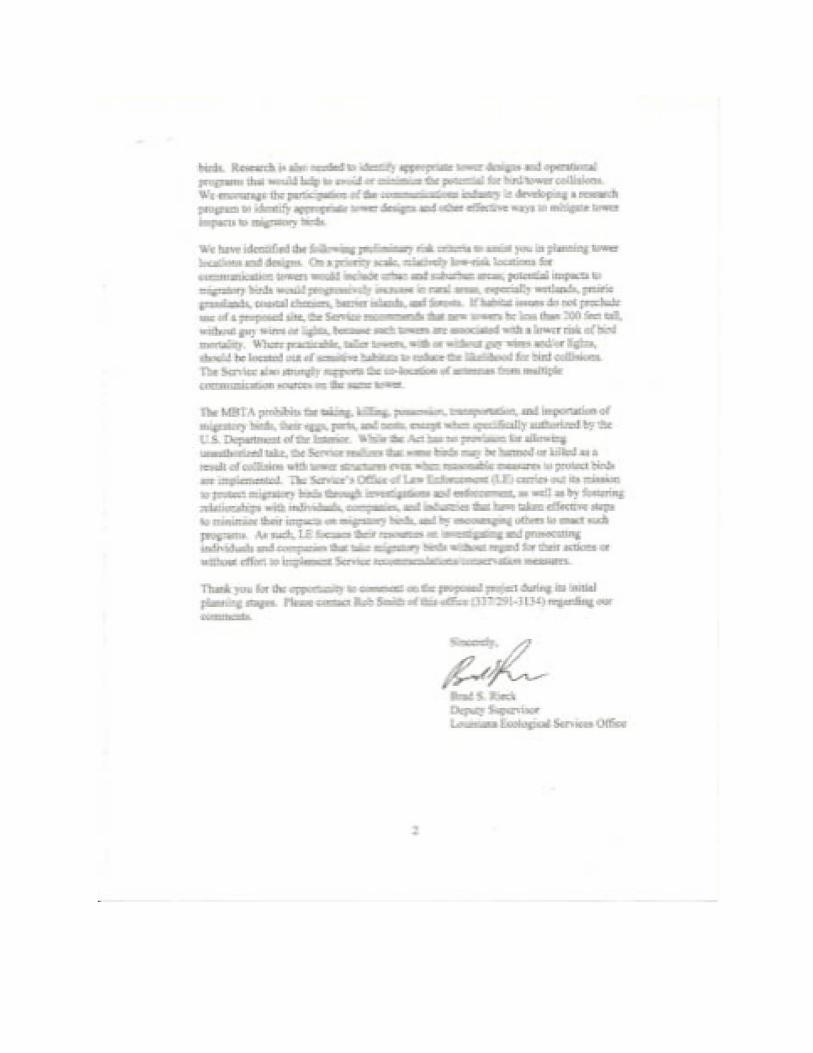
10.0 Threatened and Endangered Species and Critical Habitat Under the No Action alternative, there would be no short- or long-term impacts to Threatened and Endangered Species or Critical Habitat. Section 7 of the Endangered Species Act of 1973 (16 U.S.C. 1536a2) directs Federal agencies to utilize their authorities in furtherance of the purposes of the Act by carrying out programs for the conservation of listed species or designated critical habitats. In addition, Section 7 of the Act sets out the consultation process, which is further implemented by regulation (50 CFR 402). According to the Louisiana page of the USFWS Threatened and Endangered Species System website (http://www.fws.gov/endangered/), threatened or endangered species are known to exist in Saint James Parish (Appendix B). The Gulf Sturgeon (Acienser oxyrinchus desotoi) is listed as a threatened fish species in Saint James Parish. Gulf Sturgeon spawn in long, spring-fed, free-flowing rivers and migrate into marine waters in fall and winter. (Appendix D). The Pallid Sturgeon (Acienser scaphirhynchus) is listed as an endangered fish species in Saint James Parish. Pallid sturgeon are found in the Mississippi River where they are adapted for living close to the bottom of the swift, silty river in sand flats and gravel bars. (Appendix D). The West Indian Manatee (Trichechus manatus) is listed as an endangered mammal in Saint James Parish. Manatees are found in marine, estuarine, and freshwater environments. (Appendix D). Louisiana Black Bear (Ursus americanus luteolus) is listed as a threatened mammal in Saint James Parish. The Louisiana Black Bear frequents deep woods in Saint James Parish. Key habitat requirements of black bears include food, water, cover, and denning sites spatially arranged across sufficiently large, relatively remote blocks of land. Louisiana black bears typically inhabit bottomland hardwood forests but also utilize other types of forested habitats. Other documented habitat types used include brackish and freshwater marshes, salt domes, wooded spoil levees along canals and bayous, and agricultural fields. The proposed communication tower will be located at the Saint James Parish Emergency Operations Center (EOC) with a wooded parcel adjacent to the west of the site. The EOC is located in a rural residential area near the Mississippi River levee on the gently sloping natural levee deposits (Appendix D). As a developed parcel of land, none of the previously discussed threatened and endangered species, or supporting habitat exists on the proposed communication tower site. Also, in a letter dated March 24, 2011, the USFWS concluded that that no federally listed threatened or endangered species or their critical habitats, wilderness area or wildlife preserve presently occur within or near the proposed facility (Appendix C). Therefore, the Proposed Action will not impact threatened and endangered species.
7
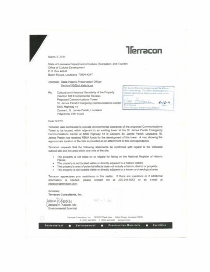
11.0 Migratory Birds Under the No Action alternative, there could be potential impacts to migratory birds because the existing tower would remain. The Migratory Bird Treaty Act (16 U.S.C. 703) established a Federal prohibition, unless permitted by regulations, to "pursue, hunt, take, capture, kill, attempt to take, capture or kill, possess, offer for sale, sell, offer to purchase, purchase, deliver for shipment, ship, cause to be shipped, deliver for transportation, transport, cause to be transported, carry, or cause to be carried by any means whatever, receive for shipment, transportation or carriage, or export, at any time, or in any manner, any migratory bird, or any part, nest, or egg of any such bird." While the USFWS concurred in the response letter dated March 24, 2011, that no threatened or endangered species would be affected by tower construction, the agency did express concerns regarding migratory birds and offered suggestions for avoiding bird collisions (Appendix C). In conforming to the United States Fish & Wildlife Service’s “Service Interim Guidelines for Recommendations on Communications Tower Siting, Construction, Operation, and Decommissioning”, the proposed new tower will be a self-supporting, freestanding 400 feet tall structure that will not employ guyed wires. It will be lighted per Federal Aviation Administration guidelines. The fenced tower and equipment compound will be located in an existing parking lot; adjacent undeveloped areas are not expected to be directly affected. Therefore, FEMA has determined that potential adverse impacts to migratory birds will be minimized or avoided (Appendix C). 12.0 Historic Properties Under the No Action alternative, there would be no short- or long-term impacts to historic properties. Section 106 of the National Historic Preservation Act of 1966 (NHPA, 16 U.S.C. §§ 470 et seq.) and it’s implementing regulations, “Protection of Historic Properties” (36 CFR Part 800), require federal agencies to take into account the effects of their undertakings on historic properties. According to information on the National Register Information System (NRIS; http://nrhp.focus.nps.gov); the National Register of Historic Places (NRHP; http://www.cr.nps.gov/nr); and the Louisiana Cultural Resources GIS Map (http://crt.state.la.us/hp) websites, one historic structure and one archaeological site were determined to be located within the one (1) mile area of potential effect (APE). A review of the information available at the Louisiana State Historic Preservation Office (SHPO) indicated the archaeological site (16SJ31) has been determined by the SHPO to be ineligible for listing on the NRHP (Appendix D). In response to a letter dated March 3, 2011, The Louisiana Department of Culture, Recreation, and Tourism, Office of Cultural Development indicated on March 12, 2011, that No known
8
historic properties will be affected by this undertaking (Appendix C). Therefore, the Proposed Action will not impact historic properties. 13.0 American Indian/Religious Sites Under the No Action alternative, there would be no short- or long-term impacts to American Indian Tribes or Religious Sites. Section 106 of the National Historic Preservation Act (NHPA) and its implementing regulations, “Protection of Historic Properties” (36 CFR Part 800) and the Nationwide Programmatic Agreement on the Collocation of Wireless Antennas (adopted March 16, 2001), as well as the Nationwide Programmatic Agreement for Review of Effects on Historic Properties for Certain Undertakings Approved by the Federal Communications Commission effective March 7, 2005, require consultation with Native American tribal groups and native Hawaiian organizations (NHO) regarding proposed projects and potential impacts to Native American religious sites. To identify Indian tribes that may have cultural interest in the area of the proposed undertaking, Saint James Parish’s consultants contacted the FCC’s online Tower Construction Notification System (TCNS) to initiate tribal participation. Approximately thirty-one days after the “Notice of Organizations Which Were Sent Proposed Tower Construction Notification Information,” Saint James Parish’s consultants issued follow-up letters to tribes that had set geographic preferences on TCNS and that had not responded to the initial TCNS notification. Tribes were also sent letters, faxes, and/or e-mails to address specific information requests. If Tribes did not respond within approximately 10 days of the follow-up letter Saint James Parish’s consultants utilized TCNS to refer the tribes to FCC for government to government consultation (Appendix D). An additional 20-day period was allowed elapse after the TCNS were referred to the FCC. No further tribal responses had been received, therefore, in accordance with the FCC Declaratory Ruling FCC 05-176, the Tribal participation process is considered complete. Specific tribal notification information/dates are as follows: TCNS Notification ID number: 74392, submitted March 3, 2011 TCNS FCC Initial Notification Date: March 11, 2011 Follow-up Letters Dated: April 4, 2011 TCNS FCC Referral / Final Notice Date: April 21, 2011 TCNS FCC Referral / Final Notice to Tribes Date: May 11, 2011 The FCC Form 620 was submitted to the Alabama Coushatta Tribe of Texas as part of the tribal consultations. In a letter dated May 2, 2011, the Alabama Coushatta Tribe of Texas indicated that no immediately known impacts to religious, cultural, or historical assets of the Alabama-Coushatta Tribe of Texas would occur due to the proposed tower project. The response did indicate that the tower site is in proximity to migratory routes and habitation sites utilized by ancestral members of the tribes, and requested immediate notification and halt to construction if human remains and/or archaeological artifacts are discovered (Appendix D). Otherwise, there
9
were no other American Indian Tribes or Religious Sites identified in the project area. Therefore, the Proposed Action is not anticipated to impact American Indian Tribes or Religious Sites. 14.0 Air Quality Under the No Action alternative, there would be no short- or long-term impacts to air quality. The Clean Air Act (CAA) was established in 1970 (42 U.S.C. § 7401 et seq.) to reduce air pollution nationwide. The US Environmental Protection Agency (EPA) has developed primary and secondary National Ambient Air Quality Standards (NAAQS) under the provisions of the CAA. The EPA classifies the air quality within an air quality control region (ACQR) according to whether the region meets or exceeds Federal primary and secondary NAAQS. An AQCR or a portion of an AQCR may be classified as being in attainment, non-attainment, or it may be unclassified for each of the seven criteria pollutants (carbon monoxide, lead, nitrogen dioxide, coarse particulates, fine particulates, ozone, and sulfur dioxide). Short-term impacts to air quality such as exhaust emissions from equipment, and dust from grading activities may occur during site construction activities. Equipment used for these activities would meet local, state, and federal requirements for air emissions, and dust would be controlled as necessary by wetting the surface of the work areas. The only long-term air emissions anticipated at the site would be from the emergency generator. The generator would only operate briefly while being tested and during power failure events affecting the electrical power supply to the site. Therefore, the Proposed Action would have no significant impact to air quality. 15.0 Noise Under the No Action alternative, there would be no short- or long-term impacts to noise. Noise is generally described as unwanted sound. Sound becomes unwanted when it either interferes with normal activities such as sleeping, conversation, or disrupts or diminishes one’s quality of life. Short-term noise generation is anticipated to result from grading and construction activities. However, site construction will be limited the daytime hours. Long-term noise generation is anticipated to be minimal and to result primarily from episodic and infrequent operation of an emergency generator at the site. However, the generator would only operate briefly when tested, and during power failure events affecting the electrical power supply to the site. Therefore, the Proposed Action would not generate significant noise.
10
16.0 Infrastructure, Utilities, Transportation, and Waste
Management Under the No Action alternative, there would be no short- or long-term impacts to infrastructure, utilities, transportation, and waste management. There may be an increase of traffic during the tower construction. Routine traffic to and from the site would be minimal and would be associated with operations, maintenance, and repair of equipment and the active EOC at the site. Minimal waste would be generated at the site during tower maintenance activities. All waste generated at the site would be disposed of in compliance with federal, state, and local regulations. Therefore, the Proposed Action will not impact infrastructure, utilities, transportation, or waste management. 17.0 Socioeconomic Concerns Under the No Action alternative, there would be long-term impacts socioeconomic because the condition of the existing tower would continue to degrade and eventually become inoperable. Losing the function of the communication tower would jeopardize public safety because communications among emergency responders would be compromised during an emergency event. Executive Order 12898 states “To the greatest extent practicable and permitted by law, and consistent with the principles set forth in the report on the National Performance Review, each Federal agency shall make achieving environmental justice part of its mission by identifying and addressing, as appropriate, disproportionately high and adverse human health or environmental effects of its programs, policies, and activities on minority populations and low-income populations in the United States and its territories and possessions, the District of Columbia, the Commonwealth of Puerto Rico, and the Commonwealth of the Mariana Islands.” No significant adverse impacts to socioeconomic resources, economic development, demographics, demand for public housing, or public services are anticipated. In addition, there would be no adverse effects on minority or low-income populations. The Proposed Action would benefit all populations in the project service area by providing better communications between emergency responder personnel. 18.0 Cumulative Impacts Cumulative impacts are an incremental impact on either the natural environment or human environment by an action when added to past and anticipated future actions. No ongoing or proposed actions are known for the project area. According to information available through the
11
FCC Antenna Structure Registration (ASR) System internet website, there are three thousand seven hundred sixty two (3,762) registered towers in the state of Louisiana (generally only those towers over 200 feet in height are included in this database). The proposed construction of the communications tower would not have cumulative impacts on geology, soil, seismicity, water resources, wetlands, floodplains, coastal resources, wild and scenic rivers, threatened or endangered species, historic properties, American Indian or religious sites, air quality, noise, infrastructure, utilities, transportation, or waste management, or socioeconomic resources. Positive long-term impacts to socioeconomic and environmental justice are anticipated since the project will provide better emergency support to the community. During the construction period, short-term impacts to soils, air quality, water quality, waste management, noise, traffic, and health and safety are anticipated.
Table 1. Summary of Impacts Resource No
Impact No Significant
Impact Significant
Impact Mitigation/Best Practices
Soils, Geology, and Seismicity
X BMPs such as, biodegradable barriers such as hay bales will be utilized.
Water Resources X BMPs such as, biodegradable barriers hay bales will be utilized.
Wetlands X None Floodplain X Adhere to conditions
stipulated by levee jurisdictional agencies (Appendix C).
Coastal Resources X None Wild and Scenic Rivers X None Threatened and Endangered Species and Critical Habitat
X None
Migratory Birds X The tower will not utilize guy-wire and the fenced tower and equipment compound will be located in an existing parking lot.
Historic Properties X None American Indian/Religious Sites
If any human remains or cultural or archaeological materials are discovered, grantee would stop all work and immediately contact FEMA and SHPO.
Air Quality X Minimal emissions from generator and construction equipment
Noise X Site construction will only
12
occur during the daytime hours.
Infrastructure, Utilities, Transportation, and Waste Management
X None
Socioeconomic Concerns X None 19.0 List of Preparers Francis Hymel, Assistant Director- Emergency Preparedness, Saint James Parish Government Private Sector Contributors Terracon Consultants, Inc Government Contributors Kevin Jaynes, CHMM, Regional Environmental Officer, FEMA Region 6 Alan Hermely, Environmental Specialist, FEMA Region 6 20.0 Informational Sources Completion of this Draft Environmental Assessment included the following:
1. NEPA Summary Report and Checklist as prepared by Terracon Consultants Project No. EH117034
2. United States Department of Agriculture Soil Conservation Service http://www.mo15.nrcs.usda.gov/technical/surveys/louisiana/StJ-StJB/StJ-StJB.pdf
3. National Wetlands Inventory http://www.fws.gov/wetlands/
4. FEMA Flood Insurance Rate Map (FIRM) http://msc.fema.gov/webapp/wcs/stores/servlet/FemaWelcomeView?storeId=10001&catalogId=10001&langId=-1
5. Louisiana Department of Natural Resources http://dnr.louisiana.gov/index.cfm?md=pagebuilder&tmp=home&pid=85&ngid=5
6. National Wild and Scenic Rivers http://rivers.gov/
7. United States and Wildlife Service Species Reports http://ecos.fws.gov/tess_public/countySearch!speciesByCountyReport.action?fips=22093
8. Historic Properties a. National Register Information System
http://nrhp.focus.nps.gov/natregsearchresult.do?briefnav&briefpage=1 b. National Register of Historic Places
http://www.nps.gov/history/nr/travel/louisiana/sitelist.htm c. Louisiana Cultural Resources GIS Map
http://crt.state.la.us/hp/
13
d. FCC Antenna Structure Registration System http://wireless2.fcc.gov/UlsApp/AsrSearch/asrRegistrationSearch.jsp;JSESSIONID_ASRSEARCH=DGcMTxtfQNLVXbJTNZpLWWGPh3SVLJW7GWflwnrXnS3n71HM8pxg!1840754471!NONE

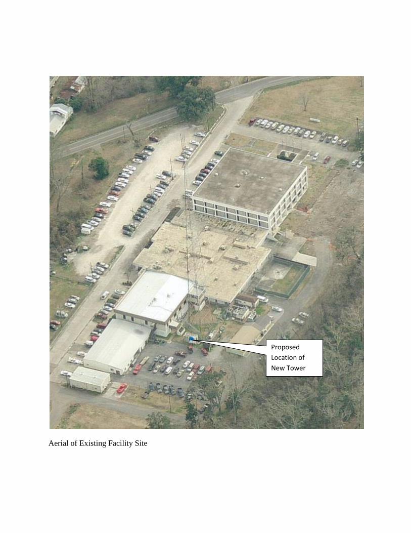
Appendix A Site Photographs

Aerial of Existing Facility Site
Proposed Location of New Tower

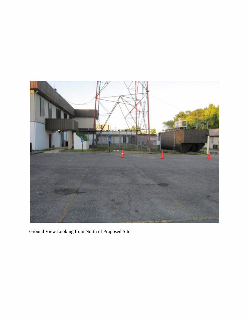
Ground View Looking from North of Proposed Site

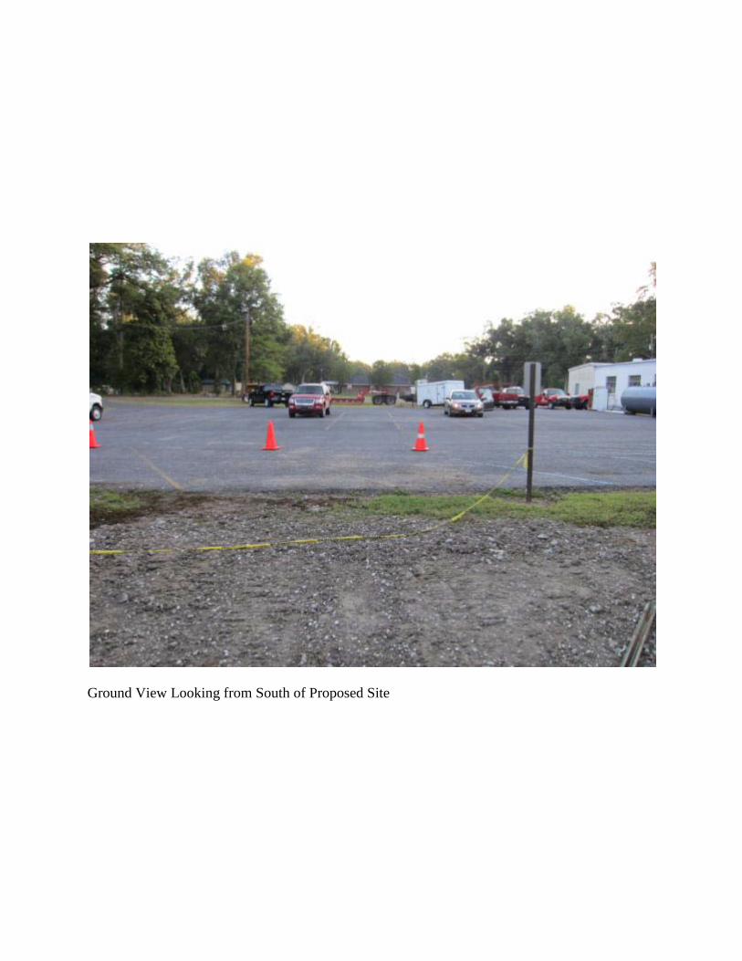
Ground View Looking from South of Proposed Site

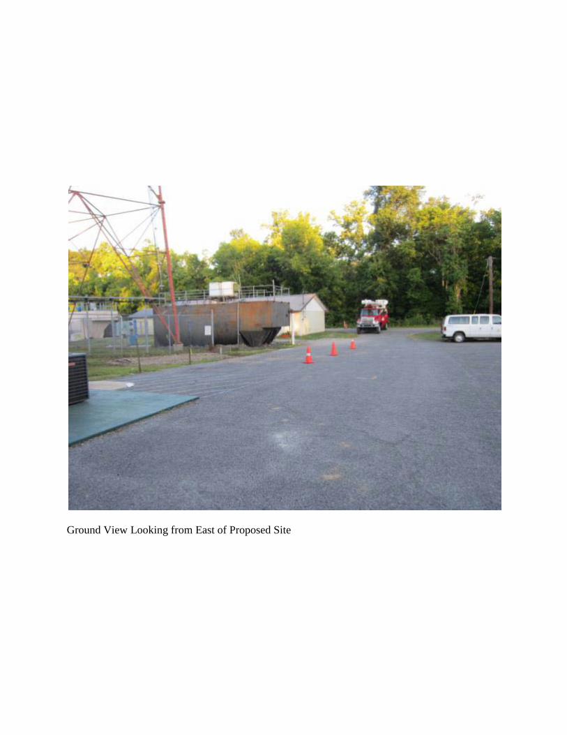
Ground View Looking from East of Proposed Site
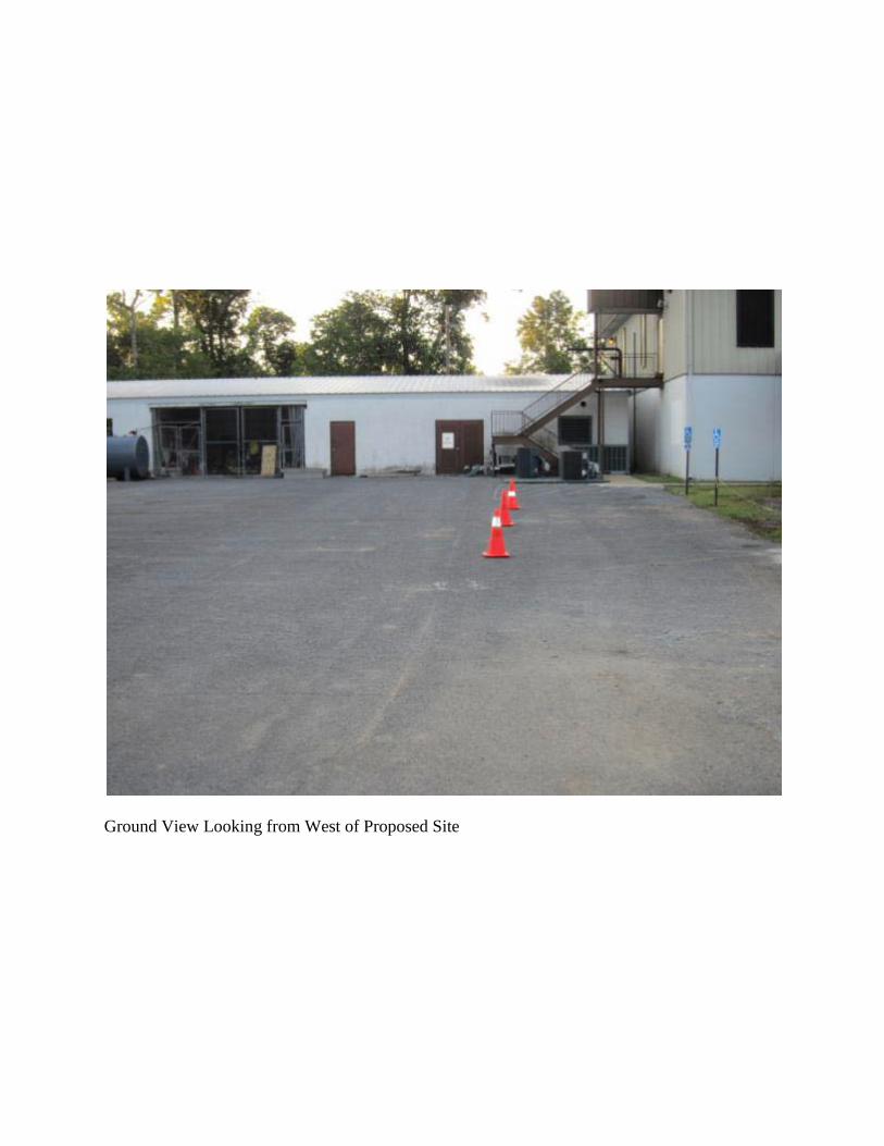
Ground View Looking from West of Proposed Site
Appendix B Site Location Maps
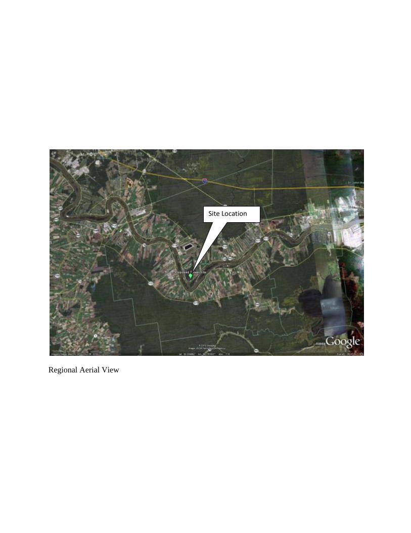
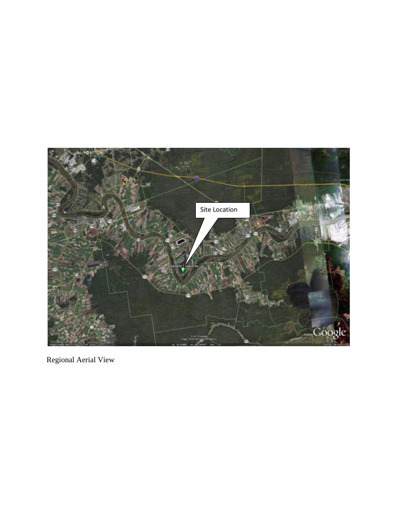
Regional Aerial View
Site Location
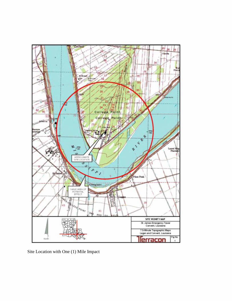
Site Location with One (1) Mile Impact
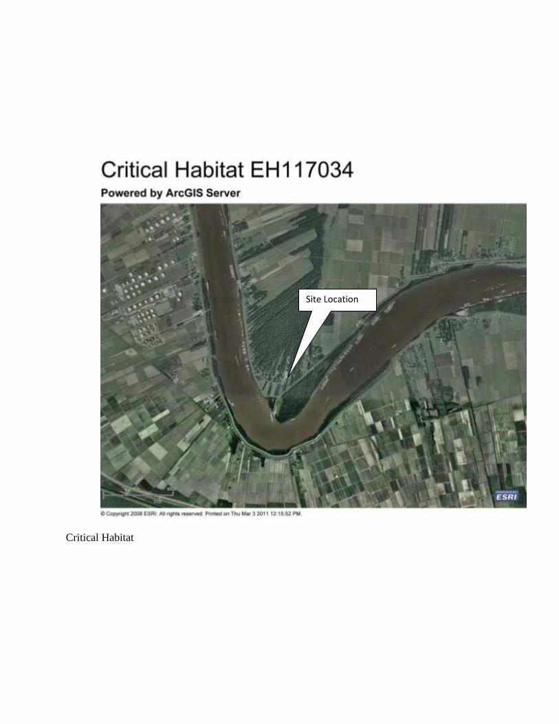
Critical Habitat
Site Location
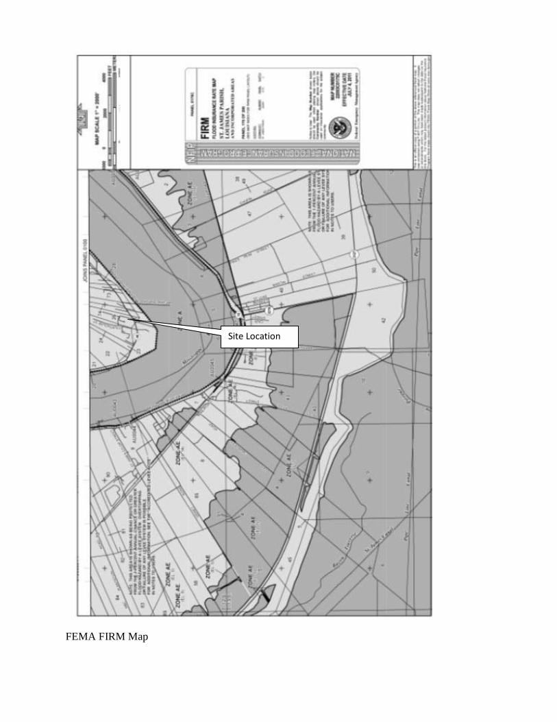
FEMA FIRM Map
Site Location

National Wetlands Inventory
Appendix C Agency Consultation Letters
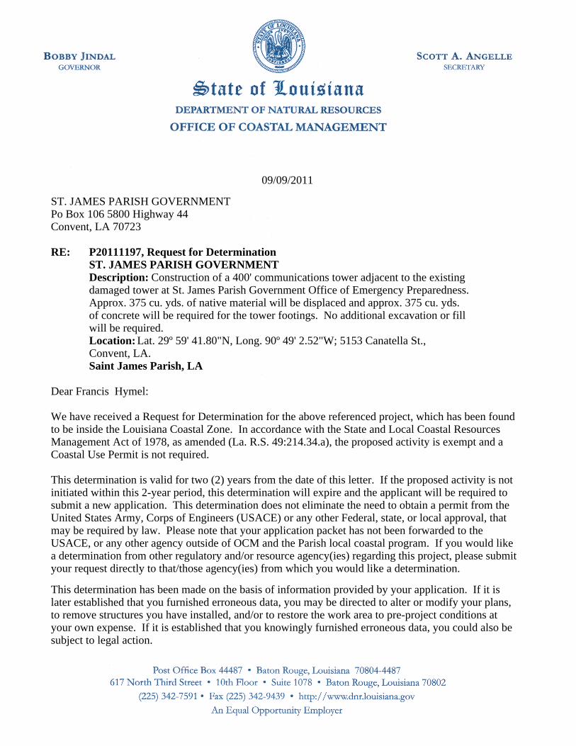
Dear Francis Hymel:
We have received a Request for Determination for the above referenced project, which has been foundto be inside the Louisiana Coastal Zone. In accordance with the State and Local Coastal ResourcesManagement Act of 1978, as amended (La. R.S. 49:214.34.a), the proposed activity is exempt and aCoastal Use Permit is not required.
This determination is valid for two (2) years from the date of this letter. If the proposed activity is notinitiated within this 2-year period, this determination will expire and the applicant will be required tosubmit a new application. This determination does not eliminate the need to obtain a permit from theUnited States Army, Corps of Engineers (USACE) or any other Federal, state, or local approval, thatmay be required by law. Please note that your application packet has not been forwarded to theUSACE, or any other agency outside of OCM and the Parish local coastal program. If you would likea determination from other regulatory and/or resource agency(ies) regarding this project, please submityour request directly to that/those agency(ies) from which you would like a determination.
09/09/2011
RE:
ST. JAMES PARISH GOVERNMENTPo Box 106 5800 Highway 44Convent, LA 70723
P20111197, Request for DeterminationST. JAMES PARISH GOVERNMENT
Saint James Parish, LA
Construction of a 400' communications tower adjacent to the existingdamaged tower at St. James Parish Government Office of Emergency Preparedness.Approx. 375 cu. yds. of native material will be displaced and approx. 375 cu. yds.of concrete will be required for the tower footings. No additional excavation or fillwill be required.
Description:
Lat. 29º 59' 41.80"N, Long. 90º 49' 2.52"W; 5153 Canatella St.,Convent, LA.Location:
This determination has been made on the basis of information provided by your application. If it islater established that you furnished erroneous data, you may be directed to alter or modify your plans,to remove structures you have installed, and/or to restore the work area to pre-project conditions atyour own expense. If it is established that you knowingly furnished erroneous data, you could also besubject to legal action.
Sincerely,
Karl L. Morgan Acting AdministratorKarl L. Morgan/va
Attachments
P20111197, Request for DeterminationST. JAMES PARISH GOVERNMENT09/09/2011Page 2
The drawings submitted with your referenced application are attached hereto and made a part of therecord. If you have any questions regarding this authorization, please contact our office at (225) 342-7591 or (800) 267-4019.
P20111197, Request for DeterminationST. JAMES PARISH GOVERNMENT09/09/2011Page 3
cc: Peggy Rooney, OCM w/plats Craig Leblanc, CMD/FI w/plats Saint James Parish w/plats
Final Plats:
P20111197 Final Plats 09/06/20111)
U.S. Department of Homeland Security FEMA Region 6 800 North Loop 288 Denton, TX 76209-3698
September 12, 2011 Brad Rieck Deputy Field Supervisor United States Fish and Wildlife Service Louisiana Ecological Services Field Office 646 Cajundome Boulevard, Suite 400 Lafayette, LA 70506-4290 RE: Saint James Parish, LA Proposed Communications Tower (2008-GB-T8-K093 (01)) Dear Mr. Rieck: This letter is to notify you that under the FEMA Grant Programs Directorate Program, Saint James Parish has applied for Port Security Grant Program funding under application number 2008-GB-T8-K093 (01) to construct a 400-foot guyed communications tower in Saint James Parish, LA. The purpose of this program is to provide for activities which help to enhance the security and safety of ports in the United States. The proposed project is to construct a 400-foot new communications tower that exceeds the current standards for American National Standards Institute/Electronic Industries Alliance/Telecommunications Industry Association (ANSI/EIA/TIA) Rev. G (class III supporting public safety and mission critical communications). The installation of the antennae and associated equipment will provide integrated emergency communications between federal, state, and local agencies during emergency situations. The proposed communications tower will also be designed for future enhancements to mission critical hardware. This antenna would include microwave dishes that are to be used to send and receive information over long distances without the limitations associated with connection to land lines/cables (primarily interruptions in service due to damage to land lines/cables during emergencies or natural disasters). The proposed tower will be constructed adjacent to an existing 300-foot tower. The proposed tower will be located along 5800 Highway 44, Convent, LA 70723 (Latitude 29.994972, Longitude -90.817417) on land that is owned by the Saint James Parish Government and is currently be used for the regional Emergency Operations Center (EOC). Saint James Parish is located within a portion of the Central Flyway for migratory birds. Fall and spring migrants use the region for temporary stops during travel between the northern and southern hemispheres. Long-term minor to moderate adverse impacts on migratory birds could be expected as a result of collision with operating towers, antennae, and other tall structures, particularly during periods of low visibility and as a result of tower lighting that might be distracting to some species. However, the probability of collision is difficult to determine
USFWS Consultation Saint James Parish Proposed Communication Tower September 12,2011 Page 2
programmatically due to the range of variables that affect the potential for collision and the lack of conclusive data on the causes of collision.
The region is a level area that gradually slopes toward dendritic drainage features that support a large palustrine forested wetlarid to the north. It has the potential to attract many bird species because of the proximity to wetlands and the Mississippi River. The proposed communication tower site will be located adjacent to the Saint James Parish EOC. It is in a rural residential area near the Mississippi River levee on the gently sloping natural levee deposits. The tower site is a developed parcel of land with maintained lawn and landscape. Adjacent areas support mature deciduous forests that are fragmented by developed parcels along regional roads. This portion of the Mississippi River is heavily used for commercial transit. In a letter dated March 24, 2011, the USFWS concluded that that no federally listed threatened or endangered species or their critical habitats, wilderness area or wildlife preserve presently occur within or near the proposed facility.
In conforming to the United States Fish & Wildlife Service's "Service Interim Guidelines for Recommendations on Communications Tower Siting, Construction, Operation, and Decommissioning", the proposed new tower will be a self-supporting, freestanding 400 feet tall structure that will not use guyed wires. Per Federal Aviation Administration guidelines, the tower will be lighted with white strobe during the day and red during the night with obstruction lights on at night. The existing 300-foot communications tower will be will be "de-stacked" to a height of 190 feet. The tower's fencing and ancillary equipment compound will be located in an existing parking lot. The adjacent undeveloped areas are not expected to be directly affected because all construction will occur on site. In addition, the United States Fish & Wildlife Service Louisiana Ecological Services Office will be given access to the proposed communication tower site for monitoring if requested.
FEMA has determined that the proposed project will have little, if any, adverse impact on migratory species based on the scope of work and mitigation measures provided by the Saint James Parish. Should you have any questions, please contact FEMA Region VI Environmental Specialist, Alan Hermely at [email protected]
Enclosures:
Aerial Photographs Site Photographs
Sincerely,
,CHMM Regional Environmental Officer FEMA Region VI
'II

USFWS Consultation Saint James Parish Proposed Communication Tower September 12, 2011 Page 3
Location Maps Critical Habitat Map National Wetland Inventory Map USFWS Consultation Letter
Aerial of Existing Facility Site
Proposed Location of New Tower
Ground View Looking from North of Proposed Site
Ground View Looking from South of Proposed Site
Ground View Looking from East of Proposed Site

Ground View Looking from West of Proposed Site
Regional Aerial View
Site Location

Site Location with One (1) Mile Impact

Critical Habitat
Site Location
National Wetlands Inventory
· I' i I! h t 1I111!!1 i 11111111 , ..
" 1 I" ,iI II,
"' "I " .!; "," , I , ' ''I .. ii'j ..I,
tMaDl& _..... oIIt.~_
.:=. .. -b_oll,;e,t;,..,. :ix
-.,.....s.l-... • a; ~ ---. {I"=ICX
~ .Iioc
~.-.-.:.=~::':=':! -.. ~, ... •
-' .... ' tk b!.
" , I!aw in;;z:I-
lAO I ... _moJ_ .... U i
. -1::;' ~
•

Appendix D NEPA Summary Report and Checklist