pureora forest park tracks · pureora forest park tracks introduction pureora forest park (78,000...
TRANSCRIPT
Pureora Forest Park tracks
Introduction
Pureora Forest Park (78,000 ha) straddles the Hauhungaroa and Rangitoto Ranges between Lake Taupo and Te Kuiti. It is a hidden wonderland of tall trees, clear rivers and rare wildlife. The park is managed by the Department of Conservation (DOC) to safeguard its natural and historic features and to provide for the enjoyment of visitors. Pureora was once a thriving timber village—today just a few houses remain along with DOC’s field base. Sections of forest were extensively logged between 1930 and the early 1970s, with exotic trees also planted for timber (many are now logged). Despite this, the park still has one of the largest tracts of native broadleaf podocarp forest in the North Island, and its towering trees and luxurious undergrowth are truly awe-inspiring.
Getting thereThe main access points to the park are from:• State Highway 30 via Maraeroa or Barryville Roads to
Pureora Village or Waitaramoa Rd to the northern block• State Highway 32 via Arataki, Kakaho and Waihora Roads
to the eastern side of the park• State Highway 4 via Ongarue and Waimiha on the south-
western side
Note: there is no petrol outlet at Pureora; the nearest facilities are at Benneydale, 15 min west along SH 30, or at Mangakino, 20 min east.
Plants and animalsThe vegetation of the park changes from lowland podocarp forest dominated by rimu, mataī, miro and tawa through to higher altitude montane forest with Hall’s tōtara, tāwheowheo and kāmahi. These forests grow on pumice and ash-derived soils. There are also nationally important wetlands and shrublands within the park—many
of the shrublands are known as frost flats, and are home to endangered plants like Turner’s kohuhu, while the forest contains the parasitic flowering plant Dactylanthus taylorii (on tree roots) and endemic mistletoe in the canopy. There is abundant birdlife in the park. Since 1995, intensive efforts at forest restoration in various locations have ensured breeding success and protection of many native species. This includes the rare North Island kōkako, kākā (forest parrot) and pītoitoi (toutouwai/North Island robin). There are populations of the rarer kārearea (New Zealand falcon), kākāriki (parakeet) and whio (blue duck) as well as both species of native bats (long-tailed and short-tailed) and Hochstetter’s frog.
a. Totara Walk 30 minThis easy loop walk winds its way among the awe-inspiring giant trees for which Pureora is famous. Ferns grow in abundance and if you are lucky, you may hear or see native birds such as tūī, fantails, tomtits, wax-eyes, kererū/kūkū or kākā. Glow worms can be seen at night. (The Timber Trail starts beside the Totara Walk—see C1 over page.)
b. The Buried Forest 5 min1800 years ago a forest was knocked over, buried and preserved by a violent volcanic eruption that formed Lake Taupo. This remarkable buried forest in Plains Rd was brought to light in 1983 when it was accidentally uncovered by a digger. Today the uncovered logs lie as they fell during the volcanic eruption.
c. Forest Tower 10 minThis 12-metre-high tower is a short walk from Bismark Rd car park (off Pikiariki Rd). It gives a different perspective of life up in the forest canopy and is a good spot for observing native birds such as kererū/kūkū, kākāriki or kākā.
d. Vintage Steam Hauler and Tractor 5 min
A short loop track takes you past a steam hauler and winch (used until the
late 1940s to haul logs from the forest for milling), and a historic tractor—reminders of
past activity in the area.
e. Historic Crawler Tractor 10 minIn the 1930s–40s this 2-ton Caterpillar tractor was used to recover split tōtara posts and battens from the bush. It is protected by a covered roof with seating. Access is from Link Rd or the Timber Trail.
4
30
41
32
!(
Tokoroa!(Te Kuiti
Taupo
TaumarunuiTurangi
LakeTaupo
!(
!(
!(
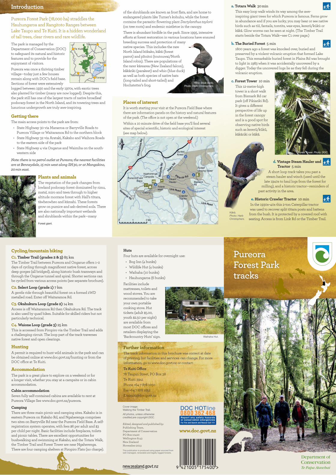
Places of interestIt is worth starting your visit at the Pureora Field Base where there are information panels on the history and natural features of the park. (The office is not open at the weekend.)Within a 10 minute drive of the field base you’ll find several sites of special scientific, historic and ecological interest (see map below).
Whio (blue duck). Photo: Herb Christophers.
Forest giant.
Forest Tower. Photo: DOC.
Kākā. Photo: Herb Christophers.
Cycling/mountain bikingC1. Timber Trail (grades 2 & 3) 85 kmThe Timber Trail between Pureora and Ongarue offers 1–2 days of cycling through magnificent native forest, across deep gorges (all bridged), along historic bush tramways and through the Ongarue tunnel and spiral. Shorter sections can be cycled from various access points (see separate brochure).
C2. Select Loop (grade 1) 7 kmA gentle ride through beautiful forest on a formed 2WD metalled road. Enter off Waitaramoa Rd.
C3. Okahukura Loop (grade 2) 14 kmAccess is off Waitaramoa Rd then Okahukura Rd. The track is also used by quad bikes. Suitable for skilled riders but not particularly technical.
C4. Waione Loop (grade 3) 25 kmThis is accessed from Piropiro via the Timber Trail and adds a challenging circuit. The loop part of the track traverses native forest and open clearings.
HuntingA permit is required to hunt wild animals in the park and can be obtained online at www.doc.govt.nz/hunting or from the DOC office at Te Kuiti.
AccommodationThe park is a great place to explore on a weekend or for a longer visit, whether you stay at a campsite or in cabin accommodation.
Cabin accommodationSeven fully self-contained cabins are available to rent at Pureora Village See www.doc.govt.nz/pureora.
CampingThere are three main picnic and camping sites. Kakaho is in eastern Pureora on Kakaho Rd, and Ngaherenga comprises two sites on Barryville Rd near the Pureora Field Base. A self-registration system operates, with fees $6 per adult and $3 per child per night. Basic facilities include fireplaces, toilets and picnic tables. There are excellent opportunities for bushwalking and swimming at Kakaho, and the Totara Walk, the Timber Trail and Forest Tower are near Ngaherenga. There are four camping shelters at Piropiro Flats (no charge).
HutsFour huts are available for overnight use: • Bog Inn (4 bunks)• Wildlife Hut (4 bunks)• Waihaha (10 bunks)• Hauhungaroa (6 bunks)
Facilities include mattresses, toilets and wood stoves. You are recommended to take your own portable cooking stove. Hut tickets (adult $5.00, youth $2.50 per night) are available from most DOC offices and retailers displaying the ‘Backcountry Huts’ sign.
Further informationThe track information in this brochure was correct at date of printing, but facilities and services can change. For more information, go to www.doc.govt.nz or contact:Te Kuiti Office78 Taupiri Street, PO Box 38Te Kuiti 3941Phone +64 7 878 1050Fax +64 7 878 1051E [email protected]
Cover image: Walking the Timber Trail.
All photos, unless otherwise credited,are copyright DOC.
Waihaha Hut.
www.doc.govt.nz Edited, designed and published by: Publishing Team, Department of Conservation PO Box 10420 Wellington 6143 New Zealand November 2013
This publication is produced using paper sourced from well-managed, renewable and legally logged forests.
Walking and tramping
There are many entry points to the Park, with tracks of varying standards and lengths.
1. Totara Walk and other short walks close to Pureora Village are described over page.
C1. Pureora to Timber Trail shelter: 3 hr, 8 kmThe first section of the Timber Trail from Pureora is an easy gradient through magnificent podocarp forest. Allow 1 hr to the crawler tractor and 2 hr to Cabbage Tree Rd. It is then a gradual climb to a shelter on the slopes of Mt Pureora. See the DOC Timber Trail brochure for other options. Allow 4 days to walk the full trail.
2. Mt Pureora: 1 hr 30 min, 2.6 kmThe summit provides panoramic views of Lake Taupo, Tongariro National Park, Mt Taranaki and Kaimanawa Ranges (weather permitting). The track starts from the Link Rd car park on the northeast side of Mt Pureora, with boardwalks and steps in place to make walking easier.
3. Toitoi Track: 2 hr 30 min, 5.7 kmAn alternative access to the summit, starting from Tui Rd (off Cabbage Tree Rd) along the Timber Trail. Past the 10 km marker, the track climbs up the northwest side of Mt Pureora.
4. Centre of the North Island Walk: 10 min, 250 mA short, flat track off Waimonoa Rd leading to the geographical centre of the North Island (marked with a cairn). The track joins the Mt Titiraupenga Track.
5. Mt Titiraupenga Track: 4 hr, 6 kmFrom Link Rd car park, the track crosses many small streams before climbing a southern ridge of Mt Titiraupenga, joining the Arataki Track just below the summit rock. The summit is Māori land and a taonga (treasure) to local iwi. Please respect cultural values by not climbing the summit rock.
6. Arataki Track: 1 hr 30 min to junction with Mt Titiraupenga Track
This track begins off Titiraupenga Rd and passes the YMCA camp. It climbs steadily to join the Mt Titiraupenga Track, 10 minutes below the summit rock. Please do not climb the summit rock (see 5 above).
7. Rimu Walk: 1 hr, 1.7 km loopFrom the Kakaho Campsite this loop walk follows the Kakaho Stream through dense rimu forest before climbing to a viewpoint. The walk emerges a short distance along Kakaho Rd.
8. Bog Inn Track: 40 min, 1.7 km to Bog Inn HutTo reach the track, turn off Link Rd onto Tihoi Rd just north of the Kakaho Campsite, then further along Tihoi Rd take Bog Inn Rd to reach the car park. An easy 10 minute climb from the car park leads to the mountain mire known as The Bog. This is a fragile area; please keep to the track.
10. Waihora Track: 1 hr 30 min, 4 km This track leaves from the Waihora Lagoon car park and follows an old road for 30 minutes to Pikopiko Stream and then a steady 1 hour climb will bring you to the junction with the Hauhungaroa Track.
11. Waihaha Track: 3 hr, 9.4 km to hutThe track follows the Waihaha River through shrubland into dense podocarp forest. The Waihaha Hut is in a clearing overlooking the river where the Waihaha and Hauhungaroa tracks meet. There is a small camping area beside the hut.
12. Hauhungaroa Track (Link Rd to Mangakahu Valley Rd): approximately 3 days
This 45 km track traverses the Hauhungaroa Range. Follow the Mt Pureora Track before dropping down a southern ridge of the mountain to Bog Inn Hut (3 hr 30 min). After skirting the bog, climb the ridge to Mt Weraroa (3 hr), turn east and drop steeply to the Waihora Track junction (1 hr 30 min). The track continues onto the Waihaha Hut (4 hr). Continue upstream from the Waihaha Hut on the true left of the Waihaha River. Just to the south of Te Awaiti Stream, the track turns southwest and climbs the ridge onto the crest of the Hauhungaroa Range. Follow the
crest south and the track continues to the Hauhungaroa Hut (7 hours from Waihaha Hut). From the Hauhungaroa Hut continue following the crest south past Mt Motere before dropping down to the head of the Mangakahu Valley and the road end (2 hr 30 min).
13. Ketemaringi Track: 4 hr to Totara Stream CrossingFrom the end of Ketemaringi Rd, climb steadily for 1 hour to Ketemaringi Trig. The track then turns south and descends easily down a ridge to emerge onto Totara Stream Rd, with a further 1 hour walk to the car park at the Totara Stream crossing.
14. Mangatutu Track: 2 hr to ridgeThis hunter’s access track is off the Okahukura Loop track (C3) in the north block of the park. The track crosses two streams before climbing steeply onto the main ridge near Mt Ranginui, where it ends.
15. Waipapa Loop Walk: 30 min returnLocated behind Pureora Forest Park Lodge, the track passes through tall podocarp forest. If the road gate is locked, allow an extra 10 minutes to walk to start of track. (Separate information sheet available.)
Î
(
!(
*
(
(
((
(
(
(
(
(
(
(
(
# !(
!(!(
*
* #
#
#
#
!(
!(
:
#
*
(
!(
(
(
*
!
!
!
!
!!
!
!
!
!
!
!
!
!
!
!
!
!
!
to Te Awamutu
Waipapa Loop TrackPureora Forest Park Lodge
C1
C2
C3
C4
Link Rd
Link Rd
Gully Rd
Tihoi
Rd
Arat
aki R
d
Waihora Rd
Okauaka Rd
Bog Inn Rd
Rang
inui R
d
Waimonoa Rd
Kokomiko Rd
Kakaho Road
Owawenga Rd
Tolle
y Rd
Duncan R
d
Hoddle Rd
Fletchers Rd
Mangakahu Rd
Ngar
oma
Rd
Okahu
kura
Rd
Waipapa Rd
Wai
rehi
Rd
Hui
rimu
Rd
Waipapa RdN
garoma R
d
Waitaram
oa Rd
Select Loop Rd
Ketemaringi Rd
Mangawhio Rd
Titiraupenga Rd
Wes
tern
Bay
R
oad
Ongarue Stream Rd
Taumarunui Ngapuke Rd
Waipari R
d
Cabbage Tree Rd
Totara Stream Rd
Lake Taupo
Waimiha
Stm
Okauaka Stm
Mihi
anga
S
tm
Waione River
Lake Kuratau
Lake Waipapa
Lake Arapuni
Okahukura Stm
Waihaha River
Wai
papa
R
Lake Maraetai
Waikat o R
iv er
Waipari R
Mangatahae Stm
Kokakotaia Stm
Waihora Stm
Maramataha River
Pungapunga Riv er
Whanganui Stm
Manuk
iore
St
m
Mangatutu Stm
Taringamotu River
Mangakino Stm
Rimu Track
Mt TitiraupengaTrack
Toitoi Track
Arataki Track
Waihora Track
Waihaha Track
Mangatutu Track
Hauhungaroa Tra
ck
Ketemaringi Track
Centre of North Island
Waihora Lagoon Track
10
5
3
11
2 4
9
7
1
12
13
8
6
15
14
Bog Inn Hut (4 bunks)
Waihaha Hut(10 bunks)
Hauhungaroa Hut(6 bunks)
YMCA Camp
Wildlifehut
Ngapuke
Ngaroma
Mangakino
Benneydale
Kuratau Junction
Tihoi Venture School
Ranginui
Mt Motere
Mt Weraroa
Ketemaringi
Mt Pureora1165m
Mt Titiraupenga
1042m
Piropiro Flats
Kakaho Campground
Pouakani Totara
Pureora Field Base
to Taupo
Ongarue
to Turangi
to Te Kuiti
to Taumarunui
swingbridge
Mangaokewa Rd
32
30
30
41
32
ÉWalking Tracks
Tramping Tracks
The Timber Trail
Places of interest
Information
Mountain Bike Track
Camping
Huts/Cabins/Lodges
Toilets
Restricted accessfor hunting
0 1 2 3 4 5
Kilometres
Other Conservation Land
Pureora Forest Park
*
!14
Hauhungaroa Hut.
Waihora Lagoon.
Track classification
Short walk: well formed track; easy walking for up to an hour.
Walking track: well formed; easy walks from a few minutes to a day.
Tramping track: mostly unformed with steep, rough or muddy sections; backcountry skills and experience required.
Part of Te Araroa Walking Trail. See www.teararoa.org.nz
Enjoying the outdoors safelyMost tracks are marked by orange triangles. Other coloured markers/tape are for pest control purposes and should not be followed. Track times are based on an average family group. They are a guide only and may vary depending on the weather and track conditions. Track times are one way unless indicated otherwise.Choose the right type of track for your group’s experience. Be well prepared for all types of weather and conditions. Have strong comfortable shoes (or boots for tramping tracks) and suitable clothing and equipment. Carry a first aid kit, food and drink and know what to do if things go wrong. Safety is your responsibility. See www.adventuresmart.org.nz for further information.Because of the terrain and heavily forested nature of the park, trampers and hunters are advised to obtain the relevant topographical maps—BF34 Benneydale, BF35 Whakamaru, BG34 Piropiro and BG35 Tihoi.
EASY
9. Waihora Lagoon Walk: 15 min, 730 mFrom SH32 turn onto Waihora Rd and travel approximately 7 km on a gravel road before turning left into the Waihora Lagoon car park. The lagoon, a 10 minute walk from the car park, is one of the most beautiful spots in the park, surrounded by tall rimu and kahikatea (although the lagoon can dry out in summer).