psp 1078 & 1080 plumpton psp & kororoit psp - vpa · pdf fileplumpton psp &...
TRANSCRIPT
Plumpton PSP & Kororoit PSPPSP 1078 & 1080
29 November 2016
Part B Submission - C146 & C147 Amendment to the Melton
Planning Scheme
VPA Part B Submission – Melton C146 (Plumpton PSP) & C147 (Kororoit PSP)
Page 1
Table of Contents 1. Introduction ........................................................................................................................................ 3
2. Part B – Directions from Panel ........................................................................................................... 3
3. Common issues raised by multiple submitters ......................................................................... 13
3.1 Beattys Road Reserve ............................................................................................................... 13
3.2 Dry Stone Walls (DSW) .............................................................................................................. 15
3.3 Flexibility in location of local parks ........................................................................................... 16
4. Plumpton – Site specific outstanding issues by submitter ............................................................. 17
Submission 3 – Tan Buu Nguyen ........................................................................................................... 17
Submission 4 – Angelo Lavecchia .......................................................................................................... 17
Submission 6 – Urban Design & Management (on behalf of L&G Failli)............................................... 18
Submission 7 – Urban Terrain ............................................................................................................... 18
Submission 8 - Marantali ...................................................................................................................... 19
Submission 10 – SJB Planning (on behalf of Domenic Santacaterina) .................................................. 19
Submission 11 – Mesh (on behalf of Villawood) .................................................................................. 20
Submission 12 – Echelon (on behalf of Mondous Group) .................................................................... 22
Submission 19 – Gadens Lawyers (on behalf of Dahua Dacland Plumpton P/L) .................................. 29
Submission 20 – Michael Ahmet ........................................................................................................... 34
Submission 24 – Select Group (on behalf of Aldi) ................................................................................. 36
Submission 25 – Melbourne Water ...................................................................................................... 37
Submission 26 – APA ............................................................................................................................. 38
Submission 27 – Zoran Trimcevski & Mirjana Mihaljevic ...................................................................... 39
Submission 29 – Melton City Council .................................................................................................... 39
Submission 30 – George & Vincenza Sultana ........................................................................................ 53
Submission 32 – Urban Design and Management (on behalf of Mrs Candan Ahmet) ......................... 53
5. Kororoit – Site specific outstanding issues by submitter ................................................................ 56
Submission 2 – Robert Magro ............................................................................................................... 56
Submission 5 – Greybox Homes (on behalf of George & Josie Gatt) .................................................... 56
Submission 6 - Kellehers Australia (on behalf of Ms Maria Natale) ..................................................... 57
Submission 7 – Town Planning Group (on behalf of landowners) ........................................................ 63
Submission 8 – Spiire (on behalf of Villa World Development) ............................................................ 67
Submission 9 – Tract Consultants (Moremac) ...................................................................................... 69
Submission 12 – Lawport Holdings ....................................................................................................... 72
Submission 14 – Tract (on behalf of Sekhon) ....................................................................................... 74
Submission 15 – Saviour and Lucy Debrincat ....................................................................................... 75
VPA Part B Submission – Melton C146 (Plumpton PSP) & C147 (Kororoit PSP)
Page 2
Submission 16 – Breese Pitt Dixon (BPD) (on behalf of landowner) .................................................... 77
Submission 18 – Insight (on behalf of Coles Property Group Developments)...................................... 78
Submission 19 – Andrew Booth ............................................................................................................ 78
Submission 20 – ID_Land ...................................................................................................................... 81
Submission 24 – Select Group (on behalf of Aldi) ................................................................................. 84
Submission 25 – APA ............................................................................................................................. 85
Submission 27 – Nola Dunn .................................................................................................................. 91
Submission 29 – Whiteman Property & Accounting (on behalf of Luzon Holdings) ............................ 92
Submission 30 – Best Hooper (on behalf of N&S Zurzolo). .................................................................. 94
Submission 32 – Melton City Council .................................................................................................... 96
Submission 33 – Mesh (on behalf of OYOB) ....................................................................................... 112
VPA Part B Submission – Melton C146 (Plumpton PSP) & C147 (Kororoit PSP)
Page 3
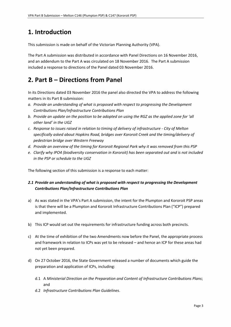
1. Introduction
This submission is made on behalf of the Victorian Planning Authority (VPA).
The Part A submission was distributed in accordance with Panel Directions on 16 November 2016,
and an addendum to the Part A was circulated on 18 November 2016. The Part A submission
included a response to directions of the Panel dated 03 November 2016.
2. Part B – Directions from Panel
In its Directions dated 03 November 2016 the panel also directed the VPA to address the following
matters in its Part B submission:
a. Provide an understanding of what is proposed with respect to progressing the Development
Contributions Plan/Infrastructure Contributions Plan
b. Provide an update on the position to be adopted on using the RGZ as the applied zone for ‘all
other land’ in the UGZ
c. Response to issues raised in relation to timing of delivery of infrastructure - City of Melton
specifically asked about Hopkins Road, bridges over Kororoit Creek and the timing/delivery of
pedestrian bridge over Western Freeway
d. Provide an overview of the timing for Kororoit Regional Park why it was removed from this PSP
e. Clarify why IPO4 (biodiversity conservation in Kororoit) has been separated out and is not included
in the PSP or schedule to the UGZ
The following section of this submission is a response to each matter:
2.1 Provide an understanding of what is proposed with respect to progressing the Development
Contributions Plan/Infrastructure Contributions Plan
a) As was stated in the VPA’s Part A submission, the intent for the Plumpton and Kororoit PSP areas
is that there will be a Plumpton and Kororoit Infrastructure Contributions Plan (“ICP”) prepared
and implemented.
b) This ICP would set out the requirements for infrastructure funding across both precincts.
c) At the time of exhibition of the two Amendments now before the Panel, the appropriate process
and framework in relation to ICPs was yet to be released – and hence an ICP for these areas had
not yet been prepared.
d) On 27 October 2016, the State Government released a number of documents which guide the
preparation and application of ICPs, including:
d.1 A Ministerial Direction on the Preparation and Content of Infrastructure Contributions Plans;
and
d.2 Infrastructure Contributions Plan Guidelines.
VPA Part B Submission – Melton C146 (Plumpton PSP) & C147 (Kororoit PSP)
Page 4
e) The VPA intends to prepare an ICP for both precincts which accords with these documents.
f) However due to the ICP guidance documents being only very recently released, the draft
Plumpton and Kororoit ICP has only recently commenced preparation by the VPA.
g) Ultimately, the ICP is intended to:
g.1 Be consistent with the PSPs, specifically, the items listed in the ICP will be the same items
identified in Table 9 of each PSP, and listed as ‘included in ICP’. These areas are also shown
on Plan 12 – Precinct Infrastructure Plan (Transport) and Plan 13 – Precinct Infrastructure
Plan (Community & Open Space) of each PSP. The items to be included are subject to any
recommendations arising from this Panel, however VPA considers that the Plumpton and
Kororoit PSPs provide the strategic justification necessary for preparing the Plumpton and
Kororoit ICP which is consistent with the Ministerial Direction and Guidelines.
g.2 Be consistent with the relevant statutory and policy framework, and therefore will include:
g.2.1 Identifying the levies payable;
g.2.2 Listing the items that will be contributed to;
g.2.3 Listing the method for indexing the levies; and
g.2.4 Setting out the administration procedures.
g.3 If a supplementary levy is required the ICP will also include cost estimates of all projects.
g.4 The ICP would be implemented under cover of the State Standard Infrastructure
Contributions Plan Overlay (“ICPO”).
h) The ICP for the Amendment areas is anticipated to be implemented by a separate amendment
to the Melton Planning Scheme, in accordance with the ICP Guidelines.
i) Based on preliminary consideration undertaken by the VPA to date, and subject to
recommendations regarding any particular infrastructure by this Panel, it is likely that a
supplementary levy is required for the Plumpton and Kororoit ICP.
j) This is largely due to the high land values in the area, and the three bridge crossings of the
Kororoit Creek, which are supplementary allowable items.
k) In terms of timing, the VPA anticipates that the process of preparation and consideration of the
Plumpton and Kororoit ICP will occur alongside the progression of these Amendments.
l) The ICP is now being progressed – and as the subject of a separate amendment will not be put
before this Panel.
VPA Part B Submission – Melton C146 (Plumpton PSP) & C147 (Kororoit PSP)
Page 5
m) The VPA therefore asks the Panel to consider the Amendments in the absence of a finalised ICP –
but having regard to the fact that the VPA intends to progress the ICP as quickly as it is able to,
also having regard to the relevant Ministerial Direction and Guidelines.
n) The VPA submits that the approval of the Amendments should not be delayed if a full ICP has
not been prepared and adopted for the Amendment Area.
o) The recent suite of documents released by the State Government also includes a:
Planning Practice Advisory Note 64: Transitional arrangements for metropolitan growth
area infrastructure contributions.
p) This document is designed to provide guidance in respect of transitional arrangements, and
addresses the question of when an ICP may be used as against when a DCP may continue to be
used.
q) With respect however, the Practice Note does not directly assist the Panel in the circumstances
of the Amendments before it: the VPA did not intend to in fact implement a DCP – an ICP was
intended once clear the ICP would be available to be used.
r) As the ICP guidance documents were not released until recently, the Amendments before the
Panel were exhibited with a Development Contributions Plan Overlay.
s) However it was not intended that an actual DCP be prepared for the Amendments areas.
Rather, the DCPO was intended to operate as an interim measure – to enable development to
occur whilst an ICP was being prepared and considered, but subject to oversight by Council in
terms of contributions on a site specific basis.
t) In the circumstances of these Amendments, the VPA proposes that the most appropriate course
is to progress the Amendments with the retention of an interim option, so that development
might be progressed before an ICP is finalised - bearing in mind the likely need for a
supplementary levy.
u) VPA notes that the Panel in Amendment C162 recommended substitution of the DCPO with an
ICPO, but submits that this approach ought not be followed in the circumstances of these
Amendments given the likely need for a supplementary levy.
2.2 Provide an update on the position to be adopted on using the RGZ as the applied zone for ‘all
other land’ in the UGZ
a) An update on the position of the VPA with regard to the application of the Residential Growth
Zone (RGZ) and the General Residential Zone (GRZ) within the PSP areas was provided in
Appendix 10 to the VPA’s Part A submission.
VPA Part B Submission – Melton C146 (Plumpton PSP) & C147 (Kororoit PSP)
Page 6
b) As outlined in Appendix 10, the VPA proposes to reduce the proposed extent of the applied
Residential Growth Zone (RGZ) from that publicly exhibited, in response to Council’s submission.
The applied zoning for the balance of areas shown as ‘residential’ on the Future Urban Structure
(FUS) of each PSP will be General Residential Zone.
c) To reflect the rationale for applying the Residential Growth and General Residential zones in the
amended FUS’s it is also proposed to update the objectives; requirements; guidelines; and, the
dwelling density tables of each PSP as detailed in Appendix 10 to the Part A submission.
d) The VPA remains committed to using the applied RGZ across significant areas of the Plumpton
and Kororoit PSPs for the following reasons:
i. Enabling Increased Choice and Diversity;
ii. Facilitating the Permanent Urban Growth Boundary;
iii. Delivering the 20 Minute City; and
iv. Delivering the structure for Compact and Liveable Communities.
v. Supporting delivery of high quality public transport services
e) There is a need for zoning to signal and support future investment in high quality public
transport, therefore a 600m (7 minute walk) distance is considered appropriate, with room for
some discretion for above or below this distance to address local conditions.
f) While Cl 56.04 states that 95% of dwellings should be within “400m street walking distance of a
bus stop”, the VPA contends that the future PPTN, being a high frequency and high capacity
services, would have more in common with the tram network standard of 600m.
g) VPA has received correspondence from PTV supporting the 600m catchment from the PPTN with
reference to the Mt Atkinson and Tarneit Plains PSP, which is considered to apply to similar PPTN
conditions as the Plumpton and Kororoit PSPs.
h) PTV’s submission to the Managing Residential Growth Advisory Committee supports the
application of the RGZ to support, and be supported by, provision of high quality public transport,
as follows:
“PTV recommends that this review of the application of the new residential zones, and any future
planning scheme amendments to introduce the new residential zonings to councils that previously
opted for a transition of the former zones to the GRZ, should consider access to public transport as
an assessment criteria……. it is proposed that planning authorities should justify why land in close
proximity to stations, tram lines and high frequency buses or the PPTN is not zoned for residential
growth, if the RGZ is not applied.”
i) VPA appreciates that at first blush, the distances it has applied in these Amendments in arriving
at the designations for where RGZ and GRZ will be applied, differ slightly from the approach
endorsed by the Amendment C162 Panel.
VPA Part B Submission – Melton C146 (Plumpton PSP) & C147 (Kororoit PSP)
Page 7
j) However the VPA stands by its approach, and further, says it is justified upon an assessment of
the facts in these Amendments.
k) First, VPA has shown flexibility by amending the zone to be applied to a mixture of RGZ and GRZ.
l) Second, the VPA submits that the application of RGZ for distances of 800m from the Major Town
Centre; 600m from the PPTN; 400m from Local Town Centres; and 100m from co-located,
community hubs, sports reserves and Local Convenience Centres is justified. Note that there is
some slight variation in these distances to extend the RGZ slightly, or reduce it slightly, to enable
‘logical’ boundaries to end the zone at precinct features such as a road or waterway.
m) VPA seeks to ensure that these new growth areas are planned not just for the next 5 or 10 years,
but for the longer term.
n) These areas are the areas where VPA seeks to encourage more than simply conventional housing,
into the future.
o) VPA seeks to clearly send the signal, within the Planning Scheme, that these are areas which
ought be expected to the subject of higher densities than surrounding areas.
p) Land that is within the applied distances is land that will be readily accessible by active transport
for most future residents. The RGZ is sought to be applied to the “walkable catchments”.
q) It is appropriate that the RGZ be applied within these areas, to send the signal that for the longer
term, these areas should be expected to be more densely developed than the remainder of the
PSP areas, which are not so readily accessible by foot or by bike.
r) In addition, the application of the 600m from the future PPTN is supported by PTV’s submission
to the Managing Residential Growth Advisory Committee. The VPA also notes that future
population will be required to support the provision of efficient public transport services to
support these densities.
s) The VPA refers to the strategic assessment it has undertaken which underpins the applied
distances, as referred to in the Part A submission.
t) The relevant zone is the Urban Growth Zone, and its purpose. Nevertheless it is instructive to
note that a comparison of the residential zone purposes does also support the VPA approach.
The GRZ purposes seek to “provide a diversity of housing types and moderate housing growth in
locations offering good access to services and transport”. The RGZ purposes seek to “encourage
a diversity of housing types in locations offering good access to services and transport including
activities areas”. The RGZ purposes also refer to encouraging a “scale of development that
provides a transition between areas of more intensive use and development and areas of
restricted housing growth”. The VPA submits that the purposes of the RGZ are appropriately
applied within the distances it has identified.
VPA Part B Submission – Melton C146 (Plumpton PSP) & C147 (Kororoit PSP)
Page 8
u) A difference between the VPA’s approach and the Council’s Housing Diversity Strategy is the
choice of 800m as against 400m as an applicable distance to the MTC.
v) VPA submits that 800m is an appropriate distance for the long term, and that it seeks to build in
flexibility to adapt to future circumstances. 800m is a distance that takes around 10 minutes to
walk. This makes uses and development within 800m highly accessible.
w) It should also be noted that Council’s “Housing Diversity Strategy 2014” was developed in relation
to existing residential areas. It is principally referred to in the Melton Planning Scheme as part of
clause 21.04 which refers to “Housing within the Established Residential Areas” (emphasis
added). Clause 22.12 also refers to the Strategy in relation to its role for established residential
areas. With respect, it is not directly applicable to the growth areas that are the subject of these
Amendments.
x) The VPA also notes that in its Part A submission it mapped the extent of the proposed RGZ/GRZ.
When the relevant maps are examined, it can be seen that the extent of land to be designated
RGZ is not excessive or unreasonable.
y) Rather, the extent of land to be designed RGZ accords with what might be expected of sensible
long term town planning. The mapped areas of RGZ will provide appropriate diversity in dwelling
demsity and form.
z) For Plumpton, the majority of the RGZ focuses around the Major Town Centre, which will be a
significant provider of services for people within this PSP area. When the proposed applied
residential zones are assessed against Plan 5 in the PSP, it can also be seen that in fact much of
the RGZ land will also be within a 400m walkable catchment of a town centre, which was the
applied benchmark in Amendment C162. The RGZ will apply to approximately 42% of the NDA-
residential.
aa) For Kororoit, an examination of the proposed FUS reveals that the extent of the RGZ is in fact
much more limited, to 20% of the total NDA-residential. It is focused around the local town
centres, and a significantly sized park and primary school adjacent a local convenience centre.
Again, undertaking an assessment of the proposed FUS as against Plan 5 in the PSP, it can be seen
that these areas are within the 400m distance.
bb) VPA notes the comment of the Panel in Amendment C162, that local circumstances might
warrant differing approaches and a broader or more confined application of the RGZ in other
locations. VPA submits that in the circumstances of Plumpton and Kororoit, that the proposed
application of the RGZ is appropriate.
2.3 Response to issues raised in relation to timing of delivery of infrastructure - City of Melton
specifically asked about Hopkins Road, bridges over Kororoit Creek and the timing/delivery of
pedestrian bridge over Western Freeway
VPA Part B Submission – Melton C146 (Plumpton PSP) & C147 (Kororoit PSP)
Page 9
a) The PSP as exhibited emphasises the delivery of Hopkins Rd through requirements and guidelines
as follows:
i. R46 (Kororoit) R53 (Plumpton): Properties abutting the future Hopkins Road must prioritise
delivery of the road in the early stages of development, to the satisfaction of the responsible
authority
ii. R95 (Kororoit) R101 (Plumpton): Development staging must provide for the timely provision
and delivery of: arterial road reservations … , G69 and Table 9 (in Kororoit PSP), and through
R53, R101, G76 and Table 9 (in Plumpton PSP). Hopkins Road is an identified arterial road.
iii. G69 (Kororoit) G76 (Plumpton): Staging of transport infrastructure should prioritise early
delivery of a connected arterial road network to:
- Ensure that subdivisions are designed to access the future arterial network rather than the
existing road network
- Reduce pressure on existing roads which were built to cater for rural, not urban use
- Reduce pressure on the existing low standard crossing of Kororoit Creek at Sinclairs Road
(Plumpton PSP adds, “in the Kororoit PSP to the south”).
iv. Table 9 of both PSPs list all Hopkins Road items (RD, BR and IN) as ‘S’ for short term staging
priority of the interim (land + first carriage-way typically) infrastructure. RD-03 was mistakenly
labelled ‘M’ and will be changed to ‘S’.
b) Through further discussion regarding the above, Melton City Council no longer raises this as an
issue and VPA understands Council is satisfied that it can manage this issue (notwithstanding
Council’s outstanding issue regarding direct access to Plumpton and Sinclairs Roads).
c) VPA has provided a specific response in relation to direct access to Plumpton and Sinclairs Roads
under Issue 6 of Council’s submission response to Plumpton PSP of this Part B submission. BR-01
and BR-03 are proposed as ICP items and Melton City Council has not objected to this in its
submission.
d) The pedestrian/ cyclist bridge over the Western Freeway (PBR-08) is apportioned partly to
Kororoit and Plumpton PSPs and partly to Mt Atkinson and Tarneit Plains PSP, and is identified for
delivery in the longer term. The identification of this bridge as an ICP item was accepted by
submitters at the recent Mt Atkinson and Tarneit Plains Panel. Melton City Council did not object
to this in their submission to Plumpton and Kororoit PSPs.
2.4 Provide an overview of the timing for Kororoit Regional Park and why it was removed from
this PSP
a) The West Growth Corridor Plan (West GCP) identified a ‘Proposed Regional Open Space’
bounded by the Western Freeway to the south, Sinclairs Road to the west and Clarke Road to
the east, and extending to the north of the Kororoit Creek.
VPA Part B Submission – Melton C146 (Plumpton PSP) & C147 (Kororoit PSP)
Page 10
b) The proposed Kororoit Regional Park was originally included in the Kororoit PSP. However, as a
number of issues still require resolution with relation to the proposed Regional Park, the VPA
decided to separate PSP 1080 into two parts:
i. Part 1 (which is the subject of Amendment C147) includes the majority of the PSP,
excluding only the existing extent of Conservation Area 3 (and also including land to the
centre of the Kororoit Creek, as this was designated as GGF Conservation Areas).
ii. Part 2 which is the remainder of the former PSP area, ie. Conservation Area 3 plus GGF
Conservation Area to the centre line of the Kororoit Creek.
c) Outstanding issues for resolution, and the proposed process, are as follows:
i. DELWP is currently developing an acquisition strategy for the proposed Kororoit Regional
Park, to ensure that funds are available when required.
ii. The proposed Regional Park is also designated as Conservation Area 3 in the Biodiversity
Conservation Strategy for Melbourne’s West (BCS).
iii. The BCS lists as a ‘Further Action’ for Conservation Area 3 to ‘Finalise boundaries of the
Kororoit Creek Regional Park’ (this is another name for the proposed Kororoit Regional
Park).
iv. The VPA has been working with DELWP and Parks Victoria, and has undertaken some
consultation with landowners within the proposed Regional Park, to determine an
appropriate boundary for the Regional Park. This will consider both its regional open space
function as well as its conservation function for matters of national and state significance.
v. Under the ‘Final Approval for Urban Development in Three Growth Corridors under the
Melbourne Urban Growth Program Strategic Assessment’ (5/9/2013), a change to the
boundary of Conservation Area 3 requires the agreement of the Commonwealth Minister
for the Environment.
vi. Once the State Minister for the Environment’s endorsement is received (if successful), the
Commonwealth Minister’s approval will then be sought.
vii. Kororoit PSP includes area which is appropriate for development in the near term as it is
close to existing infrastructure with some existing capacity, adjacent to Caroline Springs.
viii. In order to avoid unduly delaying finalisation of most of this PSP area, the VPA proceeded
with preparing PSP documents for public exhibition for Part 1.
ix. Part 2 will relate to the area excluded under Part 1, and will proceed once the
Commonwealth and Government decision is finalised.
x. Background technical reports have been completed for Part 2, as they were undertaken as
part of the original PSP scope.
xi. Once a Commonwealth decision is made, DELWP will advise the VPA and the VPA will re-
commence planning of Part 2.
xii. The VPA estimates it will take 3-6 months from this time to prepare the PSP and release it
publicly.
2.5 Clarify why IPO4 (biodiversity conservation in Kororoit) has been separated out and is not
included in the PSP or schedule to the UGZ
VPA Part B Submission – Melton C146 (Plumpton PSP) & C147 (Kororoit PSP)
Page 11
a) The majority of land within the Kororoit precinct (Part 1) is currently zoned Urban Growth
Zone (UGZ). The purposes of the UGZ are:
To implement the State Planning Policy Framework and the Local Planning Policy
Framework, including the Municipal Strategic Statement and local planning policies.
To manage the transition of non-urban land into urban land in accordance with a precinct
structure plan.
To provide for a range of uses and the development of land generally in accordance with a
precinct structure plan.
To contain urban use and development to areas identified for urban development in a
precinct structure plan.
To provide for the continued non-urban use of the land until urban development in
accordance with a precinct structure plan occurs.
To ensure that, before a precinct structure plan is applied, the use and development of
land does not prejudice the future urban use and development of the land.
(emphasis added)
b) Amendment C147 proposes to rezone part of the Kororoit precinct to UGZ12; insert
Schedule 12; and, adopt the Kororoit Precinct Structure Plan (the ‘PSP’) in the Melton
Planning Scheme, which will result in the PSP applying to all land that is zoned UGZ12.
c) However there are conservation areas within the Kororoit precinct that are proposed to be
zoned Rural Conservation Zone (RCZ). Amendment C147 proposes to introduce Schedule 3
and 4 to the RCZ and apply these schedules to the various conservation areas within the
precinct.
d) Given the RCZ does not provide a trigger for consideration of the PSP in the conservation
areas, a separate planning tool is required to trigger land use and development applications
to respond to the PSP. The most appropriate mechanism for this is the Incorporated Plan
Overlay (IPO). The purpose of the IPO is:
To implement the State Planning Policy Framework and the Local Planning Policy
Framework, including the Municipal Strategic Statement and local planning policies.
To identify areas which require:
- The form and conditions of future use and development to be shown on an
incorporated plan before a permit can be granted to use or develop the land.
- A planning scheme amendment before the incorporated plan can be changed.
To exempt an application from notice and review if it is generally in accordance with an
incorporated plan.
(emphasis added)
e) The purpose of the proposed Schedule 4 to the IPO is:
To give effect to the Kororoit Precinct Structure Plan.
To protect and manage land for nature conservation in a manner consistent with the
Biodiversity Conservation Strategy for Melbourne’s Growth Corridors.

VPA Part B Submission – Melton C146 (Plumpton PSP) & C147 (Kororoit PSP)
Page 12
f) To manage development of recreation and infrastructure associated with adjoining urban
land uses.
(emphasis added)
g) Hence Amendment C147 proposes Schedule 4 (Kororoit Precinct Structure Plan) to the IPO
and applies the IPO4 to all land that is zoned RCZ3 and RCZ4 within the Kororoit precinct to
give effect to the PSP to land that is not zoned UGZ12.
VPA Part B Submission – Melton C146 (Plumpton PSP) & C147 (Kororoit PSP)
Page 13
3. Common issues raised by multiple submitters
3.1 Beattys Road Reserve a) Beattys Road reserve is Crown land under the management and control of Melton City
Council. The road traverses through the Plumpton Precinct in a diagonal manner from its
north-east corner to the south-west. Currently it serves as a gravel road and provides access
for eleven properties.
b) The PSP proposes to retain Beattys Road with a road function in various forms, to cater for
connector roads, local access streets and loop road treatments as well as with a continuous
shared path for cyclists and pedestrians. It is also envisaged that Beattys Road reserve acts as
the civic spine of the precinct flanked by community facilities, schools and sports reserves as
well as facilitating priority pedestrian and cycling access.
c) A number of submitters have queried who is responsible for delivering necessary road
infrastructure and landscaping embellishments within Beattys Road reserve in accordance
with the PSP as they submitted that it was not sufficiently clear in the PSP. Plan 6 – Open
Space identifies Beattys Road reserve as LOS-03. Table 9 – Precinct Infrastructure lists LOS-03
(p84) as ‘developer works’.
d) On the one hand, it could be considered to be a Council implementation issue, similar to
delivery of Sinclairs Rd. However, the VPA has sought to provide further clarity on the issue, as
outlined below.
e) Under the new ICP system landscaping works and embellishments are not allowable items in
an ICP as outlined by the Ministerial Direction for ICPs. Therefore Beattys Road Reserve
embellishments have not been proposed as ICP works. Also, the land is not considered
sufficiently fragmented, as the roads can be delivered for the frontage to which they apply.
Thirdly, it is not an upgrade to an existing local road to Council arterial standard (Ministerial
Directions: Table 4, p 11).
f) For the purposes of clarity, the VPA proposes to include in the PSP an additional appendix that
includes separate plans that demonstrate who/what property is responsible for delivering the
required infrastructure be it landscaping and/or embellishments and road infrastructure (refer
to updated Beattys Road concept plans). These plans will be referenced in Table 9 Precinct
Infrastructure.
g) The VPA proposes that land owners/developers of parcels abutting Beattys Road are
responsible for delivering the length of Beattys Road which they adjoin, up to the mid point of
Beattys Road’s width (30m).
h) The VPA proposes the following responsibilities for each sections of Beattys Road, as
annotated on reference plans:
VPA Part B Submission – Melton C146 (Plumpton PSP) & C147 (Kororoit PSP)
Page 14
i) Connector Roads
i. Where there is a connector road proposed (which generally has a 25m wide cross section
in the PSP) within the road reserve, the adjoining land owner will be required to construct
the connector road which is 15.3m wide in this case (similar to the left hand side of Section
19, p 117 in the exhibited PSP). The land owner will also be required to deliver the shared
path and undertake ground levelling works and landscaping embellishments from 15.3m to
25m within the road reserve (ultimate embellishment standard). This will include grassing
the full area, tree and shrub plantings and the installation of seating/ benches (or other
standard street furniture generally required by Council along a connector road). The shared
path is intended to be meandering in nature. The land owner will be responsible for
delivering it to an average equivalent to 25m width within the road reserve. This is
considered equivalent in extent of works to what would normally be expected for a
connector road. The final 5m within the road reserve is to include ground levelling and is to
be fully grassed (interim embellishment standard). The ultimate embellishments for this
5m width will be the responsibility of Melton City Council, and will respond to the needs of
the community at a future time.
j) Level 2 Local Access Street
i. Where there is a level 2 local access street proposed, (which generally has a 20m wide
cross section in the PSP), within the road reserve, the adjoining land owner will be required
to construct the street at 14.3m (similar to the left hand side of Section 20, p 118 in the
exhibited PSP). The land owner will be also required to deliver the shared path and
undertake works to an ultimate embellishment standard to 20m. The final 10m within the
road reserve is to include ground levelling and is to be fully grassed (interim embellishment
standard).
k) Level 1 Local Access Streets (for loop roads)
i. Where there is a level 1 local access street proposed (which generally has a 16m wide cross
section in the PSP) within the road reserve, the adjoining land owner will be required to
construct the street at 13.3m. The land owner will be also required to deliver the shared
path and undertake works to an ultimate embellishment standard to 16m. The final 14m
within the road reserve is to include ground levelling and is to be fully grassed (interim
embellishment standard).
l) It is anticipated that sections of Beattys Road will be delivered at different times. When
delivering a section of Beattys Road linear park, road access must be continuous whereby the
new section delivered connects with the existing alignment of gravel road in the immediately
abutting Beattys Road sections. This will ensure that access is maintained for parcels that
require their access from Beattys Road until the wider road network has been established to
provide alternative access to parcels.
m) Following consideration of submissions on this matter, the VPA proposes to remove the three
proposed local parks (LP-20, 21 and 22) from within the Beattys Road reserve.
VPA Part B Submission – Melton C146 (Plumpton PSP) & C147 (Kororoit PSP)
Page 15
n) These parks were intended to emphasise the role of Beattys Road as the ‘civic spine’ of the
Plumpton PSP, but as there is sufficient provision of local parks and open space; as the 400m
walking catchment to local parks is met; and as it is difficult to fairly apportion delivery of these
local parks, they will be deleted from the requirement for ‘developer works’ in the Precinct
Infrastructure Table 9, and from the PSP.
o) Council is encouraged to provide a range of diverse quality play spaces, install public art and
street furniture. Council will be responsible for delivering the ultimate standard
embellishment for areas that have undergone interim standard embellishment, when it is
suitable to do so and in response to the future needs of the community.
p) Through the proposed delivery mechanism outlined above, Beattys Road Reserve will be
retained as road and civic spine with a continuous path along its length and width. Developers
will be required to undertake a reasonable and equitable portion of its delivery.
3.2 Dry Stone Walls (DSW) a) A number of submissions received to both the Plumpton and Kororoit PSP’s raised concern
with regard to the rigidity of the ‘requirement’ to retain DSW illustrated on Plan 2 of the PSP’s,
including questions about how this requirement would work in practice. In addition, concern
has been raised about the actual level of significance of various DSW depicted on Plan 2 of the
PSP’s and the necessity for the retention of those DSW that may physically exist however are
not considered significant.
b) DSW are an important and prominent landscape feature and strong lineal element within the
Melton municipality. DSW provide a direct link to historical rural use and add to the visual
interest and cultural identity of the area.
c) Relevantly Amendment C100 to the Melton Planning Scheme was gazetted in May 2016. It
amends the Schedule to the Heritage Overlay (HO) to include DSW and introduces an
incorporated document titled Shire of Melton Dry Stone Wall Study Volume 3 Statements of
Significance.
d) DSW selected for HO protection were identified via the Shire of Melton Dry Stone Wall Study
Volume 3 Statements of Significance, which included identifying the highest order DSW in the
precincts.
e) The VPA submits DSW should be retained where feasible and appropriate, particularly in
public areas (e.g. open space and road reserves).
f) VPA is of the opinion that DSW should not preclude development or road access.
g) However an effort should be made towards incorporating DSW into the subdivision design
where possible.
VPA Part B Submission – Melton C146 (Plumpton PSP) & C147 (Kororoit PSP)
Page 16
h) The VPA acknowledges that some walls vary in significance.
i) In response to concerns raised by submitters with regard to this issue the VPA, having
consulted with Council and relevant submitters, proposes to update Plan 2 in each PSP to only
depict DSW that are considered significant (refer to updated Plan 2). These designations are
based on the advice contained in the VPA’s Plumpton Post-Contact Heritage Assessment –
December 2013 – Ecology & Heritage Partners and Kororoit Post-Contact Heritage Assessment
– June 2014 – Ecology & Heritage Partners. Walls classified of ‘low’ significance or above in the
abovementioned studies, or which were part of a heritage overlay, are considered
‘significant’.
j) It is VPA’s understanding that Council agrees with this approach.
3.3 Flexibility in location of local parks
a) Several submissions in response to both PSPs have requested adjustments to the location of
local parks in order to increase the area of developable land for their property, and/or to
improve how land is developed in terms of residential/community subdivision layouts.
Requests have been made throughout submissions to provide an additional
requirement/guideline in the PSP that addresses flexibility in location and size that are
responsive to detailed residential layouts and community design.
b) In response to the submitters the VPA has advised that the distribution of local parks ensures
all residential lots have 400m access to local parks and sports reserves. In developing the open
space network the VPA endeavoured to avoid where possible locating local parks across two
parcels as this presents implementation issues in their delivery particularly if separate
properties are to be developed at different times.
c) Any further refinement of the specific location and size of local parks will be addressed by
detailed subdivision design that must be to the satisfaction of Council. This will enable the
park location, size and any more particular use relative to other surrounding local parks or
spaces in the open space network to be considered by Council and the developer proponent
once more information is known at the subdivision stage.
d) The VPA is of the view that the relevant open space requirements and guidelines (R42/G41 in
Plumpton PSP and R28/G33 in Kororoit PSP) provide adequate flexibility for developers in
terms of interpreting how and where open space can be delivered, hence the VPA does not
consider it necessary to include an additional requirement or guideline to address this issue.

VPA Part B Submission – Melton C146 (Plumpton PSP) & C147 (Kororoit PSP)
Page 17
4. Plumpton – Site specific outstanding issues by submitter
Submission 3 – Tan Buu Nguyen Address: 1384-1424 Taylors Road, Plumpton VIC / #41
Issue 1: Land take of interchange – Taylors Road and Outer Metropolitan Ring Road (OMR)
Mr Nguyen queries the size of the interchange at the OMR and Taylors Road. Submits that the
intersection appears small in land take for a proposed future busy interchange. Submits whether
safety conditions for commuters as well as residents near this interchange have been considered as
part of its design and land take.
VPA response:
The land take for this intersection is derived from research and design undertaken by the acquiring
authority, being VicRoads. The size of this intersection is dependent on the anticipated traffic volumes
and traffic conditions. The adequacy of its design is the responsibility of VicRoads. The PSP has
proposed an additional area to be included to the existing Public Acquisition Overlay to cater for the
future interchange.
Submission 4 – Angelo Lavecchia Address: 1012 Taylors Road, Plumpton VIC / #49
Issue 1: Constructed waterway width
Mr Lavecchia objects to the increase constructed waterway width from 30-35m to 60m. Requests
that it be decreased to the previously proposed narrowed width.
VPA response:
The proposed hydraulic width of the constructed waterway at exhibition is based on Melbourne
Water’s Waterway Corridors - Guidelines for Greenfield development areas within the Port Phillip and
Westernport Region. Previous widths that have been provided have been indicative only and subject
to further investigation and change by Melbourne Water whilst developing its Sinclairs Road
Development Services Scheme. The increased width is necessary and done in response to agency
consultation with Melbourne Water.
Melbourne Water response: The property is located within Melbourne Water’s Sinclairs Road
Development Services Scheme (DSS4106). The specific issue relevant to Melbourne Water is outlined in
Section 1 (points 1.1-1.4) ‘Objection to increase size of the waterway’. Melbourne Water requires a
waterway corridor of 45 metres, as shown on the Integrated Water Management Plan (Plan 10) of the
exhibited Plumpton PSP. The waterway corridor width has been determined based on the waterway
channel width required to cater for the volume of flows and Melbourne Water’s ‘Waterway Corridor’
Guidelines. A lesser width of 30-35m would be too narrow to convey the required flows, provide an
VPA Part B Submission – Melton C146 (Plumpton PSP) & C147 (Kororoit PSP)
Page 18
adequate vegetated buffer to surrounding development, and allow for future maintenance access to
the waterway. The subject waterway corridor is consistent with waterway corridor requirements
across the Plumpton PSP (refer Melbourne Water letter dated 23 November 2016).
Issue 2: Flexibility in location of local parks
Mr Lavecchia objects to the proposed location of the local park (LP-14). LP-14 has been shifted from
its previous location shown on the draft Future Urban Structure Plan (FUS) (November, 2014). The
previous location was immediately adjacent to the gas easement on the western boundary of the
property. The exhibited version of the FUS now locates LP-14 between the gas easement and the
constructed waterway. Requests that LP-14 be relocated off the parcel entirely or returned to its
former position adjacent to the gas easement.
VPA response:
The development of the precinct is such that infrastructure must be delivered generally in accordance
with the PSP. The final location of LP-14 is at the discretion of Melton City Council once an application
to develop the site is proposed. LP-14 may be relocated at the subdivision stage as long as the
distribution of open space is as per the requirements in the PSP (refer R42), to the satisfaction of the
responsible authority. Requirement 42 in the PSP ensures this flexibility in terms of the location and
distribution of open space within a parcel, provided it can be demonstrated that its residential
catchment of 400m can still be achieved. Refer to response in Section 3.3 of this Part B submission.
Submission 6 – Urban Design & Management (on behalf of L&G Failli) Address: 1056 Taylors Road /#48
Issue 1: Dry stone walls
Urban Design & Management queries the level of significance of the dry stone wall (DSW) along the
eastern edge of the property and the need for its protection. Submits that the DSW, if retained, will
need to address road crossings and constructed waterways. Recommends that the Requirement 8
becomes a guideline.
VPA response:
Refer to Section 3.2. There is no longer a DSW shown on the subject property.
Submission 7 – Urban Terrain Address: 519 Beattys Road /#39
Issue 1: Beattys Road Reserve
Urban Terrain submits that the construction and embellishment of open space and LP-22 in Beattys
Road reserve should be included in the ICP. Notes that the Table 9 (Precinct Infrastructure Plan)
identifies LP-22, immediately north of the parcel, as ‘developer works’ (page 82). There are four
VPA Part B Submission – Melton C146 (Plumpton PSP) & C147 (Kororoit PSP)
Page 19
properties within close proximity to LP-22. It is unclear as to which property will be required to
develop LP-22 and appears to cater for the wider residential areas as opposed to the
immediate community.
Submits that Requirement 96 requires developers to fund all landscaping projects and local park
creation including paths and outdoor furniture. The amount of land to undergo landscaping and
embellishment works within the Beattys Road reserve is extensive. The portion of land north of 519
Beattys Road is approximately three hectares in size and the works required in include
general landscaping and delivery of LP-22. Landscaping and embellishment of this open space
corridor is extremely onerous for a single developer given the size of the open space and its broader
function within the precinct.
Recommends the works associated with Beattys Road reserve be included in the ICP or include
an alternative funding mechanism that provides a more equitable and less onerous solution
for this infrastructure.
VPA response:
The VPA has removed the three local parks proposed within Beattys Road Reserve.
See response ‘Beattys Road’ in Section 3.1 of this Part B submission for the VPA’s proposed response
which clarifies how the stated ‘developer works’ to provide roads and landscaping in Beattys Rd will
be apportioned.
In summary, the land owner for parcel 39 will be specifically required to construct loop roads,
landscape up to 16m and undertake levelling/ grading and grass to the centreline of Beattys Road,
across the entire Beattys Road frontage adjacent to the parcel.
Submission 8 - Marantali Address: 989, 1043, 1069, 1097, and 1125 Melton Hwy, Plumpton / #21, #19, #18, #17, and #16
Issue 1: Catholic Secondary School
It is understood that the submitter has concerns with Requirement 40 in regards to the school
provider being detailed as the Catholic Education Office.
Submission 10 – SJB Planning (on behalf of Domenic Santacaterina) Address: 1015 – 1041 Melton Highway, Plumpton / #20
Issue 1: Residential densities
SJB Planning queries the VPA's rationale for the proposed 16.5 dwelling per ha (as per Requirement
14). Seeks clarification on the market analysis underpinning the selected development density. Notes
VPA Part B Submission – Melton C146 (Plumpton PSP) & C147 (Kororoit PSP)
Page 20
that their client’s own market analysis, contrasts against VPA’s, that lots in order of 420-450sqm
plus are desired by the ‘upgrader’ market likely to be purchasing in the PSP, those looking for more
space / larger lots within the corridor.
Seeks clarification on the relationship/interaction between R14 and R15 (incl. Table 3 and Plan
5). Queries whether it is the intention that less than 16.5 dwellings per ha may be appropriate in
some ‘residential areas’ as there is an expectation that higher density will be provided in the
dashed areas within Plan 5.
VPA response:
The PSP will require the property to be developed no less than 16.5 lots per hectare. The VPA notes
that Planning Panels Victoria has previously supported the density of 16.5 lots per hectare. The PSP
offers flexibility in how this overall density may be achieved/delivered. Given the variety of densities
that are expected to be delivered throughout the precinct it is likely that there will be potential for
the larger lots where appropriate.
Changes to the proposed residential applied zones were proposed in the VPA’s Part A submission and
further outlined in Section 2.2 of this Part B submission.
Issue 2: Flexibility in location of local parks
SJB Planning submits that LP-07 should be returned to its previously proposed location where it
straddled the boundary with the parcel to the east. Submits that the former location was more
central to the broader catchment, established equitable access from the proposed residential areas
compared to the exhibited location and provided a shared provision of public open space between
two existing land owners. Furthermore, submits that the exhibited location of LP-12 will not benefit
the proposed non-government secondary school given the barrier formed by proposed residential
development along north-south Connector Street, instead of accessing the abutting open space on its
western boundary.
VPA response:
The VPA does not support locating LP-07 across two parcels. The VPA and Melton City Council have
resolved to locating local parks on one parcel only to reduce implementation issues which may arise
from siting across two parcels such as different timelines for development and refinement of its
location through subdivision layout. LP-07 may be relocated at the subdivision stage as long as the
distribution of open space is as per the requirements in the PSP (refer R42), to the satisfaction of the
responsible authority. Requirement 42 in the PSP ensures this flexibility in terms of the location and
distribution of open space within a parcel, provided it can be demonstrated that its residential
catchment of 400m can still be achieved. Refer also to Section 3.3 of this Part B submission
Submission 11 – Mesh (on behalf of Villawood) Address: 167-233 Beattys Road / #27
Issue 1: ICP/DCP Infrastructure Items
Mesh submits that shared path creation and landscape embellishment proposed within Beattys
Road reserve and the powerline easement function at a regional level. Submitter requests that these
VPA Part B Submission – Melton C146 (Plumpton PSP) & C147 (Kororoit PSP)
Page 21
works form as an ICP item.
VPA response:
Share path creation and landscape embellishments are not allowable items in the ICP therefore their
inclusion in the ICP is not possible. The development industry representatives advocated these works
to be out of the ICP.
For Beattys Road Linear Park - See Beattys Road reserve general response in Section 2.1 of this Part B
submission.
For powerline easement - Table 9 and Table 6 state that the easement should have landscaping and
a shared path. Requirement 49 requires “landscaping for a width of at least 10 metres along both
edges, to the satisfaction of the responsible authority. The embellishment of ‘fitness circuit’ for
example is not a requirement - this is a 'possible use' listed in Table 6 (and Table 6 referred to in
Guideline 46) to encourage a use such as this, but it is not mandatory.
The interface to the easement is an important selling point for the residential development adjacent
and the embellishment of its interface to the future development will provide a benefit to residents
of that development.
The level of embellishment of the easement is expected to be less than a local park - ie there is not
an expectation that a developer would provide playgrounds and significant infrastructure of that
scale. There is no compensation for embellishment of local parks through the proposed ICP either.
Issue 2: Open Space (issue added after Part A submission)
Mesh submits that the PSP should be updated to clearly support a level of distribution of passive
open space not only for recreation purposes but for place making opportunities and other informal
uses within the site and the PSP more broadly. Requirement 42 seeks to provide the flexibility for
local park delivery however the requirement relies on the description of a 1ha local park in the Open
Space Delivery Guide (Table 7) and the Precinct Infrastructure Plan (Table 9).
VPA response:
The VPA does not support amending the description of LP—12. The VPA takes the position that
Requirement 42 provides flexibility for the land owner at the detail design level of subdivision. See
Local Park general response.
Issue 3: Delivery of Beattys Road Linear Park (issue added after Part A submission)
Mesh seeks confirmation for the delivery requirements and responsibilities for Beattys Road Linear
Park.
VPA response:
See updated approach to Beattys Road Linear Park in Section 3.1 of this Part B submission.
The VPA submits that these items are appropriately designated as developer works.
VPA Part B Submission – Melton C146 (Plumpton PSP) & C147 (Kororoit PSP)
Page 22
Issue 4: Saric Court Development Services Scheme (issue added after Part A submission)
Seeks confirmation that Melbourne Water supports in principle the alternative arrangement for
drainage and storm water treatment assets.
VPA response:
Melbourne Water has provided in principle support, (refer to relevant letter from MW).
Submission 12 – Echelon (on behalf of Mondous Group) Address: 20-388 Beatty's Road / #12, #13 and #15
Before turning to the unresolved issues raised on behalf of the Mondous Group, the VPA notes that
this submission also stated that the Mondous Group was “generally supportive of many of the
elements of the Plumpton PSP, including the location, general layout and zoning of the Major Town
Centre and the location of arterial roads and intersections”.
Issues 1 & 2: Staging and Housing densities
Echelon submits that the PSP does not provide a viable amount of conventional density housing
(which in the exhibited PSP is around 10% of the total Mondous Group land holding) and residential
yield for the Mondous Group land holding for development to occur in the short to medium term.
They submit that the design of the precinct results in two small and irregular shaped areas for
convention residential, potentially yielding a maximum of 83 and 149 lots respectively. Echelon
submits that conventional residential development would drive the early phases of development
within the precinct, provide cash-flow for infrastructure investment and supporting the creation of
population catchments for retail and community services. The Mondous Group will not have the
capacity to initiate development and deliver infrastructure for a considerable period of time.
Submits that out of a total of 800 lots to be delivered on the Mondous Group land holding, 600 lots
are expected to be delivered at the density of 25 dwellings per ha. The market for higher density
housing (townhouses and apartments) will only be delivered once the Plumpton Major Town
Centre has been established as well as a variety of services and amenities. Submits that this will be
likely to occur during the later stages of the precinct development cycle.
In response to this, Echelon requests that Requirement 15 be amended to a guideline and,
Area of land designated on Plan 5 for medium and high density on Property 12 land holding
be substantially reduced.
The residential density for land within 200m of the town centre (Table 3) be amended from
30 dwellings/ha to 25 dwelling per ha.
The residential land around the Plumpton Community Centre (Plan 3) be shown as having
a conventional residential density.
In summary, Echelon objects to the designation of approximately 23 hectares within the Mondous
Group land holding for medium and higher density housing. Considers both the density benchmarks
VPA Part B Submission – Melton C146 (Plumpton PSP) & C147 (Kororoit PSP)
Page 23
and the allocation proposed excessive land for such purposes and will prevent the orderly and timely
development of the land holding. Submits that the approach for this precinct is inconsistent what has
been adopted other PSPs prepared by VPA over past five years. Notes there is considerable variation
in how residential densities are expressed in PSPs across Melbourne’s growth areas.
VPA response:
In summary, the Mondous Group objects to the exhibited allocation of “higher order” designation of
uses on their land. This flows through to their submissions in relation to residential uses,
employment and industrial uses, and the location of community facilities.
In particular in relation to residential uses, the Mondous Group seeks to:
Reduce the amount of medium density housing around the MTC and next to the community
precinct; and
Insert more medium density housing into the employment precinct.
The VPA does not agree that the amendments listed above are necessary or desirable.
Note that the issue of the land area to be designated as ‘Major Town Centre’ (i.e. the C1Z-zoned area)
has now been agreed between Mondous Group, VPA and Council. The VPA has prepared a draft of
the MTC concept plan that has been agreed upon (refer to draft MTC Concept Plan).
The location of the MTC itself, within the PSP area, was the subject of detailed consideration. The VPA
submits that the MTC has been located within the PSP in an optimum location. The VPA notes that
the Mondous Group do not object to the location of the MTC itself.
Once the location and size of the MTC is set, the allocation of medium and higher density housing
surrounding this area really follows as a matter of sensible long term strategic town planning.
Whilst it is appreciated that the Mondous Group will not be able to simply roll out a conventional
density housing area in as simple or as short term a fashion as some of the other landholders, the VPA
is confident that appropriate development of the MTC and its surrounds can nonetheless be achieved
– and in fact will be an important touchstone for the community.
This is a PSP area in which conventional residential development is expected to occur in the short
term – plans are advancing rapidly for a number of significant landholdings nearby to the Mondous
Group’s land. Given this, the VPA is confident that the population required to support the
development of the MTC will be readily gained in the short term. Once these populations are
establishing in the near future, the demand for the MTC to commence developing will follow rapidly.
The proximity of the PSP to recently established, completed, suburbs to the east will also assist in
supporting the MTC.
The VPA notes that in the longer term, the Mondous Group will reap the benefits that will come from
their land being located in the MTC and surrounds. The VPA is confident that the Mondous Group
understands the importance of its role, and is a landowner with sufficient nous to be able to readily
VPA Part B Submission – Melton C146 (Plumpton PSP) & C147 (Kororoit PSP)
Page 24
unlock the future benefits to be realised through the development of its land in line with the PSP.
The VPA understands the Mondous Group ultimately to be seeking minor changes to the detail of the
plan.
The VPA submits that whilst some of the changes the Mondous Group seeks might be of benefit to
them as an individual landholder, that overall, the changes would not be for the benefit of the
broader PSP area in the long term, and the community that will establish in this area.
The VPA therefore urges the Panel to support the fundamental configuration of the surrounds of the
MTC that is contained within the Plumpton PSP.
Turning to the detail of the Mondous Group submission in respect of housing densities, essentially the
Mondous Group seeks, in respect of the medium and higher density designations, that these be
slightly reduced in both number and area, and also applied more flexibly by way of a Guideline rather
than a requirement.
The VPA refers to the changes to residential zones and densities detailed in the Part A Submission at
Appendix 10. The changes include a reduction in the identified densities for Table 3, from:
30 to 25 within the Plumpton MTC; and
from 25 to 20 within the walkable catchments.
These amendments, as circulated with the VPA’s Part A Submission, are expected to be welcomed by
the Mondous Group.
The VPA notes that the Mondous Group submission stated that they share the desire of the State and
Local Government to foster housing diversity and deliver housing density, and VPA welcomes this
submission.
Insofar as the VPA has not adopted the submission made by the Mondous Group that the
“Requirement” should be made into a “Guideline”, the VPA submits that the densities are appropriate
for a Requirement. A Guideline would not provide sufficient certainty in relation to densities,
particularly where matters such as infrastructure planning and contributions are calculated based on
densities.
VPA also notes that other PSPs currently being prepared are employing an approach consistent with
that employed in the Plumpton PSP, though of course also adapted to local circumstances.
Issue 3: Amount of industrial land in the Plumpton PSP
Echelon objects to the designation of 25 hectares of land for industrial purposes. Submits that a 50%
of land in the industrial precinct should be identified and zoned for mixed use (business with
residential). Nominates the area within its land holding closest to the Major Town Centre (MTC) and
Principle Public Transport Network (PPTN).This would provide opportunity for commercial and
residential activities catering for higher employment and resident densities. Include a provision in the
VPA Part B Submission – Melton C146 (Plumpton PSP) & C147 (Kororoit PSP)
Page 25
GRZ which prohibits residential uses on the ground floor within this precinct.
Expert evidence: Submits that rezoning 50% of Industrial-Business Precinct to mixed use will result in
an increased 41 jobs per hectare from 33 jobs per hectare.
VPA response:
The designation of 105 ha of land within the PSP for the Plumpton Business and Industrial Precinct
(“PBIP”) is appropriate. The area will set aside a sufficient area of land for business and industrial
uses for the coming decades.
The designation of this area is supported by the evidence of Mr Hrelja of Hill PDA Consulting, who
will provide evidence to the Panel. Importantly, Mr Hrelja has not assumed that state significant
business will locate in this precinct – rather, the precinct has been based upon reasonable
expectations of the degree of more local users, in the longer term.
The location of the PBIP is such that it will integrate the precinct with the MTC.
The VPA in fact has nominated a strip of land (approximately 30m, and subject to refinement as part
of the future Urban Design Framework) along the western edge of Hopkins Road for Mixed Use, and
residential uses on upper levels are permitted in this area as long as there are employment uses on
the ground floor.
To the west of the mixed-use strip, the VPA has nominated a second strip (approximately 150m, and
subject to refinement as part of the future Urban Design Framework) for Commercial 2. This will
also allow varying types of employment uses into the area.
The Industrial 1 applied zone still allows for office use. There is no cap for office in Industrial 1. Office
is encouraged to be located in the MTC, in a high amenity setting, and in the C2Z area close to the
MTC, but should these be unsuitable at the time of subdivision, then office use can also locate in the
Industrial area.
DEDJTR (Eco Dev) does not support further rezoning land within the PBIP for other uses in the
precinct and has stated that the area designated Industrial should remain as applied industrial
zoning in the PSP to ensure this type of use can be facilitated in the future, while not precluding
other commercial uses with a permit (refer DEDJTR letter dated 25 November 2016).
The nomination of the PBIP is based on the principle that the pattern of employment within the
West Growth Corridor is diverse where a variety of employment opportunities are provided, well
dispersed across the urban areas so that residents have an opportunity to access local employment
and to avoid constraining sufficient land for this use.
The West Growth Corridor Plan seeks to achieve greater local job self-containment over time.
Plumpton will accommodate a relatively small PBIP designed to serve the local areas and will
operate in a regional framework. The employment land in Mt Atkinson and Tarneit Plains will
function in a higher order role, as an extension to the Western Industrial Precinct.
VPA Part B Submission – Melton C146 (Plumpton PSP) & C147 (Kororoit PSP)
Page 26
The PBIP can accommodate small to medium sized lots (around 1,200-2,000sqm) for office and
warehouse type uses as well as larger lots. The land will attract businesses which are readily able to
set up within lots of such a size. The presence of drainage and undulation is not expected to cause
any difficulties. In fact, with modern standards of landscaping and design in these areas, the
qualities of the land may be an attractor for local employment uses. Access to the land will be
perfectly adequate for the anticipated uses.
Issue 4: Applied Zones
Submits that ‘Industrial 1’ and ‘Commercial 2’ zone should be replaced by the Commercial 1 Zone
on this submitters land holding, west of Hopkins road. If necessary, the UGZ schedule could limit
‘shop’ floor space and specify locations within this part of their land holding where residential uses
are only permitted above ground level.
VPA response:
The VPA disagrees. The intent of the applied zones are to encourage specific land uses in certain
areas, and structure a hierarchy of town centres in line with Council's retail strategy. The proposed
zones are specifically applied to direct the types of land uses that are to be generated in certain areas
to ensure the orderly planning of the precinct; refer also response to Issue 3 above.
Issue 5: Facilitating jobs via the Plumpton PSP / Methodology used in Retail and Employment Land
Assessment
Objects to adopting the City of Melbourne’s employment densities in Hill PDA’s Retail and
Employment Land Assessment for the VPA for the purpose of planning employment in the growth
corridors. Submits that it is unrealistic given it is reflective of inner metropolitan economic activities
and not of the metropolitan fringe.
Expert evidence: Submits that it is unlikely that Plumpton will account for 50% of Melton’s industrial
land demand in light of other significant areas of industrial land provision (e.g. Western Employment
Node, Western Highway and Mt Atkinson). Plumpton also does not form part of a larger industrial
node co-located with freight terminal or access to existing freeways not in a strategic location and will
serve a local function only.
Submits that job creation assumed is over estimated, based on 1 job per 60 square metres. More
likely to be in the area of 1 job per 85 square metres.
Echelon submits that the industrial-business precinct will not achieve the employment aspirations set
out in the Plumpton PSP. Requests that further consideration be given to the mix of jobs created
within the employment precinct. Submits that a ‘business park’ with ‘higher than usual’ suburban job
densities will require the following as minimum:
Applying a commercial zone rather than industrial zone to the precinct.
Achieving a high degree of flexibility in the planning framework to enable
landowners/developers to deliver office based businesses in a high amenity setting.
Requested that the PSP vision on page 9, should be amended to reference a more realistic overall
employment outcome for the precinct; and, that Objective 5 be amended to reference a more
VPA Part B Submission – Melton C146 (Plumpton PSP) & C147 (Kororoit PSP)
Page 27
realistic overall employment outcome for the precinct.
VPA response:
The HillPDA Report assumed job density based on HillPDA urban development metrics which were
reviewed against the City of Melbourne Census and Land Use Employment data as a benchmark.
This approach assessed the potential floorspace / job provision as part of a reasonable range, to
ensure that employment uses would be supported in the long term in the western Growth Corridor,
rather than being crowded out by residential uses in the short to medium term.
The VPA submits that in any event it is reasonable to set a target which might be at the high end of a
reasonable range, and to not stop potential at an early planning stage.
This approach is guided by policy to maximise jobs and services whilst retaining the adopted
hierarchy.
The Industrial 1 applied zone still allows for office use. There is no cap for office in Industrial 1. Office
is encouraged to be located in the MTC, in a high amenity setting.
Refer also to the VPA’s response to Issue 3 above.
Issue 6: Proposed location of the Plumpton Aquatic Centre
Objects to the proposed location of the Plumpton Aquatic Centre and objects to the designation of
4ha of land in the eastern portion of the landholding being identified for a regional aquatic
centre. They request that this facility be shown in an alternative location within the Plumpton PSP.
Echelon’s client submits that the location of the aquatic centre is not the optimal location for such
a regional facility and proposes for the aquatic centre to be located on the northern edge of the
town centre facing Hopkins Road.
VPA response:
The VPA and Melton City Council both consider the exhibited location of the aquatic centre as the
most optimal location. The location proposed for the aquatics centre has been based on a number of
key considerations including:
The proposed location has the capacity to provide future expansion of the facility, a siting
consideration provided in the Melton City Council's Aquatics Strategy.
The aquatics centre abuts Beattys Road, the planned future civic spine of the precinct.
The location is within walking distance to other sporting and recreation facilities, one
secondary school and one P-12 school.
The facility is adjacent to a future community centre (level 2).
The location is at the centre of where four connector roads converge, with high visibility and
links to main roads, trail network and access to public transport (north-south road will cater
for buses) including the proposed Principal Public Transport Network (PPTN).
Many successful aquatic centres are not located on primary or secondary arterial roads, e.g.
‘Aquanation’ in Ringwood, and the Geelong Aquatic Centre.
VPA Part B Submission – Melton C146 (Plumpton PSP) & C147 (Kororoit PSP)
Page 28
Disadvantages of the Mondous Group proposed location:
Big box nature of aquatics centre and car parking further removes residential walking
catchment to the north of MTC, and would be a less attractive entry into the MTC for
residents from the north.
Council seeks early delivery of aquatics centre, therefore prefers location in area of early
stages of development.
Council does not support this location and as the future manager of the facility it is important
that they support the location.
Issue 7: Dry stone walls
Seeks clarification on the location of drystone walls on properties 12 and 15. Submits that they
appear to be mapped differently on this plan compared to the mapping contained with the Post
Contact Heritage Assessment (EHP).
Submits that the requirement should not specify the retention of these walls as a ‘Requirement’.
The drystone walls on property 15 and 12 are described in the Post Contact Heritage Assessment
(EHP) are identified as being ‘poor’ and poor’/’largely destroyed’ respectively.
VPA response:
The DSW is not deemed significant and will be removed from the Precinct Features Plan (Plan 2) and
no longer subject to Requirement 7 (refer updated approach to Dry Stone Walls in Section 3.2 of this
Part B submission).
Issue 8: Requirement 18
Requests that R18 be deleted on the basis it is usually impractical to address the design issues
identified in the requirement at the time that super lots identified for medium density housing are
created.
VPA response:
This is a standard requirement (e.g. similar to the recently gazetted Rockbank PSP), and is necessary
to demonstrate that the super lots are feasible to develop and which can demonstrate how they will
address the required design issues.
Issue 9: Plumpton Library
Submits that the proposed library could be located on a smaller parcel of land than 1ha or
alternatively it could be co-located with other facilities either within the town centre or on land with
an outlook to the Beatty road reserve.
VPA response:
The VPA agrees in principle that the library may require less land, depending on any future
agreements with developers regarding co-location with other facilities, location above ground floor,
etc. This may have merit, but the PSP cannot assume this type of future agreement. Note also that
Capire’s Open Space and Community Infrastructure Needs Assessment identifies the need for a higher
VPA Part B Submission – Melton C146 (Plumpton PSP) & C147 (Kororoit PSP)
Page 29
order community facilities at this location, which would include a library as well as Planned Activity
Groups for older people, and youth facilities. Therefore the description in Table 9 will be updated to
reflect that community facilities other than a library will be required on the land.
The library and co-located community facilities are in the current location in the MTC concept plan
and Future Urban Structure plan to provide a ‘civic heart’ in the MTC, close to the main town square
area, along the Beattys Rd civic spine and along the north-south waterway.
Issue 10: Local Park 02
Requests that LP-02 be deleted.
VPA response:
The north-south drainage line includes high ecological and geomorphic values. The local park has
been located to ensure a connection to these values and to identify more desired locations for
passive recreation along this sensitive section of the existing waterway. The VPA proposes to reduce
size to 0.5 ha given that the waterway is adjacent, and no playground is needed in this location.
Issue 11: Requirement 58
Requests that Requirement 58 be amended to specify 5m rather than 7.5m. Lots with a frontage
of between 5m and 7.5m can be successfully ‘front loaded’ without impacting on streetscape
amenity or character, and requiring rear loading of lots under 7.5m wide will result in
substantial extra road pavements and will act to counter the density outcomes that small frontage
lots are intended to achieve.
VPA response:
Melton City Council has requested 7.5m at pre exhibition consultation to be consistent with Clause 56
of the Melton Planning Scheme (ResCode). This allows for 5.4m on-street car parking at one per two
lots and 2 x 4.7m vehicle crossings. The VPA supports this frontage width and notes that 7.5m is
consistent with the gazetted Rockbank PSP.
Submission 19 – Gadens Lawyers (on behalf of Dahua Dacland
Plumpton P/L) Address: 235-311 Beattys Road (#28); 365-389 Beattys Rd (#31); 391-413 Beattys Rd (#32)
Issue 1: Gas pipeline interface and use
Gadens Lawyers raises concerns in regards to the PSPs flexibility for allowing innovative interface
treatments and activities/uses within the easement itself. Submits that the Typical Cross Section in
Appendix H may limit potential residential interface treatments and easement outcomes (i.e.
vegetation, road pavements, shared paths, low impact recreation infrastructure).
VPA response:
Residential lots should not back directly onto the easement and it is preferable to ensure there is a
street either side of the easement, as per following guidelines and the requirement:
VPA Part B Submission – Melton C146 (Plumpton PSP) & C147 (Kororoit PSP)
Page 30
G1: Streets should be provided directly abutting waterway reserves, open spaces and utilities
easements to ensure houses generally face these public spaces.
G2: In locations where the responsible authority is satisfied it is not feasible to locate a street
adjacent to the open space network (including waterway reserve, open space or utilities easement),
then houses should face the path within the open space network path and be -rear-loaded’.
R17: Lots and dwellings must front or side: (‘where possible’ has been deleted as per gazetted
Rockbank PSP as this was confusing wording in a Requirement)
…
All open space and utilities easements
….
This clarifies that in some cases, there will be possibilities for sides and fronts, with loop roads.
The VPA has updated Appendix H gas pipe easement cross section (refer to updated cross sections)
to show the rear-loaded and side condition, with a path instead of a road in some cases, to make
clear that in some cases this will be acceptable.
Issue 2: Community hub reconfiguration (also incorporating issue 4 from Part A Submission)
Dacland proposes an alternative configuration for the Sports Reserve (SR-04), P-12 School and
Community Centre (CI-02) (refer to updated proposal). The proposal rotates the P-12 School to
an east-west direction with a full interface to Beattys Road linear park. SR-04 is also orientated
east-west, located directly south of the P-12 School. C1-02 shifted to directly abut Beattys Road to
the north and the P-12 school to the east, located across two parcels (#28 and #29).
Submits that this rearrangement will result in increased access to SR-04, particularly to the western
and southern residential catchments. The relocation of the P-12 School will result in a better
relationship with the MTC and Aquatics Centre. Submits Dacland would like to assist in the possible
early delivery and for Dacland to take ownership of the facility, establishing it as a destination
location.
Submits that the reconfiguration change will require changes to the east-west connector road to
accommodate the proposed locations of SR-04, the Government P-12 School and CI-02.
VPA response:
The VPA has consulted with Dacland as part of reconfiguring the community hub and supports the
current proposal. The VPA has also received support from the Department of Education and Training
(in regards to school location and shape) and Public Transport Victoria (in regards to the realignment
of the north-south connector road that in future will cater for PPTN). The reconfiguration (refer to
revised following consultation with VPA and Council following Dacland’s original submission)
addresses the main follow considerations:
CI-02 is sited on Beattys Road, the civic spine of the Plumpton precinct. Other community
facilities such as the library/ community centre and aquatics are anchored along Beattys
Road.
VPA Part B Submission – Melton C146 (Plumpton PSP) & C147 (Kororoit PSP)
Page 31
CI-02 is located outside the pipeline measurement length.
CI-02 is fully located within the Dacland parcel allowing the opportunity for early delivery.
CI-02 is located adjacent to the school.
Proposed location of P-12 will increase student access via Beattys Road.
Melton City Council's dimensions for 10 hectare sports fields has been addressed.
SR-04 will have a better interface and walkable catchment to the surrounding residential
areas to the east
SR-04 is immediately adjacent to P-12 School, enabling opportunity for future joint use
agreements subject to all parties’ agreement
The VPA notes that Dacland states that the proposal does not increase the amount of public land
required from the neighbouring properties which are affected (i.e. #29 and #30), but also that these
two properties are the subject of a late submission which is not supportive of the Dacland proposal.
The VPA notes that Melton City Council has some concerns with the school’s reconfiguration.
Issue 3: Wetland
Seeks flexibility in the location of the wetland. Proposes that the wetland is moved further north to
the site of an existing dam. This would also locate it in a more centralized location. Dacland also sees
opportunities for the wetland to provide a link to former farming uses of the land.
VPA response
The VPA does not agree to changing the location of WI-13 as insufficient design has been
undertaken to resolve issues with Melbourne Water, but suggests that Dacland work further on this
with Melbourne Water during the subdivision process.
Melbourne Water response is as follows (refer letter from Melbourne Water dated 23 November
2016):
The retarding basin is located in Melbourne Water’s Sinclairs Road Development Services Scheme
(DSS4106). The retarding basin has been conceptually located in a natural low point of the landscape
without crossing the gas main. Provision must be allowed for stormwater for developed flows to
cross the gas main (from the western side) and be retarded in retarding basin wl-13 (Integrated
Water Management Plan, Plan 10). Melbourne Water’s Sinclairs Road Development Services Scheme
provides some flexibility with the location of the asset, provided the intent of the retarding basin is
met and it is generally in accordance with the PSP. Melbourne Water notes that all stormwater
quality treatment assets are subject to confirmation through detailed design.
Issue 5: Image, Character and Housing (Section 3.1)
Does not support the approach on directing medium density to certain locations and in and around
community hubs. Dacland seek a broad review of the PSP to enhance its role as guidance rather than
mandatory prescription to provide for a range of approaches to achieve density targets. Would
prefer to deliver medium density housing in accordance with the characteristics of the particular
site and development vision, which may for instance propose a distribution of open space pockets
and/or amenity features that themselves provide the basis for medium density outcomes (i.e.
VPA Part B Submission – Melton C146 (Plumpton PSP) & C147 (Kororoit PSP)
Page 32
includes the gas pipeline easement, local park and drainage areas).
Asserts that a more flexible approach would be to rely on Requirement R14 (the achievement of
an overall density of 16.5 dwellings/ ha) and Guidelines G18 and G19. Encourages more linkages
between maps, tables, requirements and guidelines in the PSP document. Inclusion of objectives
directing that a number of different lot depths and widths and/ or housing typologies (say four) be
delivered within a designated radius of amenity (say 200m) or length of street.
Furthermore, Dacland has concerns that the requirements of Clause 3.1.1 with regard to street
tree sizes, average intervals (R2) and Boundary Fences (R5) are to prescriptive and unnecessary.
Flexibility for design responses should be promoted and these more prescriptive elements used as
‘Guidelines’ only.
VPA response:
Changes to the proposed residential applied zones were proposed in the VPA’s Part A submission and
further outlined in Section 2.2 of this Part B submission.
VPA does not consider that any further changes would be warranted. It is important that the dwelling
densities are achieved.
The VPA has agreed to amend R2 (refer changes matrix).
R5 is a standard that is included in the recently gazetted Rockbank PSP and VPA does not agree to
removing it as it is an important issue to address in terms of delivering local amenity as well as safety
in terms of ‘eyes on the street’.
Issue 7: Flexibility in location of local parks
Supports varied park sizes as listed in Appendix J i.e. pocket parks, neighbourhood parks and linear
parks. Requires clarification as to whether smaller parks will be assessed in terms of their
creditable contribution as they are not included on Plan 6 or Table 7.
Submits that the provision and location of local parks appears to be based on generic spacing.
Considers this to be arbitrary with little regard for residential/community subdivision layouts that
will emerge.
Overall, it is submitted that the location of local parks do not appear to take into consideration
residential subdivision layouts and not responsive to existing and planned local and regional
open space. Seeks an additional requirement and/or guideline that addresses flexibility in
location and size that are responsive to detailed residential layouts and community design.
VPA response:
LP-11 may be relocated at the subdivision stage as long as the distribution of open space is as per the
requirements in the PSP (refer R42), to the satisfaction of the responsible authority. Requirement 42
in the PSP ensures this flexibility in terms of the location and distribution of open space within a
parcel, provided it can be demonstrated that its residential catchment of 400m can still be achieved.
VPA Part B Submission – Melton C146 (Plumpton PSP) & C147 (Kororoit PSP)
Page 33
Refer also Section 3.3 of this Part B submission.
Issue 8: Infrastructure Contributions Plan
Submits that it is difficult to comment on the ICP insert and proposed projects detailed on the plans
without costs, timing and delivery mechanisms proposed.
VPA response:
Refer Section 2.1 of this Part B submission in response to ICP issue.
Issue 9: Urban Floodway Zone
Issue with the zoning treatment of the creek corridor that traverses both properties (although
largely burdening property 31). The creek corridor is currently zoned Urban Floodway Zone (UFZ),
rather than Urban Growth Zone (UGZ). The current Amendment seek to rezone the UFZ land to
UGZ Schedule 11 (UGZ11).
It is submitted that it is inappropriate to rezone the UFZ land to UGZ11 and that the land
continues to be encumbered land as part of the urban floodway and should remain UFZ to
indicate this status. There are no drainage works proposed as part of the PSP infrastructure that
would otherwise make this land developable and therefore it is inappropriate for it to be zoned
UGZ11 with an applied zone of Residential Growth Zone (RGZ) pursuant to Table 1 in proposed
Schedule 11 to the UGZ.
VPA response:
Upon the development of the precinct it is expected that the topography of the land, including
waterways, will evolve as development occurs. Drainage conditions will change and will be
addressed by permit applications provided they are in accordance with the requirements and
guidelines of the PSPs that trigger water management and drainage requirements.
The VPA considers it unnecessary to retain the UFZ within the both precincts as the PSP adequately
outlines how the drainage network should establish to mitigate flooding issues. The VPA submits
that the PSP and the UGZ zoning is the appropriate Planning tool to manage flooding measures.
This particular issue was raised in Melton Amendment C145 (Rockbank PSP) that went to Panel in
March 2016, and was subsequently gazetted 17 November 2016. Council in its submission to Panel
indicated that no other PSP area in the City of Melton combined a UFZ and UGZ.
Melbourne Water confirmed at Panel its support of the position that the UFZ be rezoned to the UGZ.
In addition, Melbourne Water advised the Panel that any alternative proposal for the alignment of a
waterway would be considered on submission of a functional design and formal permit application.
The Panel accepted the view that changes will occur as detailed applications take place within the
framework established in the PSP, and that in the case of waterways, where changes are proposed
by landowners they need to be assessed by the relevant servicing authority, being Melbourne
Water.
VPA Part B Submission – Melton C146 (Plumpton PSP) & C147 (Kororoit PSP)
Page 34
The Panel also accepted the submission that the UFZ and UGZ have not been combined elsewhere in
the City of Melton, hence there appeared to be no sound reason for applying both zones in the
Rockbank PSP.
Panel agreed that the re-zoning of the UFZ to UGZ, with the addition of a notation on the relevant
plan in the PSP, provides land owners with some certainty and the opportunity to reach an
agreement with Melbourne Water through the detailed design stage.
This ultimately led to the Panel recommending in favour of the removal of the UFZ and its re-zoning
to UGZ, and the suggested notation included on the ‘Integrated Water Management Plan’ in the PSP.
This same note is included on Plan 10 in Plumpton PSP.
Melbourne Water response: Melbourne Water supports the Victorian Planning Authority to rezone
Urban Floodway Zone (UFZ) to Urban Growth Zone (UGZ). This is consistent with previous
amendments in Melton including C145 Rockbank PSP. Melbourne Water’s position is that the area
will be subject to significant change as development occurs. The PSP and Development Services
Scheme provide the framework to effectively manage stormwater in the catchment. The UFZ is
unnecessary and limits flexibility if there were a need to make adjustments to the alignment of the
constructed waterway in future on this property (refer letter from Melbourne Water dated 23
November 2016)
Issue 10: Growth Areas Infrastructure Contribution
Rezoning to UGZ from UFZ results in the land being subject to the Growth Areas
Infrastructure Contribution (GAIC) under Planning & Environment Act 1987 (Vic) as the rezoning
brings the land into a 'contribution area' for the first time because it would be land that is brought
into a Growth Area and an Urban Growth Zone on or after the commencement of the Planning
and Environment Amendment (Growth Areas Infrastructure Contribution) Act 2010. It is submitted
that this land should not be liable to GAIC as it is undevelopable and should therefore remain in the
UFZ to clearly indicate its flood status and risk.
VPA response:
Growth Areas Infrastructure Contributions (GAIC) is a broad hectare tax applied to land to be
developed for urban growth. The land that is currently zoned UFZ (proposed to be re-zoned UGZ) is
required for drainage purposes in order to develop the land for urban growth, therefore the VPA
considers it appropriate to attract GAIC from this land.
Submission 20 – Michael Ahmet Address: 313 & 339 Beattys Road / #30 & #29
Note Urban Design and Management has provided a submission (#32) on behalf of the land owners of
parcels #29 and #30 that provides an alternative configuration for the Plumpton Community Hub.
Issue 1: Location of community facilities and open space:
Mr Ahmet submits that both properties are significantly affected with land required for active
VPA Part B Submission – Melton C146 (Plumpton PSP) & C147 (Kororoit PSP)
Page 35
open space, a community facility and P-12 government school. The land is additionally
encumbered with the east- west connection between Hume Drive and Tarletons Road. The greatest
concern is the amount of land required for these uses. Both parcels of land are in excess of 20ha
and both lose close to 50% of land for these uses. Property 29 results in only 54.69% of developable
land and Property 30 with only 53.12% of developable land.
VPA response:
The land acquired for community facilities will be acquired at a residential zoned rate. Ideally
community infrastructure is located on as few properties as possible in order for Council to be able to
implement acquisition of the land, but in some cases the land is too fragmented or this does not
deliver the best outcome for future communities.
An important consideration for community facilities is to locate a sporting reserve, school, and
community centre adjacent to each other. In addition, the size of the community facilities are such to
meet the requirements of Council with regards to dimensions and overall areas.
Issue 2: Delivery of roads
Mr Ahmet submits that the community facilities require a significant extent of ‘one sided road’ with
lots only able to be achieved on one side. This is an expensive way to construct with one sided
road normally minimised to take advantage of expensive road infrastructure.
VPA response:
Community infrastructure, such as schools and community centres, require road frontages for access
as do residential lots. It is not uncommon to have residential lots on only one side of the road, and is
inevitably going to be the case where other facilities are proposed opposite.
Issue 3: Inefficient parcels of land for development
Mr Ahmet submits that the east west connection between Hume Drive and Tarletons Road also results
in awkward triangle shaped parcels of land which result in an inefficient and therefore expensive
development. Inevitably these costs get passed on to purchasers which in turn impacts upon
affordability of land.
VPA response:
Given the proposed secondary arterial connects two existing roads (Hume Drive and Tarletons Road)
it is inevitable that the road will be on a slight diagonal, resulting in some awkward alignments with
the existing fragmented subdivision pattern.
It is expected that development of the precinct will not be parcel by parcel but instead will have a
more collaborative approach to ensure delivery of a better subdivision outcome. The triangular
portion of land resulting from the proposed road alignment is still developable, and the VPA has
sought to avoid very small triangular parcels to the extent possible.
Issue 4: Land acquisition and valuations
Mr Ahmet is concerned that given the extent of land to be acquired there is a lack of certainty about
land valuation and acquisition costs. In any event it is anticipated that the land valuation will not
VPA Part B Submission – Melton C146 (Plumpton PSP) & C147 (Kororoit PSP)
Page 36
be consistent with the revenue that could reasonably be expected for residential development of
the land. Given the extent of land for acquisition this means that these properties will be
disadvantaged and there is certainly an inequitable impact upon land parcels across the PSP area,
with these properties the most significantly impacted.
Submits that other land parcels that are less affected can more readily absorb the loss of revenue
from residential development. However spreading this impact across 50% of these two properties
becomes difficult to absorb.
VPA response:
In planning for future growth it is necessary to provide development and community infrastructure. In
order to strategically plan for growth areas it is necessary to provide an urban structure to guide
where required development and community infrastructure should be located.
Therefore, it is inevitable that certain properties will accommodate some/more encumbered land for
development and community infrastructure (i.e. schools/parts/road/drainage infrastructure)
compared to other properties that may not be encumbered at all.
In planning for these growth area precincts the future urban structure is prioritised to provide high
quality places which provide good access to services for future communities. All developers pay
development contributions (to be known as ‘infrastructure contributions’), and if a greater than
average proportion of a property is required for shared infrastructure for ICP items, then a reduced
development contribution for land is payable.
Land owners will have the opportunity to review the estimate of value for public land contribution for
ICP items (over and above the average).
Submission 24 – Select Group (on behalf of Aldi) Address: General
Issue 1: Encouraging commercial competition
Submits that the amendment does not appropriately recognise the direction of State Planning
Policy with regard to encouraging commercial competition for the following key reasons:
A) The Plumpton PSP specifically identifies the Town Centre as the appropriate location for
all ‘supermarket’ and ‘large format’ retail outlets, limiting the ability of smaller competitors
from establishing outside of these centres.
B) The established practice of ‘land banking’ by major grocery competitors and the ‘locking out’
of smaller competitors (such as ALDI) limits the ability of smaller competitors to establish
within the identified activity centres.
C) Policies and guidelines contained within the Plumpton PSP prevent smaller competitors
(such as ALDI) from establishing on other sites that are appropriately zoned to allow a
small format supermarket.
VPA Part B Submission – Melton C146 (Plumpton PSP) & C147 (Kororoit PSP)
Page 37
D) The proposed zoning pattern fails to acknowledge the potential there is to create commercial
competition through zoning provisions.
VPA response:
A) The VPA disagrees. The applied zoning of the town centres and business areas cater for smaller
supermarkets as these are as-of-right uses, hence streamlining the establishment of such uses in
these areas. The PSP identifies the MTC and LTC to be ideal to accommodate the larger format
supermarkets, but it does not exclude the potential for smaller scale supermarkets. Note that the
VPA proposes to increase the LCC soft caps for 'shop' uses from 500sqm to 1,00sqm - i.e. a greater
amount of 'shop' floor space could still be supportable, but a permit for the use would be required
from Council, so it would need to be justified.
B) Noted. Unfortunately this is a market reality. The PSP cannot prevent potential 'land banking' but
does address this through enabling LCC, LTC and MTC.
C) Disagree. See response to item A.
D) Disagree. The VPA considers the application of a variety of zones throughout the precinct allows
for sufficient diversity of uses including the streamlining of establishment of the small scale retailers,
such as Aldi.
Submission 25 – Melbourne Water Address: Agency
Issue 1: Waterway interface of Plumpton Business and Industrial Precinct
Melbourne Water submits that the legend on the Business & Industrial Precinct Concept Plan
identifies “Attractive frontage to waterway/arterial road”. This does not provide adequate
planning controls for industrial lots adjacent to waterways. Submits that these combined land
uses are not always complimentary. Often industrial land directly fronting onto waterways
creates visual intrusion from the waterway corridor, results in frequent rubbish dumping, and
has poor visual surveillance causing public realm spaces that are perceived to be unsafe.
Melbourne Water requests the following:
Reintroduce more frontage roads between industrial lots and waterways.
Shorten to length of directly fronting lots.
Delete cross section showing bulky building 3m from lot boundary next to waterway.
Introduce built form height controls for buildings directly fronting waterways using a sliding
scale between height and setback distance.
VPA response:
The VPA seeks to provide attractive areas adjacent waterways through the PSP. The PSP requires
continuous shared paths along waterways thus providing access to the public, and which are
VPA Part B Submission – Melton C146 (Plumpton PSP) & C147 (Kororoit PSP)
Page 38
generally retained or improved into a ‘naturalised’ state. This is a significant improvement to
waterways across most of existing Melbourne.
It is important that this is undertaken in a way which still allows development to be feasible. The PSP
seeks to encourage local employment opportunities, and seeks to ensure that land development in
employment areas in particular is feasible. Therefore the PSP requires a street only along one side of
a waterway in industrial areas. This will still provide passive surveillance across the entire waterway.
Melton City Council's Industrial Design Guidelines also address these concerns. The exhibited version
of Requirement 28. Directly references the Industrial Design Guidelines. The VPA proposes to amend
the requirement to say “relevant design guidelines”. This gives the responsible authority and the
proponent the opportunity to develop the most appropriate response to the waterway as part of the
planning application process when assessing design appropriateness of built form adjacent to these
waterways.
Submission 26 – APA Address: Agency
Issue 1: Inclusion of a planning permit trigger
It is recommended the following specific provision to trigger a planning permit requirement be
included:
“A permit is required to use land that is located within:
164m of the Derrimut to Sunbury (T62-150mm) pipeline with Pipeline Licence PL122 and 571m
of the Truganina to Plumpton (T118-500mm) pipeline with Pipeline Licence PL122, as shown
on Plan XX in the incorporated Plumpton Precinct Structure Plan for the following land uses:
Accommodation (other than a single dwelling on a lot or a Dependent persons unit), a Child
care centre, an Education Centre a Place of Assembly, Retail premises, a Cinema based
entertainment facility, or a Hospital.
Where an application is made for a permit the application must be referred to the operator of the
gas transmission pipeline. The purpose of this provision is to ensure that, prior to the
commencement of any of the said uses, consideration is given to the safety of locating the use nearby
to the gas transmission pipeline.”
VPA response:
See response in relation to APA’s submission to the Kororoit PSP.
VPA Part B Submission – Melton C146 (Plumpton PSP) & C147 (Kororoit PSP)
Page 39
Submission 27 – Zoran Trimcevski & Mirjana Mihaljevic Address: 39-51 Saric Court / #54
Issue 1: Local Park 15
Requests the configuration and location of the open space contribution be subject to review and
change (with authority consent). Submits that the proposed location against the southern boundary
creates additional restrictions on the owner’s future development plans.
VPA response:
The VPA proposes to shift LP-15 slightly north to allow development of one lot on south side of the
park, within this property, to enable the development (which makes the investment in the
embellishment of the local park – embellishments are not an ICP item) to benefit from the local park
and avoid the need for a development to include a one-sided road.
LP-15 may be relocated at the subdivision stage as long as the distribution of open space is as per the
requirements in the PSP (refer to R42), to the satisfaction of the responsible authority. Requirement
42 in the PSP ensures this flexibility in terms of the location and distribution of open space within a
parcel, provided it can be demonstrated that its residential catchment of 400m can still be achieved.
Refer also Section 3.3 of this Part B submission.
Submission 29 – Melton City Council Address: Agency
Items similar to Kororoit PSP
Issue 1: Infrastructure Contributions Plan (ICP)
A. Submitter believes that the PSP should not be gazetted until an ICP has been prepared and
consulted on.
B. Given the details of the ICP are not yet known (including the relevant rates) and no costings
have been provided, the submitter cannot provide endorsement of the Precinct
Infrastructure Plan with allowable items. The column heading ‘Included in ICP’ is misleading,
as the submitter cannot be sure that the projects listed in this table can all be funded by the
ICP. The submitter does not know what portion of the projects can be fully or partly funded.
C. The VPA should make costings available
D. Currently there is an inherent conflict with the PSP wording and the Planning Scheme
Ordinance, as the ordinance proposes to apply a Development Contributions Plan Overlay
(DCPO).
E. Council does not support the interim use of the DCPO to implement an ICP.
F. Council notes R30 from the Rockbank PSP has not been included. Please include this to
ensure consistency. Include R30 from the Rockbank PSP as relevant to the Plumpton PSP as
follows:
Further to the public open space contribution required by Clause 52.01 of the Melton
VPA Part B Submission – Melton C146 (Plumpton PSP) & C147 (Kororoit PSP)
Page 40
Planning Scheme, this provision sets out the amount of land to be contributed by each
property in the precinct and consequently where cash contribution is required in lieu of land.
For the purposes of Clause 52.01, a local park in the PSP is public open space.
All owners must provide a public open space contribution equal to x.xx% of the net
developable area (NDA) upon subdivision of land in accordance with the following:
Where land on the lot is required for unencumbered public open space purposes as
illustrated on Plan 6 and specified in Appendix A is equal to x.xx% of the lot’s NDA that land
is to be transferred to Council at no cost.
Where no land or land on the lot less than x.xx% of NDA is required for unencumbered public
open space purposes as illustrated on Plan 6 and specified in Appendix A, a cash contribution
is to be made to Council to bring the lot’s total public open space contribution to a value
equal to x.xx% of NDA.
Where land on the lot is required for unencumbered public open space purposes as
illustrated on Plan 6 and specified in Appendix A is more than x.xx% of the lot’s NDA, Council
will pay an amount equivalent to the value of the additional land being provided by that
proposed development.
Refer to the Appendix A for detailed individual property open space land areas and
percentages specified by the PSP.
The responsible authority may alter the distribution of public open space as shown in this
precinct structure plan provided the relevant vision and objectives of the document are met.
A subdivider may provide additional public open space in a subdivision to the satisfaction of
the responsible authority. There is no onus on the responsible authority or any other party to
provide compensation for public open space provided above that required by Clause 52.01
and this PSP.
G. The value of land for equalisation purposes is to be assessed as an equivalent proportion of
the value of the whole land, in accordance with Section 18 of the Subdivision Act.
Council has identified additional supplementary inclusions in the ICP. These need to be
included in the Plan:
Land allocation and construction of the Aquatics Centre (portion given District level facility);
Pedestrian signals at the intersection of Tarletons Road and the Olive Grove shared path
(between IN- 9 & IN-10);
Construction of paths, off road bicycles paths and nature strips within Melton Highway; and
Additional construction requirements to construct road segments over the APA gas
transmission pipes.
VPA Part B Submission – Melton C146 (Plumpton PSP) & C147 (Kororoit PSP)
Page 41
VPA response:
A. See general response to ICP.
B. See general response to ICP.
C. See general response to ICP.
D. See general response to ICP.
E. See general response to ICP.
F. This is related to the DCPO. Should an interim DCPO be applied as exhibited, then VPA seeks
to also apply the exhibited Clause 52.01 and would be prepared to include Council’s
additional wording as applied in Rockbank. This will be clarified by the proposed ICP once
developed for Plumpton.
G. Refer item responses below:
a. Aquatics centres are not specifically listed as ‘allowable items’ under the ICP
Ministerial Direction. Table 5, p12 of Ministerial Direction states that Land for
community and recreation is to be used for:
i. Community facilities
ii. Public open space
iii. Sports reserves
iv. Indoor sports facilities
Land for aquatic centres may be included within the definition of ‘indoor sports
facilities’. The PSP Guidelines state that provision of 5ha per 60,000 people of indoor
recreation land is reasonable. Plumpton and Kororoit PSPs include 2.5ha indoor
recreation land already. Therefore approx. 2.5ha land could potentially be apportioned
to the aquatics centre. Table 9 will be updated to reflect this.
b. Pedestrian signals are not warranted in this location, as the traffic signals at the
connector to the west are sufficiently close (approx. 140m from the west side of the
waterway) and the signals to the east are approximately 300m from the east side of
the waterway). The waterway routes are provided more as a recreation route than
being the most direct route to any given location. There is a continuous path of
travel from the waterway shared path along the secondary arterial shared path back
onto the waterway shared path.
c. Melton Highway is a declared arterial road and under the management of VicRoads.
The upgrade to the Melton Highway to an urban standard is therefore the
responsibility of VicRoads to fund any upgrades and paths. In saying that the PSP
does require developers to provide a continuous bicycle path (R54) as part of their
works, to ensure a connected network.
d. VPA’s preliminary review of the ICP Guidelines suggest that this is not specifically
considered an ‘allowable item’. However it is part of the overall project as it is
required for the construction of that segment of the arterial road (ie Taylors Road
and Tarleton Rd in Kororoit/ Plumpton ICP).
e. This is a ‘costing’ matter, rather than a matter of arguing whether there is ‘strategic
VPA Part B Submission – Melton C146 (Plumpton PSP) & C147 (Kororoit PSP)
Page 42
justification’ for the item, which the VPA does not dispute. Therefore this is an ICP
amendment issue rather than a PSP amendment issue.
Issue 2: Gas Easement
O24 – Given sensitive land uses are recommended to be located outside the pipeline measurement
length in the relevant Australian Standard, it is considered that they should be prohibited within the
pipeline measurement length to avoid issues into the future. Council does not have the technical
expertise to determine the extent to which these uses are to be acceptable. Council believes they
should be prohibited, unless the relevant pipeline operator is comfortable with these uses being
allowable within the measurement length and they are in a position to determine the
appropriateness of these uses as part of a planning referrals process (i.e. they should become a
Determining Authority). Should changes be made they must be made throughout the document.
It is also understood that development and construction of land can be an issue within the pipeline
measurement length hence include ‘development and’ construction when discussing risk mitigation.
Submitter seeks update as follows:
Ensure sensitive land uses are avoided within the measurement length of the high pressure
gas transmission pipelines and is managed to minimise risk of any adverse impacts.
G20: Convert this guideline re aged facilities etc. into a requirement and add a final dot
point: Must not be located within the Pipeline measurement length.
VPA Response:
The VPA refers to its response in relation to APA below.
It is not necessary to prohibit sensitive uses within the pipeline measurement length. The applied
zonings have had consideration for the pipeline measurement length in the first instance. A further
layer of control has been added to ensure that sensitive uses are the subject of additional permit
triggers, notice of which will be given to APA.
The VPA also notes that this issue will be addressed more broadly by the Major Hazards Advisory
Committee.
There is also already an Objective, O24: Ensure sensitive land uses are located outside the
measurement length of the high pressure gas transmission pipelines where possible and that
construction is managed to minimise risk of any adverse impacts.
Instead, G20 should have an additional dot point that reads, “should be located outside the pipeline
measurement length where possible.” This would highlight that is an issue worthy of consideration.
The Schedule to the UGZ does not prohibit the use, therefore nor should there be a Requirement
that states that it ‘must not be located within the PML”.
VPA Part B Submission – Melton C146 (Plumpton PSP) & C147 (Kororoit PSP)
Page 43
Issue 3: Residential zones
Council seeks a more strategic approach to application of the Residential Growth Zone, and a clearly
defined area within which to require medium density housing within the PSP.
VPA Response:
Refer Part A Submission and Section 2.2 in this Part B submission.
Issue 4: Small Local Enterprises (similar to Kororoit)
Recommends removal of all references to Small Local Enterprises. Submits these uses are not
supported as they could become an extension to the proposed local town centres. Additionally,
submits if required these uses can be incorporated into the existing town centre. Or define and
provide the mechanism for implementation.
VPA Response:
The VPA has identified land for ‘business’ in Plan 3, which is further specified as 'small local
enterprises' in the relevant concept plan (Figures 8). Section 3.2.2 in the exhibited PSP outlines the
types of uses which are encouraged there, stating that these are intended to provide land for
‘supporting services and ancillary uses which are typically on the periphery of, or near, Local Town
Centres in traditional inner and middle ring areas in Melbourne. It is important to have convenient
access to local services, and to provide local employment opportunities in convenient locations
adjacent to LTCs.
The concept of designating locations for ‘small local enterprises’ in the PSP is in response to VPA
review of LTCs in growth areas, which tend not to support space for a diversity of local services,
small businesses and other types of employment which may struggle to gain affordable space in
more typical applied Commercial 1-zoned parts of an LTC.
Often these Commercial 1-zoned parts of an LTC may be purchased by a single, large retail operator
or developer, and smaller local businesses can find it difficult to obtain affordable locations to rent/
buy. These are planned to be conveniently located close to residential areas, to establish thriving
LTCs and so that a long drive to the nearest industrial-zoned precinct is not necessary.
Also, as the land is ‘business’ with C2Z applied, it will attract a lower ICP rate. This will assist in
retaining somewhat lower land values, as will the fact that residential uses are prohibited in the
applied zone.
The VPA has responded to this submission by proposing to add the following to Table 2 in Schedule
12 to the UGZ:
Shop where the applied zone is Commercial 2 Zone: A permit is required to use land for a Shop for
land shown as ‘Business’ immediately north of the Plumpton Local Town Centre in the Plumpton
Precinct Structure Plan.
Issue 5: Powerlines easement table of opportunities
Council is concerned about the specific uses defined in Table 6 and Figure 1 of PSP, and seeks to:
Remove the passive and active recreation opportunity columns
VPA Part B Submission – Melton C146 (Plumpton PSP) & C147 (Kororoit PSP)
Page 44
Add a new column – Recreation Opportunities
Remove specific uses and replace with ‘opportunities for active and passive recreation uses’.
VPA Response:
The VPA notes that Table 6 was developed in a workshop held with Council officers. The table is
intended to prompt ideas and encourage use of the easement (which is over 130m wide), to avoid a
disused wide swathe of land through the area.
G46: Land in the powerlines easement should be utilised for open space, recreation and other
activities including those outlined in Figure 10 and Table 6 …..”
With words such as ‘possible use and development’ (Table 6), ‘Indicative concept” (Figure 10), and
‘active recreation opportunities’, it is difficult to see how the table can be interpreted to be
prescriptive. Diluting all of the recreation uses to be listed instead as, 'opportunities for active and
passive recreation uses' would render the table almost meaningless.
The VPA does not agree to the proposed change in wording in columns under 'passive recreation
opportunities' and 'active recreation opportunities'.
Issue 6: Plumpton Road access
Submits that a new requirement be included to manage access to Plumpton Road until the section of
Hopkins Road is constructed between Tarleton Road and Taylors Road. Submits that no new direct
access be provided to Plumpton Road until the first carriageway for the Hopkins Road alignment is
constructed between Tarleton Road and Taylors Road unless otherwise agreed by the responsible
authority.
VPA Response:
Following discussion with some of the affected landowners/ developers and Council, VPA proposes
modification to submitter’s proposal via a new Guideline. The Guidelines is as follows:
"Minimise the number of new crossovers to Plumpton Road (between Taylors and Tarleton Roads)
until the first carriageway for the Hopkins Road alignment (between Taylors and Tarleton Roads) and
the first carriageway of Tarleton Road (between Hopkins and Plumpton Roads) are constructed, to
the satisfaction of the responsible authority".
VPA notes that:
The PSP and the Future Urban Structure plan show an ultimate street network and
development scenario.
Ultimately, as shown in the transport modelling by VPA and accepted and agreed by Council
and VicRoads, Plumpton Rd will function as a connector road with connector road volumes.
The issues raised are all transition or implementation problems as it is not feasible to
provide full suite of infrastructure up front.
In this case, prioritising the delivery of Hopkins Road and the Hopkins Road bridge are clearly
priorities, as outlined in Section 2.3 of this Part B submission.
Management of transition arrangements (such as direct access to Plumpton Rd) should not
compromise the ultimate design and layout of these emerging areas.
VPA Part B Submission – Melton C146 (Plumpton PSP) & C147 (Kororoit PSP)
Page 45
If Council’s position of ‘no new direct access’ (i.e. direct vehicle crossovers/ driveways) to Plumpton
Rd in the interim were enforced, the following disbenefits may occur:
Developments may be forced to have rear and/or side fences backing on to Plumpton Rd,
which is a negative urban design outcome VPA and the PSP more generally seek to avoid.
Under this scenario, it may be difficult for Council to enforce developer upgrades of
Plumpton Rd, as lots would not be fronting Plumpton Rd and the developer would already
be constructing the road the development was facing.
Developments may require a ‘loop road’, similar to the situation along an arterial road,
adding to their undevelopable land and hence cost. Under this scenario, it may be difficult
for Council to enforce developer upgrades of Plumpton Rd, as lots would not be fronting
Plumpton Rd and the developer would already be constructing the loop.
If all lots facing Plumpton Rd were rear loaded, this would be a more desirable urban design
outcome, but there is generally a more limited market for this type of housing and this may
not be feasible for development of the full length of the road. Under this scenario also, it
may be difficult for Council to enforce developer upgrades of Plumpton Rd, as lots would not
be accessed from Plumpton Rd and the developer would already be constructing the rear
access roads.
The VPA’s proposal is preferable, as it acknowledges that some flexibility in the approach of both
developer proponents and the responsible authority is required. That is, for a site which is quite
deep, with few other constraints, it will be easier to have few direct crossovers; whereas for a
narrower site with additional constraints (eg an arterial road as per Submitter 15/ #44), it will be
more difficult. The PSP should therefore contain a guideline which gives clear direction while
allowing for flexibility in response to a future proposed subdivision pattern and site-specific
conditions.
In addressing safety, there are other measures the responsible authority may implement in its role
as local roads authority. These may include:
Requiring construction of roundabouts on Plumpton Rd when subdivision access to new or
existing side streets is needed. This will have the effect of slowing speeds on Plumpton Rd
and increasing safety. In addition, as traffic volumes increase, speeds will necessarily
decrease in response,
Sign-posting and seeking enforcement of reduce speed limits on Plumpton Rd (to 50 or
60kph).
Issue 7: PSP consistency with Melbourne Water DSS plans
Submitter has concerns that the proposed water management plans do not reflect Melbourne
Water’s Development Service Schemes that were consulted on by Melbourne Water. Submitter is
following up with Melbourne Water.
VPA Response:
The proposed water management plans reflect Melbourne Water’s Development Service Schemes in
most instances. The exceptions are where minor assets were not included (see Melbourne Water
submission), which the VPA will include, or where Melbourne Water has subsequently worked with
VPA Part B Submission – Melton C146 (Plumpton PSP) & C147 (Kororoit PSP)
Page 46
developers to agree a change to the Development Service Schemes, through its DSS consultation
process.
Melbourne Water has provided letters to relevant landowners/ developers and the VPA considers
the matters resolved in sufficient detail required for a PSP. Melbourne Water will continue to work
with developers and Council to resolve further details as stormwater management designs are
developed in further detail. As per the note on Plan 10 – Integrated Stormwater Management,
“Stormwater quality treatment assets and waterway widths on this plan are subject to confirmation
through detailed design to the satisfaction of Melbourne Water.”
Issue 8: Development staging
Submitter proposes to add a new requirement: “All development must deliver any ICP funded
infrastructure and / or any non ICP funded infrastructure necessary to support the development.
Out of sequence development must as necessary deliver ICP funded items prior to the indicative
timing within the PIP and all non ICP funded infrastructure appropriate for the development”.
VPA Response:
The VPA does not agree with this proposed requirement. The Requirement proposed by Council is
not as recommended by Rockbank Panel. The VPA proposes to update G68 to become a new
Requirement consistent with the recommendations of the Rockbank Panel and with the recently
gazetted Rockbank PSP as follows:
‘Staging will be determined largely by the development proposals on land within the precinct and
the availability of infrastructure services. Within this context, development applications must
demonstrate how the development will:
Integrate with adjoining developments, including the timely provision of road and path
connections to the extent practicable
Integrate with other developments, including the timely provision of road and path
connections to the extent practicable, where the proposed development does not adjoin an
existing development front
Provide sealed road access to each new allotment
Provide open space and amenity to new residents in the early stages of the development,
where relevant
Deliver any necessary trunk services extensions, including confirmation of agreed approach
and timing by the relevant service provider.’
The alternative wording proposed by Council in its Plumpton PSP submission is too broad in terms of
the requirement to “deliver ICP items prior to the indicative timing within the PIP”, and would create
too much uncertainty for development. Further, early developments in the area are not likely to
trigger the need for ICP funded items in which case it would not be reasonable to expect that they
be delivered earlier than the Precinct Infrastructure Table (Table 9) indicates.
Issue 9: Primary arterial cross-section
Council seeks separation between two way bike path and footpath along primary arterials (Appendix
D; Sections 1 & 2, pp 99 & 100).
VPA Part B Submission – Melton C146 (Plumpton PSP) & C147 (Kororoit PSP)
Page 47
VPA Response:
VPA subsequently suggested a strip of 0.5m or 1m could be provided between paths (refer to
updated cross sections). This cross section is similar to the cross section in front of the VicRoads
office on Power St, Kew (0.5m planted tufted grasses).
Council still does not support this as it considers there is still some risk of eg dog walkers having
conflict with cyclists.
The VPA notes that there is always some potential for conflict but that the VPA proposal is a
reasonable response, weighing up the various risks versus benefits.
Council’s proposed cross section would add 1.5m to the primary arterial width, which is already 41m
wide. Note that VPA did agree to this in the Mt Atkinson PSP as the land was not developable due to
other issues.
Issue 10: Secondary arterials: (similar to Kororoit)
Submits that the on-road bicycle lane on Tarleton Road is inconsistent with VicRoads Growth Area
Network Planning Guidance and Policy Principles document which shows two-way bicycle paths
along secondary arterial roads. Submitter recommends the removal the on-road bicycle lane on
Tarleton Road and replacement with a two way off-road bicycle path.
VPA Response:
The VPA does not agree as Tarleton Road on-road path will form part of an on-road secondary
arterial bicycle path network together with the on-road bicycle path on Gourlay Road to the east.
There would be a gap in the network along Hume Drive between the Plumpton PSP and Gourlay
Road, but there is a very wide road reservation which could accommodate an on-road bike lane in
future.
The Rockbank PSP and Mt Atkinson and Tarneit Plains PSP Panels recommended use of the cross
section agreed for secondary arterial roads in the Rockbank PSP and this is also in accordance with
Panel recommendations at Mt Atkinson PSP. VPA considers that on road bicycle lanes are
appropriate for secondary arterial roads with a 60 km/hr speed limit such as Tarleton Road.
The VPA acknowledges the large number of road bicycles sold every year and their ever increasing
presence on the road. Such road bikes have minimal suspension and users require a smooth surface
and higher levels of speed maintenance and by definition are usually ridden on the road. Users
usually ride for longer distances and are typically commuter cyclists and those riding for
exercise. These groups of cyclists will generally (legally) ride on the road whether or not there are
on road lanes to avoid negotiating slow-speed off-road intersection treatments and the much
shorter green traffic signal phases allowed for off-road cyclists. There are many real-world
demonstrations of this behaviour where on-road cycling is common despite the presence of off-road
paths. The VPA consider that it is safer to provide a network of on road bike lanes for on road
cyclists (and shared off-road facilities for other cyclists) in appropriate locations than to assume that
on road cyclists can take care of themselves.
VPA Part B Submission – Melton C146 (Plumpton PSP) & C147 (Kororoit PSP)
Page 48
Further, it is often claimed that off-road cycling is safer. While this may be the case in mid-block
locations, it is not at all clear that overall safety is improved where:
cyclists routes overlap with pedestrians on the approaches to and within intersections;
cyclists must negotiate a complex signalised intersection via a route where turning
motorists are unlikely to expect to encounter them; and
cyclists who wish to legally continue to cycle on-road are left to their own devices
without any extra space or protection.
The grid of arterial roads typically provides for alternating primary and secondary arterial
roads. Primary arterial roads proposed to ultimately have 6 lanes of traffic and an 80 km/hr speed
limit are a higher order road with relatively higher traffic speeds and volumes and are commonly
used for through traffic movements and connections to freeways. Secondary arterial roads are
proposed to ultimately have 4 lanes of traffic and a 60 km/hr speed limit and are more likely to have
key destinations such as town centres along their length. Constructing on road bike lanes on all
secondary arterial roads will provide a network for cyclists to use along these routes.
The VPA’s proposed secondary arterial road cross section includes 2.0m on road bicycle lanes for use
by road bike riders, more confident cyclists and intermediate riders wishing to learn road riding
skills. The 2.0m bike lane includes an allowance of 0.5m for chevron line marking to separate the
bicycle lane from the adjacent traffic lane. Audio-tactile line-marking can also be used to provide
further emphasis should the need arise. The cross section also includes a 3.0m shared path on both
sides of the road for slower, less experienced riders and pedestrians.
In response to evidence presented by Mr Pelosi for Council, the VPA notes that:
Austroads recommendations (p9) regarding shared roads note that these are for use when
demand by cyclists is low (Section 2.2.3), but also that shared paths may be appropriate
when ‘there is an existing road nearby which caters well for faster cyclists (eg has on –road
bicycle lanes), to limit the extent of user conflict on the shared path”. This is surely the
example of Taylors Road.
The VPA view is based on the provision of cycling infrastructure to cater for bike riders of all
skill levels.
Mr Pelosi uses the Todd Road example of a secondary arterial with off road two way bike
path. This section of Todd Road, between the Port of Melbourne Authority and industrial
land, may have a similar speed limit and role in the road hierarchy to the future Neale Road,
but will have a significantly higher degree of truck traffic. This is generally more intimidating
to most cyclists than cars, which will be more predominant along Taylors Road. Also, the
Todd Road example has bike lanes and a footpath only on one side of the road.
In response to the Bicycle Network comments: the VPA considers it important to provide for
both the ‘small minority of potential riders” who chose on-road bicycle lanes, as well as for
the “wider percentage of the community” likely to prefer off road paths.
No solution can completely remove conflict: off-road bicycle paths can in turn introduce
conflict between commuter cyclists and slower family groups for example.
The VPA maintains the view that the current network design provides for safe on road cycling
facilities where appropriate.
VPA Part B Submission – Melton C146 (Plumpton PSP) & C147 (Kororoit PSP)
Page 49
Issue 11: Street Cross Sections: Town Centres
Submits that carriageway width through Town Centres should be 3.5 metres to facilitate safer
sharing with bicycles.
VPA Response:
Section 9, which is a connector (PPTN) through the MTC, carriageway width is 3.5m. As per note on
Sections 9, 10 and 11, p 107-109 of the exhibited PSP, the street is designed for 30kph to allow safe
sharing of road space with cyclists and cars and should have traffic calming devices such as raised
pedestrian crossing to achieve this. This is as per the recently gazetted Rockbank PSP.
For urban design reasons it is preferable to have a reduced expanse of road pavement within a town
centre.
However the VPA notes Recommendation 17 of the interim Mt Atkinson Panel report to review the
town centre road cross section in conjunction with Public Transport Victoria. This matter has not yet
been resolved but the VPA will seek to report back to the Plumpton and Kororoit PSP Panel in its
closing submission to provide an updated response to this matter.
Issue 12: Utilities staging plan
Submitter requests the inclusion of a staging plan that is relevant to the provision of infrastructure
as identified within the Service and Utilities section of the PSP document.
VPA Response:
The VPA does not agree to this, and cannot as it does not having the authority to determine staging
of utilities. Plan 11 note already states that “Alignment …of utilities shown on this plan are indicative
and subject to confirmation by the relevant authority.”
Issue 13: Bushfire risk
Change Cl.37.07 Urban Growth Zone, Schedule 11 as Council should not be responsible for approving
a site management plan for bushfire risk as they are not technical experts in this area.
VPA Response:
The VPA does not agree to change. The wording is consistent with the Rockbank and Mt Atkinson &
Tarneit Plains schedules.
Issue 14: Community Centre (CI-04)
Submits that it does not support the location of CI-04 on the corner of Plumpton Road and the east-
west connector road. Requests that CI-04 be shifted to the north-west corner of the Government
primary school, adjacent to the SR-05 to enable efficiency in delivery of Council facilities.
VPA response:
The VPA believes the proposed location for CI-04 creates a civic corner presence that takes advantage
of the local town centre immediately opposite on Plumpton Road. Its location provides easier access
to the local town centre and Council facilities in a single trip. The VPA advocates council facilities
VPA Part B Submission – Melton C146 (Plumpton PSP) & C147 (Kororoit PSP)
Page 50
closer to LTC to encourage activity in this area and civic focus to LTC.
Issue 15: Land for Aquatics Centre
Seeks confirmation and process from DELWP in regards to purchasing/using land in Beattys Road
reserve for the future Aquatics Centre.
VPA response:
There is 0.4 hectares within the Beattys Road Reserve for the future Aquatics Centre. DELWP has
advised that if facilities that cannot be defined as public road then that part of the road is preferably
closed under the Local Government Act, and the relevant land acquired. Where the land is required
for the ICP, this will be updated in the PSP Land Budget and adjusted accordingly.
Issue 16: Retail floorspace
Submits that it has concerns with Requirement 19 and the amount of retail floor space being allowed
for within the Major Town Centre. Has concerns that this may affect the localised City of Melton
retail catchment. The 45,000m2 of floor space (excluding ‘restricted retail’) is much higher than the
35,000m2 identified in Council’s Retail and Activity Centres Strategy.
VPA response:
The VPA commissioned HillPDA to undertake a Retail and Employment Land Assessment for
Plumpton and Kororoit PSPs. This provides the VPA with a basis on which to estimate likely demand
for, and take-up of, retail floor space (among other things) within the Major Town Centre.
HillPDA estimated total retail floorspace based on:
Establishing a Primary Trade Area (PTA) and a Secondary Trade Area (STA) for the
MTC (refer Figure 20 in HillPDA report)
Estimating per capita retail expenditure in the PTA and the STA
Converting this expenditure to supportable floorspace, using industry average retail
turnover density figures
Estimating market share by shop type. HillPDA estimated that it was reasonable to
apply an estimate of 40% of capture of 40% of expenditure from the PTA, and 20% of
the STA, with an additional 20% of the STA capture added to account for spending
beyond the nominated residential trade area and to include an allowance for
spending by employees in the region. HillPDA does note that the actual market
share by shop type is difficult to establish, particularly until the activity centre
network is established. However the VPA submits it is appropriate to retain the
additional 20% allowance to enable the MTC to be a thriving future centre, without
prematurely restricting it through requiring permit applications for use at the
threshold requested by Council.
HillPDA’s methodology estimated an overall retail floorpsace in the order of 77,800sqm. As any
floorspace caps in the Commercial 1 zone in the planning scheme are more appropriately applied to
‘shop’ uses rather than ‘retail’ uses (thus excluding ‘fast food stores’ and ‘restaurants, hotels and
clubs’ in the HillPDA report), and also excludes ‘restricted retail’ (i.e. ‘bulky goods stores’ in HillPDA),
this translates to a ‘shop’ floorspace of 45,000sqm (refer Table 15 (Hill PDA report).
VPA Part B Submission – Melton C146 (Plumpton PSP) & C147 (Kororoit PSP)
Page 51
VPA also notes that Council’s most recent, and adopted, Retail and Activity Centres Strategy March
2014 does not provide support for a floor space cap of 35,000 sqm. In fact, the Strategy identifies
that no floorspace caps are proposed for the new Activity Centres, which includes for Plumpton (page
14). All the Strategy states is that for a catchment of 50,000 people the retail floorspace is likely to be
approximately 35,000 sqm of conventional retailing and up to 20,000 sqm of bulky goods floorspace
(page 14). In addition, the Strategy also states that for the Plumpton Town Centre, the Activity Centre
will be “as proposed in the Growth Corridor Plan” (page 17).
The VPA therefore submits that its proposed “soft cap” of 45,000 sqm is an entirely appropriate
provision.
Issue 17: Soft floorspace cap for restricted retail
Requests the inclusion of an additional requirement that provides a soft floor space cap for
restricted retail uses, which have been identified as 23,000 square metres within the Major Town
Centre and just west of Hopkins Road.
VPA response:
The exhibited UGZ Schedule 11 includes a soft floor space cap for ‘restricted retail’ where the
combined leasable floor area exceeds 20,000m2 in ‘business’ areas, being areas where the applied
zoning is Commercial 2 Zone. This includes the ‘business’ area west of Hopkins Road.
The MTC is considered an appropriate location for restricted retail uses, hence the VPA does not
consider it appropriate to provide a soft floor space cap for ‘restricted retail’ in the MTC, where the
applied zoning is Commercial 1 Zone (C1Z). The only floor space cap in the C1Z is for ‘shop’ uses.
‘Shop’ uses, and in particular supermarkets and DDS are the uses that most define a town centre in
terms of its role in the retail hierarchy. DELWP agreed at the time of preparing the Growth Corridor
Plans that C1Z could have a floorspace soft cap if it referred to ‘shop’ floorspace. In locations other
than growth areas, C1Z does not have floor space caps. This approach is consistent with the Mt
Atkinson PSP recently before Panel.
Issue 18: Addressing truck turning movements
Requests the inclusion of an additional dot point which requires street network to be delivered in
a manner which can accommodate appropriate connectivity and turning points for truck traffic and
heavy haulage vehicles.
VPA response:
The VPA will add “and truck turning movement” to dot point 8 in R38 to address this concern.
Issue 19: Beattys Road Reserve
Submits that LP-20, LP-21, LP-22 and LOS-03 (within the Beattys Road linear park) are shown as
uncredited and queries how the items will be delivered given it is Crown land. Submits that to ensure
delivery of these items, these items should be included in the ICP.
VPA Part B Submission – Melton C146 (Plumpton PSP) & C147 (Kororoit PSP)
Page 52
VPA response:
See general response to Beattys Road Linear Park. Embellishment of local parks is not an allowable
item in the ICP. Small park-type facilities could be delivered by Council in the longer term if it wishes,
but as the local park catchment is already met by local parks in proximity to Beattys Road, the VPA
will remove the three local parks (LP-20, LP-21 and LP-22) from the PSP.
Issue 20: Skate park reference
Requests the removal of the reference to a ‘skate park’ in LP-21. Submits that Council will determine
the delivery of that park at the relevant time.
VPA response:
LP-21 does not include a skatepark. The VPA has agreed to include a note to clarify that the MTC
concept, which does include a skatepark (Figure 7) is indicative.
The MTC concept plan indicates location for ‘active playspace eg. skatepark’ – this is within Beattys
Road but is not on the same location as LP-21. There is still an opportunity for the developer, subject
to discussions with the responsible authority, or Council at a later date, to provide this short of active
playspace facility in a location close to the MTC. The wording is sufficiently loose to be clear it is not a
requirement.
Issue 21: Pedestrian bridges
Requests the retention of PBR-02 and PBR-03, noting the VPA’s proposal to now delete these bridges
as ICP items.
VPA response:
The VPA agrees to remove pedestrian bridges (PBR-01, 02 and 03 in Plumpton PSP) as ICP items from
Plan 12, Plan 9 (and relevant other plans) in response to submission from Submitter 9 (Kororoit PSP),
on further review of the ICP guidelines. VPA considers that the strategic justification and need for
these is not sufficiently strong to include as ICP items, as follows:
PBR-01 is within approx. 100m of Beattys Rd to the north, which will enable a crossing of the
waterway and access between residential areas and the MTC west of the waterway, and the
school and the sports reserve to the east. Tarleton Road to the south will also provide this
connection for residential areas south of PBR-01
PBR-02 should be retained as developer works, and be listed as such on Table 9. This bridge
should be provided as it connects residential areas to the east to the LP-10, and the nearest
waterway crossings at Tarleton Rd and Hopkins Rd are approx. 250m- 300m away. As the
major beneficiaries are residents on properties #31 and #32, this should be included in
developer works. The VPA has recently notified affected properties (#31 & #32) of this
matter.
PBR-03 was located to provide access to LP-17 from the west. However, as LP-18 is also
nearby, and as LP-17 has been agreed with Submitter 17 (#47) to move slightly north to avoid
being across two properties, it will be closer to the connector road and this can provide
sufficient access across the waterway.
VPA Part B Submission – Melton C146 (Plumpton PSP) & C147 (Kororoit PSP)
Page 53
Submission 30 – George & Vincenza Sultana Address: 391-413 Beattys Road (#32)
This land is also the subject of an additional submission by Dacland (Submission #19).
Issue 1: Hume Drive/Tarleton Road alignment
The issue relates to the proposed location of Hume Drive. It is the landowners’ intention is to keep
the dwelling, shed and main supply water tank regardless of the development of the surrounding
area. Hume Drive will need to be shifted back approximately 62m south to avoid removing the
water tank and shed.
VPA response:
The West Growth Corridor Plan requires Hume Drive to be extended to Tarleton Road as a four lane
arterial road. Land ownership in the Plumpton precinct is significantly fragmented. A number of key
considerations in informing the alignment of Hume Drive/Tarleton Road. They include:
- The intersection with Hopkins Road needs to be close as possible to being at 90
degrees.
- Land ownership is fragmented, and the PSP has avoided severing properties to
produce inefficient parcels for development as much as possible.
- The VPA has avoided the existing dwelling.
It is not possible to accommodate the request to miss the sheds. We note also a late submission
related to this property which suggests that development of the site will occur sooner than previously
proposed by the submitter.
Submission 32 – Urban Design and Management (on behalf of Mrs
Candan Ahmet) Address: 1259-1265 Plumpton Road, Plumpton / #38
313-337 Beattys Road, Plumpton & 339-363 Beattys Road, Plumpton / #29 & #28
Issue 1: Community Hub configuration of parcel #38
Urban Design and Management (UDM) submits that parcel #38 has an NDA of approximately 40%
whereas surrounding parcels range between 57-93%. Submits that the location of CI-04 and
government primary school prohibits access and development for the parcel, effectively land locking
it until the adjacent parcels to the south commence development. This is also the case for parcels #36
and #37. Further submits the locating two schools and a community impacts the developablity of the
parcel and being attributed to one land owner appears unequitable.
Proposes an alternative arrangement for the community hub and relocating the Catholic primary
school to parcel #44 to frame the Local Town Centre. Parcel #44 retains a reasonable NDA of 64%.
Shift the connector road slightly north onto parcel #38 to provide access to the parcel and enable
VPA Part B Submission – Melton C146 (Plumpton PSP) & C147 (Kororoit PSP)
Page 54
development. Will result in minor widening of the Government primary school and sports reserves to
cater for the connector road on the parcel. Submits that this configuration presents a more equitable
distribution of community land uses whilst increasing the NDA to 62%.
VPA response:
The VPA does not support the proposed reconfiguration of the community hub. The VPA has
undertaken extensive consultation with Melton City Council, the Department of Education and
Training and the Catholic Education Office Melbourne in collocating the Government Primary School,
Catholic Primary school and community centre in a most effective manner (note Council prefers to
see CI-04 moved north to abut SR-05). The Catholic Education Office has a strong preference to be
collocated with Government Primary Schools and Community Centres for shared use and early
delivery of facilities wherever possible. Furthermore locating the Catholic Primary School on the other
side of the east-west connector road and further separated by the waterway along the east-west
connector acts as a barrier to accessing the community centre. The shifting of the connector road will
also result in a staggered treatment with the road that goes through the local town centre which will
require the LTC to be redesigned.
Issue 2: Community Hub for parcels #29 and #30
Urban Design and Management has submitted on behalf of parcels #29 and #30. Mr Ahmet
(submission #20) has already submitted on behalf of the two parcels but has recently engaged UDM
to represent him at the Panel Hearing.
Urban Design and Management submits that both parcels #29 and #30 have an NDA of approximately
50%. Submits that the proposed 500m length of north-south connector road that runs between the P-
12 school and sports reserve is an expensive item to deliver that presents no development return.
Submits that the alignment of Tarleton Road/Hume Drive results in awkward shaped triangle of land.
Furthermore submits that the proposed configuration results in no access to Beattys Road for parcel
#30 and will need to rely on access via parcel #29 and #31.
Proposes an alternative configuration. The changes include:
Reorientate SR-6/SR-07 to fully front Beattys Road and drainage corridor
Continuous north-south connector road to the Melton Highway. Currently concludes at the
Aquatics Centre.
Shift P-12 school further east onto parcel #31 and CI-02 onto parcel #12 to directly front and
cluster Beattys Road reserve.
Submits that these changes will result in a more equitable distribution of land uses across various
parcels. Will increase the NDA to 70% for both parcels.
VPA response:
The VPA does not support the proposed reconfiguration of the community hub. The VPA has
undertaken extensive consultation with Melton City Council and the Department of Education and
Training in establishing a configuration that addresses various urban design and dimension
requirements for various facilities. The VPA has based its response to Urban and Design
VPA Part B Submission – Melton C146 (Plumpton PSP) & C147 (Kororoit PSP)
Page 55
Management’s proposed configuration on the revised proposed reconfiguration the VPA supports
prepared by Dacland, and revised following consultation with the VPA and Melton Council - see
submission #19.
The VPA does not support the configuration proposed in Submission 32 for the following reasons:
The proposal shifts community infrastructure items to other parcels without consultation.
The VPA seeks a more residential frontage to Beattys Road to increase passive surveillance
and safety. While Beattys Road is encourage to be developed as the precinct’s civic spine,
passive surveillance achieved through housing directly facing Beattys Road for most of its
length is a key consideration. The proposal decreases the amount of residential area facing
Beattys Road.
Dacland’s proposal offers better access to the Major Town Centre, sports reserve and P-12
school for larger residential areas to the east and north-east.
CI-02 is further located from P-12 and the proposed configuration would most likely require a
local road on Beattys Road to ensure P-12 school has three roads fronting.
P-12 school and SR-06/SR-07 is separated by a connector road. Dacland’s configuration does
not include a road separation allowing for shared used of facilities.
The proposed changes to the north-south connector road results in creating an effective
competitor to Hopkins Road. The VPA has staggered the connector road to ensure slower
moving traffic, reduce through traffic past the P-12 school and community hub and
encouraging through traffic to use Hopkins Road.
VPA Part B Submission – Melton C146 (Plumpton PSP) & C147 (Kororoit PSP)
Page 56
5. Kororoit – Site specific outstanding issues by submitter
Submission 2 – Robert Magro Address: 676 – 700 Neale Road /#46
Issue 1: Location of sports reserve and local access street
Submitter opposes the local road and sports reserve that is proposed to be located on more than
half of this property. In order to retain their house it is suggested that a compromise be met by
moving the road and open space further north. Requests to alter FUS to reduce size or move further
north the open space on this property.
VPA response:
A sports reserve is shown on part of this property as it is strategically located adjacent to a
government school site and Council community facilities. This will enable efficient co-location and/or
shared use of some of the required facilities likely to be provided on the site by Council, such as
pavilions, car parking and meeting rooms.
The size of this sporting reserve is required to accommodate a range of sports and associated
pavilion and car parking. It is in a highly accessible location which will make future access convenient
for future community, along an arterial road and a connector road. Moving it further north would
bring it closer to the other sports reserve south of Kororoit Creek, and would take it further from
residents in the south east of the PSP (south of Neale Rd and west of Sinclairs Rd), which is not a
desirable outcome.
Submission 5 – Greybox Homes (on behalf of George & Josie Gatt) Address: 304 Sinclairs Road /#57
Issue 1: Local park location Submitter objects to the allocation of a park in the middle of their property, which results in a loss of
developable land and will leave them financially disadvantaged. Submitter requests the FUS be
amended to show the entire property to be fully developable with no allocation of open space.
VPA Response:
The Property Specific Land Budget at Appendix A of the PSP indicates that a 0.5ha local park is to be
located on this property. Local parks in the PSP (other than those along the Creek) are generally
around 1.0 hectares in size, but due to the size of the submitter’s property, and the smaller
catchment area for the local park, this local park (LP33) is only proposed to be 0.5 hectares.
The remaining 1.78ha of the property is shown as residential land, resulting in 78% of the site being
developable as residential land. The average NDA as a percentage of properties in this PSP is 58.62%.
VPA Part B Submission – Melton C146 (Plumpton PSP) & C147 (Kororoit PSP)
Page 57
A local park has been identified on this property in order to service the future community and meet
the 400m walkable catchment requirement. This park is shown approximately centrally located to
the residential catchment south of Neale Rd and between Hopkins Rd and Sinclairs Rd, so it is well
located and necessary to provide a local park within 400m of residents in this area (refer Plan 6 –
Open Space, in the exhibited PSP).
Development of the precinct is such that infractructure must be delivered generally in accordance
with the PSP, including the FUS. The location of the park can be moved within the property at the
subdivision stage to suit the subdivision layout better, if Council agrees to this.
Submission 6 - Kellehers Australia (on behalf of Ms Maria Natale) Address: 173-177 Deanside Drive /#31
Issue 1: Growling Grass Frog Conservation Area 15
Submitter states there is insufficient scientific evidence to substantiate the GGF boundary as defined
in the Biodiversity Conservation Strategy for Melbourne’s Growth Corridors. Seeks to change the
boundary to deliver a more cost effective solution for wetland creation, based on numerous reports
commissioned by the submitter.
VPA response:
1. On behalf of Mrs Natale, Kellehers submits that the proposed planning controls are flawed,
because they are based upon flawed research relating to the “Conservation Area 15”
(“CA15”) boundary. Kellehers submits that the exhibited amendment replicates errors in
relation to the boundary. Kellehers submits that the Amendment ought be abandoned due
to the overwhelming lack of scientific evidence to justify the boundary; alternatively, that
the boundary ought be changed.
2. In response, the VPA submits that:
a. First, there is no relevant “error” in the boundary for the Conservation Area. To the
contrary, there is sufficient evidence and justification for the CA15 boundary in its
current location on the subject land.
b. Second, this planning scheme amendment process is not the appropriate forum in
which to seek resolution of the concern in relation to the boundary. The
appropriate process to amend the boundary is to apply to DELWP, which is liaising
with the Commonwealth in respect of boundary changes. The planning scheme
follows the boundaries determined by DELWP in conjunction with the
Commonwealth, and this is appropriate. The submitter in fact has lodged an
application for boundary amendment with DELWP. VPA submits that any boundary
amendment ought follow the outcome of this process.
3. By way of relevant background in respect of growth area planning and conservation areas:
a. In June 2009, the Victorian and Commonwealth Governments agreed to undertake a
“Strategic Assessment” of the Victorian Government’s urban development program
VPA Part B Submission – Melton C146 (Plumpton PSP) & C147 (Kororoit PSP)
Page 58
“Delivering Melbourne’s Newest Sustainable Communities Program Report 2009”
pursuant to the provisions of the Commonwealth Environment Protection and
Biodiversity Conservation Act 1999 (Cth.) (“EPBC Act”). This program is known as the
“Melbourne Strategic Assessment” (“MSA”). Effectively, this program enabled an
assessment of “Matters of National Environmental Significance” (“MNES”) within
proposed growth areas, through a government co-ordinated process, such that
urban development could be planned and implemented in a strategic way, with
effective and appropriate environmental protection of MNES at the same time. This
shifted the burden and co-ordination of assessment and protection of MNES to the
government rather than individual landowners, making it more strategic and more
efficient.
b. The Growling Grass Frog (“GGF”) is a species that is listed as “vulnerable” under the
EPBC Act.
c. In December 2009 the Program Report was finalised, and in February 2010 the
Program Report was endorsed. (Delivering Melbourne’s Newest Sustainable
Communities: Program Report)
d. In August 2010 the Urban Growth Boundary was extended.
e. As part of the Program a Sub-Regional Species Strategy for the Growling Grass Frog
(“SRSS”) and a Biodiversity Conservation Strategy (“BCS”) were prepared, and
approved. The BCS applies the protection requirements of the GGF SRSS. The
implementation of the BCS together with the SRSS satisfies the conservation
requirements of the endorsed program for the GGF. In terms of timing:
i. In November 2011 draft SRSS and BCS were released;
ii. In June/August 2012 Growth Corridor Plans were prepared and finalised;
iii. In August 2013 the Commonwealth Minister approved the SRSS and BCS;
and
iv. In September 2013 the Commonwealth Minister approved all actions
associated with urban development in the relevant growth areas, in
accordance with the endorsed program.
f. The September 2013 Commonwealth Government approval of urban development
included the West Growth Corridor. There are conditions attached to this approval
that provide that areas designated for conservation within the BCS are to be dealt
with in a certain way. Importantly, any net loss of conservation area must be
approved by the Commonwealth Minister.
g. In effect, the State Government has made a commitment to the Commonwealth
Government in relation to conservation outcomes and measures to protect MNES
h. DELWP was and is the responsible State agency for co-ordinating matters relating to
the development and implementation of the Program, as well as the BCS and SRSS.
i. The Planning Scheme Amendments before the Panel effectively take the boundaries
agreed by the Commonwealth and DELWP through this extensive process, and apply
them into the Planning Scheme.
4. It is also important for the Panel to appreciate how the BCS and SRSS deal with the subject
land.
VPA Part B Submission – Melton C146 (Plumpton PSP) & C147 (Kororoit PSP)
Page 59
5. The BCS includes the subject land within “Conservation Area 15”. The boundary is clearly
marked upon Figure 32a.
6. The SRSS for the GGF also identifies Kororoit Creek as containing important GGF populations,
and meta-population nodes. It identifies the subject land as being a “Category 1 –
Strategically Important Area” in Figure 1a.
7. The development of the BCS and the SRSS was informed by detailed technical reports.
8. These include the Review of habitat corridors for Growling Grass Frog Litoria raniformis
within Melbourne’s Urban Growth corridors by Biosis Research Pty Ltd, 2012. The 2012
Biosis study is worthy of particular mention. The main objective of the Biosis study was to
reduce the GGF corridor width shown in the Draft SRSS, where it was possible to do so
without compromising the objectives (page 1). In respect of the subject land it retained the
proposed meta-population node of GGF in the vicinity of the land (see Figure 2c: Biosis
2012). This report also identified the Kororoit Creek area adjacent to the subject land as
having existing in stream habitat including pools, and several GGF records and therefore
likely to be a place where the species breeds. A metapopulation node was therefore
proposed at this location. The strategy defines how locations for metapopulation nodes in
streams of high conservation value were decided and includes consideration of contour data
to identify areas most suitable for wetland creation (page 7). The subject land provides flat
land on the high ground within the creek bend that would be suitable for construction of
several GGF breeding wetlands.
9. It can be seen from the above background that there is a significant history and technical
research that has been undertaken in relation to the CA boundaries.
10. VPA submits that it would be appropriate for the Panel to have regard to this extensive and
detailed process that has been undertaken as background work in support of the
Amendments.
11. Further, the above reports also support the VPA’s submission that the location of the CA15
boundary is justified on the subject land.
12. As is explained above, the location of the boundary is well supported by scientific and
strategic work undertaken over a long period of time. The work underpinning the boundary
has been extensive, thorough, and informed by relevant experts. The work includes the BCS,
the SRSS and the 2012 Biosis study – the first two of which have been approved by DELWP
and the Commonwealth.
13. The evidence filed by Kellehers of Mr Lane in fact also really supports the assertion that the
subject land contains and is adjacent to high quality conservation area for the GGF.
14. The attention of the Panel is drawn to the fact that during the one survey undertaken by Mr
Lane in February 2014 he in fact located three GGF on, or in the creek adjacent to, the
VPA Part B Submission – Melton C146 (Plumpton PSP) & C147 (Kororoit PSP)
Page 60
subject land. In respect of another study area on the site Mr Lane notes that access to it was
limited – but stated that GGF is expected to occur along that section also as habitat is
continuous and of high quality throughout the Creek on the subject land.
15. Further, Mr Lane does not appear to dispute that:
a. It is well documented that significant populations of GGF occur along Kororoit Creek
and as such it is considered a significant population;
b. In 2005 at least two GGF were recorded on the subject land; and
c. In 2010 five GGF were recorded in KRC09 to the south west of the subject land.
16. Mr Lane therefore concluded in February 2014 that a GGF population and its associated
suitable habitat is considered to occur along the section of the Kororoit Creek in the study
area. Mr Lane also concluded that it was likely that the GGF population may use the adjacent
flat pasture habitat below the escarpment for dispersal and the rocky escarpment area as a
potential refuge.
17. All of these things support the application of the CA.
18. Mr Lane did also consider that there was a low likelihood that individuals would travel
beyond the Creek, floodplain and escarpment to the elevated rocky grassland and modified
pasture/crop areas, “as no offline water bodies occur within the study area” (page 15). Mr
Lane concluded that a 100 metre buffer would be sufficient to encapsulate the areas that
provide habitat for the species.
19. However Mr Lane did not consider whether an area greater than a 100 metre buffer would
further enhance the conservation area. The VPA observes that the intention of the SRSS and
BCS is actually to identify suitable areas to construct wetlands on higher land.
20. In relation to this last question, Mr Lane essentially deferred to the evidence of Mr Fairbairn
that said it will be costly to construct a wetland due to the presence of rock; and that water
access will be an issue.
21. VPA submits that the Panel ought not place any great reliance on the evidence of Mr
Fairbairn. In terms of cost, it does not accord with the experience of DELWP. In terms of
water supply, it makes many broad assumptions and generalisations seeking to discredit the
idea of a wetland on the subject land. Yet it does not really grapple with the reality that a
suitable enhancement is likely to be achievable on the land. As Mr Fairbairn himself in fact
identifies, there are a number of options available for accessing water, and water of
sufficient quality.
22. Importantly, DELWP is confident that a viable and economic wetland could in fact be
constructed on the land in order to support a successful meta-population node. This is
based on their experience, and internal assessment of both the Kellehers reports and their
own estimation of whether a sufficient wetland would be viable.
VPA Part B Submission – Melton C146 (Plumpton PSP) & C147 (Kororoit PSP)
Page 61
23. DELWP’s advice is that:
a. The location of the proposed wetlands is suitable;
b. It is economically feasible to construct wetlands on the property; and
c. Water sources are available.
24. Having assessed the Kellehers material, DELWP remain of the view that the designation of
the CA boundary is entirely appropriate. The VPA refers to various letters sent by DELWP to
Kellehers which state this.
25. It is also important to recognise that the GGF is a species vulnerable to extinction. It would
be inconsistent with the precautionary principle to say that scientific uncertainty is a reason
to exclude the option of the wetland from this land.
26. The VPA submits that it is relevant that this section of Kororoit Creek is in fact a high priority
reach. It is one of the most significant nodes in the Kororoit Creek system. Property 31 will
provide the opportunity for enhancement of an important GGF node. The current boundary
delineation is appropriate.
27. The VPA therefore submits that the proposition that this area should be taken out of the CA
because of – putting the case at its highest and noting that the VPA does not accept this to
be true – a concern that the precise water arrangements have not been yet determined, is
ultimately not persuasive.
28. Further, insofar as the concerns do not relate to the appropriateness of the actual
designation of the boundary – but rather, go to concerns about implementation of the end
vision, it should be noted that this is really a conceptually separate issue to whether the
designation is appropriate in any event in terms of the location from a biological
perspective.
29. In support of the VPA’s submission that this Planning Panel is not, in any event, the
appropriate forum to seek to change the boundary, the VPA submits as follows:
a. As is appropriate, Kellehers have sought to liaise with DEWLP in respect of a
boundary change. DELWP have created a “Guidance Note on Implementing the BCS
in Melbourne’s Growth Corridors”, which contains a section in relation to
applications to adjust boundaries. Kellehers submitted a formal application with
DELWP to vary the conservation boundary, pursuant to the applicable Guidance
Note, on 17 March 2015. Kellehers states that no final response has been received
from DELWP, and that they understand the application is still being reviewed. That
is, the request is outstanding.
b. DELWP has advised the VPA that it has engaged in a great deal of correspondence
with Kellehers in relation to this land. Most importantly, DELWP has advised
Kellehers that the extant application does not sufficiently address the relevant
boundary change criteria. Hence the application is not being progressed at this
time, and DELWP awaits an application from Kellehers that addresses all of the
relevant criteria. The most relevant recent written correspondence from DELWP to
VPA Part B Submission – Melton C146 (Plumpton PSP) & C147 (Kororoit PSP)
Page 62
Kellehers was on 14 April 2015. This letter requested that Kellehers further address
two of the criteria in the Guidance Note. Whilst the two parties met in February
2016, this meeting did not result in any agreement that the boundary should be
moved. There was also a further letter from the Department to Kellehers in April
2016.
c. Therefore DELWP’s current position is that the boundary as exhibited is appropriate.
d. If a boundary change is approved by DELWP and subsequently the Commonwealth,
then a Planning Scheme Amendment can be effected to amend the boundary
consistent with those relevant government decisions.
e. However unless and until such a decision is made by DELWP and the
Commonwealth, the VPA submits that the CA boundary should remain in the
location shown in the BCS.
f. Whilst the BCS does refer to the potential for boundaries to change slightly during
the precinct structure process (see page 77), there has been a process set up by way
of the Guidance Note to effect any such slight changes. VPA notes that “slight”
variations can only occur if “necessary” and if there is no net loss of conservation
area in the precinct. Further, that “Any variation must be approved by DEPI” (now
DELWP). To the extent that Kellehers seek to rely upon this reference in the BCS, the
VPA submits that it would not be desirable for a Panel to in effect seek to “override”
the process that has been set up – noting too that any such decision of a Panel
would lead to significant questions in respect of legal effects. In any event, VPA
submits that in the circumstances of this site it has not been established that a
change is warranted and so the question does not need to be determined.
g. The VPA also notes that the BCS itself was publically exhibited and hence able to be
publically commented upon.
30. Finally, the VPA notes that other Panel reports have dealt with the issue of the designation
of CA boundaries in a consistent manner, and in the same manner that VPA requests of this
Panel in these Amendments. For example, in the June 2016 Whittlesea Amendment C188
Report, the Panel stated in respect to a submission to amend a GGF CA boundary that it was
beyond the scope of the Panel, and the submitter ought take the issue up with DELWP (see
page 60).
31. Therefore, VPA submits that the Panel ought to recommend approval of the boundary in the
location as exhibited.
Issue 2: Infrastructure
Submitter queries size of increase in stormwater management size of WI-09 as this was larger than
the previous consultation version.
VPA response:
The VPA has referred this submission to Melbourne Water (MW) to confirm the size.
Note that the size of two hectares was previously provided by MW to the VPA.
VPA Part B Submission – Melton C146 (Plumpton PSP) & C147 (Kororoit PSP)
Page 63
The retarding basin/ wetland indicated in the November 2014 draft Future Urban Structure
newsletter to landowners was smaller than this but was based on a preliminary draft of the
Development Services Scheme (“DSS”).
Note that design is a concept only (the same as the rest of the DSS) so no functional design has been
undertaken as yet. This would normally be done at the subdivision stage.
The VPA notes that very early DSS design had previously proposed WI-09 on the property outside
the Conservation Area but this has been able to be moved from developable land on property 31 to
undevelopable land within the CA thus avoiding any further decrease to the net developable area on
the property.
Issue 3: Shared paths
Submitter seeks to remove two off road shared paths within the GGF corridor, on this property.
VPA Response:
Shared paths are provided at the edge of GGF conservation areas, along the edge of local roads, to
provide a continuous shared path network along the Kororoit Creek connecting to the path to the
east to Caroline Springs and to encourage walking and cycling and healthy living in the area. The
shared paths would not need to be delivered while the land was in private ownership
Issue 4: Boundary change
Submitter states that a formal boundary change application from March 2015 is awaiting response
from DELWP.
VPA response:
Please see response to Issue 1 above.
Submission 7 – Town Planning Group (on behalf of landowners) Address: 149 - 258 Clarke Road; 274 Clarke Road; 276 Clarke Road; 402 Clarke Road (properties
within the Kororoit Part 2 PSP)
Issue 1: Separation of Kororoit PSP into two parts
Submitters object to the Amendment as the PSP has been separated into two parts. The submitters’
land is included in PSP 1080.2 Kororoit.
VPA response:
Preliminary planning for the two parts of the Kororoit PSP (i.e. including the proposed Regional Park
area including their land) was undertaken at the same time and considered holistically. The more
detailed planning of Part 2 will be undertaken with reference to Part 1 and the adjacent area of
Caroline Springs.
VPA Part B Submission – Melton C146 (Plumpton PSP) & C147 (Kororoit PSP)
Page 64
Issue 2: Kororoit Reigional Park designation
Submitter states that splitting the amendment into two parts demonstrates that the proposed
future Kororoit Regional Park has been designated south of Kororoit Creek and west of Clarke Rd.
This reduces the submitters’ ability to contest this as part of the future PSP 1080.2 Kororoit.
VPA Response:
It is not this PSP that located the proposed Regional Park in its designated location. The West Growth
Corridor Plan (2012), which set the high level strategic plan for the area, showed the proposed
Regional Park in this location. Further, the Biodiversity Conservation Strategy for Melbourne's West
(2013) also shows the proposed Regional Park in this location, and preceded preparation of the PSP.
The Melbourne Strategic Assessment (MSA) required the State Government to make commitments
to the Commonwealth Government in relation to conservation outcomes and measures to protect
matters of national environmental significance. These commitments included the preparation of the
BCS.
The Final Approval for Urban Development in three growth corridors under the Melbourne urban
growth program strategic assessment was signed by the Commonwealth Minister for the
Environment in 2013. One of the conditions of the approval was that actions associated with urban
development in the West Growth Corridor (among other places) be in accordance with approved
strategies (i.e. including the BCS).
This is why the PSP work to date has proposed the location for the proposed Kororoit Regional Park
in the location within Part 2 (identified as Conservation Area 3 in the BCS).
The BCS does state as a 'further action' to 'Finalise boundaries of Kororoit Regional Park'.
The Kororoit PSP was separated into two parts to allow the required time for this process, which
requires the agreement of the Commonwealth in accordance with the terms of the Commonwealth
approval. This is currently underway in consultation with DELWP and landowners have been updated
when there are any changes to report regarding progress of this work.
People with an interest in the PSP but outside the PSP (or current part of the exhibited PSP) are
welcome to make a submission. The VPA has not removed this right.
Issue 3: Alternative locations for the Kororit Regional Park
The Regional Park would be better located between the Kororoit Creek and Taylors Road, between
Sinclairs Rd and Monaghans Lane, and should be decided in consultation with landowners and the
community and take into account park user considerations – not only BCS dictated biodiversity
ratings. Further contends that the area defined for the future Regional Park is not suitable as land is
dissected by Neale Road and is of low landscape quality.
VPA Response:
Open space plays a key role in recreation, conservation, liveability, health and wellbeing, and the
economy.
VPA Part B Submission – Melton C146 (Plumpton PSP) & C147 (Kororoit PSP)
Page 65
The proposed Regional Park is categorised in park terms as a ‘Metropolitan Park’. Metropolitan
Parks provide people with opportunities to connect to nature and recreate within typically large-
scale natural landscapes that are generally not available to them in smaller parks in the local open
space network.
The following strategic documents have identified the need to develop open space networks in
growth areas of Melbourne, where existing open space is limited and demand is growing:
Linking People and Spaces: a strategy for Melbourne’s open space network (Parks Victoria,
2002)
Melbourne 2030 (2005)
Growth Corridor Plans (2012)
Defining the Boundaries Report, commissioned by DELWP in 2009.
The Defining the Boundaries Report for Kororoit Creek Regional Park (which is another name for the
proposed Kororoit Regional Park) lists the following reasons for its location:
Focusses on the creek as a connective and distinguishing feature
Retains remnant grasslands for both conservation and as a demonstration of local landscape
character
Allows for interaction with existing and future residential communities
Provides for both regional and local accessibility
The Biodiversity Conservation Strategy for Melbourne’s Growth Corridors (2013) confirmed that
much of the land within the proposed Regional Park has high conservation value. It lists the key
rationale for protection of the area as, “Protects high quality, herb-rich native grassland that
contains a range of biodiversity values of national and stage significance within a practically
manageable area, including the most significant population of Small Golden Moths Orchid in
Victoria”.
The BCS lists seven ‘Biodiversity values of national significance’ within the proposed Regional Park,
and eight ‘Biodiversity values of state significance’.
The area’s conservation significance had previously been identified in the Melton planning scheme,
reflected in the identification of much of the land under an Environmental Significance Overlay. The
Regional Park boundary in the BCS was also named ‘Conservation Area 3’, and added land south of
Neale Road to reflect the conservation values of that area.
Servicing a growing community
The larger reserves which exist on the western and north-western perimeter of Melbourne (eg the
Western Grasslands Reserve) have almost universally been acquired (or are being acquired
currently) because of their importance for conservation purposes. Only Brimbank Park at Keilor
provides the mix of recreational opportunities which is appropriate for a regional park serving the
needs of residents of the Western Highway corridor of Melbourne. However, Brimbank Park is
essentially part of a separate growth area for Melbourne and already serves the needs of a
significant population living in Melbourne’s older northern suburbs including Coburg, Essendon,
Glenroy, Niddrie and the northern suburbs of Brimbank City Council.
VPA Part B Submission – Melton C146 (Plumpton PSP) & C147 (Kororoit PSP)
Page 66
A strong case can be put for the development of a regional Metropolitan Park in or around the
Kororoit Creek Regional Park investigation area, as noted above. This should seek to provide a mix of
natural, semi-natural and, potentially, heritage-focused settings capable of supporting casual
individual and small group activities by younger families including walking, cycling and exercise,
through to picnicking and barbeques and group get-togethers for both small and larger groups. Trail
development along Kororoit Creek should eventually seek to link to open space systems in Melton
township to the west, and connect to Caroline Springs and Burnside in the east. The trail could
highlight the Aboriginal heritage of the area, including the significance of the Kororoit Creek and its
rocky basalt outcrops, and the European settlement of the area, located alongside dry stone walls
and connecting to the Deanside Homestead Complex further west.
Linking People and Spaces states that 60% of metropolitan park visitors are willing to travel up to 15
kilometres to access a Metropolitan Park. A 15 kilometre radius around the investigation area would
encompass the majority of the Shire of Melton and a large portion of Wyndham Shire.
The proposed Kororoit Creek Regional Park will also provide a significant opportunity for
contributing to green corridors to other existing or proposed parkland. Promoting and improving the
role of the Creek in connecting communities with other parklands is important due to the limited
access to regional parklands in the Shire of Melton and the City of Brimbank, as mentioned above.
Many such regional parklands are environmentally protected land, underscoring the role of the
proposed Kororoit Regional Park in providing passive recreation space, which in turn decreases the
public pressure on sensitive environmental areas.
Features of the potential park area
The Metropolitan Park boundaries should seek to define areas which focus upon, protect and exhibit
the essential features of the “parent” landscape in a way which is inviting, enticing and engaging.
The area is a grassland and relatively flat as mentioned, and it will be quite different to other
regional parkland areas. This should be celebrated though. When the surrounding area is developed,
the open grassland expanses of the proposed Regional Park area will provide a unique experience in
the area, and will have particular landscape qualities for visitors to enjoy.
Further, improvements to the recreational parts of the proposed Regional Park could be made in
future if needed to improve the passive recreation component of the park, particularly in areas not
defined for conservation.
Issue 4: Rural Conservation Zone
Submitter objects to rezoning of any land to RCZ as government should place a PAO over the land if
it wishes to buy it, rather than locking up the land through restrictive zoning to facilitate the
government's conservation ambitions placing the burden, cost and management of the
environmental issues on the land owners.
VPA Response:
No rezoning is proposed on properties making this submission as part of Kororoit PSP 1080. This will
be considered in Kororoit Part 2.
VPA Part B Submission – Melton C146 (Plumpton PSP) & C147 (Kororoit PSP)
Page 67
Land which will be in the Growling Grass Frog corridor within the Kororoit PSP is partly already UFZ
and RCZ. The remainder of the land within PSP 1080 (ie not in 1080.2) which is UGZ and is proposed
to be rezoned to RCZ includes land for Nature Conservation Areas (BCS Conservation Areas 1 and 2).
Land required for Nature Conservation will be acquired by DELWP, as stated in Habitat
Compensation under the Biodiversity Conservation Strategy (DEPI, August 2013).
Land in the proposed Kororoit Regional Park is part of PSP 1080.2 and not the subject of this
Amendment. However, VPA understands that DELWP is currently preparing an acquisition strategy
for the land.
Submission 8 – Spiire (on behalf of Villa World Development) Address: 1053 Taylors Rd / #63
Issue 1: Sinclairs Road cross section
Notes that cross-section 7 details the expected Sinclairs Road profile. Submits it is not clear from the
cross section that lots fronting Sinclairs Road will have direct vehicular access. Seeks confirmation
that the cross section provides appropriate sight line distance from vehicles exiting lots to the bike
path and inclusion of a note confirming direct access. Recommended change: add clarity to cross
section 7.
VPA Response:
This connector road cross section is typically applied in PSPs, and provides 4.5m between lot
boundary and bike path, which is sufficient sight line distance.
Refer to Issue 7 in the VPA’s response to Council’s Kororoit submission of this Part B regarding
proposed approach to direct access to Sinclairs Road.
Direct access will not be prevented for this property – the guideline will say “minimise” - however
the proposed arrangement will provide an overall situation which will facilitate the early delivery of
Hopkins Road infrastructure.
The connector road network provides a continuous off-road dedicated bicycle path network, when
combined with the primary arterial road network which also provides off-road dedicated bicycle
paths. Sinclairs Rd is classified as a connector road. The path along the gas easement is a shared
path, and does not provide the same level of bicycle access, so the VPA does not support this.
Issue 2: Interface treatment gas easement cross section
Notes that Appendix K illustrates a proposed interface treatment for development adjoining the gas
easement that includes a 7.3m wide carriageway on either side of the easement. Supports the
principles for passive surveillance of the easement however there is concern that the cross section
could be read prescriptively in future planning permit applications. Requests that the cross section
be accompanied by options similar to the cross sections for local streets that have options.
VPA Part B Submission – Melton C146 (Plumpton PSP) & C147 (Kororoit PSP)
Page 68
Specifically it is requested that an option include rear loaded lots with direct frontage to the
easement area as well as an option showing lots siding onto the reservation.
VPA Response:
Residential lots should not back directly onto the easement and it is preferable to ensure there is a
street either side of the easement, as per following guidelines:
G1: Streets should be provided directly abutting waterway reserves, open spaces and utilities
easements to ensure houses generally face these public spaces.
G2: In locations where the responsible authority is satisfied it is not feasible to locate a street
adjacent to the open space network (including waterway reserve, open space or utilities easement),
then houses should face the path within the open space network path and be -rear-loaded’.
In some cases, there will be possibilities for sides and fronts, with loop roads.
The VPA has updated Appendix K cross section (refer to updated cross section) to show the rear-
loaded and side condition, with a path instead of a road in some cases, to make clear that in some
cases this will be required.
Note that the option prepared by Human Habitats included with the submission is not supported as
it the extent of residential lots backing onto the easement is excessive and does not result in a
positive urban design outcome.
Issue 3: Inclusion of items to ICP
Requests the widening and upgrade of Sinclairs Road be included in the ICP. Concerned that there
may be no concerted effort in constructing the proposed widening and upgrading of Sinclairs Road
as shown in Section 7 of the PSP. Additionally, it is submitted some landowners may be unfairly
burdened by the upgrade for the benefit of other land owners. This will particularly be the case
where sections of road interface with conservation areas who will have no interest in the road
widening and or upgrades.
VPA Response:
Sinclairs Rd will be upgraded by developers as development proceeds (other than the bridge, which
is an ICP item, as the bridge is located on four properties which is too fragmented to deliver and
therefore justifiable as an ICP item).
Sinclairs Rd is widening to the east, ie not on conservation area land, so it will be in the interests of
these landowners/ developers to develop their proportion of the road, and Council will coordinate
this in an orderly manner as subdivision proceeds. Sinclairs Rd provides the main access to sites
along Sinclairs Rd, so it is reasonable that the properties that benefit will pay for its upgrade. Other
connectors are not ICP items in the PSP area.
The properties with conservation area land (22 and 23) do have developable area at the rear/ west,
so do still have an incentive to upgrade Sinclairs Rd.
The Sinclairs Rd & Taylors Rd intersection is included in the ICP.
VPA Part B Submission – Melton C146 (Plumpton PSP) & C147 (Kororoit PSP)
Page 69
Submission 9 – Tract Consultants (Moremac) Address: 624-648 Neale Rd (#48); 139 Gray Crt (#43); 140-182 Gray Crt (#39); 130-138 Gray Crt
(#35); 104-192 Deanside Dve (#33); 46-102 Deanside Dve (#37); 2-44 Deanside Dve (#40); and, 61-99
Deanside Dve (#32)
Issue 1: ICP items
Requests deletion of following pedestrian/ cyclist bridges from ICP items list: PBR-05 (mistakenly
labelled PBR-07 in Plan 12 – west of Hopkins Road), PBR-08, and consolidation of PBR-06 and PBR-07
(to proposed regional park) into a single bridge.
Requests addition of two new signalised traffic intersections at Neale Road (adjacent to LTC) and
Hopkins Rd (adjacent to LTC, on location of pedestrian signals PS-06).
VPA Response:
PBR-08: Note that this bridge should actually be correctly labelled as a 'pedestrian/ cyclist bridge’
(not only for pedestrians). The bridge is for local use, serving the local communities of Plumpton/
Kororoit PSPs and Mt Atkinson/Tarneit Plains PSP, for access to the future potential station at Mt
Atkinson and the specialised town centre from the north; and to the Kororoit Creek regional trails
and proposed Kororoit Regional Park from the south.
The Hopkins Road Bridge over the Freeway will, in future, presumably provide a footpath and off-
road bicycle lanes. However, it is located approximately 700m from the proposed PBR-08, resulting
in an additional approx. 1.4km round trip for pedestrians/ cyclists from the north-east or south-west.
Cyclists (and some fit pedestrians) crossing from Mt Atkinson residential area (south of Greigs Road)
would need to navigate a further four intersections if using the Hopkins Rd bridge, and all of which
will be large and relatively hostile to pedestrians and cyclists (namely: 1 x secondary /primary
arterial; 2 x freeway interchange intersections; 1 x connector/ primary arterial). This could include
secondary school students from Mt Atkinson, as there is no government secondary school in the PSP
due to a smaller residential area.
The journey from the Kororoit PSP south to the future specialised town centre and proposed future
train station would be similarly uninviting to pedestrians and cyclists along Hopkins Road Bridge.
BR-08 provides a continuous path of travel to the Kororoit Creek shared path network and the
Kororoit secondary school, along a connector road, safe on-road (slow speed) cycling along a short
stretch of local road, to the Kororoit Creek shared path and across PBR-05 (previously named PBR-
07) to the secondary school.
As it is serving these local communities it is logical to be considered an ICP item rather than a state
infrastructure item.
VPA Part B Submission – Melton C146 (Plumpton PSP) & C147 (Kororoit PSP)
Page 70
Note also that the Interim Panel Report to Amendment C162 for the Mt Atkinson and Tarneit Plains
PSP recommended that this bridge be included in the ICP for Mt Atkinson.
PBR-05 (mistakenly labelled PBR-07 in Plan 12 – west of Hopkins Rd) is required to connect
communities across either side of Kororoit Creek. Without this pedestrian/ cyclist bridge, it would be
1.26km ‘as the crow flies’ between road bridges (BR-01 and BR-02); or 2.4km on the north side of
the Creek around the GGF boundary between these road bridges; or 1.5km around the GGF
boundary on the south side, any of which would be a poor outcome. Providing PBR-05 connects
communities and encourages healthy living through encouraging walking and cycling.
Consolidation of PBR-06 and PBR-07 into a single bridge: Agreed. If a single pedestrian/ cyclist
bridge were provided near the powerline easement crossing of the Kororoit Creek, this would still
deliver a good connection for local communities, with a distance of approximately 800m to road
bridge BR-03 at Sinclairs Road. It would also provide a continuous connection to the shared path
along the powerlines easement running north. The precise location will be confirmed through
preparation of Kororoit PSP Part 2.
New signalised traffic intersections at Neale Rd (adjacent to LTC) and Hopkins Rd (adjacent to LTC,
on location of pedestrian signals PS-06): Agreed. The VPA has worked with Coles (submitter 18) on
its proposed revision to the LTC Concept plan (Figure 3 in the exhibited PSP), and agrees to changing
Figure 3 (refer response to Coles submission), including the two new signalised intersections
mentioned. VicRoads also supports the additional two intersections.
Issue 2: Removal of items from ICP
Does not support CU-09, BR-01, BR-03 as ICP items if the ICP exceeds the standard levy amount.
VPA Response:
BR-01 and BR-03: These are connector road bridges which form an important part of the local road
network. ICP Guidelines state that a bridge can be an allowable item if it is on or adjoins land in
fragmented land ownership. Vere Court bridge is on three properties so this is clearly fragmented;
Sinclairs Rd bridge is on four properties. The new or widened connector road on either side of these
bridges is in single ownership in the case of BR-01 (property 30 and property 9); or is an existing road
(Sinclairs Rd) which Council will coordinate developers to upgrade in an orderly manner as
subdivision proceeds. Both connector roads provide the main access to the properties which are
required to deliver them on either side of BR-01 and BR-03, so it is reasonable that the properties
that benefit will pay for its upgrade. Other connectors are not ICP items in the PSP area.
CU-09 had been included as an ICP item. However on review of the ICP Guidelines, now released, as
the culvert is on a single parcel, and there is 4.85 ha land on the property (#6) available for
development, this should be removed from the ICP- funded items list.
Issue 3: Deanside Drive
Submits that the Local Access 2 road shown on Plan 8 which runs west from Deanside Drive to join
connector E-W Rd 6 should be level 1 not level 2 road, as well as the part of Deanside Drive adjacent
to the retarding basin.
VPA Part B Submission – Melton C146 (Plumpton PSP) & C147 (Kororoit PSP)
Page 71
VPA Response:
Roads adjacent sports reserves should be LA2 (20m wide – refer Section 19 in exhibited PSP) to allow
for car parking on both sides, and for traffic to pass in both directions between parked cars. This will
allow for good access which is particularly necessary on days of high usage of the sports reserves.
Southern east-west road is important as it is the main / most legible/ direct connection from the
connector to the somewhat isolated pocket west of Deanside Drive so it should be retained as LA2.
VPA notes that the evidence of Mr Gregor filed by Moremac appears to support this position (page
5).
Note that the VPA agreed to change Deanside Drive, south of retarding basin/ east-west street, to
LA1 (16m wide – refer Section 20 in exhibited PSP).
Issue 4: Sports Reserve 09
Submitter seeks an update to the sports reserve (SR-09) layout on Properties 33 and 37 to respond
to the agreed updated waterway/ drainage solution on the land which has been agreed with
Melbourne Water
VPA Response:
The updated DSS proposal is acceptable to the VPA and Melbourne Water (refer supporting letter
from Melbourne Water). The revised configuration for the sports reserve is also generally acceptable
to the VPA. The VPA also notes that the submitter is providing an updated concept plan for the
sports reserve to Melton City Council and the VPA, to demonstrate that the required overland flow
path (width 30m) can be accommodated on the western edge of the sports reserve without
impacting on the facilities to be located there.
Issue 5: Deanside Southern Access Track cross section
Does not support revised cross section 21 (which will be known as cross section 22 – provided post
exhibition) for Deanside Access Track. Would prefer a 7.3m carriageway with on street parking and a
wider verge if required.
VPA response:
The VPA agrees to this, which would be a modified LA1 (Section 20 in exhibited PSP).
Issue 6: Clause 4.2 UGZ Schedule
Submitter recommends removing reference to Kororoit Precinct Structure Plan Clause 4.2 of the
Schedule to the UGZ. This clause stipulates must be transferred to or vested in Council at no cost to
Council unless the land is funded by the Plumpton and Kororoit Infrastructure Contributions Plan.
Submits that there is no need for these clauses as only items in the ICP will be transferred or vested
in council at no cost to the Council. The ICP will be a matter of a separate Planning Scheme
Amendment and gazettal. It is possible that the inclusion of the wording Kororoit Precinct Structure
Plan within this clause may create uncertainty and issues of interpretation.
VPA Part B Submission – Melton C146 (Plumpton PSP) & C147 (Kororoit PSP)
Page 72
VPA response:
The VPA will continue to discuss the preferred approach to re-wording of this clause with Council. As
the ICP has not yet been prepared and will be subject of a separate amendment, this clause, if
required, will be revisited at that time.
Submission 12 – Lawport Holdings Address: 855-903 Taylors Rd / #69
Issue 1: Connector Road cross section
Section 4 (Connector Street) contained in Appendix G, contains the wording, ‘where roads abut
school drop-off zones and thoroughfares, grassed natured strip should be replaced by pavement
with canopy trees incorporated into any additional pavement’.
Submitter considers this to be an unreasonable outcome sought by the PSP document. It should be
removed and left to developer / facility provider negotiations. Submits that the cost of such varied
treatment should be funded by the facility provider, as has been the normal practice.
VPA Response:
Developer should fund the road and related treatments, and should not be further compensated.
The developer requires the connector street network to access lots as part of the development. This
is a consistent approach to other PSPs, i.e the developer, not the facility provider, funds the road (for
example on ’’Connector Street 25m’ in the recently approved Rockbank PSP and and also in
‘’Connector Street 25m’ in the Paynes Rd PSP).
Issue 2: Dwelling densities
Reduce target average dwellings per net developable hectare around Kororoit East Convenience Hub
or the applicable area. The level and type of activity for this area does not justify the density
proposed.
VPA Response:
The VPA has provided an updated response to residential densities since this submission, as outlined
in the VPA’s Part A Submission, and again referred to in Part B (section 2.2 of this Part B submission).
Part of the area around the Kororoit East Convenience Hub is proposed to apply the RGZ, with a
minimum required density of 20 dpHa. As per the proposed Requirement 15, if the initial stage/s of
subdivision of the relevant part of the property do not deliver this density, then it is open to a
proponent to demonstrate how the density can be achieved in future.
The exact wording of this proposed change to Requirement 15, as shown in the Part A document, is
as follows:
‘Subdivision of land within the walkable residential catchment shown on Plan 3 must create lots
suitable for the delivery of medium or higher density housing as outlined on Table 2, and achieve a
minimum average density of 20 dwellings per hectare.
VPA Part B Submission – Melton C146 (Plumpton PSP) & C147 (Kororoit PSP)
Page 73
Applications for subdivision that can demonstrate how target densities can be achieved over time, to
the satisfaction of the Responsible Authority shall be considered.’
The VPA considers that the designation of the land around the Kororoit East Convenience Hub is
justified, consistent with its approach to the application of the Residnetial Growth Zone. This is an
area which will be a short walk from local amenities including Local Convenience Centre, sports
reserve, Council facilities and a primary school.
Issue 3: Dry stone walls
Shows Monaghans Lane dry stone wall. Discussions with Council and MPA had previously indicated
DSW did not need to be retained. EHP report by MPA states (Recommendation 10) that Council
officers did not recommend retention of the Monaghans Lane DSW (D7822-0735) in their Dry Stone
Wall amendment. Seeks to remove this DSW from Plan 2.
VPA Response:
The VPA has agreed to delete this dry stone wall from Plan 2 (non-significant dry stone walls will no
longer be shown on Plan 2).
Issue 4: Guideline 20
Guideline 20 is unnecessary and overly restrictive in stating subdivision should provide for three or
more dwelling types as per Table 2 for each stage. Replace 'for each stage', with 'for each property'.
VPA Response:
This is a guideline, not a requirement, so if there are reasons why it cannot be achieved for each
stage, these could be justified at subdivision.
The VPA proposes the rewording of G20 as part of the proposed change in extent of RGZ as follows:
"Residential subdivisions should provide a broad range of lot sizes capable of accommodating a
variety of housing types as described in Table 2."
Issue 5: Local access street
Local access street south of the WI-24 should be 'waterway interface' road.
VPA Response:
It is a waterway interface road but it is not necessary to have this as a specific item on the legend.
Plan 8 shows what level road is expected to be provided, within the road hierarchy. Then the
corresponding interface also needs to be responded to in the detailed subdivision plans provided by
proponents in future. It is not efficient for the PSP to contain every combination of interface and
road type. Instead, the PSP provides the components for use in detailed subdivision plans.
The VPA does agree to add note to plan 8 as follows, to ensure that the above approach is clear:
“Where streets abut waterways, easements or open space, the relevant cross section should apply”.
VPA Part B Submission – Melton C146 (Plumpton PSP) & C147 (Kororoit PSP)
Page 74
Issue 6: Sewer alignments
Submitter recommends variation of the sewer alignments to provide more efficient layout that
reflects new stormwater/ drainage alignment and that is consistent with Aurecon report prepared
for MPA.
VPA Response:
The VPA has discussed with the relevant servicing authority in this location, ie Western Water.
Western Water has met with the servicing consultant for this submitter (which is the same servicing
consultant as for submitter 20, ID Land) and continues to develop the sewer plan to reflect a more
efficient alignment than proposed in the exhibited PSP (this required updating as the stormwater
alignment had changed significantly across parcels 68 and 69 since Western Water had developed
their servicing plan).
A finalised concept design may be available before this Panel concludes. In any case this matter only
affects this submitter and submitter 20 and can be resolved between these two parties and Western
Water. As this is near the servicing boundary with CityWest Water, Western Water is also keeping
CWW informed of any changes to the servicing of the area.
Submission 14 – Tract (on behalf of Sekhon) Address: 68-88 Sinclairs Rd / #24
Issue 1: Direct access to Sinclairs Road
The submitter became aware of Council concern regarding potential new direct access to Sinclairs
Road and the request to limit direct access to Sinclairs Rd until Hopkins Rd is constructed. The
submitter has concerns with regard to the potential limitation of new direct access to Sinclairs Road,
but is satisfied with new Guideline proposed by VPA, subject to its confirmation as part of this Part A
Submission.
VPA Response:
The VPA proposed new Guideline as follows:
“Minimise the number of new crossovers to Sinclairs Road north of Neale Road until the first
carriageway for the Hopkins Road alignment is constructed between Neale Road and Taylors Road,
to the satisfaction of the responsible authority”.
The submitter has confirmed they are satisfied with proposed VPA new Guideline as above.
VPA Part B Submission – Melton C146 (Plumpton PSP) & C147 (Kororoit PSP)
Page 75
Submission 15 – Saviour and Lucy Debrincat Address: 103 Vere Crt / #9
Issue 1: Growling Grass Frog (GGF) Conservation Area
The GGF conservation area along Kororoit Creek significantly reduces the developable area of the
property, due to the shape and the creek forming a boundary. The existing house is located within
the GGF conservation area and the Urban Floodway Zone. The submitter seeks to remove the house
from the GGF conservation area (GGF CA) due to concerns that, despite existing use rights
continuing within the GGF CA, the submitter perceives that there may be extra burden on the home
owner if making minor improvements to the house for example.
VPA response:
The VPA submission in response to the Natalae submission above is also relevant. For the reasons
set out above in response to the Natale submission, the designation of the GGF CA boundary is
appropriate, save for the following in respect of the particular circumstances relating to the
Debrincat residence.
The Commonwealth Government may consider changes to the GGF CA boundary which “exclude
existing buildings or other infrastructure on or near the boundary of a conservation area”. This is one
of the application criteria for site-specific issues which may justify a change to the GGF CA boundary
(Guidance Note: Implementing the Biodiversity Conservation Strategy for Melbourne’s Growth
Corridors, working document February 2015.
The landowner is nearing agreement with DELWP on a proposed change to the GGF boundary in
accordance with the above criteria, for which DELWP will then seek Commonwealth Government
approval. The PSP would then be adjusted accordingly if approved.
Normally, the GGF CA aligns with the limits of development adjacent to the Kororoit Creek through
the Kororoit PSP. However, as the proposed change to the GGF CA boundary would bring the
boundary to within approximately 20 metres of the centreline of the Kororoit Creek (refer to
proposed CA boundary change plan), Melbourne Water requires a setback of 50m from the
centreline of the Creek to development. Therefore in this case a waterway setback will be indicated
in the PSP on the Future Urban Structure, and the Rural Conservation Zone will apply to the land to
50m from the centreline of the Creek (ie beyond the extent of the changed GGF CA boundary).
Melbourne Water notes in its response to VPA that Kororoit Creek is a significant waterway in the
context of the region and that a consistent, connected waterway corridor would allow the
uninterrupted passage of fauna through the landscape. Additionally, that the setback would soften
the visual impact of any future development on the creek corridor on top of the escarpment on the
submitter’s property.
Melbourne Water’s policy document “Waterway Corridors: Guidelines for greenfield development
areas within the Port Phillip and Westernport Region” (refer page 11 for corridor widths) is relied
VPA Part B Submission – Melton C146 (Plumpton PSP) & C147 (Kororoit PSP)
Page 76
upon and applied to determine waterway corridor widths in greenfield areas. Corridor designations
are largely based on strahler stream order principles. Kororoit Creek is an order 4 (major) waterway.
The corridor requirement is supported by State planning policy provisions, such as Clause 12.05-1
‘River Corridors’ which seeks to “protect and enhance the significant river corridors of metropolitan
Melbourne”, which references Melbourne Water’s Healthy Waterways Strategy (2013). The strategy
identifies the values of the Kororoit system.
The proposed boundary change and extent of RCZ are illustrated on the proposed boundary change
plan.
Issue 2: Removal of local road
Objects to the need for a road adjacent to the GGF Conservation Area on the land.
VPA Response:
A local road typically forms the edge of the GGF Conservation Area as required under the (Guidance
Note: Implementing the Biodiversity Conservation Strategy for Melbourne’s Growth Corridors,
working document February 2015) to make sure that there is a clear management boundary, and so
that houses face the GGF C.A. which is a more attractive outcome (ie houses don't have back fences
onto the creek/ conservation area). The location for the local road is proposed to only be shown for
part of the edge to the GGF area on this property, as it would not make sense to show the road
through the existing dwelling. A note will be added on the GGF concept plan that a road would be
needed but location to be confirmed. This would be a matter to be resolved in future, if the land is
subdivided.
Issue 3: Local Park 26
Objects to the location of a small local park on the south eastern corner of the developable part of
the property.
VPA Response:
Local parks are needed for basic local facilities eg seats, walking paths, small playground, within a
short and safe walking distance of residents. If a local park were not provided in this location, it
would be around 400m walk for residents nearby to the nearest local park to the north, which is not
a very good outcome, and is considered at the very upper limit of what PSPs seek to provide.
LP-26 is only 1,200sqm (ie 0.12 hectare), which is considerably smaller than most local parks in the
Kororoit PSP, which are 0.5 to 1 hectare (10,000 sqm).
A park is ideal in this location as it will have an attractive outlook over the creek area, and the land
would otherwise have required a local road along it, in a somewhat awkward 'v' shape to follow the
outline of the GGF corridor.
VPA Part B Submission – Melton C146 (Plumpton PSP) & C147 (Kororoit PSP)
Page 77
Submission 16 – Breese Pitt Dixon (BPD) (on behalf of landowner) Address: 1053 Taylors Road / #63
The VPA remains somewhat unclear regarding the status of this submission, but we include a
response below. BPD’s advice to VPA is that the submission stands despite the landowner no longer
being represented by BPD.
Issue 1: Areas of Aboriginal Cultural Heritage Sensitivity
Submitter considers Plan 2 to be inconsistent with the DELWP map base in regard to identification of
areas of cultural heritage sensitivity. Submitter believes this DELWP map base to be the more
authoritative source for map data. Submitter recommends that areas of aboriginal cultural heritage
sensitivity be shown correctly.
VPA Response: The mapping on the Precinct Features Plan has been obtained from the Aboriginal Cultural Heritage
Impact Assessment (by AHMS) which has been endorsed by Aboriginal Victora. Note though that the
mapping on Plan 2 does not, and is not intended to, denote the area within which a Cultural
Heritage Management Plan needs to be prepared. The requirements of the Aboriginal Heritage Act
remain the same (refer PSP 1.1 paragraph 7). The ACHIA for the PSP was prepared primarily as an
input to locating major PSP infrastructure, and is also for reference for G13 of the PSP.
Issue 2: Guideline 2 Submitter believes Guideline 2 needs to be more consistent with Requirement 16. Submitter
recommends that at the end of Guideline 2, include the additional text: ‘with side treatments to be
minimised’.
VPA Response: G2 is a guideline and states, 'should face the path…. and be 'rear-loaded'. This does not preclude
having sides facing the easements/ waterways in certain circumstances, therefore is consistent with
R16.
Issue 3: Requirement 6
Submits that contrary to intention of Requirement 6, the existing dry stone wall along the northern
boundary of the site will not be retained upon the upgrading and duplication of Taylors Road.
Submitter recommends a review of this matter.
VPA Response: The dry stone wall along the northern boundary of the site is not considered significant. This means
that R6 and R7 are not triggered.
Issue 4: Conservation area interface Submitter seeks confirmation that the developer of the land will not be required to deliver the
grassland entry treatment works as shown as Figure 8, as part of the developer's obligation to
upgrade this section of Sinclairs Road. Confirmation is sought that the developer of the land
VPA Part B Submission – Melton C146 (Plumpton PSP) & C147 (Kororoit PSP)
Page 78
containing Conservation Area 1 will be required to complete these works along with any additional
works associated with the grassland interface to Sinclars Road.
VPA response: Developer delivering local roads abutting C.A.s will deliver kerb and channel and footpath outside
C.A. as part of road works abutting conservation areas, and minor landscaping of nature strip as
noted outside C.A. Grassland entry treatment works will need to be designed in detail and the
location confirmed once Government owns land and land manager is appointeed, therefore these
would be works by the land manager, not by the developer.
Submission 18 – Insight (on behalf of Coles Property Group
Developments) Address: 624 – 648 Neale Rd / #48
Issue 1: Kororoit Local Town Centre Concept Plan Submitter seeks to amend Figure 3 (Kororoit Local Town Centre concept plan) to be more consistent
with the spatial arrangement shown on its own concept plan.
VPA Response: There were a number of aspects to the proposed concept plan which VPA did not support. However
following negotiation Coles has developed an updated draft concept plan which the VPA does
support. This has been circulated to the landowner, Moremac, and to Council, and VPA is awaiting
their comment.
The VPA will draw up this revised concept plan to match the standard format of the other LTC
concept plans in the PSP prior to PSP finalisation.
Submission 19 – Andrew Booth Address: General
Issue 1: Seasonal Herbaceous Wetland
Submitter notes the central part of the Deanside East Seasonal Herbaceous Wetland is proposed to
become a constructed waterway and retarding basin (WI 13), whilst the outer margins of it are
proposed for residential development. The submitter is concerned that this is at odds with the
documentation of the wetlands as being a likely important ephemeral habitat for state listed and
migratory waterbirds, potential important ephemeral breeding site for GGF, and a high quality
example of the EPBC listed community.
Notes that a substantial part of the wetland vegetation occurs beyond the footprint of the
constructed waterway and retarding basin infrastructure.
VPA Part B Submission – Melton C146 (Plumpton PSP) & C147 (Kororoit PSP)
Page 79
Submits that part of the wetland surrounding the constructed waterway should be protected as a
conservation reserve. Suggests purchase via State Government funds and negotiations with MW to
ensure retarding basin design maintains natural hydrological regime as far as possible.
VPA Response: This wetland was not identified as a Conservation Area under the BCS therefore purchase by the
State is not required. However, Melbourne Water does recognise the values of this area and has
provided the following response to this issue (refer to MW letter): Melbourne Water recognises the important ecological values of the Seasonal Herbaceous
Wetlands (SHW) present within the Kororoit PSP area.
Melbourne Water has sought to design the Deanside Drive Development Services Scheme
(DSS) in such a manner to minimise the overall loss of area of SHW. This has been
undertaken while having regard to the PSP as a whole, the developability of the land and
despite these areas of SHW not being protected under the Biodiversity Conservation
Strategy.
Melbourne Water has negotiated an outcome with the relevant landowners for the
Deanside Drive DSS to have provision for the reinstatement of SHW within both the
retarding basin-wetland (wl-13) and the waterway corridor upstream of this retarding basin
to the Western Freeway (subject to Melbourne Water’s approval of the detailed design).
Melbourne Water has been advised that it is possible to recreate sustainable SHW systems
in a re-constructed form, and that this has been successfully undertaken in another project
within the greater Melbourne area.
The Deanside Drive DSS proposes:
o The profiling of the retarding basin to include the creation of benches which can be
revegetated with SHW appropriate species
o The waterway corridor to be on average 30m wide, which may be locally widened or
narrowed to Melbourne Water’s satisfaction to accommodate the potential for
vegetative planting (planted seasonal herbaceous wetlands)
Melbourne Water needs to consider the environment, liveability and long-term maintenance
costs of planting these areas as seasonal herbaceous wetland. Detailed landscape plans
(subject to Melbourne Water approval) would be required to determine the extent of
planting within the waterway reserve.
Issue 2: Lava Plain EVC
The lava plain is a very rare wetland EVC, and occurs where the WI 23 proposed constructed
waterway meets Kororoit Creek (WI 25). Submitter notes the infrastructure table states that the
wetland will be retained partly within the GGF corridor, but does not refer to retaining it within the
constructed waterway where most of its mapped extent occurs.
Submitter wants further waterway planning and design for WI 25 (before PSP is finalised) to identify
which parts will remain in a natural state.
VPA Part B Submission – Melton C146 (Plumpton PSP) & C147 (Kororoit PSP)
Page 80
Submitter requests that Plan 7 be amended and state-wide clearning controls to remain. Submitter
requests that the part of the Lava Plain Wetland which occurs within the GGF corridor to be
identified for protection on the Conservation Area Concept Plan - states it currently is not.
VPA response:
The intent is to retain the geomorphic values both in the GGF corridor and outside it. The table was
seeking to make clear that some was inside, some was outside the GGF corridor by stating ‘part’, but
will clarify this, with the proposed wording as follows:
'Lava Plain Ephemeral Wetland Ecology with high geomorphology value to be retained.’
Note also that in response to Submission 12, Figure 5 will be updated to delete the part of the
shared path which crosses the eastern edge of WI-25.
The VPA will add the part of the geomorphic values within the GGF CA to Figure 5 (GGF
Conservation Area Concept Plan).
Melbourne Water recognises the very high landscape and geomorphology values within the reach of
Wl-25 (Plan 10 – Integrated Water Management Plan) in the Kororoit PSP, and has provided the
following response to this issue:
The Sinclairs Road Development Services Scheme provides a conceptual layout for waterway assets in
this area. Melbourne Water emphasises that requirements within the conservation area would be
subject to separate approval. Sinclairs Road DSS retains the existing landscape feature as a natural
waterway for low flows and provides a high-flow bypass pipe to protect the feature from erosion
caused by post-development high-flows. This would be subject to detailed design at the time of
subdivision. Melbourne Water would have no objection to a note on the plan which recognises the
significance of this feature to ensure future protection.
The areas of native vegetation that can be removed, as shown within Plan 7 of the PSP, are
underpinned by earlier detailed strategic work, as explained in the Part A submission. VPA submits it
is not appropriate to vary Plan 7 inconsistently with that earlier work.
Issue 3: Grassland patch adjacent Conservation Area 2
Submitter recommends the 0.6 ha grassland patch, east of Sinclairs Road (south-west of retarding
basin on the western edge of CA2), be protected in the precinct plan. Submitter suggests a co-
location of small passive recreation reserve or westerly extension of MW retarding basin reserve.
Notes the rating as excellent example of the grassland community, being only site in western
investigation area ‘in range of annual native forbs (herbs)’. Notes that the grassland patch is part of
the larger patch mapped on Plan 7, on property 66, and close to boundary with property 65.
VPA Response:
This grassland path was not identified as a Conservation Area under the BCS therefore purchase by
the State is not required. The local park proposed adjacent to CA2 is needed for passive recreation
with likely playground, so even if the park is ultimately placed in the proposed location this would be
VPA Part B Submission – Melton C146 (Plumpton PSP) & C147 (Kororoit PSP)
Page 81
unlikely to conserve the grasslands as desired. The Scheme does not preclude the land from being
retained for conservation, but similarly does not mandate that it be retained.
Submission 20 – ID_Land Address: 905 & 961 Taylors Road /#67 & #68
Issue 1: Embellishment of powerline easement
Submitter believes it is unfair to require part embellishment of the powerline transmission easement
with no compensation through the ICP.
VPA Response:
Table 9 (LOS-04) and Table 6 state that the easement should have landscaping and a shared path.
The PSP does not require full treatment of the easement. R 35 requires “landscaping for a width of
at least 10 metres along both edges, to the satisfaction of the responsible authority. The
embellishment of ‘fitness circuit’ is not a requirement - this is a 'possible use' listed in Table 6 (and
Table 6 referred to in G38) to encourage a use such as this, but it is not mandatory.
The easement land is owned by the owner of Properties 67 and 68. The interface to the easement is
an important selling point for the residential development adjacent and the embellishment of its
interface to the future development will provide a benefit to residents of that development.
The level of embellishment of the easement is expected to be less than a local park - ie there is not
an expectation that a developer would provide playgrounds and significant infrastructure of that
scale. There is no compensation for embellishment of local parks through the proposed ICP either.
Note that DELWP recently had the boundary of CA2 altered and approved by the C'wealth
government, so the area under the powerlines transmission easement is no longer part of CA2.
The shared path will negate the need for a footpath on the easement side of a road which would run
along most of the easement. As a footpath would generally be 1.5m wide, and the landowner owns
both properties and is avoiding the need for 2 x 1.5m wide footpaths, replacing this with a shared
path 3m wide which will deliver a higher amenity for residents of the development does not seem
particularly onerous.
Issue 2: Local Park allocation
Considers LP-40 surplus to open space requirements, given that the powerlines easement is
proposed to be embellished.
VPA Response:
LP-40 is a local park (also known as a ‘neighbourhood park’) which would typically include basic
facilities such as seats, walking paths, and a small playground that support stay lengths up to one
hour. Near built up areas the role, function and importance of these spaces may increase over time,
VPA Part B Submission – Melton C146 (Plumpton PSP) & C147 (Kororoit PSP)
Page 82
and they may also include more intensive infrastructure to support greater use (refer Appendix M in
the exhibited PSP).
Playgrounds are not expected to be located within the powerlines easement, as there are
restrictions on built structures in the easement, as specified in SP Ausnet – A Guide to Living with
Transmission Line Easements (SP Ausnet). For example, structures over 3 metres in height are not
permitted, which would prohibit some playground equipment for older children such as larger
climbing frames, wooden structures and swings, as well as covered seating areas.
Therefore although the powerlines easement will have a passive recreation role, it will not have the
same role as a local park is expected to have.
The powerline easement is also further from residents in the east (ie towards the Taylors Rd/ City
Vista Court intersection). Therefore if LP-40 were deleted, more residents would be further than
400m from a local park (or in this case, from a linear open space).
The benefit of the powerline easement in provision of local open space is recognised already in the
PSP open space provision, through reducing the size of LP-40 to 0.8 ha rather than the more typical
1.0 ha.
Issue 3: Dry Stone Walls
Requests removal of the requirement to retain dry stone walls if they are not of historic significance,
and specifically, that dry stone walls on the western boundary of 961 Taylors Road should not be
required to be retained, between the east west connector and Taylors Road.
VPA Response:
The dry stone wall on the western boundary of 961 Taylors Road, between the east-west connector
and Taylors Road, will no longer be shown on Plan 2, in line with the VPA’s agreed updated approach
with Council. Refer Section 3.2 of this Part B submission.
Issue 4: Housing density
Believes that the proposed mandated medium density housing adjacent to the Kororoit East
convenience hub is not practical. The requirement in clause R14 is to maximize higher density
housing around key amenity areas of the precinct. Amenity areas could also be considered as
waterways and recreation areas, not just the convenience hub. Remove the mandated medium
density area and allow developers to detail appropriate locations throughout the project to increase
density. By interspersing a range of higher density housing products in sensible locations and
decentralizing the medium density area, more diverse streets and neighbourhoods are created with
positive benefits to the community.
VPA Response:
The VPA has revised the proposed Requirements and Guidelines relating to housing densities to align
with the more strategic application of the Residential Growth Zone to particular areas across
Kororoit PSP (refer Section 2.2 of this Part B submission). This sets minimum densities for areas of
higher amenity (ie proximity to community hubs, town centres, local convenience centres and future
VPA Part B Submission – Melton C146 (Plumpton PSP) & C147 (Kororoit PSP)
Page 83
principal public transport network), which would be areas for the applied RGZ; and minimum
densities for other areas of the PSP, which would be areas for the applied GRZ. These densities are
average across the area, so some can be lower density, some parts can be higher density, thus
retaining opportunities for flexibility within the PSP.
The VPA considers that the designation of the land around the Kororoit East Convenience Hub is
justified, consistent with its approach to the application of the Residential Growth Zone. This is an
area which will be a short walk from local amenities including Local Convenience Centre, sports
reserve, Council facilities and a primary school.
Issue 5: Alignment of sewer
Alignment of the new sewer pipeline through 905 Taylors Rd should follow the revised agreed
constructed waterway to avoid creating unnecessary easements and impacting submitter’s
commercial interests.
VPA Response:
The VPA has discussed with the relevant servicing authority in this location, ie Western Water.
Western Water has met with the servicing consultant for this submitter (which is the same servicing
consultant as for submitter 20, ID Land) and continues to develop the sewer plan to reflect a more
efficient alignment than proposed in the exhibited PSP. (This required updating as the stormwater
alignment had changed significantly across parcels 68 and 69 since Western Water had developed
their servicing plan).
A finalised concept design may be available before this Panel concludes. In any case this matter only
affects this submitter and submitter 20 and can be resolved between these two parties and Western
Water. As this is near the servicing boundary with CityWest Water, Western Water is also keeping
CWW informed of any changes to the servicing of the area.
Issue 6: Rationalisation of shared paths
Submits that there is ambiguity around shared path requirement along the powerlines easement/
waterway. Figure 4 on p.31 shows a single shared path along the waterway,whereas cross- section
11 on p. 115 shows 2 separate shared paths on either side of the waterway. Shared paths through
the powerline easement and waterway Wl-23 are excessive,with 3 different shared paths combining
around the connector road. The VPA to clarify responsibility and funding for the numerous shared
paths. Consolidate the shared path network and clarify how these will be funded.
VPA response:
Figure 4 is a concept for the powerlines easement indicating at a high level the key features and role
of the easement within the open space network.
The VPA agrees that a single shared path would be sufficient along the easement, and that a shared
path along the waterway or the west side of the modified connector road along the waterway would
not be necessary.
VPA Part B Submission – Melton C146 (Plumpton PSP) & C147 (Kororoit PSP)
Page 84
Issue 7: Intersection works
The southern leg of IN-16 should be removed as ID Land believes traffic analysis cannot justify this
asset and the cost implications for the PSP / ICP (DCP) and the submitter’s project are significant. A
Type C intersection at the eastern point of 961 Taylors Rd would provide the most appropriate
access.
VPA Response:
The VPA proposes a four way intersection at IN-16 to deliver a street network which is easy to
navigate for pedestrians, cyclists and vehicles. If a three way intersection only were provided then all
vehicles exiting from the south who wished to turn right would need to either:
Turn left onto Taylors Rd and do a u-turn at the next intersection; or
Drive east to the connector intersection at City Vista Court, leading to an unnecessary
increase in traffic through that area.
The VPA’s update to the VITM transport model suggests that in the ‘ultimate’ build out of Kororoit
and Plumpton PSPs, the connector south of the City Vista – Taylors Rd intersection will have carry
over 9,000 vehicles per day, which is greater than the preferred carrying capacity of a connector at
7,000 vpd.
A four way intersection is indeed more expensive than a three way intersection, but this is a shared
(ICP) cost as it is to the benefit of the broader traffic network, and would not be borne solely by
residents of this property.
Submission 24 – Select Group (on behalf of Aldi) Address: General
Issue 1: Commercial 2 Zone
Submits that land proposed to be zoned Commercial 2 is identified within the PSP as being
appropriate for ‘small local enterprises’ yet consequently fails to acknowledge the variety of as-of-
right uses that could establish in this area.
VPA Response:
The VPA has identified this land for 'small local enterprises' in the relevant concept plans (Figures 2
and 3). Section 3.2.1 in the exhibited PSP outlines the types of uses which are encouraged there,
stating that these are intended to provide land for ‘supporting services and ancillary uses which are
typically on the periphery of, or near, Local Town Centres in traditional inner and middle ring areas
in Melbourne.
The concept of designating locations for ‘small local enterprises’ in the PSP is in response to VPA
review of LTCs in growth areas, which tend not to support space for a diversity of local services,
small businesses and other types of employment which may struggle to gain affordable space in
more typical applied Commercial 1-zoned parts of an LTC. These are planned to be conveniently
VPA Part B Submission – Melton C146 (Plumpton PSP) & C147 (Kororoit PSP)
Page 85
located close to residential areas, to establish thriving LTCs and so that a long drive to the nearest
industrial-zoned precinct is not necessary.
The submitter and other supermarket groups are encouraged in the LTCs themselves, and may also
locate in Local Convenience Centres if a smaller format, or with a use permit if over the ‘soft’
floorspace cap.
Note that the VPA proposes to increase the LCC soft caps for 'shop' uses from 500sqm to 1,000sqm.
Issue 2: Kororoit Local Town Centre
Submits that the amendment is silent regarding land diagonally south-west of the Kororoit Local
Town Centre (western side of Hopkins Road, directly north of the Western Freeway), which is
proposed to be zoned Commercial 2. This land may also have the potential to accommodate smaller
supermarket retailers and other ‘as of right’ uses, however the Kororoit PSP provides little strategic
direction regarding this area of land.
VPA Response:
Objective 8 provides guidance with regards to the provision of a range of business and services to
locate near town centres; and, the applied Commercial 2 Zone to the business areas is indicative of
the types of businesses and services that are expected to establish in these areas.
Submission 25 – APA Address: Agency
Issue 1: UGZ Schedule
Submitter requests that a pipeline specific provision be placed within the UGZ schedule for the
requirement of a planning permit for certain land uses, as per text below:
“A permit is required to use land that is located within: 164 metres of the Derrimut to Sunbury (T62-
150mm) pipeline with Pipeline Licence PL122 & 571 metres of the Truganina to Plumpton (T118-
500mm) pipeline with Pipeline Licence PL122, as shown on Plan XX in the incorporated Koroit &
Plumpton Precinct Structure Plans for the following land uses:
Accommodation (other than a single dwelling on a lot or a Dependent person’s unit), a Child
care centre, an Education centre, a Place of Assembly, Retail premises, a Cinema based
entertainment facility, or a Hospital.
Where an application is made for a permit, the application must be referred to the operator of the
gas transmission pipeline. The purpose of this provision is to ensure that, prior to the commencement
of any of the said uses; consideration is given to the safety of locating the use nearby to the gas
transmission pipeline.”
VPA Part B Submission – Melton C146 (Plumpton PSP) & C147 (Kororoit PSP)
Page 86
VPA Response:
1. In terms of background:
a. Both the Plumpton and the Kororoit PSP areas contain existing high pressure gas
pipelines and associated existing easements. The location of the pipelines and
easements can be readily seen on Plan 11 “Utilities” in respect of each PSP.
b. Also shown on Plan 11 for each PSP is a “gas pipeline measurement length”. The
measurement length varies depending upon the size of the pipeline within the
easement.
c. There are two pipelines within the Amendment areas – the Derrimut to Sunbury
pipeline with a diameter of 150mm and a measurement length of 164m; and the
Truganina to Plumpton pipeline with a diameter of 500mm and a measurement
length of 571m.
d. APA is required to manage the pipelines in accordance with the Pipelines Act 2005
(Vic.), which includes requiring APA to manage and maintain the pipelines in a safe
manner.
e. In preparing the Amendments, close consideration has been given to the treatment
of land falling within the measurement length – to ensuring that proposed uses will
be appropriate, and to ensuring that the future use and development is governed by
appropriate Planning Scheme controls.
f. This close consideration has included consultation with APA, which is the relevant
operator of the pipelines.
g. The APA was provided with a copy of a Draft Future Urban Structure Plan, which
contained substantially the same applied zonings as are contained within the
exhibited PSPs.
h. In particular, the Draft Future Urban Structure Plan:
i. Proposed predominantly residential areas within the measurement
length; and
ii. Included the Kororoit Local Town Centre in the same location as it is
now.
i. The predominant applied zoning of the land within the measurement length is
therefore residential; save for a portion of the Kororoit Local Town Centre, which
contains a small width of approximately 70m within the edge of the measurement
length, and applies the Commercial 1 Zone (C1Z) to this area. See Figure 3 on page
24 of the Kororoit PSP.
2. Generally speaking, the VPA and the APA agree on the appropriateness of the proposed
Amendments in respect of the land within the measurement length.
3. This agreement includes a common view that:
a. All of the proposed applied zones are appropriate;
b. The proposed PSP designations are appropriate;
c. A Construction Management Plan with certain provisions should be triggered for any
works within 50 metres of the easement land (see clause 2.7 of the UGZ Schedule);
and
VPA Part B Submission – Melton C146 (Plumpton PSP) & C147 (Kororoit PSP)
Page 87
d. A planning permit should be triggered for use of land within the measurement
length, for the uses of “place of worship” and “residential aged care facility”, as
provided for in clause 2.4 of the UGZ Schedule, with a corresponding notice to the
pipeline owner as set out in Clause 6 of the UGZ Schedule (also linking to clause
66.06).
4. Importantly, in response to the APA’s submission, the VPA has also agreed to include within
the clause 2.4 listed “permit required” uses, the uses of:
a. childcare centre;
b. cinema;
c. education centre;
d. hospital; and
e. place of assembly.
5. The point that remains to be resolved before this Panel relates to whether the uses of
“accommodation (other than a single dwelling on a lot or a dependent person’s unit)” and
“retail premises” should be added to clause 2.4 of the UGZ Schedule such that a planning
permit is triggered for these uses, and also added to the list in clause 6 of the UGZ Schedule
such that notice of relevant applications will be provided to APA.
6. The VPA understands that APA is seeking to be cautious in relation to these uses – however
the VPA submits that it is neither appropriate nor necessary to add permit triggers for these
uses.
7. First, in relation to the use of “accommodation (other than a single dwelling on a lot or a
dependent person’s unit)”, this is already a permit required use in all of the applied zones of
RGZ, GRZ, and C1Z (except for where the ground level frontage does not exceed 2 metres).
Hence this is already the subject of a permit trigger. VPA is willing to amend the list at clause
6 of the UGZ Schedule in order for notice to be given to APA in relation to the use of
“Accommodation (other than single dwelling on a lot or a dependant person’s unit)”.
8. Second, in relation to the use of “retail premises”, VPA submits that this use is not in fact a
“sensitive” use that requires protection by the addition of a permit trigger.
9. More broadly, the VPA submits that it has appropriately included provision for triggers and
notice in respect of the uses which are most appropriately the subject of further notice to
APA – that is, for “sensitive” uses - namely:
a. Uses that relate to persons whom may be vulnerable - the uses of childcare, aged
care facilities, hospitals and education facilities; and
b. Uses that have the potential for a large congregation of people to be concentrated
within one site for a particular event, where the group may include vulnerable
people, and where the use is such that it may reasonably require a greater degree of
co-ordination in the event of an emergency – this relates to the uses of cinema,
place of assembly, and place of worship.
VPA Part B Submission – Melton C146 (Plumpton PSP) & C147 (Kororoit PSP)
Page 88
10. In fact in respect of the second category identified above, the proposed Amendments
arguably go further than what is required on the face of the current policy regime.
11. These submissions are supported by an assessment of the two most relevant documents of:
the Planning Scheme, and the relevant Australian Standard 2885.1 – 2012 Pipelines – Gas
and liquid petroleum – Design and construction.
12. In the Planning Scheme, clause 19.03-6 contains a strategy of protecting pipelines from the
encroachment of “sensitive land uses” unless suitable additional protection is required.
13. This phrase is not defined elsewhere in the Scheme, hence in accordance with clause 71, it
must be given its ordinary meaning.
14. The VPA submits that the ordinary meaning of “sensitive land uses” in fact does not include
retail premises.
15. This submission is, in turn, supported by reference to the relevant AS.
16. The AS contains relevant classifications of land uses at section 4.3.5. “Sensitive use” is in
fact defined in the AS, as:
The sensitive use location class identifies land where the consequences of a failure
may be increased because it is developed for use by sectors of the community who
may be unable to protect themselves from the consequences of a pipeline failure.
Sensitive uses are defined in some jurisdictions, but include schools, hospitals, aged
care facilities and prisons. Sensitive use location class shall be assigned to any
portion of pipeline where there is a sensitive development within a measurement
length. It shall also include locations of high environmental sensitivity to pipeline
failure. (emphasis added)
17. It can immediately be seen that this definition of sensitive use invokes a notion of
vulnerability in the persons present in the area. The express list of uses supports this
characterisation: schools, hospitals, aged care facilities and prisons.
18. The VPA submits that “retail premises”, whilst they may attract a number of persons, are not
premises which are “developed for use by sectors of the community who may be unable to
protect themselves”.
19. Hence the VPA submits that retail premises are not sensitive uses requiring an additional
layer of protection through the Scheme.
20. The VPA appreciates that the Panel in Am C162 recommended the inclusion of a permit
trigger for retail premises within the measurement length.
VPA Part B Submission – Melton C146 (Plumpton PSP) & C147 (Kororoit PSP)
Page 89
21. In Amendment C162 the Panel had before it a letter from APA dated 7 October 2016.
Amongst other things that letter stated:
1.10 Retail premises are commonly identified by various levels of government as a
sensitive land use because they contain a broad variety of potential types of uses
involving persons who have different ability to manage and respond to risk events.
The inclusion of retail by APA reflects that it is as a standard included as a sensitive
land use within the planning system.
1.11 APA notes that the Planning Panel for the Donnybrook and Woodstock PSPs
included retail as a sensitive land use. This position is also reflected in the
government regulator (ESV) submission to the Major Hazard Advisory Committee
dated 2 May 2016 (enclosed), which outlines those land uses that are designated as
of a sensitive nature. APA supports the Regulator in this description. Various
jurisdictions define sensitive land use to include retail, including the NSW
Department of Planning Environment (see the Risk Criteria for Land Use Safety
Planning) and the WA EPA (Separation Distances between Industrial and Sensitive
Land Uses).
22. The VPA notes that whilst Donnybrook/Woodstock included retail premises, this was not an
item that was in dispute in that matter – therefore the Panel did not have to consider this
precise issue in any detail.
23. Further, to the extent that the APA letter asserts that retail premises are considered a
sensitive use by Victorian Planning Schemes, the VPA questions this assertion. To the
contrary, the part of the Planning Scheme most commonly invoked in relation to sensitive
uses is clause 45.03 which relates to the Environmental Audit Overlay (and hence is a slightly
different context), which refers to “sensitive uses” as residential, child care, pre-school
centre or primary school.
24. In relation to the reliance upon the ESV position before the Major Hazard Facility Advisory
Committee, the VPA notes that the ESV commissioned a February 2016 report by Spiire,
which noted inconsistencies between the AS and the planning scheme in terms of
terminology about sensitive use (page 20) – and amongst other things, proposed a permit
trigger for sensitive uses as defined in the AS (see page 18).
25. In addition, the APA submission to the Advisory Committee stated that the term sensitive
use was unclear; and said it was often defined by reference to a list of uses where vulnerable
members or large numbers of the community may be located (see part 8). APA listed what it
proposed should be sensitive uses, including retail premises, “where the likely population
density will increase considerably as a result of the development”.
26. Note however, that insofar as the APA submission referred to the Discussion Paper
produced by the Advisory Committee and its discussion of sensitive uses, that the relevant
part of the Discussion Paper appears to provide little or no basis to argue that “sensitive
uses” include “retail premises”. Rather, where uses are expressly listed as sensitive in
VPA Part B Submission – Melton C146 (Plumpton PSP) & C147 (Kororoit PSP)
Page 90
documents related to the Victorian planning system, the list does not include retail premises
(see page 40).
27. Whilst the VPA accepts that the types of larger format retail premises referred to by the
Panel in Amendment C162 may attract a larger number of persons overall, having regard to
their larger floor areas – this of itself does not mean that persons within those stores are
necessarily vulnerable and that the use is therefore “sensitive”. And nor has the APA
position been accepted as State supported policy – noting that the position does not appear
consistent with the relevant AS.
28. In the circumstances of the Amendment before this Panel, the Kororoit LTC concept plan
provides a likelihood of one larger supermarket and a number of smaller retail premises.
29. The VPA therefore submits that in respect of the Local Town Centre in Kororoit, the
circumstances are such that no permit trigger for retail premises is necessary.
30. The VPA notes that the retail premises are likely to be either smaller format shops which are
not going to attract large numbers of persons – or, in the case of a supermarket, it is not of
itself a retail premises which will cause vulnerable people to congregate, or cause people to
congregate in such a number or manner as would require particular management.
31. A second reason that the VPA submits these uses should not be the subject of an additional
permit trigger is because they are uses that are generally speaking entirely consistent with
the primary purpose of the applicable zone – and therefore, which should not be required to
be the subject of an additional planning permit trigger. Put another way, they are uses that
should be expected to occur within these zones.
32. To require further planning permission for the use of retail premises would be contrary to
the fundamental intent of encouraging this as a “section 1 use” in the C1Z – a fundamental
direction with which the APA has, to date, agreed.
33. In relation to this last point, the VPA notes that APA has provided “in principle” support for
the different zonings – both in relation to the PSP more broadly, and also in relation to the
retail premises uses more specifically.
34. See most relevantly, the letter of APA dated 27 July 2016 to Coles, which states that they do
not object to a proposed Coles supermarket and associated specialty shops.
35. Essentially, the VPA respectfully questions the basis upon which it could be said that the APA
could justify the imposition of a permit trigger for retail premises in a commercial zone,
especially in the absence of express justification for this particular permit trigger within the
Scheme or the relevant AS.

VPA Part B Submission – Melton C146 (Plumpton PSP) & C147 (Kororoit PSP)
Page 91
36. The VPA respectfully submits that if the APA wishes to set up a system whereby retail
premises in commercial zones ought be the subject of a permit trigger – with subsequent
notice to itself by way of clause 66.06 – that a decision in respect of this kind of system
ought really be one that is taken following a State wide judgment in respect of how the
planning system should work more generally in respect of this issue. In the absence of clear
justification as to why retail premises are a sensitive use, VPA submits that this Panel should
resist forming the conclusion that retail premises are a sensitive use. Guidance ought be
provided by way of a more structured and overarching policy position.
37. The VPA notes that this is an issue that has been the subject of submissions to the Major
Hazards Facility Advisory Committee, in respect of which a report is yet to be made public.
38. The VPA echoes the comments of the Panel in respect of the Donnybrook/Woodstock PSP
(see page 93), and looks forward to definitive direction from the State Government in
respect of these matters.
39. In the meantime, the VPA submits that APA have not justified the need for a permit trigger
for retail premises.
Submission 27 – Nola Dunn Address: 96 Reed Court (#14, #16)
Issue 1:
Submits that the heritage overlay should override the conservation values associated with the
property. As many of the heritage protected buildings are within the conservation area, the works
required maintain or improve those heritage buildings, including two existing dwellings, would not
be permitted.
For the continued preservation of the heritage site future works may be required, including extra
buildings or extensions, in order to make the property viable.
Seeks boundary change to remove dwellings and historic buildings and the mansion ruin site from
GGF conservation area.
VPA Response
Note that existing use rights remain despite the application of the GGF Conservation Area to part of
the land.
In addition, the Commonwealth Government may consider changes to the GGF CA boundary which
“exclude existing buildings or other infrastructure on or near the boundary of a conservation area”.
This is one of the application criteria for site-specific issues which may justify a change to the GGF CA
boundary (Guidance Note: Implementing the Biodiversity Conservation Strategy for Melbourne’s
Growth Corridors, working document February 2015) .
VPA Part B Submission – Melton C146 (Plumpton PSP) & C147 (Kororoit PSP)
Page 92
The landowner has almost reached agreement with DELWP on a proposed change to the GGF
boundary in accordance with the above criteria, for which DELWP will then seek Commonwealth
Government approval. This includes a change to a small part of the area of the mansion ruin (most
of which was already outside the GGF CA) from within the GGF CA.
DELWP notes that, whilst the conservation area does not prevent the existing heritage values of the
property from being maintained, it may limit substantial extensions to buildings, new buildings and
extensive landscaping from being established within the conservation area.
The PSP would then be adjusted accordingly if approved by the Commonwealth.
The proposed boundary change is illustrated in an updated plan.
Submission 29 – Whiteman Property & Accounting (on behalf of
Luzon Holdings) Address: 80-120 Gray Court/ #38; 1205 Taylors Rd / #10; 650-674 Neale Rd; #47
Issue 1: 80-120 Gray Court/ #38
Submitter notes that the Image, Character, Housing, ,Community & Employment plan (Plan 5)
identifies Medium Density housing along the Gray court frontage of the site as this interfaces with
the adjacent community hub. When this plan is read in conjunction with Requirement 14, it states
that ‘Medium density and higher density housing must be maximized within and adjacent to key
amenity areas of the Precinct, as illustrated on Plan 5 and in Table 3,‘ submitter states that it could
be misinterpreted that these areas are the only location for increased density.
Whilst the submitter understands that this is not the intention of the requirement or the plan itself,
the submitter is slightly concerned that this may limit their ability to deliver density elsewhere on
the site, in particular adjacent to the local passive park, where medium density housing is generally
encouraged.
Submitter wished to review the proposed chagnes to the extent of Residential Growth Zone and
consider any potential implications which may limit their ability to deliver a component of medium
density housing on their land.
VPA Response:
The VPA has revised the proposed Requirements and Guidelines relating to housing densities to align
with the more strategic application of the Residential Growth Zone to particular areas across
Kororoit PSP (refer Section 2.2 of this Part B submission). This sets minimum densities for areas of
higher amenity (ie proximity to community hubs, town centres, local convenience centres and future
principal public transport network), which would be areas for the applied RGZ; and minimum
densities for other areas of the PSP, which would be areas for the applied GRZ. These densities are
VPA Part B Submission – Melton C146 (Plumpton PSP) & C147 (Kororoit PSP)
Page 93
average across the area, so some can be lower density, some parts can be higher density, thus
retaining opportunities for flexibility within the PSP.
Issue 2: 1205 Taylors Rd / #10
Submitter notes the exhibited urban structure has allocated a number of different facilities on the
Taylors Road site that make up the Deanside Community Hub. Submitter has analysed the exhibited
urban structure and identified a number of both positive and negative design elements.
Submitter has presented an alternative option and refined this through further discussion with VPA
and Council. Submitter seeks to reshape the primary school on its land; relocate the community
facilities onto the property to the east (along connector road); and remove the small sliver of sports
reserve on its land to locate the sports reserve across two rather than three properties.
Submitter contends that reduction in sports reserve size is not critical in this location due to nearby
location of indoor recreation centre, and believes that the revised configuration provides a more
equitable distribution and an improved overall urban design outcome.
VPA Response:
The PSP layout is preferable to the submitter’s alternative for the following reasons:
The VPA seeeks to deliver a range of LTC and community hub types, not all the same
configuration, and prefer to have place-differentiated response. The current design provides
a civic spine from LTC through to community centre, while still enabling the benefits of co-
location of sports reserve and primary school.
Although locating a sports reserve across three properties is not ideal, in this area the land is
in small parcels so it is almost inevitable. The sports reserve is located on one of the flattest
sites in this area and is well located with respect to its catchment.
passive surveillance will be facilitated from the west side of the waterway, depending on
heights of future planting within the reserve.
Department of Education is comfortable with the configuration of the primary school. VPA considers
it a positive opportunity to have a place-responsive design for the school which is located adjacent
the historic dam wall and waterway.
The VPA agrees that of the alternatives presented by the submitter, Option 2 is preferable to Option
1. The major drawback of Option 2 is the reduction in sports reserve area, despite increasing it
somewhat on the neighbouring property (#11). This would not enable hard courts to fit on the
sports reserve land, which would mean that the sports reserve could not host a netball club and
football club at the same time for example, which VPA understands that Council seeks to
accommodate and which leads to a more efficient provision of facilities. The sports reserve does not
have direct access to connector road in this option either, which would make vehicular access
slightly more problematic.
Issue 3: 650-674 Neale Rd / #47
Submitter seeks flexibility in potentially locating some commercial uses, possibly a function centre,
on this property, and is concerned that this use may not be considered generally in accordance with
the PSP.
VPA Part B Submission – Melton C146 (Plumpton PSP) & C147 (Kororoit PSP)
Page 94
VPA Response:
The VPA has agreed to adding a note on Plan 5 to designate the corner of Hopkins and Neale Roads
(which includes this property) as a ‘gateway site’. This would suggest some flexibility in scale and
type of use beyond a typical residential proposal, and the concept of a function centre would appear
to have merit in this location.
The use of ‘Function Centre’ is contained under ‘Place of Assembly’, which is a section 2 use in the
applied RGZ. It is also a Section 2 use in a Commercial 2 zone, which the submitter had considered
requesting. The submitter did not however wish to preclude residential so did not seek a C2Z applied
zone.
Submission 30 – Best Hooper (on behalf of N&S Zurzolo). Address: 101-105 Deanside Drive, Rockbank /#28
Issue 1: Public Acqutision Overlay and Growling Grass Frog
Due to the PAO3 and the conservation area the opportunity for development is significantly
impacted. It is submitted that the relevant authorities (VicRoads and DELWP) should be consulting
with the landowner to minimise the financial impact caused to them as a result of benefitting the
wider community. It is requested that the relevant authorities explore options to reduce the
financial impacts or be compensated fairly.
VPA Response:
In planning for future growth it is necessary to provide development, community infrastructure, and
protection of areas for conservation purposes.
In order to strategically plan for growth areas it is necessary to provide an urban structure to guide
where required development and community infrastructure should be located, as well as defining
the areas to be protected. Unfortunately this does at times advantage one landowner more than
another.
The VPA met with the landowners, VicRoads, Melton Council and DELWP on 3 August 2016 to
discuss matters noted here.
The VPA understands the submitter proposed commissioning feasibility assessments of subdivision
and access issues but that this is no longer proceeding.
Issue 2: Access
Submits that the PSP does not show how vehicle access would be obtained to the developable land.
VPA Response:
The area which a road must traverse to provide access to the Zurzolo property contains high
biodiversity values including Seasonal Herbaceous Wetland, and Areas of Strategic Importance to
VPA Part B Submission – Melton C146 (Plumpton PSP) & C147 (Kororoit PSP)
Page 95
Growling Grass Frog – being sites identified for GGF wetland creation. The exhibited PSP (Plan 3 and
all other Plans, including Plan 8 – Road Network Plan) shows a local road within the OMR
reservation. VicRoads has agreed to this, and the PSP will be updated to more specifically note a
16m wide local road width.
The Conservation Area Concept Plan within the exhibited PSP indicated that the road connection
across the swamp must be constructed to minimise impacts on the conservation area values. VPA
provided the landowner’s representative with DELWP’s GGF crossing design requirements on 2
September 2016 to inform any feasibility study undertaken by the land owner. DELWP has
subsequently not received a road crossing proposal for consideration and it is understood the matter
may no longer be pursued.
Issue 3: Service Open Space
Submits that it is not clear what the “service open space (drainage) in conservation area” feature is
for.
VPA Response:
This was an area set aside for storm water management purposes, but this is no longer required due
to the changes agreed to by Melbourne Water in response to Submitter 9’s further work on the DSS.
Issue 4: Financial hardship
Submits that they are placed in a position of genuine hardship, and the relevant authorities including
DELWP should be consulting the client and working with them to minimise a substantial financial
impact to them, where benefits flow to the wider community. The submitter wishes to engage with
the authorities to see how the financial impact can be minimised and/or compensated for.
VPA Response:
A change to the GGF conservation area boundary was negotiated with DELWP in relation to this
property, to provide access to part of the property which was “made inaccessible as a result of a
conservation area, where no feasible alternatives are available” (Guidance Note, Implementing the
BCS, DELWP 2016) (to the north). This resulted in a boundary change to the C.A. which was approved
by DELWP as there was no net loss of area in the conservation area, and this also resulted in some
consolidation of the developable area.
The VPA refers to the submission in response to Kellehers, above, in relation to the justification for
the identification of the land within the CA boundary.
The VPA also refers to its submission made below in response to the same issue as raised by Council.
VPA Part B Submission – Melton C146 (Plumpton PSP) & C147 (Kororoit PSP)
Page 96
Submission 32 – Melton City Council Address: Agency
Items similar to Plumpton PSP
Issue 1: Infrastructure Contributions Plan (ICP)
A. Submitter believes that the PSP should not be gazetted until an ICP has been prepared and
consulted on.
B. Given the details of the ICP are not yet known (including the relevant rates) and no costings
have been provided, the submitter cannot provide endorsement of the Precinct
Infrastructure Plan with allowable items. The column heading ‘Included in ICP’ is misleading,
as the submitter cannot be sure that the projects listed in this table can all be funded by the
ICP. The submitter does not know what portion of the projects can be fully or partly funded.
C. The VPA should make costings available.
D. Currently there is an inherent conflict with the PSP wording and the Planning Scheme
Ordinance, as the ordinance proposes to apply a Development Contributions Plan Overlay
(DCPO).
E. Council does not support the interim use of the DCPO to implement an ICP.
F. Council notes R30 from the Rockbank PSP has not been included. Please include this to
ensure consistency. Include R30 from the Rockbank PSP as relevant to the Plumpton PSP as
follows:
Further to the public open space contribution required by Clause 52.01 of the Melton
Planning Scheme, this provision sets out the amount of land to be contributed by each
property in the precinct and consequently where cash contribution is required in lieu of land.
For the purposes of Clause 52.01, a local park in the PSP is public open space.
All owners must provide a public open space contribution equal to x.xx% of the net
developable area (NDA) upon subdivision of land in accordance with the following:
Where land on the lot is required for unencumbered public open space purposes as
illustrated on Plan 6 and specified in Appendix A is equal to x.xx% of the lot’s NDA
that land is to be transferred to Council at no cost
Where no land or land on the lot less than x.xx% of NDA is required for
unencumbered public open space purposes as illustrated on Plan 6 and specified in
Appendix A, a cash contribution is to be made to Council to bring the lot’s total
public open space contribution to a value equal to x.xx% of NDA.
Where land on the lot is required for unencumbered public open space purposes as
illustrated on Plan 6 and specified in Appendix A is more than x.xx% of the lot’s NDA,
Council will pay an amount equivalent to the value of the additional land being
provided by that proposed development.
Refer to the Appendix A for detailed individual property open space land areas and
percentages specified by the PSP.
VPA Part B Submission – Melton C146 (Plumpton PSP) & C147 (Kororoit PSP)
Page 97
The responsible authority may alter the distribution of public open space as shown in this
precinct structure plan provided the relevant vision and objectives of the document are met.
A subdivider may provide additional public open space in a subdivision to the satisfaction of
the responsible authority. There is no onus on the responsible authority or any other party to
provide compensation for public open space provided above that required by Clause 52.01
and this PSP.
The value of land for equalisation purposes is to be assessed as an equivalent proportion of
the value of the whole land, in accordance with Section 18 of the Subdivision Act.
G. Council has identified additional supplementary inclusions in the ICP. These need to be
included in the Plan:
Additional construction requirements to construct segments of road over the APA
gas transmission lines.
VPA Response:
A. Refer Section 2.1 of this Part B submission for the VPA’s proposed approach to the ICP issue.
B. Refer Section 2.1 of this Part B submission for the VPA’s proposed approach to the ICP issue.
C. Refer Section 2.1 of this Part B submission for the VPA’s proposed approach to the ICP issue.
D. Refer Section 2.1 of this Part B submission for the VPA’s proposed approach to the ICP issue.
E. Refer Section 2.1 of this Part B submission for the VPA’s proposed approach to the ICP issue.
F. Refer to the VPA’s response on this issue in Plumpton PSP.
G. Refer to the VPA’s response on this issue in Plumpton PSP.
Issue 2: Gas Easement
O21 – Given sensitive land uses are recommended to be located outside the pipeline measurement
length in the relevant Australian Standard, it is considered that they should be prohibited within the
pipeline measurement length to avoid issues into the future. Council does not have the technical
expertise to determine the extent to which these uses are to be acceptable. Council believes they
should be prohibited, unless the relevant pipeline operator is comfortable with these uses being
allowable within the measurement length and they are in a position to determine the
appropriateness of these uses as part of a planning referrals process (i.e. they should become a
Determining Authority). Should changes be made they must be made throughout the document.
It is also understood that development AND construction of land can be an issue within the pipeline
measurement length hence include ‘development and’ construction when discussing risk mitigation.
Submitter seeks:
Ensure sensitive land uses are avoided within the measurement length of the high pressure gas
transmission pipelines and is managed to minimise risk of any adverse impacts.
G21: Convert this guideline re aged facilities etc. into a requirement and add a final dot point: Must
not be located within the Pipeline measurement length.

VPA Part B Submission – Melton C146 (Plumpton PSP) & C147 (Kororoit PSP)
Page 98
VPA Response:
The VPA refers to its response in relation to APA above, and also in relation to Council’s Plumpton
submission.
Issue 3: APA referral/gas easement
Submitter is concerned that part of the Kororoit Local Town Centre (property 48) and the adjacent
business area (property 51) are located within the gas pipeline measurement length for a High
Pressure Gas Pipeline (shown on plan 11 on page 50). It is understood these zones allow uses as of
right (such as childcare centres), which may conflict with uses permitted within the relevant
Australian Standard. The submitter is not the technical expert in this field, and therefore seeks the
Pipeline Operator’s advice in relation to this matter. Submits that the VPA liaise with the Pipeline
Operator to determine the appropriateness of the Kororoit Local Town Centre on Neale Road and its
business area (to its east) within the gas pipeline measurement length (shown on plan 11).
VPA Response:
The VPA does not agree to remove the LTC from the Pipeline Measurement Length.
The VPA refers to its submission above.
Issue 4: Residential zones
Council seeks a more strategic approach to application of the Residential Growth Zone, and a clearly
defined area within which to require medium density housing within the PSP.
VPA Response:
Refer Part A submission and Section 2.2 of this Part B submission.
Issue 5: Small Local Enterprises
Recommends removal of all references to Small Local Enterprises. Submits these uses are not
supported as they could become an extension to the proposed local town centres. Additionally,
submits if required these uses can be incorporated into the existing town centre. Or define and
provide the mechanism for implementation.
VPA Response:
The VPA has identified land for ‘business’ in Plan 3, which is further specified as 'small local
enterprises' in the relevant concept plans (Figures 2 and 3). Section 3.2.1 in the exhibited PSP
outlines the types of uses which are encouraged there, stating that these are intended to provide
land for ‘supporting services and ancillary uses which are typically on the periphery of, or near, Local
Town Centres in traditional inner and middle ring areas in Melbourne. It is important to have
convenient access to local services, and to provide local employment opportunities in convenient
locations adjacent to LTCs.
The concept of designating locations for ‘small local enterprises’ in the PSP is in response to VPA
review of LTCs in growth areas, which tend not to support space for a diversity of local services,
small businesses and other types of employment which may struggle to gain affordable space in
more typical applied Commercial 1-zoned parts of an LTC.
VPA Part B Submission – Melton C146 (Plumpton PSP) & C147 (Kororoit PSP)
Page 99
Often these Commercial 1-zoned parts of an LTC may be purchased by a single, large retail operator
or developer, and smaller local businesses can find it difficult to obtain affordable locations to rent/
buy. These are planned to be conveniently located close to residential areas, to establish thriving
LTCs and so that a long drive to the nearest industrial-zoned precinct is not necessary.
Also, as the land is ‘business’ with C2Z applied, it will attract a lower ICP rate. This will assist in
retaining somewhat lower land values, as will the fact that residential uses are prohibited in the
applied zone.
The VPA has responded to this submission by proposing to add the following to Table 2 in Schedule
12 to the UGZ:
Shop where the applied zone is Commercial 2 Zone: A permit is required to use land for a Shop for
land shown as ‘Business’ immediately east of the Kororoit Local Town Centre and immediately north
of the Deanside Local Town Centre in of the Kororoit Precinct Structure Plan.
Issue 6: Powerlines easement table of opportunities
Council is concerned about the specific uses defined in Table 6 of PSP, and seeks to:
Remove the passive and active recreation opportunity columns
Add a new column – Recreation Opportunities
Remove specific uses and replace with ‘opportunities for active and passive
recreation uses’.
VPA Response:
VPA notes that Table 6 was developed in a workshop held with Council officers. The table is intended
to prompt ideas and encourage use of the easement (which is over 130m wide), to avoid a disused
wide swathe of land through the area.
G38: Land in the powerlines easement should be utilised for open space, recreation and other
activities including those outlined in Figure 4 and Table 6 …..”
With words such as ‘possible use and development’ (Table 6), ‘Indicative concept” (Figure 4), and
‘active recreation opportunities’, it is difficult to see how the table can be interpreted to be
prescriptive. Diluting all of the recreation uses to be listed instead as, 'opportunities for active and
passive recreation uses' would render the table almost meaningless.
The VPA does not agree to the proposed change in wording in columns under 'passive recreation
opportunities' and 'active recreation opportunities'.
Issue 7: Sinclairs Road
Submits that a new requirement be included to manage access to Sinclairs Road until the section of
Hopkins Road is constructed between Neale Road and Taylors Road. Submits that no new direct
access be provided to Sinclairs Road until the first carriageway for the Hopkins Road alignment is
VPA Part B Submission – Melton C146 (Plumpton PSP) & C147 (Kororoit PSP)
Page 100
constructed between Neale Road and Taylors Road unless otherwise agreed by the responsible
authority.
VPA Response:
Following discussion with some of the affected landowners/ developers and Council, VPA proposes
modification to submitter’s proposal via a new Guideline. The Guidelines is as follows:
"Minimise the number of new crossovers to Sinclairs Road north of Neale Road until the first
carriageway for the Hopkins Road alignment is constructed between Neale and Taylors Roads, to the
satisfaction of the responsible authority".
The VPA notes that of the three other relevant submitters on this issue:
Two submitters with properties along Sinclairs Road (Submitter 14/ #20/ Sekhon Associates/
Tract; and Submitter 33/#26/ OYOB/ Mesh) support this updated VPA proposed wording,
and have withdrawn their submissions to Panel as a result.
One submitter with a property along Sinclairs Road (Submitter 8/ #63/Villa World/ Spiire)
has submitted traffic evidence which argues that direct access from properties to/ from
Sinclairs Road is reasonable in the interim until the relevant part of Hopkins Road is
constructed.
The VPA notes that:
The PSP and the Future Urban Structure plan show an ultimate street network and
development scenario
Ultimately, as shown in the transport modelling by VPA and accepted and agreed by Council
and VicRoads, Sinclairs Rd will function as a connector road with connector road volumes.
The issues raised are all transition or implementation problems as it is not feasible to
provide full suite of infrastructure up front
In this case, prioritising the delivery of Hopkins Road and the Hopkins Road bridge are clearly
priorities, as outlined in Section 2.3 of this Part B submission.
Management of transition arrangements (such as direct access to Sinclairs Rd) should not
compromise the ultimate design and layout of these emerging areas
If Council’s position of ‘no new direct access’ (ie direct vehicle crossovers/ driveways) to Sinclairs Rd
in the interim were enforced, the following disbenefits may occur:
Developments may be forced to have rear and/or side fences backing on to Sinclairs Rd,
which is a negative urban design outcome VPA and the PSP more generally seek to avoid.
Under this scenario, it may be difficult for Council to enforce developer upgrades of Sinclairs
Rd, as lots would not be fronting Sinclairs Rd and the developer would already be
constructing the road the development was facing.
Developments may require a ‘loop road’, similar to the situation along an arterial road,
adding to their undevelopable land and hence cost. Under this scenario, it may be difficult
for Council to enforce developer upgrades of Sinclairs Rd, as lots would not be fronting
Sinclairs Rd and the developer would already be constructing the loop.
If all lots facing Sinclairs Rd were rear loaded, this would be a more desirable urban design
outcome, but there is generally a more limited market for this type of housing and this may
VPA Part B Submission – Melton C146 (Plumpton PSP) & C147 (Kororoit PSP)
Page 101
not be feasible for development of the full length of the road. Under this scenario also, it
may be difficult for Council to enforce developer upgrades of Sinclairs Rd, as lots would not
be accessed from Sinclairs Rd and the developer would already be constructing the rear
access roads.
The VPA’s proposal is preferable, as it acknowledges that some flexibility in the approach of both
developer proponents and the responsible authority is required. That is, for a site which is quite
deep, with few other constraints, it will be easier to have few direct crossovers; whereas for a
narrower site with additional constraints (eg a gas easement and arterial road as per Submitter 8), it
will be more difficult. The PSP should therefore contain a guideline which gives clear direction while
allowing for fleixibility in response to a future proposed subdivision pattern and site-specific
conditions.
In addressing safety, there are other measures the responsible authority may implement in its role
as local roads authority. These may include:
Requiring construction of roundabouts on Sinclairs Rd when subdivision access to new or
existing side streets is needed. This will have the effect of slowing speeds on Sinclairs Rd and
increasing safety. In addition, as traffic volumes increase, speeds will necessarily decrease in
response,
Sign-posting and seeking enforcement of reduce speed limits on Sinclairs Rd (to 50 or 60kph)
Issue 8: PSP consistency with Melbourne Water DSS plans
Submitter has concerns that the proposed water management plans do not reflect Melbourne
Water’s Development Service Schemes that were consulted on by Melbourne Water. Submitter is
following up with Melbourne Water.
VPA Response:
The proposed water management plans reflect Melbourne Water’s Development Service Schemes in
most instances. The exceptions are where minor assets were not included (see Melbourne Water
submission), which the VPA will include, or where Melbourne Water has subsequently worked with
developers to agree a change to the Development Service Schemes, through its DSS consultation
process.
Melbourne Water has provided letters to relevant landowners/ developers and the VPA considers
the matters resolved in sufficient detail required for a PSP. Melbourne Water will continue to work
with developers and Council to resolve further details as stormwater management designs are
developed in further detail. As per the note on Plan 10 – Integrated Stormwater Management,
“Stormwater quality treatment assets and waterway widths on this plan are subject to confirmation
through detailed design to the satisfaction of Melbourne Water.”
Issue 9: Development staging
Submitter proposes to add a new requirement: “All development must deliver any ICP funded
infrastructure and / or any non ICP funded infrastructure necessary to support the development.
Out of sequence development must as necessary deliver ICP funded items prior to the indicative
timing within the PIP and all non ICP funded infrastructure appropriate for the development.”
VPA Part B Submission – Melton C146 (Plumpton PSP) & C147 (Kororoit PSP)
Page 102
VPA Response:
The VPA does not agree with this proposed requirement. The Requirement proposed by Council is
not as recommended by Rockbank Panel. The VPA proposes to update G68 to become a new
Requirement consistent with the recommendations of the Rockbank Panel and with the recently
gazetted Rockbank PSP as follows:
‘Staging will be determined largely by the development proposals on land within the precinct and
the availability of infrastructure services. Within this context, development applications must
demonstrate how the development will:
Integrate with adjoining developments, including the timely provision of road and path
connections to the extent practicable
Integrate with other developments, including the timely provision of road and path
connections to the extent practicable, where the proposed development does not adjoin an
existing development front
Provide sealed road access to each new allotment
Provide open space and amenity to new residents in the early stages of the development,
where relevant
Deliver any necessary trunk services extensions, including confirmation of agreed approach
and timing by the relevant service provider.’
The alternative wording proposed by Council in its Kororoit PSP submission is too broad in terms of
the requirement to “deliver ICP items prior to the indicative timing within the PIP”, and would create
too much uncertainty for development. Further, early developments in the area are not likely to
trigger the need for ICP funded items in which case it would not be reasonable to expect that they
be delivered earlier than the Precinct Infrastructure Table (Table 9) indicates.
Issue 10: Primary arterial cross-section
Appendix G; Sections 1 & 2, pp 103 & 104
Melton City Council seeks separation between two way bike path and footpath along primary
arterials.
The VPA Response:
The VPA subsequently suggested a strip of 0.5m or 1m could be provided between paths (refer to
updated cross sections). This cross section is similar to the cross section in front of the VicRoads
office on Power St, Kew (0.5m planted tufted grasses).
Council still does not support this as it considers there is still some risk of eg dog walkers having
conflict with cyclists.
The VPA notes that there is always some potential for conflict but that the VPA proposal is a
reasonable response, weighing up the various risks versus benefits.
VPA Part B Submission – Melton C146 (Plumpton PSP) & C147 (Kororoit PSP)
Page 103
Council’s proposed cross section would add 1.5m to the primary arterial width, which is already 41m
wide. Note that VPA did agree to this in the Mt Atkinson PSP as the land was not developable due to
other issues.
Issue 11: Secondary arterials:
Submits that the on-road bicycle lane on Neale Road is inconsistent with VicRoads Growth Area
Network Planning Guidance and Policy Principles document which shows two-way bicycle paths
along secondary arterial roads. Submitter recommends the removal the on-road bicycle lane on
Neale Road and replacement with a two way off-road bicycle path.
VPA Response:
The VPA does not agree as Neale Road on-road path will form part of an on-road secondary arterial
bicycle path network together with the on-road bicycle path on Caroline Springs Boulevard to the
east. There would be a gap in the network along Rockbank Middle Rd between Neale Road and
Caroline Springs Blvd, but there is a very wide road reservation which could accommodate an on-
road bike lane in future.
It has been agreed to use the cross section agreed for secondary arterial roads in the Rockbank PSP
and this is also in accordance with Panel recommendations at Mt Atkinson PSP. VPA considers that
on road bicycle lanes are appropriate for secondary arterial roads with a 60 km/hr speed limit such
as Neale Road.
The VPA acknowledges the large number of road bicycles sold every year and their ever increasing
presence on the road. Such road bikes have minimal suspension and users require a smooth surface
and higher levels of speed maintenance and by definition are usually ridden on the road. Users
usually ride for longer distances and are typically commuter cyclists and those riding for
exercise. These groups of cyclists will generally (legally) ride on the road whether or not there are
on road lanes to avoid negotiating slow-speed off-road intersection treatments and the much
shorter green traffic signal phases allowed for off-road cyclists. There are many real-world
demonstrations of this behaviour where on-road cycling is common despite the presence of off-road
paths. VPA consider that it is safer to provide a network of on road bike lanes for on road cyclists
(and shared off-road facilities for other cyclists) in appropriate locations than to assume that on road
cyclists can take care of themselves.
Further, it is often claimed that off-road cycling is safer. While this may be the case in mid-block
locations, it is not at all clear that overall safety is improved where:
cyclists routes overlap with pedestrians on the approaches to and within intersections;
cyclists must negotiate a complex signalised intersection via a route where turning motorists
are unlikely to expect to encounter them; and
cyclists who wish to legally continue to cycle on-road are left to their own devices without
any extra space or protection.
The grid of arterial roads typically provides for alternating primary and secondary arterial
roads. Primary arterial roads proposed to ultimately have 6 lanes of traffic and an 80 km/hr speed
limit are a higher order road with relatively higher traffic speeds and volumes and are commonly

VPA Part B Submission – Melton C146 (Plumpton PSP) & C147 (Kororoit PSP)
Page 104
used for through traffic movements and connections to freeways. Secondary arterial roads are
proposed to ultimately have 4 lanes of traffic and a 60 km/hr speed limit and are more likely to have
key destinations such as town centres along their length as well as, in the case of Neale Rd, a
proposed Regional Park. Constructing on road bike lanes on all secondary arterial roads will provide
a network for cyclists to use along these routes.
The VPA’s proposed secondary arterial road cross section includes 2.0m on road bicycle lanes for use
by road bike riders, more confident cyclists and intermediate riders wishing to learn road riding
skills. The 2.0m bike lane includes an allowance of 0.5m for chevron line marking to separate the
bicycle lane from the adjacent traffic lane. Audio-tactile line-marking can also be used to provide
further emphasis should the need arise. The cross section also includes a 3.0m shared path on both
sides of the road for slower, less experienced riders and pedestrians.
In response to evidence presented by Mr Pelosi for Council, VPA notes that:
Austroads recommendations (p9) regarding shared roads note that these are for use when
demand by cyclists is low (Section 2.2.3), but also that shared paths may be appropriate
when ‘there is an existing road nearby which caters well for faster cyclists (eg has on –road
bicycle lanes), to limit the extent of user conflict on the shared path”. This is surely the
example of Neale Road.
The VPA view is based on the provision of cycling infrastructure to cater for bike riders of all
skill levels.
Mr Pelosi uses the Todd Road example of a secondary arterial with off road two way bike
path. This section of Todd Road, between the Port of Melbourne Authority and industrial
land, may have a similar speed limit and role in the road hierarchy to the future Neale Road,
but will have a significantly higher degree of truck traffic. This is generally more intimidating
to most cyclists than cars, which will be more predominant along Neale Road. Also, the Todd
Road example has bike lanes and a footpath only on one side of the road.
IN response to the Bicycle Network comments: the VPA considers it important to provide for
both the ‘ small minority of potential riders” who chose on-road bicycle lanes, as well as for
the “wider percentage of the community” likely to prefer off road paths.
No solution can completely remove conflict: off-road bicycle paths can in turn introduce
conflict between commuter cyclists and slower family groups for example.
The VPA maintains the view that the current network design provides for safe on road cycling
facilities where appropriate.
Issue 12: Street Cross Sections: Town Centres
Submits that carriageway width through Town Centres should be 3.5 metres to facilitate safer
sharing with bicycles.
VPA Response:
As per note on Section 18, p 123 of the exhibited PSP, the street is designed for 30kph to allow safe
sharing of road space with cyclists and cars and should have traffic calming devices such as raised
pedestrian crossing to achieve this. This is as per the recently gazetted Rockbank PSP.
VPA Part B Submission – Melton C146 (Plumpton PSP) & C147 (Kororoit PSP)
Page 105
However the VPA notes Recommendation 17 of the interim Mt Atkinson Panel report to review the
town centre road cross section in conjunction with Public Transport Victoria. This matter has not yet
been resolved but the VPA will seek to report back to the Plumpton and Kororoit PSP Panel in its
closing submission to provide an updated response to this matter.
Issue 13: Utilities staging plan
Submitter requests the inclusion of a staging plan that is relevant to the provision of infrastructure
as identified within the Service and Utilities section of the PSP document.
VPA Response:
The VPA does not agree to this, and cannot as it does not having the authority to determine staging
of utilities. Plan 11 note already states that “Alignment …of utilities shown on this plan are indicative
and subject to confirmation by the relevant authority.”
Issue 14: Bushfire risk
Change Cl.37.07 Urban Growth Zone, Schedule 12 as Council should not be responsible for approving
a site management plan for bushfire risk as they are not technical experts in this area.
VPA Response:
The VPA does not agree to change. The wording is consistent with the Rockbank and Mt Atkinson &
Tarneit Plains schedules.
Issue 15: Business land
The existing Hopkins Road / Western Freeway interchange on properties 53 and 54 will become
redundant when the Outer Metropolitan Ring road is constructed. The submitter notes that the
entire parcel of land for property 54 is shown as being required for business land use. It is submitted
that use of this land for business purposes was not identified in any of the background reports
prepared for this Precinct Structure Plan. The submitter agrees that the land in the redundant
interchange area may be suitable for business. However, it is submitted that the parcel 54 in the PSP
should be changed from business land use to residential land use and relevant guidelines for this
interface be included in the PSP document.
VPA Response:
It is important to have convenient access to local services (which could include car repairs, function
hire, indoor play centres, showrooms) without having to wait until the OMR is constructed to free up
the suggested designated ‘business’ land, and without having to drive a further 4km up to Plumpton
industrial and business precinct, or cross the very busy Hopkins Rd interchange/ bridge to Mt
Atkinson PSP business/ commercial areas.
The VPA acknowledges that this was not specifically analysed in the HillPDA report by VPA, but
contends that local employment and services should be encouraged in this location. This is
supported by the West GCP, which states that, “around 100 gross hectares of additional land could
also be provided for a range of local industrial and commercial activities across residential PSPs.
These will be identified as required through the PSP process.”
VPA Part B Submission – Melton C146 (Plumpton PSP) & C147 (Kororoit PSP)
Page 106
The land identified for ‘business’ uses is at a location of high visibility and accessibility at the
intersections of a secondary arterial, primary arterial and freeway. It will also provide a buffer for
residential development to the west from this busy, heavily trafficked area, with over 50,000
vehicles per day modelled to travel up Hopkins Rd in the ‘ultimate’ scenario (Update to Transport
Modelling report, Jacobs, June 2016).
Issue 16: Conservation Area on Property # 28
Submitter notes that property 28 is located between the Outer Metropolitan Ring and the Growling
Grass Frog corridor along the Kororoit Creek. Submitter notes that a section of constrained
developable land is shown which will be hard to access and service. Additionally, it is noted
Appendix A states that 4.1 hectares of this property is developable.
Requests that the developable land for property 28 should be consolidated and located at the
southern end of the site where it can be accessed and serviced. Alternatively, submitter suggests
that the viability of the development of property 28 should be demonstrated given that the site is
constrained, and access may not be possible across the Growling Grass Frog conservation area on
the southern portion of the property. The viability should demonstrate the following:
How the site could be accessed and serviced;
How many lots may be developed;
How the lots will respond to the Growling Grass Frog corridor and to the Outer Metropolitan
Ring.
VPA Response:
DEWLP has advised that the southern part of the property contains an area of high quality lignum
swamp and therefore it does not agree to removing the area on the southern part of the property
from the GGF CA.
The northern part of the site must be accessed through an area which contains high biodiversity
values including Seasonal Herbaceous Wetland, and Areas of Strategic Importance to Growling Grass
Frog – which are sites identified for GGF wetland creation. The exhibited PSP (Plan 3 and all other
Plans, including Plan 8 – Road Network Plan) shows a local road within the OMR reservation.
VicRoads has agreed to this, and the PSP will be updated to note a 16m wide local road width to
ensure sufficient width is available within the OMR reservation.
The Conservation Area Concept Plan within the exhibited PSP indicated that the road connection
across the swamp must be constructed to minimise impacts on the conservation area values. VPA
provided the landowner’s representative with DELWP’s GGF crossing design requirements on 2
September 2016 to inform any feasibility study undertaken by the land owner. DELWP has
subsequently not received a road crossing proposal for consideration and it is understood the matter
may no longer be pursued.
This matter is also dealt with in the VPA’s Part B response to the landowner, above.
The northern strip of developable land (post boundary change) on the property is approximately
50m deep, which would allow sufficient depth for lots facing the Kororoit Creek and GGF
VPA Part B Submission – Melton C146 (Plumpton PSP) & C147 (Kororoit PSP)
Page 107
Conservation Area with a local road between the lots and the C.A., with houses backing on to the
future OMR.
Issue 17: GGF CA arrangements
Council has a number of questions in respect to the land acquisition and compensation
arrangements for Growling Grass Frog (GGF) Conservation Areas (GGFCA), which are triggered by
this and the requirements in IPO4.
In the Biodiversity Conservation Strategy and the Metropolitan Strategic Assessment which applies
to the Western Growth Corridor (and therefore the land in this PSP), no compensation is proposed
to be paid for the acquisition of land in the GGF corridor by the State Government.
There are a number of properties in the Kororoit PSP which have a significant proportion of their site
identified for the conservation of GGF. Of the properties in this PSP that have GGFCA, five of them
have more than 50% of their land encumbered for this purpose.
It is noted that some landowners are also impacted by other infrastructure items that further reduce
their net developable area, these items include the Outer Metropolitan Ring reservation, Hopkins
Road, drainage reserves, and gas and electricity easements.
Whilst the compensation component for GGFCA is not strictly within the purview of this PSP, there
has been an absence of opportunity for Council to raise this concern in other forums.
VPA Response:
The background strategic work and legislative framework in respect of the identification of the CA
boundaries has been set out above in response to the Natale submission.
The VPA submits that the inclusion of the land identified as within the CA boundary has been
justified through this lengthy and detailed separate process, and that, for the reasons identified
above, it is appropriate that the PSP applies the boundaries identified in the Melbourne Strategic
Assessment.
Council is correct that for CA 15 – that is, the corridor of conservation area along the Creek, there is
currently no identified compensation regime.
The land is not to be identified within a Public Acquisition Overlay, and hence the Land Acquisition
and Compensation Act 1986 is not triggered in this manner.
The VPA notes Council’s comment that the compensation component of the GGF CA is not strictly
within the purview of this PSP.
The VPA notes Council’s concern in relation to the absence of opportunity for the issue of
compensation to be raised in other forums.
The VPA encourages Council, and the affected landowners, to liaise with DELWP in relation to this
issue.
VPA Part B Submission – Melton C146 (Plumpton PSP) & C147 (Kororoit PSP)
Page 108
The VPA understands that this is an issue that has been brought to the attention of DELWP.
Issue 18: Regional Park/ PAO/ ICP
Council has the following concerns about the inclusion of PAO10:
PAO10 proposes to cover a retarding basin, which is inconsistent to the approach taken in
the rest of the PSP, where drainage reserves and retarding basins are not proposed to be
subject to the PAO.
The PAO is located within the Kororoit Regional Park, which has been excluded from this
PSP. Justification is required why this is included when all other matters relating to the
Regional Park have been excluded.
No future urban structure or master plan has been made available which demonstrates how
the retarding basin will be incorporated into the design of the Regional Park.
VPA Response:
The retarding basin is required to service development west of Sinclairs Rd, ie within the area of the
current amendment. The retarding basin is included in the Gardiners Lane Development Services
Scheme which Melbourne Water has recently released for public consultation. Where possible,
Melbourne Water prepares DSS at the same time as the relevant PSP, but as water catchments often
do not exactly align to PSP boundaries, this is not always precisely the case.
In this case, there is a need for certainty that the land will be available for retarding and treating
stormwater from sites in the Gardiners Lane catchment (refer Plan 10 in PSP for extent of catchment
in Kororoit PSP). Melbourne Water seeks certainty that the land will be available for stormwater
management purposes, therefore seeking a PAO over the land. Melbourne Water has been
consultation with the relevant landowner, and will continue to do so as part of its consultation
regarding the Gardiners Lane DSS.
The land in question was identified in Figure 23 on p57 of the BCS as within Conservation Area 3, the
Kororoit Regional Park. The full extent of the two properties on which the PAO is proposed was
identified as, “to be excised from Conservation Area if required for active open space”, as it had a
low ‘native vegetation habitat score’ and was on the edge of the Conservation Area. Melton City
Council no longer seeks to acquire the land for active open space, as its needs are met in other
locations.
Melbourne Water has consulted closely with DELWP regarding the proposed location of the
retarding basin and wetland in this location, and DELWP supports its location. A boundary change
request to the Commonwealth to endorse removing the land required for the PAO in accordance
with the Guidance Note: Implementing the BCS, will shortly be progressed by DELWP.
Issue 19: Functional Layout Plans: Bridge widening
Submits that BR-02 be widened by 1.5m to allow for 3 x 3.5m traffic lanes; 1 x 3m bi-directional bike
paths; 1 x 1.5m footpath; on both sides.
VPA Part B Submission – Melton C146 (Plumpton PSP) & C147 (Kororoit PSP)
Page 109
VPA Response:
The VPA does not agree. The bridge provides 3 x 3.5m traffic lanes; 1 x 3m shared bi-directional
paths; on both sides. This does require cyclists and pedestrians to transition from single-mode to
double- mode off road paths for a short stretch of the road, over the bridge. However this is
sufficient width to accommodate both modes safely, particularly for a short stretch of road/ bridge.
If 1.5m width is added to the interim bridge width of approx. 15m, this could reasonably be expected
to add around 10% to the overall cost of the bridge, which is not insignificant for questionable need.
Issue 20: Conservation concept plans
Submitter has concerns with the detail shown in Conservation Area 1 and 2 Concept Plans. The plans
should be more conceptual and focus on the interface areas and significant intrusions only.
Submitter is concerned with the depiction of paths through this conservation area as there is no
certainty that they can be delivered, and may conflict with State and Federal Agreements.
A number of changes have been made to Figures 8 and 9, but outstanding matters are as follows:
Figure 8:
A) Remove paths and tracks through the conservation reserve, and entry points from the
plan.
B) Show a local access street between Conservation Area 1 and the local park to the north
of it.
C) Submits that some statements contained under Design Principles establish community
expectations for infrastructure or recreation opportunities which may not be able to be
provided. Requests that the second statement be changed from ‘locate recreational
opportunities...’ to ‘encourage the location of recreational opportunities...’ Requests the
last statement ‘provide opportunities for passive recreation...’ change to ‘explore
opportunities for passive recreation...'
Figure 9:
A) Show low fencing around western, northern and eastern edges of CA 2
VPA Response:
Conservation Area Concept Plans for Conservation Areas 1 and 2 (ie Figures 8 and 9 in the PSP) were
developed in greater detail than other recent conservation concept plans. The purpose of
developing the plans in this way was to:
Give greater 'open space' benefit to the public from areas reserved for conservation
through use of paths, trails, opportunities for interpretive signage etc; and
Increase local residents’ appreciation of the value of grasslands conservation areas,
thus leading to improved conservation outcomes.
Although the details will be resolved once land is bought by Government (and as per the note on the
Figures that “proposals are subject to future funding and detailed design by land manager”), the
development of the concept plans provides more certainty for local residents that the grasslands will
provide positive amenity for their area. Their development while the Precinct Structure Plan was
being developed and finalised enabled the Conservation Areas to be considered as part of the open
VPA Part B Submission – Melton C146 (Plumpton PSP) & C147 (Kororoit PSP)
Page 110
space network which was being designed concurrently, for example in extending indigenous
plantings through the north-south powerlines and gas easements which are adjacent to/ near C.A. 2
respectively (G39, G40).
The plan was developed through a steering group comprising DELWP (Biodiversity), Victorian
National Parks Association (VNPA), Parks Victoria, Council and VPA, and was informed by onsite
surveys commissioned by VPA. The plans are a well-informed assessment of logical locations for
items proposed at the present time, and will be useful in informing discussions with surrounding
landowners as they undertake their subdivision plans, rather than these operating in a vacuum.
The first body of work undertaken with input from the steering group was the preparation of the
Design Principles (Appendix D in the exhibited PSP) to guide preparation of the concept plans and to
guide future preparation of similar plans by the VPA. These have been adapted from principles in
Start with the Grasslands – Design Guidelines to support native grasslands in urban areas (2013)
Victorian National Parks Association, and ideas from Melbourne’s Native Grasslands: Guiding
Landscapes and Communities in Transition (2015) Royal Botanic Gardens.
The principles acknowledge that in existing and new urban areas, it is generally preferable to
encourage appropriate access to conservation areas so that these places are understood and valued
by the broader population. Experience has shown that it is in most cases impossible to exclude
people from Conservation Areas in the city and suburbs, and that well considered access leads to
improved conservation outcomes.
In response to specific unresolved Council issues, the VPA notes that it is not necessary to seek
Commonwealth Government approval for these plans - DELWP is delegated to do this. Also that:
Figure 8
A) Plan text will be edited to state that, 'proposals are subject to future funding and detailed
design by future land manager', so precise locations may change. However it is important to
have some specificity so that surrounding development can respond to what may reasonably be
expected to be located within the C.A.s in future.
B) The VPA disagrees based on principles outlined in 'Start with the Grasslands' document and
the recommendations of the VNPA during the steering group design process. Co-location gives
people in the local park a sense of being part of a larger open space and some enjoyment of the
conservation area without actually traversing it; and being adjacent is intended to encourage
some of the more active uses to happen in the local park rather than in the conservation area
(eg dog walking, kicking football etc) to reduce negative impacts on grasslands – and as outlined
in the first three dot points under ‘response to design principles’.
Figure 9
A) The VPA agrees in principle that there should be a low fence or some form of barrier around
the C.A. to deter vehicles. Some form of clear demarcation of maintenance extent is also
required. However due to the existence of the dry stone walls and the recent removal of the
VPA Part B Submission – Melton C146 (Plumpton PSP) & C147 (Kororoit PSP)
Page 111
powerline easement and the ‘bulge’ in the south west of the C.A., the detail of this is yet to be
resolved with DELWP.
Issue 21: Street Cross Sections: Conservation Areas
Conservation Area road cross-sections: Appendix G
Council’s understanding is that DELWP have a 10 metre tree exclusion zone around grassland
reserves. Trees are shown on the eastern and southern boundaries of the grassland reserves within
the 10m tree exclusion zone.
VPA Response:
VPA agrees to change.
Issue: Section 22: Industrial Access Street
It is unclear why Section 21 has been provided as no industrial areas are proposed in the Kororoit
PSP.
VPA Response:
This is provided in case the type of development in business area adjacent Freeway requires this.
Issue 23: Deanside Southern Access Track
Plan 8 indicates that Section 21 applies to the Deanside Southern Access Track. VPA to verify why
Section 21 is proposed to be applied to the Deanside Southern Access Track.
VPA Response:
Plan 8 mistakenly applied Section 21 to Deanside Southern Access Track. A new Section (22) is
proposed to be added to correctly refer to Deanside Southern Access Track, and is included also in
response to Submitter 9 (refer to new cross section).
Issue 24: Biodiversity Conservation Strategy
The polygon for RCZ3/ESO6/IPO4 does not correspond with the Biodiversity Conservation Strategy
polygon. Council requests that the VPA verify that the polygon has been drafted to match the BCS
polygon.
VPA Response:
There are some properties that are seeking a boundary change to the BCS conservation areas.
Applications have been made to DELWP seeking approval for these conservation area boundary
changes. If and/or once approval is granted the VPA will amend the relevant zoning and overlay
maps to reflect the final approved conservation areas.
VPA Part B Submission – Melton C146 (Plumpton PSP) & C147 (Kororoit PSP)
Page 112
Submission 33 – Mesh (on behalf of OYOB) Address: 112 Sinclairs Rd (#26)
Issue 1: Direct access from Sinclairs Road
Council has submitted specifically on limiting new access points from properties onto Sinclairs Rd in
order to manage traffic flows until Hopkins Road is constructed between Taylors Road and Neale
Road. Council has requested that a new requirement be included to the PSP to manage access to
Sinclairs Road. Submitter may have issue with the potential limitation on direct access to Sinclairs
Road.
VPA Response:
The VPA has proposed a new Guideline to regulate access to Sinclairs Road until the relevant section
of Hopkins Road is delivered, while ensuring that reasonable access to new development is available
(refer 2.3 of this Part B submission).
Please note a letter of withdrawal was circulated by Mesh dated 28 November 2016, confirming the
withdrawal of their submission. Therefore, the VPA considers this submission to be resolved.