plate tectonics plate tectonics chapter 17.1. plate tectonics overview historical development...
TRANSCRIPT

PlateTectonicsPlateTectonics
Chapter 17.1
Plate Tectonics
• Overview• Historical Development• Continental Drift and Paleomagnetism
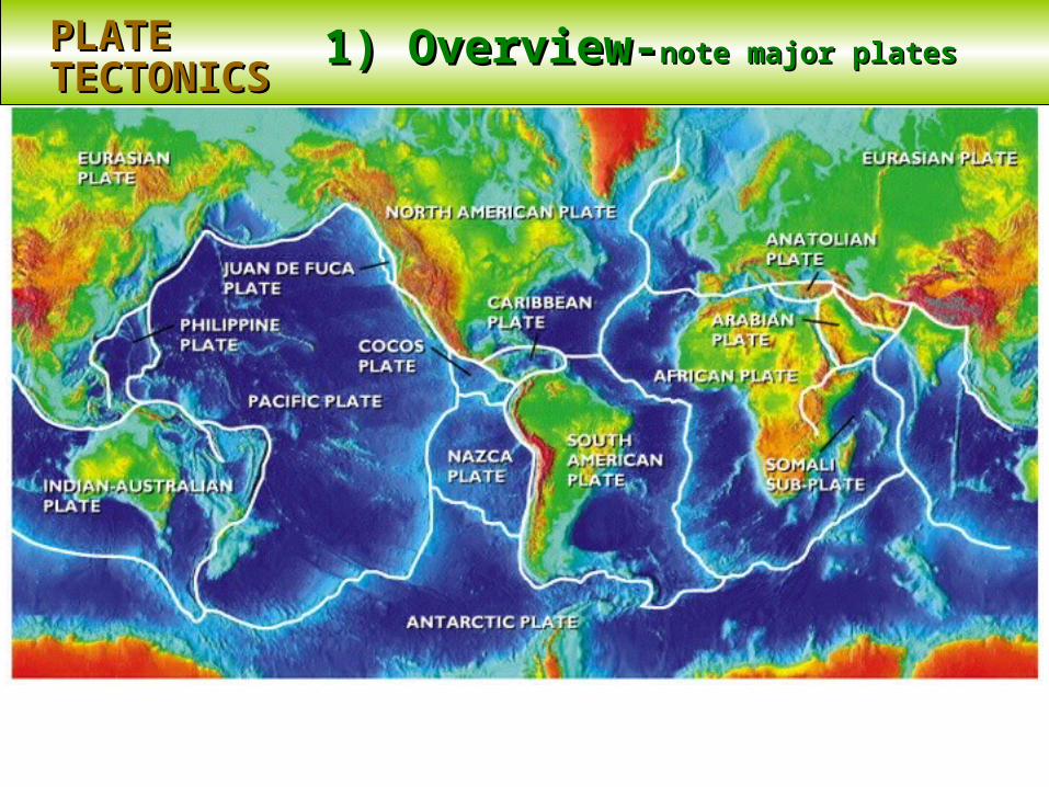
1) Overview-1) Overview-note major platesnote major platesPLATEPLATETECTONICSTECTONICS

1) Overview1) Overview-note associated -note associated volcano and earthquake activityvolcano and earthquake activity
PLATEPLATETECTONICSTECTONICS
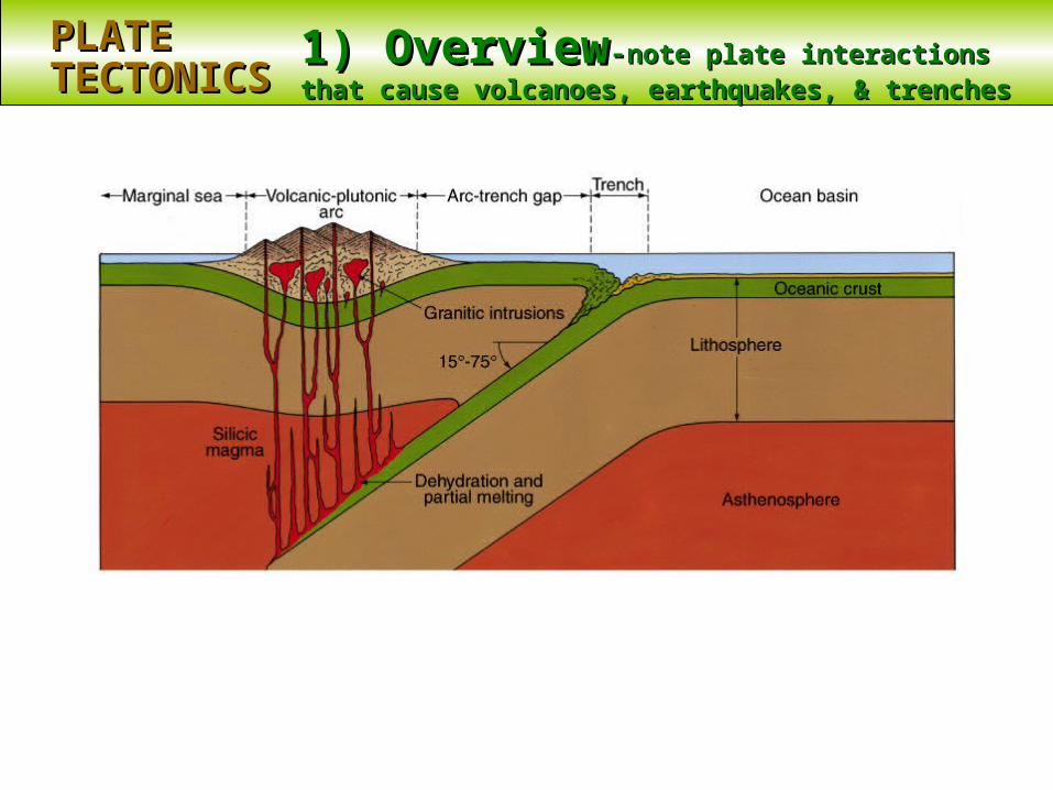
1) Overview1) Overview--note plate interactions that note plate interactions that cause volcanoes, earthquakes, & trenchescause volcanoes, earthquakes, & trenches
PLATEPLATETECTONICSTECTONICS
2) Historical development2) Historical developmentPLATEPLATETECTONICSTECTONICS
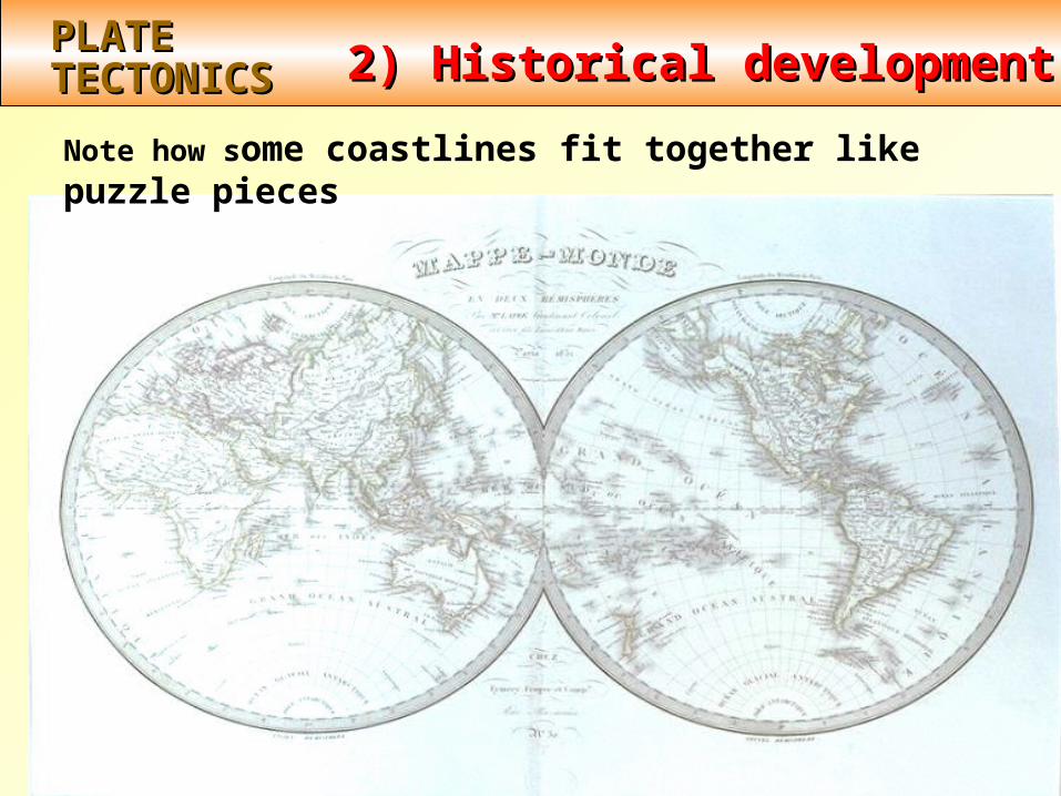
Note how some coastlines fit together like puzzle pieces
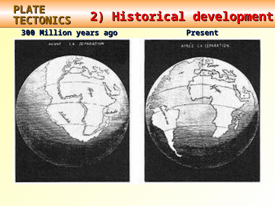
2) Historical development2) Historical developmentPLATEPLATETECTONICSTECTONICS
300 Million years ago300 Million years ago PresentPresent

2) Historical development2) Historical developmentPLATEPLATETECTONICSTECTONICS
1915Alfred Wegener published hypothesis ofcontinental drift
He hypothesized:
existence of single “super-continent” Pangaea (“pan - G - uh”)
~ 200 million years ago Pangaea broke intosmaller pieces, & “drifted” to present positions

This is what Wegner hypothesized the world to be like200 million years ago P
EG
NA
A
GONDWANALAND
LAURASIA
A
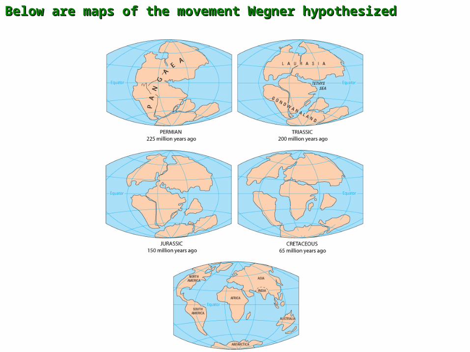
Below are maps of the movement Wegner hypothesizedBelow are maps of the movement Wegner hypothesized
2) Historical development2) Historical developmentPLATEPLATETECTONICSTECTONICS
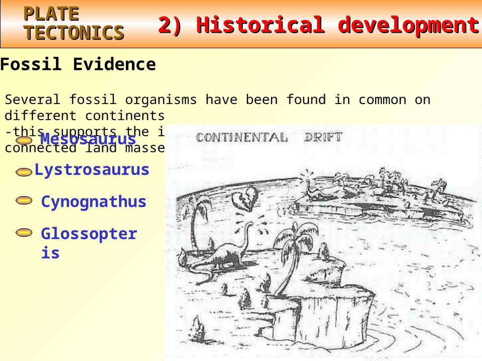
Fossil Evidence
Several fossil organisms have been found in common on different continents-this supports the idea that these organisms lived on connected land masses
Mesosaurus
Lystrosaurus How can the same speciesevolve on widely separatedcontinents???
Cynognathus
Glossopteris

Note the location of identical fossil remains that are on Note the location of identical fossil remains that are on
continents which are now separated by oceanscontinents which are now separated by oceans
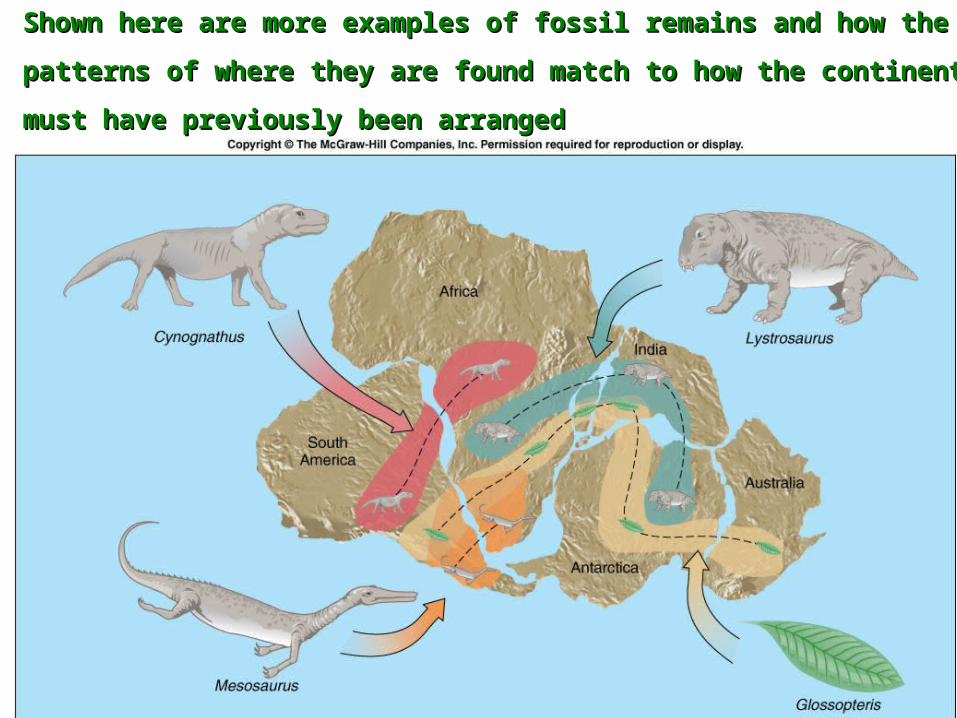
Shown here are more examples of fossil remains and how the Shown here are more examples of fossil remains and how the
patterns of where they are found match to how the continents patterns of where they are found match to how the continents
must have previously been arrangedmust have previously been arranged
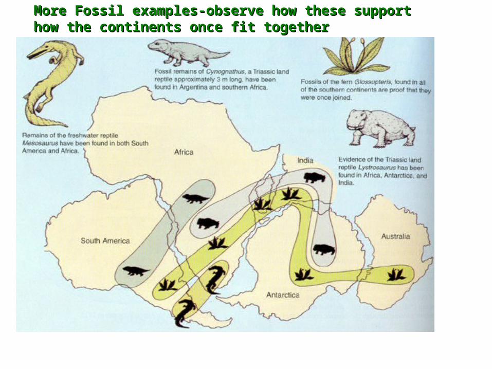
More Fossil examples-observe how these support More Fossil examples-observe how these support how the continents once fit togetherhow the continents once fit together
2) Historical development2) Historical developmentPLATEPLATETECTONICSTECTONICS
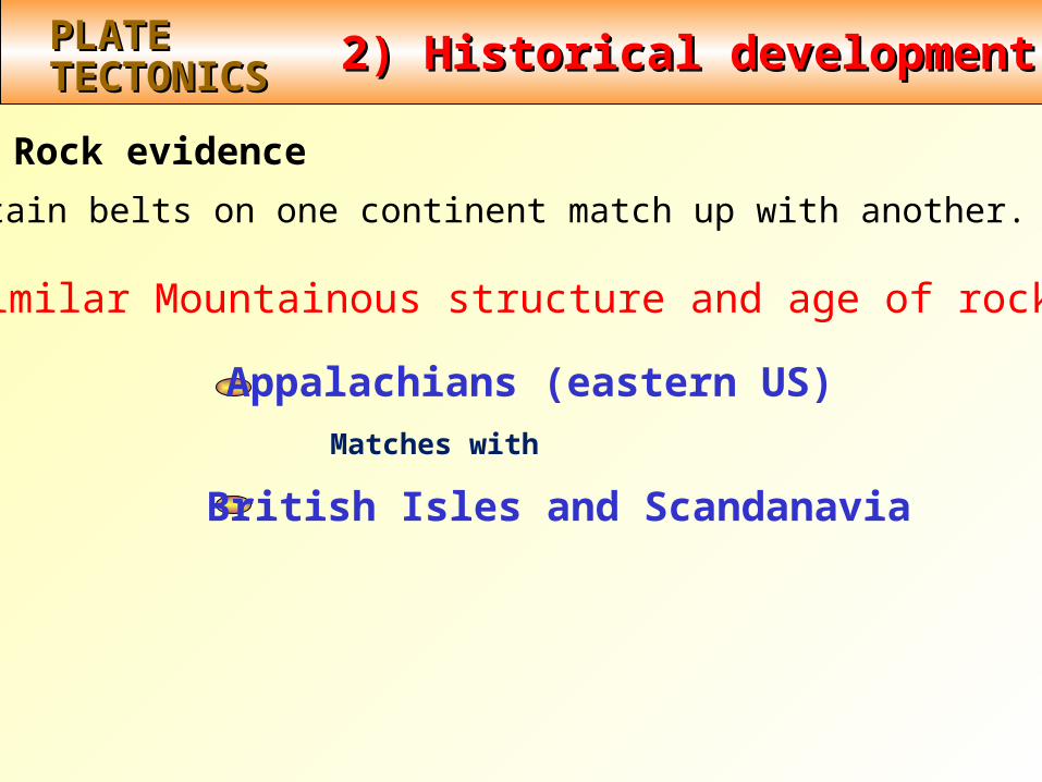
Rock evidence
Mountain belts on one continent match up with another.
Appalachians (eastern US)
Matches with
British Isles and Scandanavia
Similar Mountainous structure and age of rocks:
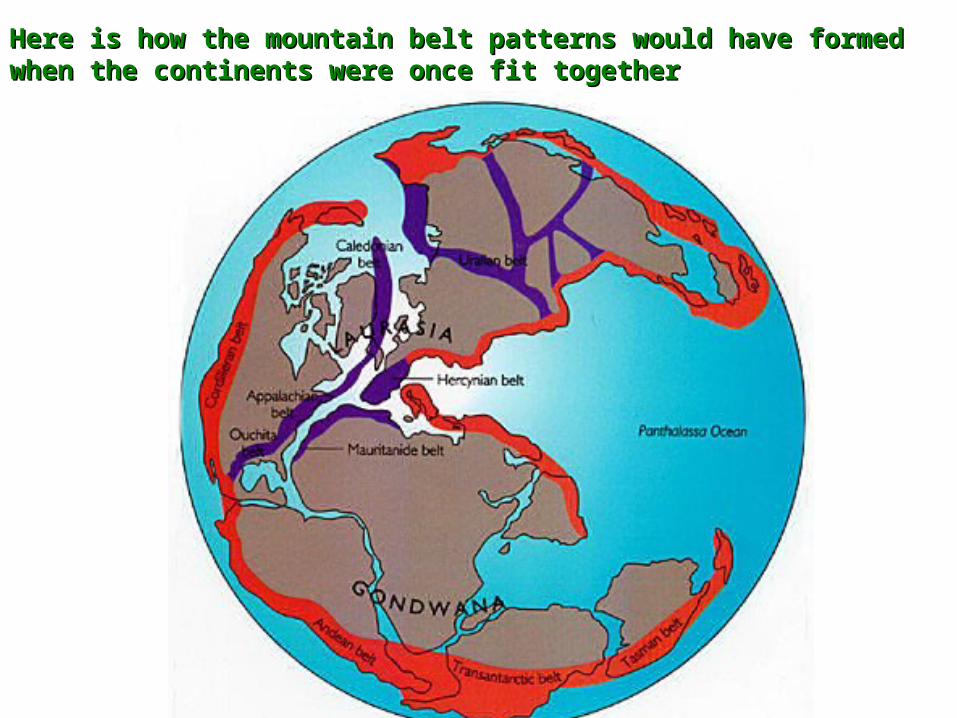
Here is how the mountain belt patterns would have formed Here is how the mountain belt patterns would have formed when the continents were once fit together when the continents were once fit together

2) Historical development2) Historical developmentPLATEPLATETECTONICSTECTONICS
Rock evidence
Similar rock & mineral deposits are found on different continents – more evidence that the continents were once fit together.
2) Historical development2) Historical developmentPLATEPLATETECTONICSTECTONICS
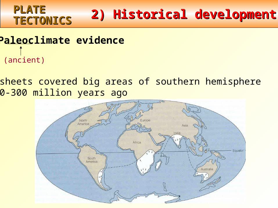
Paleoclimate evidence
Ice sheets covered big areas of southern hemisphere~ 220-300 million years ago
(ancient)
2) Historical development2) Historical developmentPLATEPLATETECTONICSTECTONICS
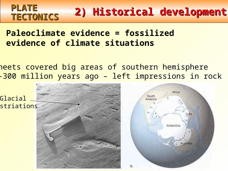
Paleoclimate evidence = fossilized evidence of climate situations
Glacialstriations
Ice sheets covered big areas of southern hemisphere~ 220-300 million years ago – left impressions in rock
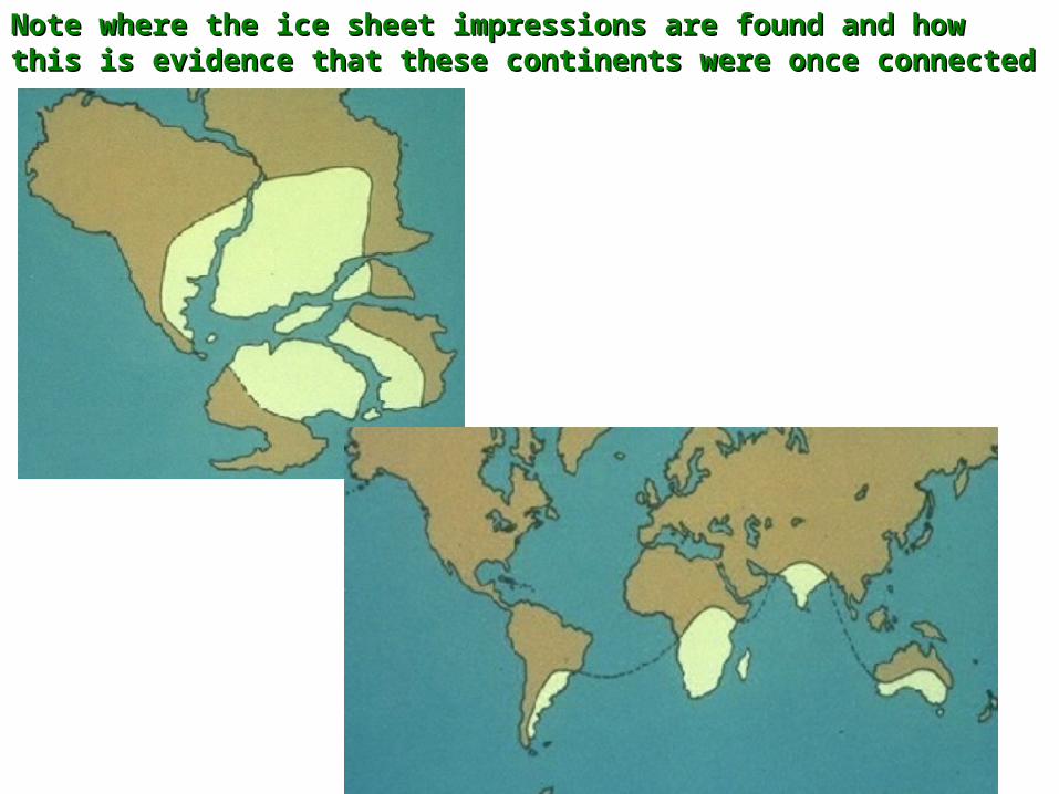
Note where the ice sheet impressions are found and how this Note where the ice sheet impressions are found and how this is evidence that these continents were once connected is evidence that these continents were once connected
2) Historical development2) Historical developmentPLATEPLATETECTONICSTECTONICS
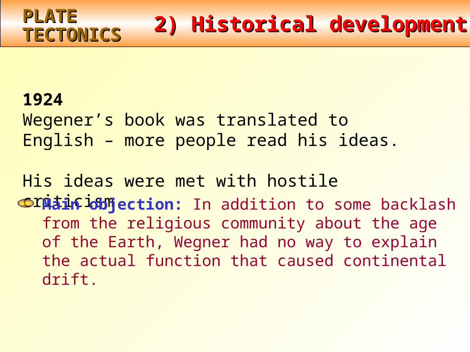
1924Wegener’s book was translated to English – more people read his ideas.
His ideas were met with hostile criticismMain objection: In addition to some backlash from the religious community about the age of the Earth, Wegner had no way to explain the actual function that caused continental drift.

3) Continental drift and paleomagnetism3) Continental drift and paleomagnetismPLATEPLATETECTONICSTECTONICS
Wegener’s idea died until 1950’s. Renewed interest from rock magnetism
Paleomagnetism: ancient magnetic field of Earth recordedand frozen into rocks
How? Need to know about 2 things: - Earth’s magnetic field- Magnetism in rocks
3) Continental drift and paleomagnetism3) Continental drift and paleomagnetismPLATEPLATETECTONICSTECTONICS
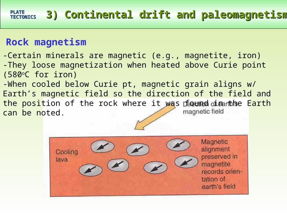
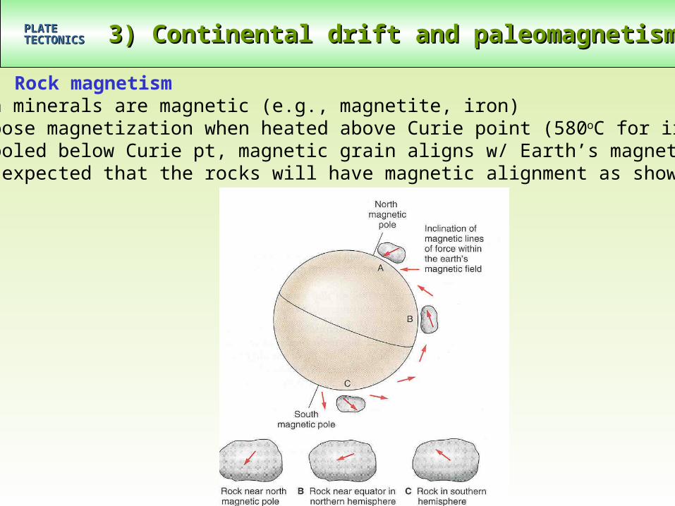
Rock magnetism-Certain minerals are magnetic (e.g., magnetite, iron)-They loose magnetization when heated above Curie point (580oC for iron)-When cooled below Curie pt, magnetic grain aligns w/ Earth’s magnetic field so the direction of the field and the position of the rock where it was found in the Earth can be noted.
3) Continental drift and paleomagnetism3) Continental drift and paleomagnetismPLATEPLATETECTONICSTECTONICS
Rock magnetism-Certain minerals are magnetic (e.g., magnetite, iron)-They loose magnetization when heated above Curie point (580oC for iron)-When cooled below Curie pt, magnetic grain aligns w/ Earth’s magnetic field- It is expected that the rocks will have magnetic alignment as shown below
3) Continental drift and paleomagnetism3) Continental drift and paleomagnetismPLATEPLATETECTONICSTECTONICS
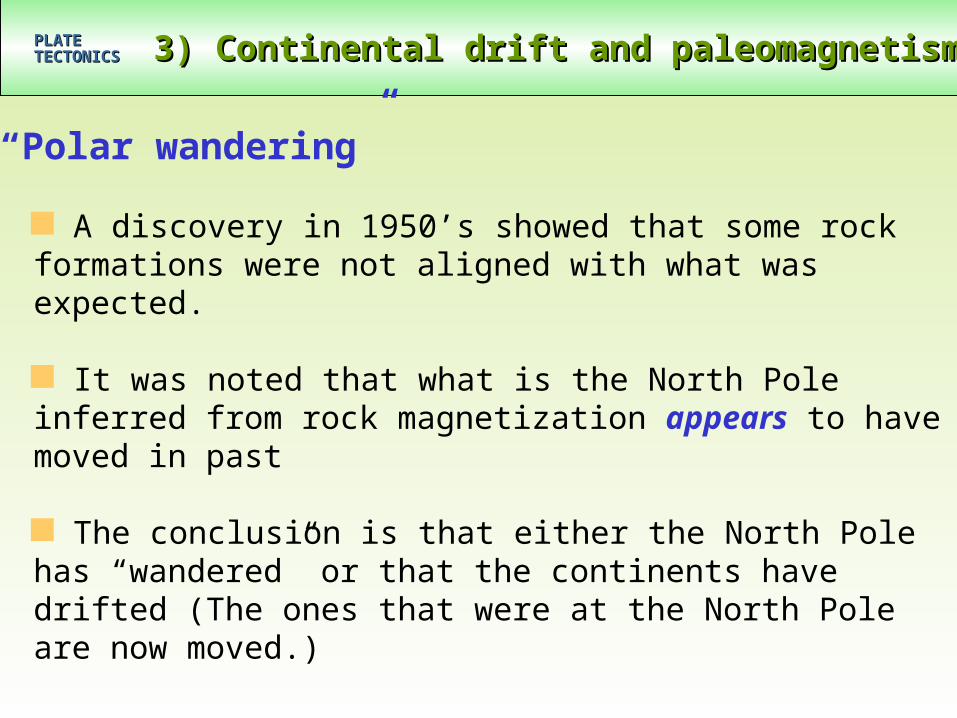
“Polar wandering”
A discovery in 1950’s showed that some rock formations were not aligned with what was expected.
It was noted that what is the North Pole inferred from rock magnetization appears to have moved in past
The conclusion is that either the North Pole has “wandered” or that the continents have drifted (The ones that were at the North Pole are now moved.)
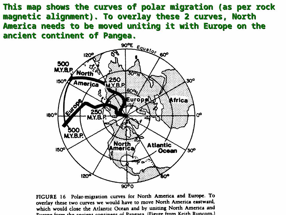
This map shows the curves of polar migration (as per rock This map shows the curves of polar migration (as per rock magnetic alignment). To overlay these 2 curves, North magnetic alignment). To overlay these 2 curves, North America needs to be moved uniting it with Europe on the America needs to be moved uniting it with Europe on the ancient continent of Pangea.ancient continent of Pangea.
3) Continental drift and paleomagnetism3) Continental drift and paleomagnetismPLATEPLATETECTONICSTECTONICS
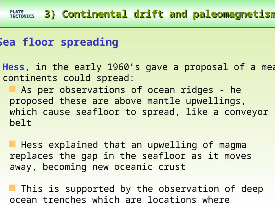
Sea floor spreading
As per observations of ocean ridges - he proposed these are above mantle upwellings, which cause seafloor to spread, like a conveyor belt
Hess explained that an upwelling of magma replaces the gap in the seafloor as it moves away, becoming new oceanic crust
This is supported by the observation of deep ocean trenches which are locations where oceanic crust has crevasses deep in planet
Harry Hess, in the early 1960’s gave a proposal of a means by which continents could spread:
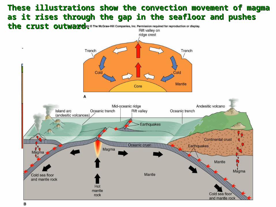
These illustrations show the convection movement of These illustrations show the convection movement of magma as it rises through the gap in the seafloor and magma as it rises through the gap in the seafloor and pushes the crust outward.pushes the crust outward.

3) Continental drift and paleomagnetism3) Continental drift and paleomagnetismPLATEPLATETECTONICSTECTONICS
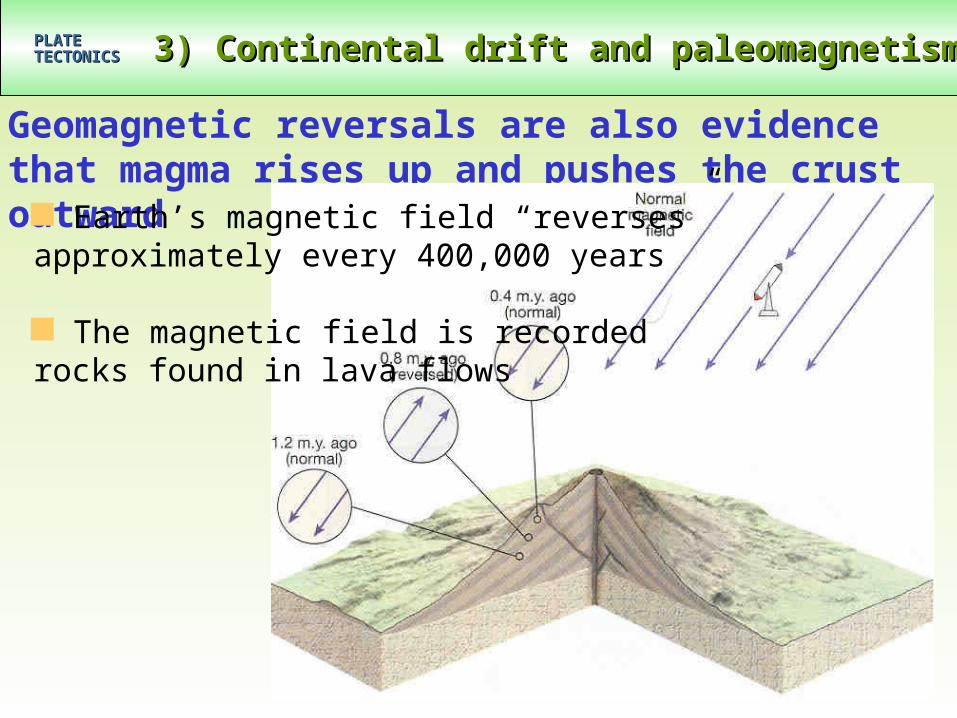
Geomagnetic reversals are also evidence that magma rises up and pushes the crust outward
Earth’s magnetic field “reverses” approximately every 400,000 years
The magnetic field is recorded rocks found in lava flows
3) Continental drift and paleomagnetism3) Continental drift and paleomagnetismPLATEPLATETECTONICSTECTONICS
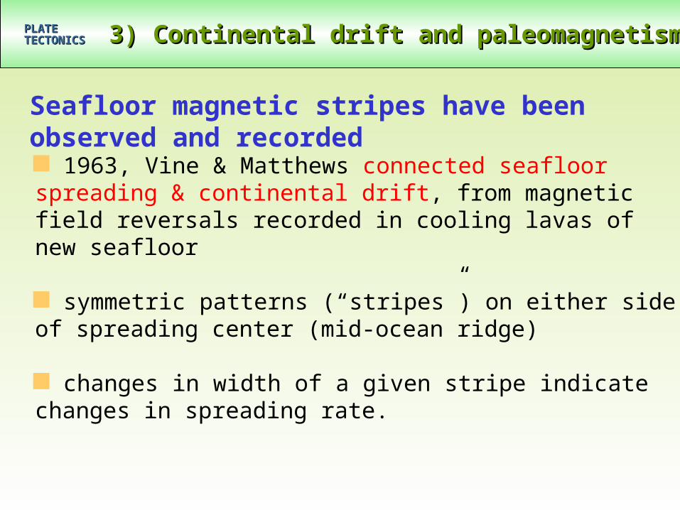
Seafloor magnetic stripes have been observed and recorded 1963, Vine & Matthews connected seafloor spreading & continental drift, from magnetic field reversals recorded in cooling lavas of new seafloor
symmetric patterns (“stripes”) on either side of spreading center (mid-ocean ridge)
changes in width of a given stripe indicate changes in spreading rate.

This diagram shows the lava flows with the varying magnetic This diagram shows the lava flows with the varying magnetic stripes recorded in the rockstripes recorded in the rock
In Conclusion:• The Theory of Plate Tectonics is now well
documented with significant evidence from fossil, mountain, and rock formations
• The Theory of Continental Drift is now well documented with significant evidence from sea floor spreading/magma upwellings and magnetic pole recordings in rock formations
• Scientists continue to collect evidence to further our understanding of how the surface of the Earth has changed over millions of years.