physical geography of sw & central asia, and n. africa ch. 17
TRANSCRIPT
Physical Physical Geography of SW Geography of SW
& Central Asia, & Central Asia, and N. Africaand N. AfricaCh. 17
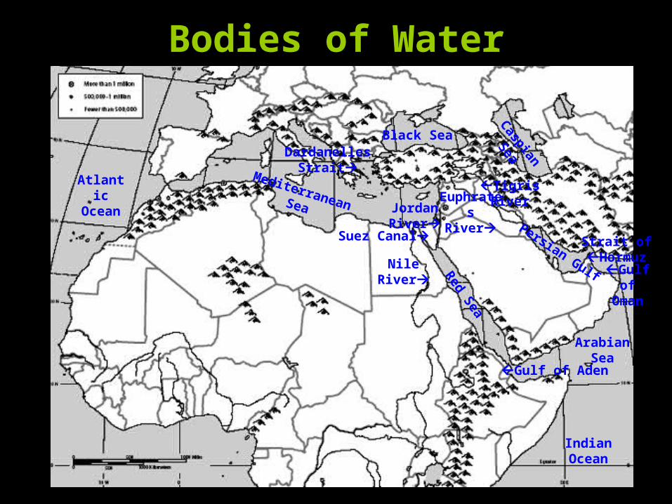
Bodies of Water
TigrisRiver
Nile River
EuphratesRiverJordan
River Persian Gulf
ArabianSea
Mediterranean Sea
IndianOcean
Red Sea
Black Sea
Gulf of Aden
Strait ofHormuz
Suez Canal
Dardanelles Strait
AtlanticOcean
Gulf of
Oman
Caspian Sea
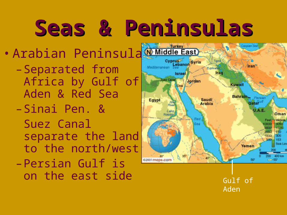
Seas & PeninsulasSeas & Peninsulas• Arabian Peninsula
– Separated from Africa by Gulf of Aden & Red Sea
– Sinai Pen. & Suez Canal separate the land to the north/west
– Persian Gulf is on the east side
Gulf of Aden
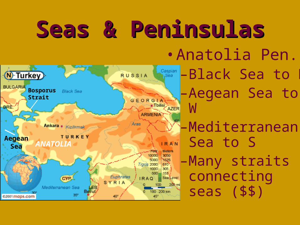
Seas & PeninsulasSeas & Peninsulas• Anatolia Pen.
–Black Sea to N–Aegean Sea to
W–Mediterranean
Sea to S–Many straits
connecting seas ($$)
Aegean Sea ANATOLIA
Bosporus Strait
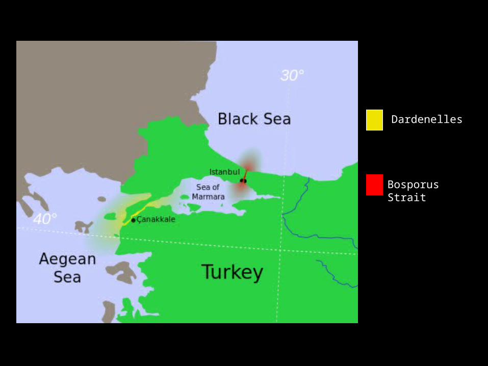
Dardenelles
Bosporus Strait
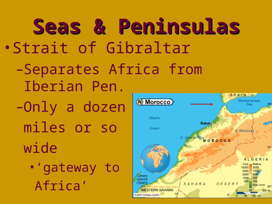
Seas & PeninsulasSeas & Peninsulas• Strait of Gibraltar
–Separates Africa from Iberian Pen.
–Only a dozen
miles or so
wide• ‘gateway to
Africa’
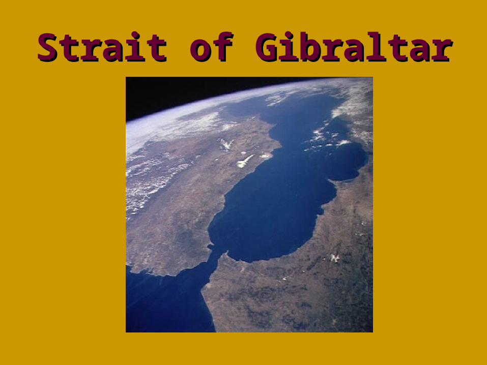
Strait of GibraltarStrait of Gibraltar
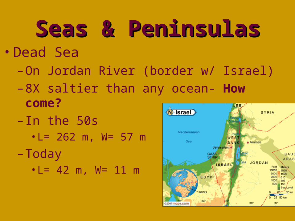
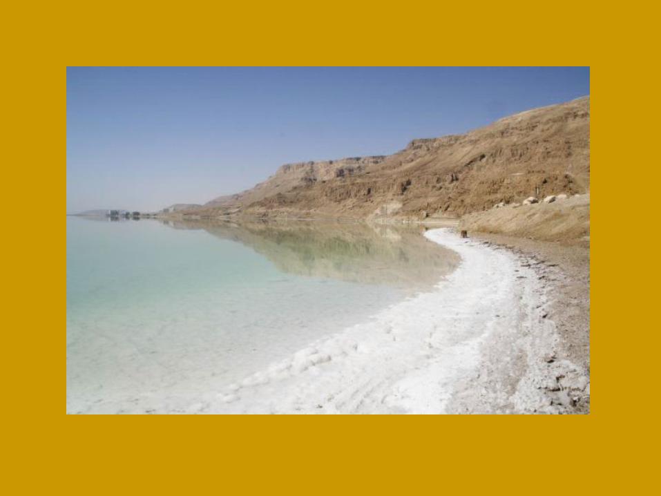
Seas & PeninsulasSeas & Peninsulas• Dead Sea
– On Jordan River (border w/ Israel)
– 8X saltier than any ocean- How come?
– In the 50s• L= 262 m, W= 57 m
– Today• L= 42 m, W= 11 m

TheJordan River
System:
Israel & Jordan--A Fight Over
Water Rights?
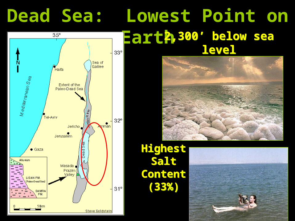
Dead Sea: Lowest Point on Earth
HighestSalt
Content(33%)
HighestSalt
Content(33%)
2,300’ below sea level
2,300’ below sea level
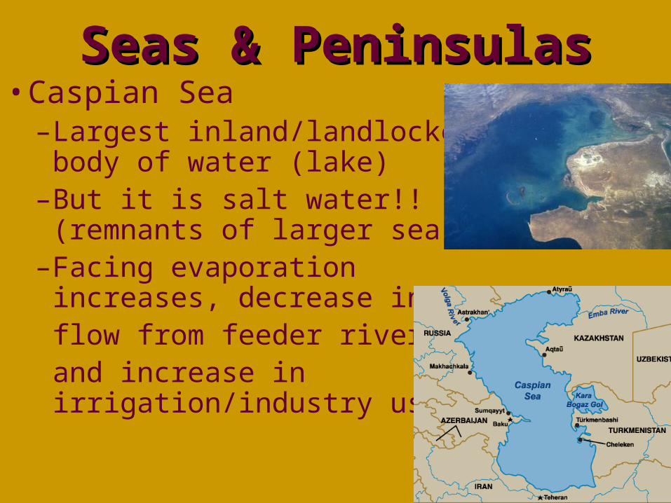
Seas & PeninsulasSeas & Peninsulas• Caspian Sea
–Largest inland/landlocked body of water (lake)
–But it is salt water!! (remnants of larger sea)
–Facing evaporation increases, decrease in flow from feeder rivers, and increase in irrigation/industry uses
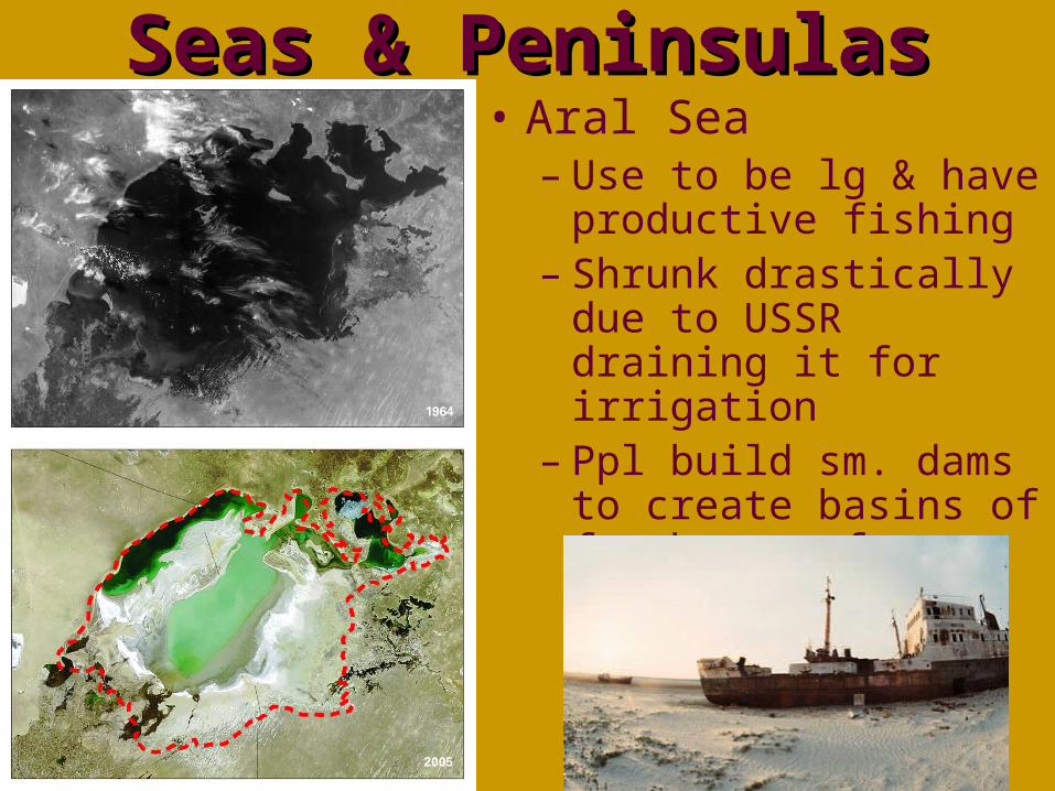
Seas & PeninsulasSeas & Peninsulas• Aral Sea
– Use to be lg & have productive fishing
– Shrunk drastically due to USSR draining it for irrigation
– Ppl build sm. dams to create basins of freshwater from rivers
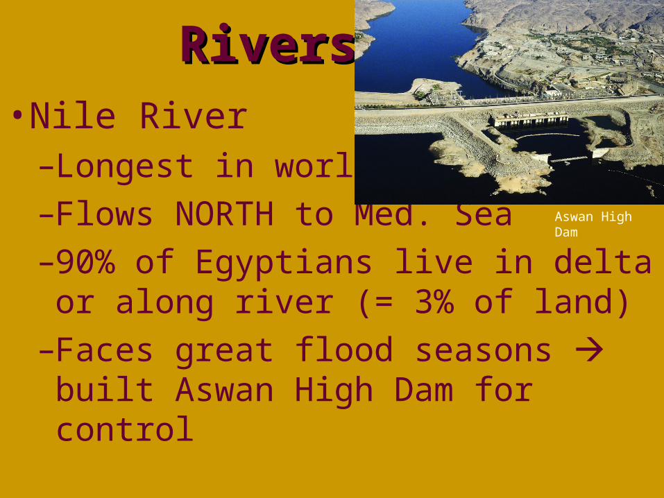
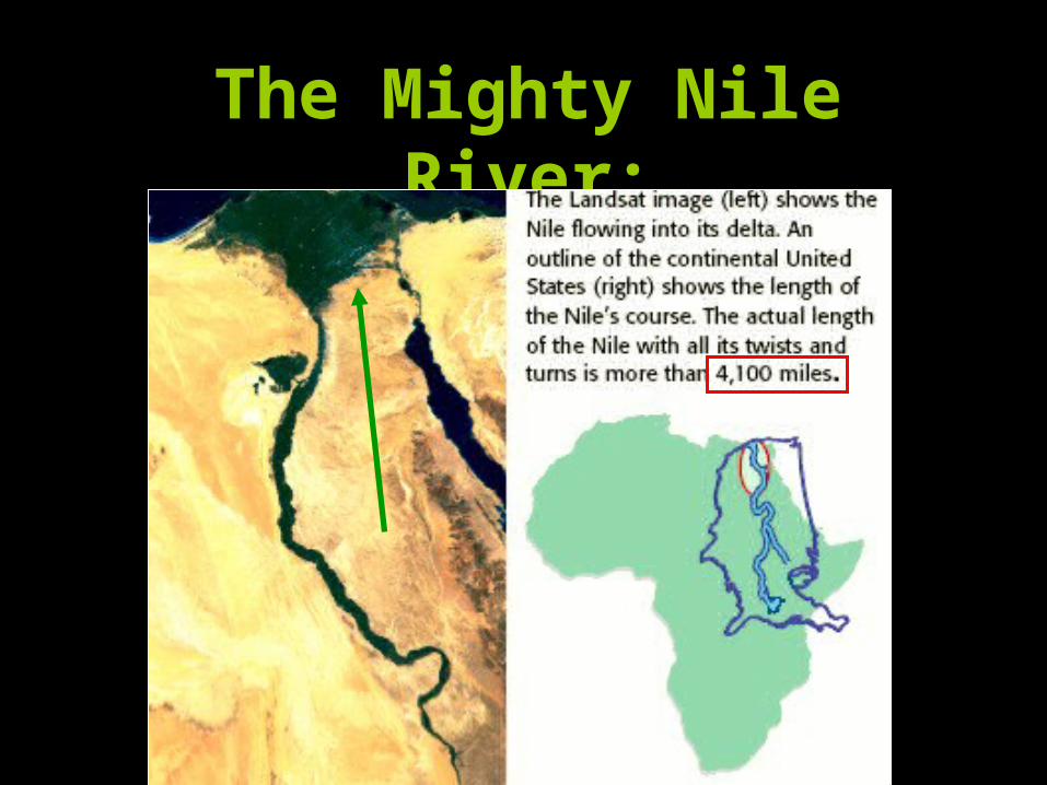
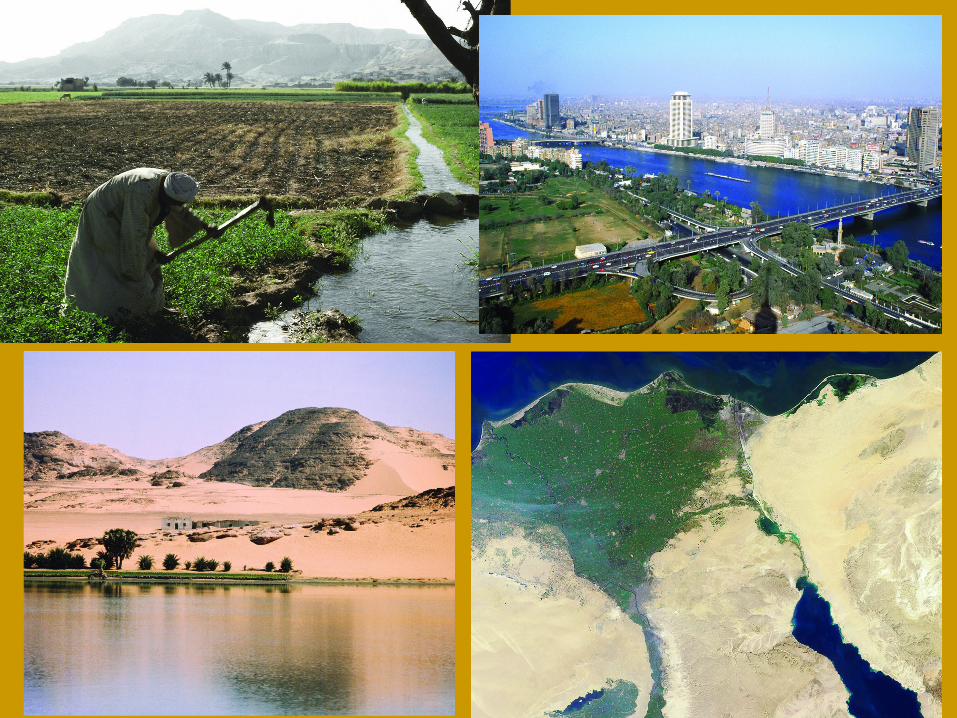
RiversRivers• Nile River
–Longest in world
–Flows NORTH to Med. Sea
–90% of Egyptians live in delta or along river (= 3% of land)
–Faces great flood seasons built Aswan High Dam for control
Aswan High Dam
The Mighty Nile River:
“Longest River in the World”
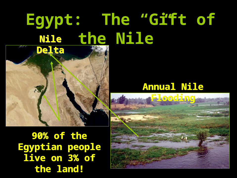
Egypt: The “Gift of the Nile”
Annual Nile Flooding
Annual Nile Flooding
Nile DeltaNile
Delta
90% of the Egyptian people live on 3% of the
land!
90% of the Egyptian people live on 3% of the
land!
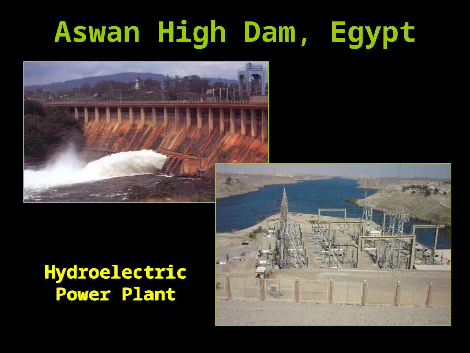
Aswan High Dam, Egypt
HydroelectricPower Plant
HydroelectricPower Plant
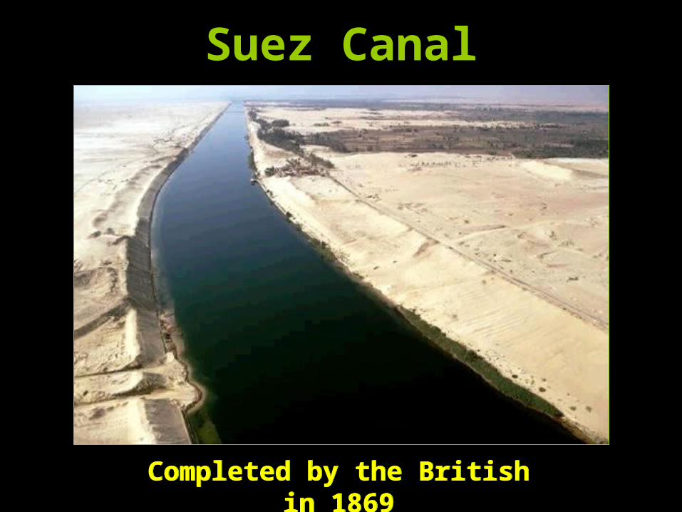
Suez Canal
Completed by the British in 1869
Completed by the British in 1869
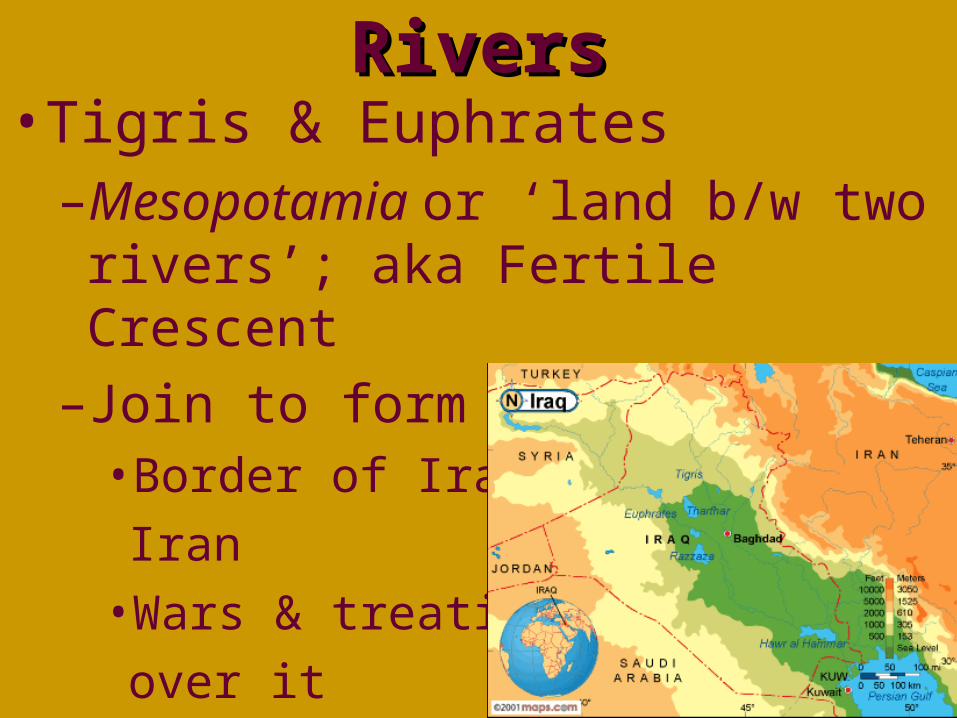
RiversRivers• Tigris & Euphrates
–Mesopotamia or ‘land b/w two rivers’; aka Fertile Crescent
–Join to form Shatt al Arab• Border of Iraq &
Iran
• Wars & treaties
over it
RiversRivers
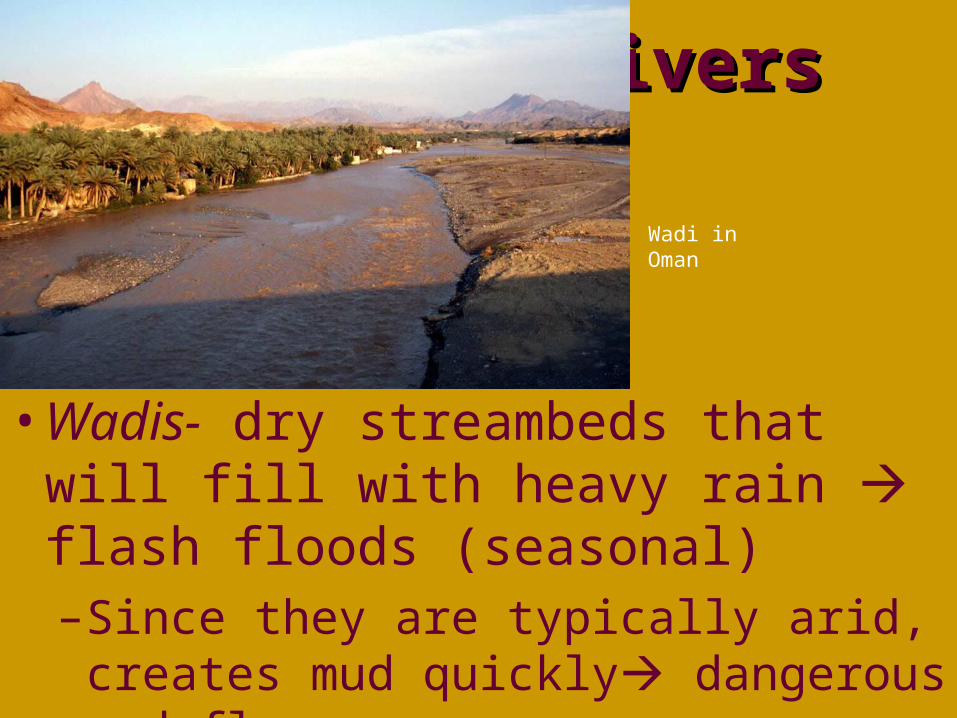
• Wadis- dry streambeds that will fill with heavy rain flash floods (seasonal)–Since they are typically arid, creates
mud quickly dangerous mud flows
Wadi in Oman

Wadis – Instant Springs
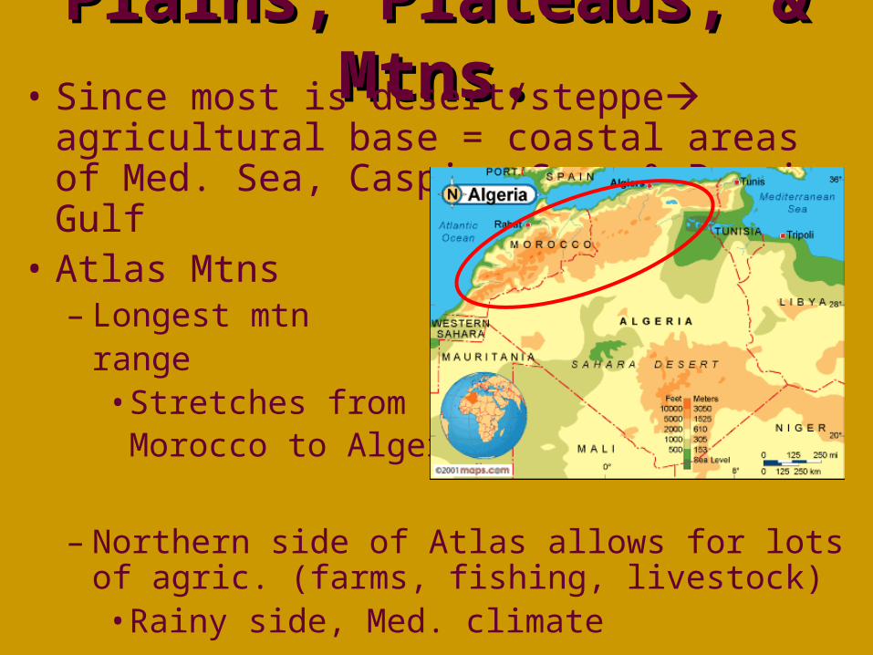
Plains, Plateaus, & Plains, Plateaus, & Mtns.Mtns.• Since most is desert/steppe agricultural
base = coastal areas of Med. Sea, Caspian Sea, & Persian Gulf
• Atlas Mtns– Longest mtn
range• Stretches from
Morocco to Algeria
– Northern side of Atlas allows for lots of agric. (farms, fishing, livestock)• Rainy side, Med. climate
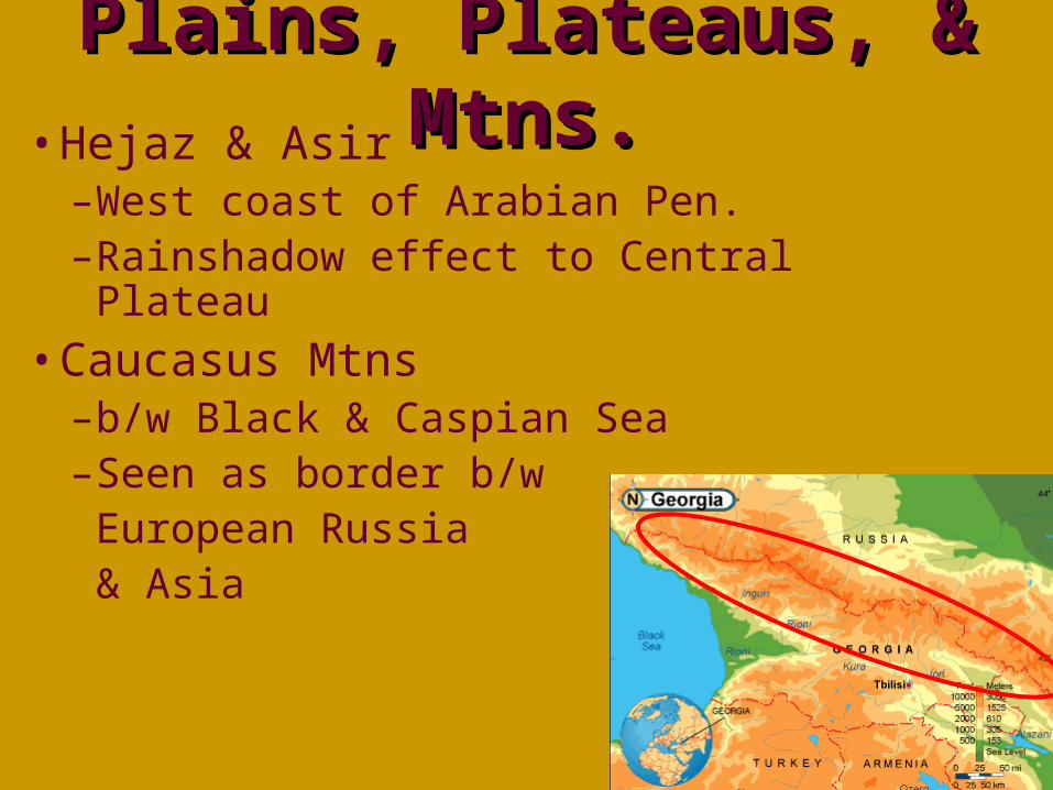
Plains, Plateaus, & Plains, Plateaus, & Mtns.Mtns.• Hejaz & Asir
–West coast of Arabian Pen.–Rainshadow effect to Central Plateau
• Caucasus Mtns–b/w Black & Caspian Sea–Seen as border b/w
European Russia & Asia
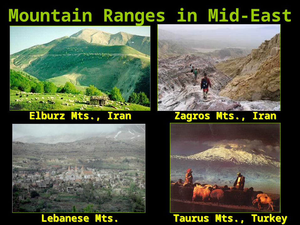
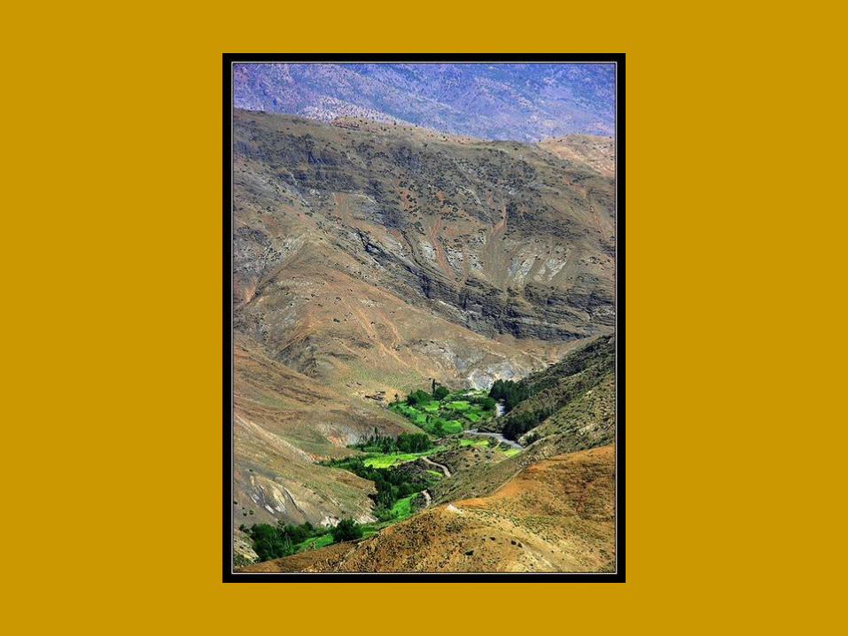
Mountain Ranges in Mid-East
Elburz Mts., IranElburz Mts., Iran Zagros Mts., IranZagros Mts., Iran
Lebanese Mts.Lebanese Mts. Taurus Mts., TurkeyTaurus Mts., Turkey
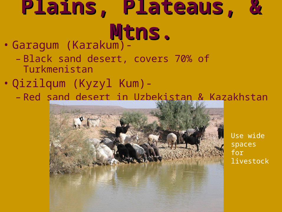
Plains, Plateaus, & Plains, Plateaus, & Mtns.Mtns.
• Garagum (Karakum)-– Black sand desert, covers 70% of Turkmenistan
• Qizilqum (Kyzyl Kum)-– Red sand desert in Uzbekistan & Kazakhstan
Use wide spaces for livestock
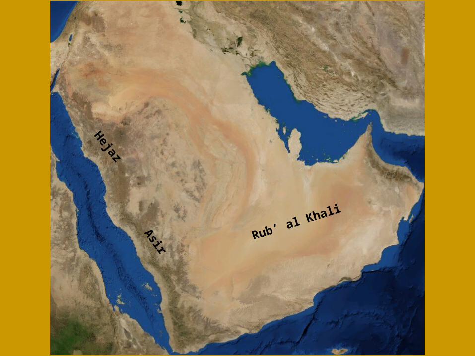
Rub’ al Khali
Hejaz
Asir
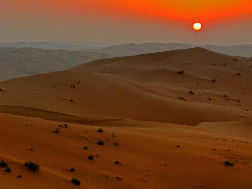
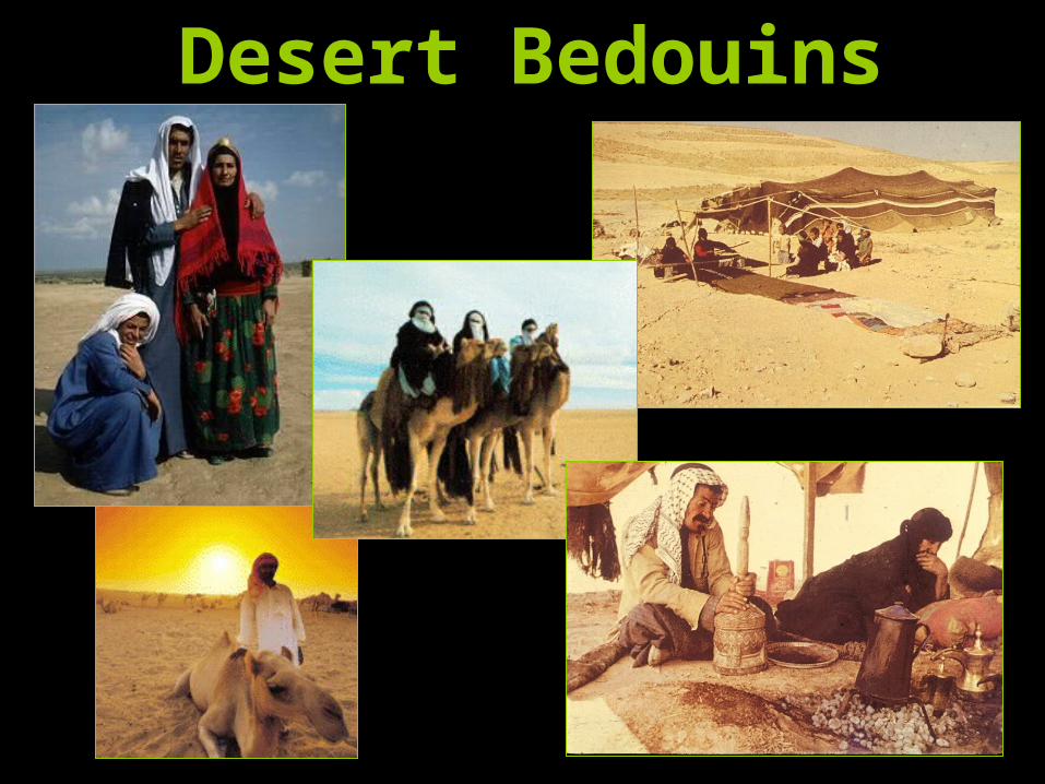
Desert Bedouins
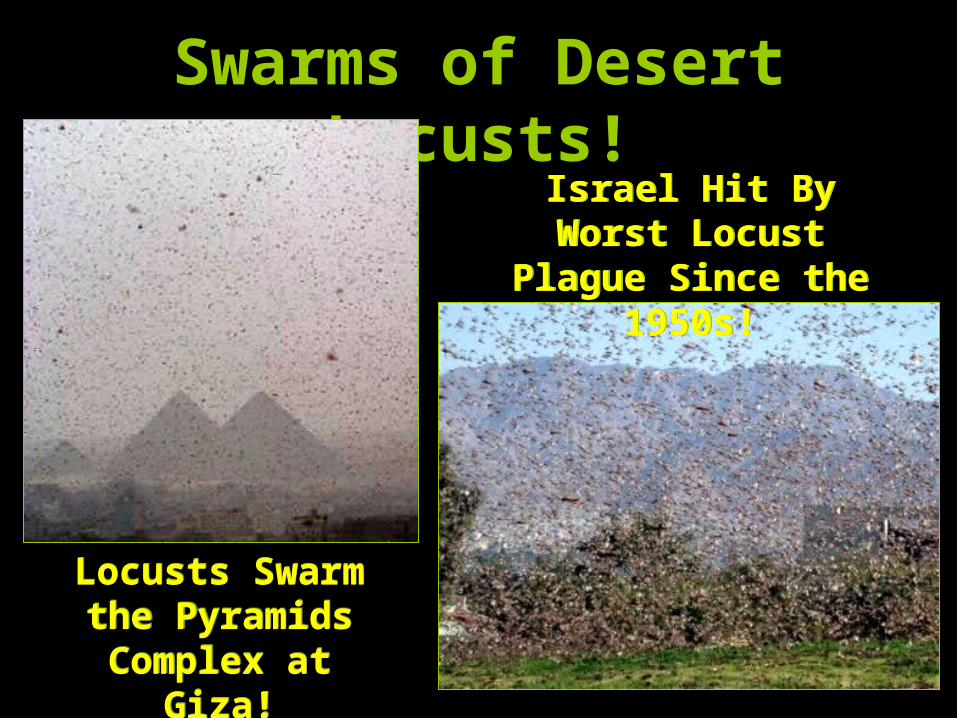
Swarms of Desert Locusts!
Locusts Swarm the Pyramids Complex at
Giza!
Locusts Swarm the Pyramids Complex at
Giza!
Israel Hit By Worst Locust Plague
Since the 1950s!
Israel Hit By Worst Locust Plague
Since the 1950s!
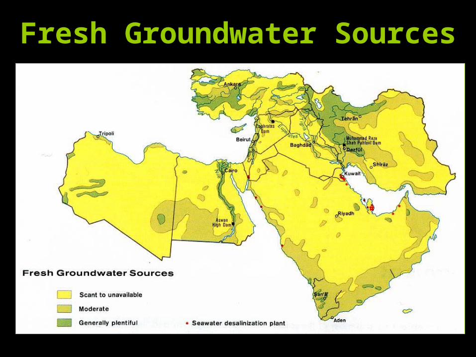
Fresh Groundwater Sources
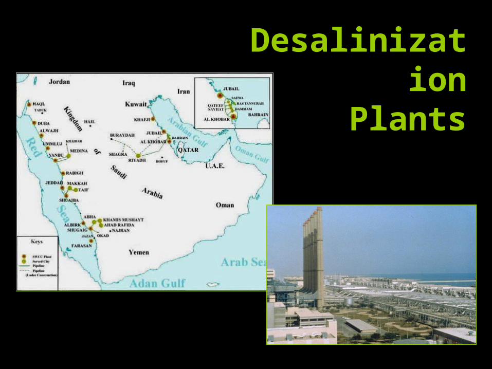
Desalinization
Plants
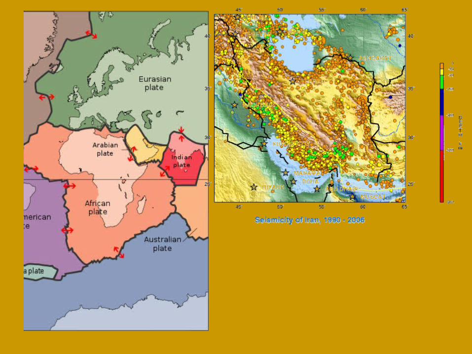
Tectonic ActivityTectonic Activity• Meeting point of the African,
Arabian, & Eurasian plates–Reason for mountainous terrain–Many earthquakes
• Turkey 1999• Iran has 90% of land on faults
–Landforms still Δing• Red Sea
Natural ResourcesNatural Resources• Oil (petroleum) & nat. gas are region’s
most abundant resources–70% of world’s oil
–33% of world’s nat. gas• Reserves are still being discovered!
–WWII sparked production as we moved to modern industry/reliance
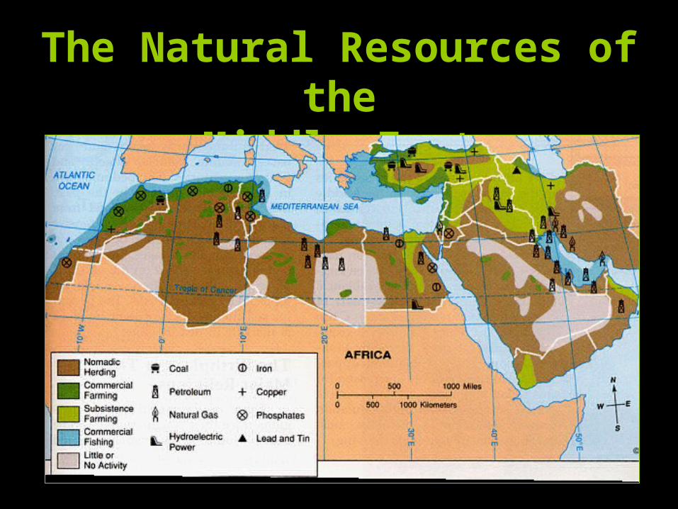
The Natural Resources of the
Middle East
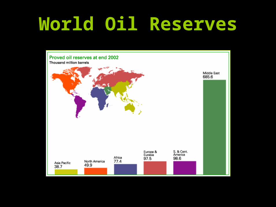
World Oil Reserves
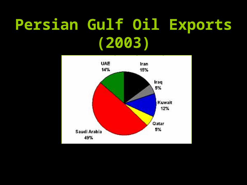
Persian Gulf Oil Exports (2003)
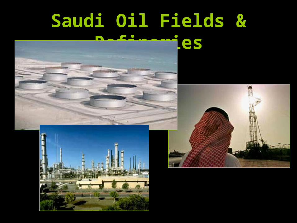
Saudi Oil Fields & Refineries
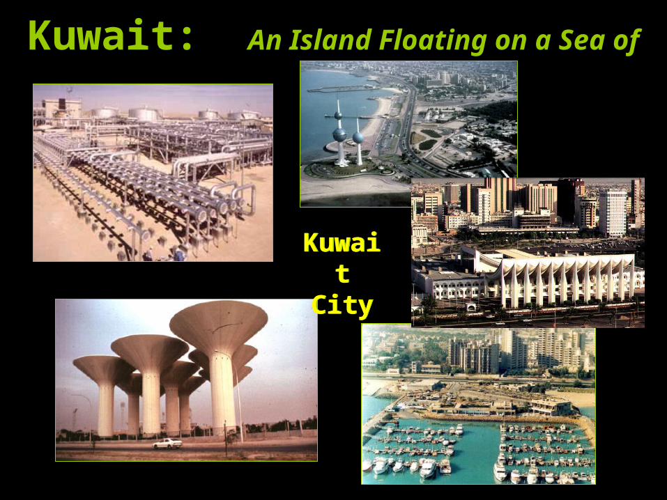
Kuwait: An Island Floating on a Sea of Oil
Kuwait
City
Kuwait
City
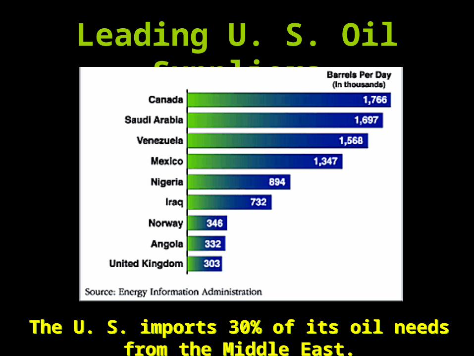
Leading U. S. Oil Suppliers
The U. S. imports 30% of its oil needs from the Middle East.
The U. S. imports 30% of its oil needs from the Middle East.
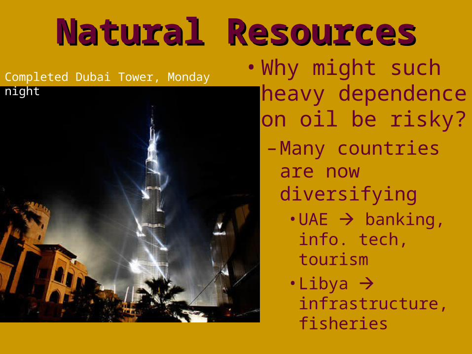
Natural ResourcesNatural Resources• Why might such
heavy dependence on oil be risky?– Many countries are
now diversifying• UAE banking,
info. tech, tourism• Libya
infrastructure, fisheries
Completed Dubai Tower, Monday night

HomeworkHomework
• Complete the Guided Reading for Ch. 17 Sec. 2