parallelizing a python geoprocessing toolgispd.com/documents/eastern wa gispd,...
TRANSCRIPT

Parallelizing a Python Geoprocessing Tool
Eastern Washington GISPD Day
May 22nd, 2015
David Howes, Ph.D. - David Howes, LLC
dhowes.com
Eric Sant - Open Range Consulting
openrangeconsulting.com
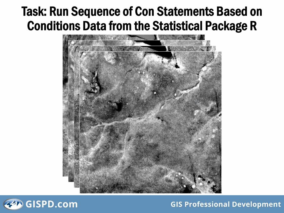
Task: Run Sequence of Con Statements Based on Conditions Data from the Statistical Package R
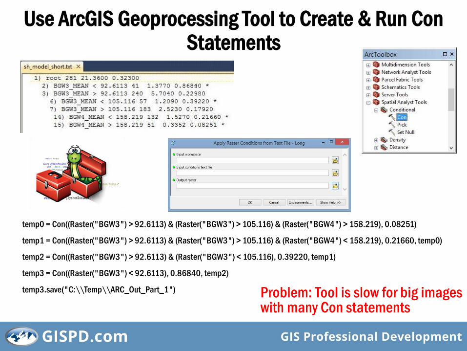
Use ArcGIS Geoprocessing Tool to Create & Run Con Statements
temp0 = Con((Raster("BGW3") > 92.6113) & (Raster("BGW3") > 105.116) & (Raster("BGW4") > 158.219), 0.08251)
temp1 = Con((Raster("BGW3") > 92.6113) & (Raster("BGW3") > 105.116) & (Raster("BGW4") < 158.219), 0.21660, temp0)
temp2 = Con((Raster("BGW3") > 92.6113) & (Raster("BGW3") < 105.116), 0.39220, temp1)
temp3 = Con((Raster("BGW3") < 92.6113), 0.86840, temp2)
temp3.save("C:\\Temp\\ARC_Out_Part_1") Problem: Tool is slow for big images with many Con statements
So here’s how to make the process at least 66% faster (with a caveat)…
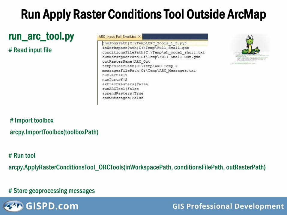
Run Apply Raster Conditions Tool Outside ArcMap
run_arc_tool.py
# Read input file
# Import toolbox
arcpy.ImportToolbox(toolboxPath)
# Run tool
arcpy.ApplyRasterConditionsTool_ORCTools(inWorkspacePath, conditionsFilePath, outRasterPath)
# Store geoprocessing messages
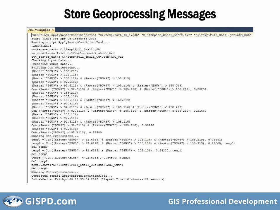
Store Geoprocessing Messages
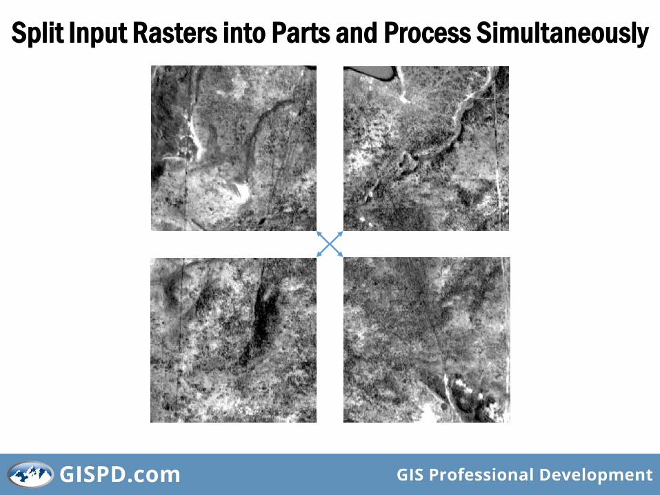
Split Input Rasters into Parts and Process Simultaneously
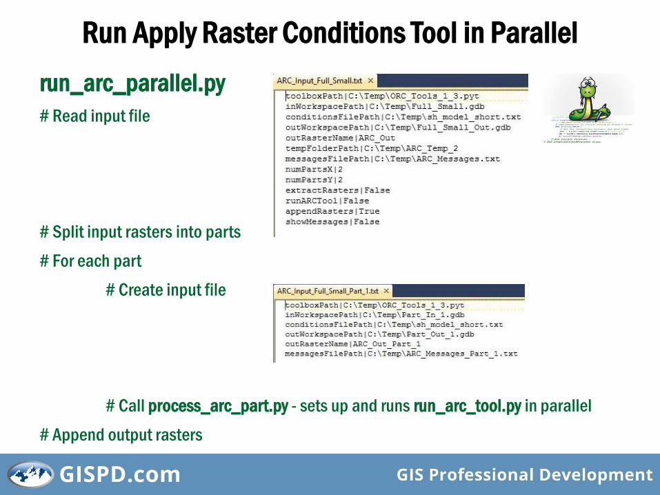
Run Apply Raster Conditions Tool in Parallel
run_arc_parallel.py
# Read input file
# Split input rasters into parts
# For each part
# Create input file
# Call process_arc_part.py - sets up and runs run_arc_tool.py in parallel
# Append output rasters

Use Multiprocessing Module
run_arc_parallel.py# Imports from multiprocessing import Process
import subprocess
# Function to run each process def run_shell(command):
p = subprocess.Popen(command)
p.communicate()
def main(argv):
for each part:
# Create process command = "python process_arc_part.py " + argsStr
task = Process(target=run_shell, args=(command,))
task.start()
tasks.append(task)
# Wait for all processes to finish for task in tasks:
task.join()
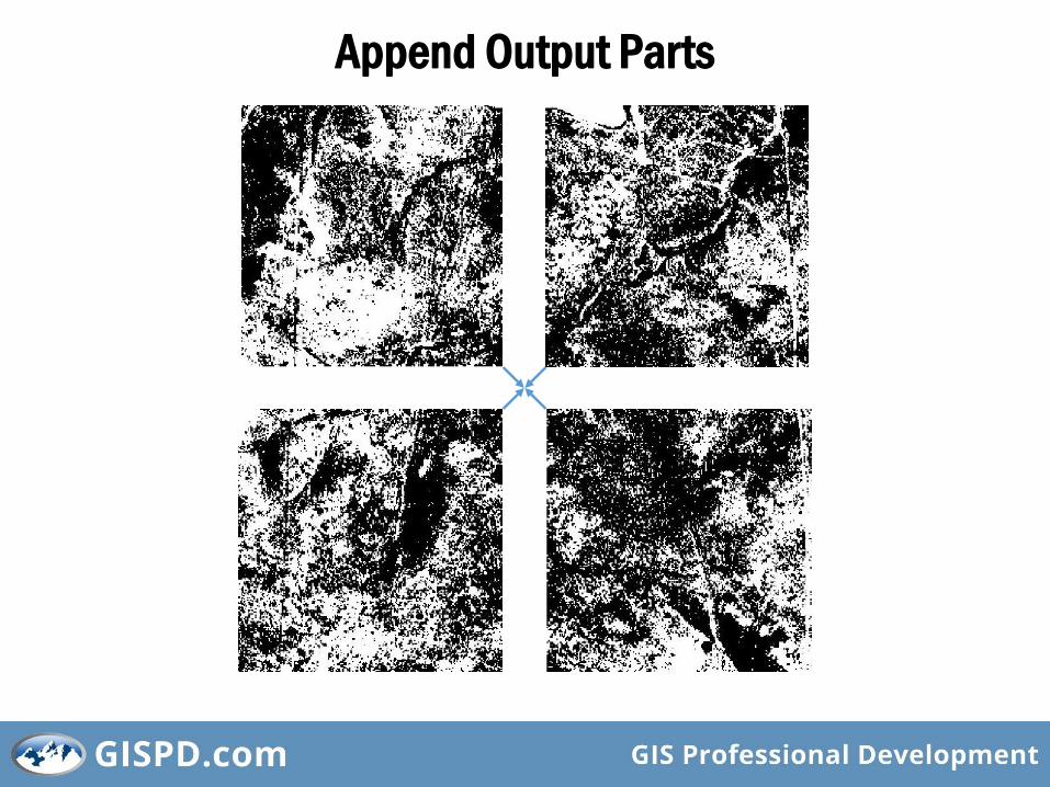
Append Output Parts
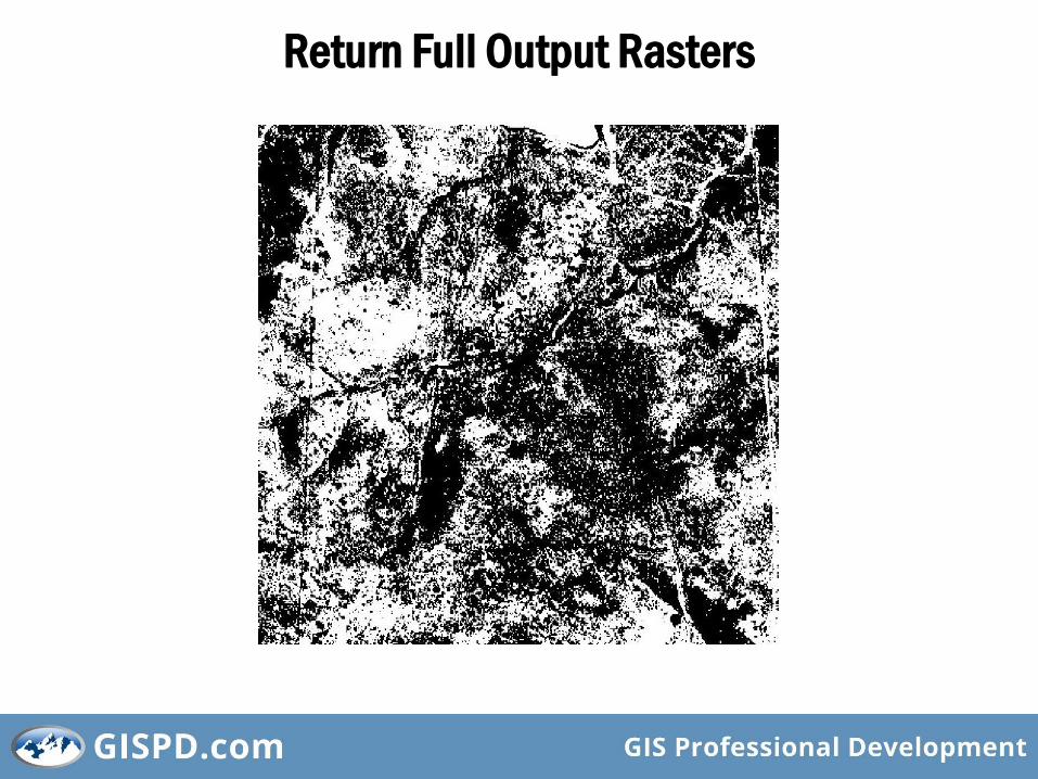
Return Full Output Rasters
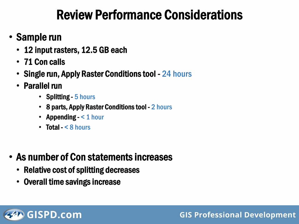
Review Performance Considerations
• Sample run
• 12 input rasters, 12.5 GB each
• 71 Con calls
• Single run, Apply Raster Conditions tool - 24 hours
• Parallel run
• Splitting - 5 hours
• 8 parts, Apply Raster Conditions tool - 2 hours
• Appending - < 1 hour
• Total - < 8 hours
• As number of Con statements increases
• Relative cost of splitting decreases
• Overall time savings increase
Consider Wider Applicability
• Processing requirements continually increasing
E.g,
• NAIP imagery improving from 3.5 ft to 1 ft resolution
• LIDAR popularity growing
• Concept can be applied to any geoprocessing operation for which tasks can be separated into independent parts

• David Howes• David Howes, LLC, Seattle, WA• GIS tools, processes & supporting infrastructure• http://dhowes.com• [email protected]
• Eric Sant• Open Range Consulting, Park City, UT• Rangeland management• http://newfoundgeo.com
For slides and other resources, please see:• http://gispd.com/events• http://www.dhowes.com/presentations
Thank You for Coming!