orienteering 1eso
TRANSCRIPT
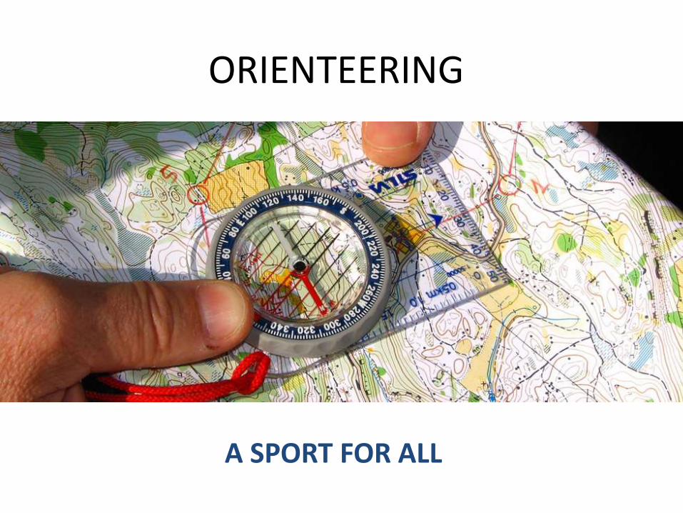
ORIENTEERING
A SPORT FOR ALL
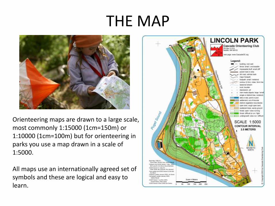
THE MAP
Orienteering maps are drawn to a large scale, most commonly 1:15000 (1cm=150m) or 1:10000 (1cm=100m) but for orienteering in parks you use a map drawn in a scale of 1:5000.
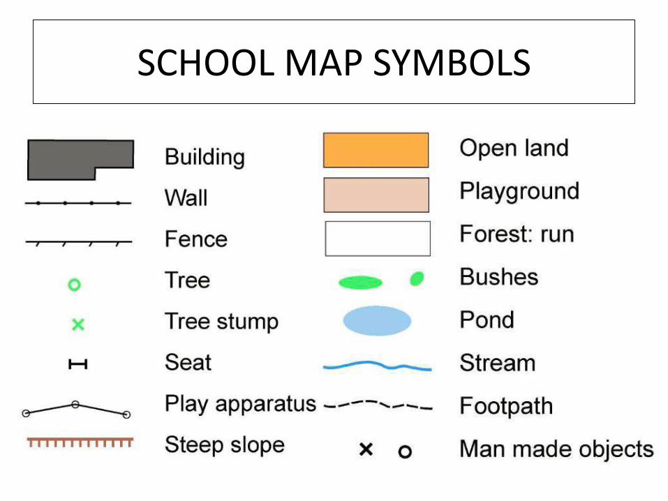
All maps use an internationally agreed set of symbols and these are logical and easy to learn.
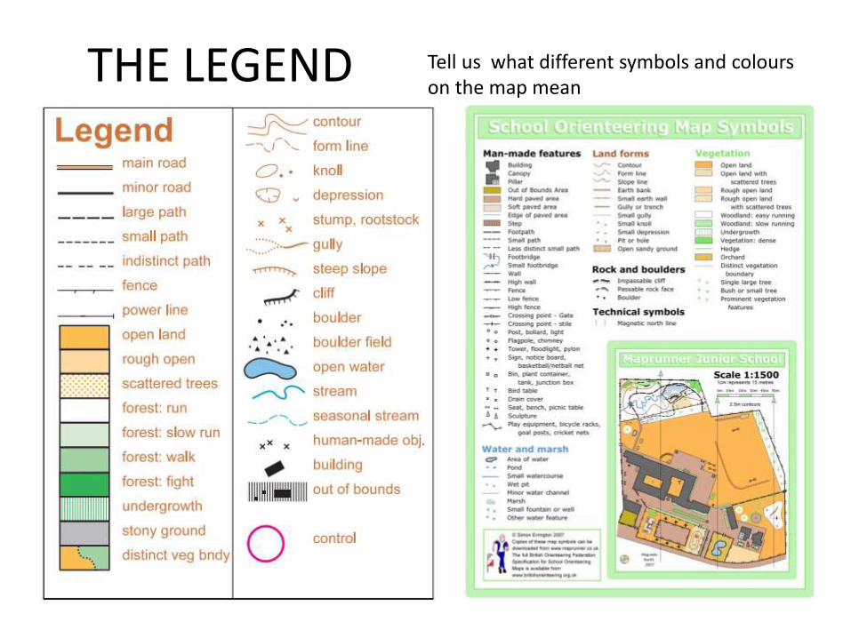
THE LEGEND Tell us what different symbols and colourson the map mean
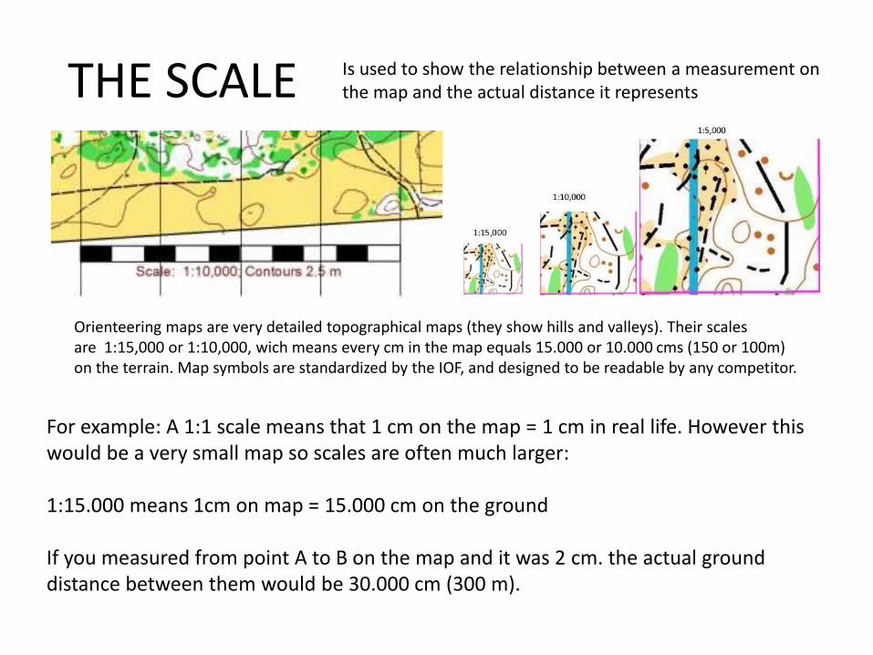
THE SCALE Is used to show the relationship between a measurement onthe map and the actual distance it represents
Orienteering maps are very detailed topographical maps (they show hills and valleys). Their scales are 1:15,000 or 1:10,000, wich means every cm in the map equals 15.000 or 10.000 cms (150 or 100m) on the terrain. Map symbols are standardized by the IOF, and designed to be readable by any competitor.
For example: A 1:1 scale means that 1 cm on the map = 1 cm in real life. However this would be a very small map so scales are often much larger:
1:15.000 means 1cm on map = 15.000 cm on the ground
If you measured from point A to B on the map and it was 2 cm. the actual ground distance between them would be 30.000 cm (300 m).
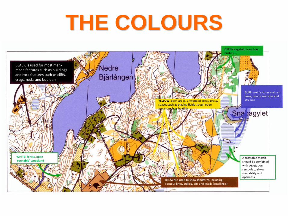
THE COLOURS
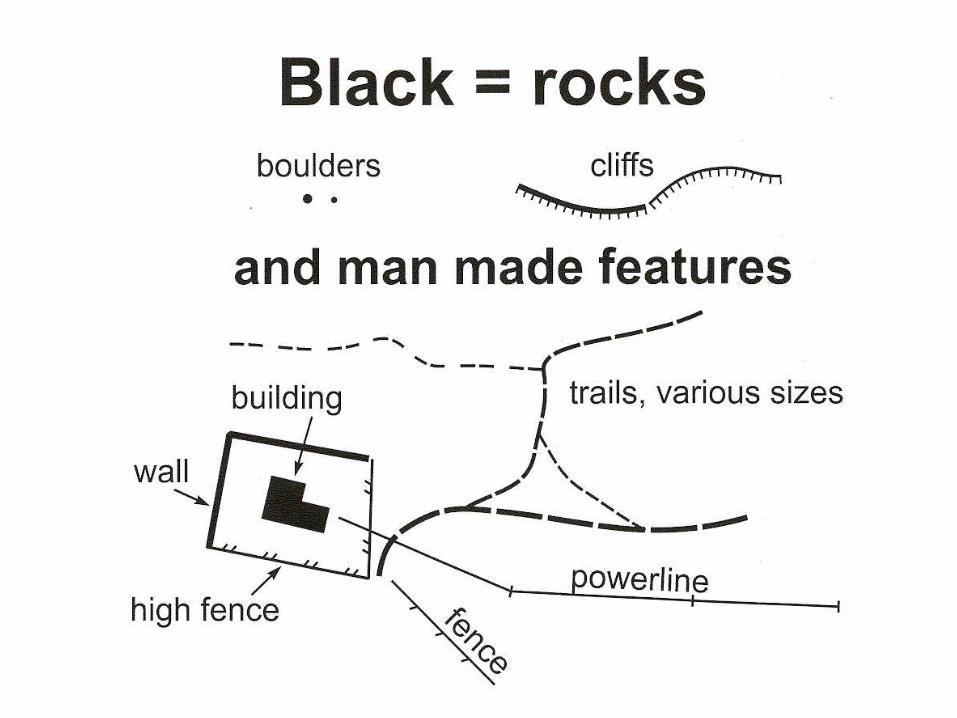
BLACK is used for most man-made features such as buildings and rock features such as cliffs, crags, rocks and boulders
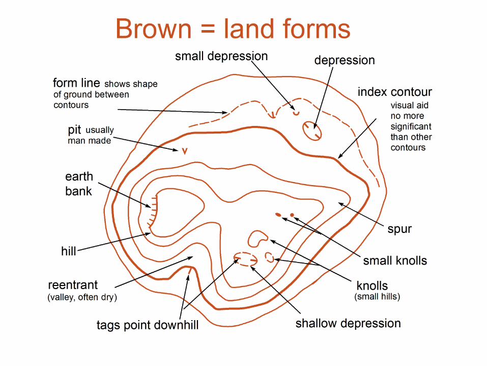
BROWN is used to show landform, including contour lines, gullies, pits and knolls (small hills)
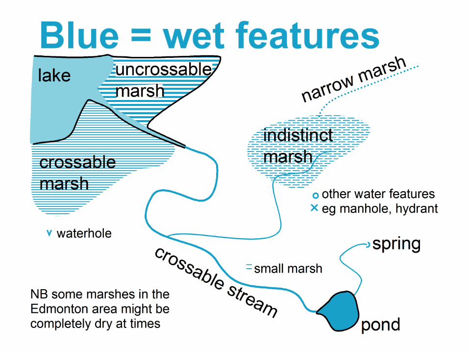
BLUE: wet features such as lakes, ponds, marshes and streams
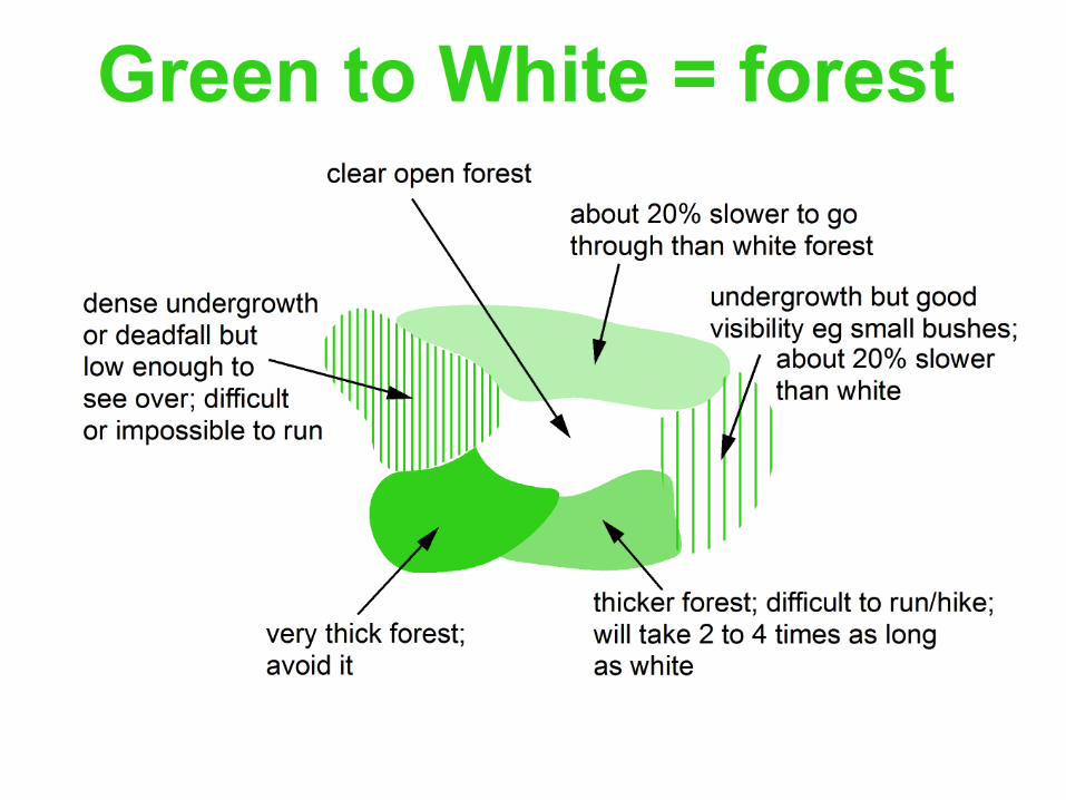
WHITE: forest, open ‘runnable’ woodland
GREEN vegetation such as bushes,..,
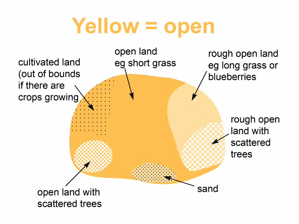
YELLOW: open areas, unwooded areas, grassy spaces such as playing fields ,rough openterrain such as heather
A crossable marsh should be combined with vegetation symbols to show runnability and openness
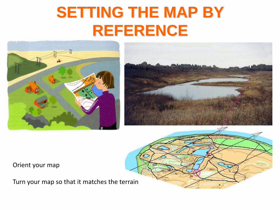
SETTING THE MAP BY
REFERENCE
Orient your map
Turn your map so that it matches the terrain
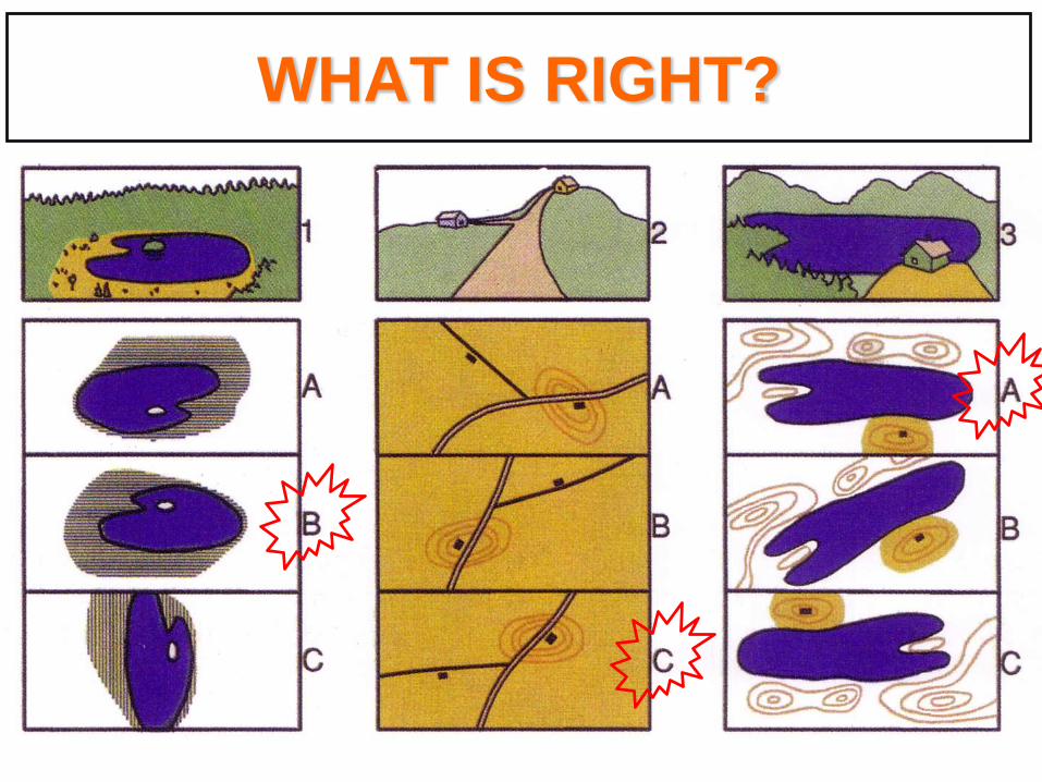
WHAT IS RIGHT?
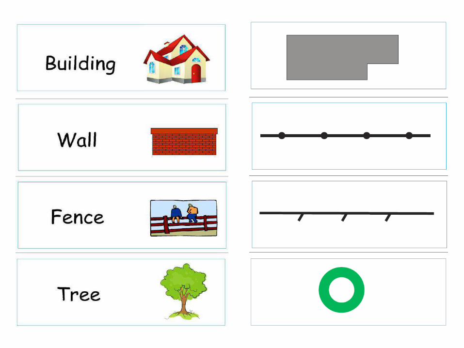
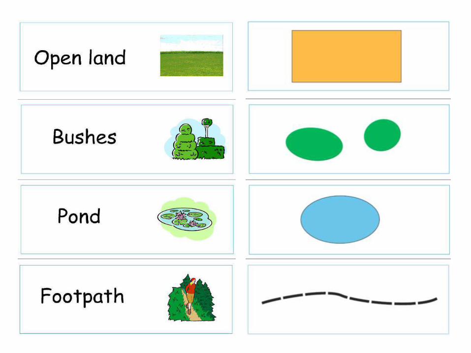
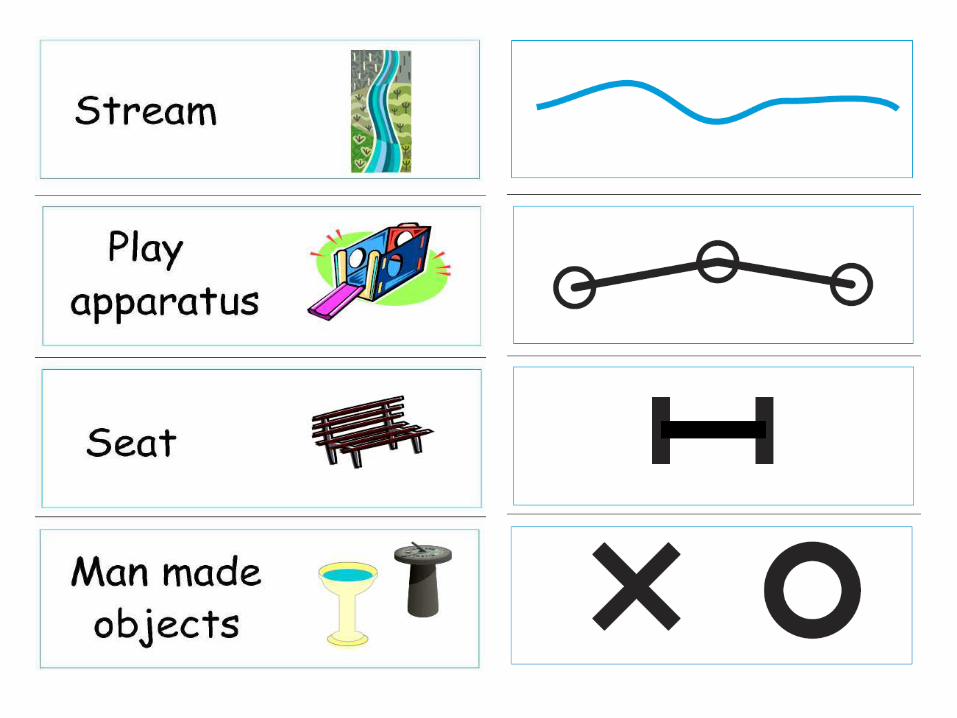
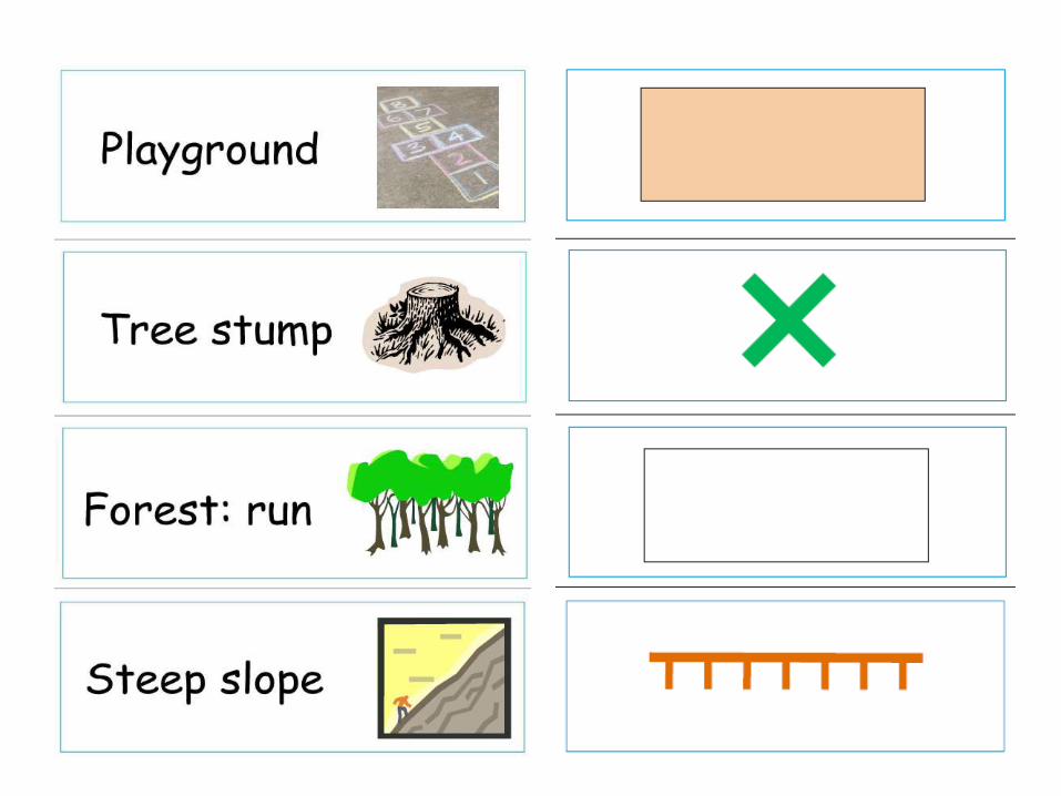
SCHOOL MAP SYMBOLS