oracle spatial – a unifying framework at the utah...
TRANSCRIPT
Oracle Spatial – A UnifyingFramework at the UtahDepartment Of Transportation
Dan PaskeUtah Department of TransportationOracle DBA
Jeff SaundersFarallon Geographics, Inc.Senior Geodatabase Developer
Today’s Goals
• UDOT background• Asset Management at UDOT• Role of Oracle Spatial• Look at the road to the future
Utah Department ofTransportation is responsible for:
Over 6,000 miles of highways Snow removal, signage, bridges, repairs,
building, and maintenance Traffic Operations – monitoring road
conditions, accidents and safety
Organization’s Strategic Goals:
• Goal 1: Take Care of What WeHave
• Goal 2: Make the System WorkBetter
• Goal 3: Improve Safety• Goal 4: Increase Capacity
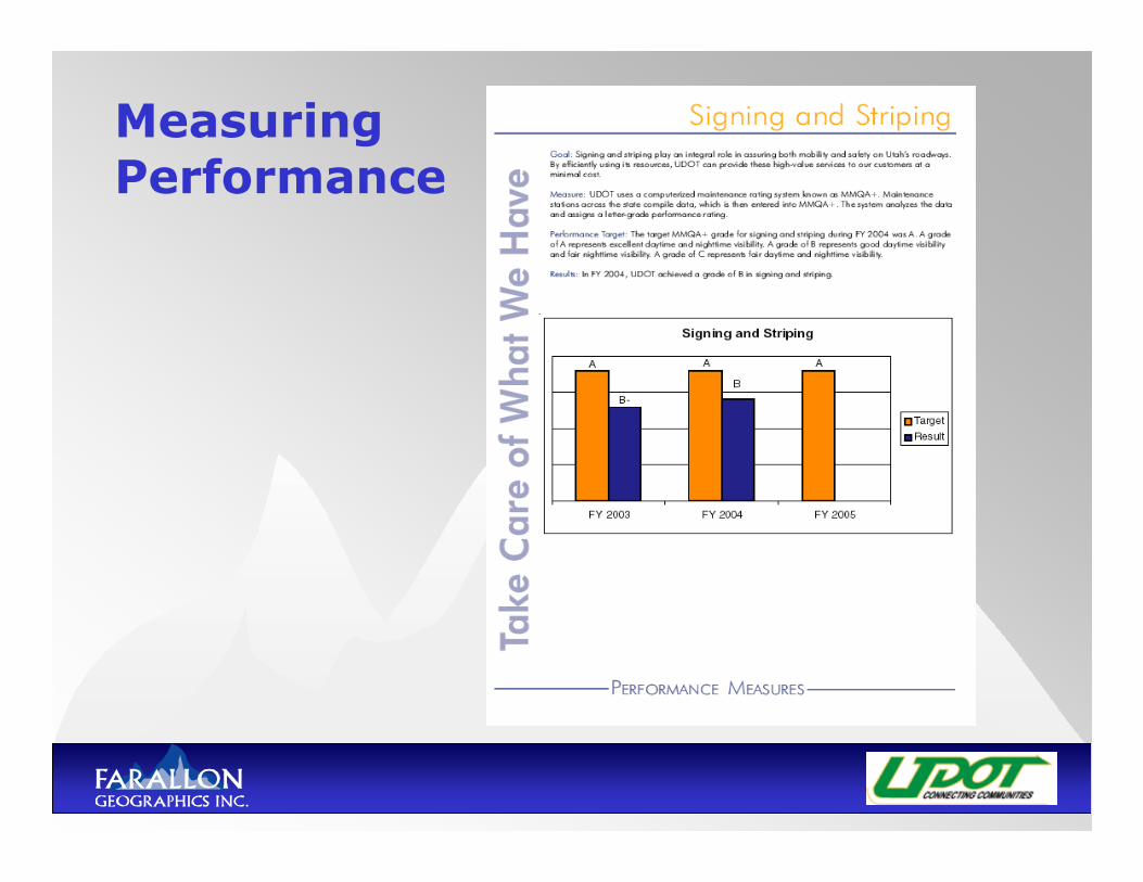
MeasuringPerformance
Challenges facing UDOT:
• Effectively allocating increasinglylimited resources to deal with: Increased congestion Increased user costs Decreased economic growth and
productivity Faster deterioration of highways
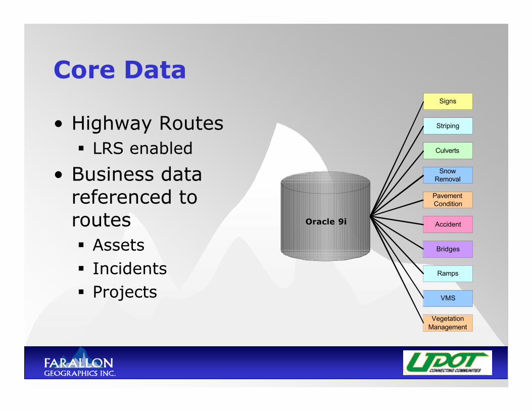
Core Data
• Highway Routes LRS enabled
• Business datareferenced toroutes Assets Incidents Projects
Oracle 9i
Striping
Culverts
Signs
SnowRemoval
PavementCondition
Accident
Bridges
Ramps
VMS
VegetationManagement
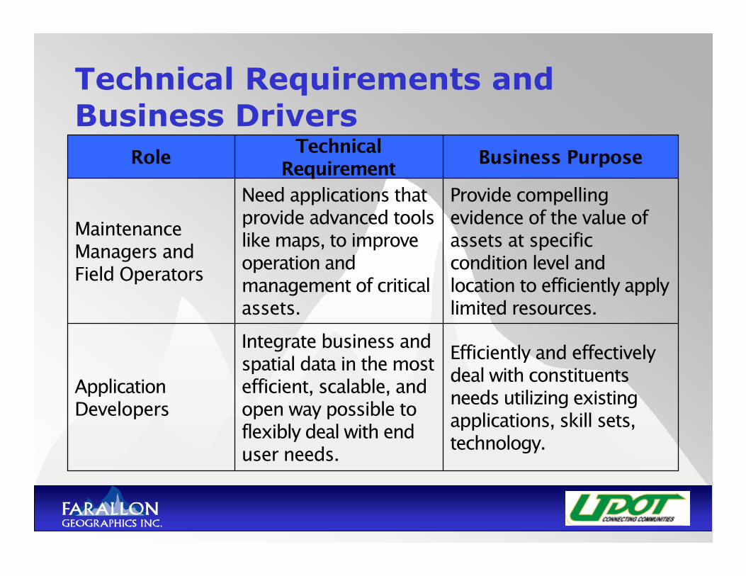
Technical Requirements andBusiness Drivers
Efficiently and effectivelydeal with constituentsneeds utilizing existingapplications, skill sets,technology.
Integrate business andspatial data in the mostefficient, scalable, andopen way possible toflexibly deal with enduser needs.
ApplicationDevelopers
Provide compellingevidence of the value ofassets at specificcondition level andlocation to efficiently applylimited resources.
Need applications thatprovide advanced toolslike maps, to improveoperation andmanagement of criticalassets.
MaintenanceManagers andField Operators
Business PurposeTechnicalRequirementRole
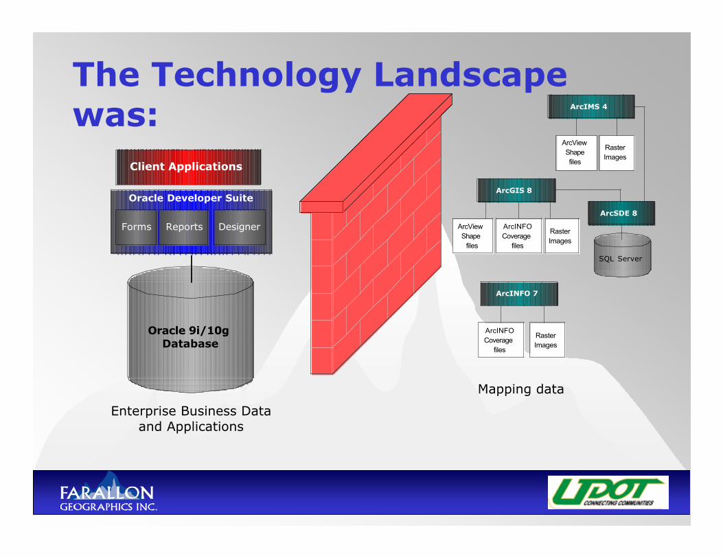
The Technology Landscapewas:
Oracle Developer Suite
Oracle 9i/10gDatabase
Forms Reports Designer
Client Applications
ArcINFOCoveragefiles
RasterImages
ArcViewShapefiles
RasterImages
ArcIMS 4
ArcINFO 7
ArcViewShapefiles
ArcINFOCoveragefiles
RasterImages
ArcGIS 8
SQL Server
ArcSDE 8
Enterprise Business Dataand Applications
Mapping data

To visualize business data:
EnterpriseBusinessDatabase
(Oracle 9i)
Take Databasesnapshot and
extract to a file
Import into Arc/INFO or ArcView
Perform TableJoin between
shape files andextracted file
Manual
Clean upresulting event
data (ifnecessary)
Manual
Output resultinghard-copy map
or shape file
Post to ArcIMSwebsite as shape
fileManual
Man
ual
Inspection andcondition
information
Manual
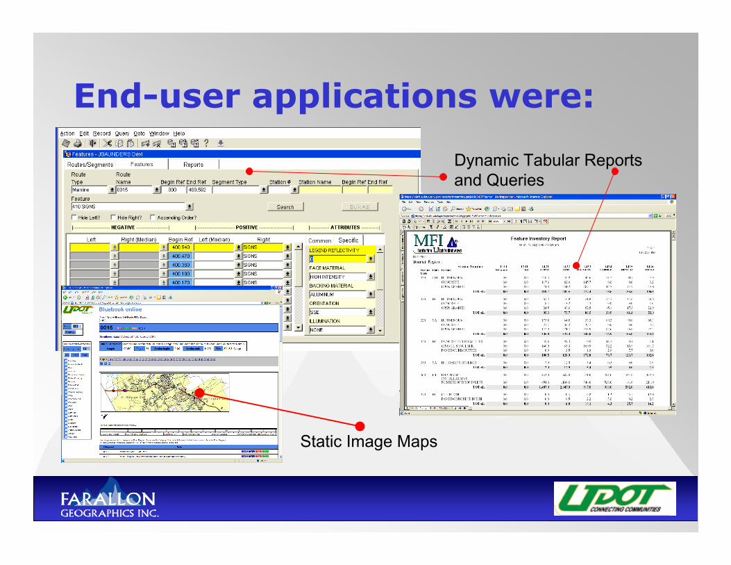
End-user applications were:
Dynamic Tabular Reports and Queries
Static Image Maps
The Issues
• The storage of business data in robust,scalable RDBMS and core spatial data infiles resulted in inefficiencies in: Resources Time Scalability Security Interoperability Data Availability
Why Oracle Spatial?Technical Drivers• Flexible, open architecture• Centralized enterprise data• Scalability and security and other
traditional benefits of Oracle• Spatial business rules in the
database
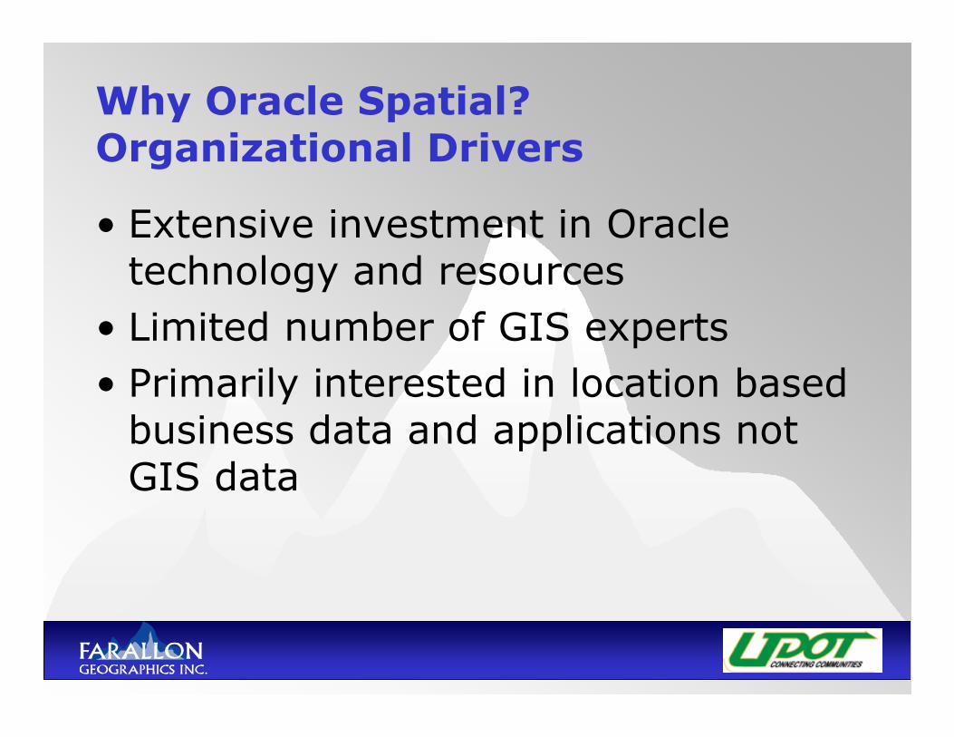
Why Oracle Spatial?Organizational Drivers
• Extensive investment in Oracletechnology and resources
• Limited number of GIS experts• Primarily interested in location based
business data and applications notGIS data
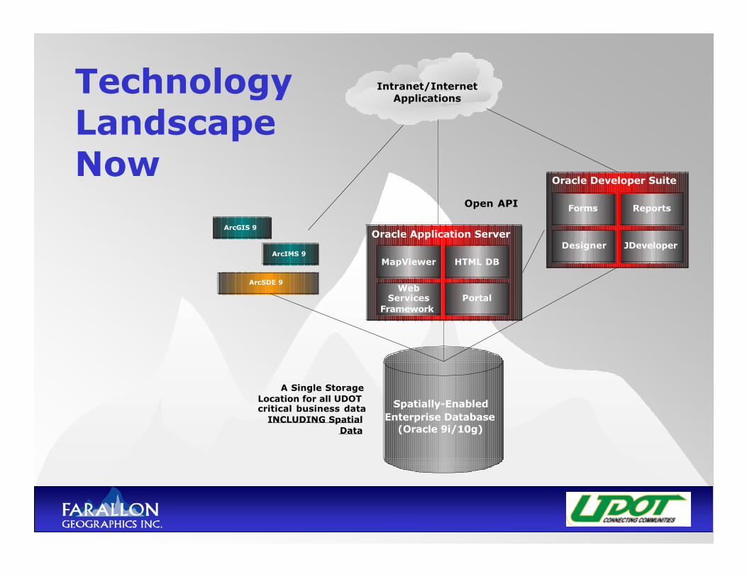
TechnologyLandscapeNow
Spatially-EnabledEnterprise Database
(Oracle 9i/10g)
ArcSDE 9
ArcIMS 9
Oracle Application Server
Oracle Developer Suite
MapViewer HTML DB
WebServices
FrameworkPortal
Forms
Designer
Reports
JDeveloper
Intranet/InternetApplications
A Single StorageLocation for all UDOTcritical business data
INCLUDING SpatialData
ArcGIS 9
Open API
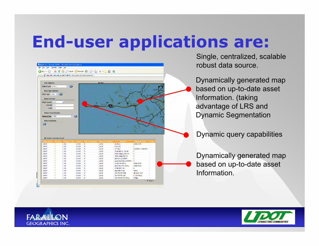
End-user applications are:
Dynamically generated mapbased on up-to-date assetInformation. (takingadvantage of LRS andDynamic Segmentation
Dynamic query capabilities
Dynamically generated mapbased on up-to-date assetInformation.
Single, centralized, scalablerobust data source.
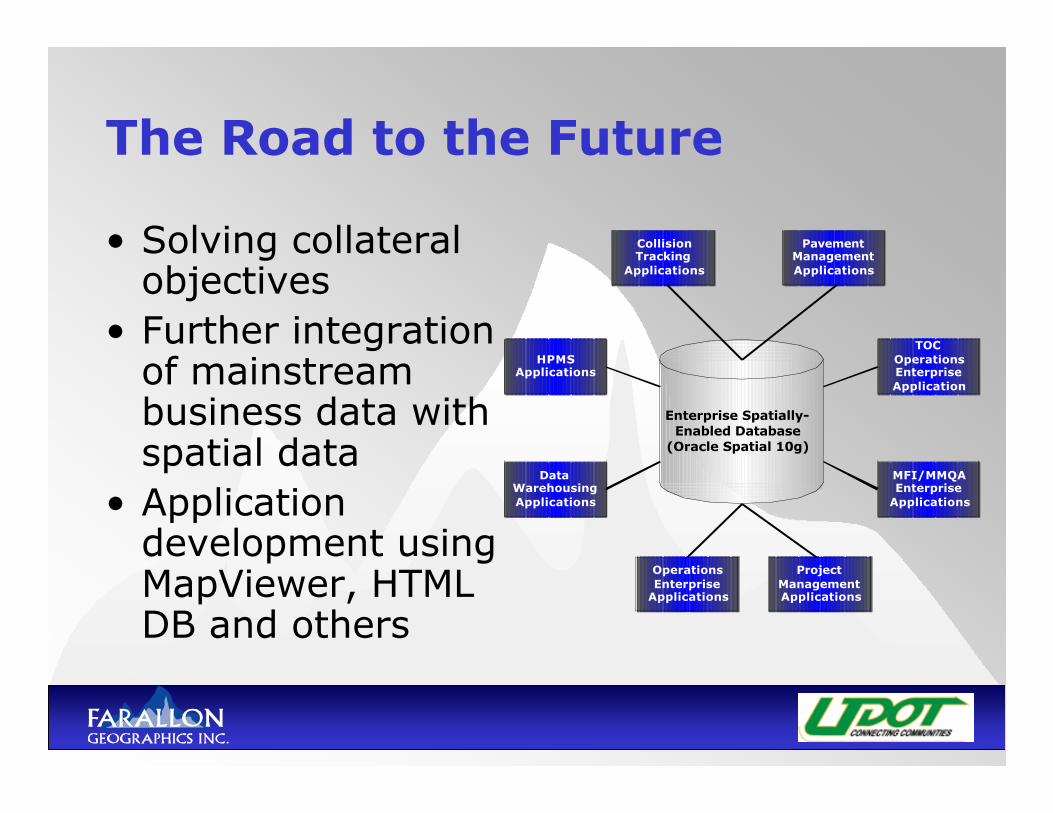
The Road to the Future
• Solving collateralobjectives
• Further integrationof mainstreambusiness data withspatial data
• Applicationdevelopment usingMapViewer, HTMLDB and others
Enterprise Spatially-Enabled Database
(Oracle Spatial 10g)
PavementManagementApplications
CollisionTracking
Applications
HPMSApplications
TOCOperationsEnterpriseApplication
MFI/MMQAEnterprise
Applications
DataWarehousingApplications
OperationsEnterprise
Applications
ProjectManagementApplications
Thank you for attending!
Q & A