oracle fusion middleware - school of geosciencesgisteac/proceedingsonline/oracle10... · mapviewer...
TRANSCRIPT

ORACLE FUSION MIDDLEWARE
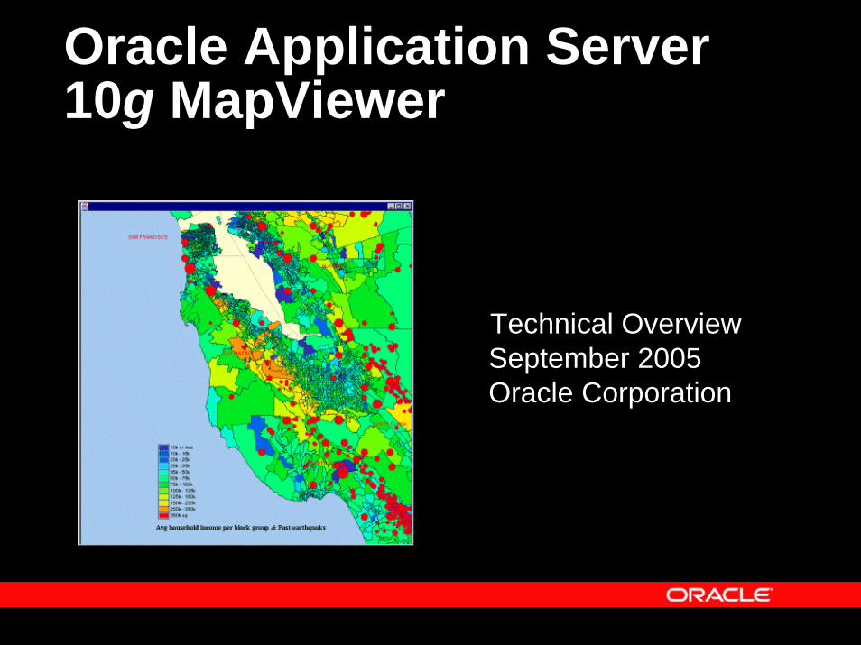
Oracle Application Server 10g MapViewer
September 2005Oracle Corporation
Technical Overview
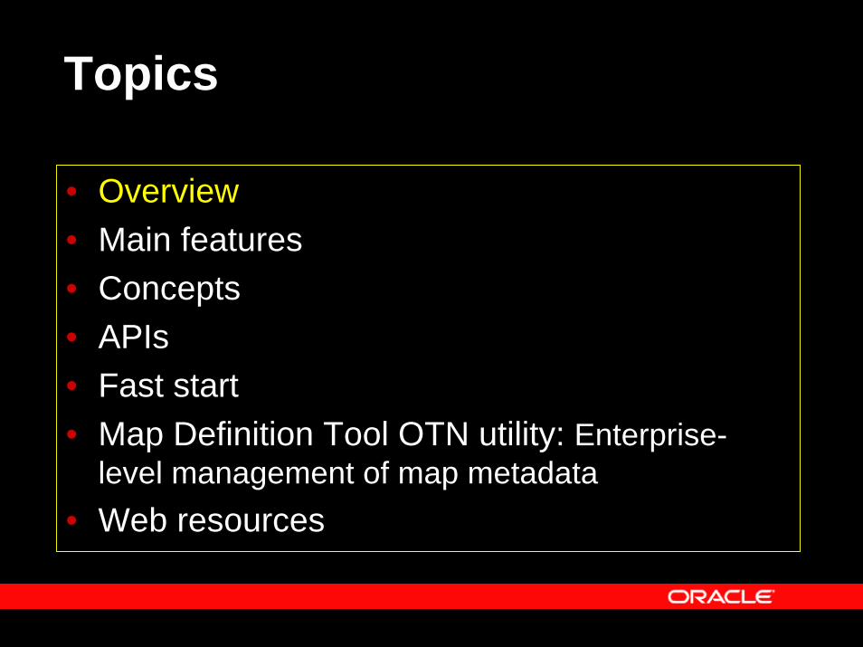
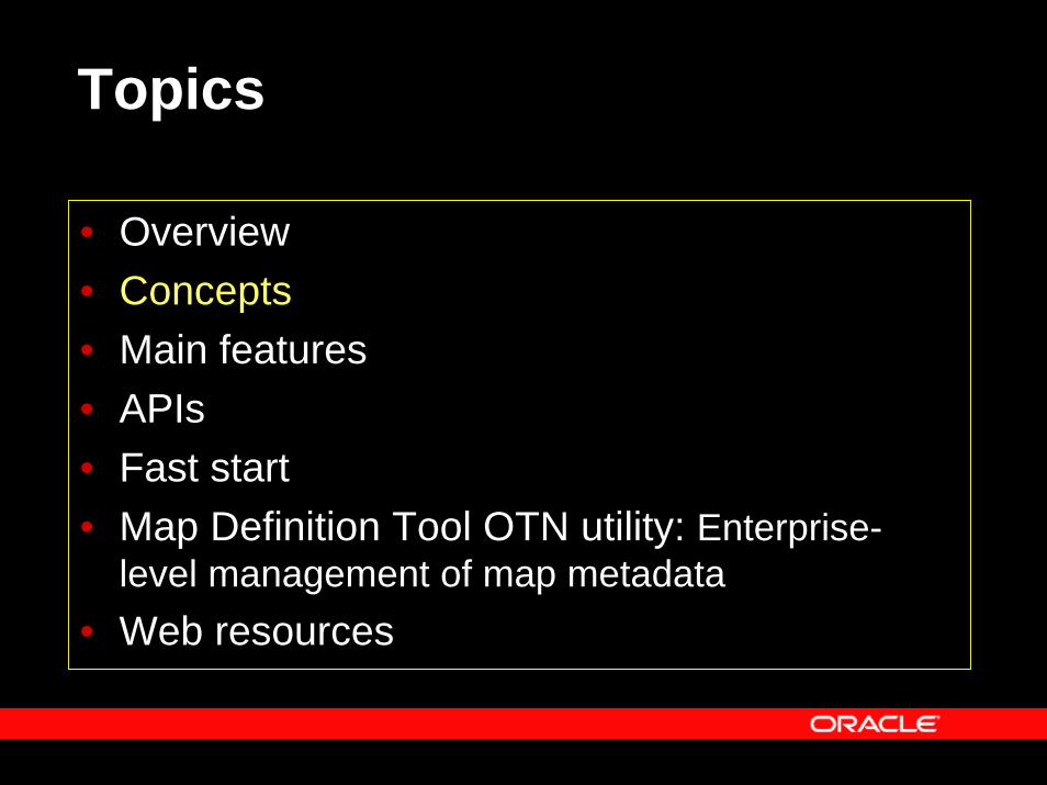
Topics
• Overview• Main features• Concepts• APIs• Fast start• Map Definition Tool OTN utility: Enterprise-
level management of map metadata• Web resources
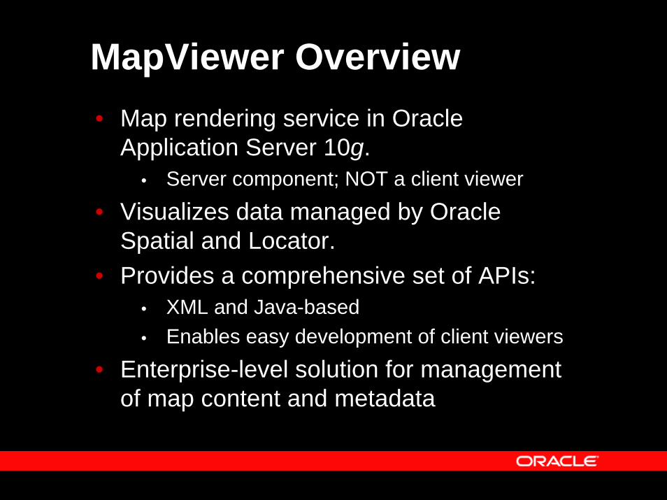
MapViewer Overview• Map rendering service in Oracle
Application Server 10g. • Server component; NOT a client viewer
• Visualizes data managed by Oracle Spatial and Locator.
• Provides a comprehensive set of APIs: • XML and Java-based • Enables easy development of client viewers
• Enterprise-level solution for management of map content and metadata
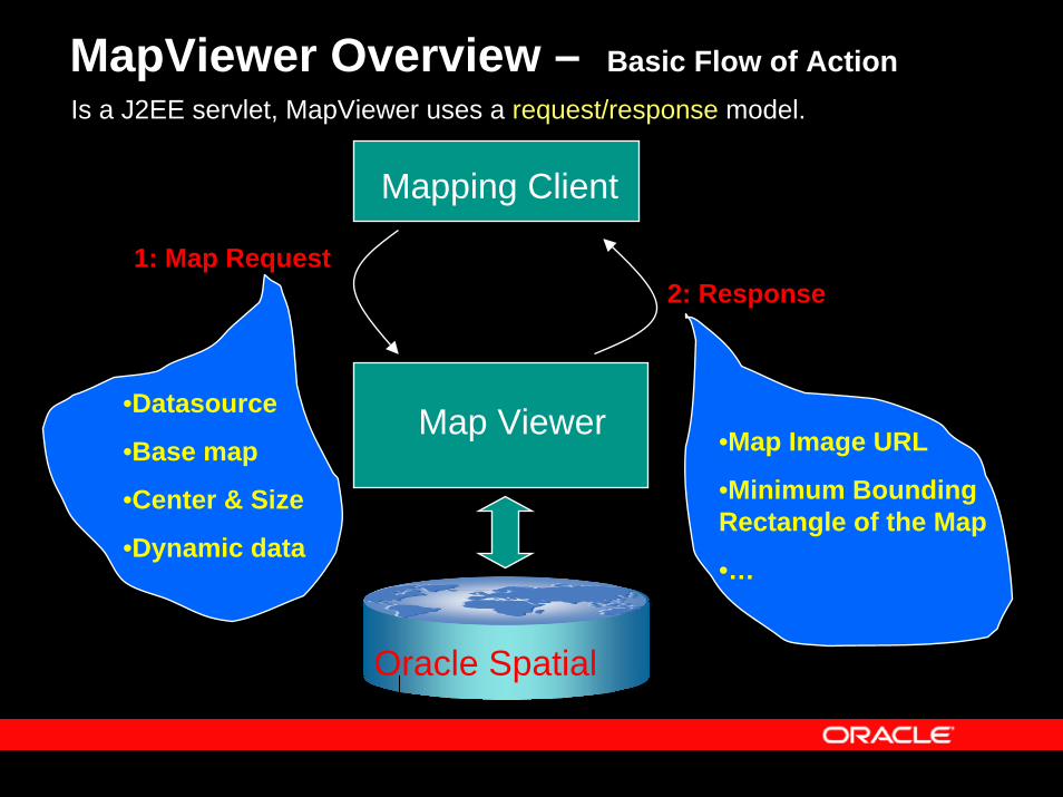
MapViewer Overview – Basic Flow of ActionIs a J2EE servlet, MapViewer uses a request/response model.
Mapping Client
Map Viewer
Oracle Spatial
1: Map Request
•Datasource
•Base map
•Center & Size
•Dynamic data
2: Response
•Map Image URL
•Minimum Bounding Rectangle of the Map
•…
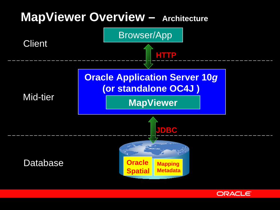
MapViewer Overview – Architecture
MapViewer
Oracle Application Server 10g(or standalone OC4J )
Mid-tier
ClientBrowser/App
HTTP
Oracle Spatial
MappingMetadata
Database
JDBC
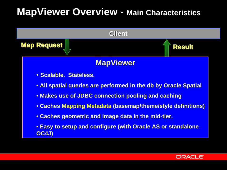
MapViewer Overview - Main Characteristics
ClientClient
MapViewer• Scalable. Stateless.
• All spatial queries are performed in the db by Oracle Spatial
• Makes use of JDBC connection pooling and caching
• Caches Mapping Metadata (basemap/theme/style definitions)
• Caches geometric and image data in the mid-tier.
• Easy to setup and configure (with Oracle AS or standalone OC4J)
Map Request Map Request ResultResult
Topics
• Overview• Concepts• Main features• APIs• Fast start• Map Definition Tool OTN utility: Enterprise-
level management of map metadata• Web resources
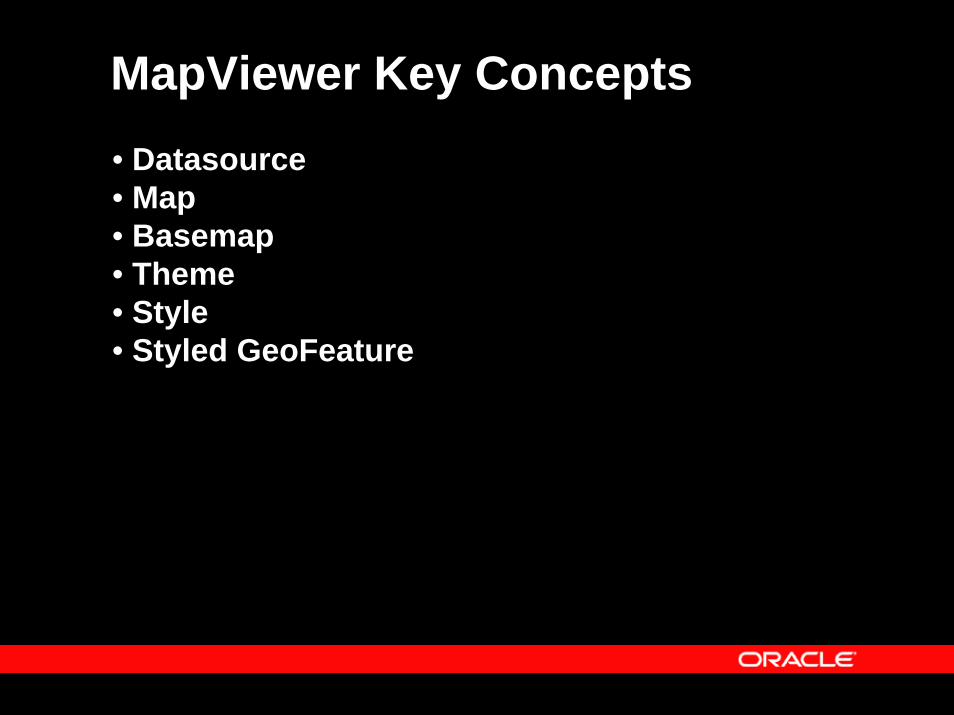
MapViewer Key Concepts• Datasource• Map • Basemap• Theme• Style• Styled GeoFeature
MapViewer Key ConceptsDatasource
• A MapViewer admin defines one or more target databases fromwhich MapViewer will generate maps. These target databasesare called Datasources.
• A datasource always references to a database schema that containssome spatial layers or tables.
• Every map request MUST specify a datasource
Map Request
• Client sends a map request to MapViewer…MapViewer returns a map to client…
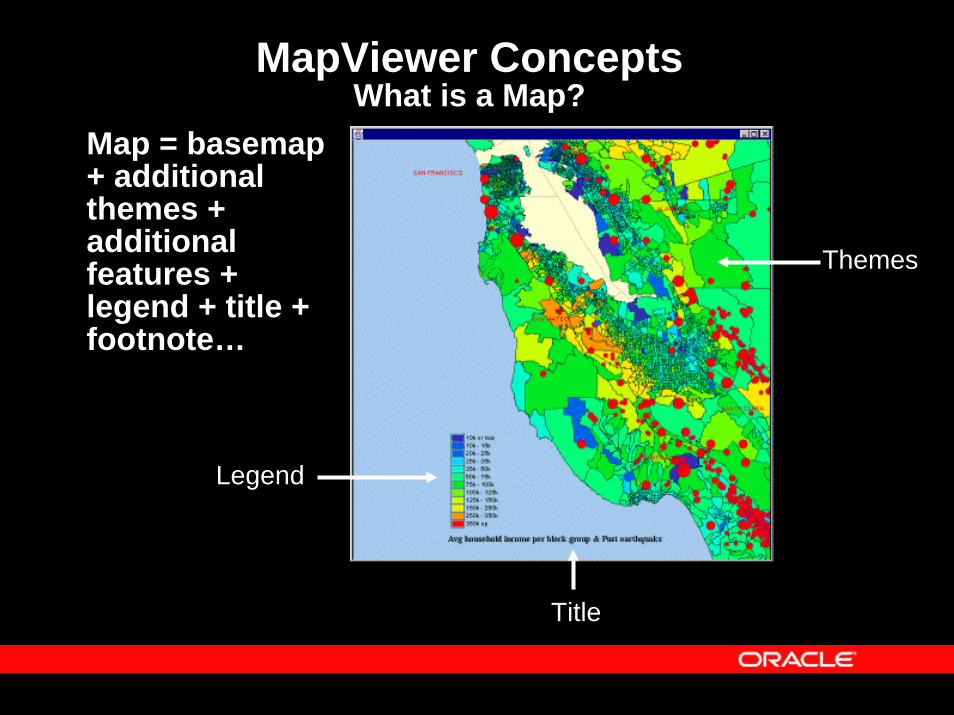
MapViewer ConceptsWhat is a Map?
Map = basemap+ additional themes + additional features + legend + title + footnote…
Title
Themes
Legend
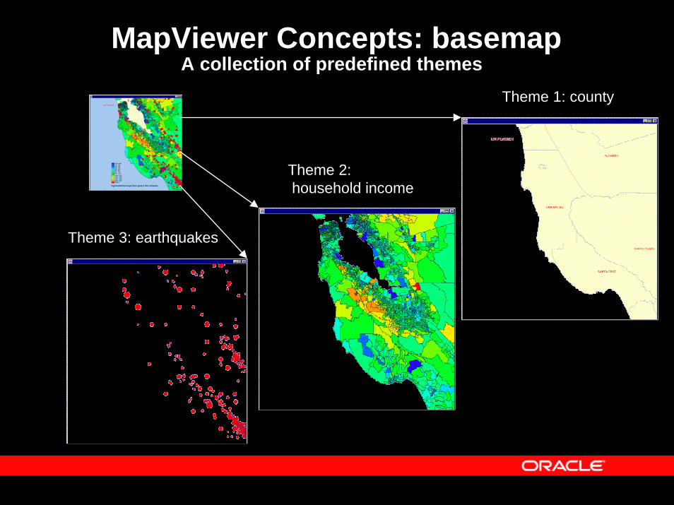
MapViewer Concepts: basemap A collection of predefined themes
Theme 1: county
Theme 2:household income
Theme 3: earthquakes
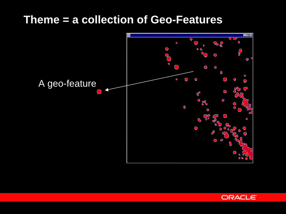
Theme = a collection of Geo-Features
A geo-feature
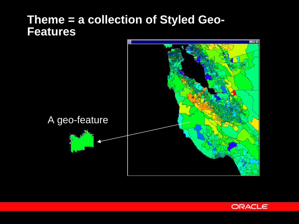
Theme = a collection of Styled Geo-Features
A geo-feature
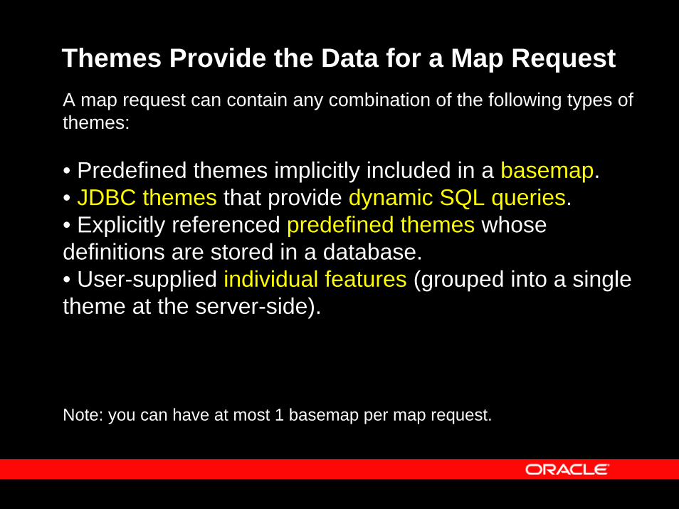
Themes Provide the Data for a Map RequestA map request can contain any combination of the following types of themes:
• Predefined themes implicitly included in a basemap.• JDBC themes that provide dynamic SQL queries.• Explicitly referenced predefined themes whose definitions are stored in a database. • User-supplied individual features (grouped into a single theme at the server-side).
Note: you can have at most 1 basemap per map request.
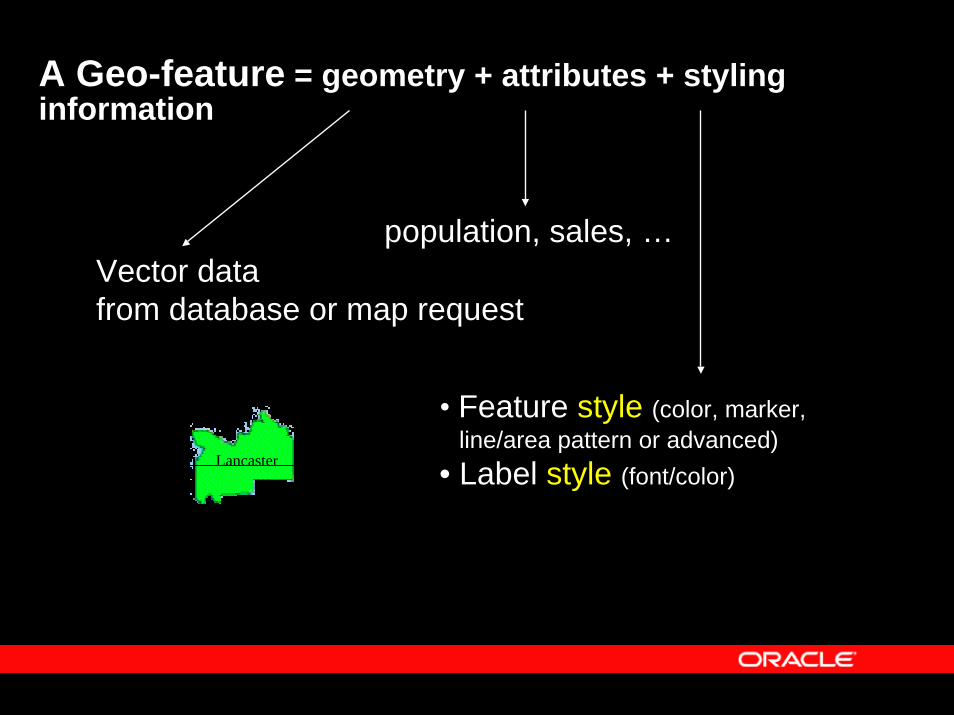
A Geo-feature = geometry + attributes + styling information
Lancaster
Vector datafrom database or map request
population, sales, …
• Feature style (color, marker, line/area pattern or advanced)
• Label style (font/color)
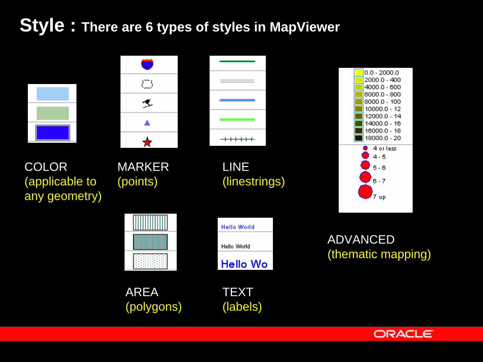
Style : There are 6 types of styles in MapViewer
COLOR(applicable to any geometry)
MARKER(points)
LINE(linestrings)
AREA(polygons)
TEXT(labels)
ADVANCED(thematic mapping)
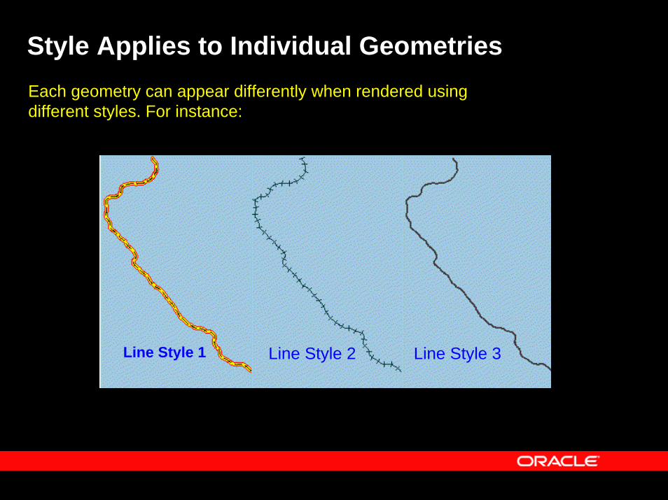
Style Applies to Individual GeometriesEach geometry can appear differently when rendered using different styles. For instance:
Line Style 1 Line Style 2 Line Style 3
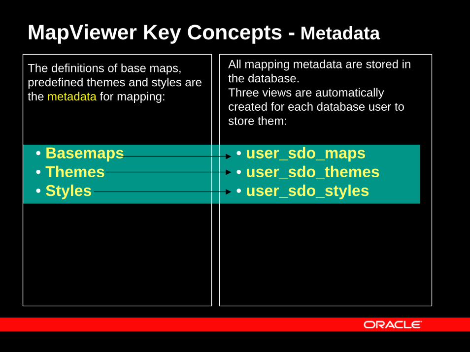
MapViewer Key Concepts - Metadata
• Basemaps• Themes• Styles
The definitions of base maps, predefined themes and styles are the metadata for mapping:
All mapping metadata are stored in the database.Three views are automatically created for each database user to store them:
• user_sdo_maps• user_sdo_themes• user_sdo_styles
Topics
• Overview• Concepts• Main Features• APIs• Fast start• Map Definition Tool OTN utility: Enterprise-
level management of map metadata• Web resources
Key Features in This Release
• Enhanced Mapping and Visualization Capabilities
• Enhanced APIs and JDeveloper Integration• Enhanced Administrative Functions
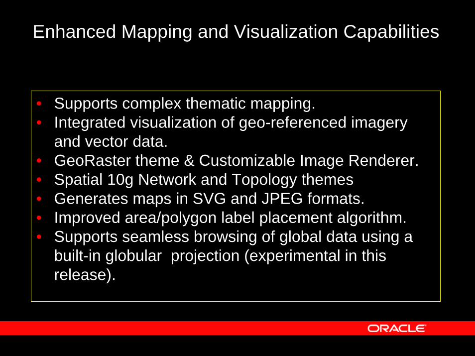
Enhanced Mapping and Visualization Capabilities
• Supports complex thematic mapping.• Integrated visualization of geo-referenced imagery
and vector data.• GeoRaster theme & Customizable Image Renderer.• Spatial 10g Network and Topology themes• Generates maps in SVG and JPEG formats.• Improved area/polygon label placement algorithm.• Supports seamless browsing of global data using a
built-in globular projection (experimental in this release).
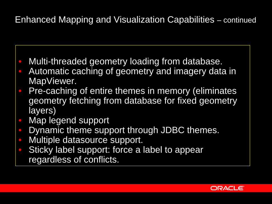
Enhanced Mapping and Visualization Capabilities – continued
• Multi-threaded geometry loading from database.• Automatic caching of geometry and imagery data in
MapViewer.• Pre-caching of entire themes in memory (eliminates
geometry fetching from database for fixed geometry layers)
• Map legend support• Dynamic theme support through JDBC themes.• Multiple datasource support. • Sticky label support: force a label to appear
regardless of conflicts.
Enhanced Administrative Functions
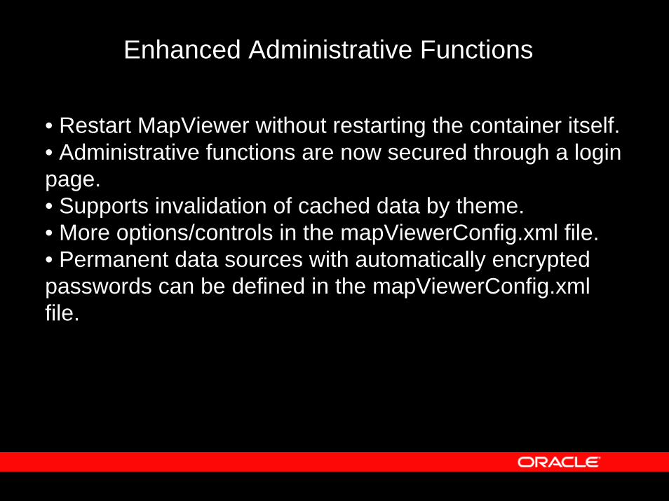
• Restart MapViewer without restarting the container itself.• Administrative functions are now secured through a login page.• Supports invalidation of cached data by theme.• More options/controls in the mapViewerConfig.xml file.• Permanent data sources with automatically encrypted passwords can be defined in the mapViewerConfig.xml file.
Topics
• Overview• Main features• Concepts• APIs• Fast start• Map Definition Tool OTN utility: Enterprise-
level management of map metadata• Web resources
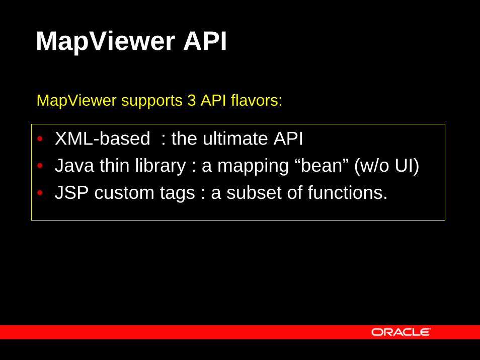
MapViewer API
MapViewer supports 3 API flavors:
• XML-based : the ultimate API• Java thin library : a mapping “bean” (w/o UI)• JSP custom tags : a subset of functions.
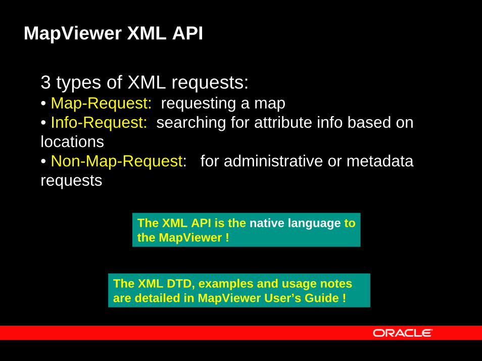
MapViewer XML API
3 types of XML requests:• Map-Request: requesting a map• Info-Request: searching for attribute info based on locations• Non-Map-Request: for administrative or metadata requests
The XML API is the native language tothe MapViewer !
The XML DTD, examples and usage notes are detailed in MapViewer User’s Guide !
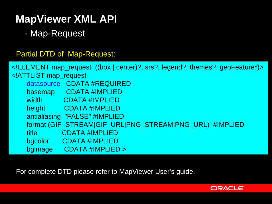
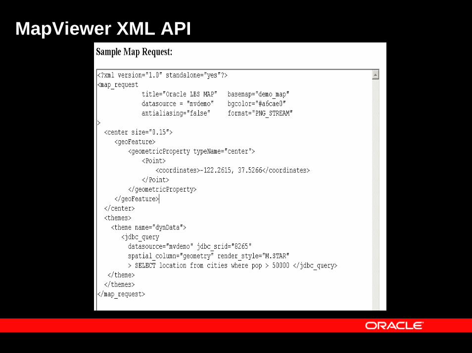
MapViewer XML API- Map-Request
Partial DTD of Map-Request:
<!ELEMENT map_request ((box | center)?, srs?, legend?, themes?, geoFeature*)> <!ATTLIST map_request
datasource CDATA #REQUIRED basemap CDATA #IMPLIED width CDATA #IMPLIED height CDATA #IMPLIED antialiasing "FALSE" #IMPLIED format (GIF_STREAM|GIF_URL|PNG_STREAM|PNG_URL) #IMPLIEDtitle CDATA #IMPLIED bgcolor CDATA #IMPLIED bgimage CDATA #IMPLIED >
For complete DTD please refer to MapViewer User’s guide.
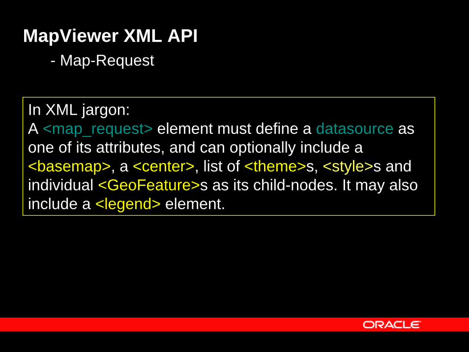
MapViewer XML API- Map-Request
In XML jargon: A <map_request> element must define a datasource as one of its attributes, and can optionally include a <basemap>, a <center>, list of <theme>s, <style>s and individual <GeoFeature>s as its child-nodes. It may also include a <legend> element.
MapViewer XML API
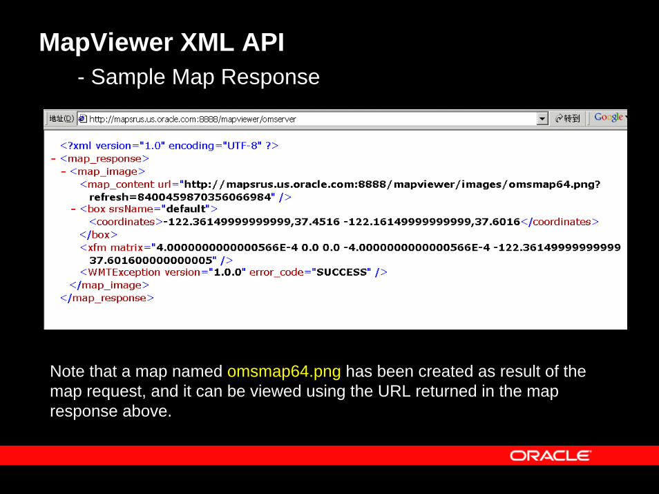
MapViewer XML API- Sample Map Response
Note that a map named omsmap64.png has been created as result of the map request, and it can be viewed using the URL returned in the map response above.
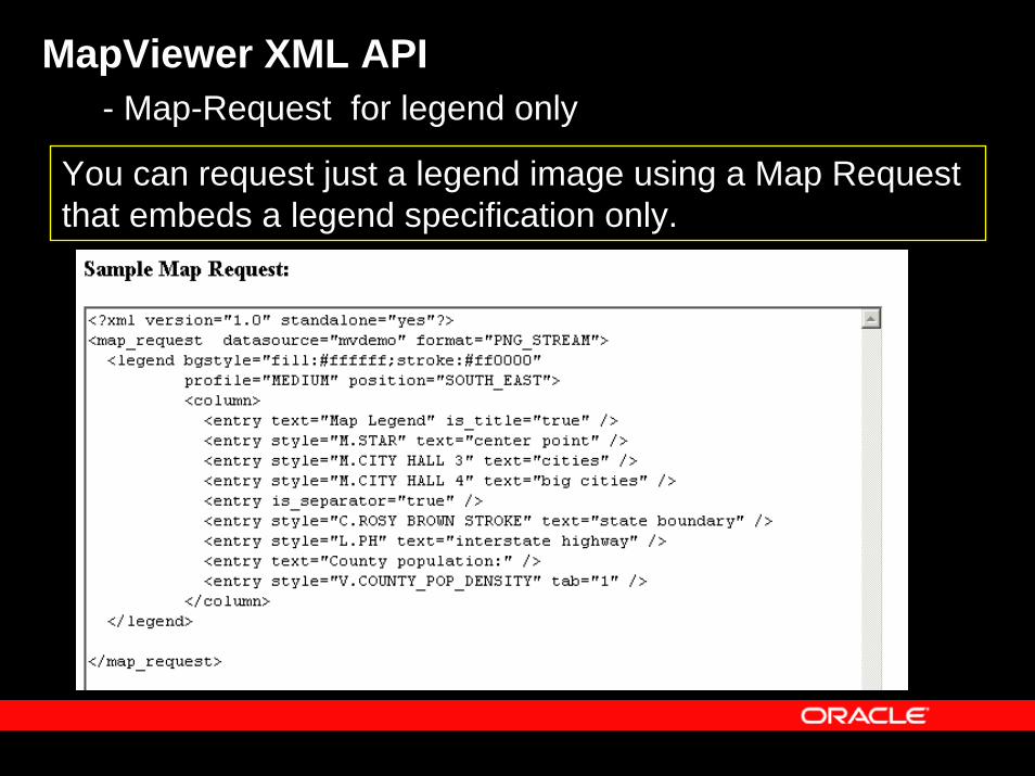
MapViewer XML API- Map-Request for legend only
You can request just a legend image using a Map Request that embeds a legend specification only.
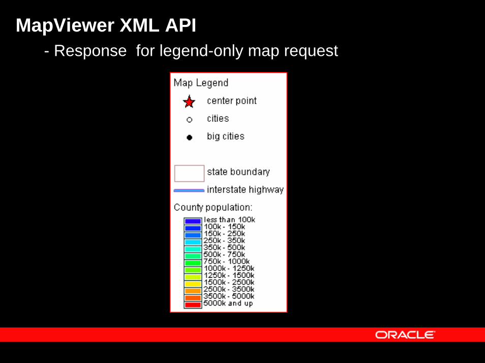
MapViewer XML API- Response for legend-only map request
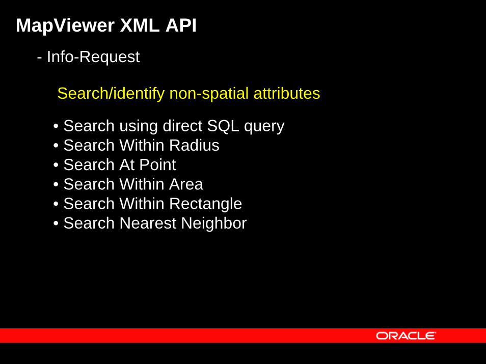
MapViewer XML API- Info-Request
Search/identify non-spatial attributes
• Search using direct SQL query• Search Within Radius• Search At Point• Search Within Area• Search Within Rectangle• Search Nearest Neighbor
MapViewer XML API
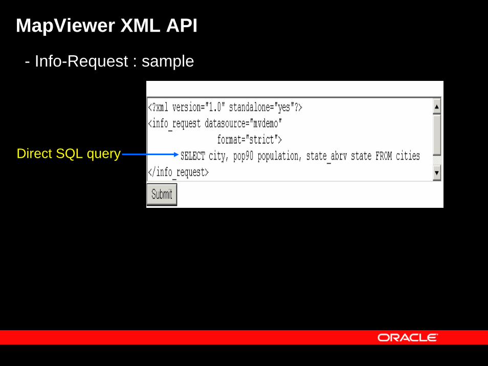
- Info-Request : sample
Direct SQL query
MapViewer XML API
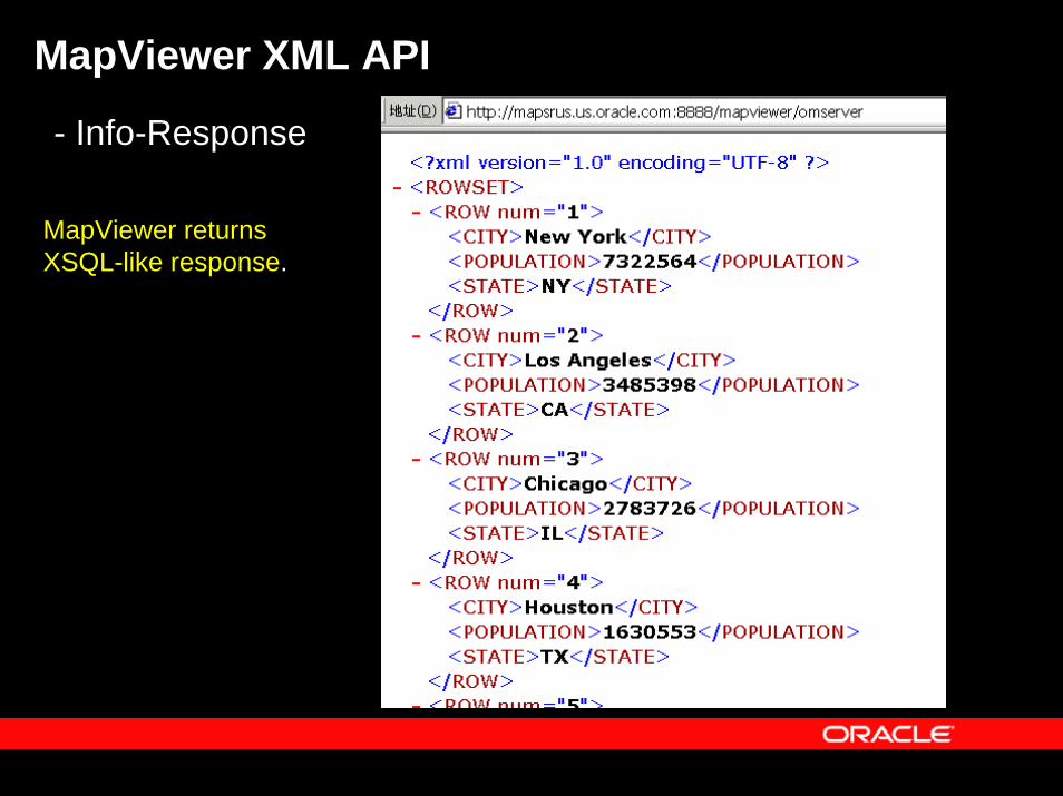
- Info-Response
MapViewer returns XSQL-like response.
MapViewer XML API
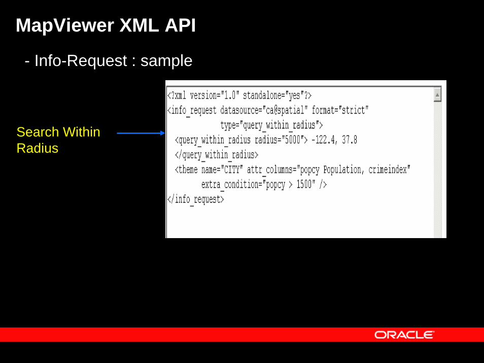
- Info-Request : sample
Search Within Radius
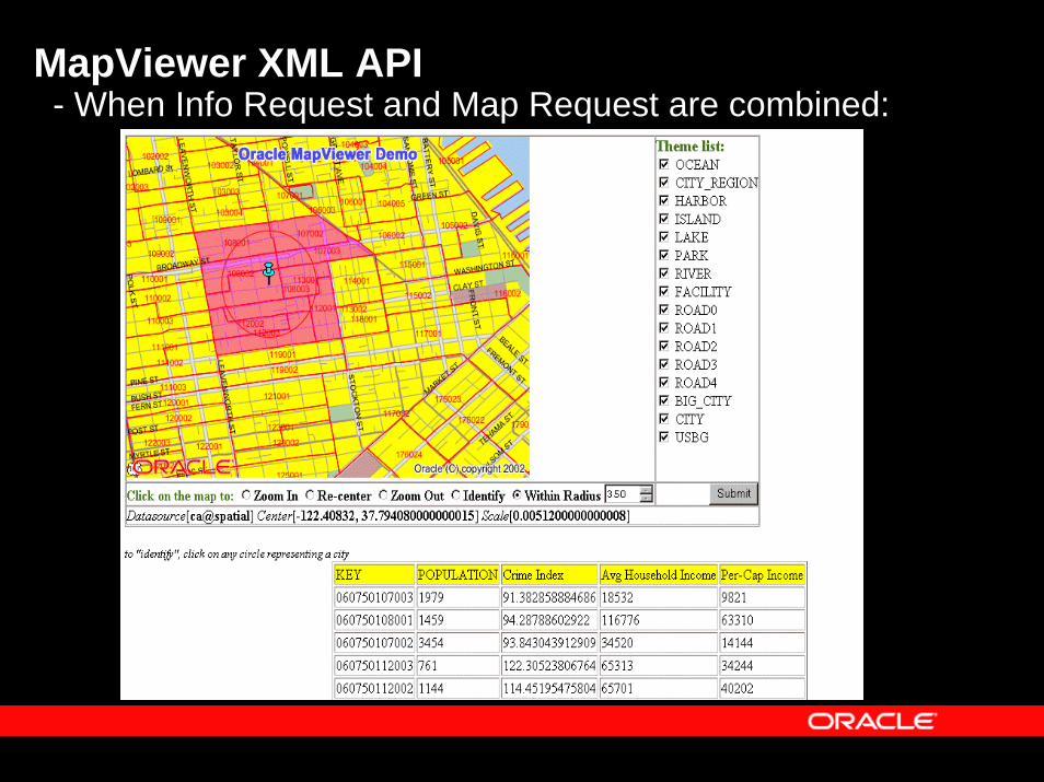
MapViewer XML API- When Info Request and Map Request are combined:
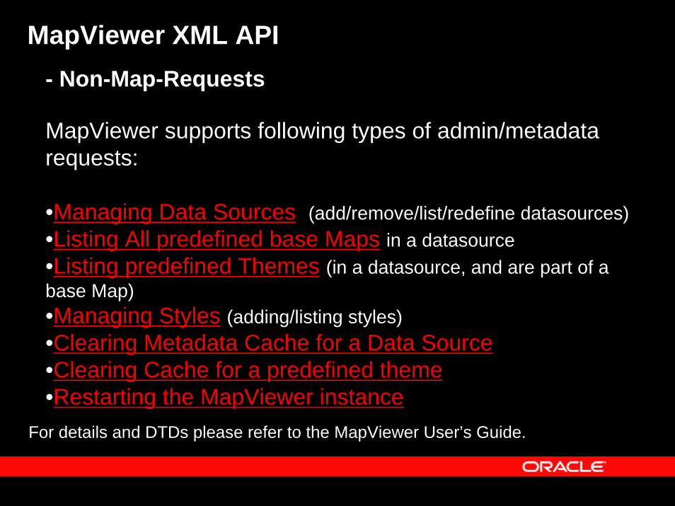
MapViewer XML API- Non-Map-Requests
MapViewer supports following types of admin/metadata requests:
•Managing Data Sources (add/remove/list/redefine datasources)•Listing All predefined base Maps in a datasource•Listing predefined Themes (in a datasource, and are part of a base Map)•Managing Styles (adding/listing styles)•Clearing Metadata Cache for a Data Source•Clearing Cache for a predefined theme •Restarting the MapViewer instance
For details and DTDs please refer to the MapViewer User’s Guide.
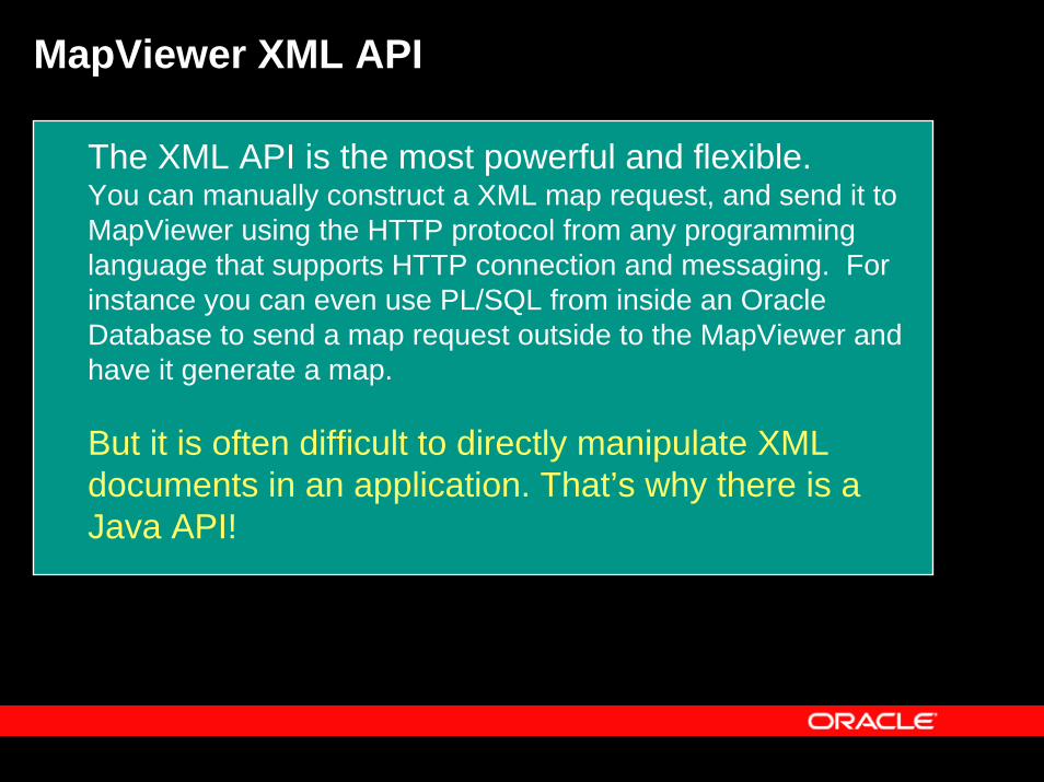
MapViewer XML API
The XML API is the most powerful and flexible.You can manually construct a XML map request, and send it to MapViewer using the HTTP protocol from any programming language that supports HTTP connection and messaging. For instance you can even use PL/SQL from inside an Oracle Database to send a map request outside to the MapViewer and have it generate a map.
But it is often difficult to directly manipulate XML documents in an application. That’s why there is a Java API!
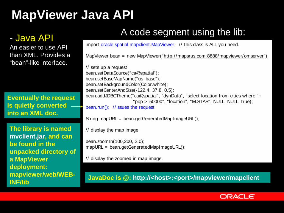
MapViewer Java APIA code segment using the lib:- Java API
An easier to use API than XML. Provides a “bean”-like interface.
Eventually the request is quietly converted into an XML doc.
import oracle.spatial.mapclient.MapViewer; // this class is ALL you need.
MapViewer bean = new MapViewer(“http://mapsrus.com:8888/mapviewer/omserver”);
// sets up a requestbean.setDataSource(“ca@spatial”);bean.setBaseMapName(“us_base”);bean.setBackgroundColor(Color.white);bean.setCenterAndSize(-122.4, 37.8, 0.5);bean.addJDBCTheme(“ca@spatial”, “dynData”, “select location from cities where “+
“pop > 50000”, “location”, “M.STAR”, NULL, NULL, true);bean.run(); //issues the request
String mapURL = bean.getGeneratedMapImageURL();
// display the map image
bean.zoomIn(100,200, 2.0);mapURL = bean.getGeneratedMapImageURL();
// display the zoomed in map image.
The library is named mvclient.jar, and can be found in the unpacked directory of a MapViewerdeployment: mapviewer/web/WEB-INF/lib
JavaDoc is @: http://<host>:<port>/mapviewer/mapclient
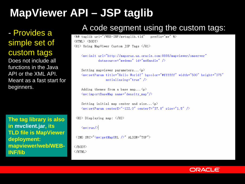
MapViewer API – JSP taglibA code segment using the custom tags:- Provides a
simple set of custom tagsDoes not include all functions in the Java API or the XML API. Meant as a fast start for beginners.
The tag library is also in mvclient.jar, its TLD file is MapViewerdeployment: mapviewer/web/WEB-INF/lib
Topics
• Overview• Main features• Concepts• APIs• Fast Start• Map Definition Tool OTN utility: Enterprise-
level management of map metadata• Web resources
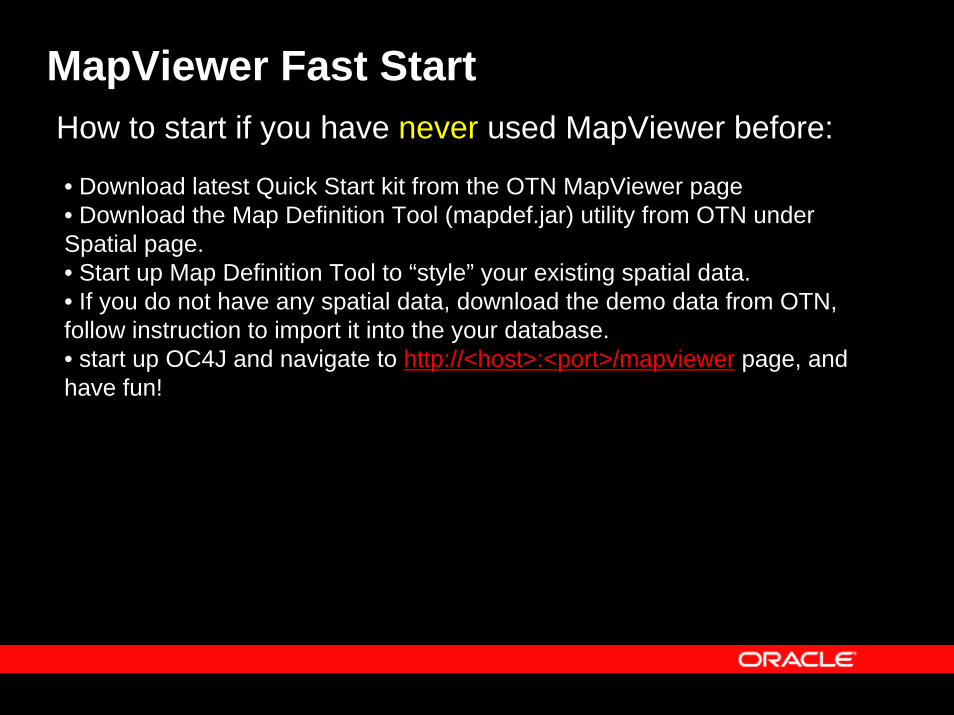
MapViewer Fast StartHow to start if you have never used MapViewer before:
• Download latest Quick Start kit from the OTN MapViewer page• Download the Map Definition Tool (mapdef.jar) utility from OTN under Spatial page.• Start up Map Definition Tool to “style” your existing spatial data.• If you do not have any spatial data, download the demo data from OTN, follow instruction to import it into the your database.• start up OC4J and navigate to http://<host>:<port>/mapviewer page, and have fun!
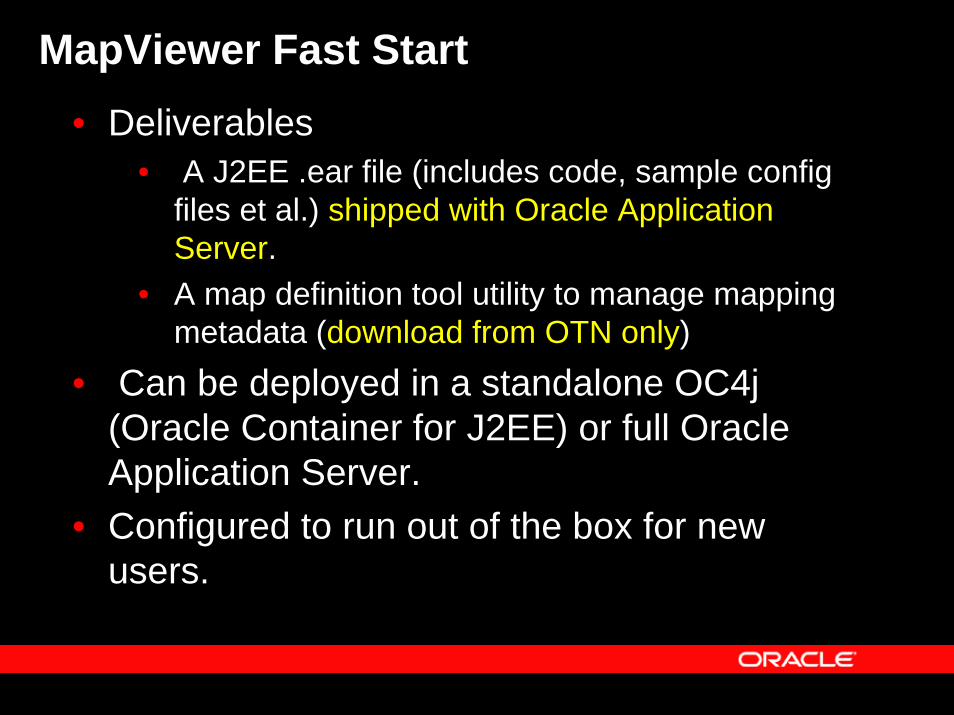
MapViewer Fast Start• Deliverables
• A J2EE .ear file (includes code, sample configfiles et al.) shipped with Oracle Application Server.
• A map definition tool utility to manage mapping metadata (download from OTN only)
• Can be deployed in a standalone OC4j (Oracle Container for J2EE) or full Oracle Application Server.
• Configured to run out of the box for new users.
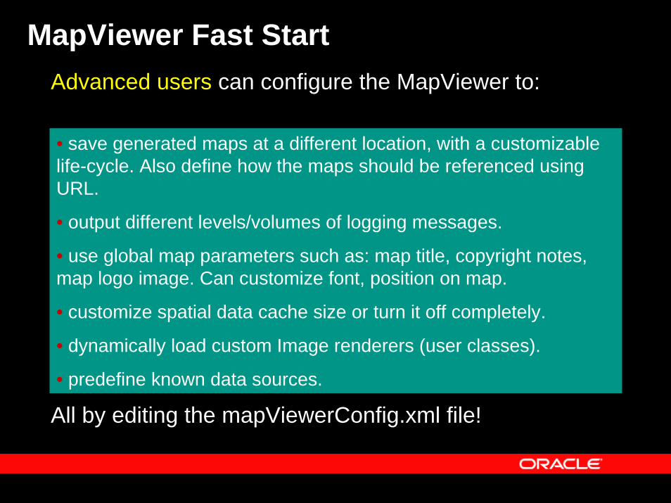
MapViewer Fast StartAdvanced users can configure the MapViewer to:
• save generated maps at a different location, with a customizable life-cycle. Also define how the maps should be referenced using URL.
• output different levels/volumes of logging messages.
• use global map parameters such as: map title, copyright notes, map logo image. Can customize font, position on map.
• customize spatial data cache size or turn it off completely.
• dynamically load custom Image renderers (user classes).
• predefine known data sources.
All by editing the mapViewerConfig.xml file!
Topics
• Overview• Main features• Concepts• APIs• Fast start• Map Definition Tool OTN utility: Enterprise-
level management of map metadata• Web resources
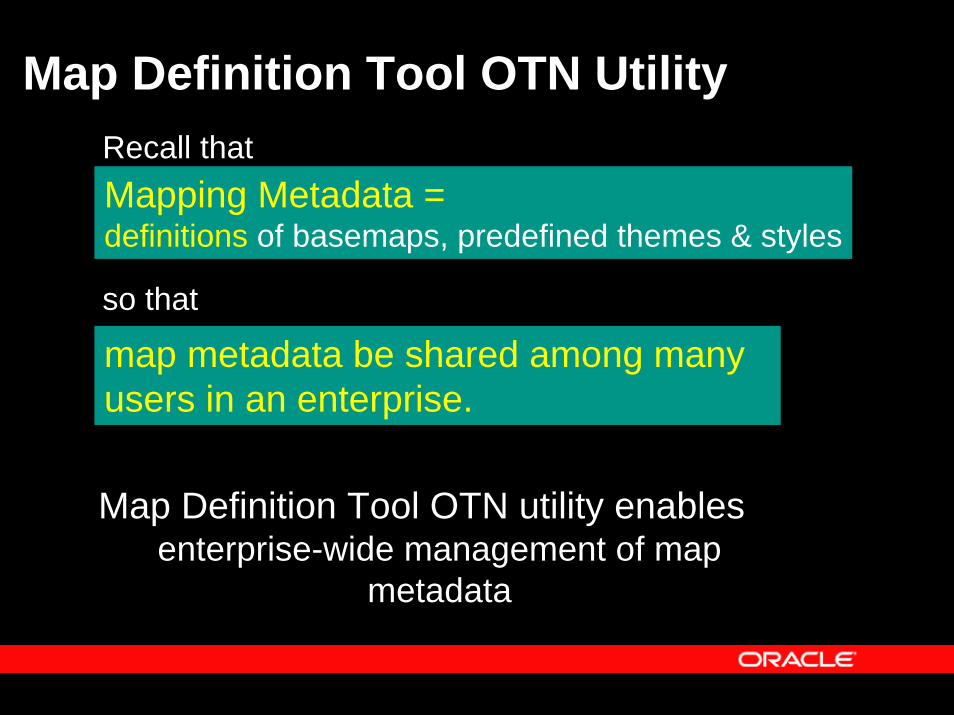
Map Definition Tool OTN UtilityRecall thatMapping Metadata = definitions of basemaps, predefined themes & styles
so that
map metadata be shared among many users in an enterprise.
Map Definition Tool OTN utility enables enterprise-wide management of map
metadata
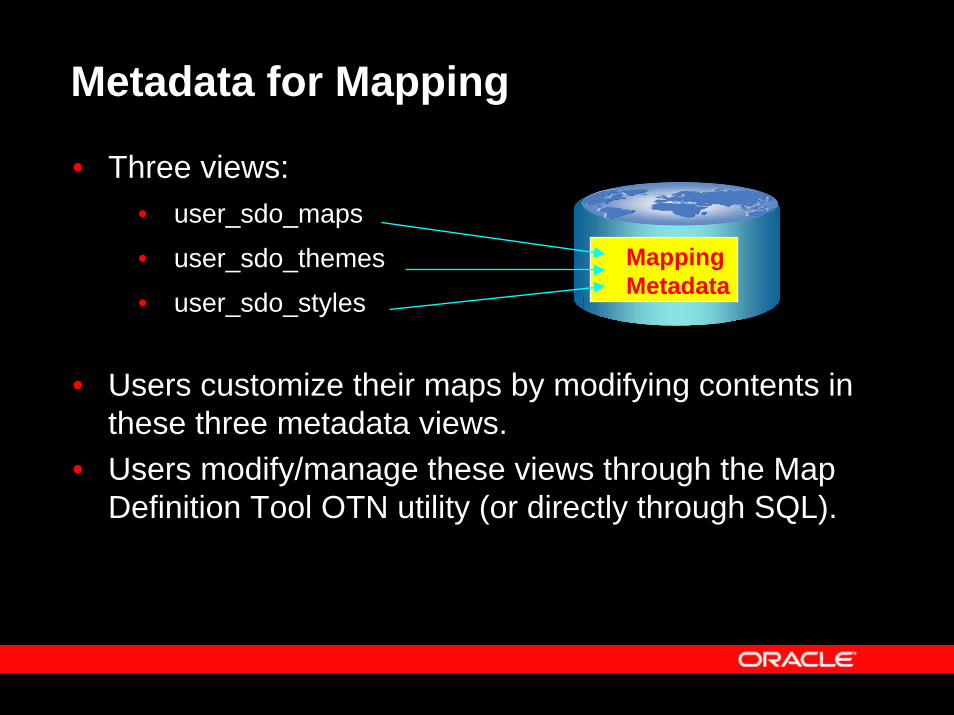
Metadata for Mapping
• Three views:• user_sdo_maps
• user_sdo_themes
• user_sdo_styles
• Users customize their maps by modifying contents in these three metadata views.
• Users modify/manage these views through the Map Definition Tool OTN utility (or directly through SQL).
associated db
MappingMetadata
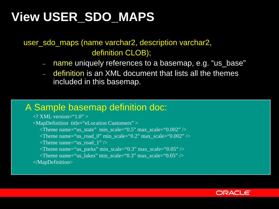
View USER_SDO_MAPS
user_sdo_maps (name varchar2, description varchar2,definition CLOB);
– name uniquely references to a basemap, e.g. “us_base”– definition is an XML document that lists all the themes
included in this basemap.
<? XML version=“1.0” ><MapDefinition title=“eLocation Customers” >
<Theme name=“us_state” min_scale=“0.5” max_scale=“0.002” /><Theme name=“us_road_0” min_scale=“0.2” max_scale=“0.002” /><Theme name=“us_road_1” /><Theme name=“us_parks” min_scale=“0.3” max_scale=“0.05” /><Theme name=“us_lakes” min_scale=“0.3” max_scale=“0.05” />
</MapDefinition>
A Sample basemap definition doc:
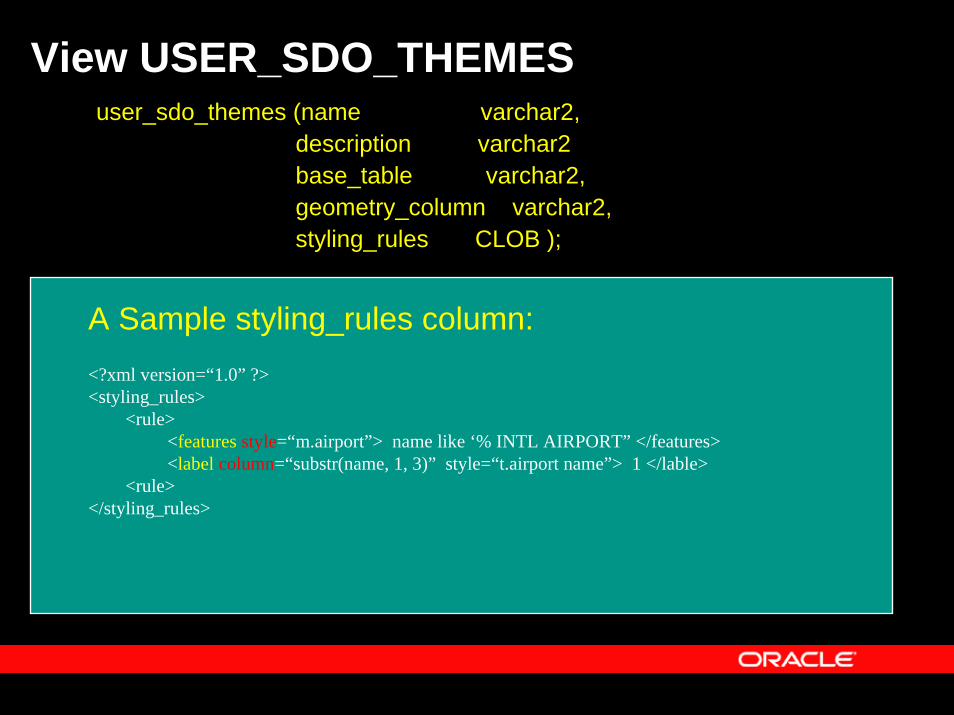
View USER_SDO_THEMESuser_sdo_themes (name varchar2,
description varchar2base_table varchar2, geometry_column varchar2, styling_rules CLOB );
A Sample styling_rules column:<?xml version=“1.0” ?><styling_rules>
<rule><features style=“m.airport”> name like ‘% INTL AIRPORT” </features><label column=“substr(name, 1, 3)” style=“t.airport name”> 1 </lable>
<rule></styling_rules>
View USER_SDO_THEMES – contd.
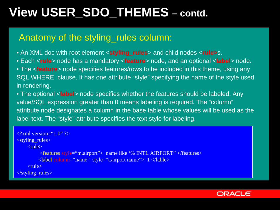
Anatomy of the styling_rules column:
<?xml version=“1.0” ?><styling_rules>
<rule><features style=“m.airport”> name like ‘% INTL AIRPORT” </features>
<label column=“name” style=“t.airport name”> 1 </lable><rule>
</styling_rules>
• An XML doc with root element <styling_rules> and child nodes <rule>s.• Each <rule> node has a mandatory <feature> node, and an optional <label> node. • The <feature> node specifies features/rows to be included in this theme, using any SQL WHERE clause. It has one attribute “style” specifying the name of the style used in rendering. • The optional <label> node specifies whether the features should be labeled. Any value/SQL expression greater than 0 means labeling is required. The “column”attribute node designates a column in the base table whose values will be used as the label text. The “style” attribute specifies the text style for labeling.
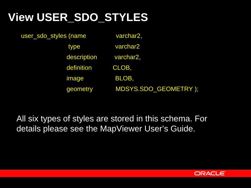
View USER_SDO_STYLESuser_sdo_styles (name varchar2,
type varchar2
description varchar2,
definition CLOB,
image BLOB,
geometry MDSYS.SDO_GEOMETRY );
All six types of styles are stored in this schema. For details please see the MapViewer User’s Guide.
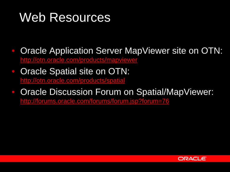
Web Resources
• Oracle Application Server MapViewer site on OTN: http://otn.oracle.com/products/mapviewer
• Oracle Spatial site on OTN: http://otn.oracle.com/products/spatial
• Oracle Discussion Forum on Spatial/MapViewer: http://forums.oracle.com/forums/forum.jsp?forum=76

Appendix
Screen Shots
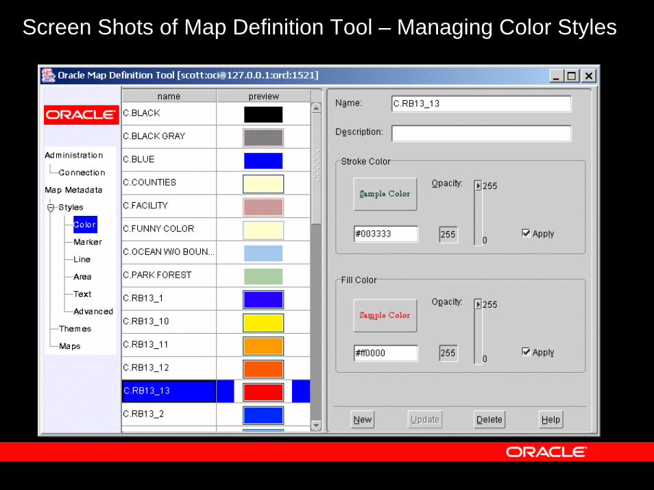
Screen Shots of Map Definition Tool – Managing Color Styles
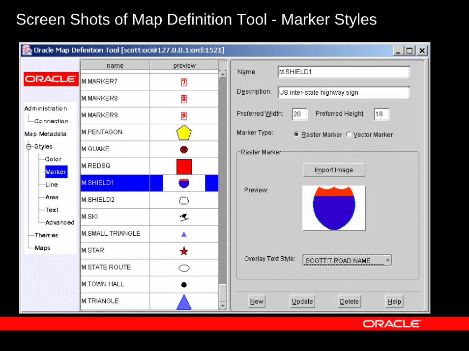
Screen Shots of Map Definition Tool - Marker Styles
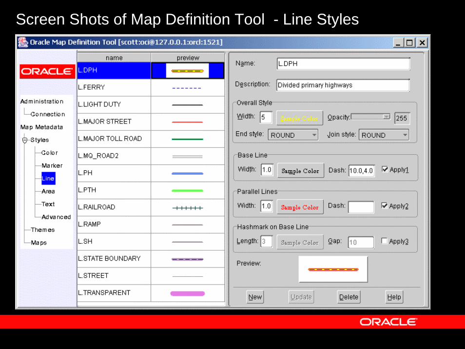
Screen Shots of Map Definition Tool - Line Styles
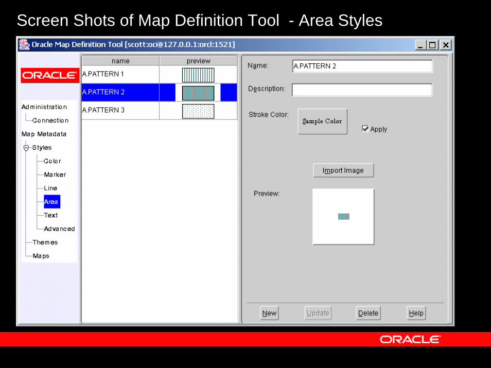
Screen Shots of Map Definition Tool - Area Styles
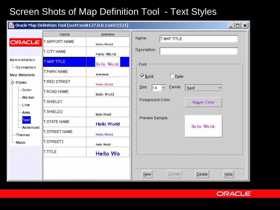
Screen Shots of Map Definition Tool - Text Styles
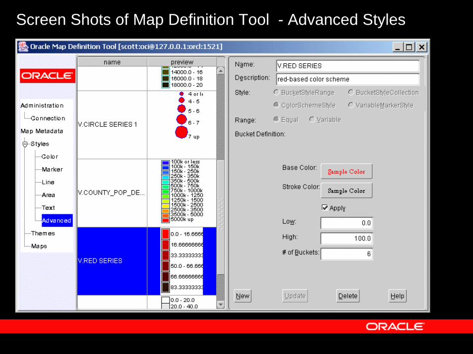
Screen Shots of Map Definition Tool - Advanced Styles
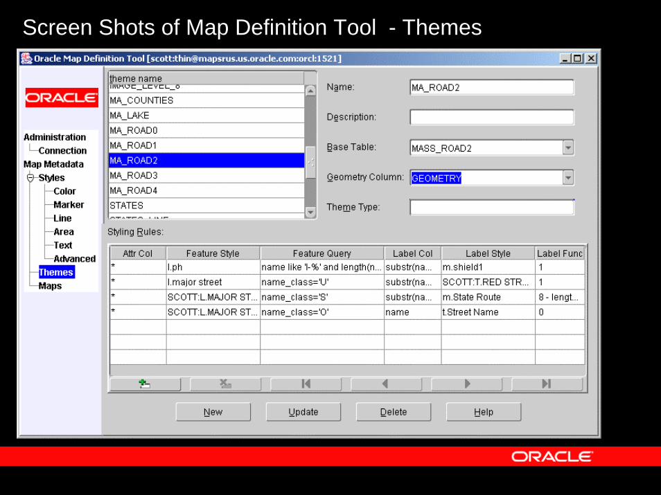
Screen Shots of Map Definition Tool - Themes
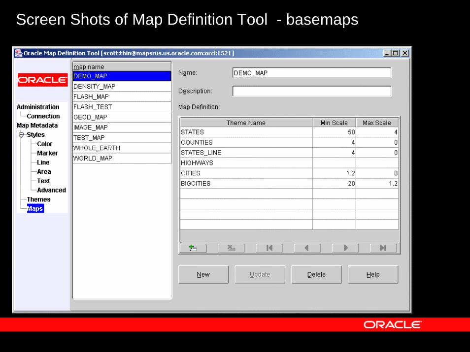
Screen Shots of Map Definition Tool - basemaps

A simple application tracking a ship’s locations as it travels from San Francisco to Singapore.
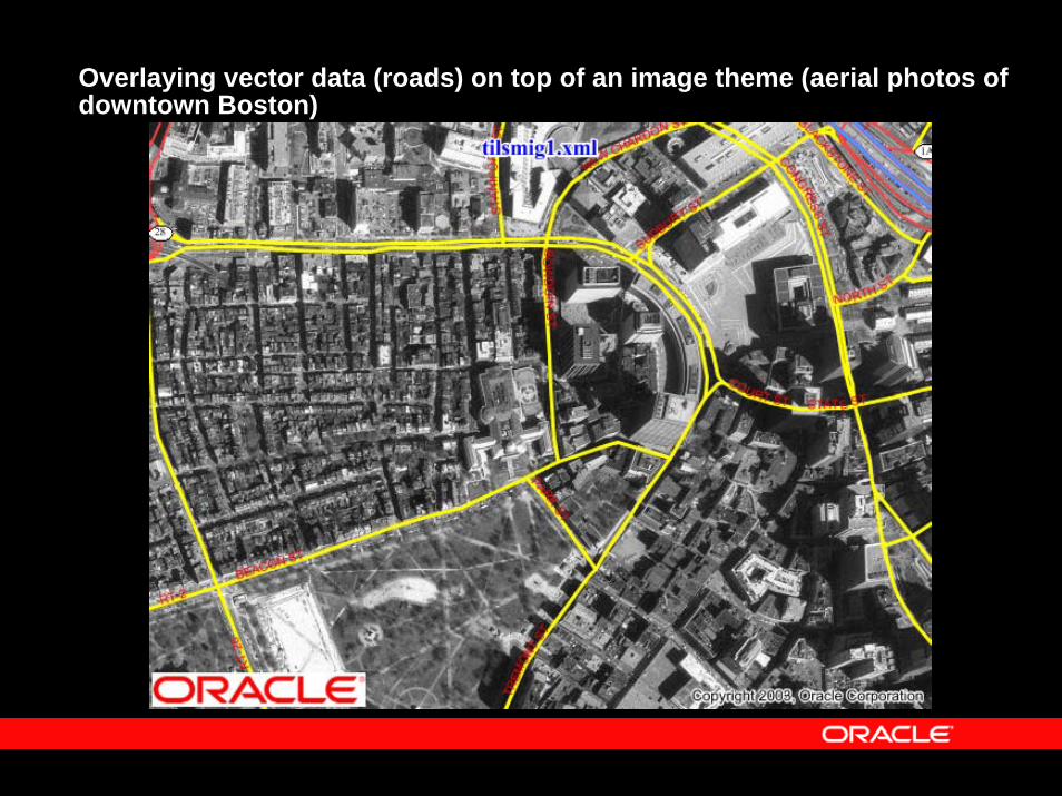
Overlaying vector data (roads) on top of an image theme (aerial photos of downtown Boston)
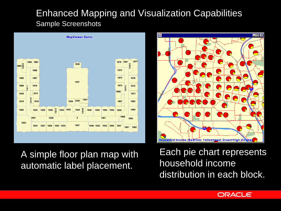
Enhanced Mapping and Visualization CapabilitiesSample Screenshots
Each pie chart represents household income distribution in each block.
A simple floor plan map with automatic label placement.
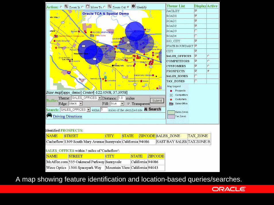
A map showing feature identification and location-based queries/searches.
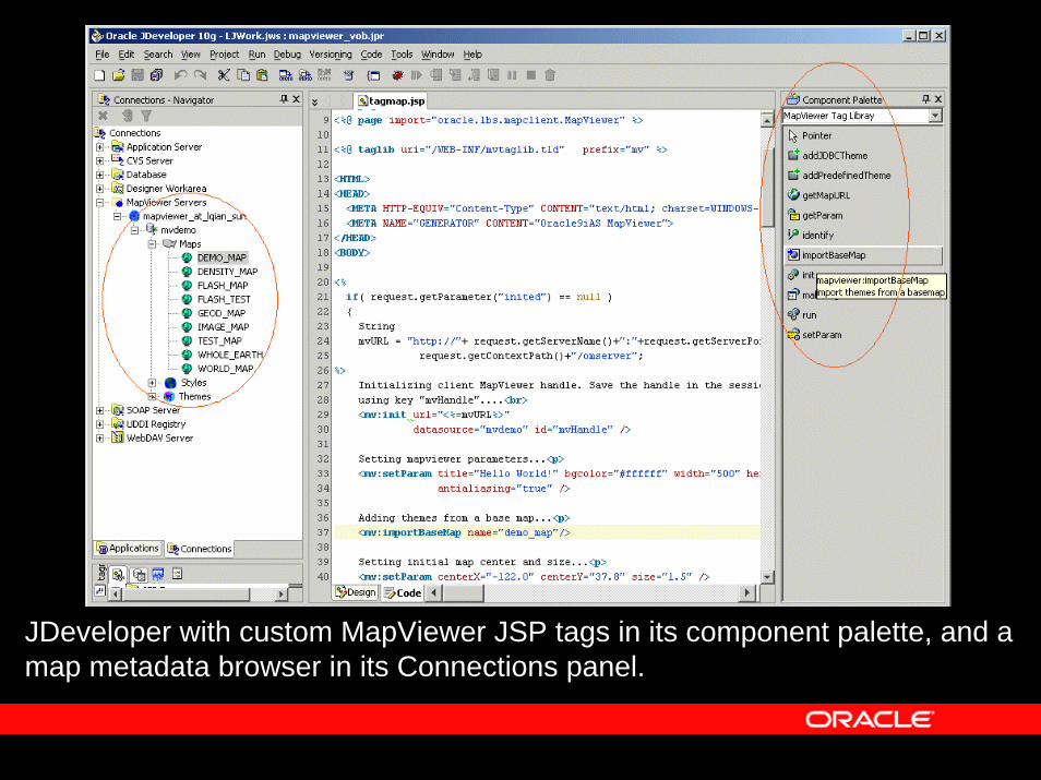
JDeveloper with custom MapViewer JSP tags in its component palette, and a map metadata browser in its Connections panel.

ORACLE FUSION MIDDLEWARE