open source geospatial web applications for utilities · open source geospatial web applications...
TRANSCRIPT
Open Source Geospatial Web Applications for Utilities
Geoff Zeiss, Autodesk
Open standards

Open Standards
CIM
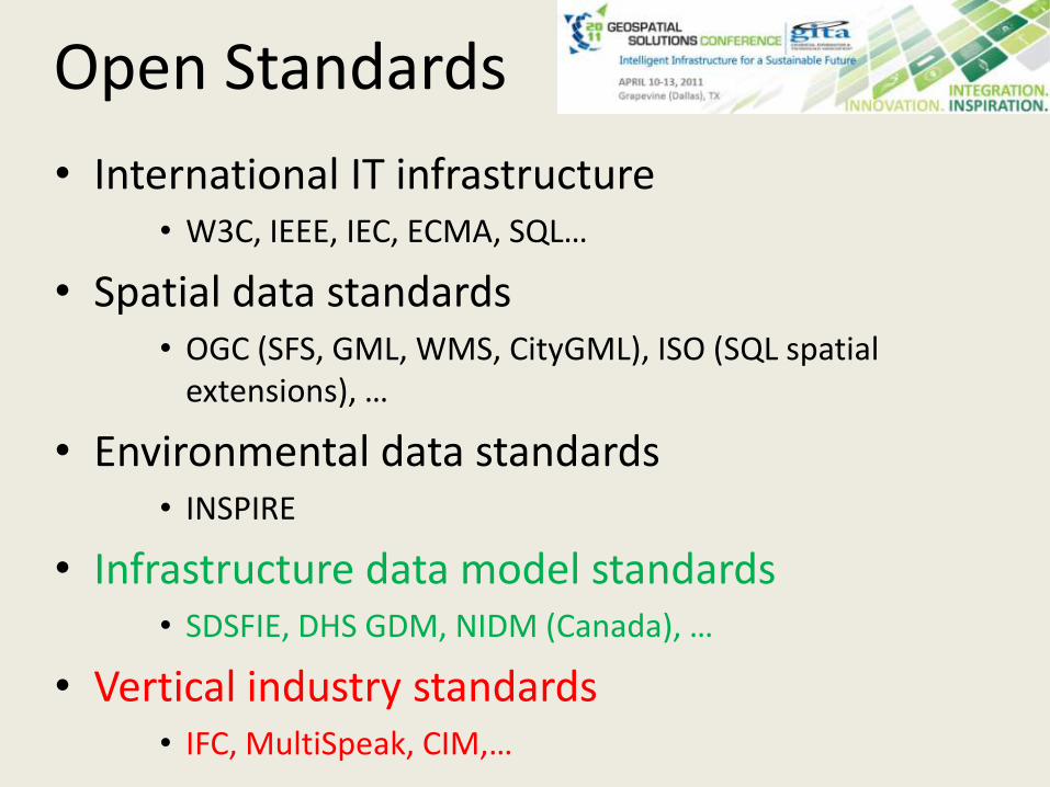
Open Standards• International IT infrastructure
• W3C, IEEE, IEC, ECMA, SQL…
• Spatial data standards• OGC (SFS, GML, WMS, CityGML), ISO (SQL spatial extensions), …
• Environmental data standards• INSPIRE
• Infrastructure data model standards• SDSFIE, DHS GDM, NIDM (Canada), …
• Vertical industry standards• IFC, MultiSpeak, CIM,…

Open Standards in the Navy
Mar 5, 2008 Navy IT Day - Vice Adm. Mark Edwards, Deputy Chief of Naval Operations for Communications
• The Navy will acquire only systems based on open technologies and standards.
• “The days of proprietary technology must come to an end, we will no longer accept systems that couple hardware, software and data.”
• “Above all, we must break the stovepipes of data so that we can share information across domains.
• “We can’t accept the increasing costs of maintaining our present-day capabilities. In the civilian marketplace, it’s just the opposite. Some private-sector concerns are cutting their costs by 90 percent while expanding their performance.”
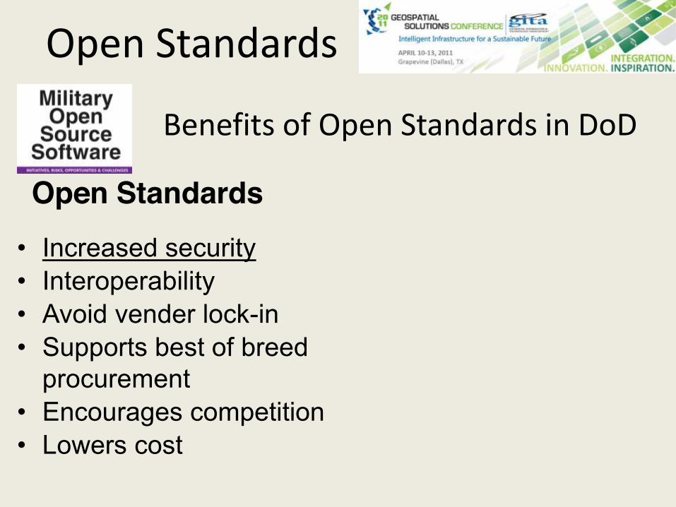
Benefits of Open Standards in DoD
• Increased security• Interoperability• Avoid vender lock-in• Supports best of breed
procurement• Encourages competition• Lowers cost
Open Standards
Open Standards
Open source
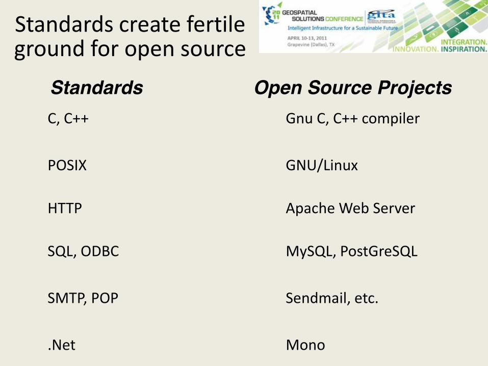
Standards create fertile ground for open source
C, C++ Gnu C, C++ compiler
POSIX GNU/Linux
HTTP Apache Web Server
SQL, ODBC MySQL, PostGreSQL
SMTP, POP Sendmail, etc.
.Net Mono
Standards Open Source Projects
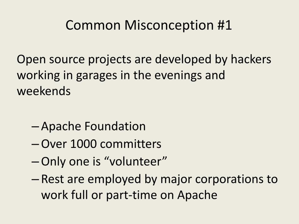
Common Misconception #1
Open source projects are developed by hackers working in garages in the evenings and weekends
–Apache Foundation–Over 1000 committers–Only one is “volunteer”–Rest are employed by major corporations to
work full or part-time on Apache
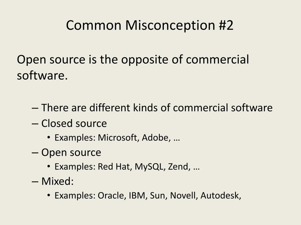
Common Misconception #2
Open source is the opposite of commercial software.
– There are different kinds of commercial software– Closed source
• Examples: Microsoft, Adobe, …
– Open source• Examples: Red Hat, MySQL, Zend, …
– Mixed: • Examples: Oracle, IBM, Sun, Novell, Autodesk,

Common Misconception #3
People who require mission critical applications don’t use open source.
– Google – All servers run Linux– Oracle - Primary development platform is Linux– Over 70% of the world’s web servers – Run Apache– Deutsche Bank, Dresdener Bank – Run PHP– US Dept of Defence - Runs open source
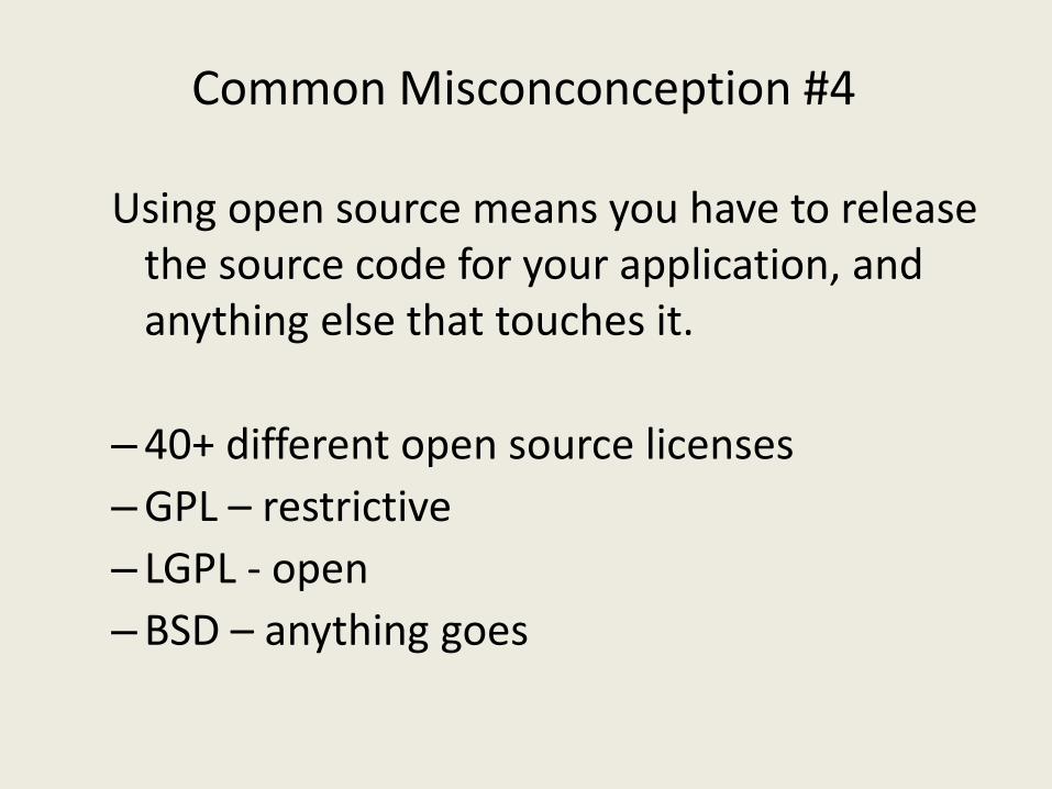
Common Misconconception #4
Using open source means you have to release the source code for your application, and anything else that touches it.
–40+ different open source licenses–GPL – restrictive– LGPL - open–BSD – anything goes
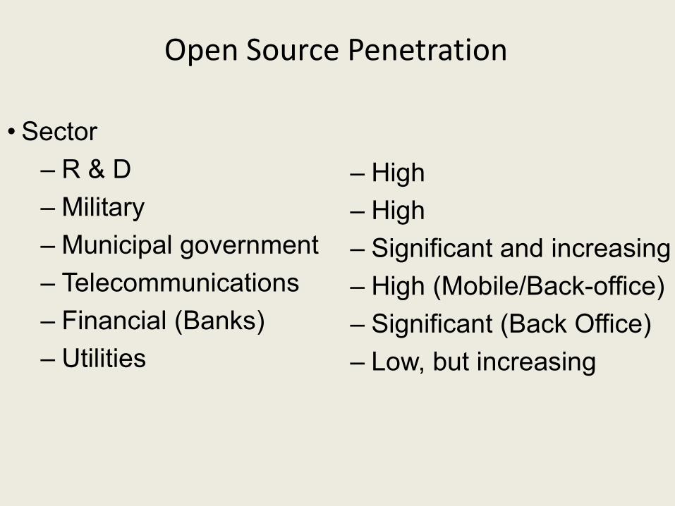
Open Source Penetration
• Sector– R & D– Military– Municipal government– Telecommunications– Financial (Banks)– Utilities
– High– High– Significant and increasing– High (Mobile/Back-office)– Significant (Back Office)– Low, but increasing
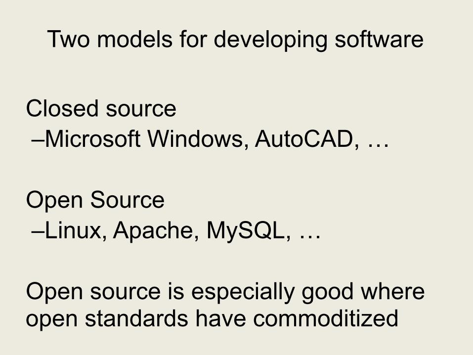
Two models for developing software
Closed source–Microsoft Windows, AutoCAD, …
Open Source–Linux, Apache, MySQL, …
Open source is especially good where open standards have commoditized
Web Mapping and Commoditization
• Web mapping should be open source
– Widely-recognized standards OGC
– Less complex than desktop applications
– Web mapping is commoditized
– Successful open source community around MapServer
Benefits of Open Source in DoD
•Security
•Standards-compliant
•Flexibility and agility
•Quality
• Lower risk
•Reduced cost
Open Source and Security
Web 2.0 and Open Source Geospatial
• Open source is good at commodity software– Open standards create a fertile ground for commoditization
• http, html -> Apache Web Server
• Web mapping is being commoditized– Open source web mapping widely used– Successful businesses based on open source web mapping
• OSGEO provides a platform for Web 2.0 geospatialapplications.
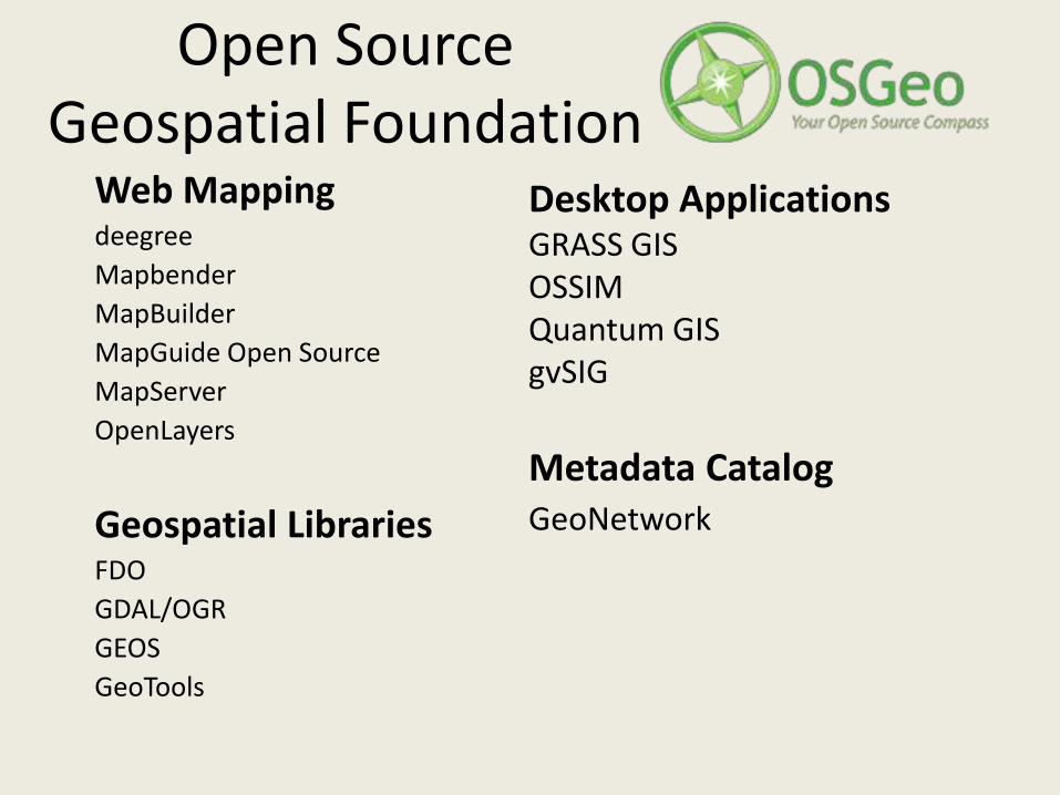
Open Source Geospatial Foundation
Web MappingdeegreeMapbenderMapBuilderMapGuide Open SourceMapServerOpenLayers
Geospatial LibrariesFDOGDAL/OGRGEOSGeoTools
Desktop ApplicationsGRASS GISOSSIMQuantum GISgvSIG
Metadata CatalogGeoNetwork
Web2.0
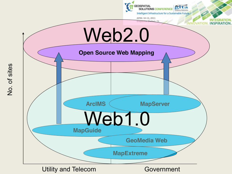
ArcIMS MapServer
Utility and Telecom Government
MapGuide
MapExtreme
GeoMedia Web
No.
of s
ites
Open Source Web Mapping
Web1.0
Utility web applications
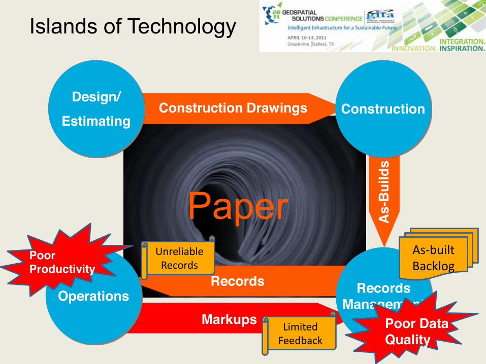
Paper
Construction Drawings
Markups
Records
As-
Bui
lds
Design/Estimating
Operations
Construction
RecordsManagement
Islands of Technology
As-builtBacklog
UnreliableRecords
LimitedFeedback
Poor Data Quality
PoorProductivity
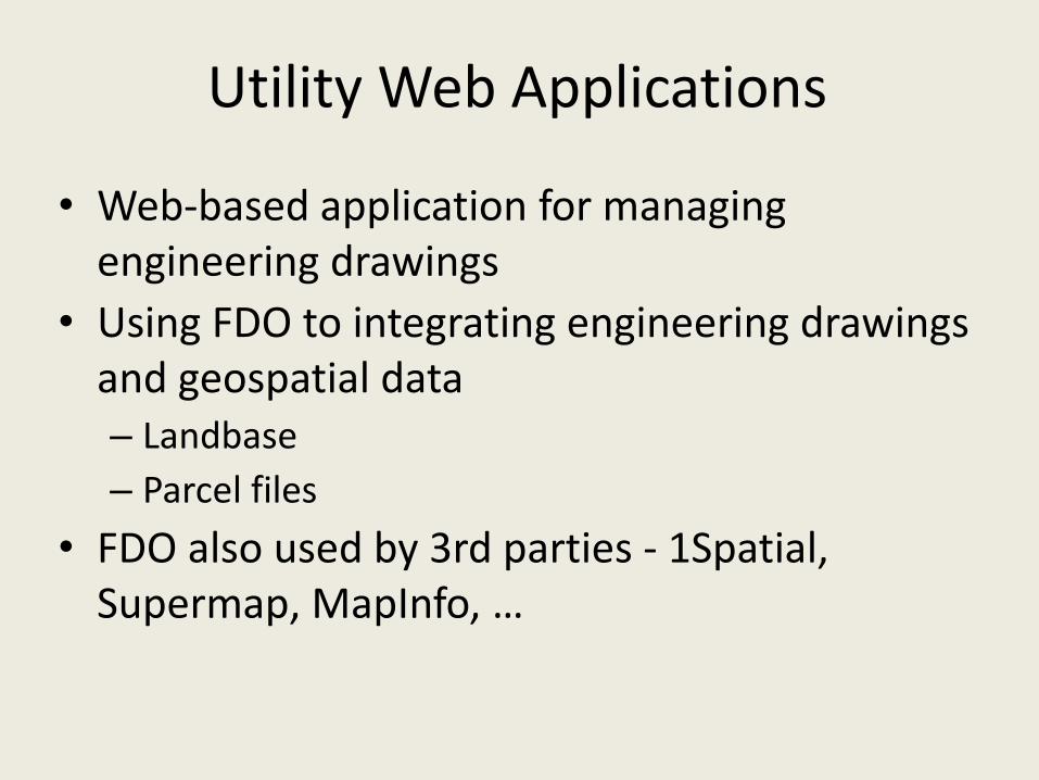
Utility Web Applications
• Web-based application for managing engineering drawings
• Using FDO to integrating engineering drawings and geospatial data– Landbase– Parcel files
• FDO also used by 3rd parties - 1Spatial, Supermap, MapInfo, …
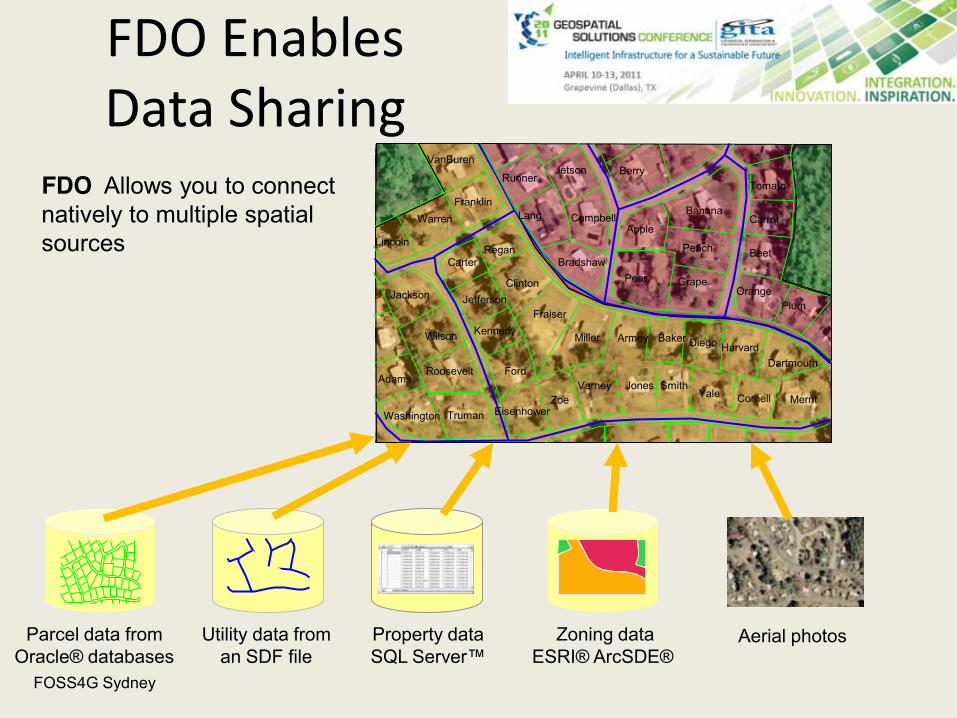
Parcel data fromOracle® databases
Kennedy
Ford
Truman
Roosevelt
Wilson
Washington
Adams Jones SmithYale Cornell
Fraiser
ZoeVarney
Armey Baker Diego Harvard
Merrit
Miller
Regan
Clinton
Eisenhower
Dartmouth
Bradshaw
Lang
Jackson Jefferson
Carter
Franklin
VanBuren
Warren
Lincoln
Jetson
Campbell`
Runner
Pear GrapeOrange
Plum
Beet
Carrot
Tomato
Peach
Banana
Apple
Berry
Utility data froman SDF file
Property data SQL Server™
Zoning dataESRI® ArcSDE®
Aerial photos
FDO Allows you to connect natively to multiple spatial sources
FDO Enables Data Sharing
FOSS4G Sydney

Example Utility Companies
• CEZ power plants
• Hungarian Railways
• First Energy
• Grant County
• Colorado Springs Utilities
• Australian Dept of Defense
• Prague Airport
• British Airport Authority
• Southern Water
• Electricity Northwest
• Qwest
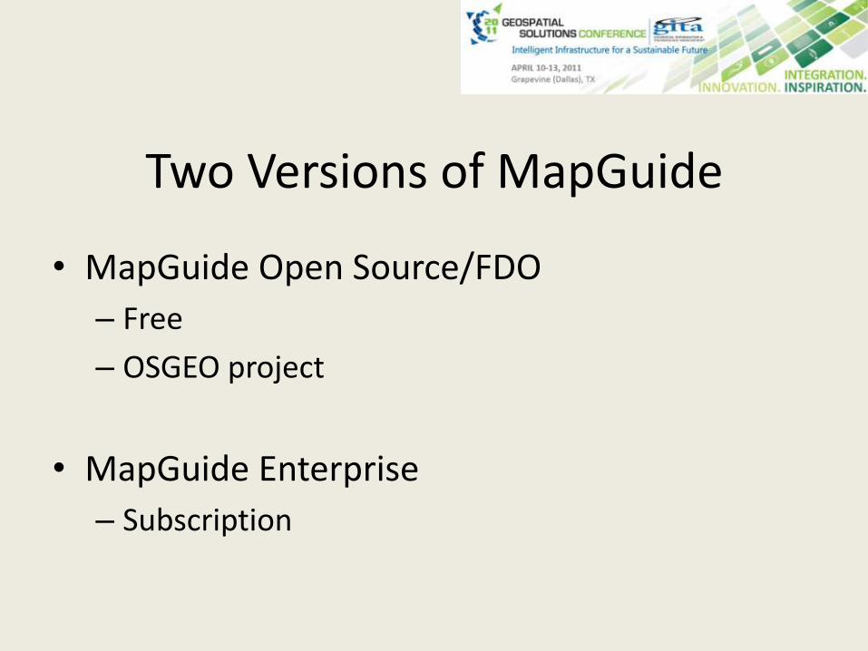
Two Versions of MapGuide
• MapGuide Open Source/FDO– Free
– OSGEO project
• MapGuide Enterprise– Subscription
GeoREST web applications
Tim Berners-Lee, in Government Data Design Issues, proposes
•Geodata on the web in raw form.
•Raw geodata must be searchable
Open Govt Geospatial Data
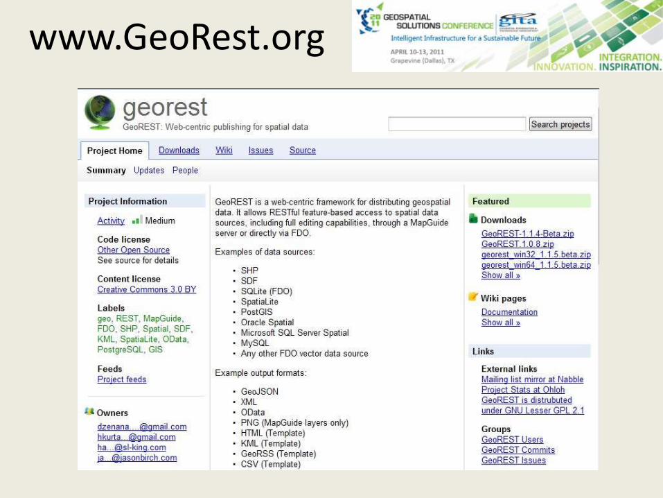
www.GeoRest.org
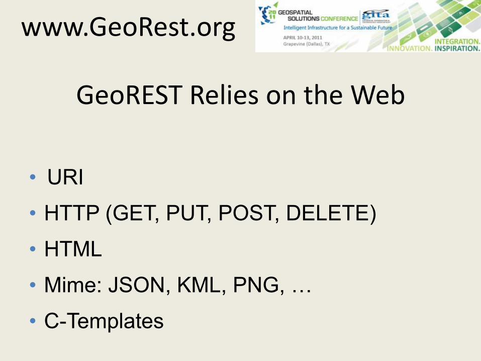
GeoREST Relies on the Web
• URI
• HTTP (GET, PUT, POST, DELETE)
• HTML
• Mime: JSON, KML, PNG, …
• C-Templates
www.GeoRest.org
GeoREST provides FDO web services
• Exposes FDO as web services
• Provides 3rd party application access to FDO data
• Company required by government to report any problems with water
• Citizen can go to web site• Identify the city ward or suburb in which he/she
lives• Find notifications of problems
Slovenian Water Company (JP Vodovod-Kanalizacija d.o.o.)
JP Vodovod-Kanalizacija d.o.o.
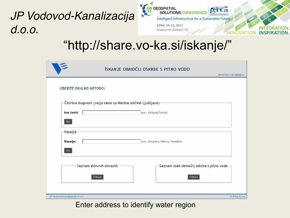
“http://share.vo-ka.si/iskanje/”
Enter address to identify water region
JP Vodovod-Kanalizacija d.o.o.
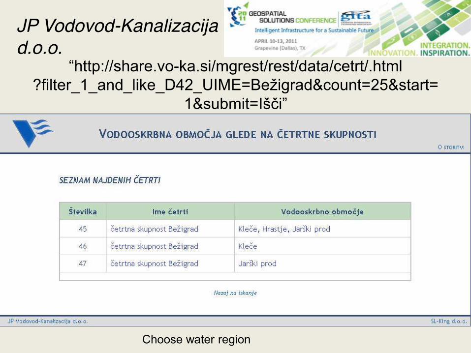
“http://share.vo-ka.si/mgrest/rest/data/cetrt/.html?filter_1_and_like_D42_UIME=Bežigrad&count=25&start=
1&submit=Išči”
Choose water region
JP Vodovod-Kanalizacija d.o.o.
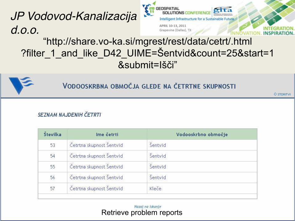
“http://share.vo-ka.si/mgrest/rest/data/cetrt/.html?filter_1_and_like_D42_UIME=Šentvid&count=25&start=1
&submit=Išči”
Retrieve problem reports
JP Vodovod-Kanalizacija d.o.o.
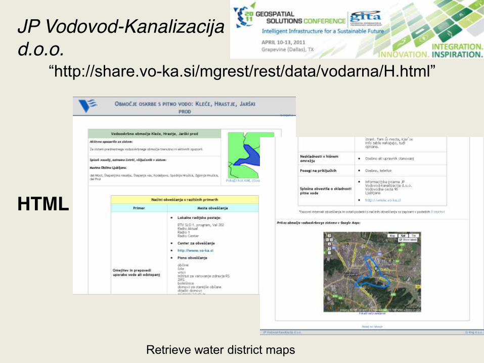
“http://share.vo-ka.si/mgrest/rest/data/vodarna/H.html”
HTML
Retrieve water district maps
JP Vodovod-Kanalizacija d.o.o.
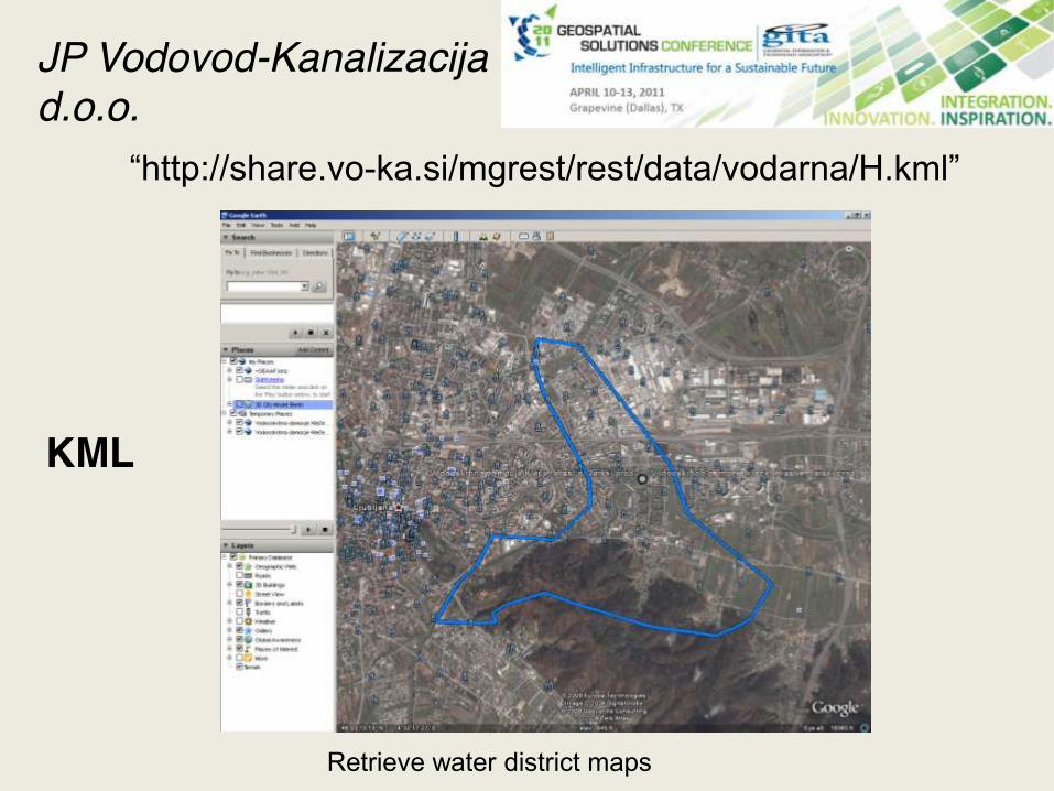
“http://share.vo-ka.si/mgrest/rest/data/vodarna/H.kml”
KML
Retrieve water district maps
JP Vodovod-Kanalizacija d.o.o.
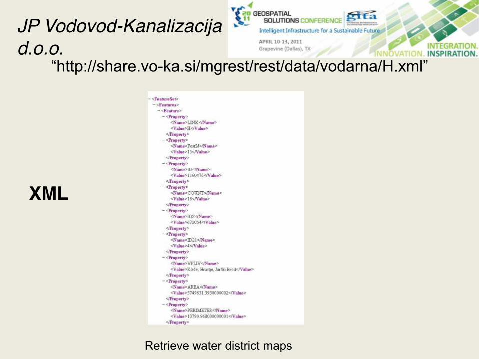
“http://share.vo-ka.si/mgrest/rest/data/vodarna/H.xml”
XML
Retrieve water district maps
JP Vodovod-Kanalizacija d.o.o.
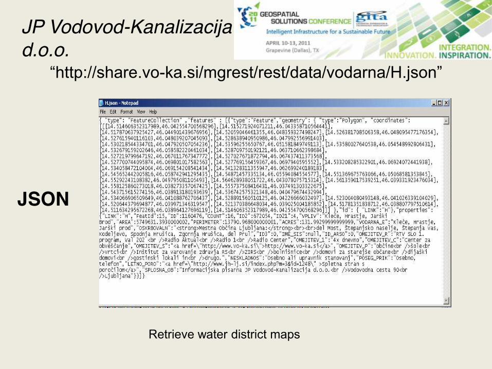
“http://share.vo-ka.si/mgrest/rest/data/vodarna/H.json”
JSON
Retrieve water district maps
JP Vodovod-Kanalizacija d.o.o.
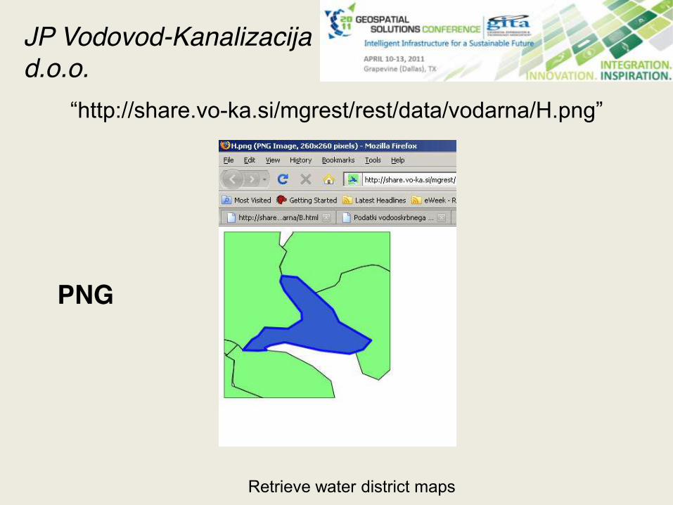
“http://share.vo-ka.si/mgrest/rest/data/vodarna/H.png”
PNG
Retrieve water district maps
JP Vodovod-Kanalizacija d.o.o.
City of Nanaimo Geodata
Business Problem
• Reporting – simple, no programming access to geodata in NanaimoMap
• Support Google Search - Provide users to search for public geodata without having to learn a new query system
• Open data access - Provide geospatial data in a variety of "Neo-Geography" formats like KML, GeoJSON, …
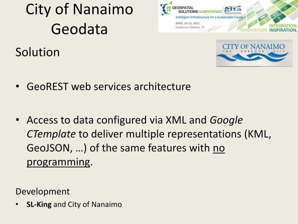
City of Nanaimo Geodata
Solution
• GeoREST web services architecture
• Access to data configured via XML and Google CTemplate to deliver multiple representations (KML, GeoJSON, …) of the same features with no programming.
Development• SL-King and City of Nanaimo
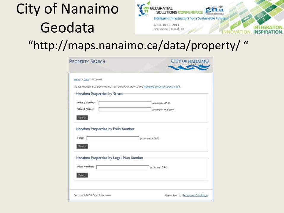
“http://maps.nanaimo.ca/data/property/ “
City of Nanaimo Geodata
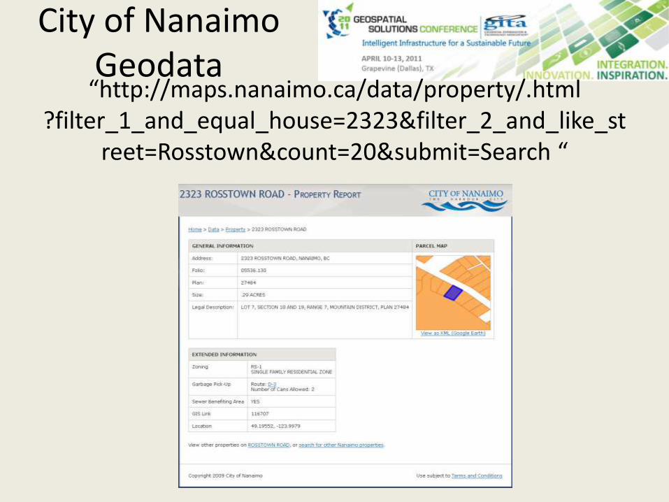
“http://maps.nanaimo.ca/data/property/.html?filter_1_and_equal_house=2323&filter_2_and_like_st
reet=Rosstown&count=20&submit=Search “
City of Nanaimo Geodata
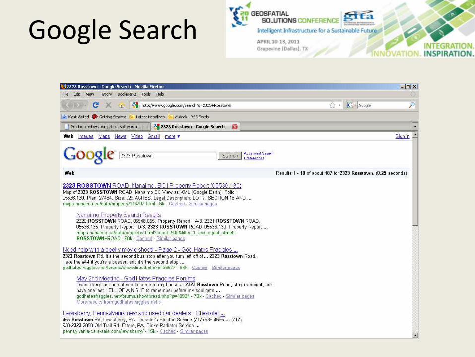
Google Search
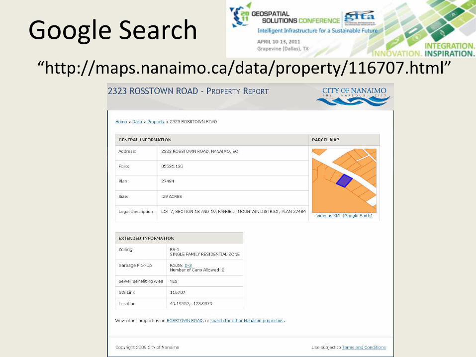
“http://maps.nanaimo.ca/data/property/116707.html”
Google Search

Searchable Raw Geospatial Data
GeoREST