online portfolio - ethan gefroh
DESCRIPTION
A collection of projects highlighting my undergraduate work at North Dakota State University.TRANSCRIPT

ETHAN GEFROH + undergraduate portfolio

CONTENTS+ Sketch
+ Urban Analysis
+ Forest Kindergarten
+ Williston Wetlands
+ Minot’s Riverfront
01
02
03
07
.......
.......
.......
.......
....... 1 1
+ Ordinance Graphics ....... 19
+ Performance Shelter ....... 05

| SKETCH |A quick, loose sketch
using micron pen and chartpak markers.
1
building street
intersectionsbuilding voidaxis point
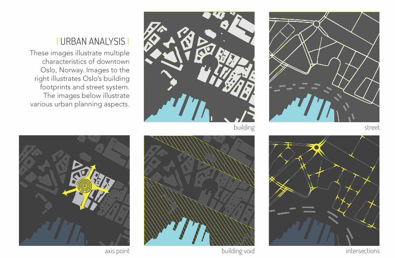
| URBAN ANALYSIS |These images illustrate multiple
characteristics of downtown Oslo, Norway. Images to the
right illustrates Oslo’s building footprints and street system. The images below illustrate
various urban planning aspects.
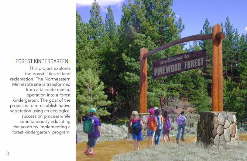
| FOREST KINDERGARTEN |This project explores
the possibilities of land reclamation. The Northeastern Minnesota site is transformed
from a taconite mining operation into a forest
kindergarten. The goal of the project is to re-establish native vegetation using an ecological
succession process while simultaneously educating
the youth by implementing a forest kindergarten program.
3
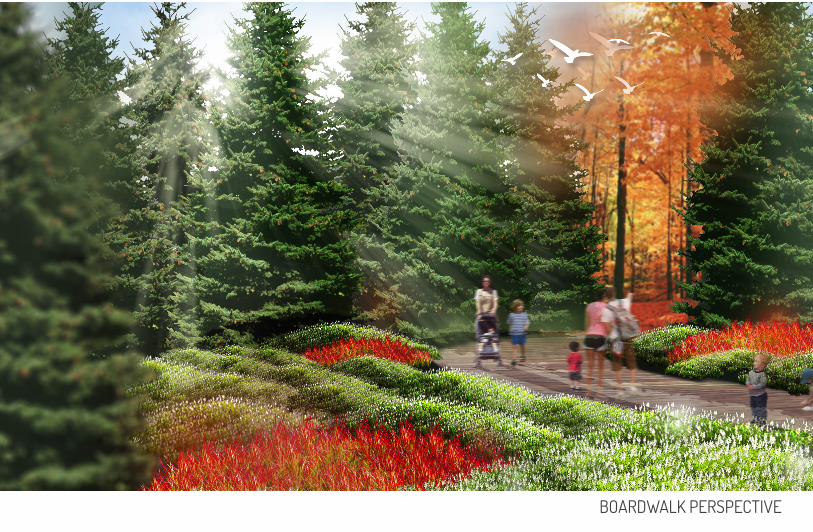
BOARDWALK PERSPECTIVE
5
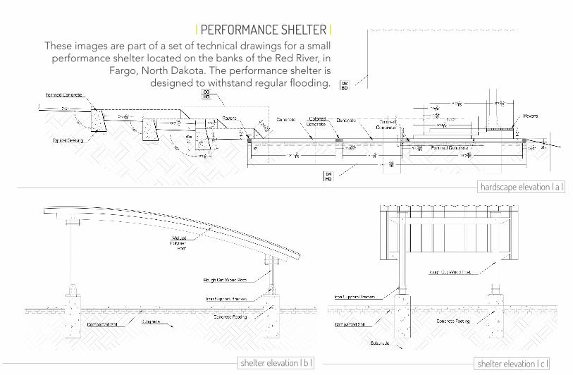
| PERFORMANCE SHELTER |These images are part of a set of technical drawings for a small
performance shelter located on the banks of the Red River, in Fargo, North Dakota. The performance shelter is
designed to withstand regular flooding.
hardscape elevation | a |
shelter elevation | c | shelter elevation | b |
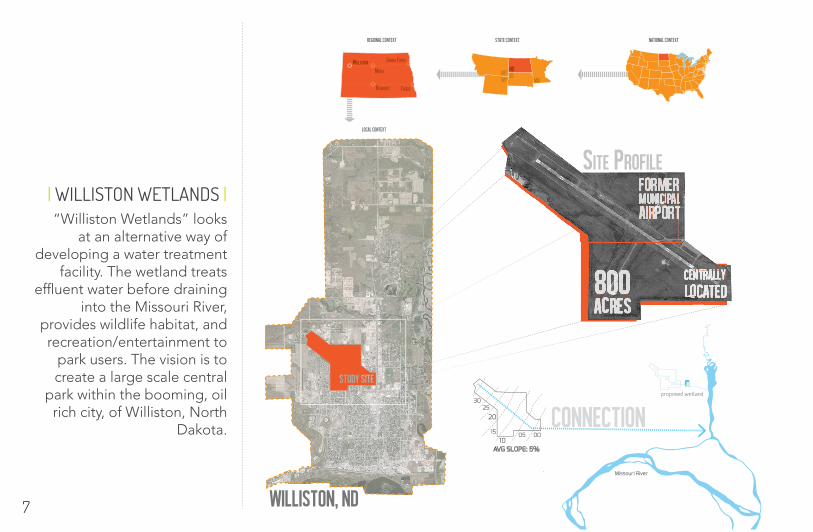
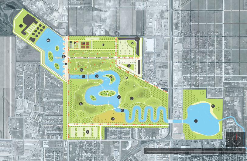
“Williston Wetlands” looks at an alternative way of
developing a water treatment facility. The wetland treats
effluent water before draining into the Missouri River,
provides wildlife habitat, and recreation/entertainment to
park users. The vision is to create a large scale central
park within the booming, oil rich city, of Williston, North
Dakota.
| WILLISTON WETLANDS |
local Context
National ContextState ContextRegional Context
Williston, ND
000510
15
2025
30
AVG SLOPE: 5%
proposed wetland
Missouri River
7
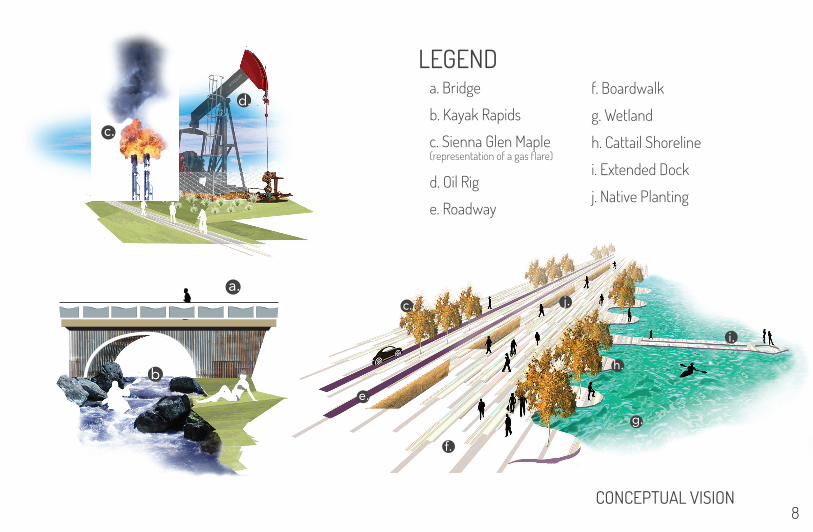
CONCEPTUAL VISION
j.
f.
g.
i.
h.
c.
e.
a.
b.
c.
d.
LEGENDa. Bridge
b. Kayak Rapids
d. Oil Rig
e. Roadway
c. Sienna Glen Maple(representation of a gas flare)
f. Boardwalk
g. Wetland
h. Cattail Shoreline
i. Extended Dock
j. Native Planting
8
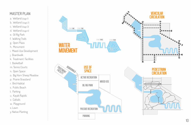
pedestrian circulation
Vehicular circulation
ACTIVE RECREATION
OIL RIG PARKMIXED USE
PASSIVE RECREATION
PARKING
Use of space
STAGE:TWOSTAGE:ONE
STAGE:FOUR
WATERmovement
STAGE:THREE
MASTER PLANa. Wetland (stage 1)
b. Wetland (stage 2)
c. Wetland (stage 3)
d. Wetland (stage 4)
e. Oil Rig Parkf. Walking Trailsg. Open Plazah. Monumenti. Mixed-Use Developmentj. Boardwalkk. Treatment Facilitiesl. Basketballm. Tennis Courtsn. Open Spaceo. Big Horn Sheep Meadowp. Prairie Grasslandr. Bird Habitats. Public Beacht. Parkingu. Kayak Rapidsv. Cattailsw. Playgroundx. Lawny. Native Planting
10
SITE CONTEXT n
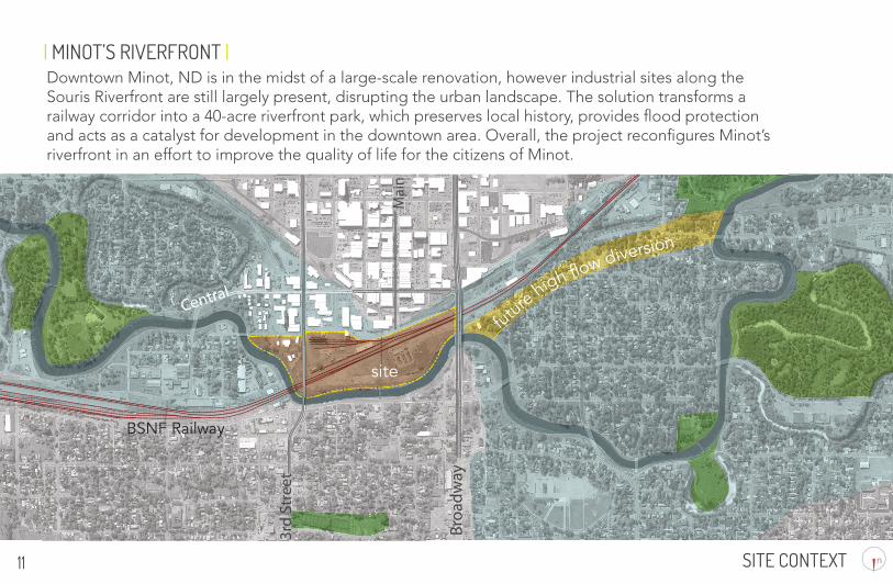
| MINOT’S RIVERFRONT |Downtown Minot, ND is in the midst of a large-scale renovation, however industrial sites along the Souris Riverfront are still largely present, disrupting the urban landscape. The solution transforms a railway corridor into a 40-acre riverfront park, which preserves local history, provides flood protection and acts as a catalyst for development in the downtown area. Overall, the project reconfigures Minot’s riverfront in an effort to improve the quality of life for the citizens of Minot.
11
site
BSNF Railway
future high f ow diversion
SITE CONTEXT
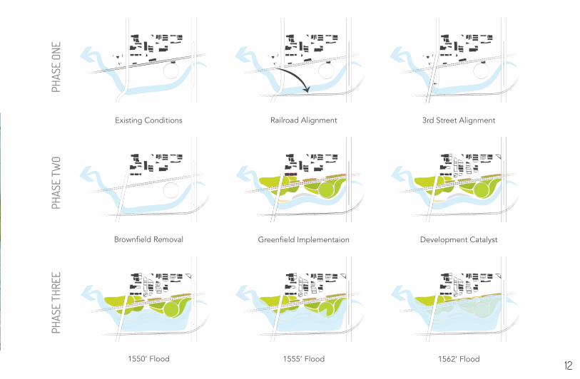
PHAS
E ON
EPH
ASE
TWO
PHAS
E TH
REE
Existing Conditions Railroad Alignment 3rd Street Alignment
Brownfield Removal Greenfield Implementaion Development Catalyst
1550’ Flood 1555’ Flood 1562’ Flood
Downtown Minot, ND is in the midst of a large-scale renovation, however industrial sites along the Souris Riverfront are still largely present, disrupting the urban landscape. The solution transforms a railway corridor into a 40-acre riverfront park, which preserves local history, provides flood protection and acts as a catalyst for development in the downtown area. Overall, the project reconfigures Minot’s riverfront in an effort to improve the quality of life for the citizens of Minot.
12
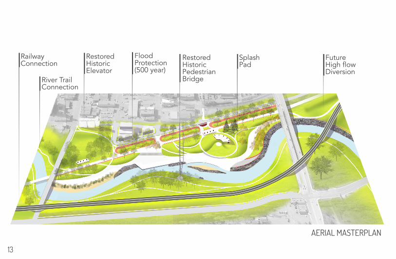
AERIAL MASTERPLAN
Railway Connection
River Trail Connection
RestoredHistoric Elevator
Flood Protection(500 year)
RestoredHistoricPedestrianBridge
Splash Pad
Future High flowDiversion
13
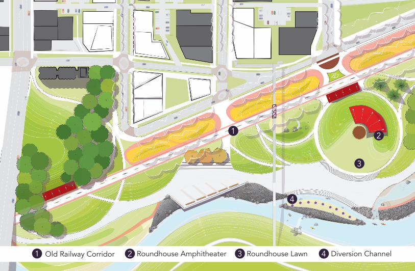
AERIAL MASTERPLANDiversion Channel4
1 2
3
4
Old Railway Corridor1 Roundhouse Amphitheater2 Roundhouse Lawn3
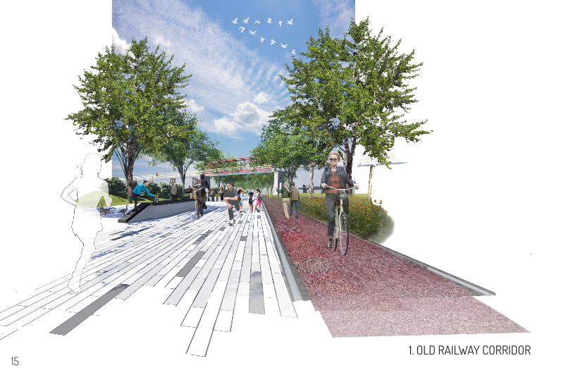
1. OLD RAILWAY CORRIDOR15
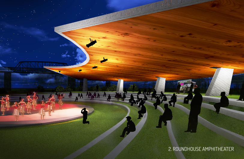
2. ROUNDHOUSE AMPHITHEATER1. OLD RAILWAY CORRIDOR
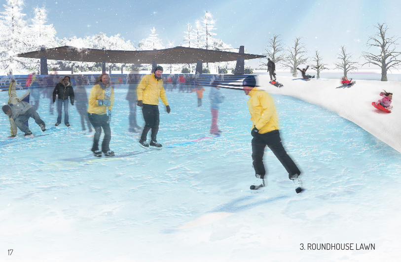
3. ROUNDHOUSE LAWN17
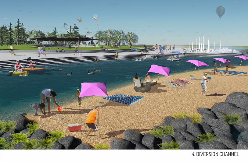
3. ROUNDHOUSE LAWN 4. DIVERSION CHANNEL
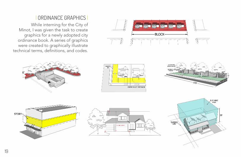
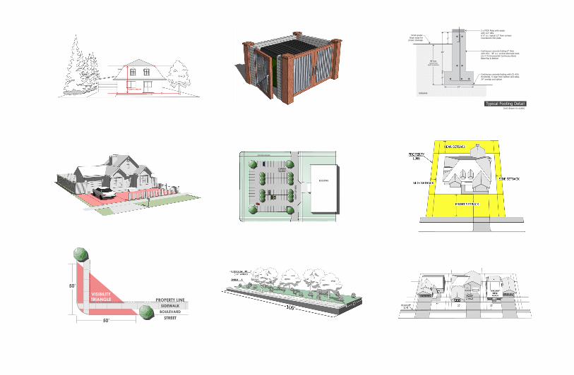
| ORDINANCE GRAPHICS |While interning for the City of
Minot, I was given the task to create graphics for a newly adopted city
ordinance book. A series of graphics were created to graphically illustrate
technical terms, definitions, and codes.
19
SIDEWALKBOULEVARD
VISIBILITY TRIANGLE PROPERTY LINE
STREET
50’
50’
CURBED ISLAND
BUILDING
PEDESTRIAN SIDEWALK
Typical Footing Detail(not drawn to scale)
Continuous concrete footing 8” thickwith #4’s - 48” o.c. verticle alternate hook(2) # 4’s Horizizontal Continuous Bond BeamTop & Bottom
24”
2 x PTDF Plate with sealerwith 1/2” AB’s6’ 0” o.c. typical 12” from cornersCountersink into plate
8”
48”
48”min.typical frost
depth protection
Continuous concrete footing with (3) #5’sHorizontal, 3’ clear from bottom and sides.24” overlap and splices
Finish grade:Slope away for
proper drainage6”
Subgrade

END.