ocean surface topography mission shannon brown jpl jason-2 wet tropospheric coastal performance
TRANSCRIPT
Ocean Surface Topography Mission
Shannon BrownShannon BrownJPLJPL
Jason-2 Wet Jason-2 Wet Tropospheric Coastal Tropospheric Coastal
PerformancePerformance
Ocean Surface Topography Mission
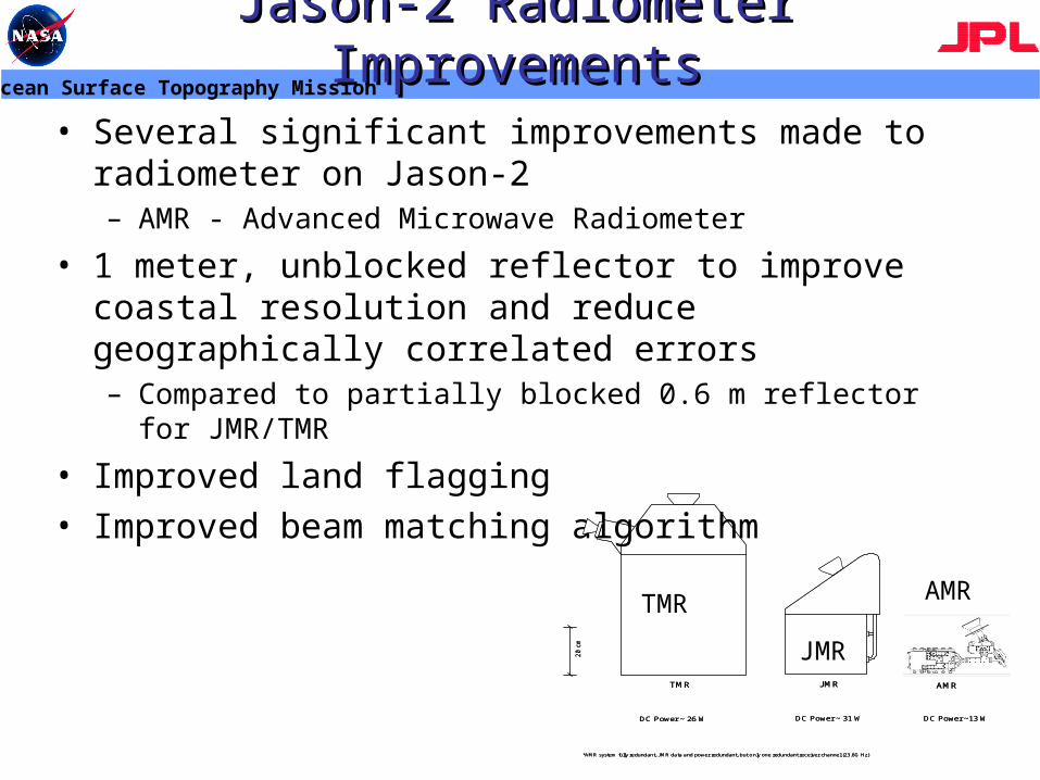
Jason-2 Radiometer ImprovementsJason-2 Radiometer Improvements
• Several significant improvements made to radiometer on Jason-2– AMR - Advanced Microwave Radiometer
• 1 meter, unblocked reflector to improve coastal resolution and reduce geographically correlated errors– Compared to partially blocked 0.6 m reflector for JMR/TMR
• Improved land flagging• Improved beam matching algorithm
DC Power ~13 WDC Power ~ 26 W DC Power ~ 31 W
*AMR system fully redundant, JMR data and power redundant, but only one redundant receiver channel (23.8G Hz)
TMR JMR
20 c
m
AMR
DC Power ~13 WDC Power ~ 26 W DC Power ~ 31 W
*AMR system fully redundant, JMR data and power redundant, but only one redundant receiver channel (23.8G Hz)
TMR JMR
20 c
m
AMR
TMR
JMR
AMR
Ocean Surface Topography Mission
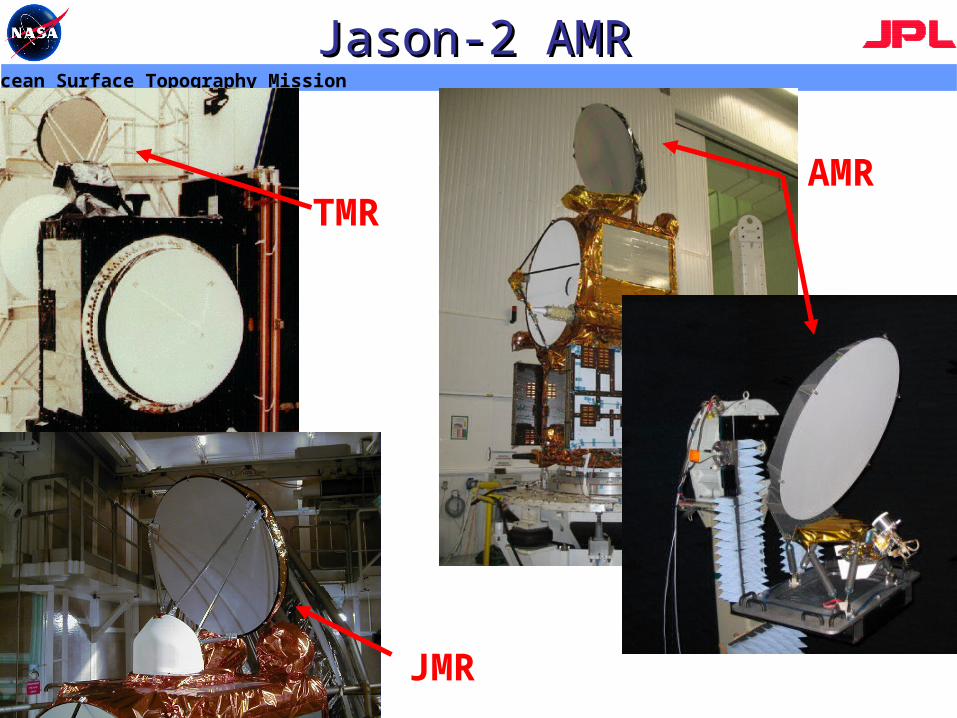
Jason-2 AMRJason-2 AMR
JMR
TMRAMR
Ocean Surface Topography Mission
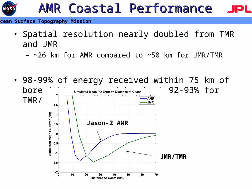
AMR Coastal PerformanceAMR Coastal Performance
• Spatial resolution nearly doubled from TMR and JMR– ~26 km for AMR compared to ~50 km for JMR/TMR
• 98-99% of energy received within 75 km of boresight, compared to about 92-93% for TMR/JMR
JMR/TMR
Jason-2 AMR
Ocean Surface Topography Mission
AMR Coastal PerformanceAMR Coastal Performance
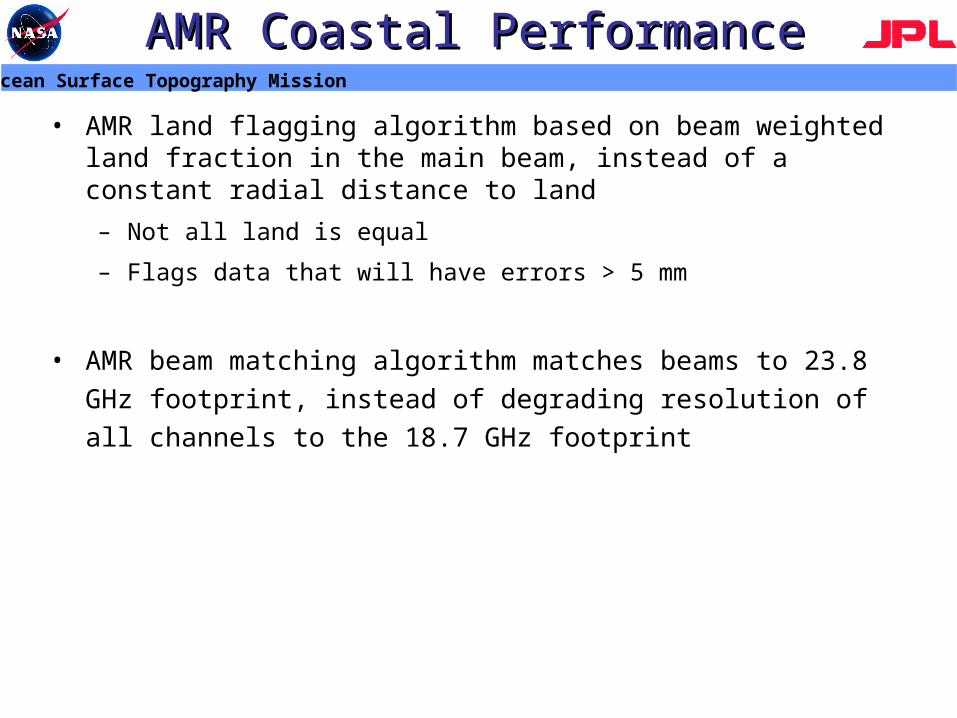
• AMR land flagging algorithm based on beam weighted land fraction in the main beam, instead of a constant radial distance to land
– Not all land is equal
– Flags data that will have errors > 5 mm
• AMR beam matching algorithm matches beams to 23.8 GHz
footprint, instead of degrading resolution of all channels to the 18.7
GHz footprint
Ocean Surface Topography Mission
Coastal PerformanceCoastal Performance
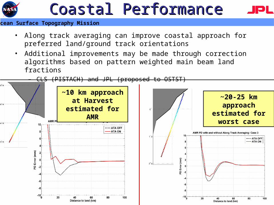
• Along track averaging can improve coastal approach for preferred land/ground track orientations
• Additional improvements may be made through correction algorithms based on pattern weighted main beam land fractions
– CLS (PISTACH) and JPL (proposed to OSTST)
~10 km approach at Harvest estimated
for AMR
~20-25 km approach estimated
for worst case